cumbria floods november 2009: an impact · pdf filecumbria floods november 2009: an impact...
TRANSCRIPT
18/03/2010
Cumbria Floods November 2009: An Impact Assessment 1.1 – Overview & meteorological circumstances 2
Figure 1: Cause and effects of floods in North West Cumbria 2
1.2 – Flooding of properties 3 1.2.1 – Countywide 3 1.2.2 – Numbers by district 3
1.2.3 – Residential & Commercial properties 3 Table 1: Properties flooded by district and use classification 3
Figure 2: Split of properties inundated by usage and location 3 Figure 3: Flood-related incidents reported to Cumbria Constabulary 4
Figure 4: Photo of Cockermouth flooding 4 1.3 – Extent of the floods 5
Ambleside 5 Backbarrow 6 Blennerhasset 7 Bomby 8 Burneside 9 Cleator 10 Cockermouth 11 Eamont Bridge 12 Glenridding 13 Hawkshead 14 Kendal 15 Keswick 16 Low Crosby 17 Low Mill 18 Rickerby 19 Staveley 20 Ulverston 21 Workington 22
1.4 - Impacts on community welfare 23 1.5 - Impacts on the environment 24
Figure 5: Holdings severely affected 24
1.6 – Impacts on the economy & businesses 25 1.7 - Impacts on infrastructure 26
1

18/03/2010
1.1 - Overview & meteorological circumstances Between Wednesday 18th November and Friday 20th November up to 372mm of rain fell over Cumbria. In the 24 hours ending 00:45 on Friday 20th 314mm of rain fell in Seathwaite. This is a record daily rainfall for the UK. The air mass responsible for this rainfall was formed in south tropics where unusually high sea surface temperatures ensured that the air was particularly rich in moisture. The air mass tracked north as part of a “warm conveyor”. As the air was blown over the Cumbrian fells it cooled causing the moisture to condense and begin to fall as rain. The warm conveyor remained over the fells for a period of 36 hours maintaining a steady downpour resulting in the exceptional rainfall levels. Rain earlier in the week ensured that the ground was already saturated in many areas. Flooding occurred in 5 of Cumbria’s 6 district areas, the only one escaping being Barrow. The effect on properties was concentrated in Allerdale and South Lakeland with most significant infrastructure damage occurring in the former district. Figure 1 below outlines the causes and effects of the heavy rainfall in Allerdale. Figure 1: Cause and effect of floods in north west Cumbria
Source: New Civil Engineer (26th November 2009)
2
18/03/2010
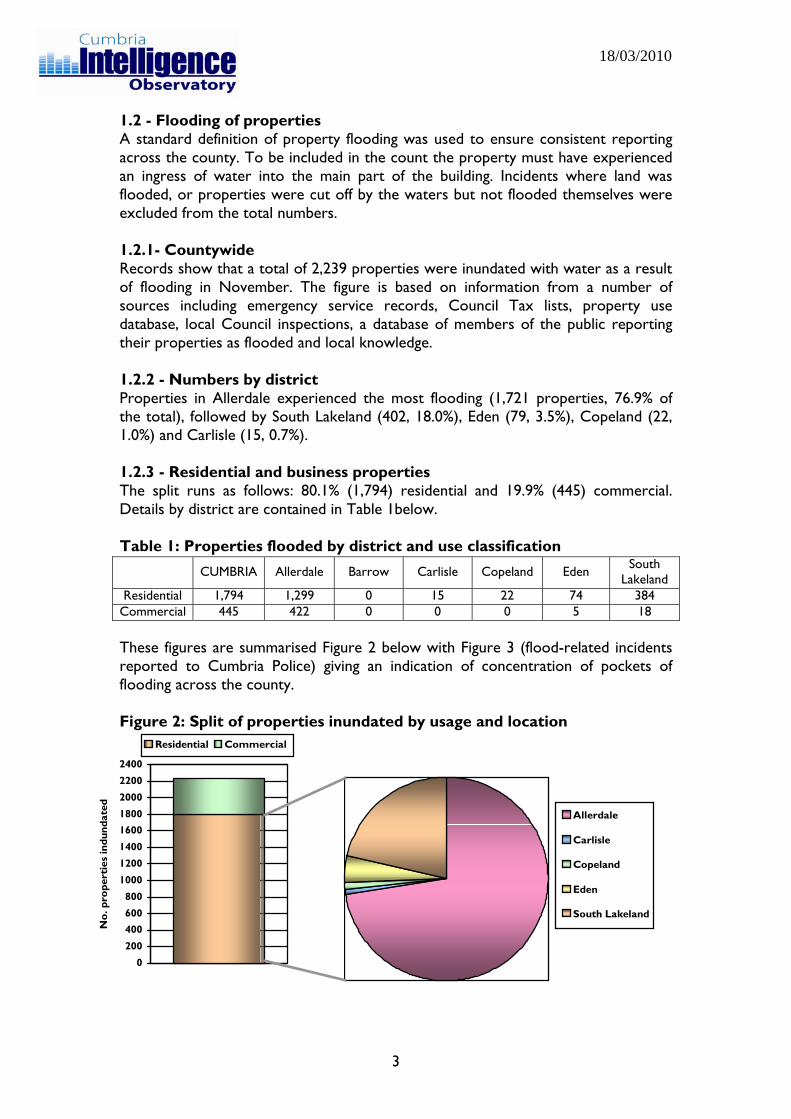
1.2 - Flooding of properties A standard definition of property flooding was used to ensure consistent reporting across the county. To be included in the count the property must have experienced an ingress of water into the main part of the building. Incidents where land was flooded, or properties were cut off by the waters but not flooded themselves were excluded from the total numbers. 1.2.1- Countywide Records show that a total of 2,239 properties were inundated with water as a result of flooding in November. The figure is based on information from a number of sources including emergency service records, Council Tax lists, property use database, local Council inspections, a database of members of the public reporting their properties as flooded and local knowledge. 1.2.2 - Numbers by district Properties in Allerdale experienced the most flooding (1,721 properties, 76.9% of the total), followed by South Lakeland (402, 18.0%), Eden (79, 3.5%), Copeland (22, 1.0%) and Carlisle (15, 0.7%). 1.2.3 - Residential and business properties The split runs as follows: 80.1% (1,794) residential and 19.9% (445) commercial. Details by district are contained in Table 1below. Table 1: Properties flooded by district and use classification
CUMBRIA Allerdale Barrow Carlisle Copeland Eden South Lakeland
Residential 1,794 1,299 0 15 22 74 384 Commercial 445 422 0 0 0 5 18 These figures are summarised Figure 2 below with Figure 3 (flood-related incidents reported to Cumbria Police) giving an indication of concentration of pockets of flooding across the county. Figure 2: Split of properties inundated by usage and location
0
1000
1200
1400
16001800
2000
2200
2400
No.
pro
pert
ies
indu
ndat
ed
Residential Commercial
Allerdale
Carlisle
Copeland
Eden800
600 South Lakeland400
200
3
18/03/2010
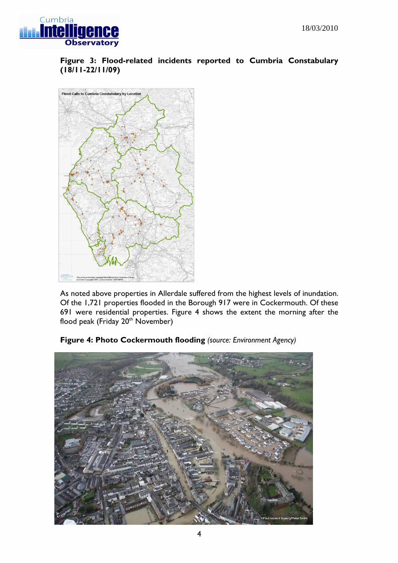
Figure 3: Flood-related incidents reported to Cumbria Constabulary (18/11-22/11/09)
As noted above properties in Allerdale suffered from the highest levels of inundation. Of the 1,721 properties flooded in the Borough 917 were in Cockermouth. Of these 691 were residential properties. Figure 4 shows the extent the morning after the flood peak (Friday 20th November) Figure 4: Photo Cockermouth flooding (source: Environment Agency)
4
18/03/2010
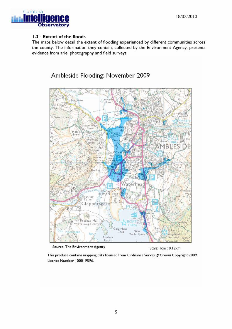
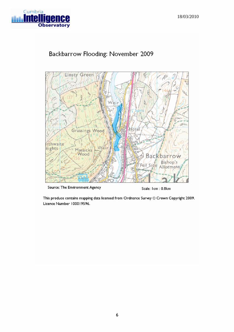
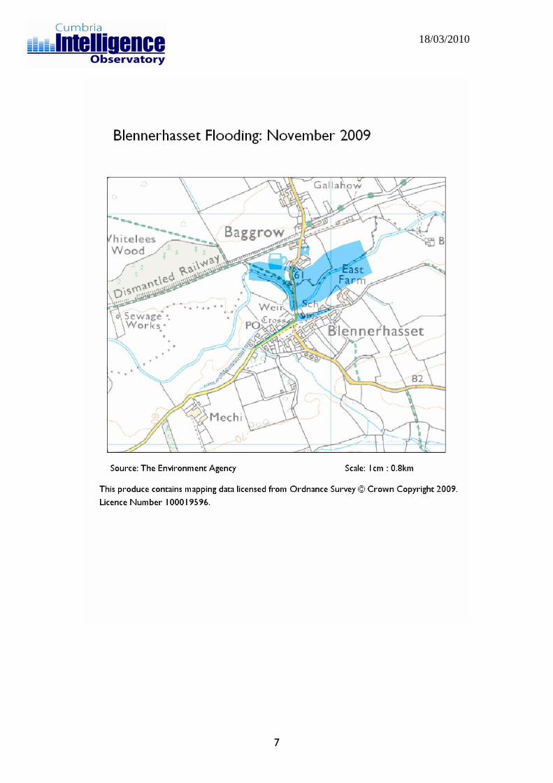
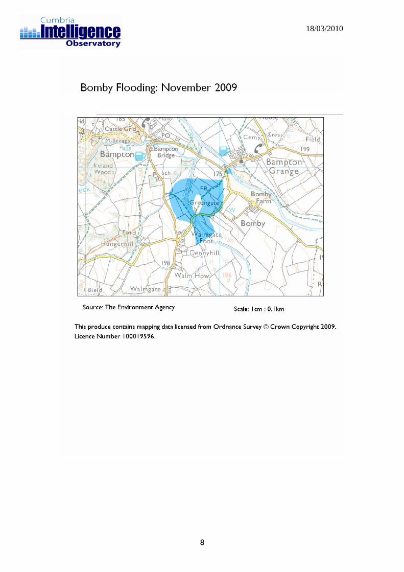
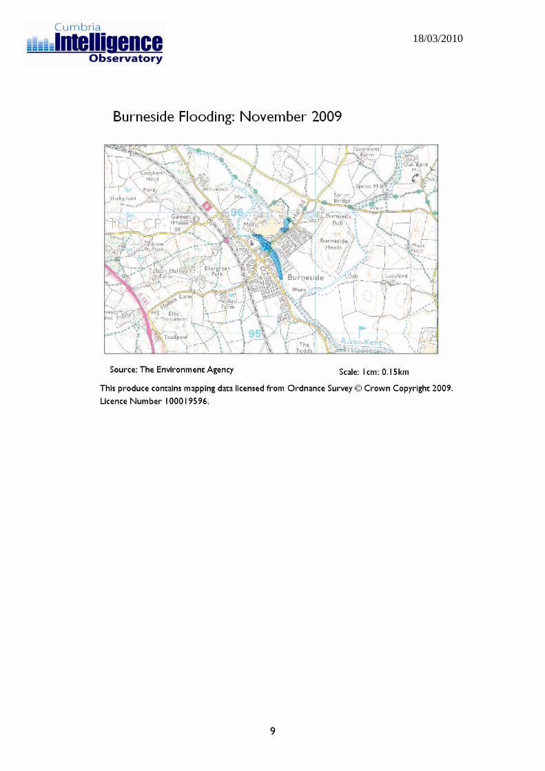
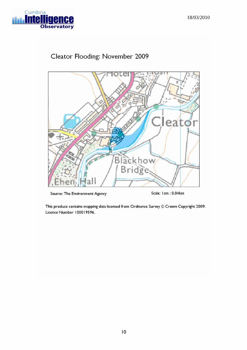
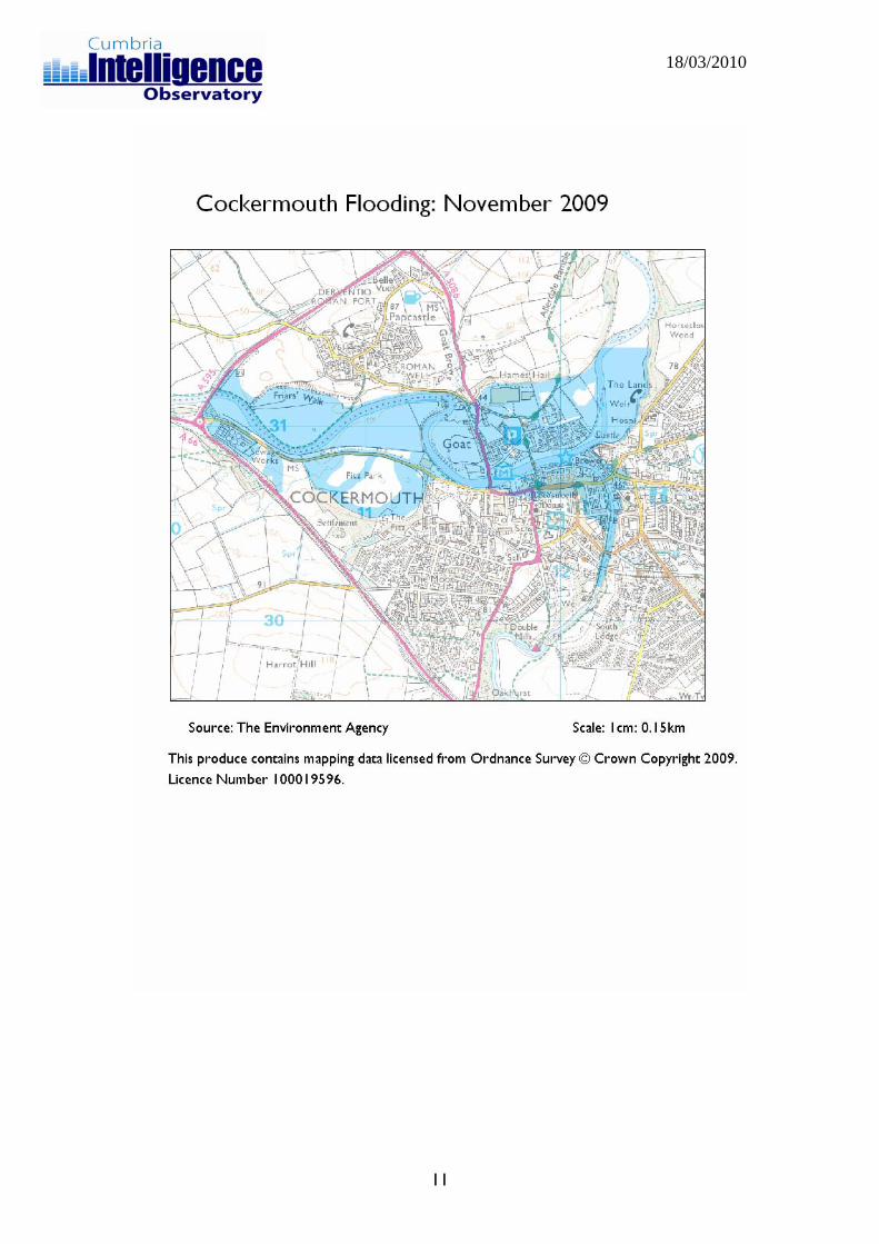
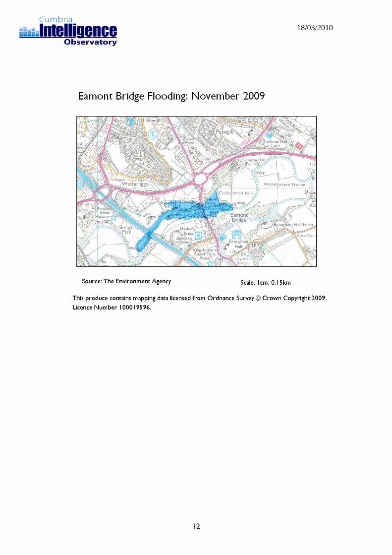
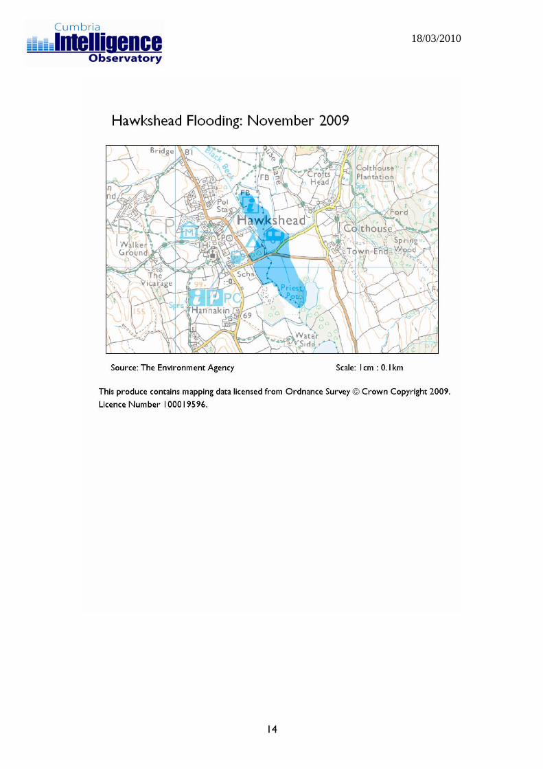
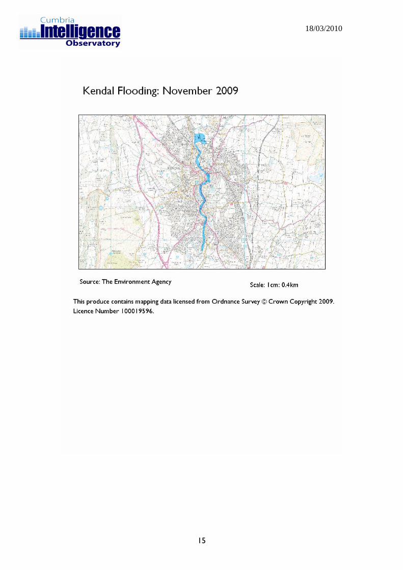
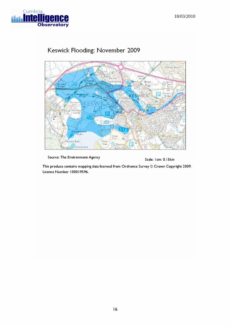
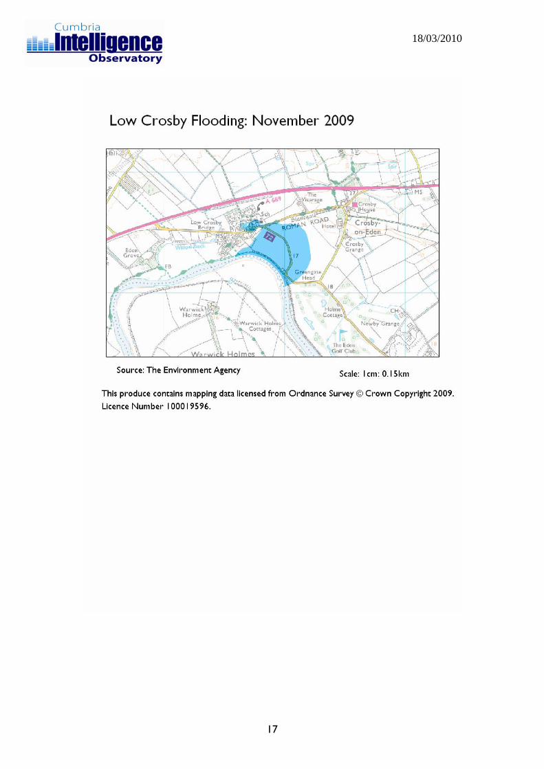
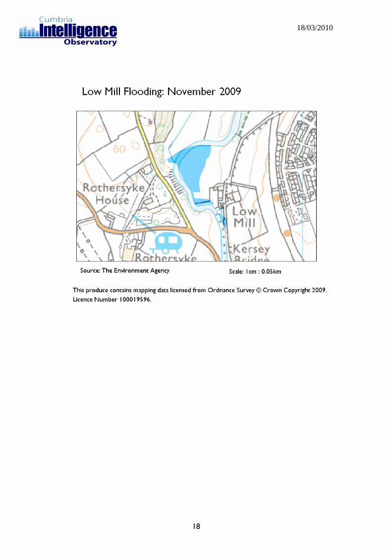
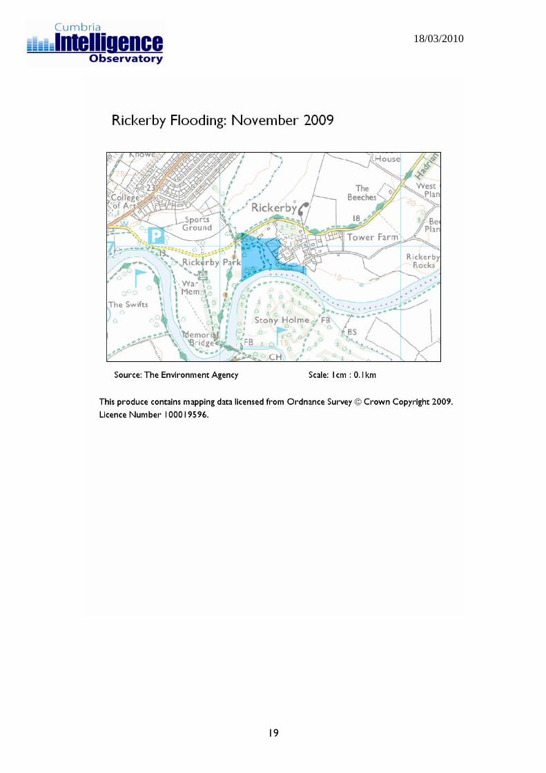
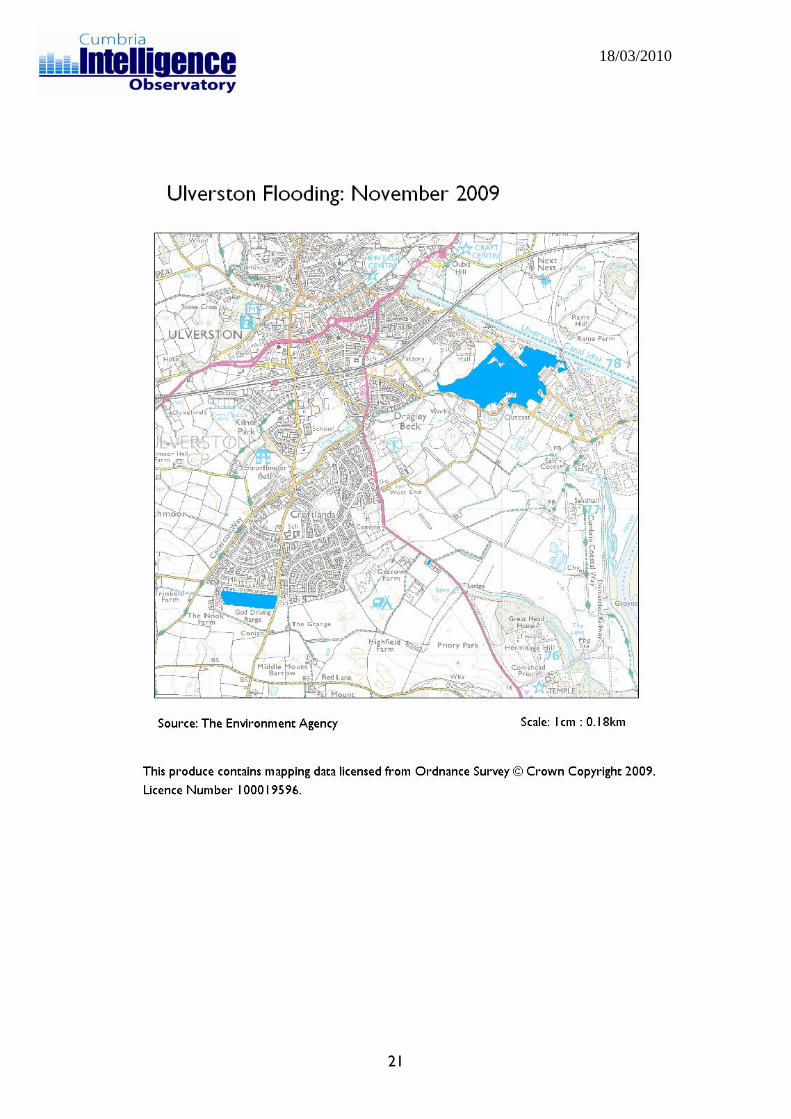
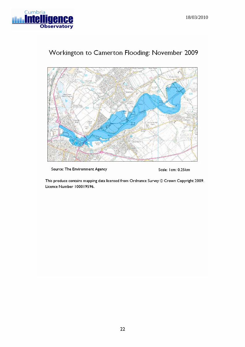
1.3 - Extent of the floods The maps below detail the extent of flooding experienced by different communities across the county. The information they contain, collected by the Environment Agency, presents evidence from ariel photography and field surveys.
5
18/03/2010
6
18/03/2010
7
18/03/2010
8
18/03/2010
9
18/03/2010
10
18/03/2010
11
18/03/2010
12

18/03/2010
13
18/03/2010
14
18/03/2010
15
18/03/2010
16
18/03/2010
17
18/03/2010
18
18/03/2010
19

18/03/2010
20
18/03/2010
21
18/03/2010
22
18/03/2010
1.4 - Impacts on community welfare
• According to information gathered from affected householders the most commonly occurring need immediately after the floods was for accommodation (24.8% of residents), with advice about insurance ranking second (9.5%), business support (8.5%), council tax advice (8.2%) and information about the Cumbria Flood Appeal (7.8%).
• Insurance companies reported that they arranged temporary accommodation for 470 policyholders.
• Local services all felt the pressure that demand resulted from the increased demand for services, including those covering reception centres and frontline policing.
• Flood waters forced some services to relocate from their usual operating bases such as GPs and Police in Cockermouth.
• Concerns associated with the spread of disease led to a localised vaccination programme being carried out in Cockermouth.
• Socio-economic analysis of the communities affected across Allerdale, using the ACORN dataset, indicates that older residents have been disproportionately affected. Around 63% of residents are from older social groups compared to only 17% in the wider population.
• The transport problems in Workington meant that around 7,000 residents were unable to access their local GP surgery. The same problems also affected the ability of the emergency services, such as the ambulance service, to meet their commitments to the public.
• Health issues have shifted from the immediate threat to life, through concerns about access to medication, and are now focussed on long term psychological problems of residents affected.
23
18/03/2010
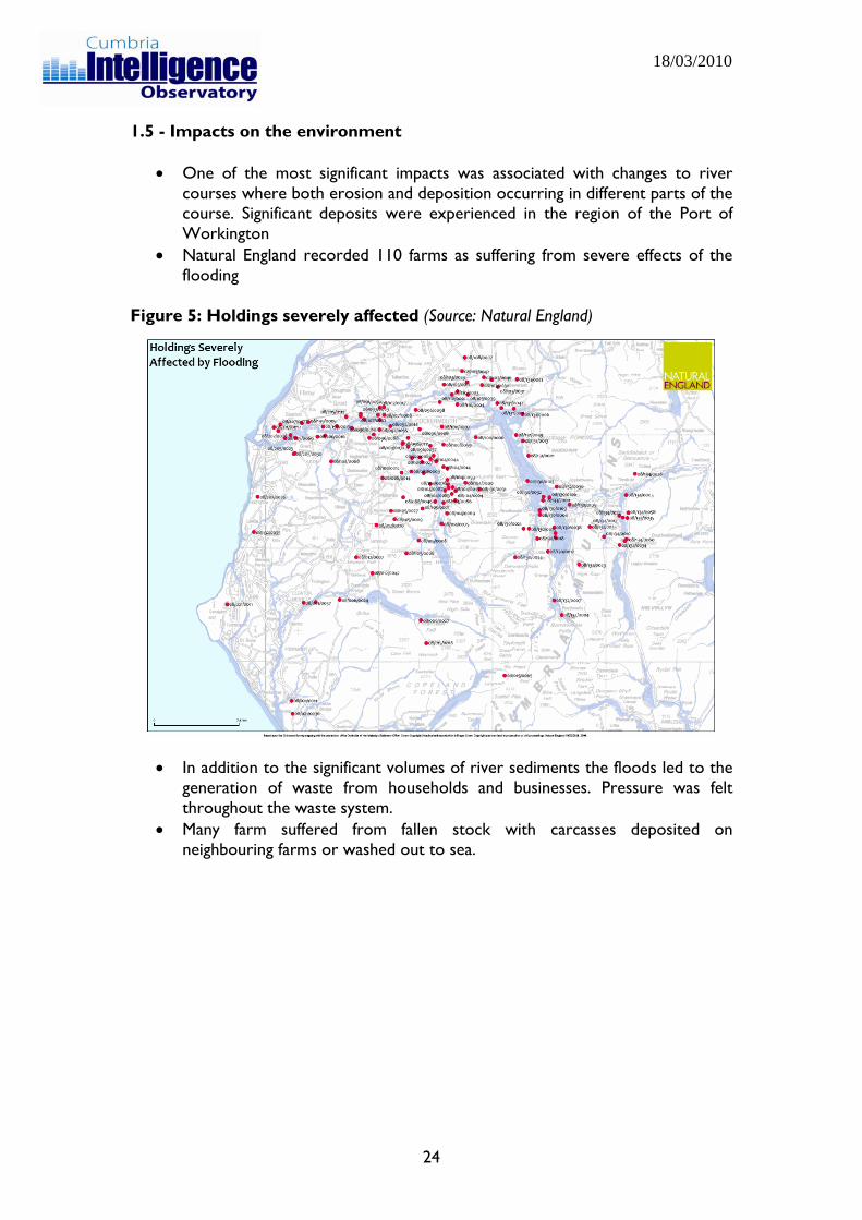
1.5 - Impacts on the environment
• One of the most significant impacts was associated with changes to river courses where both erosion and deposition occurring in different parts of the course. Significant deposits were experienced in the region of the Port of Workington
• Natural England recorded 110 farms as suffering from severe effects of the flooding
Figure 5: Holdings severely affected (Source: Natural England)
• In addition to the significant volumes of river sediments the floods led to the
generation of waste from households and businesses. Pressure was felt throughout the waste system.
• Many farm suffered from fallen stock with carcasses deposited on neighbouring farms or washed out to sea.
24
18/03/2010
1.6 - Impacts on the economy and businesses • The flooding affected 80% of businesses in Cockermouth • The County Council-operated Port of Workington was forced to close as a
result of sediment deposition. An emergency dredging campaign was promptly instigated to allow a rapid return to full operations. The total cost of flood damage to the port is estimated to be in excess of £6.75m.
• Some businesses in South Lakeland were badly damaged (inc. National Trust Information Centre, Windermere Marine, and Windermere Lake Cruises).
• Very few businesses in Workington were directly affected but businesses lost trade due to the collapse of the bridges.
• Other businesses not directly affected lost business due to the negative message in the media that Cumbria is closed for business.
• Weddings were cancelled with an associated effect on the catering and hospitality industries.
• Operation in parts of the agricultural sector were impeded due to damage to fields and walls
• Business Link data suggested that 3,057 businesses are affected in Allerdale (1,606 in Workington, 693 in Cockermouth, and 758 in Keswick)
• Dunmail Park, north of Workington, reported 90% loss in revenue through November/December; Debenhams reported 80% reduction in footfall
• Residents from the relatively affluent Seaton area were unable to get through to Workington, which had a big effect on the Workington economy.
• Survey by Cumbria Tourism noted that 72% of respondents had been affected by the floods, and 6% had to close their business as a direct result. The biggest effect on hotels was experienced in South Lakeland.
• Ten tourism businesses reported damage in excess of £100,000. These were concentrated in Cockermouth, Workington, and areas surrounding lake Windermere, including Windermere, Bowness, Newby Bridge, Lakeside and Ambleside. Between them these businesses suffered almost £12m worth of damage.
• Almost half of all tourism businesses were affected by access issues. 41% have suffered cancellations, a fifth believe bookings and enquiries were down, and more than a quarter were concerned about the impact on public perceptions.
25
18/03/2010
Impacts on infrastructure
• In terms of impacts on the transport network the most significant effects were seen in the destruction and severe damage to the county’s road and public rights of way bridges. 3 significant road bridges were lost completely and around 20 others were temporarily closed (some remaining closed) because of evidence of structural damage. Elsewhere roads were inundated as drainage was overwhelmed and surface water run-off flooded the highway.
• Across the Lake District and other rural areas 244 rights of way bridges were damaged or lost and in some cases the surfaces of rights of way were destroyed.
• The flood waters demolished and severely damaged two road bridges in Cockermouth leading to their closure, demolished a key footbridge and inundating large parts of the town centre; and finally overwhelmed the Calva Bridge in Workington causing structural damage requiring its closure and destroyed the Northside bridge and Navvies footbridge.
• These severed the A596 and A597 connections across Workington and to the A66 trunk road and cut the community in two. A further footbridge linking the banks of the River Derwent was destroyed within the Port os Workington. Sadly the collapse of the Northside Bridge resulted in the death of Police Constable Barker.
• With the loss of both road bridges across the lower Derwent the relatively deprived community of Northside was rendered inaccessible from the rest of Workington.
• The loss of functionality previously provided by the bridges in Workington severed the community and necessitated a forty mile round trip to access work, schools, healthcare and shopping. These journeys were previously of the order of a mile or two via the bridges. This placed huge time penalties on everyday trips with some journey times increasing by up to two hours in the peak. The time penalty was compounded by traffic congestion throughout the day and very long queues at peak periods on the diversionary routes which had insufficient capacity to accommodate the diverted traffic.
• Some schools (mainly in West Cumbria) closed temporarily and 461 additional pupils required the provision of transport as their usual routes to school were impassable;
• Smaller roads and bridges were kept closed to prevent rat running and the consequent further collapse of roads and bridges.
• Elsewhere across the county, while flooding was less dramatic it nevertheless overwhelmed and closed roads and damaged bridges resulting in their longer term temporary closure.
• Power supplies and telecommunications were interrupted in some areas (including contact with the emergency services).
• In the 24 hours following the rainfall, teams from across the Highways and Transport Division commenced the inspection of the road and rights of way network looking for and making safe damage, as well as putting up closures and reopening roads as flood water levels began to drop. Approximately 1,600 structures were checked during this exercise.
26