contents€¦ · telephone: 571-557-5400 dsn 547-5400 ... » ops & intel 4 nga receives joint...
TRANSCRIPT

Pathfinder • Spring 20132
The Pathfinder is an internal command publication that promotes awareness and understanding of geospatial intelligence, and is published by National Geospatial-Intelligence Agency’s (NGA) Office of Corporate Communications (OCC).
The Pathfinder is an authorized Department of Defense publication for members of the DOD. Contents of this publication are not necessarily the official view of, or endorsed by, the U.S. government, DOD or NGA. Articles in the Pathfinder may be reproduced in whole or in part without permission, unless stated otherwise. If reproduced, credit the author and the “National Geospatial-Intelligence Agency, the Pathfinder magazine.” Reproduction of graphics, photographs and imagery is subject to the original copyright.
NGA Leadership Director: Letitia A. Long Deputy Director: Michael A. Rodrigue
OCC Leadership Director: William M. Caniano News & Information Chief: Christine Phillips Editor: Glenn Holloway Designer: Jay Conklin
Contact us Telephone: 571-557-5400 DSN 547-5400
Find out more about NGA
www.nga.mil
@NGA_GEOINT
NatlGEOINTAgency
A lot happened in the first three months of 2013. There are examples everywhere that illustrate our commit-ment to providing online, on-demand geospatial intelligence. We launched a new unified Web presence that more closely aligns and brands our products and services on multiple networks— an effort that has been in the works for more than a decade. And we answered our nation’s call to fulfill numerous responsibilities, including our continued support to warfighters and policymakers and our support to the presidential inauguration and the Super Bowl in New Orleans. The men and women of NGA deliver GEOINT that enables the organizations, agencies and policy-makers we support to more effectively and efficiently do their jobs—with agility and versatility never before known. Our products and services cover the gamut, from indications and warnings of events unfolding in North Korea and Syria to direct support to our men and women on the ground in Afghanistan and other places around the globe, and from storm prepara-tion and recovery efforts to national security events, like inaugurations and iconic football games. I am proud of our accomplish-ments as an agency, and I believe the leaders of this nation feel the same way. In fact, during a ceremony Jan. 11 at our Springfield, Va., campus, Deputy Secretary of Defense Ashton Carter presented us with the DOD Joint Meritorious Unit Award for our service from 2008 to 2010. The streamer denotes our third JMUA, and Secretary Carter has challenged us keep up our efforts and continue our exemplary service to the DOD. In this issue of Pathfinder, you can read more about NGA’s ability to respond to natural disasters, like Hurricane Sandy, and the capabilities of Integrated Work Group-Readiness, Response and Recovery. You will see how IWG-R3 and the integrated analytic environment make collaboration and discoverability work for our customers and partners. With the launch of the new IWG-R3 dashboard at the first of this year, our customers and partners are now even more able to tailor their requests and get just what they need when they
On My MindProud of our history, excited about the future
need it. We are serving our customers better than ever and putting critical GEOINT into the hands of users who may have never before needed it or knew where to find it. This is the NGA strategy in action. Key to our successes is our out-standing cadre of leaders throughout the agency at every level. Our senior executives, first-line supervisors, team leads and individual employees share an understanding of the value of strong leadership and its tie to mission accomplishment. They understand that success requires a commitment to serv-ing those they lead. We are fortunate to have conscientious leaders, like our new chief operating officer, Ellen McCarthy. After years in industry, she brings a fresh set of eyes to our agency and is helping us become even better than before. You can read more about servant leadership and our new COO in this issue. NGA has a proud history and tradition of excellence. However, it is not our history that makes us vital to the nation. Rather it is our continuing efforts to provide decision makers, first responders and warfighters with the best GEOINT analysis and service available anywhere in the world that solidifies our relevance to our nation, and makes us the foundation for truly integrated intelligence.
Letitia A. Long Director
Putting the power of GEOINT in users’ hands

Pathfinder • Spring 2013 3
│ContentsSpring 2013 ▪ Vol. 11, No. 1
» On My Mind: 2 Proud of our history, excited about the future
» Ops & Intel 4 NGA receives Joint Meritorious Unit Award
5 MERIT program delivers advanced GEOINT capabiities to joint warfighters
6 Crowdsourcing leverages free talent, knowledge
7 Tool proves value of NGA, In-Q-Tel relationship
7 Milestone reached in common desktop
8 ‘Magic wall’ changes analysts’ perspective
9 Remote test facility open to NSG partners
10 Unified Web presence a ‘tangible benefit’
11 IC, DOD explore ISR challenges, solutions
» Features 15 Nature’s fury: NGA teams anticipate,
respond during national crisis
20 Developing leaders
22 Q&A with COO Ellen McCarthy
» NGA Today 12 PIE shows students slice of NGA life
24 Consider kettlebells for a fitter you
25 Historical discovery at NGA West
27 NGA Salute: Airman 1st class Sarah Gardner
22
258
15
4
20
Pathfinder • Spring 20134
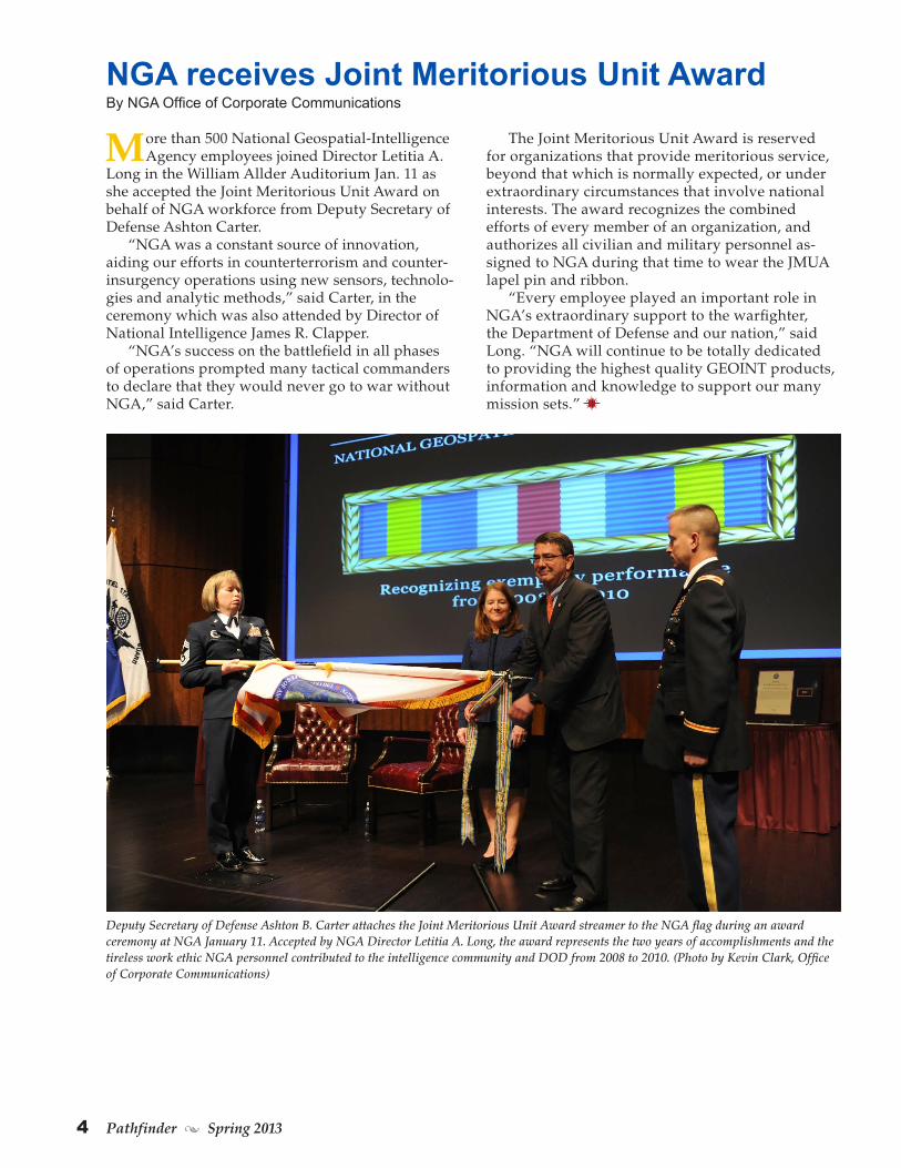
NGA receives Joint Meritorious Unit AwardBy NGA Office of Corporate Communications
More than 500 National Geospatial-Intelligence Agency employees joined Director Letitia A.
Long in the William Allder Auditorium Jan. 11 as she accepted the Joint Meritorious Unit Award on behalf of NGA workforce from Deputy Secretary of Defense Ashton Carter. “NGA was a constant source of innovation, aiding our efforts in counterterrorism and counter-insurgency operations using new sensors, technolo-gies and analytic methods,” said Carter, in the ceremony which was also attended by Director of National Intelligence James R. Clapper. “NGA’s success on the battlefield in all phases of operations prompted many tactical commanders to declare that they would never go to war without NGA,” said Carter.
The Joint Meritorious Unit Award is reserved for organizations that provide meritorious service, beyond that which is normally expected, or under extraordinary circumstances that involve national interests. The award recognizes the combined efforts of every member of an organization, and authorizes all civilian and military personnel as-signed to NGA during that time to wear the JMUA lapel pin and ribbon. “Every employee played an important role in NGA’s extraordinary support to the warfighter, the Department of Defense and our nation,” said Long. “NGA will continue to be totally dedicated to providing the highest quality GEOINT products, information and knowledge to support our many mission sets.”
Deputy Secretary of Defense Ashton B. Carter attaches the Joint Meritorious Unit Award streamer to the NGA flag during an award ceremony at NGA January 11. Accepted by NGA Director Letitia A. Long, the award represents the two years of accomplishments and the tireless work ethic NGA personnel contributed to the intelligence community and DOD from 2008 to 2010. (Photo by Kevin Clark, Office of Corporate Communications)
Pathfinder • Spring 2013 5
MERIT program delivers advanced GEOINT capabilities to joint warfightersBy MERIT program manager
The National Geospatial-Intelligence Agency, like other elements of the military services,
combat support agencies and combatant commands, is a member of the Military Exploitation of Reconnaissance and Intelligence Technology program, administered by the National Reconnaissance Office. MERIT solicits, assesses and funds advanced research and development projects that focus on in-creasing warfighter access to intelligence from national systems and national systems’ data, across the intel-ligence disciplines, and develops warfighter capability to exploit intelligence at the tactical level, said Corry Robb, the MERIT program manager. NGA’s MERIT program is managed and led by NGA’s Future Warfare Systems Division within the Military Support Directorate, said Robb. The division coordinates an internal panel of agency subject mat-ter experts to perform technical proposal evaluations. “The panel vets 70 to 85 proposals annually to ensure alignment with national and military intelli-gence priorities and guidance, including the recently published NGA strategy,” said Robb. There were 76 proposals submitted for FY2014, said Robb. Nearly 40 of them directly support GEOINT. The team tracks annual and multi-year GEOINT-related MERIT projects from development to completion to ensure delivery of successful programs that support the larger Department of Defense and National System for Geospatial Intelligence enterprise, said Robb. “MERIT places great emphasis on quickly transitioning promising technology from research
and development into operations,” said Robb. “NGA’s involvement in the MERIT program directly aligns with NGA’s Strategic Objective No. 7, ‘to lead advancement in the GEOINT field, and transition research and development and science and technology activities to operations’.” A recent example of success from NGA’s participation in MERIT is the development of the Enhanced Quality Imagery Search tool, said Robb. EQUIS enables analysts to quickly and accurately identify the imagery they need by merging multiple image libraries into a single, integrated user environment. Another GEOINT tool funded and developed through the program is the Web-based Access and Retrieval Portal, said Robb. Commonly known to many GEOINT analysts as WARP, it is a major component of the NSG’s GEOINT distribution system. It is a multi-domain system that front-ends imagery archives and provides the download, query and retrieval of data hosted on accessible libraries. The MERIT program is also responsible for myriad tools that improve overhead persistent infra-red’s utility at the tactical level, said Robb. OPIR is a key contributor to emerging GEOINT capabilities. “The MERIT program continues to benefit the NGA mission by quickly delivering to NGA analysts and the DOD warfighter cutting-edge applications and tools that significantly enhance existing capa-bilities,” said Robb. For more information about NGA’s involvement in the MERIT program, contact NGA Public Affairs at [email protected].
Dep
artm
ent o
f D
efen
se p
hot
o

Pathfinder • Spring 20136
Crowdsourcing leverages free talent, knowledgeBy Tim Little, Office of Corporate Communications
Despite advancing technology, the human element remains
a vital component in intelligence gathering and NGA is exploring methods to tap into a broader pool of knowledge. Crowdsourcing could be the answer to capturing knowledge and expertise not organic to NGA. Put simply, crowdsourcing is the utilization of talent, resources or expertise of the public in support of a project, often via the internet and without compensation. Using crowdsourcing in GEOINT is not a new concept for NGA. At the In-Q-Tel CEO sum-mit in March 2011, NGA Director Letitia A. Long addressed some of these aspirations for NGA in the crowdsourcing arena, which are starting to become a reality. “There are tens of thousands of government consumers of GEO-INT who can—and should—be in the middle of producing and delivering new, value-added content and analytical services—and sharing them with the com-munity,” said Long. One example of crowdsourcing in support of GEOINT is a joint project between Integrated Work Group-Readiness, Response and Recovery, or IWG-R3, and Depart-ment of State’s Humanitarian Information Unit in the Bureau of Intelligence and Research and the Humanitarian Open-StreetMap Team. At the request of the State Department, a lead federal agency, NGA provides commercial imagery for use in the OpenStreetMap Tasking Manager, said Katie Baucom, a GEOINT analyst in PDOR. “We just finished a project in a previously unmapped area of Uganda that produced high reso-lution structure level data of two cities at no cost to the U.S. govern-ment in less than one week,” said Baucom. “Volunteers from all over the world traced features such as buildings, roads and landmarks.
After that, local Ugandans added attribution to the data, such as road and business names.” Since the data is unclassified and shareable, it is now being used by the U.S. Agency for International Development, Red Cross and the United Nations for disaster pre-paredness projects, said Baucom. Many in the intelligence community are keeping track of new and emerging applications for crowdsourcing, especially in support of human geography. One such emerging capability is MapStory (www.mapstory.org), which was created by Christopher Tucker, Ph.D., chairman and CEO of the MapStory Foundation. Tucker was the founding chief strategic officer of In-Q-Tel, and serves as one of Director Long’s independent advisers. Tucker introduced MapStory as a platform for crowdsourcing and storytelling within a spatio-temporal framework when he spoke at NGA in the fall as part of InnoVision’s “iTalks” seminar. MapStory is a website that enables a global community to contribute data within a map-
A Haitian woman uses a cell phone amidst the ruins caused by the 2010 Haiti earthquake. Crowdsourcing allows individuals, governments and other organizations to pose questions to large and varied groups and use the information provided voluntarily to obtain answers. (Photo: U.S. Agency for International Development)
ping framework, said Tucker. It also facilitates communication of important cultural dynamics through engaging and interactive maps that tell a story. In intelligence work, verifica-tion and vetting of sources are important, said Tucker. GEOINT demands a high-attribution platform that enables structured dispute resolution. In an open, collaborative envi-ronment, those in the community can fact check others’ data and solicit information and ideas from the community to solve a problem or create a public database, said Tucker. This is the key benefit of crowdsourcing. MapStory aims to exploit the blurring of lines between consumer and producer. This is the concept of such popular sites as Wikipedia, but Tucker makes a distinction. “MapStory is a new dimension to the global data commons, which empowers people to organize what they know about the world spatially and temporally, rather than encyclopedically, the way Wikipedia already empowers us to,” said Tucker.

Pathfinder • Spring 2013 7
Tool proves value of NGA, In-Q-Tel relationshipJason Moll, Office of Corporate Communications
Even in an environment bursting with practitioners,
many at the National Geospatial-Intelligence Agency recognize the need for geographical analysis tools that can be accessed and enhanced by users across the customer base. GeoIQ was one platform that particularly stood out to NGA and In-Q-Tel, because it allows users to collect massive amounts of in-formation and analyze it through geospatial analysis, said Jay Bren-nan, deputy program manager for the NGA IQT Program. “I think a product like GeoIQ fits nicely with the (NGA) direc-tor’s desire to get GEOINT into the hands of users,” said Brennan. “It does a good job of making it easier for the non- (Geographic Information System) person to create their own maps, bring in their own data and do some first-level analysis. This frees up
NGA analysts to do second-order or third-order analyses.” In-Q-Tel is a private, independent organization that identifies and partners with companies that produce technologies of interest to the U.S. intelligence community. Since 2003, In-Q-Tel has received more than $17 million in funding from NGA. On average, for every $1 NGA spends, In-Q-Tel leverages an additional $37 from venture capital firms and the larger U.S. intelligence community, allowing NGA to maximize the impact of its investment. In-Q-Tel made its first invest-ment in GeoIQ in May 2007. Since then, the technology has found a place in the Integrated Work Group-Readiness, Response and Recovery (IWG-R3), where it is used within NGA and by many of its outside customers, such as first responders in the field.
Milestone reached in move to common desktopBy Jason Moll, Office of Corporate Communications
A joint team from NGA and the Defense Intelligence Agency
reached a major milestone in the move to a common desktop en-vironment across the intelligence community Dec. 20. The execution and same-day passage of the test readiness review by the DIA/NGA Joint Program Management Office for the Intelligence Community Desktop Environment (IC DTE) means that the DTE is ready to enter the testing phase of the project, said Vicki Jo McBee, JPMO director. The TRR was the fourth of six major milestone during the Phase 1 move to a common desktop, said McBee. Now that the TRR phase is over, DTE will undergo multiple rigorous tests, to include security and user confidence test-
ing—all of which will verify that the software is ready for use. The next major milestone in Phase 1 is scheduled for the summer, when the DTE is expected to be rolled out to the DIA/NGA workforce, also known as Initial Operating Capability (IOC). Once IOC is achieved, NGA and DIA will migrate users in batches until nearly 60,000 NGA/DIA users are connected to the common desktop in March 2014, McBee said. Phase 2 of DTE will begin in 2014 when the common desktop is made available to the entire IC—a number that will eventually exceed 100,000. The DTE was officially launched in 2011 as part of the IC Information Technology Enterprise (IC ITE, pronounced
GeoIQ has been employed during the recovery efforts follow-ing the 2010 earthquake in Haiti, in the wake of hurricanes, and after other natural disasters, said Nathaniel Wolpert, an IWG-R3 geospatial intelligence analyst. IWG-R3 uses GeoIQ to geo-spatially visualize and determine areas that are flooded or in need of supplies, and to understand the overall situation on the ground, said Wolpert. NGA maintains a contract with GeoIQ, which was acquired by California-based Esri in July 2012, to source additional capabilities and tools based on the technology. NGA has provided feedback throughout its development and the company has been and continues to be very responsive, said Wolpert. “It’s a powerful tool that we want to keep using and make more robust in the future,” said Wolpert.
“eyesight”), which is designed to increase efficiencies, improve collaboration and deliver cost savings, said McBee. In addition to a common desktop, IC ITE will deliver a cloud computing environment, various aspects of which will be delivered by the National Security Agency and CIA. NSA will also architect and host an applications mall where IC agencies will be able to host their own apps stores. DTE will provide multiple capabilities, McBee said, such as a common desktop operating system, a “mobile” desktop that will allow users to log in at any IC agency, collaborative software, and a permanent phone number and email address that will ac-company users “for life.”

Pathfinder • Spring 20138
‘Magic Wall’ changes analysts’ perspectiveBy Jason Moll, Office of Corporate Communications
When the average person hears of geospatial and imagery intelligence, or sees it covered
in the media, scenes of cutting-edge information technologies featured in Hollywood blockbusters may come to mind. While the capabilities of the U.S. government may be surprising, the average routine of a geospatial intelligence analyst is nowhere near like it is in the movies, said Jay Brennan, deputy program manager for the NGA In-Q-Tel Program. A more prosaic routine may very well be the case, but it may not be true for much longer, now that NGA has Perceptive Pixel. Known as the “Magic Wall” used by CNN presenters since 2008 for dynamic visualization during the elec-tion cycle, Perceptive Pixel has been a part of the IQT portfolio of companies since March 2009. The technology consists of a large touchscreen powered by proprietary software that enables more than one person to simultaneously manipulate imagery and data. NGA has eight Percep-tive Pixel displays scattered throughout the agency, includ-ing the Office of Corporate Communications, where the technology is used for briefings and presentations. The Geospatial Intelligence Advancement Testbed is performing hands-on research and other tests as they develop new applications and envision scenarios for NGA to incorporate the technology into its everyday workflow, said Brennan. Brennan said he sees a future for the technology at NGA that goes beyond its current use as an interac-tive display panel. “Visualization is one of the problems we’ve asked In-Q-Tel to help us with,” Brennan said. “And I think Perceptive Pixel goes far in meeting that need. If you’re an analyst and you’re looking at things on a two-dimensional sheet, you’re only going to be able to pull out so much information from that. By seeing things differently, you’re able to visualize the problem differently, and hopefully find a solution.”
This different perspective lends more body, essence and liveliness to the data, said Brennan. “We, as analysts, might be able to find something by having a unique angle; maybe see the connections between groups; maybe see the connections between place and time that we probably wouldn’t have seen in a flat file format,” he said. Originally launched as an independent startup, Perceptive Pixel was acquired by Microsoft in July.
Ph
oto courtesy of P
erceptive P
ixel.
Pathfinder • Spring 2013 9
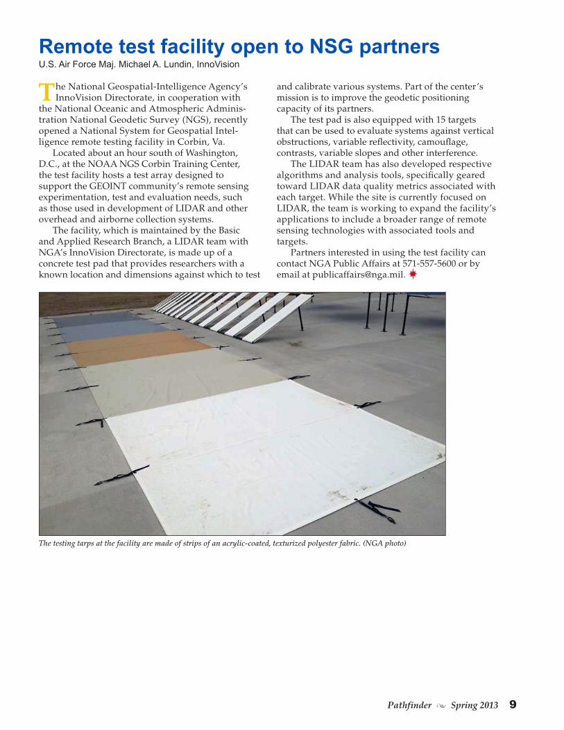
Remote test facility open to NSG partnersU.S. Air Force Maj. Michael A. Lundin, InnoVision
The National Geospatial-Intelligence Agency’s InnoVision Directorate, in cooperation with
the National Oceanic and Atmospheric Adminis-tration National Geodetic Survey (NGS), recently opened a National System for Geospatial Intel-ligence remote testing facility in Corbin, Va. Located about an hour south of Washington, D.C., at the NOAA NGS Corbin Training Center, the test facility hosts a test array designed to support the GEOINT community’s remote sensing experimentation, test and evaluation needs, such as those used in development of LIDAR and other overhead and airborne collection systems. The facility, which is maintained by the Basic and Applied Research Branch, a LIDAR team with NGA’s InnoVision Directorate, is made up of a concrete test pad that provides researchers with a known location and dimensions against which to test
and calibrate various systems. Part of the center’s mission is to improve the geodetic positioning capacity of its partners. The test pad is also equipped with 15 targets that can be used to evaluate systems against vertical obstructions, variable reflectivity, camouflage, contrasts, variable slopes and other interference. The LIDAR team has also developed respective algorithms and analysis tools, specifically geared toward LIDAR data quality metrics associated with each target. While the site is currently focused on LIDAR, the team is working to expand the facility’s applications to include a broader range of remote sensing technologies with associated tools and targets. Partners interested in using the test facility can contact NGA Public Affairs at 571-557-5600 or by email at [email protected].
The testing tarps at the facility are made of strips of an acrylic-coated, texturized polyester fabric. (NGA photo)
Pathfinder • Spring 201310
Unified Web presence a ‘tangible benefit’By Jeanne Chircop, Online GEOINT Services
Few would guess that a quiet yet significant shift is taking place inside the walls of the National
Geospatial-Intelligence Agency, but that is exactly the case. “The effort to transform NGA’s online services is nothing short of revolutionary for a government agency of NGA’s size and complexity and, most significantly, its subject focus—geospatial intelligence,” said Jim Long, deputy director of the Online GEOINT Services Office within NGA’s Online GEOINT Services Directorate. Part of what makes the change so significant is the tangible benefit of a unified NGA Web presence, the cornerstone of which is a new corporate website that will consolidate 126 websites into one on the highest security domain, said John Rother, director of OGSO. The other key components of NGA’s unified Web presence are an integrated analytic environment, a GEOINT app store and a corporate website on each security domain. Creating a unified Web presence is essential to eliminating redundancies and weeding out content that is no longer useful, said Rother. The NGA website, which will use business analytics to measure use of the site, launched on the highest security domain at the end of January. The business analytics will help the agency understand customer usage so it can tailor opera-tions toward customer needs, said Long. The site will eventually be available on all security domains, and each of the sites will share the same look and feel, as well as the same methods to navigate, search and browse—all necessary for making NGA content easier to discover and use. This will be the first time that NGA will have the same website design and architecture on multiple domains, said Long. All of those capabilities are basic needs for GEOINT users, and especially for analysts within the intelligence and defense communities, said Long. OGS is collaborating within the agency to transform the way NGA posts content by providing tools that enable self-service and integrated analysis, among other capabilities.
Concurrently, work is ongoing for an online workspace to enable GEOINT users to integrate and layer content from NGA with content from other government and non-government entities, including commercial and open-source providers, said Long. “The Integrated Analytic Environment enables the integration and use of GEOINT content and visualization capabilities to create unique observa-tions in time and space for real-time situational awareness and analysis,” said OGS Deputy Director Justin Poole. In this personalized online workspace, GEOINT users can access and integrate the broad variety of content and services they need, when and where they need them, and perform personalized analysis in a single location, said Poole. Also integral to the NGA unified Web presence is the GEOINT App Store, which can be accessed through the NGA website or independently, said Mark Riccio, director of the OGS Application Ser-vices Office. The store provides online, on-demand access to a suite of GEOINT-focused applications for Web, mobile and desktop use. “Self-service access to these apps allows analysts to interact with data to perform routine tasks more efficiently,” said Riccio. “The self-service aspect also allows them to customize end-products that satisfy their unique mission requirements.” There are many activities that go into making the three major activities possible—from content management and service-enabling data, to creating governance policies and compensation models for the acquisition of apps, said Poole. This kind of major transformation doesn’t hap-pen overnight, said Poole. OGS uses an incremental development process for all three activities, rolling out functions and capabilities in phases rather than all at once. Early instantiations mature and improve with user feedback. Interested in learning more about NGA’s unified Web presence and how it can enhance your mission needs? Contact NGA Public Affairs at 571-557-5600 or by email at [email protected].
Pathfinder • Spring 2013 11
IC, DOD explore ISR challenges, solutionsBy Kathi Ghannam, Office of Corporate Communications
Nearly 100 intelligence community and Defense Department professionals attended the Next
Generation Intelligence, Surveillance and Reconnais-sance Future Symposium in Rosslyn, Va. Dec. 10. Those gathered discussed various aspects of ISR research and development, testing, collection, dissemination, training, data standards, storage and integration, including the management of the plethora of data generated by ISR. “The problems with ISR are not technological but process problems,” said event moderator Avery White of Questar Federal Systems. “There are joint problems that require joint solutions.” One of the event’s speakers shared his organiza-tion’s data challenges and its plans to manage those issues leveraging community assets. Above all, big data needs to be managed and stored so that all users can access it in a platform-agnostic setting, said U.S. Army Col. Timothy Hill, Intelligence and Security Command Futures Division. “Data size and bandwidth, moving and storing data, and being able to exploit data in a timely manner are key,” said Hill. “These issues are getting harder, and not easier, with units that operate from forward operating bases and other locations that don’t have these capabilities.” Another problem is that commanders and collection managers aren’t all at the same level of understanding about the various platforms and their capabilities. “Right now, battalion commanders only use a small percentage of what we give them,” said Hill. “We need to be creating systems that they all can use.” The Army has decided to tie into the intelligence community’s Information Technology Enterprise architecture, known as IC ITE and pronounced “eye sight,” which is currently in development. Ultimately, this system of systems will provide a common desk-top, an apps mall and a cloud computing infrastruc-ture, alleviating the majority of the problems faced by the Army, its sister services and the IC. Once IC ITE is completed, all the services and intelligence agencies will be able to “plug in” their unique platform, which will allow them to harvest National System for Geospatial Intelligence Expedi-tionary Architecture data holdings, all while avoiding the costs and timelines associated with developing proprietary systems. The General Accounting Office provided its per-spective on the community’s growing ISR challenges. The community lacks an overall coordinated, inte-grated plan for growing and managing the complex, disparate collection of platforms which continue to generate terabytes of data each month, said Joseph
Kirschbaum, assistant director of the GAO’s Defense Capabilities and Management Office. “After 10 years of pumping out products and patching together unintegrated systems, we need an integration roadmap that aligns with congressional intent and our country’s national security chal-lenges,” said Kirschbaum. The ultimate solution lies with a well-executed procurement plan, said NGA’s Keith Barber, who advocates for more agile acquisition processes.Agile acquisition is important, especially with this type of fast-moving technology, said Barber, senior advisor for the Agile Acquisition Strategic Initiative.“Life changes every day so we need to figure out how to get something done, now,” said Barber. “We are trying to change the way we do our business to become flexible and fast.” The challenge lies in changing the acquisition culture that has been around for more than 20 years, where it took about seven years to get a product on the street, said Barber. “We don’t have that luxury anymore, and we can’t wait for something to happen to build a better solution,” said Barber. “We need the right people making the right decisions at the right time, (and to) streamline the decision making process and deliver iterative solutions.”
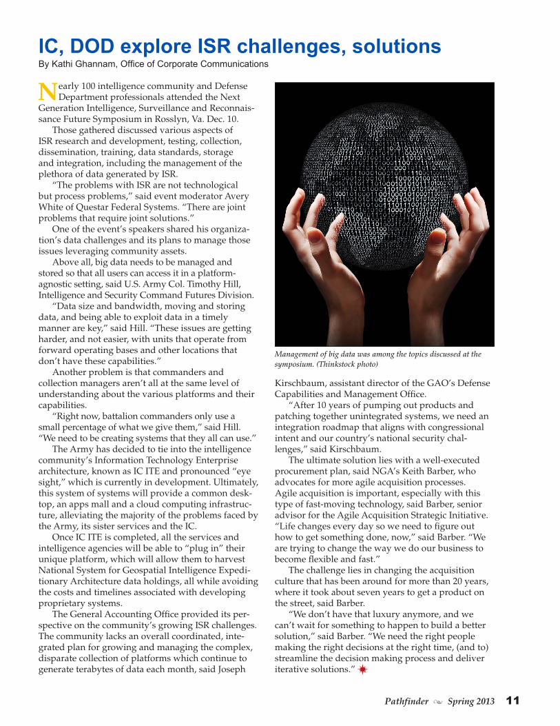
Management of big data was among the topics discussed at the symposium. (Thinkstock photo)
Pathfinder • Spring 201312
PIE shows students slice of NGA lifeBy Muridith Winder, Office of Corporate Communications
An NGA program designed to help employees make a dif-
ference in local communities and schools may be paving the road for future GEOINT professionals. The Partners in Education program, or PIE, offers employees the opportunity to volunteer with schools in the communities surrounding NGA’s facilities. NGA Campus West has estab-lished relationships with Hodgen Elementary and Rockwood School district elementary schools in the St. Louis area, said Samuel C. Wilson, PIE coordinator for NCW. The agency also supports speak-ing engagements in other school districts when requested by NGA employees. NGA speakers provide pre-sentations throughout the school year on mapping and geography to area students in kindergarten through eighth grade. The agency supports higher grade levels on a case-by-case basis, said Wilson. “This program allows me to share my love for geography with children,” said Karen Delgado, who has been tutoring with PIE in NCW for the last two years. “When I was in school, I did not realize all the potential careers available. I want students to realize that if they love geography, there are some great potential careers.” William Florich has been participating in NCW’s education program since 2002, he said. “A middle school social studies teacher heard through my son that I worked at NGA and asked if I could give a talk about maps to her class,” said Florich. “I soon found out that it was actually
six classes involving about 120 students. It was such a hit that I now do it every year. Recently, I completed my 10th presentation.” Another social studies teacher in Florich’s district asked him to present at her school, so now he presents to 12 classes of sixth grade and eighth grade social studies stu-dents each year, talking to nearly 250 students about how NGA plays a major role on the world stage. NGA Camps East has PIE partnerships with Saratoga Elementary School and West Springfield High School, both in Virginia. These partnerships help improve STEM, or science, technology, engineering and mathematics, education in these schools and the community at large by providing tutoring, guest speakers, a pen pal program for the elementary school, and math and science nights. Many NGA employees at both campuses also volunteer at non-partner schools to help in their own children’s classrooms.
“Initially, I was volunteering in my daughter’s fourth grade talented and gifted class on a day they were talking about maps, longitude and latitude, and country locations,” said Barbara S. Brown, senior execu-tive officer, Advanced Weapons Division, NCE, who volunteers at Rosaryville Elementary School in Upper Marlboro, Md. Brown’s presentation was so well received, school officials asked her to come back and talk to all the fourth-grade classes at the school, and at the schools’ career day. “They asked some very im-pressive questions,” Brown said. “I could tell that they listened and tried to relate our mission with some world events they had seen on TV.” The outreach program is a worthwhile endeavor, said Eli Rutstein, a financial budget analyst who has been involved in the PIE program for several years. “I got involved because my background is cartography and
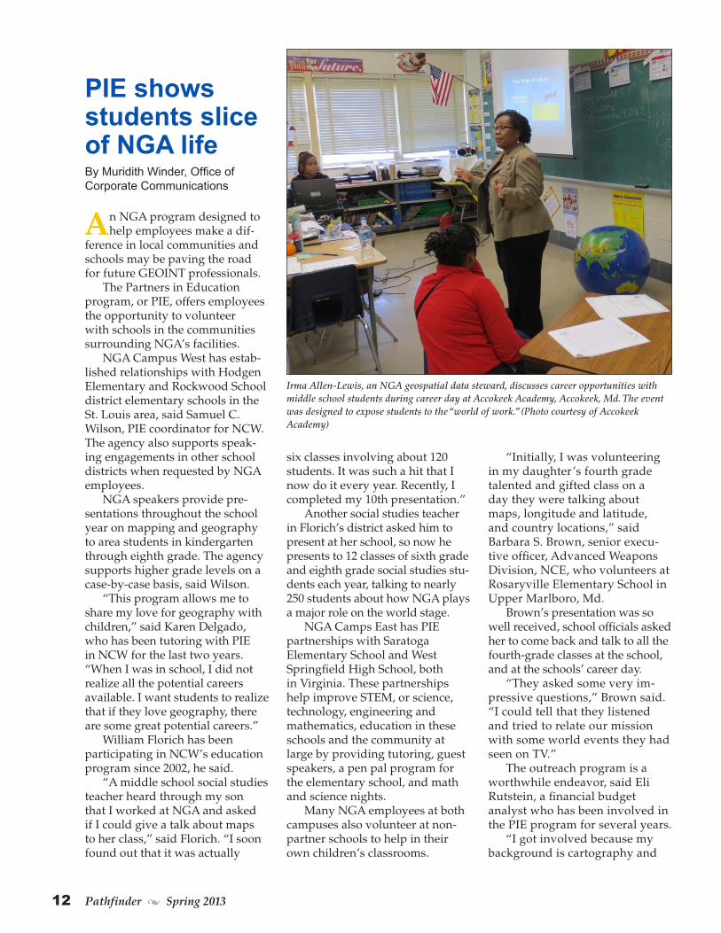
Irma Allen-Lewis, an NGA geospatial data steward, discusses career opportunities with middle school students during career day at Accokeek Academy, Accokeek, Md. The event was designed to expose students to the “world of work.” (Photo courtesy of Accokeek Academy)
Pathfinder • Spring 2013 13
physical geography and my children were learning about cartography and geography in school,” he said. “I wanted to show the students how maps are made manually and digitally.” The children liked the presentations, especially the 3-D images, and were able to relate it to their classroom studies, said Rutstein. “Many of the children are familiar with GPS digital maps and geocaching, and I think (the presentations) help them better understand how maps are made and how digital geospatial information is used by police and fire departments and others to do their jobs,” said Rutstein. The uniqueness of her job led Irma L. Allen-Lewis, a geospatial data steward, to explain her job to her daughter’s class.
“I wanted to share information about my career path here at NGA because I see my tradecraft as being out of the norm,” said Allen-Lewis. “Just as I suspected, many children had no clue what geospatial data stewards or cartographers were.” The experience was educational for the students, some of the teachers and parents, and for herself, said Allen-Lewis.
“I learned the importance of pouring back into the community and exposing children to a variety of career paths.” For additional information on the PIE program, call NGA Public Affairs at 571-557-5400, or email [email protected].

Pathfinder • Spring 201314

Pathfinder • Spring 2013 15
NGA teams anticipate, respond during national crisis
By Tim Little, Office of Corporate CommunicationsNature’s Fury
Pathfinder • Spring 201316
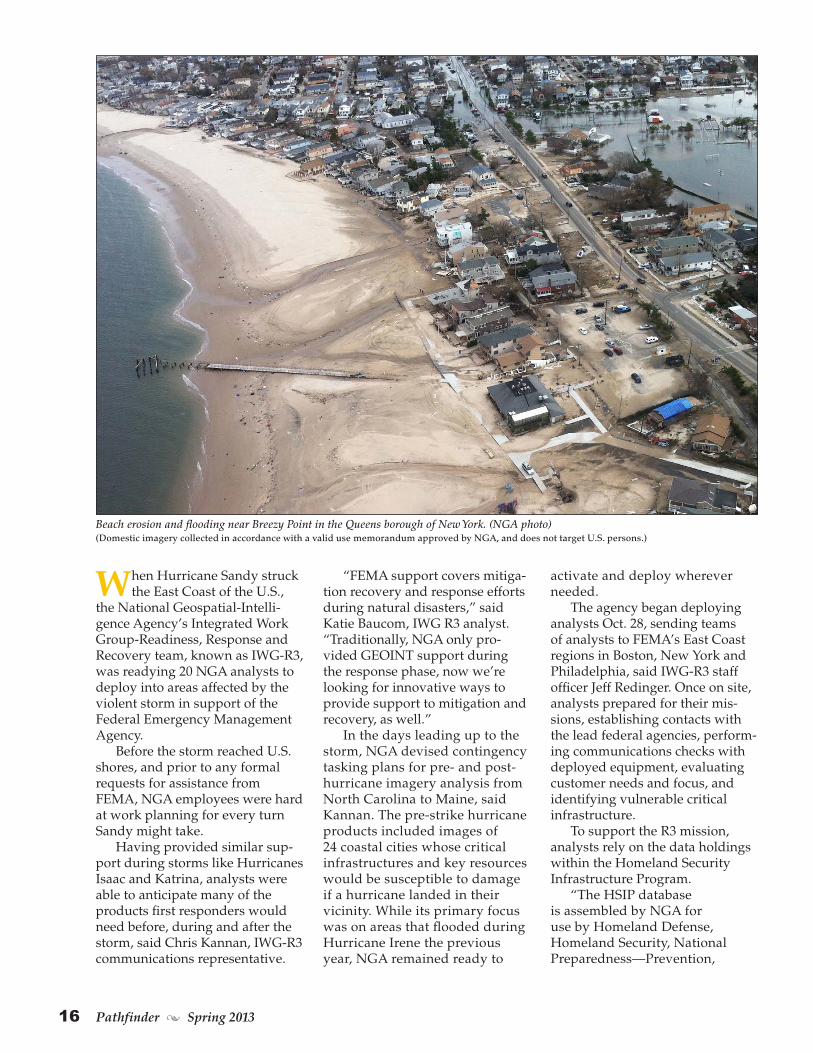
(Domestic imagery collected in accordance with a valid use memorandum approved by NGA, and does not target U.S. persons.)
When Hurricane Sandy struck the East Coast of the U.S.,
the National Geospatial-Intelli-gence Agency’s Integrated Work Group-Readiness, Response and Recovery team, known as IWG-R3, was readying 20 NGA analysts to deploy into areas affected by the violent storm in support of the Federal Emergency Management Agency. Before the storm reached U.S. shores, and prior to any formal requests for assistance from FEMA, NGA employees were hard at work planning for every turn Sandy might take. Having provided similar sup-port during storms like Hurricanes Isaac and Katrina, analysts were able to anticipate many of the products first responders would need before, during and after the storm, said Chris Kannan, IWG-R3 communications representative.
“FEMA support covers mitiga-tion recovery and response efforts during natural disasters,” said Katie Baucom, IWG R3 analyst. “Traditionally, NGA only pro-vided GEOINT support during the response phase, now we’re looking for innovative ways to provide support to mitigation and recovery, as well.” In the days leading up to the storm, NGA devised contingency tasking plans for pre- and post-hurricane imagery analysis from North Carolina to Maine, said Kannan. The pre-strike hurricane products included images of 24 coastal cities whose critical infrastructures and key resources would be susceptible to damage if a hurricane landed in their vicinity. While its primary focus was on areas that flooded during Hurricane Irene the previous year, NGA remained ready to
activate and deploy wherever needed. The agency began deploying analysts Oct. 28, sending teams of analysts to FEMA’s East Coast regions in Boston, New York and Philadelphia, said IWG-R3 staff officer Jeff Redinger. Once on site, analysts prepared for their mis-sions, establishing contacts with the lead federal agencies, perform-ing communications checks with deployed equipment, evaluating customer needs and focus, and identifying vulnerable critical infrastructure. To support the R3 mission, analysts rely on the data holdings within the Homeland Security Infrastructure Program. “The HSIP database is assembled by NGA for use by Homeland Defense, Homeland Security, National Preparedness—Prevention,
Beach erosion and flooding near Breezy Point in the Queens borough of New York. (NGA photo)

Pathfinder • Spring 2013 17
Areas in pink on the map above show first responders where searches have already been conducted. (NGA photo)
Protection, Mitigation, Response and Recovery communities,” said Bill Mullen, a senior advisor for content technology in R3. “It is a compilation of approximately 475 of the best available geospatially enabled baseline infrastructure data sets for all 18 critical infrastructure key resource sectors assembled from federal, state, local government and private mission partners.” During pre-hurricane analysis of the coastline, analysts reviewed more than 21,000 square miles of satellite data, said Redinger. This “before” picture of the landscape proves extremely useful for first responders as they assess the extent of damages and its impact to the population and infrastructure. After the storm, the focus shifted to the impending clean-up effort and resumption of services, said Baucom. As FEMA put it, their focus became “people, power and pumps.” In support of this effort, FEMA Region II Regional Response Coordination Center members from NGA operated 24/7 to create and update prod-
ucts on issues such as fuel status and power outages. “A major priority for planning and conducting recovery opera-tions was ensuring responders could safely access the hardest hit areas,” said Kannan. “To that end, NGA provided storm, port and airport assessments, and identified alternate helicopter landing zones to support long-term operations.” The IWG-R3 teams created and pushed out unclassified products to a webserver accessible to NGA customers. “Having a platform that allows customers to review exist-ing GEOINT products and request new ones reduces the likelihood of duplication of efforts,” said Bau-com. “This increased situational awareness and efficiency allows NGA to be more responsive to its customers and reduce the burden on NGA personnel, freeing them to do more complex analysis.” While providing on-demand GEOINT in a self-service environ-ment is certainly helpful for first responders, it does not nullify the need for full-service embedded NGA support on the ground or
NGA officially launched its first Integrated Work Group during the board of directors off-site in November 2011
The first IWG created was the Integrated Work Group-Iran (IWG-I)
Subsequently, two additional IWGs have been created in the agency for Yemen/Horn of Africa (IWG-Y/HOA) and Readiness, Response and Recovery (IWG-R3)
IWGs were established to develop new tools, analytic methods and work processes, which address high priority intelligence interests by focusing on three key areas: analytic expertise, geospatial intelligence, and analytic content and GEOINT in the unclassified domain
IWGs are led by a GEOINT mission manager, overseeing the day-to-day operations of the group and a national GEOINT officer, supervising and prioritizing all analysis NGA does on a specific issue
IWGs have dedicated subject matter experts from specialties including human resources, counterproliferation analysis, security and infrastructure
IWGs provide robust contextual GEOINT analysis of places, events and activities, using all the GEOINT analytic tradecrafts in an open IT environment where users from across the community can create, contribute, collaborate and consume GEOINT content
IWG 101

Pathfinder • Spring 201318
in a reach-back capacity during a large-scale emergency, said NGA analyst Scott Matheson. Some teams of analysts utilize the Domestic Mobile Integrated Geospatial System, or DMIGS. Owned and operated by NGA’s military support directorate, the DMIGS is loaded with a host of equipment and reachback
capabilities, said Jill Leas, chief of the expeditionary operations support division. Built on the chassis of a fire truck with two slide-out rooms to accommodate analysts, DMIGS integrates GEOINT hardware and software, including plotters that allow teams to print large products on site and on demand. It is also
equipped to receive geospatial data from multiple sources. The tools and technical expertise accompanying the DMIGS are clearly an asset, but the greatest value is derived from its mobility, said Andrew Lardner, a senior systems engineer for NGA. “Having the DMIGS provide GEOINT makes the situation easily understood by our part-ners,” said Lardner. “Now that their urban search and rescue operations are transitioning to a humanitarian health and welfare operation, they have asked us to come with them to Fort Dix (N.J.) to produce GEOINT products. This is why we have the DMIGS in the first place. It’s a mobile asset that we can pack up and take to where the customer needs us to be,” said Lardner. In addition to the mobile DMIGS, the military support directorate deployed lightweight, highly mobile flyaway satellite communications and production system support teams, said Leas. “These teams allowed NGA analysts embedded with urban
NGA products, like the map on the previous page, help prevent search and rescue personnel from conducting redundant searches. (NGA photo)(Domestic imagery collected in accordance with a valid use memorandum approved by NGA, and does not target U.S. persons.)

Pathfinder • Spring 2013 19
search and rescue teams in the hardest hit areas of New York and New Jersey to maintain access to reachback support in areas where most communications and infrastructure had been severely degraded by the storm,” said Leas. “These mobile teams moved with their supported units and were often up and operational within 30 minutes of arrival on scene, providing communications, hardcopy and softcopy production in extremely austere conditions.” FEMA was not the only one to benefit from IWG-R3’s products and personnel. NGA also worked closely with the U.S. Coast Guard, provid-ing mission-essential support, said Rear Adm. Christopher Tomney, director of Coast Guard Intelligence.
“NGA provided decision advantage to Coast Guard commanders on the ground by enabling access to and supply-ing analyzed images that led to superior situational awareness,” said Tomney. The images helped the Coast Guard understand the extent of flooding and the condition of its facilities and identify visible waterway blockages, said Tomney. “This information was essen-tial to determine our operational capabilities as we worked to support post-storm cleanup activities,” said Tomney. “Both the quality and timeliness of NGA support to the Coast Guard has been excellent, and is greatly appreciated.”
FEMA also recognized IWG-R3’s professionalism and support, said Matt Gamm, an IWG-R3 analyst who worked alongside FEMA members. “FEMA (Incident Support Team) leadership said they no longer consider us a partner, but now consider us a part of the family and want to make NGA a sitting member of the IST,” said Gamm. “Both the FEMA Urban Search and Rescue Task Force leader and the Long Island section leader said our NGA forward deployed personnel were a tremendous asset and the products created for the forces on the ground were relied upon and used heavily.”

Pathfinder • Spring 201320
The National Geospatial-Intelligence Agency is focused on developing leaders at all levels who are prepared to lead the agency through change.
Leader development is a top focus for NGA and is central to ensuring employee welfare, and leading and anticipating where the organization and mission will go next, to truly realize the agency’s vision, said Phyllis Corley, Leader Development lead. “Leader development is about inciting a leader-ship culture change and highlighting the importance of leaders at all levels,” said Corley. “An organiza-tion will struggle to reach its goals without people who can rapidly adapt to institutional change and navigate the very important interpersonal aspects wrought in forming and working on high-perform-ing teams.” LD efforts are aimed at creating leaders who are corporate stewards focused on the greater good of the agency and mission accomplishment, while realizing long-term efficiencies that further NGA strategy, said Corley.
In a world and workplace in which information and power paradigms are shifting rapidly, critical decisions occur at every level. This is the approach LD takes in viewing “everyone at NGA as a leader in his or her own right,” said Corley. “Whether a geospatial analyst, an IT team lead, a communications officer—or any other work role in the agency—the goal is for every individual to have the courage and tools to step up as a leader,” said Corley. Another important aspect of leader development is the construct of servant leadership, said Corley. Servant leadership recognizes that civil service employees dedicate themselves to something bigger than themselves when they take the oath of office. That is, the responsibility to take care of people, the organization, the national security mission and ultimately to be accountable to the American public.
By Kathi Ghannam, Office of Corporate Communications

Pathfinder • Spring 2013 21
”Servant leadership focuses on empowering those entrusted to your care, putting the needs of others and the organization first and finding ways to help people develop and perform at the highest level as possible,” said Corley. “It is a construct that doesn’t concern itself with hierarchy. Everyone can be of service. Everyone can identify and meet the needs of others. Everyone can become a servant leader.” Leader development sets a culture that is condu-cive for the agency to move forward on the efforts needed to attain the vision and strategy, said Corley. “People help change culture, so everyone is a critical part of this change,” said Corley. Leader development focuses on behaviors, educa-tion, and performance and selection processes, said Corley. These three areas of emphasis help leaders to be individually and collectively accountable and meet the standard the agency expects of its leaders. “The behavior focus area, for example, raises the bar for leaders,” said Corley. “We are setting the standard for the agency using leader competencies and corresponding skilled and unskilled behaviors, then modeling and reinforcing those behaviors. A key desired outcome is increased self-awareness and an environment in which open and honest conversations are a regular occurrence.” In the area of education, the NGA College has aligned all the new and expanded leadership course offerings with the leader development approach and incorporated into those courses the 17 leader compe-tencies, said Corley. NGC has also added additional course offerings to accommodate more attendees at all levels. Performance and selection processes set up the competencies as drivers for selection, promotion and performance processes, said Corley. This includes
addressing leader competency in position require-ments, job announcements, selection criteria and interview questions. This ensures those selected for leadership positions demonstrate skilled behavior in the relevant leader competencies needed to succeed in the agency. As part of his travels as the deputy director of NGA’s Office of International Affairs, Gary Dunow, who also serves as the deputy lead for leader devel-opment, meets with employees regularly to share the important leadership messages. “Throughout my career, I have been in leadership positions,” said Dunow. “In fact, since Air Force basic training, where I was a squad leader in our flight, I’ve been fortunate to have the opportunity to lead at all levels. That is why I firmly believe everyone is a leader.” Dunow, who often asks leaders what they believe to be their leadership philosophy, said he follows the “Golden Rule” and tries to be “inspirational rather than aspirational” as part of his own. “Over time, I’ve been able to draw on (my) experiences to put myself in other people’s shoes and better understand the impact of my actions, words and decisions,” said Dunow. “By striving to follow the Golden Rule, I’ve been able to develop trust with superiors, peers and subordinates, which make us all more effective.” In the next year, the leader development team plans to make leadership actionable, not just words or theories on a page, said Corley. Leader Development 2.0, as its been termed, will provide more practical tools, techniques and metrics for leaders at all levels in alignment with NGA’s tiered service model, offering self-, assisted- and full-serve options.
NGA’s Leader Development Team asked various employee groups in the agency at all levels, and in numerous venues, what they considered to be desirable leadership behavior. The responses, and themes from employee climate surveys, indicated 17 leadership competencies as crucial to successful leadership. These competencies, listed below, are now integrated into agency senior executive performance and selection processes, and will be incorporated into banded-level performance and selection plans (i.e., DCIPS), as well.
1. Interpersonal savvy 2. Listening 3. Motivating others 4. Courage 5. Perspective 6. Managing vision and purpose
7. Peer relationships 8. Political savvy 9. Strategic agility 10. Timely decision making 11. Decision quality 12. Drive for results
13. Dealing with ambiguity 14. Integrity and trust 15. Composure 16. Ethics and value 17. Self-knowledge
Pathfinder • Spring 201322
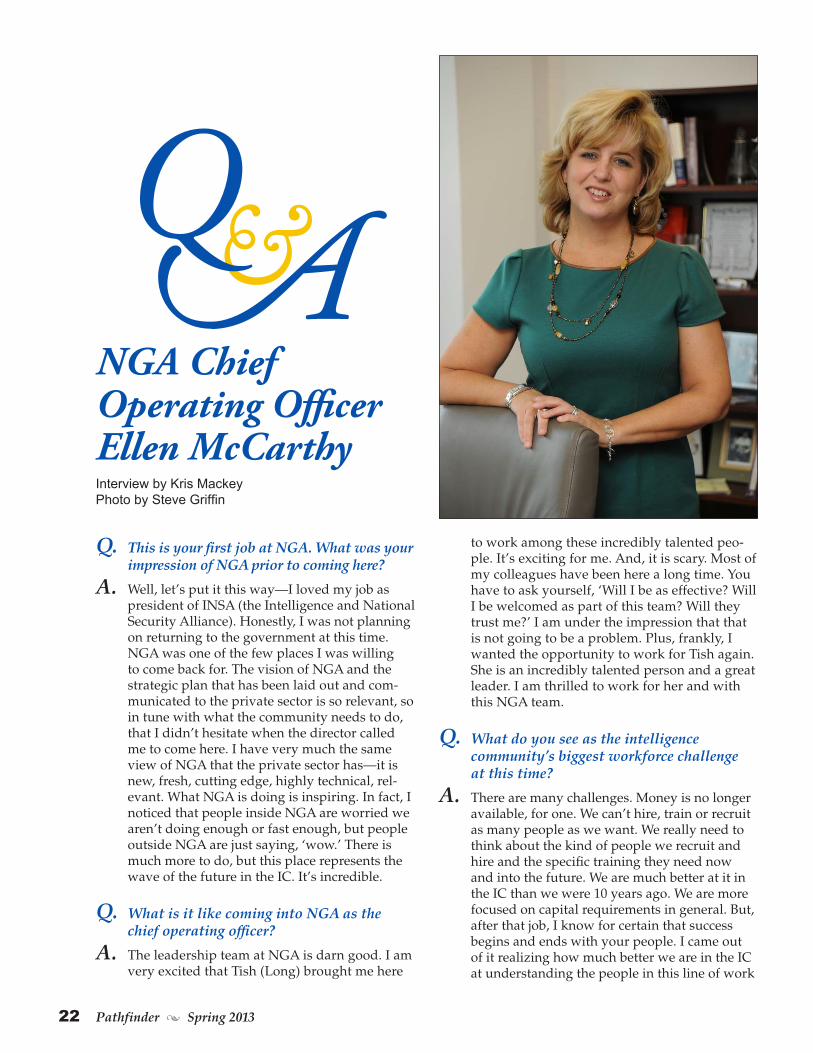
NGA Chief Operating Officer Ellen McCarthyInterview by Kris MackeyPhoto by Steve Griffin
Q. This is your first job at NGA. What was your impression of NGA prior to coming here?
A. Well, let’s put it this way—I loved my job as president of INSA (the Intelligence and National Security Alliance). Honestly, I was not planning on returning to the government at this time. NGA was one of the few places I was willing to come back for. The vision of NGA and the strategic plan that has been laid out and com-municated to the private sector is so relevant, so in tune with what the community needs to do, that I didn’t hesitate when the director called me to come here. I have very much the same view of NGA that the private sector has—it is new, fresh, cutting edge, highly technical, rel-evant. What NGA is doing is inspiring. In fact, I noticed that people inside NGA are worried we aren’t doing enough or fast enough, but people outside NGA are just saying, ‘wow.’ There is much more to do, but this place represents the wave of the future in the IC. It’s incredible.
Q. What is it like coming into NGA as the chief operating officer?
A. The leadership team at NGA is darn good. I am very excited that Tish (Long) brought me here
to work among these incredibly talented peo-ple. It’s exciting for me. And, it is scary. Most of my colleagues have been here a long time. You have to ask yourself, ‘Will I be as effective? Will I be welcomed as part of this team? Will they trust me?’ I am under the impression that that is not going to be a problem. Plus, frankly, I wanted the opportunity to work for Tish again. She is an incredibly talented person and a great leader. I am thrilled to work for her and with this NGA team.
Q. What do you see as the intelligence community’s biggest workforce challenge at this time?
A. There are many challenges. Money is no longer available, for one. We can’t hire, train or recruit as many people as we want. We really need to think about the kind of people we recruit and hire and the specific training they need now and into the future. We are much better at it in the IC than we were 10 years ago. We are more focused on capital requirements in general. But, after that job, I know for certain that success begins and ends with your people. I came out of it realizing how much better we are in the IC at understanding the people in this line of work
&QA

Pathfinder • Spring 2013 23
than when I first came into it. But there is much improvement still to be made. Another concern I have is whether we are communicating to (employees) just how critical their roles are and how we all play a part in implementing the NGA Strategy. I don’t think we communicate that well enough, yet. People in this industry work long and hard, and on issues much of the world doesn’t have to deal with or even know exist. It can be difficult. We need people, the young and the seasoned, to know they matter. We need improvement in communications. For starters, supervisors need to better communicate their mission and the importance of their employees in that mission, and do so regularly.
Q. Like Director Long, you are sought out as a speaker and representative of the IC. What is your most memorable experience?
A. I’ll talk about anything any time. The events I truly love, though, are any with a focus on leadership, diversity, and mentoring—anything that helps develop future leaders. It sounds cheesy, but it is true, and it harkens back to the human capital position I thought I would dread, but became so meaningful to me. People matter. This generation of new employees is savvy, highly technical, fascinating—and I believe they are going to be the game changers for the IC. Any chance I get to mentor them, I take. At INSA we had an intern program for graduate students who worked for us. In exchange, we helped them develop networks in the community, and eventually get jobs. There is nothing more satisfying than seeing young professionals blossom. Nothing. I am in my position because of people like Tish Long, Fran Townsend, Director Clapper, Steve Cambone, and many others—people who mentored me, trusted me and gave me great advice. I see it as my job, now, to pass that on to others.
Q. What is your leadership philosophy?
A. It is all about relationships. You have to be able to reach compromise and make decisions with folks you don’t see eye to eye with in this busi-ness. And you have to have real relationships to get to that compromise or decision. As I look back on my career, real relation-ships with people have always been a key element of any success I have ever had. Beating people over the head and telling them ‘this is the way it’s going to be’ has
never really worked in my experience. I don’t operate that way. I need to sit down with my colleagues and have discussions, bringing us together to determine shared goals and share various ways to achieve them. We are all motivated by similar goals, we are all trying to keep this country safe, and knowing that we have that united goal makes for a good foundation for a relationship. Having real relationships helps you meet goals and fix problems. I firmly believe that to fix a problem, you have to be able to make your peers part of the solution. Plus, we really need to get to know one another. We spend an awful lot of time working together, so, let’s get to know each other. I think it is critical to know how your peers tick and their operating styles, likes, dislikes and interests. Knowing that about the people you work with helps you understand where they are coming from in their decision making. That is critical to avoiding conflict and focusing on resolution.
Q. Tell us about you personally. What are your hobbies or things you like to do outside work?
A. My hobbies are my two kids, a 10- and a 12-year-old. I don’t have a lot of time, but having kids has made me be a better manager of time. I am president of my children’s PTA. I am active in my church. My kids are very busy, so I drive them everywhere when I’m not at work. I have an incredibly supportive husband. I love wine—we just installed a wine cellar in our home and I look forward to filling it up with a great collection. That is as close to a ‘hobby’ as I get, I suppose. I work out four or five times a week. I am a firm believer in exercise and am thrilled that this community has embraced exercise as being important. I used to work out like crazy until I had kids, at which time I thought in order to be a good parent and successful employee I had to work so much I gave up exercise. I realized later I was wrong. I am 50 years old now and recognize exercise is good for everyone around you, not just yourself. And sleep, we need sleep. I don’t believe in the mantra ‘work hard, play hard, sleep less.’ I think we need to work hard, play hard, and get sleep.
Pathfinder • Spring 201324
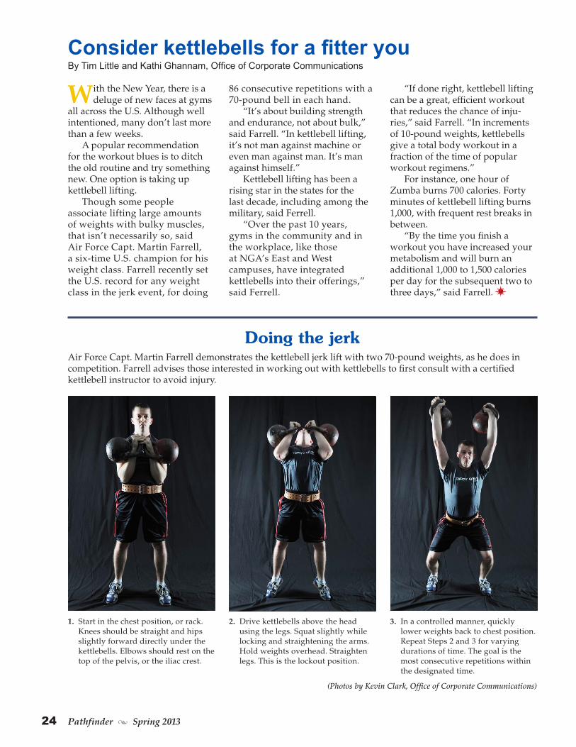
With the New Year, there is a deluge of new faces at gyms
all across the U.S. Although well intentioned, many don’t last more than a few weeks. A popular recommendation for the workout blues is to ditch the old routine and try something new. One option is taking up kettlebell lifting. Though some people associate lifting large amounts of weights with bulky muscles, that isn’t necessarily so, said Air Force Capt. Martin Farrell, a six-time U.S. champion for his weight class. Farrell recently set the U.S. record for any weight class in the jerk event, for doing
86 consecutive repetitions with a 70-pound bell in each hand. “It’s about building strength and endurance, not about bulk,” said Farrell. “In kettlebell lifting, it’s not man against machine or even man against man. It’s man against himself.” Kettlebell lifting has been a rising star in the states for the last decade, including among the military, said Ferrell. “Over the past 10 years, gyms in the community and in the workplace, like those at NGA’s East and West campuses, have integrated kettlebells into their offerings,” said Ferrell.
Consider kettlebells for a fitter youBy Tim Little and Kathi Ghannam, Office of Corporate Communications
“If done right, kettlebell lifting can be a great, efficient workout that reduces the chance of inju-ries,” said Farrell. “In increments of 10-pound weights, kettlebells give a total body workout in a fraction of the time of popular workout regimens.” For instance, one hour of Zumba burns 700 calories. Forty minutes of kettlebell lifting burns 1,000, with frequent rest breaks in between. “By the time you finish a workout you have increased your metabolism and will burn an additional 1,000 to 1,500 calories per day for the subsequent two to three days,” said Farrell.
1. Start in the chest position, or rack. Knees should be straight and hips slightly forward directly under the kettlebells. Elbows should rest on the top of the pelvis, or the iliac crest.
2. Drive kettlebells above the head using the legs. Squat slightly while locking and straightening the arms. Hold weights overhead. Straighten legs. This is the lockout position.
3. In a controlled manner, quickly lower weights back to chest position. Repeat Steps 2 and 3 for varying durations of time. The goal is the most consecutive repetitions within the designated time.
Doing the jerkAir Force Capt. Martin Farrell demonstrates the kettlebell jerk lift with two 70-pound weights, as he does in competition. Farrell advises those interested in working out with kettlebells to first consult with a certified kettlebell instructor to avoid injury.
(Photos by Kevin Clark, Office of Corporate Communications)
Pathfinder • Spring 2013 25
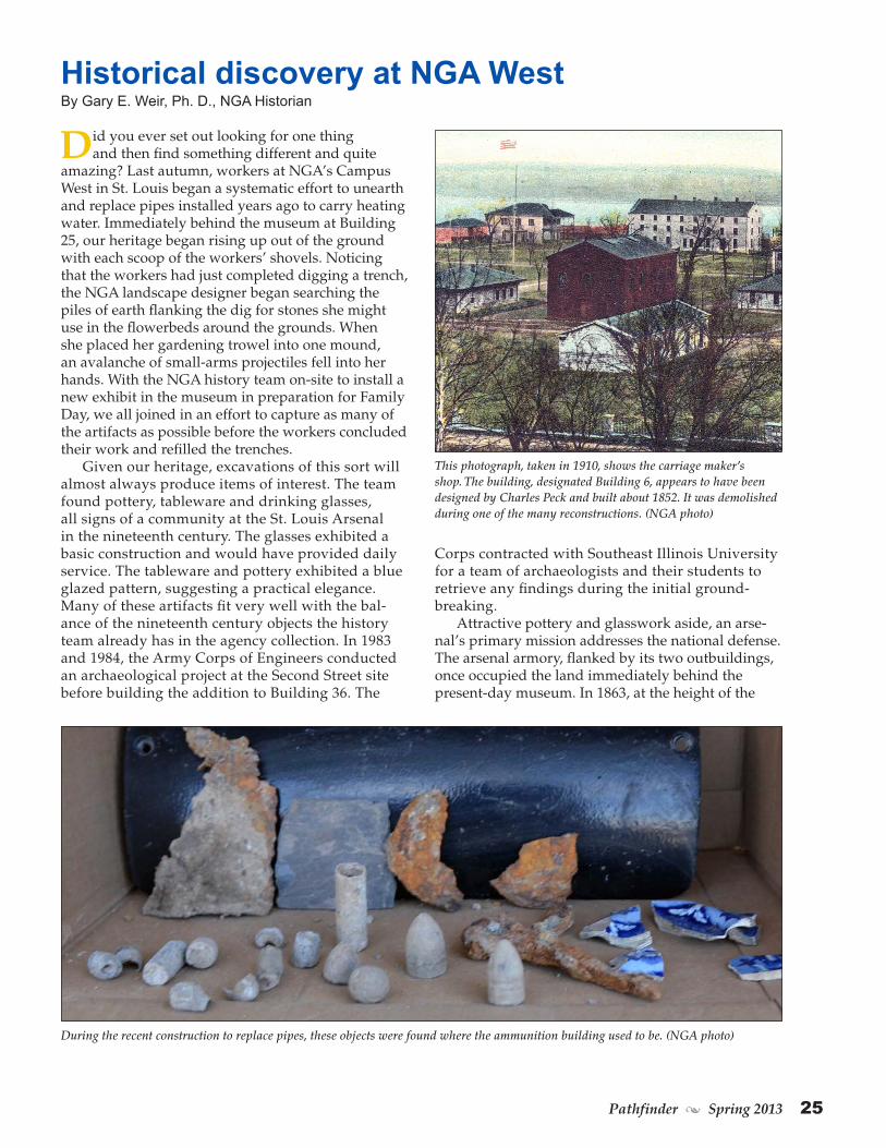
Did you ever set out looking for one thing and then find something different and quite
amazing? Last autumn, workers at NGA’s Campus West in St. Louis began a systematic effort to unearth and replace pipes installed years ago to carry heating water. Immediately behind the museum at Building 25, our heritage began rising up out of the ground with each scoop of the workers’ shovels. Noticing that the workers had just completed digging a trench, the NGA landscape designer began searching the piles of earth flanking the dig for stones she might use in the flowerbeds around the grounds. When she placed her gardening trowel into one mound, an avalanche of small-arms projectiles fell into her hands. With the NGA history team on-site to install a new exhibit in the museum in preparation for Family Day, we all joined in an effort to capture as many of the artifacts as possible before the workers concluded their work and refilled the trenches. Given our heritage, excavations of this sort will almost always produce items of interest. The team found pottery, tableware and drinking glasses, all signs of a community at the St. Louis Arsenal in the nineteenth century. The glasses exhibited a basic construction and would have provided daily service. The tableware and pottery exhibited a blue glazed pattern, suggesting a practical elegance. Many of these artifacts fit very well with the bal-ance of the nineteenth century objects the history team already has in the agency collection. In 1983 and 1984, the Army Corps of Engineers conducted an archaeological project at the Second Street site before building the addition to Building 36. The
Corps contracted with Southeast Illinois University for a team of archaeologists and their students to retrieve any findings during the initial ground-breaking. Attractive pottery and glasswork aside, an arse-nal’s primary mission addresses the national defense. The arsenal armory, flanked by its two outbuildings, once occupied the land immediately behind the present-day museum. In 1863, at the height of the
By Gary E. Weir, Ph. D., NGA HistorianHistorical discovery at NGA West
During the recent construction to replace pipes, these objects were found where the ammunition building used to be. (NGA photo)
This photograph, taken in 1910, shows the carriage maker’s shop. The building, designated Building 6, appears to have been designed by Charles Peck and built about 1852. It was demolished during one of the many reconstructions. (NGA photo)
Pathfinder • Spring 201326
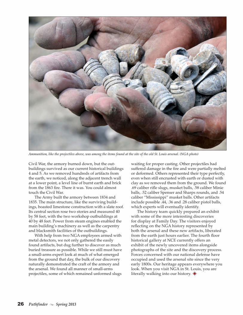
Civil War, the armory burned down, but the out-buildings survived as our current historical buildings 4 and 5. As we removed hundreds of artifacts from the earth, we noticed, along the adjacent trench wall at a lower point, a level line of burnt earth and brick from the 1863 fire. There it was. You could almost touch the Civil War. The Army built the armory between 1834 and 1835. The main structure, like the surviving build-ings, boasted limestone construction with a slate roof. Its central section rose two stories and measured 40 by 58 feet, with the two workshop outbuildings at 40 by 48 feet. Power from steam engines enabled the main building’s machinery as well as the carpentry and blacksmith facilities of the outbuildings. With help from two NGA employees armed with metal detectors, we not only gathered the easily found artifacts, but dug further to discover as much buried treasure as possible. While we still must have a small-arms expert look at much of what emerged from the ground that day, the bulk of our discovery naturally demonstrated the craft of the armory and the arsenal. We found all manner of small-arms projectiles, some of which remained unformed slugs
waiting for proper casting. Other projectiles had suffered damage in the fire and were partially melted or deformed. Others represented their type perfectly, even when still encrusted with earth or dusted with clay as we removed them from the ground. We found .69 caliber rifle slugs, musket balls, .58 caliber Minie balls, .52 caliber Spenser and Sharps rounds, and .54 caliber “Mississippi” musket balls. Other artifacts include possible .44, .36 and .28 caliber pistol balls, which experts will eventually identify. The history team quickly prepared an exhibit with some of the more interesting discoveries for display at Family Day. The visitors enjoyed reflecting on the NGA history represented by both the arsenal and these new artifacts, liberated from the earth just hours earlier. The fourth floor historical gallery at NCE currently offers an exhibit of the newly uncovered items alongside photographs of the site and the discovery process. Forces concerned with our national defense have occupied and used the arsenal site since the very early 1800s. Our heritage appears everywhere you look. When you visit NGA in St. Louis, you are literally walking into our history.
Ammunition, like the projectiles above, was among the items found at the site of the old St. Louis arsenal. (NGA photo)
Pathfinder • Spring 2013 27
NGASalute:Airman 1st Class Sarah Gardner
By Kris Mackey, Office of Corporate Communications
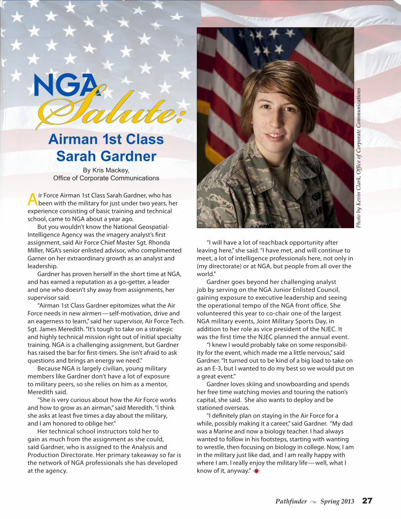
Air Force Airman 1st Class Sarah Gardner, who has been with the military for just under two years, her
experience consisting of basic training and technical school, came to NGA about a year ago. But you wouldn’t know the National Geospatial-Intelligence Agency was the imagery analyst’s first assignment, said Air Force Chief Master Sgt. Rhonda Miller, NGA’s senior enlisted advisor, who complimented Garner on her extraordinary growth as an analyst and leadership. Gardner has proven herself in the short time at NGA, and has earned a reputation as a go-getter, a leader and one who doesn’t shy away from assignments, her supervisor said. “Airman 1st Class Gardner epitomizes what the Air Force needs in new airmen—self-motivation, drive and an eagerness to learn,” said her supervisor, Air Force Tech. Sgt. James Meredith. “It’s tough to take on a strategic and highly technical mission right out of initial specialty training. NGA is a challenging assignment, but Gardner has raised the bar for first-timers. She isn’t afraid to ask questions and brings an energy we need.” Because NGA is largely civilian, young military members like Gardner don’t have a lot of exposure to military peers, so she relies on him as a mentor, Meredith said. “She is very curious about how the Air Force works and how to grow as an airman,” said Meredith. “I think she asks at least five times a day about the military, and I am honored to oblige her.” Her technical school instructors told her to gain as much from the assignment as she could, said Gardner, who is assigned to the Analysis and Production Directorate. Her primary takeaway so far is the network of NGA professionals she has developed at the agency.
“I will have a lot of reachback opportunity after leaving here,” she said. “I have met, and will continue to meet, a lot of intelligence professionals here, not only in (my directorate) or at NGA, but people from all over the world.” Gardner goes beyond her challenging analyst job by serving on the NGA Junior Enlisted Council, gaining exposure to executive leadership and seeing the operational tempo of the NGA front office. She volunteered this year to co-chair one of the largest NGA military events, Joint Military Sports Day, in addition to her role as vice president of the NJEC. It was the first time the NJEC planned the annual event. “I knew I would probably take on some responsibil-ity for the event, which made me a little nervous,” said Gardner. “It turned out to be kind of a big load to take on as an E-3, but I wanted to do my best so we would put on a great event.” Gardner loves skiing and snowboarding and spends her free time watching movies and touring the nation’s capital, she said. She also wants to deploy and be stationed overseas. “I definitely plan on staying in the Air Force for a while, possibly making it a career,” said Gardner. “My dad was a Marine and now a biology teacher. I had always wanted to follow in his footsteps, starting with wanting to wrestle, then focusing on biology in college. Now, I am in the military just like dad, and I am really happy with where I am. I really enjoy the military life—well, what I know of it, anyway.”
Phot
o by
Kev
in C
lark
, Offi
ce o
f Cor
pora
te C
omm
unic
atio
ns
National Geospatial-Intelligence AgencyNGAamI
nga.mil | FB: NatlGEOINTAgency | @NGA_GEOINT
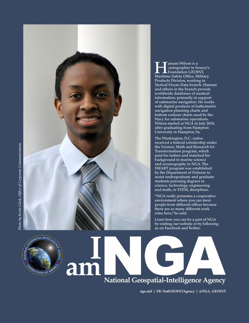
Hamani Wilson is a cartographer in Source’s Foundation GEOINT,
Maritime Safety Office, Military Products Division, working in Tactical Ocean Data branch. Hamani and others in the branch provide worldwide databases of nautical information, primarily in support of submarine navigation. He works with digital products of bathymetric navigation planning charts and bottom contour charts used by the Navy for submarine operations. Wilson started at NGA in July 2010, after graduating from Hampton University in Hampton, Va.
The Washington, D.C. native received a federal scholarship under the Science, Math and Research for Transformation program, which paid his tuition and matched his background in marine science and oceanography to NGA. The SMART program was established by the Department of Defense to assist undergraduate and graduate students pursuing degrees in science, technology, engineering and math, or STEM, disciplines.
“NGA really promotes a cooperative environment where you can meet people from different offices because there are so many different work roles here,” he said.
Learn how you can be a part of NGA by visiting our website or by following us on Facebook and Twitter. Ph
oto
by K
evin
Cla
rk, O
ffice
of C
orpo
rate
Com
mun
icat
ions