common map projections equal area projections u property of equal area commands high priority on...
TRANSCRIPT

COMMON MAP PROJECTIONS
Equal Area Projections
Property of equal area commands high priority on
most maps used as small scale general reference
maps and for instruction
Choice of equal area projection depends on these
two considerations:
Size of the region to be mapped
Distribution of the angular deformation (shape
considerations)
COMMON MAP PROJECTIONSEqual Area
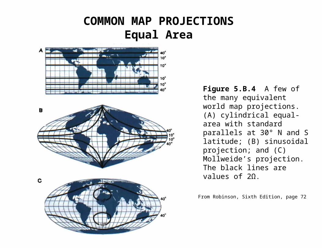
Figure 5.B.4 A few of the many equivalent world map projections. (A) cylindrical equal-area with standard parallels at 30° N and S latitude; (B) sinusoidal projection; and (C) Mollweide’s projection. The black lines are values of 2Ω.
From Robinson, Sixth Edition, page 72

COMMON MAP PROJECTIONSEqual Area
Albers’
• Conic projection with two standard parallels
• Any two small circles, reasonably close together are
used
• Low distortion, especially along parallels
• Resembles earth’s graticule – curved parallels,
converging meridians
• Best for mid-latitude areas with greater east-west
extension than north-south
• Standard for many US Government base maps,
including Census Bureau

COMMON MAP PROJECTIONSEqual Area – Albers’
From Robinson, Sixth Edition, page 81

COMMON MAP PROJECTIONSEqual Area
Lambert’s
Azimuthal as well as equivalent
Distortion symmetrical around a single point
Point can be located anywhere on globe
Good for areas that have nearly equal east-west vs.
north-south extension, such as some individual
states

COMMON MAP PROJECTIONSEqual Area
Cylindrical
Two standard parallels which may ‘coincide’ at the
equator, but otherwise must be “homolatitudes”
Distortion arranged parallel to standard small circles
When parallels are chosen at 30°, this projection
provides the least overall mean angular distortion of
any equal area world projection
COMMON MAP PROJECTIONSEqual Area
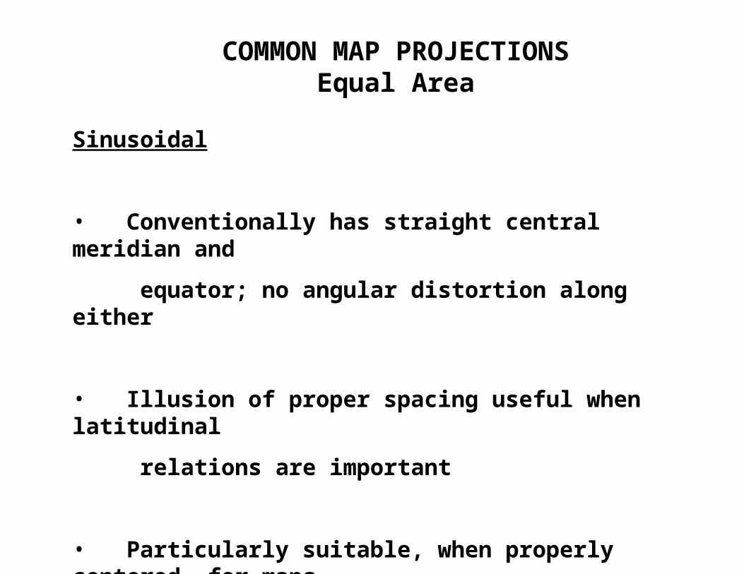
Sinusoidal
• Conventionally has straight central meridian and
equator; no angular distortion along either
• Illusion of proper spacing useful when latitudinal
relations are important
• Particularly suitable, when properly centered, for maps
of less-than-world areas - - - South America

COMMON MAP PROJECTIONSEqual Area - Sinusoidal
From Robinson, Sixth Edition, page 68

COMMON MAP PROJECTIONSEqual Area
Mollweid’s
Appears more realistic than sinusoidal
North-south decreased in high latitudes and increased
in mid-latitudes
East-west scale increased in high latitudes and
decreased in mid-latitudes
Two areas of least distortion are in the mid-latitudes,
so projection is most useful for those areas

COMMON MAP PROJECTIONSEqual Area
Goode’s Homolosine
Combines equatorial section of sinusoidal and poleward
sections of Mollweid’s
Must be constructed from the same area scale (ie.
reference globe)
Sinusoidal and Mollweid’s have one parallel of identical
length along which they may be joined
Usually used in interrupted form
Popular in the United States
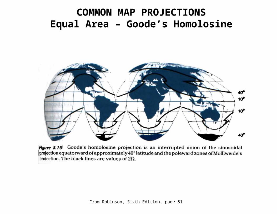
COMMON MAP PROJECTIONSEqual Area – Goode’s Homolosine
From Robinson, Sixth Edition, page 81

COMMON MAP PROJECTIONS
Azimuthal Projections (preserve direction)
• Projected on a plane that centered anywhere on the
reference globe
• Line perpendicular to plane passes through center of
globe
• Distortion is symmetrical around the center point;
peripheral distortion is extreme
• All great circles passing through the central point
show as straight lines with the correct azimuth

COMMON MAP PROJECTIONSAzimuthal
Azimuthal Equidistant
Has linear scale, uniform along radiating straight
lines through center
Movement toward or away from a center point is well
demonstrated
Works well for mapping radio impulses or seismic
waves
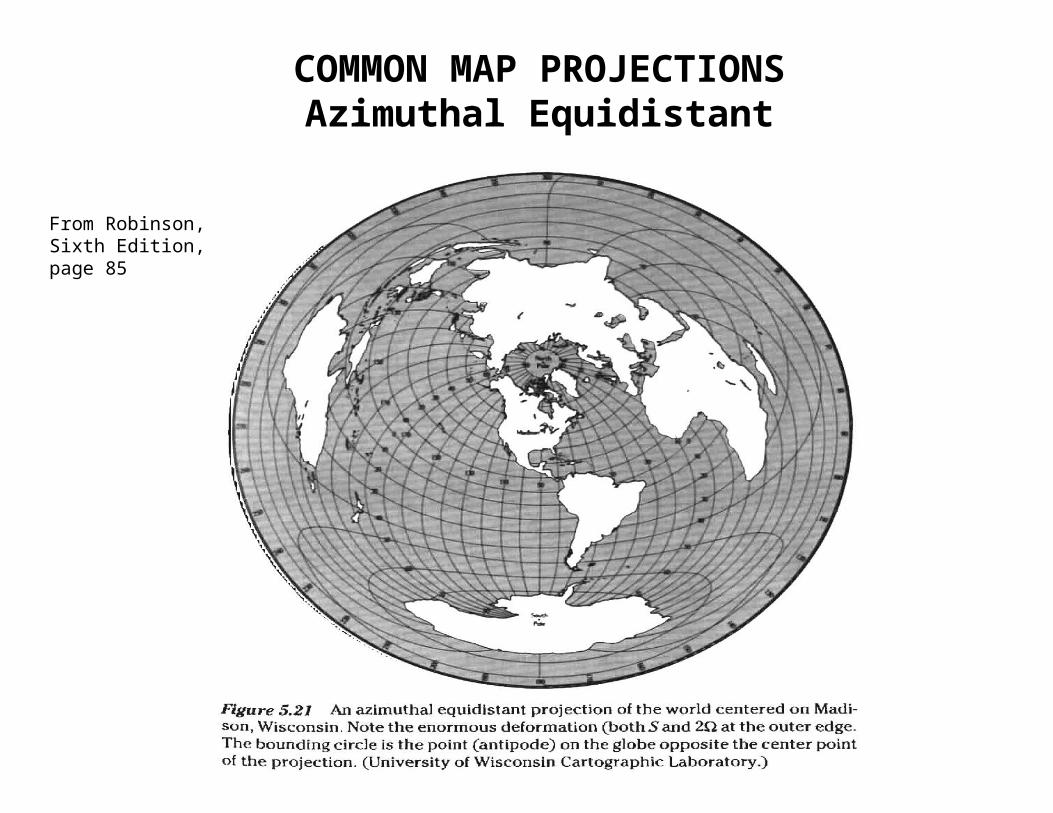
COMMON MAP PROJECTIONSAzimuthal Equidistant
From Robinson, Sixth Edition, page 85

COMMON MAP PROJECTIONSAzimuthal
Orthographic
Looks something like a perspective view of the globe
from a distance
Distortion is less visually obvious than on other
azimuthal projections
Useful for illustrations which portray the globe as a
sphere

COMMON MAP PROJECTIONSAzimuthal
Gnomic
All great circle arcs are straight lines everywhere on
the projection
Useful primarily for marine navigation

COMMON MAP PROJECTIONSAzimuthal
Stereographic
Lambert’s Equal
Area
Azimuthal
Equidistant
Orthographic
Gnomic
From Robinson, Sixth Edition, page 84

COMMON MAP PROJECTIONS
Special Purpose Map Projections
• Plane chart/equidistant cylindrical/PlateCarrée/
equirectangular
Oldest and simplest map projection
Used for navigation before Mercator
Good for city maps and base maps of
small areas
• Simple conic
Uses two standard parallels equidistant from
equator
No great distortion of angles or areas
Often used in atlases for mid-latitude areas

COMMON MAP PROJECTIONSSpecial Purpose
Equidistant Cylindrical/Plane Chart
From Robinson, Sixth Edition, page 86

COMMON MAP PROJECTIONSSpecial Purpose – Simple Conic
From Robinson, Sixth Edition, page 87

COMMON MAP PROJECTIONS
Special Purpose Map Projections, cont.
• Polyconic – not conformal or equal area
Used by the U.S. for topo sheets until 1950’s – can fit
topos together in one direction or another, but not all
• Robinson’s – not conformal or equal area
Commissioned in 1961 by Rand McNally to show
uninterrupted world maps at all scales
Minimizes the appearance of shape and area
distortion

COMMON MAP PROJECTIONSSpecial Purpose - Polyconic
From Robinson, Sixth Edition, page 88, 89
The distribution of scale factors on a polyconic projection in the vacinity of 40° latitude. N-S SF values away from the central meridian are approximate. Note that the section of the projection which is used for a standard 7.5-minute quadrangle map would be 1/8 degree E-W and N-S along the central meridian.

COMMON MAP PROJECTIONS
Special Purpose Map Projections, cont.
• Space Oblique Mercator Projection
Projection used for satellite imagery
Essentially conformal (shape/angle)
Groundtrack of satellite represents central line with
scale factor ~ 1.0
Groundtrack is not true great circle, but slightly
curved due to rotation of earth

COMMON MAP PROJECTIONSSpecial Purpose
Robinson’s
Space
Oblique
Mercator