coastal erosion commission: context, examples, and … · • north carolina: beach and inlet...
TRANSCRIPT

Coastal Erosion Commission:context, examples, and next steps, p , p

Overview• Themes from other national and state level reports
• 2007 MA Coastal Hazards Commission
• Best practices and examples
Fi i l d h i l• Financial and technical assistance
• Current efforts and next steps for Coastal Erosion Commission

Themes from similar national and state level reportsp

National and state level reports• National Research Council: Managing Coastal Erosion ‐ 1990• New York ‐ Governor's Coastal Erosion Task Force ‐ 1994
H i C t E l ti f E i H d 2000• Heinz Center: Evaluation of Erosion Hazards ‐ 2000• Maryland: Shore Erosion Task Force Report ‐ 2000• Delaware: Striking A Balance ‐ 2005g• NRC: Mitigating Erosion on Sheltered Coasts ‐ 2007• USGS: Historical Shoreline Change along the New England
d Mid Atl ti C t 2010and Mid‐Atlantic Coasts ‐ 2010• North Carolina: Beach and Inlet Management Plan ‐ 2011• NOAA: How Coastal States and Territories Use No‐Build
Areas along Ocean and Great Lake Shorefronts ‐ 2012• Connecticut: Shoreline Preservation Task Force ‐ 2013
Vi i i I i f M i S i Li i Sh li• Virginia Institute of Marine Science: Living Shoreline Guidance ‐ 2013

National and state level reports: themes• Improve mapping of erosion hazard zones
– State and local decision makers and others need t i f ti i f l d l iaccurate information on erosion for land‐use planning,
erosion hazard mitigation, and general awareness– Utilize historical shoreline change methodologyg gy– FEMA's coastal hazard mapping should include erosion hazard delineations
P b b ildi i• Promote better building practices– Limit development in high erosion hazard zones– Develop guidance on proper procedures to mitigateDevelop guidance on proper procedures to mitigate negative effects of existing and planned structures that cause adverse effects on the adjacent property owners
– Conduct technical evaluations of new shore protection products and methods

National and state level reports: themes• Policy development and implementation
– Require placement of compatible sand, dredged from h b d h l b hharbors and channels, on beaches
– About 1/3 states have erosion hazard area management programs that specifically include the establishment of p g p yerosion setbacks for new construction
– Transfer economic costs of erosion losses from federal t (NFIP) t t i i th ttaxpayers (NFIP) to property owners via premiums that approximate the risks of loss
• Improve communication education outreachImprove communication, education, outreach– Enhance notice to land‐owners on erosion hazards (insurance premium notices, deeds/title)
– Information for general public on risks associated with development on/near coastal shorelines and floodplains

Coastal Hazards Commission ‐ 2007

MA Coastal Hazards Commission• Commission charge:• Commission charge:
– Characterize vulnerability to coastal erosion, flooding, and sea‐level rise
– Evaluate data, tools, regulations and management approachesDevelop recommendations– Develop recommendations
• May 2007 report:– 29 recommendations on hazards information, policy and regulations, planning, and protectionR d ti i l d d ti– Recommendations included actions for state as well as other entities
– Pilot South Shore coastal infrastructure inventory

MA Coastal Hazards Commission:Progress on recommendationsProgress on recommendations• Development and implementation of
StormSmart Coasts Program:– Information, tools, and strategies to address erosion, flooding, and sea level riselevel rise
– Targeted, hands‐on assistance to communities
Ad i h d i d• Advancing hazard mapping and identification:– Shoreline change: maps and statistical g panalysis of historic shoreline locations from mid‐1800s to 2008/2009
– Sea level rise mapping and online– Sea level rise mapping and online viewers

MA Coastal Hazards Commission:Progress on recommendationsProgress on recommendations• Risk and vulnerability assessment and coastal planning:and coastal planning:– Direct work with coastal cities and towns: Boston, Hull, Falmouth, Oak Bluffs Scituate Marshfield DuxburyBluffs, Scituate, Marshfield, Duxbury, Nantucket, etc.
• State building code:– New design and construction requirements for buildings and structures located in hazard zonesstructures located in hazard zones
• Wetlands Protection Act: Land Subject to Coastal Storm Flowage– DEP Advisory Group convened to develop draft regulations

MA Coastal Hazards Commission:Progress on recommendationsProgress on recommendations• Sea level rise guidance
– Summarize trends, provides pbest available projections, application
• Coastal land conservation37 linear miles of coastal shoreline– 37 linear miles of coastal shoreline land protected
• Regional sediment management– New studies of sediment budget– Ongoing beach nourishment projects
• Documenting storm impacts• Documenting storm impacts– Storm Reporter: on‐line and mobile tool for rapid delivery of damage information to decision makers and emergency management personnel

Best practices and examples

Best practices and examples:Bio‐engineering for shoreline
Before
Bio engineering for shoreline stabilization• Combination of natural, biodegradable erosion‐control products and deep‐rooted plants
Coir rolls provide stability and
During Construction
– Coir rolls provide stability and protection while vegetation is planted and becomes established
– As coir rolls disintegrate (typically over 5‐7 years) plants provide stabilization through both dense root systems and
After
g yabove‐ground biomass
• Examples:P i t ti i B t bl– Private properties in Barnstable, Chatham, Orleans, Wellfleet

Best practices and examples:Repair/reconstruction of
August 2009
Repair/reconstruction of revetments, seawalls, groins• Design improvements to reduceDesign improvements to reduce impacts, improve longevity and minimize maintenance costs– Locate structure as far landward as possible
– Restore fronting beachAugust 2013
Restore fronting beach– Careful design for “end effects”– Address erosion and runoff issuesB ild t i i t t t– Build stairs into structure
• Examples:– Winthrop Shoresp– Centerville Beach, Barnstable

Best practices examples:Beach and dune nourishmentBeach and dune nourishment• Beach and dune nourishment:
– Adding compatible sediment to g pbeach/dune system
– Increased volume protects landward areas without reflecting wave energyareas without reflecting wave energy
– MassDEP’s Guide to Best Management Practices for Beach Nourishment Projects (2007)
• Example (large scale):– Merrimack River dredge beneficial re‐Merrimack River dredge beneficial reuse: Newburyport, Newbury, Salisbury
• Example (small‐medium scale):– Barnstable County Dredge– Salisbury State Park dune enhancement

NNotes:‐ From a database in development‐ Public projects only‐ Only completed projectsy p p j‐ Projects > 1,000 yd3

Barnstable County Dredge Activity (1986‐2014)
TOWN PROJECT COUNT
AVG VOL (CY)
MIN VOL (CY)
MAX VOL (CY) MOST FREQUENT RECIPIENT BEACH
Falmouth 51 2 648 1 000 20 000 Menauhant Beach (19)Falmouth 51 2,648 1,000 20,000 Menauhant Beach (19)
Chatham 38 13,847 1,000 120,000 Andrew Harding Lane Beach (10),Cockle Cove (10)
H i h 29 7 020 1 118 19 984 W hW h T R d (10)Harwich 29 7,020 1,118 19,984 WahWah Taysee Road (10)
Mashpee 24 4,634 1,377 10,000 Popponesset Spit Beach (14)
Yarmouth 24 4,342 1,200 9,286 Smuggler's Beach (9)
bl d k ( )Barnstable 18 8,507 1,000 23,938 Dead Neck (9)
Dennis 17 40,381 2,700 23,300 Cold Storage Beach (8)
Truro 16 13,007 11,000 24,339 Corn Hill Beach (16)
Bourne 8 7,672 1,410 17,000 Bassetts Island (4)
Tisbury 6 16,670 11,000 33,362 N/A
Eastham 3 8,259 2,000 19,061 N/A
Note: Projects with volumes < 1,000 CY omitted
Nantucket 3 3,333 1,000 7,000 Pocomo Head Beach (3)

Best practices examples:Elevating buildingsElevating buildings• Reduces damage to building, adjacent property and infrastructureadjacent property and infrastructure
• Open pilings without footings• Allows over‐wash and wave energy to dissipate naturally over wide area
• Reduces channelization of water flow around foundationsaround foundations
• Eligible for lower flood insurance rate above base flood elevation (BFE)( )
• Example:– Hull freeboard incentive program: encourage elevation of flood proneencourage elevation of flood‐prone buildings 2’ above BFE

Best practices examples:Relocating facilitiesRelocating facilities• Reduce risk and cost of repeated impacts and losses by movingimpacts and losses by moving facilities from high‐hazard areas– Requires available space and
llwillingness to move– Can be eligible for hazard mitigation assistance
• Examples:– Brewster Paine’s Creek LandingSiasconset Nantucket– Siasconset, Nantucket
– Cape Cod National Seashore: Provincetown Herring Cove bathhouse relocation and elevation (2012) and parking lot relocation (2014)

Best practices examples:Beach and dune managementBeach and dune management• Management plans and actions to build and protect landformsp
• Dune nourishment• Consolidated access with best practice designs
• Beach grass and native salt‐tolerant plantingsplantings
• Sand fencing• Examples:Examples:
– Duxbury Beach– North Nantasket BeachS l i St t B h– Sylvia State Beach
– Salisbury Beach State DCR Park

Financial and technical assistance for communities and landowners

Financial assistance for communities and landowners
• Coastal Community Resilience Grants (EEA/CZM)– Projects to assess vulnerability and risk; implement management measures or policies; redesigns for enhanced resilience; natural storm‐damage protection
– 2014: 10 communities for $1M in awards$• Green Infrastructure Grants (EEA/CZM)
– Projects for planning, feasibility assessment, design, permitting construction and monitoring/evaluation of naturalpermitting, construction, and monitoring/evaluation of natural or living shoreline approaches
– 2014: awards to be announced soon( / )• Hazard Mitigation and Flood Mitigation Grants (MEMA/DCR)
– Hazard mitigation plans and projects that reduce or eliminate risk/damage to people and property/ g p p p p y
– 2013: over $11.8 M to local communities
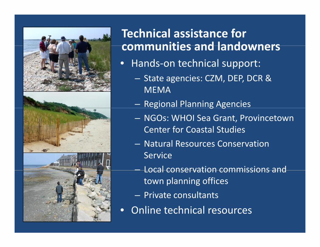
Technical assistance for communities and landownerscommunities and landowners• Hands‐on technical support:
State agencies CZM DEP DCR &– State agencies: CZM, DEP, DCR & MEMA
– Regional Planning Agenciesg g g– NGOs: WHOI Sea Grant, Provincetown Center for Coastal Studies
– Natural Resources Conservation Service
– Local conservation commissions andLocal conservation commissions and town planning offices
– Private consultants
• Online technical resources

Coastal Erosion Commission

Coastal Erosion Commission: current efforts and next stepscurrent efforts and next steps• Review public input and feedback• Working group information & materials
– Science and Technical Reasonable assessment of coastal erosion rates and areas of high hazardg Evaluating methodologies and means
– Erosion Impacts Appraisal of damage since 1978Appraisal of damage since 1978 Estimate of damages in next 10 years
– Legal and Regulatory Working Group Evaluating current regs and laws Evaluating current regs and laws Suggestions related to possible changes
• Commission meetings:3 i h h S d F ll– ~3 meetings through Summer and Fall
• Draft report and recommendations

Spring 2014 Summer 2014Spring 2014
1st i i ti
Summer 2014
P bli k h- 1st commission meeting- Working groups established
- Public workshops - Working groups underway- 2nd commission meeting
Fall 2014 Winter 2015
- Info and material from working - 4th commission groups- 3rd commission meeting- Development and drafting of
meeting- Finalize report and recommendations
report and recommendations

Coastal Erosion Commission:http://www.mass.gov/eea/waste‐mgnt‐recycling/coasts‐and‐
oceans/coastal‐erosion‐commission.html
StormSmart Coasts:StormSmart Coasts:http://www.mass.gov/eea/agencies/czm/program‐
areas/stormsmart‐coasts/
Coastal Hazards Commission Report (2007):http://www.mass.gov/eea/agencies/czm/program‐areas/stormsmart coasts/coastal hazards commission/areas/stormsmart‐coasts/coastal‐hazards‐commission/