chapter 3 – land use element - beaverton, oregon
TRANSCRIPT

BEAVERTON COMPREHENSIVE PLAN 1
What is this chapter about?
The Land Use Element describes Beaverton’s policies for the long-term growth and development of the city, consistent with the Comprehensive Plan’s major themes - livability, equity, sustainability, and resiliency. The element guides the type, location and distribution of land use, and integrates how those uses will look, function and contribute to the form of the city. The policies also describe the aspirations and goals for Beaverton’s distinct areas - Mixed Use Areas, Commercial Centers and Corridors, Neighborhoods, and Employment and Industrial Lands. The policies are supported by background studies and analysis, which are included in Volume II of the Comprehensive Plan (Background and Supporting Documents).
The relationship between land use and urban design is fundamental to achieving quality infill, redevelopment, and increased densities (measured by the number of dwelling units and/or building floor area on a site). As the density of residential and non-residential development increases, urban design issues become more important. Consequently, this land use element considers both land use and urban design.
Land Use is a topic that touches many other issues, including housing, the local economy, transportation, and natural resources. Many of the policies in other chapters of the Comprehensive Plan have an impact on or relationship to land use.
ContextBeaverton’s regional location as a first-tier suburb, largely developed in the second half of the 20th century, has shaped much of its growth and urban form. The city’s Old Town, first platted in 1868, dates to an era before cars were dominant, and has the small, walkable blocks characteristic of that time. However, the prevalence of cars during later development in the city shaped a set of neighborhoods, employment areas, and commercial corridors that are primarily built around automobile access. The city is also strongly influenced by the presence of Highways 217 and 26, which provide access to major employment areas throughout the west side of the region, as well as connecting to downtown Portland and providing freight routes that connect to other parts of the state and to Interstate 5. The extension of the MAX light rail line in the 1990s began a gradual transition towards more transit-oriented development around light rail stations. Recent planning for areas such as Progress Ridge, Beaverton Central, and South
LOCAL LAND USE PLANNING AND THE
STATEWIDE PLANNING PROGRAM
Oregon’s statewide planning goals, statutes and rules include requirements for how local governments approach land use planning, including:
• procedures for development review, notice, public hearings, and public involvement;
• coordination among jurisdictions and consistency with statewide and regional plans;
• making efficient use of land inside urban growth boundaries, while limiting development on rural land;
• limiting and/or mitigating impacts to certain natural features;
• coordinating land use planning with transportation planning; and
• providing opportunities for the type and amount of housing and employment projected within the planning horizon.
CHAPTER 3 – LAND USE ELEMENT

2 BEAVERTON COMPREHENSIVE PLAN
Cooper Mountain reflects an elevated priority for mixed use and walkable communities.
Beaverton has also become one of Oregon’s most culturally diverse communities. Planning for the physical growth and development of the city will be influenced by the varied interests, backgrounds, and priorities of its residents.
Beaverton’s location within the Portland Metropolitan region is an important context for the city’s growth and livability. Metro, the regional government, sets overarching policies on land use, transportation, and natural resources that local jurisdictions in the region, including Beaverton, must incorporate into city policies and rules. It also sets a region-wide land use pattern, in collaboration with local governments. The Metro “2040 Growth Concept” highlights areas where growth should be focused and areas where higher densities and more redevelopment are appropriate (e.g. downtowns and light rail station areas). The 2040 Growth Concept is reflected in the city’s land use designations and policies.
Relationships with other jurisdictions are also essential to Beaverton’s land use and urban form. The city boundary lines are jagged and complex, sharing borders with Portland, Tigard, Hillsboro, urban unincorporated Washington County and rural Washington County. The boundary reflects a history of small land additions and highlights the importance of coordination with Washington County and neighboring cities to determine optimal land uses and transportation networks.
Major Themes of the Comprehensive PlanAs the city plans for its future growth and development needs, it does so with an increased emphasis on four major themes - livability, equity, sustainability, and resiliency. These themes are defined in the Introduction and they are intended to guide updates to the Comprehensive Plan by focusing on priorities of our community visioning process, linking the policies included in this and other chapters to clearly held public values. As a largely built-out first-tier suburb, accommodating projected growth and development over the next 20 years will be increasingly challenging. The goals and policies in this chapter respond to the city’s limited supply of vacant land, potential redevelopment opportunities, multimodal transportation system (including pedestrian, bicycle, transit, and freight), valued natural resources, and rapidly changing demographics.
Wash.Ore.
SE Stark St
Portland GatewayHillsboro
Gresham
Beaverton
WashingtonSquare
Clackamas
OregonCity
St.Johns
Bethany
Orenco
Troutdale
Hollywood
CedarMillForest
GroveSunset
Rockwood
Aloha
RaleighHills
HillsdaleLents
PleasantValley
WestPortland
MilwaukieMurrayScholls
LakeOswegoLake
GroveDamascusKing
City
Tualatin
Gladstone
Wilsonville
TigardHappyValley
Tanasbourne/AmberGlenCornelius Fairview
WoodVillage
Sherwood
Vancouver
Orchards
MillPlain
Camas
Washougal
SalmonCreek
BattleGround
SW
Hal
lBlv
d
N E SandyBlvd
SW Elligsen Rd
N E Killingswo rth St
NE Weidler St
NW
185t
h Av
e
N Lom bard St
NE
82nd
Ave
N E M arine D r
NE
122n
d Av
e
SWT
erwilliger B
lvd
NW Lovejoy St
SE Powell Blvd
SE Stark St
N W Cornell Rd
SE Foster Rd
N M arine D r
SW Nyberg St
SW W ilso nville Rd
ND
enve
rA
ve
E Burnside St
N Portl
and Rd
SE Division St
SE Sun n ysid e Rd
NC
o lum bia Blvd
SWSt
affo
rdR
d
S W BarnesRd
SEM
cLough linBlvd
W Burnsid e St
SW Canyo n Rd
Front St
SW Farm in g to n R d
SW Farm ing ton Rd
N WM arine D r
SE8
2nd
Ave
SE Taco m a St
NW 6th Ave
S
Sprin g water
Rd
S Spring
water
Rd
19th Ave
Pio neer Blvd
NE Arndt Rd
SW Clay St
NE
242n
d D
r
SW Tu alatin Sh erwood Rd
Kruse W ay
Qui
nce
St
S Beavercreek
Rd
SEO
rient
D r
7th St
Suns
et D
r
E Po well Blvd
Boones F erry
Rd
SW D urhamRd
E Burnside St
SE Oak St
N 1s
t Ave
SE 1 st Ave
Country Club Rd
N W A m ber w o odD r
SEFo
sterR
d
SWS
p ringH
illR d
G ales Creek Rd
SBa
r low
RdS
Bar
low
Rd
SW 18
5th
Ave
S M cL o ughlinBlvd
N A dair St
SWSc
h olls
Fer r
yRd
N WYeo n Ave
SE H
ogan
Rd
SE 2
42nd
Ave
Willamette Fa llsDr
SW BaldPeak Rd
S Union Mills Rd
N E C o rnell Rd
SE Bluff Rd
SW Dixon
M i ll Rd
S R edlan d Rd
SC
lack
amas River D r
NW
Gales
Creek
Rd
SWM
acAdam
Ave
Willam ette D
r
NW
Gle
nco
eR
d
SE G
rand
Ave
SWBarb
ur Blvd
B St
S M
ain
St
SWR
ivers ide
Dr
SE 1
22nd
Ave
SW M
urra
y Bl
vd
N Holly St
N M
olal
la A
ve
E St
SE K
ane
DrSE
182
nd A
ve
Molalla Ave
S H enrici Rd
SE
River
Rd
Sprin
gH
ill Rd
SW 2
57th
Ave
Blu
f fR
d
Fren
chPr
airie
Rd
SWR
iver
Rd
SW U nger Rd
N EA irport W ay
Aurora
Banks
BarlowCanby
Carlton
DaytonDonald
Estacada
Gaston
Hubbard
Lafayette
McMinnville
Molalla
Newberg
NorthPlains
Sandy
St. Paul
Woodburn
Yamhill
Dundee
West Linn
Willamette
2040 Growth Concept MapSeptember 2014
0 2 4miles
The Metro 2040 Growth Concept defines theform of regional growth and development forthe Portland metropolitan region. The GrowthConcept was adopted in December 1995through the Region 2040 planning and publicinvolvement process. This concept is intendedto provide long-term growth management ofthe region.
The map highlights elements of parallelplanning efforts including: the 2035 RegionalTransportation Plan that outlines investments inmultiple modes of transportation, and acommitment to local policies and investmentsthat will help the region better accommodategrowth within its centers, corridors andemployment areas.
Sandy R.
Columbia River
Willamette R.
Tualatin R.
HaggLake
SturgeonLake
VancouverLake
Clackamas R.
The information on this map was derived from digital databases on Metro's GIS. Care was taken in the creation of this map. Metro cannot accept anyresponsibility for errors, omissions, or positional accuracy. There are no warranties, expressed or implied, including the warranty of merchantability orfitness for a particular purpose, accompanying this product. However, notification of any errors are appreciated.
Willamette R.
Making a great place
Employment land
Parks and natural areas
Neighborhood
Urban growth boundaries
Rural reserve
Urban reserve
Neighboring cities
Intercity rail terminal
Airports
Existing high capacity transit
Planned high capacity transit
Proposed high capacity transit tier 1
County boundaries
Mainline freight
High speed railFor more information on these initiatives, visithttp://www.oregonmetro.gov/2040
Main streets
Corridors
Central city
Regional center
Town center
Station communities
Was
hing
ton
Co.
Mul
tnom
ah C
o.
Columbia Co.
Multnomah Co.Clar k Co. Skamania Co.
Multnomah Co.Clackamas Co.
Clackamas Co.Marion Co.
Washington Co.
Cla
ckam
as C
o.
Yam
hill
Co.
Washington Co.Yamhill Co.
URBAN DESIGN
Urban design shapes the physical setting of cities by defining the interaction and transition between buildings, streets and landscapes. Integration of urban design concepts and land use policies will help promote quality places (such as streets, sidewalks, sites and buildings).
Metro 2040 Growth Concept

BEAVERTON COMPREHENSIVE PLAN 3
Chapter FormatThe Land Use Element is organized into 9 sections, each with a discussion of issues and one or more goals. Each goal is followed by a series of policies intended to help Beaverton grow and develop in a manner that exhibits the city’s commitment to livability, equity, sustainability, and resiliency.
Sections 3.1 through 3.5 address issues and goals of citywide relevance. Sections 3.6 through 3.9 provide goals and policies for each land use designation defined in the Comprehensive Plan. The Comprehensive Plan designations are grouped into four categories as shown below.
MIXED USE AREAS
COMMERCIAL CENTERS AND CORRIDORS
NEIGHBORHOODS EMPLOYMENT AND INDUSTRIAL
LAND
• Regional Commercial
• Community Commercial
• Neighborhood Centers
• Downtown Regional Center
• Town Centers
• Station Communities
• Mixed Use Corridors
• Low Density Neighborhoods
• Standard Density Neighborhoods
• Medium Density Neighborhoods
• High Density Neighborhoods
• Employment
• Industrial
Section3.6
Section3.7
Section3.8
Section3.9

4 BEAVERTON COMPREHENSIVE PLAN
3.1 Land Use and Transportation ConnectionsLand use and transportation are inherently inter-related, as the transportation system is what connects different uses in different areas and moves people and goods between them. Development is strongly influenced by the transportation system that surrounds it, and land use and development can influence how attractive it is to travel by car, transit, bike, or on foot. While cars remain an important feature of daily life, a commitment to sustainability, livability, equity and resiliency means increasing the transportation options available and making it easier for people to meet daily needs without a car. That shift can’t come from investments in the transportation system alone; land use patterns play an equal or greater role in shaping transportation options and choices. The policies below recognize and address the important relationship between land use and transportation.
Goal 3.1.1 Encourage development and land use patterns that support a variety of transportation options
Policies:
a) Emphasize pedestrian convenience and safety in all developments and transportation facilities.
b) Encourage development and programs that reduce the need for vehicle use and ownership.
c) Ensure that new development is designed to provide safe, comfortable and direct pedestrian and bicycle connections for all, regardless of ability or age, to and through the development, including to reach nearby points of interest.
d) Apply land use designations and development regulations that support high-density development near transit and services, in order to provide greater opportunities to live, work, and meet daily needs near transit.
e) Encourage increased intensity of development within Mixed Use, Commercial, and Employment areas that are located within a half-mile of high capacity transit stops or stations, such as MAX and WES.
f) Ensure that development adjacent to transit stops and stations is designed to provide direct, convenient and comfortable connections between buildings and the stop or station.

BEAVERTON COMPREHENSIVE PLAN 5
g) Encourage providing amenities for transit users at transit stops or stations, such as food carts and coffee stands, covered benches, trash/recycling receptacles, and lighting.
h) Allow use of private parking lots near transit stops and stations for park-and-ride facilities during hours when the parking spaces are not needed for on-site uses.
i) Encourage the use of innovative technologies that improve parking and transportation efficiency.
j) Encourage use of structured, underground, and/or tuck-under parking for commercial, office, and multifamily development.
k) Encourage shared parking agreements in all areas with significant volumes of surface parking lots.
l) Accommodate automobile access and parking in an efficient manner that does not detract from the desirability of other modes.

6 BEAVERTON COMPREHENSIVE PLAN
3.2 Infill and RedevelopmentThe city’s buildable lands inventory shows that there is not much vacant land left in any comprehensive plan designation, except for land added to the city through expansion of the urban growth boundary. This means that a significant share of future growth in the city will occur through infill and redevelopment.
Goal 3.2.1 Provide for thoughtful and strategic infill and redevelopment
Policies:
a) Provide a set of residential infill guidelines and standards that encourage compatible infill development, consistent with the following principles:
i. Provide flexibility on development standards when it can help preserve trees and natural resources.
ii. Allow a wider variety of housing choices that can accommodate a range of ages, household sizes and/or income levels while ensuring the new housing responds to the scale and form of the neighborhood.
iii. Manage transitions between different uses and housing types.
iv. In areas well-served by transit, amenities and services, offer more flexibility for infill housing and innovative housing types that meet city goals for affordability and livability, and provide housing for diverse household sizes, types, and age ranges.
v. Encourage site and building design features, including setbacks and sight lines, that minimize impacts to sunlight and privacy for existing adjacent homes.
b) Encourage and support quality redevelopment in target areas that is consistent with city goals.
c) Work to reduce and mitigate displacement and loss of affordable housing and commercial/employment space when planning and implementing major capital investments that increase livability and desirability.
DEFINING INFILL AND REDEVELOPMENT
The Housing Element identifies infill development as one means to provide an adequate supply of housing to meet future needs. As used in the Land Use Element, infill refers to the construction of additional housing in an existing neighborhood, or non-residential or mixed use development on relatively small pieces of undeveloped land in areas that are largely developed.
Redevelopment means demolition of an existing structure to make way for new development, which may or may not increase density or intensity of development. Redevelopment may replace existing development with a similar type and scale of new development, or may include changing the type or intensity of the use.

BEAVERTON COMPREHENSIVE PLAN 7
d) Recognize the value of low-cost commercial space for supporting small businesses and start-ups.
e) Maintain an equitable policy to allow food carts and other mobile eateries in strategic locations and provide support for siting at multiple venues citywide.
f) On underutilized property and excess parking areas, provide opportunities for interim uses, such as community gardens and food carts, that are appropriate for each plan designation.

8 BEAVERTON COMPREHENSIVE PLAN
3.3 Sustainability and Natural ResourcesThe Natural Resources Element of the Comprehensive Plan addresses protection of significant natural resources, including riparian corridors, wildlife habitat, wetlands, and cultural and historic resources. The Environmental Quality and Safety Element of the Comprehensive Plan addresses water quality, air quality, noise, seismic hazards, geologic hazards, flood hazards, and solid and hazardous waste. Direct impacts to air and water quality are generally addressed through state regulations and permits. However, sustainability and resiliency go beyond these issues. Sustainable development also means building a way that mitigates and adapts to climate change impacts, reduces energy and resource consumption in buildings, reduces the energy and fossil fuel consumption associated with transportation, and connects people to the environment.
Resilient development means building in a way that protects people, anticipates natural events and disasters, and improves the community’s ability to prepare for, adapt to, and recover from potential shocks and stresses. This section provides policies that complement, but do not repeat, the policies in the Natural Resources Element and Environmental Quality and Safety Element. Policies relevant to the transportation side of sustainability are provided in Section 3.1 of this chapter as well as the Transportation Element of the Comprehensive Plan.
Goal 3.3.1 Promote sustainable development, resilience, and resource protection
Policies:
a) Use land effectively in urban areas to relieve development pressure in rural areas and help protect farms, forests and natural resources.
b) Conserve, protect and enhance natural resources identified in the city’s adopted Significant Natural Resources inventories, consistent with policies in the Natural Resources Element.
c) Encourage and incentivize sustainable building and site design approaches that minimize environmental impacts of the built environment while creating healthy, safe places for people to live, work and play, through:
i. Energy conservation and renewable energy
ii. Reducing resource consumption and waste
iii. Reducing water consumption and wastewater

BEAVERTON COMPREHENSIVE PLAN 9
generation, including use of non-potable water systems where appropriate
iv. Integration of storm water and natural systems
v. Protecting and supporting human health
vi. Designing for adaptability over time
d) Wherever possible, allow resource areas to serve multiple purposes and acknowledge their multiple benefits.
e) Increase the resiliency of the built environment by:
i. Promoting retrofits to existing buildings and public facilities to increase the likelihood that buildings will stand and people can remain in place
ii. Increasing awareness of natural hazard risks and the value of mitigation and preparedness measures
iii. Encouraging the design of new public buildings to provide safe gathering spaces in the event of a natural disaster or other major emergency event
iv. Promoting the design of new buildings and infrastructure to withstand a natural disaster with minimal or no repair

10 BEAVERTON COMPREHENSIVE PLAN
3.4 Planning and Development ReviewThe city is responsible for establishing development code regulations to implement the Comprehensive Plan. The code regulates growth through the review of development applications, and through code enforcement efforts.
Portions of the city were originally developed under Washington County development regulations. In these areas, annexation occurred after County planning and initial development, requiring the city to implement the County’s plans through city zoning. In addition, the city and county have defined an “Urban Planning Area”, an area larger than the current city limits in which both jurisdictions have an interest in comprehensive planning and development. The Urban Planning Area Agreement spells out roles and responsibilities for both jurisdictions within the Urban Planning Area.
Goal 3.4.1 Provide effective and inclusive planning and development review services
Policies:
a) Ensure that development regulations are consistent with and implement the Comprehensive Plan.
b) Ensure that land use planning, notification, and public involvement procedures and processes are inclusive and provide meaningful opportunities for engagement by all community members.
c) Expand outreach to under-represented populations and increase participation in community activities by posting event and service notices in multiple venues and providing information in multiple languages, consistent with the city’s language access practices.
d) Apply zoning districts consistent with Comprehensive Plan policies; applicable Community Plans; adopted Comprehensive Plan designations, as identified in the Comprehensive Plan and zoning district matrix, below; and the following policies.
i. New zoning districts consistent with applicable Comprehensive Plan policies may be added or modified as needed to address area-specific needs or changing circumstances.

BEAVERTON COMPREHENSIVE PLAN 11
ii. Existing zoning that is not consistent with the Comprehensive Plan and zoning district matrix may remain in place until the city or property owner initiates a zone change; however, zoning map amendments must be consistent with the Comprehensive Plan and zoning district matrix.
iii. Area-specific zoning districts (as indicated in the Comprehensive Plan and Zoning District Matrix) shall be applied only in locations consistent with the title and purpose statement of the zone, applicable Community Plan policies or Metro Title 6 designations.
iv. Where a property is subject to an area-specific zone (as indicated in the Comprehensive Plan and Zoning District Matrix), quasi-judicial zone changes shall be limited to applying another implementing zone specific to the same area, consistent with applicable Community Plan policies or Metro Title 6 designations.
e) Where a land use approval requires demonstration of consistency with the policies of the Comprehensive Plan, the policies of the adopted Comprehensive Plan designation shall apply, regardless of whether the zone is listed as an implementing zone for the applicable Comprehensive Plan designation.

12 BEAVERTON COMPREHENSIVE PLAN
Comprehensive Plan Designation Implementing Zoning DistrictsMixed Use Areas
Downtown Regional Center
RC-E, Downtown Regional Center – East*RC-BC. Downtown Regional Center - Beaverton Central District*RC-OT, Downtown Regional Center – Old Town District*RC-DT Downtown Regional Center - Downtown Transition District*RC-MU Downtown Regional Center - Mixed Use District*
Town CentersTC-HDR, Town Center – High Density Residential DistrictTC-MU, Town Center – Multiple Use District
Station Communities
SC-E1, Station Community – Employment Sub Area 1 DistrictSC-E3, Station Community – Employment Sub Area 3 DistrictSC-HDR, Station Community – High Density Residential DistrictSC-MU, Station Community – Multiple Use DistrictSC-S, Station Community – Sunset District*
Mixed Use Corridors
CS, Community ServiceNS, Neighborhood ServiceR1, Residential Urban High Density District (1,000)R2, Residential Urban Medium Density District (2,000)
Commercial Centers and Corridors
Regional Commercial
CC, Corridor CommercialCS, Community ServiceC-WS, Washington Square Regional Center – Commercial District*GC, General Commercial
Community CommercialCC, Corridor CommercialCS, Community ServiceC-WS, Washington Square Regional Center – Commercial District*
Neighborhood CentersNS, Neighborhood ServiceR2, Residential Urban Medium Density District (2,000)R4, Residential Urban Medium Density District (4,000)
NeighborhoodsLow Density Neighborhoods R10, Residential Urban Low Density District (10,000)
Standard Density NeighborhoodsR5, Residential Urban Standard Density District (5,000)R7, Residential Urban Standard Density District (7,000)
Medium Density NeighborhoodsR2, Residential Urban Medium Density District (2,000)R4, Residential Urban Medium Density District (4,000)
High Density Neighborhoods R1, Residential Urban High Density District (1,000)Employment and Industrial Land
EmploymentOI, Offi ce IndustrialOI-NC, Offi ce Industrial – Nike Campus*OI-WS, Washington Square Regional Center – Offi ce Industrial District*
IndustrialIND, IndustrialOI, Offi ce Industrial
* Area-specifi c zones subject to Policy 3.4.1.d, part iii and iv.
Comprehensive Plan and Zoning District Matrix

BEAVERTON COMPREHENSIVE PLAN 13
Goal 3.4.2 Coordinate with Washington County on planning for the Urban Planning Area
Policies:
a) Coordinate with Washington County on planning and development review for the area outside city limits but within the Urban Planning Area, consistent with the adopted Urban Planning Area Agreement between the City of Beaverton and Washington County.
b) Recognize planning work done by Washington County when applying city policies and development regulations as annexation occurs.
c) Update city policies or create City of Beaverton Community Plans for newly annexed areas as needed to reflect changing conditions or where County plans offer little guidance.
14 BEAVERTON COMPREHENSIVE PLAN
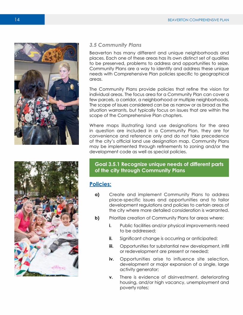
3.5 Community PlansBeaverton has many different and unique neighborhoods and places. Each one of these areas has its own distinct set of qualities to be preserved, problems to address and opportunities to seize. Community Plans are a way to identify and address these unique needs with Comprehensive Plan policies specific to geographical areas.
The Community Plans provide policies that refine the vision for individual areas. The focus area for a Community Plan can cover a few parcels, a corridor, a neighborhood or multiple neighborhoods. The scope of issues considered can be as narrow or as broad as the situation warrants, but typically focus on issues that are within the scope of the Comprehensive Plan chapters.
Where maps illustrating land use designations for the area in question are included in a Community Plan, they are for convenience and reference only and do not take precedence of the city’s official land use designation map. Community Plans may be implemented through refinements to zoning and/or the development code as well as special policies.
Goal 3.5.1 Recognize unique needs of different parts of the city through Community Plans
Policies:
a) Create and implement Community Plans to address place-specific issues and opportunities and to tailor development regulations and policies to certain areas of the city where more detailed consideration is warranted.
b) Prioritize creation of Community Plans for areas where:
i. Public facilities and/or physical improvements need to be addressed;
ii. Significant change is occurring or anticipated;
iii. Opportunities for substantial new development, infill or redevelopment are present or needed;
iv. Opportunities arise to influence site selection, development or major expansion of a single, large activity generator;
v. There is evidence of disinvestment, deteriorating housing, and/or high vacancy, unemployment and poverty rates;
BEAVERTON COMPREHENSIVE PLAN 15
vi. There is a need to coordinate private development and public investment; and/or
vii. The opportunity for development in conjunction with a transit station exists.
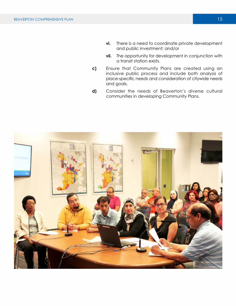
c) Ensure that Community Plans are created using an inclusive public process and include both analysis of place-specific needs and consideration of citywide needs and goals.
d) Consider the needs of Beaverton’s diverse cultural communities in developing Community Plans.

16 BEAVERTON COMPREHENSIVE PLAN
MIXED USE AREAS
COMMERCIAL CENTERS AND CORRIDORS
NEIGHBORHOODS EMPLOYMENT AND INDUSTRIAL
LAND
• Regional Commercial
• Community Commercial
• Neighborhood Centers
• Downtown Regional Center
• Town Centers
• Station Communities
• Mixed Use Corridors
• Low Density Neighborhoods
• Standard Density Neighborhoods
• Medium Density Neighborhoods
• High Density Neighborhoods
• Employment
• Industrial
Section3.6
Section3.7
Section3.8
Section3.9
3.6 Mixed Use AreasThe designations within this category (Downtown Regional Center, Town Center, Station Community, and Neighborhood Mixed Use) reflect the scale and character of different types of Mixed Use Areas, and their unique roles within the urban tapestry of the city.
The Downtown Regional Center serves as the central urban core of the city, serving the entire community and surrounding areas. With access to Highways 217, 8 and 10, plus two MAX stations and a commuter rail station, the Downtown Regional Center is highly connected to the community and the region. The Downtown Regional Center includes several distinct districts, each with their own personality, including the historic Old Town area.
Town Centers provide services to the surrounding community, roughly within a two- to three-mile radius. They tend to have one- to three-story development with a mix of housing and commercial uses.
Station Communities are focused around light-rail stations and show an on-going transition from older development that pre-dates the construction of light rail to newer development that is more transit-oriented and at a greater intensity.
Mixed Use Corridors tend to have a mix of housing and commercial uses that face the street and provide shops and services that primarily meet the needs of several adjacent neighborhoods.
Goals and policies that apply to all Mixed Use areas, as well as goals and policies specific to each type of Mixed Use Area are provided below.
BEAVERTON COMPREHENSIVE PLAN 17
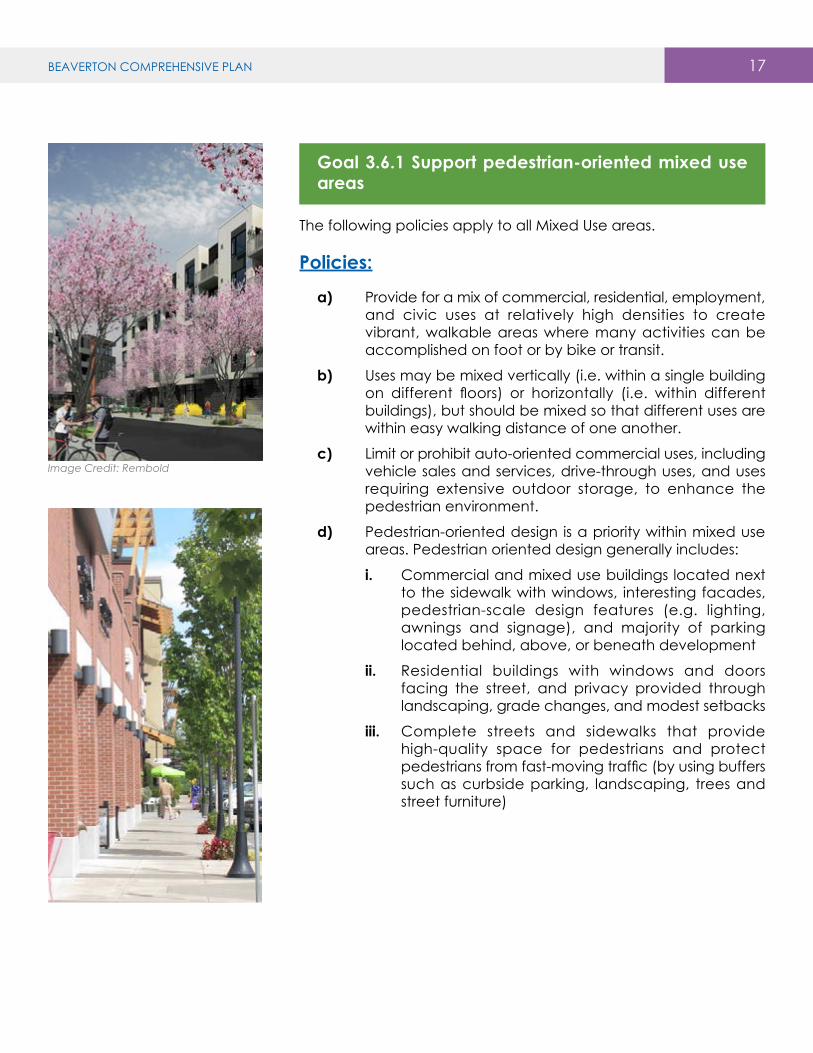
Goal 3.6.1 Support pedestrian-oriented mixed use areas
The following policies apply to all Mixed Use areas.
Policies:
a) Provide for a mix of commercial, residential, employment, and civic uses at relatively high densities to create vibrant, walkable areas where many activities can be accomplished on foot or by bike or transit.
b) Uses may be mixed vertically (i.e. within a single building on different floors) or horizontally (i.e. within different buildings), but should be mixed so that different uses are within easy walking distance of one another.
c) Limit or prohibit auto-oriented commercial uses, including vehicle sales and services, drive-through uses, and uses requiring extensive outdoor storage, to enhance the pedestrian environment.
d) Pedestrian-oriented design is a priority within mixed use areas. Pedestrian oriented design generally includes:
i. Commercial and mixed use buildings located next to the sidewalk with windows, interesting facades, pedestrian-scale design features (e.g. lighting, awnings and signage), and majority of parking located behind, above, or beneath development
ii. Residential buildings with windows and doors facing the street, and privacy provided through landscaping, grade changes, and modest setbacks
iii. Complete streets and sidewalks that provide high-quality space for pedestrians and protect pedestrians from fast-moving traffic (by using buffers such as curbside parking, landscaping, trees and street furniture)
Image Credit: Rembold
18 BEAVERTON COMPREHENSIVE PLAN
Goal 3.6.2 Downtown Regional Center: Create and strengthen a vibrant downtown and central area for Beaverton
The following policies apply to the Downtown Regional Center, in addition to policies under Goal 3.6.1. In addition, more detailed planning for the Downtown Regional Center, including the Downtown Design District and East Downtown, is provided through the Community Plan in Volume V.
Policies:
a) Tailor development regulations to the unique character and aspirations for the distinct areas within the Downtown Regional Center, taking into account form, scale, rhythm, and uses, through specialized zoning, overlay zones, or similar tools while also ensuring strong connections between these areas and throughout the Downtown Regional Center.
b) Celebrate and enhance the diversity, cultural and natural history, and geographic importance of the city to establish an overall sense of place that is uniquely Beaverton.
c) New development, redevelopment, and public investments in this area should prioritize transit and multimodal street networks to create a welcoming environment that increases social interaction, commerce, creativity and fun.
d) Encourage higher intensity development near MAX and WES stations, creating mixed-use station communities that locate housing, jobs, and services near transit.
e) Ensure that redevelopment intensifies land use, with less land dedicated to surface parking and more land occupied by multistory buildings along walkable streets.
f) Provide safe and comfortable connectivity that prioritizes active transportation (such as walking, jogging, running, cycling, wheelchair use, in-line skating or skateboarding) in public and private spaces. Incorporate context-sensitive design in public spaces, streets, sidewalks, paths and other infrastructure that helps move people around Downtown.
g) Implement programs and incentives that facilitate relocation of uses with land-intensive development patterns, such as large-format retail stores and car dealerships that have large surface parking lots, to more appropriate land use designations.
h) The city should consider the potential of policies, incentives, and investments to cause physical or
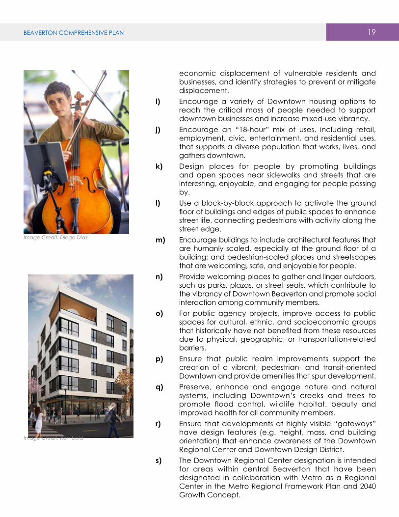
Image Credit: Diego Diaz
BEAVERTON COMPREHENSIVE PLAN 19
economic displacement of vulnerable residents and businesses, and identify strategies to prevent or mitigate displacement.
i) Encourage a variety of Downtown housing options to reach the critical mass of people needed to support downtown businesses and increase mixed-use vibrancy.
j) Encourage an “18-hour” mix of uses, including retail, employment, civic, entertainment, and residential uses, that supports a diverse population that works, lives, and gathers downtown.
k) Design places for people by promoting buildings and open spaces near sidewalks and streets that are interesting, enjoyable, and engaging for people passing by.
l) Use a block-by-block approach to activate the ground floor of buildings and edges of public spaces to enhance street life, connecting pedestrians with activity along the street edge.
m) Encourage buildings to include architectural features that are humanly scaled, especially at the ground floor of a building; and pedestrian-scaled places and streetscapes that are welcoming, safe, and enjoyable for people.
n) Provide welcoming places to gather and linger outdoors, such as parks, plazas, or street seats, which contribute to the vibrancy of Downtown Beaverton and promote social interaction among community members.
o) For public agency projects, improve access to public spaces for cultural, ethnic, and socioeconomic groups that historically have not benefited from these resources due to physical, geographic, or transportation-related barriers.
p) Ensure that public realm improvements support the creation of a vibrant, pedestrian- and transit-oriented Downtown and provide amenities that spur development.
q) Preserve, enhance and engage nature and natural systems, including Downtown’s creeks and trees to promote flood control, wildlife habitat, beauty and improved health for all community members.
r) Ensure that developments at highly visible “gateways” have design features (e.g. height, mass, and building orientation) that enhance awareness of the Downtown Regional Center and Downtown Design District.
s) The Downtown Regional Center designation is intended for areas within central Beaverton that have been designated in collaboration with Metro as a Regional Center in the Metro Regional Framework Plan and 2040 Growth Concept.
Image Credit: Diego Diaz
Image Credit: Rembold

20 BEAVERTON COMPREHENSIVE PLAN
Goal 3.6.3 Town Centers: Provide for a compact, integrated mix of uses that creates a complete community and supports walking and biking
The following policies apply to Town Centers, in addition to policies under Goal 3.6.1.
Policies:
a) Provide for a mix of housing, open space / recreational features, and shopping / services that allows residents to meet many of their needs within the Town Center.
b) Provide flexibility on where various uses are sited provided that there are strong relationships and integration among uses.
c) Provide direct and convenient connections and relationships between uses that support walking and biking.
d) Provide housing at medium to high residential densities, especially adjacent to commercial areas and open space, so that as many residents as possible have convenient walking access to these amenities.
e) Provide a mix of housing types at different price ranges and sizes to create a more inclusive community.
f) Develop public spaces (streets, paths, parks, plazas, etc.) to support urban vitality, walking and biking, and community gathering spaces.
g) The Town Center designation may be applied in areas that:
i. have been or will be developed with a compact mix of uses, typically based on a coordinated master plan or community plan;
ii. have transit service, but are not within a half-mile of a light rail station, including MAX and WES; and
iii. have been designated in collaboration with Metro as Town Centers in the Metro Regional Framework Plan and 2040 Growth Concept.

BEAVERTON COMPREHENSIVE PLAN 21
Goal 3.6.4 Station Communities: Encourage development and redevelopment around light rail stations that leverages proximity to light rail as an amenity for urban living/working and supports a variety of transportation modes
The following policies apply to Station Communities, in addition to policies under Goal 3.6.1.
Policies:
a) Encourage vertical mixed use development that provides for street-level retail while accommodating housing or office uses above, to support businesses that rely on foot traffic.
b) Incorporate high-density residential development, particularly within a half-mile walking distance of the light rail station, to provide the highest accessibility to light rail to the greatest number of households.
c) Encourage new multi-story commercial / employment development that increases the number of employees who have direct and convenient access to transit.
d) Limit surface parking to encourage compact development and reduce the space between buildings to support walking between destinations.
e) Within a half-mile of the light rail station platform and along routes that are likely to be used by pedestrians to access public transportation, require development to provide the pedestrian-oriented design features such as windows, awnings, detailed building facades and street furniture.
f) Tailor regulations and policies for individual station areas where appropriate.
g) The Station Community designation may be applied in areas within approximately a half-mile of light rail that can support higher intensity uses.
22 BEAVERTON COMPREHENSIVE PLAN
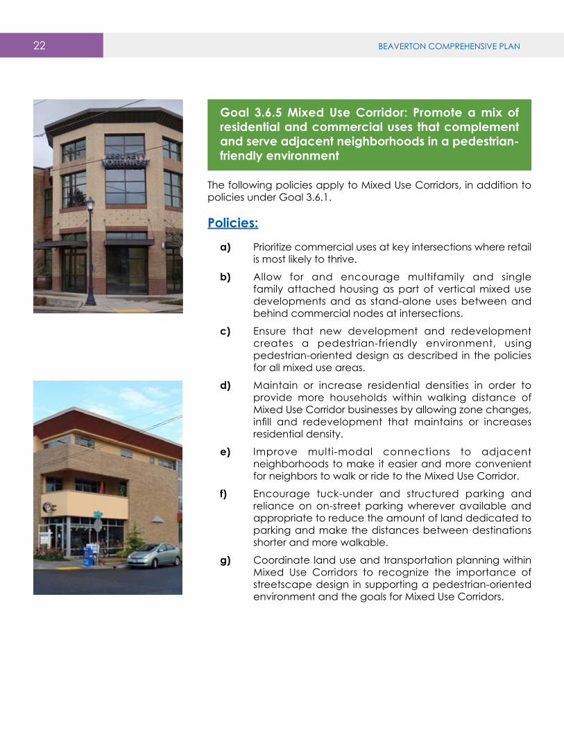
Goal 3.6.5 Mixed Use Corridor: Promote a mix of residential and commercial uses that complement and serve adjacent neighborhoods in a pedestrian-friendly environment
The following policies apply to Mixed Use Corridors, in addition to policies under Goal 3.6.1.
Policies:
a) Prioritize commercial uses at key intersections where retail is most likely to thrive.
b) Allow for and encourage multifamily and single family attached housing as part of vertical mixed use developments and as stand-alone uses between and behind commercial nodes at intersections.
c) Ensure that new development and redevelopment creates a pedestrian-friendly environment, using pedestrian-oriented design as described in the policies for all mixed use areas.
d) Maintain or increase residential densities in order to provide more households within walking distance of Mixed Use Corridor businesses by allowing zone changes, infill and redevelopment that maintains or increases residential density.
e) Improve multi-modal connections to adjacent neighborhoods to make it easier and more convenient for neighbors to walk or ride to the Mixed Use Corridor.
f) Encourage tuck-under and structured parking and reliance on on-street parking wherever available and appropriate to reduce the amount of land dedicated to parking and make the distances between destinations shorter and more walkable.
g) Coordinate land use and transportation planning within Mixed Use Corridors to recognize the importance of streetscape design in supporting a pedestrian-oriented environment and the goals for Mixed Use Corridors.

BEAVERTON COMPREHENSIVE PLAN 23
h) The Mixed Use Corridor designation may be applied in areas:
ii. along streets that can support and emphasize pedestrian, bicycle and/or transit use;
ii. that include, or provide opportunities for, a mix of housing and commercial uses; and
iii. that are surrounded by, and serve as a focal point for, nearby neighborhoods.

BEAVERTON COMPREHENSIVE PLAN24 25BEAVERTON COMPREHENSIVE PLAN
3.7 Commercial Centers and CorridorsCommercial Centers and Corridors generally have an emphasis on commercial and service uses and access to major roads. The land use designations within this category reflect different scales and characters among Commercial Centers and Corridors.
The city’s commercial centers and corridors provide for a wide range of businesses that meet the needs of Beaverton residents as well as visitors from around the region. While these areas are largely developed, renovations, new buildings, and remodels have continued to bring new investment to the city. Commercial Centers and Corridors may take the form of a continuous stretch of commercial uses, or be focused at a major intersection.
Goals and policies that apply to all Commercial Centers and Corridors, as well as goals and policies specific to each type of Commercial Centers and Corridors are provided below.
Goal 3.7.1 Enhanced Commercial Centers and Corridors
The following policies apply to all Commercial Centers and Corridors.
Policies:
a) Over time, new development and redevelopment should improve accessibility and comfort for non-auto modes, including:
i. Improving pedestrian and bicycle connections within and between sites
ii. Enhancing or creating multi-modal connections wherever feasible
iii. Providing direct pedestrian connections to, and amenities near, transit stops
iv. Providing a more visually engaging and appealing street frontage through the addition of buildings adjacent to the street, enhanced landscaping, more pedestrian scale signage, etc.
v. Providing safe and convenient paths for pedestrians within large parking areas
MIXED USE AREAS
COMMERCIAL CENTERS AND CORRIDORS
NEIGHBORHOODS EMPLOYMENT AND INDUSTRIAL
LAND
• Regional Commercial
• Community Commercial
• Neighborhood Centers
• Downtown Regional Center
• Town Centers
• Station Communities
• Mixed Use Corridors
• Low Density Neighborhoods
• Standard Density Neighborhoods
• Medium Density Neighborhoods
• High Density Neighborhoods
• Employment
• Industrial
Section3.6
Section3.7
Section3.8
Section3.9

BEAVERTON COMPREHENSIVE PLAN24 25BEAVERTON COMPREHENSIVE PLAN
b) Emphasize commercial and employment uses, and limit ground floor residential uses to preserve land to meet the city’s employment needs.
c) Allow for housing as part of an integrated mixed use development, generally behind or above commercial uses, and buffered from high-traffic roadways or uses incompatible with residential use.
Image Credit: C.E. John Co.

BEAVERTON COMPREHENSIVE PLAN26 27BEAVERTON COMPREHENSIVE PLAN
Goal 3.7.2 Regional Commercial: Provide suitable locations for commercial uses that serve the broader region and require large sites, significant access and visibility
The following policies apply to Regional Commercial areas, in addition to policies under Goal 3.7.1.
Policies:
a) Allow for the continuation of auto-oriented uses and large-format commercial uses, while encouraging a transition to more compact and pedestrian-friendly development over time.
b) Apply development regulations that:
i. Allow commercial uses at a range of scales, including large-format retail, to address community needs
ii. Allow automotive services (e.g. gas stations, car wash, and car repair)
iii. Limit new land-intensive vehicle sales and service uses and uses requiring extensive outdoor storage to areas that are over a half-mile from a high-capacity transit station and that are not heavily used by pedestrians
c) The Regional Commercial designation may be applied in areas along highways and major arterials with high visibility and auto accessibility.
Image Credit: Trammell Crow Company / Bignell Watkins Hasser Architechts

BEAVERTON COMPREHENSIVE PLAN26 27BEAVERTON COMPREHENSIVE PLAN
Goal 3.7.3 Community Commercial: Provide for commercial services that serve the surrounding community, with limited auto-oriented uses
The following policies apply to Community Commercial areas, in addition to policies under Goal 3.7.1.
Policies:
a) Allow commercial uses at a range of scales, including large-format retail, to address community needs.
b) Allow limited new automotive services (e.g. gas stations, car wash, and car repair) where compatible with adjacent uses and where the design of the site and building or structure promote a quality pedestrian environment along the street.
c) Prohibit land-intensive vehicle sales and service uses and uses requiring extensive outdoor storage.
d) Use development standards and/or conditional use review to address potential issues related to compatibility of commercial uses with adjacent housing, including noise, access and parking.
e) Require multimodal or pedestrian connections based on block size standards to encourage a pattern of development that can be easily navigated by foot or bike.
f) The Community Commercial designation may be applied in areas along arterial roads with relatively high visibility and auto accessibility that also provide pedestrian, bicycle, and/or transit connections to the surrounding community.
Image Credit: Gramor Development

BEAVERTON COMPREHENSIVE PLAN28 29BEAVERTON COMPREHENSIVE PLAN
Goal 3.7.4 Neighborhood Center: Provide opportunities for small-scale commercial development that serves adjacent neighborhoods
The following policies apply to Neighborhood Centers, in addition to policies under Goal 3.7.1.
Policies:
a) Limit the scale and type of non-residential uses to ensure compatibility with surrounding neighborhoods.
b) Limit or prohibit auto-oriented commercial uses:
i. Allow limited new automotive services (e.g. gas stations, car wash, and car repair) at a small scale where compatible with adjacent uses and where the design of the site and building or structure promote a quality pedestrian environment along the street.
ii. Prohibit land-intensive vehicle sales and service uses, uses requiring extensive outdoor storage, and large-scale automotive services.
c) Use development standards and/or conditional use review to address potential issues related to compatibility of neighborhood commercial uses with adjacent housing, including noise, access and parking.
d) Allow the continuation of existing residential uses and new residential uses that are part of a mixed use development or support and provide opportunities for future neighborhood commercial uses within the Neighborhood Center.
e) Improve and enhance connections to adjacent neighborhoods to make it easier and more enjoyable for neighbors to walk or bike to the Neighborhood Center.
f) The Neighborhood Center designation may be applied in areas that:
i. include existing small-scale commercial and neighborhood-serving uses;
ii. provide a transition between more intensive commercial or mixed use designations and Neighborhood Residential designations; or
iii. are along collector or arterial roads adjacent to Medium and/or High Density Neighborhoods that lack commercial services.

BEAVERTON COMPREHENSIVE PLAN 29BEAVERTON COMPREHENSIVE PLAN28 29BEAVERTON COMPREHENSIVE PLAN
3.8 NeighborhoodsNeighborhoods generally prioritize residential uses and compatible non-residential uses, such as schools and public parks. The different designations within this category reflect different scales and densities among different types of Neighborhoods.
The city’s existing Low and Standard Density Neighborhoods are mostly developed with subdivisions built in the second half of the 20th Century. Nearly all of the existing housing is single family detached. Streets were generally built with larger collector roads connecting between neighborhoods and many dead ends, loops, and curving streets within neighborhoods. Many subdivisions include protected open space, either in the form of parks or tracts preserved and owned by a homeowners association. Schools, religious institutions, and other civic uses are found throughout the neighborhoods, often on the larger roads.
Existing Medium and High Density Neighborhoods are developed with a mix of housing types but with an emphasis on multifamily housing.
Goal 3.8.1 Complete and livable Neighborhoods
The following policies apply to all Neighborhoods.
Policies:
a) Regulate maximum residential density by zone to maintain a balance between planned land uses and infrastructure capacity.
b) Regulate minimum residential density to ensure efficient use of residential land and meet regional housing needs.
i. Generally, the zoning code should require that residential development achieve at least 80% of the maximum density allowed in the applicable zoning district.
ii. Minimum densities should be calculated excluding significant natural resource areas and other constrained lands.
c) Allow flexibility through lot size averaging and other tools to provide flexibility and housing variety while maintaining an overall density consistent with the Comprehensive Plan designation and zoning.
MIXED USE AREAS
COMMERCIAL CENTERS AND CORRIDORS
NEIGHBORHOODS EMPLOYMENT AND INDUSTRIAL
LAND
• Regional Commercial
• Community Commercial
• Neighborhood Centers
• Downtown Regional Center
• Town Centers
• Station Communities
• Mixed Use Corridors
• Low Density Neighborhoods
• Standard Density Neighborhoods
• Medium Density Neighborhoods
• High Density Neighborhoods
• Employment
• Industrial
Section3.6
Section3.7
Section3.8
Section3.9

30 BEAVERTON COMPREHENSIVE PLAN
d) For development that achieves a public benefit or goal (i.e. increased housing options, public space or affordable housing) the city may provide opportunities in the Development Code to allow additional housing units that exceed the ranges listed for each Comprehensive Plan designation.
e) Provide opportunities for a variety of housing types in all residential plan designations while maintaining a scale and character consistent with the intent of each plan designation.
f) Facilitate development of housing that is affordable to a range of incomes, including low-income households.
g) Ensure integration of parks and schools into neighborhoods in locations where safe, convenient connections from adjacent neighborhoods on foot and by bike are or will be available.
h) Use Crime Prevention through Environmental Design (design that provides opportunities for “eyes on the street” through street-facing windows and doors) to reduce graffiti, vandalism and other property crimes and to promote a feeling of safety for pedestrians.
i) Require subdivisions and development on large sites to create a connected network of pedestrian ways, local streets, and other multimodal connections, including connections to adjacent properties or opportunities to connect in the future.

BEAVERTON COMPREHENSIVE PLAN 31
Goal 3.8.2 Low and Standard Density Neighborhoods: Provide residential neighborhoods that emphasize detached housing and integrate parks, schools, and other community institutions
The following policies apply to Low and Standard Density Neighborhoods, in addition to policies under Goal 3.8.1.
Policies:
a) Allow and encourage a variety of housing types that respond to the scale and form of existing neighborhoods as a way to increase housing options within established neighborhoods while recognizing neighborhood character.
b) Establish zoning regulations that allow housing at generally the following residential densities, while allowing for flexibility as described under Goal 3.8.1:
i. Low Density Neighborhoods: one dwelling unit per 10,000-12,500 square feet of residential land area
ii. Standard Density Neighborhoods: one dwelling unit per 5,000-10,000 square feet of residential land area
c) Provide adequate flexibility on development standards (e.g. setbacks and lot coverage) to make development of single-story housing feasible.
d) The Standard Density Neighborhood designation may be applied in areas that have limited access to transit and are not located at a major intersection or highway interchange; or areas that are presently developed with predominately single family homes.Image Credit: Union Studio Architechts

32 BEAVERTON COMPREHENSIVE PLAN
Goal 3.8.3 Medium and High Density Neighborhoods: Provide for a variety of housing types and higher residential densities in areas with more amenities and transit service
The following policies apply to Medium and High Density Neighborhoods, in addition to policies under Goal 3.8.1.
Policies:
a) Provide for a variety of housing types, with an emphasis on multifamily and attached single family housing.
b) Establish zoning regulations that allow housing at generally the following residential densities, while allowing for flexibility as described under Goal 3.8.1:
i. Medium Density Neighborhoods: one unit per 2,000-5,000 square feet of residential land area
ii. High Density Neighborhoods: one unit per 1,000-2,000 square feet of residential land area
c) Focus the highest density housing closest to transit, commercial services, parks, and/or other amenities, to provide convenient access to these amenities by as many households as possible.
d) Provide direct and efficient pedestrian and bicycle connections to nearby retail and services, transit, parks, and/or schools.
e) Ensure that the internal circulation system for larger developments creates direct and desirable pedestrian and bicycle routes and connects to adjacent local streets wherever possible.
f) Allow for innovative housing types and designs that are consistent with the other policies for these neighborhoods to accommodate projected growth and meet the diverse housing needs of the community.

BEAVERTON COMPREHENSIVE PLAN 33
g) Allow limited, small-scale retail and service uses that primarily serve the immediate neighborhood and are compatible with adjacent residential uses in terms of the amount of traffic created, noise, parking needs, and other quality of life issues.
h) The Medium and High Density Neighborhood designations may be applied in areas that have walkable access to transit, commercial services, parks, and/or other amenities. The Medium Density Neighborhood may serve as a transition between Standard Density or Low Density Neighborhoods and higher density neighborhoods or commercial or mixed use designations.

34 BEAVERTON COMPREHENSIVE PLAN
3.9 Employment and Industrial Land Employment and Industrial areas generally provide locations for work places and for industrial operations. They may include retail or service uses that are complementary to the office and industrial uses, but are not generally retail destinations in and of themselves.
Existing Employment areas in Beaverton tend to be developed in one of two ways – either a suburban office park model with primarily employment uses and little retail or personal services, or a mixed office and retail center, with a mix of professional offices and retail / service businesses. Several have concentrations of businesses within a single industry or multiple buildings used by a single employer.
Beaverton’s existing Industrial areas generally have a mix of manufacturing and other industrial businesses, storage and warehousing, some office / employment uses, and sometimes a few retail / service businesses. Most buildings are one story with large surface parking lots.
Goal 3.9.1 Successful employment lands
The following policies are relevant to all Employment and Industrial areas.
Policies:
a) Emphasize and prioritize employment and industrial uses – ensure that other uses allowed within these plan designations support and do not detract from the desirability of these areas for employment and industrial uses.
b) Encourage design features and other measures that increase the availability and desirability of non-auto transportation options for employees and visitors.
c) Provide employment land suitable to meet long-term and short-term employment growth forecasts, including encouraging increased employment densities and the reuse of underutilized employment land.
MIXED USE AREAS
COMMERCIAL CENTERS AND CORRIDORS
NEIGHBORHOODS EMPLOYMENT AND INDUSTRIAL
LAND
• Regional Commercial
• Community Commercial
• Neighborhood Centers
• Downtown Regional Center
• Town Centers
• Station Communities
• Mixed Use Corridors
• Low Density Neighborhoods
• Standard Density Neighborhoods
• Medium Density Neighborhoods
• High Density Neighborhoods
• Employment
• Industrial
Section3.6
Section3.7
Section3.8
Section3.9

BEAVERTON COMPREHENSIVE PLAN 35
Goal 3.9.2 Employment Areas: Provide desirable locations for mix of office and flexible employment space and complementary uses
The following policies apply to Employment areas, in addition to policies under Goal 3.9.1.
Policies:
a) Provide for a mix of office, industrial and other employment space and complementary uses such as retail, restaurants, hotels, and services to meet the needs of businesses and employees.
b) Limit new and expanded commercial retail uses to those appropriate in type and size to serve the needs of businesses and employees of the Employment Areas.
c) Require new development and significant redevelopment projects to support walking and biking through measures such as:
i. Providing covered and/or indoor bicycle parking available to employees and visitors
ii. Providing safe and direct pedestrian connections to any nearby streets, transit stops or stations, multi-use or pedestrian trails and retail areas
iii. Providing preferential parking for carpools and vanpools
d) Encourage other measures to reduce driving alone by employees, such as:
i. Providing shuttle service to nearby light rail stations
ii. Providing lockers and shower facilities on-site
iii. Providing secure bike storage for employees
iv. Offering employees incentives not to drive to work
e) The Employment designation may be applied in areas with good access by auto and/or transit.

36 BEAVERTON COMPREHENSIVE PLAN
Goal 3.9.3 Industrial Areas: Accommodate industrial and manufacturing uses that may conflict with housing and uses that draw the general public
The following policies apply to Industrial areas, in addition to policies under Goal 3.9.1.
Policies:
a) Protect space and land for uses needing access to freight routes and facilities.
b) Provide suitable locations for industrial and manufacturing uses that are not compatible with sensitive uses (e.g. schools, daycares, homes) or large amounts of foot traffic.
c) Allow uses that complement industrial uses and provide an appropriate amount of retail and services needed by employees with limitations that ensure the area functions well for industry and freight.
d) In applying zoning that allows non-industrial uses outright, consider:
i. the potential for interference with the operation of industrial businesses in the district;
ii. the potential for interference with the efficient movement of freight along identified freight routes;
iii. the safety of employees and visitors; and
iv. consistency with policies in the Metro Urban Growth Management Functional Plan pertaining to land designated by Metro as Industrial.
e) The Industrial designation may be applied in areas with excellent truck route access and/or access to freight rail lines.