cedar lane road public information meeting
TRANSCRIPT
CEDAR LANE ROAD Public Information Meeting City of Norman Council Chambers
January 7, 2013 6:00 p.m.
Presented by: Shawn O’Leary, Director of Public Works Josh Risley, Cardinal Engineering

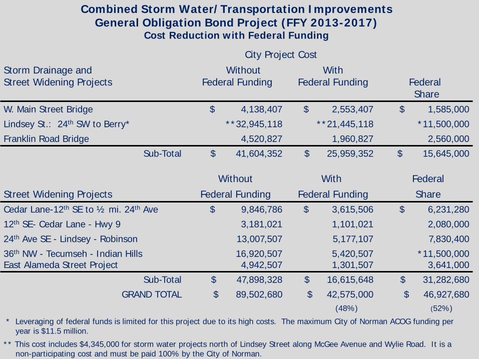
Combined Storm Water/Transportation Improvements General Obligation Bond Project (FFY 2013-2017)
Cost Reduction with Federal Funding
City Project Cost Storm Drainage and Street Widening Projects
Without Federal Funding
With Federal Funding
Federal Share
W. Main Street Bridge $ 4,138,407 $ 2,553,407 $ 1,585,000
Lindsey St.: 24th SW to Berry* **32,945,118 **21,445,118 *11,500,000
Franklin Road Bridge 4,520,827 1,960,827 2,560,000
Sub-Total $ 41,604,352 $ 25,959,352 $ 15,645,000
Without With Federal Street Widening Projects Federal Funding Federal Funding Share Cedar Lane-12th SE to ½ mi. 24th Ave $ 9,846,786 $ 3,615,506 $ 6,231,280
12th SE- Cedar Lane - Hwy 9 3,181,021 1,101,021 2,080,000
24th Ave SE - Lindsey - Robinson 13,007,507 5,177,107 7,830,400
36th NW - Tecumseh - Indian Hills East Alameda Street Project
16,920,507 4,942,507
5,420,507 1,301,507
*11,500,000 3,641,000
Sub-Total $ 47,898,328 $ 16,615,648 $ 31,282,680
GRAND TOTAL $ 89,502,680 $ 42,575,000 $ 46,927,680 (48%) (52%)
* Leveraging of federal funds is limited for this project due to its high costs. The maximum City of Norman ACOG funding per year is $11.5 million.
** This cost includes $4,345,000 for storm water projects north of Lindsey Street along McGee Avenue and Wylie Road. It is a non-participating cost and must be paid 100% by the City of Norman.
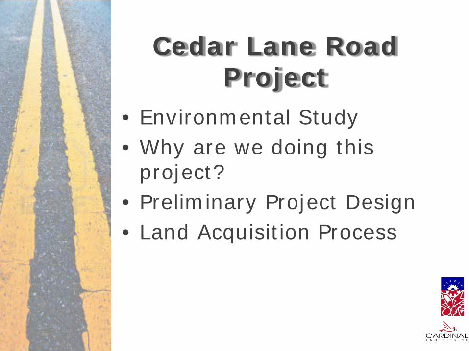
Cedar Lane Road Project
• Environmental Study • Why are we doing this
project? • Preliminary Project Design • Land Acquisition Process

Environmental Study

Cedar Lane Environmental Assessment
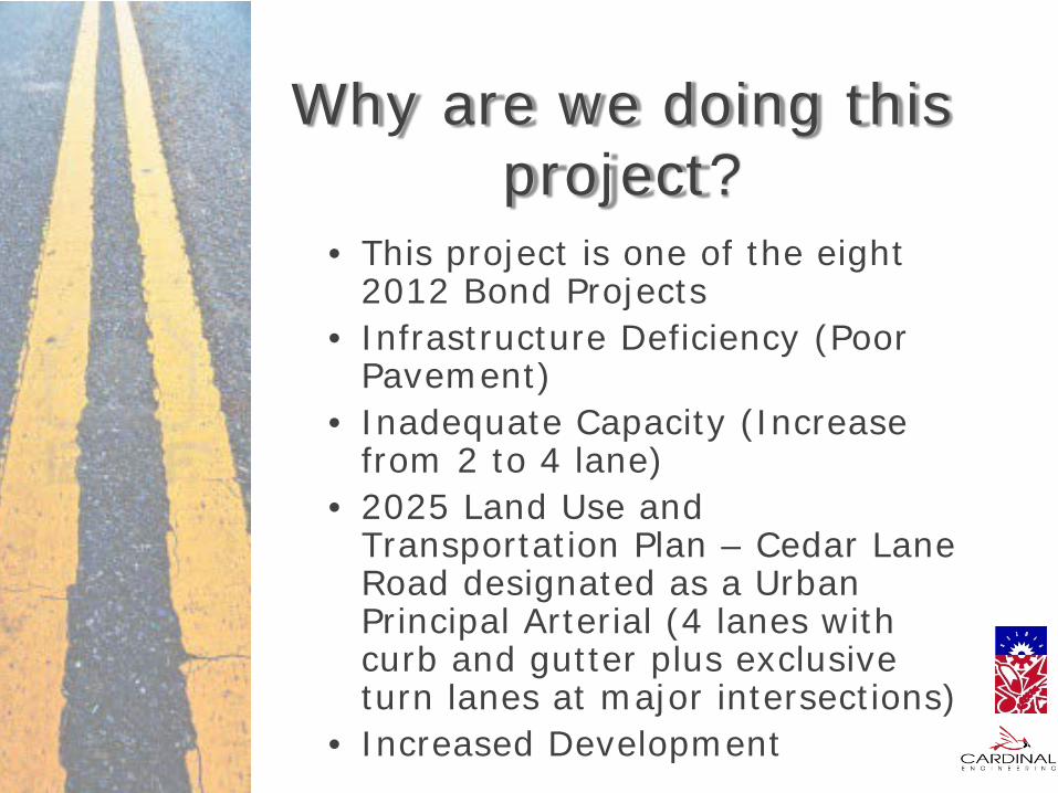
Why are we doing this project?
• This project is one of the eight 2012 Bond Projects
• Infrastructure Deficiency (Poor Pavement)
• Inadequate Capacity (Increase from 2 to 4 lane)
• 2025 Land Use and Transportation Plan – Cedar Lane Road designated as a Urban Principal Arterial (4 lanes with curb and gutter plus exclusive turn lanes at major intersections)
• Increased Development
Why are we doing this project?
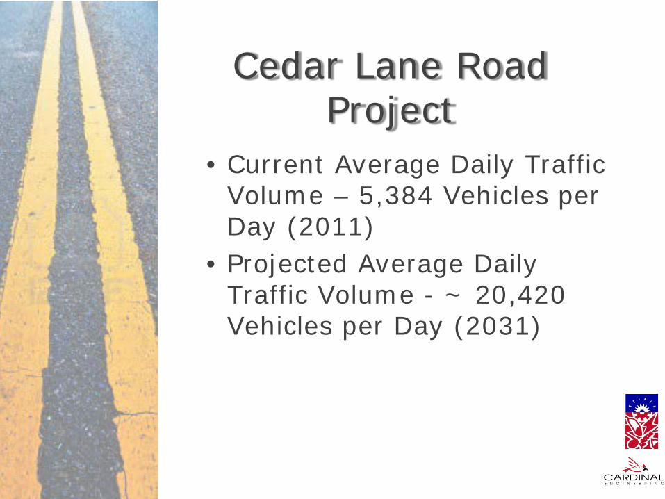
Cedar Lane Road Project
• Current Average Daily Traffic Volume – 5,384 Vehicles per Day (2011)
• Projected Average Daily Traffic Volume - ~ 20,420 Vehicles per Day (2031)

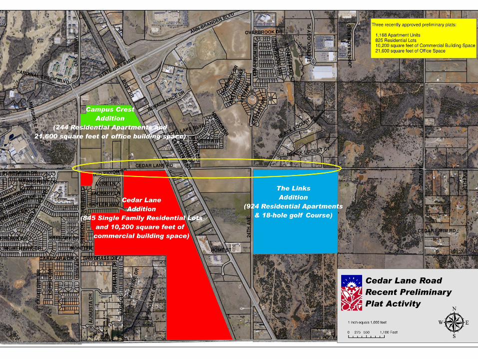
Cedar Lane Road
12th
Ave
nue
24th
Ave
nue
Project Area
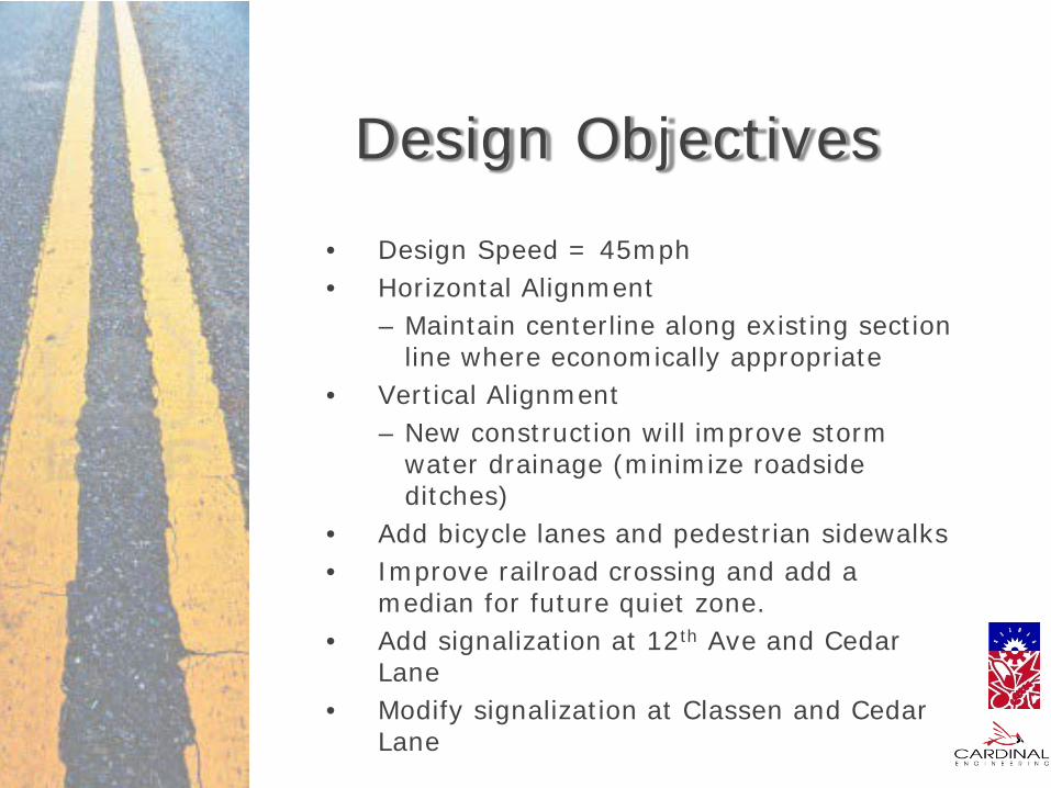
Design Objectives
• Design Speed = 45mph • Horizontal Alignment
– Maintain centerline along existing section line where economically appropriate
• Vertical Alignment – New construction will improve storm
water drainage (minimize roadside ditches)
• Add bicycle lanes and pedestrian sidewalks • Improve railroad crossing and add a
median for future quiet zone. • Add signalization at 12th Ave and Cedar
Lane • Modify signalization at Classen and Cedar
Lane

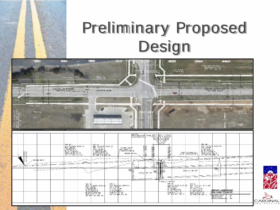
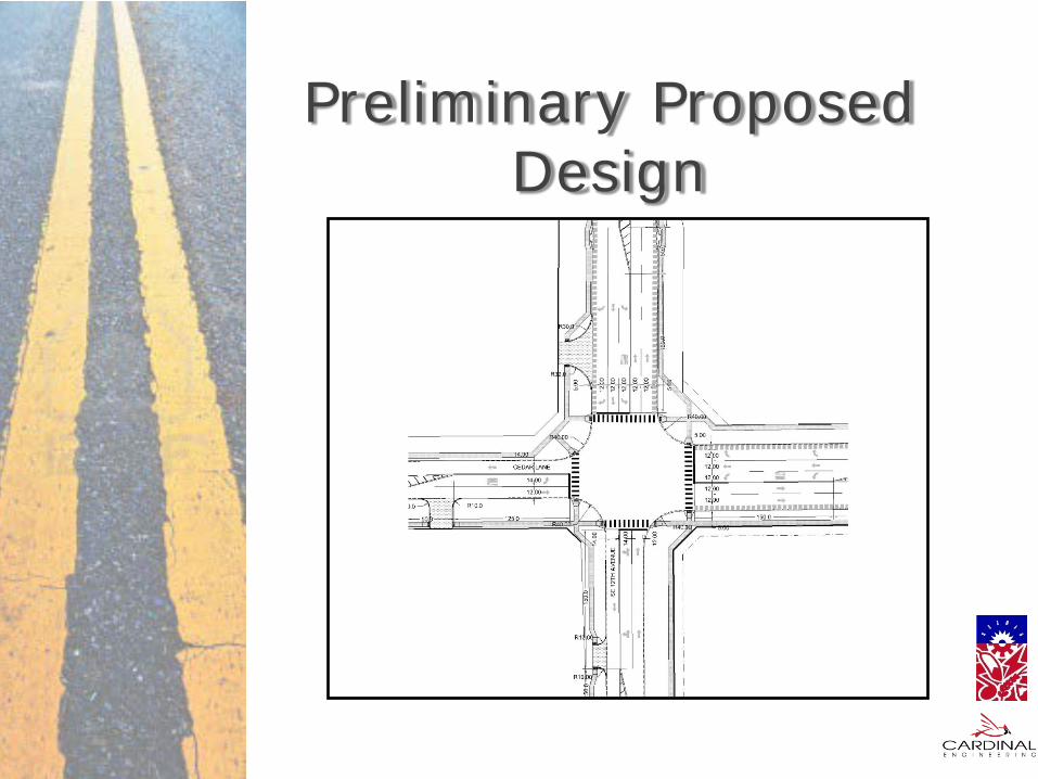
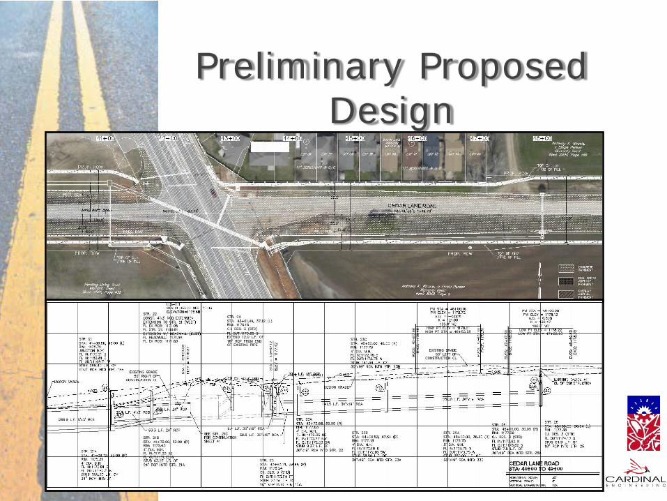
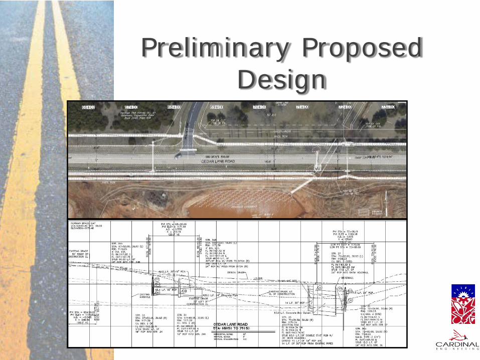
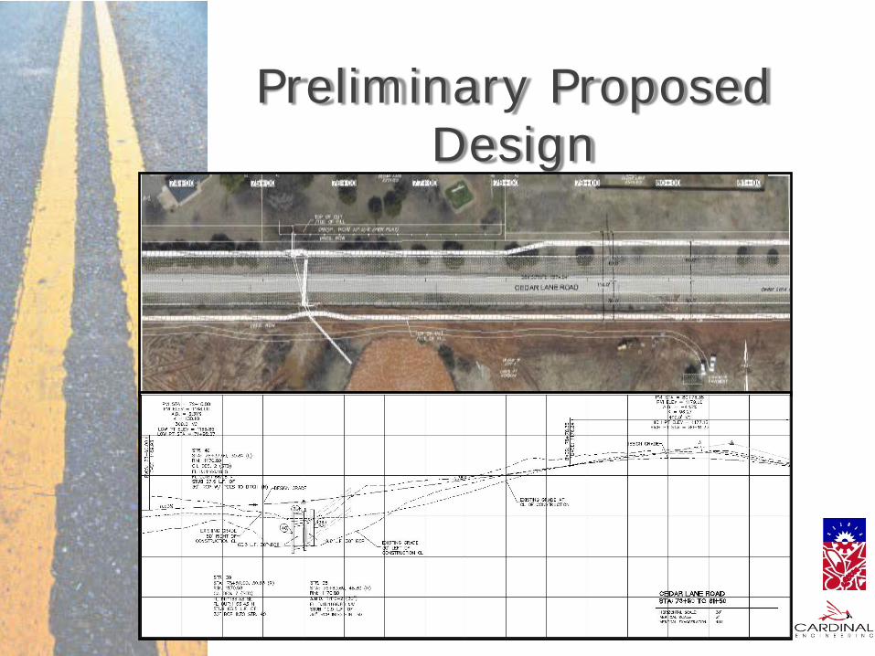
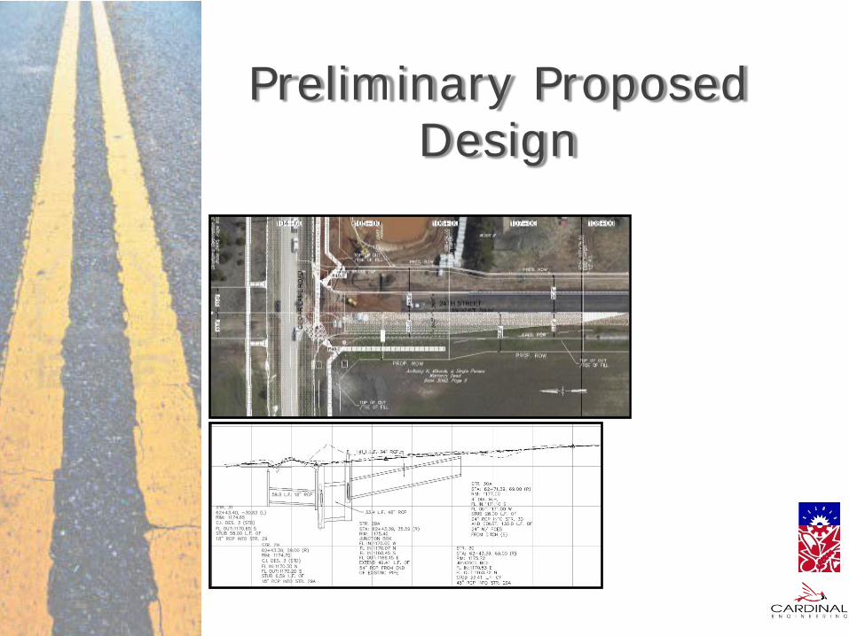
Preliminary Proposed Design

Project Description
Four Lane Concrete Pavement on Cedar Lane Beginning West of the Intersection of 12th Ave to
Black Locust Ct
Preliminary Proposed Design
Preliminary Proposed Design

Preliminary Proposed Design

Preliminary Proposed Design

Preliminary Proposed Design
Preliminary Proposed Design

Preliminary Proposed Design

Preliminary Proposed Design

Preliminary Proposed Design

Preliminary Proposed Design
Preliminary Proposed Design
Preliminary Proposed Design

Preliminary Proposed Design

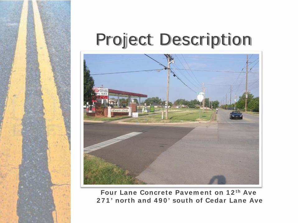
Project Description
Mill and overlay with minor shoulder improvements State Highway 77 to the north and south of Cedar
Lane

Preliminary Proposed Design
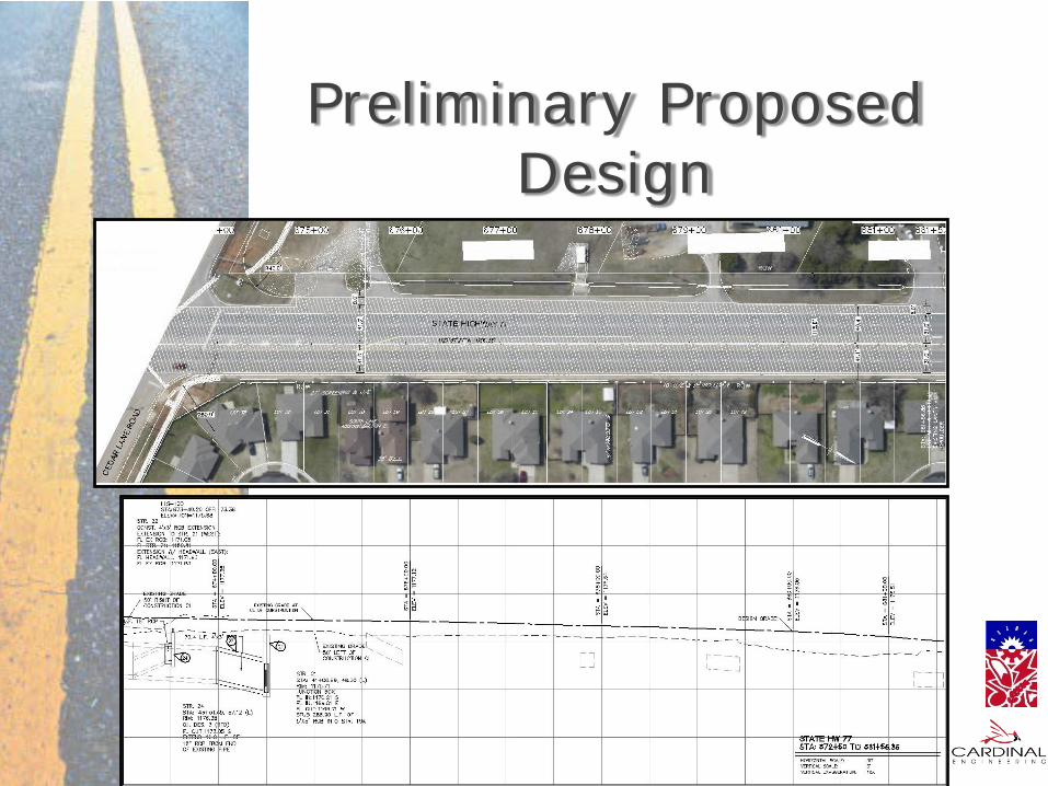
Preliminary Proposed Design
Four Lane Concrete Pavement on 12th Ave 271’ north and 490’ south of Cedar Lane Ave
Project Description
Preliminary Proposed Design

Preliminary Proposed Design
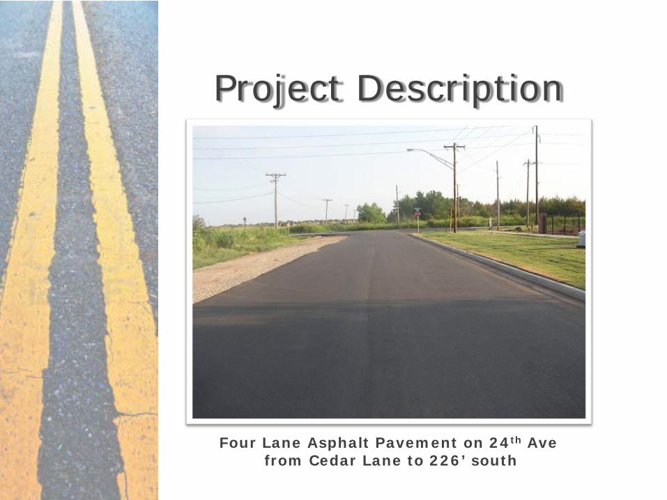
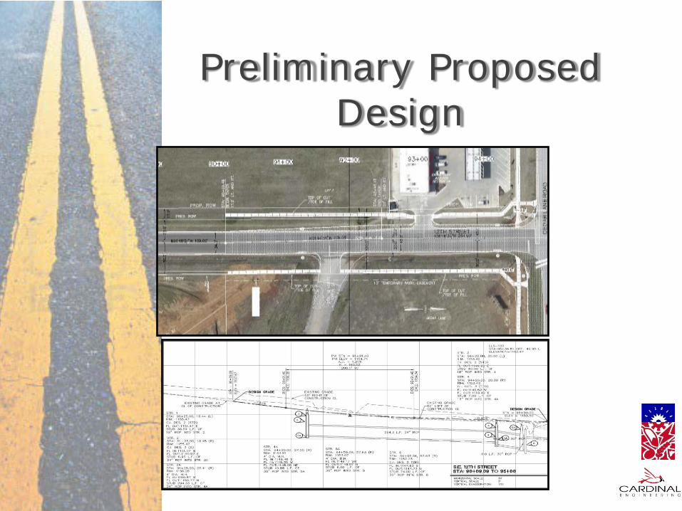
Four Lane Asphalt Pavement on 24th Ave from Cedar Lane to 226’ south
Project Description
Preliminary Proposed Design

Title Review
Appraisal
Appraisal Review
Offer / Counteroffer
Accept
Reject Final Offer (Condemnation)
Payment
Final Deed
Possession of Parcel
Acquisition Process

Preliminary Schedule February 2013
Complete Environmental Assessment August 2013
Complete Right-of-Way Acquisitions November 2013
Complete Utility Relocates May 2014
Begin Construction March 2015
Complete Construction

QUESTIONS