campaspe river resource guide - north central … campaspe river resource guide provides easy access...
TRANSCRIPT
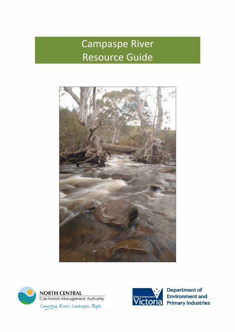
Campaspe River
Resource Guide

2 | P a g e
Contents
Contents ......................................................................................................................... 2
Introduction ................................................................................................................... 3
Campaspe catchment .................................................................................................... 4
Regional Waterway Strategy (2014-22) ......................................................................... 6
Aboriginal cultural heritage ........................................................................................... 7
European history of the Campaspe River ...................................................................... 8
Early pastoralists ........................................................................................................ 9
Gold mining .............................................................................................................. 11
Provision of domestic and irrigation water ............................................................. 12
River flows .................................................................................................................... 15
Environmental Flows................................................................................................ 15
Flooding .................................................................................................................... 17
Water storages ......................................................................................................... 19
River health .................................................................................................................. 20
Management of riparian land ...................................................................................... 21
Invasive plants and animals ......................................................................................... 23
Native flora and fauna ................................................................................................. 25
Erosion control and sustainable soils........................................................................... 28
Community ................................................................................................................... 29
Recreation, fishing and tourism ................................................................................... 31
Local government in the Campaspe catchment .......................................................... 32

3 | P a g e
Introduction
The Campaspe River Resource Guide provides easy access to information, the history
and relevant natural resource management publications relating to the Campaspe
River.
The Guide is an initiative of the ‘Caring for the Campaspe’ project funded through
the Victorian Government. This four-year project (2012-16) aims to protect and
enhance 400ha of the river’s important riparian vegetation through the delivery of
fencing, weed control and revegetation incentives to private and public land
managers. Managed by the North Central CMA, the project is guided by a Reference
Group containing representatives of the community, Indigenous groups, local
government and Goulburn-Murray Water. Community engagement activities aim to
further increase awareness and appreciation of this river system, identified as a
priority in the Regional Waterway Strategy (RWS) (2014-22).
Acknowledging that current available funding alone will not achieve the long-term
resource conditions targets identified in the RWS, this Resource Guide aims to
provide the information to support the community and partner agencies to seek
further investment in improving the health of the Campaspe River.
Photo: Campaspe River, McColl Road Strathallan (SKM, 2013)

4 | P a g e
Campaspe catchment
The Campaspe catchment extends from the Great Dividing Range in the south, to the
Murray River in the north, and covers a total area of approximately 4,000 square
kilometres (km) [approximately 17% of the North Central region]. The catchment is
approximately 150 km long and has an average width of approximately 25 km (North
Central CMA, 2005).
The Campaspe River is the major waterway in the catchment flowing over 220km
north from its headwaters near Woodend to its confluence with the Murray River at
Echuca. The Campaspe River flows through urban, peri-urban and rural townships
including Kyneton, Elmore, Rochester and Echuca. The Campaspe’s major tributary is
the Coliban River which flows from Trentham, through the three Coliban Water
storages (Upper Coliban, Lauriston and Malmsbury reservoirs) before reaching Lake
Eppalock. Other significant tributaries include the Axe, McIvor, Mount Pleasant, Wild
Duck and Pipers creeks.
Since 1836, when explorer Major Thomas Mitchell named the Campaspe River, the
landscape has undergone significant change. The cumulative effects of the gold rush,
the building of reservoirs and water supply systems, native vegetation clearing,
farming systems and urban development are clearly reflected in the current
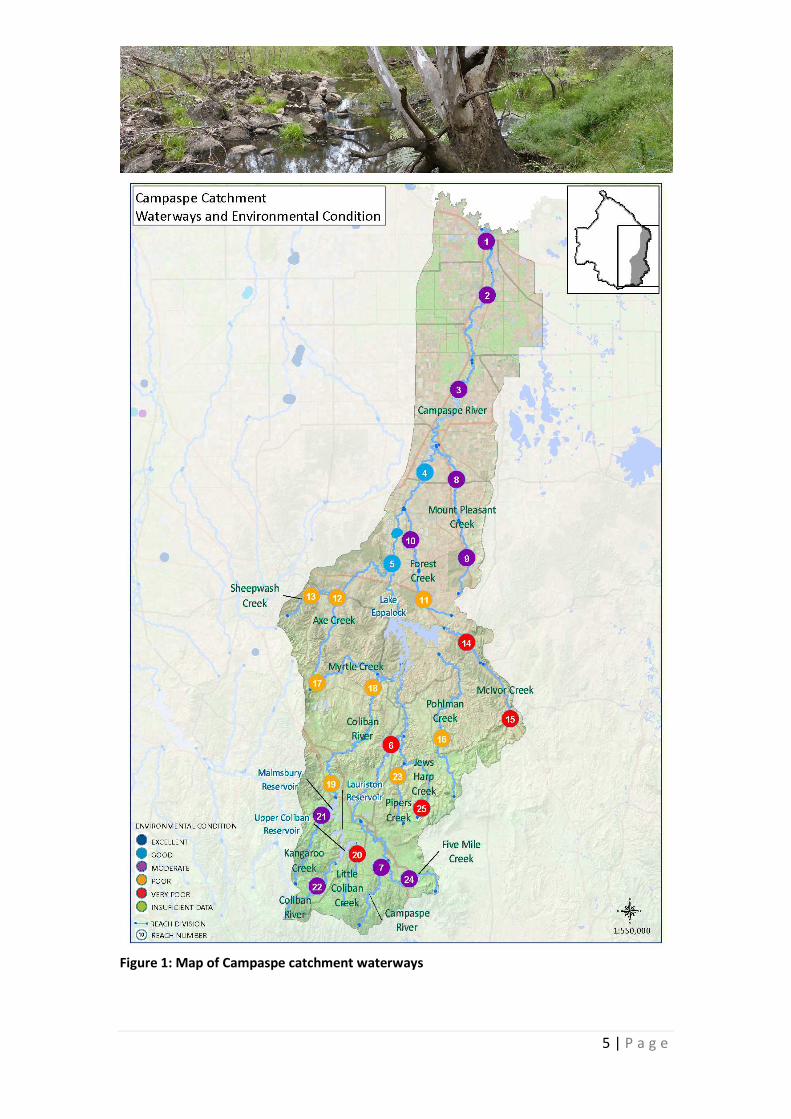
condition of the waterway (North Central CMA, 2005). Results from the 2010 ISC
survey (Refer to Figure 1) reveal that only 7% of streams in the Campaspe catchment
are in good condition, 39% are in moderate condition and 54% are in a poor to very
poor condition.
The Campaspe River has high environmental values due to its connection to the
Murray River, its iconic River Red Gum communities and native fish population,
including Murray Cod and Golden Perch. It also supports a range of social values
along its length, including camping, fishing, canoeing/kayaking, swimming,
waterskiing, bird watching, walking and picnicking.
There are no recognised significant wetlands systems within the Campaspe
catchment, although the water storages of Lake Eppalock, Upper Coliban, Lauriston
and Malmsbury reservoirs all support aquatic values and provide drought refuge.
Resource Links
DEPI (2013) Third Index of Stream Condition http://www.depi.vic.gov.au/water/water-resource-
reporting/Third-Index-of-Stream-Condition-report
5 | P a g e
Figure 1: Map of Campaspe catchment waterways

6 | P a g e
Regional Waterway Strategy (2014-22)
The vision for the 2014-2022 North Central Regional Waterway Strategy (RWS) is:
‘Waterways and floodplains will be managed sustainably to protect and enhance
their diversity and ecological function while also supporting the regional
community’s economic, recreational and amenity use’.
The draft 2014-22 North Central Regional Waterway Strategy (RWS) provides a
framework for the North Central Catchment Management Authority in partnership
with other agencies, stakeholders, traditional owners and the regional community to
manage the rivers and wetlands with the community over the next eight years. It
delivers key elements of the state-wide approach outlined in the Victorian Waterway
Management Strategy.
The purpose of the RWS is to ensure that the future management of our waterways
keeps providing these important environmental, social, cultural and economic
values. The strategy builds on the North Central Regional River Health Strategy
(2005), but has a broader scope, now including the management of floodplains and
wetlands as well as rivers.
The draft RWS identified the following long-term (8+ years) Resource Condition
Targets for the Campaspe River, divided into the Upper (above Lake Eppalock) and
Lower (below Lake Eppalock) Campaspe.
Upper Campaspe Resource Condition Targets
1. Improve the condition of the Campaspe River Reach 6 & 7 from very poor
and moderate to good (based on Index of Stream Condition) by 2050.
2. Improve the condition of the riparian zone of the Campaspe River Reach 6 &
7 by 2021 with a measured increase of one point in the streamside zone sub-
index of the ISC.
3. Removal of willows along the Upper Campaspe River by 2030.
Lower Campaspe Resource Condition Targets
1. Improve the condition of the Lower Campaspe River from moderate to good
(based on the Index of Stream Condition) by 2050.
2. Improve the condition of the riparian zone of the Lower Campaspe River by
2021 with a measured increase of one point in the streamside zone sub-index
of the ISC.
3. The delivery of environmental flows are maximised contributing to increased
hydrology and aquatic life ISC scores by 2021.

7 | P a g e
To work toward achieving these long-term Resource Condition Targets, the draft
RWS sets out specific 1-8 year Management Outcome Targets and the associated
activities/outputs required to achieve these. All actions outlined in the draft RWS are
subject to available funding. The North Central CMA will work with partner agencies
and the community to seek investment to implement the North Central RWS.
Resource Links
Draft North Central Regional Waterway
Management Strategy
North Central CMA
http://www.nccma.vic.gov.au//Publications/S
trategiesPlans/index.aspx?itemDetails=7271&
objectType=kms&searchfields=cs_ItemName
Victorian Waterway Management Strategy
Department of Environment and Primary
Industries
http://www.depi.vic.gov.au/water/rivers-
estuaries-and-wetlands/strategy-and-planning
Aboriginal cultural heritage European invasion of Australia resulted in profound changes to the Traditional
Owners and their landscape. Land clearing and occupation by the settlers,
particularly along watercourses, displaced the Aboriginal people from their
traditional land and deprived them access to many of their most abundant food,
camp and water resources.
The Campaspe catchment is the Country of three Traditional Owner groups: Dja Dja
Wurrung Clans Aboriginal Corporation west of the river to Rochester, Taungurung
Clans Aboriginal Corporation east of the river to Rochester and Yorta Yorta Nations
Aboriginal Corporation north of Rochester.
The riverine environment of the Campaspe River would have provided a rich
diversity of food sources. Plant foods were the mainstay of the indigenous people,
with hundreds of plants, such as the Myrnong, Cumbungi and Nardoo being utilised.
Aboriginal cultural heritage sites and areas are protected by legislation under the
Aboriginal Heritage Act 2006 and the Aboriginal Heritage Regulations 2007. As
Indigenous heritage sites and places are at the core of Indigenous people’s physical,
spiritual and cultural existence and identity, Aboriginal Affairs Victoria must be
consulted regarding their identification, protection and enhancement.
The North Central CMA has good relationships with Traditional Owners working on
Country and is committed to supporting and developing partnerships in natural
resource management. Our Indigenous Facilitator is invaluable in helping to ensure
cultural heritage protection and Traditional Owner relationships are maintained and
enhanced.
8 | P a g e
Resource Links
Yorta Yorta Nations Aboriginal Corporation
www.yynac.com.au
Dja Dja Wurrung Clans Aboriginal Corporation
and Enterprises
www.djadjawurrung.com.au
Registered Aboriginal Parties map
http://www.dpc.vic.gov.au/images/documents/Ab
original_Affairs/Statewide_Appointed_RAP_Dec_20
13.pdf
European history of the Campaspe River
Major Thomas Mitchell's diary records his passing of the Campaspe River on 5
October 1836, about 3km south of the present site of Redesdale:
‘…we descended into a grassy ravine, in which we found another river flowing
northward; …which I now named the Campaspe. It was difficult to find in this stream
any fordable place where the banks could be approached by the carts, one side or the
other proving too steep; but at length we succeeded’
The Campaspe River was named by Major Mitchell after a concubine of Alexander
the Great whose portrait he had seen– he thought the river was so beautiful he was
reminded of her.
In 1839, overlanders Joseph Hawdon and Charles Bonney described the lower
reaches of the Campaspe River, near the Murray River confluence as:
“a very deep creek with deep stretches of water in it” (Priestly, 1965)
Hawdon recorded:
“We proceeded two miles further up the creek, where we had to cut away the bank
with pick-axes before we could get the drays over, and even then were obliged to
unload and carry up the goods by hand” (Coulson, 1979)
Heritage Victoria has listed the
following historical sites along the
Campaspe River on the Victorian
Heritage Register:
• Windmill Bridge, Kyneton
• Degraves Campsite Mill
(former)
• Adelaide Vale Homestead
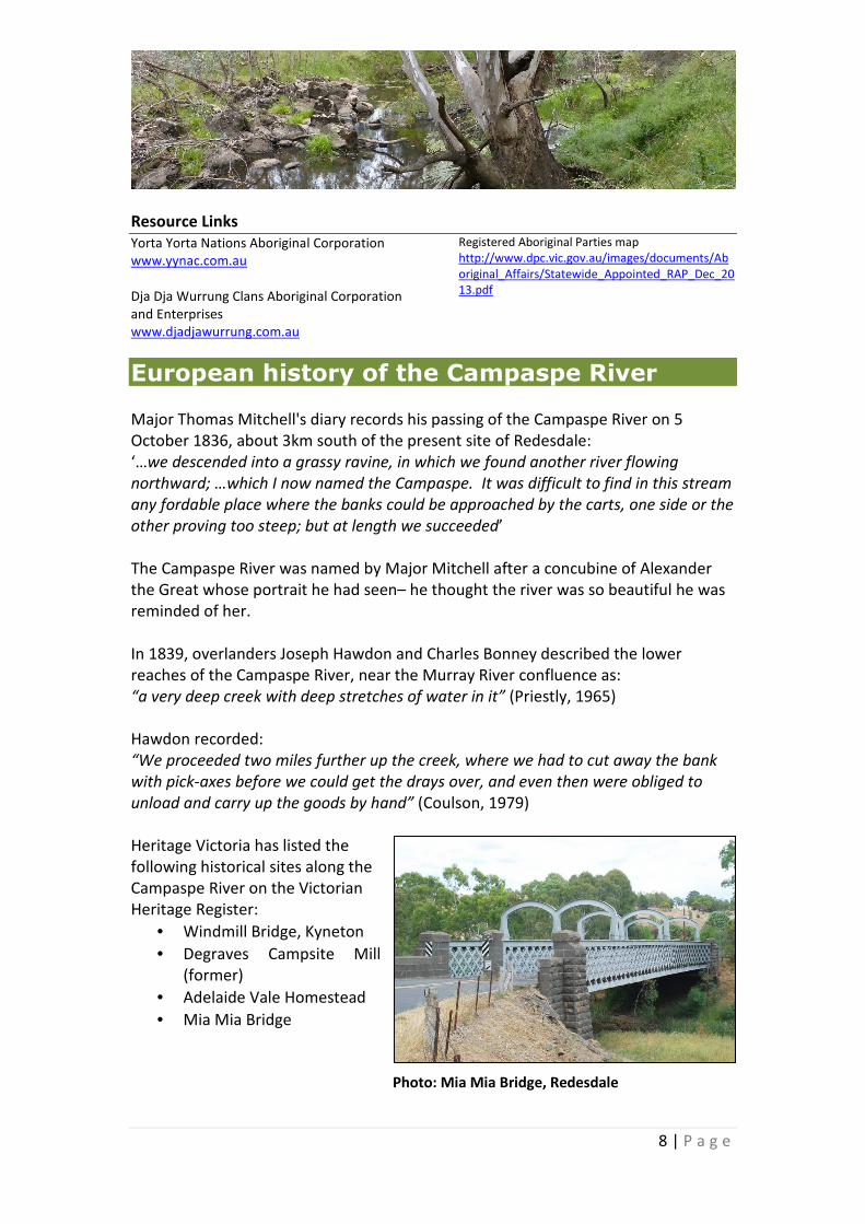
• Mia Mia Bridge
Photo: Mia Mia Bridge, Redesdale
9 | P a g e
The following sites are listed under the
Victorian Heritage Inventory:
• Mia Mia Mine
• Campaspe River Adit
• Campaspe River ‘Italian’ diggings
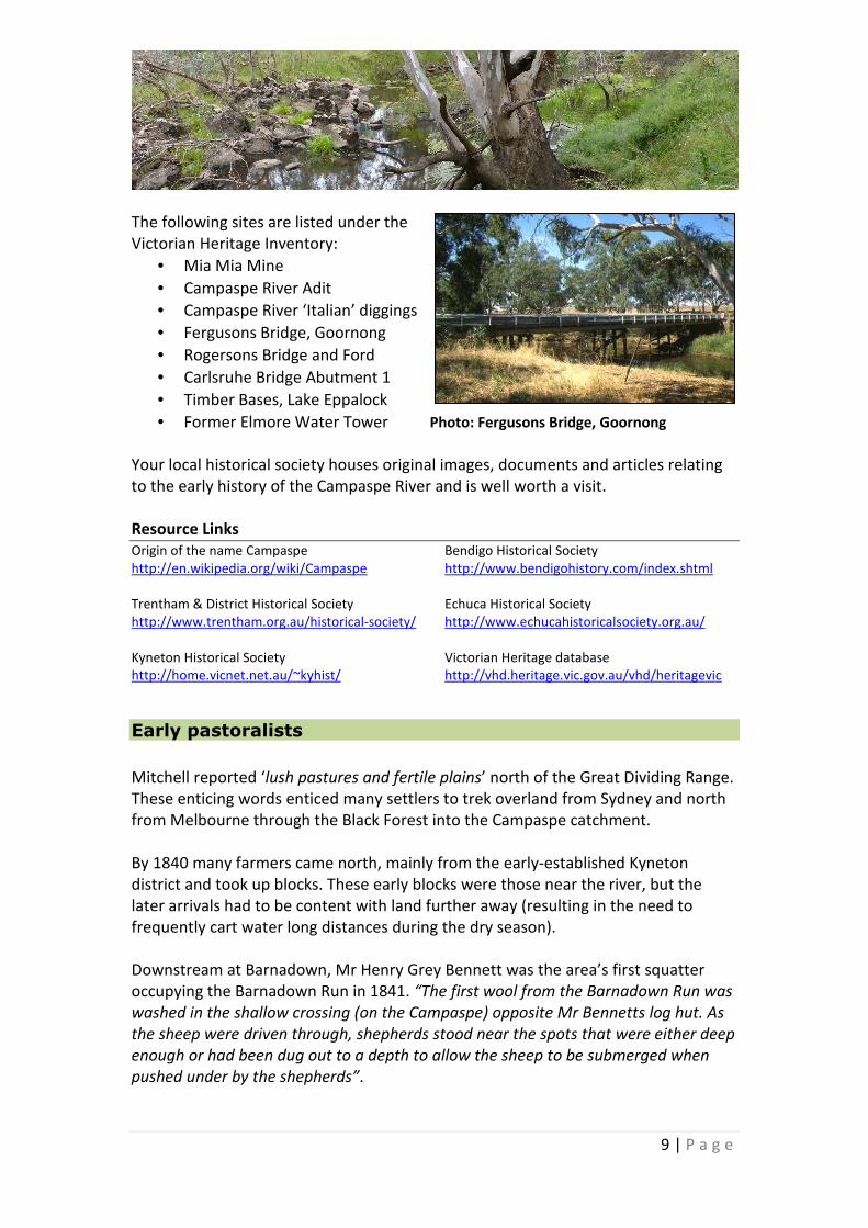
• Fergusons Bridge, Goornong
• Rogersons Bridge and Ford
• Carlsruhe Bridge Abutment 1
• Timber Bases, Lake Eppalock
• Former Elmore Water Tower Photo: Fergusons Bridge, Goornong
Your local historical society houses original images, documents and articles relating
to the early history of the Campaspe River and is well worth a visit.
Resource Links
Origin of the name Campaspe
http://en.wikipedia.org/wiki/Campaspe
Trentham & District Historical Society
http://www.trentham.org.au/historical-society/
Kyneton Historical Society
http://home.vicnet.net.au/~kyhist/
Bendigo Historical Society
http://www.bendigohistory.com/index.shtml
Echuca Historical Society
http://www.echucahistoricalsociety.org.au/
Victorian Heritage database
http://vhd.heritage.vic.gov.au/vhd/heritagevic
Early pastoralists
Mitchell reported ‘lush pastures and fertile plains’ north of the Great Dividing Range.
These enticing words enticed many settlers to trek overland from Sydney and north
from Melbourne through the Black Forest into the Campaspe catchment.
By 1840 many farmers came north, mainly from the early-established Kyneton
district and took up blocks. These early blocks were those near the river, but the
later arrivals had to be content with land further away (resulting in the need to
frequently cart water long distances during the dry season).
Downstream at Barnadown, Mr Henry Grey Bennett was the area’s first squatter
occupying the Barnadown Run in 1841. “The first wool from the Barnadown Run was
washed in the shallow crossing (on the Campaspe) opposite Mr Bennetts log hut. As
the sheep were driven through, shepherds stood near the spots that were either deep
enough or had been dug out to a depth to allow the sheep to be submerged when
pushed under by the shepherds”.

10 | P a g e
Downstream, at Burnewang the fine timber attracted Jeffrey Bros., millers from
Kyneton since 1844, and they bought the “right of station” at Burnewang in 1853.
Long straight props were carted to Bendigo, where box props were in demand for
the mines.
The selectors, and those attempting to hasten their arrival in the area, spoke proudly
of the richness of the soil. “From about Goornong, and through the Runnymede and
Rochester country, the land, almost without exception, is admirably adapted for
farming. The soil is of uniform character for miles together, of great depth, and of
excellent quality”.
The early settlers used the Rocky Crossing at Barnadown as a stock route. “Huge
drays were driven over the Rocky Crossing before huge contracts were let for
removing gravel banked up there in the river bed” (Shay, 1966).
In 1860 Burke and Wills on their epic expedition, camped at Barnadown by the
Campaspe River. Camels, horses, wagons and men crossed the river on the punt.
Andrew O’Keefe was the district’s biggest landowner in the late 19th
century. A
travelling companion, named Macartney described the area at the Axe Creek
confluence in 1882, and wrote: “The drive from Adelaide Vale to Kimbolton is a most
interesting one. It is chiefly through the valley of the Campaspe, where the Axe Creek
falls into the Campaspe, forming a natural delta and deep gorge, with high
surrounding cliffs. Here, very little engineering skill and very little money would be
required to form a large reservoir, by which a great extent of country down to the
Terricks could be irrigated”.
In 1894 Henry Goldsmith, a Kyneton lawyer and writer, wrote the following passage
describing the river of contrasts. The river in December “…was only a small creek,
murmuring and eddying through the swaying rushes and the tufted grass
roots…though in the winter flood time it could be fierce and boisterous…”
In 1904 James Smith described the upper Campaspe catchment as: “…a superb
prospect of the country to the north, with Kyneton in the far distance. Numerous
homesteads, neighboured by stockyard and environment by squares of yellowing
corn, paddocks of brown fallow, dark green breadths of potatoes and pastures
flecked by sheep or dotted with cattle. Fields bordered by hedgerows of blackberries,
with here and there a country road margined by trees, an occasional charcoal-
burner’s hut and all else is nature unadorned”.
Beginning with the early squatters of the 1840s, many waterways of the Campaspe
catchment were exposed to stock grazing, watering and sheep washing (prior to

11 | P a g e
shearing). This resulted in increased erosion rates, altered floristics due to
preferential grazing, invasion of exotic weeds, increased stream turbidity, and
increased input of nutrients and bacteria into the waterways.
Gold mining
The gold rush in the 1850s brought a massive influx of thousands of gold miners en
route to the goldfields of the Campaspe catchment. This led to the settlement of
many towns to service the flow of gold seeking travellers, including Woodend,
Kyneton, Axedale and Barnadown.
In 1857 a bridge was built over the Campaspe River at Axedale to replace the ford,
which was impossible to cross during the floods of January 1856. “At Axedale, the
normally small and peaceful stream was wide and deep…People in scores of horse-
drawn drays, spring carts, wagonettes, buggies and jinkers travelling and trading
goods between the gold diggings of Bendigo and Heathcote were camped on either
bank, waiting for the unseasonal torrent to subside”.
The discovery of gold at Heathcote, Toolleen, Fosterville and Taradale contributed to
their settlement. “Heathcote was subjected to a great influx of people in 1853,
following the discovery of gold in December of the previous year. Within a few weeks,
40 000 people were camped along the McIvor Creek where the town of Heathcote
now stands”.
The discovery of gold created a huge demand for timber, resulting in the wide-scale
clearance of native bush. The gold miners needed timber to reinforce the
underground tunnels and shafts, and fuel to drive the steam engines. The farmers
wanted the trees cleared to allow the grass to grow, and logs for fences and
farmyard buildings. Everyone needed firewood for cooking and heating. Quite
rapidly whole areas were denuded of trees, and the remaining forests were
harvested intermittently after that.
The rich alluvial deposits of gold were soon exhausted and while the population
declined many gold miners remained in the region and took up land for agriculture
or started businesses.
In the 1850s, the Axe Creek area began to fill up with former diggers who were
obliged to return to such pre-rush pursuits as farming, horticulture, fruit growing and
blacksmithing. Along the banks of Sheepwash Creek were vegetable gardens and a
dairy to service the Bendigo goldfields.

12 | P a g e
Large scale clearing of the landscape resulted in a vastly altered catchment. ‘Opening
up’ of the land for primary production and the subsequent development of broad-
scale agricultural techniques has placed significant pressure on the riparian
vegetation on both a local and catchment-wide scale. In most cases the fragmented
areas of native vegetation that remain have reduced biodiversity and resulted in
significant salinity and erosion problems.
European settlers caused profound changes to the landscape, imposing European
and British ideals on the Australian land, especially around rivers and creeks. Land
clearing, channelisation, draining and desnagging were all common practice and
encouraged as part of ‘river improvement’ projects.
The effects of these practices are still very evident across our landscape today,
particularly in central Victoria where the effects of the gold rush fundamentally
changed the landscape through denuding forests and woodlands of vegetation and
altering the course and condition of waterways.
Resource Links
Gold Mining – Victoria’s Northern Region
http://www.egold.net.au/biogs/EG00299b.ht
m
Goldmining at Kyneton
http://www.egold.net.au/biogs/EG00207b.ht
m
Provision of domestic and irrigation water
The discovery of gold in central Victoria in 1851 led to the rapid development of a
number of substantial population centres. These towns had an urgent requirement
for fresh water and for this reason the Coliban Supply System was developed.
The scarcity of water in the goldfields prompted the building of a reservoir in 1866
on the Coliban River south of Malmsbury, and the construction of a number of
tunnels and several hundred kilometres of open channels and ditches to carry water
by gravitational flow to the Bendigo-Castlemaine goldfields region. Malmsbury
Reservoir has subsequently been enlarged twice in 1887 and 1940. Over the years
increasing demand for domestic, irrigation and stock water have resulted in the
construction of two more reservoirs on the Coliban River south of the original one:
the Upper Coliban in 1903 and the Lauriston in 1941.
Major towns that the Coliban Water Supply System supplies today include Bendigo,
Castlemaine, Woodend, Kyneton, Malmsbury, Heathcote, Axedale and Goornong. In
addition to supplying water to the 50,000 residents in the Campaspe catchment,
water is also transported via the system to the adjacent Loddon catchment, where it
supplies a population of almost 100,000.

13 | P a g e
Photo: Campaspe Weir, north of Elmore
Photo: Campaspe Siphon, north of Rochester
In 1882, the Campaspe Weir
(2700ML) was completed 12km
south of Rochester to supply the
water needs for local irrigators via
channels.
The reconstruction of the Waranga
Swamp into the Waranga Basin in
1902 marked the beginning of large-
scale irrigation water from the
Goulburn River. At the Campaspe
Siphon, 2km to the north of
Rochester, the Western Waranga
Main Channel (capacity 2,800
ML/day) is siphoned under the
Campaspe River carrying irrigation
water to northern Victoria irrigation
regions.
Irrigated agriculture did not begin on
a large scale in the Campaspe
catchment until the completion of
Lake Eppalock in 1963 on the
Campaspe River a short distance
downstream of its confluence with
the Coliban River. Although initial
investigations date back to the
1890’s, construction did not commence until 1930 but ceased in 1933 due to
economic depression when the dam had a capacity of only 1500ML compared with
its planned 75,000ML capacity.
Lake Eppalock was enlarged between 1960 and 1963 to its present capacity of
312,000ML. The reservoir was constructed to:
• safeguard the supply to the Coliban Supply System
• permit increased development in urban areas, including the Bendigo urban
complex and other towns
• maintain the rural supply within the Coliban Supply System
• provide irrigation water to the Campaspe Irrigation District
• secure supplies to diverters along the Campaspe River downstream of the dam
• supplement supplies to the Waranga Western Main Channel.
14 | P a g e
Under river regulation, stream flows are high during the irrigation period (August to
May) and much lower during the remainder of the year. The flow regime of the
Campaspe River below Lake Eppalock has thus been completely reversed by river
regulation. This impacts upon the native aquatic and riparian ecosystems that rely on
the seasonal river flows to survive and reproduce. The temperature of releases from
storages also has the potential to affect river biota.
The Campaspe Irrigation District was developed as an intensive dairying area by the
Rural Finance Commission from 1964 to 1976 on the dryland plains of the Campaspe
catchment. Despite extensive surface drainage, high water tables developed quickly
and salinity and waterlogging problems emerged in the late 1970s.
The Campaspe Irrigation District was decommissioned from 2010/11 following the
uniting of the District with the larger Goulburn-Murray Irrigation District (GMID) to
allow a number of existing Campaspe District irrigators to move to alternative supply
arrangements sourced from the Goulburn system.
Groundwater is a significant and valuable component of the North Central region’s
water resources. Where a groundwater aquifer is highly connected to surface water,
a decline in groundwater levels will affect users of both the groundwater and the
connected surface water. The groundwater contribution to river flow is also reduced.
It also impacts on wetlands and other dependent ecosystems like native vegetation.
Groundwater is used extensively for stock and irrigation purposes and increasingly
for town water supplies in the North Central region. In some towns, such as
Trentham, groundwater is used to augment surface water sources, while in others, it
is the primary potable water source, such as Elmore. Thirteen groundwater systems
of different geology and flowpath lengths have been identified within the North
Central region, consisting of local, intermediate and regional types. Dependable
groundwater supplies for stock and domestic bores are available at depths less than
fifty metres in some areas of the North Central region.
Groundwater use is most extensive in the south of the region for irrigation of
horticultural crops and pastures. Mineral springs in this area are also used which also
support both the processing and tourist industries. Increasingly, deep lead aquifers
in the middle and lower reaches of the Loddon and Campaspe valleys are also
employed.
Resource Links
Coliban Supply System
Coliban Water
http://www.coliban.com.au/site/root/about/
history2.html
Water supply in the Campaspe basin
Goulburn-Murray Water
http://www.g-mwater.com.au/water-
resources/catchments/campaspebasin

15 | P a g e
River flows
The river’s natural flows and hydrologic cycles have changed significantly since
settlement. Alterations to flow regimes, flood cycles and natural channel structure
has left the rivers and creeks in a drastically altered flow regime. Weir construction,
dams and irrigation diversions that completely changed the river are now controlled
and managed within a very altered and regulated system.
Environmental Flows
Flow regulation and over extraction were the most important factors in the decline
of river health and loss of biodiversity in the Murray-Darling Basin. Many of the
rivers and creeks in north central Victoria are ‘flow-stressed’ because too much
water was extracted for other uses and natural flow patterns changed so
dramatically.
There is a need for a balance between how much water we take out for industry,
agriculture and domestic use and that which is left in the river system to maintain
the environment. We now have an improved understanding of the environmental
water requirements of our rivers, the benefits of environmental flows and better
techniques and tools for assessing these needs.
The lower Campaspe River (below Lake Eppalock) is highly regulated due to the
operation of Lake Eppalock, and the Campaspe Weir and Siphon, north of Rochester.
Although highly regulated, the Campaspe has recently received significant volumes
of environmental entitlements through the Goulburn- Murray Irrigation District
Modernisation Project and the implementation of the Murray-Darling Basin Plan.
This additional water provides a strong opportunity to meet the environmental flow
objectives for the Campaspe and improve the health of the lower Campaspe over the
coming years.
An environmental flow study was completed for the Campaspe River in 2005. The
objective of the study was to provide a flow regime that reflects the natural seasonal
pattern and variability required to enhance the ecological health of the river, rather
than trying to return the river to pre-settlement conditions. Environmental flows for
the Campaspe River are managed according to the objectives and delivery
mechanisms for four distinct sections or river reaches, according to Figure 2.

16 | P a g e
Figure 2: Campaspe River environmental flow reaches

17 | P a g e
During the Millennium Drought environmental water deliveries focused on
emergency releases of water to avoid catastrophic events, principally fish deaths
events. Inter-Valley Transfers provide summer base flows and some summer freshes
downstream of Rochester along Reach 4 (see Figure 2).
Full entitlements have been reinstated in the Campaspe system since 2011 after a
decade of drought, and with the establishment of the Campaspe Environmental
Water Entitlement in July 2013 that has positioned the river for recovery after the
drought and floods.
The current focus for environmental flow management is to both continue and
maximise recovery of the Campaspe system after the drought. This will be achieved
primarily by the provision of winter flow components including high flows and
freshes.
Successful negotiations with the Commonwealth Environmental Water Holder have
given North Central CMA access to a volume of water for use in the Campaspe, and
inter-valley transfers provide an alternative pathway for delivering consumptive
water to provide environmental benefit in Reach 4 below the Rochester Siphon.
Environmental flows are only one part of a healthy river and the maximum
environmental benefits can only be realised with complementary river restoration
works such as fencing, erosion control, pest control and revegetation.
Resource Links
Campaspe River environmental flows
http://www.nccma.vic.gov.au/Water/Environ
mental_Water/Campaspe-
Coliban_System/index.aspx
Flooding
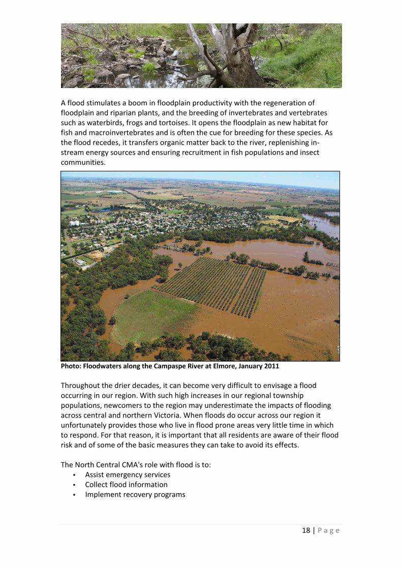
The Campaspe River catchment experienced major flooding in three separate events
in 2010-11. Flooding occurred in September 2010, November 2010 and January
2011. Riverine flooding downstream of the major water storages was progressively
worse in each of the events, with the January 2011 thought to be the largest flood
on record for the township of Rochester, affecting approximately 80% of the town.
Whilst floods can adversely impact properties, machinery, livestock and townships,
flooding is also the key to maintaining the health of both the river and the floodplain.
Transfer of sediments, nutrients and organic material between the river and the
floodplain is vital to the maintenance of both ecosystems.
18 | P a g e
A flood stimulates a boom in floodplain productivity with the regeneration of
floodplain and riparian plants, and the breeding of invertebrates and vertebrates
such as waterbirds, frogs and tortoises. It opens the floodplain as new habitat for
fish and macroinvertebrates and is often the cue for breeding for these species. As
the flood recedes, it transfers organic matter back to the river, replenishing in-
stream energy sources and ensuring recruitment in fish populations and insect
communities.
Photo: Floodwaters along the Campaspe River at Elmore, January 2011
Throughout the drier decades, it can become very difficult to envisage a flood
occurring in our region. With such high increases in our regional township
populations, newcomers to the region may underestimate the impacts of flooding
across central and northern Victoria. When floods do occur across our region it
unfortunately provides those who live in flood prone areas very little time in which
to respond. For that reason, it is important that all residents are aware of their flood
risk and of some of the basic measures they can take to avoid its effects.
The North Central CMA's role with flood is to:
• Assist emergency services
• Collect flood information
• Implement recovery programs

19 | P a g e
Resource Links
Flood studies and plans
North Central CMA
http://www.nccma.vic.gov.au/Water/Floodpla
in_Management/Flood_Studies_and_Plans/in
dex.aspx
Flood Victoria
Victorian Government
www.floodvictoria.vic.gov.au/centric/home.js
p
Water storages
Initial investigations into constructing a dam in the Eppalock region began in 1908,
however it wasn’t until 1960 that works began with construction completed by 1964.
Lake Eppalock is the seventh largest lake in Victoria, covering over 3,000 hectares
and holding more than 300,000 megalitres of water.
Lake Eppalock is an essential asset which forms part of the Central Victorian tourism
industry with a variety of quality recreation options and businesses servicing visitors
to the lake. Management by community and government enables investment and
economic benefit while maintaining the value of the prime purpose of the lake to
supply urban, irrigation and environmental water.
When full, Lake Eppalock holds 304,651 megalitres and in places is over 30 metres
deep. This water is used to supply irrigation and stock and domestic users
downstream as far as Echuca, 90 kilometres away.
As well as supplying raw water for urban treatment, Lake Eppalock also supplies
water to White Swan Reservoir via the Goldfields Super Pipe for use by Central
Highlands Water.
Goulburn-Murray Water controls 82% and Coliban Water controls 18% of the water
in Lake Eppalock.
In addition to Lake Eppalock, Western Water manages the relatively small Woodend
(Campaspe) Reservoir on the Campaspe River at Ashbourne that contributes to the
Woodend water supply.
Coliban Water’s Kyneton Water Reclamation Plant produces Class B water used to
irrigate the Kyneton racecourse, sports grounds and botanic gardens as well as the
extensive irrigation system on site at the water reclamation plant. In winter the
majority of this water is stored in the on-site lagoons awaiting irrigation over
summer or is discharged to the Campaspe River in accordance with the EPA licence.

20 | P a g e
Resource Links
‘Lake Eppalock’
Goulburn Murray Water
http://www.g-mwater.com.au/lakeeppalock
Woodend Reservoir
http://www.westernwater.com.au/wsservices
/Pages/Reservoirlevels.aspx
Campaspe Basin
jGoulburn Murray Water
http://www.g-mwater.com.au/water-
resources/catchments/campaspebasin
Declared water supply catchments
http://www.nre.vic.gov.au/dpi/vro/nthcenreg
n.nsf/pages/nthcen_lwm_cma_dwsc
Lake Eppalock Land and On-Water
Management Plan
http://www.g-
mwater.com.au/downloads/Storages/2_Dec_
13_-
_Lake_Eppalock_Management_Plan_FINAL_-
_for_web.pdf
Wastewater discharge from Kyneton Water
Reclamation Plant
Coliban Water
http://www.coliban.com.au/site/root/your_to
wn/coliban/kyneton.html
River health
The Murray Darling Basin Association Sustainable Rivers Audit in 2012 rated the
health of the Campaspe River ecosystem as very poor.
The Fish community of the Campaspe River system was rated in very poor condition.
The fish community of the Campaspe had reduced numbers of expected native
species and low biomass of those native fish populations present. Alien species
comprised over 90% of the biomass. Native fish recruitment was poor, moderate and
extremely poor in the Upland, Slopes and Montane zones respectively. Large-bodied
native fish were few, and showed no evidence of recruitment.
The Macroinvertebrate community of the Campaspe River system was rated in
moderate condition. The Campaspe Basin ranked 11th of 23 basin valleys in the
Murray Darling Basin for this theme. There was a moderate difference from
reference condition for presence and frequency of occurrence of expected families
in samples from edge and riffle habitats. The proportion of sites in moderate
condition was high (57%) across all zones, and eight of the 33 sites (23%) were rated
in good condition. Family richness was moderate and reduced compared to
reference condition, with Lowland zone site communities being the most diverse.
The riverine Vegetation of the Campaspe River system was rated in extremely poor
condition. The abundance and diversity of Campaspe riverine vegetation was in very
poor condition overall and is notable for the extremely poor condition of the Slopes
zone. The quality and integrity of valley riverine vegetation is in very poor condition

21 | P a g e
overall, with no difference between zones: Upland, Slopes and Lowland zones all
show a very large difference from reference condition.
The Physical Form of the Campaspe River system was rated in moderate condition.
Overall, the valley’s riverine physical form was characterised by channel enlargement
and simplification. There was also indication of elevated sediment loads since
European settlement and associated sedimentation within the Lowland zone river
channel and floodplain. Channel form, bed dynamics and floodplain form indicators
were all moderate and showed minor differences from reference condition. Bank
dynamics were in good (near reference) condition.
The Hydrology of the Campaspe River system was rated in moderate condition. The
mainstem river reaches were generally characterised by a large difference from
reference condition in flow seasonality, moderate alteration in flow variability and
low- and zero-flow events and near to reference condition in high-flow and flow
gross volume. The headwater streams were generally characterised by little or no
alteration in any of these indicators. There was a large difference from reference
condition for the flow regime within channels.
The Campaspe River represents a key reservoir of biodiversity across the Victorian
Riverina and Goldfields bioregions. An important value is the relatively intact River
Red Gum overstorey along lower ISC reaches 1 – 5 (Figure 1). In particular it contains
many vulnerable, threatened or depleted Ecological Vegetation Classes (EVCs)
including Plains Grassland and Riverine Chenopod Woodland.
Resource Links
Sustainable Rivers Audit
Murray Darling Basin Authority
http://www.mdba.gov.au/sites/default/files/S
RA2-SUMMARY-FINAL.pdf
Murray-Darling Basin
Murray Darling Basin Authority
http://www.mdba.gov.au/about-basin
Management of riparian land
Riparian (or riverside) fencing is the simplest way of managing animal access to
waterways to protect water quality and river health values. Fencing riparian zones
improves biodiversity of flora and fauna, reduces erosion and sedimentation and
reduces stock losses.
Whilst there are considerations with fencing out river frontage, such as weed
management, vermin control and fire hazard management, these impacts are all
considered within management agreements to ensure landholders are supported to
improve the health of the waterway.

22 | P a g e
Photo: Official project launch by Hon
Minister Peter Walsh MP, 15 March 2013
at Rochester
The four year (2012-16) ‘Caring for the
Campaspe River’ project is the first large
scale onground works restoration project
to be implemented, delivering river
health improvements for the river.
Funded by the Victorian government, the
project complements the delivery of
environmental flows downstream of Lake
Eppalock. It also complements the
modification of the Echuca stream gauge
(completed in May 2014) to enable the
passage of migratory native fish
upstream from the Murray River.
The overall project target is to improve the condition of 400 ha of riparian vegetation
along the Campaspe River leading to improvements in aquatic and riparian
ecosystem health and fish population viability of the river.
The project area includes the Campaspe River (ISC reaches 1 to 7, see Figure 1), its
aquatic environment and associated species and the adjacent riparian zone. The
Campaspe River tributaries, floodplain and adjacent land use are excluded unless
project work in these areas will have a direct benefit to the Campaspe River.
2012/13 marked the commencement of the project with the establishment of a
Project Reference Group to guide the community engagement activities and
prioritisation of on-ground works throughout the life of the project. This group
meets quarterly and contains representatives of the community, Indigenous groups,
local government and Goulburn-Murray Water.
July 2013 marked the beginning of three years of onground implementation of
fencing, weed control and revegetation works on both private and public land along
the river.
Earlier in 2013, 650 landholders along the entire river were contacted directly (with
the assistance of local government) regarding opportunities to be involved in the
project. The onground output targets for the project include:
• 80km of riparian fencing
• 163ha of woody weed control
• 48ha of willow control
• 80ha of revegetation
• community engagement activities

23 | P a g e
Over 130 individual landholders from along the length of the river expressed an
interest in being involved in the project with which the North Central CMA is
progressively working with.
Acknowledging that there is more demand than current funding levels, the North
Central CMA is also working together with Landcare and community groups to
support complementary works along the river through other funding opportunities.
In this way, community groups can also benefit from the project with boosted
membership and positive partnership projects.
Resource Links
Caring for the Campaspe
North Central CMA
http://www.nccma.vic.gov.au/Water/Rivers/C
ampaspe_River/index.aspx
Managing riparian widths to achieve multiple
objectives
Land & Water Australia
http://lwa.gov.au/files/products/river-
landscapes/pf040748/pf040748.pdf
Managing riparian land
Land & Water Australia
http://lwa.gov.au/files/products/river-
landscapes/pf020253/pf020253.pdf
Crown land water frontages
Department of Environment and Primary
Industries
http://www.dse.vic.gov.au/property-titles-
and-maps/managing-crown-land/managing-
crown-land-fact-sheets/managing-crown-land-
fact-sheet-crown-land-water-frontages
Invasive plants and animals
Invasive (pest) plants and animals are a major cause of degradation to North Central
Victoria’s natural resources – our land, water, biodiversity and farmland assets. Their
effective management is crucial to the environmental, economic and social
wellbeing of our region.
All natural resource management practitioners have a duty of care to minimise the
negative impact of invasive species on our natural assets. The North Central Invasive
Plants and Animals Strategy (2010-15) was prepared to reflect Australian and
Victorian biosecurity approaches to managing the risk and impact of invasive species
across all land tenures.
A biosecurity approach combines species-led and asset-based approaches to invasive
species management to achieve the most beneficial community outcomes from
government investment. The North Central Invasive Plants and Animals Strategy
adopts the biosecurity approach and sets clear goals and actions for invasive species
management. It was developed with the input of natural resource management
agencies and the community. It outlines high-risk invasive species and priority
24 | P a g e
natural assets under threat from invasive species in North Central Victoria, and
highlights the importance of coordinated action and community engagement in
tackling these issues.
Importantly, the strategy also recognises that there are many other invasive species
that are not considered to be of high biosecurity risk, but which pose significant
problems on a local or regional scale.
The control of weeds is important for the health of the Campaspe River, which itself
provides provides a pathway for the spread of invasive species via seed and debris
carried by water (including floodwater).
Willows in particular have a significant impact on river health and can increase
erosion, consume a substantial amount of water and provide very little habitat value
for our native animals, fish and water bugs, compared to native plants. They also
restrict access for recreational activities such as fishing and boating.
Management of weed species has benefits for both public and private land.
Weed management helps to create an opportunity for native plant species to re-
colonise areas previously dominated by invasive weeds; increase biodiversity values;
prevent the further spread of invasive species; improve structure and function of
land-based and aquatic ecosystems; increase community enjoyment and amenity
values; and increase land productivity and value.
The distribution of weeds along the Campaspe River is largely linked to rainfall. The
upper catchment has comparatively higher rainfall and is associated with woody
weeds such as willow, gorse, blackberry, broom and hawthorn. The observed extent
of Texas Needle Grass along the riparian corridor has also increased since the 2010-
11 flood events.
Riparian weeds in the relatively drier lower catchment include olive trees, wild fruit
trees, peppercorns, date palms, briar rose and pasture grasses.
Invasive animals of concern along the Campaspe River that are within the scope of the
North Central Invasive Plants and Animals Strategy (2010-15) are rabbits, foxes, hares,
feral goats, deer, cats and pigs. Exotic fish known to occur in the lower Campaspe River
include:
• Carp Cyprinus carpio
• Gambusia Gambusia holbrooki
• Goldfish Carassius auratus
• Redfin Perch Perca fluviatilis

25 | P a g e
In addition to Carp and Goldfish, the upper Campaspe River also includes the
following exotic fish:
• Rainbow Trout Oncorhychus mykiss
• Brown Trout Salmo trutta
Resource Links
NCCMA Invasive Plants and Animals Strategy
2010-2015
North Central CMA
http://www.nccma.vic.gov.au
‘Willows in the North Central region’- Strategic
Action Plan
North Central CMA
www.nccma.vic.gov.au
Weeds of National significance –Willows
www.weeds.org.au/WoNS/willows/resources.
htm
Victorian Gorse Taskforce
www.vicgorsetaskforce.com.au/
Gorse –Weeds of National Significance
www.weeds.org.au/WoNS/gorse/
Gorse National Best Practice Manual
http://bit.ly/WCF8xW
Victorian Blackberry Taskforce
www.vicblackberrytaskforce.com.au/
Blackberry control manual
http://bit.ly/Zcp0jm
Identifying weeds
www.weeds.gov.au/weeds/lists/wons.html
Controlling carp
Landline
http://www.abc.net.au/landline/content/201
2/s3550676.htm
Information about carp
http://www.dpi.nsw.gov.au/fisheries/pests-
diseases/freshwater-
pests/species/carp/general-information
Native flora and fauna
Native flora
The Campaspe River represents a key reservoir of biodiversity across the Victorian
Riverina and Goldfields bioregions. An important value is the relatively intact River
Red Gum overstorey along the lower ISC reaches 1 – 5 (see Figure 1). In particular, it
contains many vulnerable, threatened or depleted Ecological Vegetation Classes
(EVCs) listed below.
• No 56 Floodplain Riparian Woodland (Vulnerable)
• No 132 Plains Grassland (Endangered)
• No 803 Plains Woodland (Endangered)
• No 74 Wetland Formation (Endangered)
• No 168 Drainage-line Aggregate (Endangered)
• No 106 Grassy Riverine Forest (Depleted)
• No 823 Lignum Swampy Woodland (Vulnerable)
• No 267 Plains Grassland/Plains Grassy Woodland/GilgaiWetland Mosaic
(Endangered)
• No 235 Plains Woodland/Herb-rich Gilgai Wetland Mosaic (Endangered)
26 | P a g e
• No 103 Riverine Chenopod Woodland (Vulnerable)
• No 295 Riverine Grassy Woodland (Vulnerable)
• No 814 Riverine Swamp Forest (Depleted)
The following threatened flora species are found along the riparian corridor of the
Campaspe River:
• Buloke Allocasuarina luehmannii, listed under Flora and Fauna Guarantee
(FFG) Act 1988
• Australian Anchor Plant Discaria pubescens, rare in Victoria
• Tufted Hair-grass Deschampsia caespitose, rare in Victoria
Native fauna
Many threatened fauna species also utilise the riparian habitat along the Campaspe
River, including:
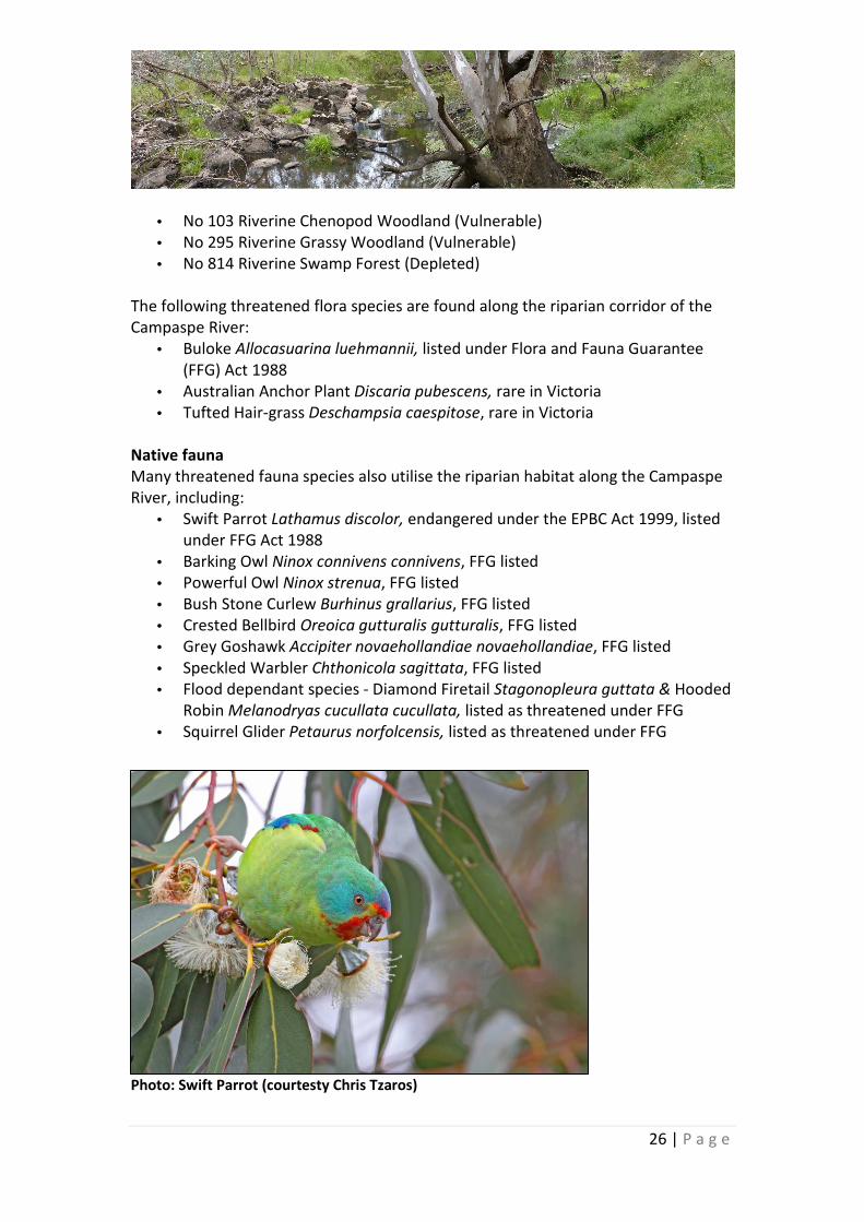
• Swift Parrot Lathamus discolor, endangered under the EPBC Act 1999, listed
under FFG Act 1988
• Barking Owl Ninox connivens connivens, FFG listed
• Powerful Owl Ninox strenua, FFG listed
• Bush Stone Curlew Burhinus grallarius, FFG listed
• Crested Bellbird Oreoica gutturalis gutturalis, FFG listed
• Grey Goshawk Accipiter novaehollandiae novaehollandiae, FFG listed
• Speckled Warbler Chthonicola sagittata, FFG listed
• Flood dependant species - Diamond Firetail Stagonopleura guttata & Hooded
Robin Melanodryas cucullata cucullata, listed as threatened under FFG
• Squirrel Glider Petaurus norfolcensis, listed as threatened under FFG
Photo: Swift Parrot (courtesty Chris Tzaros)

27 | P a g e
Photo: Murray-Darling Rainbowfish
It also supports a range of aquatic fauna including platypus, water rats and fish. The
Campaspe River is considered to have a high density of large wood instream,
providing good habitat for native fish. Specific migratory native fish in the Campaspe
River include Murray Cod, Silver Perch and Golden Perch. Non – migratory native
species include Flathead gudgeon, Southern Pygmy Perch, Mountain Galaxias, River
Blackfish, Australian gudgeon and Murray-Darling rainbowfish. Many of these fish
species are listed as vulnerable, threatened or endangered:
• Golden Perch Macquaria ambigua,
vulnerable under FFG
• Murray Cod Maccullochella peelii peelii,
vulnerable under EPBC & threatened
under FFG
• Silver Perch Bidyanus bidyanus , listed as
threatened under FFG
• Trout Cod Maccullochella
macquariensis, listed as endangered
under EPBC threatened under FFG
• Murray Spiny Crayfish Euastacus
armatus, FFG listed
• Murray-Darling Rainbowfish
Melanotaenia fluviatilis FFG listed
• Macquarie Perch Macquaria australasica, listed as endangered under EPBC
and FFG listed
Resource Links
Wildlife of the Box Ironbark Forest
www.publish.csiro.au/samples/Box%20Ironba
rkSample.pdf
VicVeg Online
http://www.vicveg.net.au/vvHome.aspx
Native Vegetation Plan
North Central CMA
http://bit.ly/Zu0iyb
Advisory lists of rare or threatened plants and
animals in Victoria
Department of Environment and Primary
Industries
http://www.depi.vic.gov.au/environment-
and-wildlife/threatened-species-and-
communities/flora-and-fauna-guarantee-act-
1988/protected-flora-controls
Fish stocking in our waterways
Department of Environment and Primary
Industries
http://www.depi.vic.gov.au/fishing-and-
hunting/recreational-fishing/fish-stocking
Platypus and Water rats
Australian Platypus Conservancy
http://www.platypus.asn.au/

28 | P a g e
Erosion control and sustainable soils
Australian soils have been subject to severe degradation ever since European settlers
cleared the land and began developing it for agriculture.
Whilst Australia has long been a land of droughts and flooding rains highly variable
climatic conditions have been much more prevalent with the onset of a protracted
drought in the mid- 1990s. These climatic extremes leave the land much more
susceptible to degrading processes that include wind and water erosion.
The soils of northern Victoria are subject to considerable pressures as farmers strive
to achieve profitable agricultural enterprises in the face of highly variable climatic
conditions, increasing market demands, and escalating production costs.
The economic value in protecting one of our most precious resources is enormous.
Protecting our soils from erosion and improving soil structure will have added
benefits right through the economy; from farmer to the consumer.
The Eppalock catchment in 1960 presented the former Soil Conservation Authority
(SCA) with a unique challenge in soil conservation extension. Although there was the
opportunity of undertaking a major soil conservation programme on a whole
catchment basis, the Authority was also faced with some definite handicaps in
undertaking this large works programme and associated extension activities.
Photo: Land degradation in the Campaspe catchment pre 1960
The Soil Conservation Authority developed a policy of assistance to landholders, and
two types of works are involved to address the siltation threat to the proposed Lake
Eppalock water storage. This included productive work, embracing general
improvement in land use and management. This productive approach aimed to
return value to the farmers for the capital and effort they put into their properties.
Second, non-productive works, which included erosion control structures, stopping

29 | P a g e
gully heads, fencing to keep out stock, putting in silt traps, planting of trees and
vegetation to stop gullies.
The Eppalock Management Project was a remarkable example of successful rural
extension both in regard to its magnitude and results.
Resource Links
Riparian Land Management Technical
Guidelines. Volume One: Principles of Sound
Management. Chapter 6.
Land and Water Resources Research and
Development Corporation (LWRRDC).
http://bit.ly/YpYzYn
Eppalock Catchment Project
Department of Environment and Primary
Industries
http://www.nre.vic.gov.au/dpi/vro/nthcenreg
n.nsf/pages/nthcen_lwm_eppalock
‘Farming for Sustainable Soils’ Factsheet
North Central CMA
http://bit.ly/XoFsh7
‘Land degradation and erosion’
Department of Primary Industries
www.nre.vic.gov.au/dpi/vro/nthcenregn.nsf/p
ages/nthcen_lwm_ld
Community
The North Central CMA works with community groups and individuals to protect and
improve rivers and the natural environment in north central Victoria by undertaking
projects to restore river health whilst funding on-ground works to protect and
improve the environment.
North central Victoria has unique and sometimes complex social, economic and
environmental values. In undertaking our role the North Central CMA recognises our
responsibility to consult and work with local communities to look after the region’s
precious waterways and the surrounds for the use and enjoyment for future
generations.
The communities that live along and near the Campaspe River have a strong
association and affinity for the river and its natural and social values. Many
landholders are committed to caring for and enhancing the river environment as
indicated by the interest in fencing, revegetation and weed control incentives as part
of the Caring for the Campaspe (2012-16) project delivered by the North Central
CMA.

30 | P a g e
There are ten active Landcare and community groups along the river’s length. These
include:
• Ashbourne Landcare
• Carlsruhe Landcare
• Campaspe River Walk Committee (Kyneton)
• Langley Landcare
• Campaspe Valley Landcare
• Upper Campaspe Landcare Network
• Axedale Our Town Our Future
• Longlea & District Landcare
• Rochester River Reserve Committee
• Strathallan Family Landcare
• Echuca Landcare
In addition, there are several angling clubs, recreation clubs, such as golf courses and
racecourses, field naturalists and Field and Game groups with interests in and
alongside the Campaspe River.
There are also many primary and secondary schools located along the river’s length,
many of which are involved in regular water quality monitoring through the
Waterwatch River Detectives program delivered by the North Central CMA.
People who love and depend on the Campaspe River have many memories and
insights to share – of the river in flood, of the marvellous flora and fauna, and of the
peace and tranquillity the river provides.
Take a minute to explore the Campaspe River through the eyes of these river
champions…
Resource Links
Campaspe River ‘champions’
Environment Victoria
http://environmentvictoria.org.au/index.php?
q=content/campaspe-river
Axedale Our Town Our Future
http://www.axedalevictoria.net/project-
platypus.html
Victorian Landcare Gateway
http://www.landcarevic.net.au/
Waterwatch River Detectives
North Central CMA
http://www.nccma.vic.gov.au/Water/Waterw
atch/Education/index.aspx

31 | P a g e
Recreation, fishing and tourism
The Campaspe River is particularly valued for fishing, boating, camping and passive
recreation. The Campaspe Weir pool near Elmore holds particularly high social value
for passive recreation (fishing & caravanning). Other popular sites include Turpins
Falls (swimming, kayaking), English's and Barnadown bridges (camping, fishing) and
Rocky Crossing Reserve (kayaking, camping). The river is a key feature of many towns
along its length with community groups supporting enhancement works in Kyneton,
Axedale, Elmore, Rochester and Echuca for passive recreation and tourism
opportunities.
Photo: Turpins Falls, Langley Photo: Summer swimming at Turpins Falls
Lake Eppalock, in the heart of the Goldfields, is central Victoria’s largest water
storage. Known as the “sailing centre of Central Victoria” the lake plays host to
regular events throughout the year, including power boat racing. Around 40 sites
around Lake Eppalock are now occupied by social clubs and commercial caravan
parks.

32 | P a g e
Resource Links
Campaspe River fishing
Department of Environment and Primary
Industries (DEPI)
http://www.depi.vic.gov.au/fishing-and-
hunting/recreational-fishing/fishing-
locations/northern-victoria-inland-fishing-
maps/campaspe
Lake Eppalock recreation
Goulburn Murray Water
http://www.g-mwater.com.au/water-
resources/storages/campaspe/lakeeppalock
Turpins Falls
http://victorianwaterfalls.com/turpins.html
O’Keefe Rail Trail
Bendigo Tourism
http://www.bendigotourism.com/images/doc
uments/okeefe_rail_trail.pdf
Search ‘Campaspe River’
Parks Victoria
http://parkweb.vic.gov.au/
Axedale Our Town Our Future
http://www.axedalevictoria.net/project-
platypus.html
Kyneton river walk
Macedon Ranges Shire Council
http://www.mrsc.vic.gov.au/Arts_Sport_Leisu
re/Healthy_Lifestyles/Walking_Routes_and_M
aps
Local government in the Campaspe
catchment Shire of Campaspe
www.campaspe.vic.gov.au
City of Greater Bendigo
www.bendigo.vic.gov.au
Mount Alexander Shire Council
www.mountalexander.vic.gov.au/
Mitchell Shire Council
www.mitchellshire.vic.gov.au
Macedon Ranges Shire Council
www.mrsc.vic.gov.au