caledon hills 'historical hike series'...
TRANSCRIPT

Caledon Hills 'Historical Hike Series' Badge
Celebrating Canada's 150th Birthday
To earn this special 150th birthday badge you must complete all the hikes listed below, either on your own or on an organized hike. You will have fun looking for the location of the required photo location/ item, to be included when you send in your log for each hike. Kilometre references are taken from the Bruce Trail Reference Edition #28. Once you have completed all five hikes, send your hiking log and photos (including the date and who you hiked with), along with $5 to the address listed below. Alternatively, you can email your photos and hike log to [email protected] if this would be a more convenient option. Marilyn Ross 6 Lombardy Cr. Brampton ON L6S 4L8
We want you to get social with us! For a chance for your photos to be featured on our Instagram and Facebook pages, tag us, or use the #caledonbrucetrail hashtag when posting photos from your hikes.
1. McLaren Road Side Trail Loop Hike: Maps 14 &15 Distance: Approx. 11 km loop Park: Roadside parking on Forks of the Credit Road near Dominion Street (km 8.8) Hike:
• Along Dominion Street to km 10.0 • Take the Dorothy Medhurst Side Trail to km 15.7 of the main Trail • Follow the main Trail to km 16.8 and then take the McLaren Road Side Trail to
km 5.1 of the main Trail • Follow the main Trail back to the roadside parking along Forks of the Credit Rd. • Optional: If you are interested, check out the Ring Kiln Side Trail before heading
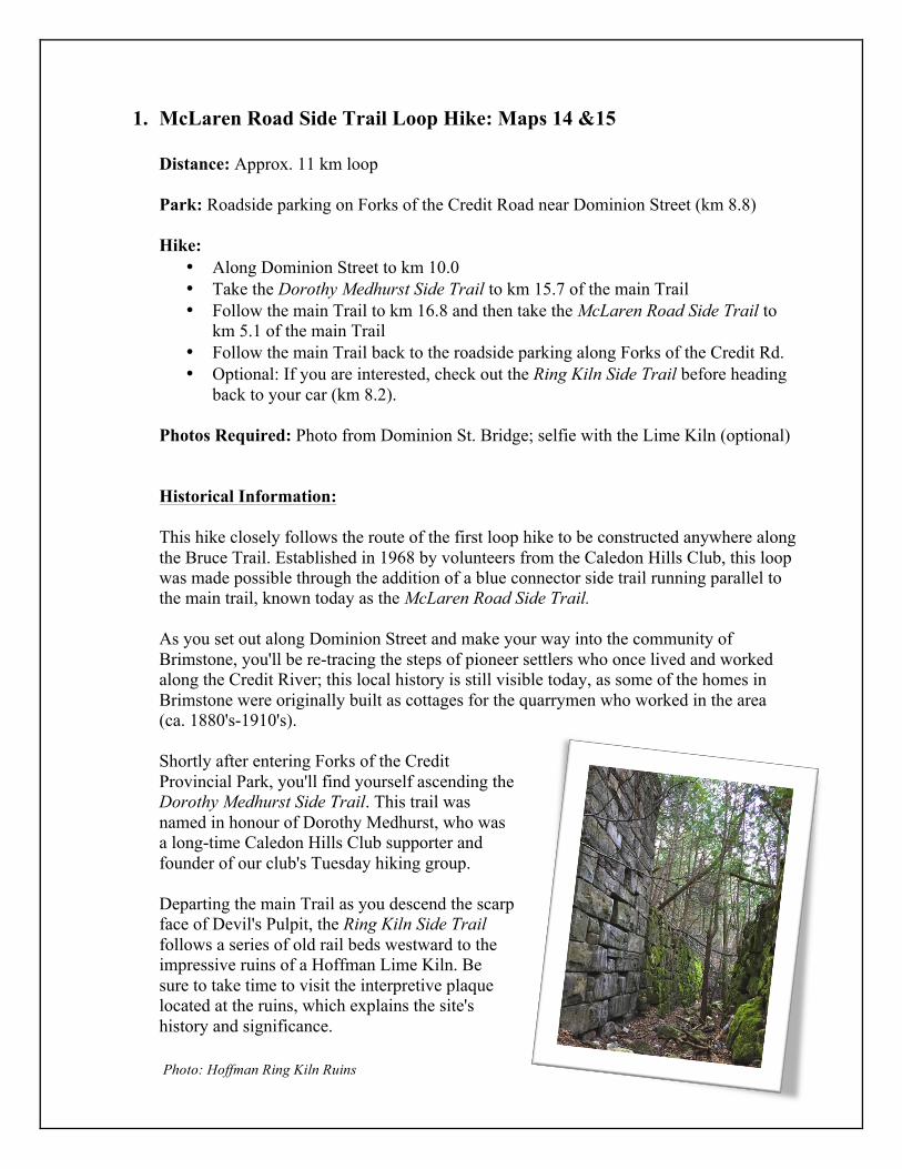
back to your car (km 8.2). Photos Required: Photo from Dominion St. Bridge; selfie with the Lime Kiln (optional) Historical Information: This hike closely follows the route of the first loop hike to be constructed anywhere along the Bruce Trail. Established in 1968 by volunteers from the Caledon Hills Club, this loop was made possible through the addition of a blue connector side trail running parallel to the main trail, known today as the McLaren Road Side Trail. As you set out along Dominion Street and make your way into the community of Brimstone, you'll be re-tracing the steps of pioneer settlers who once lived and worked along the Credit River; this local history is still visible today, as some of the homes in Brimstone were originally built as cottages for the quarrymen who worked in the area (ca. 1880's-1910's). Shortly after entering Forks of the Credit Provincial Park, you'll find yourself ascending the Dorothy Medhurst Side Trail. This trail was named in honour of Dorothy Medhurst, who was a long-time Caledon Hills Club supporter and founder of our club's Tuesday hiking group. Departing the main Trail as you descend the scarp face of Devil's Pulpit, the Ring Kiln Side Trail follows a series of old rail beds westward to the impressive ruins of a Hoffman Lime Kiln. Be sure to take time to visit the interpretive plaque located at the ruins, which explains the site's history and significance.
Photo: Hoffman Ring Kiln Ruins
2. Hockley Valley Hike: Map 18 Distance: Approx. 10 km loop Park: In the parking lot on Hockley Road, just east of 2nd Line EHS. Hike:
• West along Hockley Road using the Hockley Road Side Trail, to meet the main Trail as it enters the Hockley Valley Provincial Nature Reserve
• Follow the main Trail to km 62.5 and then take the Tom East Side Trail to the main Trail at km 64.7
• Follow the main Trail to km 65.7 and take the Isabel East Side Trail • From km 66.5 of the main Trail, head back along the main trail to km 62.5 • Return to the parking lot via the Hockley Road Side Trail
Photos Required: '39 Chevy sedan; William Thomas Allen's bench; Jeju Olle Trail Marker
Historical Information: This hike follows the route of the Jeju Olle Bruce Trail Friendship Trail, which is twinned with Route #2 of the Jeju Olle Trail in South Korea. Officially opened in September 2011, this friendship trail consists of the Tom East Side Trail, Isabel East Side Trail, Glen Cross Side Trail and the main Trail to form a 9.6 km double loop. Tom & Isabel East were both long-serving club volunteers, taking on many different roles and projects over the years. Tom was the Caledon Hills Club president from 1965-1969, later becoming BTC president; he laid out much of the Caledon section during the 1960’s. Before becoming involved with the Caledon Hills Club in 1966, Isabel was club secretary for the Sydenham Bruce Trail Club. In 1970 she would become the fourth president of the Caledon Hills Club. Tom and Isabel met on the Trail. Their interest was sparked in 1968 on a hike in the northern section of the Bruce Peninsula. From that contact their relationship grew and in 1975 they were married along the Trail at the Belfountain Community Church. As you travel along the Isabel East Side Trail be sure to take a few minutes to pause and sit on the bench that overlooks the meadow. A few years ago Laurence Christie, long-time Caledon Hills volunteer, built this bench because it was one of his favourite view spots, especially in the late afternoon. It was also constructed to honour the farmer who worked on this land in the early 1900s. William Thomas Allen, along with his wife Minnie, bought the farm where our trail passes through in 1914. William operated a threshing machine business for over 40 years and was regarded by many to
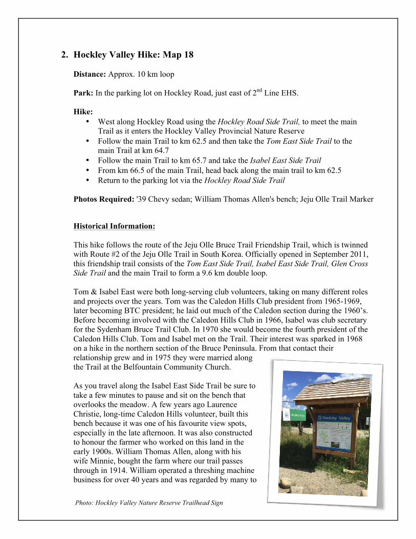
Photo: Hockley Valley Nature Reserve Trailhead Sign
be a good friend and a wonderful neighbour. All that remains of the farm now are the foundation stones of the old barn; a depression in the ground where the house likely stood, beside which are a few lilacs; and out in the farm meadow beside our trail, the remains of the old binder rusting away in the sumacs. The dedication on the bench is to William Thomas Allen (1873-1947). The abandoned car that you'll come across as you return on the main Trail has long been a topic of discussion amongst hikers. Where exactly did it come from, and how did it get to where it currently rests? Thanks to club archivist Helen Billing, we've recently come across an article penned by Bill Taylor, which reveals the origins of this '39 Chevy sedan. Prior to the creation of the Hockley Valley Nature Reserve in the 1970's, this part of the Nature Reserve was owned and farmed by the Nevett family. The car in question was purchased by the family in approximately 1951, and was used until it broke down on the way home from a family vacation in the summer of 1956. Stored in the barnyard for a few years, the car came to its current resting place sometime between 1959 and1961. With ways to dispose of unwanted vehicles limited at that time, moving cars and broken down machinery out of sight and out mind was a common practice (which you'll notice as you hike the length of the Bruce Trail).
3. Glen Haffy Hike: Map 17 Distance: Approx. 11 km car shuttle hike; you must park a car at each end of the hike. Park: Roadside parking at Finnerty Sideroad and Innis Lake Road. Hike: From km 33.8 of the main Trail to km 44.4 at the 7th Line parking lot. Photo Required: Oak Ridges Moraine Trailhead Sign
Historical Information: Irish immigrants of both Protestant and Catholic backgrounds began settling this area around 1825. Much like today, the area had steep hills and river valleys at that time, making it difficult to farm. Two of the earliest settlers in this area were James Killeen and Michael Finnerty. They each settled near what today would be s the intersection of Finnerty Sideroad & Airport Road, and their business ventures would help to establish the hamlet of Sleswick in the years to come. Finnerty operated an inn, while Killeen gradually established a tavern, store and smithy. By 1873 the community would grow in size to approximately 60 inhabitants.
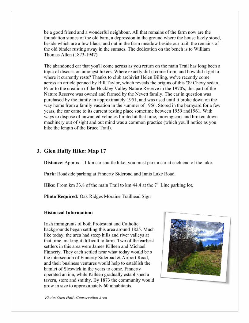
Photo: Glen Haffy Conservation Area
4. Belfountain & Cataract Falls Hike: Map 14 Distance: Approx. 12 km loop Park: Belfountain Conservation Area Hike:
• Along the Trimble Side Trail to Forks of the Credit Road, continuing on until you reach the main Trail at Dominion Street
• Hike along the main Trail from km 8.8 to km 11.3 • Continue hiking towards the Cataract Falls and then retrace your route to return to
the your cars in Belfountain Conservation Area
Photos Required: Forks of the Credit & Brimstone 'Heritage Caledon' signs; a view of Cataract Falls from the trail.
Historical Information: The Trimble Side Trail is named after Roy and Eleanor Trimble, local residents and founding members of the Caledon Hills Club.
Did you know that the Cataract Falls were once known as Church’s Falls? In 1858 Richard Church purchased a town site and named his hamlet Church's Falls. The falls, with their width of 9 m and drop of 14 m, were a very valuable purchase. Before long a sawmill, a woollen mill and a grist mill were all in operation. Church divided the town site into 160 lots and named the streets after his children.
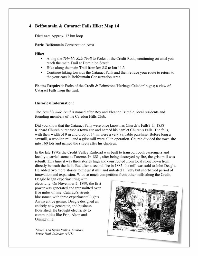
In the late 1870s the Credit Valley Railroad was built to transport both passengers and locally quarried stone to Toronto. In 1881, after being destroyed by fire, the grist mill was rebuilt. This time it was three stories high and constructed from local stone hewn from directly beneath the falls. But after a second fire in 1885, the mill was sold to John Deagle. He added two more stories to the grist mill and initiated a lively but short-lived period of innovation and expansion. With so much competition from other mills along the Credit, Deagle began experimenting with electricity. On November 2, 1899, the first power was generated and transmitted over five miles of line; Cataract's streets blossomed with three experimental lights. An inventive genius, Deagle designed an entirely new generator, and business flourished. He brought electricity to communities like Erin, Alton and Orangeville.
Sketch: Old Hydro Station, Cataract, Bruce Trail Calendar (1978)

But the flood of 1912 wiped out Deagle's plans for expansion (and Dominion Road). As well, the clearing of the forests upstream had lowered the water table, and the resulting water shortages forced the installation of costly generators. In 1947 the Cataract plant was finally shut down, and with the dam dynamited, the millpond disappeared down the river. In close to 50 years of service, few interruptions were ever experienced by Cataract power subscribers, an enviable record for a handful of men sweating to keep the plant alive twenty-four hours a day.
5. Gosling Volunteer Forest Hike: Map 18 Distance: Approx. 9 km car shuttle hike. You must park a car at each end of the hike.
Park: 7th Line Parking Lot (east of Airport Rd, just north of Hwy 9 & south of 5 Sideroad) Hike:
• From the parking lot (km 44.4) hike north on the main Trail to km 53.0 and then take the Hemlock Ridge Side Trail to the parking lot just south of Hockley Rd.
Photos Required: Gosling Forest Dedication Plaque; Dave & Sally's Pinnacle Signs
Historical Information: The Philip Gosling Volunteer Forest was opened on Sept 27th, 2009 and is named after the first President of the Caledon Hills Club, who was also one of the Trail's founders. This forest honours the spirit of volunteering that is the lifeblood of the Bruce Trail Conservancy. Dave’s Pinnacle and Sally’s Pinnacle are located along the Hemlock Ridge Side Trail and were created to honour the outstanding contributions that these two individuals have made to the Trail and Caledon Hills Club.
Sources: Bruce Trail Reference Guide, ed. 28 Caledon Comment (archived editions) Christie, Laurence. "Laurence's Bench," Caledon Comment, Fall 2011. Scheinman, Andre. "Irish Settlement of Northwest Albion," Cultural Heritage Landscapes Inventory: Town of Caledon, Section 9, Pages 1-10, https://www.caledon.ca/en/live/ resources/ Cultural_Heritage_Landscapes_Inventory_Report-Section9.pdf. Taylor, Bill. "Mystery Solved! How I tracked down the owner of this Abandoned Classic," Wheels.ca, June 16th, 2013, http://www.wheels.ca/news/mystery-solved-how-i-tracked-down-the-owner-of-this-abandoned-classic/.