brown, justin, geoengineers, inc., integrating gis into environmental field work, 2015 mecc-kc
TRANSCRIPT

Justin Brown, RG, GeologistMay 13, 2015 | MECC Seasoned Staff Update
Integrating GIS into Environmental Field Work

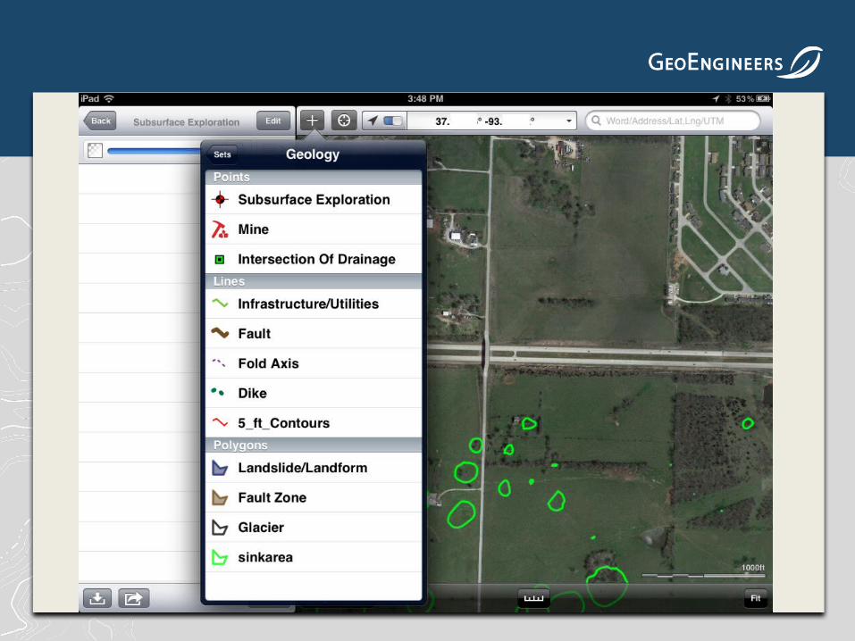
ArcGIS Collector


ArcGIS Collector Pros and Cons
• Pros─ Can easily add pre-defined attribute information to mapped features─ Wide range of user-defined feature class options─ Can be used with external Bluetooth-enabled external GPS─ Automatic data upload to Cloud ─ Supports sampling teams─ Can be used with different types of feature classes (line, point, polygon)─ Real-time monitoring of sample collection by sampling team─ For Android or Apple devices
• Cons─ Expensive/difficult to deploy─ Required dedicated GIS staff─ Requires training for field technicians─ Cannot add attributes on-the-fly─ Requires cellular or WiFi data connection
Map It GIS Data Collector


Map It Pros and Cons
• Pros─ Inexpensive─ Can easily add pre-defined attribute information to mapped features─ Wide range of user-defined feature class options─ Can be used with external Bluetooth-enabled external GPS─ Easy data exports to limited file types─ Offline map caching─ Offline data collection─ For Android or Apple devices
• Cons─ Difficult to set up and use─ Requires training for field technicians─ Cannot add attributes on-the-fly─ No automatic Cloud backup─ Single user only, cannot be used by a sampling team─ Works well with points data only
GISPro For IOS

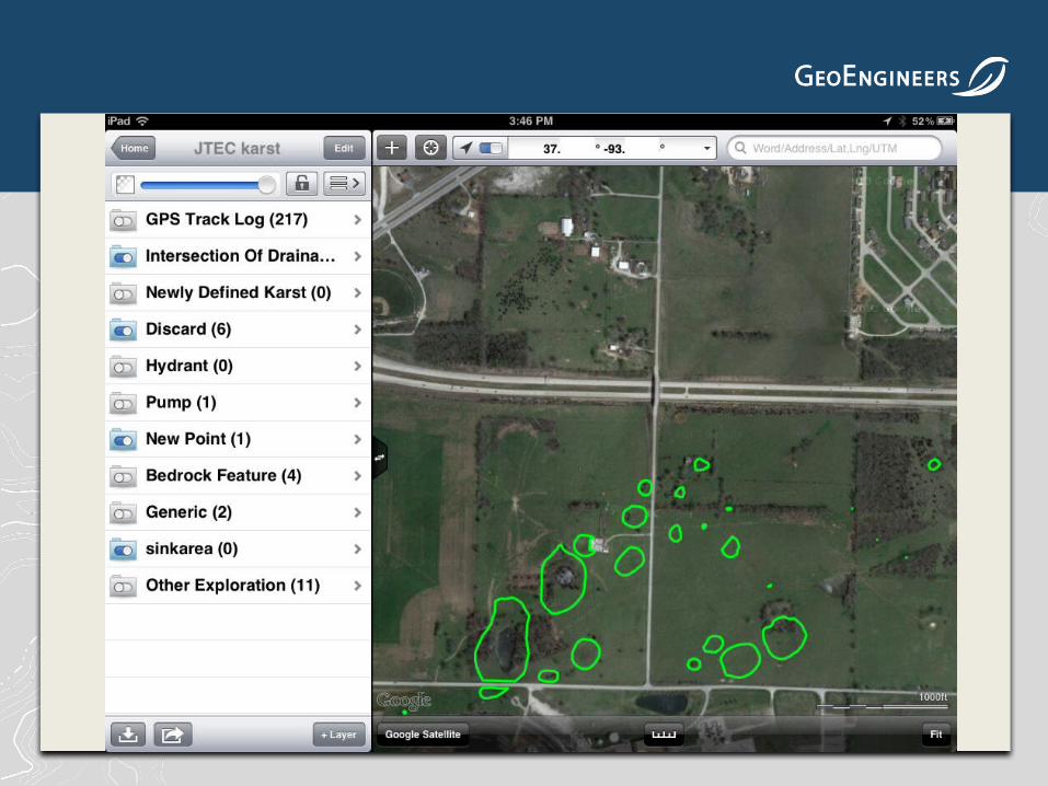
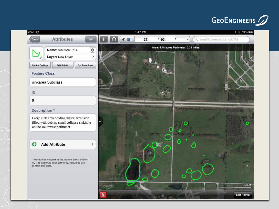


GISPro Pros and Cons
• Pros─ Can collect many types of mapping data─ Can easily add attribute information to mapped features─ Wide range of pre-defined and user-defined feature class options─ Can be used with external Bluetooth-enabled external GPS─ Easy data exports to multiple file types
• Cons─ Expensive to fully utilize─ Requires GIS background or training for field technicians─ For Apple only─ Recent IOS updates cause the program to crash─ Needs a lot of computing power and available memory─ No automatic Cloud backup
