brittany farm - biederman real estate
TRANSCRIPT
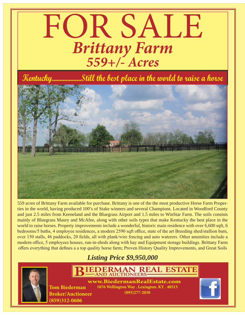
FOR SALEBrittany Farm
559+/- AcresKentucky...................Still the best place in the world to raise a horse
. 559 acres of Brittany Farm available for purchase. Brittany is one of the the most productive Horse Farm Proper-ties in the world, having produced 100’s of Stake winners and several Champions. Located in Woodford County and just 2.5 miles from Keeneland and the Bluegrass Airport and 1.5 miles to WinStar Farm. The soils consists mainly of Bluegrass Maury and McAfee, along with other soils types that make Kentucky the best place in the world to raise horses. Property improvements include a wonderful, historic main residence with over 6,600 sqft, 6 bedrooms/5 baths, 4 employee residences, a modern 2590 sqft office, state of the art Breeding shed/stallion barn, over 150 stalls, 46 paddocks, 20 fields, all with plank/wire fencing and auto waterers. Other amenities include a modern office, 5 employees houses, run-in-sheds along with hay and Equipment storage buildings. Brittany Farm offers everything that defines a a top quality horse farm; Proven History Quality Improvements, and Great Soils
Listing Price $9,950,000
www.BiedermanRealEstate.comTom BiedermanBroker/Auctioneer(859)312-0606
1076 Wellington Way . Lexington. KY . 40513 (895)277-2030
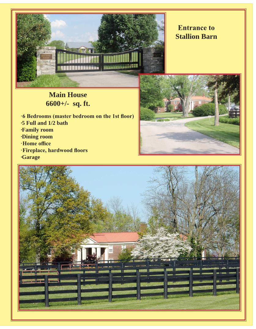
·6 Bedrooms (master bedroom on the 1st floor)·5 Full and 1/2 bath·Family room·Dining room·Home office·Fireplace, hardwood floors·Garage
Main House6600+/- sq. ft.
Entrance to Stallion Barn
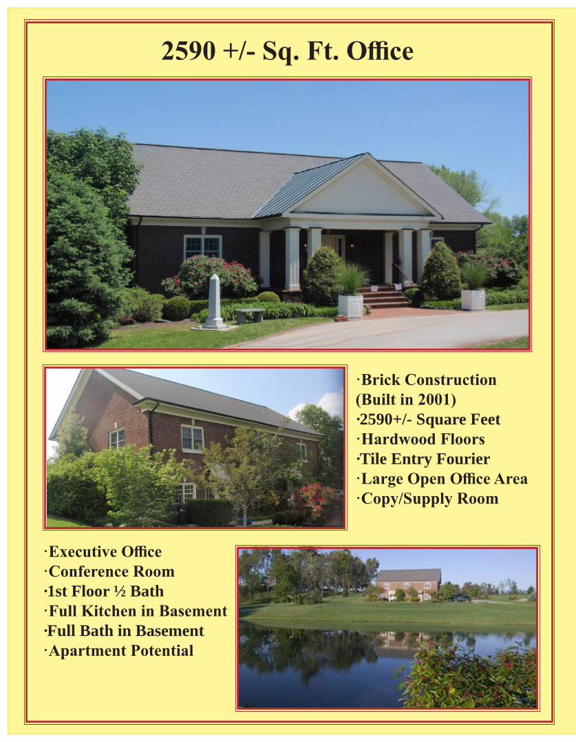
2590 +/- Sq. Ft. Office
·Brick Construction (Built in 2001)·2590+/- Square Feet·Hardwood Floors·Tile Entry Fourier·Large Open Office Area·Copy/Supply Room
·Executive Office·Conference Room·1st Floor ½ Bath·Full Kitchen in Basement·Full Bath in Basement·Apartment Potential
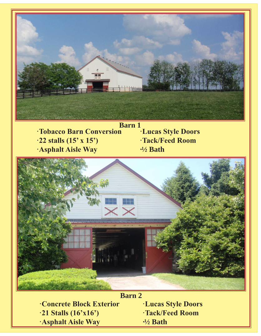
·Tobacco Barn Conversion ·22 stalls (15’ x 15’)·Asphalt Aisle Way
·Lucas Style Doors·Tack/Feed Room·½ Bath
Barn 1
·Concrete Block Exterior·21 Stalls (16’x16’)·Asphalt Aisle Way
·Lucas Style Doors·Tack/Feed Room·½ Bath
Barn 2
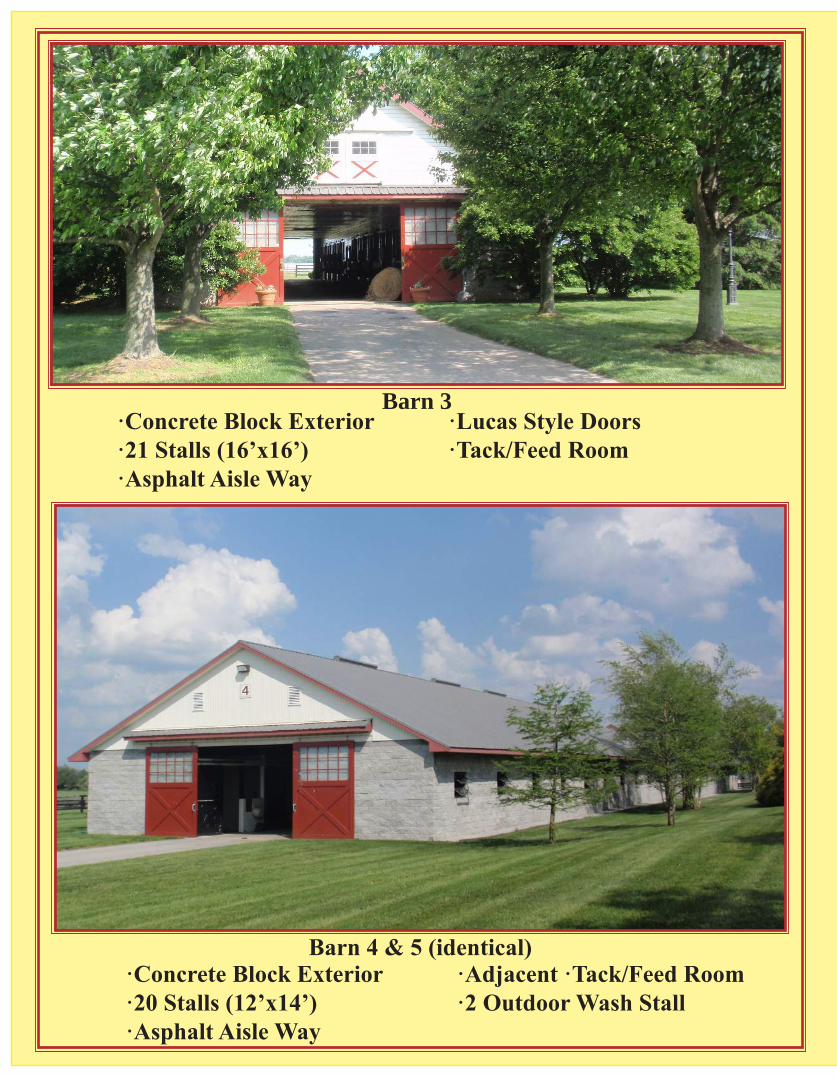
·Concrete Block Exterior·21 Stalls (16’x16’)·Asphalt Aisle Way
·Lucas Style Doors·Tack/Feed Room
Barn 3
·Concrete Block Exterior·20 Stalls (12’x14’)·Asphalt Aisle Way
·Adjacent ·Tack/Feed Room·2 Outdoor Wash Stall
Barn 4 & 5 (identical)
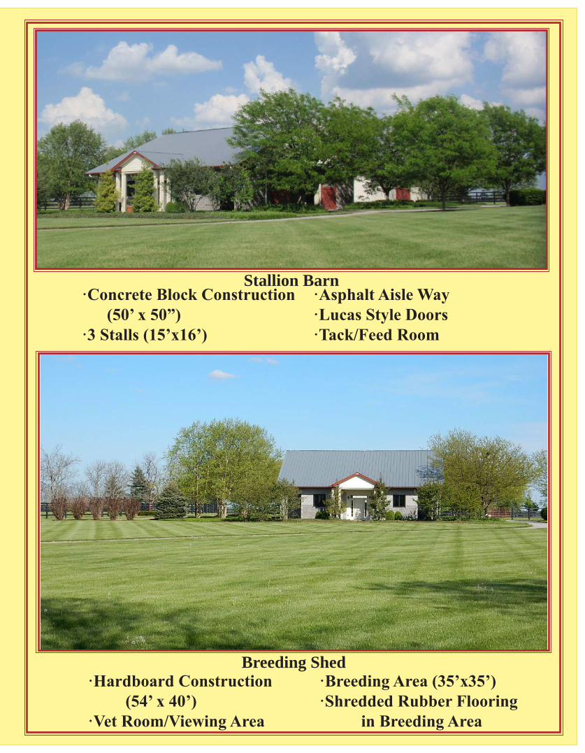
·Concrete Block Construction (50’ x 50”)·3 Stalls (15’x16’)
·Asphalt Aisle Way·Lucas Style Doors·Tack/Feed Room
Stallion Barn
·Hardboard Construction (54’ x 40’)·Vet Room/Viewing Area
·Breeding Area (35’x35’)·Shredded Rubber Flooring in Breeding Area
Breeding Shed
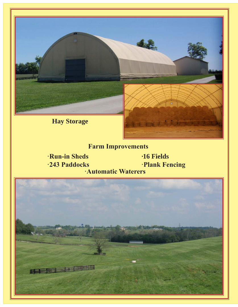
Hay Storage
Farm Improvements ·Run-in Sheds·243 Paddocks
·16 Fields·Plank Fencing
·Automatic Waterers

3 Employee Residences(2 Modular
Homes)
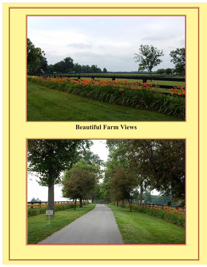
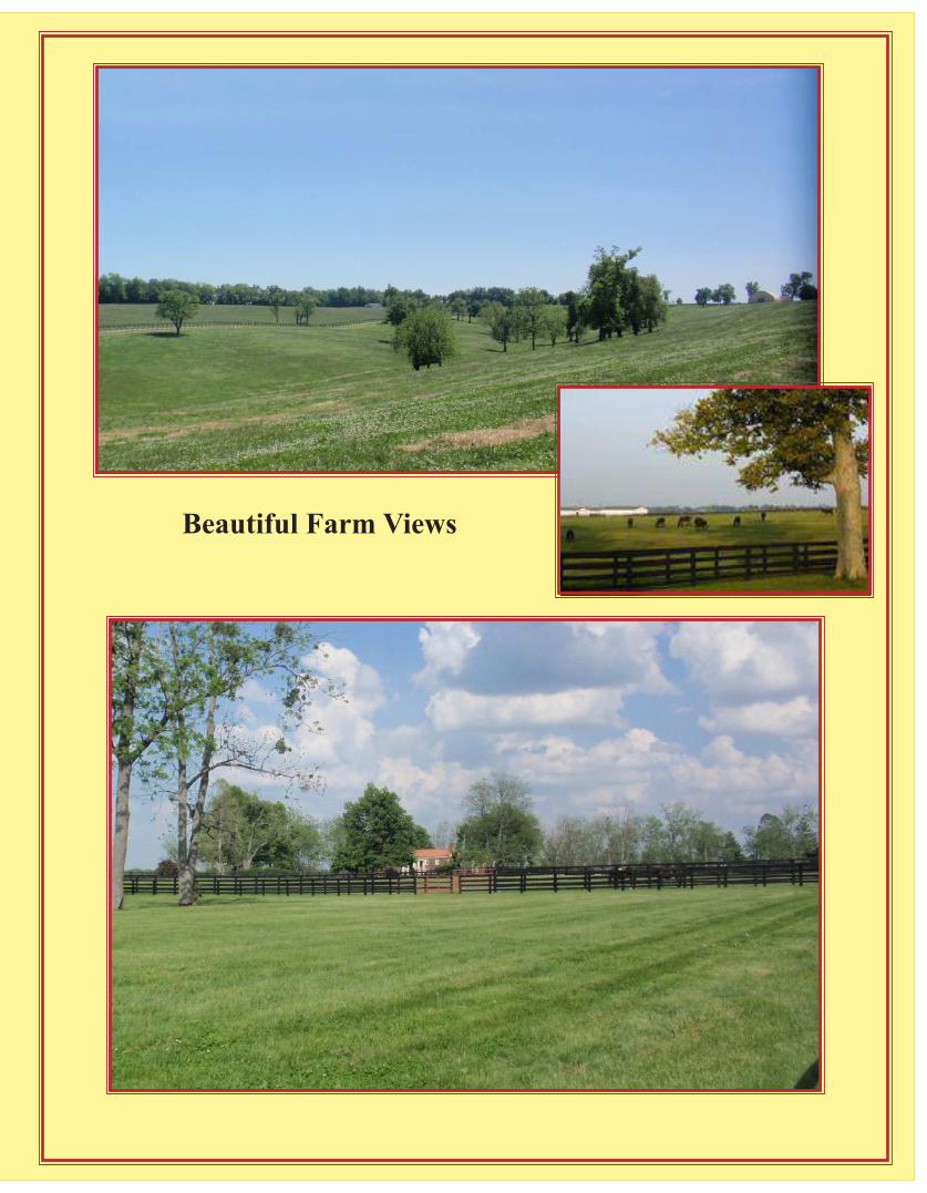
Beautiful Farm Views
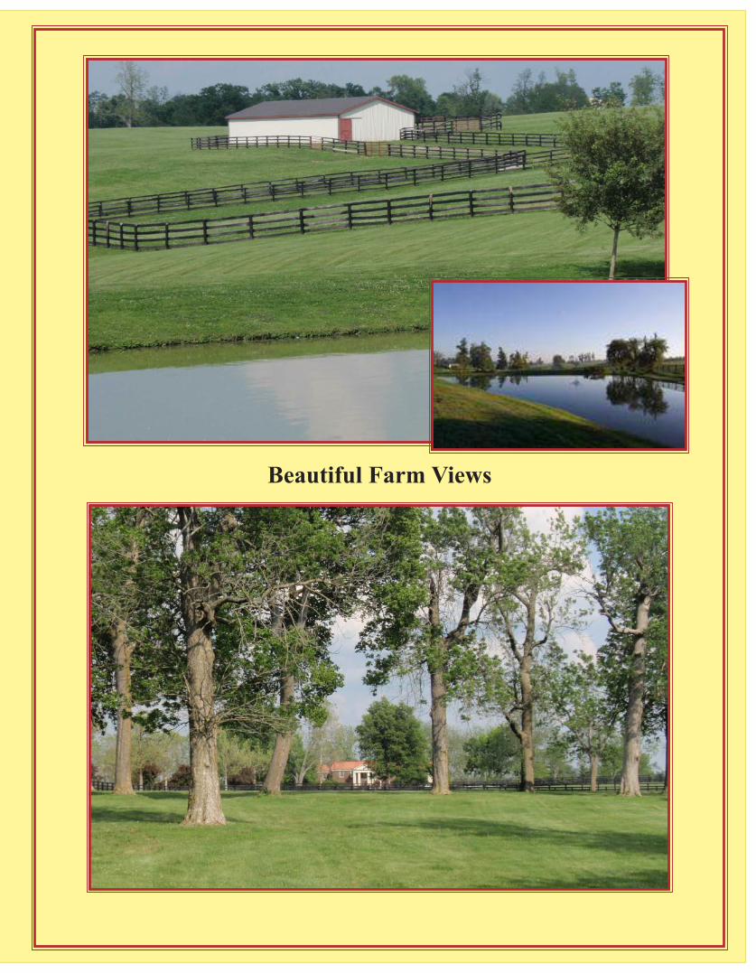
Beautiful Farm Views
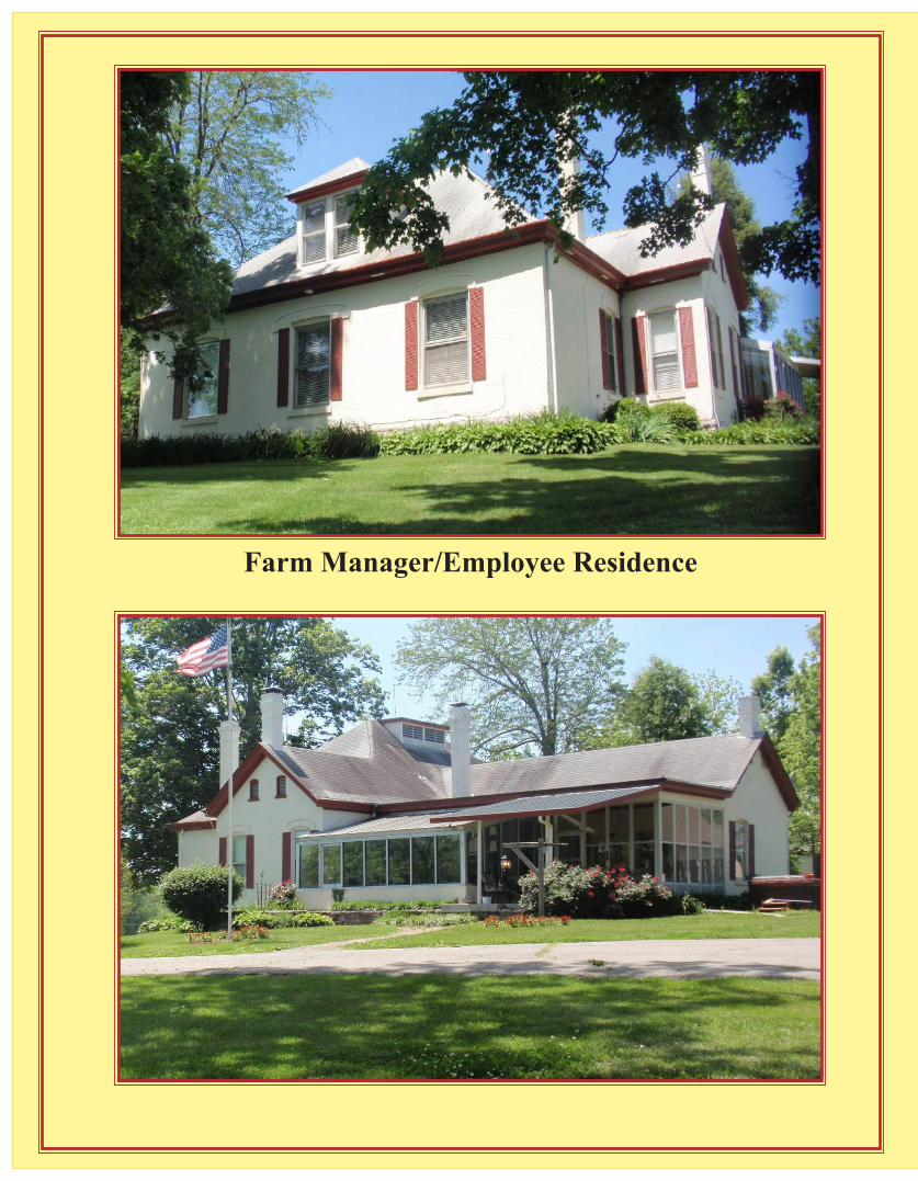
Farm Manager/Employee Residence
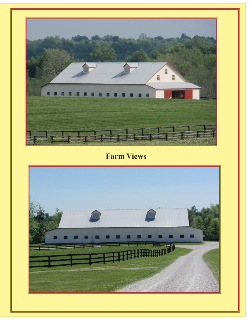
Farm Views
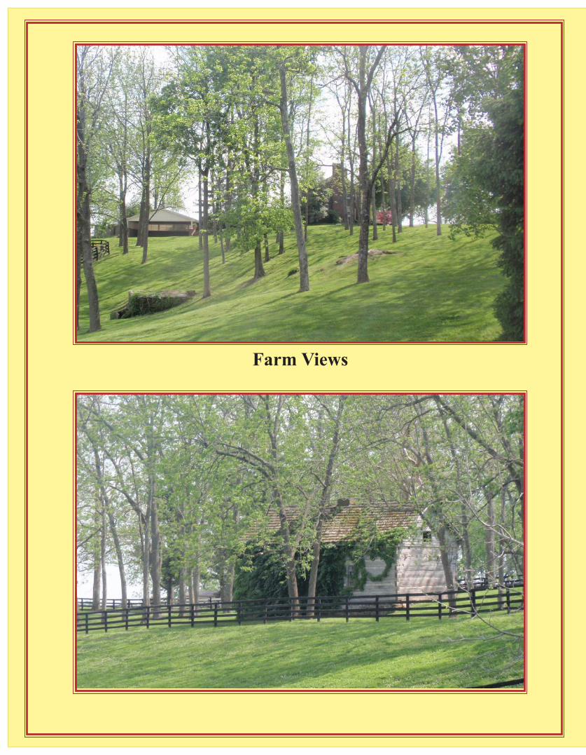
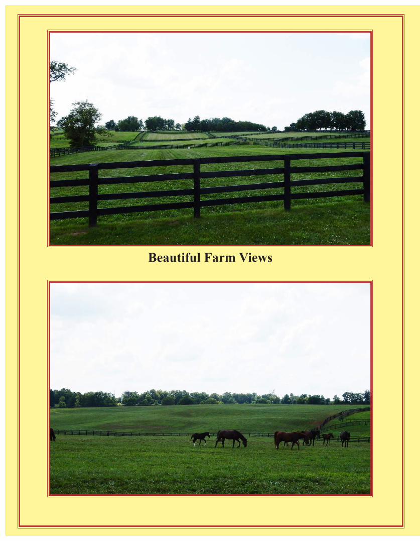
Farm ViewsBeautiful Farm Views
Beautiful Farm Views
Beautiful Farm Views
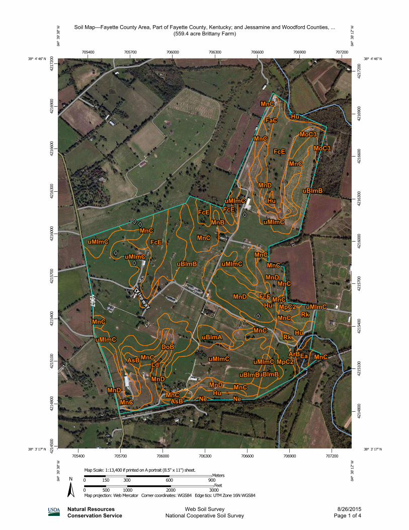
Soil Map—Fayette County Area, Part of Fayette County, Kentucky; and Jessamine and Woodford Counties, ...(559.4 acre Brittany Farm)
Natural ResourcesConservation Service
Web Soil SurveyNational Cooperative Soil Survey
8/26/2015Page 1 of 4
4214
500
4214
800
4215
100
4215
400
4215
700
4216
000
4216
300
4216
600
4216
900
4217
200
4214
800
4215
100
4215
400
4215
700
4216
000
4216
300
4216
600
4216
900
4217
200
705400 705700 706000 706300 706600 706900 707200
705400 705700 706000 706300 706600 706900 707200
38° 4' 46'' N84
° 3
9' 3
8'' W
38° 4' 46'' N
84° 3
8' 1
2'' W
38° 3' 17'' N
84° 3
9' 3
8'' W
38° 3' 17'' N
84° 3
8' 1
2'' W
N
Map projection: Web Mercator Corner coordinates: WGS84 Edge tics: UTM Zone 16N WGS840 500 1000 2000 3000
Feet0 150 300 600 900
MetersMap Scale: 1:13,400 if printed on A portrait (8.5" x 11") sheet.
MA
P LE
GEN
DM
AP
INFO
RM
ATI
ON
Are
a of
Inte
rest
(AO
I)A
rea
of In
tere
st (A
OI)
Soils
Soi
l Map
Uni
t Pol
ygon
s
Soi
l Map
Uni
t Lin
es
Soi
l Map
Uni
t Poi
nts
Spec
ial P
oint
Fea
ture
sB
low
out
Bor
row
Pit
Cla
y S
pot
Clo
sed
Dep
ress
ion
Gra
vel P
it
Gra
velly
Spo
t
Land
fill
Lava
Flo
w
Mar
sh o
r sw
amp
Min
e or
Qua
rry
Mis
cella
neou
s W
ater
Per
enni
al W
ater
Roc
k O
utcr
op
Sal
ine
Spo
t
San
dy S
pot
Sev
erel
y E
rode
d S
pot
Sin
khol
e
Slid
e or
Slip
Sod
ic S
pot
Spo
il A
rea
Sto
ny S
pot
Ver
y S
tony
Spo
t
Wet
Spo
t
Oth
er
Spe
cial
Lin
e Fe
atur
es
Wat
er F
eatu
res
Stre
ams
and
Can
als
Tran
spor
tatio
nR
ails
Inte
rsta
te H
ighw
ays
US
Rou
tes
Maj
or R
oads
Loca
l Roa
ds
Bac
kgro
und A
eria
l Pho
togr
aphy
The
soil
surv
eys
that
com
pris
e yo
ur A
OI w
ere
map
ped
at s
cale
sra
ngin
g fro
m 1
:15,
800
to 1
:20,
000.
Ple
ase
rely
on
the
bar s
cale
on
each
map
she
et fo
r map
mea
sure
men
ts.
Sou
rce
of M
ap:
Nat
ural
Res
ourc
es C
onse
rvat
ion
Ser
vice
Web
Soi
l Sur
vey
UR
L:
http
://w
ebso
ilsur
vey.
nrcs
.usd
a.go
vC
oord
inat
e S
yste
m:
Web
Mer
cato
r (E
PS
G:3
857)
Map
s fro
m th
e W
eb S
oil S
urve
y ar
e ba
sed
on th
e W
eb M
erca
tor
proj
ectio
n, w
hich
pre
serv
es d
irect
ion
and
shap
e bu
t dis
torts
dist
ance
and
are
a. A
pro
ject
ion
that
pre
serv
es a
rea,
suc
h as
the
Alb
ers
equa
l-are
a co
nic
proj
ectio
n, s
houl
d be
use
d if
mor
e ac
cura
teca
lcul
atio
ns o
f dis
tanc
e or
are
a ar
e re
quire
d.
This
pro
duct
is g
ener
ated
from
the
US
DA
-NR
CS
cer
tifie
d da
ta a
s of
the
vers
ion
date
(s) l
iste
d be
low
.
Soi
l Sur
vey
Are
a:
Fay
ette
Cou
nty
Are
a, P
art o
f Fay
ette
Cou
nty,
Ken
tuck
yS
urve
y A
rea
Dat
a:
Ver
sion
11,
Sep
18,
201
4
Soi
l Sur
vey
Are
a:
Jes
sam
ine
and
Woo
dfor
d C
ount
ies,
Ken
tuck
yS
urve
y A
rea
Dat
a:
Ver
sion
10,
Sep
17,
201
4
You
r are
a of
inte
rest
(AO
I) in
clud
es m
ore
than
one
soi
l sur
vey
area
.Th
ese
surv
ey a
reas
may
hav
e be
en m
appe
d at
diff
eren
t sca
les,
with
a di
ffere
nt la
nd u
se in
min
d, a
t diff
eren
t tim
es, o
r at d
iffer
ent l
evel
sof
det
ail.
This
may
resu
lt in
map
uni
t sym
bols
, soi
l pro
perti
es, a
ndin
terp
reta
tions
that
do
not c
ompl
etel
y ag
ree
acro
ss s
oil s
urve
y ar
eabo
unda
ries.
Soi
l map
uni
ts a
re la
bele
d (a
s sp
ace
allo
ws)
for m
ap s
cale
s 1:
50,0
00or
larg
er.
Dat
e(s)
aer
ial i
mag
es w
ere
phot
ogra
phed
: O
ct 4
, 201
1—Fe
b 20
,20
12
The
orth
opho
to o
r oth
er b
ase
map
on
whi
ch th
e so
il lin
es w
ere
com
pile
d an
d di
gitiz
ed p
roba
bly
diffe
rs fr
om th
e ba
ckgr
ound
imag
ery
disp
laye
d on
thes
e m
aps.
As
a re
sult,
som
e m
inor
shi
fting
of m
ap u
nit b
ound
arie
s m
ay b
e ev
iden
t.
Soi
l Map
—Fa
yette
Cou
nty
Are
a, P
art o
f Fay
ette
Cou
nty,
Ken
tuck
y; a
nd J
essa
min
e an
d W
oodf
ord
Cou
ntie
s, K
entu
cky
(559
.4 a
cre
Brit
tany
Far
m)
Nat
ural
Res
ourc
esC
onse
rvat
ion
Serv
ice
Web
Soi
l Sur
vey
Nat
iona
l Coo
pera
tive
Soi
l Sur
vey
8/26
/201
5P
age
2 of
4
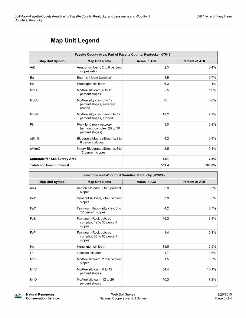
Map Unit Legend
Fayette County Area, Part of Fayette County, Kentucky (KY643)
Map Unit Symbol Map Unit Name Acres in AOI Percent of AOI
ArB Armour silt loam, 2 to 6 percentslopes (elk)
2.5 0.4%
Ea Egam silt loam (woolper) 3.9 0.7%
Hu Huntington silt loam 6.3 1.1%
MnC McAfee silt loam, 6 to 12percent slopes
5.5 1.0%
MoC3 McAfee silty clay, 6 to 12percent slopes, severelyeroded
0.1 0.0%
MpC2 McAfee silty clay loam, 6 to 12percent slopes, eroded
12.2 2.2%
Rk Rock land (rock outcrop-fairmount complex, 20 to 50percent slopes)
5.0 0.9%
uBlmB Bluegrass-Maury silt loams, 2 to6 percent slopes
4.2 0.8%
uMlmC Maury-Bluegrass silt loams, 6 to12 percent slopes
2.5 0.4%
Subtotals for Soil Survey Area 42.1 7.5%
Totals for Area of Interest 559.4 100.0%
Jessamine and Woodford Counties, Kentucky (KY624)
Map Unit Symbol Map Unit Name Acres in AOI Percent of AOI
AsB Ashton silt loam, 2 to 6 percentslopes
2.9 0.5%
DoB Donerail silt loam, 2 to 6 percentslopes
2.9 0.5%
FaC Fairmount flaggy silty clay, 6 to12 percent slopes
4.2 0.7%
FcE Fairmount-Rock outcropcomplex, 12 to 30 percentslopes
46.2 8.3%
FcF Fairmount-Rock outcropcomplex, 30 to 60 percentslopes
1.4 0.3%
Hu Huntington silt loam 19.6 3.5%
Ld Lindside silt loam 1.7 0.3%
MnB McAfee silt loam, 2 to 6 percentslopes
1.5 0.3%
MnC McAfee silt loam, 6 to 12percent slopes
84.4 15.1%
MnD McAfee silt loam, 12 to 20percent slopes
40.3 7.2%
Soil Map—Fayette County Area, Part of Fayette County, Kentucky; and Jessamine and WoodfordCounties, Kentucky
559.4 acre Brittany Farm
Natural ResourcesConservation Service
Web Soil SurveyNational Cooperative Soil Survey
8/26/2015Page 3 of 4
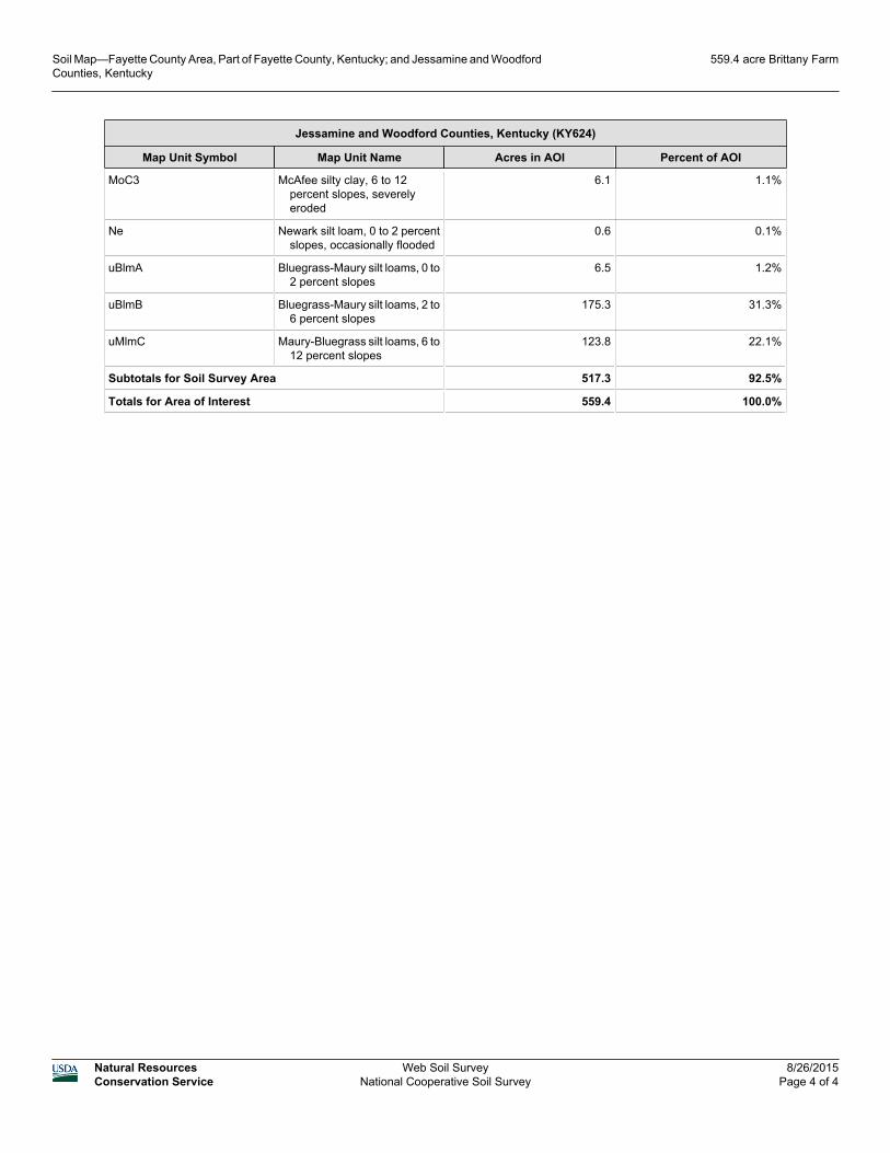
Jessamine and Woodford Counties, Kentucky (KY624)
Map Unit Symbol Map Unit Name Acres in AOI Percent of AOI
MoC3 McAfee silty clay, 6 to 12percent slopes, severelyeroded
6.1 1.1%
Ne Newark silt loam, 0 to 2 percentslopes, occasionally flooded
0.6 0.1%
uBlmA Bluegrass-Maury silt loams, 0 to2 percent slopes
6.5 1.2%
uBlmB Bluegrass-Maury silt loams, 2 to6 percent slopes
175.3 31.3%
uMlmC Maury-Bluegrass silt loams, 6 to12 percent slopes
123.8 22.1%
Subtotals for Soil Survey Area 517.3 92.5%
Totals for Area of Interest 559.4 100.0%
Soil Map—Fayette County Area, Part of Fayette County, Kentucky; and Jessamine and WoodfordCounties, Kentucky
559.4 acre Brittany Farm
Natural ResourcesConservation Service
Web Soil SurveyNational Cooperative Soil Survey
8/26/2015Page 4 of 4

Biederman Real Estate will strive to represent our clients, both buyers and sellers, with the utmost responsibility. Our representatives will always work to our highest abilities to
provide successful transactions for all parties.