bournemouth local plan: bournemouth local plan… · list of policies cs1: national planning policy...
TRANSCRIPT

BOURNEMOUTH LOCAL PLAN: BOURNEMOUTH LOCAL PLAN:
CORE STRATEGYCORE STRATEGY Bournemouth Borough Council Adopted October 2012

Produced by: Bournemouth Borough Council Planning Policy Team Town Hall Annexe St Stephen‘s Road Bournemouth BH2 6EA Tel: 01202 451323 Email: [email protected] This information can be made available in other formats upon request. It can also be downloaded from: www.bournemouth.gov.uk/CoreStrategy All maps contained in this document are reproduced from Ordnance Survey material with the permission of Ordnance Survey on behalf of the Controller of Her Majesty‘s Stationery Office © Crown copyright. Unauthorised reproduction infringes Crown copyright and may lead to prosecution or civil proceedings. 100019829, 2012.

CONTENTS
SETTING THE SCENE
1.1 INTRODUCTION 1
1.2 CONTEXT 2
1.3 SUSTAINABLE COMMUNITY STRATEGY 4
SPATIAL PLANNING 2.1 VISION AND OBJECTIVES 5
2.2 STRATEGY 7
2.3 CORE STRATEGY KEY DIAGRAM 10
2.4 PRESUMPTION IN FAVOUR OF SUSTAINABLE DEVELOPMENT 11
KEY THEMES
3.1 PREPARING FOR CLIMATE CHANGE 12
3.2 HEALTHY SOCIETY 18
3.3 DELIVERING SUSTAINABLE COMMUNITIES 20
BOROUGH WIDE STRATEGY, OBJECTIVES AND POLICIES
4.1 FOCUS ON BOURNEMOUTH TOWN CENTRE AND DISTRICT CENTRES 22
4.2 TRANSPORT 31
4.3 HOUSING 38
4.4 A THRIVING ECONOMY 48
4.5 NATURAL ENVIRONMENT, SPORT, RECREATION AND GREEN INFRASTRUCTURE 57
4.6 A QUALITY BUILT AND HISTORIC ENVIRONMENT 66
DELIVERY AND MONITORING 5.1 DELIVERY AND MONITORING 71
5.2 DELIVERY AND IMPLEMENTATION TABLE 73
APPENDICES A REFERENCES 81
B LIST OF RETAINED AND REPLACED POLICIES 83
C GLOSSARY OF TERMS 87
INDEX INDEX 90

LIST OF POLICIES
CS1: National Planning Policy Framework—Presumption in Favour of Sustainable Development 11 CS2: Sustainable Homes and Premises 15 CS3: Sustainable Energy and Heat 16 CS4: Surface Water Flooding 17 CS5: Promoting a Healthy Community 19 CS6: Delivering Sustainable Communities 21 CS7: Bournemouth Town Centre 25 CS8: Lansdowne Employment Area 27 CS9: Enhancing District Centres 28 CS10: Kinson Retail Development 29 CS11: Protecting Local Facilities and Services 29 CS12: Retaining Community Uses 30 CS13: Key Transport Routes 33 CS14: Delivering Transport Infrastructure 33 CS15: Green Travel Plan and Transport Assessments. 34 CS16: Parking Standards 34 CS17: Encouraging Greener Vehicle Technologies 35 CS18: Increasing Opportunities for Cycling and Walking 37 CS19: Protecting Small Family Dwellinghouses 41 CS20: Encouraging Small Family Dwellinghouses 41 CS21: Housing Distribution Across Bournemouth 43 CS22: New Housing Outside the Preferred Locations 43 CS23: Encouraging Lifetime Homes Standards 44 CS24: Houses of Multiple Occupation 46 CS25: Assessment of Unallocated Gypsy and Traveller Sites 47 CS26: Protecting Allocated Employment Sites 54 CS27: Protecting Unallocated Employment Sites 54 CS28: Tourist Accommodation 55 CS29: Protecting Tourism and Cultural Facilities 56 CS30: Promoting Green Infrastructure 59 CS31 Recreation, Play and Sports 60 CS32 International Sites 61 CS33 Heathland 62 CS34 Sites of Special Scientific Interest 63 CS35 Nature and Geological Conservation Interests 63 CS36 Stour Valley Project 64 CS37 Green Belt 65 CS38 Minimising Pollution 65 CS39 Designated Heritage Assets 68 CS40 Local Heritage Assets 69 CS41 Quality Design 70
LIST OF MAPS
Map 1: Lansdowne Employment Area 26 Map 2: Bournemouth Travel to Work Area 48 Map 3: Ashley Road Coal Yard Employment Allocation 52 Map 4: Ashley Road Station Approach Employment Allocation 52 Map 5: Chaseside Employment Allocation 53 Map 6: Wellington Road Employment Allocation 53
LIST OF FIGURES
Figure 1: Hierarchy of Bournemouth Retail Centres 22 Figure 2: Residential Gain and Loss 2000 to 2012 40 Figure 3: The Determinants of Health and Wellbeing in Our Settlements 57

1.1 INTRODUCTION
1.1.1 The Bournemouth Local Plan: Core Strategy [Core Strategy] was subject to an Examination in Public in March 2012. It was adopted in October 2012 and covers the period 2006 until 2026. The Core Strategy provides the spatial strategy for the Borough. It has had regard to the Sustainable Community Strategy and the procedural requirements for public consultation for Development Plan Documents. It has been subject to a Sustainability Appraisal, Equalities Impact Assessment and Habitats Regulations Assessment, which are all available to view on the Council website. 1.1.2 Bournemouth is located centrally on the south coast between the towns of Poole and Christchurch. It forms part of a much wider urban area known as the South East Dorset Conurbation that stretches from Upton in the west to Highcliffe in the east. Bournemouth is highly accessible to the South East with good road and rail links to Southampton and London. 1.1.3 Within the wider sub-region Bournemouth is the key location for retail, tourism, culture, higher education, office based employment, and other services such as hospitals. The town, in particular the town centre, will continue to be the focus of growth and inward economic investment. The wider conurbation has an operational maritime port and Airport with international destinations; both offer unique opportunities for the economy in the conurbation and jobs for its residents. 1.1.4 Bournemouth has seven miles of beaches and benefits from a strong tourism industry. The attractions within the Borough are supplemented by nearby tourist attractions, such as the New Forest National Park and World Heritage Jurassic Coastline. Within the Borough, Bournemouth has award winning historic gardens and hosts a number of events throughout the year, including a summer air festival. In recent times holiday trends have changed; a relative decline in the traditional family holiday trade in Bournemouth has been offset by a significant increase in short breaks, conference and business tourism and a lively evening economy that attracts young people from across the country.
1
© Crown Copyright. All rights reserved 10019829, 2012

2
1.2 CONTEXT
1.2.1 The Planning and Compulsory Purchase Act 2004, as amended by the Localism Act 2011, requires the preparation of Development Plan Documents that make up a Local Plan for an area. The Core Strategy makes up part of the new Bournemouth Local Plan. The Core Strategy has been drafted in accordance with national planning guidance, any relevant legislation (either national or European) and took into account the objectives of the Council and the Bournemouth 2026 Local Strategic Partnership. A Sustainability Appraisal, including a Strategic Environmental Assessment, tested the policies and objectives against a range of sustainability criteria. A Habitats Regulation Assessment determined likely impacts on protected habitats.
1.2.2 Other national legislation in the form of Acts and Circulars will have an impact on local policy formulation, for example the requirements of Housing Acts and national objectives on issues such as air quality. National planning policies and how these are expected to be applied are set out by the Government in the National Planning Policy Framework (NPPF).
1.2.3 The Core Strategy was subject to an examination in March 2012 and was adopted in October 2012. The Core Strategy was tested against, and is consistent with, the National Planning Policy Framework. The plan has been positively prepared, it has assessed objectively development needs over the plan period and has been found to be both justified and effective. 1.2.4 The Localism Act confirmed the coalition Government‘s intention to reform the planning system to give local people new rights to shape the development of their communities. The Core Strategy was drafted in anticipation of the provisions in the Act. The Council expects to work with local neighbourhood groups who wish to create a neighbourhood plan that conforms with the strategic elements of the Core Strategy. 1.2.5 The Core Strategy sets out the vision, spatial strategy and core policies for the whole Borough. It is not the purpose of this document to set out a complete suite of development management policies. This will be the role of other Local Plan documents drafted to support the Core Strategy, which are currently identified as:
Affordable Housing Development Plan Document (adopted 2009)
Bournemouth Town Centre Area Action Plan
Dorset Heathlands Joint Development Plan Document
Dorset Wide Gypsy and Traveller (including travelling show people) Site Allocation Joint Development Plan Document
Other Development Plan Documents (DPDs) where appropriate (e.g. Development Management DPD)
Neighbourhood plans. 1.2.6 Bournemouth town centre is a key strategic location to accommodate economic growth. An Area Action Plan (AAP), forming part of the Local Plan, has been prepared for the town centre. The Bournemouth Town Centre AAP places emphasis on transforming the centre, making it vibrant, diverse, sustainable and accessible, with improvements to streets and public spaces. It includes proposals for new business, retail and residential accommodation, as well as new leisure facilities and all weather family attractions. The AAP is a subordinate document and therefore its policies are in conformity with the strategies and policies of the Core Strategy.
3
1.2.7 The three authorities of Bournemouth, Poole and Dorset have together produced the Bournemouth, Poole and Dorset Local Transport Plan. This sets out a long-term strategy for travel and transport within the area. A good quality and sustainable transport system is essential to the economy, the environment and quality of life. 1.2.8 The Affordable Housing Development Plan Document (AHDPD) aims to ensure adequate provision of affordable housing for Bournemouth‘s residents. It is the result of extensive research into affordability and local housing needs. The Borough has recognised and proven affordability problems and the provision of affordable housing is a high priority for the Council. The AHDPD is the key document in delivering increased affordable housing in Bournemouth. The AHDPD was examined by an Independent Inspector in June 2009 and is the adopted policy of the Council.
1.2.9 A Dorset Heathlands Joint Development Plan Document is being produced by five local authorities (Bournemouth, Christchurch, East Dorset, Poole and Purbeck) to form a long term strategic framework to manage pressures on European-level protected heathland sites that arise from residential development. As the final DPD is still in preparation, a Dorset Heathlands Planning Framework 2012-2014 Supplementary Planning Document is in place. This seeks a prohibition of residential development within 400m of a heathland and contributions from developers of residential schemes within 400m-5km of any such site to finance mitigation measures to offset adverse impacts on biodiversity arising from such development. Other use classes are also identified as potentially needing mitigation measures. Protection of heaths is important to preserve sensitive habitats and species.
National Policy and Guidance
Sustainable Community
Strategy
Other Council Plans/
Strategies
Supplementary Planning Documents
Council‘s Monitoring
Report
Town Centre Gypsy and Affordable Heathlands 2002 District Other Area Action Traveller Housing DPD Wide Local Emerging Plan DPD DPD Plan DPDs
Core Strategy

4
1.2.10 Through legislation under the Housing Act 2004, the Council must consider the needs of the Gypsy and Traveller communities. Consultants have been appointed to produce a Dorset-wide Gypsy and Traveller (including Travelling Showpeople) Site Allocation Joint Development Plan Document on behalf of all eight local authorities within Dorset to identify suitable sites for provision. 1.2.11 The Bournemouth District Wide Local Plan was adopted in February 2002 following a local public inquiry and provided the bulk of the policies against which submitted planning applications were considered. The policies in the 2002 Local Plan will gradually be superseded as more of the documents making up the new Bournemouth Local Plan are adopted. The 2002 Local Plan policies that remain in use are known as ‗saved policies‘ and have been allowed to remain current with the agreement of the Secretary of State. Appendix B lists those 'saved policies' that are superseded by the adopted Core Strategy. A list of the saved policies is available on the Council‘s website.
1.3 THE SUSTAINABLE COMMUNITY STRATEGY
1.3.1 The Bournemouth 2026 Trust (formerly known as the Bournemouth 2026 Partnership) brings together hundreds of representatives from the public, private, voluntary, faith and community sectors to work together to improve the lives of people who live, work and visit the town. The Partnership produced a shared vision for Bournemouth which set out the long term aspirations for the town and how these could be achieved. This is the Sustainable Community Strategy. As a lead partner in Bournemouth 2026 the Council has a major role in helping to deliver this strategy. 1.3.3 Bournemouth‘s Sustainable Community Strategy (SCS) provides an overarching vision and goals for the Borough across a range of key themes. The document was produced in partnership with the purpose of encouraging all partners to work towards a shared vision to address the challenges facing Bournemouth. The Core Strategy has sought to tie the issues and themes in that document closely to its own vision and objectives, to ensure effective delivery of as many of the goals of the SCS as possible. 1.3.4 The SCS has five key themes, these are:
1. Investing in People: To be a town which values and listens to its residents
2. A Thriving Economy: To be a town with strong businesses that provides quality jobs
3. Safer & Stronger Communities: To be a safe town with inclusive and vibrant neighbourhoods
4. A Sustainable Environment: To have a sustainable environment with well designed, affordable housing and a well used public transport system
5. Health & Wellbeing: For residents to have healthy and active lifestyles 1.3.5 Copies of the SCS and further details on the Bournemouth 2026 Trust can be viewed online at www.bournemouth2026.org.uk.

5
2.1 VISION AND OBJECTIVES
VISION
Bournemouth will retain and enhance its function as the coastal garden town of the south, with people enjoying a network of open green spaces and beaches. By 2026 Bournemouth will have accommodated sustainable growth without compromising the quality of the built, natural and historic environment and the quality of life for Bournemouth's residents will be high. Bournemouth will be a town that continues to listen to its diverse communities and acts proactively on their behalf. The town will continue to be a premier tourism destination with first class facilities and accommodation to attract a wide range of visitors. Encouraging family friendly and evening economies that make our centres welcoming places for visitors and residents of all ages. Links between housing and employment locations are improved to promote accessibility for residents. Bournemouth will be a town where the economy is buoyant, employment levels are high and where businesses are encouraged to start and grow. The town centre and other urban centres will be vibrant places for retail, culture, employment, education, business and living, and will be easily accessible to residents and visitors, reducing dependency on private vehicles. Bournemouth will be a greener town in terms of development, energy consumption and generation, transportation, biodiversity and how we deal with waste, reducing the Borough's CO2 emissions and mitigating against and adapting to the impacts of Climate Change.
Objective 6
Encourage sustainable development by the use of sustainable construction and drainage methods and the increased use of renewable and low carbon energy sources.
Objective 1 Ensure that the quality of the built, natural and historic environment is high and that the necessary physical, social and green infrastructure are provided to support current needs and future growth and development.
Objective 2
Ensure that local people have access to a range of housing types and tenures that meet their needs. A safe town, with healthy and active residents.
Objective 3 Maintain and enhance the town centre and other local centres as thriving, attractive and accessible places to be for all residents and visitors. Ensuring that tourism and conferencing remains an important part of the economy.
Objective 4 Enable and encourage an integrated, accessible, sustainable and well used public transport system and increase opportunities to walk and cycle. Ensure that employment, leisure and community facilities are easily accessible by a choice of transport methods.
Objective 5 Encourage the economy to be healthy and provide a range of well paid employment opportunities. Ensure our centres are vibrant places with a range of retail, culture and leisure options to meet local needs.

6
2.1.1 The Core Strategy Vision highlights this document‘s important role in the future of Bournemouth. The objectives reflect how the Core Strategy will shape the town‘s future to deliver the vision. To successfully meet the objectives the Core Strategy comprises a number of different strategies and policies. Table 1 contains an assessment of the compatibility of the chosen strategies in delivering the objectives of the Core Strategy.
2.1.2 The objectives and the policies in this plan have been assessed in a Sustainability Appraisal. A summary of the compatibility between the Plan objectives and the Sustainability Appraisal objectives is shown in Table 2. The full document can be viewed on the Council‘s website.
Table 1: Compatibility matrix of the Core Strategy objectives and strategies
Objective
KEY THEMES 1 2 3 4 5 6
Preparing for Climate Change
A Healthy Society
Delivering Sustainable Communities
STRATEGIES
Focus on Bournemouth Town Centre and District Centres
Transport
Housing
A Thriving Economy
Natural Environment, Sport, Recreation and Green Infrastructure
A Quality Built and Historic Environment
Table 2: Sustainability Appraisal of the Core Strategy objectives
Objective
HIGHER LEVEL SA OBJECTIVE 1 2 3 4 5 6
1. Improve health
2. Support communities that meet people‘s needs
3. Develop the economy in ways that meet people‘s needs
4. Provide access to people‘s needs with least damage to communities and the environment
5. Maintain and improve environmental quality and assets
6. Minimise consumption of natural resources

7
2.2 STRATEGY
2.2.1 The Core Strategy sets out the long term planning strategy for the future of Bournemouth. It includes three key themes that underpin the strategy, namely Preparing for Climate Change, A Healthy Society and Delivering Sustainable Communities. These are complemented by six Borough wide strategies. Each strategy is illustrated in a diagram which combine to form the overall spatial strategy. The Key Diagram, page 10 illustrates the overall spatial strategy for Bournemouth.
KEY THEMES
2.2.2 The key themes are considered to be the guiding principles around which the borough wide strategies and policies are built:
Preparing for Climate Change: Sets local renewable energy targets and seeks to reduce surface water flooding.
A Healthy Society: The health of the community is promoted through improved living conditions, access to employment and open space, as well as housing.
Delivering Sustainable Communities: Contributes to improving the quality of the built and natural environment, connectivity and functionality of the town.
BOROUGH WIDE STRATEGIES
2.2.3 Focus on Bournemouth Town Centre and District Centres. The town centre is subject to a separate Area Action Plan looking in closer detail at sites and future potential in and around the existing core of the town. This area will be a focus of employment and housing growth which will be complemented by concentrating on the district centres. Policy objectives reflect the role of district centres in the local community and promote these centres as locations for development. Policies include:
Bournemouth Town Centre; Lansdowne Employment Area. Enhancing District Centres; Kinson Retail Development; Protecting Local Facilities and Services; and Retaining Community Uses.
2.2.4 Transport. Key transport routes link the centres, these offer regular public transport to travel around Bournemouth. Provision will be made to mitigate the effects of development and sustainable travel will be encouraged. Policies include:
Key Transport Routes; Delivering Transport Infrastructure; Green Travel Plan and Transport
Assessments; Parking Standards; Encouraging Greener Vehicle Technologies; Increasing Opportunities for Cycling and Walking.
Page 32
Page 23

8
2.2.5 Housing. Seeks to locate housing in sustainable locations close to services and public transport. Policies seek to protect and make provision for a balanced housing stock and to provide standards for new housing in the Borough. Policies include:
Protecting Small Family Dwellinghouses; Encouraging Small Family Dwellinghouses; Housing Distribution Across Bournemouth; New Housing Outside the Preferred
Locations; Encouraging ‗Lifetime Homes‘ Standards; Houses of Multiple Occupation; and Assessment of Unallocated Gypsy and Traveller Sites.
2.2.6 A Thriving Economy. Ensuring that sites are available to accommodate future economic growth is key to preparing for a sustainable future. Tourism and culture play a valuable role in the local economy. Policies include:
Protecting Allocated Employment Sites; Protecting Unallocated Employment Sites; Tourist Accommodation; and Protecting Tourism and Cultural
Facilities. 2.2.7 Natural Environment, Sport, Recreation and Green Infrastructure. A network of high quality green infrastructure will link across the town to encourage the use of public open space. Also improving the appearance of the town, encouraging thriving wildlife, its attractiveness for inward investment and the health of its residents. Policies include:
Promoting Green Infrastructure; Recreation, Play and Sports; International Sites
Page 44
Page 51
Page 61

9
Heathland; Sites of Special Scientific Interest Nature and Geological Conservation Interests; Stour Valley Project; Green Belt; and Minimising Pollution.
2.2.8 A Quality Built and Historic Environment. Ensure that all new development incorporates good design and delivers quality buildings and spaces across the Borough. Making sure that areas retain their identity and residents can
enjoy a high standard of living. Policies include:
Designated Heritage Assets; Local Heritage Assets; and Quality Design.
Page 67
© Crown Copyright. All rights reserved, Bournemouth Borough Council 10019829, 2012
10
2.3 CORE STRATEGY KEY DIAGRAM
© C
row
n C
opyri
ght.
All r
ights
rese
rved,
Bourn
em
outh
Boro
ugh C
ouncil 1
0019829,
2012
N
Tow
n C
entr
e A
rea A
cti
on P
lan
D
istr
ict
Centr
es
400m
Zone
H
igh q
uality
desi
gn a
cro
ss
boro
ugh
Key T
ransp
ort
Route
s
A338 W
ess
ex W
ay
Em
plo
ym
ent
Allocati
on
Sto
ur
Valley P
roje
ct
H
eath
land 4
00m
Pro
tecti
on Z
one
Coast
al Enhancem
ent
Zone

11
2.4 PRESUMPTION IN FAVOUR OF SUSTAINABLE
DEVELOPMENT
2.4.1 In accordance with the National Planning Policy Framework the Bournemouth Local Plan is based upon and reflects the presumption in favour of sustainable development. The following policy expresses how the presumption will be applied locally.
Policy CS1: National Planning Policy Framework - Presumption in
Favour of Sustainable Development
When considering development proposals the Council will take a positive approach that reflects the presumption in favour of sustainable development contained in the National Planning Policy Framework. It will always work proactively with applicants jointly, in particular through the pre-application process, to find solutions which mean that proposals can be approved wherever possible, and to secure development that improves the economic, social and environmental conditions in the area. Planning applications that accord with the policies in this Local Plan (and, where relevant, with polices in neighbourhood plans) will be approved without delay, unless material considerations indicate otherwise. Where there are no policies relevant to the application or relevant policies are out of date at the time of making the decision then the Council will grant permission unless material considerations indicate otherwise – taking into account whether:
a. any adverse impacts of granting permission would significantly and demonstrably outweigh the benefits, when assessed against the policies in the National Planning Policy Framework taken as a whole; or
b. specific policies in that Framework indicate that development should be restricted.

12
3.1 PREPARING FOR CLIMATE CHANGE
3.1.1 In recent years awareness of the implications for everyone of the likely impacts of climate change have increased. Climate change is not only an environmental issue but potentially could have major economic, social and health consequences. Understanding the likely impacts of climate change on Bournemouth is important, particularly as it is a coastal town and the quality of its environment is vital to its economic and social wellbeing. 3.1.2 An increasing number of targets and initiatives have come forward to address climate change. These targets and initiatives influence and complement the Core Strategy. Some of the more important publications are:
The Planning and Compulsory Purchase Act 2004 (as amended) and the National Planning Policy Framework place sustainable development at the heart of the planning system;
The Climate Change Act 2008 sets a legally binding target for reducing UK CO2 emissions by at least 80% on 1990 levels by 2050. An interim target of a 34% reduction by 2020 has also been set;
The EU Climate and Energy package (2009) commits the EU to a 20% reduction in greenhouse gas emissions by 2020 compared to 1990 levels increasing up to 30% in the event of an international agreement on climate change. The package includes a binding target for the UK of 15% of all energy (i.e. covering transport, electricity and heat) should come from renewables sources;
The UK Low Carbon Transition Plan and the UK Renewable Energy Strategy (both 15th July 2009) set out how the UK will achieve drastic reductions in emissions and meet targets on renewables;
The Energy Act 2008 set out powers to introduce feed-in tariffs and a Renewable Heat Incentive aimed at driving an increase in renewable energy generating capacity;
Code for Sustainable Homes and BREEAM (British Research Establishment Environmental Assessment Method) provide voluntary standards for the environmental performance of residential and commercial developments;
The Bournemouth, Dorset and Poole Renewable Energy Strategy to 2020 was endorsed by the Council in 2012. The focus of the strategy is on the use of renewable energy for helping meet the need for electricity and heat in Dorset.
3.1.3 The Core Strategy also needs to take into account:
The impacts of progressively stringent requirement on CO2 emissions under the Building Regulations (in 2010 and 2013) leading to zero carbon homes in 2016 and zero carbon non-domestic buildings by 2019;
The stepping up of the application of the Code for Sustainable Homes to Code level 6 by 2016 mirroring the Building Regulations requirement for zero carbon homes. Compliance with 2010 Building Regulations is equivalent to Code Level 3 of the Code for Sustainable Homes.
KEY T
HEM
ES
TO
WN
& D
ISTRIC
T
CEN
TRES
TRAN
SPO
RT
HO
USIN
G
A T
HRIV
ING
ECO
NO
MY
NATU
RAL
EN
VIR
ON
MEN
T
BU
ILT &
HIS
TO
RIC
EN
VIR
ON
MEN
T
Hengis
tbury
Head

13
TRENDS FROM THE RECENT PAST 3.1
3.1.4 Between 1961 and 2006 in the South West:
Average daily temperatures increased by 1.37oC;
Average number of days of air frost per year decreased by 20.9;
Annual precipitation increased with largest increase in autumn (28.6%) but a small decrease in summer (8.8%);
Rainfall from heavy winter downpours increased by approximately 5%. 3.1.5 Absolute sea level rise (not including land movement) in the South West over the 20th Century has been around 1mm per year with an indication of an increase in rate during the 1990s and 2000s.
FUTURE PREDICTED TRENDS 3.2
3.1.6 The South West in the 2050s:
Temperatures warmer across all seasons by between 2.1% and 2.7% with overall annual average of 2.5% warmer;
Annual precipitation virtually unchanged but significant seasonal variation. Summers predicted to be 20% drier whilst winters will be 17% wetter and spring 3.2% wetter;
Overall annual cloud cover reduction of 5.2% but with a summer peak reduction of 10.6%;
Overall annual relative humidity reduction of 2.4% but with a summer peak decrease of 5.5%.
3.1.7 Bournemouth Sea Level in 2050:
Predictions for sea level around Bournemouth depending on the emission scenario. In comparison with 1990 levels they range from 18.8cm (low emissions), 22.1cm (medium emissions) and 26.2cm (high emissions).
3.1.8 Predictions of climatic conditions far into the future are unlikely to be 100% accurate. However, the consensus of such predictions point to similar issues such as rising temperatures, increased incidence of extreme weather events, increased flooding and sea level rise. Bournemouth will play its part both in mitigating the effects of climate change locally and contributing to the national and international effort to reduce our impact on the climate. 3.1.9 Planning can make a significant contribution, in the short and long term, to both mitigating and adapting to climate change through decision making on the location, scale, mix and characteristics of development.
Table 3: Building Regulations Changes and Equivalent Code for Sustainable Homes Level for Carbon Reduction
2010 2013 2016
Target building Regulations carbon dioxide reduction over 2010 requirements
0% 25% Zero Carbon
Equal to carbon dioxide emission reduction for:
Code Level 3
Code Level 4
Code Level 6
KEY T
HEM
ES
TO
WN
& D
ISTRIC
T
CEN
TRES
TRAN
SPO
RT
HO
USIN
G
A T
HRIV
ING
ECO
NO
MY
NATU
RAL
EN
VIR
ON
MEN
T
BU
ILT &
HIS
TO
RIC
EN
VIR
ON
MEN
T

14
3.1.10 Sustainability and the reduction of Bournemouth‘s carbon footprint are threads that permeate the Core Strategy and are not confined to the policies contained in this section alone. For example, proposals to encourage walking and cycling, make local communities more self sustaining, and directing development close to local centres and key transport routes all contribute to the carbon reduction aim. As well as producing the Core Strategy the Council is also involved in other plans and initiatives such as the Poole and Christchurch Bay Shoreline Management Plan and Go Green Bournemouth. The Core Strategy is, therefore, a vital component in the drive towards a more sustainable, low carbon Bournemouth.
SUSTAINABLE HOMES AND PREMISES
3.1.11 Bournemouth is largely an urban borough and as a result there are impediments to the development of some forms of renewable energy, most obviously large scale, on-shore, wind turbine installations. However, the use of renewable and low carbon energy can
make a significant contribution to reducing Bournemouth‘s carbon footprint.
3.1.12 It has been common practice in many Core Strategy documents to set targets for a percentage of the energy requirement of new developments to come from renewable sources. However, the progressively demanding standards for CO2 emissions set through Building Regulations will, post 2013, make local borough wide targets unnecessary. This approach has been endorsed by the Planning and Climate Change Coalition3.3. 3.1.13 Proposals for authority-wide targets (until the proposed revisions of the Building Regulations in 2013) can be justified if evidence can be produced to support the imposition of such targets including the effect on viability of development. Given the relatively short period between the adoption date of the Core Strategy and the anticipated change in Building Regulations in 2013 the standards in Policy CS2 will apply until they are superseded by the improved Building Regulations in 2013 or until equivalent mandatory carbon dioxide reductions come into force. However encouragement will be given for developments which may achieve carbon reductions above the targets by taking a positive approach to measures that may achieve additional reductions. 3.1.14 Code for Sustainable Homes and BREEAM currently provide voluntary standards for the environmental performance of residential and commercial developments. As voluntary tools the Code for Sustainable Homes and BREEAM support the delivery of national objectives and complement the mandatory requirements of the Building Regulations. The Council acknowledges the voluntary nature of these tools but wishes to achieve improved performance where possible and will therefore encourage new residential developments to meet Level 3 of the Code and new commercial developments to reach the BREEAM ―very
good‖ standard.
3.1.15 An illustration of the benefit of building to Level 3 of the Code for Sustainable Homes comes in the area of water consumption. Over the next 50 years water resources face increasing pressures from climate change, population growth and pollution. Using water more efficiently makes a significant contribution to meeting targets for reduced carbon emissions and will ensure there is adequate water for our valued and diverse wildlife. Information from the Environment Agency indicates that water use in the home accounts for about six per cent of UK carbon emissions3.4. Most of these emissions come from heating water for washing and cooking (not including space heating). The Environment Agency indicates that if each person in the South West reduced their water use by 20 litres a day 264,442 tonnes of carbon could be saved every year – the equivalent electricity requirement of over 150,000 homes. Achieving a Level 3 standard for water consumption (105 litres/person/day) would contribute significantly to carbon reduction.
KEY T
HEM
ES
TO
WN
& D
ISTRIC
T
CEN
TRES
TRAN
SPO
RT
HO
USIN
G
A T
HRIV
ING
ECO
NO
MY
NATU
RAL
EN
VIR
ON
MEN
T
BU
ILT &
HIS
TO
RIC
EN
VIR
ON
MEN
T

15
ENCOURAGING THE PROVISION OF RENEWABLE AND LOW CARBON
ENERGY SOURCES AND INFRASTRUCTURE
3.1.16 The future requirements for zero carbon homes and premises will increase the demand for decentralised and renewable or low carbon energy capacity in Bournemouth. It is unlikely to be possible for all the required energy to be provided on individual sites as they develop, so it is important to encourage the provision of locally generated heat/energy where the potential exists. For example, the South West Heat Map3.5 shows the heat demand that exists in Bournemouth and the potential for district heating schemes to contribute toward meeting this demand. The provision of such infrastructure can encourage existing properties, particularly large buildings with big energy and heat requirements, to tap into such schemes. At the same time it may be financially advantageous for new buildings to utilise a local resource as well as making it easier to achieve the increasingly stringent low/zero carbon targets required under the Building Regulations. Other technologies such as solar water heating, ground and air source heat pumps, solar photovoltaic cells and small scale wind power all could play a role in carbon reduction in Bournemouth. 3.1.17 The Core Strategy seeks to encourage the provision of (and infrastructure supporting) decentralised and renewable/low carbon energy generation and renewable heat technology. This will include schemes of all scales from domestic installations to schemes serving a local neighbourhood or feeding into the national energy system. Any proposals will need to ensure that local amenity is not adversely affected to an unreasonable degree.
Policy CS2: Sustainable Homes and Premises
When considering proposals for residential and non-residential development the Local Planning Authority will require that at least 10% of the energy to be used in developments of more than 10 dwellings or 1000m2 of non residential floorspace will come from decentralised and renewable or low carbon sources unless this is demonstrated to not be feasible or viable. Encouragement will be given to proposals for the provision of measures to exceed these targets where there is not an unreasonable impact on local amenity.
The Council will encourage new residential developments to meet at least Level 3 of the Code for Sustainable Homes and commercial developments to achieve a BREEAM ―very good‖ rating.
KEY T
HEM
ES
TO
WN
& D
ISTRIC
T
CEN
TRES
TRAN
SPO
RT
HO
USIN
G
A T
HRIV
ING
ECO
NO
MY
NATU
RAL
EN
VIR
ON
MEN
T
BU
ILT &
HIS
TO
RIC
EN
VIR
ON
MEN
T
East W
ay

16
ANTICIPATING THE EFFECTS OF FLOODING AND ENCOURAGING
SUSTAINABLE DRAINAGE
3.1.18 The precise impacts of climate change on Bournemouth in the future are difficult to assess but it anticipated that the UK is likely to see more extreme weather events including increased flooding as well as sea level rise. The NPPF indicates that risk of flooding should be avoided by directing development away from the highest risk areas. The Council has produced a Strategic Flood Risk Assessment3.6 which includes allowances for the likely effects of projected sea level rise. This document will be used to inform the proposed acceptable location of future development and will be a consideration in the assessment of planning applications. 3.1.19 The Council is also currently producing a Surface Water Management Plan which will indicate areas at risk from localised flooding incidents. This information will also be relevant in the consideration of appropriate land allocations and the assessment of planning applications. 3.1.20 The NPPF states that when determining a planning application, local planning authorities should ensure that flood risk is not increased elsewhere as a result of a proposed development and indicates that priority should be given to the use of Sustainable Drainage Systems (SUDS). The issue of sustainably dealing with surface water drainage within a development site is a principle which the Core Strategy will strongly encourage. SUDS cover a range of measures, including:
infiltration devices to allow water to soak into the ground, that can include individual soakaways and communal facilities;
filter strips and swales, which are vegetated features that hold and drain water downhill mimicking natural drainage patterns;
filter drains and porous pavements to allow rainwater and run-off to infiltrate into permeable material below ground and provide storage if needed; and
basins and ponds to hold excess water after rain and allow controlled discharge that avoids flooding.
Policy CS3 Sustainable Energy and Heat
The Council will encourage the provision of decentralised renewable/low carbon energy generation and heat technology and the installation of the necessary supporting infrastructure. The wider environmental, economic and social benefits of all proposals for decentralised renewable and low carbon energy projects will be weighed against other policies in the Plan and will be favourably considered provided that:
The technology/infrastructure is suitable for the location and does not unreasonably detract from local amenity;
It would not, individually or cumulatively, have an unacceptably adverse impact on ecology, wildlife, or the integrity of protected habitats;
It would not cause interference to radar or telecommunications;
It would not cause harm to local amenity from noise, vibration, overshadowing, flicker or other harmful emissions.
KEY T
HEM
ES
TO
WN
& D
ISTRIC
T
CEN
TRES
TRAN
SPO
RT
HO
USIN
G
A T
HRIV
ING
ECO
NO
MY
NATU
RAL
EN
VIR
ON
MEN
T
BU
ILT &
HIS
TO
RIC
EN
VIR
ON
MEN
T

17
3.1.21 The most appropriate SUDS method can vary according to the circumstances of an individual site or the characteristics of an area. A particular issue in Bournemouth is maintaining the stability of the cliff tops and other steep slopes such as the chines. For many years there has been a presumption against the use of infiltration devices like soakaways within 200 metres of cliff tops and steep slopes and this remains the case.
3.1.22 The provision of multi-functional green infrastructure is promoted in the Core Strategy. Provision will assist in climate change mitigation through flood and surface water management/attenuation and urban cooling through tree planting. Other policies throughout the plan promote a sustainable, adaptable, urban environment.
KEY T
HEM
ES
TO
WN
& D
ISTRIC
T
CEN
TRES
TRAN
SPO
RT
HO
USIN
G
A T
HRIV
ING
ECO
NO
MY
NATU
RAL
EN
VIR
ON
MEN
T
BU
ILT &
HIS
TO
RIC
EN
VIR
ON
MEN
T
Bra
idle
y R
oad
Policy CS4 Surface Water Flooding
The design and layout of all new buildings, and the development of car parking and hard standing, will incorporate appropriate Sustainable Drainage Systems (SUDS) capable of ensuring that the level of surface water leaving the site is no greater than that prior to the development, and ensuring the quality of local water. The use of SUDS is a requirement other than in exceptional circumstances where no technical solution is available. Details of the proposed SUDS and suitable provision for maintenance will be submitted as part of any planning application.

18
3.2 A HEALTHY SOCIETY
3.2.1 A key theme throughout the Core Strategy is promoting a healthy and active population. In order to achieve this, a range of infrastructure is needed. Policies throughout this document promote a quality built and natural environment, sustainable transport, green infrastructure, community facilities, cycling and walking opportunities and a variety of housing types and tenures; all these assist in ensuring a healthy population and reducing demands on the health service. 3.2.2 The Marmot Review, 2011, reviewed health inequalities across the country and outlined six objectives:
Give every child the best start in life
Enable all children, young people and adults to maximise their capabilities and have control over their lives
Create fair employment and good work for all
Ensure healthy standard of living for all
Create and develop healthy and sustainable places and communities
Strengthen the role and impact of ill health prevention 3.2.3 The Indices of Deprivation Health Deprivation and Disability Domain (HDD) indicated that there are some areas within Bournemouth that are considered to be within the bottom 20% nationally in terms of residents' health, while other areas are registered in the top 20% nationally3.7. In addition to current health inequalities across the Borough, it is anticipated that Bournemouth will exceed the national average for its proportion of elderly residents. The proportion of people aged 65 and over in the UK is projected to rise from 16% to 23% between 2008 and 20333.8 as life expectancy increases. In Bournemouth this proportion is currently estimated at 19% and is predicted to rise to 24% by 2033. The challenge will be keeping older people fit, healthy and independent for as long as possible to ensure that pressures on health services can be managed. Over the plan period it is also anticipated that birth rates will rise.
KEY T
HEM
ES
TO
WN
& D
ISTRIC
T
CEN
TRES
TRAN
SPO
RT
HO
USIN
G
A T
HRIV
ING
ECO
NO
MY
NATU
RAL
EN
VIR
ON
MEN
T
BU
ILT &
HIS
TO
RIC
EN
VIR
ON
MEN
T
Sla
des
Farm

19
A HEALTHY AND SAFE COMMUNITY
3.2.4 One of the most effective methods of improving health is through physical activity. Physical activity can be encouraged by ensuring that everyone has access to facilities that offer a health benefit, including man-made facilities and natural open space. Bournemouth is fortunate to have a good stock of open spaces and existing green infrastructure, these already provide an opportunity to improve the physical and mental health of residents3.9. 3.2.5 The Bournemouth and Poole Joint Strategic Needs Assessment 20103.10 recognises the importance that a quality environment plays in the promotion of good mental and physical health, for example by reducing obesity. The district centres will play an important role in addressing the health inequalities across the Borough. Consolidating and enhancing the function of local centres will benefit all members of society. By ensuring a range of services and facilities are readily accessible, for example day to day shops, other services and health facilities, a sense of community can be reinforced across the town. 3.2.6 Providing adequate housing is key for people‘s health and well being. Policies elsewhere in the Bournemouth Local Plan aim to provide for affordable housing and this has been addressed in the adopted Affordable Housing DPD. The concept of Lifetime Homes is encouraged in Policy CS23. Providing for a range of housing types and tenures will also ensure that those in society who in some way care for people are themselves able to live locally. 3.2.7 Improving the health of Bournemouth‘s residents has not only a social impact, but also an economic incentive: saving on the cost of treating preventable illness. Focusing solely on the poorest areas of the Borough will not solve this problem3.9, but rather a borough wide approach to health that is proportional in its approach relative to the existing facilities and infrastructure in place. The National Health Service has indicated its intentions to concentrate on community based health centres, reserving the hospital for specialist health purposes. National policy alone will not successfully deliver a healthier nation; it is the duty of the Council and its partners to reduce health inequalities where they are identified and to work for the wellbeing of Bournemouth‘s residents.
Policy CS5 Promoting a Healthy Community
The Council will seek to ensure that the health of the community is promoted through inclusive, accessible, safe and well designed development and spaces.
KEY T
HEM
ES
TO
WN
& D
ISTRIC
T
CEN
TRES
TRAN
SPO
RT
HO
USIN
G
A T
HRIV
ING
ECO
NO
MY
NATU
RAL
EN
VIR
ON
MEN
T
BU
ILT &
HIS
TO
RIC
EN
VIR
ON
MEN
T

20
Springbourne
Tuckton and Hengistbury Head
Wallisdown
Westbourne
Winton and Moordown
KEY T
HEM
ES
TO
WN
& D
ISTRIC
T
CEN
TRES
TRAN
SPO
RT
HO
USIN
G
A T
HRIV
ING
ECO
NO
MY
NATU
RAL
EN
VIR
ON
MEN
T
BU
ILT &
HIS
TO
RIC
EN
VIR
ON
MEN
T
Illustrative Example of Communities in Bournemouth
3.3 DELIVERING SUSTAINABLE COMMUNITIES
3.3.1 Like many towns, Bournemouth has expanded rapidly over the past 150 years. Many distinctive small communities and villages have now merged into one urban area. Historically, farming communities stretched along the fertile Stour Valley while Bournemouth town centre developed as a popular coastal health resort in Victorian times. From the Edwardian period residential areas expanded, commonly being centred on local commercial areas. 3.3.2 There still remains a sense of place and neighbourhood to the various areas of the town based around local service centres where every day facilities such as shops and community infrastructure and facilities can be accessed. The spatial strategy key diagram identifies these areas as sustainable locations for continued growth. There is a need through the Bournemouth Local Plan to ensure their continued vibrancy by promoting a quality environment with the provision of integrated green infrastructure, whilst retaining and improving the sustainability of the communities. 3.3.3 Bournemouth town centre, as the area identified for significant growth, is the subject of a separate Area Action Plan. Other communities have been loosely identified as:
Boscombe
Boscombe East
Charminster
Kinson and West Howe
North Bournemouth and Strouden
Southbourne

21
3.3.4 These areas are based around shopping, community facilities and employment opportunities. To encourage sustainable living across the Borough it is important to ensure that each community, or area, has the necessary infrastructure to support nearby residents.
KEY T
HEM
ES
TO
WN
& D
ISTRIC
T
CEN
TRES
TRAN
SPO
RT
HO
USIN
G
A T
HRIV
ING
ECO
NO
MY
NATU
RAL
EN
VIR
ON
MEN
T
BU
ILT &
HIS
TO
RIC
EN
VIR
ON
MEN
T
Meyric
k P
ark
Policy CS6 Delivering Sustainable Communities
The Council, working with other partners and developers, will ensure that local neighbourhoods are improved and enhanced to reinforce local identity, access to services and functionality through:
Retaining and enhancing the functions and viability of the local centres by promoting a range and variety of retail, health, cultural and community facilities and infrastructure that meet the day to day needs of the local community;
Retaining and enhancing the features that contribute to each place‘s heritage, character and local distinctiveness;
Applying good design principles to new buildings and how spaces are treated;
Improving accessibility and permeability on foot and by cycle by providing for a well connected, safe and attractive network of streets and roads, open spaces and other routes;
Supporting the provision of a high quality public transport system allowing for improved connectivity across and beyond the Borough;
Promoting a range of housing types and tenures ensuring mixed and balanced communities;
Encouraging an increase in local employment opportunities;
Promoting a range of interconnected green infrastructure and the management of existing spaces to promote health, well being and biodiversity;
Mitigation of, and adaptation to, climate change impacts, promoting sustainability and the reduction of carbon footprints.
22
4.1 FOCUS ON BOURNEMOUTH TOWN CENTRE AND
DISTRICT CENTRES
4.1.1 The NPPF advises on planning for town and district centres; it states that policies should be positive, promote competitive town centre environments and set out policies for the management and growth of centres over the plan period. A key objective is to promote the vitality and viability of centres. 4.1.2 Bournemouth Town Centre plays a significant role in providing a wide range of services and employment opportunities for residents, workers and for visitors. The town centre's success and continued improvement is essential to the wider prosperity of the town and sub-region. Major development will be focused in the town centre as the most sustainable location for growth. The town centre is the subject of an Area Action Plan (AAP). Beyond the town centre a number of district centres of varying scale provide a wide range of retail and other services for those living in neighbourhoods around them. Some of the larger district centres have a more diverse offer and attract shoppers from beyond the local neighbourhood area acting as destinations for those travelling further distances from outside the Borough. The continued vibrancy and vitality of the town's district centres is key to the wider plan strategy. 4.1.3 The Hierarchy of Bournemouth Retail Centres (Figure 1) illustrates the different levels of centre in terms of capacity and customer catchment. Diagram 1 identifies the extent to which the town centre area is covered by the Bournemouth Town Centre Area Action Plan and the general location of the district centres. Beneath the district centres are a network of local shopping parades that support the centres in providing for the day to day needs of local residents. In addition to the retail centres the Borough also has retail parks, along Ringwood Road, at Mallard Road and the Westover Retail Park. 4.1.4 The Council has undertaken a Retail and Leisure Capacity Study4.1 that has assessed in quantitative and qualitative terms the opportunities to enhance and strengthen the Borough's retail and leisure offer. The study makes particular recommendations that have informed the Core Strategy. In addition, in order to establish the likely future supply and market demand for B1 office space the Council commissioned the Lansdowne Office Viability Study4.2. This is particularly relevant to the function of the town centre as a centre of employment.
Figure 1: Hierarchy of Bournemouth Retail Centres
Bournemouth Town Centre
Castlepoint
Boscombe Westbourne
Winton
Boscombe East Charminster
Holdenhurst Road Kinson
Moordown Southbourne Grove
Tuckton Wallisdown
Local Shopping Parades KEY T
HEM
ES
TO
WN
& D
ISTRIC
T
CEN
TRES
TRAN
SPO
RT
HO
USIN
G
A T
HRIV
ING
ECO
NO
MY
NATU
RAL
EN
VIR
ON
MEN
T
BU
ILT &
HIS
TO
RIC
EN
VIR
ON
MEN
T

23
FOCUS ON BOURNEMOUTH TOWN CENTRE
4.1.5 The role of the Town Centre is diverse and its continued prosperity, in terms of inward investment and improvements to the environment, is important to the economic success of the town and wider sub-regional area. The town centre is the main focus for retail, business, tourism and leisure opportunities within the Borough with many people being employed in these sectors. The town centre's shopping offer, day time and evening leisure attractions, natural environment including the beach, cultural facilities including Bournemouth International Centre (BIC), Russell Cotes Museum and the Pavilion Theatre attract residents and visitors into the town throughout the year. 4.1.6 The town centre was founded as a Victorian health resort and as such has many historical assets including examples of Victorian and Edwardian buildings. The built environment is protected through its listed buildings and Conservation Area designations. The town centre also has a wealth of natural resources, including the award winning historic gardens and beach. A Town Centre Character and Urban Design Analysis has been published, which examines the town centre's distinctive character and assets4.3. 4.1.7 In terms of sustainability, the town centre has the highest number and frequency of bus routes in the Borough, with connections across the conurbation. Bournemouth railway station links the town centre to neighbouring towns and other locations such as Weymouth, Southampton and London. It is therefore appropriate for future major developments to be targeted at the town centre to encourage the use of more sustainable modes of transport, to widen access to facilities to all and to ensure the continued vibrancy of the town centre. 4.1.8 To improve and encourage investment into the town centre, the Council has prepared a Town Centre Vision4.4. This developed ideas for the regeneration and development of the town centre. As a result of this work the Council has produced an Area Action Plan (AAP) for the Town Centre.
KEY T
HEM
ES
TO
WN
& D
ISTRIC
T
CEN
TRES
TRAN
SPO
RT
HO
USIN
G
A T
HRIV
ING
ECO
NO
MY
NATU
RAL
EN
VIR
ON
MEN
T
BU
ILT &
HIS
TO
RIC
EN
VIR
ON
MEN
T
Town Centre Area Action Plan
District Centres 400m Zone
Green Belt
© Crown Copyright—All rights reserved, Bournemouth Borough Council 10019829, 2012
KINSON
MOORDOWN
CASTLEPOINT
CHARMINSTER
WALLISDOWN
BOSCOMBE EAST
WINTON
TUCKTON
SPRINGBOURNE
WESTBOURNE TOWN CENTRE
BOSCOMBE SOUTHBOURNE
Diagram 1: Focus on Bournemouth Town Centre and District Centres

24
4.1.9 The AAP considers a number of topics in greater depth for the town centre, including travel into and around the centre, the quality of streets and open spaces, housing, employment and shopping. The AAP allocates areas where certain development, for example tall buildings, residential and commercial uses, will be appropriate. It takes the principles of the Core Strategy and develops them to a more detailed and site specific level. 4.1.10 To deliver some of the more ambitious changes the Council has formed a long term partnership with a private sector company, Morgan Sindell. The partnership takes the shape of a Local Asset Backed Vehicle and is called The Bournemouth Development Company. In this partnership the Council will invest a share of its land assets in the town centre in return for financial investment from the partner organisation. There are five key principles for directing change4.5:
Rejuvenate the Central area as the vibrant and glamorous heart of the town centre;
Enhance the role of the Lansdowne as a thriving area for employment and education;
Develop a world class seafront;
Promote the Triangle and upper section of Old Christchurch Road as distinctive urban communities; and
Create a sustainable and efficient transport and movement system. 4.1.11 The Council and Morgan Sindell each hold a 50% interest in the partnership and will work together to develop identified sites. The sites themselves and profit generated will be used to deliver a number of Town Centre Vision initiatives. However, when developing sites the partnership will need to work within the planning framework set out in the Area Action Plan and the Core Strategy. The overarching policies in the Core Strategy, where applicable, will be expected to be applied to the town centre. This is intended to ensure sustainable growth in all economic, environmental and social aspects of the town‘s future. The Area Action Plan will interpret the policies further, where possible, to provide greater clarity for developers and to enable development management decisions to be made to facilitate the anticipated growth.
SUPPORTING A TOWN CENTRE FIRST APPROACH
4.1.12 In order to retain and enhance its role, and to increase the Borough's economic productivity, Bournemouth Town Centre will be the primary focus for large scale retail, business, cultural, leisure and community attractions in accordance with the ‗town centre
KEY T
HEM
ES
TO
WN
& D
ISTRIC
T
CEN
TRES
TRAN
SPO
RT
HO
USIN
G
A T
HRIV
ING
ECO
NO
MY
NATU
RAL
EN
VIR
ON
MEN
T
BU
ILT &
HIS
TO
RIC
EN
VIR
ON
MEN
T
Old
Chri
stchurc
h R
oad /
Gerv
is P
lace

25
first‘ sequential test as outlined in the NPPF. Growth will be managed in order to enhance the character of the built and natural environment through the location and design of buildings and associated spaces. The town centre will be the main area of change in the Borough because of its sustainable location, hence the need for the more detailed AAP. The AAP identifies the wider functional town centre area and within that area identifies more refined zones and specific sites where particular types of land use will be promoted. In addition to economic development the area also has the greatest potential to accommodate further high density residential development.
FUTURE GROWTH IN THE LANSDOWNE EMPLOYMENT AREA
4.1.13 For some years the Lansdowne area of Bournemouth Town Centre has been considered as the town's main business and employment district. The area has established a strong commercial character with tall buildings accommodating high density office space. The Lansdowne Employment Area between Lansdowne Road, Christchurch Road and St Swithun‘s/St Paul‘s Road remains as a key, sub-regionally important, employment site for the future development of offices. The Lansdowne Employment Area is defined in Map 1. In addition Bournemouth University and the Bournemouth and Poole College have in recent years increased their presence in, and adjacent to, the area. The area is well served by road, rail and bus links. 4.1.14 As the most sustainable location in the Borough for high density / high rise office accommodation the Council has sought to direct major business development to the Lansdowne. The Bournemouth District Wide Local Plan (2002) allowed for enabling residential development as part of a mixed use scheme to encourage offices. However, that policy did not deliver the anticipated levels of office space and resulted in significant volumes of purpose built student accommodation. It is acknowledged that student accommodation can bring vibrancy and economic activity to the town, and supports the growth of the University, but such a use fails to deliver quality, better paid employment opportunities, and does not utilise the space at the Lansdowne to its full economic potential.
KEY T
HEM
ES
TO
WN
& D
ISTRIC
T
CEN
TRES
TRAN
SPO
RT
HO
USIN
G
A T
HRIV
ING
ECO
NO
MY
NATU
RAL
EN
VIR
ON
MEN
T
BU
ILT &
HIS
TO
RIC
EN
VIR
ON
MEN
T
Policy CS7 Bournemouth Town Centre
Bournemouth Town Centre, excluding the Lansdowne Employment Area, will be:
the most appropriate location in the Borough for development consisting of retail, cultural, leisure and business uses, or mixed use development consisting of these uses. Development in these categories that are proposed outside the town centre, or other allocated sites, will be assessed sequentially in accordance with the town centre first approach and will only be permitted where the proposed use would not harm the vitality, viability and functionality of the town centre as a whole; and
an appropriate location for high density residential accommodation (1,500—2,000 dwellings), tourism facilities and tourist accommodation, education facilities, student accommodation, or mixed use development consisting of these uses.
Development proposals will only be permitted where they maintain or enhance the function of the town centre, the heritage and environmental characteristics of the town centre, and accord with policies in the Town Centre Area Action Plan and other adopted planning policies.

26
4.1.15 In order to establish whether the Lansdowne Employment Area would remain as a viable location for office development over the plan period the Council commissioned a Lansdowne Office Viability Study4.2. The Study has concluded that over the plan period the Lansdowne will be a vital location for offices as demand will be apparent from office based sectors. In addition the Council has aspirations to attract businesses in the Green Knowledge Economy. The Lansdowne can offer accommodation for such an economy to evolve. Work undertaken as part of the Bournemouth, Dorset and Poole Workspace Strategy and Delivery Plan4.6 identified that a shortfall in good quality office land was a significant issue. The Lansdowne Office Viability Study has highlighted that although demand for office space has been apparent, and will remain so, there is a mismatch in the type of office space actually available and the primary demand for smaller, flexible and higher specification offices of up to 465m2. This demand has not been satisfied as much of the available stock is outdated and mainly in large floorplates.
4.1.16 Therefore it is considered appropriate to retain the Lansdowne Employment Area as a location principally for office development and, to enable the University to expand, the area is also considered appropriate for tertiary teaching accommodation. In order to stimulate office floorspace the strategy allows for mixed use developments that generate a significant amount of employment opportunities, whilst also encouraging the conversion of existing vacant office stock. This could deliver a significant amount of flexible, quality, office space alongside other employment uses where these uses are incidental to the principal use as offices and do not compromise office functions. In addition an element of student accommodation or residential development may be acceptable as part of a mixed use, principally office or tertiary teaching scheme, where such uses can be shown to be required in order to ensure the viability of the scheme.
KEY T
HEM
ES
TO
WN
& D
ISTRIC
T
CEN
TRES
TRAN
SPO
RT
HO
USIN
G
A T
HRIV
ING
ECO
NO
MY
NATU
RAL
EN
VIR
ON
MEN
T
BU
ILT &
HIS
TO
RIC
EN
VIR
ON
MEN
T
Map 1: Lansdowne Employment Area

27
RETAIN AND ENHANCE DISTRICT CENTRES
4.1.17 Bournemouth has a number of distinct district centres, some of these have evolved from the hubs of communities in villages and suburbs surrounding the main coastal settlement of Bournemouth. District centres originally met the needs of their local population, but have broadened the range of services on offer as the town expanded. They serve not only the daily needs of nearby residents, but also offer specialist retail outlets or services on a more borough wide basis, and in some cases, to the surrounding area. In order to encourage sustainability it is necessary to protect and enhance the retail and community functions of the centres. Viable and vibrant local centres require a good range of infrastructure and accessible community, employment, leisure and shopping facilities capable of meeting local and broader needs. 4.1.18 Creating vibrant active centres encourages participation and interaction from a broader section of society. Management of public spaces, buildings and the spaces around them equally contribute to reducing the fear of crime and tackles anti-social behaviour. District Centres will increasingly play a key role in providing accessible facilities as the population grows older. A quality environment will raise the attractiveness of that area to shoppers and other visitors, creating an increase in footfall that is particularly important to the smaller, independent, retailers4.7. 4.1.19 There are twelve district centres in the Borough. The hierarchy of Bournemouth Centres at Figure 1 illustrates the three levels of district centre in terms of capacity and customer catchment. It is important that each centre, regardless of catchment size, provides for the day to day needs of the local community and that larger retail and leisure development is controlled to avoid harming the vitality of other nearby centres or disrupting the hierarchy of centres. 4.1.20 The district centres vary in their function and character. Smaller centres such as Tuckton, primarily serve the local community, whereas larger centres, namely Boscombe, Westbourne and Winton, have a more significant role in that they offer a more complete range of services and facilities to a catchment beyond the immediate community.
KEY T
HEM
ES
TO
WN
& D
ISTRIC
T
CEN
TRES
TRAN
SPO
RT
HO
USIN
G
A T
HRIV
ING
ECO
NO
MY
NATU
RAL
EN
VIR
ON
MEN
T
BU
ILT &
HIS
TO
RIC
EN
VIR
ON
MEN
T
Policy CS8 Lansdowne Employment Area
Within the boundary of the Lansdowne Employment Area development, including redevelopment or conversion, will be required to provide principally Use Class B1 (Business) space or tertiary teaching development. Other uses that form an element of a principally Use Class B1 (Business), or tertiary teaching, led mixed use scheme will also be acceptable, providing the function and integrity of the principal uses are not compromised, in the following order of preference:
other employment generating uses that can be demonstrated to generate significant employment opportunities;
small scale retail and other commercial uses only where such a use forms a ground floor only, incidental element, of a mixed use development;
residential or student accommodation only where it forms a subsidiary part of a principally Use Class B1 (Business) or tertiary teaching led scheme and it can be demonstrated that such a use is required to ensure the viability and deliverability of the mixed use scheme; and opportunities in other employment generating uses have been thoroughly investigated and marketed and can be shown not to be viable.

28
Castlepoint contains larger more modern convenience and comparison retail units in a purpose built shopping complex which attracts shoppers from across the conurbation and beyond; its offer has a particularly strong retail draw that competes with the town centre. The aim of the strategy is to strengthen the role of each centre and collectively add to the combined offer across the town, enhancing the function of the centres, while retaining the shopping hierarchy in Bournemouth. 4.1.21 Future policies will be developed that seek to resist the loss of key services, identify deficiencies and potential for improvement, where appropriate, whilst allowing flexibility so that centres can adapt to changing social and economic trends in the future. Policies will be developed in consultation with key stakeholders and local residents. The Retail Capacity Study has highlighted the need to enhance the environmental quality and pedestrian environment of the centres. The centre at Wallisdown is split between the boroughs of Poole and Bournemouth; the council will work in partnership with Borough of Poole Council to improve the centre. 4.1.22 Online shopping in recent years has become more popular and can be seen as both cost effective and more convenient for the consumer. Therefore it is important that the experience of shopping in local centres is enhanced through complementary leisure and community uses, business premises and services that are appropriate to meet the needs of the consumer. The social interaction of the retail experience is a process that cannot easily be replicated online4.8. Encouraging busy, friendly and attractive centres can encourage social interaction and prevent the loss of trade in centres to internet shopping. 4.1.23 The role of the evening economy can be a valuable contribution in some centres where evening and leisure uses add to the appeal of the centre4.9. However, care needs to be taken to ensure that an over provision of such uses does not have an adverse effect on the character of the area or local residential amenity. Consideration will be taken of what, if anything, needs to be done to achieve a suitable evening economy in each centre, to ensure that the district centres in the evening are places that all can enjoy in safety4.10.
KEY T
HEM
ES
TO
WN
& D
ISTRIC
T
CEN
TRES
TRAN
SPO
RT
HO
USIN
G
A T
HRIV
ING
ECO
NO
MY
NATU
RAL
EN
VIR
ON
MEN
T
BU
ILT &
HIS
TO
RIC
EN
VIR
ON
MEN
T
Policy CS9 Enhancing District Centres
When considering proposals for development within the district centres the Local Planning Authority will have regard to enhancing the function, vitality and viability of the district centres. Development within district centres will be considered acceptable in principle providing that it:
maintains or improves upon the function, vitality and viability of the centre in relation to its retail, cultural and community facilities;
is in scale to the centre, maintains or enhances the character and environmental quality of the centre;
contributes positively to the range of services on offer;
does not unreasonably harm the amenities of local residents; and
does not result in the loss of ground floor retail / commercial floorspace to residential use.
Development proposals within, or outside of, the district centres that would result in a detrimental impact on the continued function, vitality and viability of a centre will be resisted.
A range of environmental improvements, including street furniture, paving, traffic management, signage, street tree planting, landscaping and investment in sustainable forms of travel will be encouraged in and around district centres.

29
MAJOR CONVENIENCE RETAIL DEVELOPMENT
4.1.24 The Retail Capacity Study has concluded that in quantitative terms over the plan period there is no further capacity in the Borough to support further major convenience goods floorspace, this evidence has justified not allocating a site for major retail development. However, in qualitative terms, the study recognised that the Kinson centre would benefit from the provision of a modern foodstore. The previous District Wide Local Plan (2002) allocated a site for a supermarket and smaller units on the existing outdated shopping centre in Kinson and land to the rear. It is therefore considered appropriate to retain that site as a strategic allocation within the Core Strategy.
PROTECTING LOCAL SHOPPING FACILITIES AND SERVICES
4.1.25 There are a number of local commercial uses outside the district centres distributed across the Borough, including corner shops and local services. These provide a useful supporting function to the district centres, particularly to local residents. The protection of these premises is key to reducing the need to travel and encouraging community interaction. 4.1.26 Changes from a shop, or other commercial use within a shop unit, to residential use is particularly damaging as once converted it is highly unlikely that a shop or business use will return to that premises. The appearance of converted buildings is often poor and has a negative impact on the street scene and character of an area. The loss of a shop or business to residential use creates a dead ground floor frontage, which impacts on any remaining shops nearby by making the area less attractive for shoppers. The loss of local facilities can result in people using private vehicles more often to meet their day to day needs. 4.1.27 Protecting local facilities in communities ensures that people are able to access goods and services without the need to travel far. Within the retail use class (Use Class A1), there is currently scope for a number of different types of shops. It is the intention of the Core Strategy that Use Class A1 units remain in local neighbourhoods. They include food stores and traditional local services like a newsagent or chemist.
KEY T
HEM
ES
TO
WN
& D
ISTRIC
T
CEN
TRES
TRAN
SPO
RT
HO
USIN
G
A T
HRIV
ING
ECO
NO
MY
NATU
RAL
EN
VIR
ON
MEN
T
BU
ILT &
HIS
TO
RIC
EN
VIR
ON
MEN
T
Policy CS11 Protecting Local Facilities and Services
Outside the town centre and district centres:
proposals for residential development which would lead to the loss of ground floor premises used, or last used for, commercial purposes will not be permitted; and
proposals for commercial development that would result in the loss of premises or sites used, or last used, for a retail use will not be permitted, unless it can be demonstrated that there are adequate alternative retail facilities nearby.
Policy CS10 Kinson Retail Development
The site of, and rear of, 1595-1577 Wimborne Road and 3-11 Millhams Road will be
reserved for the development of a supermarket and smaller retail units.
30
Policy CS12 Retaining Community Uses
Proposals for development which would lead to the loss of premises or sites used, or last used, for a community use will not be permitted unless:
the development is the same, similar or related to that use;
adequate alternative facilities and services are available locally;
replacement facilities and services are proposed nearby; or
it can be demonstrated that there is no demand for the use and that there is a greater benefit to the area resulting from the proposed use.
RETAINING COMMUNITY USES
4.1.28 In addition to local shops, community facilities exist that have an important role within their local communities, which contribute to the self sufficiency of places. The loss of existing local community facilities will be resisted to ensure that a suitable provision remains spread across the Borough, particularly in areas where provision is limited and access to alternative facilities is difficult. Community facilities include, for example, sports centres, public houses, allotments, cultural facilities, schools, health facilities, youth centres, community halls and places of worship.
KEY T
HEM
ES
TO
WN
& D
ISTRIC
T
CEN
TRES
TRAN
SPO
RT
HO
USIN
G
A T
HRIV
ING
ECO
NO
MY
NATU
RAL
EN
VIR
ON
MEN
T
BU
ILT &
HIS
TO
RIC
EN
VIR
ON
MEN
T
Lit
tledow
n C
entr
e

31
4.2 TRANSPORT
4.2.1 National planning policy seeks to reduce car use and to encourage people to adopt more sustainable travel habits. The NPPF requires local authorities to support a pattern of development that facilitates the use of sustainable modes of transport, locate significant trip generating development where the need to travel is minimised and promote a mix of uses within walking distance of homes. 4.2.2 The Core Strategy seeks to accommodate an additional 14,600 dwellings (net) and 16,000 jobs within the existing urban area between 2006 and 2026. These targets further strengthen the need for adequate supporting transport infrastructure, measures to restrain car use and increase use of public transport, cycling and walking as well as other improvements. More information can be found in the ‗Housing‘ and ‗A Thriving Economy‘ sections of this document. 4.2.3 It is essential that spatial planning and transport are closely integrated to ensure sustainable future development4.11. The Bournemouth, Poole and Dorset Local Transport Plan (LTP3) reflects and supports the Core Strategy and the Bournemouth Local Plan as a whole4.12. The LTP sets out seven key strategy measures. These are:
Reducing the need to travel;
Managing and maintaining the existing network more efficiently;
Active travel and 'greener' travel choices;
Public transport alternatives to the car;
Car parking measures;
Travel safety measures;
Strategic infrastructure improvements. 4.2.4 The relationship between LTPs and Local Plans is crucial to implementing the objective of managing transport demand and promoting accessibility and integration across the conurbation and wider Dorset. South East Dorset is a multi-centred conurbation, of which Bournemouth forms a part. Bournemouth is in itself multi-centred, since many of its district centres are destinations in their own right, attracting a high number of trips as the result of their own diverse range of services and facilities. The character of South East Dorset, and Bournemouth in particular, has meant that a conventional city centre traffic restraint strategy is not appropriate. 4.2.5 Planning to promote sustainable modes of travel can have many positive local impacts, such as reductions in traffic congestion, emissions including CO2 and its impact on global warming, safety, improvements to urban living environments and health and reduced obesity levels. Influencing the location, density, design and mix of land uses can make it safer, easier and more attractive for all members of the public to access jobs, shops, leisure facilities and other services by walking, cycling and public transport. A shift from car use to bus and rail would ultimately also raise the potential for improved service viability. 4.2.6 The majority of vehicle movements in South East Dorset, including Bournemouth, are concentrated along relatively narrow corridors, mostly running East-West. In Bournemouth, this is the partial consequence of the town‘s coastal location and proximity to two other adjacent towns (Poole and Christchurch), which has resulted in a linear (non-radial) main road network. This has led to traffic congestion along some cross-conurbation routes particularly Wallisdown Road and Castle Lane West/East. The congestion is further accentuated by the presence of edge of town uses such as employment, retail and leisure premises and the hospital, which generate a large number of vehicle movements along these major routes.
KEY T
HEM
ES
TO
WN
& D
ISTRIC
T
CEN
TRES
TRAN
SPO
RT
HO
USIN
G
A T
HRIV
ING
ECO
NO
MY
NATU
RAL
EN
VIR
ON
MEN
T
BU
ILT &
HIS
TO
RIC
EN
VIR
ON
MEN
T

32
4.2.7 Over the last 25 years there has been significant and widespread growth across much of the highway network, particularly on certain East-West routes4.13. However, since 2007 there has been a slowdown in traffic growth in Bournemouth, coinciding with an increased use of public transport and alternative travel modes such as cycling. The impact of the economic slowdown and an increase in fuel prices may also have had an impact on car use4.14. To illustrate, there has been a 58% increase in bus patronage in Bournemouth since 2000, to over 16 million passenger journeys per year4.15, whilst cycling trips within the Borough rose by 27% between 2003/04 and 2009/104.16.
Diagram 2: Transport
KEY TRANSPORT ROUTES
4.2.8 Bournemouth has a hierarchy of highways, ranging from the A338 (Wessex Way) to pedestrian footways and dedicated cycle paths. These routes not only serve people in the Borough but also provide linkages across and beyond the conurbation. A number of highways across the Borough that are served by frequent public transport services are identified as Key Transport Routes. To improve the sustainability of the Borough‘s local communities and in order to promote a sustainable pattern of development, the Core Strategy seeks to direct development to areas served by these high frequency services4.17. Several routes have therefore been identified as Key Transport Routes as shown in Diagram 2 and on the Spatial Strategy Key Diagram. 4.2.9 The Key Transport Routes generally coordinate with the transport corridors promoted through the LTP. Improvements along these routes, and other high frequency bus routes, will include traffic management measures to improve the flow and reliability of buses and public realm improvements through increased street planting and signage improvements. The Key Transport Routes will be integrated with new and/or upgraded routes where walking and cycling will be encouraged. New development will be expected to facilitate this integration.
Key Transport Routes
A338 Wessex Way
Green Belt
© Crown Copyright—All rights reserved, Bournemouth Borough Council 10019829, 2012
WIMBORNE ROAD
WIM
BO
RN
E R
OA
D
CH
ARM
INSTER R
OA
D
COLUMBIA ROAD
POOLE ROAD
CHRISTCHURCH R
OAD
KEY T
HEM
ES
TO
WN
& D
ISTRIC
T
CEN
TRES
TRAN
SPO
RT
HO
USIN
G
A T
HRIV
ING
ECO
NO
MY
NATU
RAL
EN
VIR
ON
MEN
T
BU
ILT &
HIS
TO
RIC
EN
VIR
ON
MEN
T

33
4.2.10 To encourage this shift towards more sustainable travel, The Core Strategy promotes intensified residential development at a number of strategic locations, namely the town centre, district centres and other areas situated within close proximity to the Key Transport Routes. Policy CS21 provides an indication of the numbers of dwellings that could be accommodated within these areas. This is in line with the NPPF, which advocates planning for development at locations which are highly accessible by public transport, walking and cycling.
DELIVERING TRANSPORT INFRASTRUCTURE
4.2.11 New development can place additional pressure on transport infrastructure. It is essential that in order to make development acceptable in planning terms, the impacts associated with new development are mitigated through the provision of adequate transport infrastructure. Presently transport contributions are sought through the South East Dorset Transport Contributions Scheme SPG4.18. As the Community Infrastructure Levy is introduced it will supersede the SPG and become the mechanism to collect developer contributions towards transport infrastructure.
KEY T
HEM
ES
TO
WN
& D
ISTRIC
T
CEN
TRES
TRAN
SPO
RT
HO
USIN
G
A T
HRIV
ING
ECO
NO
MY
NATU
RAL
EN
VIR
ON
MEN
T
BU
ILT &
HIS
TO
RIC
EN
VIR
ON
MEN
T
Policy CS14 Delivering Transport Infrastructure
The Council will require new development to be served by adequate transport infrastructure and will ensure that impacts on the existing transport network are mitigated. This shall include requirements for developers to:
Contribute towards improvements to the existing transport infrastructure that are deemed to directly relate to, and mitigate against the impacts of, new development;
Fund the necessary transport infrastructure and mitigation measures required for the development of their particular site, including high quality, attractive links to walking, cycling and public transport networks; and
Make financial contributions towards existing transport contribution schemes or when introduced a Community Infrastructure Levy, when appropriate, to provide for transport infrastructure identified as necessary to support planned growth and to mitigate the proportionate cumulative impact of additional trips generated by their development on the wider transport network.
Policy CS13 Key Transport Routes
The Key Transport Routes, as identified on the Spatial Strategy Key Diagram, will be the subject of phased measures in accordance with the Local Transport Plan. Measures will include integration with new and/or upgraded walking and cycling routes from existing and new development, management measures to improve the flow and reliability of buses, and public realm improvements whilst maintaining the economic and social viability and vitality of the district centres along these routes.

34
4.2.12 Developments that are considered to have a significant impact on the transport network will be required to submit a Green Travel Plan and Transport Assessment that demonstrate how both the location and design of the development promote sustainable forms of travel. The threshold for developments considered to have a significant impact on the transport network will, in the first instance, be identified in line with national guidance. The Department for Transport published guidance on transport assessments in 2007, which gives indicative thresholds for development where a transport assessment will be required4.19.
LEVELS OF OFF-STREET PARKING IN NEW DEVELOPMENTS
4.2.13 Maximum parking standards for new developments were introduced in Planning Policy Guidance 13: Transport (2001) and applied locally under earlier local plan policy. These resulted in reduced on-site parking provision but also increased pressure for use of on-street parking spaces. This has implications for highway safety, local amenity and the character and quality of some areas. 4.2.14 Planning Policy Statement 3: Housing (2010 as amended) subsequently advocated a different approach to the provision of parking spaces in residential developments. This included assessing car ownership levels locally, using a zoned approach and incorporating access to key facilities and other factors such as dwelling size and type. The NPPF now states that when setting local parking standards, local planning authorities should have regard to:
The accessibility of the development;
The type, mix and use of development;
The availability of, and opportunities for, public transport;
Local car ownership levels; and
An overall need to reduce the use of high-emission vehicles. 4.2.15 There are two key aspects to parking that need to be considered; residential and non-residential parking. The greatest potential for transfer from car use to public transport is from commuting trips, as this is where viable alternative travel options are often available. These can be encouraged by reducing workplace parking. 4.2.16 Adequate residential parking needs to be provided to meet the needs of residents, especially the elderly or less mobile. Therefore residential developers will be expected to build in appropriate levels of car parking into new developments to reflect current and future levels of car ownership.
KEY T
HEM
ES
TO
WN
& D
ISTRIC
T
CEN
TRES
TRAN
SPO
RT
HO
USIN
G
A T
HRIV
ING
ECO
NO
MY
NATU
RAL
EN
VIR
ON
MEN
T
BU
ILT &
HIS
TO
RIC
EN
VIR
ON
MEN
T
Policy CS16 Parking Standards
Parking provision for new development shall be in accordance with the Council‘s adopted parking standards.
Policy CS15 Green Travel Plan and Transport Assessments
Planning applications for development that may have significant impacts on the transport network shall be required to submit a Green Travel Plan and a Transport Assessment.

35
PARK AND RIDE
4.2.17 Planning permission is in place for a park and ride site and grade separated junction with the A338 at Riverside Avenue. However, the Local Transport Plan does not identify a requirement for park and ride sites in the Borough within the plan period (prior to 2026). In the longer term there may be a viable role for a network of park and ride sites across South East Dorset.
ENCOURAGING GREENER VEHICLE TECHNOLOGIES
4.2.18 Over the period of the Core Strategy a number of technological advances in relation to transport are anticipated to take place. It is therefore considered important to take advantage of opportunities to encourage these through careful design and ‗future-proofing‘ where appropriate. For example, cleaner sources of fuel or power for vehicles are now available, such as electricity, liquefied petroleum gas and compressed natural gas. The Government has expressed its desire for Councils to promote greener vehicles through good design, incorporating facilities for charge plug-in and other ultra-low emission vehicles. 4.2.19 Greener vehicle technologies are entering the market more frequently. However, existing infrastructure is not adequate to support widespread change towards them. As a result, local policies must be flexible enough to adapt to anticipated future technological changes. 4.2.20 A key factor in encouraging the wider take-up of these fuels and technologies is the development of the associated recharging or refuelling infrastructure. For instance, electric cars need secure electrical charging points at home as well as at trip destinations, for example retail centres. Planning authorities should favourably consider development proposals that help to develop this infrastructure within their local boundaries. In 2011 the Government amended the Town and Country Planning (General Permitted Development) Order 1995 to remove the requirement for planning permission for some charging points.
KEY T
HEM
ES
TO
WN
& D
ISTRIC
T
CEN
TRES
TRAN
SPO
RT
HO
USIN
G
A T
HRIV
ING
ECO
NO
MY
NATU
RAL
EN
VIR
ON
MEN
T
BU
ILT &
HIS
TO
RIC
EN
VIR
ON
MEN
T
Etc
hes C
lose
Policy CS17 Encouraging Greener Vehicle Technologies
Encouragement will be given to the provision of infrastructure and facilities in new developments and at appropriate locations across the Borough to enable the use of greener, low carbon, vehicle technologies. Criteria for design of the infrastructure will be set out in future revisions of the Residential Design Guide.

36
INCREASING OPPORTUNITIES FOR CYCLING AND WALKING
4.2.21 Improved cycling and walking opportunities can make a significant contribution to easing congestion, improving health and air quality and reducing parking problems, particularly where targeted at short distance journeys on routes associated with local centres of employment or education. To help achieve an increase in walking and cycling, ‗Smarter Choices‘ measures, for instance school and workplace travel plans and other initiatives, can be introduced, these can also reduce the level of car use4.20. 4.2.22 Cycle provision offers the opportunity of addressing accessibility to local centres, services and places of work, as well as open space and recreation areas. A strategic cycle network is key to providing continuous routes between residential areas, workplaces and other trip destinations and encouraging cycling as a healthy and sustainable means of travel between them. Local travel statistics reflect improvements already being made in this area4.21. 4.2.23 A critical aspect of encouraging walking and cycling is to make these modes of travel safer, more desirable and attractive for a range of types of journey. The Council will therefore seek to ensure that new development is fully accessible with direct, attractive and convenient pedestrian and cycle links with secure cycle parking. Links will be provided from strategic cycle routes to the town and district centres, places of employment, retail facilities and recreation areas and areas of open space, including green spaces and corridors. Routes for cycling and walking will be designed with signage, tree planting, public art and other means of making them more attractive and usable and where possible adding features that are beneficial for nature conservation.
4.2.24 This approach is intended to promote better integration between routes for pedestrians and cyclists, travel destinations and the Borough‘s green infrastructure network. Encouragement will be given to schools, employers and the universities and colleges to introduce and update travel plans to assist with facilitating the shift from car use to walking and cycling.
Talb
ot
Avenue
KEY T
HEM
ES
TO
WN
& D
ISTRIC
T
CEN
TRES
TRAN
SPO
RT
HO
USIN
G
A T
HRIV
ING
ECO
NO
MY
NATU
RAL
EN
VIR
ON
MEN
T
BU
ILT &
HIS
TO
RIC
EN
VIR
ON
MEN
T

37
KEY T
HEM
ES
TO
WN
& D
ISTRIC
T
CEN
TRES
TRAN
SPO
RT
HO
USIN
G
A T
HRIV
ING
ECO
NO
MY
NATU
RAL
EN
VIR
ON
MEN
T
BU
ILT &
HIS
TO
RIC
EN
VIR
ON
MEN
T
Policy CS18 Increasing Opportunities for Cycling and Walking
All new developments will provide adequate cycle storage in accordance with the Council's adopted standards. New development will be well integrated with, and will not compromise, any existing or proposed cycling and walking network. In preparing a development proposal, the onus will be on developers to set out clearly how the proposed development(s) will help achieve the Core Strategy's strategic objective of facilitating and increasing levels of walking and cycling in the Borough. The Council, working with other partners and developers, will promote walking and cycling through:
Linking homes and travel destinations and integrating public transport, pedestrian and cycle routes to encourage permeability between areas on travel routes and promote sustainable multi-modal trips;
Developing the Borough‘s sustainable travel network to make it more attractive and encourage walking and cycling for all types of trip. In addition, cycling and walking linkages will be made with areas of green infrastructure;
Working with employers to develop travel plans and policies to assist in the aim of reducing car use for work purposes and in promoting travel to work by more sustainable travel modes, particularly walking and cycling; and
Focusing most development within and in close proximity of the town centre and district centres and key public transport routes.
4.2.25 Developers will be required to assist in improving and increasing use of the Borough‘s cycling and walking network by making new development accessible to local facilities and services via safe, direct and attractive walking and cycling routes. They must also provide appropriate and adequate cycle storage facilities as part of new schemes. The Council can use its remit to plan, finance and manage routes for walking and cycling. However, developers will also be expected to assist directly towards developing and/or improving these routes in certain instances. This will be achieved through developer contributions, details of which are set out in separately published guidance.

38
4.3 HOUSING
4.3.1 The NPPF identifies the three dimensions of sustainable development as having environmental, economic and social roles. Housing policies should seek to reduce energy use and emissions, which can be achieved to some extent through sustainable, well located, development that reduces the need to travel by private car. To deliver a wide choice of high quality homes, policies should aim to meet the local need for housing, while ensuring that current and future trends are anticipated to create balanced and mixed communities.
OVERALL HOUSING REQUIREMENT
4.3.2 It is the responsibility of the Local Planning Authority to determine the appropriate level of housing provision in their area. In the light of this the Council is relying on evidence it submitted as part of the now abandoned regional planning process (known as the First Detailed Proposals)4.22. The Core Strategy has set the Borough housing target for the period 2006 – 2026 at 14,600 net dwellings. This figure has been used to develop the housing trajectory and the five and fifteen year land supply figures4.23. 4.3.3 Between 2006 and 2011 housing completions averaged 991 dwellings per year (net), delivering a total of 4,955 new homes. In addition to this there were, as at April 2011, 3,262 commitments including outstanding planning consents for unbuilt dwellings, dwellings under construction and Local Plan allocations. Total net dwellings constructed and outstanding commitments therefore equate to a total of 8,217 dwellings as at 2011 (56% of the 14,600 target). 4.3.4 Over the remaining 15 year plan period to 2026, 9,645 (net) dwellings, or an average net gain of 643 dwellings per annum were required to deliver 14,600 new homes. If the average completion rate experienced between 2006 - 2011 were to continue for the duration of the plan period a total of 19,820 dwellings (net) would be completed. However, since the year 2009/10 completion rates have reduced significantly. 4.3.5 The Council's approach to defining residential land supply, including allowing for windfall development, is set out in an Annual Monitoring Report (AMR) and a Strategic Housing Land Availability Assessment (SHLAA). Evidence of a five year land supply for housing is based on outstanding commitments, identified SHLAA sites and allocations as these are deliverable sites that are available, suitable and achievable. The adjusted 5 year demand is 3,215 dwellings (643 per year x five years). However, the 5 year land supply will vary from year to year depending on residential planning application and completion rates. This process is monitored and explained in further detail in the AMR. It is intended that in addition to annual monitoring a cycle of more comprehensive monitoring and review of the Core Strategy housing provision is established with review dates of 2016 and 2021. Review processes would need to start in advance of the review dates to enable any new policies to be adopted in a timely manner.
Bosc
om
be O
verc
liff
Dri
ve
KEY T
HEM
ES
TO
WN
& D
ISTRIC
T
CEN
TRES
TRAN
SPO
RT
HO
USIN
G
A T
HRIV
ING
ECO
NO
MY
NATU
RAL
EN
VIR
ON
MEN
T
BU
ILT &
HIS
TO
RIC
EN
VIR
ON
MEN
T

39
MIX OF HOUSING
4.3.6 In accordance with the NPPF a Strategic Housing Market Assessment (SHMA) has been undertaken to identify the size, type, tenure and range of housing required in Bournemouth4.24. The SHMA was updated in 2011 and suggests that to create a balanced housing market new affordable and market housing should be provided for a range of unit sizes4.25. 4.3.7 The SHMA revealed that demand for smaller one bedroom and two bedroom properties was similar to that for larger three or more bedroom properties. However, despite a fairly equal demand for these properties the annual net growth of the number of one and two bedroom properties has been on average seven times that of three or more bedroom properties.
BOURNEMOUTH HOUSING STRATEGY
4.3.8 Under section 87 of the Local Government Act 2003 the Council has an adopted Housing Strategy which sets out how it will work towards improving existing housing stock and how it intends to build additional homes to meet demands4.26. The Strategy has seven strategic aims, namely:
1. increase affordable housing to address housing needs;
2. improve the quality and energy efficiency of all housing;
promote independence and inclusion;
prevent and tackle homelessness;
5. make best use of housing and ensure sustainable communities;
6. improve access to information about housing services and options; and
7. deliver cost effective housing services with well developed partnership working.
AFFORDABILITY
4.3.9 The affordability of housing in the Borough is a recognised problem. Providing for affordable housing is identified in the Council‘s Corporate Plan and the Sustainable Community Strategy as one of the key priorities. The Council is committed to addressing this by encouraging a range of housing types and tenures. There are various ways in which this can be achieved, for example, through the implementation of the Affordable Housing Development Plan Document (AHDPD) which was adopted in December 20094.27. The AHDPD was adopted prior to progressing the Core Strategy as there was a proven need for affordable housing in the Borough and the previous, now superseded, Local Plan policy was failing to generate the level of affordable housing provision needed. Policy AH1 of the Affordable Housing DPD seeks to secure the delivery of affordable housing from general market housing schemes. 4.3.10 The Council has, for the first time in many years, built new council housing stock, and will continue to take advantage of changes to government rules in respect of allowing councils to build houses. The Council also wishes to encourage first time buyers into low cost market housing. In a popular area like Bournemouth this is a challenge, with higher than average property prices and a large property price to average wage ratio. However, the policies of this plan will go some way in ensuring a variety of open market housing is constructed in terms of size and location, thereby offering a range of prices.
KEY T
HEM
ES
TO
WN
& D
ISTRIC
T
CEN
TRES
TRAN
SPO
RT
HO
USIN
G
A T
HRIV
ING
ECO
NO
MY
NATU
RAL
EN
VIR
ON
MEN
T
BU
ILT &
HIS
TO
RIC
EN
VIR
ON
MEN
T

40
HOUSING DISTRIBUTION, TYPE AND MIX
4.3.11 Between 2000 and 2011 new flat completions accounted for 9,638 units (net) of the overall 10,648 net. The rise in proportion of flats in Bournemouth is not just a recent trend. Since the 1991 Census the percentage of houses dropped from 58% to 56% in 2001 and to an estimated 52% in 2011. In comparison, national figures recorded houses accounting for 80% of residential units in 2001. Should the current trend continue it is estimated that by 2014 flats will be the most dominant type of dwelling in the Borough. This would ultimately result in an unsustainable mix of dwelling types emerging to the detriment of particular groups in the community, for example families. 4.3.12 Currently sites are brought forward by developers where brownfield land opportunities arise. This has resulted in a concentration of new flats in certain areas of the town. Conversely these areas have seen little housing development. While the majority of demand is for smaller one and two bedroom properties, in order to ensure a mixed and balanced community a continued stock of housing is required. This will assist in meeting the requirements of families and stop a potential shortfall in this type of dwelling which would be difficult to reverse given the lack of available housing land. Retaining small scale residential development can also protect the established character and appearance of an area and offer outside garden space contributing to the objectives of providing for a healthy population and encouraging biodiversity.
KEY T
HEM
ES
TO
WN
& D
ISTRIC
T
CEN
TRES
TRAN
SPO
RT
HO
USIN
G
A T
HRIV
ING
ECO
NO
MY
NATU
RAL
EN
VIR
ON
MEN
T
BU
ILT &
HIS
TO
RIC
EN
VIR
ON
MEN
T
Figure 2: Residential Gain and Loss 2000 to 2012
Haw
thorn
e R
oad
41
4.3.13 The Council considers a dwellinghouse with an original gross external floorspace below 140m2, excluding any extensions or alterations, to be a small family sized dwellinghouse. These properties are generally considered too small for appropriate sub-division or conversion and often have three-bedrooms, for which there is a significant demand.
4.3.14 In addition to protecting the existing stock of small family dwellinghouses it is considered important to actively encourage the development of new houses. In some areas of the Borough the redevelopment of a site into flats can be more appropriate, providing all relevant policies are adhered to including scale and building design. Especially in areas characterised by large detached buildings a similar scale of building containing flats would be more appropriate than small houses. However, if a site is capable of delivering small houses and its location is suitable in terms of nearby residential character then the development should deliver small houses. This will help ensure that a suitable future stock of small family sized houses is maintained in the town as dwelling numbers increase.
4.3.15 Bournemouth is limited in its capacity to identify significant new housing site allocations due to the urban area already being largely developed. Green Belt designations currently cover around 730ha (15.79%) of the Borough and the Council has made it clear that it does not intend to allocate this land for development. In addition to this constraint, the Borough has internationally designated heathland sites within the urban area and close to the urban boundary. Proposed development in close proximity to heathland has to be carefully assessed as the cumulative effects associated with residential development can have significant negative impacts on these sensitive sites. The south east Dorset local authorities are implementing the Dorset Heathlands SPD prior to the introduction of a Joint Heathland DPD4.28. The SPD provides guidance on how development in proximity to heaths will be assessed. Therefore in addition to land designated as green belt an area of 350ha (7.5%) of land is unsuitable for residential development.
KEY T
HEM
ES
TO
WN
& D
ISTRIC
T
CEN
TRES
TRAN
SPO
RT
HO
USIN
G
A T
HRIV
ING
ECO
NO
MY
NATU
RAL
EN
VIR
ON
MEN
T
BU
ILT &
HIS
TO
RIC
EN
VIR
ON
MEN
T
Policy CS19 Protecting Small Family Dwellinghouses
In order to retain a balanced stock of housing across the Borough, the loss of small family sized dwellinghouses through either sub-division, conversion to non-residential uses or demolition will be resisted.
For the purpose of this policy a small family dwellinghouse is a house or bungalow with an original gross external floorspace of less than 140m2.
Policy CS20 Encouraging Small Family Dwellinghouses
There will be a presumption in favour of the redevelopment of sites for small family dwellinghouses as opposed to other forms of residential accommodation where:
The site is capable and suitable for accommodating small family houses; and
The resulting development will not be out of character with the local area.
For the purpose of this policy a small family dwellinghouse is a house or bungalow with a gross external floorspace of less than 140m2.

42
4.3.16 In recent years housing development has come forward primarily on windfall sites across the Borough, in effect sites have come forward on an ad-hoc basis. However in order to achieve a more sustainable growth pattern it is considered that new residential development should be located close to services and with easy access to public transport routes in accordance with national policy. The broad areas considered to be sustainable locations in the Borough are listed in Table 4.
4.3.17 Encouraging housing development into the town centre, district centres and along key transport routes can reduce dependency on the use of private vehicles and help to create more sustainable communities. Over the past ten years over 80% of new residential units have been built within these areas4.29. 4.3.18 In order to meet the anticipated housing need in Bournemouth of 14,600 dwellings (net) between 2006-2026, in addition to completions between 2006-2011, and outstanding residential planning consents and allocations at April 2011, further provision of 6,383 dwellings (net) will be made within the existing urban area. Policy CS21 indicates the general locations and range of dwellings anticipated for each area. Progress of housing delivery will be monitored through the Annual Monitoring Report. At 2016 and 2021 the Council will review the appropriate number of new homes to be provided within Bournemouth. It will examine all available evidence sources including demographic forecasts and actual provision in the intervening years. If evidence suggests that additional housing is required the reviews will consider the appropriate response.
KEY T
HEM
ES
TO
WN
& D
ISTRIC
T
CEN
TRES
TRAN
SPO
RT
HO
USIN
G
A T
HRIV
ING
ECO
NO
MY
NATU
RAL
EN
VIR
ON
MEN
T
BU
ILT &
HIS
TO
RIC
EN
VIR
ON
MEN
T
Table 4: Preferred Housing Locations in Bournemouth
Location Key Sustainability Attributes Total Area Covered
Bournemouth Town Centre
Focus for commercial growth
Significant public transport facilities 230ha
District Centres Located along key transport routes
Retail and service offer to meet day-to-day needs
Approximately 1087ha (69.5ha restricted by
heathland)
Key Transport Routes Minimum 3-4 buses an hour each way
Approximately 1286ha (159ha restricted by
heathland)
Chandle
rs C
lose

43
4.3.19 Concentrating development into any defined area has the potential to alter its local character. Each new development will be expected to respect the existing character and street scene of an area, with sensitive design to ensure that the living conditions of residents are not harmed, nor the aesthetic quality of the town lowered. Proposals will be required to meet other planning policies in the Bournemouth Local Plan. Ensuring a quality environment, both built and natural, is key to the Core Strategy vision and objectives. K
EY T
HEM
ES
TO
WN
& D
ISTRIC
T
CEN
TRES
TRAN
SPO
RT
HO
USIN
G
A T
HRIV
ING
ECO
NO
MY
NATU
RAL
EN
VIR
ON
MEN
T
BU
ILT &
HIS
TO
RIC
EN
VIR
ON
MEN
T
Policy CS22 New Housing Outside the Preferred Locations
New residential development built outside the preferred housing areas will provide around 500 – 1000 homes. To encourage new development into the preferred housing locations proposed development outside the preferred housing areas will only be permitted where:
1. the scale and appearance and density of the development is in keeping with the surrounding area;
2. any plot severance has sufficient land that can be assembled to create a type and layout of development that preserves or enhances the area‘s residential character; and
3. it would not harm local amenity or living conditions.
Policy CS21 Housing Distribution Across Bournemouth
In order to meet the anticipated housing need in Bournemouth of 14,600 dwellings (net) between 2006-2026, in addition to completions between 2006-2011, and outstanding residential planning consents and allocations at April 2011, further provision of 6,438 dwellings (net) will be made within the existing urban area. The appropriate number of new homes will be reviewed in 2016 and 2021. Urban intensification will take place in areas that are well served by sustainable modes of travel. These are identified on the key diagram and listed as A - C below. Proposals for residential development within the areas A - C below will be expected to:
reflect the housing size demands of the Borough as identified in the SHMA;
be of good design;
contribute positively to the character and function of the neighbourhood;
maintain and enhance the quality of the street scene;
respect residents‘ amenities; and
ensure a positive contribution to achieving a sustainable community.
Anticipated number of dwellings 2011-2026
Location
A Within the boundaries of the Bournemouth Town
Centre Area Action Plan 1,500—2,000
B Within 400m of a district centre 2,000—3,000
C Within 400m of a key transport route 1,500—2,500

44
ENCOURAGING LIFETIME HOMES STANDARDS
4.3.20 Lifetime Homes are built upon 16 design criteria that provide a model for building accessible and adaptable homes. The standards were developed in the 1990‘s and formally launched in 1994 by Habinteg in association with the Joseph Rowntree Foundation. The underlying aim of the standards is to produce accessible housing that meets the changing needs of occupiers over time and enables people to remain in their own homes as they progress into old age or if they become disabled. It is important to remember that the inclusion of these standards into new developments improves accessibility for residents of all ages and physical abilities but should not result in unreasonable extra cost to developers4.30. 4.3.21 The inclusion of Lifetime Homes standards in new development is not currently mandatory. The standards were due to be incorporated as a requirement of Level 4 of the Code for Sustainable Homes in 2013. However, in November 2010 the Government published changes to the Code which confirmed that this requirement would be postponed4.31. 4.3.22 Against this background the Council do not consider that it would be reasonable to insist on the inclusion of these standards into new developments ahead of it being a national requirement. However the Council recognises the role Lifetime Homes Standards could have in meeting Bournemouth‘s future housing needs given the town's demographic profile and forecasts of a growing elderly population. The Council will therefore encourage the inclusion of Lifetime Homes standards in new residential developments. Further information including the 16 requirements of Lifetime Homes can be found on the website: www.lifetimehomes.org.uk.
KEY T
HEM
ES
TO
WN
& D
ISTRIC
T
CEN
TRES
TRAN
SPO
RT
HO
USIN
G
A T
HRIV
ING
ECO
NO
MY
NATU
RAL
EN
VIR
ON
MEN
T
BU
ILT &
HIS
TO
RIC
EN
VIR
ON
MEN
T
Policy CS23 Encouraging Lifetime Homes Standards
The Council will encourage all new residential developments to meet Lifetime Homes standards
Diagram 3: Housing
Town Centre Area Action Plan
District Centres 400m Zone
Key Transport Routes
A338 Wessex Way
Heathland 400m Protection Zone
Green Belt
© Crown Copyright—All rights reserved, Bournemouth Borough Council 10019829, 2012
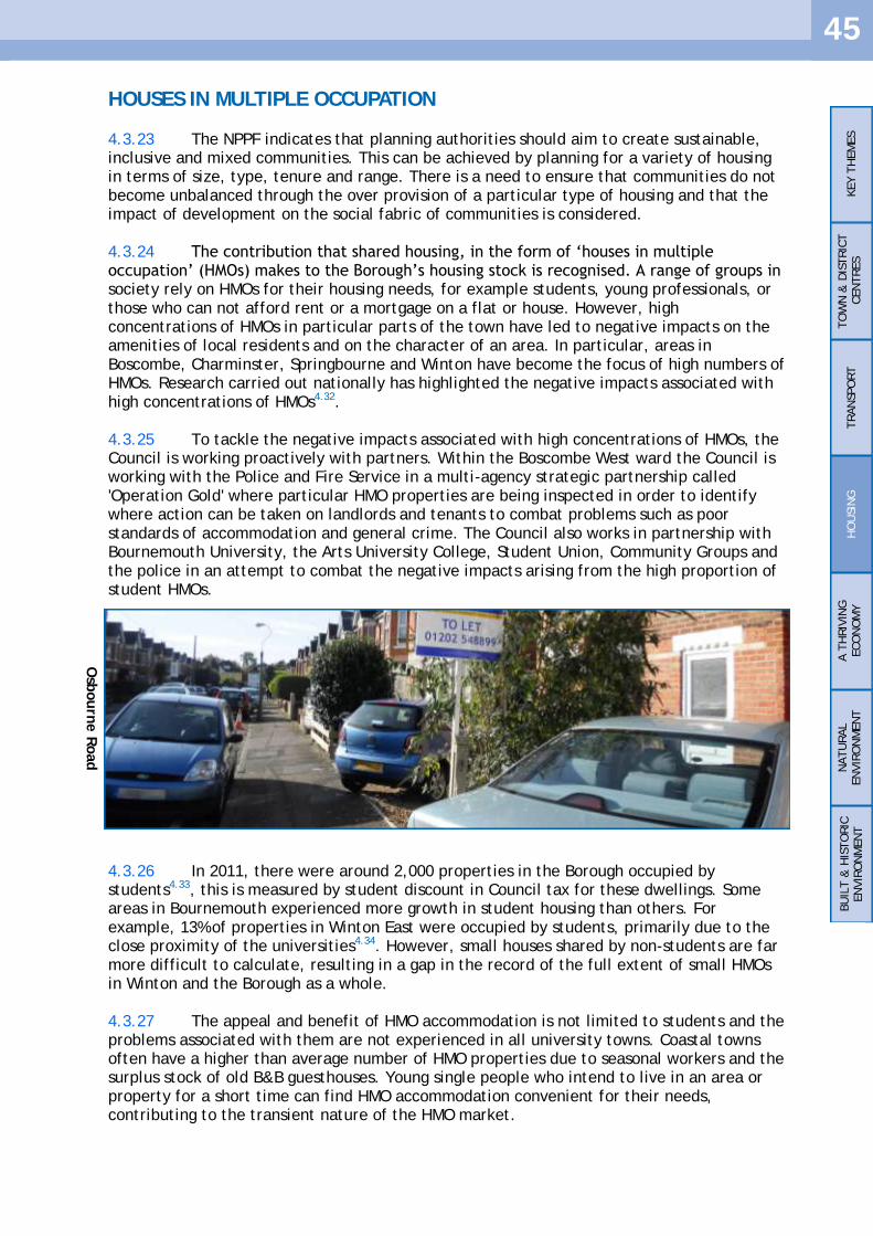
45
HOUSES IN MULTIPLE OCCUPATION
4.3.23 The NPPF indicates that planning authorities should aim to create sustainable, inclusive and mixed communities. This can be achieved by planning for a variety of housing in terms of size, type, tenure and range. There is a need to ensure that communities do not become unbalanced through the over provision of a particular type of housing and that the impact of development on the social fabric of communities is considered. 4.3.24 The contribution that shared housing, in the form of ‗houses in multiple occupation‘ (HMOs) makes to the Borough‘s housing stock is recognised. A range of groups in society rely on HMOs for their housing needs, for example students, young professionals, or those who can not afford rent or a mortgage on a flat or house. However, high concentrations of HMOs in particular parts of the town have led to negative impacts on the amenities of local residents and on the character of an area. In particular, areas in Boscombe, Charminster, Springbourne and Winton have become the focus of high numbers of HMOs. Research carried out nationally has highlighted the negative impacts associated with high concentrations of HMOs4.32. 4.3.25 To tackle the negative impacts associated with high concentrations of HMOs, the Council is working proactively with partners. Within the Boscombe West ward the Council is working with the Police and Fire Service in a multi-agency strategic partnership called 'Operation Gold' where particular HMO properties are being inspected in order to identify where action can be taken on landlords and tenants to combat problems such as poor standards of accommodation and general crime. The Council also works in partnership with Bournemouth University, the Arts University College, Student Union, Community Groups and the police in an attempt to combat the negative impacts arising from the high proportion of student HMOs. 4.3.26 In 2011, there were around 2,000 properties in the Borough occupied by students4.33, this is measured by student discount in Council tax for these dwellings. Some areas in Bournemouth experienced more growth in student housing than others. For example, 13% of properties in Winton East were occupied by students, primarily due to the close proximity of the universities4.34. However, small houses shared by non-students are far more difficult to calculate, resulting in a gap in the record of the full extent of small HMOs in Winton and the Borough as a whole. 4.3.27 The appeal and benefit of HMO accommodation is not limited to students and the problems associated with them are not experienced in all university towns. Coastal towns often have a higher than average number of HMO properties due to seasonal workers and the surplus stock of old B&B guesthouses. Young single people who intend to live in an area or property for a short time can find HMO accommodation convenient for their needs, contributing to the transient nature of the HMO market.
KEY T
HEM
ES
TO
WN
& D
ISTRIC
T
CEN
TRES
TRAN
SPO
RT
HO
USIN
G
A T
HRIV
ING
ECO
NO
MY
NATU
RAL
EN
VIR
ON
MEN
T
BU
ILT &
HIS
TO
RIC
EN
VIR
ON
MEN
T
Osb
ourn
e R
oad

46
4.3.28 There are two types of HMO to consider, the smaller Use Class C4 HMO properties (occupied by 3-6 unrelated people sharing basic amenities) and ‗Sui Generis‘ HMO properties (occupied by more than 6 unrelated people sharing basic amenities). In October 2010, the national planning regulations were amended allowing dwellings in Use Class C3 to change to a C4 HMO without the need for planning permission (planning permission still being required to change to large sui generis HMOs). As a result the Council made a borough wide Article 4 Direction, which came into force in December 2011. Consequently planning permission is required for both the change of use from a dwelling to a Use Class C4 and a Sui Generis HMO. 4.3.29 The policy is aimed at continuing to accommodate HMO uses within Bournemouth, but to manage the supply of new HMOs to avoid high concentrations of such uses in an area. The National HMO Lobby has identified that a community becomes unbalanced in respect of concentrations of HMOs when the threshold of 10% of properties in HMO use occurs4.35.
KEY T
HEM
ES
TO
WN
& D
ISTRIC
T
CEN
TRES
TRAN
SPO
RT
HO
USIN
G
A T
HRIV
ING
ECO
NO
MY
NATU
RAL
EN
VIR
ON
MEN
T
BU
ILT &
HIS
TO
RIC
EN
VIR
ON
MEN
T
Policy CS24 Houses of Multiple Occupation
In order to encourage mixed and balanced communities, the change of use from a Use Class C3 dwellinghouse to a House in Multiple Occupation (HMO), either Use Class C4 or Sui Generis, will only be permitted where no more than 10% of dwellings in the area adjacent to the application property are within a Use Class C4 or Sui Generis HMO use. For the purpose of this policy the area adjacent to the application property is defined as:
road frontage lying within 100 metres either side of the application property;
on the opposite side of the road - the property immediately opposite the application property and road frontage lying within 100 metres either side of this property;
on the road to the rear - the property immediately to the rear of the application property and road frontage lying within 100 metres either side of this property;
road frontage on either side of any adjacent road, where this frontage lies within 100 metres of the application property.
Where the distance defined in 1. to 4. divides a property, this property shall be included in any calculation.
Cast
le L
ane W
est

47
KEY T
HEM
ES
TO
WN
& D
ISTRIC
T
CEN
TRES
TRAN
SPO
RT
HO
USIN
G
A T
HRIV
ING
ECO
NO
MY
NATU
RAL
EN
VIR
ON
MEN
T
BU
ILT &
HIS
TO
RIC
EN
VIR
ON
MEN
T
GYPSY AND TRAVELLER SITES
4.3.30 The provision of both transit Gypsy and Traveller pitches and residential pitches in South East Dorset is being assessed through a joint Gypsy and Traveller (including Travelling Showpeople) Site Allocation Joint Development Plan Document being undertaken for eight local authorities including Bournemouth. However, individual windfall proposals may still be submitted for consideration to the Council in the interim or after the sites in the joint document have been identified. The Council will assess the merits of each application in accordance with Policy CS25.
Policy CS25 Assessment of Unallocated Gypsy and Traveller Sites
Proposals for unallocated Gypsy and Traveller sites will be assessed against the following criteria; sites should:
be well located to the highway network and enable access to schools, shops and healthcare;
provide on site facilities associated with residential use including parking, storage, and play;
allow for adequate levels of privacy and residential amenity for the occupiers;
not have a detrimental impact on the amenities of adjacent occupiers or the surrounding community;
not result in a detrimental impact upon the natural environment;
not be located in the Green Belt; and
not be within an identified zone (normally 400 metres) around heathlands.

48
4.4 A THRIVING ECONOMY
4.4.1 Bournemouth, Poole and Christchurch together form the Bournemouth-Poole Principal Urban Area. It is the second largest urban area in the South West and as such is economically important. The South West has, in recent years, witnessed a higher than average percentage of its working age population listed as economically active. Although Bournemouth has lagged below the regional figure it has been relatively consistent with the national average. 4.4.2 The job opportunities provided in Bournemouth are important to people from surrounding areas as well as local residents seeking work. Therefore, it is useful to consider the provision and demand within the Travel To Work Area (TTWA) when forecasting for the number of jobs required over the Plan period.
4.4.3 The Bournemouth TTWA is the broad catchment area for commuters working in Bournemouth. Within the TTWA there is a significant employment site at Aviation Park, adjacent to Bournemouth Airport, which comprises 80 hectares of land and is a base for over 140 businesses4.36. Employment opportunities at Bournemouth Airport are likely to come forward towards the latter part of the Plan period but are heavily dependent on a new link road from the A338 to make it a more accessible location as a major employment site. While this site offers significant employment opportunities, it is outside the Borough and falls within the Borough of Christchurch, who will ultimately decide future policies relating to its use.
KEY T
HEM
ES
TO
WN
& D
ISTRIC
T
CEN
TRES
TRAN
SPO
RT
HO
USIN
G
A T
HRIV
ING
ECO
NO
MY
NATU
RAL
EN
VIR
ON
MEN
T
BU
ILT &
HIS
TO
RIC
EN
VIR
ON
MEN
T
Map 2: Bournemouth Travel To Work Area
Bournemouth TTWA
Local Authority boundaries
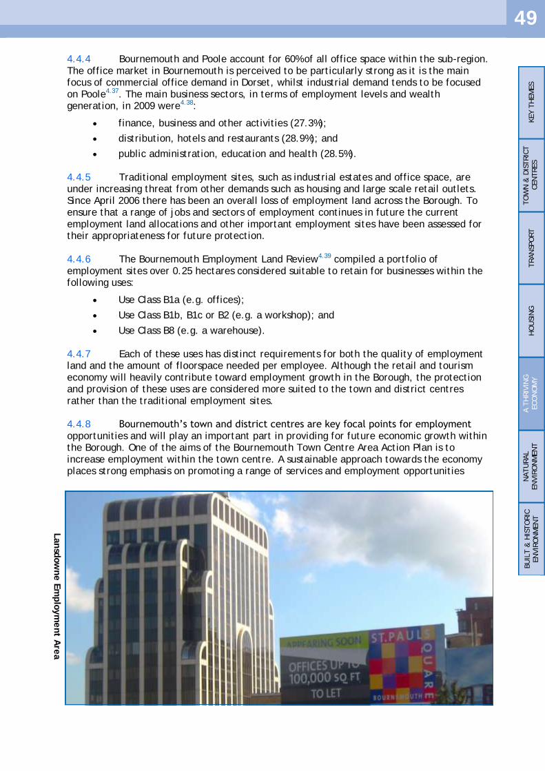
49
4.4.4 Bournemouth and Poole account for 60% of all office space within the sub-region. The office market in Bournemouth is perceived to be particularly strong as it is the main focus of commercial office demand in Dorset, whilst industrial demand tends to be focused on Poole4.37. The main business sectors, in terms of employment levels and wealth generation, in 2009 were4.38:
finance, business and other activities (27.3%);
distribution, hotels and restaurants (28.9%); and
public administration, education and health (28.5%). 4.4.5 Traditional employment sites, such as industrial estates and office space, are under increasing threat from other demands such as housing and large scale retail outlets. Since April 2006 there has been an overall loss of employment land across the Borough. To ensure that a range of jobs and sectors of employment continues in future the current employment land allocations and other important employment sites have been assessed for their appropriateness for future protection. 4.4.6 The Bournemouth Employment Land Review4.39 compiled a portfolio of employment sites over 0.25 hectares considered suitable to retain for businesses within the following uses:
Use Class B1a (e.g. offices);
Use Class B1b, B1c or B2 (e.g. a workshop); and
Use Class B8 (e.g. a warehouse). 4.4.7 Each of these uses has distinct requirements for both the quality of employment land and the amount of floorspace needed per employee. Although the retail and tourism economy will heavily contribute toward employment growth in the Borough, the protection and provision of these uses are considered more suited to the town and district centres rather than the traditional employment sites. 4.4.8 Bournemouth‘s town and district centres are key focal points for employment opportunities and will play an important part in providing for future economic growth within the Borough. One of the aims of the Bournemouth Town Centre Area Action Plan is to increase employment within the town centre. A sustainable approach towards the economy places strong emphasis on promoting a range of services and employment opportunities
KEY T
HEM
ES
TO
WN
& D
ISTRIC
T
CEN
TRES
TRAN
SPO
RT
HO
USIN
G
A T
HRIV
ING
ECO
NO
MY
NATU
RAL
EN
VIR
ON
MEN
T
BU
ILT &
HIS
TO
RIC
EN
VIR
ON
MEN
T
Lansd
ow
ne E
mplo
ym
ent A
rea

50
within centres, where employees can take advantage of good levels of accessibility by sustainable modes of transport including walking and cycling. Over the plan period these centres will retain and enhance their function as employment locations. 4.4.9 Using the Local Economy Forecasting Model 2008 produced by Cambridge Econometrics there is forecast growth of 41,900 jobs in Dorset between 2006 and 2026, including 23,000 in the Bournemouth TTWA and 16,000 within the Borough. These ‗jobs‘ comprise full-time employment, part-time employment and self-employment. In addition to preparing for the growth of some of the existing employment sectors in the Borough the Council considers the ‗Green Knowledge Economy‘ as a desirable direction for the local economy. Key to this is maximising the area‘s environmental qualities and ensuring that employment land is available for this emerging sector to deliver appropriate and accessible floorspace over the plan period4.40.
PROTECTING ALLOCATED EMPLOYMENT LAND
4.4.10 By analysing the predicted employment growth and decline over the plan period in terms of sector, it is possible to estimate the amount of land required by type. The Bournemouth, Dorset and Poole Workspace Strategy, 2008, indicated that over the course of the Core Strategy, Bournemouth is likely to see an increased demand for Use Class B1 and B8 land and a decrease in the need for Use Class B2 land. 4.4.11 It is anticipated that the increase in Use Class B8 will replace Use Class B2 on the existing industrial employment sites, with the churn from existing uses it has been calculated that providing the current industrial sties are protected from other uses, there will be sufficient land to meet the growth. The greatest growth is expected to be in office jobs, there is currently about 10 hectares of good quality undeveloped employment land that is suitable for new offices, but forecasts suggest that around 17 hectares of undeveloped land will be required over the plan period. 4.4.12 A proportion of the shortfall in suitable office land can be met by increasing the density of office space on the undeveloped sites in the Lansdowne Employment Area (see page 25). Similarly, it is anticipated that some offices will be located outside the allocated employment sites in the town centre or a district centre. However, to ensure successful growth of new offices until 2026, new employment land that is suitable for office development should be identified. Following the findings of the Employment Land Review it is considered appropriate to allocate an additional four sites for protection:
Sites to become allocated employment sites
Ashley Road Coal Yard
Ashley Road Station Approach
Chaseside
Wellington Road
Sites to release from current employment allocation
Upper Norwich Road
KEY T
HEM
ES
TO
WN
& D
ISTRIC
T
CEN
TRES
TRAN
SPO
RT
HO
USIN
G
A T
HRIV
ING
ECO
NO
MY
NATU
RAL
EN
VIR
ON
MEN
T
BU
ILT &
HIS
TO
RIC
EN
VIR
ON
MEN
T

51
4.4.13 Four additional sites will be included for protection. Ashley Road Coal Yard and Wellington Road have potential for new economic development. In addition Chaseside, which already has a large employment base, and Ashley Road Station Approach provide a valuable contribution to the economy in Bournemouth. The key employment sites for Bournemouth will be at:
Ashley Road, Coal Yard
Ashley Road, Station Approach
Castle Lane East, Deansleigh Road
Castle Lane East, Riverside Avenue
Chaseside
Elliot Road
Francis Avenue
Lansdowne
Poole Lane
Southcote Road
Wallisdown Road
Wellington Road
Wharfdale Road
Yeomans Road
4.4.14 All options for accessing the Riverside Avenue employment site will be thoroughly investigated by the Borough Council and identified within the Site Specific Allocations DPD.
KEY T
HEM
ES
TO
WN
& D
ISTRIC
T
CEN
TRES
TRAN
SPO
RT
HO
USIN
G
A T
HRIV
ING
ECO
NO
MY
NATU
RAL
EN
VIR
ON
MEN
T
BU
ILT &
HIS
TO
RIC
EN
VIR
ON
MEN
T
Employment Allocation
Town Centre Area Action Plan
District Centres 400m Zone
Green Belt
© Crown Copyright—All rights reserved, Bournemouth Borough Council 10019829, 2012
Diagram 4: A Thriving Economy

52
© Crown Copyright—All rights reserved, 10019829, 2012 Scale 1:2500
© Crown Copyright—All rights reserved, 10019829, 2012 Scale 1:5000
KEY T
HEM
ES
TO
WN
& D
ISTRIC
T
CEN
TRES
TRAN
SPO
RT
HO
USIN
G
A T
HRIV
ING
ECO
NO
MY
NATU
RAL
EN
VIR
ON
MEN
T
BU
ILT &
HIS
TO
RIC
EN
VIR
ON
MEN
T
Ashley Road Coal Yard
Map 3: Ashley Road Coal Yard Employment Allocation
Total area: 1.11 hectares Remaining developable area: 1.11 hectares Allocation reason: suitable for new employment development
Ashley Road Station Approach
Map 4: Ashley Road Station Approach Employment Allocation
Total area: 2.61 hectares Remaining developable area: none Allocation reason: retaining mixed business uses

53
© Crown Copyright—All rights reserved, 10019829, 2012 Scale 1:7500
© Crown Copyright—All rights reserved, 10019829, 2012 Scale 1:2500
KEY T
HEM
ES
TO
WN
& D
ISTRIC
T
CEN
TRES
TRAN
SPO
RT
HO
USIN
G
A T
HRIV
ING
ECO
NO
MY
NATU
RAL
EN
VIR
ON
MEN
T
BU
ILT &
HIS
TO
RIC
EN
VIR
ON
MEN
T
Chaseside
Map 5: Chaseside Employment Allocation
Total area: 11.82 hectares Remaining developable area: none Allocation reason: retaining key office employment
Wellington Road, Royal Mail Delivery Office
Map 6: Wellington Road Employment Allocation
Total area: 1.07 hectares Remaining developable area: 0.28 hectares Allocation reason: sustainable existing employment location with potential for new employment

54
KEY T
HEM
ES
TO
WN
& D
ISTRIC
T
CEN
TRES
TRAN
SPO
RT
HO
USIN
G
A T
HRIV
ING
ECO
NO
MY
NATU
RAL
EN
VIR
ON
MEN
T
BU
ILT &
HIS
TO
RIC
EN
VIR
ON
MEN
T
INCREASE PROTECTION FOR SITES OUTSIDE THE IDENTIFIED
ALLOCATIONS
4.4.15 Small businesses are vital to the local economy in Bournemouth. There are many small employment sites spread across the Borough and the continued loss of these sites could potentially have a significant impact on the health of the local economy. In recent years a considerable amount of employment land has been lost to other uses, predominantly housing4.41. Protecting unallocated sites allows for a diverse range of local sustainable employment opportunities.
Policy CS26 Protecting Allocated Employment Sites
Proposals for development in the allocated employment areas, as shown on the proposals map, that would result in the loss of sites or premises used, or last used, within Use Classes B1, B2 or B8 will not be permitted. New development on the allocated employment sites should provide a use within Use Classes B1, B2 or B8. Exceptionally, other employment development outside these Use Classes will be considered provided that they do not compromise the activities or integrity of the employment area and:
it can be demonstrated that there is no longer a need for the current employment use and the land and/or premises has been sufficiently and realistically marketed for Use Class B1, B2 and B8 uses for a period of at least 12 months;
the principal activity is not retail in nature;
there is a lack of suitable alternative sites, other than in existing employment areas for the type of employment activity proposed; and
the loss of the site to non Use Class B1, B2 or B8 uses would not prejudice the long term employment requirements of the Borough.
Policy CS27 Protecting Unallocated Employment Sites
Development resulting in the loss of sites or premises used, or last used, within Use Classes B1, B2 or B8 outside the allocated employment sites will not be permitted unless it can be demonstrated that either:
the current use causes environmental problems; or
the location of the premises is no longer suitable for employment use. Replacement uses will favour other employment generating uses prior to sites being considered for residential development. Prior to other non-employment uses being considered it must be demonstrated that an employment use is not forthcoming and the land and/or premises has been sufficiently and realistically marketed for a minimum of 12 months.

55
A BOROUGH WIDE APPROACH TO TOURISM
4.4.16 Bournemouth‘s economy relies heavily on tourism trade. A strategic approach to promoting tourism needs to balance the economic benefits of spreading tourism across the Borough with encouraging sustainable travel. The town centre will continue to be the focal point of tourism in Bournemouth and has proved broadly successful in retaining an appropriate stock of tourism accommodation and other facilities. 4.4.17 In recent years there has been a significant loss of hotels (particularly outside the town centre). However, more recently new hotels have been developed in the town catering for shorter breaks and conference tourism, indicating that the market is continuing to evolve. The effect of high residential land values has resulted in considerable pressure for the redevelopment of hotel sites and as a result the Council introduced a Tourism Supplementary Planning Guidance (SPG) document which outlined the factors to be taken into account during the assessment of planning applications that would result in the loss of tourism accommodation in the identified core areas. 4.4.18 The Core Strategy recognises the changing nature of tourism in the Borough and the contribution made by accommodation situated outside of the traditional tourism areas. At the same time it is acknowledged that some accommodation within the main tourism areas may no longer be viable or suitable for retention. Therefore Policy CS28 will be supplemented by a Tourism Supplementary Planning Document (SPD) that will apply across the Borough and will replace the existing Tourism Supplementary Planning Guidance. This is considered the best way to maintain an adequate range and availability of tourism accommodation in the town and help to sustain a competitive tourism economy into the future.
KEY T
HEM
ES
TO
WN
& D
ISTRIC
T
CEN
TRES
TRAN
SPO
RT
HO
USIN
G
A T
HRIV
ING
ECO
NO
MY
NATU
RAL
EN
VIR
ON
MEN
T
BU
ILT &
HIS
TO
RIC
EN
VIR
ON
MEN
T
Policy CS28 Tourist Accommodation
Development or change of use to form new hotels or guest houses will be granted planning permission providing there are no unreasonable effects on the character of the area or the amenities of local residents. Development resulting in the loss of sites or premises used, or last used, as tourist accommodation will only be considered acceptable where it can be demonstrated that the:
business is no longer viable and has no reasonable prospect of continuing; and
loss of the tourist accommodation will not harm the function of the area in relation to the tourism industry and the local community.
Bourn
em
outh
Beach a
nd P
ier

56
Policy CS29 Protecting Tourism and Cultural Facilities
Development resulting in the loss of sites or premises used, or last used, as a tourist or cultural facility will be resisted except where:
it can be demonstrated that the current use is no longer viable;
there is no reasonable prospect of the use continuing; and
it has been actively marketed with a guide price reflecting its market value for a period of 12 months.
In allowing a change of use from a tourist or cultural facility the planning authority will have regard to maintaining:
the function of the area in relation to the tourism industry and the local community; and
the character and appearance of the area.
RETAINING TOURISM AND CULTURAL FACILITIES
4.4.19 Bournemouth capitalises on its natural resources in attracting tourists. However, there are supporting facilities that make an important contribution to the quality of the overall experience of visiting Bournemouth and provide a variety of leisure uses for its residents. These facilities can provide particular attractions that draw people to the town (e.g. the BIC) or be places to eat and drink. Concerns have been raised over the loss of some key facilities in the town, particularly where these facilities are outside the main tourism areas and where there may be limited alternatives to a particular facility locally. A robust approach to the loss of such facilities ensures a varied and vibrant tourism economy and supports the cultural sector.
KEY T
HEM
ES
TO
WN
& D
ISTRIC
T
CEN
TRES
TRAN
SPO
RT
HO
USIN
G
A T
HRIV
ING
ECO
NO
MY
NATU
RAL
EN
VIR
ON
MEN
T
BU
ILT &
HIS
TO
RIC
EN
VIR
ON
MEN
T

57
4.5 NATURAL ENVIRONMENT, SPORT, RECREATION
AND GREEN INFRASTRUCTURE
4.5.1 The provision of a high quality sustainable environment, with a range of open spaces, habitats and natural features, including ecosystem services, encourages biodiversity and significantly contributes towards creating places where people want to live, work and visit. In providing for such an environment it is essential to strengthen the relationship between the local population, the natural environment and the range of open and green spaces. Existing and emerging national, sub-regional and local policies recognise the need to plan for sustainable communities and encourage the provision of a range of infrastructure and facilities as urban density increases. 4.5.2 The NPPF acknowledges that access to high quality open space and opportunities for sports and recreation underpins quality of life, including the delivery of health and wellbeing, attractive urban environments and biodiversity functions. The NPPF sets out the national approach to considering the potential impacts of planning on biodiversity and geological conservation. It stresses that policies should aim to maintain and enhance, restore or add to biodiversity and geological conservation interests, stating that sustainable development involves seeking a move from a net loss of biodiversity to a net gain. The NPPF stresses the importance of establishing policies to protect nationally and internationally important designated wildlife sites. The White Paper 'The Natural Choice: Securing the value of nature'4.42 emphasises the value of the natural environment in terms of its intrinsic value and for economic and social benefits, stressing that environmental issues should not be considered in isolation but across a range activities and policy making.
Figure 3: The Determinants of Health and Wellbeing in Our Settlements
Barton, H and Grant, M (2006) A health map for the human habit. Journal of the Royal
Society for the Promotion of Health, 126(6): 252-261.
KEY T
HEM
ES
TO
WN
& D
ISTRIC
T
CEN
TRES
TRAN
SPO
RT
HO
USIN
G
A T
HRIV
ING
ECO
NO
MY
NATU
RAL
EN
VIR
ON
MEN
T
BU
ILT &
HIS
TO
RIC
EN
VIR
ON
MEN
T
Hengistb
ury
Head
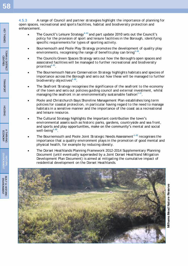
58
4.5.3 A range of Council and partner strategies highlight the importance of planning for open spaces, recreational and sports facilities, habitat and biodiversity protection and enhancement.
The Council‘s Leisure Strategy4.43 and part update 2010 sets out the Council‘s policy for the provision of sport and leisure facilities in the Borough, identifying specific requirements for types of sporting activity.
Bournemouth and Poole Play Strategy promotes the development of quality play environments, recognising the range of benefits play can bring4.44.
The Councils Green Spaces Strategy sets out how the Borough's open spaces and associated facilities will be managed to further recreational and biodiversity priorities4.45.
The Bournemouth Nature Conservation Strategy highlights habitats and species of importance across the Borough and sets out how these will be managed to further biodiversity objectives4.46.
The Seafront Strategy recognises the significance of the seafront to the economy of the town and sets out policies guiding council and external investment, whilst managing the seafront in an environmentally sustainable fashion4.47.
Poole and Christchurch Bays Shoreline Management Plan establishes long term policies for coastal protection, in particular having regard to the need to manage habitats in a sensitive manner and the importance of the coast as a recreational and leisure resource.
The Cultural Strategy highlights the important contribution the town‘s environmental assets such as historic parks, gardens, countryside and sea front, and sports and play opportunities, make on the community‘s mental and social well-being4.48.
The Bournemouth and Poole Joint Strategic Needs Assessment4.49 recognises the importance that a quality environment plays in the promotion of good mental and physical health, for example by reducing obesity.
The Dorset Heathlands Planning Framework 2012-2014 Supplementary Planning Document (until eventually superseded by a Joint Dorset Heathland Mitigation Development Plan Document) is aimed at mitigating the cumulative impact of residential development on the Dorset Heathlands.
KEY T
HEM
ES
TO
WN
& D
ISTRIC
T
CEN
TRES
TRAN
SPO
RT
HO
USIN
G
A T
HRIV
ING
ECO
NO
MY
NATU
RAL
EN
VIR
ON
MEN
T
BU
ILT &
HIS
TO
RIC
EN
VIR
ON
MEN
T
Milham
s M
ead N
atu
re R
ese
rve
59
GREEN INFRASTRUCTURE
4.5.4 Local authorities in South East Dorset, in partnership with Natural England, the Environment Agency and the Forestry Commission have developed the Investing in Green Places - South East Dorset Green Infrastructure Strategy. The strategy recommends a broader, cross conurbation, framework for the provision of high quality accessible strategic green infrastructure4.50. 4.5.5 The term green infrastructure refers to a connected network of multi-functional green assets, for example, sport pitches, public spaces, gardens, allotments, parks, street planting, beaches and cliffs. It also includes water based resources such as the sea, rivers and wetlands. Maintaining and enhancing the Borough's overall green infrastructure network supports a range of policy priorities, including:
encouraging economic investment and visitors to the town;
opportunities for recreation and health;
enhanced biodiversity and wildlife habitats;
local food production;
flood and surface water attenuation;
climate change mitigation and adaptation; and
improving other ecosystem services. 4.5.6 In effect these outcomes are interrelated and are also considered in other sections of the Core Strategy.
KEY T
HEM
ES
TO
WN
& D
ISTRIC
T
CEN
TRES
TRAN
SPO
RT
HO
USIN
G
A T
HRIV
ING
ECO
NO
MY
NATU
RAL
EN
VIR
ON
MEN
T
BU
ILT &
HIS
TO
RIC
EN
VIR
ON
MEN
T
Policy CS30 Promoting Green Infrastructure
The Council, through its own strategies and work programmes, and working with developers and other partners, will provide for a well connected and distributed multi-functional green infrastructure network, identifying the Borough as an urban greening zone and the coastal strip as a coastal enhancement zone, that:
Retains and enhances Bournemouth‘s attractiveness as a tourist destination and as a location for economic investment;
Assists in the mitigation of, and adaptation to, climate change;
Assists with flood and surface water attenuation;
Improves sustainable access through improved walking and cycling routes to key destinations, the coast and open spaces;
Connects and enriches biodiversity and wildlife habitats;
Promotes a healthy population through environmental enhancements, and increased access to open space, formal and informal recreation and sport opportunities;
Enhances the townscape, landscape, historical and cultural identity of the Borough;
Offers residents the opportunity to grow their own food through allotment and community garden provision;
Enhances the coastal strip including the beach, chines, cliffs, cliff top and Christchurch Harbour; and
Links to and complements sub-regional green infrastructure provision.

60
RECREATION, PLAY AND SPORTS
4.5.7 Bournemouth has some 780 hectares of public open space, with 304 hectares set aside for specific active recreational purposes, and the remaining 476 hectares classified either as countryside, woodland, clifftops, gardens, parkland or local amenity areas. The Borough's green and sporting assets significantly add to the attractiveness and success of the town in terms of the economy, environmental quality and social aspects such as physical activity, health and wellbeing. However, particular areas of the town are underprovided in terms of access to open spaces and this imbalance needs to be addressed, for example through encouraging multi-functional use of existing open spaces and improved linkages to spaces. 4.5.8 Supplementary Planning Guidance (SPG) 'Planning Obligations for the Provision of Open Space and Recreation Facilities4.51 requires a financial contribution from new development for open space and recreation facilities where on or off site provision is impractical. The Bournemouth and Poole Playing Pitch Strategy and Action Plan 2008, and the Bournemouth and Poole Sport and Recreation Built Facilities Strategy and Action Plan 2008 have been prepared in order to establish the future requirements for such uses4.52. These Strategies and Action Plans along with other strategies referred to above, or updated versions, provide evidence that will be used to revise the SPG, inform the Community Infrastructure Levy and draft a development management policy on the standards of green infrastructure provision.
KEY T
HEM
ES
TO
WN
& D
ISTRIC
T
CEN
TRES
TRAN
SPO
RT
HO
USIN
G
A T
HRIV
ING
ECO
NO
MY
NATU
RAL
EN
VIR
ON
MEN
T
BU
ILT &
HIS
TO
RIC
EN
VIR
ON
MEN
T
Policy CS31 Recreation, Play and Sports
The Local Planning Authority will refuse planning permission for development that results in the loss of public and private open spaces, including sports grounds and play grounds, which contribute to the recreational, visual, ecological or environmental value of an area or contribute to a network of green infrastructure, except where it is demonstrated to be underused and surplus to requirements and the benefits arising from development outweigh the loss of the space. The Council, through its own strategies and work programmes, and working with developers and other partners will seek to ensure that the quality, quantity, type and location of open space, sports grounds and play grounds meet demand for recreation and sporting activities. New residential development will be required to assist in the delivery of open space and recreational facilities.
Moord
ow
n R
ec

61
NATURE CONSERVATION
4.5.9 Bournemouth has a number of sites designated for their biodiversity and geodiversity interest, with internationally important heathland on Hengistbury Head, Turbary Common and Kinson Common. The Borough has 10 Local Nature Reserves (LNR) totalling 304 hectares, 14 Sites of Nature Conservation Interest (SNCI) totalling 135 hectares, 4 Sites of Special Scientific Interest (SSSI) totalling 185 hectares and 3 heathland sites designated as a Special Area of Conservation (SAC), Special Protection Area (SPA) or Ramsar Site totalling 76 hectares. The Christchurch Harbour SSSI is split between Bournemouth and Christchurch, it consists of the estuary servicing the internationally designated sites along the River Avon. 4.5.10 In accordance with the European Habitats Directive and Conservation of Habitats and Species Regulations 2010 a Habitats Regulation Assessment (HRA) has been prepared that assesses the potential effects of the Core Strategy on nature conservation sites of International importance4.53. The NPPF requires plans to set criteria based policies distinguishing between the hierarchy of designations and the level of protection afforded to them. Furthermore it indicates that the presumption in favour of sustainable development does not apply where development requiring appropriate assessment is being considered, planned or determined.
KEY T
HEM
ES
TO
WN
& D
ISTRIC
T
CEN
TRES
TRAN
SPO
RT
HO
USIN
G
A T
HRIV
ING
ECO
NO
MY
NATU
RAL
EN
VIR
ON
MEN
T
BU
ILT &
HIS
TO
RIC
EN
VIR
ON
MEN
T
Policy CS32 International Sites
Proposals for development which may adversely affect the integrity of a candidate or designated Special Area of Conservation, potential or classified Special Protection Area, or Ramsar site, will be allowed only if there is no alternative solution and if there are imperative reasons of overriding public interest.
Diagram 5: Natural Environment, Sport, Recreation and Green Infrastructure
© Crown Copyright—All rights reserved, Bournemouth Borough Council 10019829, 2012
Existing Open Space
Improved Green Linkages
Heathland 400m Protection Zone
Coastal Enhancement Zone
Stour Valley Project
Urban Greening Zone

62
4.5.11 Species of native plants and animals are present beyond the protected sites that are protected by international and national legislation. Some of these are identified as Biodiversity Action Plan species, for example the Otter and the Pipistrelle Bat. The Council's Nature Conservation Strategy and Dorset Biodiversity Strategy4.54 highlight those sites and species of importance across the Borough and set out how these will be managed to further biodiversity objectives. 4.5.12 As South East Dorset, and in particular Bournemouth, will continue to be a focus for residential growth it is imperative that the cumulative effects of housing development on the sensitive heathland habitat and associated species is carefully controlled. With this mind, and in order to satisfy the Habitats Directive, the Dorset Heathlands Joint Development Plan Document will be progressed to replace the current Dorset Heathlands Planning Framework 2012-2014 SPD4.55. In accordance with the SPD residential development within 400 metres of these sites is resisted due to likely negative impacts resulting from additional recreation and other urban pressures. Residential development between 400 metres and 5 kilometres of a heathland is required to avoid or mitigate any adverse effects upon the heathland site‘s integrity through avoidance and access management measures such as the provision of Suitable Alternative Natural Greenspace (SANG) or a financial contribution towards the provision of SANG or measures currently delivered through the Urban Heathland Partnership. SANGs will be required to be of a suitable size and designed to offer users an attractive alternative to heath destinations.
4.5.13 Proposals for residential development will continue to be assessed against this policy and the Dorset Heathlands Planning Framework 2012-2014 SPD until these are superseded by a Joint Dorset Heathland Mitigation Development Plan Document.
KEY T
HEM
ES
TO
WN
& D
ISTRIC
T
CEN
TRES
TRAN
SPO
RT
HO
USIN
G
A T
HRIV
ING
ECO
NO
MY
NATU
RAL
EN
VIR
ON
MEN
T
BU
ILT &
HIS
TO
RIC
EN
VIR
ON
MEN
T
Policy CS33 Heathland
Development will not be permitted unless it can be ascertained that the development will not lead to an adverse effect upon the integrity, directly or indirectly, of the Dorset Heaths international designations. To ensure the heathland sites are not harmed:
Residential development involving a net increase in dwellings will not be permitted within an identified zone (normally 400 metres) around heathlands;
Between the identified zone and 5 kilometres of a heathland, residential development will be required to take all necessary steps on site to avoid or mitigate any adverse effects upon the heathland site‘s integrity, or, where this cannot be achieved within the development, make provision for mitigation measures designed to avoid such adverse effects taking place.
Hengis
tbury
Head

63
4.5.14 Sites of Special Scientific Interest, Local Nature Reserves, Sites of Nature Conservation Interest and sites with geodiversity interest have an essential role to play in encouraging biodiversity and contributing to the quality of life in the Borough. In addition other features and sites beyond those specifically identified can add to the ecological integrity of the area. For example, green corridors are important for maintaining wildlife movement and can be havens for flora and fauna. Trees, particularly if they are locally native, are significant in the landscape and provide both environmental and ecological benefits. 4.5.15 As development continues over the plan period it will be essential to manage the negative impacts on landscape and ecological quality resulting from the cumulative loss of garden space. This can be attributed to infill development or larger replacement buildings on existing sites and associated hardstanding. Such an adverse outcome runs counter to advice in the NPPF that pursuing sustainable development should include protecting and enhancing ecosystems and seeking to secure net gains of biodiversity. Design Guidance will therefore be updated to ensure that development does not impose unacceptable damage on the town's landscape, biodiversity, ecosystem services and habitat features. Advice will be developed on retaining features of ecological importance, on the use of native species in planting schemes, including features that can benefit particular species of flora and fauna, and mitigating the impacts of climate change for example through urban shading and sustainable drainage systems.
KEY T
HEM
ES
TO
WN
& D
ISTRIC
T
CEN
TRES
TRAN
SPO
RT
HO
USIN
G
A T
HRIV
ING
ECO
NO
MY
NATU
RAL
EN
VIR
ON
MEN
T
BU
ILT &
HIS
TO
RIC
EN
VIR
ON
MEN
T
Policy CS35 Nature and Geological Conservation Interests
The Council will promote the Borough's biodiversity and geodiversity interests. When determining proposals that could have an adverse impact on a Local Nature Reserve, Site of Nature Conservation Interest, linear landscape feature, river or wetland, woodland or veteran tree, the Council will seek to ensure that the sites, or features, biodiversity and / or geodiversity interest is maintained and enhanced. If significant harm resulting from a development cannot be avoided through:
1. relocating on an alternative site with less harmful impacts
2. adequate mitigation, or
3. as a last resort, through adequate compensation,
then planning permission will be refused by the Local Planning Authority. The Council will work with partners and developers to restore, or add to, the Borough's biodiversity and geological conservation networks and seek protection and recovery of priority species having regard to the National and Local Biodiversity Action Plan (BAP) targets and to the negative impacts resultant from the loss of garden space.
Policy CS34 Sites of Special Scientific Interest
The Local Planning Authority will normally refuse planning permission for developments on land within, or outside, a Site of Special Scientific Interest that would be likely to have an adverse effect on a Site of Special Scientific Interest (either individually or in combination with other developments). Where an adverse effect on the site‘s notified special interest features is likely, an exception will only be made where the benefits of the development, at this site, clearly outweigh both the impacts that it is likely to have on the features of the site that make it of special scientific interest and any broader impacts on the national network of Sites of Special Scientific Interest.

64
STOUR VALLEY PROJECT
4.5.16 The Stour Valley has potential for a significant recreation and habitat resource as identified in the Leisure Strategy, Green Spaces Strategy and Green Infrastructure Strategy. The Stour Valley runs from Hengistbury Head to Bear Cross and beyond the Borough to the north and west. Fragmented sections of the valley are already publicly accessible, with the Stour Valley Way linking open spaces adjacent to the river. However, more extensive and coherent cycling and walking access through the valley and increased provision for environmentally friendly activities will greatly enhance opportunities for outdoor recreation. The Stour Valley has the potential to provide SANGs, thereby deflecting recreation pressure from sensitive heathland habitats. As Bournemouth continues to accommodate more residential growth, pressures on existing open spaces and sensitive habitats will increase.
4.5.17 The biodiversity and overall enjoyment of the valley and river would benefit from sensitive habitat and landscape enhancement including sustainable land management such as traditional grazing, natural flood attenuation and local food production. Management Plans have been prepared for Hengistbury Head and the Stour Valley Local Nature Reserve, these address potentially conflicting interests between amenity pressures, conservation and archaeological interests. In order to provide for better defined and more accessible entry to the valley, and to act as focal points for environmental activities and engagement, gateway points should be developed. Where feasible these gateways should provide for visitor centres, educational activities, interpretation and public facilities. The proposed visitor centre at Hengistbury Head will act as a gateway at Christchurch Harbour and there is potential to develop the Stour Acres Barn, in Muscliffe, to provide a similar resource further along the valley. The Multi Area Agreement ‗Action Plan for the Green Knowledge Economy‘ recognises the potential of the Stour Valley to contribute to furthering the aim a providing for a quality ‗greener‘ environment as a key driver of the economy4.56.
Policy CS36 Stour Valley Project
The Stour Valley has the potential to act as a sub-regionally significant recreation and habitat resource. The Council and partners will promote sustainable public access and implement a management plan that considers the following:
Sustainable access from the urban area, to a continuous walking, cycling and bridleway route through the valley, including links to the north of the River Stour;
Gateway points in the valley offering education, interpretation and other public facilities;
A demonstration farm and visitor centre at Hick‘s Farm, Muscliffe;
Habitat restoration including floodplain grazing marsh, reed beds, wet woodland and in-stream corridor habitats;
Opportunities for flood water attenuation and storage; and
Creating a valley landscape that performs the function of a ‗Suitable Alternative Natural Greenspace‘ (SANG).
Thro
op
KEY T
HEM
ES
TO
WN
& D
ISTRIC
T
CEN
TRES
TRAN
SPO
RT
HO
USIN
G
A T
HRIV
ING
ECO
NO
MY
NATU
RAL
EN
VIR
ON
MEN
T
BU
ILT &
HIS
TO
RIC
EN
VIR
ON
MEN
T

65
GREEN BELT
4.5.18 The South East Dorset Green Belt is long established. The NPPF indicates the importance the Government continues to attach to maintaining the openness of Green Belt land. There are five purposes of including land in green belts:
to check the unrestricted sprawl of large built-up areas;
to prevent neighbouring towns from merging into one another;
to assist in safeguarding the countryside from encroachment;
to preserve the setting and special character of historic towns; and
to assist in urban regeneration, by encouraging the recycling of derelict and other urban land.
4.5.19 The part of the South East Dorset Green Belt in Bournemouth forms a narrow strip between the edge of the urban area and the Borough boundary, roughly following the course of the River Stour. The green belt will continue to play a key function in protecting the separate physical identity of the town by maintaining wedges or corridors of open land between built up areas of the Borough and development in Christchurch and East Dorset. It will also continue to protect the identities of the villages of Throop and Holdenhurst.
MINIMISING POLLUTION
4.5.20 There are various sources of pollution, which can range from water based pollution to land and airborne pollution. These can result in impacts on health, amenity, and the natural environment. The NPPF requires that Local Plans take a strategic policy approach to the siting of potentially polluting development and on the location of sensitive development in proximity to existing sources of pollution. The Development Management DPD will include policies that aim to minimise the impacts of pollution, for example through the use of appropriate siting, construction techniques and design principles. Other Core Strategy policies encourage the use of Sustainable Drainage Systems (SUDS).
Policy CS37 Green Belt
The South East Dorset Green Belt will continue to be designated in the Borough. Within the Green Belt inappropriate development, including uses of land, will not be permitted. Inappropriate development will include any development which does not maintain the openness of the land or which conflicts with the purposes of including land within the Green Belt.
Policy CS38 Minimising Pollution
In order to protect environmental quality, human health and safety and general amenity development will be required to minimise potential pollution by way of noise, odour, light, effluent, vibration or any other waste materials. Mitigation measures will be required where pollution is unavoidable. Development that may be sensitive to existing or potentially polluting sources will not be sited in proximity to such sources and potentially polluting development will not be sited near to sensitive development.
KEY T
HEM
ES
TO
WN
& D
ISTRIC
T
CEN
TRES
TRAN
SPO
RT
HO
USIN
G
A T
HRIV
ING
ECO
NO
MY
NATU
RAL
EN
VIR
ON
MEN
T
BU
ILT &
HIS
TO
RIC
EN
VIR
ON
MEN
T

66
4.6 A QUALITY BUILT AND HISTORIC ENVIRONMENT
4.6.1 A quality built environment is recognised in the vision and objectives of the plan as key to the future of the town. The NPPF stresses that the Government attaches great importance to the design of the built environment. It explains that it is indivisible from good planning and emphasises the importance of positively planning for high quality and inclusive design. It states planning permission should be refused for development of poor design that fails to take the opportunities available for improving the character and quality of an area and the way it functions. 4.6.2 The NPPF also requires that Local Plans should set out a positive strategy for the conservation and enjoyment of the historic environment. The issues for Bournemouth relate to pressure from new development and the need to protect the historic fabric of the town; the need to enhance the character, setting and public realm of the historic environment. The risks of not addressing these issues through a proactive approach include potential loss of historic assets and deterioration in the quality of the built environment. The Council acknowledges the importance of the condition of Bournemouth‘s heritage assets and will continue to notify English Heritage of those at risk so that they can be added to their Register. 4.6.3 Opportunities to continue to understand, preserve and enhance Bournemouth‘s historic assets will be sought through work on: neighbourhood planning, green infrastructure, public realm improvements, identification of buildings for the local list and Conservation Area Appraisals. Consideration will also be given to carrying out a Bournemouth-wide historic environment assessment. The Town Centre AAP will also contribute to a proactive strategy through, for example, enhancement of the Lower Gardens and preparation of an Urban Design SPD and Public Realm SPD.
KEY T
HEM
ES
TO
WN
& D
ISTRIC
T
CEN
TRES
TRAN
SPO
RT
HO
USIN
G
A T
HRIV
ING
ECO
NO
MY
NATU
RAL
EN
VIR
ON
MEN
T
BU
ILT &
HIS
TO
RIC
EN
VIR
ON
MEN
T
Bourn
em
outh
Tow
n H
all a
nd C
entr
al G
ard
ens
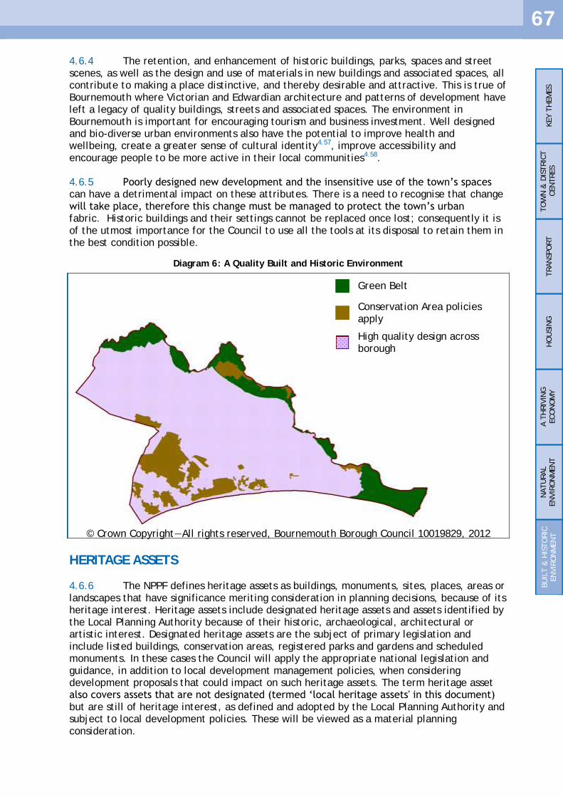
67
4.6.4 The retention, and enhancement of historic buildings, parks, spaces and street scenes, as well as the design and use of materials in new buildings and associated spaces, all contribute to making a place distinctive, and thereby desirable and attractive. This is true of Bournemouth where Victorian and Edwardian architecture and patterns of development have left a legacy of quality buildings, streets and associated spaces. The environment in Bournemouth is important for encouraging tourism and business investment. Well designed and bio-diverse urban environments also have the potential to improve health and wellbeing, create a greater sense of cultural identity4.57, improve accessibility and encourage people to be more active in their local communities4.58. 4.6.5 Poorly designed new development and the insensitive use of the town‘s spaces can have a detrimental impact on these attributes. There is a need to recognise that change will take place, therefore this change must be managed to protect the town‘s urban fabric. Historic buildings and their settings cannot be replaced once lost; consequently it is of the utmost importance for the Council to use all the tools at its disposal to retain them in the best condition possible.
HERITAGE ASSETS
4.6.6 The NPPF defines heritage assets as buildings, monuments, sites, places, areas or landscapes that have significance meriting consideration in planning decisions, because of its heritage interest. Heritage assets include designated heritage assets and assets identified by the Local Planning Authority because of their historic, archaeological, architectural or artistic interest. Designated heritage assets are the subject of primary legislation and include listed buildings, conservation areas, registered parks and gardens and scheduled monuments. In these cases the Council will apply the appropriate national legislation and guidance, in addition to local development management policies, when considering development proposals that could impact on such heritage assets. The term heritage asset also covers assets that are not designated (termed ‗local heritage assets' in this document) but are still of heritage interest, as defined and adopted by the Local Planning Authority and subject to local development policies. These will be viewed as a material planning consideration.
KEY T
HEM
ES
TO
WN
& D
ISTRIC
T
CEN
TRES
TRAN
SPO
RT
HO
USIN
G
A T
HRIV
ING
ECO
NO
MY
NATU
RAL
EN
VIR
ON
MEN
T
BU
ILT &
HIS
TO
RIC
EN
VIR
ON
MEN
T
Green Belt
Conservation Area policies apply
High quality design across borough
Diagram 6: A Quality Built and Historic Environment
© Crown Copyright—All rights reserved, Bournemouth Borough Council 10019829, 2012

68
DESIGNATED HERITAGE ASSETS
4.6.7 A conservation area is defined under section 69 of the Planning (Listed Buildings and Conservation Areas) Act 1990 as ―an area of special architectural or historic interest, the character or appearance of which it is desirable to preserve or enhance‖. Controls over development in these areas include rules over demolition of existing structures, and fewer permitted development rights. The Borough currently has 21 conservation areas. The Development Management DPD will set out detailed policies for the management, protection and further enhancement of Bournemouth's conservation areas, as well as other national and local heritage assets. It will also update any saved Local Plan policies covering development affecting these areas or that may impact on locally important historic and cultural assets. The Council is also producing a set of conservation area character appraisals that provide information on each conservation area and advice to prospective developers on how they should be maintained. These appraisals will continue to be used to guide future development and changes that may impact on the recognised attributes of a conservation area. 4.6.8 Statutorily listed buildings and their settings are protected under national legislation under the Planning (Listed Buildings and Conservation Areas) Act 1990, which places special controls on the works that may be carried out on them. These are buildings of intrinsic architectural or historic interest. There are more than 250 statutory listed buildings in the Borough and they include many forms of structural development from Victorian villas, shops and churches to farmhouses4.59. 4.6.9 Designated heritage assets are not limited to buildings but may also include historic parks and gardens, as recorded on the English Heritage Register of Parks and Gardens of Historic Interest. Historic parks and gardens form an important part of Bournemouth's heritage and character. The NPPF indicates that they form a material consideration in the assessment of applications for development that could affect them. 4.6.10 Designated heritage assets also include Scheduled Monuments. These are monuments considered to be of national importance by the government and English Heritage takes the lead in identifying sites in England. Those in Bournemouth can be found at Hengistbury Head and Wick.
Policy CS39 Designated Heritage Assets
The Local Planning Authority will seek to protect designated heritage assets from demolition, inappropriate alterations, extensions or other proposals that would adversely affect their significance. Proposals for development likely to result in substantial harm to, or loss of, Grade II listed buildings or parks and gardens will only be approved in exceptional circumstances, and for a Grade I or II* listed buildings or parks and gardens only in wholly exceptional circumstances. Where a proposal for alteration, extension or demolition is likely to affect a designated heritage asset or its setting, the developer will be required to submit an assessment of that asset and indicate the impact of the proposal on the asset.
KEY T
HEM
ES
TO
WN
& D
ISTRIC
T
CEN
TRES
TRAN
SPO
RT
HO
USIN
G
A T
HRIV
ING
ECO
NO
MY
NATU
RAL
EN
VIR
ON
MEN
T
BU
ILT &
HIS
TO
RIC
EN
VIR
ON
MEN
T
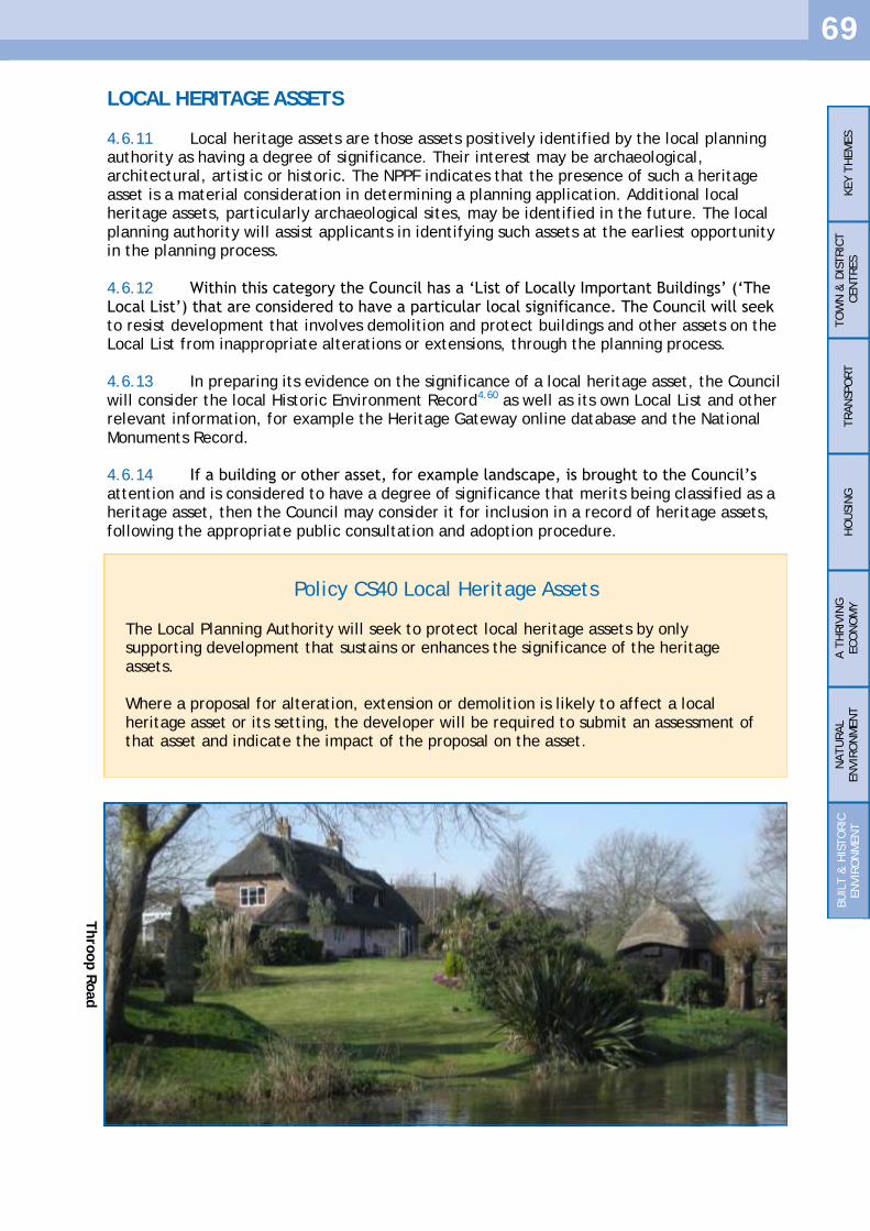
69
LOCAL HERITAGE ASSETS
4.6.11 Local heritage assets are those assets positively identified by the local planning authority as having a degree of significance. Their interest may be archaeological, architectural, artistic or historic. The NPPF indicates that the presence of such a heritage asset is a material consideration in determining a planning application. Additional local heritage assets, particularly archaeological sites, may be identified in the future. The local planning authority will assist applicants in identifying such assets at the earliest opportunity in the planning process. 4.6.12 Within this category the Council has a ‗List of Locally Important Buildings‘ (‗The Local List‘) that are considered to have a particular local significance. The Council will seek to resist development that involves demolition and protect buildings and other assets on the Local List from inappropriate alterations or extensions, through the planning process. 4.6.13 In preparing its evidence on the significance of a local heritage asset, the Council will consider the local Historic Environment Record4.60 as well as its own Local List and other relevant information, for example the Heritage Gateway online database and the National Monuments Record. 4.6.14 If a building or other asset, for example landscape, is brought to the Council‘s attention and is considered to have a degree of significance that merits being classified as a heritage asset, then the Council may consider it for inclusion in a record of heritage assets, following the appropriate public consultation and adoption procedure.
Policy CS40 Local Heritage Assets
The Local Planning Authority will seek to protect local heritage assets by only supporting development that sustains or enhances the significance of the heritage assets. Where a proposal for alteration, extension or demolition is likely to affect a local heritage asset or its setting, the developer will be required to submit an assessment of that asset and indicate the impact of the proposal on the asset.
KEY T
HEM
ES
TO
WN
& D
ISTRIC
T
CEN
TRES
TRAN
SPO
RT
HO
USIN
G
A T
HRIV
ING
ECO
NO
MY
NATU
RAL
EN
VIR
ON
MEN
T
BU
ILT &
HIS
TO
RIC
EN
VIR
ON
MEN
T
Thro
op R
oad

70
QUALITY DESIGN
4.6.15 The council is committed to achieving good design in all new development and spaces. The design of new buildings and associated spaces, including materials used and the attention paid to the detailing of a scheme are all important elements of a wider sustainable community. Such attention to detail can not only maintain the area‘s existing character, local distinctiveness and function but can also significantly enhance it. Design of development should, at an early stage, consider the lifestyle choices of residents, including the need for outdoor private space and the potential for enhancements to habitats and biodiversity. It should also respond to the existing character, movement patterns, appearance and other attributes of the existing area in which a proposed development is to be sited. 4.6.16 In 2008, in recognition of the need to promote high quality design in residential development the council adopted the Residential Development Design Guide and the Residential Extensions Design Guide. These act as best practice guidance and assist in interpreting local and national policies. Future revisions of these guides will be undertaken periodically as required. Building for Life standards also support and promote high quality design in new residential development. The Council will continue to encourage use of the Building for Life standards in new residential developments. Further information, including the 20 requirements of Building for Life can be found on the website: www.designcouncil.org.uk.
Policy CS41 Quality Design
The Council will seek to ensure that all development and spaces are well designed and of a high quality. Development should, through its scale, density, layout, siting, character and appearance be designed to respect the site and its surroundings, provide a high standard of amenity to meet the day to day requirements of future occupants, and contribute positively to the appearance and safety of the public realm. The Council will seek to ensure that new developments, including changes of use, enhance the character, local distinctiveness, cultural identity, amenities of future occupants and neighbouring residents. New developments should also aim to conserve and improve landscape and townscape, biodiversity and habitats. The Council will encourage all new residential developments to meet Building for Life standards. Development which by virtue of its design would be detrimental to the built environment, amenity or character of any part of the Borough will not be permitted.
KEY T
HEM
ES
TO
WN
& D
ISTRIC
T
CEN
TRES
TRAN
SPO
RT
HO
USIN
G
A T
HRIV
ING
ECO
NO
MY
NATU
RAL
EN
VIR
ON
MEN
T
BU
ILT &
HIS
TO
RIC
EN
VIR
ON
MEN
T

71
5.1 DELIVERY AND MONITORING
5.1.1 It is necessary for a Local Plan to be aspirational but realistic. The NPPF indicates that it is important to ensure that there is a realistic prospect that planned infrastructure is deliverable in a timely fashion. This section breaks down the Core Strategy into the individual polices that will deliver the overall vision and objectives and gives an analysis of how the policy aims will be achieved. 5.1.2 Infrastructure includes a range of facilities and services including roads, transport, utilities, health and education facilities, open spaces and leisure and recreation facilities. 5.1.3 The Delivery and Implementation Table takes each Core Strategy policy in turn and examines how the policy links to each objective of the plan and how and when the policy will be delivered. It also examines potential risks or barriers to the policies and the likely sources of funding that will help towards bringing the policies forward. It is clear that many of the policies will be ongoing through the plan period and this reflects the local context of Bournemouth where there are few large allocations of land for development or large development projects outside the town centre. More detail on the evidence gathered examining what infrastructure is known to be required to enable the Core Strategy to be delivered is contained in a supporting document "Infrastructure Delivery and Implementation". 5.1.4 When looking at the delivery methods it is implicit that the individual policy itself will be used when considering planning proposals and therefore is a delivery method in itself. The ‗Delivery Methods‘ column looks at the other factors and strategies that combine with the particular policy to go towards achieving the objectives and vision of the Bournemouth Plan.
PLAN, MONITOR AND MANAGE
5.1.5 The Core Strategy sets a vision and objectives for Bournemouth to achieve by 2026. It is more than a traditional land use document as it strives to deliver these objective and the vision through a suite of spatial policies. The progress that this plan makes needs to be monitored to ensure it is successfully delivering, or if not, identify the areas where there are problems. 5.1.6 The Core Strategy is the key document in the Local Plan, all other development documents must implement its strategy and deliver upon its vision. Every year the Council produces an Annual Monitoring Report (AMR), which records development across the Borough. The statistics drawn from the AMR are valuable in measuring the success of an adopted approach and predicting future trends. The AMR has been produced since 2006/07 and has recorded the progress already made toward achieving the targets of this plan. Bournemouth Borough Council will continue to produce an AMR annually as it is an essential monitoring tool. It is intended that in addition to annual monitoring a cycle of more comprehensive monitoring and review of the Core Strategy housing provision is established with review dates of 2016 and 2021. If evidence suggests that additional housing is required a review of the Core Strategy will consider the appropriate response. 5.1.7 The documents that sit ‗under‘ the Core Strategy and combine with it to form the Local Plan, such as the Affordable Housing Development Plan Document and the Bournemouth Town Centre Area Action Plan will be judged upon their ability to deliver this Core Strategy. The Council will consider the merits of producing additional Development

72
Plan Documents (DPDs) to update existing planning policies, particularly if the AMR indicates that current policy is not delivering the objectives of the Core Strategy and is failing to meet targets. Documents making up the Local Plan must conform with the Core Strategy. 5.1.8 In addition to DPDs, a Supplementary Planning Document (SPD) can be produced comparatively quickly and without the need for independent examination. They are a useful tool for explaining and expanding on planning policies. 5.1.9 If the objectives in this document cannot be delivered through other planning documents consideration will be given to revising the Core Strategy.

73
5.2
D
ELIV
ERY A
ND
IM
PLEM
EN
TAT
ION
TA
BLE
Core
Str
ate
gy P
olicy
Obje
cti
ves
delivere
d
Pri
ncip
al D
elivery
Agencie
s D
elivery
meth
ods
When w
ill
policy
aim
be
delivere
d
Fundin
g
Ris
ks
or
barr
iers
to
delivery
C
onti
ngency P
lan
CS 1
NPPF P
resu
mpti
on in
Favour
of
Sust
ain
able
D
evelo
pm
ent
1,2
,3,4
,5,6
D
elivery
agencie
s fo
r Policy C
S1 w
ill sp
an
those
specif
ied f
or
the o
ther
Policie
s in
the
Core
Str
ate
gy d
eta
iled in t
his
table
.
Delivery
meth
ods
for
Policy C
S1 w
ill sp
an t
hose
sp
ecif
ied f
or
oth
er
polices
in t
he C
ore
Str
ate
gy in t
his
ta
ble
. O
ngoin
g
Fundin
g f
or
Policy C
S1 w
ill sp
an
those
specif
ied f
or
oth
er
polices
in
the C
ore
Str
ate
gy in t
his
table
. N
/A
N/A
CS 2
Sust
ain
able
hom
es
and
pre
mis
es
1,
6
Pri
vate
Resi
denti
al
and C
om
merc
ial Pro
pert
y
Develo
pers
Bourn
em
outh
Boro
ugh C
ouncil
Socia
l H
ousi
ng P
rovid
ers
New
pri
vate
and p
ublic s
ecto
r re
sidenti
al and
com
merc
ial develo
pm
ent;
Buildin
gs
Regula
tions
post
2013.
BREEAM
sta
ndard
s Code f
or
Sust
ain
able
Hom
es
Ongoin
g o
n a
n
incre
menta
l basi
s as
new
develo
pm
ent
com
es
forw
ard
Pro
vis
ion f
acto
red into
build c
ost
s on
new
develo
pm
ents
In
vest
ment
to s
ecure
Feed in T
ari
ff
Perc
enta
ge t
arg
et
in p
lace is
tem
pora
ry m
easu
re p
endin
g
changes
to B
uildin
g R
egula
tions.
D
ela
y in c
hanges
to B
uildin
g
Regula
tions
would
mean
pro
posa
ls b
elo
w t
hre
shold
would
be e
xem
pt.
BREEAM
and C
ode f
or
Sust
ain
able
H
om
es
rem
ain
ing v
olu
nta
ry.
Lack o
f via
bilit
y in d
evelo
pm
ents
m
ay m
ake p
olicy d
iffi
cult
to
imple
ment
ahead o
f Buildin
g
Regula
tions
changes.
Consi
der
revis
ion o
f policy s
hould
the
curr
ent
pro
jecte
d
changes
in n
ati
onal
regula
tions
is d
ela
yed
or
not
com
e f
orw
ard
.
CS 3
Sust
ain
able
energ
y a
nd
heat
1,
6
Bourn
em
outh
Boro
ugh C
ouncil w
ith s
pecia
list
part
ner
com
panie
s Specia
list
pri
vate
secto
r pro
vid
ers
Tow
n c
entr
e d
istr
ict
heati
ng s
chem
e (
feasi
bilit
y s
tudy
com
ple
ted);
Furt
her
pote
nti
al sc
hem
es
com
ing f
orw
ard
; Specia
list
pri
vate
secto
r in
vest
ment
Tow
n c
entr
e
dis
tric
t h
eati
ng
schem
e
pote
nti
ally w
ithin
fi
rst
five y
ears
. O
ther
inst
allati
ons
- ongoin
g a
s new
develo
pm
ent
pro
posa
ls c
om
e
forw
ard
; N
ew
inst
allati
ons
on e
xis
ting
buildin
gs
- ongoin
g.
Pri
vate
secto
r in
vest
ment
to
inst
all dis
tric
t heati
ng s
yst
em
s;
Pri
vate
and p
ublic s
ecto
r in
vest
ment
on n
ew
buildin
gs;
Pri
vate
and p
ublic s
ecto
r in
vest
ment
on inst
allati
ons
on
exis
ting b
uildin
gs;
In
vest
ment
to s
ecure
Feed in T
ari
ff
Relu
cta
nce o
f h
om
es
and
busi
ness
es
to u
se d
istr
ict
heati
ng
syst
em
; Reducti
on o
f in
centi
ve f
rom
Feed
in T
ari
ff;
Availabilit
y o
f pri
vate
fin
ance.
Geophysi
cal,
am
enit
y and n
atu
re
conse
rvati
on r
est
rain
ts.
Consi
der
revis
ion o
f policy.
How
ever
som
e
issu
es
may b
e
insu
rmounta
ble
such a
s la
ck o
f w
ind s
peed o
r pre
sence o
f a
desi
gnate
d n
atu
re
conse
rvati
on s
ite.
CS 4
Surf
ace w
ate
r fl
oodin
g
1,
6
Housi
ng a
nd c
om
merc
ial develo
pers
in t
he
pri
vate
and p
ublic s
ecto
rs
Bourn
em
outh
Boro
ugh C
ouncil
Envir
onm
ent
Agency
New
develo
pm
ent
in t
he p
ublic a
nd p
rivate
secto
r.
Ongoin
g
Pro
vis
ion f
acto
red into
build c
ost
s on
new
develo
pm
ents
Physi
cal
rest
rain
ts m
ay m
ake u
se
on p
art
icula
r si
tes
inappro
pri
ate
but
should
be
feasi
ble
on m
ost
None
CS 5
Pro
moti
ng a
Healt
hy
Com
munit
y
1,2
,4
Bourn
em
outh
Boro
ugh C
ouncil
Develo
pers
in t
he p
rivate
and p
ublic s
ecto
rs
Natu
ral Engla
nd
Envir
onm
ent
Agency
The T
ree C
ouncil
New
resi
denti
al
and c
om
merc
ial develo
pm
ent
in t
he
pri
vate
and p
ublic s
ecto
r D
evelo
pm
ent
Managem
ent
DPD
Sust
ain
able
Com
munit
ies
and S
ite A
llocati
ons
DPD
Bourn
em
outh
Dors
et
and P
oole
Local Tra
nsp
ort
Pla
n;
Open S
pace a
nd R
ecre
ati
on S
PG
D
ors
et
Heath
lands
Inte
rim
Pla
nnin
g F
ram
ew
ork
and D
ors
et
Heath
lands
Join
t D
PD
Bourn
em
outh
Gre
en S
paces
Str
ate
gy
Bourn
em
outh
Leis
ure
Str
ate
gy
Bourn
em
outh
and P
oole
Pla
y S
trate
gy
Bourn
em
outh
Natu
re C
onse
rvati
on S
trate
gy
Bourn
em
outh
Seafr
ont
Str
ate
gy
Poole
and C
hri
stchurc
h B
ay S
hore
line M
anagem
ent
Pla
n
Bourn
em
outh
Cult
ura
l Str
ate
gy
Rig
hts
of
Way Im
pro
vem
ent
Pla
n
Ongoin
g
Local Auth
ori
ty f
unded c
apit
al
and
revenue p
rogra
mm
es;
D
evelo
per
contr
ibuti
ons
curr
entl
y
thro
ugh t
he O
pen S
pace a
nd
Recre
ati
on S
PG
. To b
e c
onsi
dere
d
for
inclu
sion in C
IL;
Develo
per
Contr
ibuti
ons
thro
ugh
Dors
et
Heath
lands
Inte
rim
Pla
nnin
g
Fra
mew
ork
and D
ors
et
Heath
lands
Join
t D
PD
. To b
e c
onsi
dere
d f
or
inclu
sion in C
IL;
Envir
onm
enta
l Ste
ward
ship
(H
igher
Level Ste
ward
ship
) Access
Managem
ent
Gra
nt
Heri
tage L
ott
ery
Fund
Big
Lott
ery
Fund (
Aw
ard
s fo
r All)
Landfi
ll C
om
munit
ies
Fund
Tre
e C
ouncil gra
nts
Envir
onm
ent
Agency in
vest
ment
pro
gra
mm
e
EU
fundin
g (
LIF
E,
LEAD
ER,
INTERREG
IV
)
Reducti
on in L
ocal Auth
ori
ty,
oth
er
public a
gency a
nd E
U
fundin
g
Reducti
on in d
evelo
per
contr
ibuti
ons
Exam
inin
g p
ote
nti
al
addit
ional fu
ndin
g
stre
am
s e.g
. N
ew
Hom
es
Bonus,
Carb
on
off
sett
ing

74
Core
Str
ate
gy P
olicy
Obje
cti
ves
delivere
d
Pri
ncip
al D
elivery
Agencie
s D
elivery
meth
ods
When w
ill
policy
aim
be
delivere
d
Fundin
g
Ris
ks
or
barr
iers
to
delivery
C
onti
ngency P
lan
CS 6
Deliveri
ng S
ust
ain
able
Com
munit
ies
1,2
,3,4
,5,6
Delivery
agencie
s fo
r Policy C
S5 w
ill sp
an
those
specif
ied fo
r th
e o
ther
policie
s in
the
Bourn
em
outh
Pla
n in t
his
table
. This
will be
develo
ped f
urt
her
in t
he D
eliveri
ng
Sust
ain
able
Com
munit
ies
and S
ite A
llocati
ons
DPD
Delivery
meth
ods
for
policy C
S5 w
ill sp
an t
hose
sp
ecif
ied f
or
oth
er
policie
s in
the C
ore
Str
ate
gy in t
his
ta
ble
. This
will be d
evelo
ped f
urt
her
in t
he D
evelo
pin
g
Sust
ain
able
Com
munit
ies
and S
ite A
llocati
ons
DPD
.
Ongoin
g w
hile
Deliveri
ng
Sust
ain
able
Com
munit
ies
and
Sit
e A
llocati
ons
DPD
is
develo
ped
Fundin
g f
or
Policy C
S5 w
ill sp
an
those
specif
ied fo
r th
e o
ther
policie
s in
the B
ourn
em
outh
Pla
n in t
his
ta
ble
. This
will be d
evelo
ped f
urt
her
in t
he D
eliveri
ng S
ust
ain
able
Com
munit
ies
and S
ite A
llocati
ons
DPD
To b
e c
onsi
dere
d in t
he D
eliveri
ng
Sust
ain
able
Com
munit
ies
and S
ite
Allocati
ons
DPD
N
/A
CS 7
Bourn
em
outh
Tow
n
Centr
e
2,3
,4,5
Bourn
em
outh
Boro
ugh C
ouncil
Develo
pers
in t
he p
rivate
and p
ublic s
ecto
rs
Pri
vate
secto
r busi
ness
es
Educati
on p
rovid
ers
H
ote
l chain
s and Indiv
idual to
uri
sm
accom
modati
on b
usi
ness
es
Bourn
em
outh
Develo
pm
ent
Com
pany
Tow
n C
entr
e M
anagem
ent
Board
Bourn
em
outh
Cham
ber
of
Tra
de a
nd
Com
merc
e
New
resi
denti
al
and c
om
merc
ial develo
pm
ent
in t
he
pri
vate
and p
ublic s
ecto
r;
Tow
n C
entr
e A
rea A
cti
on P
lan
Develo
pm
ent
Managem
ent
DPD
Bourn
em
outh
Tow
n C
entr
e V
isio
n
Resi
denti
al D
esi
gn G
uid
e
Develo
pm
ents
in t
he e
ducati
on s
ecto
r G
reen K
now
ledge E
conom
y d
evelo
pm
ents
D
evelo
pm
ent
of
Council o
wned land
Ongoin
g
Pri
vate
secto
r develo
pm
ent
fundin
g
Local Auth
ori
ty capit
al and r
evenue
pro
gra
mm
es
Bourn
em
outh
Develo
pm
ent
Com
pany
invest
ment
Secti
on 1
06 a
gre
em
ent
contr
ibuti
ons/
CIL
Lack o
f pri
vate
secto
r busi
ness
develo
pm
ent
com
ing f
orw
ard
if
econom
y r
ecovers
slo
wly
Busi
ness
develo
pm
ent
att
racte
d
els
ew
here
(e.g
. Poole
, Bourn
em
outh
Air
port
D
ecline in s
hop p
rem
ises
occupati
on r
ate
s due t
o r
ecess
ion
Decline in t
ouri
st t
rade
Revie
w p
olicy.
CS 8
Lansd
ow
ne
Em
plo
ym
ent
Are
a
3,4
,5
Pri
vate
secto
r busi
ness
es
Bourn
em
outh
Univ
ers
ity
Bourn
em
outh
Boro
ugh C
ouncil
Bourn
em
outh
Develo
pm
ent
Com
pany
Tow
n C
entr
e M
anagem
ent
Board
Bourn
em
outh
Cham
ber
of
TRade a
nd
Com
merc
e
Pri
vate
secto
r com
merc
ial develo
pm
ents
D
evelo
pm
ents
in t
he e
ducati
on s
ecto
r G
reen K
now
ledge E
conom
y d
evelo
pm
ents
D
evelo
pm
ent
of
Council o
wned land
Tow
n C
entr
e A
rea A
cti
on P
lan
Develo
pm
ent
Managem
ent
DPD
Bourn
em
outh
Tow
n C
entr
e V
isio
n
Ongoin
g r
enew
al
and
redevelo
pm
ent
Pri
vate
secto
r develo
pm
ent
fundin
g
Local Auth
ori
ty capit
al and r
evenue
pro
gra
mm
es
Bourn
em
outh
Develo
pm
ent
Com
pany
invest
ment
Secti
on 1
06 a
gre
em
ent
contr
ibuti
ons/
CIL
Lack o
f pri
vate
secto
r busi
ness
develo
pm
ent
com
ing f
orw
ard
if
econom
y r
ecovers
slo
wly
Busi
ness
develo
pm
ent
att
racte
d
els
ew
here
(e.g
. Poole
, Bourn
em
outh
Air
port
Revie
w p
olicy.
Exam
ine s
trate
gy in
Tow
n C
entr
e A
rea
Acti
on P
lan.
Re-e
xam
ine c
onst
rain
ts
to d
evelo
pm
ent
e.g
. Park
ing p
olicy
Conti
nued p
ress
ure
for
appro
val of
non
em
plo
ym
ent
use
s
CS 9
Enhancin
g D
istr
ict
Centr
es
1,2
,3,4
,5
Pri
vate
secto
r busi
ness
es
Bourn
em
outh
Boro
ugh C
ouncil
Pri
vate
and p
ublicly
funded h
ousi
ng
develo
pers
Yellow
Buse
s W
ilts
and D
ors
et
Buse
s N
HS B
ourn
em
outh
and P
oole
Pri
vate
secto
r busi
ness
develo
pm
ent
New
busi
ness
sta
rt u
ps
Pri
vate
and p
ublicly
funded h
ousi
ng d
evelo
pm
ents
Pro
vis
ion o
f lo
cal healt
h s
erv
ices
Local Auth
ori
ty p
rovid
ed p
ublic r
ealm
im
pro
vem
ents
D
evelo
pm
ent
Managem
ent
DPD
policie
s D
eliveri
ng S
ust
ain
able
Com
munit
ies
and S
ite
Allocati
ons
DPD
Bourn
em
outh
Dors
et
and P
oole
Local Tra
nsp
ort
Pla
n
Ongoin
g
Pri
vate
secto
r com
merc
ial
develo
pm
ent
fundin
g
Pri
vate
and p
ublicly
funded h
ousi
ng
Local Auth
ori
ty c
apit
al and r
evenue
pro
gra
mm
es
Secti
on 1
06 a
gre
em
ent
contr
ibuti
ons/
CIL
N
HS f
undin
g f
or
pro
vis
ion o
f lo
cal
healt
h s
erv
ices
Bus
com
pany f
undin
g
Decline in s
hop p
rem
ises
occupati
on r
ate
s due t
o r
ecess
ion
Lack o
f su
itable
sit
es
to
accom
modate
addit
ional re
quir
ed
serv
ices
in t
he c
entr
es
Reducti
on in a
vailable
Local
Auth
ori
ty
fundin
g
Reducti
on in n
um
ber/
frequency
of
bus
route
s
Pro
ducti
on a
nd if
necess
ary
revie
w o
f th
e
deta
iled p
olicie
s and
allocati
ons
in t
he
Deliveri
ng S
ust
ain
able
Com
munit
ies
and S
ite
Allocati
ons
DPD
CS 1
0 M
ajo
r Convenie
nce
Reta
il D
evelo
pm
ent
3,4
M
ajo
r Reta
iler
Majo
r Reta
iler
pro
pose
d d
evelo
pm
ent
Millh
am
s develo
pm
ent
lik
el
y w
ithin
the f
irst
5
years
Pri
vate
reta
il invest
ment
Majo
r re
tailer
does
not
take u
p
the s
ite
Str
ate
gic
allocati
on
whic
h R
eta
il C
apacit
y
study indic
ate
d w
ould
benefi
t Kin
son.
Unlikely
to
am
end a
llocati
on in
the s
hort
to m
ediu
m
term
CS 1
1 P
rote
cti
ng L
ocal
Facilit
ies
and S
erv
ices
1,3
,5
N/A
Develo
pm
ent
Managem
ent
DPD
O
ngoin
g
N/A
Excess
of
em
pty
pre
mis
es
if
busi
ness
es
are
not
via
ble
Revie
w o
f th
is p
olicy o
r policie
s in
Develo
pm
ent
Managem
ent
DPD
CS 1
2 R
eta
inin
g C
om
munit
y
Use
s 1,4
,5
N/A
Develo
pm
ent
Managem
ent
DPD
O
ngoin
g
N/A
Rate
of
success
at
appeal
for
the
policy
Revie
w o
f th
is p
olicy o
r policie
s in
Develo
pm
ent
Managem
ent
DPD
if
not
support
ed a
t appeal .
CS 1
3 K
ey T
ransp
ort
Route
s 4
Bourn
em
outh
Boro
ugh C
ouncil
Neig
hbouri
ng H
ighw
ay A
uth
ori
ties
Yellow
Buse
s W
ilts
and D
ors
et
Buse
s
Bourn
em
outh
Dors
et
and P
oole
Local Tra
nsp
ort
Pla
n
Bus
Str
ate
gy
Road S
afe
ty S
trate
gy
Develo
pm
ent
Managem
ent
DPD
D
eliveri
ng S
ust
ain
able
Com
munit
ies
and S
ite
Allocati
ons
DPD
Over
the p
lan
peri
od in c
o -
ord
inate
d w
ith
Local Tra
nsp
ort
Pla
n.
Bourn
em
outh
Boro
ugh C
ouncil a
nd
neig
hbouri
ng a
uth
ori
ties
capit
al and
revenue p
rogra
mm
es
Secti
on 1
06 a
gre
em
ent
contr
ibuti
ons
South
East
Dors
et
Tra
nsp
ort
Contr
ibuti
ons
SPG
/CIL
Bus
com
pany f
undin
g
Reducti
on in L
ocal Auth
ori
ty,
fundin
g
Reducti
on in d
evelo
per
contr
ibuti
ons
Reducti
on in n
um
ber/
frequency
of
bus
route
s
Revie
w a
t next
revis
ion
of
Local Tra
nsp
ort
Pla
n
Pro
ducti
on a
nd if
necess
ary
revie
w o
f th
e
deta
iled p
olicie
s and
allocati
ons
in t
he
Deliveri
ng S
ust
ain
able
Com
munit
ies
and S
ite
Allocati
ons
DPD

75
CS 1
4 D
eliveri
ng T
ransp
ort
In
frast
ructu
re
1,
4
Bourn
em
outh
Boro
ugh C
ouncil
Develo
pers
in t
he p
rivate
and p
ublic s
ecto
rs
Bourn
em
outh
Dors
et
and P
oole
Local Tra
nsp
ort
Pla
n
Develo
pm
ent
Managem
ent
DPD
D
eliveri
ng S
ust
ain
able
Com
munit
ies
and S
ite
Allocati
ons
DPD
Over
the p
lan
peri
od in c
o -
ord
inate
d w
ith
Local Tra
nsp
ort
Pla
n.
Secti
on 1
06 c
ontr
ibuti
ons
South
East
Dors
et
Tra
nsp
ort
Contr
ibuti
ons
SPG
/CIL
Reducti
on in d
evelo
per
contr
ibuti
ons
Revie
w a
t next
revis
ion
of
Local Tra
nsp
ort
Pla
n
Pro
ducti
on a
nd if
necess
ary
revie
w o
f th
e
deta
iled p
olicie
s and
allocati
ons
in t
he
Deliveri
ng S
ust
ain
able
Com
munit
ies
and S
ite
Allocati
ons
DPD
CS 1
5 G
reen T
ravel Pla
ns
and T
ransp
ort
Ass
ess
ments
1,
4
Non r
esi
denti
al develo
pers
in t
he p
rivate
and
public s
ecto
rs
Requir
ed info
rmati
on w
ith p
lannin
g a
pplicati
ons
New
resi
denti
al
and c
om
merc
ial develo
pm
ent
in t
he
pri
vate
and p
ublic s
ecto
r Bourn
em
outh
Dors
et
and P
oole
Local Tra
nsp
ort
Pla
n
Develo
pm
ent
Managem
ent
DPD
Ongoin
g a
s develo
pm
ent
com
es
forw
ard
N
/A
N/A
N/A
CS 1
6 P
ark
ing S
tandard
s 1,4
D
evelo
pers
in t
he p
rivate
and p
ublic s
ecto
rs
New
resi
denti
al
and c
om
merc
ial develo
pm
ent
in t
he
pri
vate
and p
ublic s
ecto
r Bourn
em
outh
Park
ing S
tandard
s (e
merg
ing t
o r
epla
ce
standard
s in
Bourn
em
outh
Dis
tric
t W
ide L
ocal Pla
n)
Ongoin
g a
s develo
pm
ent
com
es
forw
ard
N
/A
N/A
N/A
CS 1
7 E
ncoura
gin
g G
reener
Vehic
le T
echnolo
gie
s 1,6
D
evelo
pers
in t
he p
rivate
and p
ublic s
ecto
rs
Bourn
em
outh
Boro
ugh C
ouncil in p
art
ners
hip
New
resi
denti
al
and c
om
merc
ial develo
pm
ent
in t
he
pri
vate
and p
ublic s
ecto
r Bourn
em
outh
Dors
et
and P
oole
Local Tra
nsp
ort
Pla
n
Develo
pm
ent
Managem
ent
DPD
Resi
denti
al D
esi
gn G
uid
e
Ongoin
g a
s develo
pm
ent
com
es
forw
ard
Pro
vis
ion f
acto
red into
build c
ost
s on
new
develo
pm
ents
Cost
of
pro
vis
ion o
f public v
ehic
le
charg
ing p
oin
ts
Take u
p o
f gre
ener
vehic
le
technolo
gie
s
Revie
w o
f policy
CS 1
8 Incre
asi
ng
Opport
unit
ies
for
Cycling
and W
alk
ing
1,4
Bourn
em
outh
Boro
ugh C
ouncil
Neig
hbouri
ng L
ocal
Auth
ori
ties
Develo
pers
in t
he p
rivate
and p
ublic s
ecto
rs
Sust
rans
New
resi
denti
al
and c
om
merc
ial develo
pm
ent
in t
he
pri
vate
and p
ublic s
ecto
r Bourn
em
outh
Dors
et
and P
oole
Local Tra
nsp
ort
Pla
n
Develo
pm
ent
Managem
ent
DPD
Bourn
em
outh
Park
ing S
tandard
s (e
merg
ing t
o r
epla
ce
standard
s in
Bourn
em
outh
Dis
tric
t W
ide L
ocal Pla
n)
Deliveri
ng S
ust
ain
able
Com
munit
ies
and S
ite
Allocati
ons
DPD
Sm
art
er
Choic
es
Str
ate
gic
Cycle
Route
Netw
ork
Tra
vel Pla
nnin
g
Rig
hts
of
Way Im
pro
vem
ent
Pla
n
Over
the p
lan
peri
od in c
o -
ord
inate
d w
ith
Local Tra
nsp
ort
Pla
n.
Indiv
idual
develo
pm
ent
- ongoin
g a
s develo
pm
ent
com
es
forw
ard
.
Bourn
em
outh
Boro
ugh C
ouncil a
nd
neig
hbouri
ng a
uth
ori
ties
capit
al and
revenue p
rogra
mm
es
Secti
on 1
06 a
gre
em
ent
contr
ibuti
ons
South
East
Dors
et
Tra
nsp
ort
Contr
ibuti
ons
SPG
/CIL
Reducti
on in L
ocal Auth
ori
ty,
fundin
g
Reducti
on in d
evelo
per
contr
ibuti
ons
Revie
w o
f policy,
Local
Tra
nsp
ort
Pla
n s
trate
gy
and fu
ndin
g s
tream
s
CS 1
9 P
rote
cti
ng S
mall
Fam
ily D
wellin
ghouse
s 2
Bourn
em
outh
Boro
ugh C
ouncil
Consi
dera
tion o
f in
div
idual pla
nnin
g p
roposa
ls
Over
the p
lan
peri
od
N/A
Rate
of
success
at
appeal
for
the
policy
Policy r
evie
w
CS 2
0 E
ncoura
gin
g S
mall
Fam
ily D
wellin
ghouse
s 2
Resi
denti
al develo
pers
in t
he p
rivate
and
publicly
funded s
ecto
rs
Bourn
em
outh
Boro
ugh C
ouncil
New
resi
denti
al develo
pm
ent
in t
he p
rivate
and
publicly
funded s
ecto
r D
evelo
pm
ent
Managem
ent
DPD
Resi
denti
al D
esi
gn G
uid
e
Over
the p
lan
peri
od
Pri
vate
and p
ublicly
funded h
ousi
ng
Rate
of
success
at
appeal
for
the
policy
Slo
w r
ecovery
of
housi
ng
mark
et
fro
m t
he
recess
ion d
epre
ssin
g b
uild r
ate
s
Policy r
evie
w
CS 2
1 H
ousi
ng D
istr
ibuti
on
Acro
ss B
ourn
em
outh
1,2
,3,4
,5,6
Resi
denti
al develo
pers
in t
he p
rivate
and
publicly
funded s
ecto
rs
Bourn
em
outh
Boro
ugh C
ouncil
New
resi
denti
al develo
pm
ent
in t
he p
rivate
and
publicly
funded s
ecto
r Tow
n C
entr
e A
rea A
cti
on P
lan
Develo
pm
ent
Managem
ent
DPD
Resi
denti
al D
esi
gn G
uid
e
Over
the p
lan
peri
od
Pri
vate
and p
ublicly
funded h
ousi
ng
Incre
ase
d d
ensi
ty p
ote
nti
al
insu
ffic
ient
to s
trongly
dir
ect
dir
ect
develo
pm
ent
to p
refe
rred
locati
ons
Develo
pers
wis
hin
g t
o c
oncentr
ate
in
less
sust
ain
able
part
s of
the
Boro
ugh
Slo
w r
ecovery
of
housi
ng
mark
et
fro
m t
he
recess
ion d
epre
ssin
g b
uild r
ate
s
Policy re
vie
w
CS 2
2 N
ew
Housi
ng O
uts
ide
the P
refe
rred L
ocati
ons
2
Resi
denti
al develo
pers
in t
he p
rivate
and
publicly
funded s
ecto
rs
Bourn
em
outh
Boro
ugh C
ouncil
New
resi
denti
al develo
pm
ent
in t
he p
rivate
and
publicly
funded s
ecto
r D
evelo
pm
ent
Managem
ent
DPD
Resi
denti
al D
esi
gn G
uid
e
Over
the p
lan
peri
od
Pri
vate
and p
ublicly
funded h
ousi
ng
Rate
of
success
at
appeal
for
the
policy
Slo
w r
ecovery
of
housi
ng
mark
et
fro
m t
he
recess
ion d
epre
ssin
g b
uild r
ate
s
Policy re
vie
w
CS 2
3 E
ncoura
gin
g L
ifeti
me
Hom
es
Sta
ndard
s 2,6
Resi
denti
al develo
pers
in t
he p
rivate
and
publicly
funded s
ecto
rs
Bourn
em
outh
Boro
ugh C
ouncil
New
resi
denti
al develo
pm
ent
in t
he p
rivate
and
publicly
funded s
ecto
r Lif
eti
me H
om
es
Sta
ndard
s D
evelo
pm
ent
Managem
ent
DPD
Tow
n C
entr
e A
rea A
cti
on P
lan
Resi
denti
al D
esi
gn G
uid
e
Ongoin
g o
r unti
l su
ch t
ime a
s th
e
standard
s becom
e
mandato
ry
Pri
vate
and p
ublicly
funded h
ousi
ng
Policy is
an e
ncoura
gin
g o
ne s
o
there
can b
e no c
om
puls
ion
thro
ugh t
his
policy.
N/A
CS 2
4 H
ouse
s in
Mult
iple
O
ccupati
on
2
Pri
vate
pro
pert
y o
wners
and r
ente
d p
ropert
y
landlo
rds
Bourn
em
outh
Boro
ugh C
ouncil
Consi
dera
tion o
f in
div
idual pla
nnin
g p
roposa
ls
Ongoin
g
N/A
Rate
of
success
at
appeal
for
the
policy
Revie
w p
olicy t
o
adju
st ass
ess
ment
cri
teri
a
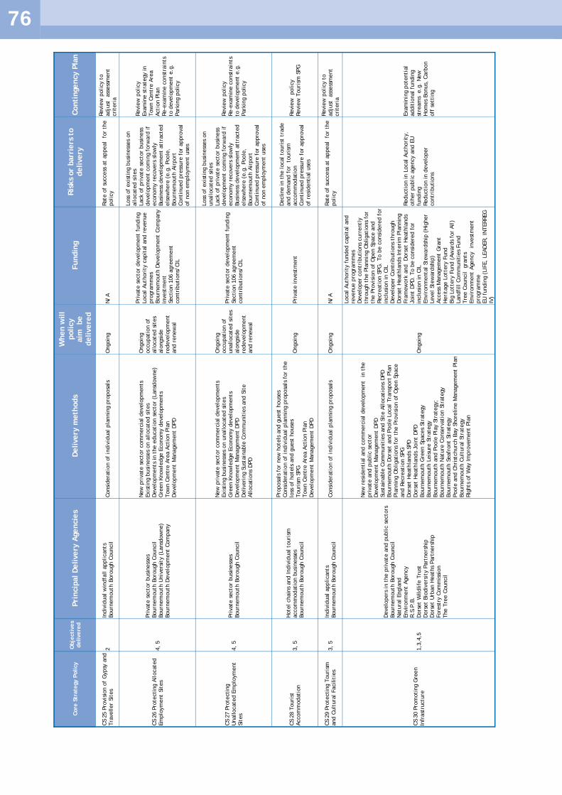
76
Core
Str
ate
gy P
olicy
Obje
cti
ves
delivere
d
Pri
ncip
al D
elivery
Agencie
s D
elivery
meth
ods
When w
ill
policy
aim
be
delivere
d
Fundin
g
Ris
ks
or
barr
iers
to
delivery
C
onti
ngency P
lan
CS 2
5 P
rovis
ion o
f G
ypsy
and
Tra
veller
Sit
es
2
Indiv
idual w
indfa
ll a
pplicants
Bourn
em
outh
Boro
ugh C
ouncil
Consi
dera
tion o
f in
div
idual pla
nnin
g p
roposa
ls
Ongoin
g
N/A
Rate
of
success
at
appeal
for
the
policy
Revie
w p
olicy t
o
adju
st ass
ess
ment
cri
teri
a
CS 2
6 P
rote
cti
ng A
llocate
d
Em
plo
ym
ent
Sit
es
4,
5
Pri
vate
secto
r busi
ness
es
Bourn
em
outh
Boro
ugh C
ouncil
Bourn
em
outh
Univ
ers
ity (
Lansd
ow
ne)
Bourn
em
outh
Develo
pm
ent
Com
pany
New
pri
vate
secto
r com
merc
ial develo
pm
ents
Exis
ting b
usi
ness
es
on a
llocate
d s
ites
Develo
pm
ents
in t
he e
ducati
on s
ecto
r (L
ansd
ow
ne)
Gre
en K
now
ledge E
conom
y d
evelo
pm
ents
Tow
n C
entr
e A
rea A
cti
on P
lan
Develo
pm
ent
Managem
ent
DPD
Ongoin
g
occupati
on o
f allocate
d s
ites
alo
ngsi
de
redevelo
pm
ent
and r
enew
al
Pri
vate
secto
r develo
pm
ent
fundin
g
Local Auth
ori
ty c
apit
al and r
evenue
pro
gra
mm
es
Bourn
em
outh
Develo
pm
ent
Com
pany
invest
ment
Secti
on 1
06 a
gre
em
ent
contr
ibuti
ons/
CIL
Loss
of
exis
ting b
usi
ness
es
on
allocate
d s
ites
Lack o
f pri
vate
secto
r busi
ness
develo
pm
ent
com
ing f
orw
ard
if
econom
y r
ecovers
slo
wly
Busi
ness
develo
pm
ent
att
racte
d
els
ew
here
(e.g
. Poole
, Bourn
em
outh
Air
port
Conti
nued p
ress
ure
for
appro
val
of
non e
mplo
ym
ent
use
s
Revie
w p
olicy
Exam
ine s
trate
gy in
Tow
n C
entr
e A
rea
Acti
on P
lan
Re-e
xam
ine c
onst
rain
ts
to d
evelo
pm
ent
e.g
. Park
ing p
olicy
CS 2
7 P
rote
cti
ng
Unallocate
d E
mplo
ym
ent
Sit
es
4,
5
Pri
vate
secto
r busi
ness
es
Bourn
em
outh
Boro
ugh C
ouncil
New
pri
vate
secto
r com
merc
ial develo
pm
ents
Exis
ting b
usi
ness
es
on u
nallocate
d s
ites
Gre
en K
now
ledge E
conom
y d
evelo
pm
ents
D
evelo
pm
ent
Managem
ent
DPD
D
eliveri
ng S
ust
ain
able
Com
munit
ies
and S
ite
Allocati
ons
DPD
Ongoin
g
occupati
on o
f unallocate
d s
ites
alo
ngsi
de
redevelo
pm
ent
and r
enew
al
Pri
vate
secto
r develo
pm
ent
fundin
g
Secti
on 1
06 a
gre
em
ent
contr
ibuti
ons/
CIL
Loss
of
exis
ting b
usi
ness
es
on
unallocate
d s
ites
Lack o
f pri
vate
secto
r busi
ness
develo
pm
ent
com
ing f
orw
ard
if
econom
y r
ecovers
slo
wly
Busi
ness
develo
pm
ent
att
racte
d
els
ew
here
(e.g
. Poole
, Bourn
em
outh
Air
port
Conti
nued p
ress
ure
for
appro
val
of
non e
mplo
ym
ent
use
s
Revie
w p
olicy
Re-e
xam
ine c
onst
rain
ts
to d
evelo
pm
ent
e.g
. Park
ing p
olicy
CS 2
8 T
ouri
st
Accom
modati
on
3,
5
Hote
l chain
s and Indiv
idual to
uri
sm
accom
modati
on b
usi
ness
es
Bourn
em
outh
Boro
ugh C
ouncil
Pro
posa
ls f
or
new
hote
ls a
nd g
uest
house
s Consi
dera
tion o
f in
div
idual pla
nnin
g p
roposa
ls f
or
the
loss
of
hote
ls a
nd g
uest
house
s Touri
sm S
PG
Tow
n C
entr
e A
rea A
cti
on P
lan
Develo
pm
ent
Managem
ent
DPD
Ongoin
g
Pri
vate
invest
ment
Decline in t
he local to
uri
st t
rade
and d
em
and f
or
touri
sm
accom
modati
on
Conti
nued p
ress
ure
for
appro
val
of
resi
denti
al
use
s
Revie
w policy
Revie
w T
ouri
sm S
PG
CS 2
9 P
rote
cti
ng T
ouri
sm
and C
ult
ura
l Facilit
ies
3,
5
Indiv
idual applicants
Bourn
em
outh
Boro
ugh C
ouncil
Consi
dera
tion o
f in
div
idual pla
nnin
g p
roposa
ls
Ongoin
g
N/A
Rate
of
success
at
appeal
for
the
policy
Revie
w p
olicy t
o
adju
st ass
ess
ment
cri
teri
a
CS 3
0 P
rom
oti
ng G
reen
Infr
ast
ructu
re
1,3
,4,5
Develo
pers
in t
he p
rivate
and p
ublic s
ecto
rs
Bourn
em
outh
Boro
ugh C
ouncil
Natu
ral Engla
nd
Envir
onm
ent
Agency
R.S
.P.B
.
Dors
et
Wildlife
Tru
st
Dors
et
Bio
div
ers
ity P
art
ners
hip
D
ors
et
Urb
an H
eath
s Part
ners
hip
Fore
stry
Com
mis
sion
The T
ree C
ouncil
New
resi
denti
al
and c
om
merc
ial develo
pm
ent
in t
he
pri
vate
and p
ublic s
ecto
r D
evelo
pm
ent
Managem
ent
DPD
Sust
ain
able
Com
munit
ies
and S
ite A
llocati
ons
DPD
Bourn
em
outh
Dors
et
and P
oole
Local Tra
nsp
ort
Pla
n
Pla
nnin
g O
bligati
ons
for
the P
rovis
ion o
f O
pen S
pace
and R
ecre
ati
on S
PG
D
ors
et
Heath
lands
SPD
D
ors
et
Heath
lands
Join
t D
PD
Bourn
em
outh
Gre
en S
paces
Str
ate
gy
Bourn
em
outh
Leis
ure
Str
ate
gy
Bourn
em
outh
and P
oole
Pla
y S
trate
gy;
Bourn
em
outh
Natu
re C
onse
rvati
on S
trate
gy
Bourn
em
outh
Seafr
ont
Str
ate
gy
Poole
and C
hri
stchurc
h B
ay S
hore
line M
anagem
ent
Pla
n
Bourn
em
outh
Cult
ura
l Str
ate
gy
Rig
hts
of
Way Im
pro
vem
ent
Pla
n
Ongoin
g
Local Auth
ori
ty f
unded c
apit
al
and
revenue p
rogra
mm
es
Develo
per
contr
ibuti
ons
curr
entl
y
thro
ugh t
he P
lannin
g O
bligati
ons
for
the P
rovis
ion o
f O
pen S
pace a
nd
Recre
ati
on S
PG
. To b
e c
onsi
dere
d f
or
inclu
sion in C
IL
Develo
per
Contr
ibuti
ons
thro
ugh
Dors
et
Heath
lands
Inte
rim
Pla
nnin
g
Fra
mew
ork
and D
ors
et
Heath
lands
Join
t D
PD
. To b
e c
onsi
dere
d f
or
inclu
sion in C
IL
Envir
onm
enta
l Ste
ward
ship
(H
igher
Level Ste
ward
ship
) Access
Managem
ent
Gra
nt
Heri
tage L
ott
ery
Fund
Big
Lott
ery
Fund (
Aw
ard
s fo
r All)
Landfi
ll C
om
munit
ies
Fund
Tre
e C
ouncil gra
nts
Envir
onm
ent
Agency in
vest
ment
pro
gra
mm
e
EU
fundin
g (
LIF
E,
LEAD
ER,
INTERREG
IV
)
Reducti
on in L
ocal Auth
ori
ty,
oth
er
public a
gency a
nd E
U
fundin
g
Reducti
on in d
evelo
per
contr
ibuti
ons
Exam
inin
g p
ote
nti
al
addit
ional fu
ndin
g
stre
am
s e
.g.
New
H
om
es
Bonus,
Carb
on
off
sett
ing

77
CS 3
1 R
ecre
ati
on,
Pla
y a
nd
Sport
s 1,
2
Bourn
em
outh
Boro
ugh C
ouncil
Develo
pers
in t
he p
rivate
and p
ublic s
ecto
rs
Local Com
munit
y G
roups
Schools
Consi
dera
tion o
f in
div
idual pla
nnin
g p
roposa
ls involv
ing
loss
of
public a
nd p
rivate
open s
paces
Develo
pm
ent
Managem
ent
DPD
D
eliveri
ng S
ust
ain
able
Com
munit
ies
and S
ite
Allocati
ons
DPD
Bourn
em
outh
and P
oole
Pla
yin
g P
itch S
trate
gy a
nd
Acti
on P
lan
Bourn
em
outh
and P
oole
Sport
and R
ecre
ati
on B
uilt
Facilit
ies
Str
ate
gy a
nd A
cti
on P
lan
Ongoin
g
Local Auth
ori
ty f
unded c
apit
al
and
revenue p
rogra
mm
es
Develo
per
contr
ibuti
ons
curr
entl
y
thro
ugh t
he P
lannin
g O
bligati
ons
for
the P
rovis
ion o
f O
pen S
pace a
nd
Recre
ati
on S
PG
. To b
e c
onsi
dere
d f
or
inclu
sion in C
IL
Reducti
on in L
ocal Auth
ori
ty a
nd
oth
er
public a
gency f
undin
g
Reducti
on in d
evelo
per
contr
ibuti
ons
Exam
inin
g p
ote
nti
al
addit
ional fu
ndin
g
stre
am
s e
.g.
New
H
om
es
Bonus,
Carb
on
off
sett
ing
CS 3
2 Inte
rnati
onal Sit
es
1
Bourn
em
outh
, Poole
, Chri
stchurc
h,
East
D
ors
et,
Purb
eck a
nd D
ors
et
County
Councils
Develo
pers
in t
he p
rivate
and p
ublic s
ecto
rs
Natu
ral Engla
nd
Envir
onm
ent
Agency
R.S
.P.B
. D
ors
et
Wildlife
Tru
st
Dors
et
Bio
div
ers
ity P
art
ners
hip
D
ors
et
Urb
an H
eath
s Part
ners
hip
Fore
stry
Com
mis
sion
The T
ree C
ouncil
Volu
nta
ry G
roups
New
resi
denti
al
and c
om
merc
ial develo
pm
ent
in t
he
pri
vate
and p
ublic s
ecto
r D
ors
et
Heath
lands
SPD
D
ors
et
Heath
lands
Join
t D
PD
D
evelo
pm
ent
Managem
ent
DPD
Nati
onal Bio
div
ers
ity A
cti
on P
lan
Local Bio
div
ers
ity A
cti
on P
lan
Resi
denti
al D
esi
gn G
uid
e
Ongoin
g
Secti
on 1
06 a
gre
em
ent
contr
ibuti
ons/
CIL
Local Auth
ori
ty f
unded init
iati
ves
Reducti
on in d
evelo
per
contr
ibuti
ons
Reducti
on in L
ocal Auth
ori
ty a
nd
oth
er
public a
gency f
undin
g
Revie
w policy
CS 3
3 H
eath
land
1
Bourn
em
outh
, Poole
, Chri
stchurc
h,
East
D
ors
et,
Purb
eck a
nd D
ors
et
County
Councils
Develo
pers
in t
he p
rivate
and p
ublic s
ecto
rs
Natu
ral Engla
nd
Dors
et
Heath
lands
SPD
D
ors
et
Heath
lands
Join
t D
PD
O
ngoin
g
Develo
per
contr
ibuti
ons
thro
ugh
Dors
et
Heath
lands
Inte
rim
Pla
nnin
g
Fra
mew
ork
D
ors
et
Heath
lands
Join
t D
PD
to
mit
igate
any a
dvers
e im
pact
of
develo
pm
ent
Non a
pplicati
on o
f D
ors
et
Heath
lands
Inte
rim
Pla
nnin
g
Fra
mew
ork
Dors
et
Heath
lands
Join
t D
PD
could
resu
lt in t
he
resi
denti
al develo
pm
ent
in
Bourn
em
outh
bein
g im
peded.
Requir
em
ent
for
mit
igati
on b
acked b
y E
U
legis
lati
on.
No c
redib
le
fall b
ack p
osi
tion o
r conti
ngency
CS 3
4 S
ites
of
Specia
l Scie
nti
fic Inte
rest
1
Bourn
em
outh
, Poole
, Chri
stchurc
h,
East
D
ors
et,
Purb
eck a
nd D
ors
et
County
Councils
Develo
pers
in t
he p
rivate
and p
ublic s
ecto
rs
Natu
ral Engla
nd
Envir
onm
ent
Agency
R.S
.P.B
. D
ors
et
Wildlife
Tru
st
Dors
et
Bio
div
ers
ity P
art
ners
hip
D
ors
et
Urb
an H
eath
s Part
ners
hip
Fore
stry
Com
mis
sion
The T
ree C
ouncil
Volu
nta
ry G
roups
New
resi
denti
al
and c
om
merc
ial develo
pm
ent
in t
he
pri
vate
and p
ublic s
ecto
r D
evelo
pm
ent
Managem
ent
DPD
N
ati
onal Bio
div
ers
ity A
cti
on P
lan
Local Bio
div
ers
ity A
cti
on P
lan
Resi
denti
al D
esi
gn G
uid
e
Ongoin
g
Local Auth
ori
ty f
unded init
iati
ves
Reducti
on in L
ocal Auth
ori
ty a
nd
oth
er
public a
gency f
undin
g
Revie
w policy
CS 3
5 N
atu
re a
nd g
eolo
gic
al
conse
rvati
on inte
rest
s 1
Bourn
em
outh
, Poole
, Chri
stchurc
h,
East
D
ors
et,
Purb
eck a
nd D
ors
et
County
Councils
Develo
pers
in t
he p
rivate
and p
ublic s
ecto
rs
Natu
ral Engla
nd
Envir
onm
ent
Agency
R.S
.P.B
. D
ors
et
Wildlife
Tru
st
Dors
et
Bio
div
ers
ity P
art
ners
hip
D
ors
et
Urb
an H
eath
s Part
ners
hip
Fore
stry
Com
mis
sion
The T
ree C
ouncil
Volu
nta
ry G
roups
New
resi
denti
al
and c
om
merc
ial develo
pm
ent
in t
he
pri
vate
and p
ublic s
ecto
r Pla
nnin
g O
bligati
ons
for
the P
rovis
ion o
f O
pen S
pace
and R
ecre
ati
on S
PG
D
evelo
pm
ent
Managem
ent
DPD
N
ati
onal Bio
div
ers
ity A
cti
on P
lan
Local Bio
div
ers
ity A
cti
on P
lan
Resi
denti
al D
esi
gn G
uid
e
Ongoin
g
Secti
on 1
06 a
gre
em
ent
contr
ibuti
ons/
CIL
Local Auth
ori
ty f
unded init
iati
ves
Reducti
on in d
evelo
per
contr
ibuti
ons
Reducti
on in L
ocal Auth
ori
ty a
nd
oth
er
public a
gency f
undin
g
Revie
w policy

78
Core
Str
ate
gy P
olicy
Obje
cti
ves
delivere
d
Pri
ncip
al D
elivery
Agencie
s D
elivery
meth
ods
When w
ill
policy
aim
be
delivere
d
Fundin
g
Ris
ks
or
barr
iers
to
delivery
C
onti
ngency P
lan
CS 3
6 S
tour
Valley P
roje
ct
1,4
Bourn
em
outh
, Poole
, Chri
stchurc
h,
East
D
ors
et,
Purb
eck a
nd D
ors
et
County
Councils
Develo
pers
in t
he p
rivate
and p
ublic s
ecto
rs
Natu
ral Engla
nd
Envir
onm
ent
Agency
R.S
.P.B
. D
ors
et
Wildlife
Tru
st
Dors
et
Bio
div
ers
ity P
art
ners
hip
D
ors
et
Urb
an H
eath
s Part
ners
hip
Fore
stry
Com
mis
sion
The T
ree C
ouncil
Sust
rans
Volu
nta
ry G
roups
Pla
nnin
g O
bligati
ons
for
the P
rovis
ion o
f O
pen S
pace
and R
ecre
ati
on S
PG
D
ors
et
Heath
lands
Inte
rim
Pla
nnin
g F
ram
ew
ork
D
ors
et
Heath
lands
Join
t D
PD
M
ult
i Are
a A
gre
em
ent
'Acti
on P
lan f
or
the G
reen
Know
ledge E
conom
y'
Not
finalise
d t
o
date
Secti
on 1
06 a
gre
em
ent
contr
ibuti
ons/
CIL
Local Auth
ori
ty f
unded init
iati
ves
Reducti
on in d
evelo
per
contr
ibuti
ons
Reducti
on in L
ocal Auth
ori
ty a
nd
oth
er
public a
gency f
undin
g
Revie
w policy
CS 3
7 G
reen B
elt
1
Bourn
em
outh
Boro
ugh C
ouncil
Consi
dera
tion o
f in
div
idual pla
nnin
g p
roposa
ls
Over
the p
lan
peri
od
N/A
Subm
issi
on o
f in
appro
pri
ate
pla
nnin
g a
pplicati
ons
wit
h a
vie
w
to t
est
ing g
reen b
elt
policy a
t appeal
N/A
CS 3
8 M
inim
isin
g P
olluti
on
1
Bourn
em
outh
Boro
ugh C
ouncil
Develo
pers
in t
he p
rivate
and p
ublic s
ecto
rs
Consi
dera
tion o
f in
div
idual pla
nnin
g p
roposa
ls
Develo
pm
ent
Managem
ent
DPD
D
eliveri
ng S
ust
ain
able
Com
munit
ies
and S
ite
Allocati
ons
DPD
Ongoin
g
N/A
N/A
N/A
CS 3
9 D
esi
gnate
d H
eri
tage
Ass
ets
1,3
Bourn
em
outh
Boro
ugh C
ouncil
Develo
pers
in t
he p
rivate
and p
ublic s
ecto
rs
English
heri
tage
Consi
dera
tion o
f in
div
idual pla
nnin
g p
roposa
ls
Develo
pm
ent
Managem
ent
DPD
D
eliveri
ng S
ust
ain
able
Com
munit
ies
and S
ite
Allocati
ons
DPD
Adopti
on o
f Conse
rvati
on A
rea A
ppra
isals
Ongoin
g
Local Auth
ori
ty in-h
ouse
reso
urc
es
Reducti
on in L
ocal Auth
ori
ty
fundin
g
N/A
CS 4
0 L
ocal H
eri
tage A
ssets
1,3
Bourn
em
outh
Boro
ugh C
ouncil
Develo
pers
in t
he p
rivate
and p
ublic s
ecto
rs
English
heri
tage
Consi
dera
tion o
f in
div
idual pla
nnin
g p
roposa
ls
Develo
pm
ent
Managem
ent
DPD
D
eliveri
ng S
ust
ain
able
Com
munit
ies
and S
ite
Allocati
ons
DPD
Revie
w o
f Local Lis
t
Ongoin
g
Local Auth
ori
ty in-h
ouse
reso
urc
es
Reducti
on in L
ocal Auth
ori
ty
fundin
g
N/A
CS 4
1 Q
uality
Desi
gn
1,3
Bourn
em
outh
Boro
ugh C
ouncil
Develo
pers
in t
he p
rivate
and p
ublic s
ecto
rs
Public A
rt D
elivery
Pla
n
Bourn
em
outh
Art
Str
ate
gy
Develo
pm
ent
Managem
ent
DPD
D
eliveri
ng S
ust
ain
able
Com
munit
ies
and S
ite
Allocati
ons
DPD
Resi
denti
al D
evelo
pm
ent
Desi
gn G
uid
e
Resi
denti
al Exte
nsi
ons
Desi
gn G
uid
e
Buildin
g f
or
Lif
e
Ongoin
g
N/A
N/A
N/A

79
APPENDIX A
REFERENCES
1.1 Environmental Assessment of Plans and Programmes Regulations 2004 3.1 South West Observatory Network (2010) State of the South West‘s Environment 2010, Taunton: South West
Observatory. 3.2 Defra (2009) UK Climate Projections 2009, UKCIP, Met Office and DEFRA. 3.3 Planning and Climate Change Coalition (2010) Planning for Climate Change – guidance and model policies
for local authorities. London: Town and Country Planning Association. 3.4 Environment Agency (2009) Water for People and the Environment: Water Resources Strategy Regional
Action Plan for South West Region. Devon: Environment Agency. 3.5 Regen SW (2010) South West Heat Map. The Centre for Sustainable Energy and Geofutures Ltd. 3.6 Halcrow Group Limited (2008) Bournemouth, Christchurch, East Dorset, North Dorset and Salisbury Strategic
Flood Risk Assessment Level 1. Swindon: Halcrow Group Limited. 3.7 Department for Communities and Local Government (2007) Indices of Deprivation 2007 Health Deprivation
and Disability Domain. 3.8 ONS (2009) National population projections. 3.9 Natural England (2009) Our Natural Health Service: The Role of the Natural Environment in Maintaining
Healthy Lives. 3.10 NHS Bournemouth and Poole and Bournemouth and Poole Councils (2008) Health and well-being in
Bournemouth and Poole: Bournemouth and Poole Joint Strategic Needs Assessment 2010-2015. 4.1 GVA Ltd (2011) Bournemouth Borough Council Retail & Leisure Capacity Study Update. Bournemouth:
Bournemouth Borough Council. 4.2 GVA Ltd (2011) Lansdowne Office Viability Study, Bournemouth Borough Council: Final Report. GVA Ltd 4.3 Bournemouth Borough Council (2010) Bournemouth Town Centre Character and Urban Design Analysis.
Bournemouth: Bournemouth Borough Council 4.4 Bournemouth Borough Council (2008) Bournemouth Town Centre Vision 4.5 Bournemouth Borough Council. Bournemouth Town Centre Area Action Plan. http://
www.bournemouth.gov.uk/PlanningBuildings/Planning/Policy/Local/Emerging/TCAAP/TCAAP.aspx 4.6 GVA Grimley Ltd (2011) South West Regional Development Agency: Bournemouth, Dorset and Poole
Workspace Strategy and Delivery Plan. London: GVA Grimley Ltd 4.7 The Conservative Parliamentary Enterprise Group (2008) A Strategy for Successful Community Hubs:
Commission into Small Shops in the High Street 4.8 Court, Y. et al (2006) Future of Retail Property, Online Retailing: The Impact of Click on Brick. London:
BCSC 4.9 Davies, P. (2010) Better Town Centres at Night: Raising the Standard and Broadening the Appeal. London:
BCSC 4.10 Civic Trust (2006) Nightvision: Town Centres For All. Civic Trust 4.11 DfT (2009) Guidance on Local Transport Plans. London: DfT. 4.12 Bournemouth, Dorset and Poole Councils (2011) Bournemouth, Poole and Dorset Local Transport Plan 2011-
2026 (LTP3). 4.13 Bournemouth, Dorset and Poole Councils (2009) Bournemouth, Poole and Christchurch Transport Statistics
2009 Annual Progress Report. Bournemouth. 4.14 DfT (2009) Road Traffic Statistics 2009: Traffic Speeds and Congestion. London: TSO. 4.15 Bournemouth Borough Council (2010) 2010 traffic survey data (LTP2 indicator Core 7). 4.16 Bournemouth Borough Council (2010) 2010 traffic survey data (Data for indicator in LTP3). 4.17 Local bus frequencies for the Bournemouth area as of January 2011. 4.18 South East Dorset Transport Contributions Scheme Supplementary Planning Guidance 2009 4.19 CLG and DfT (2007) Guidance on Transport Assessment. London: TSO. 4.20 Atkins (2010) Draft South East Dorset Multimodal Transport Study (SEDMMTS), Summary of the emerging
Transport Strategy developed by the South East Dorset Transport Study. 4.21 Bournemouth Borough Council (2010) 2010 traffic survey data (Data for indicator in LTP3). 4.22 Bournemouth Borough Council, Dorset County Council and Borough of Poole (2005) South East Dorset Sub-
Regional Study – Final First Detailed Proposals. & Bournemouth Borough Council, Dorset County Council and Borough of Poole (2006) Implications of the 2003 Revised Household Projections Section 4(4) Advice.
4.23 Bournemouth Borough Council (2010) Bournemouth Local Development Framework Annual Monitoring Report for 2009/10. Bournemouth Borough Council.
4.24 Fordham Research (2008) Dorset Survey of Housing Need and Demand - Bournemouth & Poole Housing Market Assessment and Local Authority Report for Bournemouth. London: Fordham Research.
4.25 Bournemouth/Poole Housing Market Area 2011 Strategic Housing Market Assessment Update, (2012), JG Consulting and CBA
4.26 Bournemouth Borough Council (2008) Bournemouth Housing Strategy 2008-11. Bournemouth Borough Council.
4.27 Bournemouth Borough Council (2009) Affordable Housing Development Plan Document. Planning Policy,

80
Bournemouth Borough Council. 4.28 Borough of Poole, Bournemouth Borough Council, Christchurch Borough Council, Dorset County Council,
East Dorset District Council and Purbeck District Council (2010) The Dorset Heathlands Interim Planning Framework 2010-2011.
4.29 Bournemouth Borough Council (2011) The Bournemouth Plan: Core Strategy, Topic Paper: Housing. 4.30 http://www.lifetimehomes.org.uk/pages/costs.html. 4.31 Department for Communities and Local Government (2010) Summary of Changes to the Code for
Sustainable Homes Technical Guidance. London: CLG. 4.32 Department for Communities and Local Government(2008) Evidence Gathering – Housing in Multiple
Occupation and possible planning responses final report. London: CLG. 4.33 Bournemouth Borough Council, Council Tax Records 4.34 Rugg, J. et al. (2000) The Nature and Impact of Student Demand on Housing Markets. York: YPS for the
Joseph Rowntree Foundation. 4.35 National HMO Lobby (2008) Balanced Communities and Studentification: Problems and Solutions. Leeds:
National HMO Lobby. 4.36 South West Regional Development Agency (2001) The Demand and Supply of Employment Land, Sites and
Premises in South West England. Bristol: DTZ Consulting and Research. 4.37 Bournemouth Borough Council. Evolutive Property Pilot, February 2011 4.38 NOMIS (2010) Official Labour Market Statistics (data from Annual Business Inquiry). 4.39 Bournemouth Borough Council (2011) Employment Land Review. Bournemouth Borough Council 4.40 GVA Ltd (2011) Lansdowne Office Viability Study, Bournemouth Borough Council: Final Report. GVA Ltd. 4.41 Residential Land Monitoring, Research and Information Team, Bournemouth Borough Council. 4.42 Defra (2011) White Paper, The Natural Choice: Securing the value of nature. London: HM Government. 4.43 Bournemouth Borough Council, Leisure Strategy 2003 4.44 Bournemouth Borough Council and Borough of Poole (2008) Joint Play Strategy for children and young
people. 4.45 Bournemouth Borough Council (2007) Green Space Strategy 2007-11. Leisure Services, Bournemouth
Borough Council. 4.46 Bournemouth Borough Council (2007) Nature Conservation Strategy. 4.47 Bournemouth Borough Council. Seafront Strategy, 2007-11. Leisure Services, Bournemouth Borough
Council. 4.48 Bournemouth Borough Council. Bournemouth Cultural Strategy 2002. 4.49 NHS Bournemouth and Poole and Bournemouth and Poole Councils. Bournemouth and Poole Joint Strategic
Needs Assessment 2010-2015. 4.50 Land Use Consultants (2011) Investing in Green Places - South East Dorset Green Infrastructure Strategy
June 2011 . London: Land Use Consultants, for the South East Dorset Green Infrastructure Steering Group. 4.51 'Bournemouth Borough Council (1999, reissue May 2010) Supplementary Planning Guidance: Planning
Obligations for the Provision of Open Space and Recreation Facilities. 4.52 Knight, Kavanagh and Page (2008) Bournemouth and Poole Playing Pitch Strategy and Action Plan. Bury:
Knight, Kavanagh and Page.Knight, Kavanagh and Page (2008) Bournemouth and Poole Sport and Recreation Built Facilities Strategy and Action Plan. Knight, Kavanagh and Page.
4.53 Land Use Consultants (2011) The Bournemouth Plan Habitats Regulation Assessment Report. Bristol: Land Use Consultants.
4.54 Dorset Wildlife Trust (2003) The Dorset Biodiversity Strategy. 4.55 Borough of Poole, Bournemouth Borough Council, Christchurch Borough Council, Dorset County Council,
East Dorset District Council and Purbeck District Council (2012) The Dorset Heathlands Planning Framework 2012-2014 Supplementary Planning Document.
4.56 Geo Economics (2009) Bournemouth, Dorset and Poole Multi Area Agreement: An Action Plan for the Green Knowledge Economy.
4.57 CABE (2007) Improving the Design of New Housing: What Role for Standards? London: CABE 4.58 Building for Life: Delivering Great Places to Live (CABE, 2007) and Manual for Streets (DfT, 2007) 4.59 Bournemouth Borough Council (2002) Bournemouth District Wide Local Plan, 4.60 Historic Environment Record maintained by Dorset County Council: www.dorsetforyou.com/her
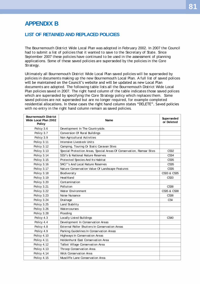
81
APPENDIX B
LIST OF RETAINED AND REPLACED POLICIES
The Bournemouth District Wide Local Plan was adopted in February 2002. In 2007 the Council had to submit a list of policies that it wanted to save to the Secretary of State. Since September 2007 these policies have continued to be used in the assessment of planning applications. Some of these saved policies are superseded by the policies in the Core Strategy. Ultimately all Bournemouth District Wide Local Plan saved policies will be superseded by policies in documents making up the new Bournemouth Local Plan. A full list of saved polices will be maintained on the Council‘s website and will be updated as new Local Plan documents are adopted. The following table lists all the Bournemouth District Wide Local Plan policies saved in 2007. The right hand column of the table indicates those saved polices which are superseded by specifying the Core Strategy policy which replaces them. Some saved policies are not superseded but are no longer required, for example completed residential allocations. In these cases the right hand column states ―DELETE‖. Saved policies with no entry in the right hand column remain as saved policies.
Bournemouth District Wide Local Plan 2002
Policy Name
Superseded or Deleted
Policy 3.6 Development In The Countryside.
Policy 3.7 Conversion Of Rural Buildings
Policy 3.9 Non Agricultural Activities
Policy 3.11 Intensive Livestock Units
Policy 3.12 Camping, Touring Or Static Caravan Sites
Policy 3.13 Special Protection Areas, Special Areas Of Conservation, Ramsar Sites CS32
Policy 3.14 SSSI‘s & National Nature Reserves CS34
Policy 3.15 Protected Species And Its Habitat CS35
Policy 3.16 SNCI‘‘s And Local Nature Reserves CS35
Policy 3.17 Nature Conservation Value Of Landscape Features CS35
Policy 3.18 Biodiversity CS33 & CS35
Policy 3.19 Heathland CS33
Policy 3.20 Contamination
Policy 3.21 Pollution CS38
Policy 3.22 Water Environment CS35 & CS38
Policy 3.23 Noise Nuisance CS38
Policy 3.24 Drainage CS4
Policy 3.25 Land Stability
Policy 3.26 Watercourses
Policy 3.28 Flooding
Policy 4.3 Locally Listed Buildings CS40
Policy 4.4 Development In Conservation Areas
Policy 4.8 External Roller Shutters In Conservation Areas
Policy 4.9 Parking Guidelines In Conservation Areas
Policy 4.10 Highways In Conservation Areas
Policy 4.11 Holdenhurst East Conservation Area
Policy 4.12 Talbot Village Conservation Area
Policy 4.13 Throop Conservation Area
Policy 4.14 Wick Conservation Area
Policy 4.15 Muscliffe Lane Conservation Area

82
Policy 4.18 Historic Parks And Gardens CS39
Policy 4.19 Amenity/Townscape CS41
Policy 4.20 Access
Policy 4.21 Shop Fronts
Policy 4.23 Poster Hoardings
Policy 4.24 Public Works Of Art
Policy 4.25 Landscaping
Policy 5.1 Job Creation
Policy 5.2 Small Businesses To Have Regard For Neighbouring Residential Amenities
Policy 5.3 New B1 Uses
Policy 5.4 Loss Of Employment Uses CS26 & CS27
Policy 5.5 Yeomans Road Industrial Estate CS26
Policy 5.6 Major Office Development In The Lansdowne and Castle lane East CS8 & CS26
Policy 5.7 Major Office Use, Castle Lane East CS26
Policy 5.8 Lansdowne Area Mixed Office / Residential CS8
Policy 5.9 Minor Business Uses
Policy 5.10 Home Working
Policy 5.11 Telecommunications
Policy 5.13 Energy Conservation CS2
Policy 5.14 Prime Shopping Area
Policy 5.15 Major Shopping Use
Policy 5.16 Exeter Road Bus Station Site
Policy 5.18 Retail Provision, Kinson C10
Policy 5.19 Core Shopping Areas
Policy 5.20 Secondary Shopping Areas
Policy 5.21 Shopping Centres CS9
Policy 5.22 Shopping Centres CS9
Policy 5.24 Local Shopping Parades CS11
Policy 5.25 Change Of Use Of Shops Outside A Shopping Designation CS11
Policy 5.26 New Retail Floorspace Outside A Shopping Designation
Policy 5.27 Shopping Centres CS9
Policy 5.28 Ringwood Road Retail Warehousing
Policy 5.29 Amusement Centres
Policy 5.30 Motor Vehicle Sales
Policy 5.31 Day Nurseries Close To Employment
Policy 5.32 Day Nurseries In Residential Areas
Policy 5.33 Private and Language Schools
Policy 5.34 Tertiary Teaching Accommodation At Lansdowne CS8
Policy 5.35 Student Living Accommodation
Policy 6.2 Residential Development CS21 & CS22
Policy 6.3 Retention Of Residential Accommodation
Policy 6.4 Loss Of Residential
Policy 6.5 Conversion Of Floors Above Shops To Residential
Policy 6.6 Affordable Housing (Replaced by adopted Affordable Housing DPD)
Policy 6.7 Named Residential Sites DELETE
Policy 6.8 Residential Infill
Policy 6.9 Residential Development Of Derelict/Vacant Land
Policy 6.10 Flats Redevelopment

83
Policy 6.12 Class C2 Accommodation
Policy 6.13 Flat Conversions – Location Of Property
Policy 6.14 Flat Conversions – Type Of Property
Policy 6.15 Flat Conversions – Size Of Property CS19
Policy 6.16 Flat Conversions – Car Parking
Policy 6.17 Houses in Multiple Occupation and Hostels
Policy 6.18 Mobile Home Parks
Policy 7.1 Town Centre Tourism Area CS28
Policy 7.2 Loss Of Tourist Accommodation In Town Centre Tourism Area CS28
Policy 7.3 Tourism Cores And Town Centre Tourism Area CS28
Policy 7.4 Tourism Cores And Town Centre Tourism Area CS7, CS28,
CS29
Policy 7.5 Tourism Cores And Town Centre Tourism Area CS28
Policy 7.6 Boscombe Overstrand / Honeycombe Chine DELETE
Policy 7.7 Winter Gardens
Policy 7.8 Amusement Arcades
Policy 7.10 Indoor And Outdoor Sport And Recreation Facilities
Policy 7.11 West Hants Tennis Club
Policy 7.12 Loss Of Local Community Facilities CS12 & CS31
Policy 7.13 Provision For Community Facilities CS6
Policy 7.14 Stour Valley Walk CS36
Policy 7.15 Country Park At Kinson CS36
Policy 7.17 Loss Of Public And Private Open Spaces, Including Sports Grounds CS31
Policy 7.19 School Playing Fields
Policy 7.20 Statutory Allotments CS12
Policy 7.21 Open Space Provision (And SPG On Open Space/ Recreation Facilities)
Policy 7.22 Sandy Way
Policy 8.1 Development On Primary & County Distributor Routes
Policy 8.2 District Distributor Roads
Policy 8.3 Highway Improvements
Policy 8.4 Widening Of A338 – (Area Specific)
Policy 8.5 Junction Of Wessex Way & St. Paul’s Rd
Policy 8.6 Castle Lane West Relief Road DELETE
Policy 8.7 Transportation Corridor On A341 Wimborne Road DELETE
Policy 8.8 Highway Improvements Between Northbourne Roundabout & East Howe Lane And Between Durdells Avenue & Bear Cross Roundabout
Policy 8.9 Relief Of Traffic Flow On Castle Lane East
Policy 8.10 Highway Network Improvements
Policy 8.11 Development Prejudicing Highway Network Improvements
Policy 8.12 New Distributor Roads
Policy 8.13 Developer Contributions Towards Highway Improvements CS14
Policy 8.14 New Development & Traffic Generation CS14
Policy 8.15 Development Around The Triangle
Policy 8.16 Road Closures And Extension To Pedestrian Areas
Policy 8.17 Public Transport Routes Around The Triangle
Policy 8.18 Development Effecting High Frequency Bus Routes CS13
Policy 8.19 Bus Priority Measures CS13
Policy 8.20 Rail Network
Policy 8.21 Park & Ride DELETE
Policy 8.22 Development Effecting Public Car Parking Spaces
Policy 8.23 Maximum Parking Standards CS16
Policy 8.24 Temporary Commuter Parking Site
Policy 8.25 Additional Short Stay Parking In The Town Centre Restraint Area
Policy 8.26 Parking & Retail Development In The Town Centre
Policy 8.27 Town Centre And Lansdowne Parking Restraint CS16

84
Policy 8.28 Additional Short Stay Public Car Parking At Winton
Policy 8.29 Car Parking In Westbourne
Policy 8.30 Temporary Car Parking In Westbourne
Policy 8.31 Additional Public Short Stay Parking In Millhams Road CS10
Policy 8.32 Coach Parking At Queens Road And Glen Fern Road
Policy 8.33 Taxi Stands
Policy 8.34 Lorry Park At Riverside Avenue DELETE
Policy 8.35 Access Onto Primary, County & District Distributor Roads
Policy 8.36 Cycle Policy CS18
Policy 8.37 Cycle Policy CS18
Policy 8.38 Pedestrian Links CS18
Policy 8.39 Access For Mobility Impaired
Policy 8.40 Parking For The Disabled
Policy 8.41 Disabled Access Ramps
Policy 8.42 Highway Development Control Lines
Policy 8.43 Highway Development Control Lines

85
APPENDIX C
GLOSARY OF TERMS
Affordable Housing
Affordable housing includes social rented, affordable rented and intermediate housing, provided to eligible households whose needs are not met by the market.
Area Action Plan (AAP)
A detailed plan for a particular area lying within the local authority boundary, usually where there is major new development, or substantial regeneration or conservation issues.
Annual Monitoring Report (AMR)
An annual report assessing the progress and effectiveness of the documents which together form the new Bournemouth Local Plan including monitoring the progress of each document with respect to the timetable specified for each document in the Local Development Scheme.
Biodiversity The range of plant and animal species present in an area.
BREEAM Building Research Establishment Environmental Assessment Method. A form of assessment used to measure a building's environmental performance.
Brownfield Land Land which has been previously developed.
Code for Sustainable Homes
An assessment to rate the sustainable design and construction of new homes.
Community Infrastructure Levy (CIL)
A charge levied on developers to contribute to the provision of infrastructure.
Conservation Areas
Section 69 of the 1990 Planning (ListedBuildings and Conservation Areas) Act empowers local planning authorities to designate Conservation Areas, being areas of ―special architectural or historic interest, the character or appearance of which it is desirable to preserve or enhance‖. A local planning authority has also to keep these areas under review and prepare schemes of enhancement.
Development Defined as "the carrying out of building, engineering, mining or other operations in, on, over or under land, or the making of any material change in the use of any buildings or other land‖.Development Plan Document (DPD)
Development Plan Document (DPD)
Local policy documents which together form the new Local Plan for the area and form the basis on which planning decisions are made.
Dwelling A building or part of a building which provides structurally separate living quarters.
Environmental enhancements
Environmental works, including landscaping, tree planting, surfacing, repairs to buildings and other work designed to enhance the environmental quality of an area.
Flood Plain Usually land beside a river, stream or other watercourse over which the water flows in time of flood, or would flow if there were no flood defences.
Green Belt An area of land designated to restrict urban sprawl, prevent the coalescence of neighbouring settlements in order to preserve their character and the green spaces between them.
Green Infrastructure
A strategically planned and delivered network of high quality green spaces and other environmental features.
Green Knowledge Economy (GKE)
A term to describe a new model for sustainable economic development that integrates two paradigms – the Knowledge Economy and the Green Economy. The goal of the EU 2020 Strategy is to make Europe ‗a competitive and greener knowledge-based economy‘. The GKE concept refers to the ‗greening‘ of the existing economy through products, processes and policies that are used to tackle climate change, reduce greenhouse gas emissions, improve resource efficiency and conserve ecosystems and biodiversity.

86
Heathland Lowland heathland is an open landscape generally found in poor, acid sandy soils less than 300 metres above sea level. Heathlands were recognised as an important habitat at a European level by the EU Habitats Directive in 1992. Over 96% of the heaths in Dorset are classified as Sites of Special Scientific Interest (SSSI), a designation given to the most valuable wildlife habitats.
Hectare Metric unit of measurement of land area (1 hectare is equivalent to 10 000 square metres or 2.471 acres).
Heritage assets
A building, monument, site, place, area or landscape identified as having a degree of significance meriting consideration in planning decisions. Heritage assets include designated heritage assets and assets identified by the local planning authority (including local listing).
Historic Parks and Gardens
Parks and gardens which have been included in the Register of Parks and Gardens of Special Historic Interest compiled by English Heritage.
Household Either one person living alone or a group of people (who may or may not be related) living, or staying temporarily at the same address, with common housekeeping.
Infill Development
Development of individual houses or buildings on sites which are gaps in another wise developed road frontage. Can also be applied to any development on spaces within towns or villages.
Infrastructure Publicly accessible assets, systems and networks including roads, electricity/gas, sewers, water and education services.
Listed Building Buildings included in the statutory list of Buildings of Special Architectural or Historic Interest. Historic buildings are listed by English Heritage and are classified into three grades - I , II* and II depending on their importance.
Local Development Scheme (LDS)
The Local Development Scheme sets out the time tabled programme for preparing planning policy documents over a rolling three year period.
Local Nature Reserve (LNR)
A title conferred by a local authority under Section 21 of the National Parks and Access to the Countryside Act 1949 on a site needing special protection because of its value for wildlife and for people to see, learn about and enjoy wildlife.
National Nature Reserve (NNR)
A Site of Special Scientific Interest which is particularly important in national terms and is owned, leased or managed by agreement with Natural England.
National Planning Policy Framework (NPPF)
Published in March 2012 the NPPF sets out the Governments planning policies for England and how these are expected to be applied. The NPPF superseded the Planning Policy Guidance and Planning Policy Statement documents that had contained previous Government advice.
Park and Ride Scheme enabling motorists to leave their vehicles at edge of town car parks and to travel into town centres by public transport.
Ramsar site A wetland Site of Special Scientific Interest which is designated by the Secretary of State for the Environment under the Ramsar Convention as being of international importance, usually as a waterfowl habitat.
Regional Spatial Strategies (RSSs)
Regional Spatial Strategies were intended to set out a region‘s policies in relation to the development and use of land and form part of the development plan for local planning authorities. The draft RSS for the South West is no longer being progressed following the governments decision to revoke such strategies.
Renewable Energy
Energy forms that occur naturally and repeatedly in the environment, such as solar, wind and tidal power.
Section 106 Agreement
A legal agreement negotiated under Section 106 of the Town and Country Planning Act 1990.

87
Site of Nature Conservation Interest (SNCI)
A site defined by the Dorset Wildlife Trust as being of County importance for nature conservation.
Site of Special Scientific Interest (SSSI)
A site notified by Natural England under Section 28 of the Wildlife and Countryside Act 1981 on account of its flora, fauna, geological or physiographical features. All NNRs, Ramsar sites, SACs and SPAs have also been notified as SSSIs.
Special Area of Conservation (SAC)
A Site of Special Scientific Interest additionally designated a Special Area of Conservation under the European Union‘s Habitats Directive 1992 (92/43/EEC), because of the need to maintain or restore priority natural habitats and wild species.
Special Protection Area (SPA)
A Site of Special Scientific Interest additionally designated a Special Protection Area under the European Union‘s Directive (79/409/EEC) on the Conservation of Wild Birds 1979, because of the need to protect threatened birds, their eggs, nests and habitats.
Strategic Flood Risk Assessment
A flood risk assessment looking at all forms of flooding designed to assist Local Authorities in directing new developments to low flood risk areas.
Suitable Alternative Natural Greenspace (SANG)
Alternative green space provided or enhanced to encourage public access, the aim being to deter visits to, and thereby help conserve, protected habitats such as SPAs.
Supplementary Planning Document (SPD)
Non-statutory documents primarily intended to expand upon the policies and proposals in Local Plan documents. Not subject to independent examination.
Sustainable Development
Meeting the needs of the present without compromising the ability of future generations to meet their own needs.
Sustainability Appraisal (SA)
Required by European and UK law, sustainability appraisal is an assessment of the social, economic and environmental impacts of the policies and proposals contained within the Local Development Framework.
Windfall development
Development proposals granted planning permission but which have not been allocated or identified formally in development plans.

88
INDEX
A
Affordable housing 2-4, 19, 39, 71 Ashley Road, Coal Yard 50-52 Ashley Road, Station Approach 50-52 Aviation Park 48
B
Bear Cross 64 Biodiversity 3, 5, 21, 40, 57-64, 70 Boscombe 20, 22, 27, 45 Boscombe East 20, 22 Bournemouth Airport 48 Bournemouth and Poole College 25, 36 Bournemouth University 25-26, 45
C
Castlepoint 22, 28 Charminster 20, 22, 45 Chaseside 50-51, 53 Christchurch Harbour 59, 61, 64 Climate change 5, 12-17, 21, 59, 63 Coastal strip 59 Community facilities 5, 18, 21, 28, 30 Conservation Areas 67-68 Cultural facilities 23, 30, 56 Cycling 14, 18, 31-33, 36-37, 50, 59, 64
D
Deansleigh Road 51 Delivery and Monitoring 71-78 Design quality 17, 19, 21, 23, 25, 31, 34-35, 41, 43-44, 63, 66-67, 70 District centres 19, 22, 27-28, 29, 31, 33, 36-37, 42-43, 49-50
E
Economy 3-5, 26, 28, 48-56, 58, 64 Elliot Road 51 Employment sites, allocated 50-54 Employment sites, unallocated 54 Energy conservation 5, 12, 14-15, 38-39 Equalities Impact Assessment 1
F
Flats development 40-41 Flooding 13, 16-17 Francis Avenue 51

89
G
Green Belt 41, 47, 65 Green Infrastructure 5, 17-19, 21, 36-37, 57, 59, 60, 64, 66 Green Knowledge Economy 26, 50, 64 Green Travel Plans 34 Greener vehicle technologies 35 Gypsy and Traveller sites 2-4, 47
H
Habitat Regulations Assessment (HRA) 1-2, 61 Health 4-5, 12, 18-19, 20-21, 23, 30-31, 40, 49, 54, 57-60,
65, 67, 71 Heathland 2-3, 41-42, 47, 58, 61-62, 64 Hengistbury Head 12, 20, 57, 61-62, 64, 68 Heritage assets 21, 25, 66-69 Historic Parks and Gardens 58, 68 Homelessness 39 Hotels, loss of 49, 55 Houses in Multiple Occupation (HMOs) 45-46, Housing 2-5, 18-19, 21, 24, 34, 38-46, 49, 54, 62, 71 Housing completions 38, 40, 42-43 Housing distribution, type and mix 40-43
K
Key Transport Routes 14, 32-33, 42-43 Kinson 20, 22, 29, 61
L
Lansdowne 22, 24, 25-27, 49-51 Leisure facilities 2, 30, 31, 58, 60 Lifetime Homes 19, 44 Listed buildings 23, 67-68 Local Nature Reserves (LNR) 58, 61, 63, 64 Local shops/parades 22, 29 Local Transport Plan (LTP) 3, 31-33, 35 Locally Listed Buildings 66, 69
M
Mixed use 25-27 Monitoring 38, 42, 71-72 Moordown 20, 22, 60
N
Nature conservation 51-63 Noise 16, 65

90
O
Obesity 19, 31, 58 Offices (B1) 1, 22, 25-27, 49-54 Open Space 19, 21, 24, 36, 57, 60, 64, 71
P
Park and Ride 35, Parking 17, 31, 34, 36, 47 Pollution 14, 65 Poole Lane 51
R
Rail 1, 23, 25, 31 Ramsar Sites 61 Renewable and low carbon energy 5, 12, 14-16 Retail (A1) uses 1, 2, 5, 21, 22-25, 27-29, 31, 35-36, 42, 49, 54 Riverside Avenue 35, 51
S
Sites of Nature Conservation Interest (SNCI) 61, 63 Sites of Special Scientific Interest (SSSI) 61, 63 Small businesses 54 Small family dwellinghouses 41 Southbourne 20, 22 Southcote Road 51 Special Area of Conservation (SAC) 61 Special Protection Area (SPA) 61 Sports facilities 30, 57-58, 60 Springbourne 20, 45 Stour Valley Project 64 Student accommodation 25-27, 45-46 Suitable Alternative Natural Greenspace (SANGs) 62-64 Surface water 16-17, 59 Sustainability Appraisal 1, 2, 6 Sustainable communities 4, 20-21, 39, 42-43, 57, 70 Sustainable development 5, 11, 12, 38, 57, 61, 63 Sustainable Drainage Systems (SuDS) 16-17, 63, 65
T
Tertiary Education 26-27 Tourism 1, 5, 23-25, 49, 55-56, 67 Tourist accommodation 25, 55 Town Centre Area Action Plan (AAP) 2, 22-25, 66 Town centre first' sequential approach 24-25 Transport 3-5, 12, 14, 18, 21, 23-24, 31-37, 42-43, 50, 71 Tuckton 20, 22, 27 Turbary Common 61

91
U
Urban cooling 17
W
Wellington Road, Royal Mail Delivery Office 50-51, 53 West Howe 20 Westbourne 20, 22, 27 Windfall sites 38, 42, 47 Winton 20, 22, 27, 45
Z
Zero or low carbon 5, 12-16, 35
