biodiversity in ontario’s greenbelt...suite 219, 2211 west 4th avenue, vancouver, b.c. v6k 4s2 t:...
TRANSCRIPT

Biodiversity in Ontario’s Greenbelt

Suite 219, 2211 West 4th Avenue, Vancouver, B.C. V6K 4S2T: 604.732.4228 F: 604.732.4228 Toll free: 1-800-453-1533E: [email protected]
www.davidsuzuki.org
BiOdiVErSiTy in OnTAriO’S GrEEnBElT
november 2011
david Suzuki Foundation and Ontario nature
This report was made possible through the generous
support of the Ontario Greenbelt Foundation.
Canadian Cataloguing in Publication data for this report is available through the national library of Canada
Graphic design by nadene rehnby and Pete Tuepah handsonpublications.com
This report can be downloaded free of charge at www.davidsuzuki.org or www.ontarionature.org
iSBn 978-1-897375-44-0
214 King Street West, Toronto, Ontario M5H 3S6T: 416-444-8419 F: 416-444-9866 Toll free (in Ontario): 1-800-440-2366 E: [email protected]
www.ontarionature.org

ContentsinTrOduCTiOn ............................................................................................................................5
PArT 1 nATurE AT THE EdGE OF THE PAVEMEnT: BiOdiVErSiTy in THE GrEEnBElT ...........7
Greenbelt Habitats ............................................................................................................ 8
Special environments within the Greenbelt ............................................................8
diversity of the landscape within the Greenbelt ................................................. 10
Why Biodiversity Matters ............................................................................................... 13
Species at risk Within the Greenbelt ............................................................................ 15
Greenbelt to the rescue ................................................................................................. 17
PArT 2 lOSinG Our COnnECTiOnS: KEy THrEATS TO GrEEnBElT SPECiES AT riSK...........18
A Fragmented World ........................................................................................................18
Edge effect ............................................................................................................... 20
Climate change .........................................................................................................21
What are Species At risk Telling us? ............................................................................22
redside dace: The health of the watershed ......................................................... 22
Jefferson salamander: A tale of two regions ........................................................ 23
Common snapping turtle: licence to kill ............................................................. 25
Hooded warbler and other forest birds: living on the edge ............................... 26
The Benefits of Functioning Ecosystems .....................................................................28

Page 4
Download David
Suzuki Foundation
reports, including our
2008 report on the
value of natural capital
in Ontario’s greenbelt,
at davidsuzuki.org/
publications
ACKnOWlEdGEMEnTS This report was written by Amber Cowie, Ontario nature. Editing and guidance were
provided by rachel Plotkin, david Suzuki Foundation, and dr. Anne Bell, Ontario nature.
reviewers included dr. Faisal Moola, david Suzuki Foundation, Kathy Macpherson,
Ontario Greenbelt Foundation, and Mark Carabetta and Joshua Wise, Ontario nature.
This report was made possible through the generous support of the Ontario Greenbelt
Foundation.
PArT 3 THE WAy FOrWArd: HOW ExiSTinG POliCy TOOlS CAn BE STrEnGTHEnEd ..........29
Plans and Policies for the Greenbelt .............................................................................31
niagara Escarpment Plan, 1985 ............................................................................ 31
Oak ridges Moraine Conservation Plan, 2001 ..................................................... 32
Greenbelt Plan, 2005 .............................................................................................. 33
Endangered Species Act, 2007 .............................................................................. 35
Species at risk Act, 2002 ....................................................................................... 36
Planning Act and Provincial Policy Statement, 2005 .......................................... 37
Growth Plan for the Greater Golden Horseshoe ................................................... 38
Taking it to the People .....................................................................................................40
Cootes to Escarpment Park System ..................................................................... 40
Voluntary stewardship programs ..........................................................................41
Monitoring the Greenbelt ...............................................................................................44
Systemic Planning and Social Action ............................................................................45
COnCluSiOn ............................................................................................................................. 46
recommendations ..........................................................................................................47
rEFErEnCES ........................................................................................................................... 48

Dav iD S uzu ki FOu n DatiOn a n D On ta riO n at u r e Page 5
OntariO’S greenbelt StretcheS north to south from the wild forests of the Bruce Peninsula to
the lush Carolinian woodlands in niagara region. it spans west to east from the small vernal pools of
Halton region to the butterfly plains of rice lake. The richness of habitat in the region is evident in the
sight of turtles sunbathing on stream banks, the sound of birdsongs from the trees and the flicker of
tiny movements in the grass as small mammals duck in and out. Slick-skinned salamanders and tiny,
brightly striped fish rely almost entirely on the land and water of the Greenbelt for their survival. indeed,
the Greenbelt is home to 78 of over 200 provincially listed species at risk in Ontario. Their wavering but
continued presence serves as a reminder of the importance in this area of the woodlands, wetlands,
meadows, rivers and streams.
The Greenbelt is a bustling place where speeding cars zig and zag on wide highways, and the
silhouettes of buildings on the horizon define a hard, concrete skyline. Plants and animals that move at
a different pace can often be forgotten or dismissed in urban and suburban areas that hum with human
energy and automated movement. The constant push of cities to grow and convert natural areas to shop-
ping centres, residential developments, parking lots and roads threatens these plants and animals and
their habitat. natural areas are paved over, split apart and whittled away to increasingly small fragments.
Almost unbelievably in some instances — witness Jefferson salamanders crawling through the
basements of homes built in the way of their migration paths to get to their breeding grounds — plants
and animals continue to eke out their existence within this altered environment. Humans chose to settle
in this part of Ontario in large part because of the rich diversity and fertility of the land. Millions now
make their home in this region, as do a large number of our most enchanting species at risk, including
the monarch butterfly, the red-headed woodpecker, the spotted turtle, the lakeside daisy and many
more. ironically, however, the popularity and subsequent development of the region have resulted in
many species’ decline and loss.
introductionhumans chose to settle in
this part of Ontario in large
part because of the rich
diversity and fertility of the
land. Millions now make their
home in this region, as do
a large number of our most
enchanting species at risk.

Page 6 biODi v e r Sit y in On ta riO ’ S gr e e n be lt
While loss and fragmentation of habitat is an imminent threat to 97 per cent of species at risk in
the Greenbelt, the connection between habitat protection and human health and well-being is often
overlooked. Adequately protecting the habitat of the redside dace, a tiny fish with 80 per cent of its
Canadian habitat in the Greenbelt, for instance, could have profound benefits for people. The fish is
extremely sensitive to environmental changes in the rivers and streams it calls home — even small
declines in water quality or quantity can lead to the loss of redside dace populations. As a result, the
species can signal problems such as a deterioration of drinking water or the onset of drought. On a
more positive note, keeping redside dace populations healthy can help ensure that water sources are
clean and plentiful. This little fish reveals a simple truth: humans and other life all require healthy,
functioning ecosystems to survive. We’re in it together.
The Greenbelt was created by the Ontario Government in 2005 in recognition of the significance
of the region’s natural and agricultural values — and the risk that these areas might be gobbled up by
residential and industrial uses. The Greenbelt acknowledges and accommodates a multitude of land
uses within its 728,434 hectares (1.8 million acres), while aiming to maintain agricultural land as well as
natural and hydrological systems. The Greenbelt Plan was designed to build on the ecological protection
already in effect under two earlier and precedent-setting land use plans, the niagara Escarpment Plan
and the Oak ridges Moraine Conservation Plan. it works in concert with other policy and legislation
such as the Endangered Species Act, 2007; the Provincial Policy Statement; and the Growth Plan for
the Greater Golden Horseshoe.
in coordination with these laws and policies, the Greenbelt Plan articulates a vision of planning that is
system based, protecting more than individual natural features to incorporate the areas that surround,
connect and support them. System-based planning requires that decision-makers consider the impact
that a development or activity has on the landscape as a whole, rather than just on the project area.
in 2008, the david Suzuki Foundation released Ontario’s Wealth, Canada’s Future: Appreciating the Value of the Greenbelt’s Ecological Services. Building on that research, this subsequent report, Bio-diversity in Ontario’s Greenbelt, showcases the significance of the Greenbelt for the diversity of life
in Ontario and emphasizes the importance of system-based planning. Beginning with an overview of
Greenbelt species and ecosystems, the first section of this report highlights their value and divers-
ity, and then outlines trends for
species at risk in the region. The
second section discusses histor-
ical and ongoing threats to spe-
cies in the Greenbelt, focusing
on the threat of habitat loss and
degradation for the redside dace,
Jefferson salamander, common
snapping turtle and hooded war-
bler. The third section describes
a more promising path forward,
assessing current policy and
ongoing voluntary stewardship
initiatives on public and private
land. The conclusion includes rec-
ommendations for ensuring that
species and their habitat are pro-
tected in the Greenbelt.
the greenbelt was
created by the Ontario
government in 2005
in recognition of the
significance of the region’s
natural and agricultural
values — and the risk
that these areas might be
gobbled up by residential
and industrial uses.

Dav iD S uzu ki FOu n DatiOn a n D On ta riO n at u r e Page 7
the greenbelt iS a wOrlD of both natural and human-made wonders, heavily populated by a
diverse web of life made up of plants, animals and other life forms, each connecting and contribut-
ing to the function and health of the area. diversity defines the Greenbelt — from its wide range of
habitats and landscapes to the incredible differences among the life forms within them. While the
values of human diversity in language, culture and custom are often touted as beneficial to society,
the benefits of biological diversity are less commonly understood and celebrated.
The Greenbelt’s grasslands, woodlands, wetlands and waterways underpin many major economic
activities, such as forestry, agriculture and tourism. They also benefit human health and well-
being — physical, mental, social and spiritual. When these natural systems are lost or degraded,
humans and other life suffer both directly and indirectly.1 Their critical importance can be quickly
dismissed in an area undergoing rapid change and population growth.
Southern Ontario is one such area. it is one of the most heavily populated places in Canada: with
a population of over 13 million people, it is home to one in three Canadians.2 Most of the popula-
tion — over 75 per cent of Ontarians — have settled inside or in close proximity to the Greenbelt.3
The temperate climate that attracts many people to the area also provides favourable conditions
for other species, including over one-third of Ontario’s species at risk. For most of these species,
habitat loss is the greatest threat.4
1 Sara J. Wilson. 2008. Ontario’s Wealth, Canada’s Future: Appreciating the Value of the Greenbelt’s Eco-Services. report to the david Suzuki Foundation. Vancouver, Canada. p.3.
2 www.ontario.ca/en/about_ontario/EC001035.html.3 Ontario Biodiversity Council. 2010. State of Ontario’s Biodiversity 2010: Highlights Report. A report of the
Ontario Biodiversity Council. Peterborough, Canada. p.8.4 Committee on the Status of Endangered Wildlife in Canada (COSEWiC). www.cosewic.gc.ca.
Pa rt 1
nature at the Edge of the Pavement:
Biodiversity in the Greenbelt
“Nature holds the key to
our aesthetic, intellectual,
cognitive and even
spiritual satisfaction.”
— E. O. Wilson

Page 8 biODi v e r Sit y in On ta riO ’ S gr e e n be lt
Greenbelt Habitats
Habitat within the Greenbelt is shaped, broadly speaking, by three special environments: the niagara
Escarpment, the Oak ridges Moraine and the Carolinian life zone. The value of these environments in
terms of biodiversity is described here, followed by a discussion of species at risk and what those
species can tell us about the overall health of the Greenbelt.
SPecial envirOnMentS within the greenbelt
These three significant natural environments constitute the Greenbelt, providing an incredible range
of habitat for Ontario’s species: the long, curving spine of the niagara Escarpment which shelters
cliff-dwelling creatures and rare wetland types; the thick band of the Oak ridges Moraine which
secures the headwaters of many rivers and aquatic habitats; and the complex quilt of the Carolinian
life zone along the edge of lake Ontario. Here numerous ecosystems — many increasingly rare and
fragmented — abound with common, rare and at-risk plants and animals.
niagara eScarPMent
The niagara Escarpment is perhaps the most dramatically varied landscape within the Greenbelt, with
its southern drop into the churning waters of niagara Falls and its northern arc forming the tall cliff
faces of the Bruce Peninsula. it is part of a large and complex geological formation, stretching from
new york state up through Manitoulin island and back down into Michigan and Wisconsin. Made up
of substantial peaks of bedrock covered in sediment deposits from glacial movement, the escarp-
ment has been shaped, over time, by natural erosion leading to varied elevations, underwater caves
and more than 60 waterfalls. its varied elevations have
resulted in a range of habitat types for many species at
risk, from hibernacula for the eastern massassauga to
vernal pools for Jefferson salamander. The escarpment
also contains the only populations of American hart’s-
tongue fern in Canada.5
The escarpment provides shelter to some of Ontario’s
oldest and most unique trees — a population of eastern
white cedars that cling stolidly to the sheer rock face.
These gnarled, ancient trees could be considered natural
bonsai trees, trimmed and tended by the rugged condi-
tions in which they grow. Many of the cedars are well over 1,000 years old, with the oldest close to
1,700. The cliff ecosystem of the escarpment is both rare and fascinating and illustrates the breadth
of habitat provided by the highest elevation points in southern Ontario.6
5 ian Attridge, rick lindgren and linda Pim. 1998. Protecting the Niagara Escarpment: A Citizen’s Guide. report to the Coalition on the niagara Escarpment. Scarborough, Ontario. pp.8–14.
6 Attridge and others, Protecting the Niagara Escarpment: A Citizen’s Guide, p.12.
three significant
environments constitute
the greenbelt: the long,
curving spine of the niagara
escarpment, the thick band
of the Oak ridges Moraine,
and the complex quilt of the
carolinian life zone along
the edge of lake Ontario.

Dav iD S uzu ki FOu n DatiOn a n D On ta riO n at u r e Page 9
Oak riDgeS MOraine
The Oak ridges Moraine is one of the most significant landforms in southern Ontario, created by
the ebbs and flows of long-ago glacial movements that loosely packed layers of rock, sand and
gravel across its 160 kilometres. The landscape includes rare habitat such as kettle lakes, as well
as thick swathes of woodlands, marshes and meadows. The Oak ridges Moraine also contains the
headwaters of more than 65 rivers and streams.7
Stretching from east of Peterborough to its westernmost point where it joins the niagara Escarp-
ment in northern Peel, the Oak ridges Moraine harbours the most continuous forest cover in the
Greater Toronto Area. The moraine is still 30 per cent forested,8 despite the pressures of development
and land conversion that have resulted as Toronto and its suburbs push northward.
The moraine provides critical migratory routes for birds and mammals as well as habitat for several
at-risk species such as the king rail, spiny softshell turtle and redside dace. All 13 of the frogs and
toads known to the Great lakes inhabit wetlands on the moraine.9 One per cent of the moraine also
contains rare open meadow habitat, in the form of retired farm fields or of remnant tall grass prairie
ecosystems — the most vulnerable ecosystem in southern Ontario.10
carOlinian liFe zOne
The Carolinian life zone,11 which overlaps with the southern section of the Greenbelt, extends from
Toronto on lake Ontario, to Grand Bend on lake Huron and Windsor on lake Erie. Early botanists
coined the term Carolinian after discovering plants and animals thought to exist only in the Carolinas.
indeed, this unique region supports ecosystems found nowhere else in Canada, such as globally
rare dune ecosystems, forests where rare tulip trees grow and habitat for opossums.12 its weather
conditions include warm temperatures, low rates of frost and plentiful rainfall, a combination that
has resulted in one of the highest diversity of habitats and species per square inch in Canada.13
The Carolinian life zone is home to some of the most threatened species in the country, many of
which are at the northern limit of their range, including American chestnut, eastern fox snake and
eastern prairie fringed-orchid. living at the northern extent of their range, such plants and animals
often have adapted to tougher conditions (longer winters, colder average temperatures) than their
southern counterparts.14 These adaptations can result in northern populations having unique genetic
characteristics that help them to resist blight and/or disease, traits that may become increasingly
important for species facing the predicted creep of rising temperatures currently modelled in climate
change projects.15
7 Moraine for life: Oak ridges Moraine Foundation. http://moraineforlife.org/about/. 8 Moraine for life.9 Central lake Ontario Conservation Authority. Durham Region Coastal Wetlands: Baseline Conditions and
Study Findings 2002 and 2003. 2003. report for the Central lake Ontario Conservation Authority. Toronto, Canada. p.1.
10 Ontario Biodiversity Council, State of Ontario’s Biodiversity 2010, p.21.11 The term life zone was first coined by C. Hart Merriam in the late 19th century to describe areas where plants
and animals relied on similar conditions. http://en.wikipedia.org/wiki/life_zone. 12 lorraine Johnson. Winter 2010/2011. Endangered ecosystem: Carolinian zone. ON Nature.13 Jane Bowles, Michelle Kanter, Veronique leHouk and dave Martin. 2004. Species at Risk in Carolinian Canada
and How to Help. report to the Carolinian Canada Coalition. london, Canada. p.5.14 Michelle Connolly, Keith Ferguson, Susan Pinkus and Faisal Moola. 2010. On the Edge: British Columbia’s
Unprotected Transboundary Species. report to the david Suzuki Foundation. Vancouver, Canada. p.16.15 Connolly and others, On the Edge.
Stretching from east
of Peterborough to its
westernmost point
where it joins the niagara
escarpment in northern
Peel, the Oak ridges
Moraine harbours the most
continuous forest cover in
the greater toronto area.

Page 10 biODi v e r Sit y in On ta riO ’ S gr e e n be lt
Before European settlement, Carolinian Canada was a landscape blanketed by lush deciduous
forests comprising sycamore, black oak, cucumber magnolia, tulip and other trees. Providing habitat
for the Acadian flycatcher, prothonotary warbler and other Carolinian species, the forests sheltered
an assortment of now at-risk plants such as the American ginseng and wood poppy. Warm rains
and above-average temperatures ensured both the canopy and the understorey of these forests
grew quickly and prolifically.
Today, because of the pressures of land conversion and development, the Carolinian forest is
one of Canada’s most endangered ecosystems.
DiverSity OF the lanDScaPe within the greenbelt
Within the niagara Escarpment, the Oak ridges Moraine and the Carolinian life zone, forests,
grasslands, wetlands and rivers support a rich diversity of life forms, right on the doorstep of many
urban dwellers.
FOreStS
Once covering up to 90 per cent of the southern Ontario landscape,16 forests are still the most
significant ecosystem in the Greenbelt. They now cover roughly 24 per cent of the Greenbelt, ap-
proximately 182,594 hectares.17 These areas are remnants of the almost continuous canopy that
formerly covered this landscape. Most are small in size and often fragmented from neighbouring
woodlands by development, roads or infrastructure corridors.18
16 Pat Mohr and John riley. 1994. The Natural Heritage of Southern Ontario’s Settled Landscapes: A Review of Conservation and Restoration Ecology for Land-Use and Landscape Planning. report to the Ontario Ministry of natural resources. Aurora, Canada.
17 Wilson, Ontario’s Wealth, Canada’s Future, p.2. 18 ryan Cheng and Peter lee. 2008. Urban Sprawl and Other Major Land Use Conversions in Ontario’s Greenbelt
from 1993-2007: A Change Analysis Project Using Satellite Imagery. report to the david Suzuki Foundation and the Greenbelt Foundation. Global Forest Watch Canada. Edmonton, Canada. p.9, fig.2.

Dav iD S uzu ki FOu n DatiOn a n D On ta riO n at u r e Page 11
A number of species at risk inhabit these forested ecosystems, such as the wood turtle, American
ginseng and cucumber tree. The majority of Greenbelt species at risk use woodlands for at least
one element of their life cycle.19 Forests provide multiple benefits to humans as well: by cleaning air
and water, by storing carbon and tempering the effects of climate change and by providing shade
and wood products. Based on these and other services, the david Suzuki Foundation has valued the
economic benefits of forests in the Greenbelt at roughly $5,400 per hectare per year.20
wetlanDS
Three-quarters of southern Ontario’s original wetlands have been lost since settlement, mostly as a
result of drainage for agriculture and development.21 in some areas, such as metropolitan Toronto,
less than 15 per cent of the wetlands remains, and the function of several watersheds, such as
Highland Creek, is severely impaired by the impervious surfaces that surround them.22
Wetlands make up approximately 12 per cent of the Greenbelt’s land base — roughly 96,014
hectares.23 The value of these wetlands is enormous. The marshes, bogs, fens and swamps of
the Greenbelt store carbon, filter water and provide natural stormwater management systems. in
economic terms, wetlands can be valued at roughly $14,000 per hectare per year based on the role
they play in, among other functions, climate regulation, flood control, waste treatment and habitat
provision.24 in addition, these areas support a wide range of species at risk, such as the Blanding’s
turtle, swamp rose mallow and least bittern. The Greenbelt also provides protection for some rare
Great lakes coastal wetlands, located at the mouths of streams and rivers that empty into lake
Ontario and Georgian Bay. The position of these wetlands between permanent deep water and upland
areas creates unique and critical habitat types.
The Greenbelt Plan protects all wetlands, a boon to municipal decision-makers attempting
to conserve these critical ecosystems. Before the introduction of the plan, most municipalities
protected only Provincially Significant Wetlands, as required by the Provincial Policy Statement,
leaving many locally and regionally significant wetlands open to development.
river valleyS
river valleys cover 7,821 hectares of the Greenbelt and provide diverse habitats and microclimates,
often resulting in a high proportion of regionally and locally significant species.25 numerous species
at risk also rely on these areas, including fish such as the river redhorse, dragonflies such as the
rapids clubtail and reptiles such as the wood turtle. Critical to many species, river valleys provide
shelter from harsh weather and cover from predators and offer fresh water and food.26
Many of the Greenbelt’s river valleys run north to south, in some cases, as with the don and the
Humber, providing vital natural corridors across the landscape and connecting the large freshwater
19 Species at risk Act Public registry status reports. www.sararegistry.gc.ca/default_e.cfm. 20 Wilson, Ontario’s Wealth, Canada’s Future, p.29.21 ducks unlimited Canada. 2010. Southern Ontario Wetland Conversion Analysis. A report of ducks unlimited
Canada. Barrie, Canada. p.1.22 Toronto region Conservation Authority: www.trca.on.ca/protect/watersheds/highland-creek/.23 Wilson, Ontario’s Wealth, Canada’s Future, p.2.24 Wilson, Ontario’s Wealth, Canada’s Future, p.34.25 Ontario Ministry of natural resources. 2005. Natural Heritage Reference Manual for Natural Heritage Policies
of the Provincial Policy Statement, 2005 (2nd ed.). Queen’s Printer for Ontario. Toronto, Canada. p.75.26 Ontario Ministry of natural resources, Natural Heritage Reference Manual.
before the introduction of
the greenbelt plan, most
municipalities protected
only Provincially Significant
wetlands, as required
by the Provincial Policy
Statement, leaving many
locally and regionally
significant wetlands
open to development.

Page 12 biODi v e r Sit y in On ta riO ’ S gr e e n be lt
system of lake Ontario with the groundwater and surface-water features of the Oak ridges Moraine.27
As water moves from the surface through the ground to deep aquifers, it is filtered in a process called
groundwater recharge, helping to ensure that the rivers provide safe, clean water into lake Ontario.
The protection provided by these river valleys thus has a direct benefit to humans. The david Suzuki
Foundation estimates the value of the ecological services provided by rivers in the Greenbelt at
roughly $335 per hectare per year.28
graSSlanDS
Only 441 hectares of the Greenbelt is covered by grasslands — far less than one per cent of the
entire plan area. The scarcity of this ecosystem type in the Greenbelt reflects the national trend:
grasslands are the most endangered ecosystem in Canada, from the native grasslands in British
Columbia’s Okanagan and Kootenay regions to the scattered remnants of tall grass prairie and
oak savannah in the Oak ridges Moraine. The moraine is one of the northernmost areas where tall
grass prairie ecosystems grow in Ontario, largely because of its unique soil composition.29 Though
tall grass prairies have never been the dominant ecosystem across the moraine, areas such as the
County of northumberland were once large, contiguous regions of tall grass prairie and savannah.30
urban development and agricultural conversion are the two greatest threats to the grasslands
of the world — the arid climate and topography that create these ecosystems also make them desir-
able places for human settlement and the production of food.31 These conditions are uncommon,
resulting in a relatively low number of tall grass prairies: before European settlement, roughly 80,000
hectares of prairie and savannah existed in southern Ontario. There is now less than two per cent of
the original grasslands remaining in the entire province.32 in the Greenbelt, small grassland patches
provide potential habitat for species like the barn owl. These areas play a critical economic role in
climate regulation, water run-off control and nutrient cycling and are valued at roughly $1,600 per
hectare per year.33
27 Greenbelt Plan, 2005. S.O. 2005. Queen’s Printer for Ontario. Toronto, Canada. pp.20–21.28 Wilson, Ontario’s Wealth, Canada’s Future, p.43.29 Moraine for life. 30 Barry King. The northumberland forest. Save the Oak ridges Moraine (STOrM) Coalition. www.stormcoalition.
org/newsroom/king121305.htm. 31 Grasslands Conser vation Council of British Columbia. www.bcgrasslands.org/grasslands/
understandingGrasslands.htm. 32 lorraine Johnson. Spring 2008. A garden of rarities. ON Nature,.33 Wilson, Ontario’s Wealth, Canada’s Future, p.36.

Dav iD S uzu ki FOu n DatiOn a n D On ta riO n at u r e Page 13
Why Biodiversity Matters
The protection of natural spaces is often undervalued when compared with activities that may yield
more immediate and tangible returns, such as creating single-family dwellings or extracting sand
and gravel for new highways. Current economic evaluations often fail to take into account many of
the less tangible goods and services provided by natural areas, leading to short-term decisions to
develop or alter these places despite potential negative impacts.
Such decisions may not acknowledge that humans rely on biodiversity — the web of life on our
planet that provides for everything from basic needs to inspiration for our most beautiful accomplish-
ments and greatest knowledge. This web of life is currently in peril. At least 16,000 species across
the world are dangerously close to extinction.34 Four hundred and seventy of those species have
habitat in Canada and are currently listed as at risk nationally. Over 200 of these species are located
in Ontario.35 Seventy-eight rely on the Greenbelt for some or all of their habitat needs.
The loss of species and their habitat has a direct impact on the economy, society and ecology of
the country and its citizens.36 Ecosystems maintain a delicate balance where each life form acts in
concert to allow the system to function. Changes to or losses of all or part of these systems, such
as eradicating an animal population with pesticide or destroying a woodland through conversion
to subdivisions, affect the ability of the system to provide the resources or services necessary for
a healthy, functioning environment.
These resources are natural capital — the occasionally valued but often unappreciated wealth of
the natural world. The term is used to describe both natural materials that currently have a value in
the marketplace (such as timber) and those that do not (such as the genetic diversity of unique or
rare populations of plants and animals). natural capital attempts to capture the economic value of
numerous ecosystem services that are also often taken for granted despite their direct and indirect
benefits to humans. Ecosystem services include water storage and filtration, carbon sequestration,
soil retention, pollination and habitat provision for species at risk.
Every species plays a role in the functioning of ecosystems, and thus in the provision of
ecosystem services that are frequently not valued in traditional economic models. natural capital
estimations can help to highlight both the tangible and the intangible values of biodiversity. Cur-
rently, economists are developing ways to measure the economic values of natural capital and the
associated ecosystem services. Ecological economics translates the critical value of biodiversity
into hard numbers that can help inform individual and societal decision-making on land use. The
annual worth of the Greenbelt’s natural capital has been estimated at roughly $2.6 billion by the
david Suzuki Foundation — an average value of $3,487 per hectare per year.37 Plants, animals and
34 Michelle Connolly, lindsay Coulter, Faisal Moola and devon Page. 2007. Rich Wildlife/Poor Protection: The Urgent Need for Strong Legal Protection of British Columbia’s Biodiversity. report for the david Suzuki Foundation and Sierra legal. p.2.
35 All but three of Ontario’s provincially listed species are listed nationally as well. The Western Virginia white butterfly and the eastern elk have not been listed under the Species at risk Act (SArA), and data on the eastern cougar have been classified as deficient.
36 Secretariat of the Convention on Biological diversity. 2010. Canada’s Fourth National Report to the United Nations Convention on Biological Diversity. report to the united nations. Canada. p.2.
37 Wilson, Ontario’s Wealth, Canada’s Future, p.1.
the annual worth of
the greenbelt’s natural
capital has been
estimated at roughly
$2.6 billion by the David
Suzuki Foundation — an
average value of $3,487
per hectare per year.

Page 14 biODi v e r Sit y in On ta riO ’ S gr e e n be lt
other life forms provide numerous ecosystem services that contribute to this estimated worth,
including seed dispersal, pest control, soil retention and pollination services.38
All species, including humans, receive direct and indirect benefits from healthy, functioning
ecosystems. The loss or weakening of these systems can have both anticipated and unforeseen
consequences. For example, nature deficit disorder is a term coined to underline the negative health
impacts (increased anxiety, depression, obesity) associated with childhoods spent largely indoors,
dissociated from the natural world.39 indeed, research indicates that many benefits arise from regular
exposure to nature, ranging from improved academic achievement and family relationships to lower
crime rates and increased longevity.40
38 Wilson, Ontario’s Wealth, Canada’s Future, pp.1–5.39 richard louv. 2005. Last Child in the Woods: Saving Our Children from Nature Deficit Disorder. Algonquin
Books. Chapel Hill, nC. 40 news Bureau, illinois. http://news.illinois.edu/news/09/0213nature.html.

Dav iD S uzu ki FOu n DatiOn a n D On ta riO n at u r e Page 15
Species at risk Within the Greenbelt
in 2004, an analysis of Greenbelt species at risk illustrated the biodiversity at risk in the region.41
At the time, 72 of the species at risk listed in Ontario had some or all of their known populations in
the Greenbelt area. That number has now risen to 78 and includes 25 plants, 25 birds, 12 reptiles,
six fish, five mammals, two butterflies, two amphibians and one dragonfly. The majority of these
species face habitat loss and fragmentation as their primary threat.42
raPiDS clubtail: habitat loss and Fragmentation create a ripple effect
Habitat loss and fragmentation are a significant threat facing all species at risk in the province.43
According to the status reports prepared by the Committee on the Status of Endangered Wildlife in
Canada (COSEWiC), habitat loss and fragmentation threaten close to 90 per cent of species at risk in
Ontario — and about 97 per cent of Greenbelt species. in response to this threat, the Environmental
Commissioner of Ontario has repeatedly issued directives, most recently in his 2010 annual report,
to provincial leaders to help staunch the conversion of natural spaces to developed lands.44
For the rapids clubtail, the first dragonfly listed as a species at risk in Ontario, the Greenbelt’s
provisions for the protection of key hydrological features and the northern portions of river valleys
could not come at a better time. More than three-quarters of this dragonfly’s known habitat is within
water corridors that are protected by and connected to the Greenbelt. The existing populations of
the small, dark-coloured dragonfly rely on the Greenbelt’s Humber and Mississippi rivers for all
aspects of their life cycle. listed as a species at risk in Ontario in 2009, it is one of the Greenbelt’s
few listed species that can claim the dubious honour of entering the list at the highest level of
threat: endangered.
rapids clubtail require medium to large streams and rivers with heavily vegetated shorelines.
Their disappearance from the Credit and Thames rivers has been cited by experts as an indicator of
the overall deterioration of the water quality and flow caused by development along those water-
ways.45 Vegetated areas close to rivers filter contaminants from nearby human activities. The loss
of these areas can lead to changes in the water quality and quantity, which has significant impacts
for dragonflies, because they rely on cool, clear water with quiet pools and riffles for breeding.
The rapids clubtail require thoughtful action by humans to both protect and restore these stream
buffers and water corridors. in return, they help keep insect populations such as mosquitoes and
midges under control.
41 Anne Bell and Jerry deMarco. 2004. Waiting for the Ark: Endangered Species in the Golden Horseshoe Greenbelt. report to Environmental defence. Toronto, Canada. pp.13–14.
42 COSEWiC. 43 Ontario Biodiversity Council, State of Ontario’s Biodiversity 2010, p.5.44 Environmental Commissioner of Ontario. 2010. Redefining Conservation: Annual Report 2009/2010. report
to the legislative Assembly of Ontario. Toronto, Canada. p.101.45 Peter Christie. Summer 2011. The tiny hunter. ON Nature: 19–23.
rapids clubtail is the first
dragonfly listed as a species
at risk in Ontario; more than
three-quarters of its known
habitat is within water
corridors protected by and
connected to the greenbelt. PhOtO Dan irizarry/Flickr

Page 16 biODi v e r Sit y in On ta riO ’ S gr e e n be lt
bObOlink: coexisting can be a delicate balance
Humans and other animals often develop symbiotic relationships, particularly when the loss of
natural areas pushes them into increasingly tight quarters. Given the rate of habitat loss and the
close quarters shared by humans, plants and animals in southern Ontario, it is interesting to examine
a species that relies on and is threatened by human activity: the bobolink.
The bobolink is a small bird with a native habitat of grasslands and open meadow ecosystems.
Though small populations were present in Ontario before European settlement, most bobolinks lived
in western north America. increasing conversion of forested land in Ontario to agriculture, combined
with development of native grasslands in Western Canada and the united States, spurred a slow
eastward movement of many of the western populations of bobolink. now, the bobolink is present
in farmers’ fields across Ontario. Though it is still relatively widespread in the area, losses of about
65 per cent of the bobolink population since 1968, with the most significant declines of roughly
seven per cent per year over the last decade, prompted its 2010 provincial listing as threatened.
Without the conversion of forests to agriculture, the bobolink could never have established
such a large population in Ontario, yet its most significant threats have been caused by changes in
market forces and technological advances in that same industry. Key threats to the bobolink in the
Greenbelt and the rest of Ontario include a second wave of habitat loss that began in the mid-20th
century, when working farms began converting to crops such as soybeans and alfalfa, resulting in
the loss of crops that could serve as replacement grasslands.46 As well, bobolink nests are vulnerable
to haying that occurs before their young have fledged — warmer springs with less precipitation and
advancing agricultural technology have allowed haying to begin before the bobolink breeding season
is completed, possibly resulting in increased mortality of the species.47
Tallgrass prairies are recognized in the natural heritage system of the Greenbelt, which is crucial
if remnant patches are to persist within the plan area. For species like the bobolink, which use farm
fields as habitat, the efforts of farmers and landowners within the Greenbelt will also likely play an
important role in the species’ survival and recovery. Bobolink populations are particularly strong
along the central and northern niagara Escarpment.48
46 E. K. Bollinger and T. A. Gavin. 1992. Eastern Bobolink populations: Ecology and conservation in an agricultural landscape. pp. 497–506 in Ecology and Conservation of Neotropical Migrant Landbirds. J. M. Hagan iii and d. W. Johnston. (Eds.) Smithsonian. Washington, dC.
47 Bollinger and Gavin. Eastern Bobolink populations.48 Cadman, M.d., d.A. Sutherland, G.G. Beck, d. lepage, and A.r. Couturier (eds.). 2007.. Atlas of the Breeding
Birds of Ontario, 2001–2005. p.587.
losses of about 65
per cent of the bobolink
population since 1968, with
the most significant declines
of roughly seven per cent per
year over the last decade,
prompted its 2010 provincial
listing as threatened.
PhOtO by kelly cOlgan azar via Flickr

Dav iD S uzu ki FOu n DatiOn a n D On ta riO n at u r e Page 17
balD eagle anD Peregrine FalcOn: human actions can help turn the tide
Species showing improvement are doing so for a variety of reasons. Advancements in research
findings, the influence of environmental policy (such as chemical bans) and concerted habitat
restoration efforts have all played a role.49 Four Greenbelt species (southern flying squirrel,
bigmouth buffalo, greenside darter and red-shouldered hawk) have been removed from the list of
species at risk, largely because of greater information becoming available
about their populations. Others have experienced significant improvements
in their populations because of strong environmental policy and stewardship
both inside and outside of the Greenbelt. The bald eagle and peregrine falcon,
recently down-listed from endangered to special concern and threatened,
respectively, are commonly cited as symbols of the significance policy can
have on the recovery of species at risk.
The national ban on ddT in 1985 has been linked with a huge upsurge in
these species’ populations within a few generations. ddT was a pesticide in
wide use throughout most of the 20th century, before its effects on birds
of prey, songbirds and waterfowl were identified in rachel Carson’s Silent Spring. Carson argued that ddT was causing widespread eggshell thinning and
disruptions to breeding habits for many birds, resulting in high mortality rates.50 ddT has since been
classified as moderately toxic to humans by the World Health Organization. The effect of ddT illustrates
the importance of policy and planning that take into account the health of species and humans.
Greenbelt to the rescue
The creation of the Greenbelt in 2005 aimed to “provide a continuous and permanent land base
necessary to support human and ecological health in the Greenbelt and beyond.” 51 That same year,
the Millennium Ecosystem Assessment reported that humans had changed ecosystems more rapidly
and extensively in the last 50 years than in any other period in history.52 Certainly such changes had
been ongoing in southern Ontario, especially around the Greater Golden Horseshoe. The Greenbelt
offers an opportunity to choose a different path forward and to ensure, for example, that no more
species join the ranks of those that have already been extirpated from the area: spring salamander,
lake sturgeon, timber rattlesnake, eastern wolf and eastern cougar.
The creation of the Greenbelt has also increased public recognition of the importance of protecting
biodiversity. The coupling of stronger policy and heightened awareness of species at risk and their
habitat is a hopeful sign for the plants and animals. it is critical that the Greenbelt’s principles of
connecting and protecting natural areas be used to drive system-based planning and to help inform
decision-making, so that biodiversity is protected on public and private lands alike.
49 Bowles and others, Species at Risk in Carolinian Canada, p.10. 50 rachel Carson. 1962. Silent Spring. Houghton Mifflin. Boston.51 Greenbelt Plan, p.15.52 Millennium Ecosystem Assessment. 2005. Ecosystems and Human Well-Being: Synthesis. island Press.
Washington, dC. Foreword.

Page 18 biODi v e r Sit y in On ta riO ’ S gr e e n be lt
Pa rt 2
lOSinG Our COnnECTiOnS:
Key Threats to Greenbelt Species at risk
A Fragmented WorldThe high concentration of species at risk in the Greenbelt — more than one-third of the total in
Ontario — is inextricably linked to the intense development pressure in this area. The conversion of
natural and agricultural land to low-density housing developments, paved roadways and aggregate
pits and quarries has had a significant impact on the overall health of the ecosystems in the area.
The siting of developments is a key factor in their overall impact. When poorly sited, developments
can fracture ecosystems or rupture connecting corridors among natural areas. Many creatures
are imperilled by the loss of connectivity between the variety of habitats they rely on for different
parts of their life cycle. loss and fragmentation of habitat have significantly affected the majority
of populations of species at risk in the Greenbelt.
Habitat fragmentation can be defined as breaking up large sections of habitat into smaller pieces,
often resulting from clearing land for cities, roads and agriculture.53 it affects the ability of many
species to persist in an area, rendering them vulnerable to loss of food and shelter, increased disturb-
ance from human activity, collisions with vehicles on roads and increased exposure to predators and
parasitic or invasive species (for example, raccoons, feral cats, cowbirds and garlic mustard) that
thrive along the edges of remaining, increasingly isolated patches of habitat. The intergovernmental
53 Committee on the Status of Species at risk in Ontario (COSSArO). Glossary: Habitat fragmentation. www.mnr.gov.on.ca/en/Business/FW/2ColumnSubPage/STEl02_168425.html.
“Destroying a rain forest
for economic gain is like
burning a Renaissance
painting to cook a meal.”
— E. O. Wilson

Dav iD S uzu ki FOu n DatiOn a n D On ta riO n at u r e Page 19
Panel on Climate Change (iPCC) has also shown that the damage done to species by fragmentation
may be compounded by the expected increase in global temperature.54
For certain species, the risks associated with habitat fragmentation may lead to their disappear-
ance from an area.55 Most animals, for example, move naturally across the landscape to differing
habitat required for their breeding, feeding and wintering behaviours. Without the freedom to move
from place to place, species become increasingly vulnerable to threats from humans and the natural
world, leaving them susceptible to devastating effects from both natural and human-caused disasters
(for example, forest fires or chemical spills). Populations can become inbred and susceptible to
disease or blight. limited food availability can weaken overall health. regular seasonal patterns
(such as migration to breeding areas) can become disrupted, altering behaviours and birth rates.
Juveniles may not be able to disperse to less populated regions, and larger populations may have
difficulty recolonizing areas where habitat has been restored or improved.56
The predicaments of many Greenbelt species highlight the fundamental link between habitat
connectivity and healthy populations, as well as the losses that can be suffered as a result of habitat
fragmentation. For species that face habitat loss and fragmentation as a primary threat, addressing
detrimental impacts that land use decisions can have on the ecosystem as a whole is vital. The
Greenbelt Plan helps to ensure that development decisions and changes to natural features are
considered from a landscape-level perspective.
The challenge is nevertheless significant. From 1971 to 2001, urban areas in Canada more than
doubled from 14,676 to 30,693 square kilometres. Ontario experienced one of the highest jumps in
land conversion in the country, from under 6,000 to nearly 10,000 square kilometres.57 Though the
size of these developed regions is relatively small compared to the land base in the country, urban
centres are often located in areas of high biodiversity58 — such as the Greenbelt — and their footprint
is enormous. urban areas threaten biodiversity by causing the loss and degradation of habitat,
through the encroachment of paved surfaces and human activities that cause pollution, greenhouse
gas emissions and exploitation of species.59 The construction of development sites in areas of high
biodiversity can often result in high impacts to particular ecosystems such as wetlands.60
A report prepared for the Environmental Commissioner in 200861 detailed the disastrous effects
of settlement patterns on wildlife habitat in southern Ontario after the Second World War. For more
than 50 years, communities have been expanding their footprints through the development of low-
density, single-family homes and their associated infrastructure (such as shopping malls, sewage
treatment plants and roads). The pervasive creep of these suburban communities has likely caused
“irreversible losses of forests, green space, wetlands, wildlife habitat, and natural environments.”62
54 A. Fischlin, G. F. Midgley, J. T. Price, r. leemans, B. Gopal, C. Turley, M. d. A. rounsevell, O. P. dube, J. Tarazona and A. A. Velichko. 2007. Ecosystems, their properties, goods, and services. Climate Change 2007: Impacts, Adaptation and Vulnerability. Contribution of Working Group ii to the Fourth Assessment report of the intergovernmental Panel on Climate Change. M. l. Parry, O. F. Canziani, J. P. Palutikof, P. J. vander linden and C. E. Hanson. (Eds.) Cambridge university Press. Cambridge, london.
55 Natural Heritage Reference Manual, pp.195–198.56 Natural Heritage Reference Manual, pp.195–198.57 Secretariat of the Convention on Biological diversity, Canada’s Fourth National Report, p.29.58 Secretariat of the Convention on Biological diversity, Canada’s Fourth National Report, p.29.59 Secretariat of the Convention on Biological diversity, Canada’s Fourth National Report, p.98.60 Secretariat of the Convention on Biological diversity, Canada’s Fourth National Report, p.29.61 Jack donnan. 2008. Economic Implications and Consequences of Population Growth, Land Use Trends, and
Urban Sprawl in Southern Ontario. report to the Environmental Commissioner of Ontario. www.eco.on.ca. 62 ibid, p.2.
Most animals move
naturally across the
landscape to differing
habitat required for their
breeding, feeding and
wintering behaviours.
without the freedom
to move from place to
place, species become
increasingly vulnerable
to threats from humans
and the natural world.PhOtO ScOtt gillingwater

Page 20 biODi v e r Sit y in On ta riO ’ S gr e e n be lt
in 2010, the conversion of agricultural lands to urban, built-up areas was also found to be a
significant threat to species at risk that may rely on agricultural fields for surrogate habitat, such
as grassland species.63 Agricultural lands provide food and other commodities to southern Ontario
residents — but they can also act as habitat for many species at risk, such as the American badger
and barn owl. From 1993 to 2007, 68 per cent of the roughly five per cent of land that had been
converted in the Greenbelt was agricultural.64 york region underwent the most significant land
conversion of all the regional municipalities in the Greenbelt, accounting for 32 per cent of the land
converted in the Greenbelt between 1993 and 2007.65
eDge eFFect
Many species at risk in the Greenbelt require relatively undisturbed natural areas of a significant size
for all or some of their life cycles. As areas decrease in size because of habitat loss or fragmentation,
the “interior” habitat they offer grows smaller and the amount of exposed “edge” habitat grows larger,
augmenting threats to species that require the safety of interior habitat conditions for breeding
and/or nesting.
in woodlands, edge habitat is usually warmer, drier and more susceptible to disturbance by
predators and parasitic or invasive species than the sheltered, wetter interior forest. The Natural Heritage Reference Manual defines interior habitat for woodlands as more than 100 metres from the
edge of the forested area, meaning that woodlands must be of a significant size
to ensure this habitat exists.66 The smaller the forest patches become, the fewer
species remain within them.67 in woodlands less than 100 hectares in size, for
example, interior habitats are smaller than what is required by species like the
hooded warbler and Acadian flycatcher.68 The Greenbelt currently has an average
of 30 per cent natural cover (forests and associated wetlands), with areas in
the niagara Escarpment containing well over 40 per cent.69 These areas stand
in marked contrast to some sections of southwestern Ontario, where natural
cover can be as low as five per cent of the land base.70 Environment Canada
recommends that watersheds retain a minimum of 30 per cent natural cover
to retain critical interior forest habitat.71
63 ryan Cheng and Peter lee. 2008. Urban Sprawl and Other Major Land Use Conversions in Ontario’s Greenbelt from 1993-2007: A Change Analysis Project Using Satellite Imagery. report to the david Suzuki Foundation. Global Forest Watch Canada. Edmonton, Canada. pp.4–5.
64 Cheng and lee, Urban Sprawl, p.6.65 Cheng and lee, Urban Sprawl. 66 Natural Heritage Reference Manual, p.198.67 Environment Canada. 2004. How Much Habitat Is Enough? A Framework for Guiding Habitat Rehabilitation
in Great Lakes Areas of Concern. (2nd ed.). report for the Ministry of the Environment. p.7. 68 landowner resource Centre. Conserving the Forest Interior: A Threatened Wildlife Habitat. www.lrconline.
com/Extension_notes_English/pdf/forinterior.pdf. 69 Wilson, Ontario’s Health, Canada’s Future, p. 24.70 Ontario nature. 2004. Suggested Conservation Guidelines for the Identification of Significant Woodlands in
Southern Ontario. report for Ontario nature. Toronto, Canada. p.74.71 Ontario nature, Suggested Conservation Guidelines, p.8
agricultural lands
provide food and other
commodities to southern
Ontario residents — but
they can also act as habitat
for many species at risk,
such as the american
badger and barn owl.

Dav iD S uzu ki FOu n DatiOn a n D On ta riO n at u r e Page 21
cliMate change
The anticipated effects of climate change will be magnified in fragmented areas. invasive species
are more likely to gain a toehold whereas native species may be unable to make the necessary
northern migration.72 Current climate change models predict that plant and animal populations will
have a better chance at long-term survival as global temperatures increase if they are able to move
northward to areas with a more suitable climate.73
A recent report by the Environmental Commissioner predicted that the climatic conditions of most
of southern Ontario will shift more than 500 kilometres northward, resulting in an average summer
temperature increase of 2.6 C within the next 100
years. The temperature increase will likely be accom-
panied by more extreme weather events, including
water shortages, severe storms and increased and
prolonged heat waves.74 As a result, according to the
report, “Ontario’s ecosystems will change radically
with climatic shifts in the coming years.”75 indeed,
northern species have already begun to move
northward from the united States, species that
may disrupt existing ecological systems, such as
the Virginia opossum and the black-legged tick.76
These species can introduce new bacteria into
ecosystems, crowd out native species in breeding
and feeding grounds and disrupt the established
food web.77 increasing temperatures may also alter
species habitat, displacing prey species or changing
moisture levels in soil. The ability of species to adapt
to these and other climate-related threats will be heavily affected by habitat fragmentation. The
presence of human-made barriers such as roads or cities would likely hinder the ability of many
species to move across the landscape to locate alternative food sources and breeding grounds,
potentially leading to disastrous effects on local populations as temperatures rise.
A resilient landscape is a critical buffer against the predicted effects of climate change. Without
landscape connectivity, species may be unable to move to more hospitable environments if neces-
sary to escape established populations of invasive species or protect themselves against extreme
weather events. in addition, temperature changes may alter plant cycles, requiring species to move
to find new food sources. Maintaining landscape connectivity may be the single greatest protective
tool for biodiversity in a changing climate. The iPCC has stated that without it, 20 to 30 per cent of the
earth’s plants and animals may go extinct — the largest mass extinction since the disappearance
of the dinosaurs more than 65 million years ago.78
72 Environmental Commissioner, Report 2009/2010, p.33. 73 Environmental Commissioner, Report 2009/2010, p.33.74 Environmental Commissioner, Report 2009/2010, p.33.75 Environmental Commissioner, Report 2009/2010, p.33.76 Environmental Commissioner, Report 2009/2010, p.34.77 Environmental Commissioner, Report 2009/2010, p.34.78 A. Fischlin and others, Ecosystems, their properties, goods, and services, p.213.
current climate change
models predict that plant
and animal populations
will have a better chance
at long-term survival
as global temperatures
increase if they are
able to move northward
to areas with a more
suitable climate.

Page 2 2 biODi v e r Sit y in On ta riO ’ S gr e e n be lt
What are Species At risk Telling us?
The loss or decline of species is often used to illustrate loss of function in ecosystems. like the
canary in the coal mine once used to determine whether the levels of poisonous gas were too
high for humans, these species signal the impact of human activities in the environment on which
humans also ultimately depend. Four species at risk are highlighted here to illustrate the range of
threats faced by species occupying diverse habitats across the Greenbelt and to demonstrate the
pervasive challenge posed by ongoing habitat loss and degradation.
in the five years following the creation of the Greenbelt in 2005, 22 new species were listed as
being at risk in Ontario. Eight of these species, roughly one-third, have habitat in the Greenbelt: rapids
clubtail, common snapping turtle, bobolink, Canada warbler, chimney swift, common nighthawk,
olive-sided flycatcher and eastern flowering dogwood. Threats to these species are diverse, and in
some cases, such as the aerial insectivores, poorly understood.79 invasive species, pesticide use,
road mortality, hunting, agricultural operations and less prey are among the causes of decline for
one or more of these species. Habitat loss and degradation are a common threat to all.80
Four Greenbelt species have been placed in higher-risk categories. Three of these species — Amer-
ican columbo, redside dace and spotted turtle — face habitat loss as a primary threat. One species,
American chestnut, is threatened by the non-native chestnut blight fungus.81
reDSiDe Dace: the health OF the waterSheD
For the redside dace, of which 80 per cent of the remaining population occurs in the Greenbelt,
habitat loss and degradation resulting from urbanization are the greatest threats.82
The redside dace has been steadily declining over time. Five of 24 confirmed historic populations
have already been lost.83 Although its greatest stronghold in Ontario lies within the Greenbelt, it
continues to decline even here — a sign of the deterioration of hydrological systems within the
plan area caused by development pressures. Alarmingly, some of its most stable populations are
in Greenbelt municipalities expected to face significant jumps in human population in the next 10
to 15 years: durham, york and Simcoe.84
79 J. McCracken. 2008. Are aerial insectivores being “bugged out”? BirdWatch Canada 42: 4–7.80 COSEWiC.81 See American chestnut at www.cosewic.gc.ca. 82 redside dace recovery Team. 2010. Recovery Strategy for the Redside Dace (Clinostamus elongatus)
in Ontario. Ontario recovery Strategy Series. Prepared for the Ontario Ministry of natural resources. Peterborough, Ontario. pp.6–10.
83 redside dace recovery Team, Recovery Strategy, pp.6–10.84 COSEWiC. 2007. COSEWIC Assessment and Update Status Report on the Redside dace (Clinostomus elongatus)
in Canada. Committee on the Status of Endangered Wildlife in Canada. Ottawa, Canada. p.28.
For the redside dace,
of which 80 per cent of
the remaining population
occurs in the greenbelt,
habitat loss and degradation
resulting from urbanization
are the greatest threats.

Dav iD S uzu ki FOu n DatiOn a n D On ta riO n at u r e Page 23
The redside dace is a strong indicator of the overall health of watersheds, given its sensitivity
to changes in water temperature, quality and flow.85 it could serve as the Greenbelt’s poster child
for the impacts of habitat loss and degradation. Both federal and provincial recovery strategies for
the species emphasize the immediate threat of urban development, and they note the importance
of addressing the “underlying mechanisms” that drive the destruction of natural areas.86 These
mechanisms include an increase in paved surfaces in urban areas that cause stream temperature
fluctuations, unsatisfactory storm management that leads to increased pollutants in watercourses
and changes to water flow that can alter breeding and feeding areas.87 understanding and addressing
these mechanisms to maintain or restore hydrological systems would benefit both redside dace
and humans inhabiting the same watersheds.
The impacts of habitat loss and degradation are well illustrated by comparing two redside dace
populations in lynde Creek, one of the few watercourses in southern Ontario with both viable and
historical populations of this species. With headwaters originating on the Oak ridges Moraine, lynde
Creek and its tributaries drain an area of approximately 130 kilometres into lake Ontario. This
watershed is highly rural in its northern sections and increasingly urban in the southern section
near Whitby. in the northern section of the creek, a population of redside dace remains viable, though
not strong. in the southern section of the creek, the redside dace population is likely gone. Though
opportunities exist for restoration efforts, increasing urbanization has led to lower natural cover,
playing a significant role in reducing the range and abundance of redside dace in the watercourse.88
Some portions of the southern end of lynde Creek and many of its associated coastal wetlands fall
outside the purview of the Greenbelt Plan, as they are located in existing or previously approved urban
areas. A watershed-based approach to protecting and restoring redside dace is thus a challenge,
requiring the cooperation of municipalities and conservation authorities to address development
pressures the length of the river corridor.
recent efforts by the Town of Whitby to purchase and protect upland properties to reduce the
effects of impervious surfaces (for example, roads, parking lots and buildings) on the stream,
combined with the Greenbelt’s stronger protections of the lynde Creek headwaters on the Oak ridges
Moraine, may benefit the small red-striped fish. Ontario Streams, a not-for-profit environmental
organization, has also undertaken a large private-landowner project to help restore vegetated buffers
on the watercourse (see Section 3 of this report).
JeFFerSOn SalaManDer: a tale OF twO regiOnS
The long-toed, long-snouted Jefferson salamander is an elusive species inhabiting the vernal pools
and forests of the niagara Escarpment. The salamander is secretive by nature, spending winter
buried underground in dry deciduous forests, and spring and summer in small, ephemeral ponds
close to its forested hibernation grounds. despite, or perhaps because of, its mysterious nature, the
Jefferson salamander is a much-beloved symbol of the escarpment’s natural wonders. Though its
range in Ontario was once continuous on and adjacent to the escarpment, with some populations
on the north shore of lake Erie, the salamander is now known to be present in only 328 breeding
ponds often isolated from each other by roads and other developments.
85 redside dace recovery Team, Recovery Strategy, p.7.86 COSEWiC, Report on the Redside Dace, p.2887 redside dace recovery Team, Recovery Strategy, p.7.88 redside dace recovery Team, Recovery Strategy, p.3.
the redside dace is
a strong indicator of
the overall health of
watersheds, given its
sensitivity to changes
in water temperature,
quality and flow. it could
serve as the greenbelt’s
poster child for the
impacts of habitat loss
and degradation.

Page 24 biODi v e r Sit y in On ta riO ’ S gr e e n be lt
Habitat loss and degradation resulting from development and other human activities are the
number one threat to the Jefferson salamander.89 This species must cover relatively large distances
every year as it migrates between underground areas for wintering and wetlands for breeding. disrup-
tion of natural corridors between these areas can severely impair the salamander’s ability to breed.
indeed, Jefferson salamander populations appear to be doing better in areas where habitat
fragmentation is low. For instance, in york region, where urban growth has accelerated dramatically
over the last 30 years — since 1971, the developed area in the region has more than doubled — a
population of salamanders was verified to be extant, but not likely to persist, by Ontario’s natural
Heritage information Centre (nHiC).90 Though a number of wetlands remain in the area, only small
forest patches are present, and the area has been highly fragmented by urban development that
occurred before and immediately after the passing of the Greenbelt Plan.91 in some cases, these
developments were “grandfathered,” that is, permitted to go forward because approval had been
granted before the new plan came into effect.92 in others, these developments are activities
permitted under the Greenbelt Plan, often to the detriment of species habitat, such as infrastructure
development or aggregate extraction of rock or gravel.93
in comparison, numerous healthy populations of Jefferson salamander still
exist in the more rural areas at the western edge of the Greenbelt’s Protected
Countryside in Halton region.94 The lush, deciduous forests and wetlands, which
have long harboured these populations, have not been heavily fragmented.
in fact, Halton region currently has the highest number of viable populations
of Jefferson salamander in the Greenbelt.95 One of the healthiest populations
identified by the nHiC 96 occurs in an area near Speyside, where the percent-
age of natural cover is high (approximately 37 per cent forest and 17 per
cent wetland) and connections among natural areas are relatively intact. it
is important to note that before the passing of the Greenbelt Plan, this area
fell outside the protections of the niagara Escarpment Plan. its inclusion in
the Greenbelt’s Protected Countryside will help ensure the persistence of the
Jefferson salamander and other native species in the region.
The creation of the Greenbelt has also helped Halton region strengthen its own natural heritage
system policies. its most recent official plan extended many Greenbelt natural heritage policies
across the region as a whole. The extension of the natural heritage system outside the Greenbelt is
a promising and laudable initiative which should benefit both known and undiscovered populations
of Jefferson salamander.
89 Jefferson Salamander recovery Team. 2010. Recovery Strategy for the Jefferson Salamander (Ambystoma jeffersonianum) in Ontario. Ontario recovery Strategy Series. Prepared for the Ontario Ministry of natural resources. Peterborough, Canada. p.10.
90 natural Heritage information Centre, Ontario Ministry of natural resources. http://nhic.mnr.gov.on.ca.91 Cheng and lee, Urban Sprawl, pp.4–5.92 Environmental registry (accessed Feb. 1, 2011). www.ebr.gov.on.ca/ErS-WEB-External/displaynoticecontent.
do?noticeid=MjM0njE=&statusid=MjM0njE=&language=en. 93 Greenbelt Plan, p.54 (site alteration).94 note, however, that portions of the Halton region have experienced heavy development as well over the last
few decades, leading to natural cover in some areas as low as 12 per cent.95 natural Heritage information Centre.96 natural Heritage information Centre.
habitat loss and
degradation resulting from
development and other
human activities are the
number one threat to the
Jefferson salamander.PhOtO cOurtSey tODD w PierSOn via Flickr

Dav iD S uzu ki FOu n DatiOn a n D On ta riO n at u r e Page 25
cOMMOn SnaPPing turtle: licence to kill
The common snapping turtle is a rather prehistoric-looking creature. its impressive size and even
more impressive hooked upper jaw have perhaps awarded it with an undeserved reputation as being
dangerously aggressive — rumoured to nip at the toes of unsuspecting swimmers in freshwater
lakes, in search of a tasty morsel. Even its nomenclature reflects the dread evoked by its fierce beak,
long neck and long tail: in English, it is the snapping turtle; in French, tortue serpentine, loosely
translated as the serpent turtle. its reputation is not well deserved. Though its posture may be
aggressive if cornered on land, there are no confirmed attacks from a snapping turtle in the water in
Ontario. it will usually choose flight over fight if an escape route is available.97 The common snapping
turtle is often to be seen sunning its large shell beside the freshwater habitat it relies upon.
The 2009 listing of the common snapping turtle as a species of special concern illustrates the
impact of a specific type of lost connectivity that results from road development. The common
snapping turtle — as its name suggests — was once abundant in wetlands, slow-moving streams
and ponds throughout southern Ontario, including the Greenbelt. Over the last several decades,
however, its numbers have been steadily dropping and its range contracting.98 road mortality is a
highly significant threat for Canada’s largest freshwater turtle because of its slow, lumbering gait
and habitat fidelity.
Given that southern Ontario has more roads than anywhere else in Canada and has suffered
extensive aquatic habitat loss and degradation — for example, 85 per cent of wetlands have been
lost since settlement in the niagara region99 — road mortality poses a particular threat to reptiles
and amphibians as they move back and forth between aquatic and terrestrial habitats, often to
mate or lay eggs. Combined with low reproductive rates, the effects of roadkill on populations of the
common snapping turtle can be devastating. Quite simply, the loss of mature adults in populations
can slow reproduction levels below what is needed to maintain viable population numbers, and even
relatively secure populations can be severely affected.100
As the listing for snapping turtle is quite recent, few data have been gathered on the health of its
populations, but reports from groups like the Ontario road Ecology Group show that snapping turtles
are often hit by passing vehicles.101 The impact of road mortality on the common snapping turtle
illustrates a weakness of the Greenbelt Plan, which allows infrastructure development, including
roads, in natural heritage areas, following an environmental assessment. As a result of this policy,
the common snapping turtle, as well as many other species at risk, faces the twinned threat of road
mortality and habitat loss.
The news is not all bad, however, for common snapping turtle habitat in the Greenbelt. While
infrastructure and road development have caused and will likely continue to cause some wetlands to
be damaged or lost, positive trends have emerged for protecting both locally and regionally significant
wetlands within the Greenbelt.102 The Greenbelt Plan has resulted in regional municipalities in the
area protecting or working toward protection for all wetlands and adjacent lands within their region,
not only those designated as provincially significant, from development and site alteration.
97 www.tortoisetrust.org/articles/snappers.htm. 98 COSSArO Classification March 24–25 and May 27–29, 2009, assessments reported to the Minister of natural
resources on June 11, 2009. p.4.99 Ontario Biodiversity Council, State of Ontario’s Biodiversity 2010.100 COSSArO, p.4.101 Ontario road Ecology Group, Toronto Zoo. www.torontozoo.com/conservation/roadEcologyGroup.asp. 102 unpublished data. 2010. Monitoring the Greenbelt’s Wetlands Project. ducks unlimited, Ecojustice, Earthroots
and Ontario nature. report to Friends of the Greenbelt Foundation.
road mortality is a
highly significant threat
for canada’s largest
freshwater turtle because
of its slow, lumbering
gait and habitat fidelity.

Page 26 biODi v e r Sit y in On ta riO ’ S gr e e n be lt
hOODeD warbler anD Other FOreSt birDS: living on the edge
Several Greenbelt species at risk are birds that rely on large forest patches for at least one part of
their life cycle (breeding, nesting, feeding and/or migration).103 These include the recently listed
olive-sided flycatcher, Canada warbler and whip-poor-will as well as the hooded warbler, Acadian
flycatcher and cerulean warbler. Habitat loss and degradation are known or suspected threats to
all of these species.
The hooded warbler, so named for the dramatic black hood next to the bright yellow face of the
male of the species, requires large forested areas for survival and clearly illustrates the threats
posed by habitat fragmentation and the edge effect. The hooded warbler builds its nest close to the
ground and requires areas of 100 to 400 hectares to protect itself from predators lurking on the
edge of its habitat. The loss of large, intact forests in southern Ontario, including the Greenbelt, has
had a significant impact on this species’ ability to guard its nest from the parasitic brown-headed
cowbird. The cowbird, a grassland species that thrives along forest edges, lays its eggs in the nests
of other birds such as the yellow warbler, song sparrow, red-eyed vireo and chipping sparrow. its
young often outcompete the young of the host species. under favourable conditions, the cowbird
can lay up to 40 eggs in other birds’ nests in a single season.104 Without the ability to go deeper into
forests where cowbirds do not penetrate, hooded warblers are ill-equipped to defend themselves.105
The lack of interior forest also exposes them to edge habitat predators such as raccoons, common
crows, grey squirrels and domestic cats.
Few large forest patches remain in the Carolinian life zone of the Greenbelt, and hooded warbler
populations have been extirpated from the more heavily developed sections of Halton, niagara and
york. Currently, there are only four known populations of hooded warbler in the Greenbelt.106 none
of these populations is considered likely to persist, in part because of the small size of the forest
patches in which they live and the extremely high site fidelity of the species that makes it difficult
for hooded warblers to adapt and move to areas with more woodland cover.107
One of the healthiest populations ranked by the nHiC is located in the niagara region near the
small town of Brookville.108 unfortunately, the warblers’ survival remains questionable. Though the
area still has relatively high forest cover, and the patch in which the warblers are located is one of
the largest forested areas in the region, natural cover mapping shows some potential fragmentation
of the area, which may have resulted in the relatively low health of the population.
Concerted efforts by landowners outside the Greenbelt to create the conditions necessary for
the hooded warbler to thrive have helped, in part, to improve its overall ranking over the last five
years from threatened to special concern.109 Education, outreach and action by local conservation
organizations, such as the Carolinian Canada Coalition and Bird Studies Canada, have helped
landowners to practise group tree selection, where trees are cut in a manner that more closely
resembles old-growth stands with natural gaps in the canopy. These initiatives demonstrate that
a concerted approach to education and habitat restoration across a landscape can have proven
103 landowner resource Centre, Conserving the Forest Interior.104 Bird Studies Canada. Brown-headed Cowbird Fact Sheet. www.bsc-eoc.org/national/nw_cowbirdsheet.html. 105 Bowles and others, Species at Risk in Carolinian Canada, p.14.106 natural Heritage information Centre.107 COSEWiC. 2000. COSEWIC Assessment and Update Status Report on the Hooded Warbler (Wilsonia citrina)
in Canada. Committee on the Status of Endangered Wildlife in Canada. Ottawa, Canada.108 natural Heritage information Centre.109 Bird Studies Canada.
concerted efforts by
landowners outside the
greenbelt to create the
conditions necessary
for the hooded warbler
to thrive have helped,
in part, to improve its
overall ranking over
the last five years
from threatened to
special concern.

Dav iD S uzu ki FOu n DatiOn a n D On ta riO n at u r e Page 27
benefits for forest birds. Similar, targeted stewardship efforts should be undertaken with identified
populations in the Greenbelt.
Meanwhile, it is fortunate for the hooded warbler and other forest-dwelling species at risk that
the Greenbelt Plan defines woodlands to capture even small stands of trees.110 Within the plan,
woodlands can be designated as significant because of the function they provide in the landscape.
For example, small forest patches can be deemed significant if they occur in areas with little overall
forest cover. Since the Greenbelt Act was only passed in 2005, it is too early to determine whether
these stronger protections have been successful in both creating and protecting hooded warbler
habitat, but the broader definitions of woodlands have, in part, enabled planners to take a landscape
approach to natural heritage system planning in areas where hooded warbler are found, such as
Halton region.111
110 Greenbelt Plan.111 region of Halton: Regional Official Plan. www.halton.ca/cms/one.aspx?portalid=8310&pageid=8483.
Page 28 biODi v e r Sit y in On ta riO ’ S gr e e n be lt
The Benefits of Functioning Ecosystems
Functioning ecosystems provide an immense number of ecosystem services, which are relied on
by all components within the web of life, including humans. Sometimes referred to as the planet’s
“life-support systems,”112 these ecosystem services comprise tangible goods and services such
as clean water, timber, wild foods, pollination, flood control and carbon sequestration as well as
cultural, spiritual, recreational and health benefits.113
By protecting ecosystems such as the habitat of species like redside dace and Jefferson
salamander, Ontarians are protecting their own drinking water. Similarly, by protecting wetlands
and small freshwater areas for the common snapping turtle, we can better manage stormwater,
leading to lower rates of flooding and soil erosion. Without these healthy ecosystems, infrastructure
that performs the same services would have to be built at great cost to society, with no guarantee
that the function would compare favourably to that which is provided for free by the original natural
areas. in areas of high environmental degradation, human health tends to be lower.114 Without the full
complement of Greenbelt species, critical ecosystem services will be lost, which will have immense
ramifications for humans living in and near the Greenbelt.
Humans rely on natural areas for both their physical and their mental well-being. Keeping water-
courses clean and flowing ensures humans have healthy drinking water. retaining wetlands helps
prevent floods and soil erosion. Maintaining forest cover aids with cleaning the air and regulating
temperature. Keeping natural spaces intact has also been shown to benefit mental health. A study
conducted in the 1980s among hospital patients showed that patients with a view of green spaces
enjoyed quicker recoveries and experienced less pain while recuperating.115 Children exhibit higher
levels of concentration when encouraged to get regular exercise outdoors.116 Office workers reported
lower levels of stress and higher job satisfaction when windows faced natural areas.117
Collectively, we must protect the natural ecosystems in the Greenbelt, for humans and wildlife
alike. The next section explores what is needed to protect species at risk and their habitat, and
some of the tools at our disposal to do so, examining the strengths and weaknesses of supporting
policies.
112 Millennium Ecosystem Assessment, Ecosystems and Human Well-Being, p.1.113 Wilson, Ontario’s Wealth, Canada’s Future, executive summary.114 Millennium Ecosystem Assessment, Ecosystems and Human Well-Being, introduction.115 Ontario nature. 2008. Healthy Perspectives: Your Greenbelt/Your Health. report for Friends of the Greenbelt
Foundation. 116 Ontario nature, Healthy Perspectives.117 Ontario nature, Healthy Perspectives.
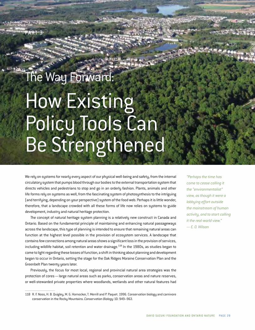
Dav iD S uzu ki FOu n DatiOn a n D On ta riO n at u r e Page 29
Pa rt 3
The Way Forward:
How Existing Policy Tools Can Be StrengthenedWe rely on systems for nearly every aspect of our physical well-being and safety, from the internal
circulatory system that pumps blood through our bodies to the external transportation system that
directs vehicles and pedestrians to stop and go in an orderly fashion. Plants, animals and other
life forms rely on systems as well, from the fascinating system of photosynthesis to the intriguing
(and terrifying, depending on your perspective) system of the food web. Perhaps it is little wonder,
therefore, that a landscape crowded with all these forms of life now relies on systems to guide
development, industry and natural heritage protection.
The concept of natural heritage system planning is a relatively new construct in Canada and
Ontario. Based on the fundamental principle of maintaining and enhancing natural passageways
across the landscape, this type of planning is intended to ensure that remaining natural areas can
function at the highest level possible in the provision of ecosystem services. A landscape that
contains few connections among natural areas shows a significant loss in the provision of services,
including wildlife habitat, soil retention and water drainage.118 in the 1980s, as studies began to
come to light regarding these losses of function, a shift in thinking about planning and development
began to occur in Ontario, setting the stage for the Oak ridges Moraine Conservation Plan and the
Greenbelt Plan twenty years later.
Previously, the focus for most local, regional and provincial natural area strategies was the
protection of cores — large natural areas such as parks, conservation areas and nature reserves,
or well-stewarded private properties where woodlands, wetlands and other natural features had
118 r. F. noss, H. B. Quigley, M. G. Hornocker, T. Merrill and P. Paquet. 1996. Conservation biology and carnivore conservation in the rocky Mountains. Conservation Biology 10: 949–963.
“Perhaps the time has
come to cease calling it
the “environmentalist”
view, as though it were a
lobbying effort outside
the mainstream of human
activity, and to start calling
it the real-world view.”
— E. O. Wilson

Page 3 0 biODi v e r Sit y in On ta riO ’ S gr e e n be lt
been restored or maintained. unfortunately, as road construction and housing development and
industrial activities crept ever closer to the perimeter of these cores, populations of species within
those natural areas became cut off from nearby ecological areas on which they formerly relied for
food, breeding and other parts of their life cycle. Without the ability to move around the landscape,
these populations were increasingly vulnerable to the effects of disease, drought and disturbance.
in 1986, Forman and Godron’s Landscape Ecology detailed the lack of function within these
increasingly fragmented areas of north America, illustrating the link between a disconnected
landscape and vulnerable populations of species. This new school of thought, coupled with provincial
landscape assessments that illustrated the decreasing natural cover in southern Ontario, prompted
the Ontario government to begin examining the current land use regime and start coordinating
planning decisions across the landscape.119 in Ontario, this planning method is called natural
heritage system planning.
natural heritage system planning was first formally discussed by the Ontario government in
1991, enshrined in policy in the Provincial Policy Statement in 1997 and further refined in large
land use plans, such as the amendment to the niagara Escarpment Plan, the Oak ridges Moraine
Conservation Plan and the Greenbelt Plan. All three of these plans within the Greenbelt are rooted
in the protection and restoration of natural cores and corridors that provide habitat for species at
risk and other plants and animals.
large natural areas, or cores, are critically important to species at risk. These core areas “form
a nucleus of habitat critical to the survival of species.”120 For these cores to fully function as habitat,
however, natural corridors must also be present on the landscape. Corridors or linkages connect the
core areas to each other, increasing the habitat value of smaller or more fragmented core areas by
allowing species to move away from threats, to breed with populations outside their immediate sur-
roundings, and to locate different food sources. like cores, the size of corridors can vary depending
on the surrounding landscape, though larger corridors are more likely to provide safe passage for
species and withstand pressures from nearby human activities. There are numerous recognized
core areas with established linkages between them in all three plans within the Greenbelt. Though
they vary in size depending on their landscape context, they have all been identified as significant
given their high concentration of natural heritage values and their ability to provide habitat for a
range of plant and animal species.121
Because of its complexity, the success of natural heritage system planning relies on more than
the creation and implementation of policy frameworks such as the three plans within the Greenbelt.
While these land use plans coordinate the high-level planning, complementary legislation such as
the Endangered Species Act and the Species at risk Act has also been put in place to protect and
recover species at risk and their habitat. Further, a variety of individuals and organizations engaging
in voluntary stewardship actions can help breathe life into policy, fostering communities that
appreciate and conserve natural areas for their ecological values and their importance to human
health and well-being.
119 natural Heritage information Centre.120 Ontario nature. Cores and Corridors: The Importance of a Green System in Southern Ontario. www.
ontarionature.org/protect/PdFs/cores.pdf. 121 Greenbelt Plan.
corridors or linkages
connect the core areas to
each other, increasing the
habitat value of smaller
or more fragmented core
areas by allowing species
to move away from threats,
to breed with populations
outside their immediate
surroundings, and to locate
different food sources.

Dav iD S uzu ki FOu n DatiOn a n D On ta riO n at u r e Page 31
Plans and Policies for the Greenbelt
Working at a landscape level to protect individual species and biodiversity requires legislation and
policy that provide a comprehensive overview and coordinated approach as well as specific direction
on activities. it also requires efforts by individuals and organizations to meaningfully implement
both regulations and voluntary activities. This section will evaluate the three land use plans of the
Greenbelt; the policy that supports and adds to the objectives of those plans; and the individual
and community actions that are contributing to the protection of biodiversity within the Greenbelt.
niagara eScarPMent Plan, 1985
The niagara Escarpment Plan (nEP) was the first large-scale environmental land use plan adopted
in Ontario, and indeed in Canada. it protected a significant landform across municipal jurisdictions
and recognized the importance of cores and corridors in land use planning. its establishment was
a significant accomplishment in the history of conservation in Ontario, in part because it set an
important precedent for landscape-level planning and in part because it protected an important
landform in the province. The nEP was born of citizens’ concerns regarding large aggregate operations
up and down the spine of the escarpment. As early as 1962, public concern regarding the effect of
pits and quarries on the niagara Escarpment had begun to grow, coming to a head when an aggregate
operator blasted away a large chunk of the escarpment in the Halton region that was clearly visible
from the heavily travelled Highway 401.122 Public outcry from local residents and organizations
such as Ontario nature (formerly Federation of Ontario naturalists) led to the Ontario government
commissioning several studies, appointing a task force to make recommendations based on those
studies and passing the niagara Escarpment Planning and development Act in 1973.
The nEP is the only large-scale land use plan in Ontario that is overseen by its own independent
commission, which was created when the legislation was passed in 1973. The niagara Escarpment
Commission (nEC) is a provincial agency composed of 17 people appointed by the Ontario Cabinet
and paid staff that has the central duty of administering the nEP. The nEC has four major functions:
approving or rejecting applications for development permits; reviewing proposals for amendments
to the plan; assessing land uses both inside and outside of the plan area; and coordinating plan-
related activities with other government activities. The nEC is advised by a public interest advisory
committee, which is intended to provide a cross-section of public opinion from a variety of sectors,
including industry and conservation.123 The nEC has the mandate to monitor and amend the plan
based, in part, on the advice of the public committee.
122 Attridge and others, Protecting the Niagara Escarpment: A Citizen’s Guide, p.20.123 niagara Escarpment Foundation and the Coalition on the niagara Escarpment. 2004. Protecting the Niagara
Escarpment: A Success Story. report prepared for the George Cedric Metcalf Foundation.
the neP was born of
citizens’ concerns regarding
large aggregate operations
up and down the spine of
the escarpment. as early
as 1962, public concern
regarding the effect of
pits and quarries on the
niagara escarpment
had begun to grow.

Page 32 biODi v e r Sit y in On ta riO ’ S gr e e n be lt
As the nEP has been in place for more than 25 years, it is possible to gauge its success in
protecting the habitat of species at risk by doing baseline assessments. Though aggregate extraction
is prohibited in many parts of the escarpment plan area, some significant habitat destruction has
still occurred as a result of aggregate extraction in selected regions, and strong pressure still exists
for the development of more aggregate extraction sites in the region.124 A comparative study done
in 2004 showed that more shoreline and woodlands have been protected in the escarpment plan
area than in its immediate surroundings — outside the plan area, 44.4 kilometres of shoreline had
been developed (24.6 per cent of the total area), while inside, only 3.6 kilometres had been altered
(3.3 per cent). in addition, forested area within the plan area had increased by more than double
the rate outside.125
Oak riDgeS MOraine cOnServatiOn Plan, 2001
The Oak ridges Moraine Conservation Plan (OrMCP) was created to help protect the rolling hills
and green valleys located at the northern edge of Greater Toronto. Much of the moraine remains
in a natural state and provides habitat to many of the Greenbelt’s species at risk. in addition, its
groundwater and surface water provide drinking water for many people in Ontario. The particular
geological processes that formed these aquatic features left behind numerous deposits of sand
and gravel, making the area a popular location for aggregate extraction. Further, its location at the
north end of metropolitan Toronto made it an ideal location for urban commuters to settle, resulting
in an increasing rate of urbanization.
in 1989, a public interest group, Save The Oak ridges Moraine (STOrM), was formed to raise
concerns about the increasing stress placed on the sensitive ecological system of the moraine. in
the years that followed, numerous studies were conducted, task forces were struck and reports
were published that highlighted the need for special protection on the moraine. Bolstered by a
growing public outcry, the campaigns of elected officials and the support of groups like Ontario
nature (formerly Federation of Ontario naturalists), STOrM was successful in 2001 in its bid for the
creation of the Oak ridges Moraine Conservation Act, establishing the OrMCP.126
The OrMCP requires municipalities within it to develop watershed plans to help safeguard import-
ant hydrological areas. These plans are intended to reflect the carrying capacity of each area; that
is, community expansion and land use decisions must consider the ecological function of the area.
like the nEP before it, the OrMCP focused on restoring and protecting natural connections across
the landscape. The plan area specifically designates natural cores, linkages, and countryside and
settlement areas, with varying uses that can occur within each designation. Specific natural features
within these areas are also identified and given individual protection, if necessary.
in most cases, development and site alteration cannot occur in or immediately beside key natural
heritage areas. Aggregate extraction cannot occur in areas designated as natural cores, but it is
permitted to occur in areas designated as natural linkage, despite the function these areas perform
for species at risk. As well, infrastructure projects can occur in both natural cores and natural linkages.
Though the OrMCP has been in place for nearly 10 years, its requirement to develop a monitoring
framework to assess its efficacy in accomplishing objectives has yet to be fulfilled. The lack of
124 M. Winfield and A. Taylor. 2005. Rebalancing the Load: The Need for an Aggregates Conservation Strategy for Ontario. report for the Pembina institute. Toronto, Canada.
125 niagara Escarpment Foundation, Protecting the Niagara Escarpment: A Success Story, p.60.126 Moraine for life.
the plan area
specifically designates
natural cores, linkages,
and countryside and
settlement areas,
with varying uses
that can occur within
each designation.

Dav iD S uzu ki FOu n DatiOn a n D On ta riO n at u r e Page 33
monitoring makes it difficult to determine whether species at risk and their habitat have benefited
from the plan.
greenbelt Plan, 2005
The Greenbelt now refers to the entire area covered by all three plans, encompassing the nEP area,
and the OrMCP area and additional Greenbelt lands. The specific zoning designations and policy
requirements of the nEP and OrMCP prevail within their boundaries. The Greenbelt Plan is a specific
set of policies intended to complement and support those of the other two plans.
The goal of the Greenbelt Plan to protect both natural heritage and agricultural land is unique
in the three plans and was created as a result of extremely high projections regarding increasing
settlement in Toronto and its surrounding region. Public concern regarding the effect these new
housing developments and services would have on already swiftly disappearing natural and
agricultural areas resulted in striking the Greenbelt Task Force in 2004. it recommended that a plan
be created to include both environmental and agricultural protection. Though both of the preceding
plans outline and support the importance of protecting farmland, neither emphasizes it to the same
degree as the Greenbelt Plan.
The Greenbelt Plan is designed to direct urbanization away from important natural heritage
features within its natural and agricultural systems. it identifies key natural heritage and key hydro-
logical features and their interrelationships, and restricts, for the most part, potentially damaging
activities both on and adjacent to these features and systems. development and site alteration that
adversely affect the function of or connectivity among natural features, such as habitat for species
at risk, woodlands, wetlands and grasslands, are not permitted. The Greenbelt Plan’s definition of
woodlands can be used to capture a range of tree stands, depending on the landscape context.
The two major policy components of the Greenbelt Plan clearly show the plan’s emphasis on
systems rather than individual features: the natural heritage system and the agricultural system.
Covering nearly a quarter of the total Greenbelt area, the natural heritage system is the backbone
of the Greenbelt Plan for species at risk and their habitat. Significant habitat for all species at risk
(endangered, threatened and special concern) is considered a key natural heritage feature. As a
result, development and site alteration cannot occur in these areas unless it can be demonstrated
that these activities will have no negative effects on the feature or its function. As well, connectivity
between these habitat areas is required to be maintained.
Wetlands are also considered a key natural heritage feature; that is, the same protections apply
as they do for significant habitats. in addition to its strong protection for wetlands, the Greenbelt
Plan requires the identification and protection of many surface and underground watercourses
that serve as the source of water in the area. By considering the natural system in its entirety, and
prompting decisions on this basis, the Greenbelt Plan protects the complex ecology that humans,
plants and animals need to survive. The natural heritage system in the Greenbelt Plan allows regions
to move forward with detailed natural heritage system planning that, at times, has exceeded the
requirements of the Greenbelt Plan.
As a result, the natural heritage system of the Greenbelt Plan protects headwaters of all major
watersheds in the areas extending from the west end of Toronto that were not previously protected
under the other plans; by doing so, it connects and enhances existing protection and supports desig-
nated urban growth centres. As well, habitat for species at risk, such as the Jefferson salamander,
that was previously at the western edge of the niagara Escarpment Plan is now included.
in addition to its strong
protection for wetlands,
the greenbelt Plan
requires the identification
and protection of many
surface and underground
watercourses that
serve as the source of
water in the area.

Page 34 biODi v e r Sit y in On ta riO ’ S gr e e n be lt
in 2009, the Ministry of Municipal Affairs and Housing (MMAH) developed a set of criteria to
encourage municipalities to put forward requests to expand the Greenbelt into areas that would
enhance the existing natural heritage or hydrological systems of the plan. Six municipalities are now
entertaining the option of submitting requests: Brampton, Guelph, Hamilton, Mississauga, Oakville
and Toronto. in several cases, the municipalities are considering requesting that public lands along
major river systems within their boundaries be included in the Greenbelt.
it is important to note that many populations of species at risk exist on the boundary of the
Greenbelt. As such, the development of a framework to allow municipalities to make requests to
grow the Greenbelt is a positive step. Though habitat for species at risk and other species has not
been, to date, the first consideration for Greenbelt expansion requests, the habitat of many species
will likely be included if draft requests go forward. For example, Toronto’s consideration of public
lands along the Humber and don rivers will have a positive benefit by formally incorporating the
entirety of the river valley corridors into the water resource system where known redside dace
populations are present.
like the nEP and the OrMCP, the Greenbelt’s principles are laid out in the high-level plan and
implemented through more detailed municipal official plans where geographic decisions and
designations are clearly outlined in maps and descriptions. This process is lengthy. More than five
years after the Greenbelt Act’s enactment, most regional municipalities have only recently completed
their new official plans. Many smaller municipalities, which must conform to their upper tier’s plan,
have only just begun the process of aligning their policies with the Greenbelt Plan.
despite the protections offered through the Greenbelt Plan’s natural heritage system, infra-
structure development, transportation corridors and aggregate extraction are all permitted within
it. Aggregate extraction continues to present one of the most significant threats to the landscape
resiliency of the Greenbelt,127 but all of these large-scale activities have the potential to significantly
affect the habitat of species at risk, both now and in the future. The increasing road mortality rates
for many reptiles, amphibians and small mammals with habitat close to highway corridors is only
one example of the challenges presented by these permitted uses within the Greenbelt Plan.
Finally, though the Greenbelt Act requires a full-scale extensive monitoring framework to be
developed and implemented to ensure the plan’s objectives are being met, the province currently
has released only a draft version of the framework, and no results have been collected or analyzed.
As a result, it is difficult to evaluate the impact that the Greenbelt has had on the habitats and
biodiversity of the Greenbelt Plan area.
127 Maureen Carter-Whitney. 2010. Ontario’s Greenbelt in an International Context. report to the Friends of the Greenbelt Foundation. Canadian institute for Environmental law and Policy. Toronto, Canada. p.64.

Dav iD S uzu ki FOu n DatiOn a n D On ta riO n at u r e Page 35
enDangereD SPecieS act, 2007
Given the significant number of species at risk in the Greenbelt, the strengthening of Ontario’s
Endangered Species Act (ESA) in 2007 will help planners and the public fulfill the broad objectives
of the Greenbelt Plan in two ways. The first is the protection of the species themselves from harm or
harassment. The second is through the development of recovery strategies and habitat regulations.
The ESA’s greatest potential for protecting Greenbelt species is its reliance on science as the
deciding factor for the listing of species at risk. under Ontario’s previous endangered species legisla-
tion, which was passed in 1971, only 42 species were listed as of 2008. Only 12 of the identified
Greenbelt species at risk were listed, including the prothonotary warbler, Henslow’s sparrow and
loggerhead shrike.128 Other species, such as the northern bobwhite, barn owl and wood turtle, were
acknowledged by the Ministry of natural resources (Mnr) as being in peril, but no legal protection
was granted to them. Ontario’s new ESA has assigned listing decisions to the Committee on the
Status of Species at risk in Ontario (COSSArO), resulting in a significant increase in listed species
to its current count of over 200. in addition, the ESA provides mandatory habitat protection for all
threatened and endangered species, though many land use activities can still continue within
regulated habitat. The previous Act’s inability to offer any flexibility in land uses within regulated
habitat made many decision-makers leery of listing species at all.129 This flexibility is a strength of the
new ESA, though it must be used carefully to ensure that development activities do not undermine
the ecological function of these habitat areas.
Activities that previously might not have been permitted in habitat can now go forward by permit,
agreement or another instrument (i.e., an authorization under another piece of legislation such as
the Aggregate resources Act). Permits can be issued for the purpose of human health or safety;
the protection or recovery of species; overall benefit for the species (that is, significant measures
must be taken to ensure that more good than harm will come to the species); and significant social
or economic benefit to Ontario. Agreements can be granted for the sake of stewardship that might
involve unintentional harm to a species at risk, but will ultimately assist in the protection or recovery
of the species. instruments allow for activities permitted under other acts to go forward despite
their impact on the habitat of species at risk or a member of the species, with the permission of the
Minister of natural resources, so long as the same general conditions as those for permits are met
and the minister believes that the action will not jeopardize the survival or recovery of the species.
The ESA is a huge step forward for the protection of biodiversity in the Greenbelt and beyond.
There is, however, potential for the spirit and intent of the ESA to be undermined if flexibility measures
are used too freely. For example, since the passing of the ESA, permits have been used to allow for
activities that damage or destroy habitat for species at risk, often with little regard for the cumulative
impact that a series of individual permits might have.130
in the case of redside dace, four permits and two agreements have been issued for developing
buildings, sewers, roads, municipal drains and stormwater management.131 The permits were ‘overall
benefit’ permits, setting a high standard for activities to go forward. yet, like many species at risk,
the redside dace relies on a wide variety of factors for its life cycle, and damage to one part of the
system may not be offset by improvement to another part. As the redside dace is under significant
128 Bell and deMarco, Waiting for the Ark, pp.13–14.129 Environmental Commissioner of Ontario. 2009. The Last Line of Defence: A Review of Ontario’s New Protections
for Species at Risk. Special report to the legislative Assembly of Ontario. Toronto, Canada.130 Environmental registry (accessed Feb. 16, 2011). www.ebr.gov.on.ca. 131 Environmental registry (accessed Feb. 16, 2011). www.ebr.gov.on.ca.
the eSa’s greatest
potential for protecting
greenbelt species is its
reliance on science as
the deciding factor for the
listing of species at risk.

Page 36 biODi v e r Sit y in On ta riO ’ S gr e e n be lt
pressure in almost all of its occupied areas, and the Mnr has yet to develop guidelines on the
thresholds to disturbance that populations of redside dace can withstand, it is impossible to confirm
whether the mitigation measures within the permits will be enough to help populations survive.132
Fortunately, the ESA also appears to be driving significant reforms in planning and decision-
making for redside dace habitat. The redside dace habitat regulation protects both direct and indirect
habitat for the species, including the headwaters that feed the streams and rivers on which the fish
relies as well as historical habitat where redside dace populations may reasonably reoccur. Because
many redside dace populations occur in areas under high demand for development, this regulation
is also accompanied by recommendations of best management practices for the development
industry. One of these recommended practices is the development of sub-watershed plans within
redside dace habitat, which would complement the watershed plans that are already required under
the OrMCP and help refine the existing protections for hydrological systems in both the Greenbelt
Plan and the nEP. This recommendation is a significant step forward in the integration of habitat
protection and land use planning, as it requires that the full effect of actions on an entire system be
considered. This approach should be applauded as a strong precedent for implementation of the act.
it is critical that science inform the implementation of the ESA, whether through the assessment of
applications for permits that allow potential harmful activities to move forward or through guidelines
for industry and private citizens to ensure that a full understanding of the required habitat is used
to inform land use decisions in and around species at risk.
SPecieS at riSk act
The provincial ESA is complemented at the national level by federal species at risk legislation.
Although the Species at risk Act (SArA) has not had many immediate ramifications for Greenbelt
species at risk or their habitat, it is a potential mechanism for their protection in the future. Habitat
protection under SArA is limited to federal lands for most species, though aquatic species and their
habitats are also offered some protection. it is also possible for SArA’s “safety net” to be employed;
however, it has not been used to date for any species in Canada.133 This provision in SArA is a
discretionary measure that enables the federal minister to protect habitat outside of federal lands
that is facing significant threats of destruction. its lack of deployment is, in part, why provincial
legislation to protect species at risk is so critical.
SArA was enacted in 2002; its responsible agencies are Environment Canada, Parks Canada and
the department of Fisheries and Oceans. As of May, 2011, there were 635 species listed as at risk
in Canada by the Committee on the Status of Endangered Wildlife in Canada (COSEWiC); but, as of
October 2011, only 492 of those were listed under SArA (i.e. listed on Schedule 1 of the Act). Those not
listed, including several Greenbelt species, do not fall under the provisions of the federal legislation.
As recovery strategies are required under both the ESA and the federal SArA, recovery strategies
developed under SArA are used as the basis for recovery strategies for Greenbelt species under the
ESA . The sharing of information is a good indicator of how the two laws can be used cooperatively
to enhance the scientific understanding of species at risk in Ontario and other jurisdictions in
Canada. The transfer of knowledge may also help reduce the substantial workload attached to the
development of recovery strategies and other regulations under both laws.
132 COSEWiC, Report on the Redside Dace, p.28.133 Wojciechowski et al., 2011.
Protection under
Sara is limited to federal
lands for most species,
but aquatic species
and migratory birds are
protected everywhere
across the country.

Dav iD S uzu ki FOu n DatiOn a n D On ta riO n at u r e Page 37
However, the potential to develop joint recovery strategies has also resulted in red tape bogging
down the process. Two recovery strategies under the ESA (for eastern pondmussel and red knot)
have been delayed “to allow for cooperation” at the federal level, putting off protection for these
species in Ontario.134 The notice on the Environmental registry states that provincial strategies for
both species will be completed within nine months of finalizing the federal strategy, but no further
timeline is provided. The notice was posted in december 2009.135
Planning act anD PrOvincial POlicy StateMent, 2005
The Planning Act and, under it, the Provincial Policy Statement (PPS) guide land use planning
throughout Ontario. The Planning Act is the regulatory framework; the PPS provides direction for
municipalities that must implement the policy in municipal official plans. The Greenbelt Plan,
nEP, OrMCP and all supporting policy must be read in coordination with the Planning Act’s policy
directives in the PPS.
Section 2.0 of the PPS is intended to be the touchstone for municipal planning departments
making natural heritage policy decisions. Municipalities must follow the requirements of the PPS on
areas outside the Greenbelt and follow the PPS and the designated land use plan within the Greenbelt.
The province encourages municipalities to develop policies for their communities that support the
natural heritage systems within the Greenbelt through good policy decisions for areas outside of
it. The increased emphasis of the importance of natural heritage systems was a significant step
forward in the 2005 version of the PPS.
The PPS ensures the overall goals and objectives for community development are fulfilled at every
level of municipal decision-making, from the footprint of infrastructure for stormwater management
and waste diversion to the protection of natural areas for both recreational and ecological purposes.
The process of making decisions that can meet goals for economic development, environmental
protection and social well-being warrants this comprehensive approach.
The PPS guides municipalities at a very high level; it does not delve into detailed explanations
of how its requirements are to be met. Further, though it suggests that natural heritage systems
should be protected, there is no requirement to do so within its policies. natural heritage systems
are not defined or contained by the borders of a town or city or even by the designations of the
Greenbelt Plan. Watercourses run inside and outside of the Greenbelt; forests straddle the Greenbelt’s
boundaries. Though the PPS does recognize that natural systems do not follow lines drawn on maps
by policy-makers, it is up to municipal planners to make decisions on whether natural heritage
systems should extend beyond Greenbelt boundaries. Given the economic and social pressures
facing many municipalities, areas outside the Greenbelt are generally awarded less protection to
accommodate industry and urban growth.
A requirement, rather than a recommendation, to protect natural heritage systems would help
Greenbelt planners to protect the necessary components that would support the Greenbelt’s natural
heritage system across their municipalities.
134 Environmental Commissioner of Ontario. 2010. Supplement to Redefining Conservation: Annual Report 2009/2010. report to the legislative Assembly of Ontario. Toronto, Canada.
135 Environmental registry 010-8464 (accessed Feb. 17, 2011). www.ebr.gov.on.ca/ErS-WEB-External/displaynoticecontent.do?noticeid=MTA4MzA4&statusid=MTyynjk2&language=en.
the PPS ensures the
overall goals and
objectives for community
development are
fulfilled at every level
of municipal decision-
making, from the footprint
of infrastructure for
stormwater management
and waste diversion to
the protection of natural
areas for both recreational
and ecological purposes.

Page 38 biODi v e r Sit y in On ta riO ’ S gr e e n be lt
Further, the PPS currently has no requirement that planners consider the cumulative impact of
a series of relatively small decisions on the natural heritage system, which can eat away at species
habitat and the natural heritage system as a whole.
Finally, though the current PPS requires that municipalities protect habitat for species at risk
in their official plans, restricting development within specified zones, the method for coordinating
these protections with those under the ESA and SArA is not always clear to planning agencies. Some
Greenbelt aquatic species, for example, may require the protection of tributary streams outside of
the Greenbelt to ensure water quantity and quality are appropriate. in the absence of clearly defined
habitat provisions in a recovery strategy under the ESA, planners may unknowingly be required to
make decisions that could have an adverse effect on Greenbelt species at risk.
grOwth Plan FOr the greater gOlDen hOrSeShOe
While the PPS provides high-level guidance to planners for urban growth areas, the Growth Plan for the
Greater Golden Horseshoe (Growth Plan) details where development can occur. The Growth Plan was
designed to work in concert with the Greenbelt Plan to ensure that communities can accommodate
new settlement while still protecting the natural areas that provide critical ecosystem services for
residents, such as clean air and water.
The Growth Plan was prepared under the Places to Grow Act, 2005. By issuing specific directives
regarding where development can occur (that is, in urban growth centres), the plan is intended to
protect “key building blocks of the GGH’s natural systems ... rivers and streams, forests and natural
areas will be protected and accessible for residents to enjoy their beauty.” The Growth Plan is provided
to help municipalities make educated decisions on where it is appropriate to build and expand their
communities, forecasted to grow significantly in the next 20 years. The strategy, to anticipate and
plan for growth rather than attempt to retroactively combat the effects of unplanned development,
has the overall goal of reducing sprawl in the Greater Golden Horseshoe (GGH).
The Growth Plan provides the smart-growth underpinnings of development in the GGH. Problems
with the Growth Plan arise when the ecological carrying capacity of areas designated as urban growth
centres are not taken into account136 — an issue identified in many of the forecasted growth regions,
perhaps none as startling as the Paris and Galt moraines on the western edge of the Greenbelt’s
Protected Countryside.
The Paris and Galt moraines cover more than 560 square kilometres from Caledon to nor-
folk — approximately one-third of the moraines are currently in the Greenbelt Plan. like the Oak
ridges Moraine, this area stores and filters a large amount of groundwater, thereby supporting a
huge network of cold water streams and wetlands throughout the Grand river watershed. despite
requests from the Grand river Conservation Authority that the entire moraine be protected to ensure
that human activities would not undermine the ecological function of the area,137 only one-third was
included in the Greenbelt.
The Growth Plan has identified five urban growth centres on the Paris and Galt moraines. The
Environmental Commissioner of Ontario has commented that these sites clearly illustrate the “tension
between meeting Growth Plan population targets and protecting the water resources of watersheds.”
136 Environmental Commissioner, Report 2009/2010.137 Ministry of the Environment. 2009. EBR Review Response: Paris and Galt Moraines. report to the Ministry
of the Environment. Queen’s Printer for Ontario. Toronto, Canada.
Problems with the
growth Plan arise when the
ecological carrying capacity
of areas designated as urban
growth centres are not taken
into account — an issue
identified in many of the
forecasted growth regions,
perhaps none as startling
as the Paris and galt
moraines on the western
edge of the greenbelt’s
Protected countryside.
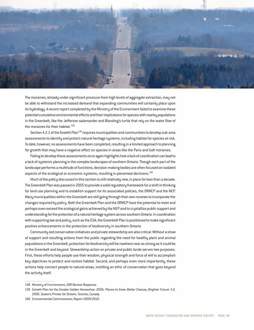
Dav iD S uzu ki FOu n DatiOn a n D On ta riO n at u r e Page 39
The moraines, already under significant pressure from high levels of aggregate extraction, may not
be able to withstand the increased demand that expanding communities will certainly place upon
its hydrology. A recent report completed by the Ministry of the Environment failed to examine these
potential cumulative environmental effects and their implications for species with nearby populations
in the Greenbelt, like the Jefferson salamander and Blanding’s turtle that rely on the water flow of
the moraines for their habitat.138
Section 4.2.1 of the Growth Plan139 requires municipalities and communities to develop sub-area
assessments to identify and protect natural heritage systems, including habitat for species at risk.
To date, however, no assessments have been completed, resulting in a limited approach to planning
for growth that may have a negative effect on species in areas like the Paris and Galt moraines.
Failing to develop these assessments once again highlights how a lack of coordination can lead to
a lack of systemic planning in the complex landscapes of southern Ontario. Though each part of the
landscape performs a multitude of functions, decision-making bodies are often focused on isolated
aspects of the ecological or economic systems, resulting in piecemeal decisions.140
Much of the policy discussed in this section is still relatively new, in place for less than a decade.
The Greenbelt Plan was passed in 2005 to provide a solid regulatory framework for a shift in thinking
for land use planning and to establish support for its associated policies, the OrMCP and the nEP.
Many municipalities within the Greenbelt are still going through their own reviews to incorporate the
changes required by policy. Both the Greenbelt Plan and the OrMCP have the potential to meet and
perhaps even exceed the ecological gains achieved by the nEP and to crystallize public support and
understanding for the protection of a natural heritage system across southern Ontario. in coordination
with supporting law and policy, such as the ESA, the Greenbelt Plan is positioned to make significant
positive enhancements in the protection of biodiversity in southern Ontario.
Community-led conservation initiatives and private stewardship are also critical. Without a show
of support and resulting actions from the public regarding the need for healthy plant and animal
populations in the Greenbelt, protection for biodiversity will be nowhere near as strong as it could be
in the Greenbelt and beyond. Stewardship action on private and public lands serves two purposes.
First, these efforts help people use their wisdom, physical strength and force of will to accomplish
key objectives to protect and restore habitat. Second, and perhaps even more importantly, these
actions help connect people to natural areas, instilling an ethic of conservation that goes beyond
the activity itself.
138 Ministry of Environment, EBR Review Response.139 Growth Plan for the Greater Golden Horseshoe. 2006. Places to Grow: Better Choices, Brighter Future. S.O.
2006. Queen’s Printer for Ontario. Toronto, Canada.140 Environmental Commissioner, Report 2009/2010.

Page 40 biODi v e r Sit y in On ta riO ’ S gr e e n be lt
Taking it to the People
As a large-scale land use goal that relies on municipal implementation and community support,
the protection of biodiversity within the Greenbelt hinges on the contribution of local knowledge
and action. The integration of community-led efforts with the regulatory regime accomplishes
two things. First, decision-makers can be both heartened and inspired by on-the-ground support
for high-level policies. Second, natural heritage systems can be strengthened in ways that make
sense scientifically and socially, leading to the increased resilience of the system and an increased
understanding of the beneficial role nature plays in healthy communities.
A program operates with greatest strength if its actors can do whatever they do best to help
accomplish a common goal. in the southern section of the Greenbelt, a partnership of individuals,
conservation groups, planning authorities and funding organizations is doing just that. Each partner
has been able to contribute a specific component to get a large landscape-level project off the ground
that combines the purchase of properties by land trusts and voluntary efforts on private and public
land that provides natural connections.
cOOteS tO eScarPMent Park SySteM
nothing can better illustrate the complexities of land use planning in southern Ontario than the vision
for the Cootes to Escarpment Park System, which covers 1,500 hectares, involves nine partners
and attempts to accomplish the major ecological and community goals of the Greenbelt plan.141
The project’s goal is to connect nine existing protected areas to form a migratory and recreational
corridor from Hamilton Harbour and Cootes Paradise to the niagara Escarpment. The area is the
last remaining region on the Greenbelt where wetlands are still contiguous to lake Ontario, and its
connectivity provides Carolinian habitat for Greenbelt species at risk such as the hooded warbler,
Jefferson salamander, monarch butterfly and eastern spiny softshell turtle. The area is also used
by many more common bird, amphibian and reptile populations.
The project is in early days, with a recent publication of its vision and strategy. Early funding for
the strategy’s development has come from the project partners: Bruce Trail Conservancy, City of
Burlington, City of Hamilton, Conservation Halton, Hamilton Conservation Authority, Hamilton Harbour
remedial Action Plan, Hamilton naturalists Club, region of Halton and the royal Botanical Garden,
as well as the Friends of the Greenbelt Foundation and, in 2011, the Ontario Trillium Foundation. The
coordinated effort has a key goal of creating “stronger and more sustainable protection for species
at risk and their sensitive ecological communities.” The strategy will involve protection through the
purchase and management of properties by land trusts, education and outreach for property owners
within the project area and coordinated voluntary stewardship efforts on public and private land.
These efforts will help restore and maintain the natural integrity of the core areas and associated
corridors, many of which may be found on private land, to enhance the ecological system in the
141 Cootes to Escarpment. 2009. Cootes to Escarpment Park System: A Conservation Vision. report to Cootes to Escarpment.
the area is the last
remaining region on the
greenbelt where wetlands
are still contiguous to
lake Ontario, and its
connectivity provides
carolinian habitat for
greenbelt species at
risk such as the hooded
warbler, Jefferson
salamander, monarch
butterfly and eastern
spiny softshell turtle.

Dav iD S uzu ki FOu n DatiOn a n D On ta riO n at u r e Page 41
region. A collaborative project like the this one has the potential to make a significant contribution
to the protection of species at risk and their habitat in the Greenbelt.
vOluntary StewarDShiP PrOgraMS
Private land stewardship is an important component of natural heritage protection in southern
Ontario. The role of private landowners in stewardship cannot be overestimated in the Greenbelt,
where significant sections of environmentally sensitive land are owned by private citizens. Many
programs coordinated by government and non-profit organizations provide willing landowners
with information and partial or full funding to implement positive ecological actions on their land.
lynDe creek biODiverSity rehabilitatiOn PrOJect
using preliminary funding from the Oak ridges Moraine land Trust, Ontario Streams has identified the
important hydrological corridor of lynde Creek for its myriad ecological values, not least of which is
the habitat provided for redside dace.142 lynde Creek, which originates on the Oak ridges Moraine, is
one of the urban watercourses with protected headwaters within the Greenbelt but an unprotected
watercourse. At its northern extent, it flows through a fairly rural landscape before running into the
increasingly urban centres of Brooklin and Whitby.
Brooklin is surrounded by “whitebelt lands” — areas where Greenbelt protection does not apply
and which abut existing urban settlement boundaries. Since the passing of the
Greenbelt Plan, many of these whitebelt areas have been purchased by developers
operating under the assumption that urban growth will soon push into these areas.
The increased development interest has caused concern for both Ontario Streams and
private landowners on lynde Creek and resulted in the creation of the lynde Creek
Biodiversity rehabilitation Project. in 2009, Ontario Streams contacted numerous
landowners, subsequently enrolling five in the initial project. rehabilitation plans for
five properties have been developed, based in part on habitat assessment.
in 2010, a 430-metre buffer strip was planted on a stream that flows into lynde
Creek. Previously, the property had supported a livestock operation and cattle
were permitted to graze right down to the stream’s edge, damaging terrestrial and
hydrological system in the area. The buffer extends horizontally 30 metres on both
sides of the water’s edge along the watercourse, leading to increased soil retention
and cooling of the freshwater stream. The initiative is the first to be completed under the project
and will set the precedent for other plans to follow.143
These projects will feature a number of actions for stream restoration, including planting vege-
tated buffers (with a direct benefit for shade-dwelling species like the redside dace), removing debris
and potential sources of contamination adjacent to the stream and creating in-stream structures to
encourage spawning or other life processes for species at risk as well as more common species.144
142 Ontario Streams: Lynde Creek Biodiversity Rehabilitation Project. www.ontariostreams.on.ca/lynde%20Creek.htm.
143 interview with Christine Pritchard, Ontario Streams, Jan. 27, 2011. 144 interview with Christine Pritchard.

Page 4 2 biODi v e r Sit y in On ta riO ’ S gr e e n be lt
cOnServatiOn lanD tax incentive PrOgraM anD ManageD FOreSt tax incentive PrOgraM
The Conservation land Tax incentive Program (ClTiP) is managed by the Ministry of natural
resources to provide tax relief to private landowners with specific natural features on their land.145
landowners with portions of the niagara Escarpment natural zones, wetlands, areas of natural or
scientific interest (AnSis) and habitat for endangered species can apply for 100 per cent tax relief
on the eligible portions of their land. All conservation land must be at least one-fifth of a hectare.
The Managed Forest Tax incentive Program (MFTiP) is coordinated by stewardship councils across
the province to enhance woodlands on private property. To qualify for the tax credits associated
with MFTiP, landowners must own at least four hectares of land and prepare a forest management
plan for those areas under the guidance of the stewardship councils. Areas enrolled in MFTiP are
taxed at 25 per cent of the local municipal rate for residential properties.
in 2004, the province announced improvements to ClTiP and MFTiP to help support the then-
proposed Greenbelt Plan. Conservation organizations were able to apply for ClTiP, and the assessment
process for MFTiP was refined. unfortunately, the landowners with threatened or special concern
species are still not eligible for benefits under ClTiP. This omission is significant, because a concerted
effort to protect habitat for species listed as special concern or threatened might help enhance their
survival and recovery, ultimately leading to them being taken off the list of species at risk.146 in
2010, only 60 properties in the province received tax relief under this section of the ClTiP because
they had endangered species on their property.147
The Ministry of natural resources does not release statistics on regional enrollment or land
types currently in the program, but in 2011, there were 19,050 participants in the program with
over 237,320 hectares enrolled across the province.
SPecieS at riSk FarM incentive PrOgraM anD canaDa FarM StewarDShiP PrOgraM
in november 2008, the Ministry of natural resources announced the creation of a funding pool
designed to help private landowners restore or enhance species at risk habitat on their properties.
The announcement coincided with the end of the Greenbelt Farm Stewardship Program that had
previously been funded by the Friends of the Greenbelt Foundation. This program had been providing
funding of a similar type exclusively to farms within the Greenbelt.
The initial pilot for the Species at risk Farm incentive Program (SArFiP) was awarded $800,000,
to be administered by the Ontario Federation of Agriculture and delivered by the Ontario Soil and
Crop improvement Association (OSCiA). it could fund up to 100 per cent of the costs of a habitat
improvement project worth up to $20,000. As the program moved forward, it was restructured to
emphasize cost-sharing over full payment for habitat improvement. Currently, the program funds
up to 50 per cent of the costs. in areas identified as a priority, such as the lake Simcoe watershed,
federal funding can also be accessed to cover additional costs.
SArFiP was designed to run in tandem with the federal Canada Farm Stewardship Program. To
qualify for both programs, farmers are required to put together an Environmental Farm Plan (EFP),
to assess and prioritize which environmental actions should take place on their farm and put a plan
145 Ministry of natural resources.146 Environmental Commissioner, Last Line of Defence, p.54.147 Environmental Commissioner, Last Line of Defence, p.54.
in november 2008,
the Ministry of natural
resources announced the
creation of a funding pool
designed to help private
landowners restore or
enhance species at risk
habitat on their properties.

Dav iD S uzu ki FOu n DatiOn a n D On ta riO n at u r e Page 43
in place to accomplish these tasks. Often, the OSCiA helps farmers to determine whether federal
or provincial funding is available to complete components of their EFP to ensure that as much
landscape restoration as possible is done in a fiscal year.148 The purpose of both the Canada Farm
Stewardship Program and the SArFiP is, in part, to engage farmers in species at risk protection, as well
as numerous other farm stewardship practices that can have positive environmental benefits. High
enrollment rates indicate a great interest and desire in the agriculture community to do just that.149
SArFiP does not require landowners to prove that species at risk are present on their property
or to restore habitat based on the needs of targeted species. As a result, successful SArFiP-funded
projects over the last two years have resulted in greater landscape cover that may be used as
habitat, such as wetlands, woodlands and grasslands, but no numbers are available on usage of
this land by species at risk.150
greenbelt FarM StewarDShiP PrOgraM
From 2006 to 2008, the Greenbelt Farm Stewardship Program, funded by the Friends of the Greenbelt
Foundation, helped farmers accomplish projects associated with their EFP. The program, delivered
by the OSCiA, helped to lay the groundwork for SArFiP by encouraging farmers to complete their
EFPs and to consider how improved farm practices, such as planting trees for windbreaks, creating
stream buffers and improving nutrient management, could achieve the benefit of creating habitat
for species at risk.151
Over its two-year run, 700 projects were completed. These projects covered a range of objectives
and included 20,000 trees planted on 20 farms. The trees were often planted as windbreaks.
Windbreaks offer numerous habitat benefits as increased tree cover provides nesting and feeding
grounds for bird species and can also help regulate the temperatures of stream corridors, depending
on their location on the farm.152
nutrient management was also a popular project under the Greenbelt Farm Stewardship Program.
Plans were developed on 6,000 acres of farmland in the Greenbelt for farmers to manage chemicals,
fertilizers and other potentially toxic material in a way that does not damage water and soil. Further
changes to grazing practices can also help keep waterways clean for species at risk; for example,
refined rotational grazing practices on nine farms prompted a change in livestock management, and
12 producers erected 18 kilometres of fencing to keep livestock out of riparian areas. The relocation
of three livestock buildings away from water sources was also completed to help keep hydrological
corridors intact.153
Finally, the Greenbelt Farm Stewardship Program prompted a 30 per cent reduction in pesticide
use on 53 farms (constituting 4,000 acres) in the niagara region and additional pesticide reduction
(on 47,000 acres) in other regions of the Greenbelt.154 Many farmers were aware of and motivated
by the fact that their work in planting trees, managing nutrients and reducing pesticides would have
positive peripheral benefits for species at risk.155
148 interview with Andrew Graham, Ontario Soil and Crop improvement Association, Feb. 3, 2011.149 interview with Tom Parker, Species at risk Farm incentive Program participant, Feb. 3, 2011.150 Personal communication from Andrew Graham, Ontario Soil and Crop improvement Association, Feb. 3, 2011.151 Personal communication from Andrew Graham.152 Personal communication from Shelley Petrie, Friends of the Greenbelt Foundation, Feb. 1, 2011.153 Personal communication from Shelley Petrie.154 Personal communication from Shelley Petrie.155 Personal communication from Shelley Petrie.
Over its two-year run, 700
projects were completed.
these projects covered a
range of objectives and
included 20,000 trees
planted on 20 farms.

Page 4 4 biODi v e r Sit y in On ta riO ’ S gr e e n be lt
Overall, stewardship incentive programs, whether they be payment for projects, cost-sharing for
priorities of the EFP or services by qualified agencies to help coordinate and advise on environmental
actions, are beneficial to the Greenbelt’s biodiversity. The results of these programs are difficult to
measure, however, partly because of the lack of a requirement in the Greenbelt Plan for the province
to put in place a cohesive and comprehensive monitoring framework to gauge changes over time
in the plan area.
Section 5.8 of the Greenbelt Plan requires the Ontario government to create and implement a
framework to evaluate the effectiveness of the Greenbelt Plan in achieving its goals.156 Though a
discussion paper on the draft framework was posted by the government in April 2010 for public
consultation, no final version of the framework has been released to date. Without a framework, it
is difficult to assess the achievements of the Greenbelt policies.
Monitoring the effectiveness of both regulatory and voluntary actions that provide habitat
protection for species at risk is a critical component of effective implementation of the Greenbelt
Plan. These results can help groups and individuals to adjust their activities. They can also enhance
the development and implementation of policy. While some groups that work closely with specific
areas are well positioned to provide consistent data on what is working and what is not — data that
can help inform improvements to the Greenbelt — the need remains for a coordinated monitoring
framework to help understand the current strengths and weaknesses of Greenbelt policies.
Monitoring the Greenbelt
DurhaM regiOn cOaStal wetlanDS MOnitOring PrOJect
The durham region Coastal Wetlands Monitoring Project has been gathering consistent results over
time that could provide data for Greenbelt monitoring. led by the Central lake Ontario Conservation
Authority (ClOCA), the program was created to help address significant losses in durham’s coastal
wetlands, which have been heavily affected by encroaching development.157 Environment Canada,
the Toronto region Conservation Authority and the Ganaraska region Conservation Authority all
partner with ClOCA to monitor the coastal wetlands of durham.
The purpose of the project is to gather and analyze data over time in the coastal wetlands to
ensure that trends can be adequately understood and management plans can be developed for
the future. Key threats and the impact of nearby activities on the wetlands and their associated
habitat for many species, including those at risk, are a critical component of the long-range study.
The partners use geological and biological indicators, including the health of plants, fish, breeding
birds and amphibian communities, to develop rankings of water quality, quantity, vegetation and
more. They pay specific attention to the impact that restoration efforts have had on the health of
the wetland, to ensure that adaptive management practices are used in maintaining and restoring
these critical hydrological systems.
156 Greenbelt Plan, p.45.157 Central lake Ontario Conservation Authority, Durham Region Coastal Wetlands.
the purpose of the
project is to gather and
analyze data over time in
the coastal wetlands to
ensure that trends can be
adequately understood
and management
plans can be developed
for the future.

Dav iD S uzu ki FOu n DatiOn a n D On ta riO n at u r e Page 45
Systemic Planning and Social Action
The strongest hope for the protection of biodiversity in the Greenbelt and beyond is the implementa-
tion of system-based land use planning and concerted social action to connect natural cores and
corridors on both a terrestrial and a hydrological level.
The Greenbelt Plan and supporting policies are a huge step forward in land use planning in
Ontario. Without the requirements and tools to identify and protect habitat for known species at risk
and the natural heritage systems that support them, imperilled species could become extirpated
(locally extinct) because of the rapid urbanization of regions of the
Greenbelt.158 if implemented effectively and strengthened in key
respects, existing policies in southern Ontario can provide municipal,
regional and provincial decision-makers with the ability to protect
the Greenbelt and the multitude of species at risk and their habitats
within it. Concerted efforts to create and coordinate funding for land
securement, private stewardship efforts and stewardship incentive
programs can also help breathe life into policy for the Greenbelt’s
plants and animals.
The directive and the opportunity granted to public entities
and private citizens to use science-based thresholds to determine
whether and how land use changes should occur, such as the
requirement for community watershed plans to be developed under the OrMCP, are the most critical
components of existing policy — and they must continue to be used in concert with stewardship
incentive programs, educational activities and land securement initiatives to ensure that habitat
for species at risk within the Greenbelt can be protected and restored.
The devil is in the details, however. Ontarians have many of the necessary tools to protect the
plants, animals and other life forms within the Greenbelt. it is critical, therefore, that education and
awareness of the need for protecting systems be provided to Ontarians. Without the political will
to uphold and properly implement these policies, the worth of natural capital will continue to be
an abstract concept to most people. Making certain that complementary policies are integrated at
every level of their implementation can help ensure that the fundamental principles of the Greenbelt
Plan are upheld.
The time has come to celebrate the benchmarks in protecting biodiversity that have been
achieved, but, also, to talk of the various ways protecting wildlife habitat can be strengthened in
the Greenbelt. This report will conclude with recommendations for doing just that.
158 numerous species in the Greenbelt have been listed as vulnerable by the natural Heritage information Centre, including the Jefferson salamander, hooded warbler, redside dace, Blanding’s turtle and rapids clubtail. increased stresses for these populations could lead to their extirpation.

Page 4 6 biODi v e r Sit y in On ta riO ’ S gr e e n be lt
Conclusionthe greenbelt FaceS PreSSureS. Fragile plants grow on the edge of busy freeways; birds make
their nests on the ledges of apartment buildings; rare trees cling to cliffs overlooking an expanse of
natural and developed lands. The beauty and diversity of the Greenbelt’s vast acreage could never
be replicated by human hands — but it is in our power to protect all that remains on the landscape.
Small actions can make a huge difference. in some cases, mere acknowledgement of the con-
nection between the natural world and human health will help build communities that adhere to,
rather than exceed, the carrying capacity of the landscape in which they are situated. in others, big
actions, such as the banning of ddT, have resulted in large changes. Given that so many species at
risk remain, the time for concerted action to protect the Greenbelt’s biodiversity is now.
These species need help to survive. Habitat loss and fragmentation are an ongoing threat. roads,
disturbances and development are taking their toll. Wetlands, woodlands and agricultural lands are
experiencing the eroding pressures of urbanization. Without a resilient landscape, the approaching
threat of climate change becomes ever more significant.
Strong policy currently exists that grants both public entities and private citizens an opportunity
to build and maintain strong natural heritage systems. The Greenbelt Plan and supporting policies
must continue to be implemented thoughtfully in concert with stewardship incentive programs,
educational activities and land securement initiatives to ensure that habitats within the Greenbelt
can be protected and restored.
if Ontarians understand and acknowledge the many benefits of protecting habitat for plants,
animals and other life forms, the Greenbelt can fulfill its promise and become a model of ecological
and economic innovation for communities across Canada and the rest of the world.
if Ontarians understand
and acknowledge the many
benefits of protecting
habitat for plants, animals
and other life forms, the
greenbelt can fulfill its
promise and become a
model of ecological and
economic innovation for
communities across canada
and the rest of the world.

Dav iD S uzu ki FOu n DatiOn a n D On ta riO n at u r e Page 47
recommendations
For the Greenbelt Plan and associated policy to effectively protect species at risk and their habitat,
the Ontario government must take several steps:
recOMMenDatiOn 1 Make natural heritage system planning a requirement
under the Provincial Policy Statement to ensure
municipalities are clearly directed to develop system-
based plans both inside and outside the Greenbelt.
recOMMenDatiOn 2 Strengthen the Greenbelt Plan during the 2015 review
to better address the negative impacts of infrastructure
development and aggregate extraction.
recOMMenDatiOn 3 Work with municipalities to refine requests to grow the
Greenbelt so that they capture habitat for species at risk.
recOMMenDatiOn 4 develop a comprehensive monitoring program to assess the
extent to which the Greenbelt is accomplishing its objectives,
including the protection of species at risk, and to enable and
inform adaptive management to better meet those objectives.
recOMMenDatiOn 5 increase funding for stewardship incentive programs, so that
opportunities to leverage the interest and goodwill of landowners
are not lost, and refine program objectives to more explicitly address
the protection and restoration of habitat for species at risk.
recOMMenDatiOn 6 Coordinate incentive programs, stewardship activities,
outreach programs and municipal policy on species at
risk with recommendations in recovery strategies, so that
efforts are strategically organized and delivered.
recOMMenDatiOn 7 Broaden the Conservation land Tax incentive Program
to include habitat for threatened species.
recOMMenDatiOn 8 Coordinate the implementation of the Growth Plan with the
implementation of the Greenbelt Plan through the development
of sub-area assessments so that features which support
the Greenbelt natural heritage system are protected for the
long term and not overwhelmed by growing populations.

Page 48 biODi v e r Sit y in On ta riO ’ S gr e e n be lt
rEFErEnCES
PubliSheD SOurceS
Attridge, ian, rick lindgren and linda Pim. 1998. Protecting the Niagara Escarpment: A Citizen’s Guide. report to
the Coalition on the niagara Escarpment. Scarborough,
Ontario.
Beck, Gregor G., Michael d. Cadman, Andrew r. Couturier, denis
lepage and donald A. Sutherland. (Eds.) 2007. Atlas of the Breeding Birds of Ontario, 2001–2005. Bird Studies
Canada, Environment Canada, Ontario Field Ornithologists,
Ontario Ministry of natural resources and Ontario nature.
Toronto, Canada.
Bell, Anne and Jerry deMarco. 2004. Waiting for the Ark: Endangered Species in the Golden Horseshoe Greenbelt. report to Environmental defence. Toronto, Canada.
Bollinger, E. K. and T. A. Gavin. 1992. Eastern Bobolink
populations: Ecology and conservation in an agricultural
landscape, pp. 497–506 in Ecology and Conservation of Neotropical Migrant Landbirds. J. M. Hagan iii and d. W.
Johnston. (Eds.) Smithsonian. Washington, dC.
Bowles, Jane, Michelle Kanter, Veronique leHouk and dave
Martin. 2004. Species at Risk in Carolinian Canada and How to Help. report to the Carolinian Canada Coalition.
london, Canada.
Cadman, M.d., d.A. Sutherland, G.G. Beck, d. lepage, and A.r.
Couturier (eds.). 2007. Atlas of the Breeding Birds of
Ontario 2001-2005. Bird Studies Canada, Environment
Canada, Ontario Field Ornithologists, Ontario Ministry of
natural resources and Ontario nature. Toronto.
Carson, rachel. 1962. Silent Spring. Houghton Mifflin. Boston.
Carter-Whitney, Maureen. 2010. Ontario’s Greenbelt in an International Context. report to the Friends of
the Greenbelt Foundation. Canadian institute for
Environmental law and Policy. Toronto, Canada.
Central lake Ontario Conservation Authority. Durham Region Coastal Wetlands: Baseline Conditions and Study Findings 2002 and 2003. 2003. report for the Central lake Ontario
Conservation Authority. Toronto, Canada.
Cheng, ryan and Peter lee. 2008. Urban Sprawl and Other Major Land Use Conversions in Ontario’s Greenbelt from 1993–2007: A Change Analysis Project Using Satellite Imagery. report to the david Suzuki Foundation and
the Greenbelt Foundation. Global Forest Watch Canada.
Edmonton, Canada.
Christie, Peter. Summer 2011. The tiny hunter. ON Nature: 19–23.
Connolly, Michelle, Keith Ferguson, Susan Pinkus and Faisal
Moola. 2010. On the Edge: British Columbia’s Unprotected Transboundary Species. report to the david Suzuki
Foundation. Vancouver, Canada.
Connolly, Michelle, lindsay Coulter, Faisal Moola and devon
Page. 2007. Rich Wildlife/Poor Protection: The Urgent Need for Strong Legal Protection of British Columbia’s Biodiversity. report for the david Suzuki Foundation and
Sierra legal. Vancouver, Canada.
Cootes to Escarpment. 2009. Cootes to Escarpment Park System: A Conservation Vision. report to Cootes to
Escarpment.
COSEWiC. 2000. COSEWIC Assessment and Update Status Report on the Hooded Warbler (Wilsonia citrina) in Canada. Committee on the Status of Endangered Wildlife
in Canada. Ottawa, Canada.
COSEWiC. 2007. COSEWIC Assessment and Update Status Report on the Redside Dace (Clinostomus elongatus) in Canada. Committee on the Status of Endangered Wildlife
in Canada. Ottawa, Canada.

Dav iD S uzu ki FOu n DatiOn a n D On ta riO n at u r e Page 49
donnan, Jack. 2008. Economic Implications and Consequences of Population Growth, Land Use Trends, and Urban Sprawl in Southern Ontario. report to the Environmental
Commissioner of Ontario.
ducks unlimited Canada. 2010. Southern Ontario Wetland Conversion Analysis. A report of ducks unlimited Canada.
Barrie, Canada.
Endangered Species Act, 2007. Statute of Ontario, 2007. S.O.
2007, Chapter 6. Queen’s Printer for Ontario. Toronto,
Canada.
Environment Canada. 2004. How Much Habitat Is Enough? A Framework for Guiding Habitat Rehabilitation in Great Lakes Areas of Concern (2nd ed.). report for the Ministry
of the Environment.
Environmental Commissioner of Ontario. 2007. Reconciling Our Priorities: Annual Report 2006/2007. report to the
legislative Assembly of Ontario. Toronto, Canada.
Environmental Commissioner of Ontario. 2008. Getting to Know: Annual Report 2007/2008. report to the legislative
Assembly of Ontario. Toronto, Canada.
Environmental Commissioner of Ontario. 2009. Building Resilience: Annual Report 2008/2009. report to the
legislative Assembly of Ontario. Toronto, Canada.
Environmental Commissioner of Ontario. 2009. The Last Line of Defence: A Review of Ontario’s New Protections for Species at Risk. Special report to the legislative Assembly of
Ontario. Toronto, Canada.
Environmental Commissioner of Ontario. 2010. Redefining Conservation: Annual Report 2009/2010. report to the
legislative Assembly of Ontario. Toronto, Canada.
Fischlin, A., G. F. Midgley, J. T. Price, r. leemans, B. Gopal, C.
Turley, M. d. A. rounsevell, O. P. dube, J. Tarazona and A.
A. Velichko. 2007. Ecosystems, their properties, goods
and services. Climate Change 2007: Impacts, Adaptation and Vulnerability. Contribution of Working Group ii to the
Fourth Assessment report of the intergovernmental Panel
on Climate Change. M. l. Parry, O. F. Canziani, J. P. Palutikof,
P. J. vander linden and C. E. Hanson. (Eds.) Cambridge
university Press. Cambridge, london.
Greenbelt Plan, 2005. S.O. 2005. Queen’s Printer for Ontario.
Toronto, Canada.
Growth Plan for the Greater Golden Horseshoe. 2006. Places to Grow: Better Choices, Brighter Future. S.O. 2006. Queen’s
Printer for Ontario. Toronto, Canada.
Jefferson Salamander recovery Team. 2010. Recovery Strategy for the Jefferson Salamander (Ambystoma
jeffersonianum) in Ontario. Ontario recovery Strategy
Series. Prepared for the Ontario Ministry of natural
resources. Peterborough, Canada.
Johnson, lorraine. 2005. Carolinian Canada Signature Sites: A Guide to 38 Special Natural Areas in Ontario’s Deep South and Heritage Plaques Celebrating Community Conservation. report to the Carolinian Canada Coalition.
london, Canada.
Johnson, lorraine. Spring 2008. A garden of rarities. ON Nature.
Johnson, lorraine. Winter 2010/2011. Endangered ecosystem:
Carolinian zone. ON Nature.
louv, richard. 2005. Last Child in the Woods: Saving Our Children from Nature Deficit Disorder. Algonquin Books.
Chapel Hill, nC.
McCracken, J. 2008. Are aerial insectivores being “bugged
out”? BirdWatch Canada 42: 4–7.
Millennium Ecosystem Assessment. 2005. Ecosystems and Human Well-Being: Synthesis. island Press. Washington,
dC.
Ministry of the Environment. 2009. EBR Review Response: Paris and Galt Moraines. report to the Ministry of the
Environment. Queen’s Printer for Ontario. Toronto, Canada.
Mohr, Pat and John riley. 1994. The Natural Heritage of Southern Ontario’s Settled Landscape: A Review of Conservation and Restoration Ecology for Land-Use and Landscape Planning. report to the Ontario Ministry of
natural resources. Aurora, Canada.
Molles, Manuel C. Jr. 1999. Ecology: Concepts and Application. McGraw-Hill Companies. new york.

Page 50 biODi v e r Sit y in On ta riO ’ S gr e e n be lt
nebel, Silke, Alex Mills, Jon McCracken and Philip d. Taylor.
2010. declines of aerial insectivores in north America
follow a geographic gradient. Avian Conservation and Ecology — Ecologie et conservation des oiseaux 5(2): 1.
Available at www.ace-eco.org/vol5/iss2/art1/.
niagara Escarpment Foundation and the Coalition on the
niagara Escarpment. 2004. Protecting the Niagara Escarpment: A Success Story. report prepared for the
George Cedric Metcalf Foundation.
niagara Escarpment Plan, 2005. amended 2010. Queen’s
Printer for Ontario. Toronto, Canada.
noss, r. F., H. B. Quigley, M. G. Hornocker, T. Merrill and P.
Paquet. 1996. Conservation biology and carnivore
conservation in the rocky Mountains. Conservation Biology 10: 949–963.
Oak ridges Moraine Conservation Plan, 2002. S.O. 2002.
Queen’s Printer for Ontario. Toronto, Canada.
Ontario Biodiversity Council. 2010. State of Ontario’s Biodiversity 2010: Highlights Report. A report of the
Ontario Biodiversity Council. Peterborough, Canada.
Ontario Expert Panel on Climate Change Adaptation. 2009.
Adapting to Climate Change in Ontario: Towards the Design and Implementation of a Strategy and Action Plan. report to the Minister of the Environment. Toronto,
Canada.
Ontario Ministry of natural resources. 2005. Natural Heritage Reference Manual for Natural Heritage Policies of the Provincial Policy Statement, 2005 (2nd ed.). Queen’s
Printer for Ontario. Toronto, Canada.
Ontario nature. 2004. Suggested Conservation Guidelines for the Identification of Significant Woodlands in Southern Ontario. report for Ontario nature. Toronto, Canada.
Ontario nature. 2008. Healthy Perspectives: Your Greenbelt/Your Health. report for the Friends of the Greenbelt
Foundation. Toronto, Canada.
Provincial Policy Statement, 2005. S.O. 2005. Queen’s Printer
for Ontario. Toronto, Canada.
redside dace recovery Team. 2010. Recovery Strategy for the Redside Dace (Clinostamus elongatus) in Ontario. Ontario recovery Strategy Series. Prepared for the Ontario
Ministry of natural resources. Peterborough, Canada.
Secretariat of the Convention on Biological diversity. 2010.
Canada’s Fourth National Report to the United Nations Convention on Biological Diversity. report to the united
nations. Canada.
Smith, Andrea. 2009. The Green Way Forward: A Review of Natural Heritage Policies for Southern Ontario. report to
Ontario nature. Toronto, Canada.
TEEB. 2010. The Economics of Ecosystems and Biodiversity.
Mainstreaming the Economics of Biodiversity: A Synthesis of the Approach, Conclusions and Recommendations of TEEB. report to the united nations Environment Program.
Malta.
Theberge, John B. (Ed.) 1989. Legacy: The Natural History of Ontario. McClelland & Stewart. Toronto, Canada.
Wilson, Sara J. 2008. Ontario’s Wealth, Canada’s Future: Appreciating the Value of the Greenbelt’s Eco-Services. report to the david Suzuki Foundation. Vancouver,
Canada.
Winfield, M. and A. Taylor. 2005. Rebalancing the Load: The Need for an Aggregates Conservation Strategy for Ontario.
report for the Pembina institute. Toronto, Canada.
Wojciechowski, S., S. McKee, C. Brasard, C. S. Findlay and
S. Elgie. 2011. SArA’s Safety net Provisions and the
Effectiveness of Species at risk Protection on non-federal
lands. Journal of Environmental law and Practice. 22[3]:
203-222.

Dav iD S uzu ki FOu n DatiOn a n D On ta riO n at u r e Page 51
Online SOurceS
Bird Studies Canada: Brown-headed Cowbird Fact Sheetwww.bsc-eoc.org/national/nw_cowbirdsheet.html
Committee on the Status of Endangered
Wildlife in Canada (COSEWiC)
www.cosewic.gc.ca
Committee on the Status of Species at risk in Ontario
(COSSArO): Classifications and Rationales, 2008–2010www.mnr.gov.on.ca/en/Business/
Species/2ColumnSubPage/244543.html
Environmental registry, Government of Ontario nature
www.ebr.gov.on.ca
Grasslands Conservation Council of British Columbia
www.bcgrasslands.org/grasslands/understandingGrasslands.
htm
Greenbelt Protection, Ontario Ministry of
Municipal Affairs and Housing
www.mah.gov.on.ca/Page187.aspx
landowner resource Centre: Conserving the Forest Interior: A Threatened Wildlife Habitatwww.lrconline.com/Extension_notes_English/pdf/forinterior.pdf
Moraine for life, Oak ridges Moraine Foundation
http://moraineforlife.org/about
natural Heritage information Centre,
Ontario Ministry of natural resources
http://nhic.mnr.gov.on.ca
nature Conservancy of Canada: Habitat Linkageswww.natureconservancy.ca
news Bureau, illinois
http://news.illinois.edu/news/09/0213nature.html
Ontario nature: Cores and Corridors: The Importance of a Green System in Southern Ontariowww.ontarionature.org/protect/PdFs/cores.pdf
Ontario road Ecology Group, Toronto Zoo
www.torontozoo.com/conservation/roadEcologyGroup.asp
Ontario’s Species at risk, Ontario Ministry of natural resources
www.mnr.gov.on.ca/en/Business/Species/index.html
Ontario Streams: Lynde Creek Biodiversity Rehabilitation Project.
www.ontariostreams.on.ca/lynde%20Creek.htm
People and Culture: Population densities, Government of Ontario
www.ontario.ca/en/about_ontario/EC001035.html
region of Halton: Regional Official Planwww.halton.ca
royal Ontario Museum
www.rom.on.ca/ontario/index.php
Save the Oak ridges Moraine (STOrM) Coalition
www.stormcoalition.org
Species at risk Act Public registry
www.sararegistry.gc.ca/default_e.cfm
Tortoise Trust
www.tortoisetrust.org/articles/snappers.htm
Toronto region Conservation Authority
www.trca.on.ca/protect/watersheds
interviewS anD PerSOnal cOrreSPOnDence
Andrew Graham, Ontario Soil and Crop improvement Association,
Feb. 3, 2011.
Fiona McKay, Ministry of natural resources, Conservation land
Tax incentive Program, Feb. 4, 2011.
Tom Parker, participant, Species at risk Farm incentive
Program, Feb. 3, 2011.
Shelley Petrie, Friends of the Greenbelt Foundation,
Feb. 1, 2011.
Christine Pritchard, Ontario Streams, Jan. 27, 2011.

Printed on 100% post-consumer recycled paper, processed chlorine free.
The david Suzuki
Foundation works with
government, business and
individuals to conserve our
environment by providing
science-based education,
advocacy and policy work,
and acting as a catalyst
for the social change that
today’s situation demands.
www.davidsuzuki.org
this report is the fourth in a series that
studies natural capital and ecosystem
services in canada’s urban centres. it
reviews the state of species protection
in southern Ontario and examines the
benefits of protecting natural habitat
in the internationally renowned Ontario
greenbelt. the report also provides
recommendations on how to ensure that
the Ontario greenbelt fulfill its promise
and become a model of ecological and
economic innovation for communities
across canada and the rest of the world.
Ontario nature protects wild
species and wild spaces
through conservation,
education and public
engagement. Ontario nature
is a charitable organization
representing more than
30,000 members and
supporters and 140 member
groups across Ontario.
www.ontarionature.org