big era five patterns of interregional unity 300 – 1500 ce...
TRANSCRIPT
World History for Us All A project of San Diego State University
In collaboration with the National Center for History in the Schools (UCLA)
http://worldhistoryforusall.sdsu.edu/
Big Era Five
Patterns of Interregional Unity 300 – 1500 CE
Closeup Teaching Unit 5.3.1
West African Geography, Climate, and History 500-1600 CE
Table of Contents Why this unit? 2 Unit objectives 2 Time and materials 2 Author 2 The historical context 2 This unit in the Big Era timeline 8 Lesson 1: Vocabulary 9 Lesson 2: Ecological Environment (Accompanying PowerPoint Presentation) 13 Lesson 3: Mapping changes 15 Lesson 4: Making Connections 20 This unit and the Three Essential Questions 31 This unit and the Seven Key Themes 31 This unit and the Standards in Historical Thinking 31 Resources 32 Correlations to National and State Standards 34 Conceptual links to other lessons 35
World History for Us All Big Era 5 Closeup 5.3.1
http://worldhistoryforusall.sdsu.edu/ Page 2
Why this unit? This unit addresses the role geography and trade played in the development of cities and states in West Africa. Students will examine cause and effect relationships, both in the study of Africa’s geography and its relationship with the rest of Afroeurasia through trade. The vegetation zones of West Africa—forest, savanna, and desert—all presented particular environmental challenges that people had to face in order to establish agrarian (agricultural) or pastoral nomadic societies. These challenges are often ignored in history textbooks. This unit allows students to view the achievements of the Ghana, Mali, and Songhai kingdoms in light of the ecological environment in which they survived and prospered. Owing to the work of scholars in recent decades, information available about the societies of West Africa has greatly increased. The study of West Africa provides a forum to help students develop critical thinking skills and provide the necessary background information for later classes, both in US and World History. By working with a variety of secondary sources, students will recognize that interpretations of history are subject to change as new information is uncovered.
Unit objectives Upon completing this unit, students will be able to:
1. Explain the effects of vegetation zones of forest, savanna, and desert on the development of human societies in West Africa.
2. Analyze the importance of disease in shaping the human colonization of West Africa. 3. Describe the challenges faced by people in West Africa in adapting to particular physical
and natural environments.
Time and materials This unit is designed to be completed within 5 days of 55-minute classes. Materials are specified within each lesson.
Author Gail Hamilton teaches seventh-grade World History and eighth-grade US History at Bancroft Middle School in Long Beach, California. She is currently working on her Master’s degree in History at California State University, Long Beach. She has been a member of a team of teachers from the Long Beach Unified School District to pilot and evaluate the World History for Us All model curriculum.
The historical context Empires of West Africa
World History for Us All Big Era 5 Closeup 5.3.1
http://worldhistoryforusall.sdsu.edu/ Page 3
The introduction of the camel to West Africa in the fourth century made it possible to increase the trade between North Africa and the people south of the Sahara desert. The empires of Ghana, Mali, and Songhai in West Africa were built fundamentally upon farming and animal herding, but also upon their ability to take advantage of their location between gold mines in the south and salt mines in the central Sahara. The climate of West Africa is a frequently overlooked factor in how the empires developed. Scholars have recently drawn the connection between an increase in rainfall, which pushed the northern edge of the savannas, or grasslands, further north, and the emergence of Ghana, Mali, and Songhai. The emphasis in teaching the history of West Africa is often placed on the rich natural resources available. The role of the Niger river as a conduit for transportation and trade is emphasized, as is the role of the three vegetation zones in shaping the development of kingdoms in sub-Saharan Africa. In recent decades much research has been done related to the field of environmental history. Ghana The empire of Ghana was founded by a Mande-speaking people known as the Soninke. The name of their kingdom comes from the title of their ruler: Ghana. They became a powerful political entity in West Africa in approximately 500 CE. The empire of Ghana, not to be confused with the present-day country in Africa by the same name, was located in the Sahel, or “edge” of the Sahara desert on its southern side. This region now includes parts of the countries of Mali and Mauritania. (It encompassed none of the area now known as Ghana). It was after the introduction of camels to the region in about 300 CE that trade across the Sahara desert became more feasible and profitable. The people living between the Sahara desert and the forests in tropical West Africa were in a prime position to take advantage of the increasing trade along the trans-Saharan routes. Located in between two regions that had different products to trade, the ruler of Ghana was able to collect taxes on the trade between people to the north and to the south. The people of the rain forest to the south were willing and able to trade the gold from their mines for the salt they needed. Gold and salt were not the only items exchanged. Leather and metal goods, slaves, honey, tools, livestock, horses, textiles, and jewelry also were traded. Most of the traders who crossed the desert were Muslims. While most people in Ghana retained their traditional religion, some of the elite converted to Islam. Beginning in the ninth century, Muslim scholars created written records about Ghana, although most of these were written by North African geographers such as al-Bakri, who spoke with travelers who visited Ghana but did not visit the empire himself. Our understanding of Africa has benefitted greatly from the work of archaeologists, anthropologists, linguists, and other scholars. Recent scholarship has shown that the empire of Ghana probably continued a tradition that had been established by people living in the same area earlier. Archaeologists have excavated the site of Koumbi Saleh, referred to in early Arabic sources as the capital of Ghana. Recent scholarship indicates that this may not have been Ghana’s capital; in fact the empire may have had several important cities. Ghana ceased to be a major political power in 1076 after it was invaded by the Almoravids, Muslim invaders from Mauritania. Ghana achieved independence from the Almoravids but no strong ruler emerged to

World History for Us All Big Era 5 Closeup 5.3.1
http://worldhistoryforusall.sdsu.edu/ Page 4
take control. As a result, the area became less stable and trade caravans tried to avoid Koumbi Saleh, making Ghana weaker. One leader to emerge was Sumanguru. Oral traditions portray him as a nasty ruler, levying high taxes, killing opponents, and enslaving women. He declared himself ruler of Ghana and no one was able to overthrow him until Sundiata, leader of the Malinke (Mandinka), another Mande-speaking people, came to power. Mali The origin and history of Mali was preserved both in written and oral accounts. Oral history was passed from generation to generation by griots (keepers of oral history) and recorded by Muslim scholars who either visited the region (notably ibn Battuta) or who spoke with people who traveled to the area. As its wealth grew, it became an area of keen interest to Muslim scholars who traveled there and wrote about their experiences. When Sumanguru was king of Ghana, the empire was not nearly as large or strong as it had been at its peak. Yet, he was able to conquer the Malinke people. According to oral tradition, the rule of Sumanguru was extremely harsh. This is the origin of the story of the Lion King. This legend tells of Sundiata’s victory over Sumanguru at the battle on the plain of Krina. Under Sundiata and his successors, Mali was able to expand well beyond the territory of Ghana. At its peak, it may have been the largest land empire of its time except for the Mongol empire. The rulers of Mali controlled an area larger than western Europe. Its borders stretched to the Atlantic coast. Similarly to Ghana, Mali took advantage of its location to control the gold and salt trade. A tax upon this trade was an important source of revenue that helped generate Mali’s wealth. The rulers used this wealth to create an army, which included cavalry forces, to conquer other territories. Compared to Ghana, Islam was adopted by more people in Mali. This was helped perhaps by Mansa Musa, or King Musa, Mali’s most famous ruler. The world became aware of Mali’s wealth after Mansa Musa made a pilgrimage to Mecca accompanied by 60,000 people and hundreds of camels loaded with gold. A Muslim scholar remarked that the amount of gold spent by Mansa Musa in Cairo depressed the value of gold for a decade after his visit. The spectacle of his pilgrimage drew the world’s attention to Mali. Mansa Musa and the gold of Mali appeared on a map produced in 1375 by Abraham Cresques. The attention brought by Mansa Musa’s pilgrimage increased the volume of trade between Mali and the rest of the world. When Mansa Musa returned from his pilgrimage, he stopped in the city of Gao, which had been captured by his army. Gao, an important trade center on the Niger river, also controlled areas rich in copper. Upon departing from Gao, Mansa Musa took two Songhai princes as hostages to ensure the captured city’s loyalty. This also expanded the Mali empire further north. In addition to picking up the two royal captives in Gao, Mansa Musa returned from his pilgrimage with Arab scholars and the architect Abu-Ishaq Ibrahim al-Saheli, who subsequently changed the look and style of West African architecture. Under the rule of Mansa Musa and his successors, the city of Timbuktu became a center for Muslim learning and scholarship. Some of

World History for Us All Big Era 5 Closeup 5.3.1
http://worldhistoryforusall.sdsu.edu/ Page 5
the mosques and other buildings constructed under al-Saheli’s designs can still be seen today in Jenne and Timbuktu. After the death of Mansa Musa, his descendents fought over who should succeed him as ruler. The internal fighting, combined with attacks from Tuareg nomads and rebellions of outlying territories, contributed to Mali’s decline. One of the cities that rebelled was Gao, after the captured princes escaped and returned home. Another city that fell was Timbuktu, which was sacked and burned by Tuareg from the north. As a result, Mali lost of control over the economically-important salt, gold, and copper revenue. Songhai The people of Songhai were not happy under Mali’s rule. When Mansa Musa died, the captives escaped and returned to Gao. One of these princes was selected to be the ruler and began the Sonni dynasty. Sonni is a Songhai word that means restoration and was used to describe the return of Songhai rule. There are two versions of Songhai’s rule and expansion. One comes from Muslim scholars who chronicled the events and the other from oral tradition. The Muslim accounts are very critical of Sonni Ali, because of the way he practiced a combination of Islam and traditional religion and left the people of Songhai to their traditional religions. Sonni Ali declared Gao independent and under his leadership, and Songhai expanded to encompass much of the area formerly controlled by Mali and beyond. He led a large army, which included a cavalry and a “navy” that patrolled the rivers of West Africa. Using his military might, he captured the cities of Timbuktu and Jenne. While he was hated by Muslims for his razing of Timbuktu, he ordered his troops to leave Jenne intact. Sonni Ali did more than conquer. He also used diplomacy to help keep the Songhai empire strong. When the Malinke were threatening to form an alliance with the Portuguese, he offered the latter trade concessions on the Atlantic coast. When Sonni Ali died, he was succeeded by his son, who also practiced a modified version of Islam. The Muslim scholars consequently selected a devout military leader to lead a coup against the ruler. The general, Muhammad Ture, became ruler of Songhai as Askiya Muhammad. His rule was endorsed by the sharif of Mecca when he declared Muhammad the “Caliph of the Sudan.” Similar to the Catholic Church’s attempt to wield political power by its support of leaders, Muslim leaders attempted to spread their influence in West Africa by supporting rulers that followed Islamic law. During the Askiya dynasty, Songhai’s reputation for Islamic scholarship grew. Over a hundred Muslim schools were established in Timbuktu, and scholars from all over the Muslim empire came there to study. The empire received part of its wealth from controlling regional trans-Saharan trade networks as Ghana and Mali had done. But in addition, Songhai forces captured slaves both for production and export. Scholars estimate that the slave “plantations” that were established along the Niger river probably helped create its most productive period of farming. In
World History for Us All Big Era 5 Closeup 5.3.1
http://worldhistoryforusall.sdsu.edu/ Page 6
addition to using slaves for farming, Songhai rulers sold slaves for export. Historian Paul Lovejoy estimates that the slave exports from Songhai were at their peak in the sixteenth century. Although a central government with five provincial governors was established during the rule of Sonni Ali and Askiya Muhammad, Songhai did not last long. In the late sixteenth century, the empire was weakened by a civil war. A ruler of the Sa’adian dynasty in Morocco took advantage of this situation to cross the desert and invade Songhai using an army equipped with firearms. It is during this time that trade interactions between Africa and Europe increased and more gold was shipped to southern ports to be transferred to Europe, perhaps decreasing the value of Morocco’s capture of Songhai. Disease The ecological environment of West Africa presents serious challenges to the people that inhabit the area. The rich environmental zones which, at a glance, appear so conducive to agriculture are also home to tropical diseases. Malaria was probably one of the major causes of death in infants and children. Owing to their long exposure to the disease, however, West Africans likely did not suffer the high mortality rates from malaria that people in other parts of the world did. Malaria is spread to humans by mosquitoes, so in all except the coldest and driest areas malaria was a problem. Another disease that plagued West Africa was spread by the tsetse fly. Trypanosomosis causes sleeping sickness in humans; it is also fatal for large domestic animals, so West Africans south of the desert were not able to raise cattle that could be used for either food or production. The result was a diet lacking in protein, which compounded the problems caused by endemic diseases. The fact that Mali and Songhai were able to create a large cavalry is a testament to their innovation and wealth. Most of the horses used in West African militaries were imported from North Africa. A number of attempts were made to breed a horse that was less susceptible to trypanosomosis, but on the whole this was not successful. Records from the eighteenth century show an average lifespan of less than one year for horses in West Africa. It is probable, based on the records available, that the mortality for horses in the Mali and Songhai cavalry was not much better. The ability to import horses across the desert and maintain a cavalry in the face of such daunting odds speaks to the wealth of Mali and Songhai. Changing Climate Interest in climatic history arose out of the concern generated by the periodic droughts and famines that devastated Africa during the last thirty-five years of the twentieth century. The early work of scholars looking into Africa’s climate history tried to show a direct causal relationship between African human and environmental catastrophes. That is, these scholars argued for a connection between cutting down trees and droughts. In this argument, Africans became responsible for their own problems and the rest of the world could ignore them. This contrasted with the longue-durée (long-term) view taken by environmental historians studying Europe and North America. This view argues that climate can have indirect effects which then influence humans to adapt to new environmental conditions. In the last three decades, environmental
World History for Us All Big Era 5 Closeup 5.3.1
http://worldhistoryforusall.sdsu.edu/ Page 7
historians studying Africa have shifted their focus to examine human adaption to inter-seasonal climate changes. One argument forwarded by Reid Bryson and Christine Paddock is that regions are influenced by a variety of climatic factors, but often there is one that is the “limiting factor.” In Iceland, for example, a small decrease in temperature can shorten the growing season by a significant percent. In West Africa the “limiting factor” in regard to food production is rainfall. Rainfall affects the crops that can be grown, but it also has an effect on whether domestic animals like cattle and horses can be raised in an area. The West African vegetation zones can be mapped, not as fixed regions, but according to changing rainfall boundaries. For example, 100 mm isohyte is the border of the Sahara, the 1000 mm rainfall zone is the limit of the area in which the tsetse flies can live. Areas south of this are often fatal for large domestic animals due to the trypanosomosis carried by the tsetse fly. Some scholars have argued that this also protected Africans who lived in the forest from attacks by empires with cavalries. One scholar, James Webb, points out that the three centuries in which Ghana, Mali, and Songhai arose in West Africa experienced a climate change that caused the southern border of the Sahara to move northwards. The northern border of the Sahel was 250 miles further north in 1600 than it was in 1850. This allowed the empires to establish farms in areas that later could only support camel grazing. There is still much work to be done in the area of African climate history, but it is clear that we need to look at the achievements of the West African empires in the proper context. The success of Africans in establishing their empires in the midst of a harsh and challenging environment speaks to their creativity, adaptability, and the skill of their leaders.
World History for Us All Big Era 5 Closeup 5.3.1
http://worldhistoryforusall.sdsu.edu/ Page 8
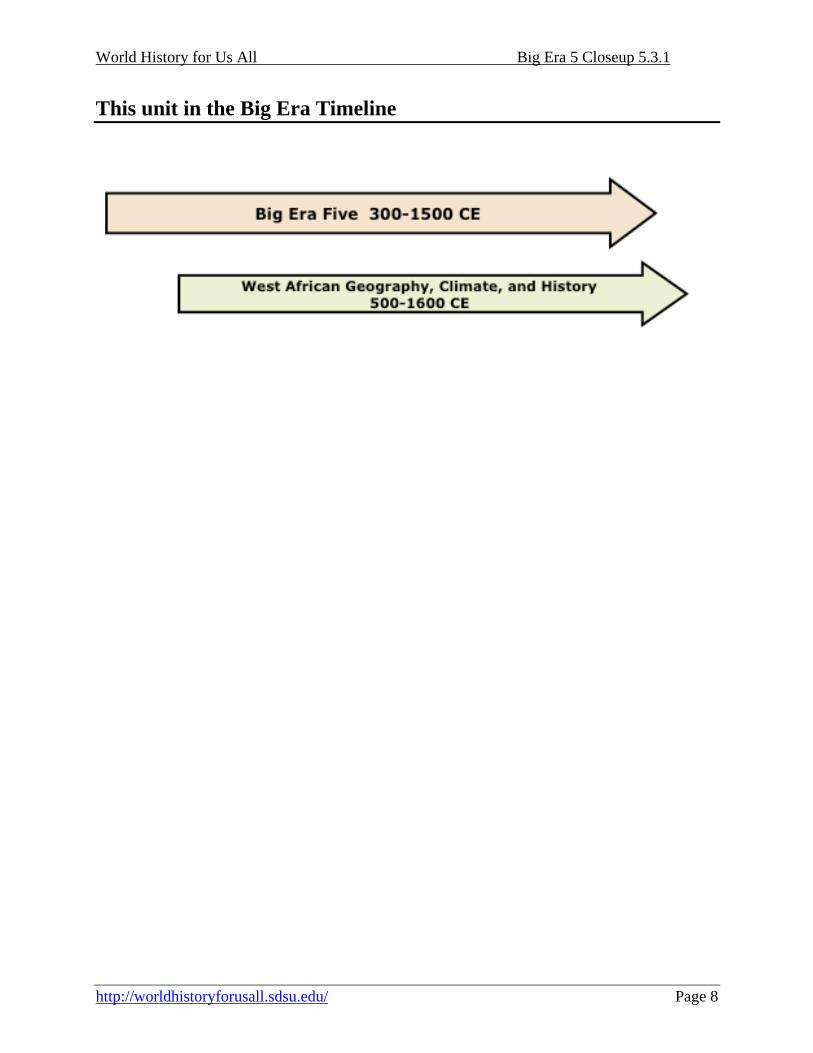
This unit in the Big Era Timeline
World History for Us All Big Era 5 Closeup 5.3.1
http://worldhistoryforusall.sdsu.edu/ Page 9
Lesson 1 Language of the Discipline
Preparation Teachers should make enough photocopies of Student Handout 1.1 so that all students have their own copy. In addition, make ten copies of Student Handout 1.2 on card stock. The vocabulary terms should be cut apart and placed in envelopes so that each group of four has one envelope with African vocabulary and an envelope of academic vocabulary. It is suggested that this unit be taught towards the beginning of the unit on Africa to maximize student understanding. Introduction This first lesson on West Africa will provide a brief introduction to the language of the discipline necessary for students to comprehend environmental challenges in West Africa. Based on the reading selected, students will probably see West Africa’s environment as having an abundance of natural resources. Students’ views on this will be complicated when they do lesson 2. Activities Vocabulary Development As with each topic studied in world history, there are specialized vocabulary terms students need to be familiar with to understand West Africa’s ecological conditions. This activity will allow students to work actively with the terms and to create meaningful categorization for each term. Students should be divided into groups of four. Each group will get two envelopes of vocabulary terms (one of terms specific to the unit and one of terms used in academic writing). The students will divide the terms amongst their group and then create definitions for each. When the groups have defined all the terms, they will divide the terms into categories. The students decide what the categories will be and how to divide the terms. After dividing the terms into different categories, the teacher will lead a whole class discussion on how and why the students divided the terms into chosen categories. To complete the activity, each group will arrange the words in a paragraph to answer the essential question: Based on the reading, how did Africa’s geography affect the development of kingdoms in West Africa? Assessment Students will use the vocabulary terms to write an essay answering the essential question for this lesson. The vocabulary terms should be highlighted.

World History for Us All Big Era 5 Closeup 5.3.1
http://worldhistoryforusall.sdsu.edu/ Page 10
Lesson 1 Student Handout 1.1—Vocabulary Instructions
1. In small groups, define terms from envelope #1.
2. Sort words into categories.
3. As a class, share categorizations.
4. BEWARE! Individuals will be called on to share.
5. Quietly read Student Handout on the geography of West Africa.
6. Open envelope #2.
7. Essential question: Based on the reading, how did Africa’s geography affect the development of kingdoms in West Africa?
8. Using ALL the words from the African geography envelope, and
three terms from the academic language envelope, work as a team to arrange the words so that they answer the essential question.
9. Individually, answer the essential question on your paper,
highlighting or underlining all the words used.
World History for Us All Big Era 5 Closeup 5.3.1
http://worldhistoryforusall.sdsu.edu/ Page 11
Lesson 1 Student Handout 1.2—Geography and its Influence on African History The geography, or physical characteristics of the land, may affect the characteristics and development of civilizations. For example, a civilization that has navigable rivers may use those to integrate the region economically and to link interior areas with seacoasts and therefore encourage trade with foreign lands. A region that has very limited land that is good for growing crops is less likely to develop a sedentary civilization than an area with abundant fertile soil and a climate good for crops. Some geographical areas have more advantages than others. In addition to geographical land forms, the climate may influence the types of agriculture, trade, and industry that are possible. In West Africa, there are three general vegetation zones: desert, savanna (grasslands), and forests. Each one has its own ecological character, that is, a range of possible relationships between humans and the land. The Sahara desert covers most of the northern section of West Africa. The savannas south of the Sahara are open grasslands to the north and wooded grasslands farther to the south. South of the savanna are wet tropical forests. In the past, historians thought the Sahara, along with the oceans that surround the African continent, kept its empires isolated from other civilizations. They also thought the abundant natural resources in Africa were unchanging. The actual situation is more complicated. Over the past several hundred thousand years, the southern Sahara has varied in size and amount of precipitation. Changes in rainfall influenced the pattern of human migration and agriculture. While precious minerals like gold are found in the savanna and forest areas of West Africa, people had limited access to salt, a requirement for human survival. It had to be traded in from salt beds along the southern or western seacoasts or from mines in the Sahara. Such variations in natural resources of course encouraged regional trade. The West African kingdoms of Ghana, Mali, and Songhai were able to grow and prosper due to their location and control of trans-regional trade routes. The introduction of camels for trans-Saharan transport early in the first millennium CE greatly expanded the potential of trade between West Africa and Mediterranean North Africa. Although West Africa had numerous natural resources, the advantages of these riches could be offset somewhat by disadvantages, such as erratic rainfall patterns that limited the growing season for rice and millet, or the presence of diseases like malaria. These drawbacks made it harder for communities to increase their population. Another challenge was provided by the ocean currents on the Atlantic coast of West Africa. While eastern African communities could take advantage of the monsoon winds to engage in trade across the Indian ocean, the Atlantic winds and currents flowed consistently southward, making African maritime exploration to the north more difficult.
World History for Us All Big Era 5 Closeup 5.3.1
http://worldhistoryforusall.sdsu.edu/ Page 12
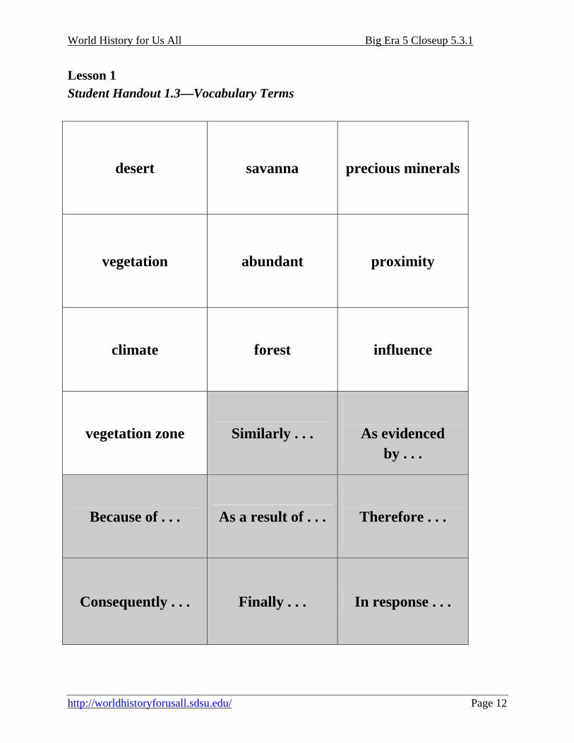
Lesson 1 Student Handout 1.3—Vocabulary Terms
desert savanna precious minerals
vegetation
abundant proximity
climate
forest influence
vegetation zone
Similarly . . .
As evidenced
by . . .
Because of . . .
As a result of . . .
Therefore . . .
Consequently . . . Finally . . . In response . . .

World History for Us All Big Era 5 Closeup 5.3.1
http://worldhistoryforusall.sdsu.edu/ Page 13
Lesson 2 West Africa’s Ecological Environment
Preparation Teachers should download a copy of the PowerPoint that accompanies this unit (The West African Environment). Also, each student will need a copy of Student Handout 2.1 to complete this lesson. It is suggested that this unit be taught introducing students to vocabulary for West Africa’s geography to maximize student understanding. Introduction This lesson should be taught after students have completed the lesson introducing the environmental vocabulary. This lesson is designed to provide additional information about the environmental conditions in West Africa that are often left out of textbook accounts. While the geography of West Africa provided many natural resources and precious metals, it also was an ecologically-challenging environment with diseases that hindered the expansion of both human and animal populations. Activities This lesson will provide students with the background information needed to analyze how geography affected the development of West Africa. The lesson begins with a PowerPoint that shows some of the natural wealth of Africa. After showing some of the scenic slides, the students will respond in writing to the prompt (Student Handout 2.1—West Africa’s Environment) about whether the environment had a generally positive or generally negative effect on human life. Then the teacher will finish by showing the rest of the PowerPoint, which explains the challenging environmental conditions faced by peoples of West Africa.
World History for Us All Big Era 5 Closeup 5.3.1
http://worldhistoryforusall.sdsu.edu/ Page 14
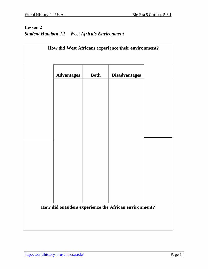
Lesson 2 Student Handout 2.1—West Africa’s Environment
How did West Africans experience their environment?
Advantages
Both
Disadvantages
How did outsiders experience the African environment?
World History for Us All Big Era 5 Closeup 5.3.1
http://worldhistoryforusall.sdsu.edu/ Page 15
Lesson 3 Climate Change in West Africa
Preparation Make copies of Student Handouts 3.1-3.3 (Question Starters, Three Levels of Thinking, and Climate Change and its Influence on African History with maps) for each student. Divide the room into two teams and then divide each team into pairs. Objectives Students will compare how climate change in West Africa influenced changes in the economic and political structure of early modern West African empires and kingdoms by examining two ecological zone maps. Introduction This lesson is designed to help students analyze data incorporated in maps by creating questions at increasingly-higher levels of thinking. The students will work with partners to create the questions and answers in a competition with the opposing team. Activities
1. Distribute copies of Student Handouts 3.1, 3.2, and 3.3 to each student.
2. Review question starters on Student Handout 3.1 with students. Explain to students the different levels of questions and ask which will be harder to answer.
3. Model the creation of questions at each level of thinking.
4. Assign students to two teams, and divide each team into pairs.
5. Students have 15 minutes to come up with 5 questions with answers per pair about the
maps and accompanying article. Randomly select one pair of students from team 1 and team 2 to ask and answer the question. Both pairs of students must stand. They may confer with each other before answering the question. The pair asking the question scores 1, 2, or 3 points for their team (based on the thinking level of the question). If the partners are able to answer the question correctly, their team wins a point. If the partners are stumped, the other team earns a point. Choose another pair from each of the teams, but in this round team 1 asks the question and team 2 must answer it.
World History for Us All Big Era 5 Closeup 5.3.1
http://worldhistoryforusall.sdsu.edu/ Page 16
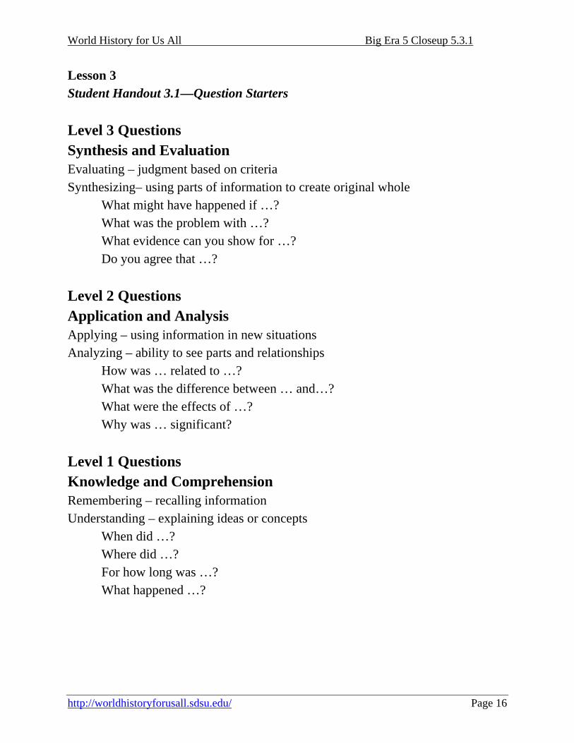
Lesson 3 Student Handout 3.1—Question Starters Level 3 Questions Synthesis and Evaluation Evaluating – judgment based on criteria Synthesizing– using parts of information to create original whole
What might have happened if …? What was the problem with …? What evidence can you show for …? Do you agree that …?
Level 2 Questions Application and Analysis Applying – using information in new situations Analyzing – ability to see parts and relationships
How was … related to …? What was the difference between … and…? What were the effects of …? Why was … significant?
Level 1 Questions Knowledge and Comprehension Remembering – recalling information Understanding – explaining ideas or concepts
When did …? Where did …? For how long was …? What happened …?
World History for Us All Big Era 5 Closeup 5.3.1
http://worldhistoryforusall.sdsu.edu/ Page 17
Lesson 3 Student Handout 3.2—Three Levels of Thinking
Level of Thinking Questions Answers
3. Synthesis and Evaluation
2. Application and Analysis
Rai
se y
our l
evel
of t
hink
ing
1. Knowledge and Comprehension

World History for Us All Big Era 5 Closeup 5.3.1
http://worldhistoryforusall.sdsu.edu/ Page 18
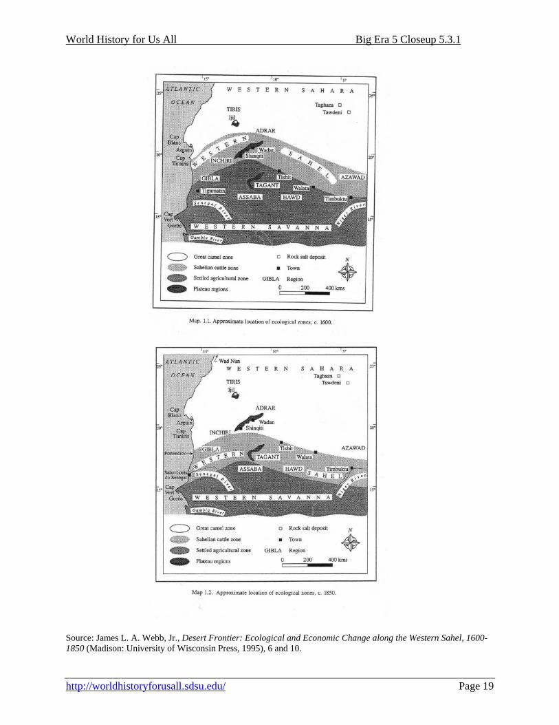
Lesson 3 Student Handout 3.1—Climate Change and its Influence on African History The study of the environment and its effect on humans is a recent but important branch of history. In West Africa, scholars have used different methods to find out what the climate was like hundreds of years ago. Some of these theories are based on the descriptions left by people who lived at the time and others are based on fossil records and the study of tree rings. More than temperature changes, changes in precipitation (rainfall) can be critical for West Africa. In West Africa, the evidence seems to show that the region experienced a wetter climate from about 800 to 1300 CE and then a dryer period from 1600 to 1850 CE. The amount of rainfall can affect the types of food and other vegetation produced. During the wetter period, Timbuktu grew from a population of about 10,000 to over 30,000. In wetter areas, the mosquito that carries malaria thrives. The tsetse fly, which carries sleeping sickness that is fatal to many types of large domestic animals such as cattle, also lives in areas with more rain. So while the increased rain makes it possible for more crops to grow for grazing animals, it also makes it a good place for diseases like malaria and sleeping sickness to flourish. Changing climate in West Africa presented leaders with a challenge and led to lifestyle changes as they adjusted to new climatic conditions.
World History for Us All Big Era 5 Closeup 5.3.1
http://worldhistoryforusall.sdsu.edu/ Page 19
Source: James L. A. Webb, Jr., Desert Frontier: Ecological and Economic Change along the Western Sahel, 1600-1850 (Madison: University of Wisconsin Press, 1995), 6 and 10.
World History for Us All Big Era 5 Closeup 5.3.1
http://worldhistoryforusall.sdsu.edu/ Page 20
Lesson 4 Making Connections
Preparation Gather markers, highlighters, tape, and scissors for 4 student groups. Cut a piece of butcher paper approximately 3 feet long for each group. Make one copy of Student Handout 4.1 (Modified Document-Based Questions). Make one copy of Source Document Packet (Student Handouts 4.2-4.7) for each group: Objectives Students will analyze how West Africans adapted to their environment by reading primary and secondary sources and completing a modified document based question (DBQ). Introduction Students have learned about the challenging nature of West Africa’s environment and its relationship to historical change. This lesson will help students synthesize the challenges faced by West Africans and how they adapted to them. Activities
1. Distribute Student Handout 4.1, and review instructions with students.
2. Assign students to 4 heterogeneous groups.
3. Assign group roles (writer, artist, leader, reader, for example) so that every student in each group has a role.
4. Distribute markers, highlighters, and butcher paper to each group, and show students how
to fold butcher paper so that eight rectangular grids are created
5. Model writing the title across the top of the page.
6. Model drawing a comparison chart in the first rectangle. As a class, complete a chart comparing the positives and negatives that students know about Africa’s environment.
7. Distribute document source packet to each group.
World History for Us All Big Era 5 Closeup 5.3.1
http://worldhistoryforusall.sdsu.edu/ Page 21
8. Model the steps on the instructions for analyzing the document and creating the poster to summarize each piece of evidence.
9. Ask students to complete the DBQ poster using at least 2 written sources.
World History for Us All Big Era 5 Closeup 5.3.1
http://worldhistoryforusall.sdsu.edu/ Page 22
Lesson 4 Student Handout 4.1—Modified Document-Based Questions
Collaborative Group Activity Instructions In class, you and your group mates will analyze sources about West Africa. Each group will receive a packet of source material.
1. Materials needed: source packet, large paper, scissors, highlighters, markers, tape. 2. Select a group leader. 3. Read the question and discuss key words to help determine what is being asked. 4. Create a chart using the model on the second page of this Student Handout. Use the chart
to sort information about West Africa that group members already know. Categorize the information as positive or negative. For example, diseases could be negative, but rivers could be positive. Put the information under the appropriate sign. If you are not sure whether it is positive or negative, put it in the middle.
5. Skim all the documents. Choose 4 to analyze. Be prepared to explain why you chose those documents.
6. Read the first document together, highlighting any information that may provide evidence to support an answer to the question.
7. Write a descriptive statement about the first source and an analysis of the document that explains how the source helps to answer the question. Write a rough draft. Get you teacher’s approval before copying the information onto the poster.
8. Repeat steps 6 and 7 for each document. 9. Cut out each source and attach it to the poster paper. Write your descriptive statement and
analysis under each document. 10. Based on the evidence, write your group’s thesis statement to answer the key question.
Key Question: Were West Africans successful in adapting to their physical and natural environment?
World History for Us All Big Era 5 Closeup 5.3.1
http://worldhistoryforusall.sdsu.edu/ Page 23
West Africa’s Environment
+ -
Essential Question:
Source 1 Source 2
Thesis: Source 3 Source 4

World History for Us All Big Era 5 Closeup 5.3.1
http://worldhistoryforusall.sdsu.edu/ Page 24
Lesson 4 Student Handout 4.2—Source Document Packet The tsetse fly (Glossina sp, pictured [above]) is found only in Africa and carries trypanosomes (the disease agents causing human sleeping sickness and animal trypanosomosis). The disease is a serious problem in sub-Saharan Africa, and it is estimated that the removal of this disease could double livestock production and markedly increase cultivation levels there. … The tsetse fly is very sensitive to environmental conditions—it will not survive in areas that are too hot, too dry, or too high. There are, however, twenty three species, many of which have different habitats and different levels of susceptibility to climatic conditions. Source: United Nations Food and Agriculture Organization, Animal Health and Production Division, Livestock Atlas Series, “Tsetse,” http://ergodd.zoo.ox.ac.uk/livatl2/tsetse.htm
World History for Us All Big Era 5 Closeup 5.3.1
http://worldhistoryforusall.sdsu.edu/ Page 25
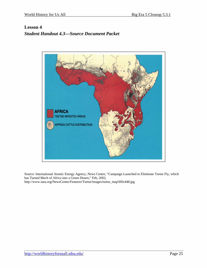
Lesson 4 Student Handout 4.3—Source Document Packet Source: International Atomic Energy Agency, News Centre, “Campaign Launched to Eliminate Tsetse Fly, which has Turned Much of Africa into a Green Desert,” Feb, 2002, http://www.iaea.org/NewsCenter/Features/Tsetse/images/tsetse_map500x448.jpg
World History for Us All Big Era 5 Closeup 5.3.1
http://worldhistoryforusall.sdsu.edu/ Page 26
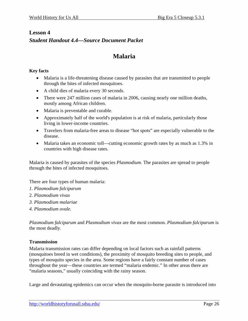
Lesson 4 Student Handout 4.4—Source Document Packet
Malaria Key facts
• Malaria is a life-threatening disease caused by parasites that are transmitted to people through the bites of infected mosquitoes.
• A child dies of malaria every 30 seconds. • There were 247 million cases of malaria in 2006, causing nearly one million deaths,
mostly among African children. • Malaria is preventable and curable. • Approximately half of the world's population is at risk of malaria, particularly those
living in lower-income countries. • Travelers from malaria-free areas to disease “hot spots” are especially vulnerable to the
disease. • Malaria takes an economic toll—cutting economic growth rates by as much as 1.3% in
countries with high disease rates. Malaria is caused by parasites of the species Plasmodium. The parasites are spread to people through the bites of infected mosquitoes. There are four types of human malaria: 1. Plasmodium falciparum 2. Plasmodium vivax 3. Plasmodium malariae 4. Plasmodium ovale. Plasmodium falciparum and Plasmodium vivax are the most common. Plasmodium falciparum is the most deadly. Transmission Malaria transmission rates can differ depending on local factors such as rainfall patterns (mosquitoes breed in wet conditions), the proximity of mosquito breeding sites to people, and types of mosquito species in the area. Some regions have a fairly constant number of cases throughout the year—these countries are termed “malaria endemic.” In other areas there are “malaria seasons,” usually coinciding with the rainy season. Large and devastating epidemics can occur when the mosquito-borne parasite is introduced into
World History for Us All Big Era 5 Closeup 5.3.1
http://worldhistoryforusall.sdsu.edu/ Page 27
areas where people have had little prior contact with the infecting parasite and have little or no immunity to malaria, or when people with low immunity move into areas where malaria cases are constant. These epidemics can be triggered by wet weather conditions and further aggravated by floods or mass population movements driven by conflict. Symptoms The common first symptoms—fever, headache, chills, and vomiting—usually appear 10 to 15 days after a person is infected. If not treated promptly with effective medicines, malaria can cause severe illness and is often fatal. Who is at risk? Most cases and deaths are in sub-Saharan Africa. However, Asia, Latin America, Southwest Asia, and parts of Europe are also affected. In 2006, malaria was present in 109 countries and territories.
Source: World Health Organization, Fact Sheet No. 94, Updated Jan. 2009, “Malaria,” http://www.who.int/mediacentre/factsheets/fs094/en/print.html
World History for Us All Big Era 5 Closeup 5.3.1
http://worldhistoryforusall.sdsu.edu/ Page 28
Lesson 4 Student Handout 4.5—Source Document Packet
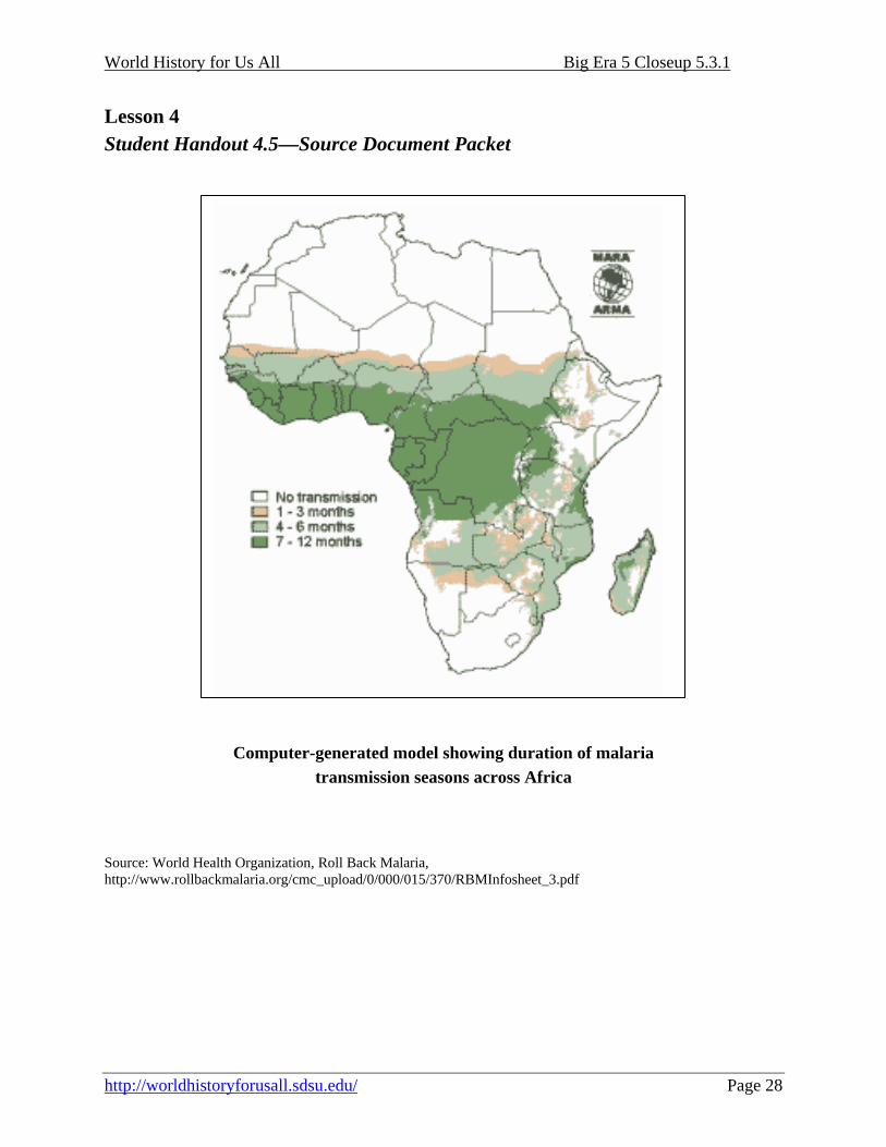
Computer-generated model showing duration of malaria
transmission seasons across Africa Source: World Health Organization, Roll Back Malaria, http://www.rollbackmalaria.org/cmc_upload/0/000/015/370/RBMInfosheet_3.pdf
World History for Us All Big Era 5 Closeup 5.3.1
http://worldhistoryforusall.sdsu.edu/ Page 29
Lesson 4 Student Handout 4.6—Source Document Packet Ibn Battuta, a Muslim traveler and scholar, describes his arrival in Mali: My entry into Mali was on the fourteenth of the first month of Jumada in the year '53 (i.e., 753 AH, 28th June AD 1352), and my going out from there was on the twenty-second of Muharram in the year '54 (i.e. 754 AH, 27 February AD 1353). I was accompanied by a merchant known as Abu Bakr ibn Yacqub. We set out on the Mima road. I was riding a camel because horses were dear, costing about one hundred mithqals apiece. We reached a large arm of the river which comes out of the [Niger] and which cannot be crossed except in boats. That place has many mosquitoes and nobody passes through except at night. Source: Qtd. In The 153 Club, “Ibn Battuta and His Saharan Travels,” http://www.the153club.org/battuta.html
World History for Us All Big Era 5 Closeup 5.3.1
http://worldhistoryforusall.sdsu.edu/ Page 30
Lesson 4 Student Handout 4.7—Source Document Packet Leo Africanus, an Arab traveler, visited Timbuktu in the Kingdom of Songhay early in the 1500s and left this description of that city: Original English translation spelling: Howbeit there is a most stately temple to be seene, the wals whereof are made of stone and lime; and a princely palace also built by a most excellent workeman of Granada. Here are many shops of artificers, and merchants, and especially of such as weaue linen and cotton cloth. And hither do the Barbarie [North African] merchants bring cloth of Europe. All the women of the region except maidservants go with their faces couered, and sell all necessarie victuals. The inhabitants, & especially strangers there residing, are exceeding rich, insomuch that the king that now is, maried both his daughters vnto two rich merchants. Here are many wels, containing most sweete water; and so often as the riuer Niger overfloweth, they conueigh the water thereof by certaine sluces into the towne. Corne [sorghum], cattle, milke, and butter this region yeeldeth in great abundance: but salk is verie scarce heere; for it is brought hither by land from Taghaza, which is fiue humdred miles distant. When I myselfe was here, I saw one camel loade of salt sold for 80 ducates. The rich king of Tombuto [Timbuktu] hath many plates and scepters of gold, some of whereof weigh 1300 poindes; ... He hath alwaies three thousand horsemen, and a great number of footmen that shoot poysoned arrowes, attending upon him. ... Here are great store of doctors, judges, priests and other learned men, that are bountifully maintained at the kings cost and charges. And hither are brought diuers manuscripts or written bookes out of Barbarie, which are sold for more money than any other merchandize. From: “Kingdom of Songhay: Primary Source Documents,” Boston University, African Studies Center, http://www.bu.edu/africa/outreach/materials/handouts/k_o_Songhay.html
Modernized spelling: Howbeit there is a most stately temple to be seen, the walls whereof are made of stone and lime; and a princely palace also built by a most excellent workman of Granada. Here are many shops of artificers, and merchants, and especially of such as weave linen and cotton cloth. And hither do the Barbary [North African] merchants bring cloth of Europe. All the women of the region except maidservants go with their faces covered, and sell all necessary victuals. The inhabitants, and especially strangers there residing, are exceeding rich, insomuch that the king that now is, married both his daughters unto two rich merchants. Here are many wells, containing most sweet water; and so often as the river Niger overflows, they convey the water thereof by certain sluices into the town. Corn [sorghum], cattle, milk, and butter this region yields in great abundance: but salt is very scarce here; for it is brought hither by land from Taghaza, which is five hundred miles distant. When I myself was here, I saw one camel load of salt sold for 80 ducats. The rich king of Tombuto [Timbuktu] has many plates and scepters of gold, some of which weigh 1300 pounds; ... He has always three thousand horsemen, and a great number of footmen that shoot poisoned arrows, attending upon him. ... Here are great store of doctors, judges, priests, and other learned men, that are bountifully maintained at the king’s cost and charges. And hither are brought diverse manuscripts or written books out of Barbary, which are sold for more money than any other merchandise.

World History for Us All Big Era 5 Closeup 5.3.1
http://worldhistoryforusall.sdsu.edu/ Page 31
This unit and the Three Essential Questions
Research and present a report on drought and its effects on peoples of West Africa since 1970. How have changing rainfall patterns affected the way of life of camel-herding people in the southern Sahara desert, notably Tuareg-speaking groups? How have changing rainfall patterns affected cattle herding and farming in the Sahel, that is, the region between the desert to the north and the well-watered grasslands to the south?
Choose the Ghana, Mali, or Songhai empire. Using secondary sources or primary source documents, write a travel guide for visitors to one of these West African empires. Include specific details about what travelers should expect when they travel to one of these empires. (See, for example, Internet African History Sourcebook, http://www.fordham.edu/halsall/africa/africasbook.html#African%20Societies).
Since the nineteenth century, the name “Timbuktu” has been a metaphor in Western societies for the idea of a “lost city” that flourished in the distant past or a place that is remote and unreachable. Why do you think “Timbuktu” might have come into use as a figure of speech for a remote and fabled place? Was Timbuktu really a remote place? What is Timbuktu like today? How has the city changed in the past 500 years? How might environmental changes have affected the city over time?
This unit and the Seven Key Themes This unit emphasizes: Key Theme 2: Economic Networks and Exchange Key Theme 6: Science, Technology, and the Environment
This unit and the Standards in Historical Thinking
Historical Thinking Standard 1: Chronological Thinking The student is able to (F) reconstruct patterns of historical succession and duration in which historical developments have unfolded, and apply them to explain historical continuity and change.
Historical Thinking Standard 2: Historical Comprehension The student is able to (D) differentiate between historical facts and historical interpretations.
World History for Us All Big Era 5 Closeup 5.3.1
http://worldhistoryforusall.sdsu.edu/ Page 32
Historical Thinking Standard 3: Historical Analysis and Interpretation The student is able to (D) draw comparisons across eras and regions in order to define enduring issues.
Historical Thinking Standard 4: Historical Research Capabilities The student is able to (C) interrogate historical data.
Historical Thinking Standard 5: Historical Issues-Analysis and Decision-Making The student is able to (C) identify relevant historical antecedents and differentiate from those that are inappropriate and irrelevant to contemporary issues.
Resources Resources for teachers Bastian, Misty L. and Jane Parpart, eds. Great Ideas for Teaching about Africa. Boulder: Lynne
Rienner, 1999. The editors selected nineteen essays that provide a wide range of ideas for teaching about Africa to Americans. While designed for university professors, the ideas are useful for high school and middle school teachers as well. The essays contain practical advice and are short and to the point. One very useful article was “Teaching the Slave Trade with Documents” by Curtis A. Keim. In addition to providing resources for where to find documents about the slave trade, he discusses the difficult topic of the internal African slave trade.
Collins, Robert O., James McDonald Burns, and Erik Kristofer Ching, eds. Problems in African
History: The Pre-Colonial Centuries. New York: Markus Wiener Publishing, Inc. 1993. This text provides an overview of the historiography and different scholarly viewpoints of seven different topics including the Bantu migrations, women in African societies, and slavery in Africa. The articles are fairly short and easy to read. Developed in a graduate seminar, the problems the editors have chosen to analyze have been revised since the book’s first publication in 1968. Only two parts remain from the initial publication. Some of the topics overlap, as in the essays on women in African societies and slavery in Africa. The essay by George Brooks on the role of the signares in acting as an entrepreneurial bridge between two cultures in the sixteenth and seventeenth centuries is especially illuminating.
Curtin, Philip, Steven Feierman, Leonard Thompson, and Jan Vansina. African History: From
Earliest Times to Independence. 2nd ed. Harlow, UK: Longman, 1995. Designed as a university textbook, this volume provides a comprehensive history of Africa. It is broken into twenty chapters, and each focuses on a specific area and periodization, for example, “Africa North of the Forest in the Early Islamic Age.”
Gilbert, Erik and Jonathan T. Reynolds. Africa in World History: From Prehistory to the Present.
2nd ed. Upper Saddle River, NJ: Prentice Hall, 2008. Written as an introduction to Africa

World History for Us All Big Era 5 Closeup 5.3.1
http://worldhistoryforusall.sdsu.edu/ Page 33
for undergraduates, this volume is an excellent synthesis of the current scholarship on African history. It is written in a lively style and with a bit of humor.
Iliffe, John. Africans: The History of a Continent. Cambridge: Cambridge UP, 1995. This is an
excellent and very readable history of Africa, incorporating current scholarship. The author’s main theme is the battle that Africans faced in populating the continent because of its harsh environmental conditions. The first half of the book describes the earliest humans, the development of animal domestication, and the spread of agriculture. Of interest for this unit are the discussion of indigenous life and the effects of the environment.
McMann, James, C. “Climate and Causation in African History.” International Journal of
African Historical Studies 32, 2/3 (1999): 261-79. This is an excellent overview of the current literature on climate and its effect on Africa.
Munson, Patrick J. “Archeology and the Prehistoric Origins of the Ghana Empire.” Journal of
African History 21, 4 (1980): 457-66. This article explains archeological research that points to evidence that earlier West African states, in the area later controlled by the Ghana empire, showed some similar political characteristics. While Ghana became much more powerful than its predecessor, it was following a pre-existing pattern.
Oliver, Roland and Anthony Atmore. Medieval Africa: 1250-1800. Cambridge: Cambridge UP,
2001. This is an easy-to-read overview of Africa with helpful maps. The authors emphasize the geography of Africa and its role in shaping the development of societies in thirteen different areas.
Thornton, John. Africa and Africans in the Making of the Atlantic World, 1400-1800. 2nd ed.
New York: Cambridge UP, 1998. This work gives agency to Africans and examines the reasons they participated in the slave trade with Europeans. He also analyzes African society and the influence Africans had in creating an Afro-American culture.
Webb, James L. A., Jr. Desert Frontier: Ecological and Economic Change along the Western
Sahel, 1600-1850. Madison: University of Wisconsin Press, 1995. Webb focuses on expanding the study of West Africa to include the southwestern area of the Sahara. He examines how the drying period of the Sahara increased the strains on the people living there and this led to new tensions. He examines both the desert-side and Sahel-side perspectives. In contrast to a number of scholars, he rejects the theory that the arrival of Europeans shifted trade from the desert to the Atlantic. He also argues for a direct link between the slave and horse trade.

World History for Us All Big Era 5 Closeup 5.3.1
http://worldhistoryforusall.sdsu.edu/ Page 34
Resources for students Burns, Khephra. Mansa Musa: The Lion King of Mali. Orlando, Florida: Gulliver Books. 2001.
This illustrated volume about Mansa Musa contains more text than most picture books, but it does a good job of portraying Mansa Musa’s life using evidence obtained through a combination of oral tradition and written records.
McKissack, Patricia and Fredrick. The Royal Kingdoms of Ghana, Mali, and Songhay: Life in
Medieval Africa. New York: Henry Holt and Company, 1994. This is a very readable survey of the West African kingdoms. It includes maps and photographs.
Wisniewski, David. Sundiata: Lion King of Mali. New York: Clarion Books, 1992. This is an
excellent illustrated version of the legend of Sundiata. It could be read aloud or as reader’s theater as a beginning for class discussion of the Mali empire.
Correlations to National and State Standards National Standards for World History Era 4: Expanding Zones of Exchange and Encounter, 300-1000 CE. 5A: The student understands state-building in Northeast and West Africa and the southward migrations of Bantu-speaking peoples. Era 5: Intensified Hemispheric Interactions, 1000-1500 CE, standard 4: The growth of states, towns, and trade in sub-Saharan Africa between the 11th and 15th centuries. California: History-Social Science Content Standard Grade Seven, 7.4.1: Study the Niger river and the relationship of vegetation zones of forest, savanna, and desert to trade in gold, salt, food, and slaves; 7.4.2 Analyze the importance of family, labor specialization, and regional commerce in the development of states and cities in West Africa; 7.4.3 Describe the role of the trans-Saharan caravan trade in the changing religious and cultural characteristics of West Africa and the influence of Islamic beliefs, ethics, and law.
Michigan High School Content Expectations: Social Studies WHG Era 4. Expanding and Intensified Hemispheric Interactions, 300-1500 CE. 4.1.3. Trade networks and contacts: Analyze the development, interdependence, specialization, and importance of interregional trading systems both within and between societies, including land-based routes across the Sahara; 4.3.1. Africa to 1500: Describe the diverse characteristics of early African societies and the significant changes in African society by comparing and contrasting at least two of the major states/civilizations of East, South, and West Africa (Aksum, Swahili Coast, Zimbabwe, Ghana, Mali, Songhai), in terms of environmental, economic, religious, political, and social structures. Texas Essential Knowledge and Skills for Social Studies
§113.33. World History (c) Knowledge and skills (6) The student understands the major developments of civilizations of sub-Saharan Africa.

World History for Us All Big Era 5 Closeup 5.3.1
http://worldhistoryforusall.sdsu.edu/ Page 35
Conceptual links to other teaching units