ballast point park walama - department of planning
TRANSCRIPT
BALLAST POINT PARK WALAmA

Foreword
Ballast
Out of the Past
A Landscape Made Obedient - 1922
Port of Sydney – 1924
Aerial View of Ballast Point
Voice Behind the Victory
Battle of Ballast
Oil and Water Mix
Design Philosophy
Conserved for Future Generations
A Park of Future Thinking
Getting the Job Done
Facing the Facts
Remember: Reuse, Reduce, Recycle
A Shape of the Future
• • •Fuel For Thought
Past and Future Cycle
Tank Comes Full Circle
Team Spirit
Canopy of Light
Coveted Real Estate
A Social History
Plant Ecology
Grass Roots
Window to the Future
Underground Stories
Bridging the Gap
Tall Walls
Poetry in Motion
Every Journey
A Step Up
• • •Waste to Water
Open Sky
Old Places New Eyes
Story Telling
Long Term View
Home Team
Metamorphosis
In September 2002, Ballast Point was
offi cially returned to public ownership,
providing the opportunity to create
a new and exciting harbourside park.
This is its story...
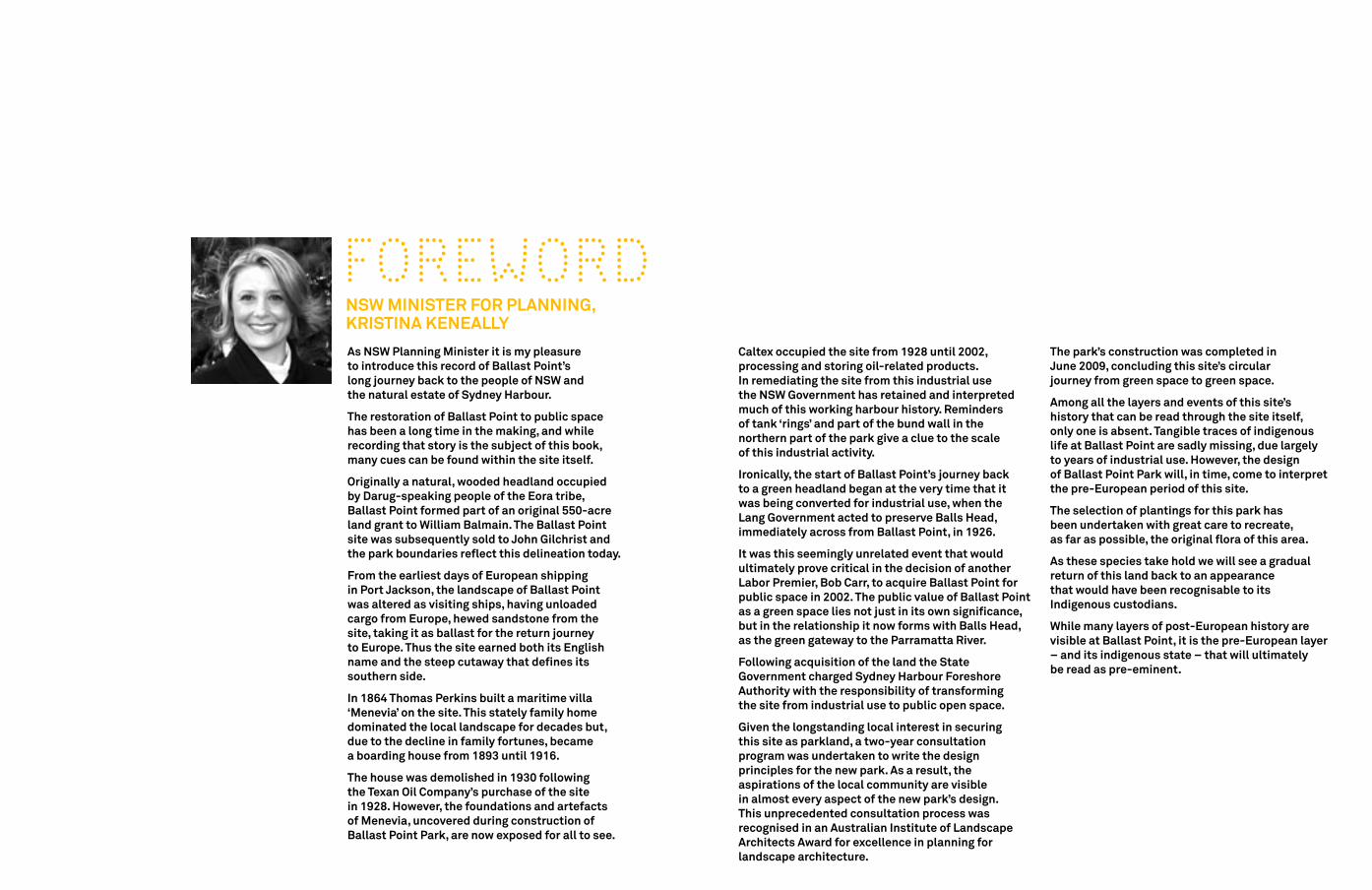
Caltex occupied the site from 1928 until 2002, processing and storing oil-related products. In remediating the site from this industrial use the NSW Government has retained and interpreted much of this working harbour history. Reminders of tank ‘rings’ and part of the bund wall in the northern part of the park give a clue to the scale of this industrial activity.
Ironically, the start of Ballast Point’s journey back to a green headland began at the very time that it was being converted for industrial use, when the Lang Government acted to preserve Balls Head, immediately across from Ballast Point, in 1926.
It was this seemingly unrelated event that would ultimately prove critical in the decision of another Labor Premier, Bob Carr, to acquire Ballast Point for public space in 2002. The public value of Ballast Point as a green space lies not just in its own significance, but in the relationship it now forms with Balls Head, as the green gateway to the Parramatta River.
Following acquisition of the land the State Government charged Sydney Harbour Foreshore Authority with the responsibility of transforming the site from industrial use to public open space.
Given the longstanding local interest in securing this site as parkland, a two-year consultation program was undertaken to write the design principles for the new park. As a result, the aspirations of the local community are visible in almost every aspect of the new park’s design. This unprecedented consultation process was recognised in an Australian Institute of Landscape Architects Award for excellence in planning for landscape architecture.
The park’s construction was completed in June 2009, concluding this site’s circular journey from green space to green space.
Among all the layers and events of this site’s history that can be read through the site itself, only one is absent. Tangible traces of indigenous life at Ballast Point are sadly missing, due largely to years of industrial use. However, the design of Ballast Point Park will, in time, come to interpret the pre-European period of this site.
The selection of plantings for this park has been undertaken with great care to recreate, as far as possible, the original flora of this area.
As these species take hold we will see a gradual return of this land back to an appearance that would have been recognisable to its Indigenous custodians.
While many layers of post-European history are visible at Ballast Point, it is the pre-European layer – and its indigenous state – that will ultimately be read as pre-eminent.
As NSW Planning Minister it is my pleasure to introduce this record of Ballast Point’s long journey back to the people of NSW and the natural estate of Sydney Harbour.
The restoration of Ballast Point to public space has been a long time in the making, and while recording that story is the subject of this book, many cues can be found within the site itself.
Originally a natural, wooded headland occupied by Darug-speaking people of the Eora tribe, Ballast Point formed part of an original 550-acre land grant to William Balmain. The Ballast Point site was subsequently sold to John Gilchrist and the park boundaries reflect this delineation today.
From the earliest days of European shipping in Port Jackson, the landscape of Ballast Point was altered as visiting ships, having unloaded cargo from Europe, hewed sandstone from the site, taking it as ballast for the return journey to Europe. Thus the site earned both its English name and the steep cutaway that defines its southern side.
In 1864 Thomas Perkins built a maritime villa ‘Menevia’ on the site. This stately family home dominated the local landscape for decades but, due to the decline in family fortunes, became a boarding house from 1893 until 1916.
The house was demolished in 1930 following the Texan Oil Company’s purchase of the site in 1928. However, the foundations and artefacts of Menevia, uncovered during construction of Ballast Point Park, are now exposed for all to see.
FOREWORD NSW MINISTER FOR PLANNING, KRISTINA KENEALLy

is any heavy material used to balance or stabilise a ship
Images: Delicate Balance - Concept sketches. © Robyn Backen.
ballast
out of the past
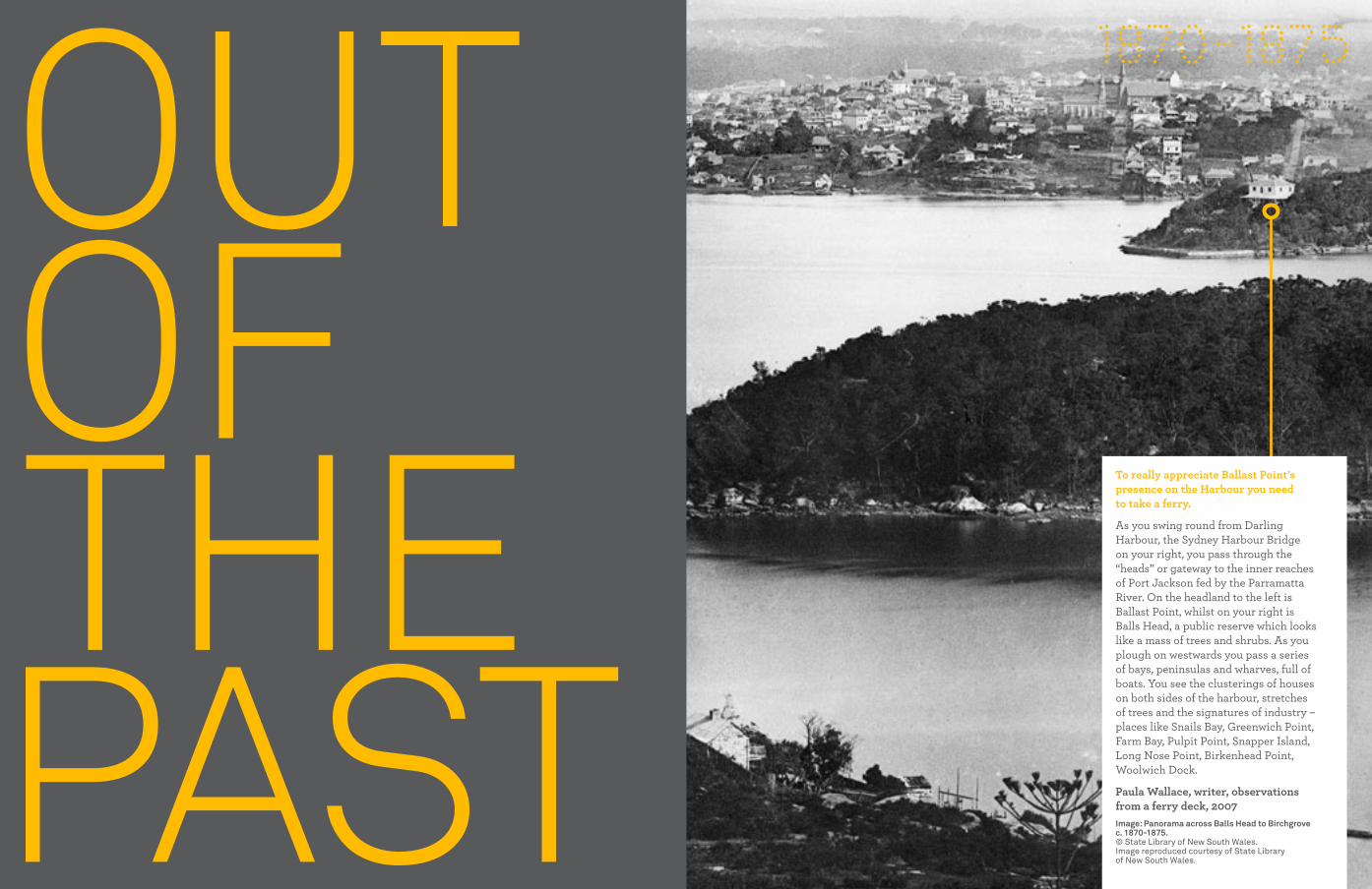
1870-1875
To really appreciate Ballast Point’s presence on the Harbour you need to take a ferry.
As you swing round from Darling Harbour, the Sydney Harbour Bridge on your right, you pass through the “heads” or gateway to the inner reaches of Port Jackson fed by the Parramatta River. On the headland to the left is Ballast Point, whilst on your right is Balls Head, a public reserve which looks like a mass of trees and shrubs. As you plough on westwards you pass a series of bays, peninsulas and wharves, full of boats. You see the clusterings of houses on both sides of the harbour, stretches of trees and the signatures of industry – places like Snails Bay, Greenwich Point, Farm Bay, Pulpit Point, Snapper Island, Long Nose Point, Birkenhead Point, Woolwich Dock.
Paula Wallace, writer, observations from a ferry deck, 2007 Image: Panorama across Balls Head to Birchgrove c. 1870-1875. © State Library of New South Wales. Image reproduced courtesy of State Library of New South Wales.

In this context, Ballast Point seems disturbed by its historic uses; it seems ugly.
Maybe it taps into a collective memory we would rather filter or forget. With its cut and plundered landscape it could only be a product of industrialisation.
From the early days of mining ballast, to its occupation as a site for a maritime villa, through to its industrial usage, the land uses have imprinted themselves on Ballast Point’s landform.
Modifying, cutting, levelling, Ballast Point is a landscape made obedient to different masters. Their activities are expressed in a concrete and sandstone landscape of walls, platforms and cliffs.
Paula Wallace, writer, observations from a ferry deck, 2007Image: Children, Menevia, c. 1922. Mort family - negative collection by John (Jack) Laidley Mort. © State Library of New South Wales. Image reproduced courtesy of State Library of New South Wales.
a landscape made obedient to different masters
1922
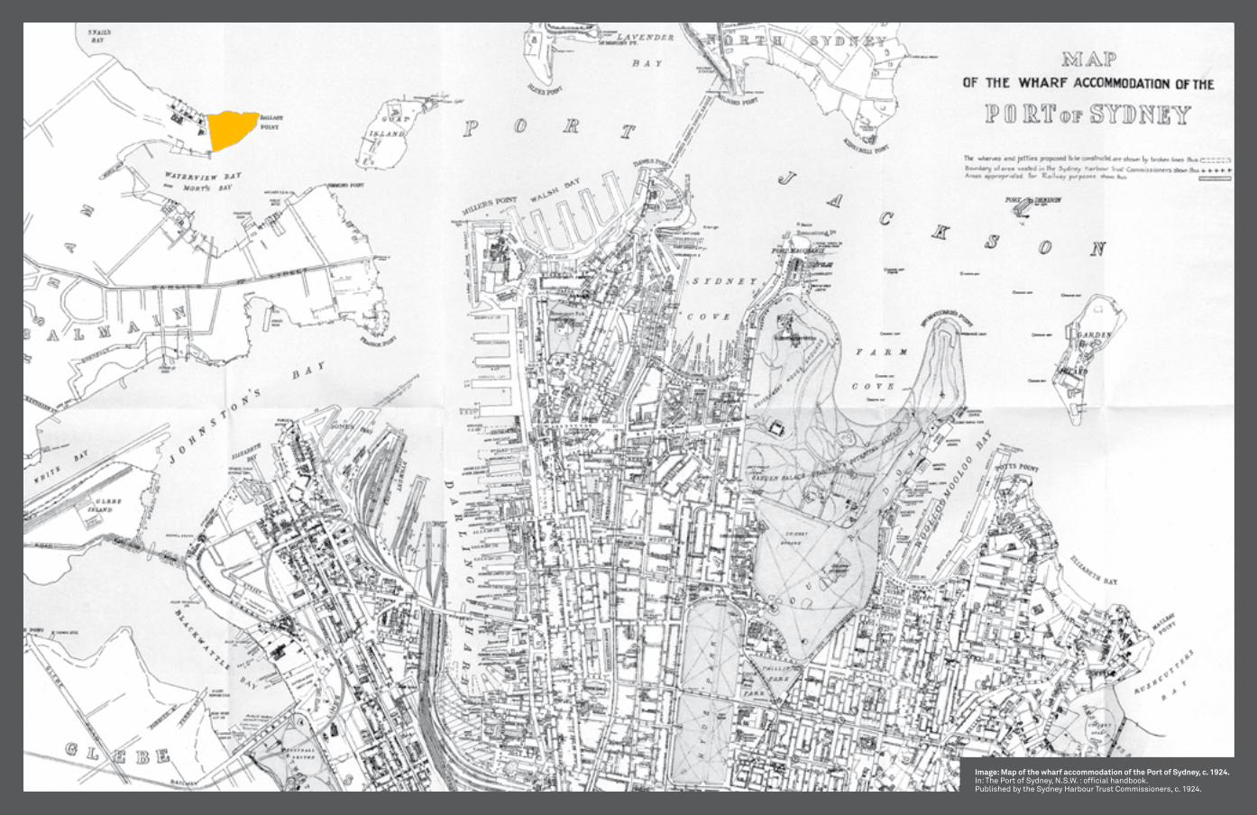
Image: Map of the wharf accommodation of the Port of Sydney, c. 1924.In: The Port of Sydney, N.S.W. : official handbook. Published by the Sydney Harbour Trust Commissioners, c. 1924.

“SydNey HaRBouR IS moRe THaN a jeWeL – IT IS SydNey’S HeaRT. I Have TRaveLLed THe WoRLd aNd I Have fouNd NoTHINg To ComPaRe WITH ITS BeauTy.”Tom Uren, 2009
Image: Ballast Point site, c. 2002. © Sydney Harbour foreshore authority.
voice behind the victory
2001
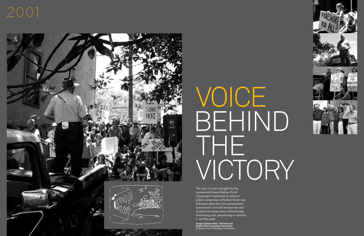
The epic 15-year struggle by the community-based Ballast Point Campaign Committee to achieve public ownership of Ballast Point was followed, after the Carr government announced it would resume the site in 2002, by seven years of hectoring, mentoring and monitoring to achieve a worthy park. Images: Ballast Rally - Balmain and Ballast Point Campaign Committee.© Ballast Point Campaign Committee.
battle of ballast
Water rises above oil
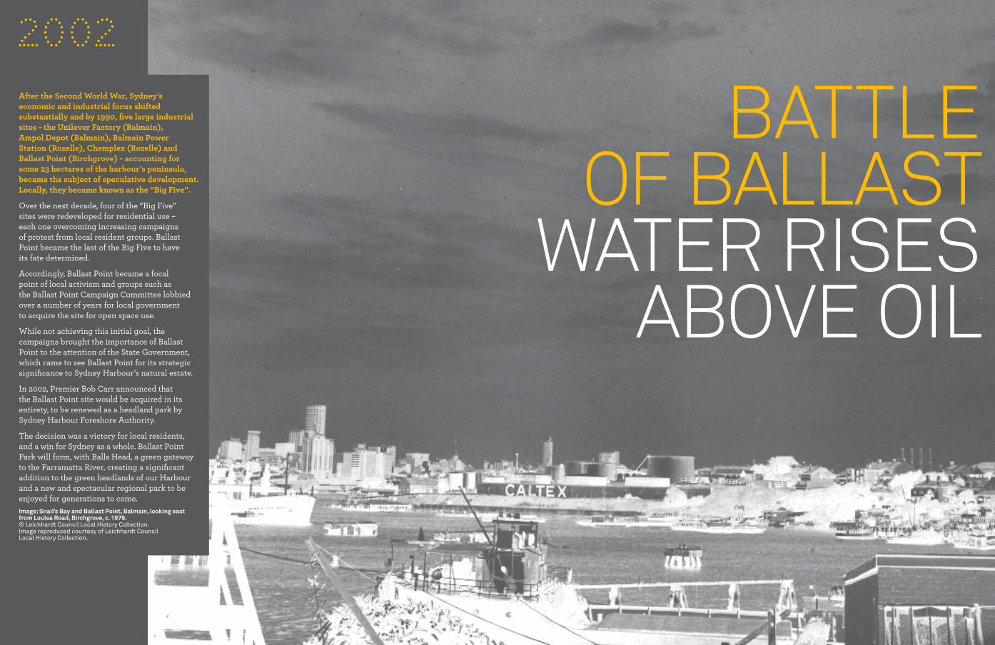
After the Second World War, Sydney’s economic and industrial focus shifted substantially and by 1990, five large industrial sites - the Unilever Factory (Balmain), Ampol Depot (Balmain), Balmain Power Station (Rozelle), Chemplex (Rozelle) and Ballast Point (Birchgrove) - accounting for some 23 hectares of the harbour’s peninsula, became the subject of speculative development. Locally, they became known as the “Big Five”.
Over the next decade, four of the “Big Five” sites were redeveloped for residential use – each one overcoming increasing campaigns of protest from local resident groups. Ballast Point became the last of the Big Five to have its fate determined.
Accordingly, Ballast Point became a focal point of local activism and groups such as the Ballast Point Campaign Committee lobbied over a number of years for local government to acquire the site for open space use.
While not achieving this initial goal, the campaigns brought the importance of Ballast Point to the attention of the State Government, which came to see Ballast Point for its strategic significance to Sydney Harbour’s natural estate.
In 2002, Premier Bob Carr announced that the Ballast Point site would be acquired in its entirety, to be renewed as a headland park by Sydney Harbour Foreshore Authority.
The decision was a victory for local residents, and a win for Sydney as a whole. Ballast Point Park will form, with Balls Head, a green gateway to the Parramatta River, creating a significant addition to the green headlands of our Harbour and a new and spectacular regional park to be enjoyed for generations to come. Image: Snail’s Bay and Ballast Point, Balmain, looking east from Louisa Road, Birchgrove, c. 1979.© Leichhardt Council Local History Collection. Image reproduced courtesy of Leichhardt Council Local History Collection.
2002

Environmental remediation deals with the removal of pollution or contaminants from media such as soil, groundwater, sediment, or surface water for the general protection of human health and the environment.Image: Caltex remnant at Ballast Point.© Sydney Harbour foreshore authority.
oil and Water miX
2000

A WAY TO MELD NATURE, HISTORY AND THE FUTURE.
“THIS LaNd uSe CHaNge NoT oNLy ReLIeveS THe SITe of ITS PaST BuRdeNS, BuT moST ImPoRTaNTLy RefLeCTS SydNey’S CuLTuRaL evoLuTIoN oveR THe LaST 200 yeaRS. THIS PaRK aNd ITS deSIgN INTeNT IS a CeLeBRaTIoN of THaT CHaNge.”Philip Coxall mcgregor+coxallImage: Ballast Point park, c. 2006.© mcgregor+coxall.
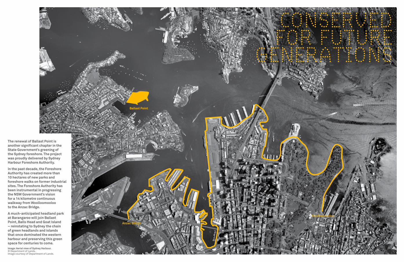
The renewal of Ballast Point is another significant chapter in the State Government’s greening of the Sydney foreshore. The project was proudly delivered by Sydney Harbour Foreshore Authority.
In the past decade, the Foreshore Authority has created more than 10 hectares of new parks and foreshore walks on former industrial sites. The Foreshore Authority has been instrumental in progressing the NSW Government’s vision for a 14 kilometre continuous walkway from Woolloomooloo to the Anzac Bridge.
A much-anticipated headland park at Barangaroo will join Ballast Point, Balls Head and Goat Island – reinstating to Sydney the chain of green headlands and islands that once dominated the western harbour and preserving this green space for centuries to come.Image: Aerial view of Sydney Harbour.© department of Lands. Image courtesy of department of Lands.
Anzac Bridge
Ballast Point
Woolloomooloo
CONSERvED FOR FUTURE
GENERATIONS
A PARk OF FUTURE THINkING
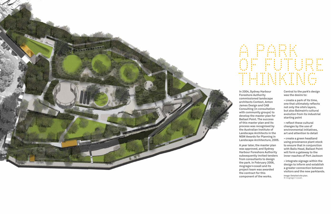
In 2004, Sydney Harbour Foreshore Authority commissioned landscape architects Context, Anton James Design and CAB Consulting (in consultation with community groups) to develop the master plan for Ballast Point. The success of this master plan and its process was recognised by the Australian Institute of Landscape Architects in the NSW Awards for Planning in Landscape Architecture, 2005.
A year later, the master plan was approved, and Sydney Harbour Foreshore Authority subsequently invited tenders from consultants to design the park. In February 2006, mcgregor+coxall and its project team was awarded the contract for this component of the works.
Central to the park’s design was the desire to:
• create a park of its time, one that ultimately reflects not only the site’s layers, but also Balmain’s cultural evolution from its industrial starting point
• reflect these cultural changes by the use of environmental initiatives, art and attention to detail
• create a green headland using provenance plant stock to ensure that in conjunction with Balls Head, Ballast Point will form a gateway to the inner reaches of Port Jackson
• integrate signage within the design to inform and establish a greater connection between visitors and the new parklands.Image: Detailed site plan.© mcgregor+coxall.
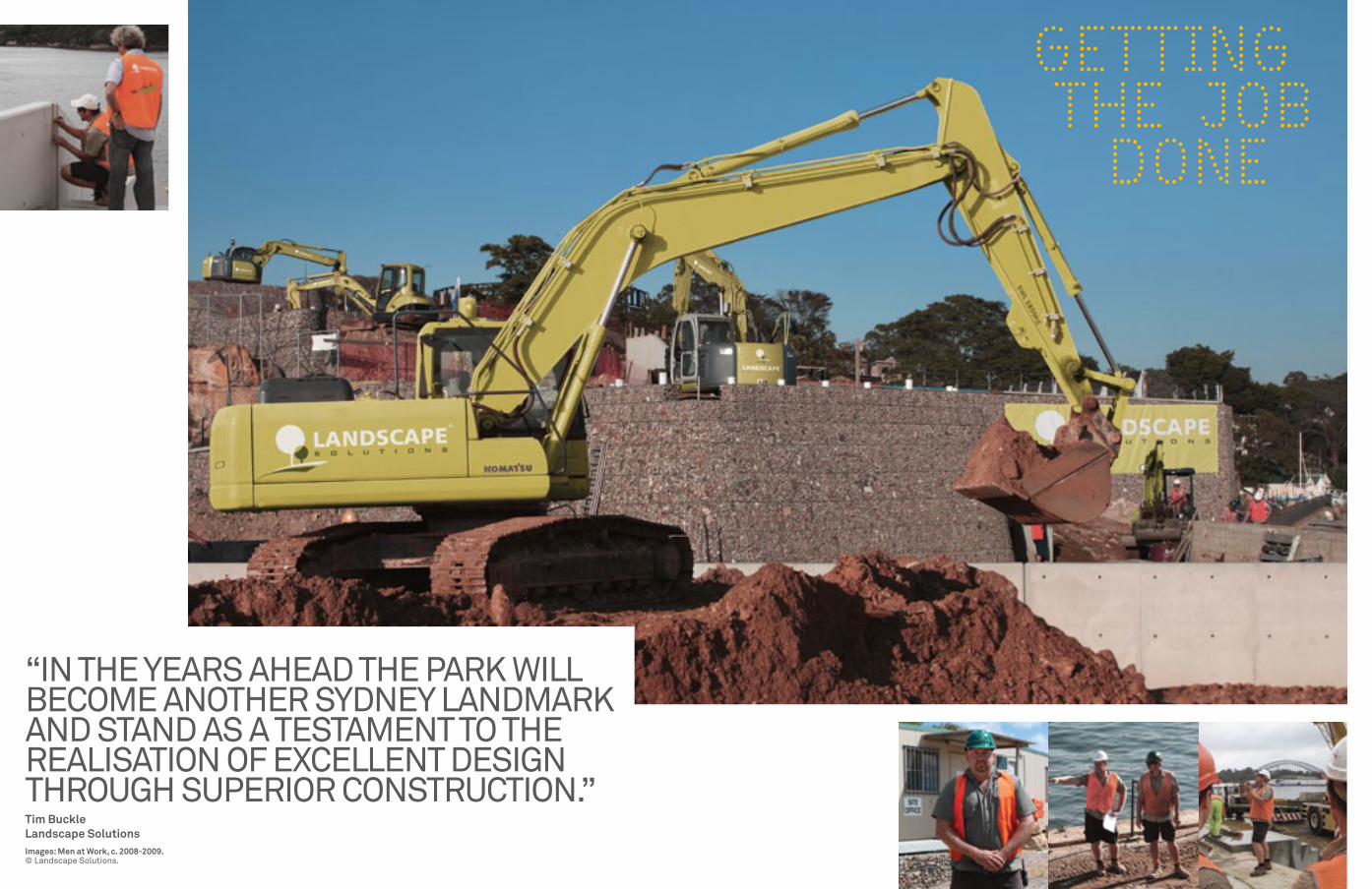
“IN THe yeaRS aHead THe PaRK WILL BeCome aNoTHeR SydNey LaNdmaRK aNd STaNd aS a TeSTameNT To THe ReaLISaTIoN of exCeLLeNT deSIgN THRougH SuPeRIoR CoNSTRuCTIoN.”Tim Buckle Landscape SolutionsImages: Men at Work, c. 2008-2009.© Landscape Solutions.
GETTING THE JOB DONE

FACING THE FACTS
You can see across the harbour to Balls Head from many positions at Ballast Point. Situated on a prominent headland at the tip of the Waverton peninsula it looks green and lush. There was some debate in the earlier part of the 20th century as to the use of Balls Head for commercial and residential purposes versus open public space. Strong public protests resulted in it being declared public parkland in 1926. Bush regeneration began on Balls Head in 1980 and a Bushcare group has been working weekly on the site since 1990. Balls Head is a fine example of how a community can work together and maintain a beautiful open public park.Image: Ferry passing Balls Head, c. 1920s (image inset).© Stanton Library. Image courtesy of Stanton Library.
Image: Balls Head , c. 2004.© Sydney Harbour foreshore authority.
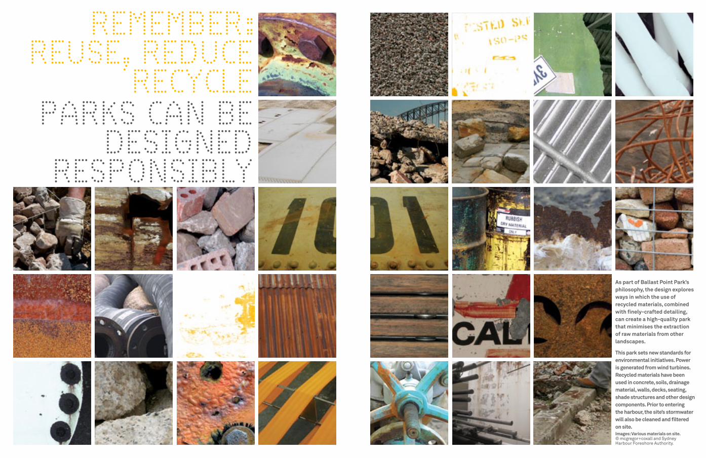
REMEMBER: REUSE, REDUCE
RECYCLEPARkS CAN BE
DESIGNED RESPONSIBLY
As part of Ballast Point Park’s philosophy, the design explores ways in which the use of recycled materials, combined with finely-crafted detailing, can create a high-quality park that minimises the extraction of raw materials from other landscapes.
This park sets new standards for environmental initiatives. Power is generated from wind turbines. Recycled materials have been used in concrete, soils, drainage material, walls, decks, seating, shade structures and other design components. Prior to entering the harbour, the site’s stormwater will also be cleaned and filtered on site.Images: Various materials on site.© mcgregor+coxall and Sydney Harbour foreshore authority.

SEA WALL
SEA WALL
BUND WALL
CITC BUILD
ING
. C.1973
RON
ALD
ST. BOUN
DA
RY
WHARF ST. BOUNDARY
ADMINISTRATION BUILDING. 1936
LUBE OIL WAREHOUSE. C.1936
MAIN WHARF. 1929
PILOT JETTY.
1954
BUNK
ERIN
G W
HARF
. 195
4
BOILER HOUSE. 1929
GARAGE/WORKSHOP. 1929
MENEVIA HOUSE FOOTPRINT. 1864-1928
A SHAPE OF THE FUTURE
This plan shows the new park’s design elements
on the former site plan.Image: Ballast Point Park design elements.
© deuce design.
Tank 101
Wharf Road Amenities
Shade Structure
Cliff Face Wall
Grassrings and WetlandsBund Wall
Stairs + Path
Menevia
Central Movement Spine
Viewing Terraces
Sculpture, ‘Delicate Balance’
Railings + Stairsyeend Street Amenities Ballast Garden

SEA WALL
SEA WALL
BUND WALL
CITC BUILD
ING
. C.1973
Ronald St. Boundary
Wharf St. Boundary
Administration Building. 1936
Lube Oil Warehouse. C.1936
Main Wharf. 1929
Pilot Jetty. 1954
Bunk
erin
g W
harf
. 195
4
Boiler House. 1929
Garage/Workshop. 1929
Menevia House footprint. 1864-1928
Tank 101
At the height of its operation, Ballast Point was a large, busy fuel processing and storage facility, dominated by tanks, oil fumes and the transport that linked it to the harbour. Tank 101 was the largest primary industrial storage vessel for oil on the site. Panels of the tank’s curved sheet steel have been rescued from the demolition process for incorporation into a new interpretive structure. The cutout circle sculpture incorporates eight 3,000-Watt vertical axis wind turbines that generate power to be fed back into the electricity grid. The sculpture is a shadow of our fossil fuel legacy, and perhaps a window into a more sustainable future.Images: Tank 101, c. 2003.© mcgregor+coxall and Sydney Harbour foreshore authority.
FUEL FOR THOUGHT
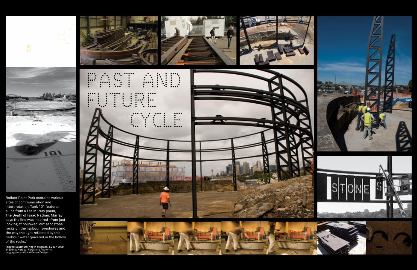
Ballast Point Park contains various sites of communication and interpretation. Tank 101 features a line from a Les murray poem, The death of Isaac Nathan. murray says the line was inspired “from just looking at hollowed-out sandstone rocks on the harbour foreshores and the way the light reflected by the harbour water quivered in the hollow of the rocks.”Images: Sculptural ring in progress, c. 2007-2009.© Sydney Harbour foreshore authority, mcgregor+coxall and deuce design.
PAST AND FUTURE CYCLE
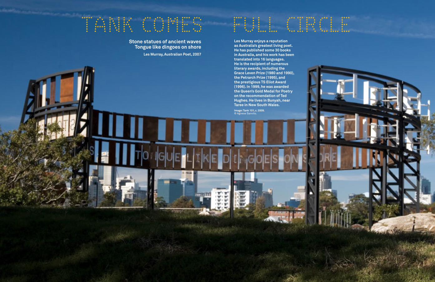
Stone statues of ancient waves Tongue like dingoes on shore
Les Murray, Australian Poet, 2007
Les Murray enjoys a reputation as Australia’s greatest living poet. He has published some 30 books in Australia, and his work has been translated into 16 languages. He is the recipient of numerous literary awards, including the Grace Leven Prize (1980 and 1990), the Petrarch Prize (1995), and the prestigious TS Eliot Award (1996). In 1999, he was awarded the Queen’s Gold Medal for Poetry on the recommendation of Ted Hughes. He lives in Bunyah, near Taree in New South Wales.Image: Tank 101, c. 2009. © agnese Sanvito.
TANk COMES FULL CIRCLE
SEA WALL
SEA WALL
BUND WALL
CITC BUILD
ING
. C.1973
Ronald St. Boundary
Wharf St. Boundary
Administration Building. 1936
Lube Oil Warehouse. C.1936
Main Wharf. 1929
Pilot Jetty. 1954
Bunk
erin
g W
harf
. 195
4
Boiler House. 1929
Garage/Workshop. 1929
Menevia House footprint. 1864-1928
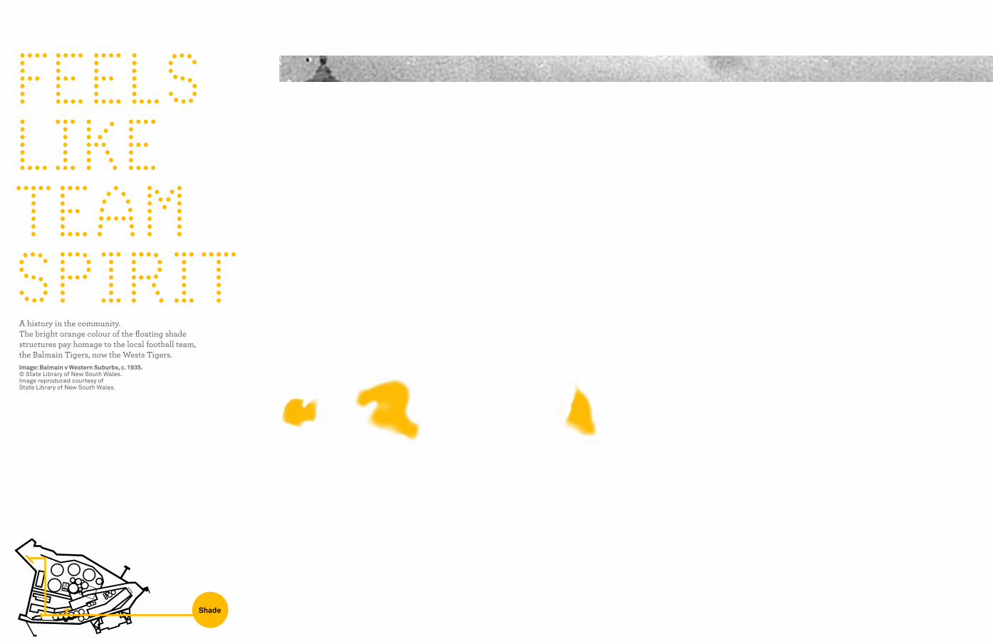
FEELS LIkE TEAM SPIRIT
A history in the community. The bright orange colour of the floating shade structures pay homage to the local football team, the Balmain Tigers, now the Wests Tigers.Image: Balmain v Western Suburbs, c. 1935.© State Library of New South Wales. Image reproduced courtesy of State Library of New South Wales.
Shade
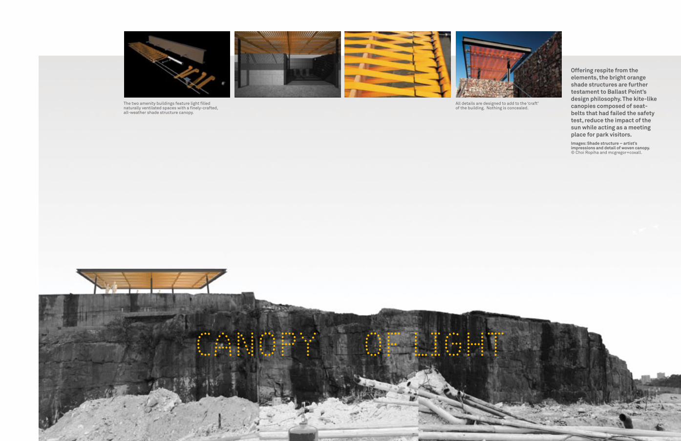
CANOPY OF LIGHT
Offering respite from the elements, the bright orange shade structures are further testament to Ballast Point’s design philosophy. The kite-like canopies composed of seat- belts that had failed the safety test, reduce the impact of the sun while acting as a meeting place for park visitors.Images: Shade structure – artist’s impressions and detail of woven canopy.© Choi Ropiha and mcgregor+coxall.
The two amenity buildings feature light filled naturally ventilated spaces with a finely-crafted, all-weather shade structure canopy.
all details are designed to add to the ‘craft’ of the building. Nothing is concealed.

COvETED REAL ESTATE A SEA BREEZE A GLITTERING vIEW From 1800 to 1852, the
land on which Ballast Point is located changed hands numerous times. Despite this, it retained its integrity as a single piece of land and it was not subdivided like the adjoining parcels of land.
Thomas Perkins bought the land in 1852, building a classic maritime villa called Menevia on the ridge-line of the site in 1864. By 1893, Menevia had fallen into disrepair and was listed as a boarding house. In 1928 the Texas Oil Company (TEXACO) purchased the site and demolished the house. Image: Menevia House.© Royal australian Historical Society. Image courtesy of Royal australian Historical Society.
SEA WALL
SEA WALL
BUND WALL
CITC BUILD
ING
. C.1973
Ronald St. Boundary
Wharf St. Boundary
Administration Building. 1936
Lube Oil Warehouse. C.1936
Main Wharf. 1929
Pilot Jetty. 1954
Bunk
erin
g W
harf
. 195
4
Boiler House. 1929
Garage/Workshop. 1929
Menevia House footprint. 1864-1928Menevia

The Menevia interpretive component is located on remnant sandstone footings of the former home revealed during the archaeological excavation of the site. The interpretive component consists of an L-shaped wall featuring historic information, photos and a display case of original Menevia artefacts.Images: Menevia wall, c. 2009.© deuce design.
A SOCIAL HISTORY
birds / mammals
invertebrates
vegetation / plants
marine life / reptiles
civic
commercial
food/ culture
retail
housing
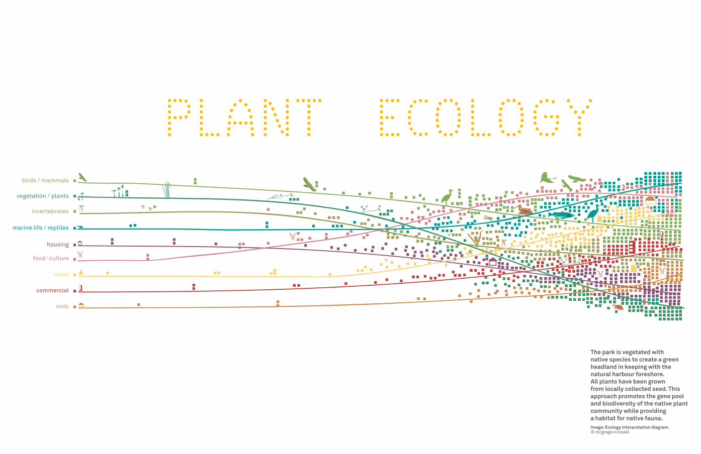
PLANT ECOLOGY
The park is vegetated with native species to create a green headland in keeping with the natural harbour foreshore. All plants have been grown from locally collected seed. This approach promotes the gene pool and biodiversity of the native plant community while providing a habitat for native fauna.Image: Ecology interpretation diagram.© mcgregor+coxall.
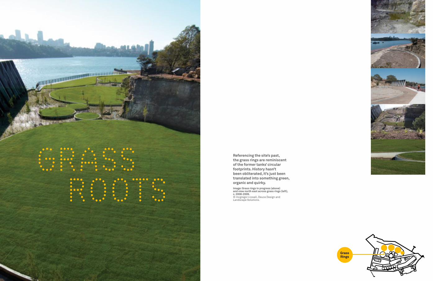
GRASS ROOTS
Referencing the site’s past, the grass rings are reminiscent of the former tanks’ circular footprints. History hasn’t been obliterated, it’s just been translated into something green, organic and quirky.Image: Grass rings in progress (above) and view north east across grass rings (left), c. 2008-2009.© mcgregor+coxall, deuce design and Landscape Solutions.
SEA WALL
SEA WALL
BUND WALL
CITC BUILD
ING
. C.1973
Ronald St. Boundary
Wharf St. Boundary
Administration Building. 1936
Lube Oil Warehouse. C.1936
Main Wharf. 1929
Pilot Jetty. 1954
Bunk
erin
g W
harf
. 195
4
Boiler House. 1929
Garage/Workshop. 1929
Menevia House footprint. 1864-1928
Grass Rings
WINDOW TO THE FUTURE
SEA WALL
SEA WALL
BUND WALL
CITC BUILD
ING
. C.1973
Ronald St. Boundary
Wharf St. Boundary
Administration Building. 1936
Lube Oil Warehouse. C.1936
Main Wharf. 1929
Pilot Jetty. 1954
Bunk
erin
g W
harf
. 195
4
Boiler House. 1929
Garage/Workshop. 1929
Menevia House footprint. 1864-1928
Terraces
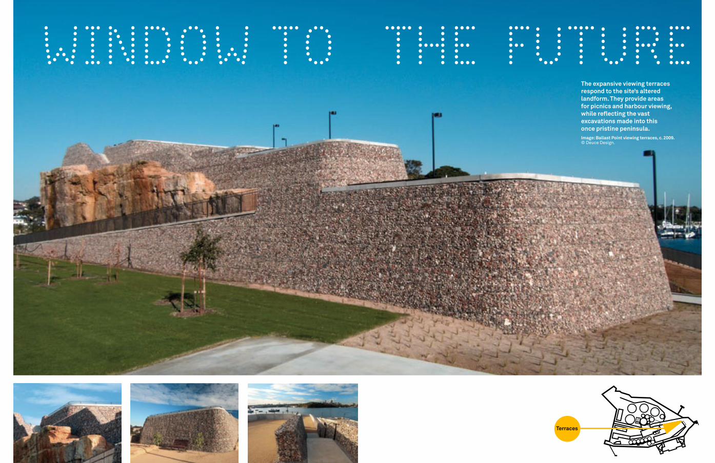
The expansive viewing terraces respond to the site’s altered landform. They provide areas for picnics and harbour viewing, while reflecting the vast excavations made into this once pristine peninsula.Image: Ballast Point viewing terraces, c. 2009.© deuce design.

UNDER GROUND STORIES
Most parts of Sydney Harbour are built on sandstone. Formed from sand that was deposited more than 200 million years ago, it has weathered into features, especially cliffs, beaches and platforms that are characteristic of sandstone along erosional coastlines. Situated on a sandstone ridge, Ballast Point Park is typical of this phenomenon.Images: ‘Heritage Graffiti’ and remnant sandstone featuring evidence of Thomas Perkins’ ownership (top right).Exposed sandstone at various locations on site.© mcgregor+coxall and deuce design.
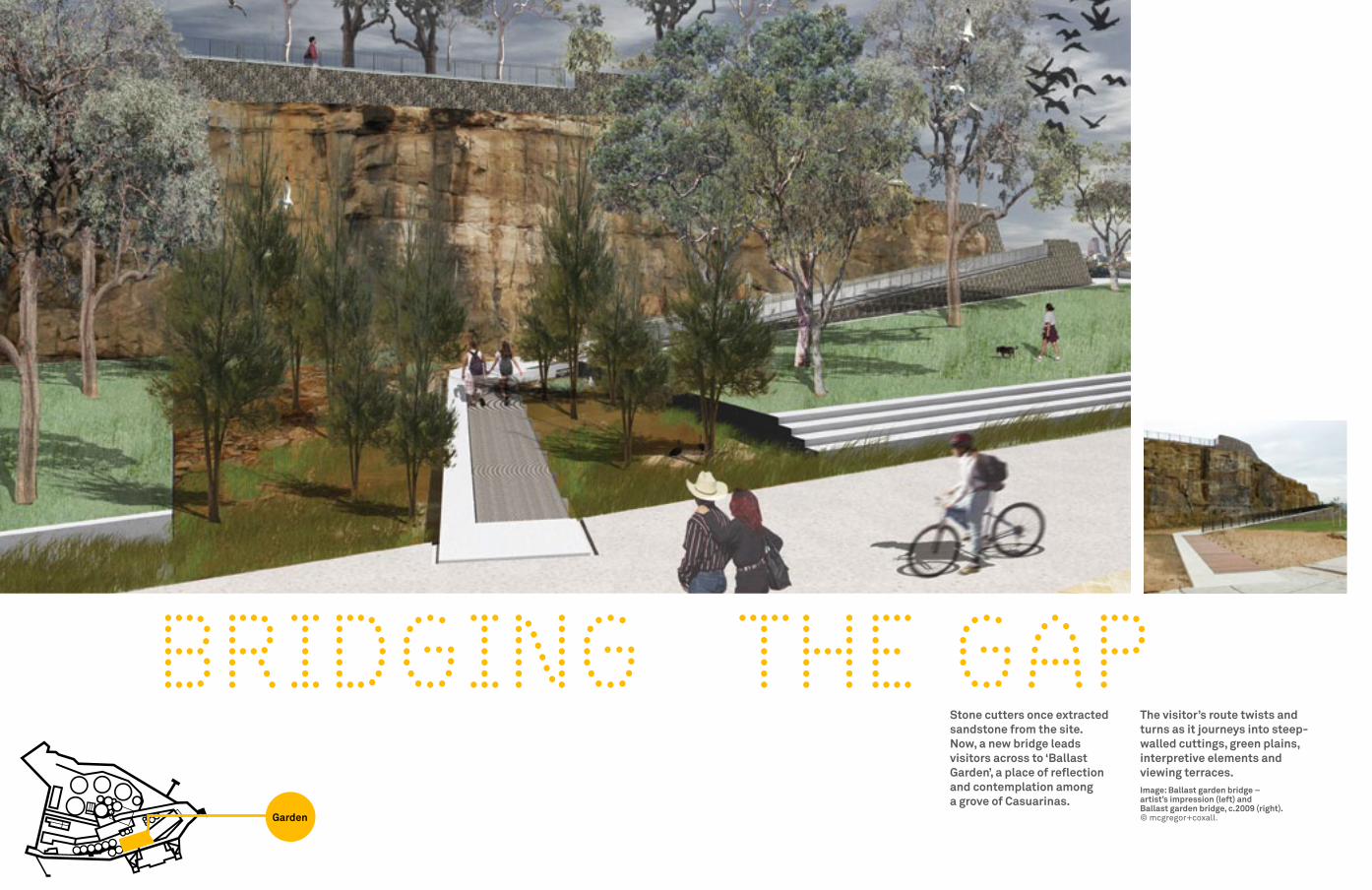
BRIDGING THE GAPStone cutters once extracted sandstone from the site. Now, a new bridge leads visitors across to ‘Ballast Garden’, a place of reflection and contemplation among a grove of Casuarinas.
The visitor’s route twists and turns as it journeys into steep-walled cuttings, green plains, interpretive elements and viewing terraces.Image: Ballast garden bridge – artist’s impression (left) and Ballast garden bridge, c.2009 (right).© mcgregor+coxall.
SEA WALL
SEA WALL
BUND WALL
CITC BUILD
ING
. C.1973
Ronald St. Boundary
Wharf St. Boundary
Administration Building. 1936
Lube Oil Warehouse. C.1936
Main Wharf. 1929
Pilot Jetty. 1954
Bunk
erin
g W
harf
. 195
4
Boiler House. 1929
Garage/Workshop. 1929
Menevia House footprint. 1864-1928
Garden
TALL
WALLS SEA WALL
SEA WALL
BUND WALL
CITC BUILD
ING
. C.1973
Ronald St. Boundary
Wharf St. Boundary
Administration Building. 1936
Lube Oil Warehouse. C.1936
Main Wharf. 1929
Pilot Jetty. 1954
Bunk
erin
g W
harf
. 195
4
Boiler House. 1929
Garage/Workshop. 1929
Menevia House footprint. 1864-1928
Bund Wall
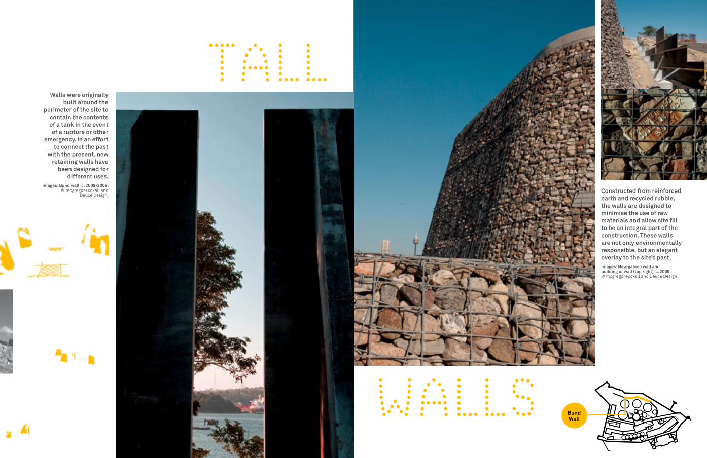
Constructed from reinforced earth and recycled rubble, the walls are designed to minimise the use of raw materials and allow site fill to be an integral part of the construction. These walls are not only environmentally responsible, but an elegant overlay to the site’s past.Images: New gabion wall and building of wall (top right), c. 2009.© mcgregor+coxall and deuce design.
Walls were originally built around the
perimeter of the site to contain the contents of a tank in the event of a rupture or other
emergency. In an effort to connect the past
with the present, new retaining walls have
been designed for different uses.
Images: Bund wall, c. 2008-2009.© mcgregor+coxall and
deuce design.
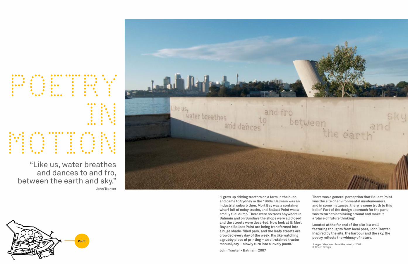
There was a general perception that Ballast Point was the site of environmental misdemeanors, and in some instances, there is some truth to this belief. Part of the design approach for the park was to turn this thinking around and make it a ‘place of future thinking’.
Located at the far end of the site is a wall featuring thoughts from local poet, John Tranter. Inspired by the site, the harbour and the sky, the poetry reflects the whimsy of nature.
Images: View west from the point, c. 2009.© deuce design.
POETRY IN
MOTION
“I grew up driving tractors on a farm in the bush, and came to Sydney in the 1960s. Balmain was an industrial suburb then. Mort Bay was a container wharf full of noisy trucks, and Ballast Point was a smelly fuel dump. There were no trees anywhere in Balmain and on Sundays the shops were all closed and the streets were deserted. Now look at it: Mort Bay and Ballast Point are being transformed into a huge shade-filled park, and the leafy streets are crowded every day of the week. It’s like watching a grubby piece of printing – an oil-stained tractor manual, say – slowly turn into a lovely poem.”
John Tranter - Balmain, 2007
“Like us, water breathes and dances to and fro,
between the earth and sky.” John Tranter
Point
SEA WALL
SEA WALL
BUND WALL
CITC BUILD
ING
. C.1973
Ronald St. Boundary
Wharf St. Boundary
Administration Building. 1936
Lube Oil Warehouse. C.1936
Main Wharf. 1929
Pilot Jetty. 1954
Bunk
erin
g W
harf
. 195
4
Boiler House. 1929
Garage/Workshop. 1929
Menevia House footprint. 1864-1928
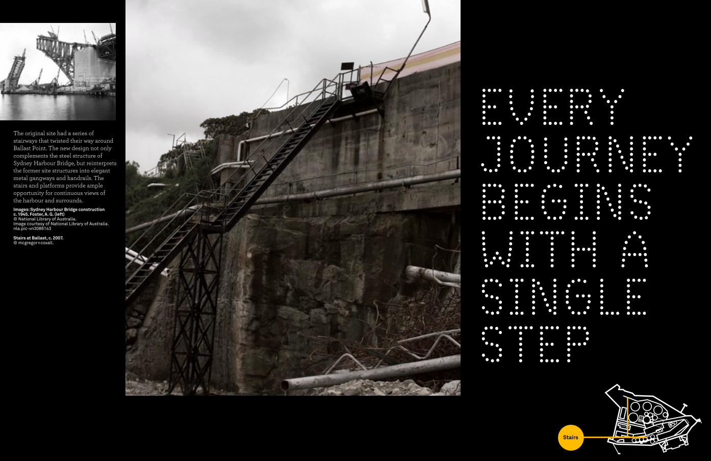
EvERY JOURNEY BEGINS WITH A SINGLE STEP
The original site had a series of stairways that twisted their way around Ballast Point. The new design not only complements the steel structure of Sydney Harbour Bridge, but reinterprets the former site structures into elegant metal gangways and handrails. The stairs and platforms provide ample opportunity for continuous views of the harbour and surrounds. Images: Sydney Harbour Bridge construction c. 1945. Foster, A. G. (left)© National Library of australia. Image courtesy of National Library of australia.nla.pic-vn3086143
Stairs at Ballast, c. 2007.© mcgregor+coxall.
SEA WALL
SEA WALL
BUND WALL
CITC BUILD
ING
. C.1973
Ronald St. Boundary
Wharf St. Boundary
Administration Building. 1936
Lube Oil Warehouse. C.1936
Main Wharf. 1929
Pilot Jetty. 1954
Bunk
erin
g W
harf
. 195
4
Boiler House. 1929
Garage/Workshop. 1929
Menevia House footprint. 1864-1928
Stairs

A STEP
UP
The metallic grey of the park’s balustrading and railings reflect
the urban hue of Sydney Harbour Bridge rising over Goat Island.
Images: Stairs at north end of remnant bund wall, c. 2009.
© agnese Sanvito, deuce design and mcgregor+coxall.
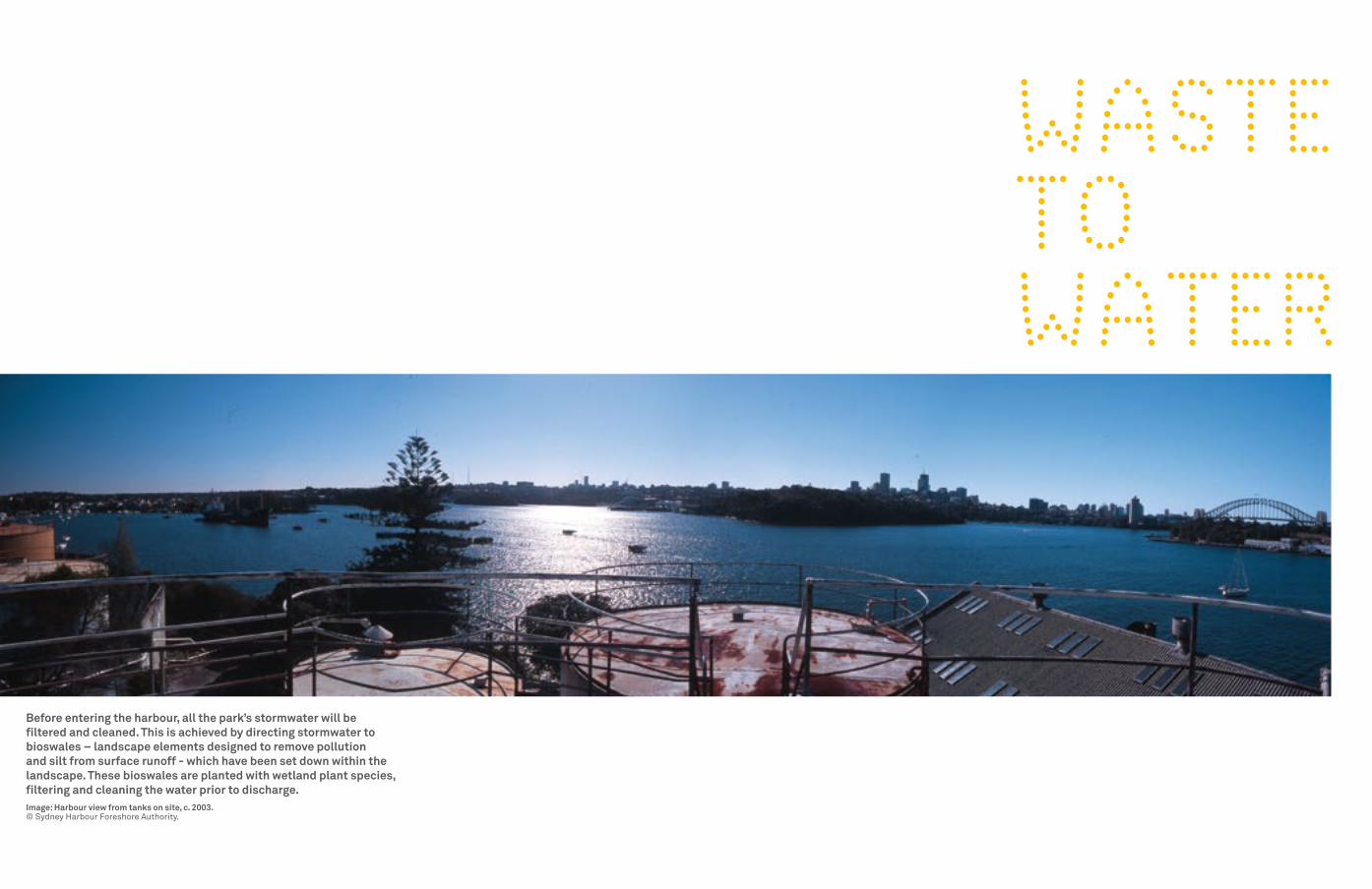
Before entering the harbour, all the park’s stormwater will be filtered and cleaned. This is achieved by directing stormwater to bioswales – landscape elements designed to remove pollution and silt from surface runoff - which have been set down within the landscape. These bioswales are planted with wetland plant species, filtering and cleaning the water prior to discharge. Image: Harbour view from tanks on site, c. 2003.© Sydney Harbour foreshore authority.
WASTE TO WATER

OPEN SkY
The object is made of frames …framing harbour water, the sky and the view back to Ballast Garden.
Located on the southern side of Ballast Point, directly on the harbour’s edge, a tall, tilted cylindrical form is moored to the promenade. Its liminal position invites the passer-by to enter and be within the artwork. The artwork in its form and content loosely references the past industrial history of the newly established parkland – the fabric of which has been virtually erased from the site. The form echoes the Caltex tanks while the principle of the work structurally and conceptually is balance and ballast.
Robyn Backen is an interdisciplinary artist based in Sydney. In addition to her local career, she has an extensive exhibition history throughout Asia and Europe. She has been the recipient of a number of awards, including overseas study and residencies throughout the world. Her installations actively engage with the spaces they inhabit – whether gallery, landscape or building. The site provides the structural and associative framework for both formal and conceptual elements.
Ballast Point Park Public Art Team artist: Robyn Backen Public art Consultant: Amanda Sharradarchitect: Neil Mackenzie, Mackenzie Pronk Architects engineer: Stephen Maher, Northrop Engineers fabricator: Mick Davidovic, Obnova Concrete Pty LtdInstaller: Ross McIntosh, McIntosh Constructions Pty Ltd
Images: Delicate Balance – Concept sketch, artwork progression to completion c. 2008-2009.© Robyn Backen and Ian Hobbs. Sketch courtesy of Robyn Backen.
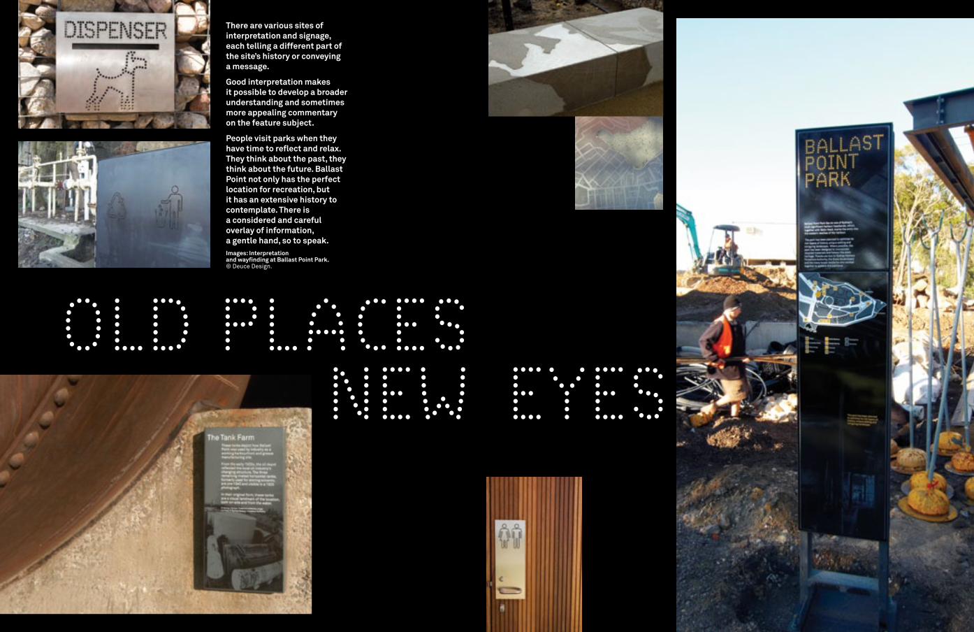
There are various sites of interpretation and signage, each telling a different part of the site’s history or conveying a message.
Good interpretation makes it possible to develop a broader understanding and sometimes more appealing commentary on the feature subject.
People visit parks when they have time to reflect and relax. They think about the past, they think about the future. Ballast Point not only has the perfect location for recreation, but it has an extensive history to contemplate. There is a considered and careful overlay of information, a gentle hand, so to speak.Images: Interpretation and wayfinding at Ballast Point Park.© deuce design.
OLD PLACES NEW EYES

STORY TELLING A key principle in the design philosophy of the park was to integrate the interpretive signage and artistic expression throughout the site.
The interpretive stories embrace the Aboriginal occupation of the area, the history of Ballast Point, the history of the local waterfront and industry, the story of the Wagon Mound case and the story of oil and Caltex.Images: View east from the Belvedere (left) Belvedere construction in progress (below left).© deuce design, Terence Chin and mcgregor+coxall.
“a designer should be capable of interpreting a park in their own way by using architecture, landscape architecture, graphic design, art, poetry and music, depending on which vision is appropriate.”Bruce Slorach, Director Deuce Design, 2009

LONG TERM vIEWImage: View to Ballast Point, c. 2008. © mcgregor+coxall.
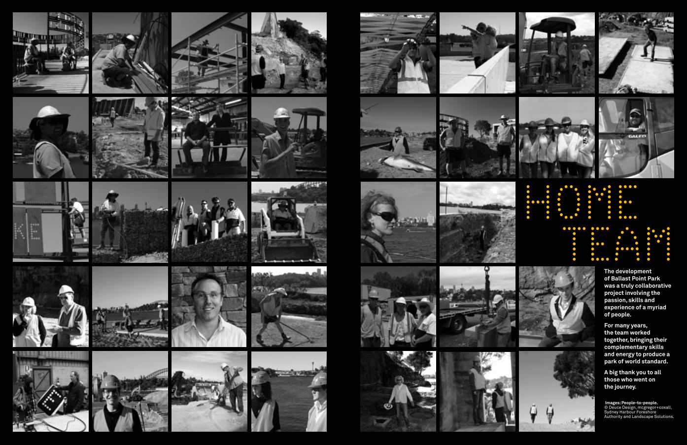
HOME TEAM
The development of Ballast Point Park was a truly collaborative project involving the passion, skills and experience of a myriad of people.
For many years, the team worked together, bringing their complementary skills and energy to produce a park of world standard.
A big thank you to all those who went on the journey.
Images: People-to-people. © deuce design, mcgregor+coxall, Sydney Harbour foreshore authority and Landscape Solutions.

METAMOR PHOSISMetamorphosis 1. change of form, structure, or substance,
as transformation by magic or witchcraft.2. any complete change in appearance,
character, circumstances, etc. 3. a form resulting from any such change...Macquarie Concise Dictionary. (1998) third edition,
Macquarie The Macquarie Library Pty Ltd.
Image: Tank Farm – Ballast Point, 2004. © Sydney Harbour foreshore authority.
Credits
Sydney Harbour Foreshore Authority www.shfa.nsw.gov.au
• • •Deuce Design www.deucedesign.com.au
• • •mcgregor+coxallPhilip Coxall Adrian McGregor Christian Borchert Kristin Spradbrow Jeremy Gill www.mcgregorcoxall.com
• • •Landscape Solutionswww.landscapesolutions.com.au
• • •Ballast Point Campaign Committee• • • Robyn Backenwww.robynbacken.com
• • •Terence Chin • • •Choi Ropiha John Choi Steven Fighera www.choiropiha.com
• • • Les Murray• • •Agnese Sanvito• • • John Tranter• • • Tom Uren• • • Paula Wallace
Historic photographs
Department of Lands• • •Leichhardt Council Local History Library• • •Sydney Harbour Trust Commission• • •State Library of NSW• • •Stanton Library
Production
Printing : Special T Print www.specialtprint.com.au
• • •Paper: K.W. Doggett Fine Paper Enviroboard 230gsm (cover) Impact 135gsmThis book has been printed on Impact. Made with a carbon neutral manufacturing process and consisting of 100% certified post consumer waste recycled fibre. This new generation bright white recycled paper has been produced in a facility that operates under the world’s best practice ISO 14001 Environmental Management System.
www.kwdoggett.com.au
© 2009 Sydney Harbour Foreshore Authority.
• • •Cover image: Tank 101. © Agnese Sanvito.
Inside front cover image: Tank rivet detail. © Sydney Harbour Foreshore Authority.
Inside front gatefold images: Tanks on site, c. 2002 and salvaged tank 101 panel. © Sydney Harbour Foreshore Authority.
Inside back cover image: Remnant detail at Ballast.© Sydney Harbour Foreshore Authority.
Inside back gatefold image: Bund wall. © Deuce Design.
