b h. three routes over the divide - lewis & clark … · between great falls and mis- ... no...
TRANSCRIPT

b H. THREE ROUTES OVER THE DIVIDE
GREAT FALLS, MT TO MISSOULA, MT
Summary Data for Three Routes:
Distance ClimbingLemhi Pass 460 mi. 15,000 ft.
Big Hole 420 mi. 13,000 ft.
Route 200 Shortcut 170 mi. 7,000 ft.
Missoula
Lolo
Great Falls
Lincoln
RogersPass
5,610
Ovando
LEMHI PASS
ROUTE 200 SHORTCUT
BIG
HO
LE
•
•
••
•
•
••
•
•
•
•
••
•
•
•
••
•
•
•
•
SalmonDillon
ThreeForks
Helena
Badger Pass6,760
Big Hole Pass7,360
Lemhi Pass7,373
Lost TrailPass
7,014
Chief JosephPass, 7,264
Wisdom
Bannack
Grant
JacksonNorthFork
Shoup
Clark CanyonReservoir
Twin Bridges
Silver Star
Cardwell
WhitehallSula
Darby
Hamilton •Townsend
Gates of theMountains
• •
•
•
Wolf Creek
Cascade
Augusta
•
20 miles
142 Bicycle Guide to the Lewis & Clark Trail

Great Falls is perhaps the critical transition point in the entire Lewis and ClarkTrail—both for the original expedition and for today’s bicycle tourer—as it is
the transition from the plains to the mountains. And not just any mountains; theseare the Rocky Mountains—actually made up of many different and dramatic inter-locking mountain ranges. With 1,800 miles behind you, there are another 1,200miles to go—600 of which are in the Rocky Mountains.
The Corps of Discovery used three different routes over the ContinentalDivide, as shown in the map and summary above. On their original westboundjourney they crossed over Lemhi Pass. On their return eastbound journey Lewisand Clark split the group and explored two different routes. Clark took his groupthrough the Big Hole and then down the Yellowstone River. Lewis took his groupon the more direct route they had learned about from the Indians—about 300miles shorter than their original westbound route. I call this third option the“Route 200 Shortcut,” because it approximates today’s Route 200. The two groupsrejoined where the Yellowstone River joins the Missouri River near the Montana-North Dakota border.
Which route should you take? I will lay out the advantages and disadvantagesof each and let you decide based on what’s important to you. All three routes aredescribed in both the Master Plan and the Detailed Plan. This part of Montana isan area where you could put together a great loop trip if you want to park a carsomeplace and take two of these routes. You could also use these routes along withthe state highway map to design your own loop.
The Lemhi Pass Route is the original route the Corps of Discovery fol-lowed on their westbound trip. It offers historical accuracy and a feeling of dis-covery and excitement, as you think about Lewis desperately searching for Indi-ans so they could purchase horses before winter set in, and wondering whenthey would reach the Continental Divide and what the other side would be like.You, too, will wonder about making it over the mountains. This route is thelongest at 460 miles, the most challenging, the most beautiful, and has the leasttraffic. From Great Falls it follows the river south, winding up canyons throughthe foothills, past the Gates of the Mountains, and into Helena—state capitaland great small city. On south to Three Forks, where Lewis and Clark onceagain agonized over which of the three forks would lead them to the source ofthe Missouri River. Along the river and up through pretty valleys to Dillon—another good small town for bicycle tourers. This is the only route that includesthe following places:
1. Camp Fortunate, where Sacagawea was unexpectedly reunited with her brother,Chief Cameahwait, in an incredibly emotional scene that was probably criticalto the success of the expedition. The site is now covered by Clark CanyonReservoir.
2. Lemhi Pass and the (arguable) source of the Missouri River. You can see whatLewis saw when he first looked across the Continental Divide. He expected an
Detailed Route: Town Maps and Descriptions 143
mile
1786

easy portage to a river that would float them down to the Pacific; instead hesaw more mountains and mountain ranges than he had ever dreamed of.
3. The town of Salmon, Idaho, a great little active outdoor adventure town,where you can take time off for a whitewater rafting adventure on the SalmonRiver (also known as the River of No Return). After scouting this river for sev-eral days, Lewis and Clark reluctantly decided they could not navigate it.
Before you choose this route, be aware there are two significant disadvantages.First, it includes two major passes instead of one. Lemhi Pass at 7,373 feet isdescribed below. Lost Trail Pass at 7,014 feet includes 3,500 feet of climbing in 23miles on the south side (or 2,600 feet of climbing in 12 miles if you’re travelling east-bound).
Second, it includes 24 miles of fairly rough dirt road. I have done it on mytouring bike, because I desperately wanted to do this route; but I will never (well,probably never) do it again and can’t recommend it. The dirt includes 1,400 feet ofclimbing in 12 miles on the east side and 2,400 feet in 12 miles on the west side,and the ride down the west side is especially rough. After rain, Lemhi Pass can bemuddy, slippery, and difficult for four-wheel drive vehicles! There is talk aboutadding a layer of gravel on top of the dirt, which might make it better in some waysand worse in others.
If you want to ride this route westbound but are concerned about Lemhi Pass,it is always possible to ride as far as Grant, and then make a last-minute decision to
ride a pretty good dirt road 12 milesnorth to Bannack and connect withthe Big Hole Route. Eastbound ridersdon’t have this easy option. Once youride to Salmon, you would have tobacktrack 45 miles and 4,000 feet toget back on the Big Hole Route.
The Big Hole Route is almost aslong (420 miles) as the Lemhi Route,all paved, almost as beautiful, almostas free of traffic, and almost as hilly.Historically, this follows Clark’s return
144 Bicycle Guide to the Lewis & Clark Trail
Can you find the cyclist climbing Lemhi Pass?

route pretty closely between Lolo and Bannack and between Dillon and Great Falls.You can choose to follow Clark’s route by taking the dirt road between Bannackand Grant, and using the Lemhi Pass Route between Grant and Dillon. (see sum-mary map above) This route does not follow Clark’s route up the Yellowstone River,because this would involve several hundred miles on I-94.
This is the only route that includes the following places:
1. The Big Hole, a gorgeous high valley with dramatic mountains on both sides.There are many prosperous (and mostly invisible) ranches here using theunique Beaverslide (see photo with Wisdom, MT) to collect and store hay.
2. The cute, tiny town of Jackson with its motel, restaurant, hot springs, and bar.
3. The Big Hole National Battlefield and Visitors Center. It is definitely worth anhour or two to both see and hear the tragic and heroic story of Chief Josephand the Nez Perce Indians.
The third option is the Route 200 Shortcut between Great Falls and Mis-soula. This approximates the eastbound return route of Lewis and nine men in1806, as they followed the well-worn Indian trail up the “River of the Road to theBuffalo” (today’s Blackfoot River). About ten miles east of Lincoln, they followedthe trail over the divide, at what is now called Lewis and Clark Pass—about fivemiles north of today’s Route 200 crossing at Roger’s Pass. Lewis followed the trail
east—close to today’sAugusta—and pickedup the Sun River toGreat Falls.
This general routewas also followed in1859 when JohnMullan constructedthe Mullan Road sothe U.S. Army couldtransport military
Detailed Route: Town Maps and Descriptions 145
mile
1786
The Big Hole near Jackson, MT
Approaching theDivide on the
Route 200 Shortcut

supplies over 600 miles from the Missouri River at Fort Benton to the ColumbiaRiver at Wallula—both places we pass on the Lewis & Clark Trail. The road wascompleted in only one year, although there was a 130% cost overrun and the quali-ty of the road left something to be desired.
The major (only?) advantage of this route is that it’s shorter with less climbing.If you have a tight schedule, or need to make up time, this route can help. If Lewisand Clark had known about this route, they could have saved about 45 days andcontinued over the Bitterroots in the summer weather of early August.
Route 200 also has several disadvantages. First, because it is more direct, it car-ries more and faster traffic—including trucks—than the other routes. Second,although this route involves less climbing, the climbing is less pleasant. Especiallybetween Simms and Lincoln, the highway tends to be straight with lots of big upsand downs. Third, Lincoln, at about the halfway point, is the only significant townon this 165-mile stretch. If you don’t want to do two long days, you can detourthrough Augusta, stop in Ovando, or camp in pleasant Forest Service camp-grounds. Finally, although the scenery is beautiful, it’s not as spectacular as theother routes; and you miss a lot of great towns.
LEMHI PASS AND BIG HOLE ROUTE
Cascade, MTPopulation: 730
Cascade is a pleasant small town for an overnight stop, and especially convenient ifyou don’t want to do the whole 88 hilly miles to Helena in a single day. There aretwo possible areas to stay. There is camping, motels, food shopping, and a café rightin town. There is also camping with a full restaurant and bar near Hardy, aboutnine miles south (towards Helena) from the downtown area.
Zip: 59421
l 1) Badger Motel & Café ($), 1st St., 406-468-9330
2) A&C Motel ($), 308 1 Ave. N, 406-468-2513
c 1) Atkinson Park, 3rd Ave. N, next to I-15, good grass, no shade, restrooms,showers at pool next door
2) Missouri Inn, 9 mi. south of Cascade, camping behind restaurant, rest-rooms with showers, some shade, be aware of possible conflict with weekendflea market on summer weekends, 406-468-9884
146 Bicycle Guide to the Lewis & Clark Trail

Wolf Creek, MTPopulation: 150
Wolf Creek is a very small fishing town right on the river in the beautiful Wolf CreekCanyon. There are two motels, a restaurant, café, and bar. Pleasant and convenient asthis town is, the motels are usually filled by fishermen on a weekly basis during thesummer. Call ahead for reservations. There are also two primitive National Forest Ser-vice campgrounds north (towards Cascade) of Wolf Creek.
Zip: 59648
l 1) Montana River Outfitters Cabins ($–$$), 800-800-4350
2) Frenchy’s Motel ($), 406-235-4251
c 1) NFS Campground, 11 mi. north (towards Cascade), on river, roughground, no water, pit toilet
2) NFS Campground, 3 mi. north (towards Cascade), on river, rough ground,no water, pit toilet
Helena, MTPop 30,000
Nestled in the foothills of the Elkhorn Mountains, Helena is the capital of Mon-tana. There was nothing here in 1864 when four discouraged miners decided totake one last chance to find gold on their way home to Georgia. They struck it rich,and the population exploded. The name “Last Chance Gulch” stuck, and todayyou can visit shops and restaurants along a pleasant pedestrian mall in the gulch.Bicycle tourers can minimize hills and avoid traffic by skirting the city to the northand east, but you miss a lot if you don’t tackle some of the hills and see the sights.
Helena is a very appealing small city. It’s big enough to have a variety of services,but small enough to get around without too much traffic. The nearby mountains,river, and lake offer great opportunities for year round outdoor recreation. There isan active community of both road and mountain bikers. Finally, it is a well-educatedand sophisticated small city with lots of music and art.
There are clusters of motels and restaurants near the I-15 interchanges and inthe downtown area. You can find camping either five miles east or five miles northof the city, although food shopping is much better north of the city. Rememberthat east of the city means heading westbound on our route, and north of the citymeans heading eastbound.
The Capitol offers both guided and self-guided tours. Note that the dome isgilded with copper instead of the more typical gold, once again reminding us whatmade this state. The building contains several historical paintings, including thefamous mural of “Lewis and Clark Meeting the Flathead Indians at Ross’ Hole” byCharles Russell. Across the street the Montana Historical Society Museum has
Detailed Route: Town Maps and Descriptions 147
mile
LP-5
8

exhibits of Montana history, plus a gallery of Russell art. The Last Chance TourTrain leaves from the museum for an overview tour of the city, including the pedes-trian mall in Last Chance Gulch, the cathedral, and the elegant Victorian mansionsbuilt with the wealth from gold mining.
Seventeen miles north of Helena, and down a 2.7-mile steep hill from its ownexit on I-15, is the beautiful two-hour boat trip along a three-mile stretch of theMissouri River with 1,200-foot cliffs through the Gates of the Rocky Mountains(406-458-5241, www.gatesofthemountains.org). Although it may be difficult to fitthis into your riding plan (it almost requires either an overnight stop in Wolf Creekor an extra day in Helena), this is a spectacular section of the river.
On July 19 Lewis wrote, “wherever we get a view of the lofty summits of themountains the snow presents itself, altho’ we are almost suffocated in this confinedvally with heat . . . this evening we entered much the most remarkable clifts thatwe have yet seen. these clifts rise from the waters edge on either side perpendicu-larly to the hight of 1200 feet. every object here wears a dark and gloomy aspect. . . the river appears to have forced it’s way through this immence body of solidrock for the distance of 5 3/4 miles and where it makes it’s exit below has thrownon either side vast collumns of rocks mountains high . . . from the singularappearance of this place I called it the gates of the rocky mountains.”
Helena, MT — Zip: 59601
15
12 287
85
1
3
4
2
2
1 mile
Lincoln Rd.
Custer
Was
hing
ton
Airport Way
Car
ter
MuseumCapitol
Prospect
Last
Cha
nce
Gul
ch
Main
Cedar
2 mi.
1 mi.
3 mi.1
2
1 11th Ave.
Mon
tana
148 Bicycle Guide to the Lewis & Clark Trail

V Chamber of Commerce: 225 Cruse, 800-743-5362,www.helenachamber.com, [email protected]
l The Chamber of Commerce can provide a listing of 20 motels and 8 B&Bs.Listed below are a few convenient ones from different price categories.
1) Motel 6 ($), 800 N Oregon, 406-442-9990
2) Holiday Inn Express ($$), 701 Washington, 800-465-4329
3) Budget Inn ($$), 524 N Last Chance, 800-862-1334
4) St. James B&B ($$$), 114 N Hoback, 406-449-2623
c 1) Helena Campground and RV Park, 5820 N Montana, 406-458-4714, 5 mi. north, former KOA campground, quiet, good grass sites with shade,excellent restrooms with showers, pool, hot tub, laundry, camp store, rela-tively expensive tenting, excellent food shopping 3 flat mi. south
2) Buzz In RV Park and Campground, 3699 Hwy. 12, 406-449-1291, 5 mi. east, open, near highway, grass, some shade, showers, laundry
B 1) Big Sky Cyclery, 1419 11th Ave., 406-442-4644
2) Great Divide Cyclery, 336 N Jackson, 406-443-5188
Detailed Route: Town Maps and Descriptions 149
mile
LP-9
2
Gates of the Mountains, near Helena, MT

Townsend, MTPopulation: 1,650
Townsend is a pleasant small town with motels, campgrounds, restaurants, andgood food shopping. If you plan to camp, wait until you arrive and make yourchoice based on your priorities.
Zip: 59644
V Townsend Area Chamber of Commerce: Box 947, 406-266-3911
l Mustang Motel ($) and Lake Townsend Motel ($), 406-266-3491
c 1) Indian Road CG, 1 mi. north, grass, shade, water, pit toilet, no shower
2) Roadrunner RV CG, .6 mi. north, on road, some grass, open, no shade
150 Bicycle Guide to the Lewis & Clark Trail
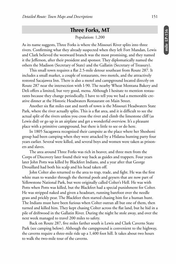
Along the Jefferson River, Three Forks, MT
Three Forks, MTPopulation: 1,200
As its name suggests, Three Forks is where the Missouri River splits into threerivers. Confirming what they already suspected when they left Fort Mandan, Lewisand Clark believed the westward branch was the most promising, and they namedit the Jefferson, after their president and sponsor. They diplomatically named theothers the Madison (Secretary of State) and the Gallatin (Secretary of Treasury).
This small town requires a flat 2.5-mile detour southeast from Route 287. Itincludes a small market, a couple of restaurants, two motels, and the attractivelyrestored Sacajawea Inn. There is also a motel and campground located directly onRoute 287 near the intersection with I-90. The nearby Wheat Montana Bakery andDeli offers a limited, but very good, menu. Although I hesitate to mention restau-rants because they change periodically, I have to tell you we had a memorable cre-ative dinner at the Historic Headwaters Restaurant on Main Street.
Another six flat miles east and north of town is the Missouri Headwaters StatePark, where the river actually splits. This is a flat area, and it is difficult to see theactual split of the rivers unless you cross the river and climb the limestone cliff (asLewis did) or go up in an airplane and get a wonderful overview. It’s a pleasantplace with a primitive campground, but there is little to see or do here.
In 1805 Sacagawea recognized their campsite as the place where her Shoshonigroup had been camping when they were attacked by a Hidatsa hunting party fouryears earlier. Several were killed, and several boys and women were taken as prison-ers and slaves.
The area around Three Forks was rich in beaver, and three men from theCorps of Discovery later found their way back as guides and trappers. Four yearslater John Potts was killed by Blackfeet Indians, and a year after that GeorgeDrouillard had both his scalp and his head taken off.
John Colter also returned to the area to trap, trade, and fight. He was the firstwhite man to wander through the thermal pools and geysers that are now part ofYellowstone National Park, but were originally called Colter’s Hell. He was withPotts when Potts was killed, but the Blackfeet had a special punishment for Colter.He was stripped naked and given a headstart, running barefoot over the needlegrass and prickly pear. The Blackfeet then started chasing him for a human hunt.The Indians must have been furious when Colter outran all but one of them, thenturned and killed him. They kept chasing Colter across the flat land, but he hid in apile of driftwood in the Gallatin River. During the night he stole away, and over thenext week managed to travel 200 miles to safety.
Back on Route 287, five miles farther south is Lewis and Clark Caverns StatePark (see camping below). Although the campground is convenient to the highway,the caverns require a three-mile ride up a 1,400 foot hill. It takes about two hoursto walk the two-mile tour of the caverns.
Detailed Route: Town Maps and Descriptions 151
mile
LP-1
56

Three Forks, MT — Zip: 59752
V Three Forks Chamber of Commerce: Box 1103, 406-285-4753,www.threeforksmontana.com
l 1) Broken Spur Motel ($-$$), 124 W Elm 406-285-3277
2) Lewis and Clark Sportsman’s Lodge ($$), 510 S Main, 406-285-3454
3) Fort Three Forks Motel ($$), on Route 287 near I-90, 406-285-3233
c 1) Fort Three Forks RV Park and Campground, grass, no shade, windy, goodrestrooms with showers, 406-285-3233
2) KOA Campground, Route 287 just below I-90, 406-285-3611
3) Missouri Headwaters State Park Campground, no water, pit toilets, flat,near river, 6 mi. east and north of town
4) Lewis and Clark Caverns State Park, Route 287 4.8 mi. south of Route 205intersection, sloping ground, pretty canyon, no shade, little privacy, goodrestrooms with showers
Special Events
Rodeo, 3rd weekend in JulyLewis and Clark Rendevous, last weekend in JulyAntique Aircraft Show, first weekend in August
287
20590
205
287
4
21
3
Mai
n St
.
1
2
2 miles
Wheat MontanaBakery & Deli
3
152 Bicycle Guide to the Lewis & Clark Trail

Cardwell, MTPop 35
Cardwell Store is an interchange on I-90 that offers a convenience store and inex-pensive cabins, tepees, and camping area.
Zip: 59721
c Cardwell Store, camping behind store, grass, some shade, restrooms withshowers
Whitehall, MTPop 1,100
Whitehall offers good food shopping and a variety of motels and restaurants in thesmall downtown area and near the I-90 interchange a half mile from downtown.
Zip: 59759
l 1) Whitehall Creek Motel ($), Legion St., 406-287-5315
2) Chief Motel ($), Legion St., 406-287-3921
3) Rice Motel ($), Legion St., 406-287-3895
4) Super 8 Motel ($$), I-90 Interchange, 406-287-3055
Silver Star, MTPopulation: 50
This pleasant tiny town offers a country store, café, and, two miles farther downthe route, a fishing resort with cabins, rooms, and campground.
Zip: 59751
l& c Jefferson River Cabins and Campground, 406-684-5225
Twin Bridges, MTPopulation: 375
In Twin Bridges the Jefferson River splits again into three rivers. Lewis and Clarknamed the westernmost river the Wisdom (now the Big Hole River that flowsthrough the town of Wisdom), and the central river the Philanthropy (now theBeaverhead). Although tempted by the larger volume and western direction of theWisdom, they chose the Philanthropy because it was warmer—deducing that it mustflow from a greater distance into the mountains. The easternmost river, the Ruby, was
Detailed Route: Town Maps and Descriptions 153
mile
LP-1
78

never a temptation. Its source, at the Continental Divide near Yellowstone NationalPark, was later determined to be the most distant source of the Missouri River.
Be sure to notice the Beaverhead River just north and west of town and thinkabout the Corps of Discovery dragging their canoes up this river. On August 4Clark wrote, “the method we are compelled to take to get on is fatigueing &laborious in the extreen, haul the Canoes over the rapids, which Suckceedeach other every two or three hundred yards and between the water rapidoblige to towe & walke on stones the whole day except when we have poleingmen wet all day Sore feet &c.”
Lewis was struggling on ahead of the main party at this point, trying ever moredesperately, as summer turned into fall and the river continued to peter out, tolocate Indians who could provide them with horses for travel over the mountains.At this time they still believed it would be a one-day portage over the mountains toa new river that would carry them to the Pacific. Clark was following behind withthe main group—several of whom were sick and injured, and all of whom werebecoming discouraged by the ever dwindling river and increasing difficulty of mak-ing mileage towards the mountains.
About ten miles upriver (south) from Twin Bridges Sacagawea recognized the“Beaver’s Head” rock formation off to the right, and the captains felt reassured theywere heading in the right direction to find the Shoshoni and horses. Many peopletoday question how appropriate the name is for this rock formation. I think it’s avalid question if you just view it from the main road, but I’ve found the formation
actually looks more like a beaver ifyou explore farther north and eastoff the main road—as the NativeAmericans would have done intheir normal daily life.
Today Twin Bridges offerscabins, a motel, small restaurants,grocery store, and a rest area withwater and restrooms on the river.
154 Bicycle Guide to the Lewis & Clark Trail
Beaverhead Rock Monument,Twin Bridges, MT
Historical AssociationTwin Bridges, MT

Zip: 59754
V Chamber of Commerce: PO Box 134
l 1) Hemingway’s Cabins and Fly Shop ($$), 406-684-5648
2) King’s Motel ($), 800-222-5510
c Hemingway’s Cabins and Fly Shop, lawn with bath house and showers,406-684-5648
Dillon, MTPopulation: 4,000
Located in the southwestern corner of the state, Dillon is the county seat of Beaver-head County and the home of Western Montana College of the University of Mon-tana. Named after Sydney Dillon, president of the Union Pacific Railroad, the townwas built as the railroad pushed north in 1880 to haul gold from Butte. Notice theattractive architecture of the courthouse, railroad station (now the visitor center),and Western Montana College (south end of town).
Today agriculture is the main industry in this area, and Dillon seems to be ayoung and active town. Although it’s a little too large to walk around, it’s flat andeasy to ride anywhere on your bicycle. There is a good selection of motels, restau-rants, food shopping, and campgrounds.
Detailed Route: Town Maps and Descriptions 155
mile
LP-2
41
Kids love fire drills in Dillon, MT.

Dillon, MT — Zip: 59725
V Chamber of Commerce: Box 425, 406-683-5511, www.bmt.net/~chamber, [email protected]
l 1) Sacagawea Motel ($), 775 N Montana, 406-683-2381
2) Best Western Paradise Inn ($$), 650 N Montana, 406-683-4214
3) Super 8 Motel ($$), 550 N Montana, 800-800-8000
4) Sundowner Motel ($), 500 N Montana, 800-524-9746
5) Centennial Inn B&B ($$), 122 S Washington, 406-683-4454
c 1) KOA, E Park St. (from Reeder St.), convenient, pool, 406-683-2749. If mosquitoes are a problem, try the drier Skyline (see 2 below).
2) Skyline RV Park, 2.5 relatively flat mi. north on Old Hwy. 91, sloping dryground, not much grass or shade, good restrooms with showers, laundry,406-683-4692
B Bad Beaver Bike and Ski, 25 E Helena, 406-683-9292
Special Events
Jaycee Rodeo and Concert, Labor Day weekendBeaverhead County Fair, week before Labor Day
1 2
41
91
15
1
234
5Idaho
Helena
Reeder
Atlantic
2 mi.
Montana
.3 mile
ParkO
ld H
wy.
91
156 Bicycle Guide to the Lewis & Clark Trail
Montanatraffic jam

LEMHI PASS ROUTE
Clark Canyon Reservoir and Dam
Twenty miles upriver (south) from Dillon, Clark Canyon Reservoir offers two pos-sibilities for camping. This is the general location of Camp Fortunate for the Corpsof Discovery, although the actual site is now buried under the reservoir.
The story of Lewis forging ahead with a small party to find the source of HorsePrairie Creek, cross the Continental Divide at Lemhi Pass, drink from the headwa-ters of the Columbia River, and finally make contact with the Shoshonis is a spec-tacular adventure—especially as told by Stephen Ambrose in Undaunted Courage.Ever more desperate to find Indians and horses as the river petered out, the moun-tains loomed, and winter approached, Lewis and a small band of men finally saw anIndian scout, who ran away from them. Later that day Lewis caught up with twoIndian women, convinced them he was friendly, and finally met with the Shoshonileaders.
Although the Indians suspected that Lewis was leading them into a trap, theyfinally followed their leader, Chief Cameahwait back over Lemhi Pass to find therest of the Corps of Discovery and help transport their baggage over the pass. Thestory of the emotional meeting of Chief Cameahwait and Sacagawea back at CampFortunate—when they discovered they were brother and sister—is one moreincredible example of truth being stranger than fiction. Although these Indianswere frightened and poor in all resources, they offered everything they had for thesuccess of the Corps of Discovery. Even though the expedition was sometimes clob-bered by bad luck, this was a case of incredibly good luck—hence the name ofCamp Fortunate.
c 1) Clark Canyon Reservoir NFS Campground, 19 mi. south of Dillon and 12 mi. east of Grant, off I-15 on Lemhi Pass route, pretty location on lake,windy, no shade/grass/privacy, covered picnic tables, water, pit toilets
2) Armstead Campground, 19 mi. south of Dillon and 12 mi. east of Grant,east side of I-15 across from Clark Canyon Reservoir, 406-683-4199, moresheltered, grass, showers, laundry
Detailed Route: Town Maps and Descriptions 157
mile
LP-2
61

Grant, MTPopulation: 35
Twelve miles farther west is the “town” of Grant, a road intersection and a formerstagecoach stop on the Dillon-Salmon run. Later it was a stop on the Gilmore andPittsburgh Railroad, whose Galloping Goose rail-bus is still parked here. The HorsePrairie Hilton is a rustic rambling B&B with a “big sky” view all around.
Zip: 59725
l& c Unfortunately the Horse Prairie Hilton is now closed. This means theLemhi Pass route requires some extra thought and planning for the 67 milesbetween lodging/camping options in Clark Canyon Reservoir and Salmon.there has also been new gravel added on the west side of Lemhi Pass, whichmakes this road more difficult for both road and mountain bikes. Inquire atDillon or Salmon for more updated information on this route.
LEMHI PASS, MONTANA/IDAHO BORDERIf you made it to the top of the Continental Divide here, you deserve some time forrest and reflection. Lewis arrived here with a small party on August 12, 1805. Revelin your accomplishment, as Lewis did on August 12. “After refreshing ourselveswe proceeded on to the top of the dividing ridge from which I discoveredimmence ranges of high mountains still to the West of us with their tops par-tially covered with snow. I now decended the mountain about 3/4 of a milewhich I found much steeper than on the opposite side, to a handsome boldrunning Creek of cold Clear water. here I first tasted the water of the greatColumbia river. after a short halt we continued our march along the Indianroad.”
158 Bicycle Guide to the Lewis & Clark Trail
Horse PrairieHilton at thestage stop, Grant, MT

Although Lewis wrote nothing of his feelings at this moment, most historiansspeculate that he must have been disappointed to look west and see nothing but aseries of massive snow-capped peaks instead of a broad gentle river flowing to thePacific. I’m not convinced he was discouraged. I have looked both east and west,seen the same view of many confusing mountains, and thought optimistically: If aseries of rivers can flow eastward through that tangle of mountains, there’s no rea-son a series of rivers can’t flow westward through a similar tangle of mountains.
It’s worth a short walk down to the Sacagawea Memorial, where Horse PrairieCreek first emerges from a small spring. Although Lewis and Clark—and somewriters—claim this is the source of the Missouri River, the source of the Red RockRiver (a neighboring tributary of the Ruby/Jefferson/Missouri River) is technicallythe farthest point from the mouth of the Missouri, and therefore is officially consid-ered the source. “two miles below McNeal had exultingly stood with a foot oneach side of this little rivulet and thanked his god that he had lived to bestridethe mighty & heretofore deemed endless Missouri.” (August 12, Lewis)
Detailed Route: Town Maps and Descriptions 159
mile
LP-2
73
The author also “exultingly stood with a foot on each side of this little rivuletand thanked his god that he had lived to bestride the mighty & heretoforedeemed endless Missouri.“ Below Lemhi Pass, MT

Salmon, IDPopulation: 3,000
This delightful town is your reward for climbing over both Lemhi Pass (3,500 feetabove you) and Lost Trail Pass (3,500 feet above you). You climbed one to reachSalmon, and you will climb the other to leave. So enjoy yourself here. Salmon hasmany opportunities for camping, lodging, shopping, and eating; and it is a flat andcompact town that is easy to get around.
If you have any dreams of whitewater rafting, the Chamber of Commerce lists27 outfitters and guides; and this would make a fine resting place for a day or two.What’s rewarding to us was extremely disappointing and discouraging to Lewis andClark. They knew they were on the west side of the Continental Divide, and theythought they would float gently down to the Pacific Ocean; but the Salmon Riverbelow here is known as the “River of No Return” for good reasons.
At first they refused to believe the Indians, who told them the Salmon was notnavigable. Cameahwait “added on further enquiry . . . that the river was con-fined between inacessable mountains, was very rapid and rocky insomuch thatit was impossible for us to pass either by land or water down this river to thegreat lake where the white men lived as he had been informed. this was unwel-come information but I still hoped that this account had been exaggerated.”(August 13, Lewis) However, after several days of exploring the river, they reluc-tantly agreed and set off on foot on the most difficult and dangerous part of theirtrip—struggling over Lost Trail Pass and Lolo Pass in early fall snowstorms.
In 1805 Lewis and Clark were the first white men to visit this area. In 1832Captain Bonneville drove the first wagon over the Rockies and built a fort on theSalmon River. In 1855 a Mormon group from Salt Lake City established a fort inthis area and named it Lemhi, after a person in the Book of Mormon. In 1866 agroup of prospectors from Montana discovered gold fourteen miles west ofSalmon, and this led to the establishment of Salmon City in a more convenientlocation in 1867.
160 Bicycle Guide to the Lewis & Clark Trail
Clark determined the Salmon River (aka “River of No Return”) was not navigable.
Below North Fork, ID

Salmon, ID — Zip: 83467
V Chamber of Commerce: 200 Main, 208-756-2100
l 1) Motel DeLuxe ($), 112 S Church, 208-756-2231
2) Stagecoach Inn ($$), 201 Hwy. 93 N, 208-756-2919
3) Wagons West Motel ($$), 503 Hwy. 93 N, 800-756-4281
4) Heritage Inn B&B ($), 510 Lena, 208-756-3174
c 1) Century II Campground, 603 Hwy. 93 N, laundry, 208-756-2063
2) Salmon Meadows, St. Charles 3 blocks N of Main, grass, shade, laundry,showers, 208-756-2640
St. C
harl
es
And
rew
s
Cha
llis
Salm
on
Riv
er
28
41
32
.3 mileLena
Main
93
93
Detailed Route: Town Maps and Descriptions 161
mile
LP-3
27

North Fork, IDPopulation: 250
Twenty-one miles north of Salmon is the tiny village of North Fork, where theNorth Fork of the Salmon River joins the main river. There are two motels, tworestaurants, and a campground. This is also a staging area for many raft trips on theriver.
If you want to take a side detour down the river towards Shoup on 18 miles ofpaved road along the river, you can get a good idea of the rugged canyon that scaredLewis and Clark. There is a pleasant café with a couple of rustic cabins at Shoup.
Zip: 83466
l 1) North Fork Motel and Campground ($$), 208-865-2412
2) River’s Fork Inn ($$), 208-865-2301
3) Shoup General Store and Cabins ($), 18 mi. west of North Fork on SalmonRiver Rd., Shoup, 83469, 208-394-2125
4) 100 Acre Wood B&B, 3 mi. north on Route 93, 208-865-2165
c 1) North Fork Motel and Campground, 208-865-2412
2) Wagon Hammer Springs Campground and RV Park, 1 mi. South on Route93, 208-865-2477
162 Bicycle Guide to the Lewis & Clark Trail
Former gold rush town and capital of Montana Territory, Bannack, MT

Bicycle Guide to the Lewis & Clark Trail
Copyright © 2000 by Tod Rodger. All rights reserved. Printed in the United Statesof America. No part of this publication may be reproduced or distributed in anyform or by any means, electronic or mechanical, including photocopying, record-ing, or by any information storage retrieval system, without the prior written con-sent of the publisher.
DisclaimersThe author and publisher of this book, and the government agencies on whoseroads you bicycle, are not responsible for your riding habits, bicycle condition, andany accidents which might occur while following this route. They urge users of thisGuide to wear a certified bicycle helmet, wear highly visible clothing, use reflectorsand lights, obey all traffic laws, watch for pedestrians and motorists, and generallyuse good common sense and courtesy.
Road and trail conditions change. The routes suggested in this book may bealtered due to road and trail maintenance, changes in state and local roads, androad and trail surface conditions. Surface conditions of roads and trails may changedue to weather, construction, and other local factors. Every effort has been made toprovide accurate information in this book at the time of publication.
Updates will be posted on the author’s website at www.deerfootpublications.comas they are received and verified. Readers are invited to send suggested updates [email protected].
ISBN 0-9704027-0-8
Design and Composition by Lyn Rodger, Deerfoot Studios.Cover design by Lyn Rodger, Deerfoot Studios.
iv