automated machine guidance systems · machine control automation … convert into a 3d model...
TRANSCRIPT

.
Automated Machine
guidance systems
Jason Killpack
Topcon Positioning Systems


Construction Cycle 2D Controls

Traditional 2D Controls

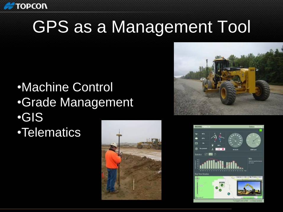
GPS as a Management Tool
.
•Machine Control
•Grade Management
•GIS
•Telematics
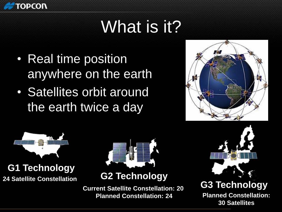
What is it?
• Real time position
anywhere on the earth
• Satellites orbit around
the earth twice a day
24 Satellite Constellation
USA
G1 Technology
Current Satellite Constellation: 20
Planned Constellation: 24
Russia
G2 Technology
Planned Constellation:
30 Satellites
G3 Technology

Machine Control Using GNSS determines …
I am here
How it works?
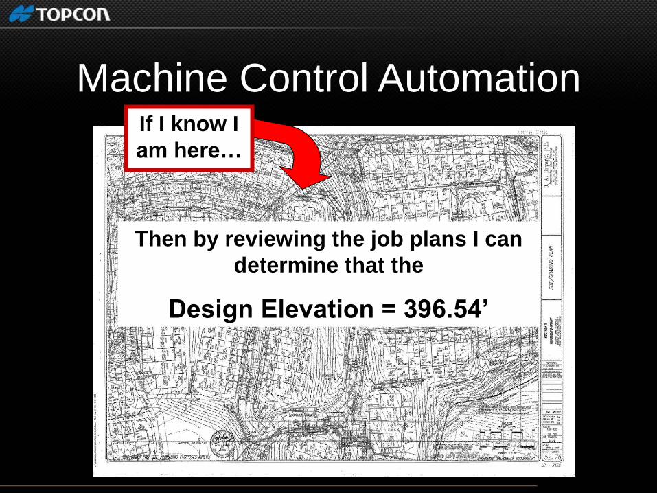
If I know I
am here…
Then by reviewing the job plans I can
determine that the
Design Elevation = 396.54’
Machine Control Automation
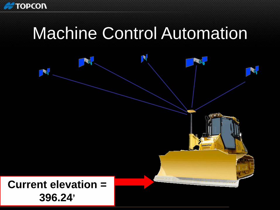
Current elevation =
396.24’
Machine Control Automation
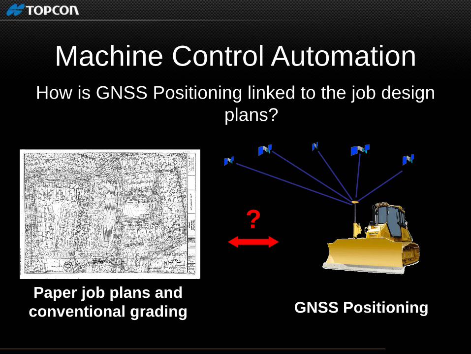
How is GNSS Positioning linked to the job design
plans?
GNSS Positioning Paper job plans and
conventional grading
?
Machine Control Automation

… Convert into a 3D model
Machine Control Automation
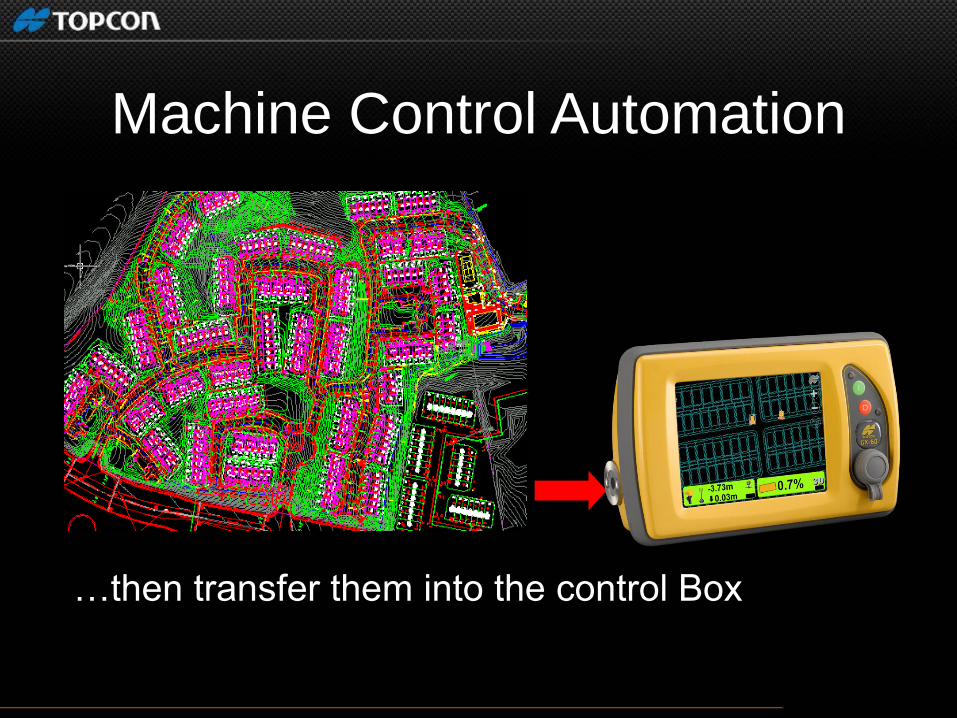
…then transfer them into the control Box
Machine Control Automation

Control box determines
Cut or Fill:
Job file says the Design elevation = 396.54’
396.84’
- 396.54’
= 0.30’ Cut
GNSS says the current elevation = 396.84’
Machine Control Automation
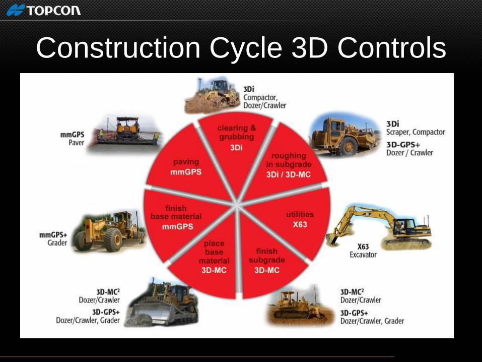
Construction Cycle 3D Controls

SitePrep Magazine - “2008 Machine Control Report”
Benefits of Machine Control

Vertical Accuracy:
+/- 0.1 ft
Satellite Positioning Weakness:
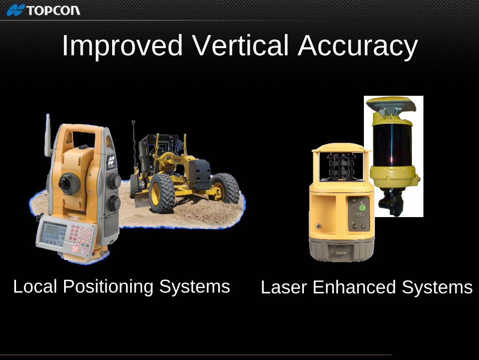
Improved Vertical Accuracy
Local Positioning Systems Laser Enhanced Systems
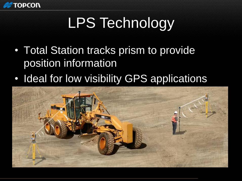
LPS Technology
• Total Station tracks prism to provide
position information
• Ideal for low visibility GPS applications

local Positioning System set up
TS #2 (MC)
TS #1 (MC)
TS #4 (MC) TS #5
(MC)
TS #3
(Grade
Checking)
• (2) 360 prism
• Control box
• Radio communications
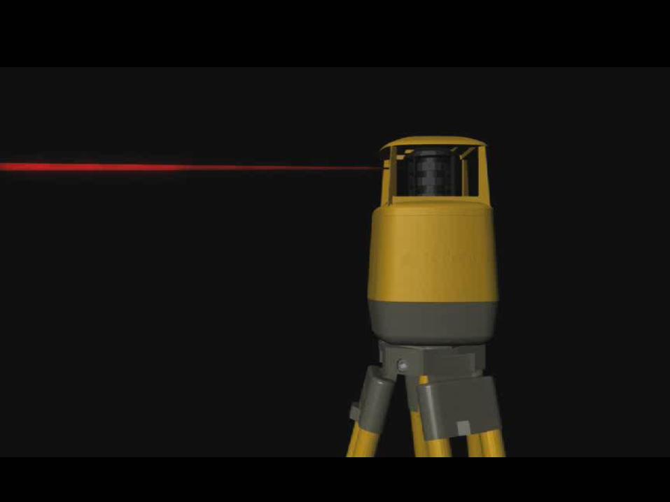

mmGPS Video

• Multiple user RTK advantages with laser precision
• Large elevation working range
• More versatile than robotic machine control
Laser Augmented GPS

PZS-MC
•Run any combination: mmGPS,
sonic or cross slope
•Same GPS components used for
grading
=
mmGPS Paving

Ele
vatio
n C
on
trol
mmGPS Paving
Slope Control

mmGPS Asphalt
Joint match with Sonic Check grade at the
same time
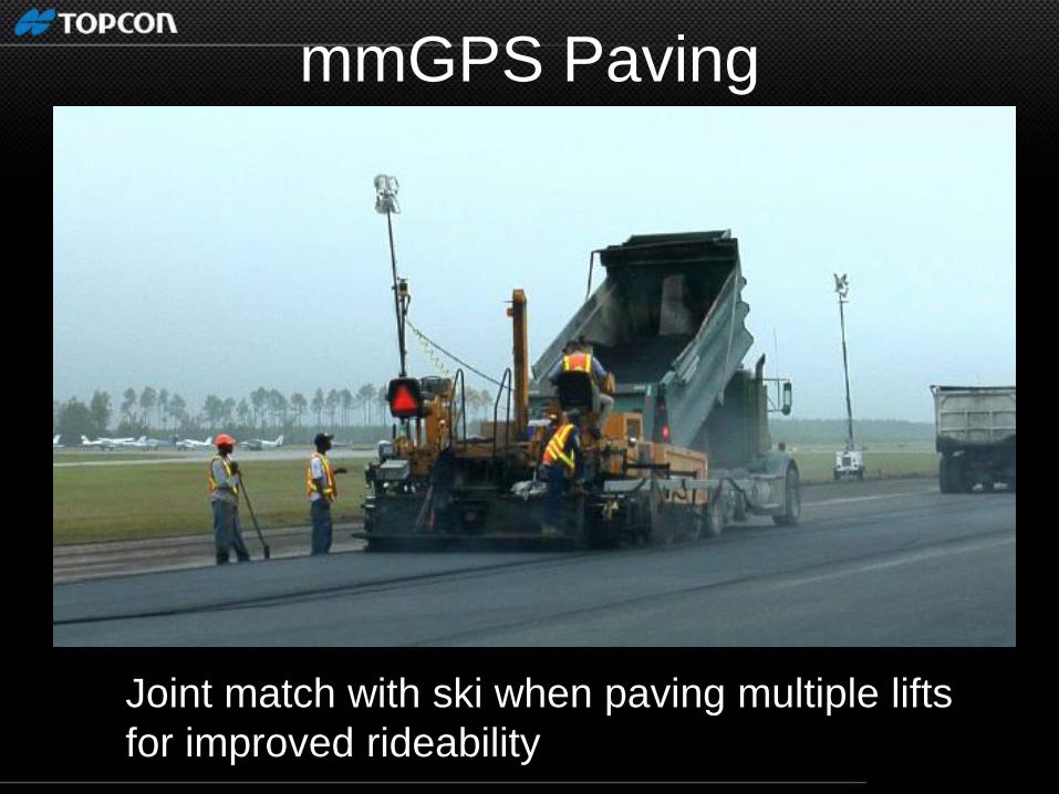
mmGPS Paving
Joint match with ski when paving multiple lifts
for improved rideability


Additional mmGPS Machines
• Profilers
•Trimmers

• Using a 3D design verses stringline. Eliminates staking-out
Avoids inaccurate stringline placement
• NO stringline... Significantly reduces material & labor costs
Saves time...prior to paving & during
No damaged string line to reset
Complete multiple lanes/passes without resetting string line
Ability to work in narrow work corridors
Advantages of 3D Paving
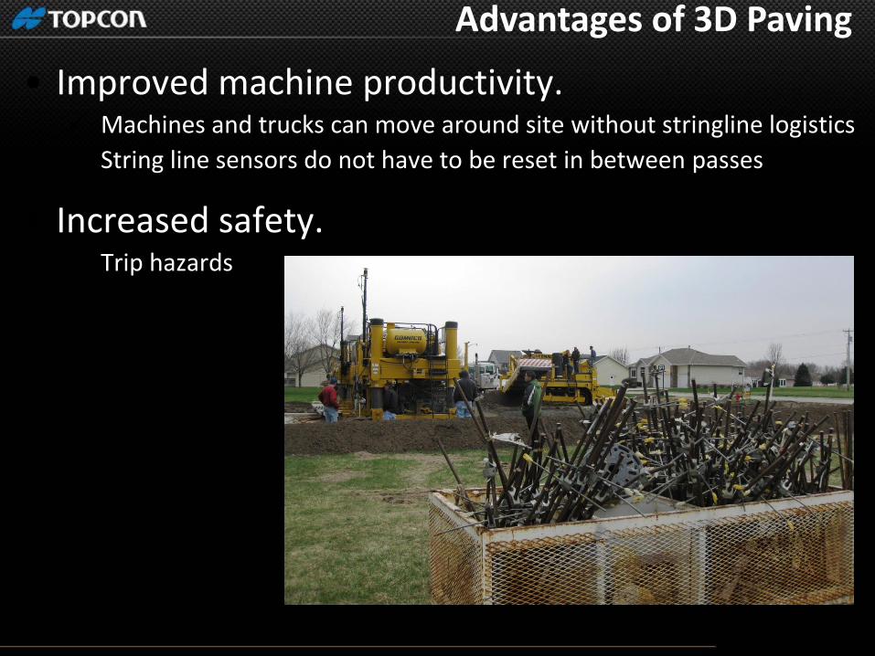
• Improved machine productivity. Machines and trucks can move around site without stringline logistics
String line sensors do not have to be reset in between passes
• Increased safety. Trip hazards
Advantages of 3D Paving


Maximizing Production
• New technologies increases speed at
which grading work can be performed
John Deere 764 Topcon 3D-MC2

3D-MC2 High Speed Steep Slopes

“IC” Intelligent Compaction

Intelligent Compaction?
• “A system of hardware, software and
analysis equipment installed on a roller
that work together to improve the
compaction process and to provide
innovative tools for compaction
acceptance”
Rollers/Compactors
Major benefits of Intelligent Compaction
• Improved Density
• Increased Productivity
• Reduction of Highway Repair Costs
• Continuous Record of Material Stiffness Values
• Identification of Non-Compactable Areas
• Improved Depth of Compaction

IC for Soils
• Improve uniformity of compaction
and provide assurance of adequate
compaction.
• Permits identification of “soft spots” or
even non-compactable areas prior to
placing pavement.

IC for HMA Pavement
• Ensure uniformity and efficiency of
compaction, and ensure compaction under
proper conditions (mat temperatures).
• Improve Efficiency (fewer passes)
• Generally used to track roller passes and
mat temperatures using GPS system
• Stiffness/Support can also be mapped
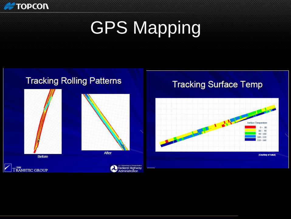
GPS Mapping

Machine Control in the Future

Mainline Paving Project Timeline...
Asbuilt Measure Existing
Trim / Mill Constant Depth
Analysis Design phase
Paving Multiple Lifts
Inspection Confirm milling
Inspection Confirm paving
Asbuilt Measure Finished
Rolling Optimum Density

RTP-300 Real Time Profiler

RTP-300
•Replacement of Manual
Profilograph
•Profile road while driving
•Create identical reports
•Increase productivity without lane
closures
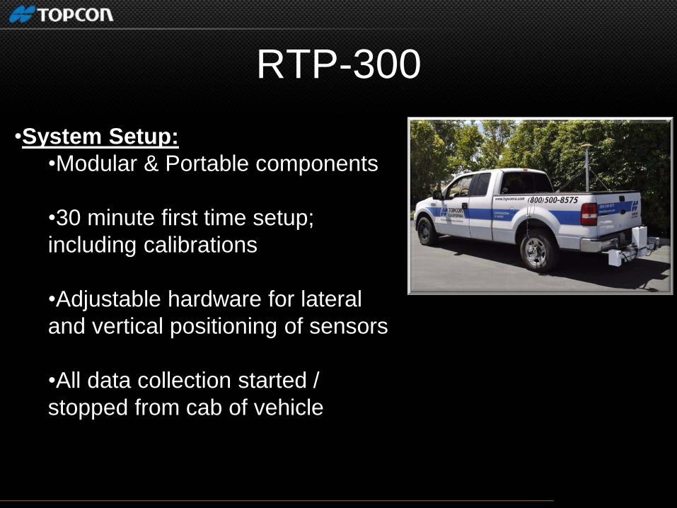
RTP-300
•System Setup:
•Modular & Portable components
•30 minute first time setup;
including calibrations
•Adjustable hardware for lateral
and vertical positioning of sensors
•All data collection started /
stopped from cab of vehicle
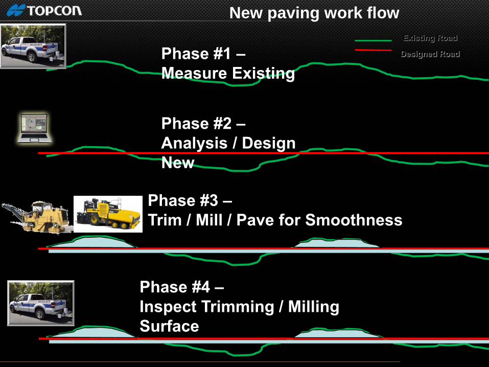
Phase #2 –
Analysis / Design
New
Phase #3 –
Trim / Mill / Pave for Smoothness
Existing Road
Designed Road Phase #1 –
Measure Existing
Phase #4 –
Inspect Trimming / Milling
Surface
New paving work flow
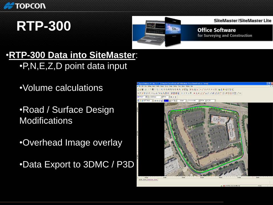
•RTP-300 Data into SiteMaster:
•P,N,E,Z,D point data input
•Volume calculations
•Road / Surface Design
Modifications
•Overhead Image overlay
•Data Export to 3DMC / P3D
RTP-300

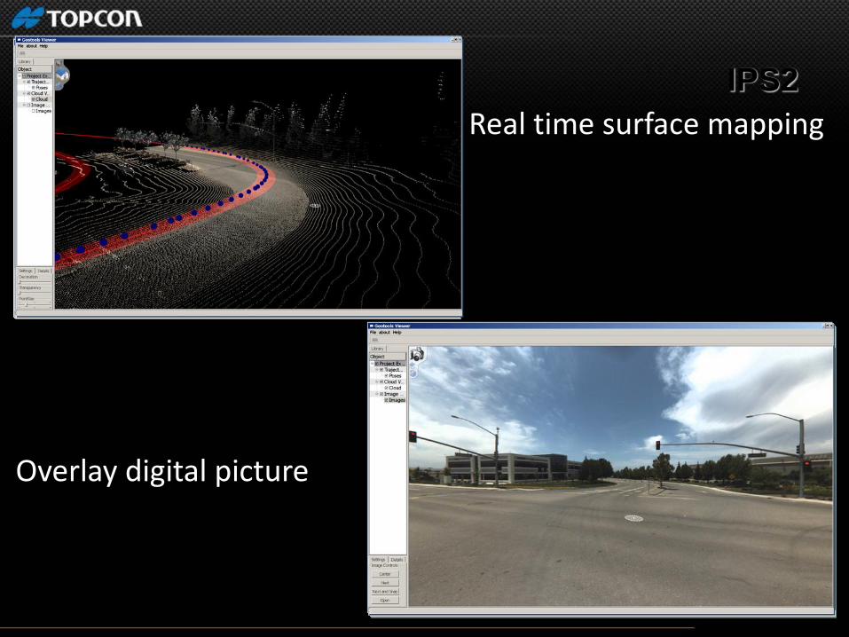
IPS2
Real time surface mapping
Overlay digital picture
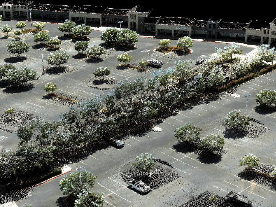
Integrated Positioning System

. Thank You!