atmospheric circulation. 1. global convection currents equator = warm rising air poles = cold ...
TRANSCRIPT
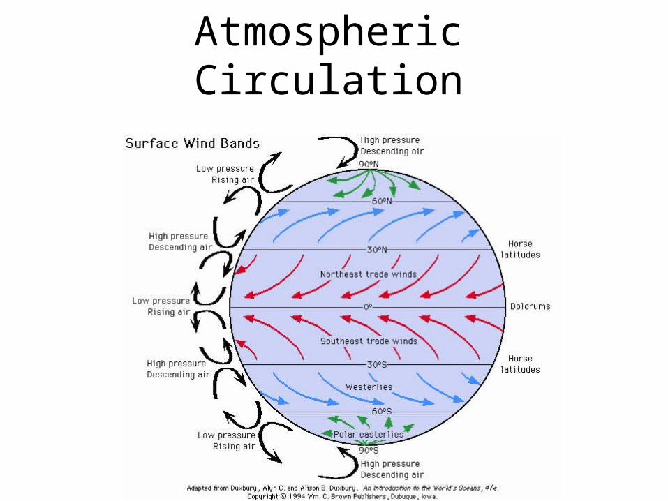
Atmospheric Circulation
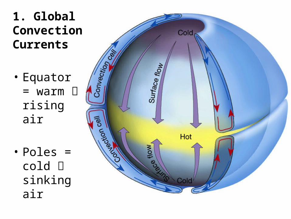
1. Global Convection Currents
• Equator = warm rising air
• Poles = cold sinking air
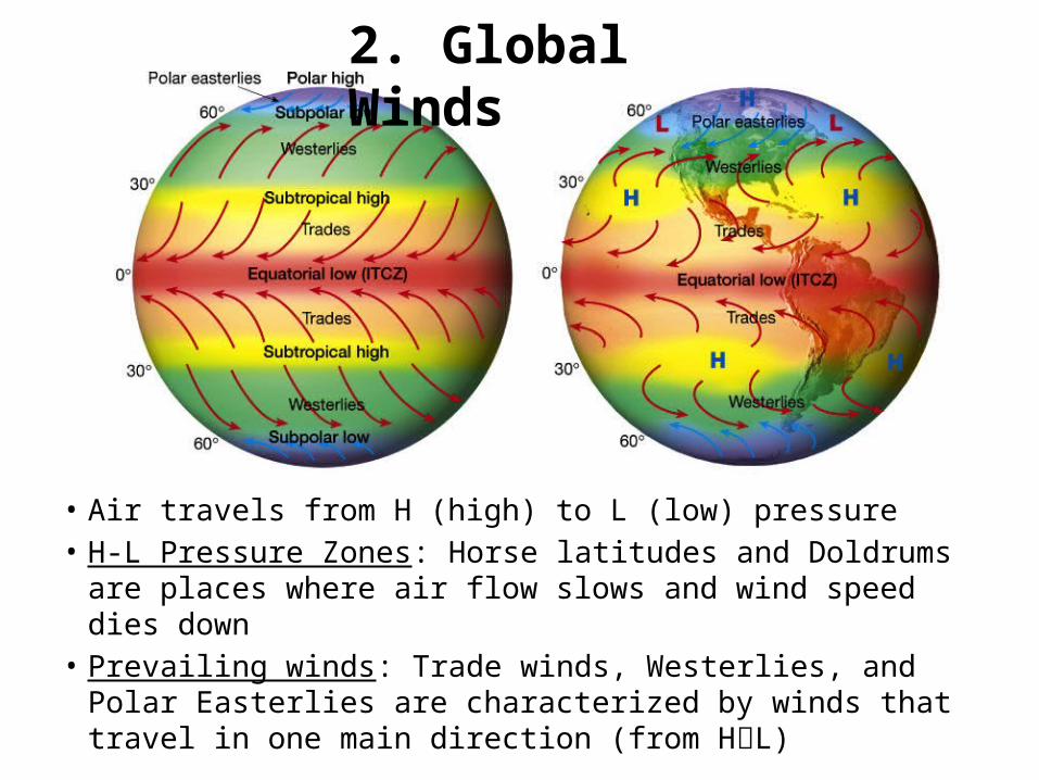
• Air travels from H (high) to L (low) pressure• H-L Pressure Zones: Horse latitudes and Doldrums are
places where air flow slows and wind speed dies down • Prevailing winds: Trade winds, Westerlies, and Polar
Easterlies are characterized by winds that travel in one main direction (from HL)
2. Global Winds
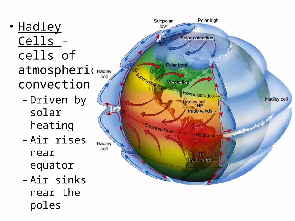
• Hadley Cells - cells of atmospheric convection– Driven by
solar heating – Air rises near
equator– Air sinks near
the poles
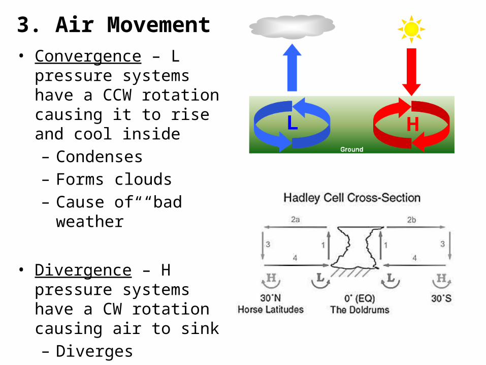
3. Air Movement• Convergence – L pressure
systems have a CCW rotation causing it to rise and cool inside– Condenses– Forms clouds– Cause of “bad weather”
• Divergence – H pressure systems have a CW rotation causing air to sink – Diverges – Form clear air– Cause of “good weather”
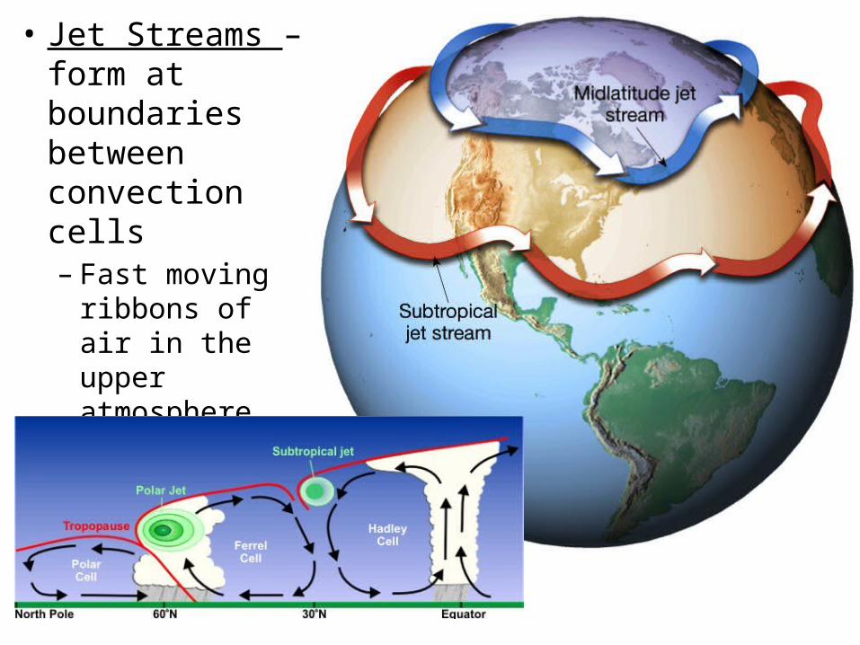
• Jet Streams – form at boundaries between convection cells– Fast moving
ribbons of air in the upper atmosphere
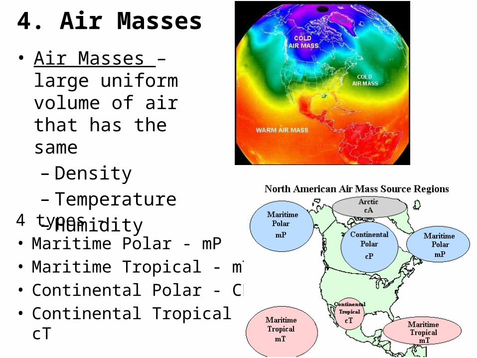
• Air Masses – large uniform volume of air that has the same– Density– Temperature– Humidity
4 types - • Maritime Polar - mP• Maritime Tropical - mT• Continental Polar - CP• Continental Tropical - cT
4. Air Masses
Weather Formation

5. Wind Formation
• Variations of solar energy input lead to
• temperature differences which lead to
• pressure variations in the atmosphere
• The wind blows to try to correct these imbalances in pressure.
• Regions of L and H pressure moving through an area cause changes in weather as different air masses pass by.
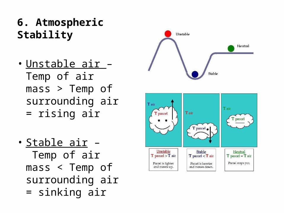
6. Atmospheric Stability
• Unstable air –Temp of air mass > Temp of surrounding air = rising air
• Stable air – Temp of air mass < Temp of surrounding air = sinking air
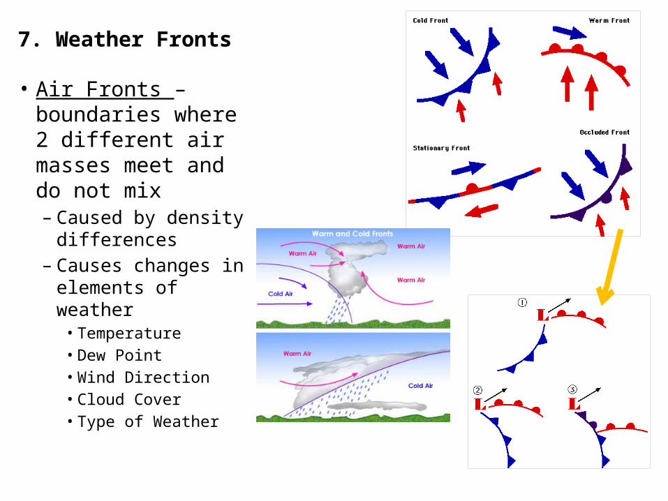
7. Weather Fronts
• Air Fronts – boundaries where 2 different air masses meet and do not mix– Caused by density
differences– Causes changes in
elements of weather• Temperature• Dew Point• Wind Direction• Cloud Cover• Type of Weather
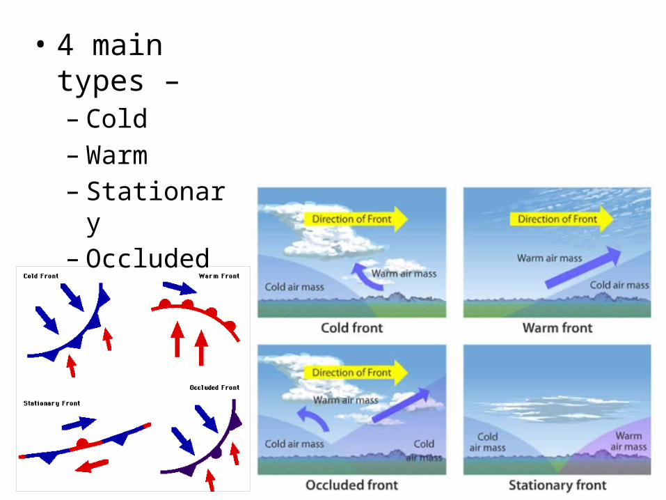
• 4 main types –– Cold– Warm– Stationary– Occluded
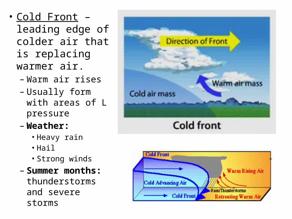
• Cold Front – leading edge of colder air that is replacing warmer air. – Warm air rises– Usually form with
areas of L pressure– Weather:
• Heavy rain• Hail• Strong winds
– Summer months: thunderstorms and severe storms
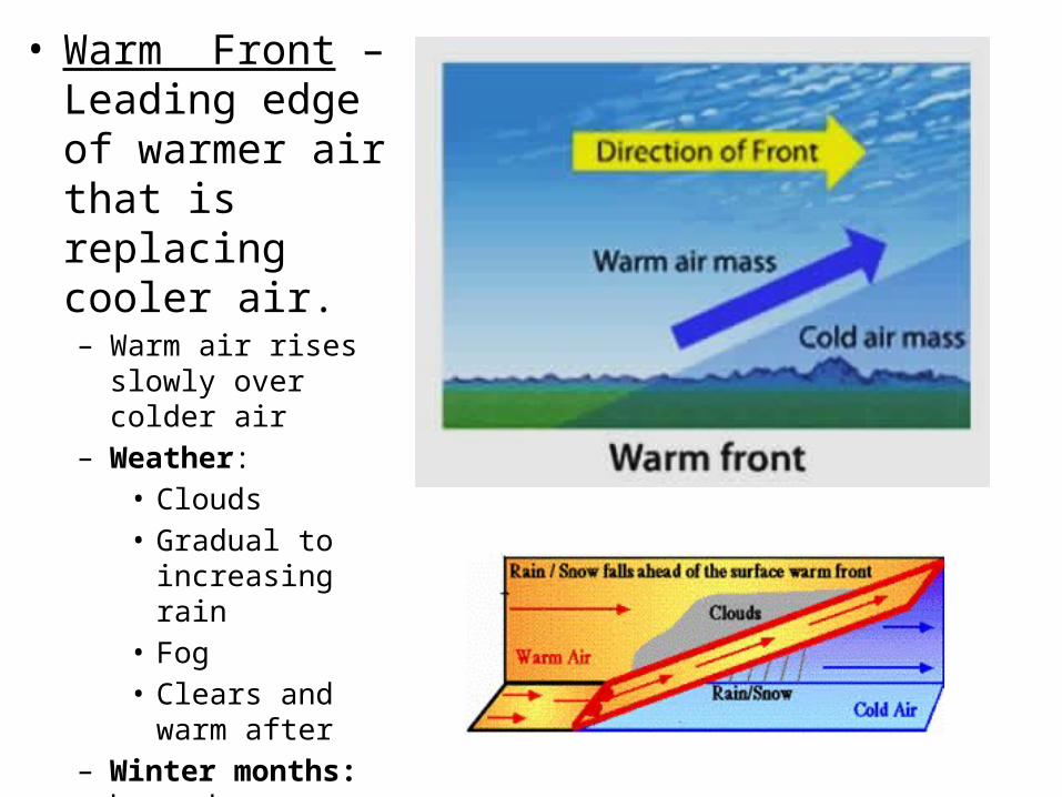
• Warm Front – Leading edge of warmer air that is replacing cooler air.– Warm air rises slowly
over colder air – Weather:
• Clouds• Gradual to
increasing rain• Fog• Clears and warm
after– Winter months:
hazardous weather conditions• Sleet• Freezing rain
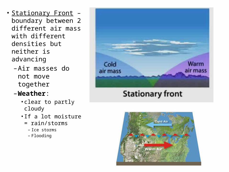
• Stationary Front – boundary between 2 different air mass with different densities but neither is advancing– Air masses do
not move together
– Weather:• clear to partly
cloudy• If a lot moisture
= rain/storms– Ice storms– Flooding
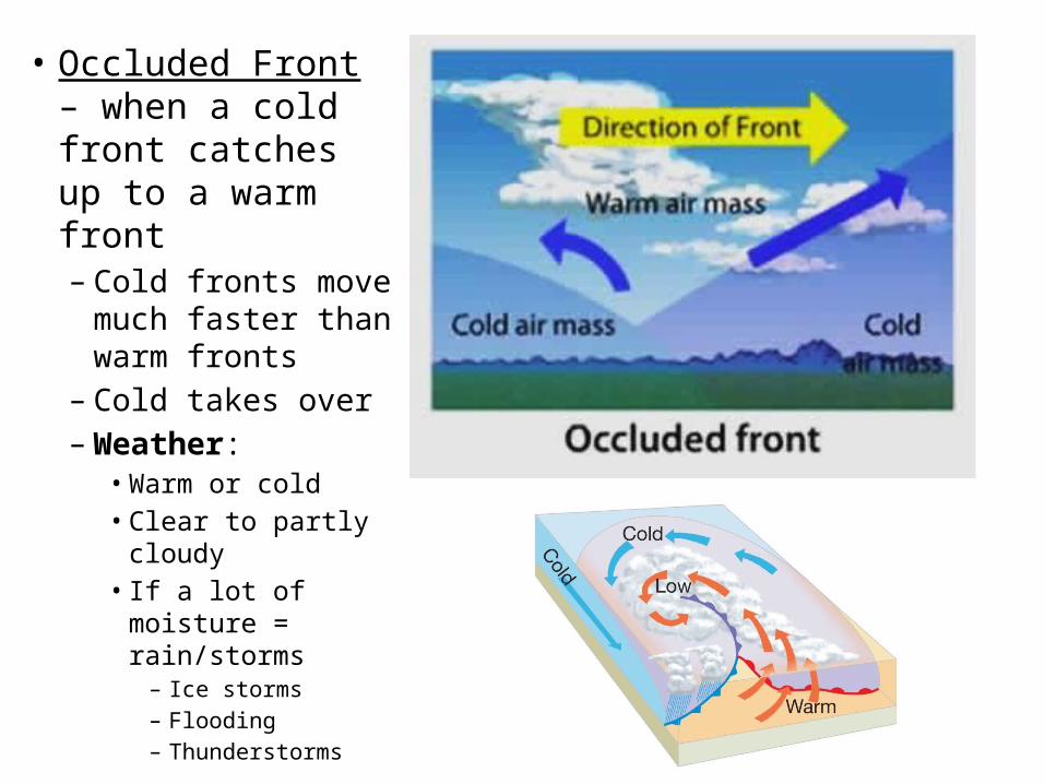
• Occluded Front – when a cold front catches up to a warm front– Cold fronts move
much faster than warm fronts
– Cold takes over– Weather:
• Warm or cold• Clear to partly
cloudy• If a lot of moisture =
rain/storms– Ice storms– Flooding – Thunderstorms
Types of Weather
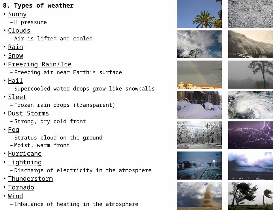
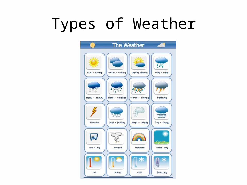
8. Types of weather• Sunny
– H pressure• Clouds
– Air is lifted and cooled • Rain• Snow• Freezing Rain/Ice
– Freezing air near Earth’s surface• Hail
– Supercooled water drops grow like snowballs• Sleet
– Frozen rain drops (transparent) • Dust Storms
– Strong, dry cold front• Fog
– Stratus cloud on the ground– Moist, warm front
• Hurricane• Lightning
– Discharge of electricity in the atmosphere• Thunderstorm• Tornado• Wind
– Imbalance of heating in the atmosphere
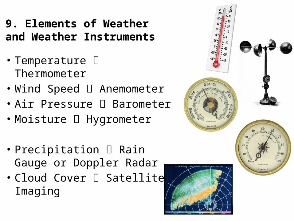
9. Elements of Weather and Weather Instruments
• Temperature Thermometer • Wind Speed Anemometer• Air Pressure Barometer • Moisture Hygrometer
• Precipitation Rain Gauge or Doppler Radar
• Cloud Cover Satellite Imaging
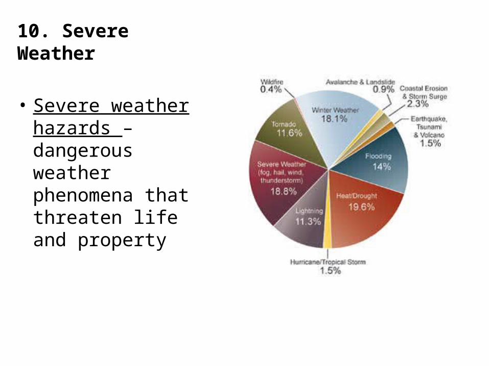
10. Severe Weather
• Severe weather hazards – dangerous weather phenomena that threaten life and property
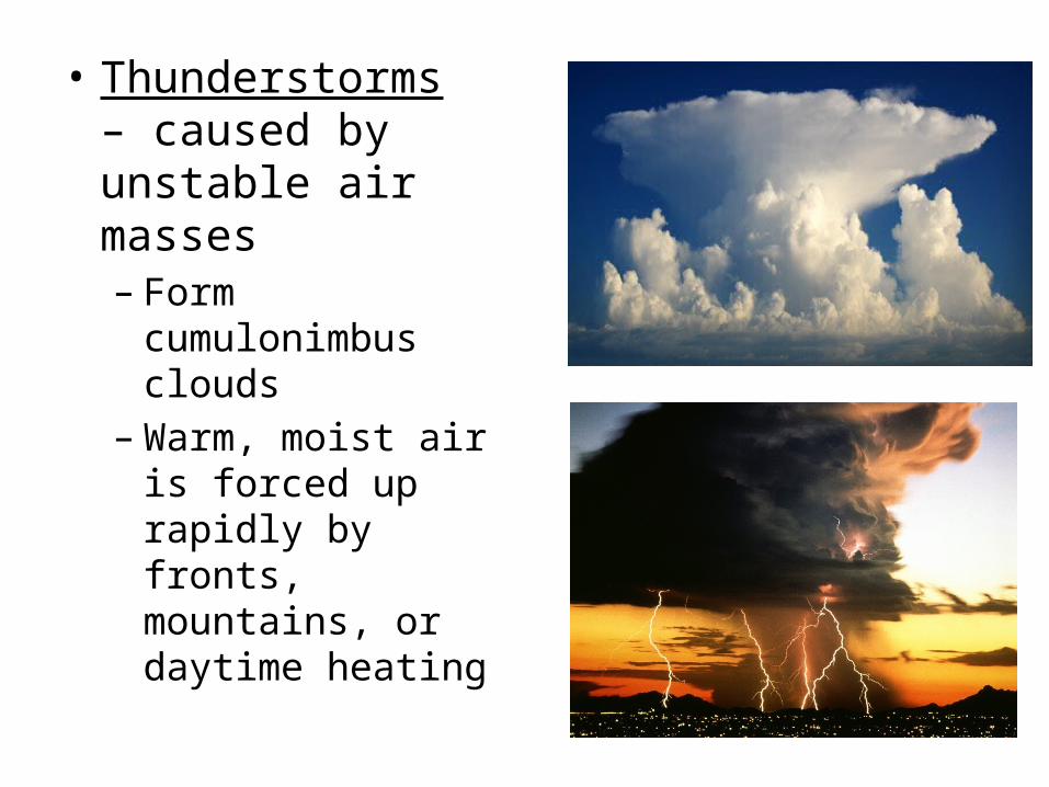
• Thunderstorms – caused by unstable air masses– Form
cumulonimbus clouds
– Warm, moist air is forced up rapidly by fronts, mountains, or daytime heating
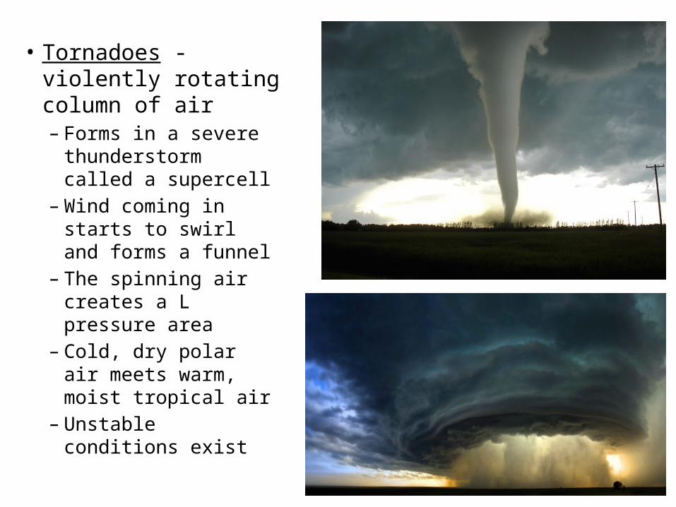
• Tornadoes - violently rotating column of air– Forms in a severe
thunderstorm called a supercell
– Wind coming in starts to swirl and forms a funnel
– The spinning air creates a L pressure area
– Cold, dry polar air meets warm, moist tropical air
– Unstable conditions exist
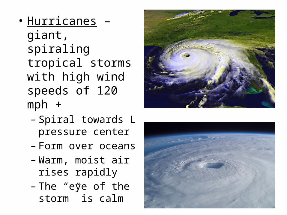
• Hurricanes – giant, spiraling tropical storms with high wind speeds of 120 mph +– Spiral towards L
pressure center– Form over oceans– Warm, moist air
rises rapidly – The “eye of the
storm” is calm
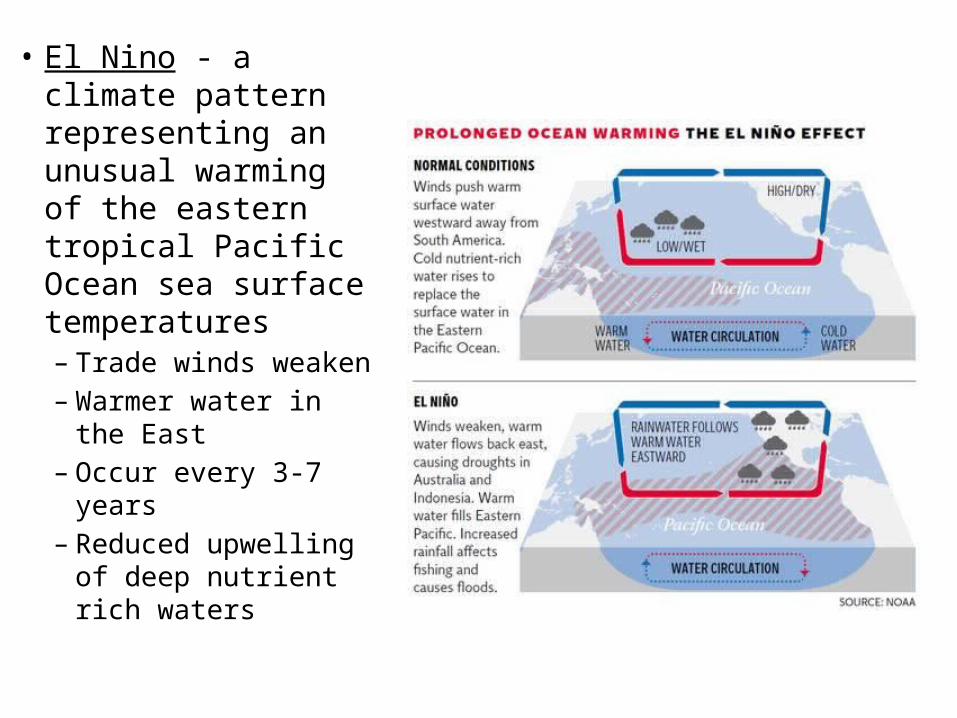
• El Nino - a climate pattern representing an unusual warming of the eastern tropical Pacific Ocean sea surface temperatures– Trade winds weaken– Warmer water in the
East– Occur every 3-7 years– Reduced upwelling of
deep nutrient rich waters
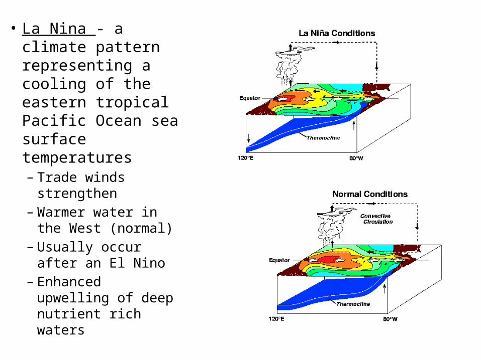
• La Nina - a climate pattern representing a cooling of the eastern tropical Pacific Ocean sea surface temperatures– Trade winds
strengthen – Warmer water in
the West (normal)– Usually occur after
an El Nino – Enhanced upwelling
of deep nutrient rich waters
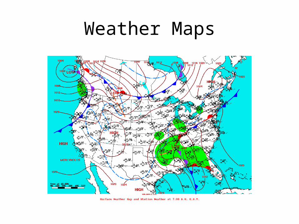
Weather Maps
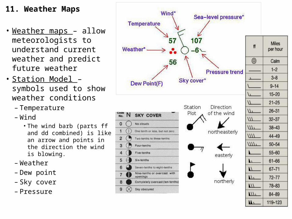
11. Weather Maps
• Weather maps – allow meteorologists to understand current weather and predict future weather
• Station Model – symbols used to show weather conditions– Temperature– Wind
• The wind barb (parts ff and dd combined) is like an arrow and points in the direction the wind is blowing.
– Weather– Dew point– Sky cover– Pressure
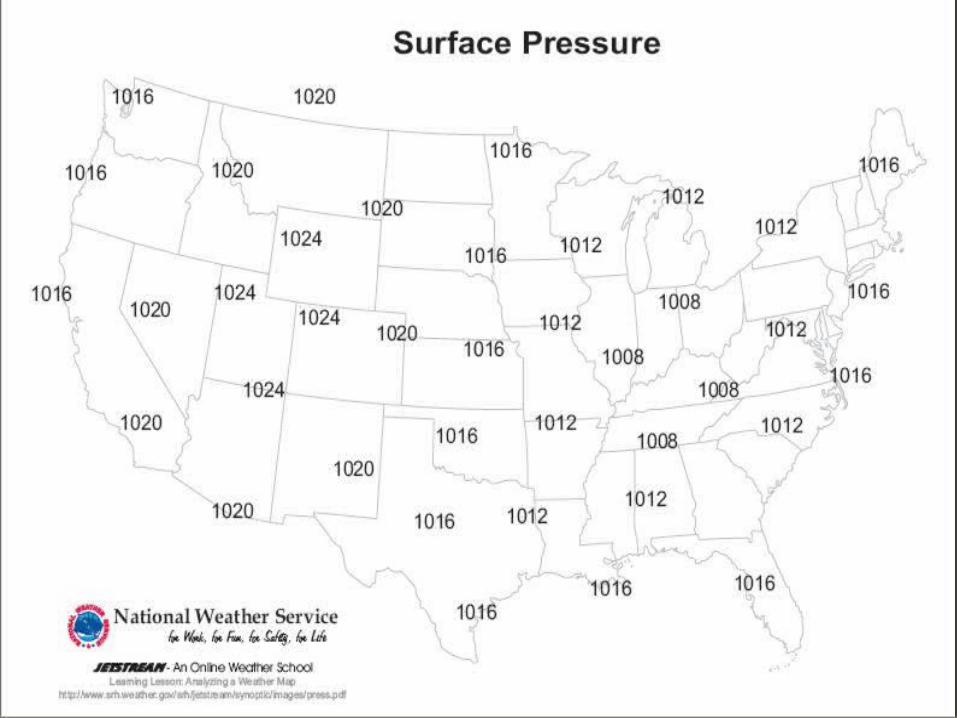
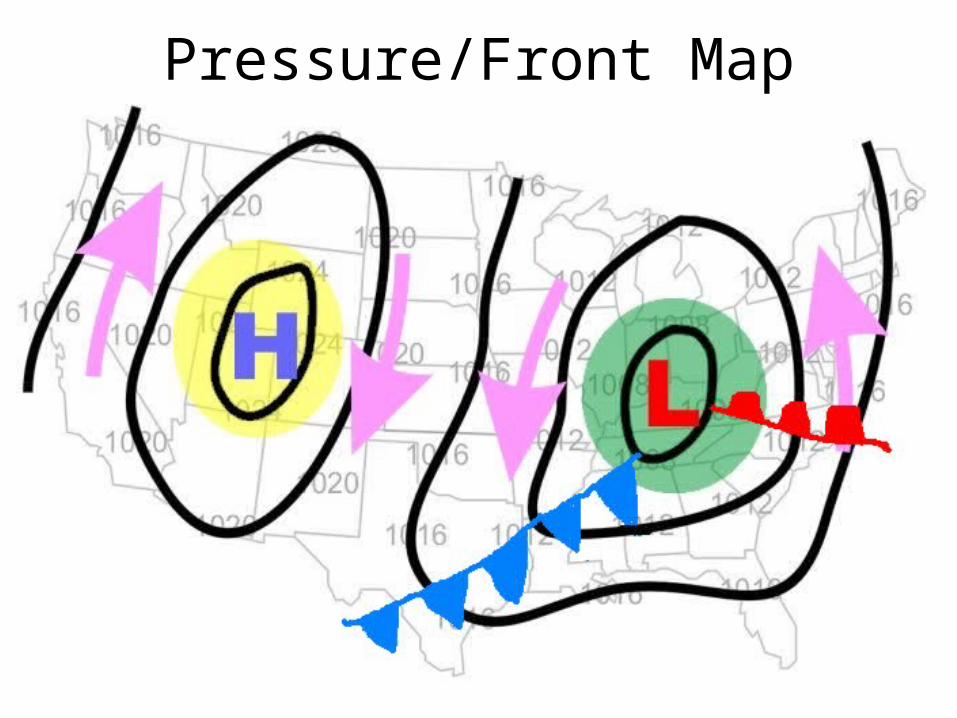
Pressure/Front Map
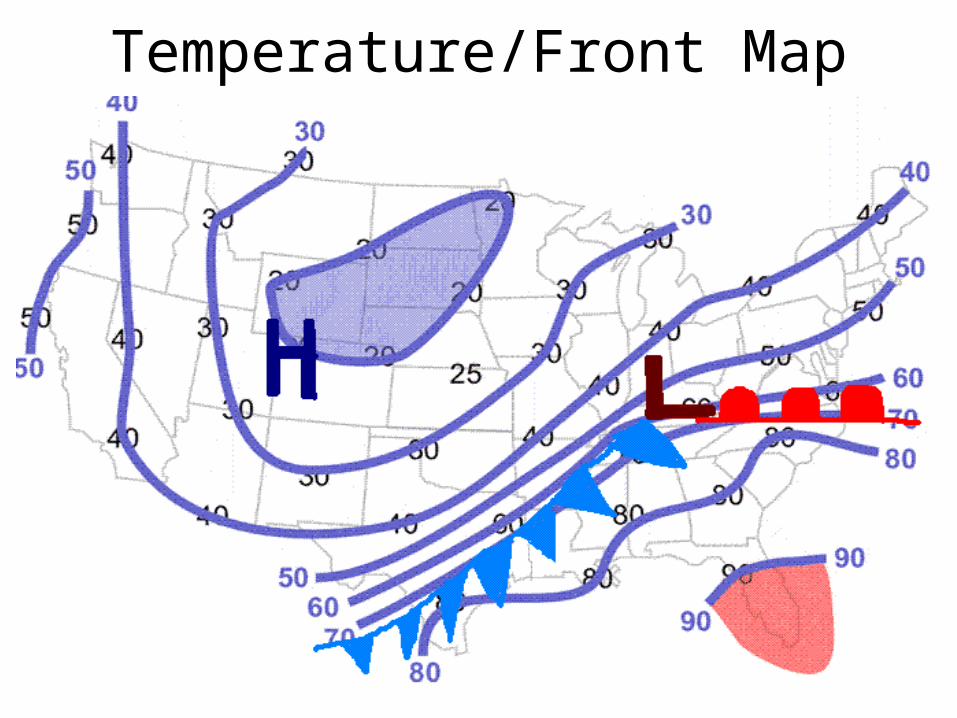
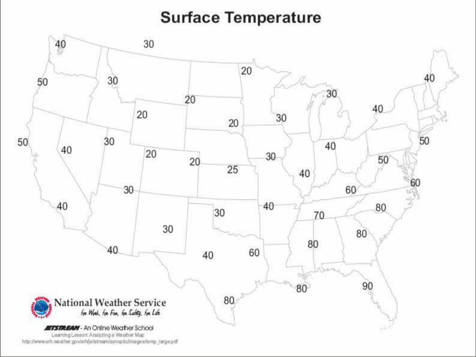
Temperature/Front Map