aquifer mapping in ontario: what we know (and what we … · ontario geological survey presentation...
TRANSCRIPT
Ontario Geological SurveyOntario Geological Survey
Aquifer Mapping in Ontario: What We Know (and What We
Don’t)Ontario Geological Survey
Ministry of Northern Development and Mines
Aquifer Mapping in Ontario: Aquifer Mapping in Ontario: What We Know (and What We What We Know (and What We
DonDon’’t)t)Ontario Geological SurveyOntario Geological Survey
Ministry of Northern Development and MinesMinistry of Northern Development and Mines
A.D. Latornell ConferenceNovember 2008
A.D. A.D. LatornellLatornell ConferenceConferenceNovember 2008November 2008
Ontario Geological SurveyOntario Geological Survey
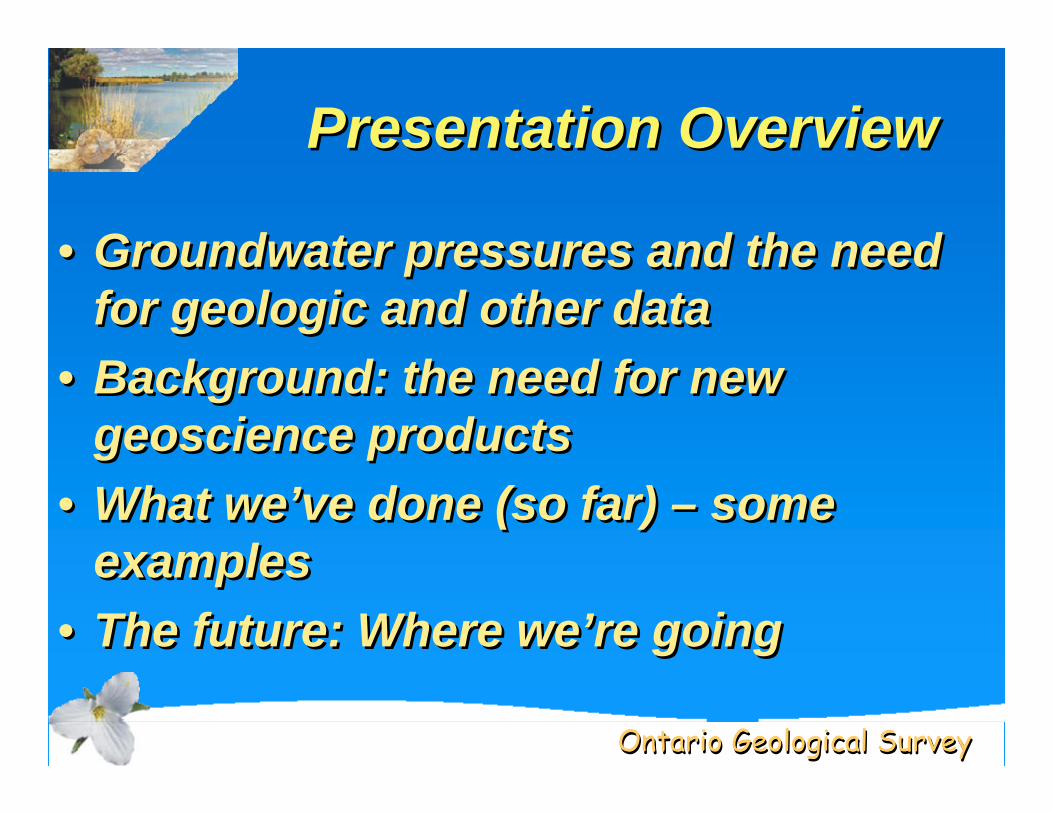
Presentation OverviewPresentation Overview
• Groundwater pressures and the need for geologic and other data
• Background: the need for new geoscience products
• What we’ve done (so far) – some examples
• The future: Where we’re going
• Groundwater pressures and the need for geologic and other data
• Background: the need for new geoscience products
• What we’ve done (so far) – some examples
• The future: Where we’re going

Ontario Geological SurveyOntario Geological Survey
Groundwater PressuresGroundwater Pressures
• Population growth and demands on existing sources
• Growing business/industry water needs• Need to locate new sources• Quality issues (human and natural)• Climate change and impacts on groundwater
• Need for data and information to understand and manage the resource
• Population growth and demands on existing sources
• Growing business/industry water needs• Need to locate new sources• Quality issues (human and natural)• Climate change and impacts on groundwater
• Need for data and information to understand and manage the resource
Ontario Geological SurveyOntario Geological Survey
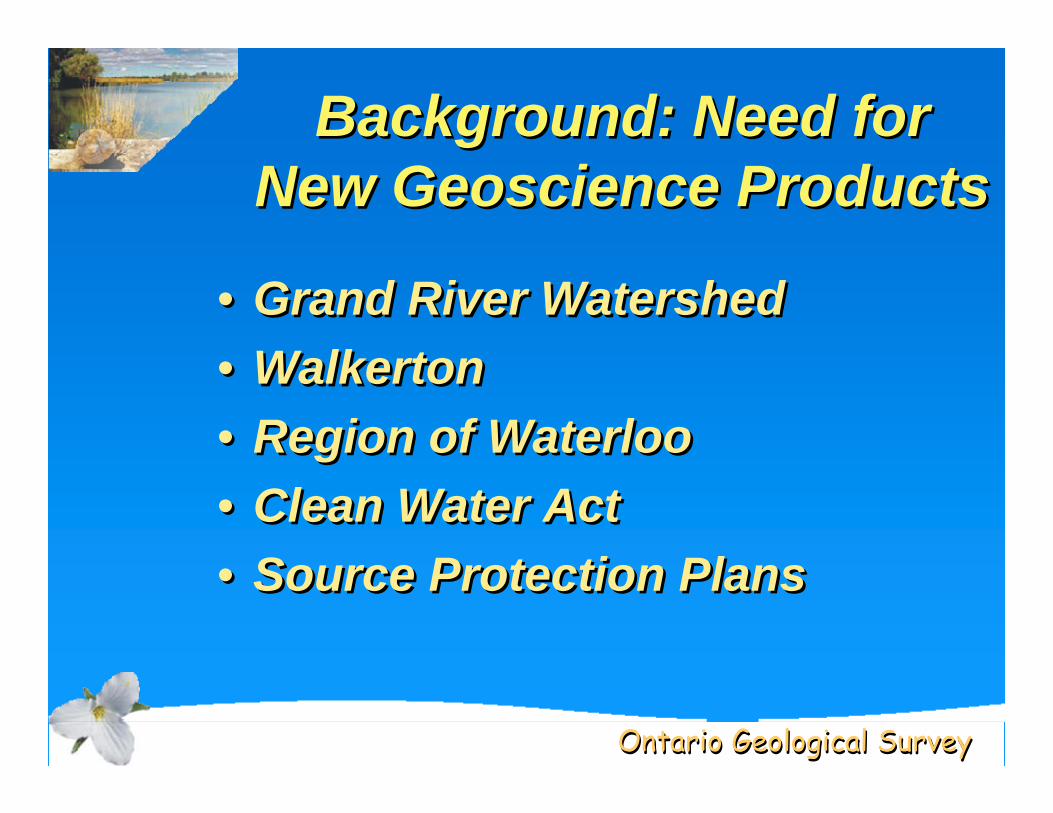
Background: Need for New Geoscience Products
Background: Need for New Geoscience Products
• Grand River Watershed• Walkerton • Region of Waterloo• Clean Water Act• Source Protection Plans
• Grand River Watershed• Walkerton • Region of Waterloo• Clean Water Act• Source Protection Plans
Ontario Geological SurveyOntario Geological Survey
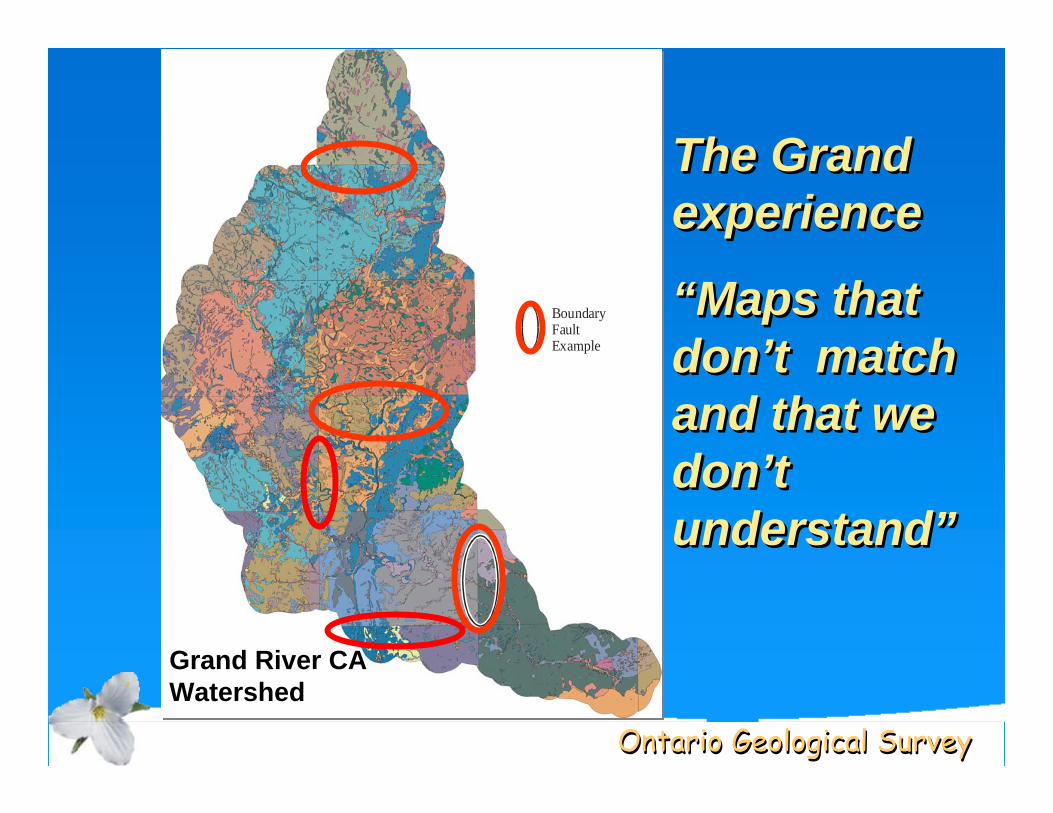
BoundaryFaultExample
BoundaryFaultExample
The Grand experience
“Maps that don’t match and that we don’t understand”
The Grand The Grand experienceexperience
““Maps that Maps that dondon’’t match t match and that we and that we dondon’’t t understandunderstand””
Grand River CA Watershed
Ontario Geological SurveyOntario Geological Survey
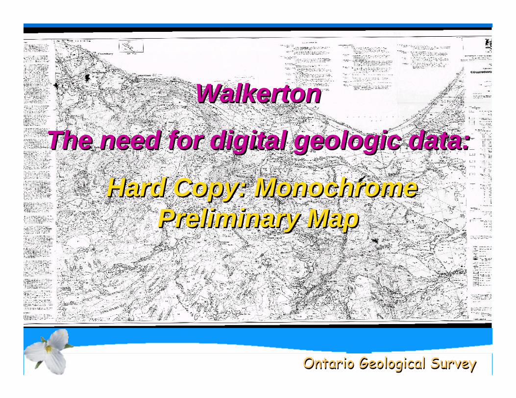
Walkerton
The need for digital geologic data:
Hard Copy: Monochrome Preliminary Map
WalkertonWalkerton
The need for digital geologic data:The need for digital geologic data:
Hard Copy: Monochrome Hard Copy: Monochrome Preliminary MapPreliminary Map
Ontario Geological SurveyOntario Geological Survey
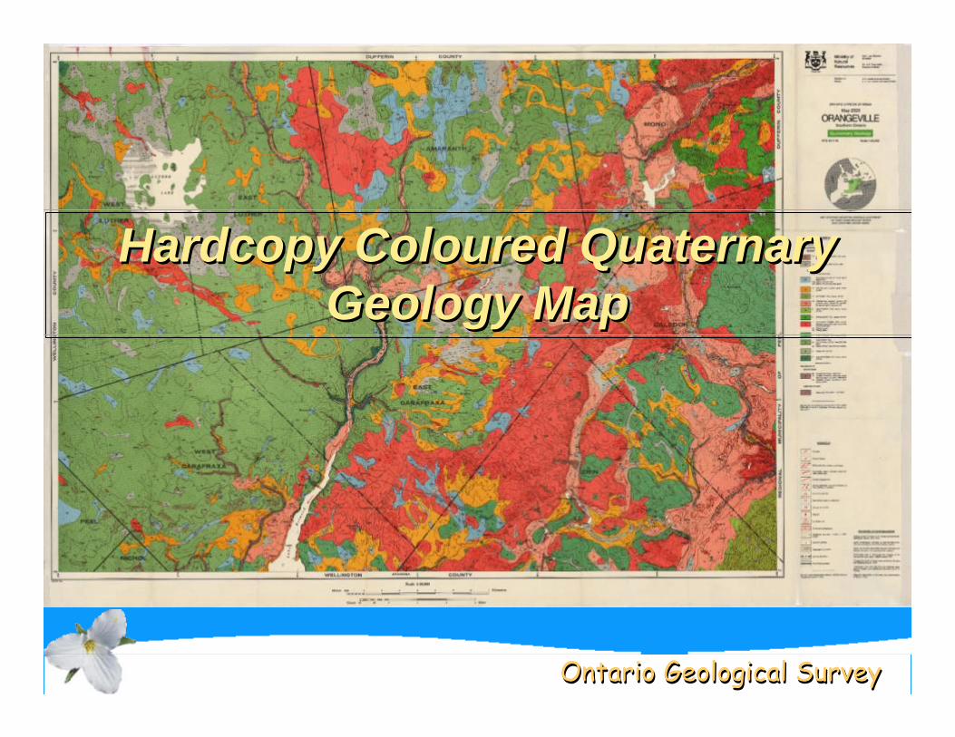
Hardcopy Coloured Quaternary Geology Map
Hardcopy Hardcopy ColouredColoured Quaternary Quaternary Geology MapGeology Map
Ontario Geological SurveyOntario Geological Survey
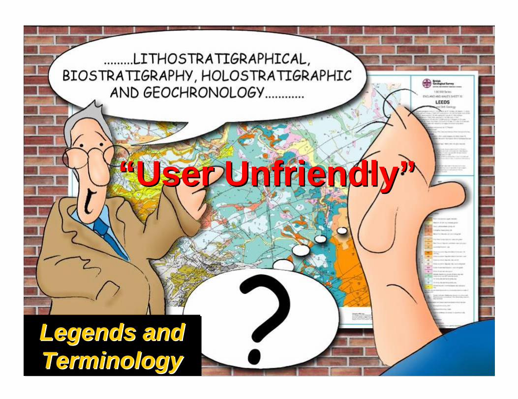
Legends and TerminologyLegends and Legends and TerminologyTerminology
“User Unfriendly”“User Unfriendly”
Ontario Geological SurveyOntario Geological Survey
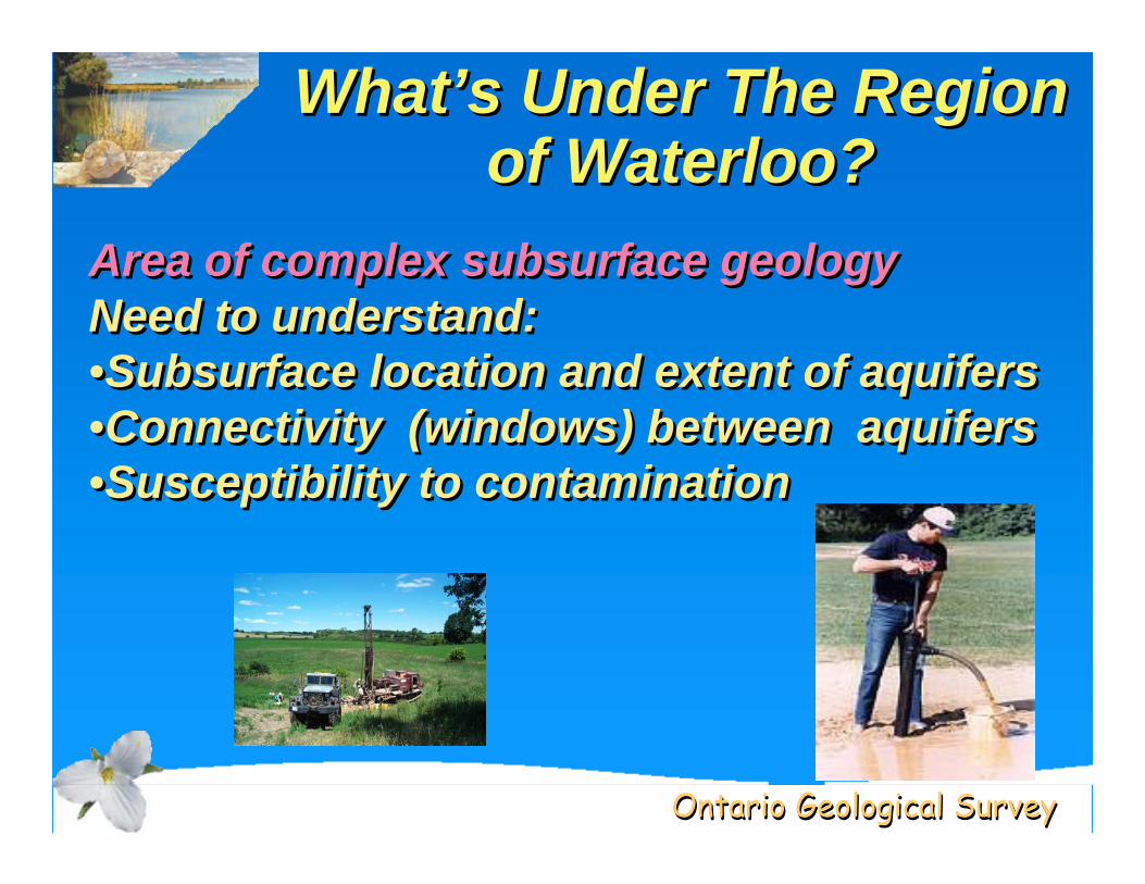
What’s Under The Region of Waterloo?
WhatWhat’’s Under The Region s Under The Region of Waterloo?of Waterloo?
Area of complex subsurface geologyNeed to understand:•Subsurface location and extent of aquifers•Connectivity (windows) between aquifers•Susceptibility to contamination
Area of complex subsurface geologyNeed to understand:•Subsurface location and extent of aquifers•Connectivity (windows) between aquifers•Susceptibility to contamination
Ontario Geological SurveyOntario Geological Survey
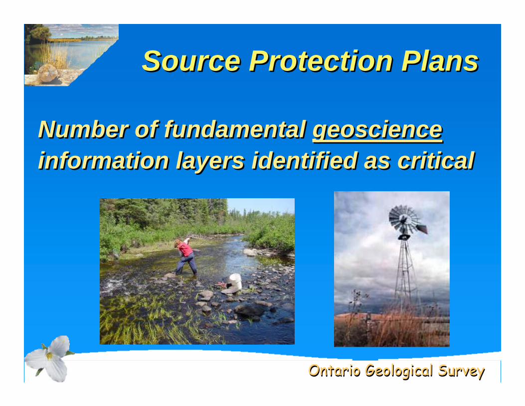
Source Protection PlansSource Protection PlansSource Protection Plans
Number of fundamental geoscienceinformation layers identified as criticalNumber of fundamental geoscienceinformation layers identified as critical
Ontario Geological SurveyOntario Geological Survey
A Big Challenge: New Ideas Needed
A Big Challenge: New Ideas Needed
Ontario Geological SurveyOntario Geological Survey
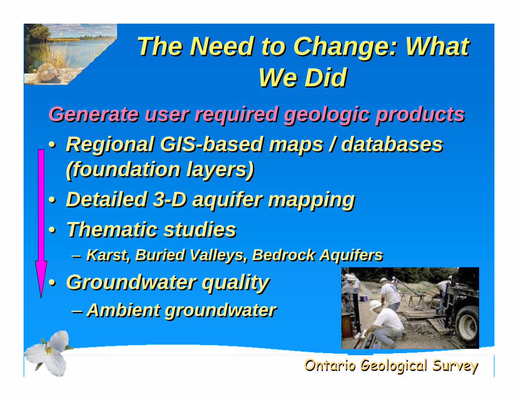
The Need to Change: What We Did
The Need to Change: What The Need to Change: What We DidWe Did
Generate user required geologic products• Regional GIS-based maps / databases
(foundation layers)• Detailed 3-D aquifer mapping• Thematic studies
– Karst, Buried Valleys, Bedrock Aquifers
• Groundwater quality– Ambient groundwater
Generate user required geologic products• Regional GIS-based maps / databases
(foundation layers)• Detailed 3-D aquifer mapping• Thematic studies
– Karst, Buried Valleys, Bedrock Aquifers
• Groundwater quality– Ambient groundwater

Ontario Geological SurveyOntario Geological Survey
Foundation LayersFoundation Layers
Bedrock
Surficial
Ontario Geological SurveyOntario Geological Survey
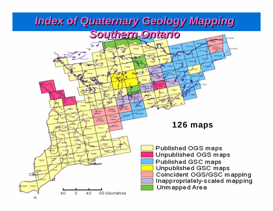
Index of Quaternary Geology Mapping Southern Ontario
Index of Quaternary Geology Mapping Index of Quaternary Geology Mapping Southern OntarioSouthern Ontario
126 maps
Ontario Geological SurveyOntario Geological Survey
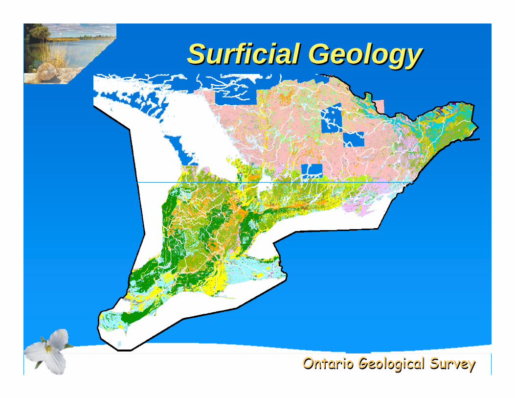
Surficial GeologySurficial GeologySurficial Geology

Ontario Geological SurveyOntario Geological Survey
MaterialPaleozoic Bedrock
clay
diamicton
fill
gravel
organic deposits
sand
silt
Derivative MapsDerivative MapsDerivative Maps
Primary MaterialPrimary Material
PermeabilityHigh
Low-Medium
Low
Variable
Relative PermeabilityRelative Permeability
SymbologySymbology
Ontario Geological SurveyOntario Geological Survey
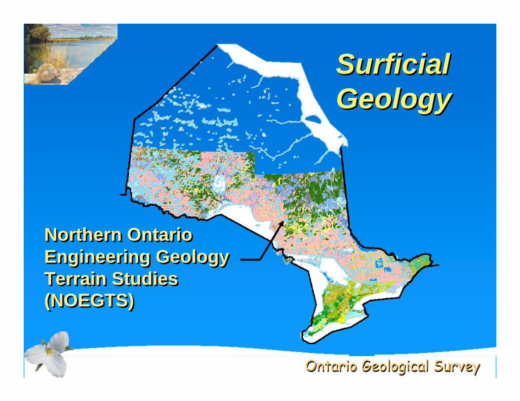
SurficialGeologySurficialSurficialGeologyGeology
Northern Ontario Engineering Geology Terrain Studies (NOEGTS)
Northern Ontario Engineering Geology Terrain Studies (NOEGTS)
Ontario Geological SurveyOntario Geological Survey
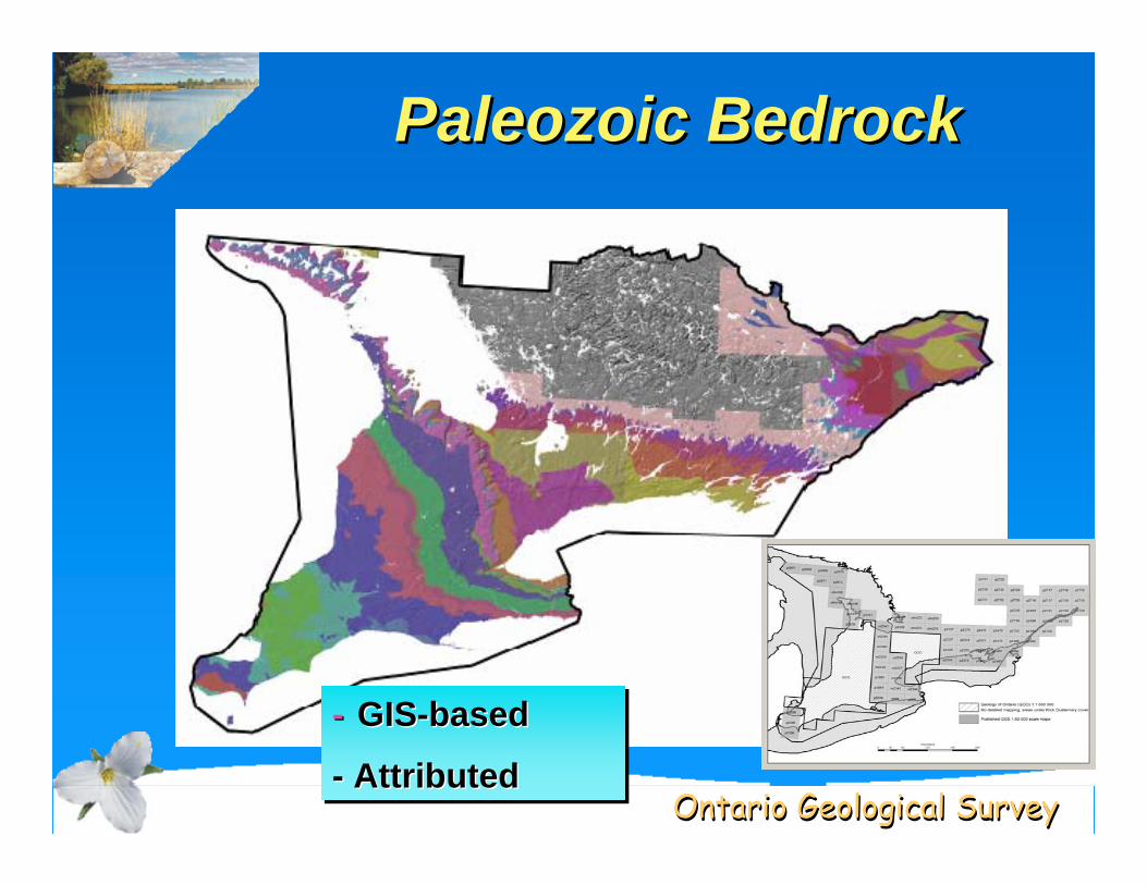
Paleozoic BedrockPaleozoic BedrockPaleozoic Bedrock
- GIS-based
- Attributed
-- GISGIS--basedbased
-- AttributedAttributed
Ontario Geological SurveyOntario Geological Survey
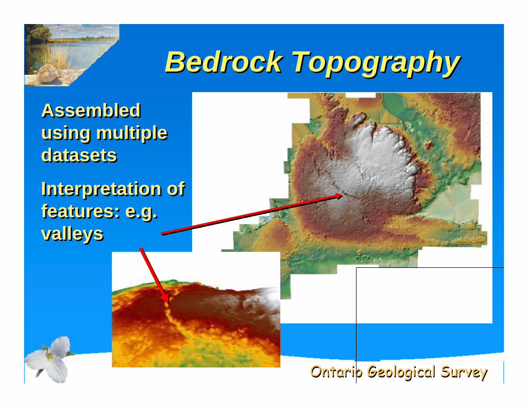
Bedrock TopographyBedrock TopographyBedrock TopographyAssembled using multiple datasets
Interpretation of features: e.g. valleys
Assembled using multiple datasets
Interpretation of features: e.g. valleys

Ontario Geological SurveyOntario Geological Survey
Drift ThicknessDrift ThicknessDrift Thickness
• Complements bedrock topolayer
• Multiple data sources
• Thick drift: potential aquifers
• Complements bedrock topolayer
• Multiple data sources
• Thick drift: potential aquifers
Thick
Thin
Ontario Geological SurveyOntario Geological Survey
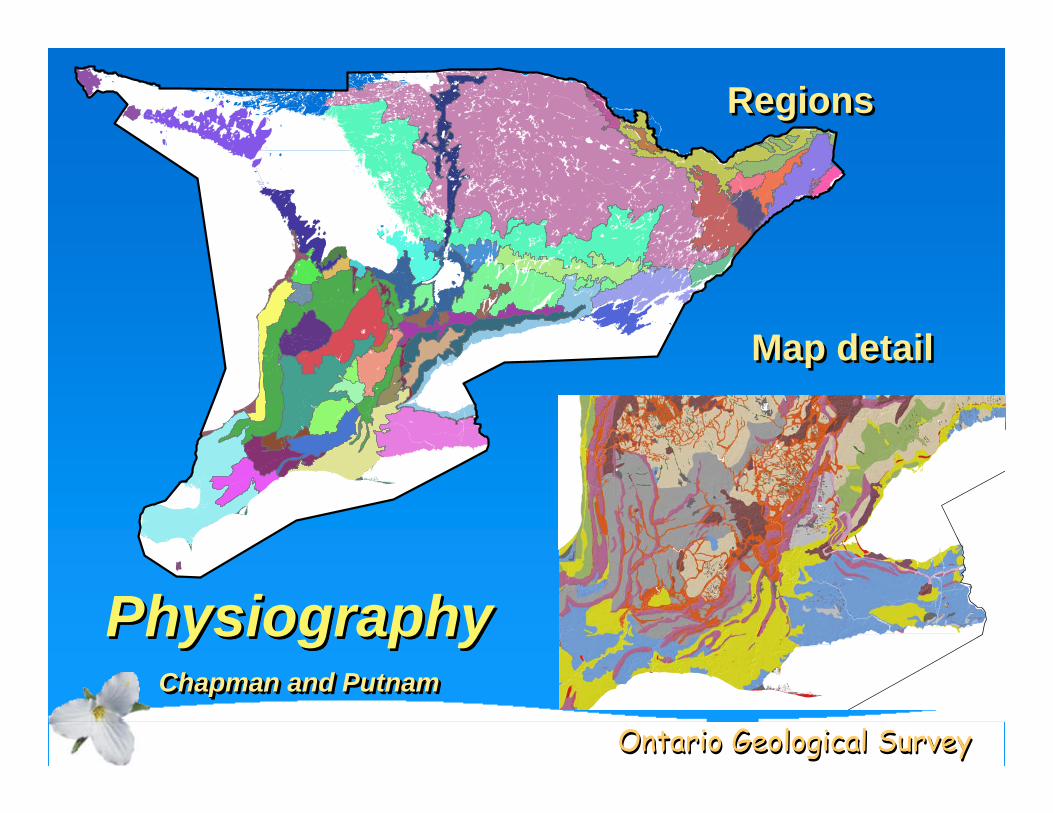
PhysiographyChapman and Putnam
PhysiographyPhysiographyChapman and PutnamChapman and Putnam
RegionsRegions
Map detailMap detail
Ontario Geological SurveyOntario Geological Survey
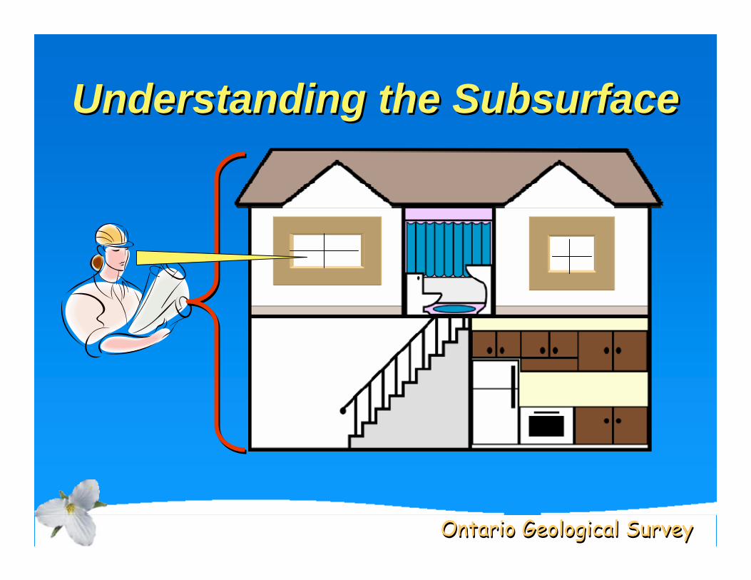
Understanding the SubsurfaceUnderstanding the Subsurface
Ontario Geological SurveyOntario Geological Survey
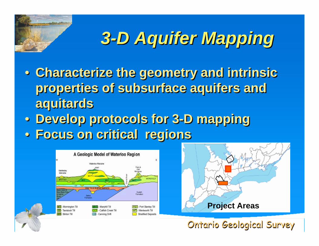
3-D Aquifer Mapping33--D Aquifer MappingD Aquifer Mapping
• Characterize the geometry and intrinsic properties of subsurface aquifers and aquitards
• Develop protocols for 3-D mapping• Focus on critical regions
• Characterize the geometry and intrinsic properties of subsurface aquifers and aquitards
• Develop protocols for 3-D mapping• Focus on critical regions
Project Areas
Ontario Geological SurveyOntario Geological Survey
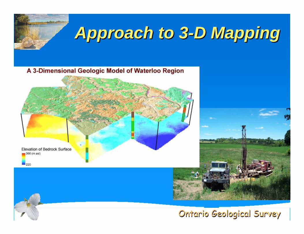
Approach to 3-D MappingApproach to 3Approach to 3--D MappingD Mapping

Ontario Geological SurveyOntario Geological Survey
Source Count %BAJC 1,036 5%KARROW 3,747 16%MOE 12,529 55%RMOW 1,575 7%WAGAIS 4,065 18%
22,952 100%
Assemble Subsurface DatasetsAssemble Subsurface DatasetsAssemble Subsurface Datasets
Ontario Geological SurveyOntario Geological Survey
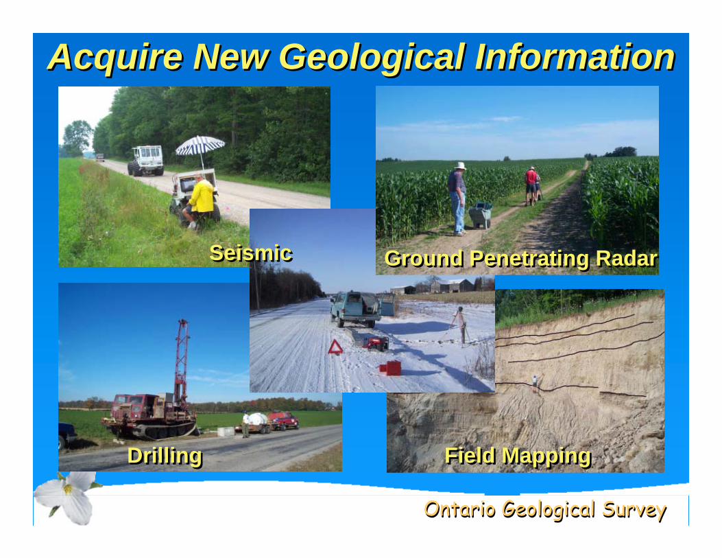
Acquire New Geological InformationAcquire New Geological InformationAcquire New Geological Information
SeismicSeismic Ground Penetrating RadarGround Penetrating Radar
DrillingDrilling Field MappingField Mapping
Ontario Geological SurveyOntario Geological Survey
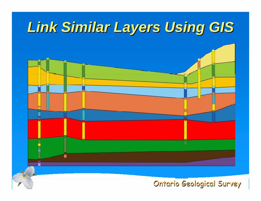
Link Similar Layers Using GISLink Similar Layers Using GIS
Ontario Geological SurveyOntario Geological Survey
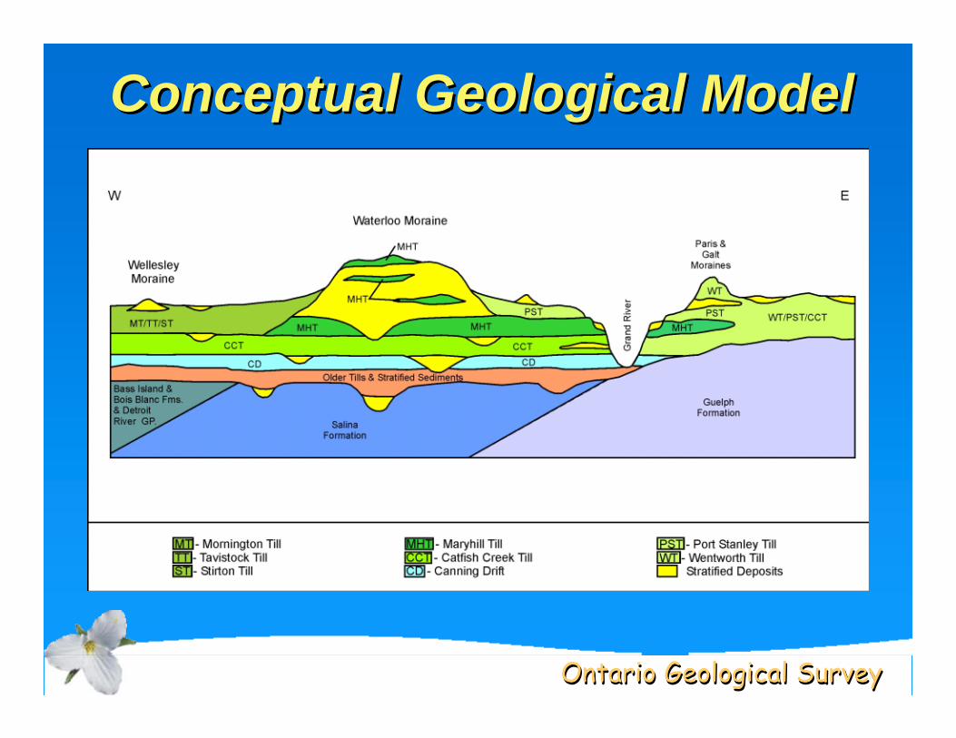
Conceptual Geological ModelConceptual Geological ModelConceptual Geological Model
Ontario Geological SurveyOntario Geological Survey
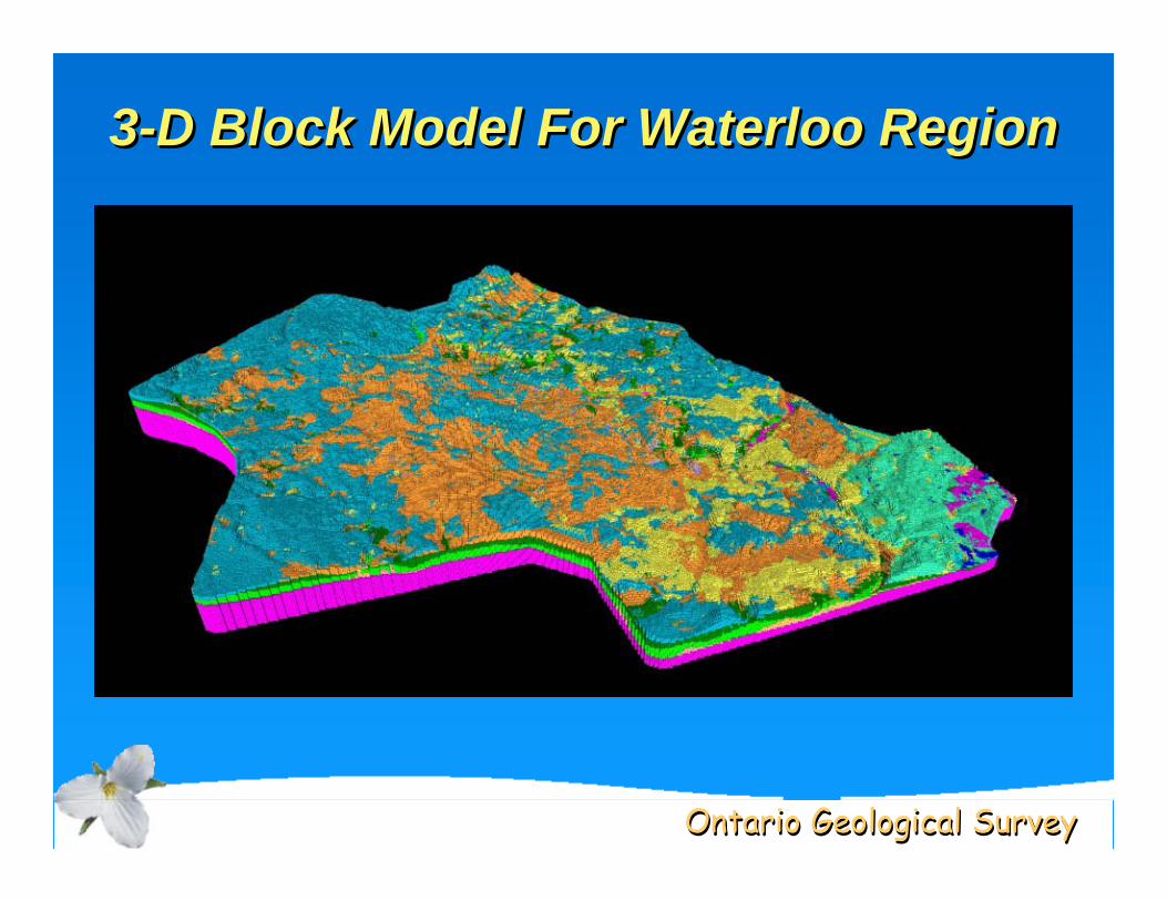
3-D Block Model For Waterloo Region33--D Block Model For Waterloo RegionD Block Model For Waterloo Region
Ontario Geological SurveyOntario Geological Survey
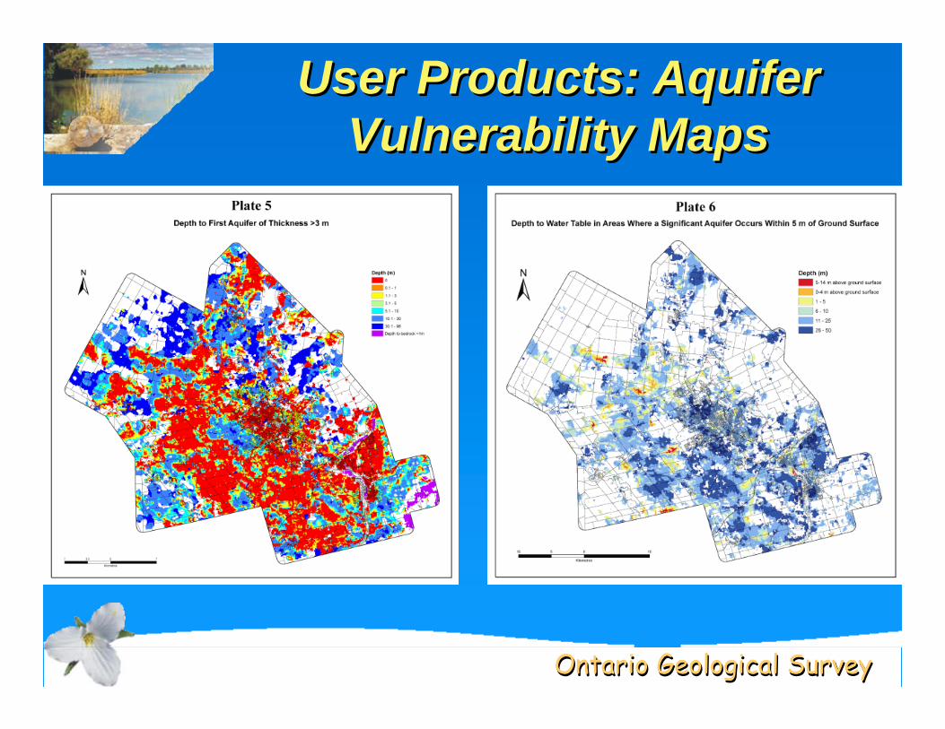
User Products: Aquifer Vulnerability Maps
User Products: Aquifer User Products: Aquifer Vulnerability MapsVulnerability Maps
Ontario Geological SurveyOntario Geological Survey
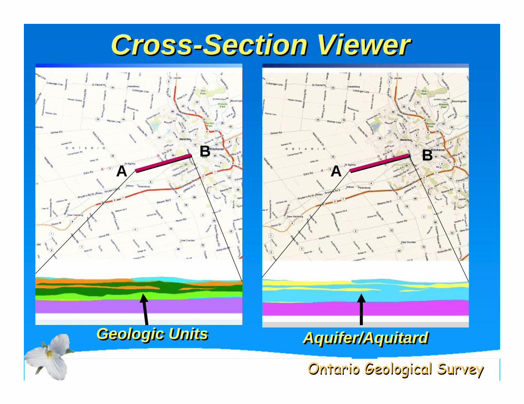
Cross-Section ViewerCrossCross--Section ViewerSection Viewer
AB
Geologic UnitsGeologic Units Aquifer/AquitardAquifer/Aquitard
AB
Ontario Geological SurveyOntario Geological Survey
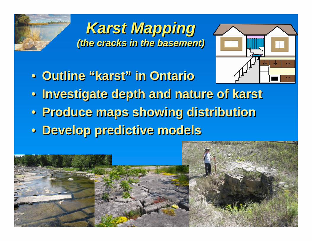
Karst Mapping(the cracks in the basement)
Karst MappingKarst Mapping(the cracks in the basement)(the cracks in the basement)
• Outline “karst” in Ontario• Investigate depth and nature of karst• Produce maps showing distribution• Develop predictive models
• Outline “karst” in Ontario• Investigate depth and nature of karst• Produce maps showing distribution• Develop predictive models
Ontario Geological SurveyOntario Geological Survey
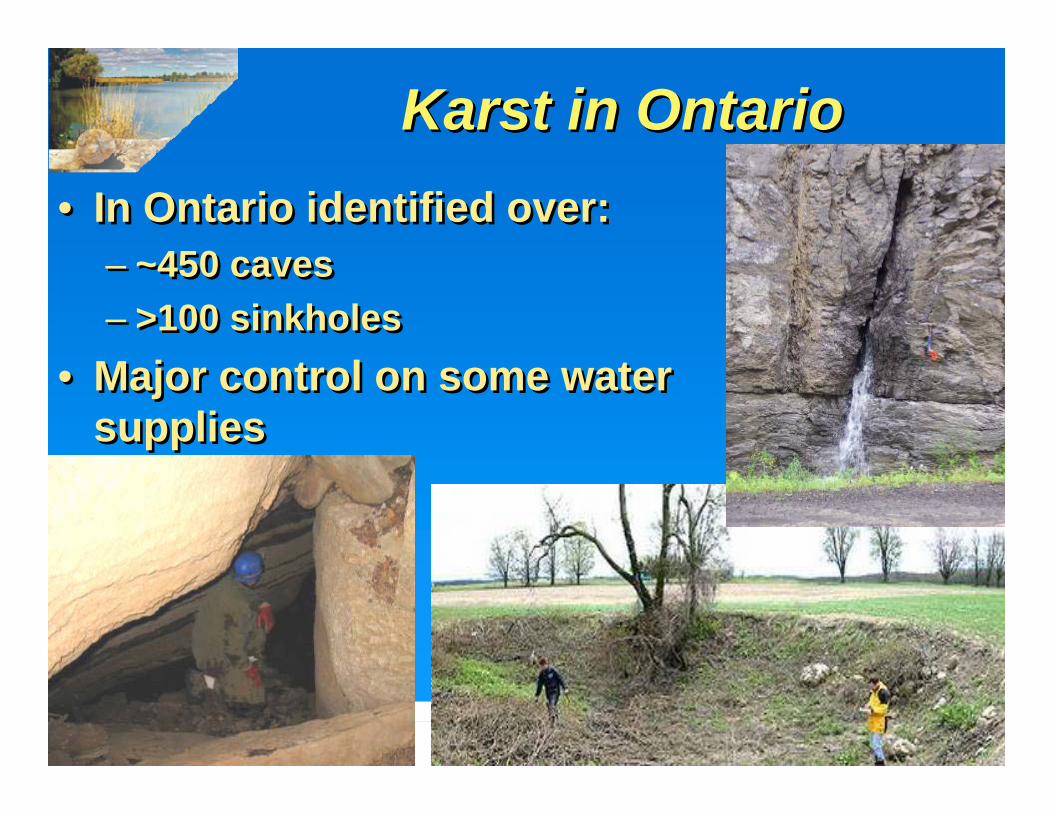
Karst in OntarioKarstKarst in Ontarioin Ontario• In Ontario identified over:
– ~450 caves– >100 sinkholes
• Major control on some water supplies
• In Ontario identified over:– ~450 caves– >100 sinkholes
• Major control on some water supplies
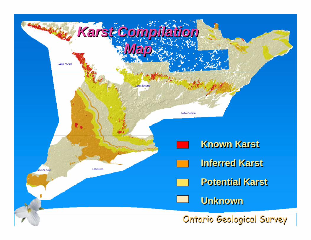
Ontario Geological SurveyOntario Geological Survey
Known KarstKnown Known KarstKarst
Inferred KarstInferred Karst
Potential KarstPotential Karst
UnknownUnknown
Karst Compilation Map
KarstKarst Compilation Compilation MapMap
Ontario Geological SurveyOntario Geological Survey
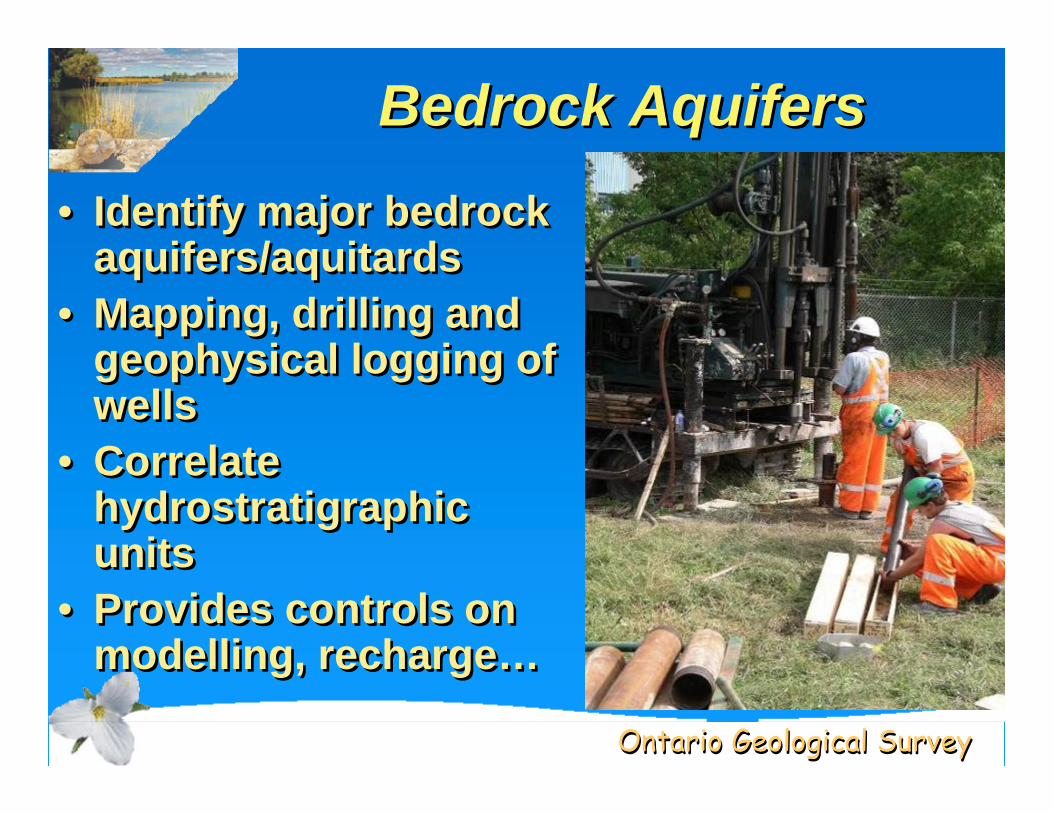
Bedrock AquifersBedrock AquifersBedrock Aquifers
• Identify major bedrock aquifers/aquitards
• Mapping, drilling and geophysical logging of wells
• Correlate hydrostratigraphicunits
• Provides controls on modelling, recharge…
• Identify major bedrock aquifers/aquitards
• Mapping, drilling and geophysical logging of wells
• Correlate hydrostratigraphicunits
• Provides controls on modelling, recharge…
Ontario Geological SurveyOntario Geological Survey
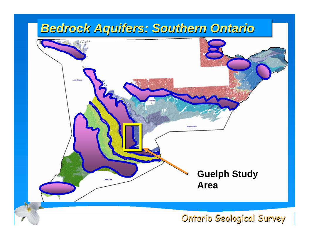
Bedrock Aquifers: Southern OntarioBedrock Aquifers: Southern OntarioBedrock Aquifers: Southern Ontario
Guelph Study Area
Ontario Geological SurveyOntario Geological Survey
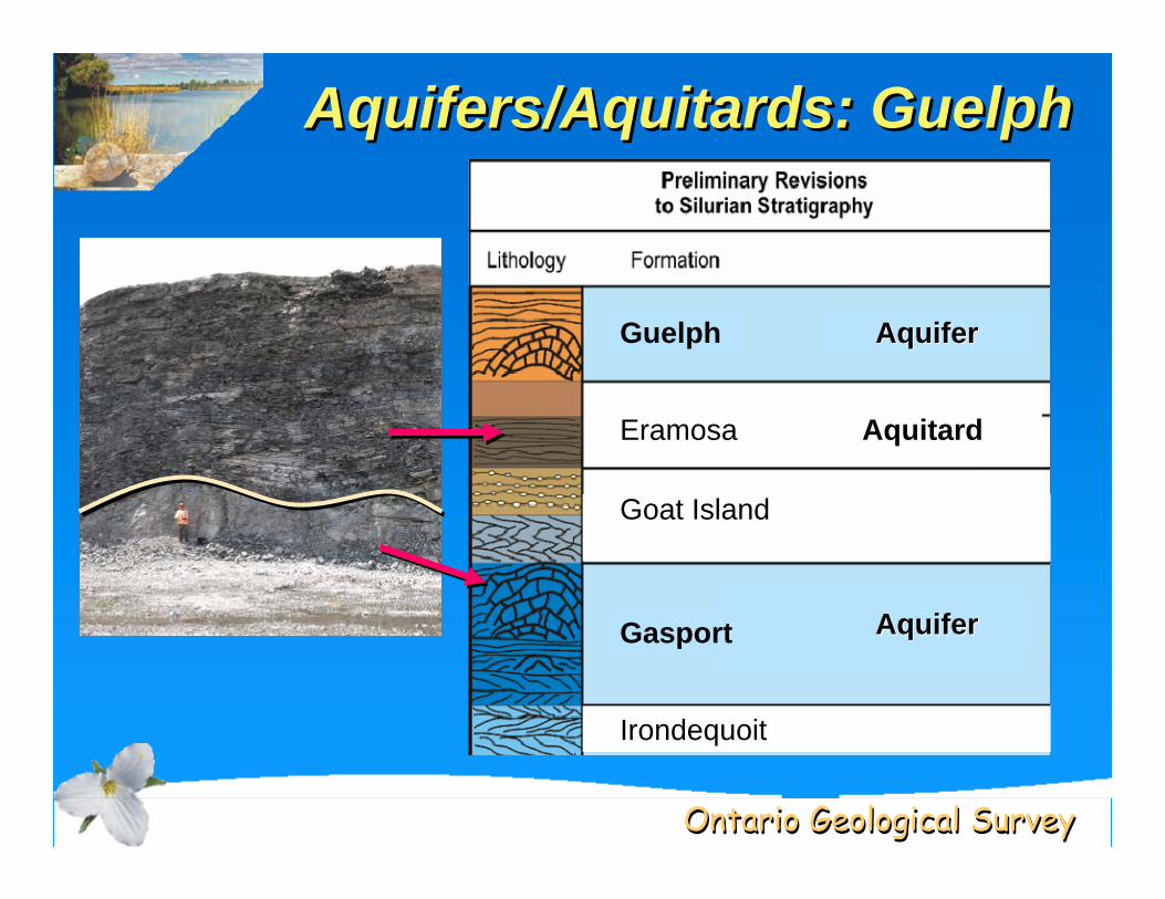
Aquifers/Aquitards: GuelphAquifers/Aquifers/AquitardsAquitards: Guelph: Guelph
AquiferAquifer
Aquitard
AquiferAquifer
Guelph
Irondequoit
Gasport
Eramosa
Goat Island
Ontario Geological SurveyOntario Geological Survey
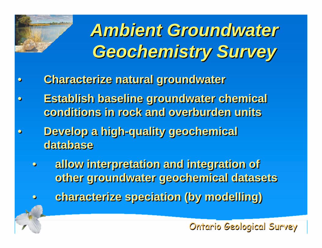
Ambient Groundwater Geochemistry SurveyAmbient Groundwater Ambient Groundwater Geochemistry SurveyGeochemistry Survey
• Characterize natural groundwater • Establish baseline groundwater chemical
conditions in rock and overburden units• Develop a high-quality geochemical
database• allow interpretation and integration of
other groundwater geochemical datasets• characterize speciation (by modelling)
• Characterize natural groundwater • Establish baseline groundwater chemical
conditions in rock and overburden units• Develop a high-quality geochemical
database• allow interpretation and integration of
other groundwater geochemical datasets• characterize speciation (by modelling)
Ontario Geological SurveyOntario Geological Survey
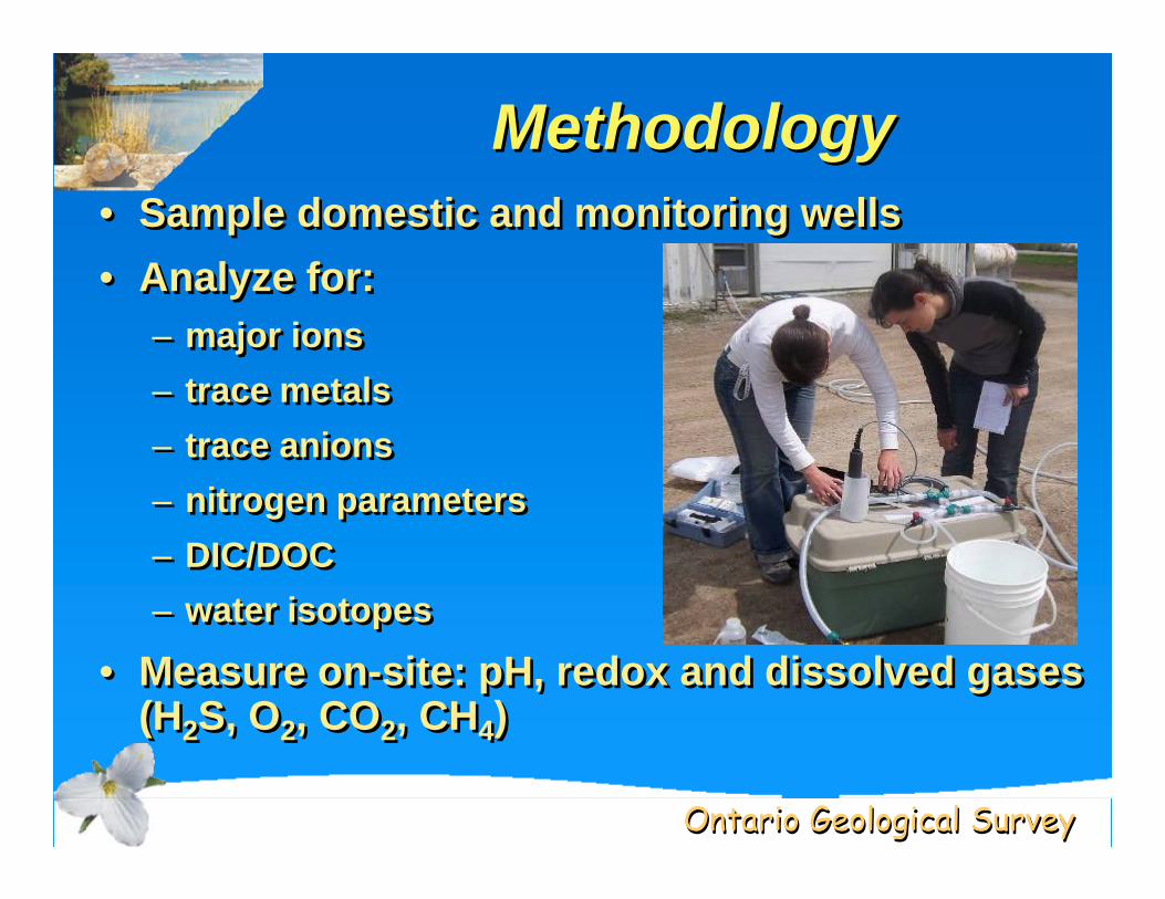
MethodologyMethodologyMethodology• Sample domestic and monitoring wells• Analyze for:
– major ions– trace metals– trace anions– nitrogen parameters– DIC/DOC– water isotopes
• Measure on-site: pH, redox and dissolved gases (H2S, O2, CO2, CH4)
• Sample domestic and monitoring wells• Analyze for:
– major ions– trace metals– trace anions– nitrogen parameters– DIC/DOC– water isotopes
• Measure on-site: pH, redox and dissolved gases (H2S, O2, CO2, CH4)
Ontario Geological SurveyOntario Geological Survey
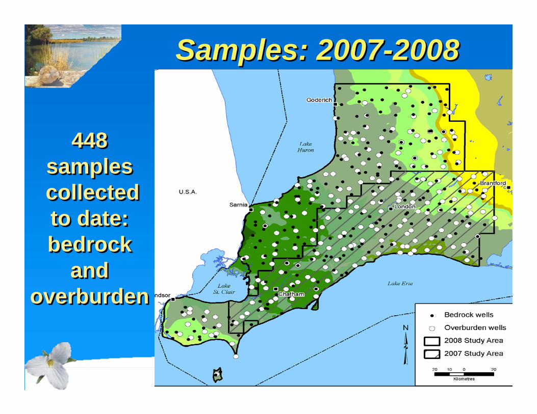
Samples: 2007-2008Samples: 2007Samples: 2007--20082008
448samplescollected to date: bedrock
and overburden
448samplescollected to date: bedrock
and overburden
Ontario Geological SurveyOntario Geological Survey
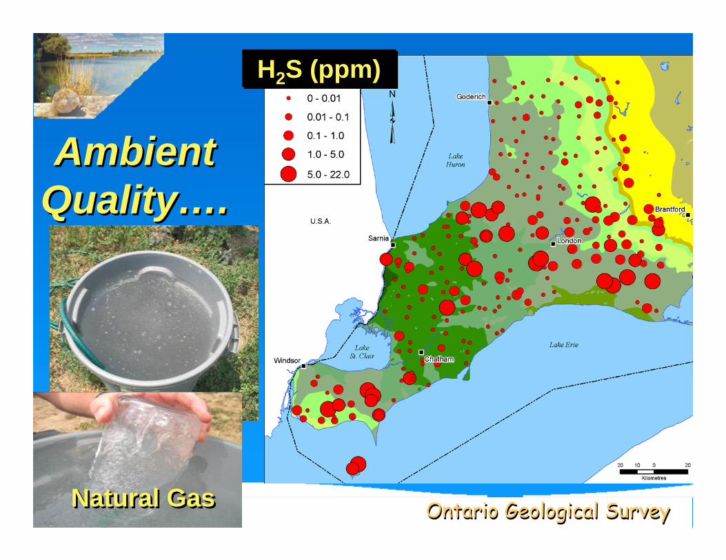
Ambient Quality….Ambient Ambient
QualityQuality……..
H2S (ppm)H2S (ppm)
Natural GasNatural Gas
Ontario Geological SurveyOntario Geological Survey
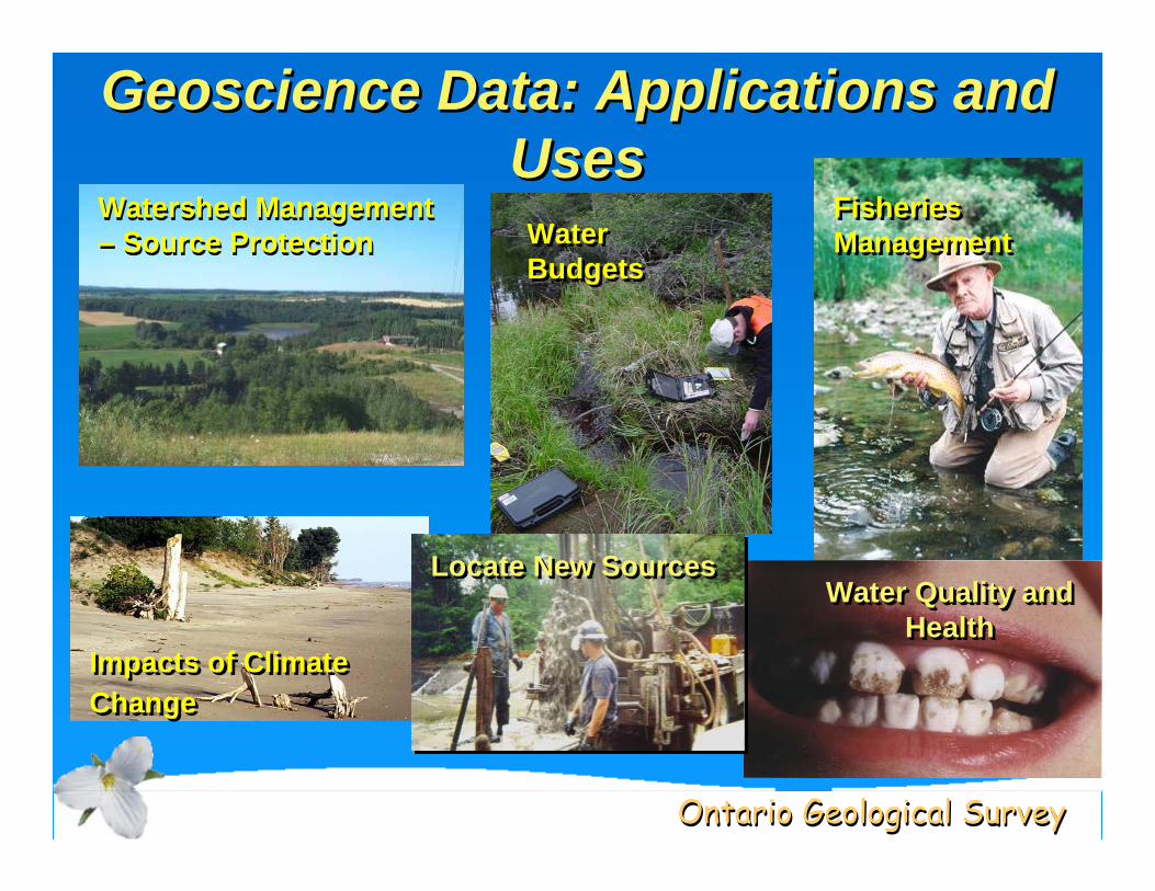
Geoscience Data: Applications and Uses
GeoscienceGeoscience Data: Applications and Data: Applications and UsesUses
Watershed Management – Source ProtectionWatershed Management – Source Protection
Fisheries ManagementFisheries Management
Impacts of Climate ChangeImpacts of Climate Change
Water BudgetsWater Budgets
Water Quality and Health
Water Quality and Water Quality and HealthHealth
Locate New SourcesLocate New Sources

Ontario Geological SurveyOntario Geological Survey
The Future: Lots to Do The Future: Lots to Do The Future: Lots to Do
Aquifer Characterization• 3-D aquifer mapping – overburden and
bedrock• Identify new GW sources: growth areas• Climate change and groundwater
impacts• Karst and groundwater vulnerability
–Land-use planning
Aquifer Characterization• 3-D aquifer mapping – overburden and
bedrock• Identify new GW sources: growth areas• Climate change and groundwater
impacts• Karst and groundwater vulnerability
–Land-use planning
Ontario Geological SurveyOntario Geological Survey
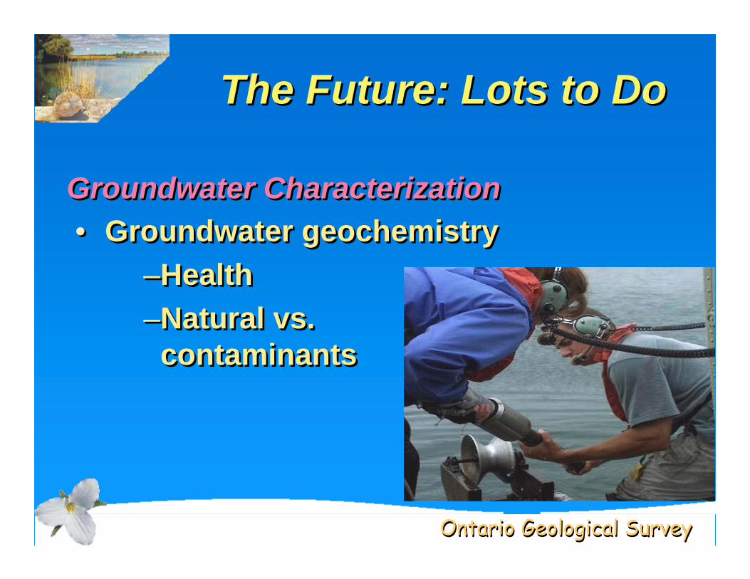
The Future: Lots to DoThe Future: Lots to DoThe Future: Lots to Do
Groundwater Characterization• Groundwater geochemistry
–Health–Natural vs.
contaminants
Groundwater Characterization• Groundwater geochemistry
–Health–Natural vs.
contaminants
Ontario Geological SurveyOntario Geological Survey
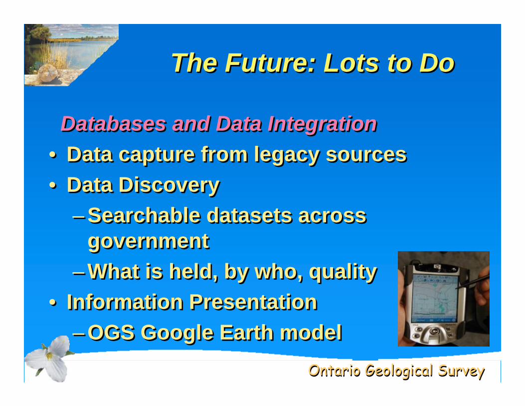
The Future: Lots to DoThe Future: Lots to DoThe Future: Lots to Do
Databases and Data Integration• Data capture from legacy sources• Data Discovery
– Searchable datasets across government
– What is held, by who, quality• Information Presentation
– OGS Google Earth model
Databases and Data Integration• Data capture from legacy sources• Data Discovery
– Searchable datasets across government
– What is held, by who, quality• Information Presentation
– OGS Google Earth model
Ontario Geological SurveyOntario Geological Survey
Digital Datasets
Download from our Geology Ontario website @:
www.mndm.gov.on.ca/mines
Digital DatasetsDigital Datasets
Download from our Download from our Geology Ontario website @:Geology Ontario website @:
www.mndm.gov.on.cawww.mndm.gov.on.ca/mines/mines