application of hec- hms for hydrologic studies texas a&m university department of civil...
Post on 20-Dec-2015
213 views
TRANSCRIPT

Application of HEC-Application of HEC-HMS for Hydrologic HMS for Hydrologic
StudiesStudiesTexas A&M UniversityTexas A&M University
Department of Civil EngineeringDepartment of Civil EngineeringCVEN689 – Applications of GIS in CECVEN689 – Applications of GIS in CE
Instructor: Dr. Francisco OliveraInstructor: Dr. Francisco OliveraLogan BurtonLogan Burton
3/14/033/14/03
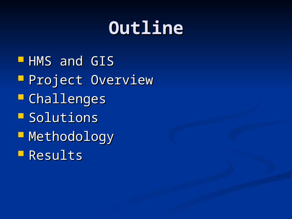
OutlineOutline
HMS and GISHMS and GIS Project OverviewProject Overview ChallengesChallenges SolutionsSolutions MethodologyMethodology ResultsResults
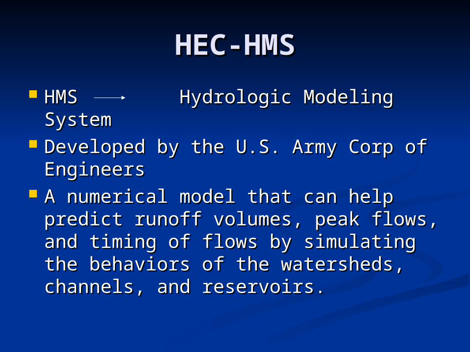
HEC-HMSHEC-HMS
HMS Hydrologic Modeling HMS Hydrologic Modeling SystemSystem
Developed by the U.S. Army Corp of Developed by the U.S. Army Corp of EngineersEngineers
A numerical model that can help A numerical model that can help predict runoff volumes, peak flows, predict runoff volumes, peak flows, and timing of flows by simulating the and timing of flows by simulating the behaviors of the watersheds, behaviors of the watersheds, channels, and reservoirs.channels, and reservoirs.
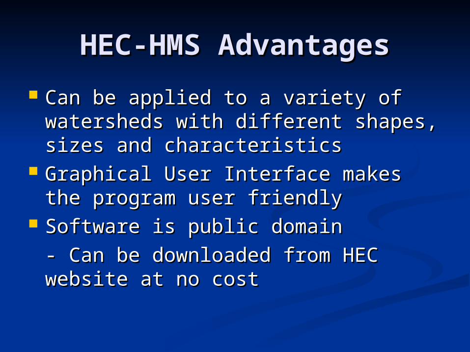
HEC-HMS AdvantagesHEC-HMS Advantages
Can be applied to a variety of Can be applied to a variety of watersheds with different shapes, watersheds with different shapes, sizes and characteristicssizes and characteristics
Graphical User Interface makes the Graphical User Interface makes the program user friendlyprogram user friendly
Software is public domainSoftware is public domain
- Can be downloaded from HEC - Can be downloaded from HEC website at no costwebsite at no cost
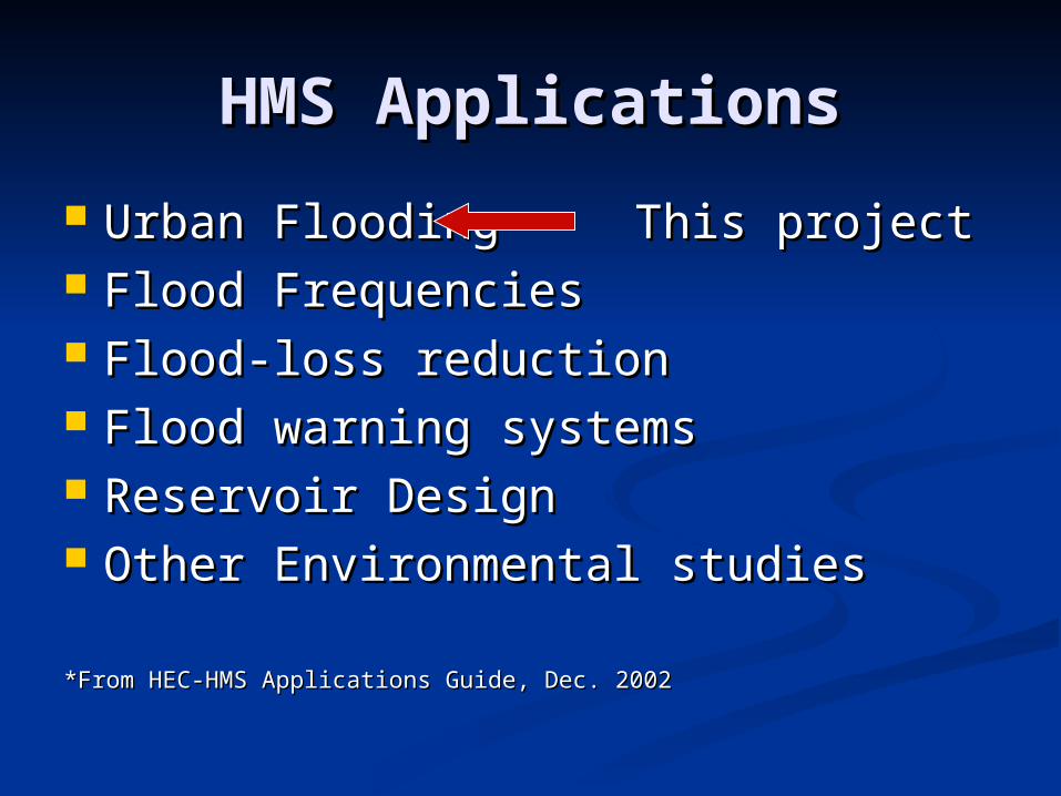
HMS ApplicationsHMS Applications
Urban FloodingUrban Flooding This projectThis project Flood FrequenciesFlood Frequencies Flood-loss reductionFlood-loss reduction Flood warning systemsFlood warning systems Reservoir DesignReservoir Design Other Environmental studiesOther Environmental studies
*From HEC-HMS Applications Guide, Dec. 2002*From HEC-HMS Applications Guide, Dec. 2002
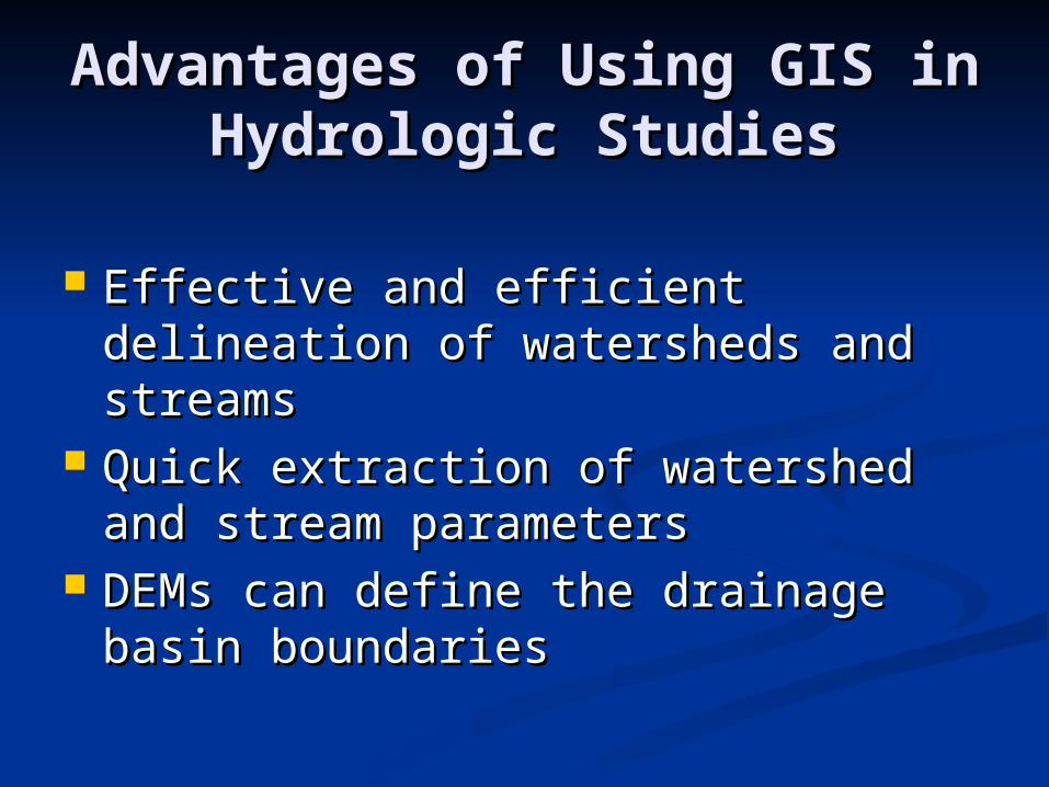
Advantages of Using GIS in Advantages of Using GIS in Hydrologic StudiesHydrologic Studies
Effective and efficient delineation of Effective and efficient delineation of watersheds and streamswatersheds and streams
Quick extraction of watershed and Quick extraction of watershed and stream parametersstream parameters
DEMs can define the drainage basin DEMs can define the drainage basin boundariesboundaries
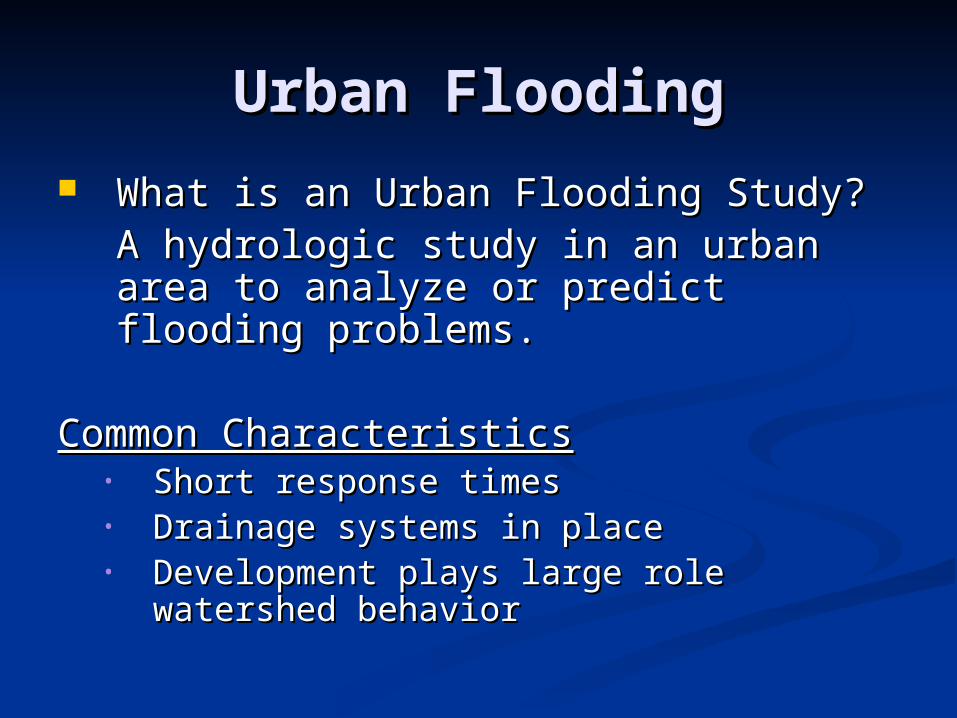
Urban FloodingUrban Flooding
What is an Urban Flooding Study?What is an Urban Flooding Study?A hydrologic study in an urban area A hydrologic study in an urban area to analyze or predict flooding to analyze or predict flooding problems. problems.
Common CharacteristicsCommon Characteristics• Short response timesShort response times• Drainage systems in placeDrainage systems in place• Development plays large role watershed Development plays large role watershed
behaviorbehavior
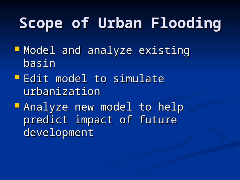
Scope of Urban FloodingScope of Urban Flooding
Model and analyze existing basinModel and analyze existing basin Edit model to simulate urbanizationEdit model to simulate urbanization Analyze new model to help predict Analyze new model to help predict
impact of future developmentimpact of future development
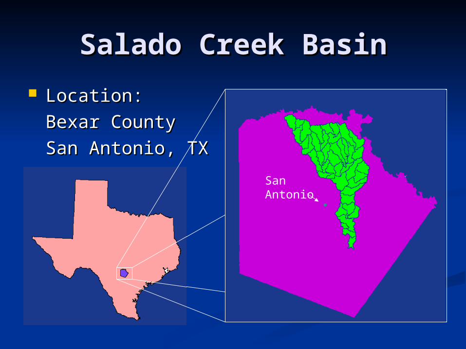
Salado Creek BasinSalado Creek Basin
Location: Location:
Bexar CountyBexar County
San Antonio, TXSan Antonio, TX
San Antonio
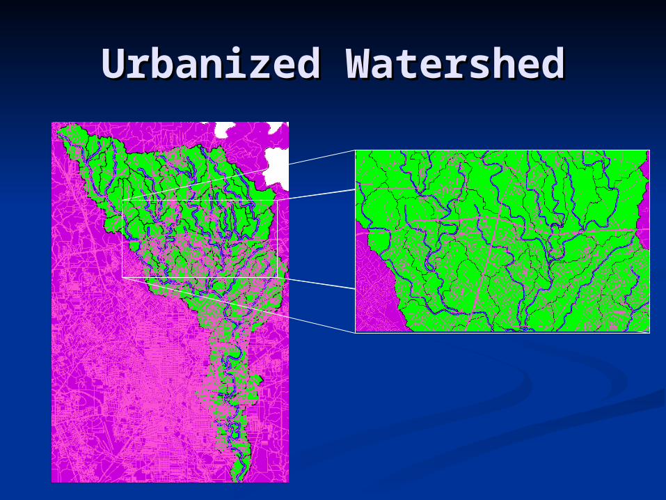
Urbanized WatershedUrbanized Watershed
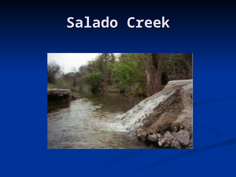
Salado CreekSalado Creek
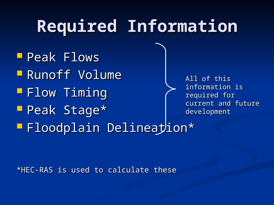
Required InformationRequired Information
Peak FlowsPeak Flows Runoff VolumeRunoff Volume Flow TimingFlow Timing Peak Stage*Peak Stage* Floodplain Delineation*Floodplain Delineation*
*HEC-RAS is used to calculate these*HEC-RAS is used to calculate these
All of this information All of this information is required for current is required for current and future and future developmentdevelopment
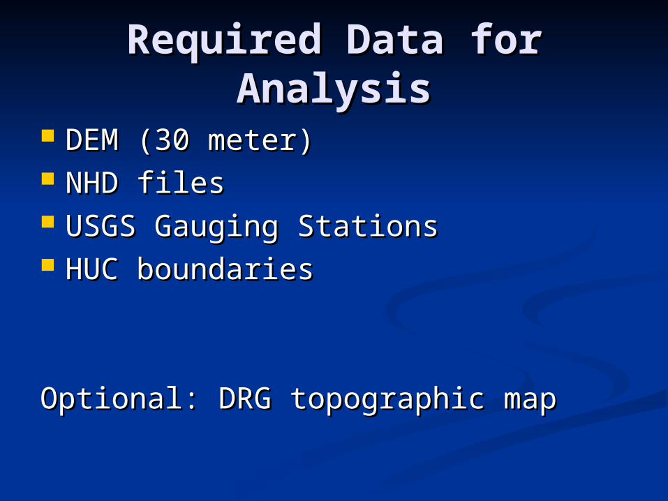
Required Data for Required Data for AnalysisAnalysis
DEM (30 meter)DEM (30 meter) NHD filesNHD files USGS Gauging StationsUSGS Gauging Stations HUC boundariesHUC boundaries
Optional: DRG topographic mapOptional: DRG topographic map
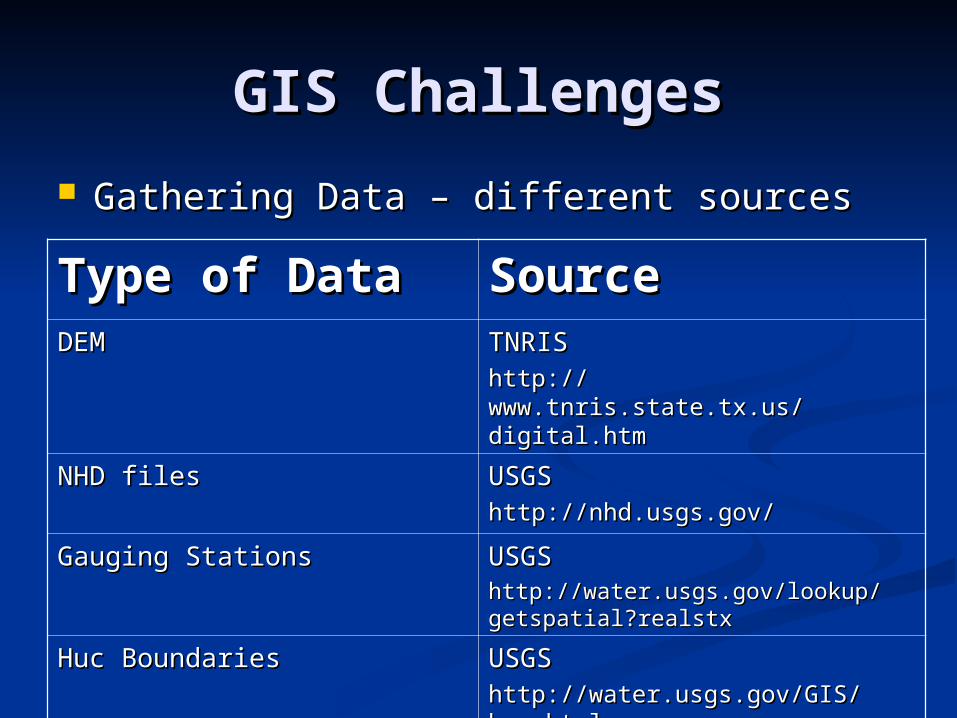
GIS ChallengesGIS Challenges
Gathering Data – different sourcesGathering Data – different sources
Type of DataType of Data SourceSourceDEMDEM TNRISTNRIS
http://www.tnris.state.tx.us/http://www.tnris.state.tx.us/digital.htmdigital.htm
NHD filesNHD files USGSUSGShttp://nhd.usgs.gov/http://nhd.usgs.gov/
Gauging StationsGauging Stations USGSUSGShttp://water.usgs.gov/lookup/http://water.usgs.gov/lookup/getspatial?realstxgetspatial?realstx
Huc BoundariesHuc Boundaries USGSUSGShttp://water.usgs.gov/GIS/huc.htmlhttp://water.usgs.gov/GIS/huc.html
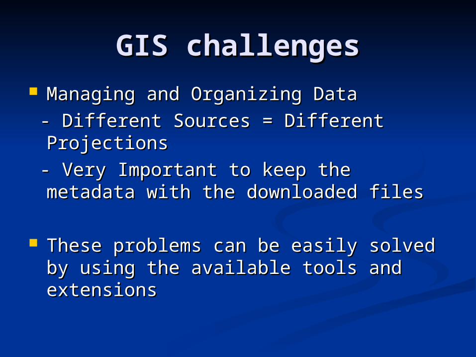
GIS challengesGIS challenges Managing and Organizing DataManaging and Organizing Data
- Different Sources = Different Projections- Different Sources = Different Projections
- Very Important to keep the metadata with - Very Important to keep the metadata with the downloaded filesthe downloaded files
These problems can be easily solved by These problems can be easily solved by using the available tools and extensionsusing the available tools and extensions
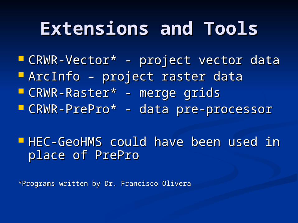
Extensions and ToolsExtensions and Tools
CRWR-Vector* - project vector dataCRWR-Vector* - project vector data ArcInfo – project raster dataArcInfo – project raster data CRWR-Raster* - merge gridsCRWR-Raster* - merge grids CRWR-PrePro* - data pre-processorCRWR-PrePro* - data pre-processor
HEC-GeoHMS could have been used HEC-GeoHMS could have been used in place of PreProin place of PrePro
*Programs written by Dr. Francisco Olivera*Programs written by Dr. Francisco Olivera
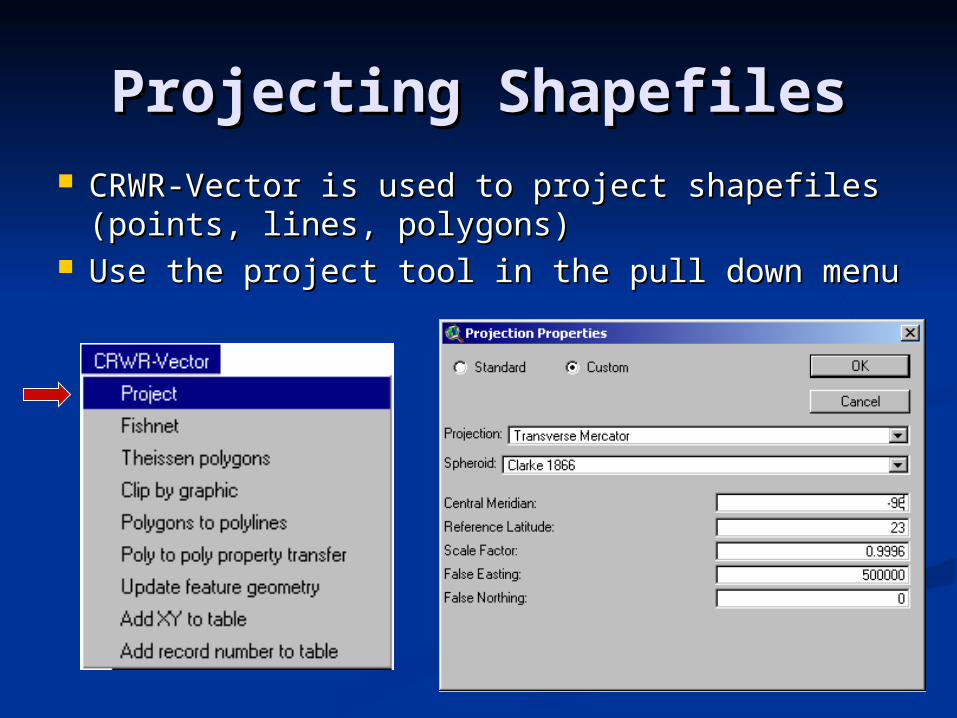
Projecting ShapefilesProjecting Shapefiles CRWR-Vector is used to project shapefiles CRWR-Vector is used to project shapefiles
(points, lines, polygons)(points, lines, polygons) Use the project tool in the pull down menuUse the project tool in the pull down menu
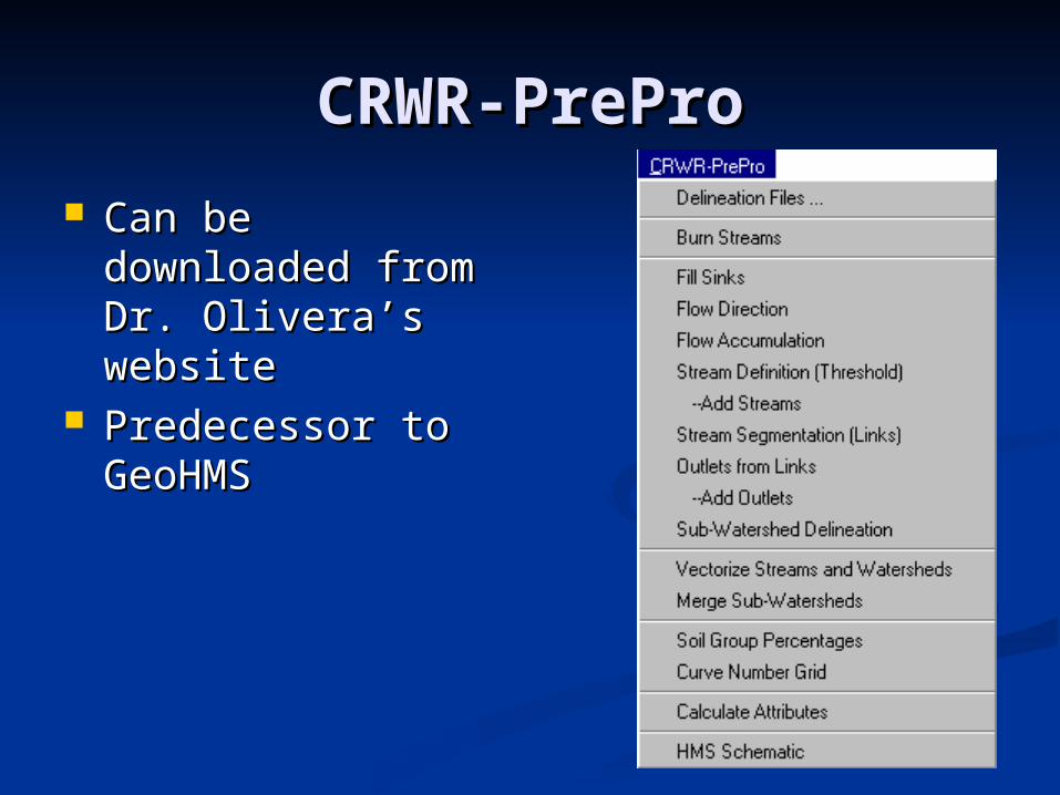
CRWR-PreProCRWR-PrePro
Can be Can be downloaded from downloaded from Dr. Olivera’s Dr. Olivera’s websitewebsite
Predecessor to Predecessor to GeoHMSGeoHMS
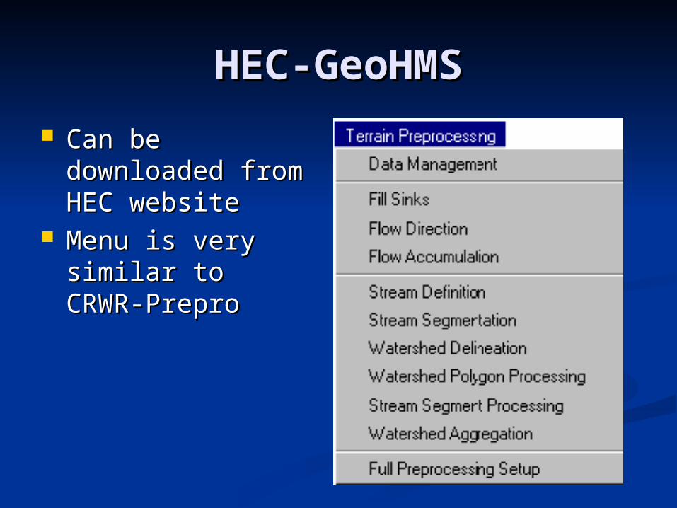
HEC-GeoHMSHEC-GeoHMS
Can be Can be downloaded from downloaded from HEC websiteHEC website
Menu is very Menu is very similar to CRWR-similar to CRWR-PreproPrepro

MethodologyMethodology
1.1. Projected all data to UTM27 – Zone Projected all data to UTM27 – Zone 1414
2.2. Ran CRWR-PrePro to delineate Ran CRWR-PrePro to delineate watershedwatershed
- Problem appeared- Problem appeared
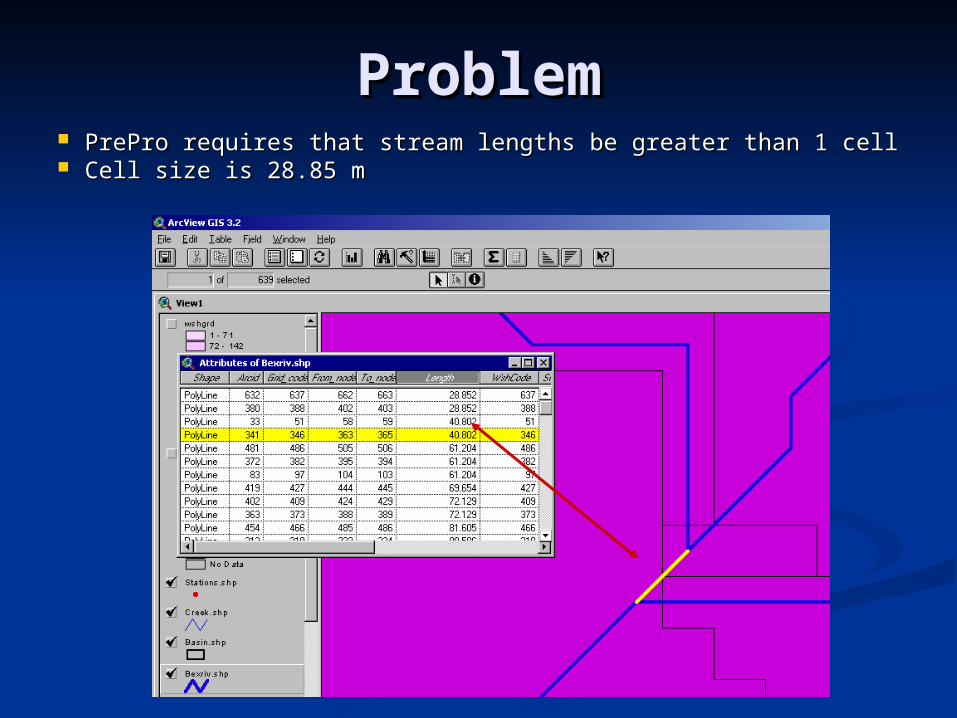
ProblemProblem PrePro requires that stream lengths be greater than 1 cellPrePro requires that stream lengths be greater than 1 cell Cell size is 28.85 mCell size is 28.85 m
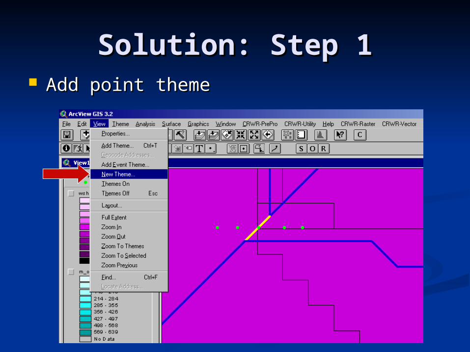
Solution: Step 1Solution: Step 1 Add point themeAdd point theme
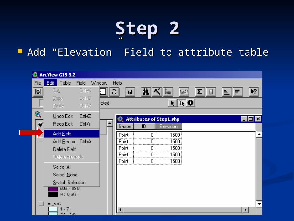
Step 2Step 2 Add “Elevation” Field to attribute tableAdd “Elevation” Field to attribute table
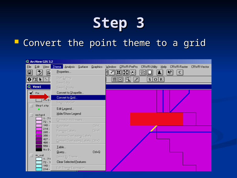
Step 3Step 3 Convert the point theme to a gridConvert the point theme to a grid
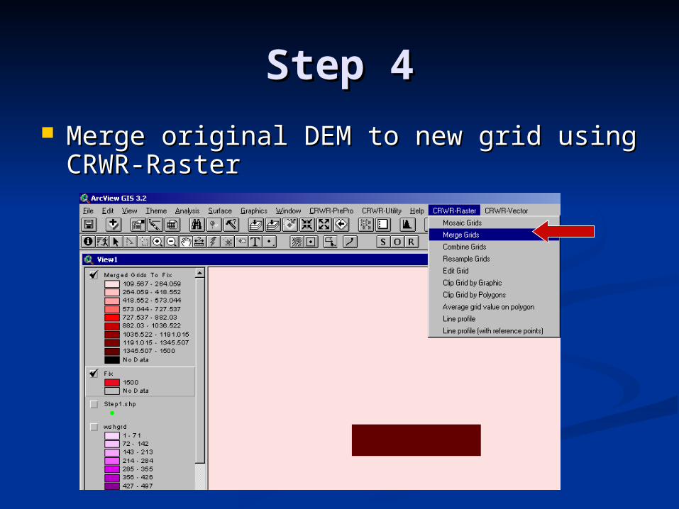
Step 4Step 4 Merge original DEM to new grid using Merge original DEM to new grid using
CRWR-RasterCRWR-Raster
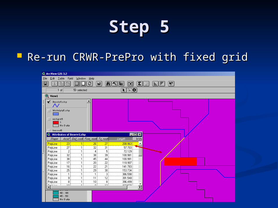
Step 5Step 5
Re-run CRWR-PrePro with fixed gridRe-run CRWR-PrePro with fixed grid
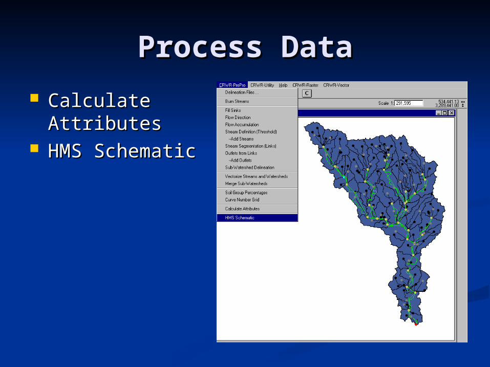
Process DataProcess Data
Calculate Calculate AttributesAttributes
HMS SchematicHMS Schematic
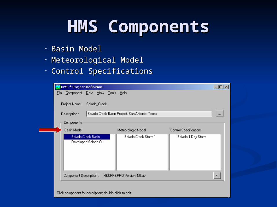
HMS ComponentsHMS Components• Basin ModelBasin Model• Meteorological ModelMeteorological Model• Control SpecificationsControl Specifications
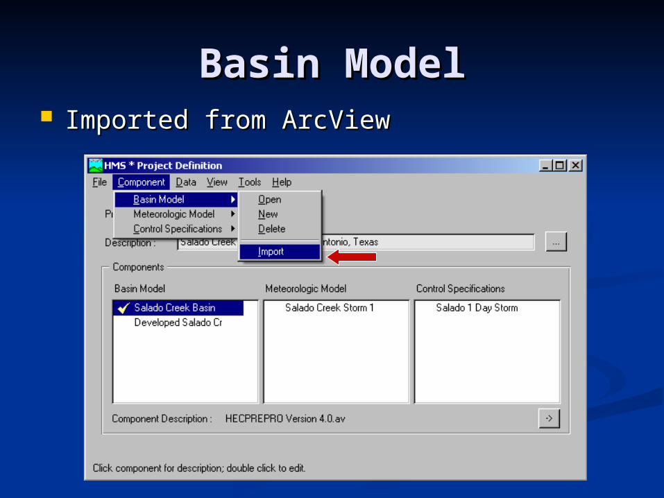
Basin ModelBasin Model Imported from ArcViewImported from ArcView
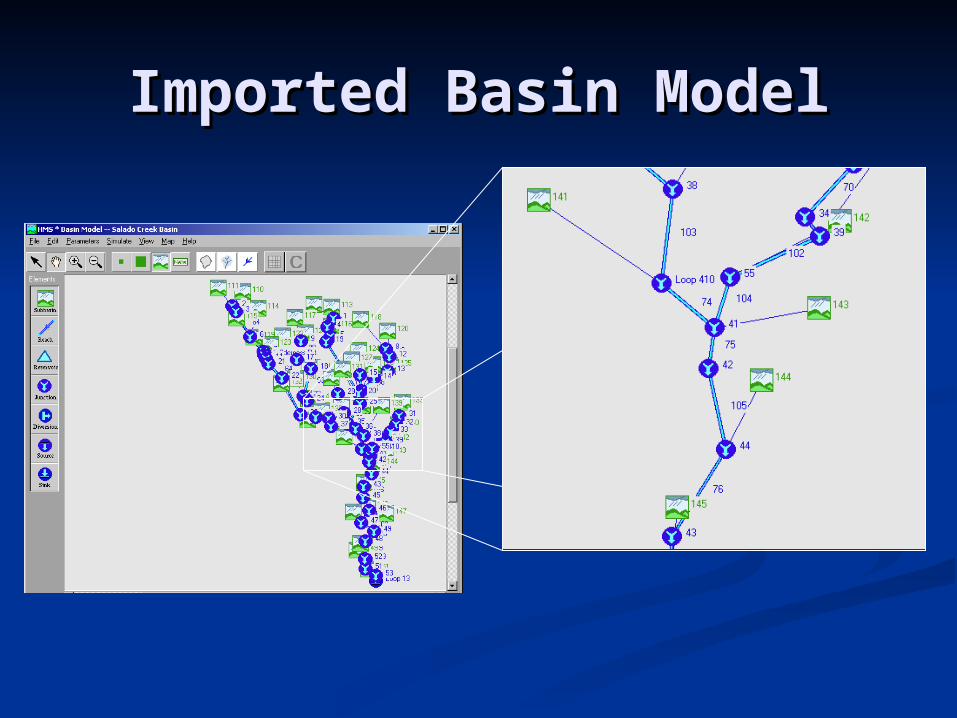
Imported Basin ModelImported Basin Model
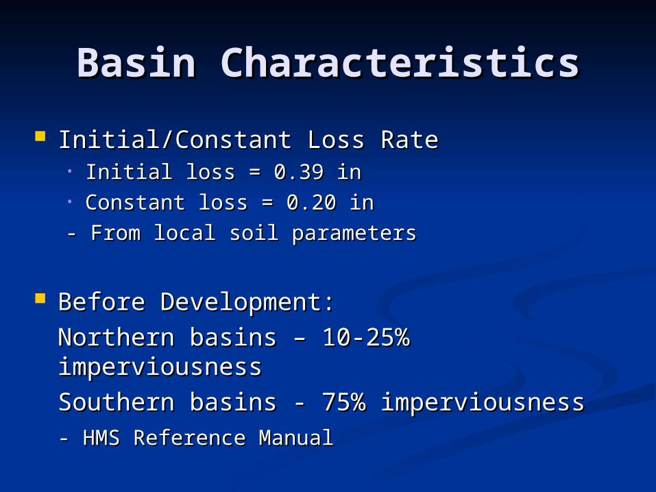
Basin CharacteristicsBasin Characteristics
Initial/Constant Loss RateInitial/Constant Loss Rate• Initial loss = 0.39 inInitial loss = 0.39 in• Constant loss = 0.20 inConstant loss = 0.20 in
- From local soil parameters- From local soil parameters
Before Development:Before Development:
Northern basins – 10-25% imperviousnessNorthern basins – 10-25% imperviousness
Southern basins - 75% imperviousnessSouthern basins - 75% imperviousness- HMS Reference Manual- HMS Reference Manual
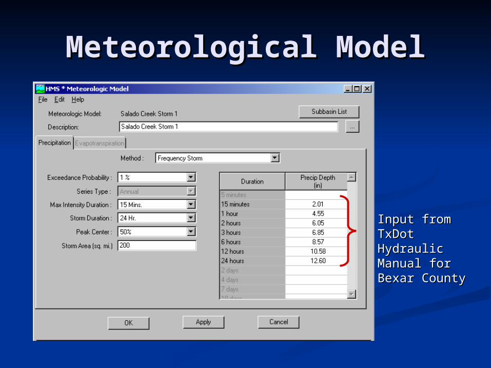
Meteorological ModelMeteorological Model
Input from Input from TxDot Hydraulic TxDot Hydraulic Manual for Manual for Bexar CountyBexar County
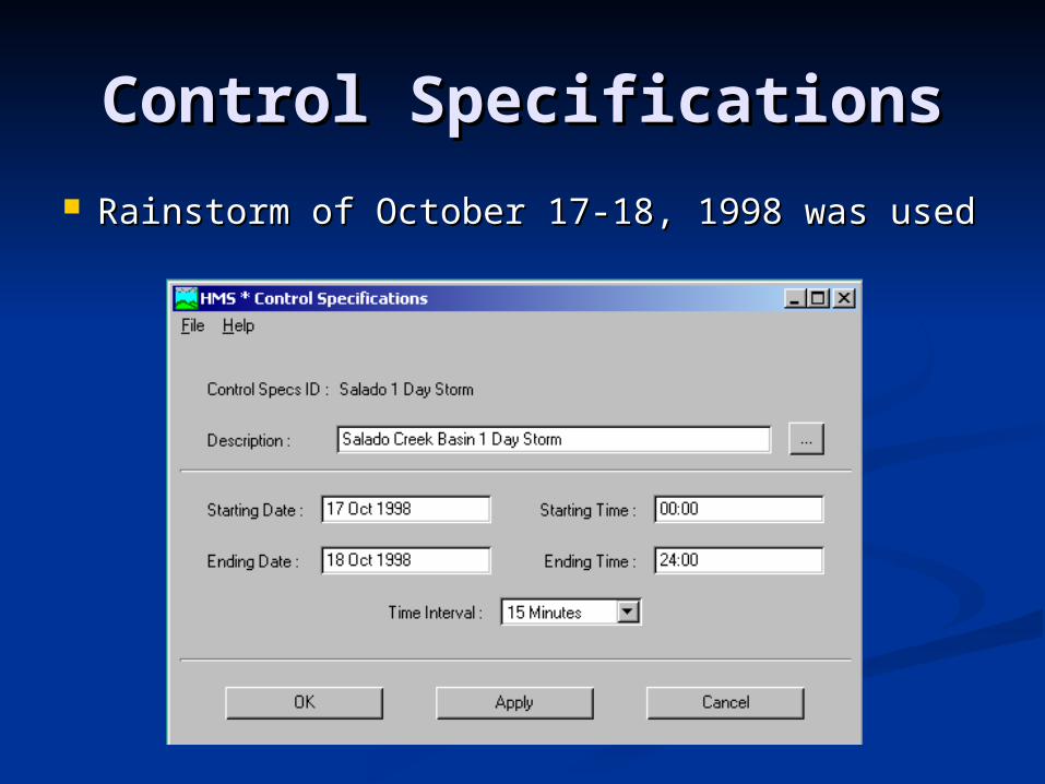
Control SpecificationsControl Specifications
Rainstorm of October 17-18, 1998 was usedRainstorm of October 17-18, 1998 was used
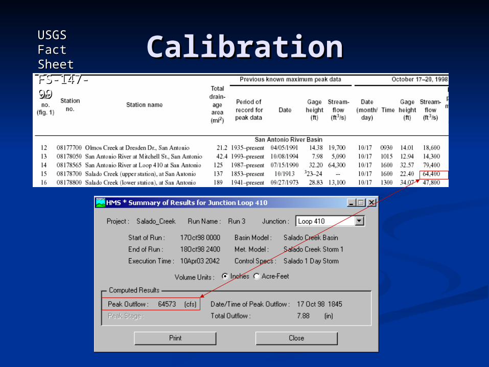
CalibrationCalibrationUSGS USGS Fact Fact Sheet FS-Sheet FS-147-99147-99
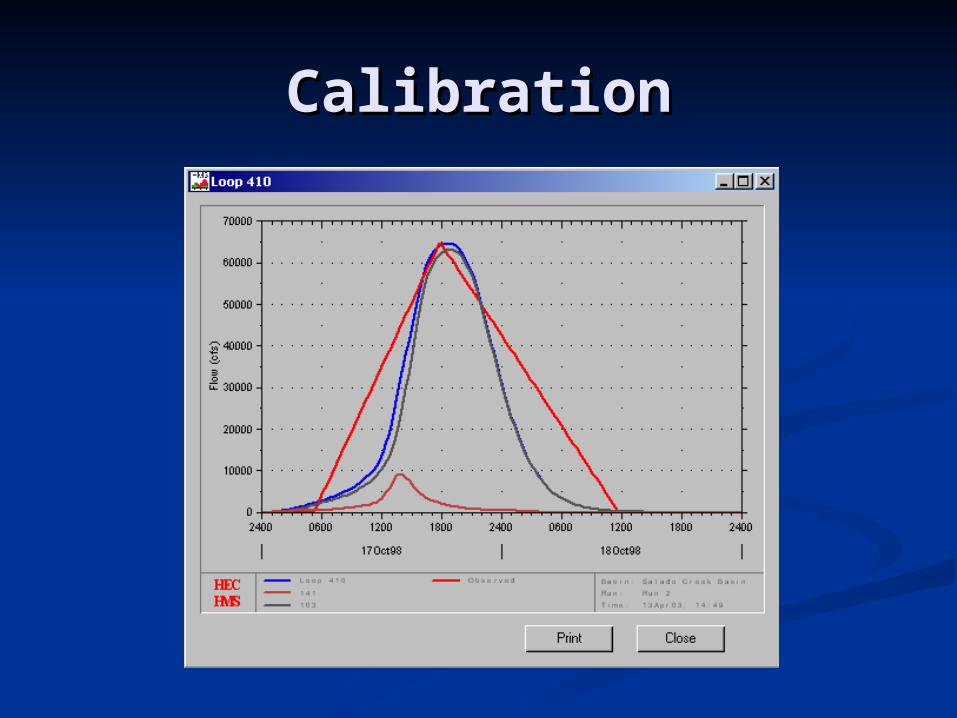
CalibrationCalibration
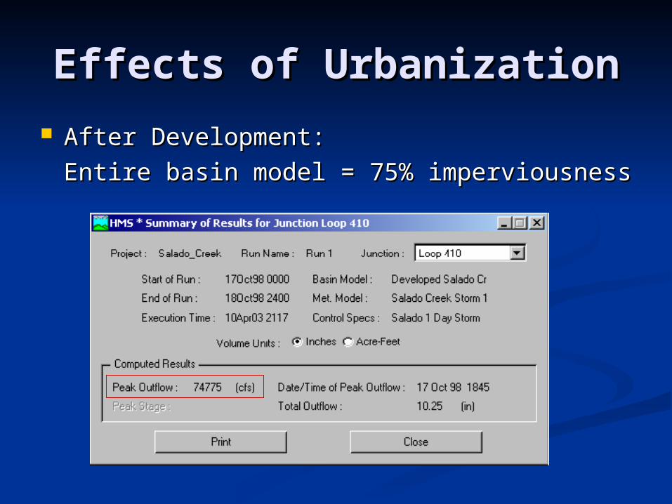
Effects of UrbanizationEffects of Urbanization
After Development:After Development:
Entire basin model = 75% imperviousnessEntire basin model = 75% imperviousness
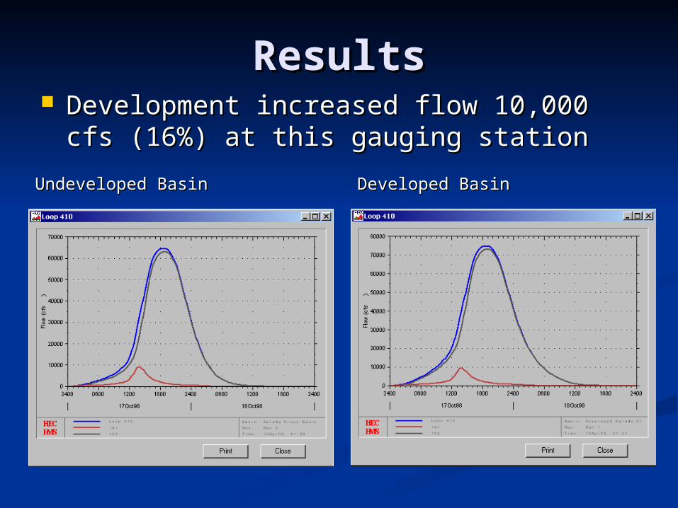
ResultsResults Development increased flow 10,000 cfs Development increased flow 10,000 cfs
(16%) at this gauging station(16%) at this gauging station
Undeveloped BasinUndeveloped Basin Developed BasinDeveloped Basin
FloodplainsFloodplains
Input channel geometry and Input channel geometry and roughness data into HEC-RASroughness data into HEC-RAS
Import peak flows from developed Import peak flows from developed basin into HEC-RAS to calculate basin into HEC-RAS to calculate water surface elevations and water surface elevations and floodplains floodplains

Questions?Questions?
SaladoSalado CreekCreek