aeronautical charts procedures for air navigation services ... references/state letter 08-05... ·...
TRANSCRIPT

999 University Street
Montréal, Quebec
Canada H3C 5H7
Tel.: +1 514-954-8219
Fax: +1 514-954-6077
E-mail: [email protected]
www.icao.int
International
Civil Aviation
Organization
Organisation
de l’aviation civile
internationale
Organización
de Aviación Civil
Internacional
Международная
организация
гражданской
авиации
Tel.: +1 (514) 954-8219 ext. 6718
Ref.: SP 65/4-08/05 29 February 2008 Subject: Proposal for the amendment of Annexes 4, 11and 15, PANS-ABC, PANS-ATM and PANS-OPS regarding instrument flight procedures Action required: Comments to reach Montreal by 2 May 2008 Sir/Madam,
1. I have the honour to inform you that the Air Navigation Commission, at the twelfth meeting of its 176th Session on 13 December 2007, considered proposals developed by the Instrument Flight Procedures Panel (IFPP) first working group of the whole meeting to amend Annex 4 — Aeronautical Charts; Annex 11 — Air Traffic Services; Annex 15 — Aeronautical Information Services; the Procedures for Air Navigation Services — ICAO Abbreviations and Codes (PANS-ABC, Doc 8400); the Procedures for Air Navigation Services — Air Traffic Management (PANS-ATM, Doc 4444); and the Procedures for Air Navigation Services — Aircraft Operations (PANS-OPS, Doc 8168), Volume I — Flight Procedures and Volume II — Construction of Visual and Instrument Flight Procedures relating to instrument flight procedures, and authorized their transmission to Contracting States and appropriate international organizations for comments.
2. The amendment proposal to Annex 4 relates to the charting of flight procedures and amends the hierarchy in which the significant point in area navigation (RNAV) shall appear on RNAV charts. As a result of this amendment to Annex 4, consequential amendments are required to Annex 11 and the PANS-ATM.
3. The amendment proposal to Annex 4 also gives guidance on the publication of bearings and tracks additionally as true values on RNAV charts and expands on the existing definition of minimum en-route altitude in order to provide benefits for users of global navigation satellite system (GNSS) sensors.
4. The amendment proposal to Annex 11 also makes changes to the current waypoint naming convention.

- 2 -
5. The amendment proposal to Annex 15 and the PANS-ABC expand on the existing definition of minimum en-route altitude in order to provide benefits for users of GNSS sensors.
6. The amendment proposal to PANS-OPS, Volumes I and II addresses the following:
a) aligns the procedure design criteria for RNAV applications in PANS-OPS, Volume II with the PBN concept as detailed in the Performance-based Navigation Manual (Doc 9613);
b) expands the guidance on coding requirements for satellite-based augmentation system (SBAS) and ground-based augmentation system (GBAS) final approach segment (FAS) data block and extends the existing precision approach criteria for simultaneous approaches to parallel or near parallel runways and for procedures with glide paths above 3.5° to approach with vertical guidance (APV) SBAS procedures;
c) modifies the PANS-OPS, Volume II procedure design criteria to allow SBAS certified aircraft to fly Baro-VNAV procedures without having to change the chart. Amends PANS-OPS, Volume I to indicate the different usage of Baro-VNAV in order to address possible confusion among pilots;
d) new criteria to help to prevent Controlled Flight Into Terrain (CFIT) during helicopter operations in visual flight rules (VFR) conditions. These criteria include protection for the visual segment between the missed approach point (MAPt) and the intended landing location and adds guidance and criteria to pilots and procedure designers on the development of a direct visual segment (VS);
e) adds an explanation of the validity of the target level of safety for the Collision Risk Model (CRM) to amplify the differences between the CRM and the obstacle assessment surface (OAS) method, also restricting it to the final approach segment;
f) validates instrument flight procedures which is a critical element of the flight procedure design process;
g) adds a reference to the new Quality Assurance Manual for Flight Procedure Design and additional training requirements to ensure that the quality assurance in the procedure design process and its output meets the requirements of Annex 15;
h) adds a reference to the new Required Navigation Performance Authorization Required (RNP AR) Procedure Design Manual; and
i) adds a note in PANS-OPS, Volume II on how to handle precision approaches with regard to new larger aircraft from a procedure design perspective; includes additional information on waypoints on straight segments to increase the efficiency of air traffic; adds criteria for procedure designers and pilots on manual RNAV holding; deletes the requirement of increased minimum obstacle clearance (MOC) for final approaches longer than 11 km (6 NM); and relaxes the requirement to apply the terminal arrival altitude concept instead of the minimum sector altitude (MSA).
7. It should be noted that both the Quality Assurance Manual for Flight Procedure Design and the Required Navigation Performance Authorization Required (RNP AR) Procedure Design Manual are currently in final draft and posted on the ICAO-NET. Publication of these manuals is expected in late 2008.

- 3 -
8. In examining the proposed amendment, you should not feel obliged to comment on editorial aspects as such matters will be addressed by the Air Navigation Commission during its final review of the draft amendment.
9. May I request that any comments you may wish to make on the proposed amendment to Annexes 4, 11 and 15, PANS-ABC, PANS-ATM and PANS-OPS be dispatched to reach me not later than 2 May 2008. The Air Navigation Commission has asked me to specifically indicate that comments received after the due date may not be considered by the Commission and the Council. In this connection, should you anticipate a delay in the receipt of your reply, please let me know in advance of the due date.
10. The proposed amendments to the PANS-ABC and PANS-OPS are envisaged for applicability on 20 November 2008. The proposed amendments to Annexes 4, 11, 15 and the PANS-ATM are envisaged for applicability on 19 November 2009. Any comments you may have thereon would be appreciated.
11. The subsequent work of the Air Navigation Commission and the Council would be greatly facilitated by specific statements on the acceptability or otherwise of the amendment proposal. Please note that, for the review of your comments by the Air Navigation Commission and the Council, replies are normally classified as “agreement with or without comments”, “disagreement with or without comments”, or “no indication of position”. If in your reply the expressions “no objections” or “no comments” are used, they will be taken to mean “agreement without comment” and “no indication of position”, respectively. In order to facilitate proper classification of your response, a form has been included in Attachment H which may be completed and returned together with your comments, if any, on the proposals in Attachments A, B, C, D, E, F and G.
Accept, Sir/Madam, the assurances of my highest consideration.
Taïeb Chérif
Secretary General Enclosures: A — Proposed amendment to Annex 4
B — Proposed amendment to Annex 11 C — Proposed amendment to Annex 15 D — Proposed amendment to the PANS-ABC E — Proposed amendment to the PANS-ATM F — Proposed amendment to PANS-OPS, Volume I G — Proposed amendment to PANS-OPS, Volume II H — Response form

ATTACHMENT A to State letter SP 65/4-08/05
PROPOSED AMENDMENT TO ANNEX 4
NOTES ON THE PRESENTATION OF THE PROPOSED AMENDMENT
The text of the amendment is arranged to show deleted text with a line through it and new text highlighted with grey shading, as shown below:
1. Text to be deleted is shown with a line through it. text to be deleted
2. New text to be inserted is highlighted with grey shading. new text to be inserted
3. Text to be deleted is shown with a line through it followed by the replacement text which is highlighted with grey shading.
new text to replace existing text

A-2
TEXT OF THE PROPOSED AMENDMENT TO
INTERNATIONAL STANDARDS AND RECOMMENDED PRACTICES
AERONAUTICAL CHARTS
ANNEX 4
TO THE CONVENTION ON INTERNATIONAL CIVIL AVIATION
. . .
CHAPTER 1. DEFINITIONS, APPLICABILITY AND AVAILABILITY
1.1 Definitions . . . Intersection. A significant point defined by radials, bearings and/or distances from ground-based
navigation aids. . . . Minimum en-route altitude-GNSS (MEA-G). A lower minimum en-route altitude (MEA) for VHF and
LF en-route segments that can be obtained by use of GNSS.
Note.— The MEA-G is below the minimum reception altitude of the ground-based navigation aid defining the route segment and provides for standard en-route obstacle clearance and two-way communications.
. . . Reporting point. A specified (named) geographical location in relation to which the position of an aircraft
can be reported. Note.— There are three categories of reporting points: ground-based navigation aid, intersection and
waypoint. A reporting point can be indicated as “on request” or as “compulsory”. . . . Significant point. A specified geographical location used in defining an ATS route or the flight path of an
aircraft and for other navigation and ATS purposes. Note.— There are three categories of significant points: ground-based navigation aid, intersection and
waypoint. . . .

A-3
CHAPTER 2. GENERAL SPECIFICATIONS
. . . 2.4 Symbols
2.4.1 Symbols used shall conform to those shown in Appendix 2 – ICAO Chart Symbols, except that where it is desired to show on an aeronautical chart special features or items of importance to civil aviation for which no ICAO symbol is at present provided, any appropriate symbol may be chosen for this purpose, provided that it does not cause confusion with any existing ICAO chart symbol or impair the legibility of the chart. Note.— The size and prominence of symbols and the thickness and spacing of lines may be varied according to the scale and functions of the chart, with due regard to the importance of the information they convey. 2.4.2 To represent intersections, ground-based navigation aids and waypoints, the same basic symbol shall be used on all charts on which they appear, regardless of chart purpose. 2.4.3 The symbol used for significant points shall be based on a hierarchy of symbols and selected in the following order: ground-based navigation aid, intersection, waypoint symbol. A waypoint symbol shall be used only when a particular significant point does not already exist as either a ground-based navigation aid or intersection. 2.4.4 States shall ensure that as of 18 November 2010, symbols are shown in the manner specified in 2.4.2, 2.4.3 and Appendix 2 – ICAO Chart Symbols, symbol number 121. 2.4.5 Recommendation.— States should ensure that symbols are shown in the manner specified in 2.4.2, 2.4.3 and Appendix 2 – ICAO Chart Symbols, symbol number 121. . . .
2.15.3 Recommendation.— For instrument procedure charts, the publication of a magnetic variation change should be completed within a maximum of six AIRAC cycles.
2.15.4 Recommendation.— In large terminal areas with multiple aerodromes, a single rounded value of magnetic variation should be applied so that the procedures that service multiple aerodromes use a single, common variation value. . . .
CHAPTER 7. ENROUTE CHART — ICAO . . .
7.8 Bearings, tracks and radials
7.8.1 Bearings, tracks and radials shall be magnetic, except as provided for in Recommendation 7.8.2. Where bearings and tracks are additionally provided as true values for RNAV segments, they shall be shown in parentheses to the nearest tenth of a degree, e.g. 293° (294.9°T) . . .

A-4
CHAPTER 8. AREA CHART — ICAO . . .
8.8 Bearings, tracks and radials 8.8.1 Bearings, tracks and radials shall be magnetic, except as provided for in Recommendation 8.8.2. Where bearings and tracks are additionally provided as true values for RNAV segments, they shall be shown in parentheses to the nearest tenth of a degree, e.g. 293° (294.9°T). . . .
8.9 Aeronautical data . . .
8.9.4 Air traffic services system . . . 8.9.4.1.1 The components shall include the following: . . . 14) communication facilities listed with their channels and, if applicable, logon address.;
15) an indication of ‘flyover’ ground-based navigation aids, intersections and waypoints.
. . .
CHAPTER 9. STANDARD DEPARTURE CHART — INSTRUMENT (SID) — ICAO
. . . 9.8.1 Bearings, tracks and radials shall be magnetic, except as provided for in Recommendation 9.8.2. Where bearings and tracks are additionally provided as true values for RNAV segments, they shall be shown in parentheses to the nearest tenth of a degree, e.g. 293° (294.9°T).
Note — A note to this effect may be included on the chart.
. . . 9.9 Aeronautical data
. . . 9.9.4 Air traffic services system
. . . 9.9.4.1.1 The components shall comprise the following: . . .
10) an indication of ‘flyover’ ground-based navigation aids, intersections and waypoints. . . .

A-5
CHAPTER 10. STANDARD ARRIVAL CHART — INSTRUMENT (STAR) — ICAO . . .
10.8 Bearings, tracks and radials
10.8.1 Bearings, tracks and radials shall be magnetic, except as provided for in Recommendation 10.8.2. Where bearings and tracks are additionally provided as true values for RNAV segments, they shall be shown in parentheses to the nearest tenth of a degree, e.g. 293° (294.9°T). Note .— A note to this effect may be included on the chart. . . .
10.9 Aeronautical data . . .
10.9.4 Air traffic services system . . . 10.9.4.1.1 The components shall comprise the following: . . . 9) an indication of ‘flyover’ ground-based navigation aids, intersections and waypoints.
. . .
CHAPTER 11. INSTRUMENT APPROACH CHART — ICAO . . .
11.9 Bearings, tracks and radials 11.9.1 Bearings, tracks and radials shall be magnetic except as provided for in Recommendation 11.9.2. Where bearings and tracks are additionally provided as true values for RNAV segments, they shall be shown in parentheses to the nearest tenth of a degree, e.g. 293° (294.9°T). Note .— A note to this effect may be included on the chart. . . .
11.10 Aeronautical data . . .
11.10.6 Portrayal of procedure tracks
11.10.6.1 The plan view shall show the following information in the manner indicated: . . . i) an indication of ‘flyover’ ground-based navigation aids, intersections and waypoints. . . .
APPENDIX 2. ICAO CHART SYMBOLS . . .

A-6
Delete symbols as follows and renumber subsequent symbol numbers:
RADIO NAVIGATION AIDS
. . .

A-7
Add new symbol number 121, Reporting and Fly-by/Flyover functionality, in the Air Traffic Services section, as follows:
AIR TRAFFIC SERVICES
. . .
Note.— See 2.4.4 and 2.4.5.

A-8
. . .
Editorial Note.— Amend the Index section of Appendix 2 accordingly. . . .
APPENDIX 6. AERONAUTICAL DATA QUALITY REQUIREMENTS
Table 1. Latitude and longitude
Latitude and longitude Chart
Resolution Integrity
Classification
. . . En-route navaids and fixes, intersections and waypoints, and holding, and STAR/SID points .................................................
1 sec
1 ×10⁻⁵
essential
. . .
— — — — — — — —

ATTACHMENT B to State letter SP 65/4-08/05
PROPOSED AMENDMENT TO ANNEX 11
NOTES ON THE PRESENTATION OF THE PROPOSED AMENDMENT
The text of the amendment is arranged to show deleted text with a line through it and new text highlighted with grey shading, as shown below:
1. Text to be deleted is shown with a line through it. text to be deleted
2. New text to be inserted is highlighted with grey shading. new text to be inserted
3. Text to be deleted is shown with a line through it followed by the replacement text which is highlighted with grey shading.
new text to replace existing text

B-2
TEXT OF THE PROPOSED AMENDMENT TO
INTERNATIONAL STANDARDS AND RECOMMENDED PRACTICES
AIR TRAFFIC SERVICES
ANNEX 11
TO THE CONVENTION ON INTERNATIONAL CIVIL AVIATION
. . .
CHAPTER 1. DEFINITIONS
. . . Intersection. A significant point defined by radials, bearings and/or distances from ground-based
navigation aids. . . . Significant point. A specified geographical location used in defining an ATS route or the flight path of an
aircraft and for other navigation and ATS purposes. Note.— There are three categories of significant points: ground-based navigation aid, intersection and
waypoint. . . .
CHAPTER 2. GENERAL . . .
2.14 Establishment and identification of significant points 2.14.1 Significant points shall be established for the purpose of defining an ATS route or instrument approach procedure and/or in relation to the requirements of air traffic services for information regarding the progress of aircraft in flight. . . .
APPENDIX 2. PRINCIPLES GOVERNING THE ESTABLISHMENT AND IDENTIFICATION OF SIGNIFICANT POINTS
. . .
3. Designators for significant points not marked by the site of a radio navigation aid
3.1 Where a significant point is required at a position not marked by the site of a radio navigation aid, and is used for ATC purposes, it the significant point shall be designated by a unique five-letter

B-3
pronounceable “name-code” This name-code designator then serves as the name as well as the coded designator of the significant point. Note.— The principles governing the use of alphanumeric name-codes in support of RNAV SIDs, STARs and instrument approach procedures are detailed in PANS-OPS (Doc 8168). 3.2 The This name-code designator shall be selected so as to avoid any difficulties in pronunciation by pilots or ATS personnel when speaking in the language used in ATS communications.
Examples: ADOLA, KODAP
3.3 The name-code designator shall be easily recognizable in voice communications and shall be free of ambiguity with those used for other significant points in the same general area. 3.4 The unique five-letter pronounceable name-code designator assigned to a significant point shall not be assigned to any other significant point. When there is a need to relocate a significant point, a new name-code designator shall be chosen. In cases when a State wishes to keep the allocation of specific name-codes for reuse at a different location, such name-codes shall not be used until after a period of at least six months.
3.5 States’ requirements for unique five-letter pronounceable name-code designators shall be notified to the Regional Offices of ICAO for coordination. . . .
— — — — — — — —

ATTACHMENT C to State letter SP 65/4-08/05
PROPOSED AMENDMENT TO ANNEX 15
NOTES ON THE PRESENTATION OF THE PROPOSED AMENDMENT
The text of the amendment is arranged to show deleted text with a line through it and new text highlighted with grey shading, as shown below:
1. Text to be deleted is shown with a line through it. text to be deleted
2. New text to be inserted is highlighted with grey shading. new text to be inserted
3. Text to be deleted is shown with a line through it followed by the replacement text which is highlighted with grey shading.
new text to replace existing text

C-2
TEXT OF THE PROPOSED AMENDMENT TO
INTERNATIONAL STANDARDS AND RECOMMENDED PRACTICES
AERONAUTICAL INFORMATION SERVICES
ANNEX 15
TO THE CONVENTION ON INTERNATIONAL CIVIL AVIATION
. . . CHAPTER 2. DEFINITIONS
. . . Minimum en-route altitude-GNSS (MEA-G). A lower minimum en-route altitude (MEA) for VHF and
LF en-route segments that can be obtained by use of GNSS.
Note.— The MEA-G is below the minimum reception altitude of the ground-based navigation aid defining the route segment and provides for standard en-route obstacle clearance and two-way communications.
. . .
APPENDIX 7. AERONAUTICAL DATA QUALITY REQUIREMENTS
Table A7-1. Latitude and longitude
Latitude and longitude Publication resolution
Integrity Classification
. . . En-route NAVAIDS and fixes, intersections and waypoints, and holding, and STAR/SID points ..........................................
1 sec
1 ×10⁻⁵
essential
— — — — — — — —

ATTACHMENT D to State letter SP 65/4-08/05
PROPOSED AMENDMENT TO THE PANS-ABC (DOC 8400)
NOTES ON THE PRESENTATION OF THE PROPOSED AMENDMENT
The text of the amendment is arranged to show deleted text with a line through it and new text highlighted with grey shading, as shown below:
1. Text to be deleted is shown with a line through it. text to be deleted
2. New text to be inserted is highlighted with grey shading. new text to be inserted
3. Text to be deleted is shown with a line through it followed by the replacement text which is highlighted with grey shading.
new text to replace existing text

D-2
TEXT OF THE PROPOSED AMENDMENT TO
PROCEDURES FOR AIR NAVIGATION SERVICES
ICAO ABBREVIATIONS AND CODES
. . .
Insert the following new terms:
ABBREVIATIONS . . .
DECODE
. . . M . . . MEA-G Minimum en-route altitude — GNSS . . . V . . . VPT Visual manoeuvre with prescribed track . . .
Editorial Note.— New terms also apply to Encode.
— — — — — — — —

ATTACHMENT E to State letter SP 65/4-08/05
PROPOSED AMENDMENT TO THE PANS-ATM (DOC 4444)
NOTES ON THE PRESENTATION OF THE PROPOSED AMENDMENT
The text of the amendment is arranged to show deleted text with a line through it and new text highlighted with grey shading, as shown below:
1. Text to be deleted is shown with a line through it. text to be deleted
2. New text to be inserted is highlighted with grey shading. new text to be inserted
3. Text to be deleted is shown with a line through it followed by the replacement text which is highlighted with grey shading.
new text to replace existing text

E-2
TEXT OF THE PROPOSED AMENDMENT TO
PROCEDURES FOR AIR NAVIGATION SERVICES
AIR TRAFFIC MANAGEMENT
. . .
CHAPTER 1. DEFINITIONS
. . . Intersection. A significant point defined by radials, bearings and/or distances from ground-based
navigation aids. . . . Significant point. A specified geographical location used in defining an ATS route or the flight path of an
aircraft and for other navigation and ATS purposes. Note.— There are three categories of significant points: ground-based navigation aid, intersection and
waypoint. . . .
— — — — — — — —

ATTACHMENT F to State letter SP 65/4-08/05
PROPOSED AMENDMENT TO PANS-OPS, VOLUME I (DOC 8168)
NOTES ON THE PRESENTATION OF THE PROPOSED AMENDMENT
The text of the amendment is arranged to show deleted text with a line through it and new text highlighted with grey shading, as shown below:
1. Text to be deleted is shown with a line through it. text to be deleted
2. New text to be inserted is highlighted with grey shading. new text to be inserted
3. Text to be deleted is shown with a line through it followed by the replacement text which is highlighted with grey shading.
new text to replace existing text

F-2
TEXT OF THE PROPOSED AMENDMENT TO THE
PROCEDURES FOR AIR NAVIGATION SERVICES
AIRCRAFT OPERATIONS
VOLUME I
FLIGHT PROCEDURES
. . . PART I
FLIGHT PROCEDURES – GENERAL
. . . Section 1
DEFINITIONS, ABBREVIATIONS AND ACRONYMS AND UNITS OF MEASUREMENT
Chapter 1
DEFINITIONS
Add new definitions as follows: . . . Direct visual segment (Direct-VS). The portion of flight that connects the PinS to the landing location;
this can be either direct to the landing location or via a descent point (DP) where a limited track change may occur.
. . . Fictitious helipoint (FHP). A point used as the FTP for a PinS procedure. . . . Helipoint (HP). The three-dimensional point normally centred over the final approach and take-off area.
Note.— The HP is analogous to the landing threshold point (LTP). The HP is used in the description of procedures that are flown directly to the heliport. Heliport reference point (HRP). The designated location of the heliport or landing location. . . . Holding point. A specified location, identified by visual or other means, in the vicinity of which the
position of an aircraft in flight is maintained in accordance with air traffic control clearances.
Note.— In RNAV holding, holding pattern fixes are charted as fly-by points unless the fix has an additional fly-over requirement separate from the holding pattern.

F-3
. . . Landing location. A landing area that has the same physical characteristics as a non-instrument heliport
as per Annex 14, Volume II. (Example: the landing location could be a non-instrument heliport or could be located on a non-instrument runway.)
. . . Point-in-space (PinS) visual segment. This is the segment of a helicopter PinS approach procedure from
the MAPt to the landing location for a PinS “proceed visually” procedure. . . . Visual segment descent angle (VSDA). The angle between the MDA at the MAPt/DP and the heliport
crossing height. . . . Waypoint distance (WD). Distance on the WGS ellipsoid from a defined waypoint to the aircraft RNAV
receiver. . . .
Chapter 2 ABBREVIATIONS AND ACRONYMS
Add new abbreviations and acronyms as follows: CDFA Continuous descent final approach . . . Direct-VS Direct visual segment . . . DP Descent point . . . FHP Fictitious helipoint . . . HP Helipoint . . . HRP Heliport reference point

F-4
. . . OCS Obstacle clearance surface . . . OLS Obstacle limitation surface . . . VSDA Visual segment descent angle . . . WD Waypoint distance . . .
Section 3 DEPARTURE PROCEDURES
. . . Chapter 2
STANDARD INSTRUMENT DEPARTURES
2.1 GENERAL . . .
2.1.3 Types of SID . . .
Track guidance may be provided by a suitably located facility (VOR or NDB), by the localizer of the opposite landing runway (front course outbound) or by RNAV. See Figure I-3-2-1. When using the localizer of the opposite landing runway for track guidance, some onboard equipment may display guidance in reverse. Operational procedures shall be established to mitigate this.
. . . Section 4
ARRIVAL AND APPROACH PROCEDURES
Chapter 1 GENERAL CRITERIA FOR
ARRIVAL AND APPROACH PROCEDURES . . .
Add new paragraph as follows:
1.8 APPROACH OPERATIONS UTILIZING BARO-VNAV EQUIPMENT
1.8.1 Baro-VNAV equipment can be applied to two different approach and landing operations as defined in Annex 6:

F-5
a) Approach and landing operations with vertical guidance. In this case the use of a VNAV system such as Baro-VNAV is required. When Baro-VNAV is used, the lateral navigation guidance is provided by basic GNSS.
b) Non-precision approach and landing operations. In this case the use of a baro-VNAV system
is not required but auxiliary to facilitate the CDFA technique as described in 1.7.2. This means that advisory VNAV guidance is being overlaid on a non-precision approach. The lateral navigation guidance is predicated on the navigation system designated on the chart.
1.8.2 Approach and landing operations with vertical guidance provide significant benefits over
advisory VNAV guidance being overlaid on a non-precision approach, as they are based on specific procedure design criteria (see Part II, Section 4, Chapter 1 “APV/Baro-VNAV procedures”) avoiding the requirement for cross-checking the non-precision approach procedure constraints such as stepdown fixes. These criteria furthermore address:
a) height loss after initiating a missed approach allowing the use of a DA instead of an MDA, thereby standardizing flight techniques for vertically guided approach operations;
b) obstacle clearance throughout the approach and landing phase taking into account
temperature constraints down to the DA, therefore resulting in a better obstacle protection compared to a non-precision approach procedure.
Note 1.–– Guidance on the operational approval for approach and landing operations with
vertical guidance using Baro-VNAV equipment can be found in the Performance-based Navigation (PBN) Manual (Doc 9613), Volume II, Attachment A, “Baro-VNAV” and Volume II, Part C, Chapter 5, “Implementing RNP APCH”.
Note 2.— For challenging obstacle environments or where tight separation requirements exist, specific procedure design criteria are available for approach and landing operations with vertical guidance and are contained in the Required Navigation Performance Authorization Required (RNP AR) Procedure Design Manual (Doc xxxx). Associated operational approval guidance for RNP AR APCH operations can be found in the Performance-based Navigation Manual (Doc 9613), Volume II, Part C, Chapter 6, “Implementing RNP AR APCH”. . . .
Amend the Note in Figure I-4-1-3 as follows:
Note.— MOC may include an additional margin in mountainous terrain and is increased for excessive length of final approach segment and for remote and forecast altimeter settings.
. . .
Chapter 5 FINAL APPROACH SEGMENT
Replace Figure I-4-5-1 with the following figure:

F-6
Figure I-4-5-1. Stepdown fix
. . .
Section 8 PROCEDURES FOR USE BY HELICOPTERS
Add new Chapter 4 as follows:
Chapter 4
HELIPORT APPROACH PROCEDURES
4.1 PinS APPROACH OPERATIONS CHARACTERISTICS
4.1.1 General 4.1.1.1 A PinS approach is an instrument procedure flown to a point-in-space. Obstacle protection is provided on the approach to the point-in-space and the missed approach. At or prior to the point-in-space, the pilot shall decide to continue to the landing location or execute a missed approach. There are two types of PinS approach procedures: a PinS “proceed VFR” procedure and a PinS “proceed visually” procedure, which are detailed in 4.1.2 and 4.1.3 respectively.

F-7
4.1.1.2 Protection to the MAPt. Minimum obstacle clearance (MOC) is provided for all IFR segments of the procedure including the missed approach segment. 4.1.1.3 Speed restrictions
4.1.1.3.1 Minimum airspeed. The minimum airspeed for IFR operations is contained in the helicopter operations manual and described as the Vmini airspeed.
4.1.1.3.2 Maximum airspeed. The maximum airspeed on the final and missed approach segments is 130 km/h (70 KIAS) or 165 km/h (90 KIAS) depending on the criteria used to develop the procedure. The chart shall be annotated “LIMIT MAXIMUM FINAL AND MISSED APPROACH AIRSPEED to 130 km/h (70 KIAS) or 165 km/h (90 KIAS)”.
4.1.1.3.3 A minimum/maximum speed limitation may also apply to holding.
4.1.1.4 Procedure IFR segment length. The optimum length for other than the visual segment of a PinS procedure is 5.6 km (3.0 NM).
4.1.2 PinS “proceed VFR” procedure
4.1.2.1 A PinS “proceed VFR” is an instrument approach procedure developed for landing locations that may not meet the standards for a non-instrument heliport. The approach delivers the helicopter to a missed approach point (MAPt). Prior to or at the MAPt, the pilot shall decide to proceed VFR or execute a missed approach and remain in the IFR structure.
4.1.2.2 PinS “proceed VFR” procedure requirement. These procedures may be developed where PinS “proceed visually” criteria cannot be met. The pilot, at or prior to the MAPt, is required to either determine if the published minimum visibility or the visibility required by State regulations (whichever is higher) is available to safely transition from IFR to VFR flight, or execute a missed approach. The pilot shall comply with VFR weather minimum requirements after departing the MAPt.
4.1.2.3 Protection on a “proceed VFR” procedure. There is no protection beyond the MAPt if a missed approach procedure is not completed after the MAPt. The pilot is responsible to see and avoid obstacles. The visibility for these approaches is the visibility published on the chart, or VFR minimums required by the class of airspace, or State regulations, whichever is higher.
4.1.2.4 “Proceed VFR” segment length. There is no specified minimum or maximum length for the VFR phase beyond the MAPt.
4.1.2.5 Maximum track changes. There is no maximum track change at the MAPt.
4.1.3 PinS “proceed visually” procedure
4.1.3.1 This is an instrument approach procedure developed to locations having the same physical surface characteristics as a non-instrument heliport as per Annex 14, Volume II. The approach delivers the helicopter to a missed approach point (MAPt). Prior to or at the MAPt, the pilot shall decide to proceed visually to the landing location or execute a missed approach. A visual segment connects the

F-8
point-in-space (PinS) to the landing location. This can be a direct visual segment as described below. This connection can also be accomplished via a route or by manoeuvring.
Note.— Design guidance for manoeuvring and route visual segments is currently under development.
4.1.3.2 PinS “proceed visually” procedure requirement. If the landing location or visual references associated with it is acquired visually and the pilot elects to continue to the landing location, the pilot will proceed to the landing location. If the landing location or visual references associated with it are not visually acquired upon reaching the MAPt, a missed approach shall be executed.
4.1.3.3 The visibility minimum is based upon the distance from the MAPt to the landing location for a direct visual segment, and other factors for manoeuvering/route segments. IFR obstacle clearance areas are not applied to the visual segment of the approach, and missed approach protection is not provided between the MAPt and the landing location.
4.1.3.4 Protection on the visual segment. For PinS procedures the visual segment from the MAPt is protected by an OCS similar in size and shape to the Annex 14 OLS for non-instrument heliports, and three obstacle identification surfaces.
4.1.3.5 The OCS lies 1.12° below the visual segment descent angle (VSDA). Once on the visual segment of the procedure, no missed approach protection is provided.
4.1.3.6 Obstacle identification surface (OIS) protection. Two obstacle identification surfaces adjoin the lateral outer edges of the OCS and rise at the same slope. The origins of the outer edges of these two OISs are coincident with the edges of the OCS and splay to the width of the primary area at the MAPt or DP when different from the MAPt.
4.1.3.7 The third OIS begins at the MAPt at the edges of the secondary area and extends to encompass a 0.4 NM radius centred on the landing location.
4.1.3.8 Obstacles that penetrate the OIS are charted and may be marked or lighted.
4.1.3.9 “Proceed visually” segment length. The length of the visual segment should be selected to provide sufficient visual references from the MAPt to the landing location whilst also providing sufficient distance to decelerate, descend and land the aircraft at the landing location.
4.1.3.10 The maximum visual segment length shall be 3.00 km (1.62 NM).
4.1.3.11 The optimum visual segment length is dependent on the maximum speed in the final approach segment of the instrument procedure and is as follows:
130 km/h (70 KIAS): 1.20 km (0.65 NM)
165 km/h (90 KIAS): 2.00 km (1.08 NM).
4.1.3.12 The minimum visual segment length is dependaent on the maximum speed in the final approach segment of the instrument procedure and shall be as follows:
130 km/h (70 KIAS): 1.00 km (0.54 NM)

F-9
165 km/h (90 KIAS): 1.60 km (0.85 NM).
4.1.3.13 Maximum track change. The maximum track change at the MAPt for a “proceed visually” segment should not exceed 30°.
4.1.3.14 Use of a descent point (DP). A DP is used to identify the end of that portion of the visual segment that should be flown at the minimum descent altitude (MDA) and to identify the point at which the final descent for landing should begin. Obstacle protection from the MAPt to the DP is provided by the calculation of the OCA/H.
4.1.3.15 The DP is established at a distance from the MAPt on the visual segment track but may be located at the MAPt.
4.1.3.16 Obstacle protection is provided from the DP to the edge of the landing safety area by the OCS 1.12° below the VSDA. . . .
PART II FLIGHT PROCEDURES – RNAV AND SATELLITE-BASED
. . .
Section 4 APPROACH PROCEDURES WITH VERTICAL GUIDANCE
Chapter 1
APV/BARO-VNAV APPROACH PROCEDURES
1.1 GENERAL
1.1.1 Procedure classification 1.1.1.1 The information in 1.1.1 refers only to the procedures designed using APV/Baro-VNAV criteria found in Volume II, Part III, Section 3, Chapter 4. APV/Baro-VNAV approach procedures are classified as instrument approach procedures in support of approach and landing operations with vertical guidance (see Annex 6). Such procedures are promulgated with a decision altitude/height (DA/H). They should not be confused with classical non-precision approach (NPA) procedures, which specify a minimum descent altitude/height (MDA/H) below which the aircraft must not descend. 1.1.1.2 APV/Baro-VNAV procedures provide a greater margin of safety than non-precision approach procedures by providing for a guided, stabilized descent to landing. They are particularly relevant to large commercial jet transport aircraft, for which they are considered safer than the alternative technique of an early descent to minimum altitudes. An altimeter cross-check which is available for ILS, MLS, GLS, APV I/II or CAT I is not available with APV/Baro-VNAV. This is true because the single point of failure, the altimeter, will impact both the vertical guidance and the determination of altitude. Mitigation of altimeter failures or incorrect setting shall be accomplished by means of Standard Operating procedures similar to those applied to non-precision approach procedures. . . .

F-10
1.3 EQUIPMENT REQUIREMENTS . . .
1.3.2....
Note.— Acceptable means of compliance can be found in documents such as the United States Federal Aviation Administration (FAA) Advisory Circular (AC) 20-138, AC 20-130A and AC 120-29.
Note.– Guidance on the airworthiness approval of APV/Baro-VNAV equipment and the operational approval process for APV/Baro-VNAV operations can be found in the Performance-based Navigation (PBN) Manual (Doc 9613). . . .
Section 6 RNAV HOLDING
Chapter 1
GENERAL
. . . 1.2 Aircraft equipped with RNAV systems with holding functionality (see Figure II-6-2-1). 1.2.1 These systems are which have been approved by the State of the Operator for the appropriate level of RNAV operations and may be used these systems to carry out VOR/DME RNAV holding, provided that before conducting any flight it is ensured that: a) the aircraft is fitted with serviceable RNAV equipment; and
b) the pilot has a current knowledge of how to operate the equipment to optimize navigation accuracy.; and
c) the published VOR/DME facility upon which the procedure is based is serviceable. 1.3 1.2.2 The accuracy and limitations of RNAV systems are those of the computer. The computer is designed so that calculation errors are minimal and do not affect the accuracy of the output significantly. However, the computer cannot identify data input error. 1.41.2.3 Waypoint and, in some cases, data contained in the navigation database have been calculated, promulgated by States and input by the operator or crew. Any errors introduced into the navigation database will affect the actual computed position.
1.3 Aircraft equipped with RNAV systems without holding functionality (see Figure II-6-2-2)
1.3.1 For aircraft equipped with RNAV systems without any holding functionality, it is possible to fly manually a published RNAV holding procedure overhead a waypoint. 1.3.2 Only the holding waypoint is retrieved from the database. The desired inbound course

F-11
and the end of the outbound shall be published by the State. 1.3.3 The pilot shall fly the holding manually by at least:
a) changing the automatic sequencing of waypoint to manual;
b) designating the holding waypoint as active (Direct to);
c) selecting the desired inbound course (by mean of numerical keypad entry, HSI course pointer, or CDI omnidirectional bearing selector (OBS)) to the designated holding waypoint.
1.3.4 This type of holding will be flown manually and RNAV track guidance is provided only on the inbound track. Note.– The holding waypoint may not be charted as a flyover waypoint, but the pilot and/or aircraft navigation system is expected to treat the waypoint as a flyover waypoint while flying the holding. 1.3.5 The end of the outbound leg of the holding is defined by timing or by a distance from the holding waypoint (WD) provided by the RNAV system.
1.3.5.1 Outbound leg defined by timing (see Figure II-6-2-2 A). Outbound timing begins when turn to outbound is completed or abeam the waypoint, whichever occurs later.
1.3.5.2 Outbound leg defined by a RNAV distance from the waypoint (see Figure II-6-2-2 B).When the end of the outbound leg is defined by an RNAV distance from the holding waypoint (WD), the outbound leg terminates as soon as the distance is reached. 1.54 Conventional holding patterns may be flown with the assistance of an RNAV system. In this case, the RNAV system has no other function than to provide guidance for the autopilot or flight director. The pilot remains responsible for ensuring that the aircraft complies with the speed, bank angle, timing and distance assumptions contained in Part I, Section 6, Chapter 1, 1.3.
1.65 PILOT RESPONSIBILITIES 1.65.1 When RNAV equipment is used for non-RNAV holding procedures, the pilot shall verify positional accuracy at the holding fix on each passage of the fix.
1.65.2 Pilots shall ensure that speeds used to fly the RNAV holding procedures comply with Tables I-65-1-1 and I-165-1-2. . . .
Chapter 2 HOLDING PATTERNS
. . . 2.3 RNAV holding procedures may be constructed using one or two waypoints (see Figures II-

F-12
6-2-1 A and B). Area holding may also be provided (see Figure II-6-2-1 C). 2.4 3 RNP holdings are characterized by a maximum track geometrically defined by the length of the inbound track and diameter of the turn (see Figure II-6-2-1 E3). 2.5 4 An RNP approved RNAV system is assumed to be able to remain within the RNP limit for 95 per cent of the time spent in the holding pattern. 2.6 5 RNAV area holding is specified by an area holding waypoint and an associated circle. The radius of this circle is always such that the pilot may select any inbound track to the fix and join and follow a standard left or right holding pattern based on the fix and selected track. Alternatively, any other pattern may be flown which will remain within the specified area (see Figure II-6-2-1 C4). 2.7 6 The waypoints for VOR/DME RNAV holding are defined by radio navigation fixes which determine the minimum accuracy required to fly the procedure.
Editorial Note.— Delete existing Figure II-6-2-1 and add new Figures II-6-2-1, II-6-2-2, II-6-2-3 and II-6-2-4 as follows:

F-13
Figure II-6-2-1. RNAV holding for systems with holding functionality
Figure II-6-2-2. RNAV holding for systems without holding functionality
Figure II-6-2-3. RNP holding Figure II-6-2-4. RNAV area
A B

F-14
. . . Chapter 3
HOLDING ENTRY 3.1 Except where it is published that specific entries are required, entries into an one waypoint RNAV holding overhead a waypoint are the same as for conventional holding. Note.— Future RNAV systems able to enter into an one waypoint RNAV holding without overflying the holding point may use specific holding patterns based on this assumption. They may also use conventional or RNAV holding. 3.2 Sectors for entry to an RNAV two waypoint holding procedure are separated by the line which passes through the two waypoints. Entries from either sector shall be made through the associated waypoint. (See Figure II-6-2-1 D.) After passing the waypoint, the aircraft shall turn to follow the procedure. Note.— Flight management systems designed only for single waypoint holding procedures will not normally be able to use two waypoint procedures without a software modification. Alternatives to two waypoint procedures will be provided for aircraft with single waypoint flight management systems. 3.32 For area holding, any entry procedure which is contained within the given area is permissible. . . .
— — — — — — — —

ATTACHMENT G to State letter SP 65/4-08/05
PROPOSED AMENDMENT TO PANS-OPS, VOLUME II
(DOC 8168)
NOTES ON THE PRESENTATION OF THE PROPOSED AMENDMENT
The text of the amendment is arranged to show deleted text with a line through it and new text highlighted with grey shading, as shown below:
1. Text to be deleted is shown with a line through it. text to be deleted
2. New text to be inserted is highlighted with grey shading. new text to be inserted
3. Text to be deleted is shown with a line through it followed by the replacement text which is highlighted with grey shading.
new text to replace existing text

G-2
TEXT OF THE PROPOSED AMENDMENT TO THE
PROCEDURES FOR AIR NAVIGATION SERVICES
AIRCRAFT OPERATIONS
VOLUME II
CONSTRUCTION OF VISUAL AND INSTRUMENT FLIGHT PROCEDURES . . .
PART I GENERAL
. . .
Section 1 DEFINITIONS, ABBREVIATIONS AND ACRONYMS AND UNITS OF MEASUREMENT
Chapter 1
DEFINITIONS
Add new definitions as follows: . . . Direct visual segment (Direct-VS). The portion of flight that connects the PinS to the landing location;
this can be either direct to the landing location or via a descent point (DP) where a limited track change may occur.
. . . Fictitious helipoint (FHP). A point used as the FTP for a PinS procedure. . . . Helipoint (HP). The three-dimensional point normally centred over the final approach and take-off area.
Note.— The HP is analogous to the landing threshold point (LTP). The HP is used in the description of procedures that are flown directly to the heliport. Heliport reference point (HRP). The designated location of the heliport or landing location. . . . Holding point. A specified location, identified by visual or other means, in the vicinity of which the
position of an aircraft in flight is maintained in accordance with air traffic control clearances.
Note.— In RNAV holding, holding pattern fixes are charted as fly-by points unless the fix has an additional flyover requirement separate from the holding pattern.
. . .

G-3
Landing location. A landing area that has the same physical characteristics as a non-instrument heliport as per Annex 14, Volume II. (Example: the landing location could be a non-instrument heliport or could be located on a non-instrument runway.)
. . . Minimum en-route altitude-GNSS (MEA-G). A lower minimum en-route altitude (MEA) for VHF and
LF en-route segments that can be obtained by use of GNSS.
Note 1.— The MEA-G is below the minimum reception altitude of the land-based navigation facility defining the route segment and provides for standard en-route obstacle clearance and two-way communications.
Note 2.— If the route requires GNSS, the MEA does not require the “G” suffix. . . . Point-in-space (PinS) visual segment. This is the segment of a helicopter PinS approach procedure from
the MAPt to the landing location for a PinS “proceed visually” procedure.
. . .
Visual segment descent angle (VSDA). The angle between the MDA/H at the MAPt/DP and the heliport crossing height.
. . . Waypoint distance. Distance on the WGS ellipsoid from a defined waypoint to the aircraft RNAV
receiver. . . .
Chapter 2 ABBREVIATIONS AND ACRONYMS
Add new abbreviations and acronyms as follows: CRC Cyclic redundancy check . . . Direct-VS Direct visual segment DP Descent point . . . FAS Final approach segment FHP Fictitious helipoint . . .

G-4
FTE Flight technical error . . . HCH Heliport crossing height HP Heliport HRP Heliport reference point . . . LF Low frequency LP Localizer performance . . . MEA-G Minimum en-route altitude-GNSS . . . NSE Navigational system error . . . PBN Performance-based navigation . . .
RSS Root sum square . . . SA Safety area . . . SIS Signal in space . . . TSE Total system error . . . VEB Vertical error budget . . . VS Visual segment

G-5
. . . VSDA Visual segment descent angle . . . WD Waypoint distance . . . 5LNC Five-letter name code
. . .
Section 2 GENERAL PRINCIPLES
. . .
Chapter 2 TERMINAL AREA FIXES
. . .
2.7.3 Stepdown fix
. . .
2.7.3.2 The use of the stepdown fix in the final approach segment shall be limited to aircraft capable of simultaneous reception of the flight track and a crossing indication unless otherwise specified. Where a stepdown fix is used in the final approach segment, an OCA/H shall be specified both with and without the stepdown fix except for RNAV/RNP procedures. . . .
Chapter 4 QUALITY ASSURANCE
. . .
4.6 GROUND AND FLIGHT VALIDATION
. . . 4.6.3 Flight validation 4.6.3.1 Flight validation of instrument flight procedures should be carried out as part of the initial certification and should also be included as part of the periodic quality assurance programme as established by the individual States to ensure that the procedure design process and its output, including the quality of aeronautical information/data, meets the requirements of Annex 15. It shall be accomplished by a qualified and experienced flight inspector validation pilot, certified or approved by the State. The objectives of the flight validation of instrument flight procedures are to: . . .
4.6.4 The procedure designer shall be the originator of all data applicable to conducting a flight validation provided to the flight validation or flight inspection operations activity. The procedure designer

G-6
should be prepared to provide briefings to the flight validation or flight inspection crews in those cases where flight procedures have unique application or special features. 4.6.5 The procedure designer may participate in the initial validation flight to assist in its evaluation and obtain direct knowledge of issues related to the procedure’s design from the flight inspection or validation pilot and/or inspector. 4.6.6 Flight validation pilot qualifications and training 4.6.6.1 The State shall establish a written policy requiring minimum qualifications, training and competency level standards for flight validation pilots, including those flight inspection pilots who perform flight validation of instrument flight procedures. 4.6.6.2 Each State shall ensure that flight validation pilots have acquired and maintain the required competency level through training and supervised on-the-job training. This is in order to achieve the safety and quality assurance objectives of the flight validation.
Note.— Recommended qualifications and training, as well as guidance concerning the skills,
knowledge and attitudes to be addressed in the training and evaluation of flight validation pilots can be found in Appendix B, Volume 1 (Flight Procedure Design Quality Assurance System) of the Quality Assurance Manual for Flight Procedure Design (Doc xxxx).
4.6.67 Additional detailed information and guidance concerning flight inspection and validation of instrument flight procedures, as well as qualifications and certification of flight inspectors, can be found in the ICAO Manual on Testing of Radio Navigation Aids, Volumes I, II, and III (Doc 8071). . . .
4.7 PROCEDURE DESIGNER QUALIFICATIONS AND TRAINING
. . . 4.7.2 Training for flight procedure design should at least include an initial training and recurrent training at periodic intervals. The State should establish the appropriate interval for recurrent training. . . . 4.7.7 Guidance material for planning, implementing and evaluating flight procedure designer training is provided in the Quality Assurance Manual for Flight Procedure Design, Volume 2 – Flight Procedure Designer Training (Doc xxxx). . . .
Section 3 DEPARTURE PROCEDURES
. . . Chapter 3
DEPARTURE ROUTES . . .
3.2.5 Straight departure with track guidance . . .

G-7
3.2.5.2 Areas associated with a navigation aid
The areas associated with a navigation aid other than a localizer consist of appropriate... (For localizers providing track guidance for departures see 3.2.5.3.)
3.2.5.3 Areas associated with localizers
When using a localizer front course outbound∗ for track guidance, the associated area shall be constructed as follows:
a) The area starts with a width of ±150 m at the DER, splaying at 15° from the runway centre line until reaching the outline of the localizer departure protection area. See Figure I-3-3-1.
b) Derivation of the localizer departure protection area: 1) use the ILS OAS surfaces for 2.5° GP and the appropriate LOC-THR distance; and 2) use the line D-D” (OAS X surface) as the boundaries of the localizer protection area.
c) No secondary areas are applicable.
Figure I-3-3-1. Construction of localizer departure protection area . . .
Section 4 ARRIVAL AND APPROACH PROCEDURES
. . .
Chapter 5 FINAL APPROACH SEGMENT
. . .
5.4 OBSTACLE CLEARANCE ALTITUDE/HEIGHT (OCA/H) . . .
∗ Note.– Not applicable to procedures using localizer back course signals.

G-8
5.4.5 MOC and OCA/H adjustments
. . . 5.4.5.2 Additional margin applied to MOC 5.4.5.2.1 a) Mountainous areas. See 1.7, “Increased altitudes/heights for mountainous areas” in Section 2, Chapter 1 for guidance on increased MOC in mountainous areas.
b) Excessive length of final approach. When a FAF is incorporated in a non-precision approach procedure, and the distance from the fix to the runway threshold for which the procedure is designed exceeds 11 km (6 NM), the obstacle clearance shall be increased at the rate of 1.5 m (5 ft) for each 0.2 km in excess of 11 km (0.1 NM in excess of 6 NM).
5.4.5.2.1 Where a stepdown fix is incorporated in the final approach segment, the basic obstacle clearance may be applied between the stepdown fix and the MAPt, provided the fix is within 11 km (6 NM) of the runway threshold.
5.4.5.2.2 These criteria are applicable to non-precision approach procedures only.
. . .
Amend the following Note from Figure I-4-5-3 b) as follows:
Note.— MOC may include an additional margin in mountainous terrain and is increased for excessive length of final approach segment and for remote and forecast altimeter settings. . . .
Chapter 9 CHARTING/AIP
. . .
9.5.2.2 Additional navaids. If additional navigation aids are required (such as fix formations or transition routes) for the approach procedure, they associated additional equipment requirements shall be specified on the plan view of the chart, but not in the title.
9.5.2.2.1 The equipment requirements mentioned on the plan view refer only to the equipment on board the aircraft necessary to conduct the final and missed approach of the procedure in normal mode (i.e. not for backup). For example :
Editorial Note.– The following examples are moved from paragraph 9.5.4.1. “NDB VOR required ” on an VOR NDB approach. “Dual ADF required”, when required on an NDB approach where two ADFs are required;. “When inbound from XXX NDB, change over to YYY NDB at midpoint.” “DME required” on a VOR/DME arc approach. “SBAS required for this procedure” when the application of SBAS is employed outside the final approach segment.

G-9
9.5.2.2.2 Equipment that is required in the corresponding airspace may be mentioned as equipment requirements. 9.5.4.2.2.3 Optional carriage of equipment that may support lower minima shall be evident from the minimum box. In such a case it is not necessary to provide a note on the chart. See 9.5.54. . . .
9.5.2.5 Circling approach. When on a chart only circling minima are provided, the approach procedure shall be identified by the last navaid providing final approach guidance followed by a single letter, starting with the letter Aa. . . . . .
9.5.3.1 A single letter suffix, starting with the letter Zz following the radio navigation aid type shall be used if two or more procedures to the same runway cannot be distinguished by the radio navigation aid type only. For example: . . .
9.5.3.3 As some avionics systems are capable of loading only a single approach, States should ensure that the preferred approach is identified using the z suffix. . . .
Editorial Note.— Delete paragraph 9.5.4 and renumber paragraph 9.5.5 as paragraph 9.5.4.
Part II CONVENTIONAL PROCEDURES
Section 1
PRECISION APPROACHES
Chapter 1 INSTRUMENT LANDING SYSTEM (ILS)
1.1.3 .... . . . Note 2.— The dimensions shown are those which encompass current aircraft types. They are chosen to facilitate OCA/H calculations and promulgation of aircraft category related minima. It is assumed that these dimensions are not intended to be used for other purposes than the OCA/H calculations in other ICAO documents. The use of OAS surfaces to calculate OCA/H may result in significant differences between aircraft categories because of small differences in size. For this reason, it is always preferable to use the Collision Risk Model (1.4.9) which will allow for more realistic assessment for both height and position of obstacles. When applying OAS methodology to determine OCH, new larger aircraft with performance as demonstrated in ICAO Circular 301 may be treated as standard Category C or D aircraft, without correcting the OAS for wingspan and/or vertical dimension. . . .

G-10
1.1.5.3 Second method. The second method involves a set of obstacle assessment surfaces (OAS) above the basic ILS surfaces (see 1.4.8.4, “Definition of obstacle assessment surfaces (OAS)... Note.— The OAS surfaces are an approximation of the mathematically derived iso-probability contours. The surfaces are simplified compared to the complex shape of the iso-probability contours. The result is that the OAS method is normally more conservative compared to the CRM method (resulting in a higher OCH). Preference should therefore be given to the use of the CRM over the OAS. Refer to the Attachment to Part II for specific areas where this differences may affect the OCH calculation. . . .
Chapter 3 MLS
. . . 3.1.3 Standard conditions
. . . Note 2.— The dimensions shown are those which encompass current aircraft types. They are chosen to facilitate OCA/H calculations and promulgation of aircraft category related minima. It is assumed that these dimensions are not intended to be used for other purposes than the OCA/H calculations in other ICAO documents. The use of OAS surfaces to calculate OCA/H may result in significant differences between aircraft categories because of small differences in size. For this reason, it is always preferable to use the Collision Risk Model (3.4.9) which will allow for more realistic assessment for both height and position of obstacles. When applying OAS methodology to determine OCH, new larger aircraft with performance as demonstrated in ICAO Circular 301 may be treated as standard Category C or D aircraft, without correcting the OAS for wingspan and/or vertical dimension. . . .
Section 2 NON-PRECISION APPROACHES
Chapter 1
LLZ ONLY
. . . 1.3 FINAL APPROACH SEGMENT
. . . 1.3.4 Obstacle clearance
The MOC is 75 m (246 ft) in the primary area, reducing to zero at the outer edges of the secondary areas. The general criteria apply except that obstacles in the secondary areas underlying the OAS Y surfaces are only considered if they penetrate those surfaces, in which case the required obstacle clearance is determined as in Part I, Section 2, Chapter 1, Figure I-2-1-3, and Figure II-2-1-2. See item b) in Part I, Section 4, Chapter 5, 5.4.5, “MOC and OCA/H adjustments” for increased MOC due to excessive length of final segment and Part I, Section 2, Chapter 1, 1.7, “Increased altitudes/heights for mountainous areas” regarding increased altitudes/heights for mountainous areas. . . .
Chapter 2 MLS AZIMUTH ONLY
. . . 2.3 FINAL APPROACH SEGMENT
. . .

G-11
2.3.4 Obstacle clearance
The MOC is 75 m (246 ft) in the primary area, reducing to zero at the outer edges of the secondary areas. The general criteria apply except that obstacles in the secondary areas underlying the OAS Y surfaces are only considered if they penetrate those surfaces, in which case the required obstacle clearance is determined as in Part I, Section 2, Chapter 1, Figure I-2-1-3, and Figure II-2-2-2. See item b) in Part I, Section 4, Chapter 5, 5.4.5, “MOC and OCA/H adjustments” for increased MOC due to excessive length of final segment and Part I, Section 2, Chapter 1, 1.7, “Increased altitudes/heights for mountainous areas” regarding increased altitudes/heights for mountainous areas. . . .
Chapter 3 VOR OR NDB WITH NO FAF
. . . 3.6 USE OF STEPDOWN FIX
3.6.1 The use of a stepdown fix (Part I, Section 2, Chapter 2, 2.7.3) is permitted. Where a stepdown fix is provided then the obstacle clearance may be reduced to 75 m (246 ft) between the stepdown fix and the MAPt so long as the distance from the fix to the threshold does not exceed 11 km (6 NM). See Figure II-2-3-2.
3.6.2 If the distance from the fix to the threshold exceeds 11 km (6 NM), obstacle clearance penalties will be incurred (see Part I, Section 4, Chapter 5, 5.4.5.2 b), “Excessive length of final approach”). . . .
Replace Figure II-2-3-2 as follows:

G-12
Figure II-2-3-2. Stepdown fix with dual OCA/H
. . .
Chapter 4 VOR OR NDB WITH FAF
. . .
4.4 FINAL APPROACH SEGMENT
. . . 4.4.4 Area
. . .
4.4.4.3 The optimum length of the final approach segment is 9 km (5 NM) (Cat H, 3.7 km (2 NM)). The maximum length should not normally be greater than 19 km (10 NM) (See Part I, Section 4, Chapter 5, 5.4.6.2 b), “Excessive length of final approach” for excessive length consideration). The minimum length (See Part I, Section 4, Chapter 5, 5.5.1.31.2) shall provide adequate distance for an aircraft to make the required descent, and to regain track alignment when a turn is required over the FAF. Table II-2-4-1 shall be used to determine the minimum length needed to regain the track after a turn over the FAF.
. . .

G-13
4.4.6 Obstacle clearance
4.4.6.1 Straight-in approach. The minimum obstacle clearance in the primary area is 75 m (246 ft). In the secondary area 75 m (246 ft) of clearance shall be provided over all obstacles at the inner edge, tapering uniformly to zero at the outer edge. See Part I, Section 4, Chapter 5, 5.4.5.2 b), “Excessive length of final approach” for increased MOC due to excessive length of final segment and Part I, Section 2, Chapter 1, 1.7, “Increased altitudes/heights for mountainous areas”. . . .
Chapter 5 DF
. . . 5.5 FINAL APPROACH SEGMENT
. . . 5.5.4 Obstacle clearance in the final approach
5.5.4.1 Straight-in. The minimum obstacle clearance in the final approach area is 90 m (295 ft).
See Part I, Section 4, Chapter 5, 5.4.5.2 b), “Excessive length of final approach” for increased MOC due to excessive length of final segment and Part I, Section 2, Chapter 1, 1.7, “Increased altitudes/heights for mountainous areas”. . . .
Attachment to Part II
ILS: BACKGROUND INFORMATION ON ILS OBSTACLE CLEARANCE AND ON AIRBORNE AND GROUND EQUIPMENT PERFORMANCE VALUES ASSOCIATED WITH
CATEGORIES I AND II OBSTACLE ASSESSMENT SURFACES USED IN THE MATHEMATICAL MODEL
1. ILS OBSTACLE CLEARANCE
. . .
1.2. . . c) to apportion risk for pilot/system performance at the sub-order level was cosmetic rather than
practical.
It thus appeared appropriate to accept a target level of safety of 10-7 for the performance related criteria in PANS-OPS. Subsequently the 10-7 value was reviewed following a concern to align the target level of safety with that specified in various other aviation documents. However, a review of the accident statistics over the preceding 20 years lead to the conclusion that the level of safety achieved by the precision instrument approach criteria exceeds the stated level by a large margin. It was noted that changing the target level of 1 x 10E-7 associated with the 2007 version of the CRM would not achieve any measurable difference in the achieved safety. . . . 1.9 Missed approach obstacles were defined as those located beyond 900 m after threshold. In order to ensure simplicity a fixed value was chosen. No category-dependent values were used and the lower categories of aircraft with slower speeds were therefore over-protected. By that range (-900 m) all aircraft were considered to be climbing, and the margin above obstacles accounted for the fact that an increase in OCA/H also increased the distance available to climb prior to reaching a given obstacle. Due to this fixed longitudinal displacement of the OAS missed approach obstacle surface, the OAS method

G-14
provides a greater vertical margin compared with the mathematical model and the CRM missed approach 10-5 contour (see Figure II-Att-1). OAS Z surface
Figure II-Att-1. OAS Z surface below the mathematically modelled climbing portion of the missed approach (profile on centre-line)
. . . 1.11 Although the obstacle assessment surfaces can be considered as equivalent to the CRM iso-probability contours, there are some significant differences between the two. The set of surfaces matching the CRM iso-probability contours are simplified. This simplification results in conservatism. It is relevant that the procedure designer understands the differences between the two, as in some instances the resulting OCH may be unnecessarily high and result in unnecessary operational penalties. 1.12 The most significant differences are provided in Figure II-Att-2: OAS X surface
Figure II-Att-2. Cross section ILS CRM and OAS at 7 800 m standard conditions ILS CAT I, 3 degrees glide path, distance threshold to LOC antenna 3 000 m
1.13 Figure II-Att-2 indicates that application of the OAS method results in a conservative OCH when obstacles are located between the CRM iso-probability contour and the OAS. There is a large difference in the width of the obstacle accountabillity areas between the two. 1.14 In addition, the CRM gives a gradual increase of the OCH, whereas the OAS has a binary effect: an obstacle penetrates or does not penetrate the surface. In the case of the CRM, the penetration has a gradual effect on the OCH. In the case of the OAS method the obstacle may become the controlling obstacle and determining the OCH.
418 m (6.2 SD)
1231 m (17 SD)
XW surface
CRM 10E-7 iso-probability contour
900 m
OAS Z
15 m CRM 10E-5 iso-probability
CRM 10E-7 iso-probability contour
Nominal Flight path

G-15
OAS W surface
Figure II-Att-3. OAS W surface compared to the CRM flight path 1.15 From a distance of approximately 3 000 m (depending on glide path angle) the CRM iso-probability contour bends upwards based on the assumed go-around manoeuvre. However, the associated OAS W surface continues at the same angle to threshold level. Thus, after approximately 3 000 m prior to threshold the OAS W surface becomes more conservative. As a consequence an obstacle penetrating the W surface may be a controlling obstacle when using the OAS method but be assessed as less than 1E-7 in the CRM (see Figure II-Att-3). 1.16 From the above, it can be concluded that in these three areas the use of the OAS method will result is a more conservative OCH.
Editorial Note.— Renumber subsequent paragraphs. . . .
Part III RNAV PROCEDURES AND
SATELLITE-BASED PROCEDURES
Section 1 UNDERLYING PRINCIPLES
. . .
Replace existing Chapter 1 with the following:
Chapter 1 RNAV CONCEPTS
1.1 GENERAL
1.1.1 The chapters in this section provide the components (XTT, ATT and area semi-width)
which are required for the construction of instrument flight procedures, detailed in Sections 2 and 3. It should be noted that this does not apply to SBAS APV and GBAS, as the error components for such procedures are considered equivalent to the ILS approach, which are angular in nature.
1.1.2 Performance-based navigation (PBN) is defined as a type of area navigation (RNAV) in which the navigation performance requirements are prescribed in navigation specifications. A navigation specification is defined as a set of aircraft and air crew requirements needed to support PBN operations within a defined airspace. RNAV as defined in PANS-OPS includes PBN and non-PBN applications, such as SBAS APV and GBAS.
Between 3 000 and 2 000 m
OAS W surface CRM 10E-7 iso-probability contour
Noninal flight path

G-16
Note.— ICAO is currently reviewing the possibility/need for developing navigation specifications for SBAS APV and GBAS under performance- based navigation.
1.1.3 There are two types of navigation specifications:
a) RNAV specification. A navigation specification designation that does not include requirements for on-board performance monitoring and alerting.
b) RNP specification. A navigation specification designation that includes requirements for
on-board performance monitoring and alerting
1.1.4 The ICAO Performance-based Navigation (PBN) Manual (Doc 9613) provides a detailed explanation of the PBN concept and guidance on how to implement PBN applications as well as navigation specifications for the following applications:
RNAV 10 – used to support RNAV operations in the en-route phase of flight to support 50 NM lateral and 50 NM longitudinal distance-based separation minima in oceanic or remote area airspace. Procedure design criteria have not been developed.
RNAV 5 – used to support RNAV operations in the en-route phase of flight for continental airspace. Obstacle clearance criteria are detailed in Part III, Section 1, Chapters 2, 3 and 4, and Section 3, Chapters 7 and 8. RNAV 1 and 2 – used to support RNAV operations in the en-route phase of flight, on SIDs, on STARs and on approaches up to the FAF/FAP. Obstacle clearance criteria are detailed in Part III, Section 1, Chapters 2 and 3, and Section 3, Chapters 1, 2, 3, 7 and 8.
Note.— The criteria are also applicable to regional/national navigation specifications published prior to RNAV 1, such as P-RNAV and US RNAV type B.
RNP 4 – used to support RNAV operations in the en-route phase of flight to support 30 NM lateral and 30 NM longitudinal distance-based separation minima in oceanic or remote area airspace. Obstacle clearance criteria are detailed in Part III, Section 1, Chapter 2 and Section 3, Chapter 8.
Basic RNP 1 – used to support RNAV operations on SIDs, on STARs and on approaches up to the FAF/FAP with no or limited ATS surveillance and with low to medium density traffic. Obstacle clearance criteria are detailed in Part III, Section 1, Chapter 2 and Section 3, Chapters 1, 2, 7 and 8.
RNP APCH – used to support RNAV approach operations up to RNP 0.3, designed with straight segments. May include a requirement for Baro VNAV capabilities. Obstacle clearance criteria are detailed in Part III, Section 1, Chapter 2 and Section 3, Chapters 3, 4 and 7.
RNP (AR) APCH – used to support RNAV approach operations with a final approach segment of RNP 0.3 or lower, designed with straight segments and/or fixed radius segments. Note.— The criteria to develop RNP AR approach procedures are detailed in the Required Navigation Performance Authorization Required (RNP AR) Procedure Design Manual (Doc xxxx).

G-17
1.2 FLIGHT TECHNICAL ERROR The 95 per cent FTE values from which the design criteria for PBN applications have been derived are detailed in Table III-1-1-1 below:
Table III-1-1-1.
Phase of flight FTE (95 per cent)
Specific to required navigation specification
En-route (greater than or equal to 56 km (30 NM) from departure or destination ARP)
RNAV 5 – 4 630 m (2.5 NM)
RNP 4 – 3 704 m (2 NM)
RNAV 2 – 1 852 m (1 NM)
RNAV 1 – 926 m (0.5 NM)
basic RNP 1 – 926 m (0.5 NM)
Terminal (SIDs, STARs, initial and intermediate approaches less than 56 km (30 NM) of the ARP)
RNAV 2 – 1 852 m (1 NM)
RNAV 1 – 926 m (0.5 NM)
basic RNP 1 – 926 m (0.5 NM)
RNP APCH – 926 m (0.5 NM)
Final approach RNP APCH – 463 m (0.25 NM)
Missed approach RNP APCH – 926 m (0.5 NM)
Note.— The FTE values for RNAV 5 and RNP 4 are those specified in the PBN Manual
navigation specifications and may be considered to be conservative in the context of the demonstrable performance.
1.3 BUFFER VALUES
1.3.1 The RNAV and RNP cross-track tolerance are comprised of the NSE and FTE. These balances are both treated as though they are Gaussian and are determined by the RSS of these two errors. (For GNSS-based RNP systems, the NSE is small and the FTE is the dominant component.) However, it is known that the distributions which include, inter alia, blunder errors, are not truly Gaussian and the tails of the distributions cannot be accurately determined without an extensive data set, which is not available. These tails are therefore accounted for in the procedure design criteria for RNP 4, basic RNP 1, RNP APCH, RNAV 1, RNAV 2 and RNAV 5 applications by an additional ‘buffer value’, based upon the aircraft characteristics (speed, manoeuvrability, etc.) and the phase of flight (pilot reaction time, time of exposure, etc.), to address excursions beyond a 3 standard deviation (3σ) value.
1.3.2 The following buffer values (BV) are applied in RNP 4, basic RNP 1, RNP APCH, RNAV 1, RNAV 2 and RNAV 5 applications:

G-18
Table III-1-1-2. Buffer values
Phase of flight BV for CAT A-E BV for CAT H
En-route, SIDs and STARs (greater than or equal to 56 km (30 NM) from departure or destination ARP)
3 704 m (2.0 NM) 1 852 m (1.0 NM)
Terminal (STARs, initial and intermediate approaches less than 56 km (30 NM) of the ARP; and SIDs and missed approaches less than 56 km (30 NM) of the ARP but more than 28 km (15 NM) from the DER/MAPt)
1 852 m (1.0 NM) 1 296 m (0.7 NM)
Final approach 926 m (0.5 NM) 648 m (0.35 NM)
Missed approaches and SIDs up to 28 km (15 NM) from the DER/MAPt
926 m (0.5 NM) 648 m (0.35 NM)
1.4 OBSTACLE CLEARANCE AREA
1.4.1 Area semi-width 1.4.1.1 The ½ AW of the obstacle clearance area in all RNAV and RNP applications (except RNP AR) is based upon the following: ½ AW=1.5*XTT+BV Where XTT is the 2σ cross-track tolerance value (known as TSE) and BV is the “buffer value”, detailed in Table III-1-1-2.
1.4.1.2 More than one navaid type can be used on a procedure (e.g. DME/DME and basic GNSS for RNAV 1), the XTT, ATT and area semi-width shall be calculated for each specific navaid type and the obstacle clearance shall be based on the greater of these values.
1.4.2 Secondary areas The principle of secondary areas is applied on all RNAV legs where track guidance is available. Secondary areas may also be used on legs which are coded for heading mode (VA, VI, VM path terminators) provided that the whole area splays out at 15° to take account of wind effect
1.4.3 Merging areas at flight phase interfaces
1.4.3.1 For arrivals and approaches, at the point where the flight phase and/or XTT changes, the area width is defined using the buffer value for the preceding phase and the XTT value for the subsequent phase. When the area width of the subsequent segment is smaller than the area width of the preceding one, the merge is achieved using a line at 30° to the nominal track anchored by the area width at the point of change (e.g. IF, FAF). The outer edge of the primary area delineates half the total area. This is illustrated in Figure III-1-1-1, for FAF change, where:
Intermediate segment ½ AW = 1.5*XTTIntermediate + terminal buffer value
FAF ½ AW = 1.5*XTTFinal + terminal buffer value

G-19
Final approach segment ½ AW=1.5*XTTMissed Approach + final approach buffer value
1.4.3.2 The same principle applies at the interface between the en-route phase and the initial approach phase.
1.4.3.3 When the area width of the subsequent segment is larger than the area width of the preceding one, the merge is achieved by a 15° splay from the area width of the preceding segment at the earliest limit of the point where the flight phase and/or XTT changes. The outer edge of the primary area delineates half the total area. This is illustrated in Figure III-1-1-2.
Figure III-1-1-2. Merging at phase-of-flight interfaces - departures . . .
Editorial Note.— Insert new 1.5.1 and 1.5.2, formerly 1.1 and 1.2.3 of Part III, Section 1, Chapter 1, amended as follows:
Figure III-1-1-1. Merging at phase-of-flight interfaces - FAF

G-20
1.5 FIXES
1.5.1 Fix identification The fixes used are those in the general criteria. Each fix shall be determined as a waypoint as specified in Annex 15.
1.5.2 Stepdown fixes
Criteria contained in Part I, Section 2, Chapter 2, 2.7.3, “Stepdown fix” and 2.7.4, “Obstacle close to a final approach fix or stepdown fix” relative to stepdown fixes apply. The SDF location shall not be considered for the calculation of the lateral protection area.
1.5.3 Additional fixes within a straight segment
To allow implementation of specific constraints (e.g. a speed restriction, a change of altitude or a reporting point for ATC purposes) some waypoints that are neither turning waypoints nor specified as IAF, IF, FAF or MAPt may be added within a straight segment. Nevertheless, as the limitation of waypoint number is essential for various reasons (e.g. flyability, pilot workload, navigation database size), the following needs to be taken into account: a) The least number of waypoints required should be used in developing procedures; b) Altitude and speed restrictions shall be limited when operational benefits are expected; and c) Unless necessary and whatever the phase of flight, no more than two additional waypoints should be
specified within a straight segment. These additional waypoints are not considered for the calculation of the lateral protection area and are defined as fly-by waypoints.
. . .
Chapter 2 BASIC GNSS RNAV
2.1 GENERAL
Replace existing Chapter 2 with the following:
2.1.1 This chapter provides the cross-track and along-track parameters for basic GNSS used as an input to the procedure construction criteria provided in Section 3 of this part. Basic GNSS positioning is applicable to the following navigation specifications:
a) RNAV 5; b) RNAV 2; c) RNAV 1; d) RNP 4;

G-21
e) basic RNP 1; and f) RNP APCH.
2.2 XTT, ATT AND AREA SEMI-WIDTH
2.2.1 XTT and ATT for RNP navigation specifications. The total system error (TSE) is dependent upon position estimation error (SIS error and airborne receiver error), path definition error, display error and flight technical error. The RNP navigation specifications define lateral TSE values as follows:
a) RNP 4. The lateral TSE and the along-track error will not exceed ± 7.4 km (4 NM) for at least 95 per cent of the total flight time.
b) Basic RNP 1. The lateral TSE and the along-track error will not exceed ± 1.9 km (1 NM) for at
least 95 per cent of the total flight time.
c) RNP APCH. The lateral TSE and the along track error will not exceed ± 1.9 km (1 NM) 95 per cent of the total flight time during the initial and intermediate segments of the approach and during the missed approach, where the missed approach is predicated upon an RNAV requirement. The lateral TSE and the along-track error will not exceed ± 0.56 km (0.3 NM) 95 per cent of the total flight time during the final approach.
The TSE is used to define the XTT and ATT values as follows:
XTT = TSE
ATT = 0.8*TSE
2.2.1.1 RNP APCH criteria shall only be applied within 56 km (30 NM) of the destination ARP. Outside this distance, either the RNAV 1 or basic RNP 1 criteria should be applied. 2.2.2 XTT and ATT for RNAV navigation specifications. Where the FTE in an RNAV navigation specification exceeds the integrity monitoring alarm limit (IMAL) of the GNSS receiver, the XTT is based upon the standard root sum square of the TSE (TSE=NSE+FTE+ST, where ST is equal to 0.25 NM). Where the FTE is equal to, or less than, the IMAL, the XTT is based upon the IMAL. This is illustrated in the following table:
Phase of flight Navigation specification XTT En-route and terminal (>56 km (30 NM) from ARP)
RNAV 5 4.65 km (2.51 NM)
En-route and terminal (>56 km (30 NM) from ARP)
RNAV 1 and 2 3 704 m (2.00 NM)
Terminal (< 56 km (30 NM) from ARP) to the IAF
RNAV 1 and 2 1 852 m (1.00 NM)
ATT= 0.8*XTT

G-22
2.2.3 Area semi-width 2.2.3.1 Area semi-width (½ AW) at a waypoint is determined by the following equation: ½ AW = XTT x 1.5 + BV where: 1.5 XTT corresponds to a 3 σ lateral TSE value BV = buffer value (for values see Table III-1-1-2). 2.2.3.2 RNAV holding fixes should be defined using the XTT and ATT values for en-route, except where the hold is less than 56 km (30 NM) of the ARP, where STAR values should be used. 2.2.3.3 Results of calculations of the semi-width are shown as follows:
a) RNP 4: Tables III-1-2-1 and III-1-2-2;
b) basic RNP 1 (Aeroplane): Tables III-1-2-3 and III-1-2-4;
c) RNP 1 (CAT H): Tables III-1-2-5 and III-1-2-6;
d) RNP (APCH) (Aeroplane): Tables III-1-2-7 and III-1-2-8;
e) RNP APCH (CAT H): Tables III-1-2-9 and III-1-2-10;
f) RNAV 1 and RNAV 2: Tables III-1-2-11 to III-1-2-12;
g) RNAV 5: Tables III-1-2-13 to III-1-2-14.
Table III-1-2-1. XTT, ATT and area semi-width for RNP 4 in the en-route phase of flight (km)
En-route / STAR / SID (>56 km ARP)
XTT ATT ½ AW 7.41 5.93 14.82
Table III-1-2-2. XTT, ATT and area semi-width for RNP 4 in the en-route phase of flight (NM)
En-route / STAR / SID (>30 NM ARP)
XTT ATT ½ AW 4.00 3.20 8.00
Table III-1-2-3. XTT, ATT and area semi-width for basic RNP 1 (aeroplane) in arrival and departure phases
of flight (km)
STAR / SID (>56 km ARP) STAR / SID(<56 km ARP) SID (<28 km DER)
XTT ATT ½ AW XTT ATT ½ AW XTT ATT ½ AW 1.85 1.48 6.48 1.85 1.48 4.63 1.85 1.48 3.70

G-23
Table III-1-2-4. XTT, ATT and area semi-width for basic RNP 1 (aeroplane) in arrival and departure phases of flight (NM)
STAR / SID (>30 NM ARP) STAR / SID
(<30 NM ARP) SID (<15 NM DER)
XTT ATT ½ AW XTT ATT ½ AW XTT ATT ½ AW 1.00 0.80 3.50 1.00 0.80 2.50 1.00 0.80 2.00
Table III-1-2-5. XTT, ATT and area semi-width for basic RNP 1 (CAT H) in arrival and departure phases of
flight (km)
STAR / SID (>56 km ARP) STAR / SID(<56 km ARP) SID (<28 km DER)
XTT ATT ½ AW XTT ATT ½ AW XTT ATT ½ AW 1.85 1.48 4.63 1.85 1.48 4.07 1.85 1.48 3.43
Table III-1-2-6. XTT, ATT and area semi-width for basic RNP 1 (CAT H) in arrival and departure phases of flight (NM)
STAR / SID (>30 NM ARP) STAR / SID
(<30 NM ARP) SID (<15 NM DER)
XTT ATT ½ AW XTT ATT ½ AW XTT ATT ½ AW 1.00 0.80 2.50 1.00 0.80 2.20 1.00 0.80 1.85
Table III-1-2-7. XTT, ATT and area semi-width for RNP APCH (CAT A-E) in initial/intermediate/final approach and missed approach phases of flight (km)
IF / IAF / missed
approach(<56 km ARP) FAF MAPt Missed approach (<28 km
MAPt)
XTT ATT ½ AW XTT ATT ½ AW XTT ATT ½ AW XTT ATT ½ AW 1.85 1.48 4.63 0.56 0.44 2,69 0.56 0.44 1.76 1.85 1.48 3.70
Table III-1-2-8. XTT and ATT, area semi-width for RNP APCH (CAT A-E) in initial/intermediate/final approach and missed approach phases of flight (NM)
IF / IAF / missed approach
(<30 NM ARP) FAF MAPt Missed approach (<15 NM
MAPt)
XTT ATT ½ AW XTT ATT ½ AW XTT ATT ½ AW XTT ATT ½ AW 1.00 0.80 2.50 0.30 0.24 1.45 0.30 0.24 0.95 1.00 0.80 2.00
Table III-1-2-9. XTT, ATT and area semi-width for RNP APCH (CAT H) in initial/intermediate/final approach and missed approach phases of flight (km)
IF / IAF / missed approach
(<56 km ARP) FAF MAPt Missed approach (<28 km
MAPt)
XTT ATT ½ AW XTT ATT ½ AW XTT ATT ½ AW XTT ATT ½ AW 1.85 1.48 4.07 0.56 0.44 2,13 0.56 0.44 1.48 1.85 1.48 3.43

G-24
Table III-1-2-10. XTT, ATT and area semi-width for RNP APCH (CAT H) in en-route, arrival, initial/intermediate/final approach and missed approach phases of flight (NM)
IF / IAF / missed approach
(<30 NM ARP) FAF MAPt Missed approach (<15 NM
MAPt)
XTT ATT ½ AW XTT ATT ½ AW XTT ATT ½ AW XTT ATT ½ AW 1.00 0.80 2.20 0.30 0.24 1.15 0.30 0.24 0.80 1.00 0.80 1.85
Table III-1-2-11. XTT, ATT and area semi-width for RNAV 1 and RNAV 2 in en-route, arrival, initial/intermediate approach and departure phases of flight (km)
En-route / STAR / SID
(>56 km ARP) STAR / IF / IAF / SID
(<56 km ARP) SID (<28 km DER)
XTT ATT ½ AW XTT ATT ½ AW XTT ATT ½ AW 3.70 2.96 9.26 1.85 1.48 4.63 1.85 1.48 3.70
Table III-1-2-12. XTT, ATT and area semi-width for RNAV 1 and RNAV 2 in en-route, arrival, initial/intermediate approach and departure phases of flight (NM)
En-route / STAR / SID
(>30 NM ARP) STAR / IF / IAF / SID
(<30 NM ARP) SID (<15 NM DER)
XTT ATT ½ AW XTT ATT ½ AW XTT ATT ½ AW 2.00 1.60 5.00 1.00 0.80 2.50 1.00 0.80 2.00
Table III-1-2-13. XTT, ATT and area semi-width for RNAV 5 in the en-route phase of flight (km)
En-route / STAR / SID (>56 km
ARP)
XTT ATT ½ AW 4.65 3.72 10.69
Table III-1-2-14. XTT, ATT and area semi-width for RNAV 5 in the en-route phase of flight (NM)
En-route / STAR / SID (>30 NM ARP)
XTT ATT ½ AW 2.51 2.01 5.77

G-25
Replace existing Chapter 3 with the following:
Chapter 3 DME/DME RNAV
3.1 GENERAL
3.1.1 This chapter provides design criteria for DME/DME RNAV in RNAV 1 and RNAV 2 navigation applications, which are applicable to operations in the continental en-route and terminal phases of flight, including SIDs, STARs and initial approaches up to, but not including, final approach/missed approach. It also addresses RNAV 5 applications, which are applicable to operations in the continental en-route phase of flight only. The provisions of Part I, Section 2, Chapter 4, “Quality Assurance” as amplified or modified in this chapter apply. 3.1.2 The criteria in this chapter are not appropriate for RNP applications. Where DME/DME positioning is used to support RNP applications, the existing basic RNP 1 and RNP APCH criteria should be used, as appropriate.
3.2 AIRBORNE AND GROUND EQUIPMENT REQUIREMENTS FOR DME/DME PROCEDURES
3.2.1 The standard assumptions for airborne and ground equipment on which DME/DME procedures are based are as follows. a) DME station coordinates are referenced to WGS-84 and elevations in AMSL (where a DME
is not exactly co-located with a VOR, the location and elevation of the DME should be published separately in the AIP).
b) Airborne equipment complies with the guidance laid down in the ICAO Performance-based
Navigation (PBN) Manual (Doc 9613):
1) Volume II, Part B, Chapter 2, Implementing RNAV 5; or
2) Volume II, Part B, Chapter 3, Implementing RNAV 1 and RNAV 2.
c) Ground equipment complies with the criteria laid down in ICAO Annex 10 and does not contribute an error of more than 185 m/0.1 NM, 95 per cent of the time.
3.3 DME/DME RNAV SYSTEM USE ACCURACY 3.3.1 The system use accuracy (DTT) of airborne receiving systems is defined as:
( ) ( )α
σσσσσ
Sinsisairsisair
2,2
2,2
2,1
2,122
+++=
where σsis=0.05 NM, σair=MAX{0.085 NM, 0.125 per cent distance (as defined in RTCA DO-189 and TSO-C66c)} for RNAV 1 and RNAV 2

G-26
and 30≤α≤150.
3.3.2 The ATT, XTT and ½ AW values are calculated for α=90° where more than 2 DME stations are useable throughout the procedure (i.e. at least 2 DME pairs available at any point on the track); otherwise a value of α=30° is used. Note.— Theoretical maximum radio horizon in km is 4.11 √h, where h is in metres. Theoretical maximum radio horizon in NM is 1.23 √h, where h is in feet.
3.4 FLIGHT TECHNICAL TOLERANCE The FTE values detailed in Table III-1-1-1 are applied.
3.5 SYSTEM COMPUTATIONAL TOLERANCE The system computational tolerance (ST) is ±463 m (0.25 NM). This tolerance is dependent upon the implementation of WGS-84.
3.6 XTT, ATT AND AREA SEMI-WIDTH
3.6.1 XTT and ATT 3.6.1.1 The combination of the tolerances specified in 3.3 to 3.5 on a root sum square basis gives the cross-track and along-track tolerance of any fix defined by waypoints as follows.
222 STFTEDTTXTT ++=
22 STDTTATT += 3.6.1.2 Results of calculations of XTT and ATT are shown as follows:
a) RNAV 1: Tables III-1-3-1 to III-1-3-4;
b) RNAV 2: Tables III-1-3-5 to III-1-3-6;
c) RNAV 5: Tables III-1-3-7 to III-1-3-8.
3.6.2 Area semi-width
3.6.2.1 Area semi-width (½ AW) at a waypoint is determined by the following equation: ½ AW = 1.5*XTT + BV where: BV = buffer value (for values see Table III-1-1-2).

G-27
3.6.2.2 RNAV holding fixes should be defined using the XTT and ATT values for en-route, except where the hold is less than 30 NM of the ARP, where the STAR values should be used. 3.6.2.3 Results of calculations of the semi-width are shown as follows:
a) RNAV 1: Tables III-1-3-1 to III-1-3-4;
b) RNAV 2: Tables III-1-3-5 to III-1-3-6;
c) RNAV 5: Tables III-1-3-7 to III-1-3-8.
3.7 NAVIGATION AID COVERAGE
3.7.1 As it is not possible to know which DME facilities the airborne system will use for a position update, a theoretical viability check should be made of the route to ensure that there is appropriate DME coverage available at any point along the proposed route, based upon at least two selected facilities (the coverage of DME stations is given in Figure III-1-3-1). The initial check should be carried out using a qualified DME screening model and should consider: a) the promulgated maximum range of the DME facility, allowing a theoretical maximum radio
horizon of the station of 300 km/160 NM; b) maximum and minimum intersection angle of the DME stations (between 30° and 150°);
c) that DME facilities within 5.6 km (3 NM) of the design track cannot be used for navigation; and
d) promulgated restrictions in designated operational coverage, if any. Note.— Several States and organizations such as the FAA and EUROCONTROL utilize DME screening tools. 3.7.2 The theoretical viability check should determine the coverage and redundancy over the route. If, at any point on the procedure, the positioning can only be achieved using a specific DME pair, then those DMEs are considered to be critical to the procedure. Procedures with critical DMEs have no redundancy. Critical DMEs shall be noted on the procedure chart. 3.7.3 If a TACAN not meeting the DME-ranging Annex 10 requirements falls within the possible update range, this station shall not be published in the civil AIP in order to discourage storage in an electronic airborne navigation database. 3.7.4 A DME station may be located above the nominal flight path provided that the performance is confirmed to be acceptable by flight inspection and the operational acceptability is closely monitored during the initial months of operation (at least 3 months). Note.— Airborne systems use all DME facilities within a maximum range and determine the most suitable facilities for position estimation. 3.7.5 Where continuous DME/DME coverage cannot be achieved, the design must take account of the limitation by the use of a dead reckoning segment. The protected area shall splay 15° either side of track, starting from the edge of the primary area at the point where coverage is not

G-28
available. The track distance outside coverage shall not exceed 19 km (10 NM). (In the initial departure segments, where DME coverage is often inadequate and the design is strongly influenced by the ATM requirements, the use of heading legs and initial turns at altitude or even conventional (non-RNAV) navigation should be considered). The service provider should ensure that there are no adverse effects on positioning from VOR/DME stations while outside DME/DME coverage. Note.— Multi-sensor solutions involving the use of VOR/DME and/or DME/DME/IRU may be developed for specific scenarios.
3.8 VALIDATION
3.8.1 Ground validation
3.8.1.1 An initial validation of the proposed procedure may be made using flight simulators and/or FMC simulation software tools to check the predicted flight path for continuity and repeatability of the route. Such validation should include the effect of minimum and maximum IAS, winds, type and mass of aircraft and type of FMC.
3.8.2 Flight inspection 3.8.2.1 The initial theoretical viability check should be subsequently confirmed by flight inspection. The flight inspection organization should be provided with full details of the pre-design checks, including details of any critical DMEs. 3.8.2.2 The pre-promulgation flight check should include an analysis of the update history (use of DME stations for update). If the RNAV system uses DME stations outside their promulgated radio range, an additional check on the effect of the use of those stations should be made.

G-29
Table III-1-3-1. XTT, ATT and area semi-width for DME RNAV (RNAV 1) in en-route, arrival,
initial/intermediate approach and departure phases of flight (km). Table based on availability of two DME update stations.
Altitude
(m)
En-route / STAR / SID (>56 km ARP)
STAR/IF/IAF(<56 km ARP) SID (<28 km DER) FAF
XTT ATT ½ AW XTT ATT ½ AW XTT ATT ½ AW XTT ATT ½ AW
4 500 For all altitudes 2.29 2.09 5.29 2.29 2.09 4.36
4 200 2.29 2.09 7.14 2.23 2.03 5.20 2.23 2.03 4.27
3 900 2.17 1.97 5.11 2.17 1.97 4.18
3 600 2.11 1.90 5.02 2.11 1.90 4.09
3 300 2.05 1.83 4.93 2.05 1.83 4.00
3 000 1.99 1.76 4.83 1.99 1.76 3.90 1.82 1.76 3.65
2 700 1.92 1.68 4.73 1.92 1.68 3.80 1.74 1.68 3.54
2 400 1.85 1.60 4.63 1.85 1.60 3.70 1.67 1.60 3.43
2 100 1.78 1.52 4.52 1.78 1.52 3.59 1.59 1.52 3.31
1 800 1.70 1.43 4.41 1.70 1.43 3.48 1.50 1.43 3.18
1 500 1.63 1.34 4.29 1.63 1.34 3.36 1.41 1.34 3.05
1 200 1.54 1.24 4.17 1.54 1.24 3.24 1.32 1.24 2.91
300 -900 1.46 1.13 4.05 1.46 1.13 3.12 1.22 1.13 2.76
Table III-1-3-2. XTT, ATT and area semi-width for DME RNAV (RNAV 1) in en-route, arrival, initial/intermediate approach and departure phases of flight (NM).
Table based on availability of two DME update stations.
Altitude
(ft)
En-route / STAR / SID (>30 NM ARP)
STAR/IF/IAF(<30 NM ARP) SID (<15 NM DER) FAF
XTT ATT ½ AW XTT ATT ½ AW XTT ATT ½ AW
XTT ATT ½ AW
15 000 For all altitudes 1.24 1.13 2.85 1.24 1.13 2.35
14 000 1.24 1.13 3.85 1.20 1.10 2.81 1.20 1.10 2.31
13 000 1.17 1.06 2.76 1.17 1.06 2.26
12 000 1.14 1.02 2.71 1.14 1.02 2.21
11 000 1.11 0.99 2.66 1.11 0.99 2.16
10 000 1.07 0.95 2.61 1.07 0.95 2.11 0.98 0.95 1.97
9 000 1.04 0.91 2.55 1.04 0.91 2.05 0.94 0.91 1.91
8 000 1.00 0.86 2.50 1.00 0.86 2.00 0.90 0.86 1.85
7 000 0.96 0.82 2.44 0.96 0.82 1.94 0.86 0.82 1.79
6 000 0.92 0.77 2.38 0.92 0.77 1.88 0.81 0.77 1.72
5 000 0.88 0.72 2.32 0.88 0.72 1.82 0.76 0.72 1.65
4 000 0.83 0.67 2.25 0.83 0.67 1.75 0.71 0.67 1.57
1 000-3 000 0.79 0.61 2.18 0.79 0.61 1.68 0.66 0.61 1.49

G-30
Table III-1-3-3. XTT, ATT and area semi-width for DME RNAV (RNAV 1) in en-route, arrival, initial/intermediate approach and departure phases of flight (km). Table based on availability of more than two DME update stations.
Altitude 0
(m)
En-route / STAR / SID (>56 km ARP)
STAR/IF/IAF(<56 km ARP) SID (<28 km DER) FAF
XTT ATT ½ AW
XTT ATT ½ AW XTT ATT ½ AW
XTT ATT ½ AW
4 500 For all altitudes 1.45 1.12 4.03 1.45 1.12 3.11
4 200 1.45 1.12 5.88 1.43 1.09 4.00 1.43 1.09 3.07
3 900 1.41 1.06 3.96 1.41 1.06 3.04
3 600 1.39 1.03 3.93 1.39 1.03 3.00
3 300 1.36 1.00 3.89 1.36 1.00 2.97
3 000 1.34 0.97 3.86 1.34 0.97 2.93 1.07 0.97 2.53
2 700 1.31 0.93 3.82 1.31 0.93 2.90 1.04 0.93 2.49
2 400 1.29 0.90 3.78 1.29 0.90 2.86 1.01 0.90 2.44
2 100 1.26 0.86 3.75 1.26 0.86 2.82 0.98 0.86 2.39
1 800 1.24 0.82 3.71 1.24 0.82 2.78 0.94 0.82 2.34
1 500 1.21 0.78 3.67 1.21 0.78 2.74 0.91 0.78 2.29
1 200 1.18 0.74 3.63 1.18 0.74 2.70 0.87 0.74 2.23
300 - 900 1.16 0.69 3.59 1.16 0.69 2.66 0.83 0.69 2.18
Table III-1-3-4. XTT, ATT and area semi-width for DME RNAV (RNAV 1) in en-route, arrival, initial/intermediate approach and departure phases of flight (NM). Table based on availability of more than two DME update stations.
Altitude 0
(ft)
En-route / STAR / SID (>30 NM ARP)
STAR/IF/IAF(<30 NM ARP) SID (<15 NM DER) FAF
XTT ATT ½ AW
XTT ATT ½ AW XTT ATT ½ AW
XTT ATT ½ AW
15 000 For all altitudes 0.78 0.61 2.18 0.78 0.61 1.68
14 000 0.78 0.61 3.18 0.77 0.59 2.16 0.77 0.59 1.66
13 000 0.76 0.57 2.14 0.76 0.57 1.64
12 000 0.75 0.56 2.12 0.75 0.56 1.62
11 000 0.74 0.54 2.10 0.74 0.54 1.60
10 000 0.72 0.52 2.08 0.72 0.52 1.58 0.58 0.52 1.37
9 000 0.71 0.50 2.06 0.71 0.50 1.56 0.56 0.50 1.34
8 000 0.70 0.48 2.04 0.70 0.48 1.54 0.54 0.48 1.32
7 000 0.68 0.46 2.02 0.68 0.46 1.52 0.53 0.46 1.29
6 000 0.67 0.44 2.00 0.67 0.44 1.50 0.51 0.44 1.26
5 000 0.65 0.42 1.98 0.65 0.42 1.48 0.49 0.42 1.23
4 000 0.64 0.40 1.96 0.64 0.40 1.46 0.47 0.40 1.20
1 000-3 000 0.62 0.37 1.94 0.62 0.37 1.44 0.45 0.37 1.18

G-31
Table III-1-3-5. XTT, ATT and area semi-width for DME RNAV (RNAV 2) in en-route, arrival, initial/intermediate approach and departure phases of flight (km).
Table based on availability of two DME update stations.
Altitude 0
(m)
En-route / STAR / SID (>56 km ARP)
STAR/IF/IAF (<56 km ARP)
SID (<28 km DER) FAF
XTT ATT ½ AW XTT ATT ½ AW XTT ATT ½ AW XTT ATT ½ AW
4 500 For all altitudes 2.79 2.09 6.04 2.79 2.09 5.12
4 200 2.79 2.09 7.90 2.75 2.03 5.97 2.75 2.03 5.05
3 900 2.70 1.97 5.90 2.70 1.97 4.98
3 600 2.65 1.90 5.83 2.65 1.90 4.90
3 300 2.60 1.83 5.76 2.60 1.83 4.83
3 000 2.55 1.76 5.68 2.55 1.76 4.75 N/A N/A N/A
2 700 2.50 1.68 5.60 2.50 1.68 4.68 N/A N/A N/A
2 400 2.45 1.60 5.52 2.45 1.60 4.60 N/A N/A N/A
2 100 2.39 1.52 5.44 2.39 1.52 4.52 N/A N/A N/A
1 800 2.34 1.43 5.36 2.34 1.43 4.44 N/A N/A N/A
1 500 2.28 1.34 5.28 2.28 1.34 4.35 N/A N/A N/A
1 200 2.23 1.24 5.19 2.23 1.24 4.27 N/A N/A N/A
300 - 900 2.17 1.13 5.11 2.17 1.13 4.18 N/A N/A N/A
Table III-1-3-6. XTT, ATT, area semi-width for DME RNAV (RNAV 2) in en-route, arrival, initial/intermediate approach and departure phases of flight (NM).
Table based on availability of two DME update stations.
Altitude
(ft)
En-route / STAR / SID (>30 NM ARP)
STAR/IF/IAF (<30 NM ARP)
SID (<15 NM DER) FAF
XTT ATT ½ AW XTT ATT ½ AW XTT ATT ½ AW XTT ATT ½ AW
15 000 For all altitudes 1.51 1.13 3.26 1.51 1.13 2.76
14 000 1.51 1.13 4.26 1.48 1.10 3.23 1.48 1.10 2.73
13 000 1.46 1.06 3.19 1.46 1.06 2.69
12 000 1.43 1.02 3.15 1.43 1.02 2.65
11 000 1.41 0.99 3.11 1.41 0.99 2.61
10 000 1.38 0.95 3.07 1.38 0.95 2.57 N/A N/A N/A
9 000 1.35 0.91 3.03 1.35 0.91 2.53 N/A N/A N/A
8 000 1.32 0.86 2.98 1.32 0.86 2.48 N/A N/A N/A
7 000 1.29 0.82 2.94 1.29 0.82 2.44 N/A N/A N/A
6 000 1.26 0.77 2.90 1.26 0.77 2.40 N/A N/A N/A
5 000 1.23 0.72 2.85 1.23 0.72 2.35 N/A N/A N/A
4 000 1.20 0.67 2.80 1.20 0.67 2.30 N/A N/A N/A
1 000- 3 000 1.17 0.61 2.76 1.17 0.61 2.26 N/A N/A N/A

G-32
Table III-1-3-7. XTT, ATT, area semi-width for DME RNAV (RNAV 5) in the en-route phase of flight (km). Table based on availability of two DME update stations.
En-route / STAR / SID (>56 km ARP)
XTT ATT ½ AW
For all altitudes
6.11 3.98 12.86
Table III-1-3-8. XTT, ATT, area semi-width for DME RNAV (RNAV 5) in the en-route phase of flight (NM). Table based on availability of two DME update stations.
En-route / STAR / SID (>30 NM ARP)
XTT ATT ½ AW
For all altitudes
3.30 2.15 6.95
Note.— The altitude applied for the calculation in all the tables above is assumed to be the minimum altitude (rounded up to the next higher value) of the previous segment of the procedure in the case of an arrival/approach phase of flight. In the case of a turn altitude for a departure/missed approach procedure, a climb gradient of 3.3 per cent, or equal to the lowest specified climb gradient if greater than 3.3 per cent, is assumed. For specific cases, e.g. high-altitude airports, the assumed height of the aircraft is applied instead of the altitude. In that case, the height must be related to the lowest DME station located within the maximum range of DME reception.
Replace existing Chapter 4 with the following:
Chapter 4 VOR/DME RNAV
4.1 GENERAL
This chapter provides design criteria for VOR/DME RNAV in RNAV 5 navigation applications, which are applicable to operations in the continental en-route phase of flight only. The criteria are not appropriate for VOR/DME approaches.
4.1.1 Reference facilities Although it is not possible to know which VOR/DME facility the airborne system will use for a position update, a check should be made to ensure that there is appropriate coverage available from at least one reference facility within 60 NM range, or 75 NM for Doppler VOR. The designer should select the VOR/DME facility that provides the optimum geometry for the track guidance solution at each waypoint, to calculate the XTT, ATT and 1/2 AW at those waypoints.

G-33
4.2 AIRBORNE AND GROUND EQUIPMENT REQUIREMENTS FOR VOR/DME PROCEDURES
4.2.1 The standard assumptions for airborne and ground equipment on which VOR/DME
procedures are based are as follows.
a) VOR/DME station coordinates are published in WGS-84 and elevations in AMSL (Where a DME is not exactly co-located with a VOR, the location and elevation of the DME should be published separately in the AIP.)
b) Airborne equipment complies with the criteria laid down in the ICAO Performance-based
Navigation (PBN) Manual (Doc 9613), Volume II, Part B, Chapter 2, Implementing RNAV 5.
c) Ground equipment complies with the criteria laid down in ICAO Annex 10.
4.3 VOR/DME RNAV SYSTEM USE ACCURACY
4.3.1 Accuracy The operational performances of the area navigation equipment shall be such that the tolerances which determine the system use accuracy remain within the values specified in 4.3.2 through 4.4. These values are based on 2 sigma (95 per cent) confidence limits.
4.3.2 Navigation accuracy factors The factors on which the navigation accuracy of VOR/DME RNAV depends are:
a) ground station tolerance;
b) airborne receiving system tolerance; c) flight technical tolerance;
d) system computation tolerance; and e) distance from the reference facility.
4.3.3 System use accuracies
4.3.3.1 The system use accuracy of the VOR is equal to the VOR system use accuracy of a facility not providing track, which is ± 4.5 degrees. 4.3.3.2 The system use accuracy of the DME is equal to the DME system use accuracy (DTT) of a facility not providing track guidance, which is ( )2
,12,122 sisair σσσ += (see Annex 10, Volume I,
3.5.3.1.3.2)
where σsis=0.05 NM,

G-34
σair=MAX{0.085 NM, 0.125 per cent distance (as defined in RTCA DO-189 and TSO-C66c)}. Note.— For further information on system use accuracies see Part I, Section 2, Chapter 2, “Terminal
area fixes”.
4.4 FLIGHT TECHNICAL TOLERANCE
The standard PANS-OPS FTE values detailed in Table III-1-1-1 are applied.
4.5 SYSTEM COMPUTATION TOLERANCE
The system computation tolerance (ST) is assumed to be 463 m (0.25 NM).
4.6 XTT, ATT AND AREA SEMI-WIDTH
4.6.1 XTT and ATT
4.6.1.1 The combination of the tolerances specified in 4.3.2 to 4.5 on a root sum square basis gives the cross-track tolerance (XTT) and the along-track tolerance (ATT) of any fix as follows:
2222 STFTTDTVTXTT +++=
222 STADTAVTATT ++= (see Figures III-1-4-1 and III-1-4-2) where: D is the distance from the reference facility to the waypoint; D = [D12 + D22]1/2. D1 is the tangent point distance. The tangent point is the perpendicular projection of the reference facility onto the nominal track. The tangent point distance (D1) is the distance from the reference facility to the tangent point. D2 is the distance to the tangent point. This is the distance from the waypoint to the tangent point (see Figure III-1-4-1). α = VOR system use accuracy (degrees) DTT = DME system use accuracy θ = arctan (D2/D1) (degrees) (if D1 = 0, θ = 90°) VT = D1 – D cos (θ + α) DT = DTT cos θ

G-35
AVT = D2 – D sin (θ – α) ADT = DTT sin θ
Note.— ATT does not contain an FTT component.
4.6.2 Area semi-width Area semi-width (½ AW) at a waypoint is determined by 1.5 × XTT + BV where: 1.5 XTT corresponds to 3 sigma and BV = buffer value (for values see Table III-1-1-2). Results of calculations of the XTT, ATT and semi-width are shown in Table III-1-4-1 and Table III-1-4-2.
4.6.3 ATT and XTT track dependency ATT and XTT are track dependent. Thus when a turn is specified at a fix, the ATT and XTT are different before and after the turn due to the individual fix geometry. Table III-1-4-1. XTT, ATT, area semi-width for VOR/DME RNAV in the en-route phase of flight (RNAV 5)
(km)
D1 D2 0 10 20 30 40 50 60 70 80 XTT 4.7 4.8 5.3 6.1 7.0 8.0 9.0 10.2 11.3 ATT 0.5 1.4 2.6 3.9 5.2 6.5 7.8 9.1 10.3 0
½ AW 10.7 9.1 8.9 9.1 10.4 11.9 17.3 17.1 17.6 XTT 4.7 4.9 5.5 6.4 7.5 8.7 9.9 11.2 12.6 ATT 0.5 1.6 3.0 4.4 5.9 7.3 8.8 10.2 11.7 10
½ AW 10.7 11.0 12.0 13.3 14.9 16.7 18.6 20.6 22.6 XTT 4.7 4.9 5.5 6.5 7.5 8.7 10.0 11.3 12.6 ATT 0.5 1.6 3.1 4.5 5.9 7.4 8.8 10.3 11.7 20
½ AW 10.7 11.1 12.0 13.4 15.0 16.8 18.7 20.6 22.6 XTT 4.7 4.9 5.6 6.5 7.6 8.8 10.0 11.3 12.7 ATT 0.5 1.7 3.1 4.6 6.0 7.5 8.9 10.4 11.8 30
½ AW 10.7 11.1 12.1 13.4 15.1 16.9 18.8 20.7 22.7 XTT 4.7 5.0 5.6 6.5 7.6 8.8 10.1 11.4 12.7 ATT 0.5 1.8 3.2 4.6 6.1 7.5 9.0 10.4 11.9 40
½ AW 10.7 11.1 12.1 13.5 15.1 16.9 18.8 20.8 22.8 XTT 4.7 5.0 5.6 6.6 7.7 8.9 10.1 11.4 12.8 ATT 0.6 1.8 3.2 4.7 6.1 7.6 9.0 10.5 11.9 50
½ AW 10.7 11.2 12.2 13.6 15.2 17.0 18.9 20.9 22.9 XTT 4.7 5.0 5.7 6.6 7.7 8.9 10.2 11.5 12.8 ATT 0.6 1.9 3.3 4.7 6.2 7.6 9.1 10.5 12.0 60
½ AW 10.7 11.2 12.2 13.6 15.3 17.1 19.0 21.0 23.0 XTT 4.7 5.0 5.7 6.7 7.8 9.0 10.2 11.6 12.9 ATT 0.6 1.9 3.3 4.8 6.2 7.7 9.1 10.6 12.0 70
½ AW 10.7 11.2 12.3 13.7 15.3 17.2 19.1 21.0 23.0 XTT 4.7 5.0 5.7 6.7 7.8 9.0 10.3 11.6 12.9 ATT 0.7 2.0 3.4 4.8 6.3 7.7 9.2 10.6 12.1 80
½ AW 10.7 11.3 12.3 13.8 15.4 17.2 19.1 21.1 23.1

G-36
Table III-1-4-2. XTT, ATT, area semi-width for VOR/DME RNAV in the en-route phase of flight (RNAV 5)
(NM)
D1 D2 0 10 20 30 40 50 60 70 80 XTT 2.5 2.6 2.9 3.3 3.8 4.3 4.9 5.5 6.1 ATT 0.3 0.7 1.4 2.1 2.8 3.5 4.2 4.9 5.6 0 ½ AW 5.8 4.9 4.8 4.9 5.6 6.4 9.3 9.2 9.5 XTT 2.5 2.6 3.0 3.5 4.0 4.7 5.4 6.1 6.8 ATT 0.3 0.9 1.6 2.4 3.2 4.0 4.7 5.5 6.3 10 ½ AW 5.8 6.0 6.5 7.2 8.1 9.0 10.0 11.1 12.2 XTT 2.5 2.7 3.0 3.5 4.1 4.7 5.4 6.1 6.8 ATT 0.3 0.9 1.7 2.4 3.2 4.0 4.8 5.6 6.3 20 ½ AW 5.8 6.0 6.5 7.2 8.1 9.1 10.1 11.1 12.2 XTT 2.5 2.7 3.0 3.5 4.1 4.7 5.4 6.1 6.8 ATT 0.3 0.9 1.7 2.5 3.2 4.0 4.8 5.6 6.4 30 ½ AW 5.8 6.0 6.5 7.3 8.1 9.1 10.1 11.2 12.3 XTT 2.5 2.7 3.0 3.5 4.1 4.8 5.4 6.2 6.9 ATT 0.3 0.9 1.7 2.5 3.3 4.1 4.8 5.6 6.4 40 ½ AW 5.8 6.0 6.5 7.3 8.2 9.1 10.2 11.2 12.3 XTT 2.5 2.7 3.0 3.6 4.1 4.8 5.5 6.2 6.9 ATT 0.3 1.0 1.7 2.5 3.3 4.1 4.9 5.7 6.4 50 ½ AW 5.8 6.0 6.6 7.3 8.2 9.2 10.2 11.3 12.4 XTT 2.5 2.7 3.1 3.6 4.2 4.8 5.5 6.2 6.9 ATT 0.3 1.0 1.8 2.6 3.3 4.1 4.9 5.7 6.5 60 ½ AW 5.8 6.0 6.6 7.4 8.3 9.2 10.3 11.3 12.4 XTT 2.5 2.7 3.1 3.6 4.2 4.8 5.5 6.2 7.0 ATT 0.3 1.0 1.8 2.6 3.4 4.1 4.9 5.7 6.5 70 ½ AW 5.8 6.1 6.6 7.4 8.3 9.3 10.3 11.4 12.4 XTT 2.5 2.7 3.1 3.6 4.2 4.9 5.6 6.3 7.0 ATT 0.4 1.1 1.8 2.6 3.4 4.2 5.0 5.7 6.5 80 ½ AW 5.8 6.1 6.7 7.4 8.3 9.3 10.3 11.4 12.5

G-37
. . .
Chapter 5 GENERAL CRITERIA FOR SBAS GNSS RECEIVERS
. . .
5.2 SYSTEM TOLERANCES . . .
5.2.2 Flight technical tolerance (FTT) . . . 5.2.2.2 Terminal and non-precision approach (NPA) mode. For the phase of flight supported by terminal and NPA mode, the contribution of the FTT to the cross-track tolerance is defined by the basic RNP 1 and RNP APCH FTE values in Table III-1-15-1. . . .
5.2.3 XTT, ATT, and area semi-width 5.2.3.1 The navigation system tolerance and the flight technical tolerance (see 5.2.1 and 5.2.2) define the total system tolerance (XTT and ATT).

G-38
5.2.3.1 Terminal and NPA mode. For the phase of flight supported by terminal and NPA mode, the XTT, ATT and area semi-width are determined according to the appropriate Basic-RNP 1 and RNP APCH values in Chapter 2, basic GNSS RNAV. 5.2.3.2 Terminal and NPA mode. For the phase of flight supported by terminal and NPA mode, the area semi-width can be calculated according to the following equations: ATT = Horizontal alarm limit (HAL) XTT = HAL + FTT Area semi-width = 2XTT Results of calculations for applicable fixes are listed in Table III-1-5-1. 5.2.3.23 PA mode. The SBAS APV OAS surfaces are derived from the ILS Cat I OAS surfaces on the basis of a difference between the APV and the ILS Cat I final approach vertical tolerances, equal to the difference between the APV and ILS Cat I VAL values. Note.— A nominal VAL of 12 m is assumed for ILS Cat I for the purpose of deriving SBAS APV OAS.
5.3 OBSTACLE CLEARANCE AREA 5.3.1 Terminal and NPA mode. For the phase of flight supported by terminal and NPA mode, obstacle clearance areas are determined according to the method in Chapter 1, 1.4, Obstacle clearance area. 5.3.2 PA mode. For the phase of flight supported by PA mode, obstacle clearance areas are determined as described in Section 3, Chapter 5, APV I/II Procedures-SBAS.
Editorial Note.— Delete Table III-1-5-1. . . .
Chapter 7 RNP
Replace paragraph 7.1 with:
7.1 APPLICATION
These criteria were developed prior to the introduction of the PBN concept. They are retained in PANS-OPS to support RNP applications based upon national authorizations. Any new application using these criteria shall not be introduced until adequate safety assessments have been successfully conducted. This assessment shall address aircraft equipment and performance, crew procedures and training, data integrity and contingency procedures.
Note.— It is recommended that consideration be given to applying RNP AR APCH criteria in preference to these criteria as it is expected that these criteria will be superseded by PBN-specific criteria once the appropriate navigation specifications have been issued. . . .

G-39
Editorial Note.— Delete paragraph 7.4.4.
. . .
Amend Table III-1-7-1 as follows:
Table III-1-7-1. RNP buffer values
Segment Buffer value (BV)
Departure 566 m (0.30 NM)
En route1 and arrival2 1.85 km (1.00 NM)
Arrival31/initial/intermediate approach 926 m (0.50 NM)
Final 370 m (0.20 NM)
Missed approach 566 m (0.30 NM)
Holding42
1. For all RNP types equal to or exceeding RNP 1. 2. Arrival up to 46 km (25 NM) before the IAF. 1.3. Arrival closer than 46 56 km (25 30 NM) to the IAF ARP. 2.4. Holding areas use different principles.
Note.— The buffer values in Table III-1-7-1 are derived from an assessment of the worst case maximum excursion beyond the ANP alarm limits generated by the RNP system.
Section 2
GENERAL CRITERIA
Chapter 1
MINIMUM LENGTH OF A SEGMENT LIMITED BY TWO TURNING WAYPOINTS
1.1 GENERAL
1.1.1 To prevent turning waypoints being placed so close that RNAV systems are forced to bypass them, a minimum distance between successive turning waypoints must be taken into account. Two types of waypoints are considered:
. . .
1.5 DETERMINATION OF THE MINIMUM LENGTH OF AN RNAV SEGMENT LIMITED BY AT LEAST ONE WAYPOINT THAT IS NOT A TURNING WAYPOINT
To allow implementation of specific constraints, some waypoints that are not turning waypoints can be added within a straight segment. As for turning waypoints, these waypoints shall be located at a distance not lower than the minimum distance D from a waypoint, as defined in Table III-2-1-21.

G-40
Table III-2-1-21. Minimum length of an RNAV segment limited by at least one waypoint which is not a turning waypoint
Phase of fight D: minimum distance to waypoint *
En-route
More than 56 km (30 NM)from departure or destination ARP
9.3 km (5.0 NM)
STARs, Initial within 56 km (30 NM) of the ARP
5.6 km (3.0 NM)
SID within 28 km (15 NM) from DER and final approach
2.8 km (1.5 NM)
Missed approaches and SIDs within 56 km (30 NM) of the
ARP
5.6 km (3.0 NM)
*When the stabilization distance is greater than D, D is equal to the stabilization distance.
. . .
Chapter 2 TURN PROTECTION AND OBSTACLE ASSESSMENT
2.1 GENERAL
2.1.1 This chapter provides the basic criteria that shall be used in the protection of turns for all
RNAV and RNP procedures. Illustrations…
2.1.2 Speed The maximum speed and the minimum speed defined for the relevant phase of flight shall be considered in all RNAV and RNP turn constructions.
2.1.3 Turn construction methods . . .
2.1.3.4 Radius to fix turn (RF turn). RF turns only apply to RNAV and RNP procedures and are constructed by a different method than for fly-by, flyover or TA/H turns, The construction is described in 2.4. . . .

G-41
2.4 RF TURN METHOD
2.4.1 General 2.4.1.1 A radius to fix turn is a constant radius circular path (see Figure III-2-2-13) defined by the: . . .
d) RNP XTT value; and
e) buffer value (BV), where the BV is defined in Table III-1-2 for RNAV applications and Table III-1-7-1 for RNP applications.
2.4.1.2 Where the BV is defined in Part III, Section 1, Chapter 7. 7.5, “XTT, ATT, and area
semi-width”, The value of the turn radius for arrival, approach and departure phases of flight is determined as follows:
a) for en-route phase of flight: 1) the turn radius if a controlled (fixed radius) turn for RNP 1 route is equal to: i) 28 km (15 NM) at and below FL 190; and ii) 41.7 km (22.5 NM) at and above FL 200;
b) for arrival, approach and departure phases of flight: 1) the turn radius of a radius to fix turn (RF turn) is equal to: r = (V+Vw)2/127094.tan θ r in km; V and Vw in km/h r = (V+Vw)2/68626.tan θ r in NM; V and Vw in kt Where V is the aircraft maximum true airspeed Vw is the maximum wind speed θ is the maximum bank angle for the phase of flight (assumed to be equal to the average achieved bank angle, as described in the various chapters for the different phases of flight, plus 5º).
2.4.2 Protection of the outer turn boundary
2.4.2.1 Primary area. The outer edge of the primary area is defined by the segment of a circle:
a) centred on point O (centre of the turn);
b) having a radius r+ [ATT + (BV/2)]/cos 45º r + [0.75*XTT + BV/2]/cos 45º; and c) delimited by the edges of the adjacent straight segments (points J and M in Figure III-2-2-13).

G-42
2.4.2.2 Secondary area. The outer edge of the secondary area is defined by a segment of a circle offset at a distance of ATT + BV/2 0.75*XTT + BV/2 from, and parallel to, the outer edge of the primary area.
2.4.3 Protection of the inner turn boundary
2.4.3.1 Primary area. The inner edge of the primary area is defined by the segment of a circle:
a) centred on point I at a distance of [ATT + (BV/2)/cos 45º] [0.75*XTT + BV/2]/cos 45º from
the centre of the turn (point O);
b) having a radius r; and
c) delimited by the edges of the adjacent straight segments (points P and R in Figure III-2-2-13).
2.4.3.2 Secondary area. The inner edge of the secondary area is defined by a segment of a circle offset at a distance of ATT + BV/2 0.75*XTT + BV/2 from, and parallel to, the inner edge of the primary area.
Replace Figure III-2-2-13 with:
Figure III-2-2-13. RF turn protection . . .

G-43
Chapter 4 TERMINAL ARRIVAL ALTITUDE (TAA)
4.1 GENERAL
4.1.1 Terminal arrival altitudes (TAAs) are associated with an should be established for any RNAV procedure based upon the T or Y arrangement described in Chapter 3. 4.1.2 TAA shall be established for each aerodrome where RNAV instrument approach procedures have been established. If appropriate, minimum sector altitude (MSA) may be established instead of TAAs for an RNAV instrument approach procedure. . . .
Chapter 6 APPLICATION OF FAS DATA BLOCK FOR SBAS AND GBAS
6.1 GENERAL
This chapter describes the guidance in construction and application of the FAS data block. A full description of the FAS data blocks for SBAS and GBAS is are provided in the appendixces to this chapter. The descriptions provide the full encoding of the FAS data blocks as described in Annex 10 and the avionics standards.
Note. -The FAS Data Block description for GBAS is currently under development and will be added to this chapter when completed. . . .
6.4 QUALITY REQUIREMENTS
. . . 6.4.4 Offset procedures
Offset procedures are coded as straight-in approaches. The FTP is encoded rather than the LTP. The FAS data block descriptions in the appendices to this chapter include the encoding of offset procedures.
6.4.5 Procedure designer encoding format Although Annex 10 and the avionics standard, to a lesser degree, describe FAS data block encoding at the binary level, procedure designers should encode FAS data block elements in the alphanumeric format depicted in the appendices to this chapter. Conversion to binary format is part of the functional requirement of a standardized FAS data block software tool.
6.4.6 Standardized FAS data block software tool It is highly recommended that a standardized FAS data block software tool be used. The software tool should:
a) derive the FPAP Δ offsets for latitude and longitude from procedure designer entries for FPAP and LTP/FTP latitudes and longitudes;

G-44
b) convert the procedure designer alphanumeric encoding of the FAS data block fields to binary format;
c) construct the CRC remainder as described in Annex 10 and encode as a hexadecimal value;
d) provide a feedback mechanism to ensure the software tool has encoded what was intended by
the procedure designer. . . .
Appendix A to Chapter 6
FAS DATA BLOCK DESCRIPTION FOR SBAS
1. GENERAL
1.1 The FAS data block is intended to protect the data and ensure that the procedure designer’s intent is what is provided to the end user. Some elements of the FAS data block are not the responsibility of the procedure designer. All data used in the construction of the FAS data block requires the use of a high integrity quality control process. The procedure designer should provide alphanumeric input to an appropriate software tool that generates the binary string describing the FAS data block as well as the cyclic redundancy check (CRC) remainder. The standardized alphanumeric input of the elements of the FAS data block is described in this appendix. The cyclic redundancy check (CRC) must be computed by a software tool. All data used in the construction of the FAS data block requires the use of a high integrity quality control process. The FAS data block data content must be protected by this quality control process. The software tools used in this quality control process must ensure the procedure designer’s intent is what is provided to the end user. . . . 1.2 When encoding a helicopter point-in-space FAS data block, the procedure designer should refer to Part IV, Helicopters, Appendix to Chapter 2, SBAS point-in-space (PinS). . . .
2. CONTENT OF THE FAS DATA BLOCK 2.1 Each FAS data block contains 24 elements (fields). Twenty-one fields including the CRC
remainder field are protected by the CRC. There are twenty-one fields including the CRC remainder field. The first twenty fields are protected by the CRC. The encoding described here combines the runway number and runway letter, if appropriate into one field, resulting in one less field than described in Annex 10. This combining of runway number and letter into one field is expected by the FAS data block software tool which generates the binary format of runway number and letter in two fields. The specific encoding of the twenty-one fields is described in Annex 10. The specific order and coding of the fields shall be followed rigorously when computing the CRC to ensure avionics compatibility. Within the context of the FAS data block, the term TCH equates to the use of the term RDH. The following FAS data block information shall be stored as a binary string in the prescribed format, as described in Annex 10, and can only be transmitted electronically.
2.2 FAS data fields. The following presents a standardized alphanumeric encoding of These are the fields needed for the final approach segment (FAS) data block record for approaches using SBAS (LPV minima) and are included in the CRC wrap: . . .

G-45
2.3 Integrity field. This is the field needed for integrity monitoring, and is calculated using binary representation of the FAS data block (as described in Annex 10). The avionics, when “unwrapping” the FAS data block, must compare the resulting CRC remainder with the value provided by the procedure designer. If the values do not match, the FAS data block will not be used. . . .
3. EXPLANATION OF FAS DATA BLOCK DATA FIELD ENTRIES . . .
a) Operation type. A number from 0 to 15 that indicates the type of the final approach segment.
Example: 0 is coded for a straight-in approach procedure including offset procedures. (Codes for other procedures are reserved for future definition.)
b) Service provider identifier. A number from 0 to 15 that associates the approach procedure to a
particular satellite-based approach system service provider as defined in Annex 10. For GBAS applications, this data is ignored. A service provider identifier code 15 implies any service provider (WAAS, EGNOS, etc.) may be used. A service provider code of 14 implies this FAS data block is not to be used by SBAS.
. . . d) Runway. Runways are identified by two characters “RW” followed by the runway number. The
fifth character is used where needed to indicate a left (L), right (R), or centre (C). Helicopters are indicated by HEL0 without a number (the runway number is 0 and used to calculate the CRC). For helicopter point-in-space procedures see Part IV, Section I, Chapter 2, Appendix 1 for encoding the FAS data block.
Examples: RW26R, RW 08L, RW18C, RW02, HEL0 e) Approach performance designator. A number from 0 to 7 that identifies the type of an approach.
A “0” is used to identify an LPV approach procedure and a “1” indicates a Category I approach procedure. This field in the GBAS FAS data block is encoded differently. Other values are reserved for future use.
. . . g) Reference path data selector (RPDS). A number (0-48) that enables automatic tuning of a
procedure by GBAS avionics. For GBAS, the number is related to the frequency of the VHF data broadcast and a 5-digit tuning identifier. The future ICAO SBAS SARPS will provide further information. SBAS operations are always coded as "0". This field is reserved for use by GBAS and is not used by SBAS.
. . .
At the end of paragraph 3 h) after the note, add the following sentence: For SBAS, the reference path identifier is charted and is used by the avionics to confirm to the crew that the correct procedure has been selected. . . .

G-46
Editorial Note.— Add two notes to the end of paragraph 3 1) as follows:
Note 1.— Annex 10 describes the encoding of the FPAP latitude as a Δ offset from the LTP/FTP latitude. The encoding here assumes the software tool generating the FAS data block binary code calculates the offset. Note 2.— For offset procedures, the FPAP is located on the extension of the final approach course, at a distance from the FTP that provides the appropriate lateral course width.
Add new note at the end of paragraph 3 m) as follows: Note.— Annex 10 describes the encoding of the FPAP longitude as a Δ offset from the LTP/FTP longitude. The encoding here assumes the software tool generating the FAS data block binary code calculates the offset.
Amend paragraph 3 q) and 3 r) as follows: q) Course width at threshold. The semi-width (in metres) of the lateral course width at the LTP/FTP,
defining the lateral offset at which the receiver will achieve full-scale deflection. In combination with the distance to the FPAP, the course width defines the sensitivity of the lateral deviations throughout the approach. The allowable range varies from 80 m to 143.75 m. The course width at threshold is rounded to the nearest 0.25 m. When the procedure is designed to overlie an ILS/MLS procedure, use the course width at the threshold value from the flight inspection report of the underlying ILS/MLS system. If the localizer (azimuth) course width is less than 80 m, use 80 m as the default value. For offset procedures, use the course width at the FTP.
Note: - For circling approaches or Helicopter procedures the runway number is set to
00, then the course width field is ignored and the course width is 38 meters. Example 106.75 r) Δ Length offset. The distance from the stop end of the runway to the FPAP. It defines the location
where lateral sensitivity changes to the missed approach sensitivity. The value is in metres with the limits being 0 to 2 032 m. The actual distance is rounded up to the nearest value divisible by 8. If the FPAP is located at the designated centre of the opposite runway end, the distance is zero. For offset procedures, the Δ length offset is coded as zero.
Example: 0000, 0424
Add a note to paragraph 3 s) as follows: . . . Note.— The HAL field is not part of the FAS data block/CRC wrap for GBAS procedures.
Amend paragraph 3 t) as follows: Note 1.— A VAL of 00.0 indicates that the vertical deviations should not be used (i.e. a lateral only {LNAV} ((localizer performance (LP)) approach).

G-47
Note 2.— The VAL field is not part of the FAS data block/CRC wrap for GBAS procedures. . . . v) ICAO code. The first two designators of the ICAO code number, as identified in ICAO Doc 7910. Example: K2, PA w) Orthometric height. The height of the LTP/FTP as related to the geoid and presented as an MSL
elevation to a tenth of a metre with the decimal point suppressed. The value is preceded by “+” or “-”.
Example: +00362 (36.2 m) -00214 (-21.4 m) . . .
5. ENCODING OF THE FAS DATA BLOCK FOR OFFSET PROCEDURES 5.1 For offset procedures, the FAS data block is encoded as shown in this appendix with the following additions: a) Operation type 00 = offset approach. b) Landing threshold point (LTP)/fictitious threshold point (FTP)-latitude The FTP latitude is encoded. c) Landing threshold point (LTP)/fictitious threshold point (FTP)-longitude The FTP longitude is encoded. d) LTP/FTP height above ellipsoid (HAE) The HAE of the FTP is encoded as the HAE of the LTP. e) Threshold crossing height The height the glide path crosses above the FTP is encoded. f) Course width at threshold Encode the course width at the FTP. g) Δ length offset The Δ length offset is encoded as zero. 5.2 Location of the FTP relative to the LTP. For offset procedures, the FTP is located on the arc radius originating at the intersection of the final approach course and the extended runway centre line and drawn through the LTP. This orientation is depicted in Figure III-2-6-App-A-1.

G-48
Add new figure as follows:
Final ApproachCourse
Extended RunwayCenterline
GARP
FTP
LTP
Course WidthPFAP
305 m
A
A = OFFSET ANGLE
Figure III-2-6-App-A-1. Location of FTP relative to LTP
Add new Appendix B to Chapter 6, as follows:
Appendix B to Chapter 6
ENCODING OF THE GBAS FAS DATA BLOCK
1. General 1.1 The FAS data block is intended to protect the data and ensure that the procedure designer’s intent is what is provided to the end user. Some elements of the FAS data block are not the responsibility of the procedure designer. The cyclic redundancy check (CRC) must be computed by a software tool. The procedure designer should provide alphanumeric input to an appropriate software tool that generates the binary string describing the FAS data block. The standardized alphanumeric input of the elements of the FAS data block is described below. 1.2 All data used in the construction of the FAS data block requires the use of a high integrity quality control process. The FAS data block data content must be protected by this quality control process. The software tools used in this quality control process must ensure the procedure designer’s intent is what is

G-49
provided to the end user. The description in this appendix identifies the differences from the description of encoding the SBAS FAS data block in Appendix A to Chapter 6. Note.— For guidance material on the FAS data block, see Annex 10, Attachment D, 6.6 and 7.11.
2. Differences in encoding the GBAS FAS data block 2.1 Operation type. Provides information indicating whether the operation is a straight-in path or other operation to be defined later. The coding convention is as follows: 0 = straight-in which includes offset procedures. 1-15 = spare. 2.2 SBAS service provider. Used only by SBAS. 2.3 Approach performance designator. This field represents the general information about the approach design and GBAS service level (GSL). The GSLs are defined in Annex 10. The coding convention is as follows: 0 = lateral only procedure 1 = Category I 2 = Category II 3 = Category III 4-7 = spare. 2.4. Reference path data selector (RPDS). The RPDS is a numerical identifier that is unique on a frequency in the broadcast region and used to select the FAS data block. Note 1.— The RPDS is the only identifier guaranteed to be unique to one FAS data block among all the FAS data blocks within radio range of the ground reference station on the tuned frequency. Note 2.— Numerical identifier values 0-48 are selected via receiver channelling. 2.5 Reference path identifier. Encoded the same as for SBAS except the leading alpha character distinguishes it from an SBAS procedure. Example: G09A or L09A. The horizontal alert limit (HAL) and the vertical alert limit (VAL) are not included in the GBAS FAS data block. . . .
Section 3 PROCEDURE CONSTRUCTION
. . .

G-50
Chapter 1 DEPARTURE PROCEDURES
1.1 GENERAL
1.1.1 Application
1.1.1.1 This chapter describes the departure criteria for RNAV and RNP RNAV 1, RNAV 2 and
basic RNP 1 procedures. . . .
1.1.4 Area widths
1.1.4.1 For RNAV based on VOR/DME, DME/DME or GNSS RNAV 1, RNAV 2 and basic RNP 1, the total area width results from joining the various area widths at the relevant fixes. For the calculation of area widths and the underlying tolerances involved in these calculations, see the paragraph entitled “XTT, ATT and area semi-width” in Section 1 for the appropriate sensor. These are:
a) VOR/DME, Section 1, Chapter 4, 4.5 ;
ba) DME/DME, Section 1, Chapter 3, 3.6;
cb) basic GNSS, Section 1, Chapter 2, 2.5; and
dc) SBAS, Section 1, Chapter 5, 5.1.2. Notes.– 1. Multi-sensor solutions involving the use of VOR/DME may be developed for specific scenarios. In
such cases, Section 1, Chapter 4 applies. 2. SBAS departure criteria detailed in Section 1, Chapter 5, 5.1.2 were developed prior to the PBN
concept and are retained pending the introduction of a relevant navigation specification. 3. For pre-PBN RNP applications (see Section 1, Chapter 7), when the promulgated RNP value
decreases at a point in the procedure, the total area width as defined in Section 1, Chapter 7, 7.5, “XTT, ATT and area semi-width” decreases from the initial value to the final value in accordance with the methodology detailed in Section 1, Chapter 1, 1.4.
1.1.4.2 Where more than one sensor type is allowed to be used, e.g. in RNAV 1, apply the greater
of the XTT, ATT and 1/2 AW values at each waypoint.
1.1.4.2 For RNAV based on RNP when the promulgated RNP value decreases in a point of a procedure the total area width as defined in Section 1, Chapter 7, 7.5, “XTT, ATT and area semi-width” decreases from the initial value to the final value with a convergence value of 30° each side of the axis. . . .
1.3 AREA WIDTH AT THE BEGINNING OF THE DEPARTURE
1.3.1 For the construction of the area width at the beginning of the departure, the general criteria apply (see Part I, Section 3) until the splaying boundaries reach the outer boundary of the fictitious area (see Figure III-3-1-21) from where it follows the width of the fictitious area until the first waypoint of the departure procedure. The fictitious area begins at the DER and extends to the first waypoint. The area

G-51
semi-width of this area at the DER and at the first waypoint varies according to sensor type (see Table III-3-1-1).
1.3.2 Basic GNSS area semi-width remains constant after the initial splay at the DER until the distance of 56 km (30 NM) from the reference point of the aerodrome is reached. At 56 km (30 NM), the area splays a second time (at an angle of 15°) until the area semi-width is (14.82 km (8 NM)). After the initial splay at the DER, the area width changes at 15 NM from the DER and then at 30 NM from the ARP. At each change, a 15° splay on either side of track is used in accordance with the methodology detailed in Section 1, Chapter 1, 1.4.3. See Figure III-3-1-1.
1.4 TURNING DEPARTURES
1.4.1 General
1.4.1.1 Four kinds of turns can be prescribed: a) turn at a “fly-by” waypoint;
b) turn at a “flyover” waypoint (which corresponds to a turn at a designated TP);
c) turn at an altitude/height (avoid with RNP procedures); and
d) fixed radius (RF) turns (RNP only).
Note 1.— For some GNSS systems “turns at an altitude/height” cannot be coded in the database, but if there is an operational need, a turn at an altitude/height can be defined and executed manually.
Note 2.— Turns for SBAS can only be specified as fly-by or flyover.
Note.— The RF functionality is not required in RNAV 1, RNAV 2 or basic RNP 1. It is a recommended function in some regional applications (e.g. P-RNAV). If a State wishes to apply RF turns, it needs to be addressed in national standards and suitably indicated in the AIP and on the chart. Charting criteria can be found in Part 3, Section 5.
1.4.1.2 Wherever obstacle clearance and other considerations permit, turn at a “fly-by” waypoint is preferred. Whenever possible, use of a turn at an altitude/height should be avoided, in order to preclude dispersion of tracks after the turn. . . .
1.4.1.5 For SBAS the maximum area width on the straight segment on the turn is 11.10 km (6.00 NM). . . .

G-52
Table III-3-1-1. Area semi-width of the fictitious area
Procedure type Area semi-width RNP RNAV 2 2 x XTT + 0.56 km (0.30 NM)4.4.19 km
(2.26 NM) if DME updating allowed, else 3 704 m (2.00 NM)
SBAS RNAV 1 1.85 km (1.00 NM) 3 111 m (1.68 NM) if DME updating allowed, else 3 704 m
(2.00 NM) Basic GNSS basic RNP 1 5.56 km (3.00 NM) 3 704 m (2.00 NM) VOR/DME or DME/DME The greater of these values:
• 1.5 x XTT + 0.93 km (0.50 NM) 1.85 km (1.00 NM)
Editorial Note.— Replace Figure III-3-1-1 as follows. Delete Figure III-3-1-2 and renumber Figures III-3-1-3, 4, 5 and 6 as Figures III-3-1-2, 3, 4 and 5.

G-53
Figure III-3-1-1. Straight departure
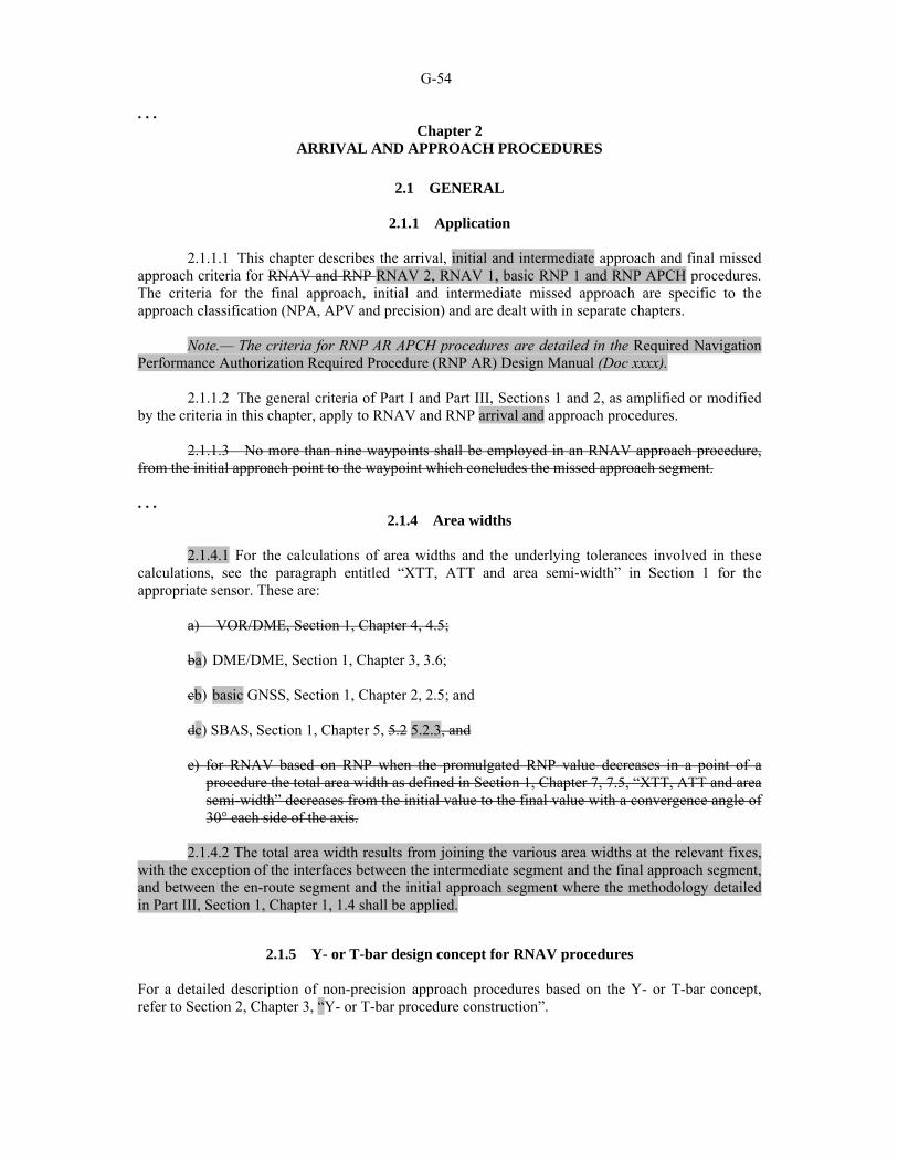
G-54 . . .
Chapter 2 ARRIVAL AND APPROACH PROCEDURES
2.1 GENERAL
2.1.1 Application
2.1.1.1 This chapter describes the arrival, initial and intermediate approach and final missed
approach criteria for RNAV and RNP RNAV 2, RNAV 1, basic RNP 1 and RNP APCH procedures. The criteria for the final approach, initial and intermediate missed approach are specific to the approach classification (NPA, APV and precision) and are dealt with in separate chapters.
Note.— The criteria for RNP AR APCH procedures are detailed in the Required Navigation Performance Authorization Required Procedure (RNP AR) Design Manual (Doc xxxx).
2.1.1.2 The general criteria of Part I and Part III, Sections 1 and 2, as amplified or modified by the criteria in this chapter, apply to RNAV and RNP arrival and approach procedures.
2.1.1.3 No more than nine waypoints shall be employed in an RNAV approach procedure, from the initial approach point to the waypoint which concludes the missed approach segment. . . .
2.1.4 Area widths
2.1.4.1 For the calculations of area widths and the underlying tolerances involved in these calculations, see the paragraph entitled “XTT, ATT and area semi-width” in Section 1 for the appropriate sensor. These are:
a) VOR/DME, Section 1, Chapter 4, 4.5;
ba) DME/DME, Section 1, Chapter 3, 3.6;
cb) basic GNSS, Section 1, Chapter 2, 2.5; and
dc) SBAS, Section 1, Chapter 5, 5.2 5.2.3, and
e) for RNAV based on RNP when the promulgated RNP value decreases in a point of a procedure the total area width as defined in Section 1, Chapter 7, 7.5, “XTT, ATT and area semi-width” decreases from the initial value to the final value with a convergence angle of 30° each side of the axis.
2.1.4.2 The total area width results from joining the various area widths at the relevant fixes,
with the exception of the interfaces between the intermediate segment and the final approach segment, and between the en-route segment and the initial approach segment where the methodology detailed in Part III, Section 1, Chapter 1, 1.4 shall be applied.
2.1.5 Y- or T-bar design concept for RNAV procedures For a detailed description of non-precision approach procedures based on the Y- or T-bar concept, refer to Section 2, Chapter 3, “Y- or T-bar procedure construction”.

G-55
2.2 ARRIVAL ROUTES
2.2.1 General Arrival obstacle clearance criteria shall apply up to the initial or intermediate approach fix (see Part I, Section 4, Chapter 2). See Figures III-3-2-1 and III-3-2-2. . . .
Editorial Note.— Delete paragraphs 2.2.3, 2.2.4, 2.2.5 and 2.2.6. . . .
2.4 INTERMEDIATE APPROACH SEGMENT . . .
2.4.2 Intermediate approach length
2.4.2.1 The intermediate segment may consist of two components:
a) a turning component (where used) abeam the intermediate waypoint followed by
b) a straight component immediately before the final approach waypoint. . . .
2.6 END OF THE MISSED APPROACH SEGMENT — MAHF A waypoint (MAHF) defining the end of the missed approach segment shall be located at or after the point where the aircraft, climbing at the minimum prescribed gradient for each segment, reaches the minimum altitude for en route or holding, whichever is appropriate. . . .
Editorial Note.— Delete Figure III-3-2-1. Replace Figures III-3-2-2 and III-3-2-3 with the following new figures. Delete Figures III-3-2-4 a) and b). Renumber Figures III-3-2-5 and III-3-2-6 as III-3-2-3 and III-3-2-4. Delete Figure III-3-2-7.

G-56
Figure III-3-2-1. Arrival - IAF greater than or equal to 56 km (30 NM) ARP

G-57
Figure III-3-2-2. Arrival - IAF less than 56 km (30 NM) ARP

G-58
. . . Chapter 3
NON-PRECISION APPROACH PROCEDURES
Add new paragraph 3.1 as follows:
3.1 GENERAL
3.1.1 Application
3.1.1.1 This chapter describes the non-precision approach criteria for RNP APCH procedures.
3.1.1.2 The general criteria of Part I, Section 3 and Part III, Sections 1 and 2 as amplified or modified by the criteria in this chapter apply.
3.12 FINAL APPROACH SEGMENT
3. 12.1 Final approach alignment
The final approach track should be aligned with the runway centre line; if this is not possible, the criteria in Part I, Section 4, Chapter 5, 5.2, “Alignment” apply.
3. 12.2 Final approach length
3.12.2.1 The optimum length is 9.3 km (5.0 NM) (Cat H, 3 704 m (2.0 NM)), but it should normally not exceed 18.5 km (10 NM). For lengths greater than 11.1 (6.0 NM), the provisions of Part I, Section 4, Chapter 5, 5.4.6.2 b) apply. The minimum length of the final segment and distance between FAF and threshold shall not be less than 5.6 km (3.0 NM) except for Cat H.
3.1.2.2 The minimum length for VOR/DME and DME/DME is determined according to Section 1, Chapter 4, Table III-1-4-2 and to the criteria in Section 1, Chapter 1, 1.2, “Satisfactory fixes”.
3.12.3 Final approach area width
3.12.3.1 The principle of secondary areas applies.
3.12.3.2 The final approach segment area width is derived from joining the primary and secondary area boundaries at the FAF and the MAPt. the area semi-width published for the MAPt and the merging methodology detailed in Part 3, Section 1, Chapter 1, 1.4.3.
3. 12.3.3 For area widths see Part III, Section 1, Chapter 2, basic GNSS RNAV.
3.12.4 Obstacle clearance
The minimum obstacle clearance in the primary area is 75 m (246 ft), increased as specified in Part I, Section 4, Chapter 5, 5.4.5.2 b), “Excessive length of final approach”, in case of excessive length of the final segment.
3.12.5 Descent gradient
The general criteria of Part I, Section 4, Chapter 5, 5.3, “Descent gradient”, apply.

G-59
3.23 INITIAL AND INTERMEDIATE MISSED APPROACH SEGMENT
General criteria apply as modified by this paragraph.
3.23.1 Missed approach point (MAPt)
The missed approach point (MAPt) shall be defined by a flyover waypoint.
3.23.2 Location of MAPt
For a runway-aligned approach, the missed approach point shall be located at or before the threshold. Where the final segment is not aligned with the runway centre line, the optimum location is the intersection of the final approach course and the extended runway centre line. (See Figure III-3-3-1). Where necessary, the MAPt may be moved away from the threshold towards the FAF provided that the OCA/H is not lower than the altitude/height at the MAPt on a nominal 5.2 per cent (3°) descent gradient or the promulgated descent gradient if steeper. An increase in OCA/H may be required to meet this condition.
3.23.3 Missed approach area length
Minimum segment length distances between the MAPt and the MATF or the MAHF are contained in Table III-2-1-4 or III-2-1-10.
Editorial Note.— Renumber paragraphs 3.2.4 and 3.2.5 as 3.3.4 and 3.3.5 and delete existing paragraph 3.2.6.
Editorial Note.— Delete Figures III-3-3-1, III-3-3-2 and III-3-3-4. Renumber Figure III-3-3-3 as Figure III-3-3-1. Add new Figures III-3-3-2 and III-3-3-3 as follows:

G-60
Figure III-3-3-2. RNP APCH areas

G-61
Figure III-3-3-3. RNP APCH missed approach areas
G-62
Chapter 4 APV/BAROMETRIC VERTICAL NAVIGATION
(BARO-VNAV)
Note 1.— Barometric vertical navigation (Baro-VNAV) is a navigation system that presents to the pilot computed vertical guidance referenced to a specified vertical path angle (VPA), nominally 3°. The computer-resolved vertical guidance is based on barometric altitude and is specified as a vertical path angle from reference datum height (RDH).
Note 2.— APV/Baro-VNAV criteria provided in this chapter do not include procedure design criteria for RNP AR APCH procedures. Vertical obstacle clearance for APV/Baro-VNAV based on RNP AR APCH is predicated on a specific, well-defined vertical error budget (VEB). This VEB is not used in APV/Baro-VNAV criteria where different design criteria are applied.
Note 2 3.— In this chapter, distances and heights related to obstacle clearance surfaces are all in SI units. Distances and heights are measured relative to threshold (positive before/above threshold, negative after/below threshold). If non-SI units are required, the appropriate conversions must be made as in the GBAS criteria (see Chapter 6).
4.1 GENERAL
4.1.1 This chapter describes the APV/Baro-VNAV criteria. The general criteria and Sections 1, 2 and 3, Chapter 2, as amplified or modified by criteria in this chapter, apply to area navigation (RNAV) approach procedures using barometric vertical navigation (Baro-VNAV). The criteria associated with the lateral navigation performance (LNAV) are based on the RNP APCH criteria detailed in Chapter 3. . . .
4.2 STANDARD CONDITIONS
Note.— Guidance on the airworthiness approval of APV/Baro-VNAV equipment and the operational approval process for APV/Baro-VNAV operations can be found in the Performance-based Navigation (PBN) Manual (Doc 9613).
Note.— Acceptable means of compliance can be found in documents such as Federal Aviation Administration (FAA) AC 90-97 (Use of Barometric Vertical Navigation (VNAV) for instrument Approach Operations using Decision Altitude), which references FAA AC 20-1381, AC 20-130A2 and AC 20-1293. Examples of database quality requirements can be found in the ICAO World Geodetic System — 1984 (WGS-84) Manual (Doc 9674) and Radio Technical Commission for Aeronautics (RTCA) Do-201A4/European Organization for Civil Aviation Equipment (EUROCAE) ED 775 and RTCA Do-200A6/EUROCAE ED 767, AC120-29A/ Criteria for Approval of Category I and Category II Weather Minima for Approach, AC25-15/Approval of Flight Management Systems in Transport Category Airplanes and RTCA Do 229C/Minimum operational performance standards for global positioning systems/wide area augmentation system airborne.
4.2.1 Use of Baro-VNAV procedures developed in accordance with this chapter assume that the aircraft is equipped with at least the following:
a) a VNAV system certificated for approach operations including the ability to have timely changeover to positive course guidance for missed approach; and
Note.— See AC120-29A, paragraph 4.3.1.8a(2), AC 25-15, paragraph 5.e(1) (ii) (B)
(1) and RTCA Do-229C.

G-63
b) an LNAV system with a certificated along- and across-track performance (TSE), equal to or less than 0.6 km (0.3 NM), 95 per cent probability (see also 4.2.2). The following systems are deemed to meet this requirement:
1) GNSS navigation equipment certificated for approach operations; or
2) multi-sensor systems using inertial reference units in conjunction with DME/DME or GNSS certificated for approach operations; or
3) RNP systems approved for RNP 0.3 approach operations or less; and c) a navigation database containing the waypoints and associated RNAV and VNAV
information (RDH and VPA) for the procedure and the missed approach that is automatically loaded into the navigation system flight plan when selected by the crew.
4.2.1.1 Aircraft equipped with SBAS class 2, 3 or 4 avionics may use SBAS vertical
guidance instead of baro vertical guidance when flying a Baro-VNAV procedure developed in accordance with this chapter, provided that the State has determined that the SBAS vertical navigation system error is 27 m or less. . . .
4.3 APV SEGMENT
. . .
4.3.2 APV OAS. The APV OAS start at the final approach point (FAP) which is located at the intersection of the vertical path and the minimum height specified for the preceding segment. The FAP should not normally be located more than 19 km (10 NM) before the threshold. The APV OAS ends at the MAHF or MATF, whichever is first. The LNAV FAF and MAPt are primarily used to define the geometry of the areas and surfaces. Once the procedure has been designed, the FAF and MAPt of the associated LNAV procedure are solely used for database coding purposes and to define any underlying LNAV procedure (RNP APCH).
4.3.3 Relation of APV-OAS surface with LNAV criteria. The upper/outer edges of the APV-OAS side surfaces are based on the outer edges of the LNAV secondary areas of the LNAV system providing the final approach guidance. The lower/inner edges of the APV-OAS side surfaces are based on the edges of the LNAV primary area of LNAV system providing the final and missed approach guidance (see Figures III-3-4-2 to III-3-4-4). The outer edges of the side surfaces are as follows: . . .
4.3.5.2 Final approach surface (FAS). The origin of the final approach surface is at threshold level and located at a distance before threshold equal to the point where the vertical path reaches a height of MOCapp above threshold, plus a longitudinal distance of 556 m 444 m (ATT). The final approach surface extends to the range of the nominal FAP + ATT with an angle as defined in 4.3.5.2.2. (See Figure III-3-4-5). . . .
4.3.5.2.3 Calculation of final approach surface angle and origin. The angle of the final approach surface (FAS) can be determined as follows:
. . . where: MOCapp = approach MOC

G-64 RDH = reference datum height (m) ATT = along track tolerance (444 556 m) For temperature correction see Appendix A.
Add new paragraphs as follows:
4.3.5.3 To protect aircraft equipped with vertical angular scaling, flying APV/Baro-VNAV procedures, an additional assessment of obstacles shall be made when the length of the final approach segment is greater than 9.26 km (5 NM).
4.3.5.3.1 Obstacle assessment. The additional assessment surface is derived from application of the W surface. When the final approach segment is longer than 9.26 km (5 NM), after the point where the W plane intersects the final approach surface, the W plane becomes the obstacle assessment surface in the primary area out to the FAP. The constants for calculation of the W surface are contained on the OAS CD ROM. See Figures III-3-4-8 and III-3-4-9.
Editorial Note.— Renumber subsequent paragraphs.
4.3.5.45 Missed approach (Z) surfaces
Note.— The criteria in this chapter however, assumes that the RNAV system has use of an appropriately certificated VNAV and LNAV system (including the ability to have timely change over to positive course guidance for missed approach in a timely manner), in order to allow the use of secondary areas.
. . .
4.5 PROMULGATION
4.5.1 The general criteria in Part I, Section 4, Chapter 9, 9.5, “Procedure naming for arrival and approach charts” apply. The instrument approach chart shall be entitled RNAV(GNSS) Rwy XX or RNAV(DME/DME). The minimum box on the chart shall include OCA/H values for NPA (LNAV) and APV/Baro-VNAV (LNAV/VNAV) operations and shall include the RNP value where applicable. . . .
Editorial Note.— Replace Figure III-3-4-2 by the following:

G-65
Figure III-3-4-2. APV/Baro-VNAV area – APV OAS in plan view
. . .
Insert new Figures III-3-4-8 and III-3-4-9 as follows:
Figure III-3-4-8. Profile view of obstacle assessment surface to protect aircraft equipped with vertical angular scaling
Final approach surface (FAS)
Threshold to W surface origin
W surface
Resultant obstacle assessment surface
Threshold to FAS origin
Approx 2.2 NM

G-66
Figure III-3-4-9. Plan view of the obstacle assessment surface to protect aircraft equipped with vertical angular scaling

G-67
. . .
Chapter 5 APV I/II PROCEDURES – SBAS
. . .
5.4 APV SEGMENT . . .
Editorial Note.— Add a new paragraph 5.4.5.9.4 as follows: 5.4.5.9 Determination of OCA/H . . . 5.4.5.9.4 Adjustment for high airfield elevations and steep glide path angles 5.4.5.9.4.1 Height loss (HL)/altimeter margins. The margins in Table II-1-1-2 shall be adjusted as follows: a) for airfield elevations higher than 900 m (2 953 ft), the tabulated allowances shall be
increased by 2 per cent of the radio altimeter margin per 300 m (984 ft) airfield elevation; and
b) for glide path angles greater than 3.2, in exceptional cases, the allowances shall be increased
by 5 per cent of the radio altimeter margin per 0.1 increase in glide path angle between 3.2 and 3.5 .
5.4.5.9.4.2 Steep glide path angle. Procedures involving glide paths greater than 3.5° or any angle when the nominal rate of descent (Vat for the aircraft type multiplied by the sine of the glide path angle) exceeds 5 m/sec (1 000 ft/min) are non-standard for fixed-wing aircraft. They require the following:
a) increase of height loss margin (which may be aircraft-type specific);
b) adjustment of the origin of the missed approach surface;
c) adjustment of the slope of the SBAS APV OAS W and W’ surfaces;
d) re-survey of obstacles; and
e) the application of related operational constraints. Such procedures are normally restricted to specifically approved operators and aircraft and are associated with appropriate aircraft and crew restrictions. For fixed-wing aircraft they are not to be used as a means to introduce noise abatement procedures. 5.4.5.9.4.3 Appendix A shows the procedure design changes required for APV SBAS procedures for glide path angles up to 6.3° (11 per cent) and the related operational/certification considerations. . . .

G-68
Editorial Note.— Add the following paragraph and renumber subsequent paragraphs.
5.6 SIMULTANEOUS ILS/MLS/GBAS/APV SBAS APPROACHES TO PARALLEL OR NEAR-PARALLEL
INSTRUMENT RUNWAYS Note.— Guidance material is contained in the Manual on Simultaneous Operations on Parallel or Near-Parallel Instrument Runways (Doc 9643).
5.6.1 General When it is intended to use an APV SBAS approach procedure to parallel runways, simultaneously with ILS, MLS or GBAS precision approach, the following additional criteria shall be applied in the design of both procedures:
a) the maximum intercept angle with the final approach course approach track is 30°. The point of intercepting the final approach track course should be located at least 3.7 km (2.0 NM) prior to the point of intercepting the glide path;
b) the minimum altitudes of the intermediate segments of the two procedures differ by at least
300 m (1 000 ft); and
c) the nominal tracks of the two missed approach procedures diverge by at least 30°, the associated missed approach turns being specified as “as soon as practicable” which may involve the construction of (a) missed approach procedure(s).
APV SBAS approaches may also be implemented to serve both runways simultaneously; however, a separate safety study needs to be carried out when it is intended to use SBAS for both runways.
5.6.2 Obstacle clearance The obstacle clearance criteria for APV SBAS and precision approaches, as specified in the designated chapters, apply for each of the parallel approach procedures. In addition to these criteria, a check of obstacles shall be made in the area on the side opposite the other parallel runway, in order to safeguard early turns required to avoid potential intruding aircraft from the adjacent runway. This check can be made using a set of separately defined parallel approach obstacle assessment surfaces (PAOAS). An example of a method to assess obstacles for these procedures is included in Part II, Section 1, Chapter 1, Appendix D. . . .

G-69
Add a new Appendix A to Chapter 5 as follows:
Appendix A to Chapter 5
STEEP GLIDE PATH ANGLE APPROACHES UP TO 6.3° (11 per cent)
1. GENERAL
1.1 For fixed-wing aircraft, glide path angles above 3.5° should be used in approach procedure design only for obstacle clearance purposes and must not be used as a means to introduce noise abatement procedures. Such procedures are non-standard and require special approval. 1.2 The use of the APV SBAS criteria in this appendix is limited to procedures with a glide path angle smaller than or equal to 6.3° (11 per cent).
2. PROCEDURE DESIGN
2.1 Obstacle clearance criteria The following obstacle clearance criteria should be adjusted for the specific glide path angle: a) the W and W’ surfaces of the SBAS APV OAS; b) origin of the Z surface of the SBAS APV OAS; and c) height loss/altimeter margin (see paragraph 3).
2.2 Determination of the SBAS APV OAS coefficients
• W surface: Coefficient AW is determined by the formula AW = 0.0239 + 0.0092 (θ – 2.5) in which θ is the glide path angle in degrees. Coefficient CW = –6.45
• W’ surface: Coefficients AW’ and CW’ are determined by the formula AW’ = tan(0.75θ) CW’ = - 50 + RDH tan(0.75θ)/tan(θ) for APV I and CW’ = - 20 + RDH tan(0.75θ)/tan(θ) for APV II

G-70 where RDH = reference datum height (m) θ = glide path angle
• X and Y surfaces: The X and Y surface coefficients for 3.5° glide path at the appropriate GARP/threshold distance are used for all glide path angles greater than 3.5°.
• Z surface: The coefficient Cz for the Z surface is determined by the formula
CZ = –AZ XE where AZ is the A coefficient for the selected missed approach gradient; and XE is the new coordinate of the Z surface origin:
XE = - [900 + (38/tanθ) + 50( θ-3.5°)/0.1°] for APV I and XE = - [900 + (8/tanθ) + 50 (θ-3.5°)/0.1]°for APV II
For Cat H, XE = - [700 + (38/tanθ) + 50( θ-3.5°)/0.1°] for APV I and XE = - [700 + (8/tanθ) + 50( θ-3.5°)/0.1°] for APV II.
2.3 Determination of the height of equivalent approach obstacle Use the formula: ha = [hma cot Z + (x – XE)]/(cot Z + cot θ) where ha = height of equivalent approach obstacle hma = height of missed approach obstacle θ = glide path angle Z = angle of missed approach surface XE = new coordinate of the Z surface origin x = range of obstacle relative to threshold (negative after threshold).
2.4 Re-survey of obstacles As the configuration of the SBAS APV OAS is changed, a re-survey of obstacles may be required.

G-71
2.5 Promulgation A special note shall be included on the instrument approach chart stating that appropriate aircraft and crew qualifications are required to use such a procedure (see Annex 4, 11.10.8.8).
3. HEIGHT LOSS MARGIN AND OTHER CONSIDERATIONS
3.1 Height loss margins for glide paths greater than 3.5° The height loss margin can be obtained by extrapolation from the formulas in Part II, Section 1, Chapter 1, 1.4.8.8.3.1 and Chapter 3, 3.4.8.8.3.1, both entitled “Height loss (HL)/altimeter margins”. However, this extrapolation may not be valid for glide paths greater than 3.5° or less than 3.5° when the nominal rate of descent (Vat for the aircraft type multiplied by the sine of the glide path angle) exceeds 5 m/sec (1 000 ft/min), unless certification on flight trials has verified the effects of:
a) minimum drag configuration; b) wind shear; c) control laws; d) handling characteristics; e) minimum power for anti-icing; f) GPWS modification; g) use of flight director/autopilot; h) engine spin-up time; and i) Vat increase for handling considerations.
3.2 Additional operational considerations for height loss margin In addition, the height loss margin may be inadequate unless operational consideration is given to configuration, engine-out operation, maximum tailwind — minimum headwind limits, GPWS, weather minima, visual aids and crew qualifications, etc. . . .
Chapter 7 HOLDING PROCEDURES
7.1 GENERAL 7.1.1 This chapter contains the criteria for RNAV holding procedures.

G-72
Editorial Note.— Remainder of 7.1.1 has been moved to new 7.1.2.1. 7.1.2 Holding procedures can be designed both for operations with navigation specifications that require and do not require an aircraft equipment holding functionality. 7.1.2.1 Navigation specifications requiring RNAV systems with holding functionality. Aircraft equipped with RNAV systems have the flexibility to hold on tracks which are defined by the RNAV equipment and to use procedures which are less rigid than those used in conventional holdings. The benefits of using this technique include the optimum utilization of airspace with regard to the siting and alignment of holding areas as well as, under certain circumstances, a reduction of holding area airspace.
Note.— A navigation specification requiring RNAV systems with holding functionality is
currently under development.
7.1.2.2 Navigation specifications not requiring RNAV systems with holding functionality. For RNAV systems without any holding functionality it is possible to define an RNAV holding procedure, to be flown manually, based on a waypoint. A conventional holding template shall be used to construct the obstacle clearance area for this type of holding. Navigation specifications not requiring RNAV systems with holding functionality are RNAV 1 and 2, basic RNP 1, RNP APCH and RNP AR APCH. 7.1.23 Flight management systems are normally controlled through a navigation database. 7.1.34 Location and number of holding patterns. To avoid congestion only one holding pattern should be established for each procedure. The normal location would be at one of the IAFs. RNAV holding waypoints shall be located so that they are referenced to and verifiable from specified radio navigation facilities. The holding waypoint (MAHF) is a flyover waypoint.
7.2 TYPES OF RNAV HOLDING PROCEDURES FOR VOR/DME, DME/DME AND GNSS PROCEDURES
7.2.1 The following three two types of RNAV holding procedures may be established:
a) one waypoint RNAV holding;: 1) for operations requiring RNAV systems with holding functionality; and 2) for operations not requiring RNAV systems with holding functionality; and b) two waypoint RNAV holding; and cb) area holding. This type of holding may be applied for both types of operations as specified in
7.1.2.
The general criteria contained in Part I, Section 4, Chapter 3, Appendix C for conventional holding using an outbound leg defined by distance apply as modified by the criteria listed under each holding type.

G-73 7.2.2 One wWaypoint RNAV holding (See Figure III-3-7-1 a)) 7.2.2.1 Operations requiring RNAV systems with holding functionality
a) It is assumed that the RNAV system is able to compensate for the effect of a wind coming
from the outside of the outbound turn by a reduction of the bank angle.
b) The length of the outbound leg of the holding pattern is at least equal to one diameter of turn.
c) It is assumed that the RNAV system is able to correct the drift on straight segments.
d) No heading tolerance is taken into account on the straight segments.
7.2.2.2 Operations not requiring RNAV systems with holding functionality (i.e. class A basic GNSS receivers)
a) This type of holding will be flown manually, and RNAV track guidance is only provided on the inbound track.
b) No wind compensation effects or drift correction by the RNAV system are considered.
c) The end of the outbound leg of the holding is defined by timing or by a distance from the
holding waypoint (WD) provided by the RNAV system.
7.2.3 Two waypoint RNAV holding. This type of holding is similar to one waypoint RNAV holding with the addition of a second waypoint to define the end of the outbound leg (see Figure III-3-7-1 b)). Inclusion of this second waypoint results in a reduction in required airspace by:
a) reducing the basic protection area; and b) reducing the omnidirectional entry protection areas.
Note.— Flight management systems designed only for single waypoint holding procedures will normally require software modifications to cater for two waypoint holding procedures. Procedure designers are advised that not all FMS will be so modified, and provision will always be required for aircraft with unmodified systems. 7.2.4 7.2.3 Area holding. This type of holding provides a circular area, centred on a designated waypoint, large enough to contain a standard racetrack holding pattern in any orientation. (See Figure III-3-7-1cb).)
7.3 ENTRY PROCEDURES FOR VOR/DME, DME/DME AND GNSS PROCEDURES
7.3.1 One w Waypoint RNAV holding
Entry procedures to one a waypoint RNAV holding shall be the same as those used for conventional holding.

G-74
7.3.2 Two waypoint RNAV holding The line passing through the two waypoints divides the area into two sectors. An entry from a given sector shall be made through the corresponding waypoint. After passing the waypoint, the aircraft shall turn to follow the procedure. (See Figure III-3-7-2.)
7.3.32 Area holding Any entry procedure which is contained within the given area is permissible.
7.4 FIX TOLERANCE 7.4.1 The fFix tolerance is the greater of the fix tolerances of the individual sensors allowed for in the application of the navigation specification operation. depends on the sensors on which the holding procedure is based. DME/DME and basic GNSS fix tolerance are described in Section 1, Chapter 3, 3.56 and Chapter 2, 2.5 respectively. For RNP procedures the fix tolerance does not apply in the design of the procedure.
Note.– Some regional operations allow the use of VOR/DME. 7.4.2 For VOR/DME fix tolerance the following two paragraphs apply. 7.4.2.1 Fix tolerance — one waypoint and two waypoint holding. The waypoint tolerances for the construction of waypoint fix tolerance areas (VT, DT, AVT, ADT) are calculated as shown in Section 1, Chapter 4, 4.5, “XTT and ATT”. (See also Figure III-3-7-3.) 7.4.32.2 Fix tolerance — area holding. In order to achieve a circular holding area it is necessary to construct a circular waypoint fix tolerance area centred on the holding waypoint. The radius (Rt) of this tolerance area is given by: Rt = max(DTT, D sin α) where: α = VOR system use accuracy DTT = DME system use accuracy D = distance from holding waypoint to VOR/DME. (See Figure III-3-7-3.)
7.5 HOLDING AREA CONSTRUCTION FOR VOR/DME, DME/DME AND GNSS PROCEDURES
7.5.1 One wWaypoint holding area
The holding area is constructed by applying the basic holding area, defined techniques in Part II, Section 4, Chapter 1, 1.3, “Construction of holding areas” to the waypoint tolerance area.

G-75
7.5.2 Details of pProtection area construction for waypoint holding area (one waypoint holding area)
7.5.2.1 General. The general criteria described in 3.3, “Protection area of racetrack and holding procedures” of Part I, Section 4, Chapter 3, Appendix C, “Initial approach segment” “Construction of obstacle clearance areas for reversal and holding procedures” apply as modified by the criteria in this paragraph. The criteria are broken down into the following three steps: (see Appendix A, paragraph 1).
a) construction of the RNAV a template; b) basic area construction; and c) construction of entry area.
7.5.2.2 This additive tolerance method, the template tracing technique (TTT), is described in Appendix A.
Editorial Note.– Existing paragraphs 7.5.2.2 to 7.5.2.4 have been moved to Appendix A of this chapter.
7.5.3 Two waypoint holding area The holding area is constructed by applying the techniques of Part II, Section 4, Chapter 1, 1.3, “Construction of holding areas” to each waypoint as if it were a holding fix. The techniques of Part II, Section 4, Chapter 1, are used until the outbound turn from each waypoint is protected. These protection curves are then joined by their common tangents and the area thus enclosed is the holding area. The protection required for the entry manoeuvre is described by the area enclosed by wind spirals applied successively to the most penalistic points of the waypoint tolerance area and the common tangents to those spirals.
7.5.4.3 Holding area The holding area shall contain the basic holding protection area rotated about the waypoint fix tolerance area described in 7.4.3 7.4.2.2. (See Figures III-3-7-1 cB) and III-3-7-.32.)
7.6 HOLDING AREA CONSTRUCTION FOR RNP
Note.– These criteria were developed prior to the introduction of the PBN concept. They are retained in PANS-OPS to support existing RNP applications based upon national authorizations. It is anticipated that they will be superseded by PBN-specific criteria once the appropriate navigation specifications have been issued.
7.6.1 Parameters that define the maximum RNP holding pattern.
The maximum RNP holding pattern is defined by: . . .

G-76 See Figures III-3-7-83 and III-3-7-94. . . .
7.6.3 RNP holding plus Sector 4 entries limit The RNP “holding plus sector 4 entries” limit results from combining the RNP holding pattern with the sector 4 protection limit (see Figure III-3-7-83). . . .
7.6.4 Obstacle clearance 7.7.1.1 RNP holding area. The holding area includes the basic RNP holding area and the additional protection for entries from Sector 4 (see above). Holding area protection (See Figure III-3-7-94) consists of two parts: primary area and buffer area. These are applied to the maximum track defined in Figure III-3-7-83 as described below. . . .
Insert new paragraph 7.7 as follows:
7.7 PROMULGATION OF RNAV HOLDING PROCEDURES
7.7.1 RNAV holding for RNAV systems with holding functionality For this type of holding the outbound leg is defined by its length. The outbound length shall be published on the approach chart expressed in kilometres (nautical miles).
7.7.2 RNAV holding for all RNAV systems 7.7.2.1 For holding flown manually the outbound leg is either defined by a timing or a distance from the holding waypoint.

G-77 7.7.2.2 Where the two types of RNAV holding patterns (both the ones to be flown manually and the ones with holding functionality) are possible on the same waypoint, the length of the outbound leg and either the timing or WD shall be published. 7.7.2.3 For holding coded in a system with holding functionality, the outbound leg distance to be coded shall be provided in the procedure description tabular form on the verso of the chart or on a separate, properly referenced sheet (see the example below). Example:
Path descriptor
Fix identifier (waypoint
name)
Inbound course
° M (° T)
Leg
distance Turn
direction Minimum altitude
Maximum altitude
Speed limit
Magnetic variation
Navigation specification
Hold POLIN 270 (272.3)
4.0 R 2 000 6 000 250 –2.3 RNAV 1
7.7.2.4 Where the outbound leg is defined by a distance from the holding waypoint, the waypoint distance (WD) shall be published on the approach chart expressed in tenths of kilometres (tenths of nautical miles).
Note.— The holding waypoint may not be charted as a flyover waypoint, but the pilot and/or aircraft navigation system is expected to treat the waypoint as a flyover waypoint while flying the holding (see Appendix A for background and rationale). 7.7.2.5 See Appendix B for the definition of RNAV sectors. . . .

G-78 Insert revised Figure III-3-7-1 (Items A and B have been replaced by a new A and Item C has been renamed B) as follows:
Figure III-3-7-1. Types of RNAV holding procedures

G-79
Editorial Note.— Delete Figure III-3-7-2 and renumber Figures III-3-7-3 as III-3-7-2. Move Figures III-3-7-4, III-3-7-5 a), III-3-7-5 b), III-3-7-6 and III-3-7-7 to new Appendix A. Renumber Figures III-3-7-8 and III-3-7-9 as Figures III-3-7-3 and III-3-7-4, respectively.
Add new Appendix A to Chapter 7 as follows:
Appendix A to Chapter 7
CONSTRUCTION OF OBSTACLE CLEARANCE AREA FOR VOR/DME, DME/DME AND GNSS RNAV HOLDING
1. GENERAL
The holding area construction is broken down into the following three steps:
a) construction of the template; b) basic area construction; and c) construction of entry area.
2. CONSTRUCTION OF THE TEMPLATE
2.1 RNAV systems with holding functionality Construct a RNAV holding template using the following guidelines (see Figure III-3-7-App A-1 as an example):
a) choose the outbound distance: D is the length of the outbound leg; D shall be at least equal to one diameter of turn rounded to the next higher km (NM);
b) draw the nominal trajectory; locate point “i” at the end of the outbound leg; c) draw the protection of a turn of more than 180° as for a conventional template (see Diagram
I-4-3-App C-6 in Part I, Section 4, Chapter 3, Appendix C); d) draw a parallel to the outbound track tangent to line (2); e) from “i”, draw a perpendicular to the outbound track; f) lines (3) and (4) intercept at i1;

G-80
g) place conventional template point “a” on “i”, then on “i1”, with axis parallel to the outbound leg and, in both cases, draw the protection of a turn of more than 180°; draw the tangent T to these protections;
h) draw the tangent T1 between line (6) and line (2); i) draw the tangent T2 between line (2) and (6); and j) locate point E on the template (see Part I, Section 4, Chapter 3, Appendix C, 3.3.2.2.4.7) and
use the following formulas for XE and YE (which are different from those in Part I, Section 4, Chapter 3, Appendix C, 3.3.2.2.4.7):
(See Figures III-3-7-App A-2 a) and III-3-7-App 2-b).)
2.2 RNAV systems without holding functionality
Construct a conventional holding template according to Part I, Section 4, Chapter 3, Appendix C, 3.3.2 or use a template from the Template Manual for Holding, Reversal and Racetrack Procedures (Doc 9371) for the appropriate time, speed and altitude.
3. CONSTRUCTION OF THE BASIC AREA
3.1 Holding point tolerance area
Draw around holding point A the RNAV fix tolerance associated with the waypoint and locate points A1, A2, A3 and A4 on the four corners of this area.
3.2 Basic area construction
3.2.1 RNAV system with holding functionality
(See Figure III-7-3-App A-3.) a) place the RNAV template point “a” successively on A1, A2, A3 and A4 to draw curves “1”,
“2”, “3” and “4”; and
b) draw the common tangents to curves “1” and “2”, “2” and “4”, “3” and “4”, “3” and “1”.
3.2.2 RNAV systems without holding functionality
3.2.2.1 Outbound leg of the holding defined by timing
(See Figure III-7-3-App A-4.)
'105119011112 WRR
vDrXE ⎟⎠⎞
⎜⎝⎛ ++++++=
'151190201120sin.20cos.11 WRRR
rrvYE ⎟⎠⎞
⎜⎝⎛ ++++++°+°=

G-81
a) place the conventional template point “a” successively on A1, A2, A3 and A4 to draw curves
“1”, “2”, “3” and “4”;
b) draw the common tangents to curves “1” and “2”, “2” and “4”, “3” and “4”, “3” and “1”. 3.2.2.2 Outbound leg of the holding defined by distance
(See Figure III-7-3-App A-5.) 3.2.2.2.1 Protection of outbound turn and the outbound leg
a) place the conventional template point “a” on Al, with axis parallel to the inbound track, and draw curve “l” (part of the outline of the template) and circle with centre “g” and radii WG;
b) place the conventional template point “a” on A3, with axis parallel to the inbound track, and
draw curve “2” (part of the outline of the template) and line “3” (protection of the outbound leg in the direction of the non-manoeuvring side); and
c) draw the common tangent to curves “l” and “2” and extend the straight part of curve “l” and
the line “3” in the direction of the outbound end. 3.2.2.2.2 Calculation of the limiting outbound distance: WD WD is the distance between the holding waypoint and the vertical projection of the end of the outbound track onto the WGS-84 ellipsoid. The distance parameters are chosen and calculated in the following sequence: a) choice of the outbound length: ds ds is the horizontal length of the outbound leg; ds should conform to the relationship ds > vt,
where t is the outbound timing, as specified in Part I, Section 4, Chapter 3, 3.5.5, “Outbound time” for racetrack procedures and in Part II, Section 4, Chapter 1, 1.3.2.2, “Outbound timing” for holding procedures;
b) calculation of the limiting outbound distance: WD
WD is the horizontal distance between the holding point and the vertical projection of the end of the outbound track.
WD = (ds2 + 4 r2) 1/2
c) minimum value for WD
Additionally, in order to guarantee that this distance does not cross the area containing the end of the outbound turn, the limiting outbound distance is such that it does not cross the area containing the end of the outbound turn. Practically, a circle with centre “holding point” and radius WD shall not interfere with the circle with centre “g” and radii WG as drawn as described in 3.2.2.2.1 a).

G-82
If the distance calculated in point b) is such that an interference occurs, the WD shall be increased up to a value complying with these criteria.
Note.– The minimum value of WD complying with these criteria may also be determined using the formula:
WD = [(ATT+11v)2 +(2r+XTT)2]1/2 + Wg
d) WD is then rounded to the next higher tenth of a km (or NM).
3.2.2.2.3 Area containing the end of the outbound leg
a) draw from A the inbound track “RP” and two lines “RP1” and “RP2” at a distance equal to XTT on each side of it
where XTT is the holding point cross-track tolerance
b) with centre on A, draw arcs “D” with a radius WD, “D1” with a radius WD-ATT, “D2” with
a radius WD+ATT
where ATT is the holding point along-track tolerance c) locate point C1 at the intersection of the extension of curve “1” with the arc D2;
d) locate points C2 and C3 at the intersection of the extension of line “3” with arcs D1 and D2;
and
e) if the aircraft intercepts the RNAV holding inbound track before reaching the limiting outbound distance WD, the pilot is assumed to follow outbound the RNAV track without drifting any further from the procedure axis, so:
where C2 and C3 are further from the procedure axis than RP2 (see Figure III-7-3-App A-6 a)), replace C2 an C3 by the intersection of RP2 with arcs D1 and D2 respectively; and where C3 only is further from the procedure axis than RP2 (see Figure III-7-3-App A-6 b)), replace C3 by the intersection of RP2 with D2, add point C’2 at the intersection of line “3” with RP2.
3.2.2.3 Protection of the inbound turn. Rotate the template 180°, then:
a) place template point “a” on C1, with axis parallel to the inbound track, and draw curve “4” (part of the protection line of a turn of more than 180°);
b) move the template point “a” along arc D2 from C1 to C3 (with axis parallel and opposite to
the inbound track) and draw curve “5”; c) place template point “a” on C2, C3 and eventually on C’2 and draw curves “6”, “7” and
eventually “8” and their common tangent; and

G-83
d) draw the tangent to curve “7” and “2”.
4. CONSTRUCTION OF THE ENTRY AREAS
4.1 RNAV system with holding functionality
(See Figure III-7-3-App A-7.)
Draw the circle centred on “A” passing through A1 and A3; apply the same method as explained in Part I, Section 4, Chapter 3, Appendix C, 3.3.3.2.1 using the RNAV holding template.
4.2 RNAV system without holding functionality
4.2.1 Outbound leg of the holding defined by timing
(See Figure III-7-3-App A-8.)
Draw the circle centred on “A” passing through A1 and A3; apply the same method as explained in Part I, Section 4, Chapter 3, Appendix C, 3.3.3.2.1 using the conventional holding template.
4.2.2 Outbound leg of holding defined by distance
(See Figure III-7-3-App A-9.)
Omnidirectional entry areas are defined according general principles. For sector 1 and sector 2 entries the outbound leg of the entry is limited by the holding outbound distance (WD).

G-84
Editorial Note.— Insert the following figures as indicated:
Figure III-3-7-App A-1. RNAV template for RNAV systems with holding functionality
0 1 2 3 4 5 6
0 1 2 3
km
NMD
A
T2
(3)
6
T
6T1
an3
(4)
i2(1)
(2)
g ho
p
c bd
e
f
B
i1
i
+E
Scale
distance D
Altitude: 3 050 m (10 000 ft)IAS: 405 km/h (220 kt)Outbound distance: 7.7 km (4.2 NM)

G-85
Figure III-3-7-5 a) App A-2 a). RNAV holding: XE calculation
r D 11 s rwind effect from
a to E max
B
D
A
11 s
C
15°E max
a

G-86
Figure III-3-7-5 b) App A-2 b). RNAV holding: YE calculation
70°
20°
B
A a
11.v.cos20°
r.sin20°
wind effect froma to E max
15°
r
D
E max

G-87
Figure III-3-7-6 App A-3. RNAV basic area for RNAV system with holding functionality
Editorial Note.— This figure has been amended by the addition of points A1, A2, A3 and A4 and identification of curves “1”, “2”, “3” and “4”.
Insert new Figures III-3-7-App A-4, III-3-7-App A-5 and III-3-7-App A-6 as follows:

G-88
Figure III-3-7-App A-4. RNAV holding basic area for RNAV system without holding functionality
- outbound leg defined by timing

G-89
Figure III-3-7-App A-5. RNAV holding basic area for RNAV system without holding functionality - outbound leg defined by distance

G-90
Figure III-3-7-App A-6

G-91
Insert Figure III-3-7-App A-7 as follows:
Figure III-3-7-7 App A-7. RNAV holding area including protection of entry procedures for RNAV system with holding functionality

G-92
Insert new Figures III-3-7-App A-8 and III-3-7-App A-9 as follows:
Figure III-3-7-App A-8. RNAV holding area including protection of entry procedures for RNAV system without holding functionality - outbound leg defined by timing

G-93
Figure III-3-7-App A-9. RNAV holding area including protection of entry procedures for RNAV system without holding functionality - outbound leg defined by distance

G-94
Appendix B to Chapter 7
. . . 1.2 DEFINING THE ENTRY SECTORS
a) Draw the outline of the holding pattern (see Figure III-3-7-App-B-1); and
. . .
Figure III-3-7-App B-1. Entry sectors
1
2 3
470°
A
(C1) (C2)

G-95 . . .
Chapter 8
EN-ROUTE PROCEDURES
8.1 GENERAL
8.1.1 Application
8.1.1.1 The criteria assume the use of any kind of sensor (such as VOR/DME, DME/DME, etc.). This chapter describes the en-route criteria for RNAV 5, RNP 4, RNAV 2 and RNAV 1. The general criteria of Part II, Section 3, “Enroute criteria” apply with the following modification: on the straight segments, the area has a constant width (angular limits do not apply). Note.— For RNP applicable to the en-route phase of flight, see the Manual on Required Navigation Performance (RNP) (Doc 9613).
8.1.1.2 The general criteria of Part I and Part III, Sections 1 and 2, as amplified or modified by the criteria in this chapter, apply.
Editorial Note.— Delete paragraphs 8.1.2, 8.1.2.1 and 8.1.2.2.
8.1.32 Secondary areas
For areas based on RNP criteria, The general principle of criteria for secondary areas is applied apply (see Part I, Section 2, Chapter 1, 1.2 and 1.3). For RNAV procedures, the criteria of Part II, Section 3, “Enroute criteria” apply.
8.1.3 Area widths For the calculation of area widths and the underlying tolerances involved in these calculations, see the paragraph entitled “XTT, ATT and area semi-width” in Part III, Section 1 for the appropriate sensor. These are:
a) basic GNSS, Section 1, Chapter 2, 2.2;
b) DME/DME, Section 1, Chapter 3, 3.6; and
c) VOR/DME, Section 1, Chapter 4, 4.6 The total area width results from joining the various area widths at the relevant fixes, with the exception of the interfaces between the en-route segment and the initial approach segment, and between the en-route segment and the departure segment where the methodology detailed in Part III, Section 1, Chapter 1, 1.4 should be applied.
8.1.4 Definition of turns Two kinds of enroute turns are specified:

G-96
a) the turn at a fly-by waypoint; b) the controlled turn (for RNP 1 routes only).
The turn at a fly-by waypoint is the only turn allowed in en-route RNAV operations.
8.1.5 Turn at a fly-by waypoint 8.1.5.1 General . . .
Editorial Note.— Delete paragraph 8.1.6.
8.1.67 Minimum altitudes See Part II, Section 3, Chapter 1. . . .
Section 5 PUBLICATION
Chapter 1
PUBLICATION AND CHARTING – GENERAL
. . .
Delete existing paragraph 1.3 and replace by new paragraph 1.3 as follows
1.3 RNAV DEPARTURES AND ARRIVALS 1.3.1 Chart titles. Charts shall be titled in accordance with Annex 4, 2.2.
1.3.2 Chart identification 1.3.2.1 The chart shall be identified in accordance with Annex 4, 9.5 for departures and 10.5 for arrivals and shall include the term RNAV. 1.3.2.2 The chart should include an identifier which is unique for that aerodrome and which may include reference to either a runway, fix or NAVAID.
1.3.3 Route designation 1.3.3.1 Each route shall be assigned a designator that is unique for that aerodrome. The designator shall be defined in accordance with Annex 11, Appendix 3. In addition, the first 4 letters of any 5LNC used in a route designator shall be unique for the aerodrome. Note 1.– Airborne navigation databases use a maximum of 6 characters to identify a route. If the

G-97 coded route designator is longer than 6 characters, the fifth character is not coded in navigation databases. Note 2.– The coded route designator may be charted alongside the route in the plan view. 1.3.3.2 Separate charts should be published only if the routes differ laterally or vertically. When operationally required, separate charts may be published for each sensor or for a combination of sensors.
1.3.4 Chart notes. RNAV-related requirements concerning equipment, operation, or navigation functionality shall be charted as a note. For example: “GNSS required” or “GNSS or DME/DME/IRU required” or: “BATEL 1L RF required” or “RF required”. Note.— Lengthy text may be shown on the verso of the chart. 1.3.5 Depiction Any RF requirement shall be charted with a note. The note may be charted with the applicable leg, or as a specific note with reference to the applicable leg. If RF is a common requirement within a given chart, then a general note should be used as indicated in 1.3.4.
Add new paragraph 1.4 as follows:
1.4 RNAV APPROACH 1.4.1 Chart titles. Charts shall be titled in accordance with Annex 4, 2.2.
1.4.2 Chart identification 1.4.2.1 The chart shall be identified in accordance with Annex 4, 11.6, and shall include the term RNAV. 1.4.2.2 RNP approach charts depicting procedures that meet the RNP APCH navigation specification criteria shall include the term RNAV(GNSS) in the identification. Note.– Charting requirements for RNP procedures that meet the RNP AR APCH navigation specifications are contained in the Required Navigation Performance Authorization Required (RNP AR) Procedure Design Manual (Doc xxxx). 1.4.2.3 Other RNAV approach procedures shall include the radio navigation aid or sensor upon which the approach procedure is based, in parentheses in the identification. 1.4.2.4 The chart identification shall include the runway identification for straight-in landing, or a letter designator (a, b, c, etc.) for circling approach (see Part I, Section 4, Chapter 9).

G-98 1.4.2.5 When more than one RNAV approach (regardless of navigation specification or sensor type) exists for the same runway, the duplicate identification criteria defined in Part 1, Section 4, Chapter 9 apply. When an RNAV approach is combined with another approach on the same chart, the multiple criteria defined in Part 1, Section 4, Chapter 9 apply. Note.— The text in parentheses that is part of the procedure identification does not form part of the ATC clearance.
1.4.3 Chart notes. RNAV-related requirements concerning equipment, operation or navigation functionality shall be charted as a note.
For example:
“dual GNSS required” or “IRU required” or “RF required”.
1.4.4 Depiction 1.4.4.1 Any RF requirement shall be charted with a note. The note may be charted with the applicable leg, or as a procedure note with reference to the applicable leg. If RF is a common requirement within a given chart, then a general procedure note should be used as indicated in 1.4.3. 1.4.4.2 Different required RNP levels on different initial segment legs must be charted with a note. The required note may be charted with the applicable leg, or as a procedure note with reference to the applicable leg. If the same RNP value applies to all initial and intermediate segments, then a general procedure note should be used as indicated in 1.4.3.
1.4.5 Minima
Minima for RNAV approach procedures shall be labelled on the chart as follows: a) non-precision approach procedures: “LNAV”; and b) approach procedures with vertical guidance (APV): 1) SBAS LNAV/VNAV performance level and Baro-VNAV: “LNAV/VNAV”; and 2) SBAS APV-I/II performance level: “LPV”.
Editorial Note.— Renumber subsequent paragraphs. . . .

G-99
Editorial Note.— Add a new paragraph as follows:
1.6 WAYPOINT NAMING
1.6.1 Waypoints used in support of RNAV SIDs, STARs and instrument approach procedures shall be designated by either a unique, five-letter, pronounceable “name-code” or a five-alphanumeric name-code. The following principles apply: a) Waypoints shall be designated by a five-alphanumeric name-code only if they are used for
waypoints unique to one aerodrome that has a properly assigned four-letter location indicator (in accordance with Doc 7910).
b) In the following cases a unique, five-letter, pronounceable “name-code”, in accordance with Annex 11, shall be applied:
1) final waypoint of a SID;
2) initial waypoint of a STAR;
3) waypoints common to more than one terminal control area or used in a procedure common to more than one airport which are not used for en-route; and
4) waypoints for ATC purposes.
1.6.2 The following criteria apply when five-alphanumeric name-codes are used:
a) the five-alphanumeric name-code convention that is adopted shall be applicable to all aerodromes within the State;
b) the five-alphanumeric name-code should consist of no more than three numbers with the alphabetic characters being taken from the airport designator;
c) the convention and the rules of application shall be published in the State AIP;
d) the five-alphanumeric name-code shall be unique within the terminal area in which it is used;
e) as global uniqueness cannot be assured, all waypoints that do not have a five-alphanumeric name-code identifier should be clearly listed as terminal waypoints in the AIP; and
f) as global uniqueness cannot be assured for waypoints containing five-alphanumeric name-codes, to avoid any potential misselection by the pilot, ATC should not use waypoints designated by five-alphanumeric name-codes in any re-routing from the en-route structure into a terminal procedure.
. . .
G-100
Part IV
HELICOPTERS
Chapter 1 AREA NAVIGATION (RNAV) POINT-IN-SPACE (PinS)
APPROACH PROCEDURES FOR HELICOPTERS USING BASIC GNSS RECEIVERS
1.1 GENERAL
. . .
1.1.2 Helicopter specific parameters. Parameters such as airspeed, fix tolerances, area widths and descent and climb gradients are specified in this chapter for exclusive use in designing helicopter procedures. Fix tolerances and area widths are specified in Part III, Section 1, Chapter 2, “BASIC GNSS RNAV”. These specifications have been defined in accordance with the helicopter performance characteristics and the operational requirements to perform the procedure. . . .
1.1.4 Fix identification. Part III, Section 1, Chapter 1, 1.1, “Fix identification” applies.
1.1.54 Secondary areas. The general criteria for secondary areas apply as modified or amplified in this chapter.
1.1.65 Certification/operational approval. The aircraft equipped with a basic GNSS receiver as described in Part III, Section 1, Chapter 2, that have been approved by the national authority for the operator for the appropriate level of GNSS RNP APCH operations may use these systems to carry out approaches.
1.2 GNSS RNAV SYSTEM ACCURACY
1.2.1 The criteria in Part III, Section 1, Chapter 2, apply as modified or amplified in this chapter. The total system tolerance components are listed in Table IV-1-1.
1.3 ARRIVAL ROUTES
1.3.1 The provisions of Part III, Chapter Section 3, Chapter 2 apply, using an area semi-width of 14.82 km (8.00 NM) if the IAF is more than 55.56 km (30.00 NM) from the PRP or 4.63 km (2.50 NM) if the IAF is less than 55.56 km (30.00 NM) from PRP. See Figure IV-1-1 for arrival routes and initial approach segment widths.
1.3.2 Minimum sector altitude/terminal arrival altitude. For the application of the minimum sector altitude, the provisions of Part II III, Section 4, Chapter 89 apply except that only a single omnidirectional sector shall be established. The sector is centered on the PRP/MAPt. The PRP/MAPt must be provided in the database as the reference point serving the same purpose as the ARP in approaches to aerodromes. For the application of the terminal area altitude the provisions of Part III, Section 2, Chapter 4 apply.

G-101 . . .
1.5 INITIAL APPROACH SEGMENT
. . .
1.5.3 Area. See Figure IV-1-1 for the areas of initial, intermediate and final approach segments. See also Part III, Section 3, Chapter 3, Figure III-3-3-2. . . .
1.5.3.2 Area width.See Part III, Section 1, Chapter 2, Tables III-1-2-9 and III-1-2-10. The area semi-width is 14.82 km (8.00 NM) for regions where the nominal track is more than 55.56 km (30.00 NM) from the PRP and 4.63 km (2.50 NM) for regions where the nominal track is equal to or less than 55.56 km (30.00 NM) from PRP. The area boundaries converge at an angle of 30º to the track beginning at the point where the nominal track crosses within 55.56 km (30.00 NM) of the PRP and continuing until reaching ±4.63 km (2.50 NM). . . .
1.6 INTERMEDIATE APPROACH SEGMENT
. . .
1.6.3 Area. See Part III, Section 3, Chapter 3, Figure III-3-3-2See Figure IV-1-3, Intermediate and final segments. . . .
1.6.3.2 Width. See Part III, Section 1, Chapter 2, Tables III-1-2-9 and III-1-2-10 The area width is formed by joining the boundaries of the initial area of the IF and the final area at the nominal FAF.
1.7 FINAL APPROACH SEGMENT
. . .
1.7.3 Area. See Part III, Section 3, Chapter 3, Figure III-3-3-2 See Figure IV-1-3. . . .
1.7.3.3 Width. See Part III, Section 1, Chapter 2, Tables III-1-2-9 and III-1-2-10. The area semi-width begins at 1.85 km (1.00 NM) at the nominal position of the FAF and tapers to 1.67 km (0.90 NM) at the nominal position of the MAPt. For procedures designed to accommodate 165 km/h (90 KIAS) final approach speed the area semi-width begins at ± 2.23 km (1.20 NM) at the nominal FAF and reaches ± 2.04 km (1.10 NM) at the nominal position of MAPt.
Note.— The width of the area semi-width at the MAPt is slightly greater than the one
corresponding to the fixedwing GNSS criteria as the maximum authorized angle at the FAF is 60° instead of 30° . . .

G-102
Add new paragraph 1.9 as follows and renumber existing paragraph 1.9 as 1.10:
1.9 VISUAL SEGMENT
1.9.1 General. The visual segment connects the point-in-space (PinS) to the landing location. This can be a direct visual segment as described below. This connection can also be accomplished via a route or by manoeuvring.
Note.— Material providing guidance for manoeuvring and route visual segments is currently under development.
1.9.2 Direct-visual segment (VS). The Direct-VS connects the PinS to the landing location; this can be either direct to the landing location or via a descent point where a limited track change may occur. The Direct-VS provides the pilot flying a PinS instrument approach procedure with a visual segment to proceed visually from the MAPt to the landing location.
Note.— The “landing location” is a landing area that has the same physical characteristics as a non-instrument heliport as per Annex 14, Volume II. (Example: the landing location could be a non-instrument heliport or could be located on a non-instrument runway.)
1.9.2.1 General. The following paragraphs provide a description of the components of the Direct-VS.
1.9.2.1.1 The landing location shall meet the dimensions of the non-instrument heliport final approach and take-off area (FATO) and safety area (SA) as defined in Annex 14, Volume II.
1.9.2.1.2 The obstacle clearance surface (OCS) is continued from the MAPt to the landing location and is similar to an obstacle limitation surface (OLS) provided in Annex 14, Volume II, and a visual segment surface (VSS).
1.9.2.1.3 The three obstacle identification surfaces (OIS) provide the pilot obstacle awareness in the vicinity of the landing location.
1.9.2.1.4 A descent point (DP) defined by track and distance from the MAPt may be necessary to identify the point at which the aircraft can descend below the OCA and begin a visual descent to the landing location.
1.9.2.1.5 The visual segment descent angle (VSDA) is the angle from the MDA at either the MAPt or DP to the landing location HRP at HCH.
1.9.2.2 Obstacle clearance surface (OCS) and obstacle identification surface (OIS)
1.9.2.2.1 OCS alignment, slope, origination base width, and lateral dimensions. The OCS is aligned symmetrically on the course between HRP and MAPt If a DP is established with a change of track at the DP, the OCS is aligned symmetrically on the course between the HRP and the DP.
1.9.2.2.1.1 The OCS originates at the outer edge of the landing location SA.

G-103 1.9.2.2.1.2 The width of the OCS at its origin is equal to the width of the SA.
1.9.2.2.1.3 The outer edges splay from their origins at the edge of the SA, symmetrically around the OCS centre line direction, to an overall maximum width of 120 m, at which point the outer edges parallel the OCS centre line. For the provision of day-only operations the splay is 10 per cent. For night operations the splay angle is increased to 15 per cent.
1.9.2.2.1.4 The elevation of the origin of the OCS is equal to the landing location elevation.
1.9.2.2.1.5 The OCS slopes upward at nominally 12.5 per cent from the heliport elevation to the point where the surface reaches the altitude of the OCA minus the MOC established for the final approach segment (FAS).
Note 1.— The calculation of the SA size and the SA outer edges used to establish the origination base width is aircraft dependent and needs to be provided with other landing location information to develop a Direct-VS for a helicopter PinS instrument approach procedure.
Note 2.— The nominal 12.5 per cent OCS slope is consistent with a VSDA 8.3º and the OCS of 1.12º below VSDA.
1.9.2.2.2 Sloping OIS inner and outer lateral dimensions. There are two sloping OIS areas; one on each side of the OCS.
1.9.2.2.2.1 The sloping OIS inner and outer edges originate at the outer edge of the OCS origin (at the outer edge of the SA).
1.9.2.2.2.2 The inner edge of the OIS extends to the limit of the OCS outer edge.
1.9.2.2.2.3 The outer edge of the sloping OIS is established by connecting the origin directly to the outer edge of the primary areas at the MAPt/DP.
1.9.2.2.2.4 The origin of the sloping OIS is established at the elevation of the landing location.
1.9.2.2.2.5 The inner edge of each sloping OIS rises in the vertical plane at the same gradient as the OCS.
1.9.2.2.2.6 The outer edge of the sloping OIS rises in the vertical plane at the same gradient as the OCS.
1.9.2.2.3 Level OIS. A level OIS surrounds the outer lateral limits of the sloping OIS.
1.9.2.2.3.1 The inner edge of the level OIS abuts the outer edge of the sloping OIS.
1.9.2.2.3.2 The outer edge of the level OIS originates at each outer edge of the FAS secondary area and connects tangentially with a 750 m (0.40 NM) radius circle centred on the HRP.
1.9.2.2.3.3 The altitude of the level OIS is equal to the OCA for the instrument approach procedure minus 30 m.

G-104 1.9.2.3 Visual segment descent angle (VSDA). The VSDA describes the nominal descent path of the aircraft in the visual segment. The VSDA is derived from the slope of the OCS and is equivalent to the OCS slope plus 1.12º. The maximum VSDA is 8.3°. The VSDA originates at MAPt, or DP if established, at MDA/H, and terminates at HCH over the HRP.
1.9.2.4 DP establishment, alignment, OCS dimensions, FAS extension. If the VSDA reaches an altitude equal to OCA at a point that is between the latest ATT of the MAPt and the HRP, then a DP is established. The associated DP alignment course is between HRP and DP. In such a case, an additional OCS is required. This additional OCS is established as a level surface equal in dimension to the FAS primary area and at an altitude of OCA minus MOC; it extends beyond the MAPt to the DP. The semi-width of this OCS extension is equal to the FAS primary area semi-width extended from the MAPt to abeam the DP.
1.9.2.5 Obstacle clearance. No obstacles shall penetrate the Direct-VS OCS. Obstacles that penetrate the sloping OIS shall be documented and charted. Obstacles that penetrate the level OIS shall be documented and should be charted.
1.9.2.6 Direct-visual segment length. The length of the visual segment should be selected to provide sufficient visual references from the MAPt to the landing location whilst also providing sufficient distance to decelerate, descend and land the aircraft at the landing location.
1.9.2.6.1 The maximum visual segment length shall be 3.00 km (1.62 NM)
1.9.2.6.2 The optimum visual segment length is dependent on the maximum speed in the final approach segment of the instrument procedure and is as follows:
130 km/h (70 KIAS): 1.20 km (0.65 NM)
165 km/h (90 KIAS): 2.00 km (1.08 NM).
1.9.2.6.3 The minimum visual segment length is dependent on the maximum speed in the final approach segment of the instrument procedure and shall be as follows:
130 km/h (70 KIAS): 1.00 km (0.54 NM)
165 km/h (90 KIAS): 1.60 km (0.85 NM).
1.9.2.7 Course change. Course changes are permitted at either the MAPt or the DP (if established) but not at both. The maximum course change is 30º.
Editorial Note.— Renumber subsequent paragraphs.
Editorial Note.— Delete Table IV-1-1. Delete Figures IV-1-1 and IV-1-3. In the remaining figures, change the values and renumber as indicated below:

G-105
2.2 NM 4.07 km
2.2 NM 4.07 km
1.15 NM 2.13 km
0.8 NM 1.48 km

G-106
1.15 NM 2.13 km
0.8 NM 1.48 km
0.24 NM 0.44 km
0.24 NM 0.44 km
2.2 NM 4.07 km

G-107
2.2 NM 4.07 km
1.15 NM 2.13 km
0.24 NM 0.44 km
0.24 NM 0.44 km
0.8 NM 1.48 km

G-108
0.8 NM 1.48 km
2.2 NM 4.07 km
2.2 NM 4.07 km
0.24 NM 0.44 km
0.24 NM 0.44 km
1.15 NM 2.13 km

G-109
Editorial Note.— Add the following new figures:
Figure IV-1-5. Direct-VS without DP and without course change

G-110
Figure IV-1-6. Direct-VS with DP and without course change

G-111
Figure IV-1-7. Direct-VS without DP and with 30º course change at MAPt

G-112
Figure IV-1-8. Direct-VS with DP and with 30º course change at MAPt

G-113
Figure IV-1-9. Direct-VS with DP and with 30º course change at DP
— — — — — — — —

ATTACHMENT H to State letter SP 65/4-08/05
RESPONSE FORM TO BE COMPLETED AND RETURNED TO ICAO TOGETHER WITH ANY COMMENTS YOU MAY
HAVE ON THE PROPOSED AMENDMENTS To: The Secretary General
International Civil Aviation Organization 999 University Street Montreal, Quebec Canada, H3C 5H7
(State) ________________________________________
Please make a checkmark (√) against one option for each amendment. If you choose options “agreement with comments” or “disagreement with comments”, please provide your comments on separate sheets.
Agreement without comments
Agreement with comments*
Disagreementwithout comments
Disagreement with comments
No position
Amendment to Annex 4 — Aeronautical Charts (Attachment A refers)
Amendment to Annex 11 — Air Traffic Services (Attachment B refers)
Amendment to Annex 15 — Aeronautical Information Services (Attachment C refers)
Amendment to the Procedures for Air Navigation Services — ICAO Abbreviations and Codes (PANS-ABC, Doc 8400) (Attachment D refers)
Amendment to the Procedures for Air Navigation Services — Air Traffic Managements (PANS-ATM, Doc 4444) (Attachment E refers)
Amendment to the Procedures for Air Navigation Services — Aircraft Operations, Volume I — Flight Procedures (PANS-OPS, Doc 8168) (Attachment F refers)
Amendment to the Procedures for Air Navigation Services — Aircraft Operations, Volume II — Construction of Visual and Instrument Flight Procedures (PANS-OPS, Doc 8168) (Attachment G refers)
* “Agreement with comments” indicates that your State or organization agrees with the intent and overall
thrust of the amendment proposal; the comments themselves may include, as necessary, your reservations concerning certain parts of the proposal and/or offer an alternative proposal in this regard.
Signature Date _____________________
— END —