advanced skywarn presentation
DESCRIPTION
Advanced Skywarn Storm Spotter class presentation as distributed for free by the National Weather Service. This information is for educational purposes only and viewing this or downloading this document does not certify you as a NWS Skywarn Storm Spotter. Hosted by http://thestormblog.com/TRANSCRIPT
Advanced Severe Weather Spotter Course ‐ 2013
Advanced Severe Weather Spotter Course ‐ 2013
National Weather Service
Wakefield, VA
National Weather Service
Wakefield, VA
The National Weather Service (NWS) provides weather, hydrologic, and climate forecasts and warnings for the United States, its territories, adjacent waters and ocean areas, for the protection of life and property and the
enhancement of the national economy.
NWS data and products form a national information database and infrastructure which can be used by other governmental agencies, the private sector, the public,
and the global community.
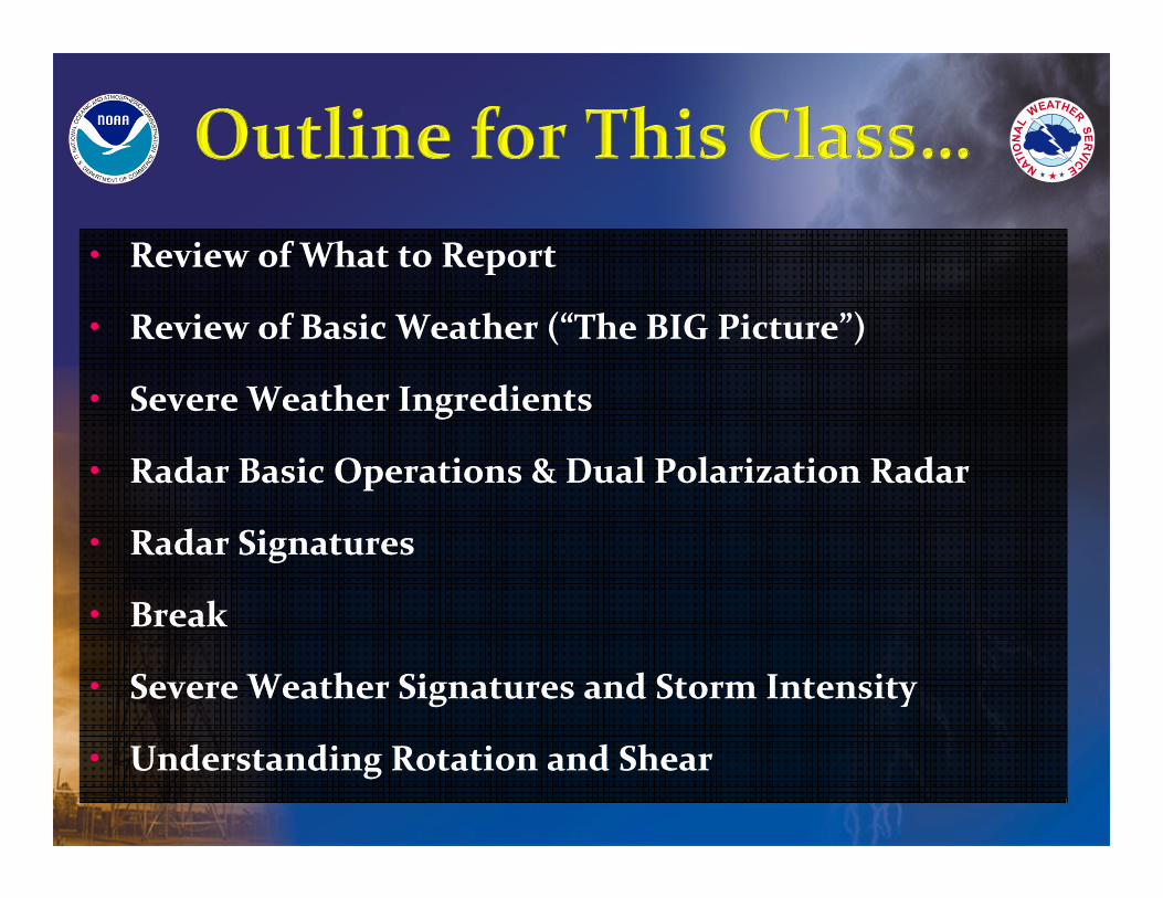
• Review of What to Report
• Review of Basic Weather (“The BIG Picture”)
• Severe Weather Ingredients
• Radar Basic Operations & Dual Polarization Radar
• Radar Signatures
• Break
• Severe Weather Signatures and Storm Intensity
• Understanding Rotation and Shear
• Review of What to Report
• Review of Basic Weather (“The BIG Picture”)
• Severe Weather Ingredients
• Radar Basic Operations & Dual Polarization Radar
• Radar Signatures
• Break
• Severe Weather Signatures and Storm Intensity
• Understanding Rotation and Shear
A Review of What to Report …
A Review of What to Report …
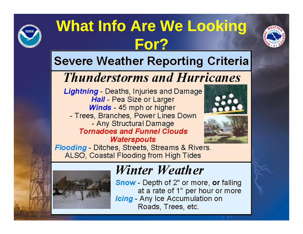
What Info Are We Looking For?
What Info Are We Looking For?
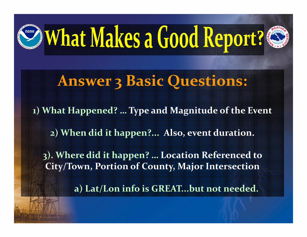
Answer 3 Basic Questions:
1) What Happened? … Type and Magnitude of the Event
2) When did it happen?... Also, event duration.
3). Where did it happen? … Location Referenced to City/Town, Portion of County, Major Intersection
a) Lat/Lon info is GREAT...but not needed.
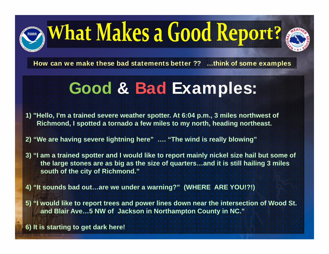
Good & Bad Examples:1) "Hello, I'm a trained severe weather spotter. At 6:04 p.m., 3 miles northwest of
Richmond, I spotted a tornado a few miles to my north, heading northeast.
2) “We are having severe lightning here” …. “The wind is really blowing”
3) “I am a trained spotter and I would like to report mainly nickel size hail but some of the large stones are as big as the size of quarters…and it is still hailing 3 miles south of the city of Richmond.”
4) “It sounds bad out…are we under a warning?” (WHERE ARE YOU!?!)
5) “I would like to report trees and power lines down near the intersection of Wood St. and Blair Ave…5 NW of Jackson in Northampton County in NC.”
6) It is starting to get dark here!
How can we make these bad statements better ?? …think of some examples
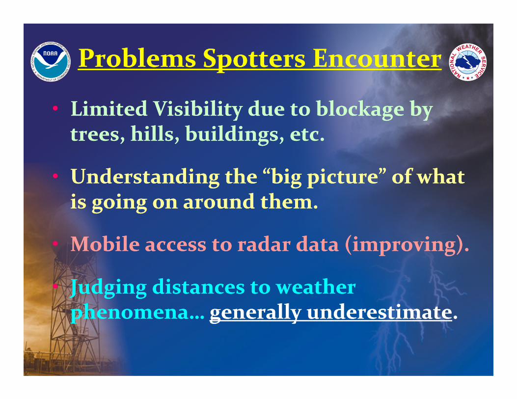
Problems Spotters EncounterProblems Spotters Encounter
• Limited Visibility due to blockage by trees, hills, buildings, etc.
• Understanding the “big picture” of what is going on around them.
• Mobile access to radar data (improving).
• Judging distances to weather phenomena… generally underestimate.
• Limited Visibility due to blockage by trees, hills, buildings, etc.
• Understanding the “big picture” of what is going on around them.
• Mobile access to radar data (improving).
• Judging distances to weather phenomena… generally underestimate.
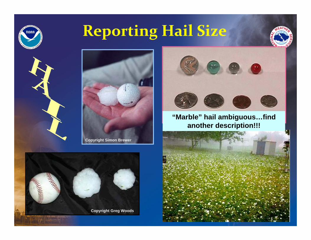
Copyright Simon Brewer
Copyright Greg Woods
Reporting Hail Size
“Marble” hail ambiguous…find another description!!!
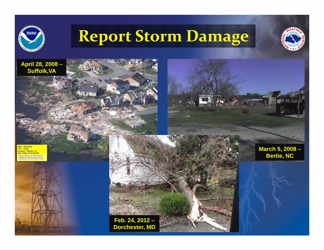
Report Storm Damage April 28, 2008 –
Suffolk,VA
March 5, 2008 –Bertie, NC
Feb. 24, 2012 –Dorchester, MD
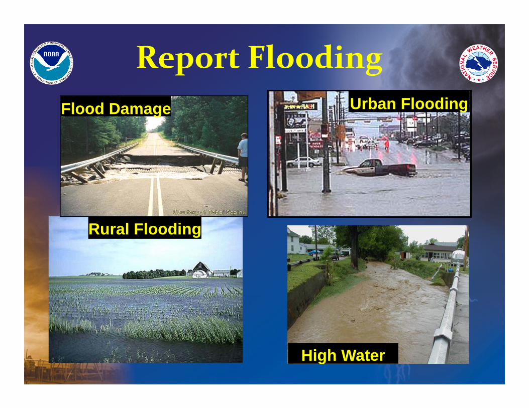
Urban Flooding
High Water
Rural Flooding
Flood Damage
Report Flooding

From a Place of Safety…From a Place of Safety…
1-800-737-8624
Let the NWS know what you observed, to help protect others!
For critical information, like a developing or on‐going tornado…
CALL US !
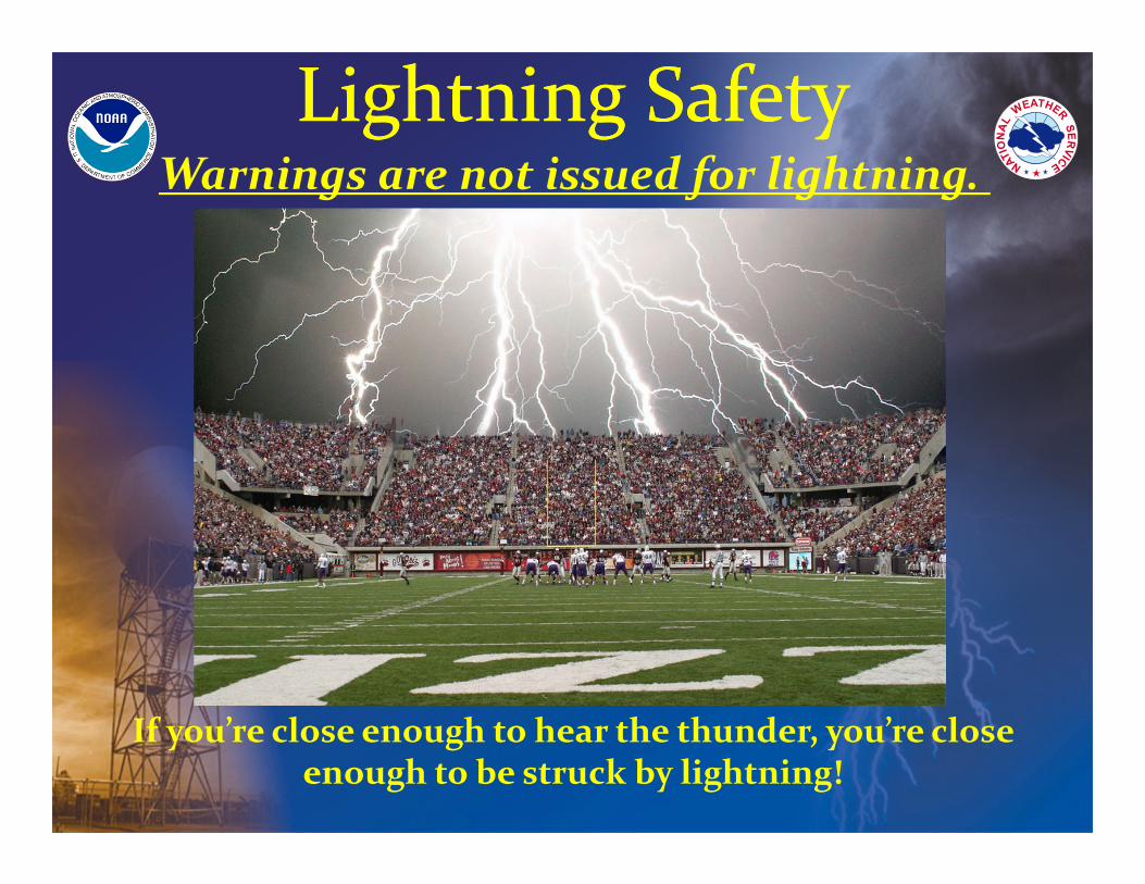
If you’re close enough to hear the thunder, you’re close enough to be struck by lightning!
Lightning SafetyLightning SafetyWarnings are not issued for lightning.
The Big Picture &
Thunderstorm
Ingredients
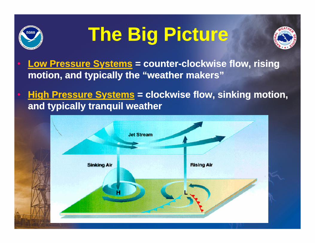
The Big PictureThe Big Picture• Low Pressure Systems = counter-clockwise flow, rising
motion, and typically the “weather makers”
• High Pressure Systems = clockwise flow, sinking motion, and typically tranquil weather
• Low Pressure Systems = counter-clockwise flow, rising motion, and typically the “weather makers”
• High Pressure Systems = clockwise flow, sinking motion, and typically tranquil weather
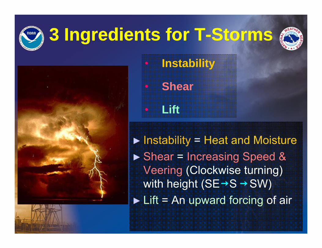
• Instability
• Shear
• Lift
► Instability = Heat and Moisture►Shear = Increasing Speed &
Veering (Clockwise turning) with height (SE S SW)
► Lift = An upward forcing of air
3 Ingredients for T-Storms3 Ingredients for T-Storms
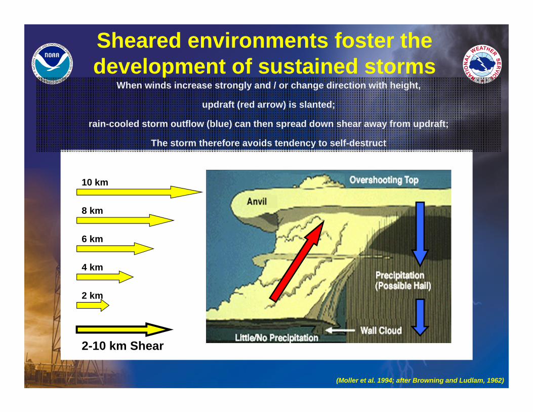
Sheared environments foster the development of sustained storms
When winds increase strongly and / or change direction with height,
updraft (red arrow) is slanted;
rain-cooled storm outflow (blue) can then spread down shear away from updraft;
The storm therefore avoids tendency to self-destruct
(Moller et al. 1994; after Browning and Ludlam, 1962)
10 km
8 km
6 km
4 km
2 km
2-10 km Shear
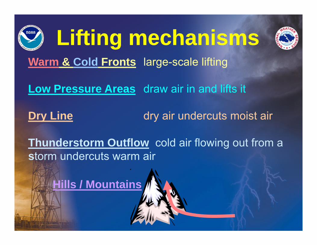
Lifting mechanismsLifting mechanismsWarm & Cold Fronts large-scale lifting
Low Pressure Areas draw air in and lifts it
Dry Line dry air undercuts moist air
Thunderstorm Outflow cold air flowing out from astorm undercuts warm air
Hills / Mountains
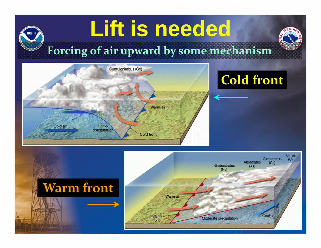
Cold front
Warm front
Lift is neededLift is neededForcing of air upward by some mechanism
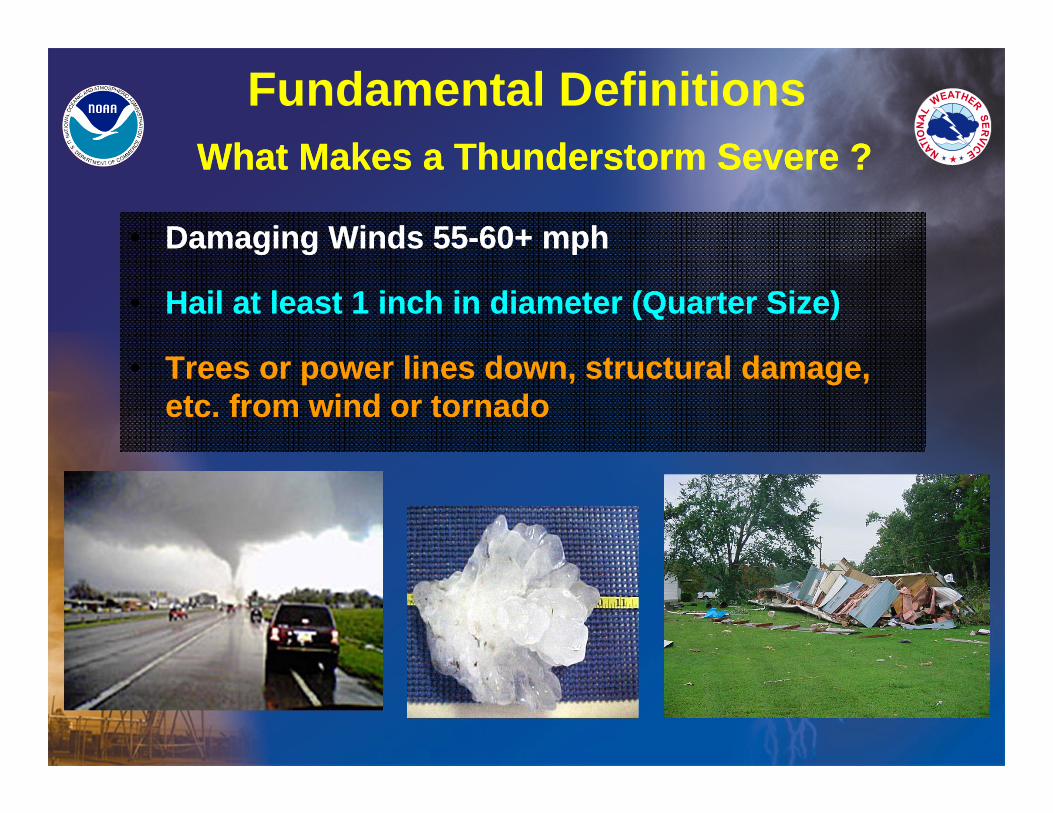
What Makes a Thunderstorm Severe ?What Makes a Thunderstorm Severe ?
• Damaging Winds 55-60+ mph
• Hail at least 1 inch in diameter (Quarter Size)
• Trees or power lines down, structural damage, etc. from wind or tornado
• Damaging Winds 55-60+ mph
• Hail at least 1 inch in diameter (Quarter Size)
• Trees or power lines down, structural damage, etc. from wind or tornado
Fundamental Definitions
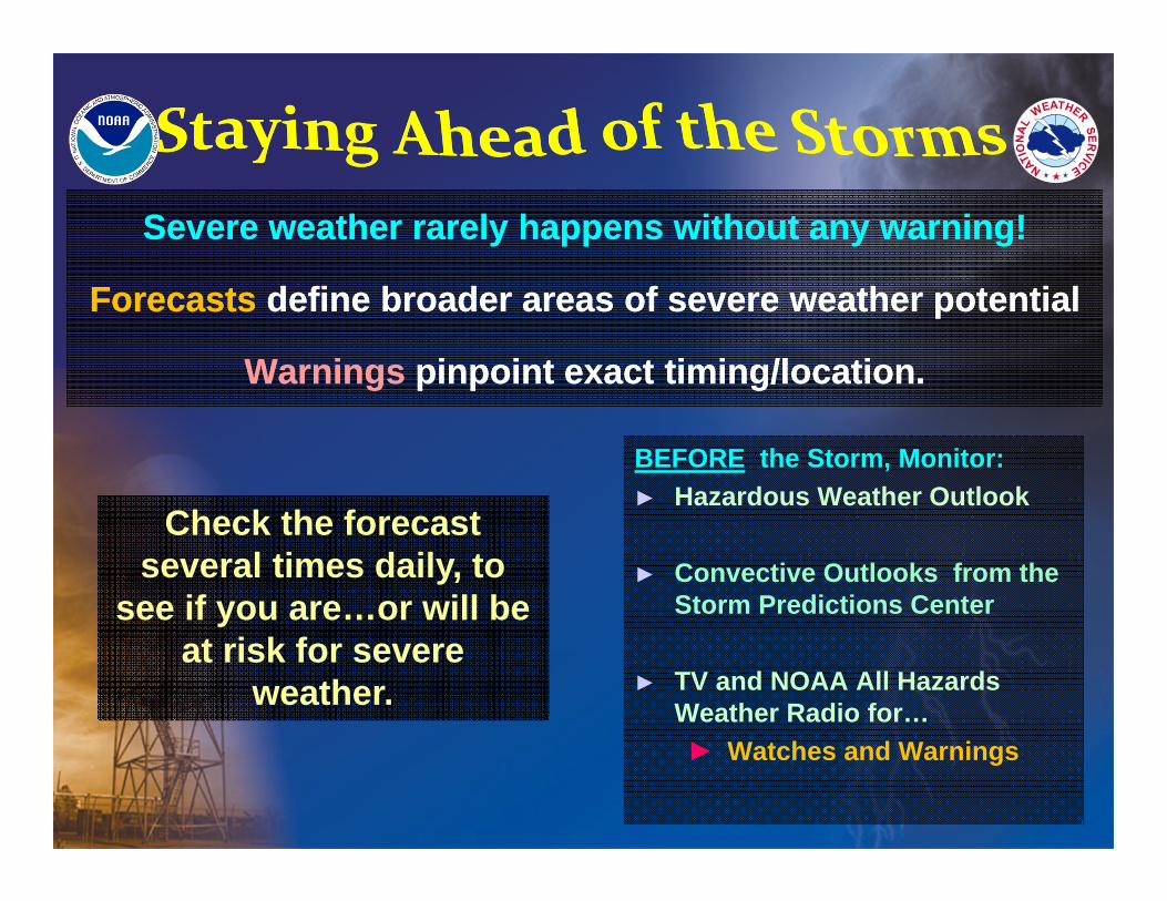
Severe weather rarely happens without any warning!
Forecasts define broader areas of severe weather potential
Warnings pinpoint exact timing/location.
Severe weather rarely happens without any warning!
Forecasts define broader areas of severe weather potential
Warnings pinpoint exact timing/location.
BEFORE the Storm, Monitor: ► Hazardous Weather Outlook
► Convective Outlooks from the Storm Predictions Center
► TV and NOAA All Hazards Weather Radio for…► Watches and Warnings
Check the forecast several times daily, to
see if you are…or will be at risk for severe
weather.
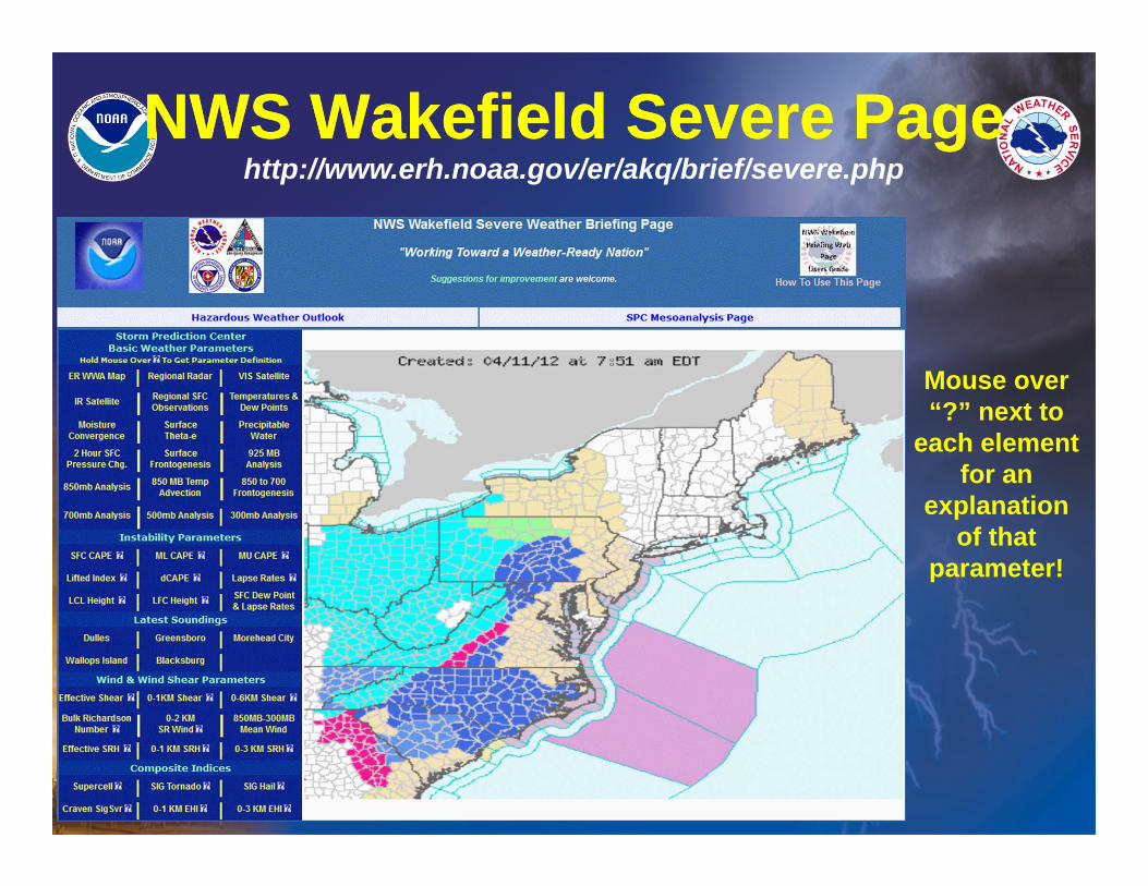
NWS Wakefield Severe PageNWS Wakefield Severe Page
Mouse over “?” next to
each element for an
explanation of that
parameter!
http://www.erh.noaa.gov/er/akq/brief/severe.php
Basic Radar OperationsBasic Radar Operations
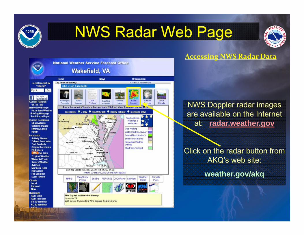
NWS Radar Web PageNWS Radar Web PageAccessing NWS Radar Data
NWS Doppler radar images are available on the Internet
at: radar.weather.gov
Click on the radar button from AKQ’s web site:
weather.gov/akq
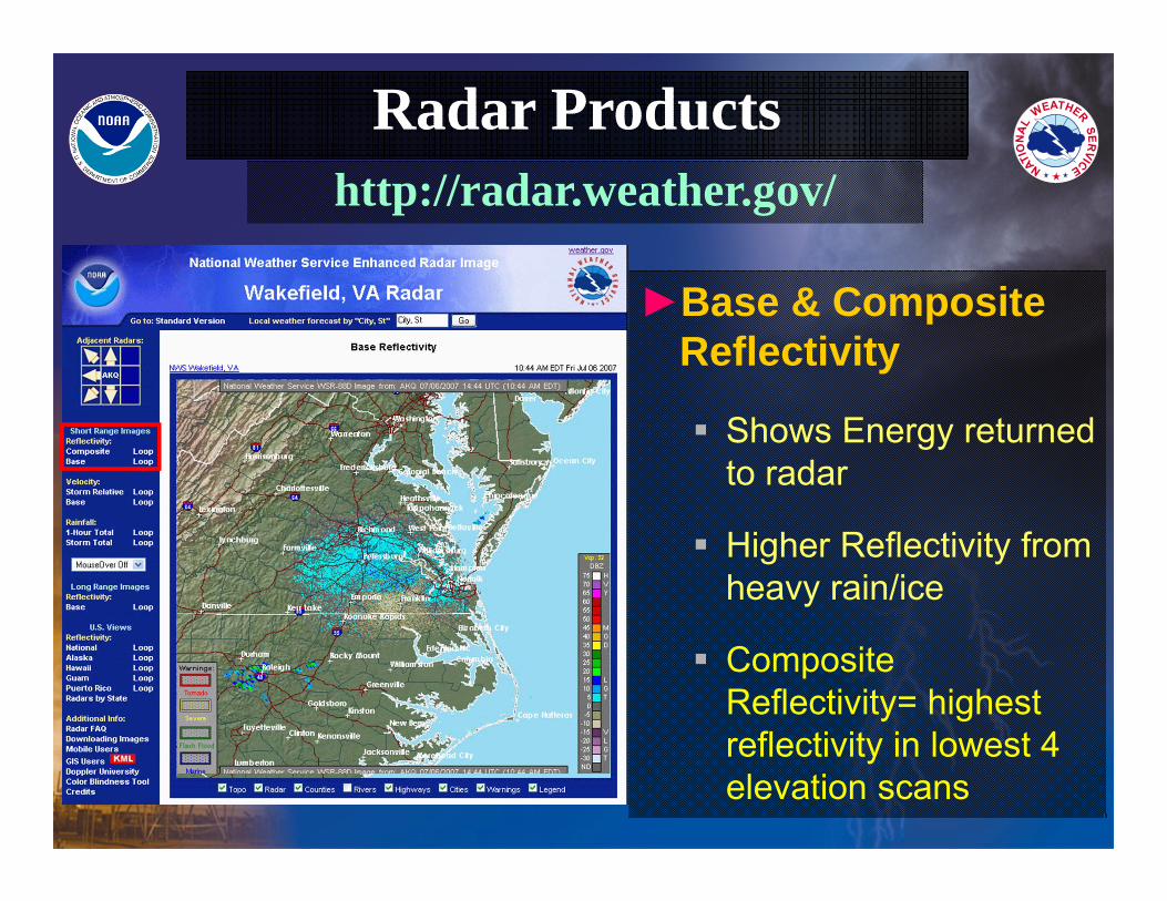
►Base & Composite Reflectivity
Shows Energy returned to radar
Higher Reflectivity from heavy rain/ice
Composite Reflectivity= highest reflectivity in lowest 4 elevation scans
Radar ProductsRadar Productshttp://radar.weather.gov/
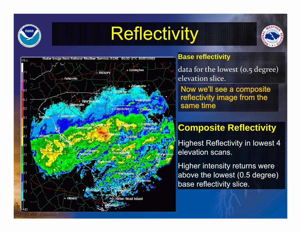
ReflectivityReflectivityBase reflectivity
data for the lowest (0.5 degree) elevation slice.
Composite ReflectivityHighest Reflectivity in lowest 4 elevation scans.
Higher intensity returns were above the lowest (0.5 degree) base reflectivity slice.
Composite ReflectivityHighest Reflectivity in lowest 4 elevation scans.
Higher intensity returns were above the lowest (0.5 degree) base reflectivity slice.
Now we’ll see a composite reflectivity image from the same time
VelocityVelocity
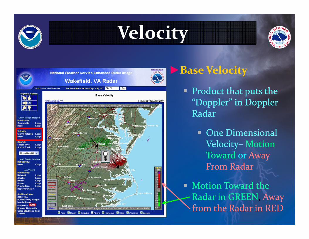
►Base Velocity
Product that puts the “Doppler” in Doppler Radar
One Dimensional Velocity– Motion Toward or Away From Radar
Motion Toward the Radar in GREEN, Away from the Radar in RED
►Base Velocity
Product that puts the “Doppler” in Doppler Radar
One Dimensional Velocity– Motion Toward or Away From Radar
Motion Toward the Radar in GREEN, Away from the Radar in RED
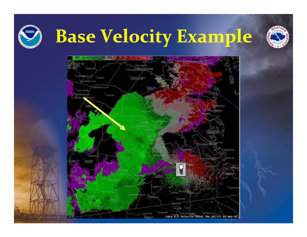
Base Velocity ExampleBase Velocity Example
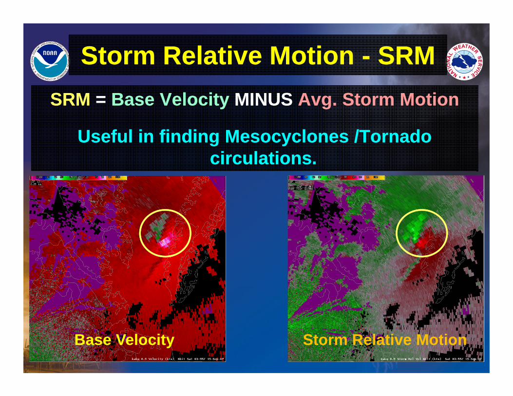
Storm Relative Motion - SRMStorm Relative Motion - SRMSRM = Base Velocity MINUS Avg. Storm Motion
Useful in finding Mesocyclones /Tornado circulations.
SRM = Base Velocity MINUS Avg. Storm Motion
Useful in finding Mesocyclones /Tornado circulations.
Base Velocity Storm Relative Motion
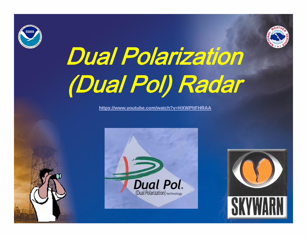
Dual Polarization (Dual Pol) RadarDual Polarization (Dual Pol) Radar
https://www.youtube.com/watch?v=HXWPltFHRAA
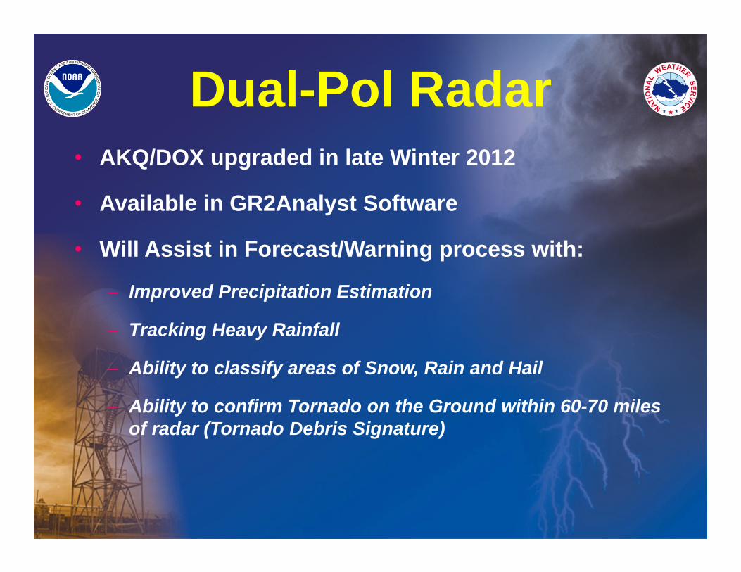
• AKQ/DOX upgraded in late Winter 2012
• Available in GR2Analyst Software
• Will Assist in Forecast/Warning process with:
– Improved Precipitation Estimation
– Tracking Heavy Rainfall
– Ability to classify areas of Snow, Rain and Hail
– Ability to confirm Tornado on the Ground within 60-70 miles of radar (Tornado Debris Signature)
Dual-Pol Radar
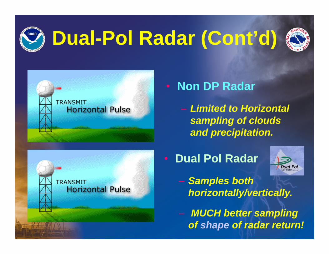
Dual-Pol Radar (Cont’d)
• Dual Pol Radar
– Samples both horizontally/vertically.
– MUCH better sampling of shape of radar return!
• Non DP Radar
– Limited to Horizontal sampling of clouds and precipitation.
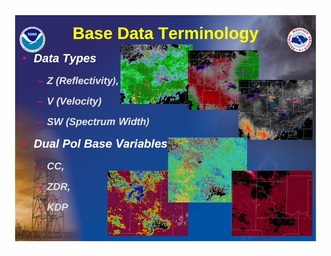
Base Data TerminologyBase Data Terminology• Data Types
– Z (Reflectivity),
– V (Velocity)
– SW (Spectrum Width)
• Dual Pol Base Variables
– CC,
– ZDR,
– KDP
• Data Types
– Z (Reflectivity),
– V (Velocity)
– SW (Spectrum Width)
• Dual Pol Base Variables
– CC,
– ZDR,
– KDP
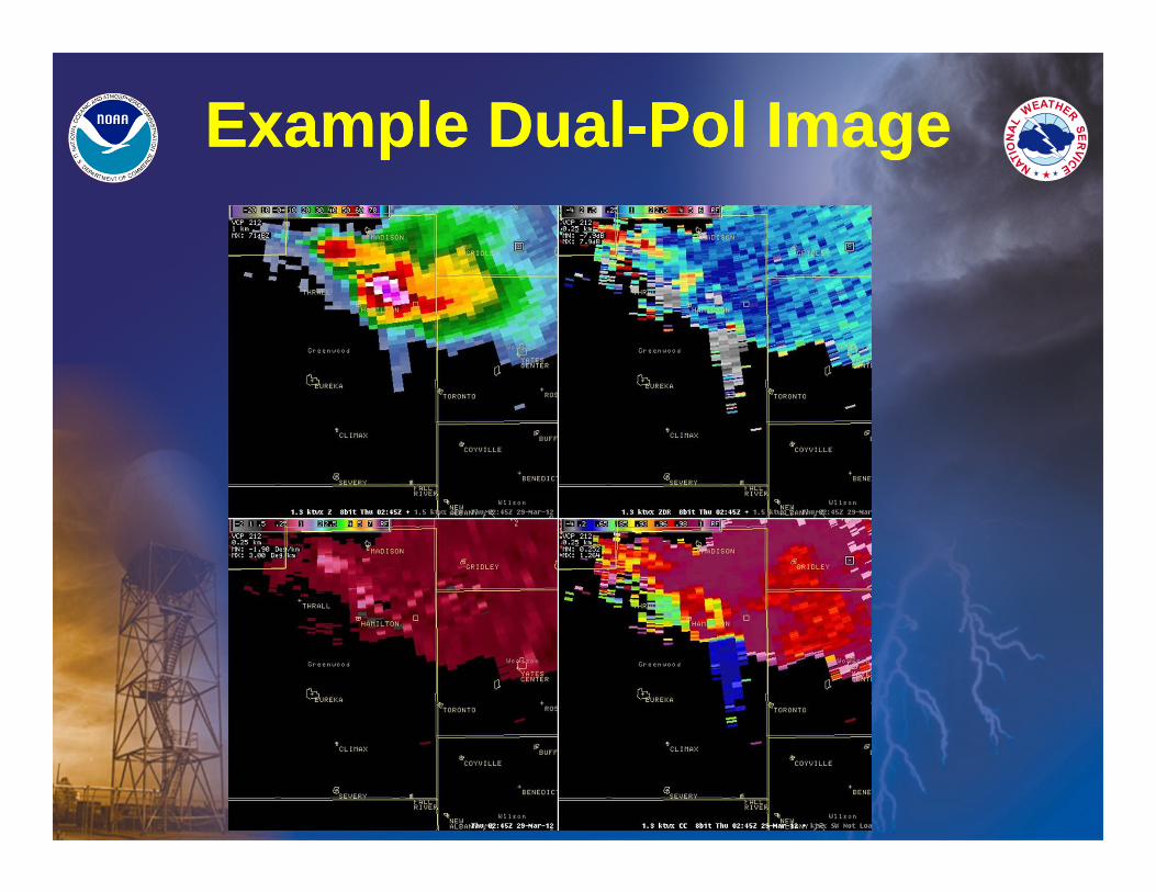
Example Dual-Pol ImageExample Dual-Pol Image
Dual Polarization OnlineDual Polarization Online
• http://www.wdtb.noaa.gov/courses/dualpol/outreach/
• Online Module by WDTB on each product
• Courses for media & non-meteorologists available!
• http://www.wdtb.noaa.gov/courses/dualpol/outreach/
• Online Module by WDTB on each product
• Courses for media & non-meteorologists available!
Common Radar Signatures
Common Radar Signatures
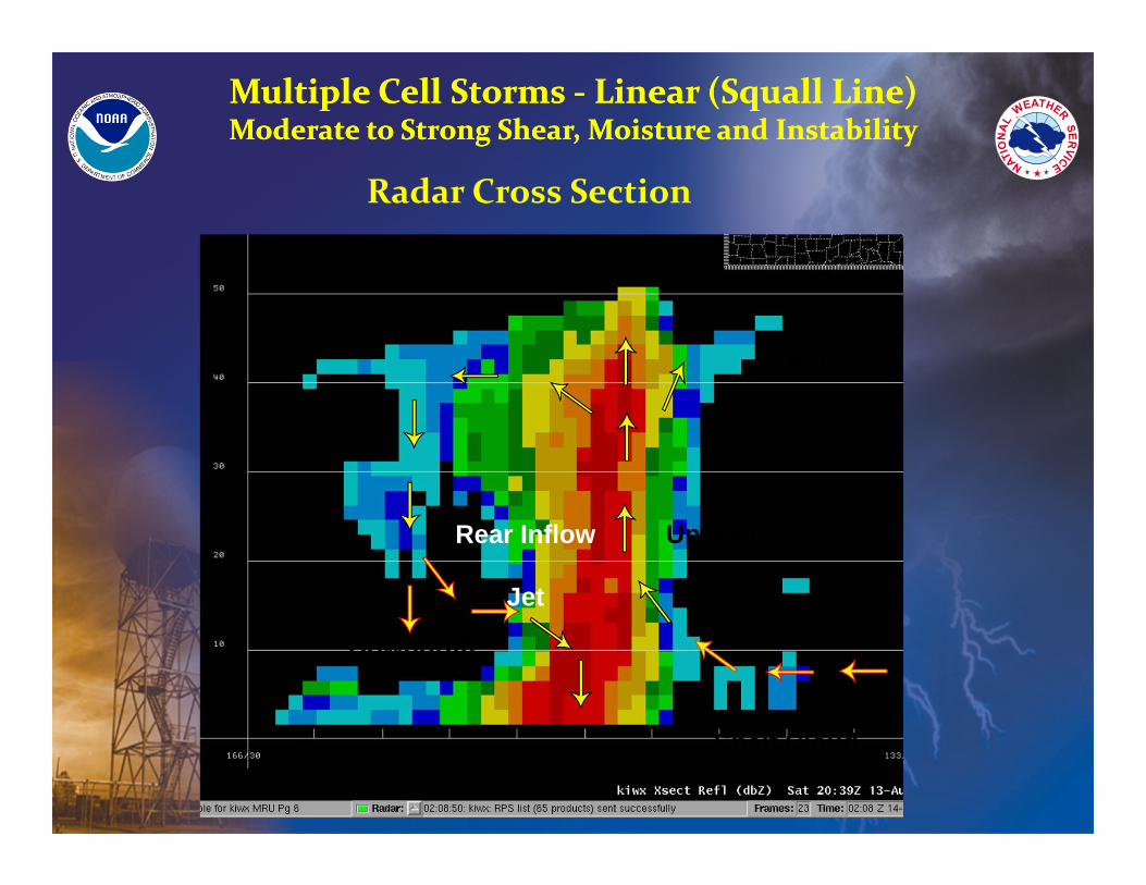
Multiple Cell Storms ‐ Linear (Squall Line)Moderate to Strong Shear, Moisture and InstabilityMultiple Cell Storms ‐ Linear (Squall Line)Moderate to Strong Shear, Moisture and Instability
Radar Cross Section
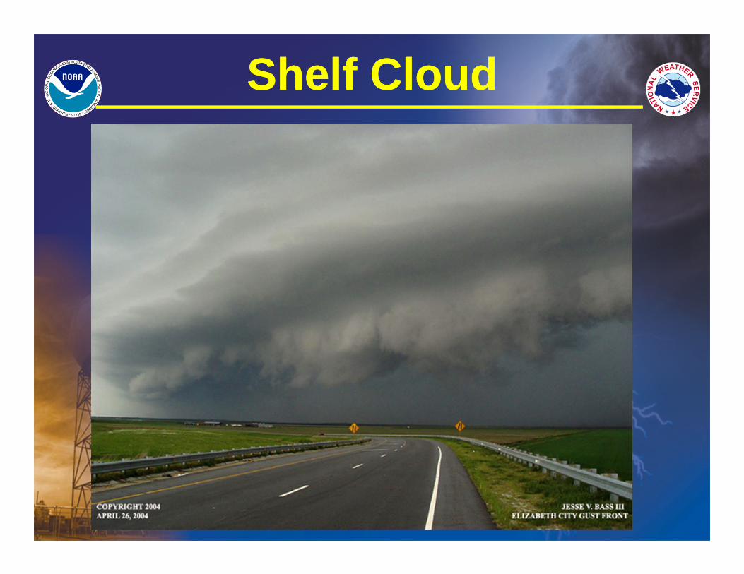
Shelf Cloud
Rear Inflow
Jet
Downdraft
Updraft
Anvil
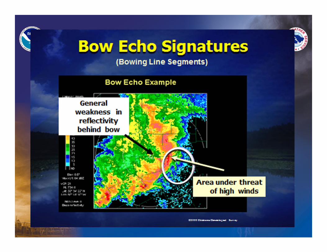
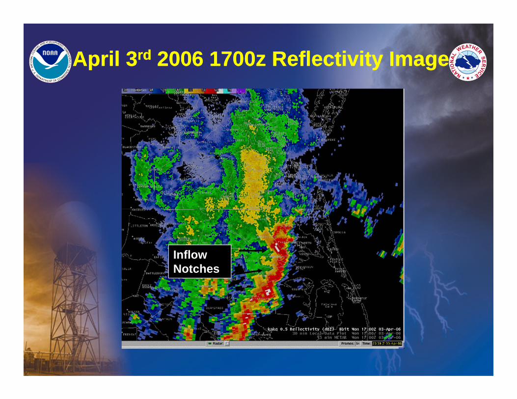
Inflow Notches
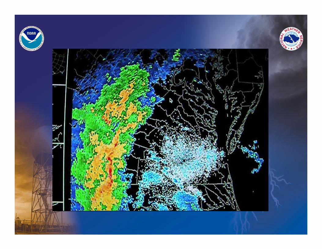
April 3rd 2006 1700z Reflectivity ImageApril 3rd 2006 1700z Reflectivity Image
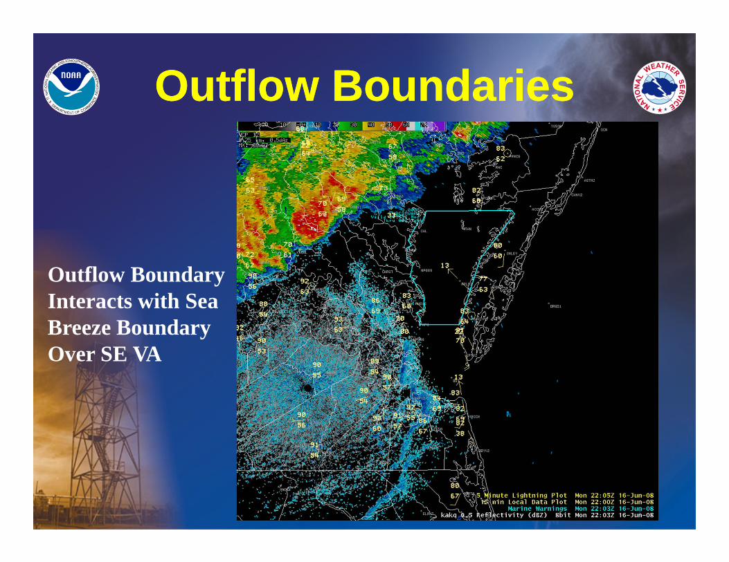
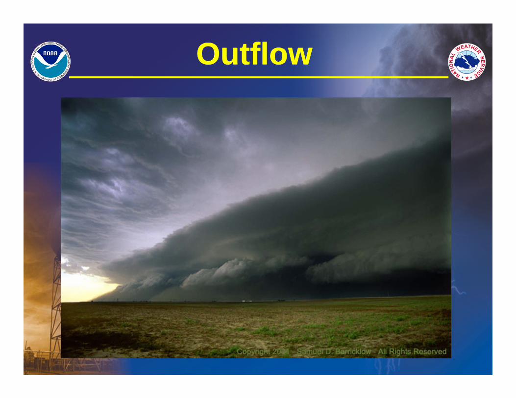
Outflow BoundariesOutflow Boundaries
Outflow Boundary Interacts with Sea Breeze Boundary Over SE VA
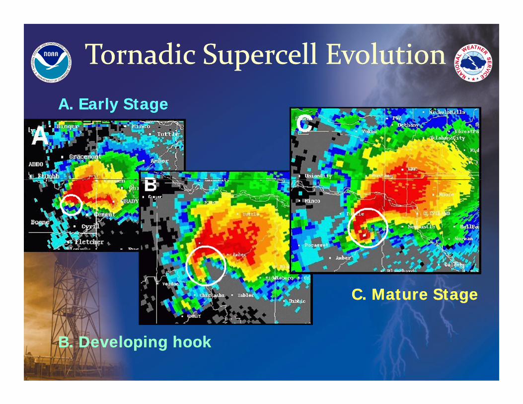
Tornadic Supercell EvolutionTornadic Supercell EvolutionA. Early StageA. Early Stage
B. Developing hookB. Developing hook
C. Mature StageC. Mature Stage
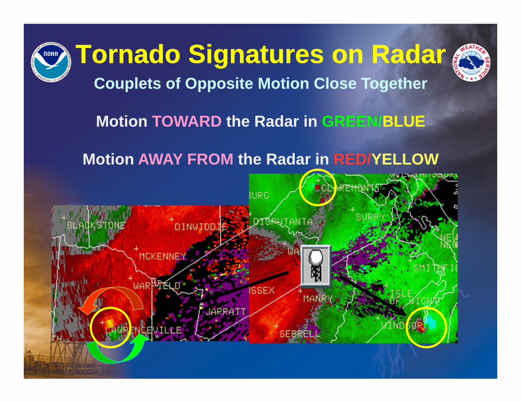
Tornado Signatures on RadarTornado Signatures on RadarCouplets of Opposite Motion Close Together
Motion TOWARD the Radar in GREEN/BLUE
Motion AWAY FROM the Radar in RED/YELLOW
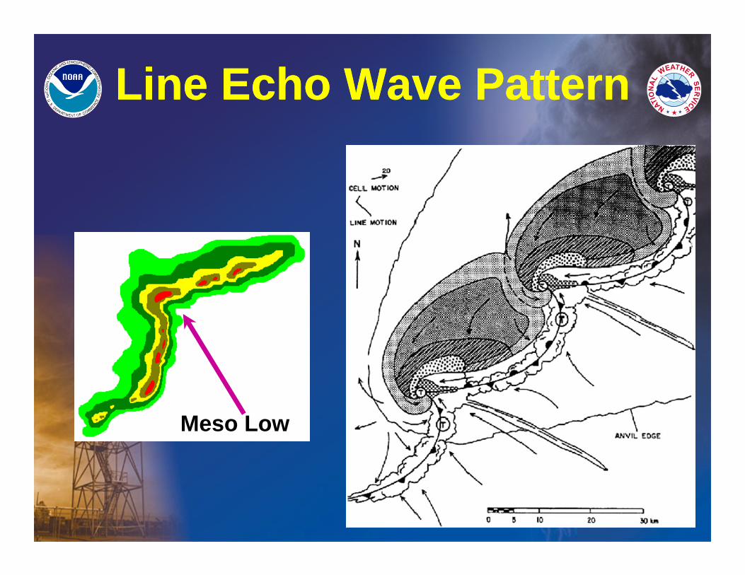
Line Echo Wave PatternLine Echo Wave Pattern
Meso Low
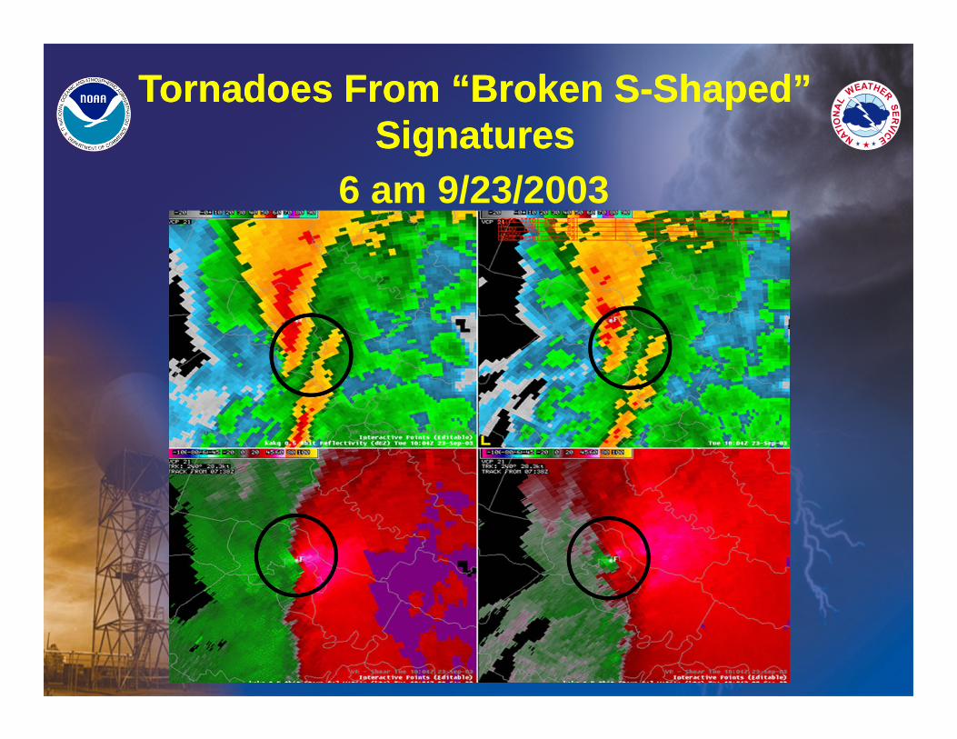
Tornadoes From “Broken S-Shaped” Signatures
Tornadoes From “Broken S-Shaped” Signatures
6 am 9/23/2003
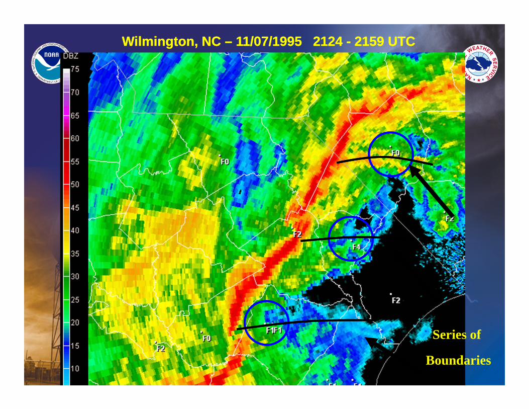
Wilmington, NC – 11/07/1995 2124 - 2159 UTC Wilmington, NC – 11/07/1995 2124 - 2159 UTC
Series of
Boundaries
BREAK TIME!
We’ll Resume with Severe Weather Signatures in about 10 minutes!
Severe Weather Signatures
Severe Weather Signatures
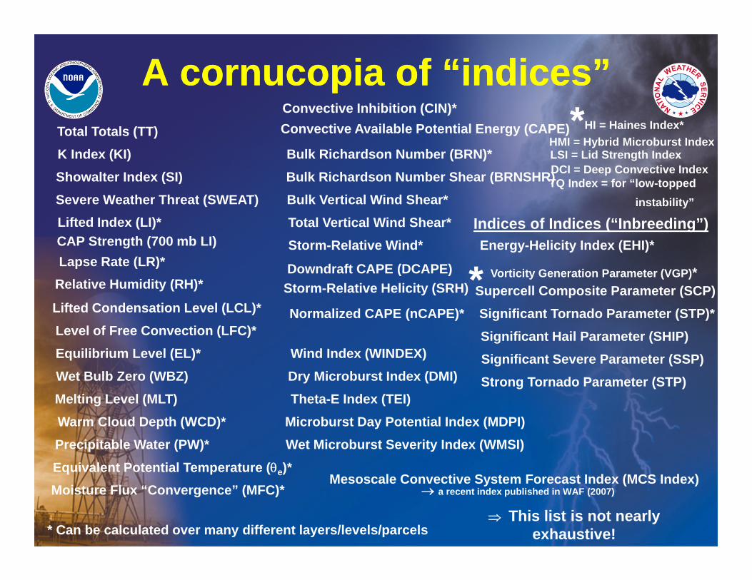
A cornucopia of “indices”A cornucopia of “indices”
Vorticity Generation Parameter (VGP)*Supercell Composite Parameter (SCP)
This list is not nearly exhaustive!
K Index (KI)Total Totals (TT)
Severe Weather Threat (SWEAT)Lifted Index (LI)*
Showalter Index (SI)
Lapse Rate (LR)*CAP Strength (700 mb LI)
Relative Humidity (RH)*
Lifted Condensation Level (LCL)*Level of Free Convection (LFC)*Equilibrium Level (EL)*
* Can be calculated over many different layers/levels/parcels
Moisture Flux “Convergence” (MFC)*Equivalent Potential Temperature (e)*Precipitable Water (PW)*Warm Cloud Depth (WCD)*
Wet Bulb Zero (WBZ)Melting Level (MLT)
Convective Available Potential Energy (CAPE)*Convective Inhibition (CIN)*
Bulk Richardson Number (BRN)*
Storm-Relative Helicity (SRH)*
Bulk Vertical Wind Shear*Total Vertical Wind Shear*Storm-Relative Wind*
Downdraft CAPE (DCAPE)
Normalized CAPE (nCAPE)*
Bulk Richardson Number Shear (BRNSHR)
Dry Microburst Index (DMI)Theta-E Index (TEI)
Wind Index (WINDEX)
Wet Microburst Severity Index (WMSI)Microburst Day Potential Index (MDPI)
Energy-Helicity Index (EHI)*
Significant Tornado Parameter (STP)*Significant Hail Parameter (SHIP)Significant Severe Parameter (SSP)Strong Tornado Parameter (STP)
Indices of Indices (“Inbreeding”)
LSI = Lid Strength IndexDCI = Deep Convective IndexTQ Index = for “low-topped
instability”
HI = Haines Index*HMI = Hybrid Microburst Index
Mesoscale Convective System Forecast Index (MCS Index) a recent index published in WAF (2007)
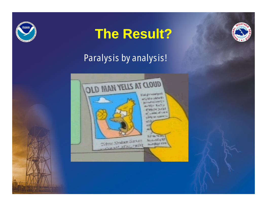
The Result?The Result?Paralysis by analysis!
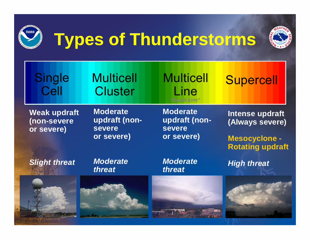
Types of ThunderstormsTypes of Thunderstorms
SingleCell
MulticellCluster
MulticellLine
Supercell
Weak updraft(non-severeor severe)
Slight threat
Moderate updraft (non-severe or severe)
Moderate threat
Intense updraft(Always severe)
Mesocyclone -Rotating updraft
High threat
Moderateupdraft (non-severeor severe)
Moderatethreat
“Squall Line”
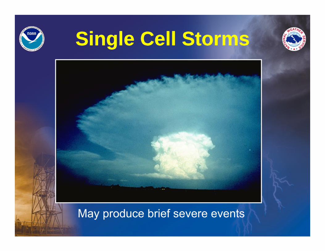
Single Cell StormsSingle Cell Storms
May produce brief severe events
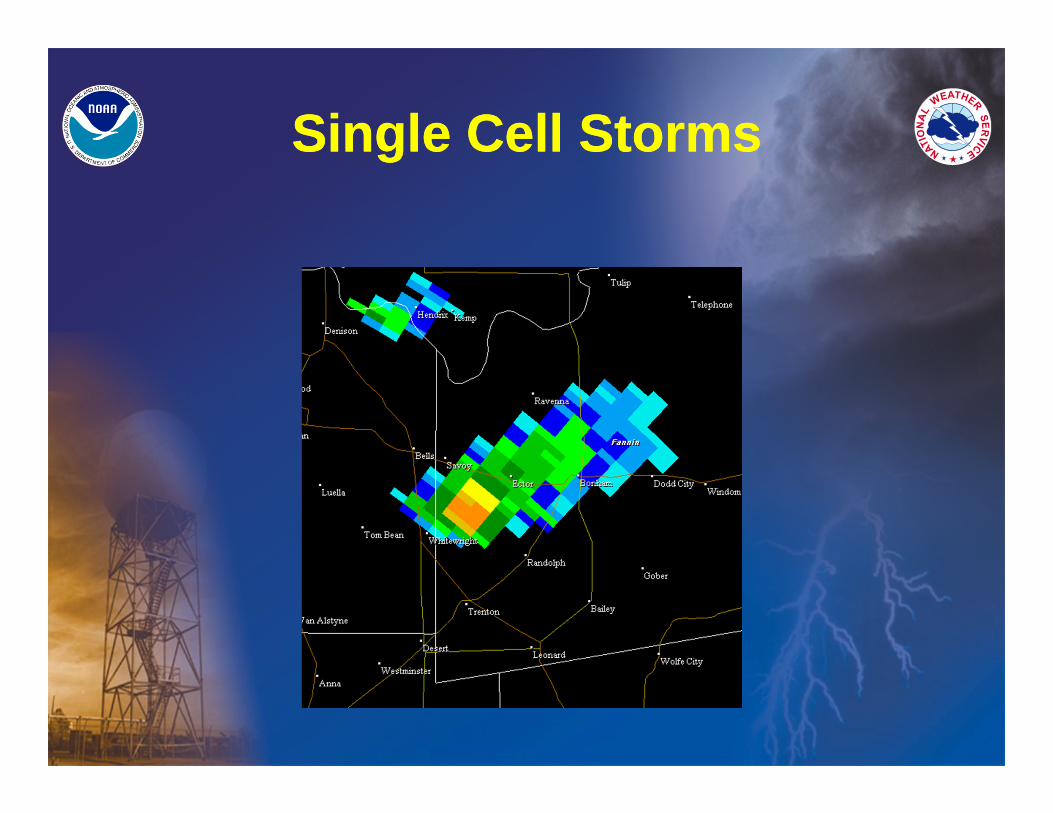
Single Cell StormsSingle Cell Storms
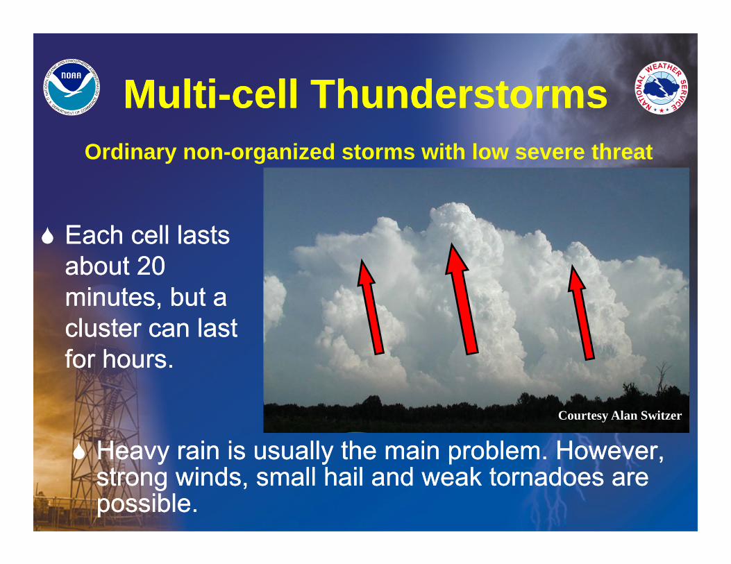
Multi-cell ThunderstormsMulti-cell Thunderstorms
Each cell lasts about 20 minutes, but a cluster can last for hours.
Each cell lasts about 20 minutes, but a cluster can last for hours.
Heavy rain is usually the main problem. However, strong winds, small hail and weak tornadoes are possible.
Heavy rain is usually the main problem. However, strong winds, small hail and weak tornadoes are possible.
Courtesy Alan Switzer
Ordinary non-organized storms with low severe threat
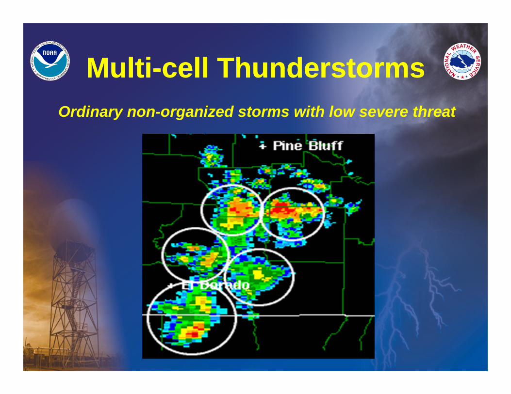
Multi-cell ThunderstormsMulti-cell ThunderstormsOrdinary non-organized storms with low severe threat
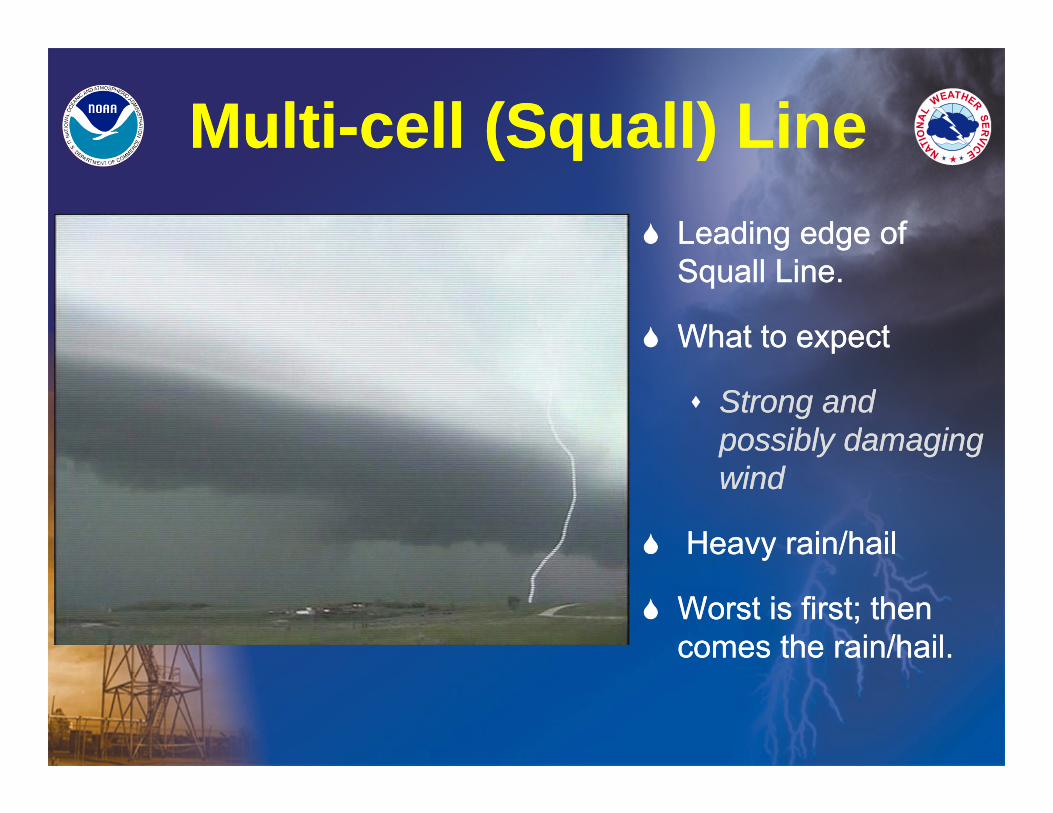
Multi-cell (Squall) LineMulti-cell (Squall) Line Leading edge of
Squall Line.
What to expect
Strong and possibly damaging wind
Heavy rain/hail
Worst is first; then comes the rain/hail.
Leading edge of Squall Line.
What to expect
Strong and possibly damaging wind
Heavy rain/hail
Worst is first; then comes the rain/hail.
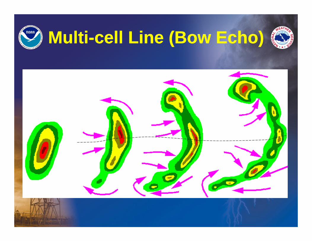
Multi-cell Line (Bow Echo)Multi-cell Line (Bow Echo)
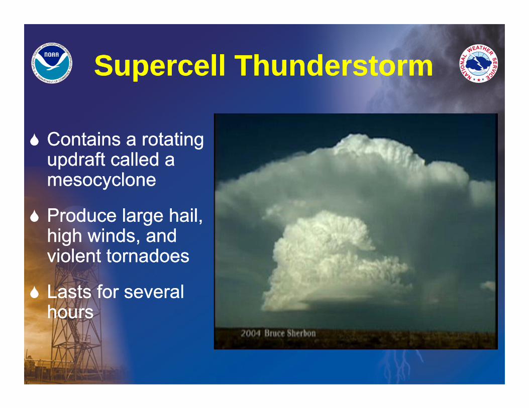
Supercell ThunderstormSupercell Thunderstorm
Contains a rotating updraft called a mesocyclone
Produce large hail, high winds, and violent tornadoes
Lasts for several hours
Contains a rotating updraft called a mesocyclone
Produce large hail, high winds, and violent tornadoes
Lasts for several hours
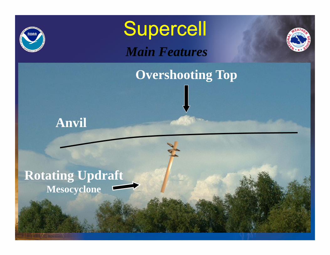
SupercellSupercellMain Features
Anvil
Overshooting Top
Rotating UpdraftMesocyclone
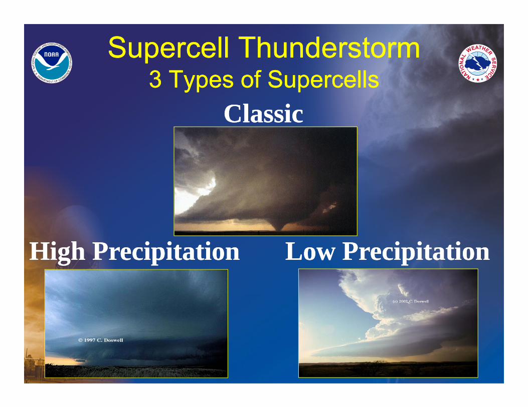
Supercell Thunderstorm3 Types of Supercells
Supercell Thunderstorm3 Types of Supercells
ClassicClassic
Low PrecipitationLow PrecipitationHigh PrecipitationHigh Precipitation
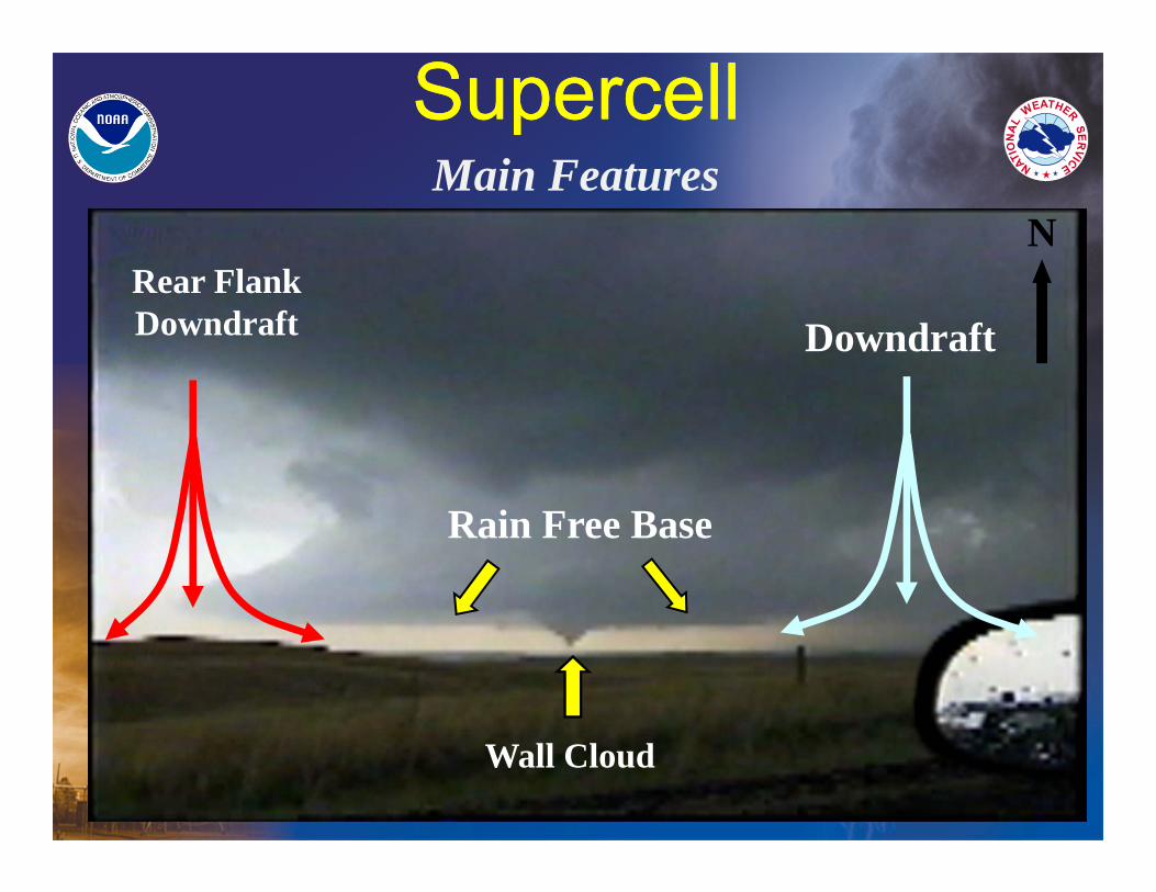
SupercellSupercell
DowndraftRear FlankDowndraft
NMain Features
Wall Cloud
Rain Free Base
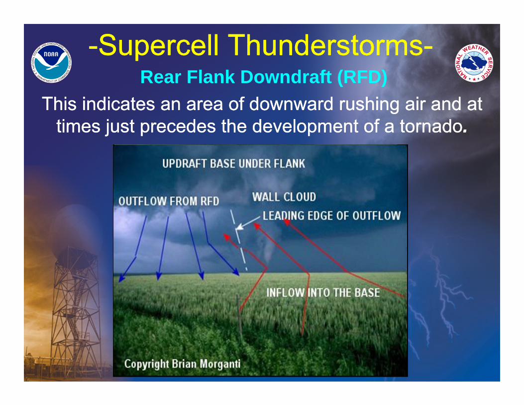
-Supercell Thunderstorms--Supercell Thunderstorms-Rear Flank Downdraft (RFD)
This indicates an area of downward rushing air and at times just precedes the development of a tornado.
This indicates an area of downward rushing air and at times just precedes the development of a tornado.
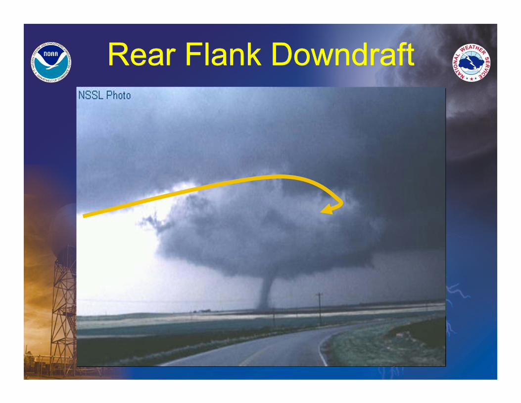
Rear Flank DowndraftRear Flank Downdraft
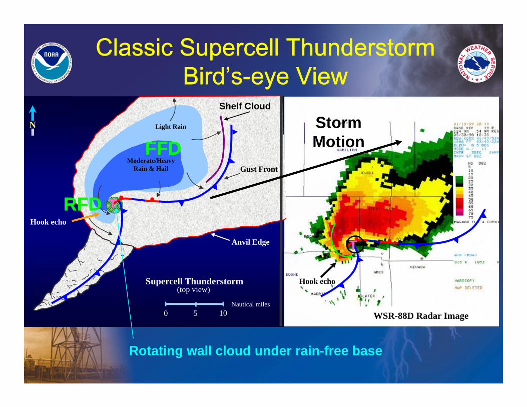
Classic Supercell ThunderstormBird’s-eye View
Classic Supercell ThunderstormBird’s-eye View
0 5 10Nautical miles
Light Rain
Moderate/Heavy Rain & Hail
Supercell Thunderstorm(top view)
Anvil Edge
Gust Front
WSR-88D Radar Image
N
Hook echo
Hook echo
Rotating wall cloud under rain-free base
TT
TT
Shelf Cloud
RFDRFD
FFDFFDStorm Motion
Anvil Edge
Heavy Rain
Light Rain
Updraft
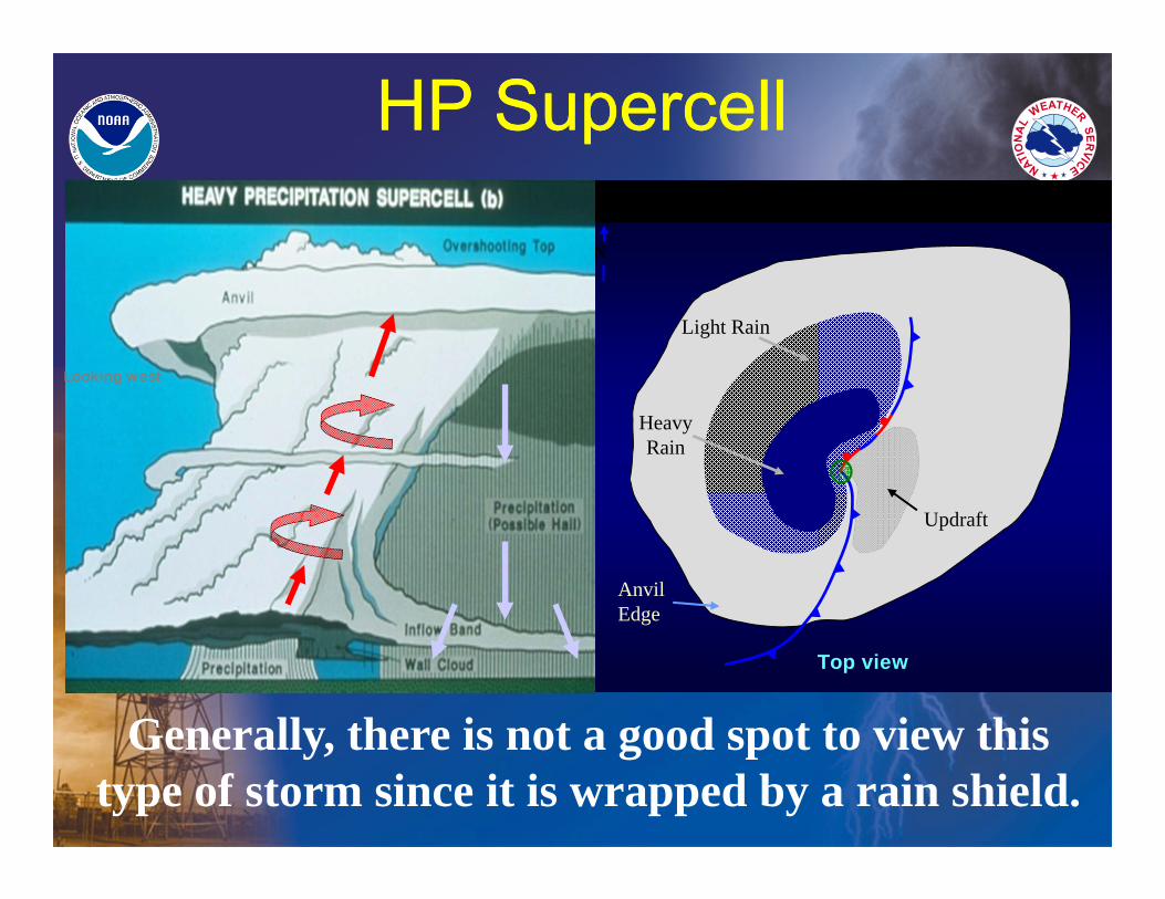
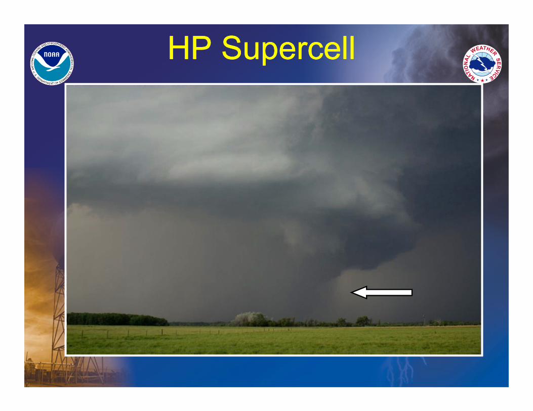
HP Supercell
N
Looking west
Top view
HP SupercellHP Supercell
Generally, there is not a good spot to view this type of storm since it is wrapped by a rain shield.
HP SupercellHP Supercell
Copyright Jon Davies
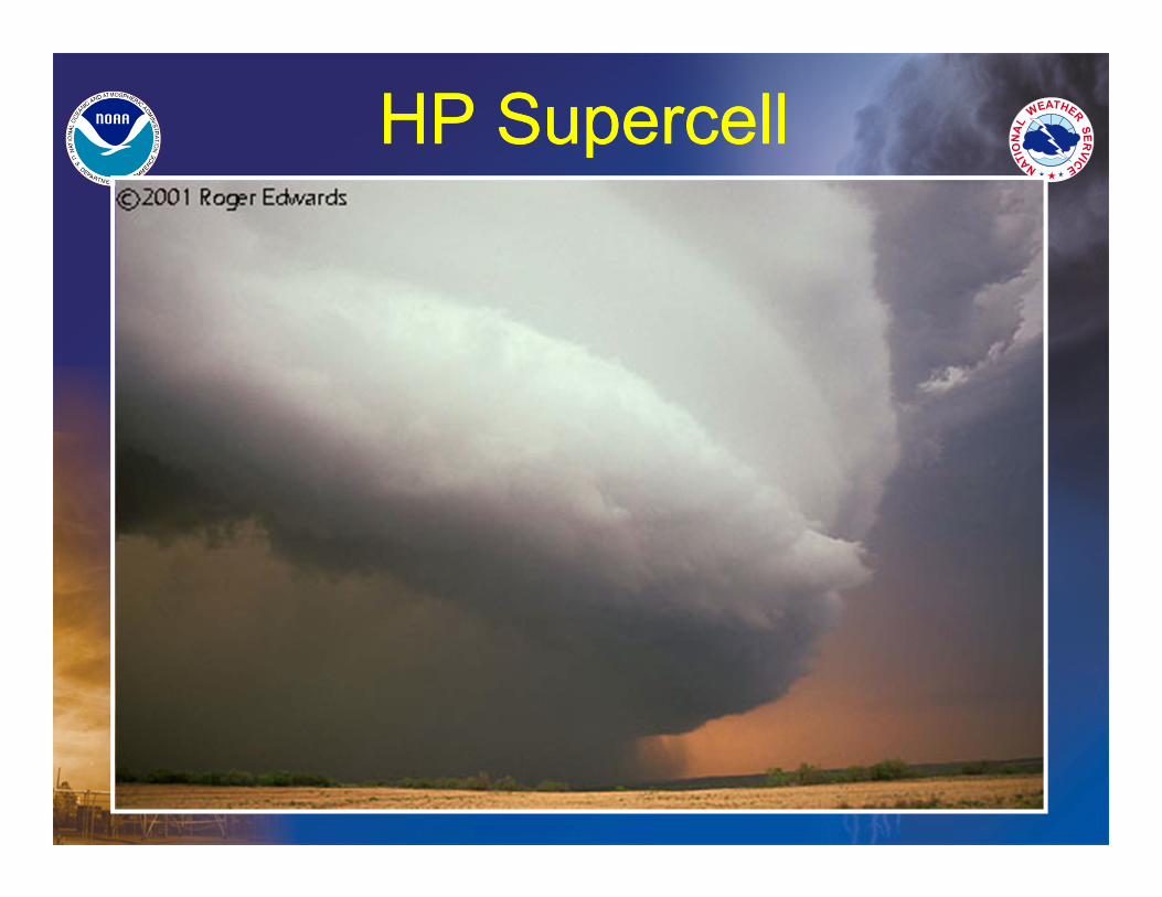
HP SupercellHP Supercell
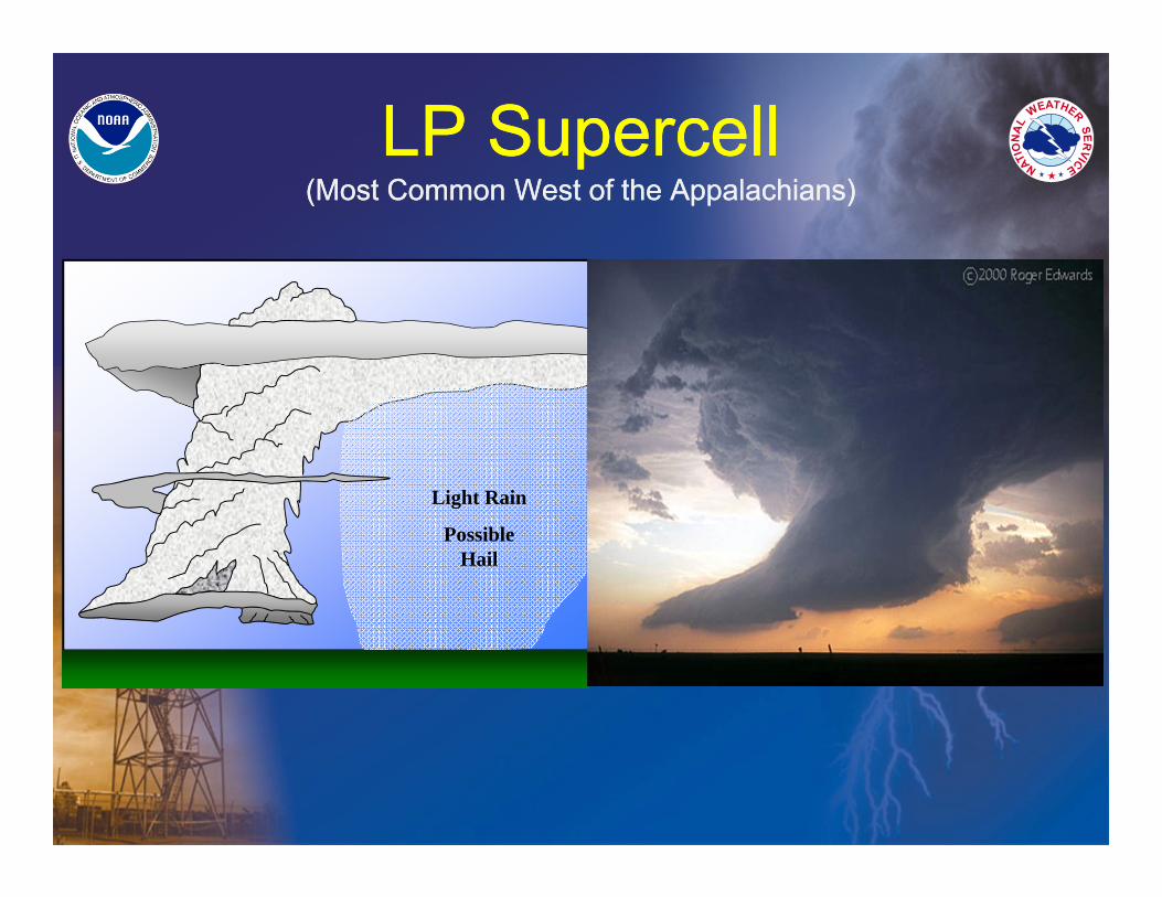
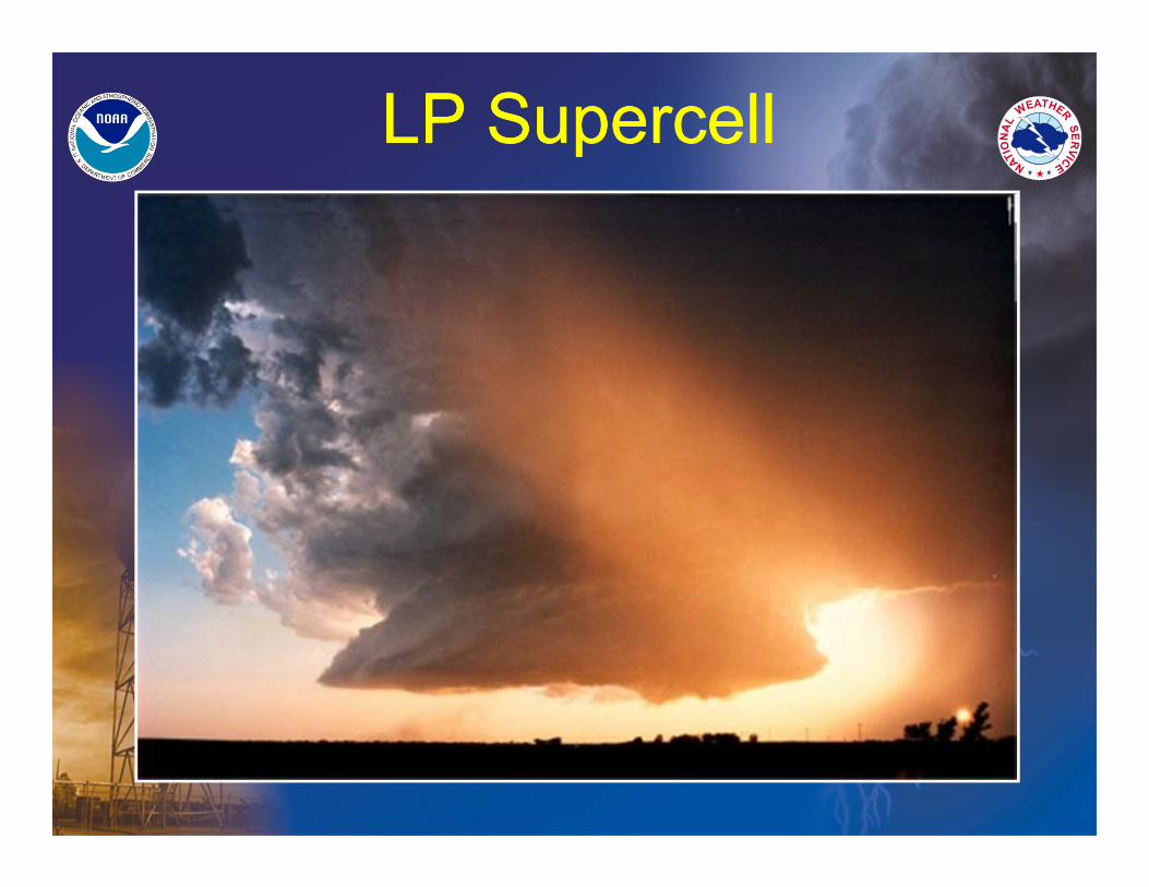
LP Supercell(Most Common West of the Appalachians)
LP Supercell(Most Common West of the Appalachians)
Light Rain
Possible Hail
LP SupercellLP Supercell
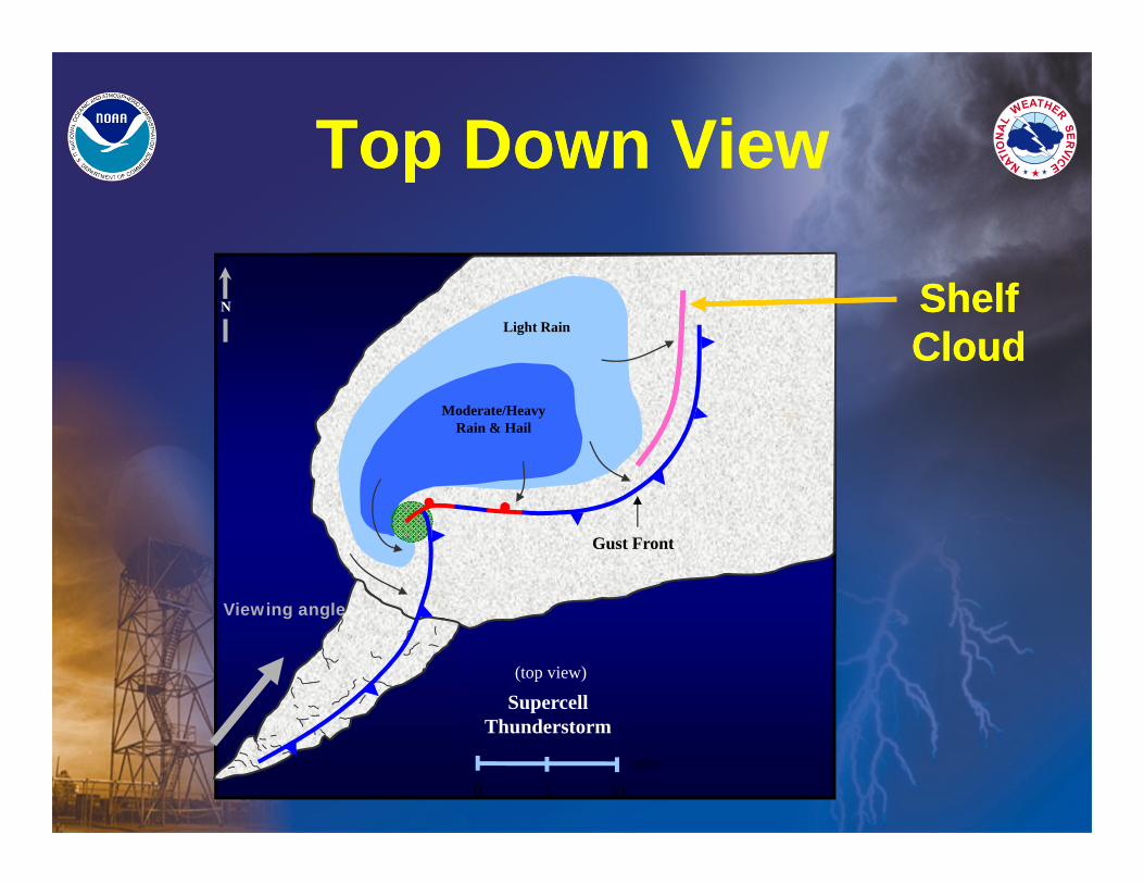
Top Down ViewTop Down View
0 5 10
miles
Light Rain
Moderate/Heavy Rain & Hail
Supercell Thunderstorm
(top view)
Gust Front
Viewing angle
N Shelf CloudShelf Cloud
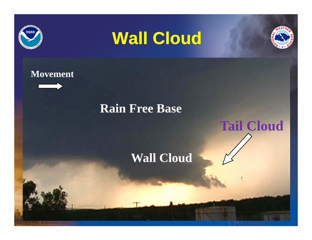
Wall CloudWall Cloud
Rain Free Base
Wall Cloud
Tail Cloud
Movement
Storm Intensity
Clues
Storm Intensity
Clues
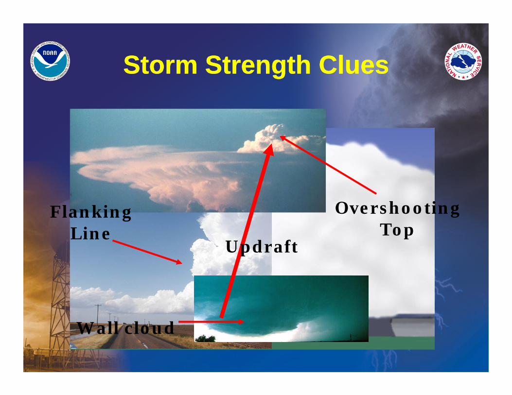
Storm Strength CluesStorm Strength Clues
Wall cloud
Updraft
Overshooting Top
Flanking Line
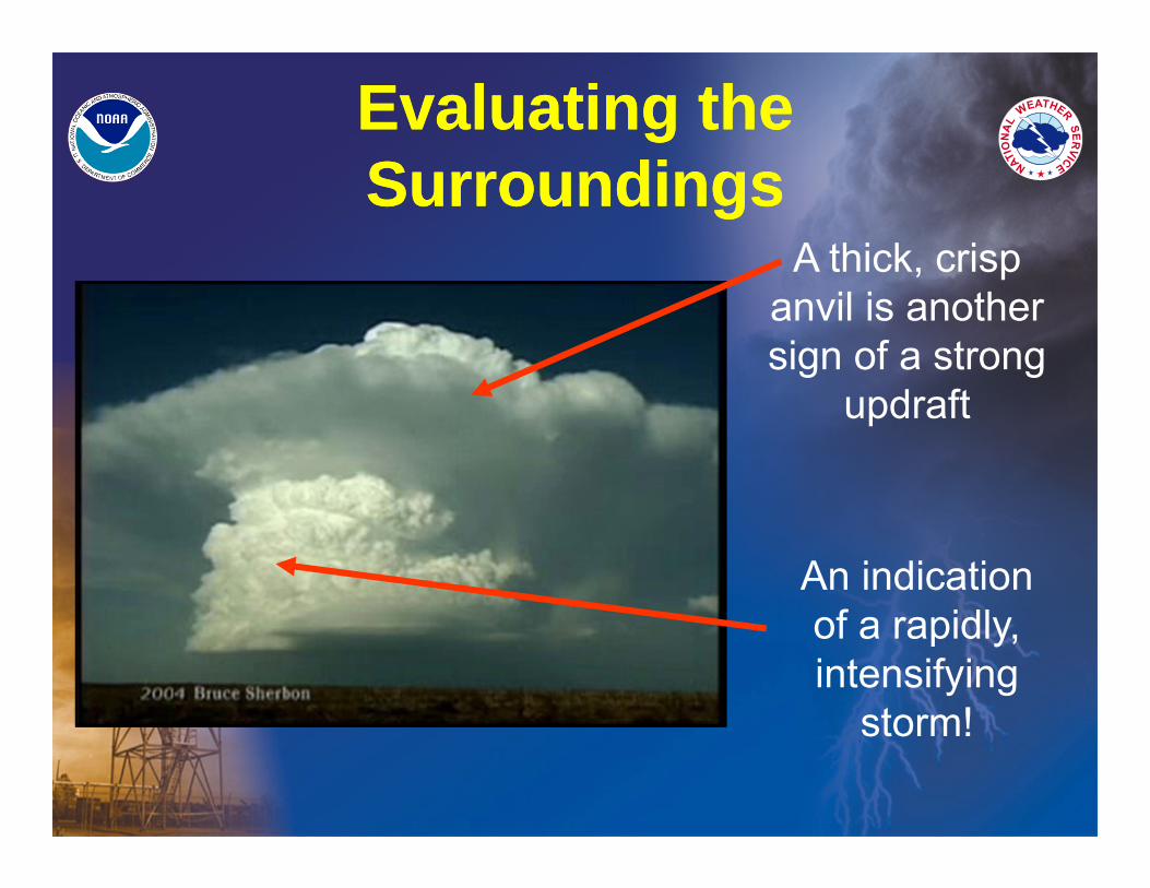
Evaluating the SurroundingsEvaluating the Surroundings
An indication of a rapidly, intensifying
storm!
A thick, crisp anvil is another sign of a strong
updraft
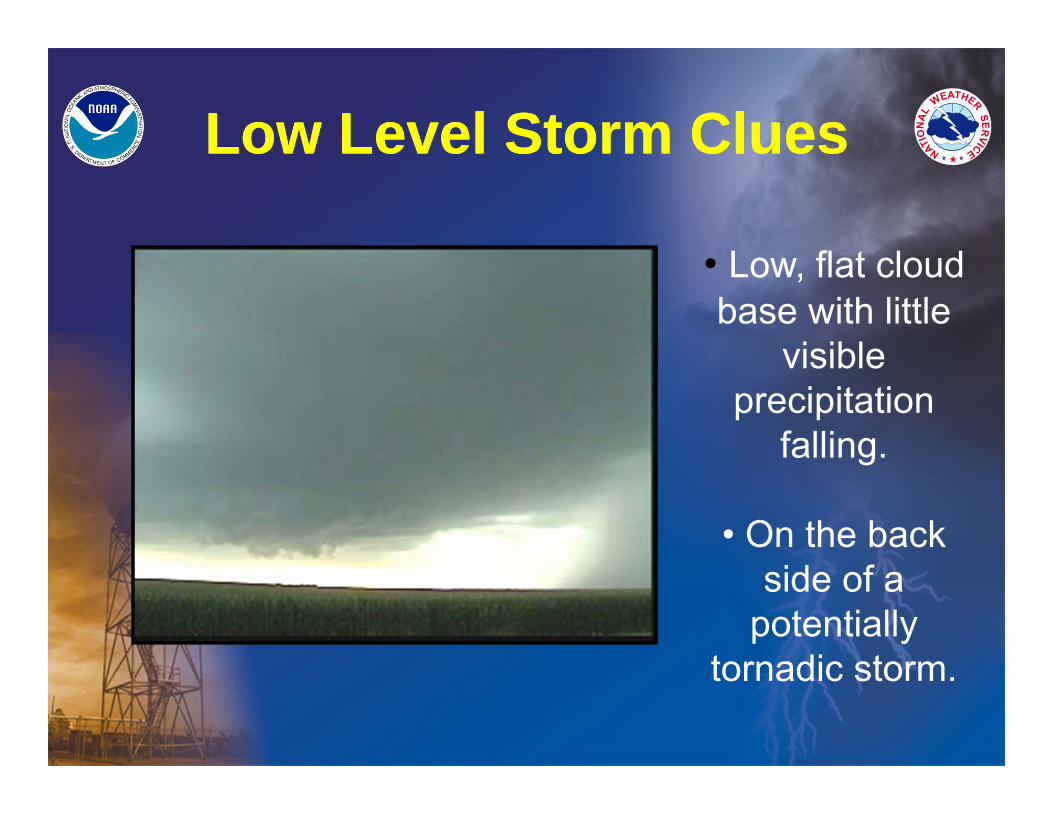
Low Level Storm CluesLow Level Storm Clues
• Low, flat cloud base with little
visible precipitation
falling.
• On the back side of a
potentially tornadic storm.

Understanding Rotation
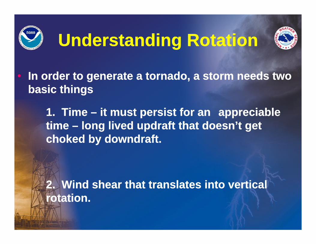
Understanding RotationUnderstanding Rotation
• In order to generate a tornado, a storm needs two basic things
1. Time – it must persist for an appreciable time – long lived updraft that doesn’t get choked by downdraft.
2. Wind shear that translates into vertical rotation.
• In order to generate a tornado, a storm needs two basic things
1. Time – it must persist for an appreciable time – long lived updraft that doesn’t get choked by downdraft.
2. Wind shear that translates into vertical rotation.
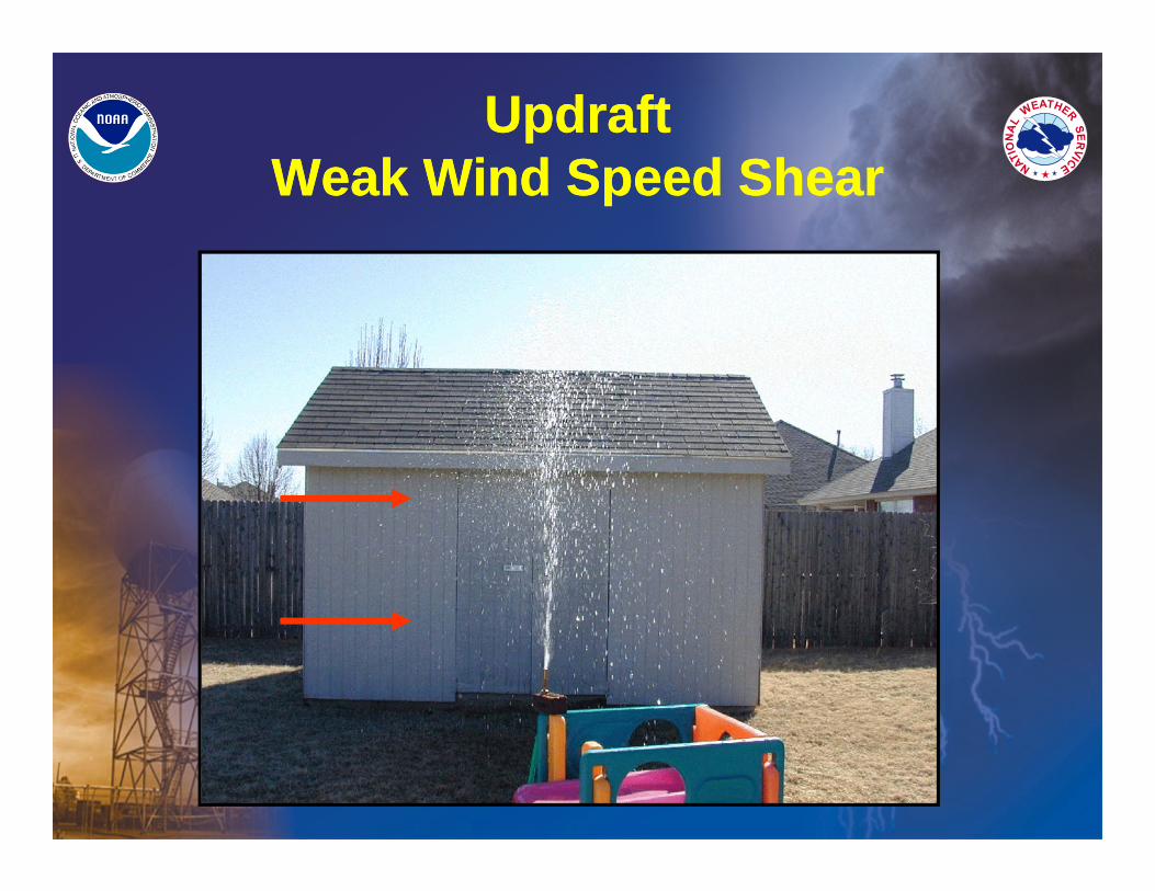
Updraft Weak Wind Speed Shear
Updraft Weak Wind Speed Shear
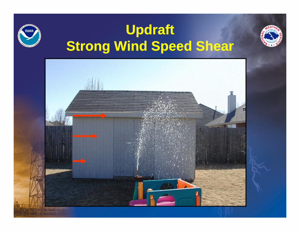
Updraft Strong Wind Speed Shear
Updraft Strong Wind Speed Shear
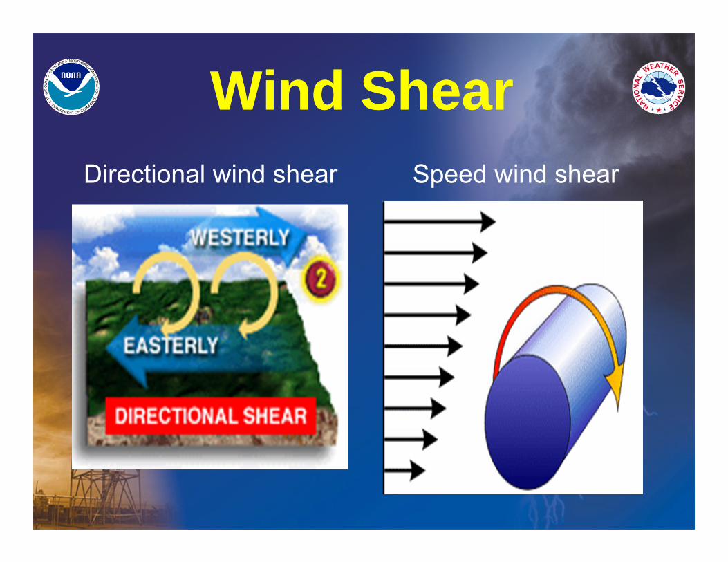
Wind ShearWind ShearDirectional wind shear Speed wind shear
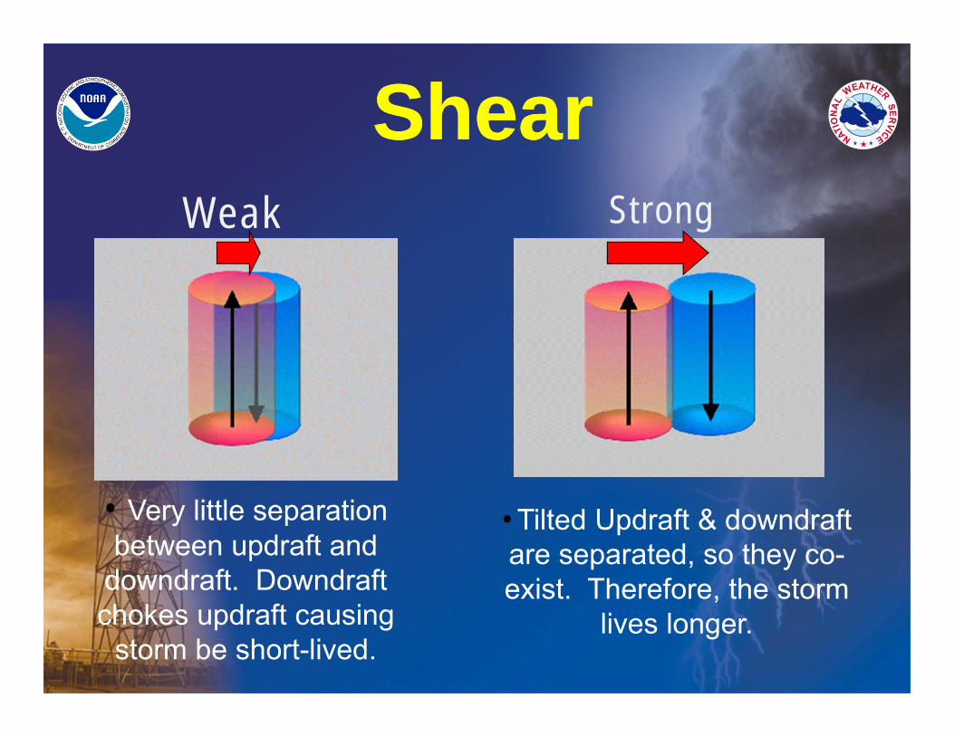
ShearShear
• Very little separation between updraft and
downdraft. Downdraft chokes updraft causing
storm be short-lived.
• Tilted Updraft & downdraft are separated, so they co-exist. Therefore, the storm
lives longer.
Weak Strong
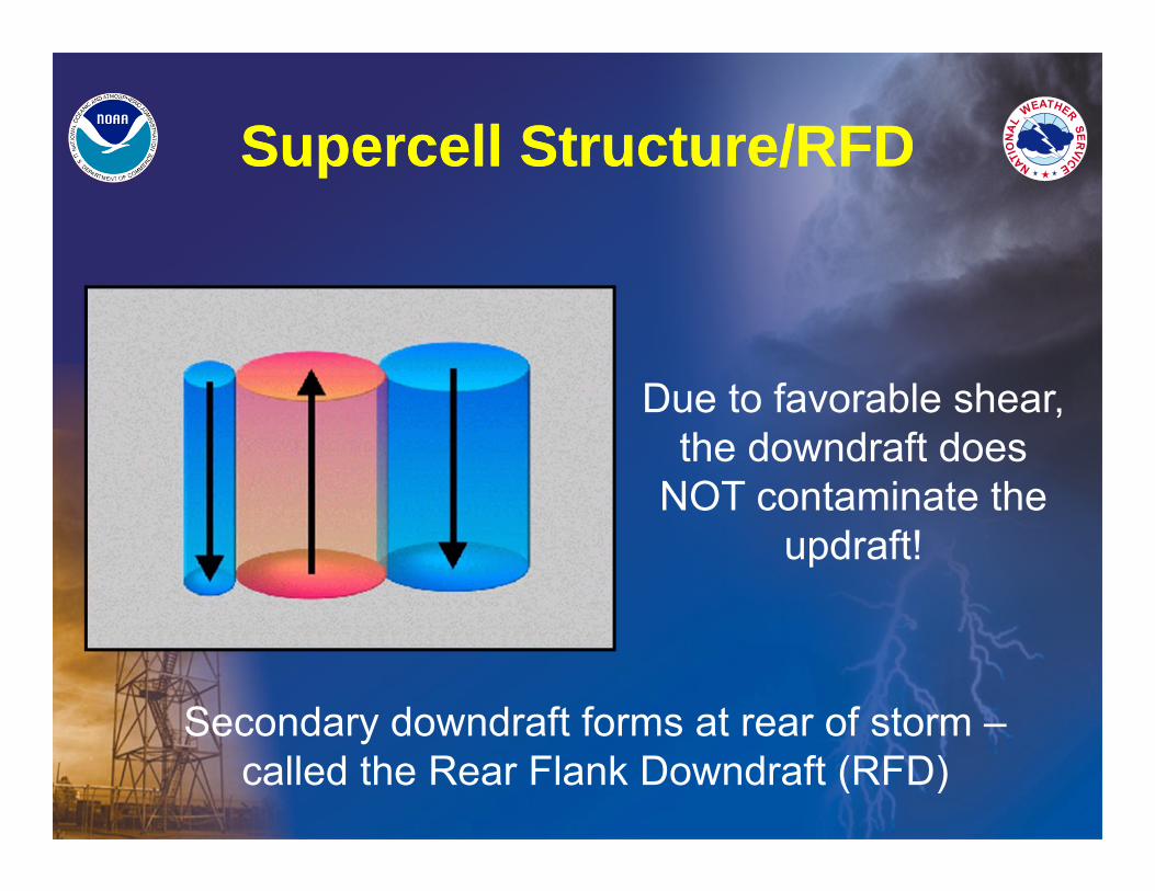
Supercell Structure/RFDSupercell Structure/RFD
Due to favorable shear, the downdraft does
NOT contaminate the updraft!
Secondary downdraft forms at rear of storm –called the Rear Flank Downdraft (RFD)
What is a Rear Flank Downdraft
(RFD)?
What is a Rear Flank Downdraft
(RFD)?
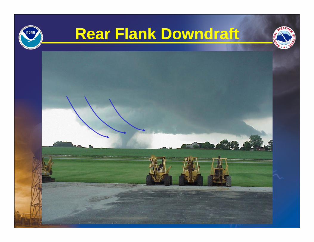
Rear Flank DowndraftRear Flank Downdraft
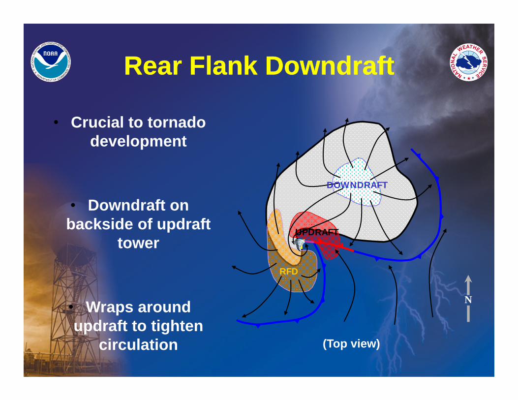
• Crucial to tornado development
• Downdraft on backside of updraft
tower
• Wraps around updraft to tighten
circulation
T
RFD
UPDRAFT
DOWNDRAFT
N
(Top view)
Rear Flank DowndraftRear Flank Downdraft
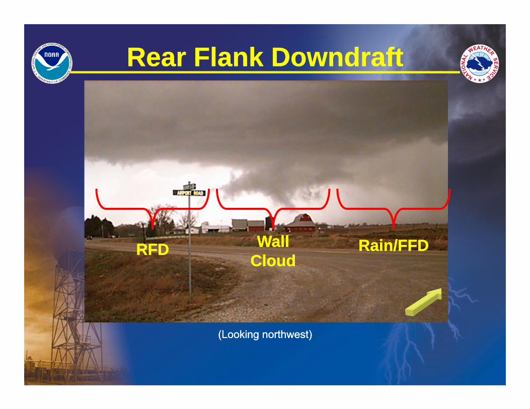
RFDRFD Rain/FFDRain/FFDWall CloudWall
Cloud
(Looking northwest)(Looking northwest)
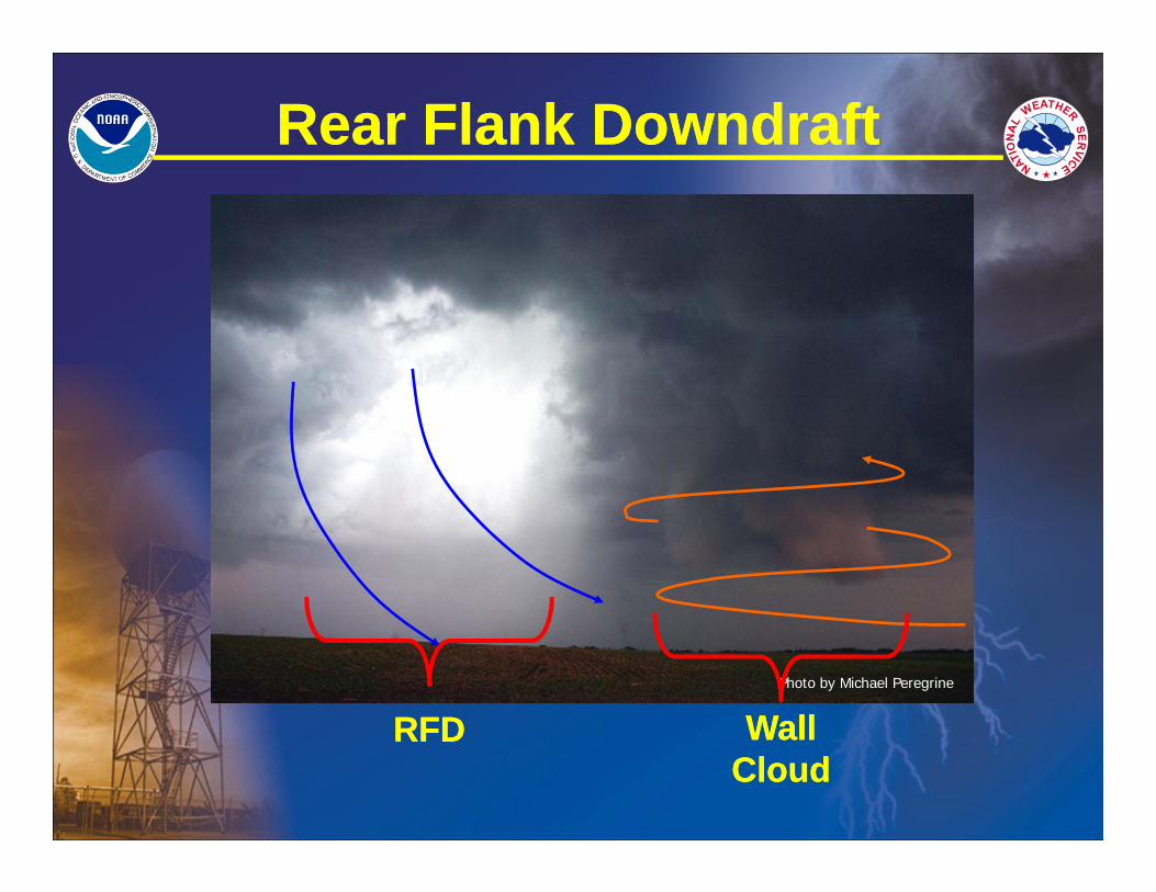
Photo by Michael Peregrine
Rear Flank DowndraftRear Flank Downdraft
RFDRFD Wall CloudWall
Cloud
Rear Flank DowndraftRear Flank Downdraft
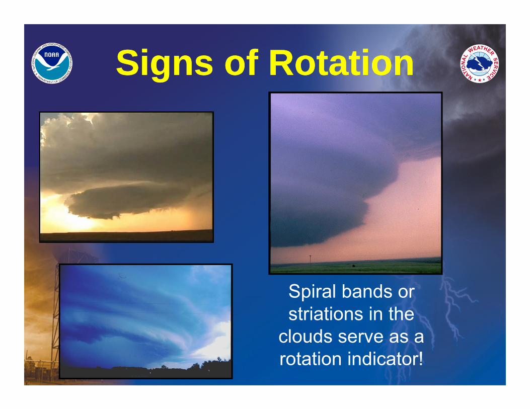
Signs of RotationSigns of Rotation
Spiral bands or striations in the
clouds serve as a rotation indicator!
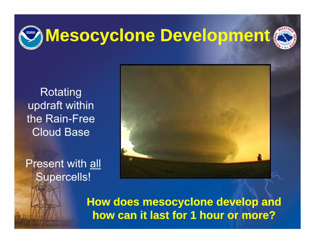
Mesocyclone DevelopmentMesocyclone Development
Present with allSupercells!
Rotating updraft within the Rain-Free Cloud Base
How does mesocyclone develop and how can it last for 1 hour or more?
How does mesocyclone develop and how can it last for 1 hour or more?
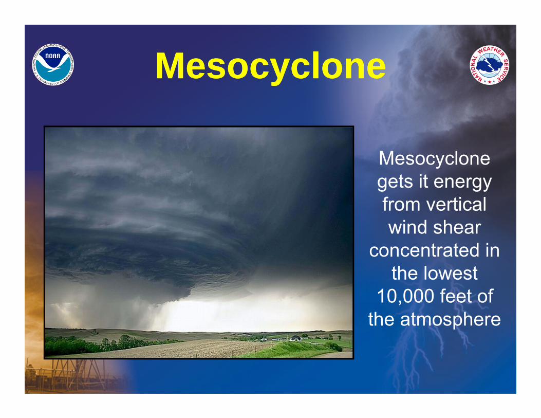
MesocycloneMesocyclone
Mesocyclone gets it energy from vertical wind shear
concentrated in the lowest
10,000 feet of the atmosphere
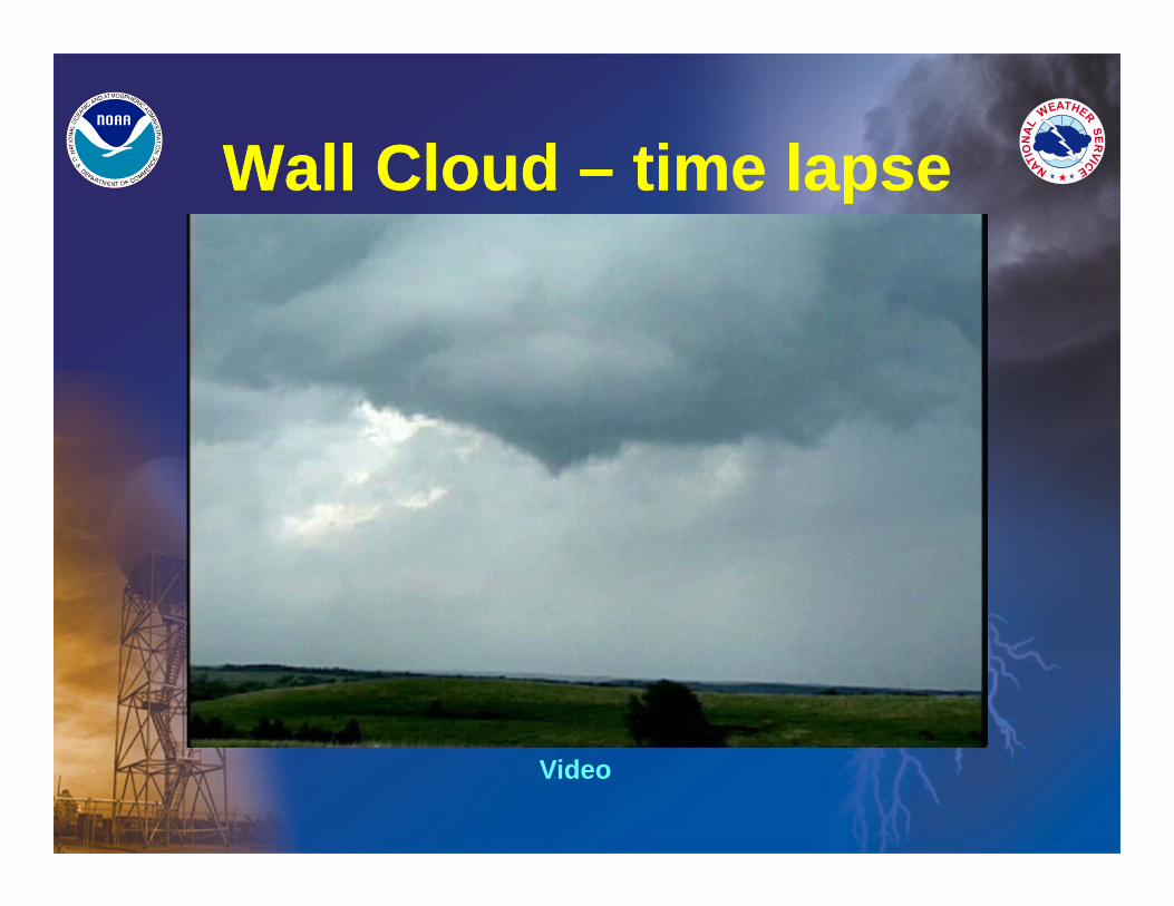
Wall Cloud – time lapseWall Cloud – time lapse
Video
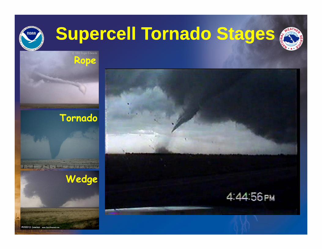
Rope
Tornado
Wedge
Supercell Tornado StagesSupercell Tornado Stages
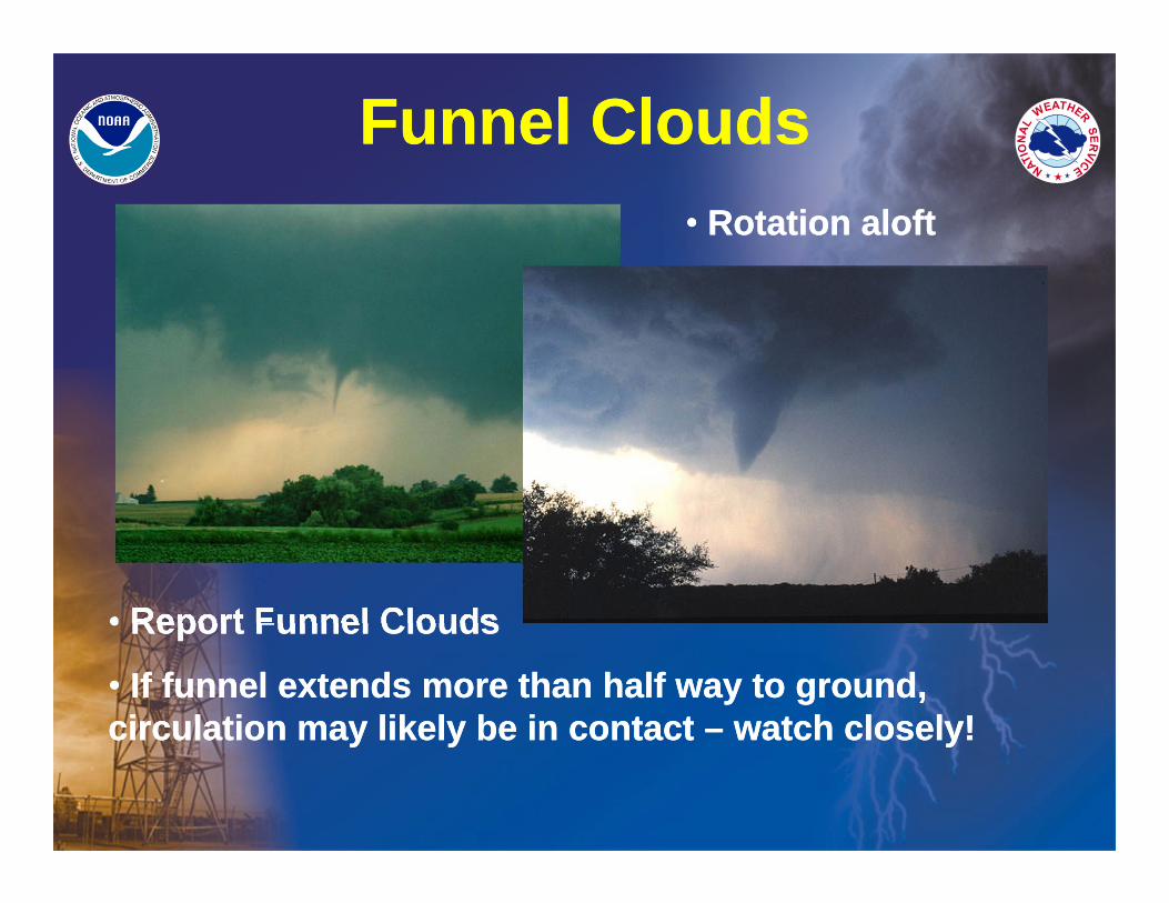
Funnel CloudsFunnel Clouds
• Report Funnel Clouds
• If funnel extends more than half way to ground, circulation may likely be in contact – watch closely!
• Report Funnel Clouds
• If funnel extends more than half way to ground, circulation may likely be in contact – watch closely!
• Rotation aloft• Rotation aloft
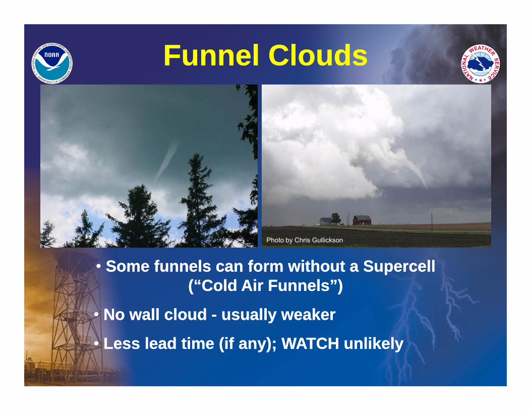
Funnel CloudsFunnel Clouds
• Some funnels can form without a Supercell (“Cold Air Funnels”)
• No wall cloud - usually weaker
• Less lead time (if any); WATCH unlikely
• Some funnels can form without a Supercell (“Cold Air Funnels”)
• No wall cloud - usually weaker
• Less lead time (if any); WATCH unlikely
Photo by Chris Gullickson
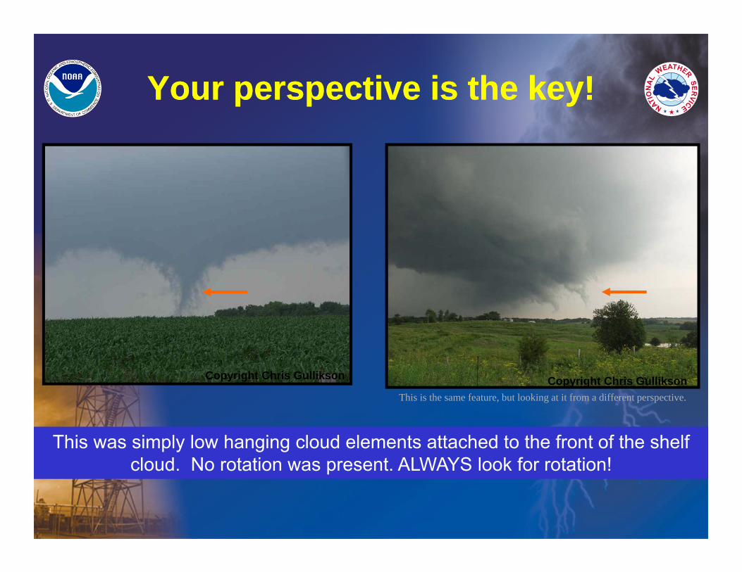
Your perspective is the key!Your perspective is the key!
Copyright Chris Gullikson Copyright Chris Gullikson
This was simply low hanging cloud elements attached to the front of the shelf cloud. No rotation was present. ALWAYS look for rotation!
This is the same feature, but looking at it from a different perspective.
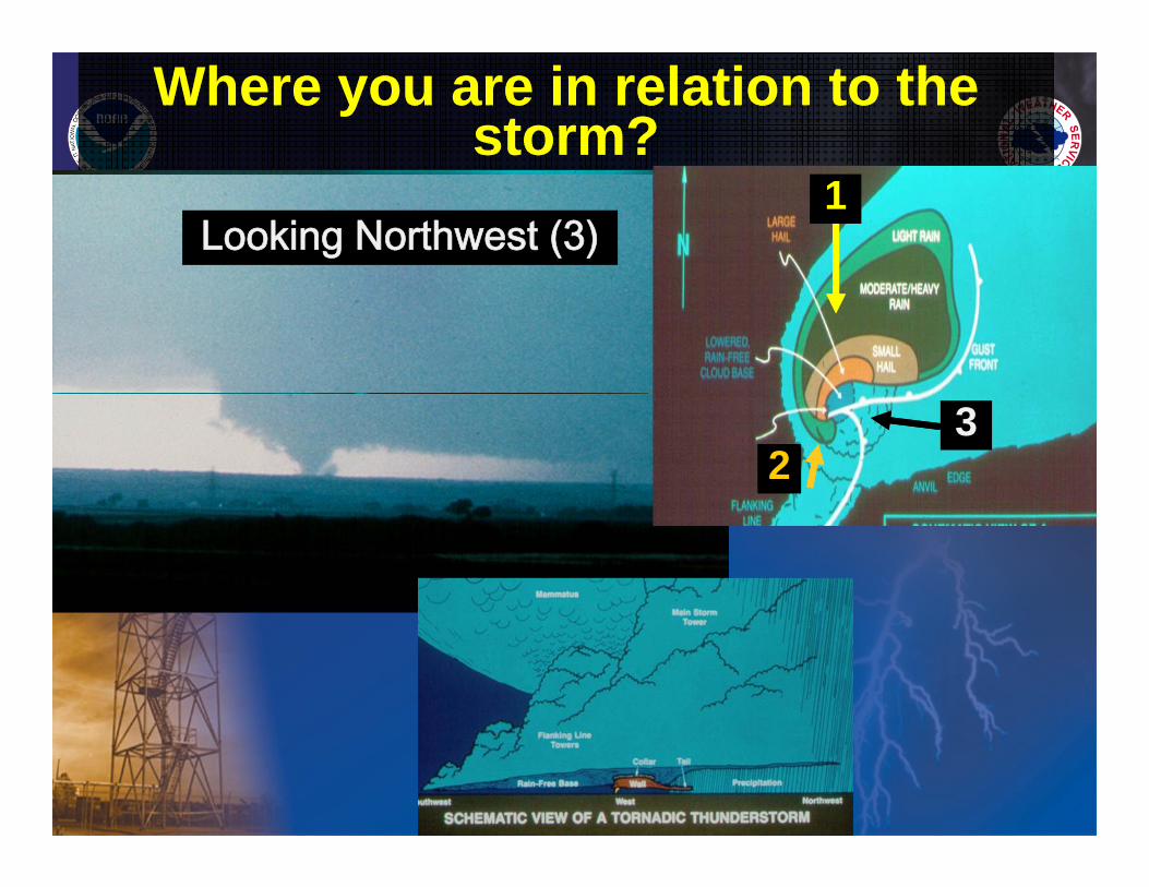
Where you are in relation to the storm?
Where you are in relation to the storm?
Looking South (1)Looking Northeast (2)
Looking Northwest (3)
Tornado 32
1
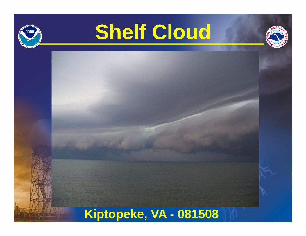
Shelf CloudShelf Cloud
Kiptopeke, VA - 081508
Shelf CloudShelf Cloud
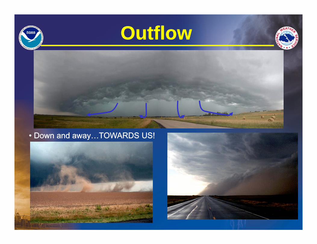
OutflowOutflow
• Down and away…TOWARDS US!• Down and away…TOWARDS US!
OutflowOutflow
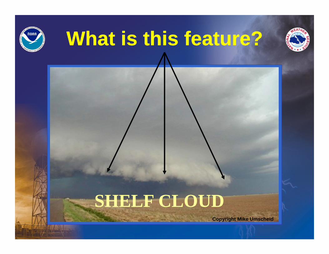
What is this feature?What is this feature?
Copyright Mike Umscheid
SHELF CLOUD
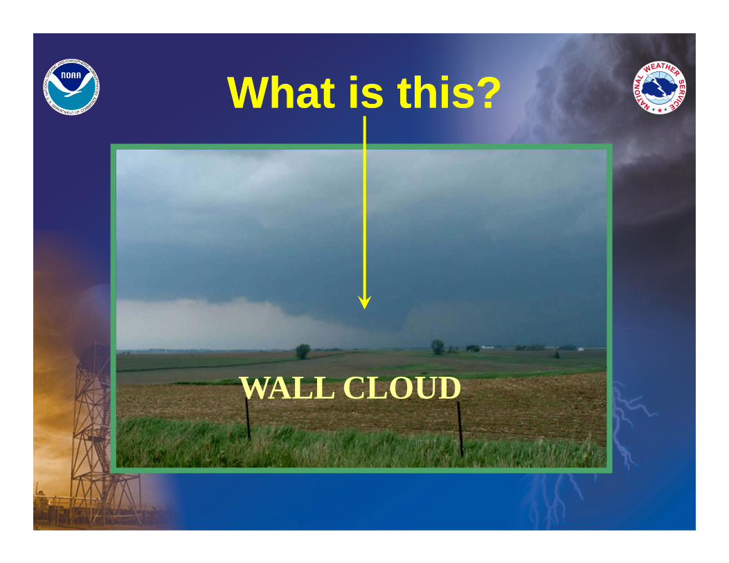
What is this? What is this?
WALL CLOUD
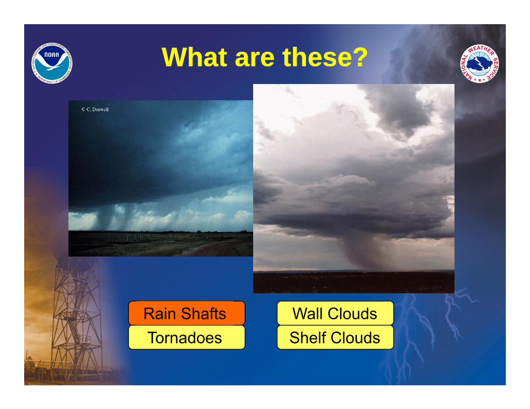
What are these?What are these?
Rain ShaftsTornadoes Shelf Clouds
Wall CloudsRain Shafts
For more information…For more information…
• See our website at:www.weather.gov/wakefieldOr just go to weather.gov and click on area of interest
• E-mail address:[email protected]
• Follow us on Facebook & Twitter
Spotter Hotline: 1-800-737-8624
• See our website at:www.weather.gov/wakefieldOr just go to weather.gov and click on area of interest
• E-mail address:[email protected]
• Follow us on Facebook & Twitter
Spotter Hotline: 1-800-737-8624
QUESTIONS ?QUESTIONS ?
?
?
?
?
?
? ??
?
??