accion plan, swot analysis, scenarios
TRANSCRIPT
ACCION PLAN, SWOT ANALYSIS, SCENARIOS.ACCION PLAN, SWOT ANALYSIS, SCENARIOS.EnvironmentEnvironment RegionalRegional MinistryMinistry ,, AndaluciaAndalucia
ConsejerConsejer íía de Medio Ambiente. Junta de Andaluca de Medio Ambiente. Junta de Andaluc ííaa
EnerscapesEnerscapes ’’ meeting. meeting. VolosVolos ,, octuberoctuber , 9/10, 9/10

INDEXINDEX
1. SWOT ANALYSIS2. ACTION PLAN3. SCENARIOS
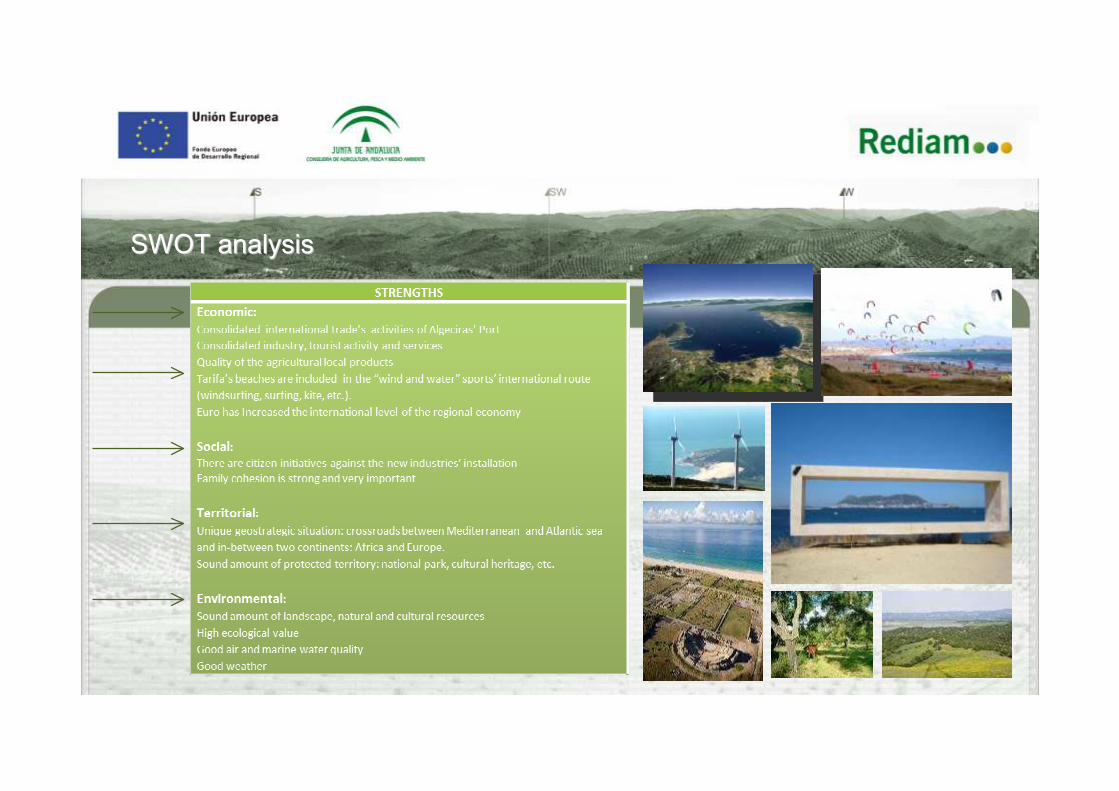
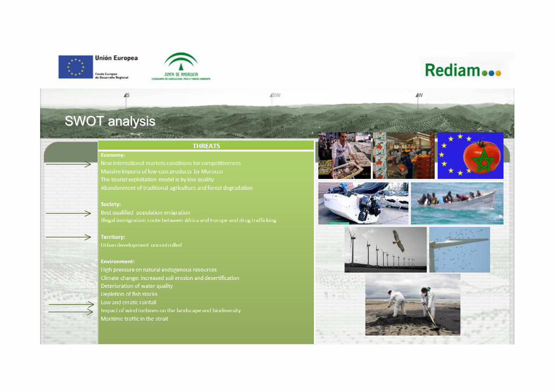
SWOTSWOT analysisanalysis

SWOTSWOT analysisanalysis

SWOTSWOT analysisanalysis
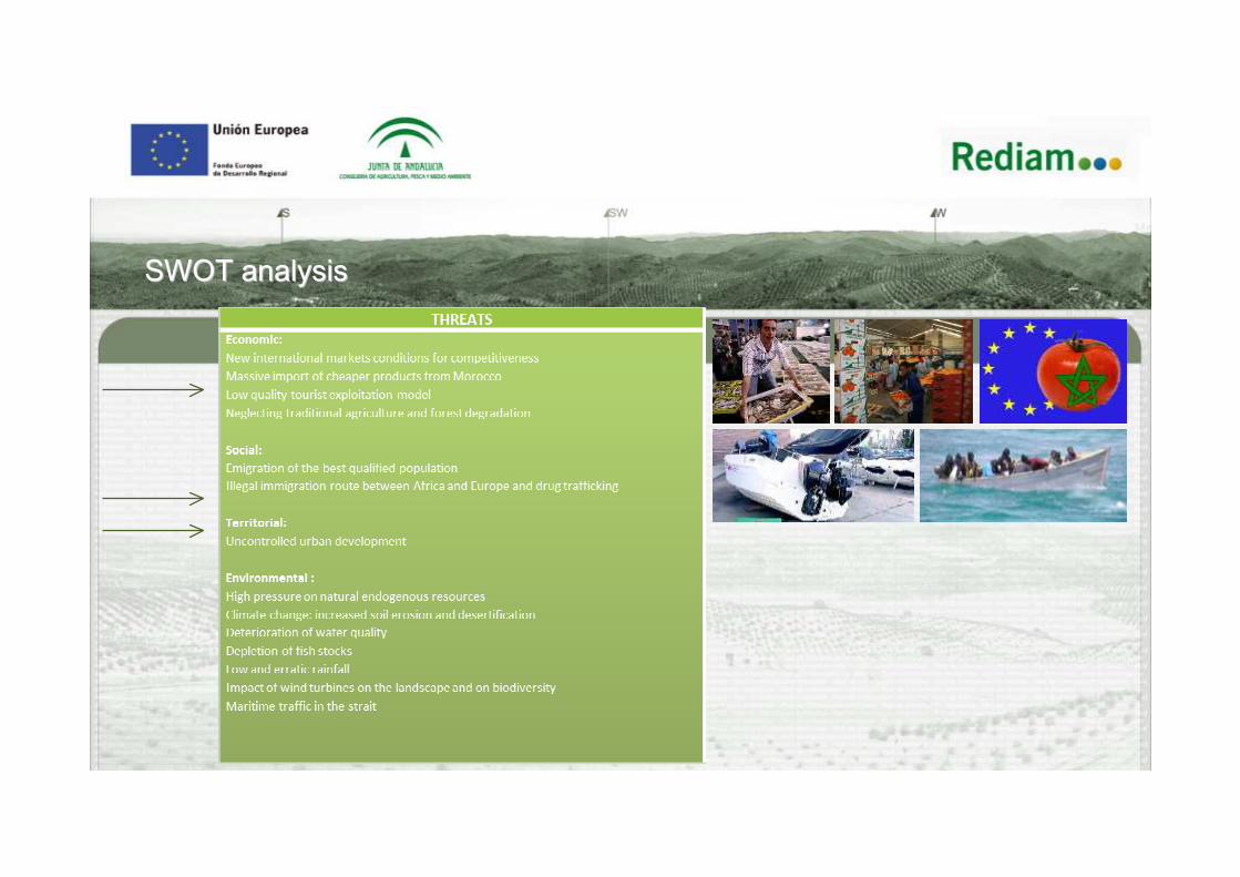
SWOTSWOT analysisanalysis
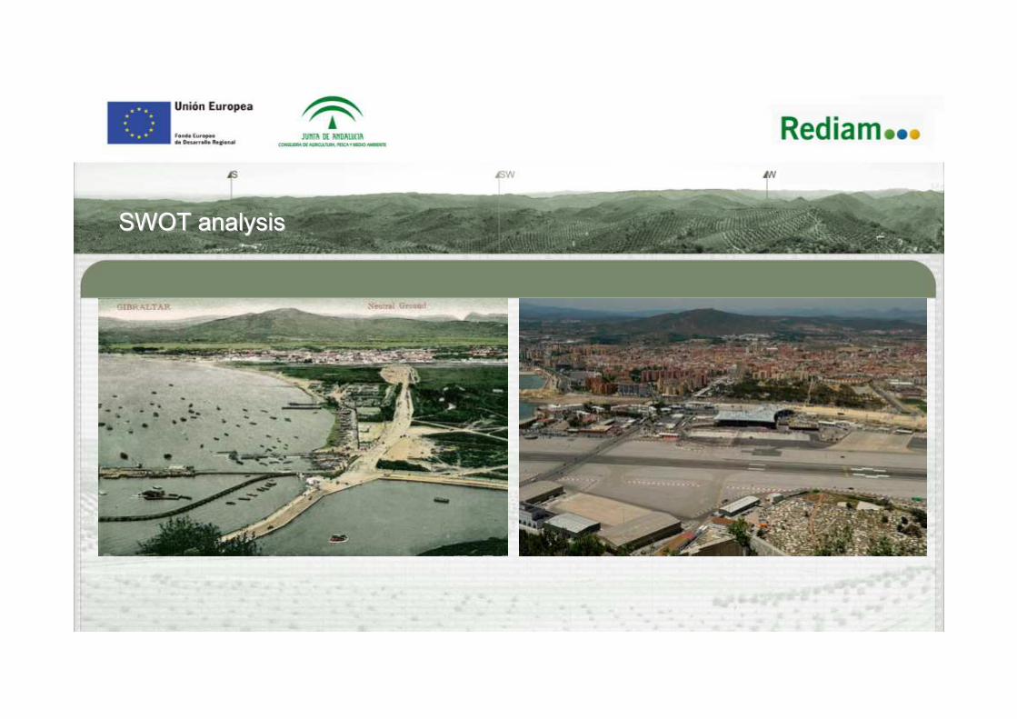
SWOTSWOT analysisanalysis
SWOTSWOT analysisanalysis
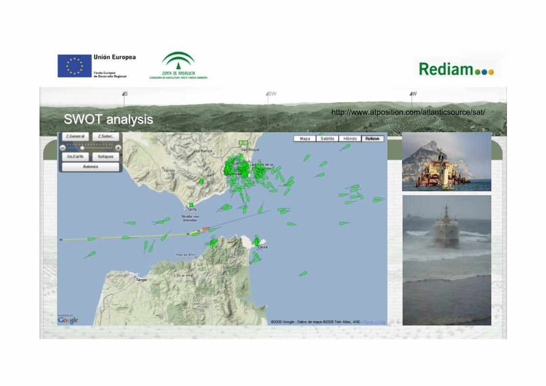
http://www.atposition.com/atlanticsource/sat/SWOTSWOT analysisanalysis
INDEXINDEX
1. SWOT ANALYSIS2. ACTION PLAN3. SCENARIOS
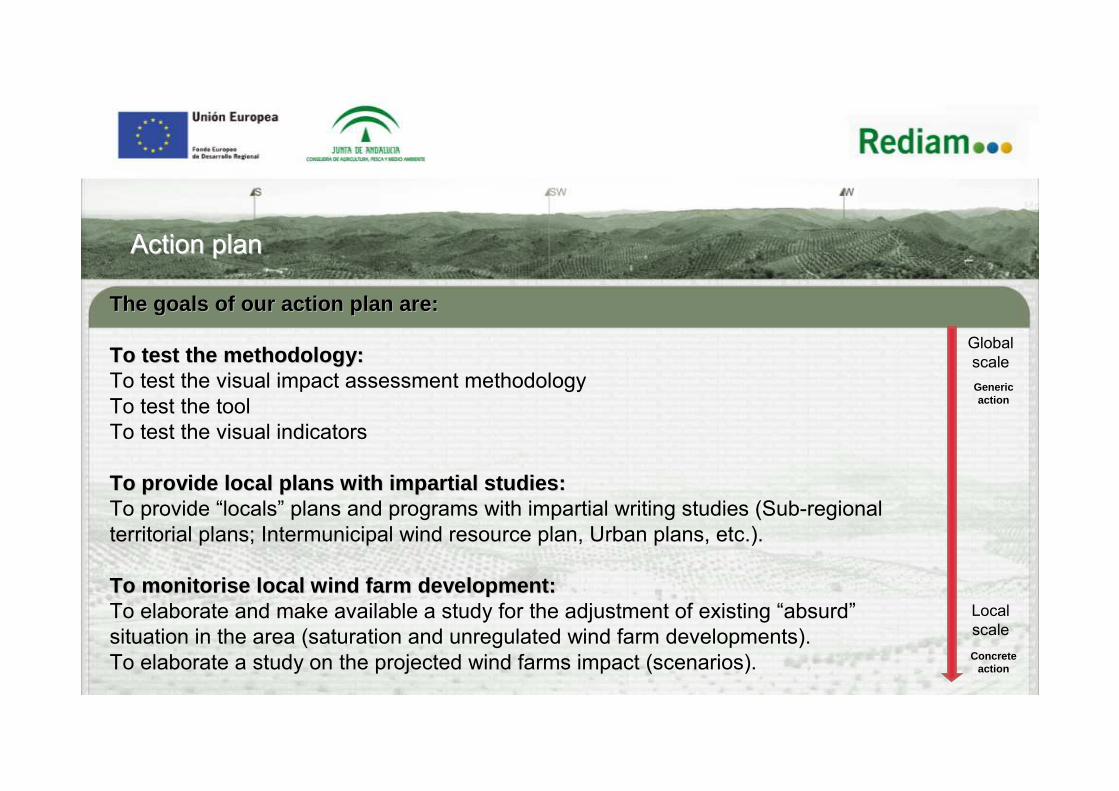
ActionAction planplan
The goals of our action plan are:The goals of our action plan are:
To test the methodology:To test the methodology:To test the visual impact assessment methodology To test the toolTo test the visual indicators
To provide local plans with impartial studies:To provide local plans with impartial studies:To provide “locals” plans and programs with impartial writing studies (Sub-regional territorial plans; Intermunicipal wind resource plan, Urban plans, etc.).
To To monitorisemonitorise local wind farm development: local wind farm development: To elaborate and make available a study for the adjustment of existing “absurd”situation in the area (saturation and unregulated wind farm developments). To elaborate a study on the projected wind farms impact (scenarios).
Global scale
Local scale
Generic action
Concrete action
INDEXINDEX
1. SWOT ANALYSIS2. ACTION PLAN3. SCENARIOS
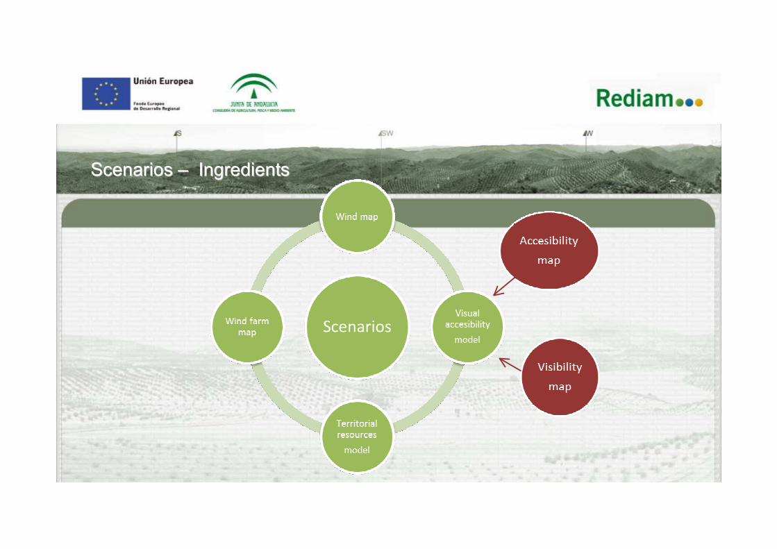
ScenariosScenarios –– IngredientsIngredients

ScenariosScenarios –– 1st1st IngredientIngredient:: wind potential mapwind potential map

Existing Wind farm
Projected Wind farm
PROJECTED WIND FARMNAME MW
GUADACORTE I 12.00GUADACORTE II 16.00IRUELAS 21.00LEVANTERA (AMPLIACIÓN) 13.80
TURCO (EL) 21.47TOTAL 84.27
EXISTING WIND FARM36 MW
TOTAL 583.26
ScenariosScenarios. 2th. 2th ingredientingredient:: Expected wind farm developExpected wind farm develop
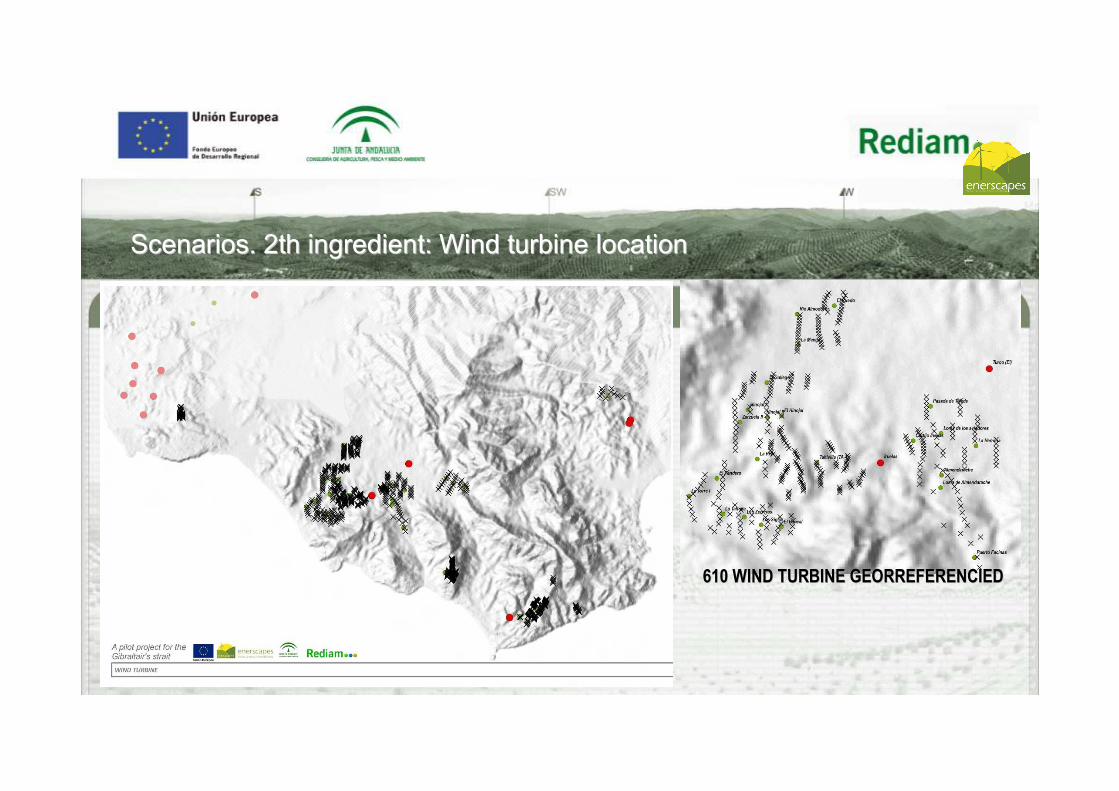
610 WIND TURBINE GEORREFERENCIED610 WIND TURBINE GEORREFERENCIED
ScenariosScenarios. 2th. 2th ingredientingredient:: Wind turbine locationWind turbine location
Legend
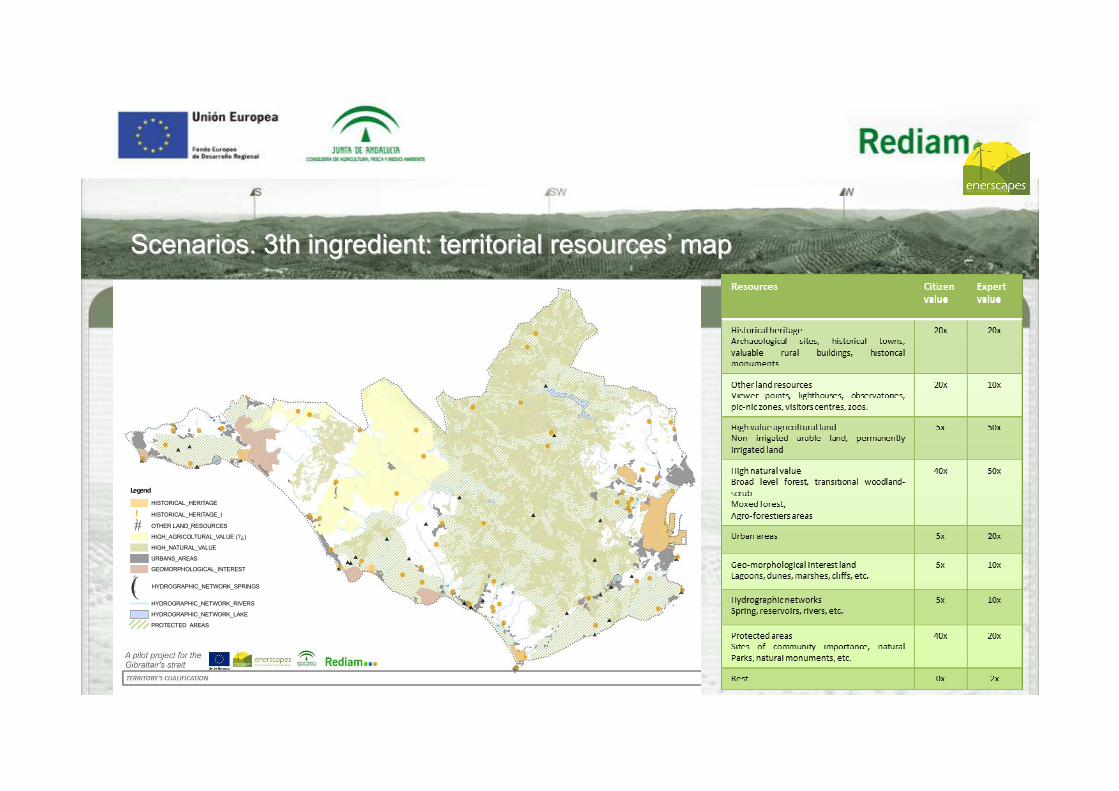
HISTORICAL_HERITAGE
! HISTORICAL_HERITAGE_I
# OTHER LAND_RESOURCES
HIGH_AGRICOLTURAL_VALUE (?¿)
HIGH_NATURAL_VALUE
URBANS_AREAS
GEOMORPHOLOGICAL_INTEREST
!( HYDROGRAPHIC_NETWORK_SPRINGS
HYDROGRAPHIC_NETWORK_RIVERS
HYDROGRAPHIC_NETWORK_LAKE
PROTECTED_AREAS
ScenariosScenarios. 3th. 3th ingredientingredient: territorial: territorial resourcesresources’’ mapmap
Visual accesibilit
ymodel
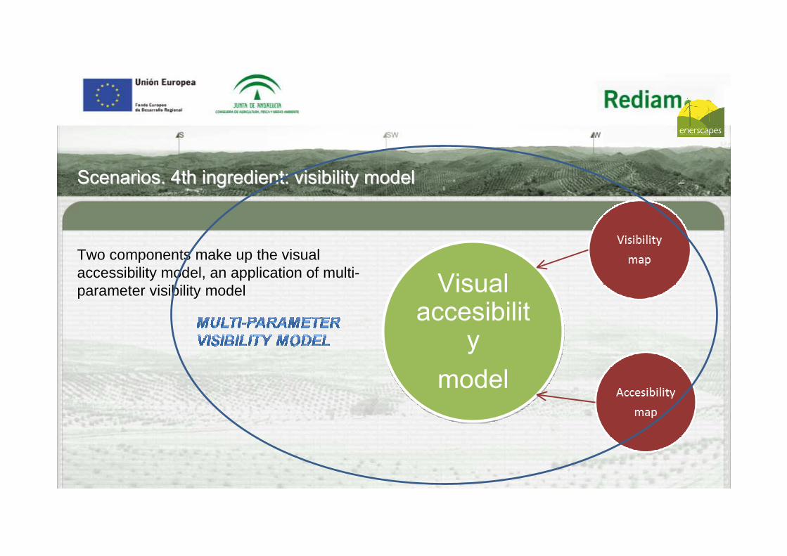
ScenariosScenarios. 4th. 4th ingredientingredient:: visibility modelvisibility model
Two components make up the visual accessibility model, an application of multi-parameter visibility model

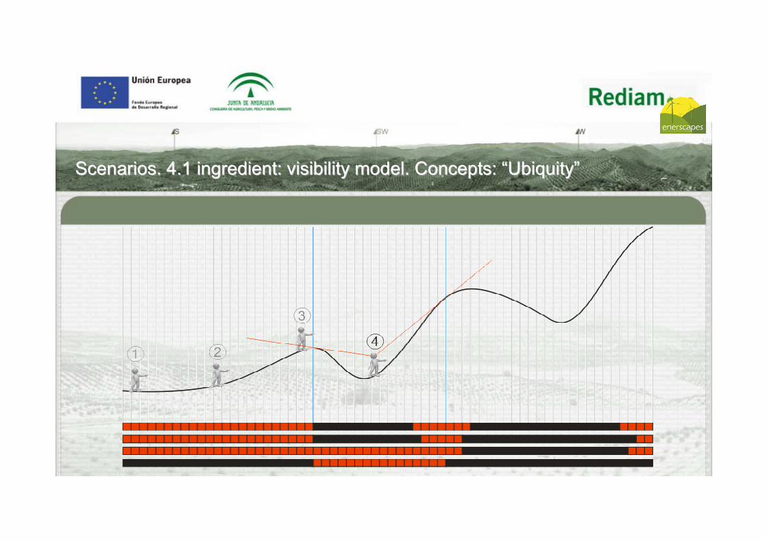
ScenariosScenarios. 4.1. 4.1 ingredientingredient:: visibility modelvisibility model.. ConceptsConcepts: : ““UbiquityUbiquity””
Observationpoint
Observationpoint
Observationpoint
Observationpoint
Observationpoint
Observationpoint
observed point
Observation point 100x100mPoint observed 20x20m
Visibility 15 km.

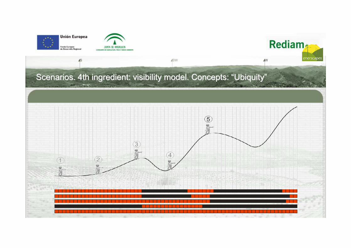
ScenariosScenarios. 4.1. 4.1 ingredientingredient:: visibility modelvisibility model.. ConceptsConcepts: : ““UbiquityUbiquity””

ScenariosScenarios. 4.1. 4.1 ingredientingredient:: visibility modelvisibility model.. ConceptsConcepts: : ““UbiquityUbiquity””

ScenariosScenarios. 4.1. 4.1 ingredientingredient:: visibility modelvisibility model.. ConceptsConcepts: : ““UbiquityUbiquity””
ScenariosScenarios. 4.1. 4.1 ingredientingredient:: visibility modelvisibility model.. ConceptsConcepts: : ““UbiquityUbiquity””
ScenariosScenarios. 4th. 4th ingredientingredient:: visibility modelvisibility model.. ConceptsConcepts: : ““UbiquityUbiquity””

ScenariosScenarios. 4th. 4th ingredientingredient:: visibility modelvisibility model.. ConceptsConcepts: : ““UbiquityUbiquity””
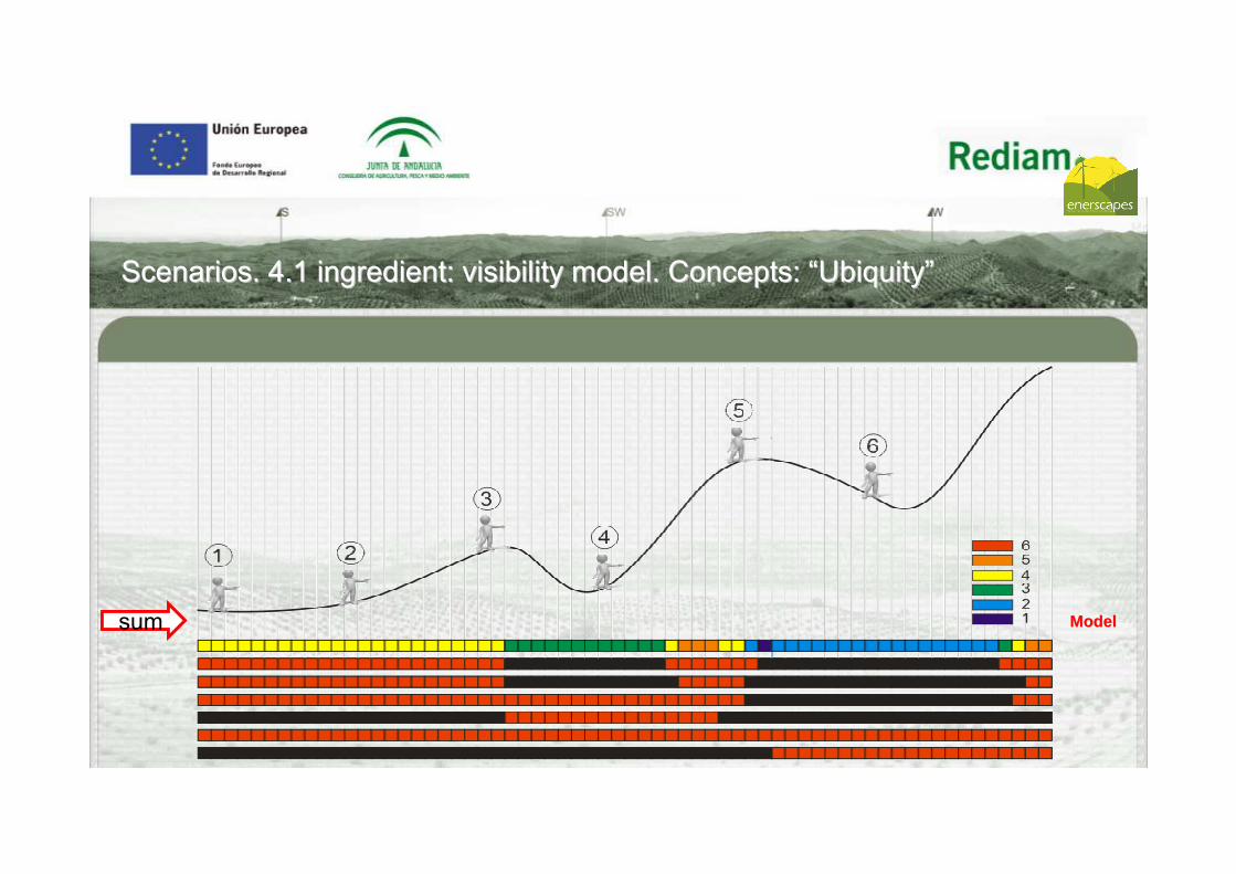
sum ModelModelsum
ScenariosScenarios. 4.1. 4.1 ingredientingredient:: visibility modelvisibility model.. ConceptsConcepts: : ““UbiquityUbiquity””
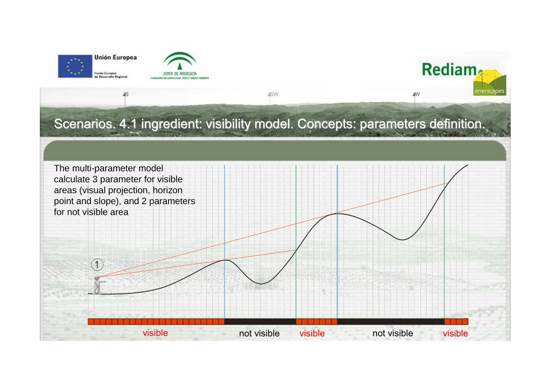
not visible not visiblevisible visible visible
ScenariosScenarios. 4.1. 4.1 ingredientingredient:: visibility modelvisibility model.. ConceptsConcepts:: parameters definitionparameters definition..
The multi-parameter model calculate 3 parameter for visible areas (visual projection, horizon point and slope), and 2 parameters for not visible area

Additional height needed (non-visible points) - Define the needed height for a point to be visible from the observation point.
ScenariosScenarios. 4.1. 4.1 ingredientingredient:: visibility modelvisibility model.. ConceptsConcepts:: parameters definitionparameters definition..

Additional height needed (to become visible)
It’s a concept born in relation whit fire’s control. The additional height is the height
of column of smoke’s needed by a to become visible from a fire tower.
ScenariosScenarios. 4.1. 4.1 ingredientingredient:: visibility modelvisibility model.. ConceptsConcepts:: parameters definitionparameters definition..
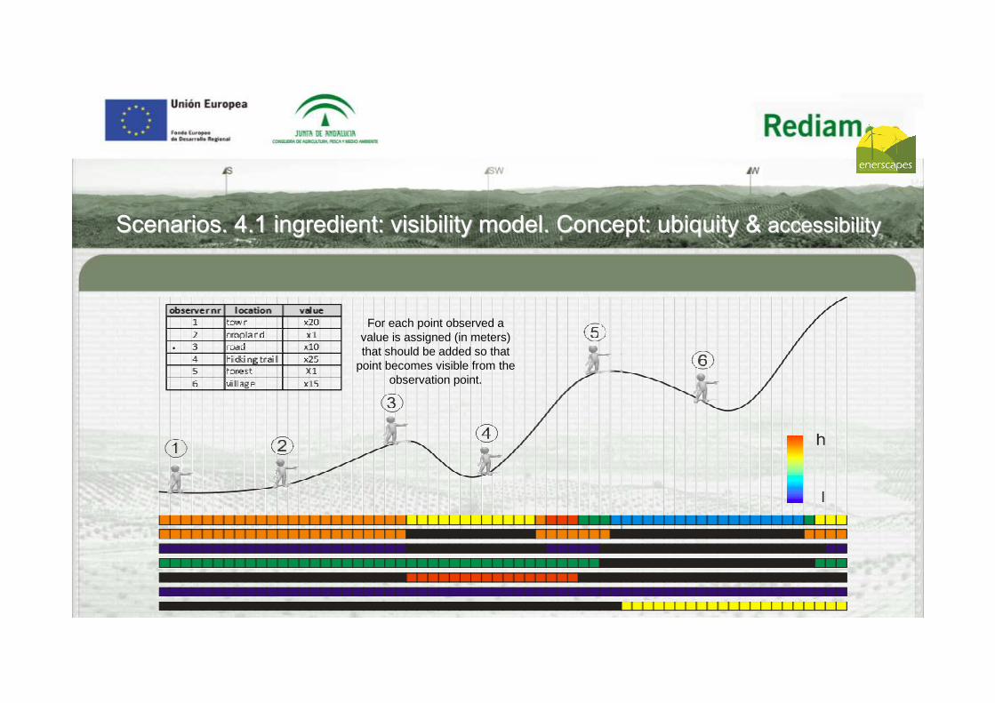
ScenariosScenarios. 4.1. 4.1 ingredientingredient:: visibility modelvisibility model.. ConceptConcept:: ubiquityubiquity && accessibilityaccessibility
.For each point observed a
value is assigned (in meters) that should be added so that
point becomes visible from the observation point.

ScenariosScenarios. 4.1. 4.1 ingredientingredient:: visibility model resultsvisibility model results
Calculation of additional height based on some stretches of similar height to the wind turbine or PV plant: 0, 20, 40, 60, 80, 100, 120 m.
The product will be a collection of 182 rasters : 2 raster (intervisibility simple and intervisibilitydivided by distance) for each level of intervention (tot.7) and local accessibility category (tot.13).

TERRITORY’S CLASSIFICATION BASED ON LOCAL ACCESSIBILITY Large groups Type ConstituentsHuman settlements
Urban areas of special interest Historic and tourist cities
Residential areas Urban land, including the agricultural/residential land and isolated buildings.No residencial urban areas Industrial and commercial zone, sporting and recreational facilities, building sites (vacant lot).
Rustic land Non-urban altered or agricultural solis
Agricultural land, crops, wetlands, dumps and landfills, mining areas, airports and other technical infrastructure, agricultural facilities.
Natural or forest land Forest land and natural woodland, scrub, grassland.Road network Railways In use railways
Motorway system Motorways, dual carriagewaysRoad Other roadsRural roads Livestock trail, rural road, pathwaysTurist pedestrian route Cycling routes, greenways, footpath
Tourism resorces
High frequentation High potential tourism resources (ex.: Baelo Claudia’s archaeological site, beaches, viewer point, etc.).
Medium frequentation “Highlights“ cultural and natural elements (monuments, castles, etc..) and nature’s facilities (visitors centres, recreational areas, etc.).
Low frequentation Little-known Cultural and natural elements (ex.: rural buildings, caves and shelters, archaeological sites, etc..), golf courses, etc..
ScenariosScenarios. 4.2. 4.2 ingredientingredient:: accessibility modelaccessibility model

Livestock trail
Rural road
Cycling routes
Footpath
Railway
Motorway
Conventional roads
ScenariosScenarios. 4.2. 4.2 ingredientingredient:: accessibility modelaccessibility model: : Road networkRoad network

ScenariosScenarios. 4.2. 4.2 ingredientingredient:: accessibility modelaccessibility model. . SoilsSoils’’ typetype
Human settlements
Rustic soils
Tourism resorcesRecursos turísticos
High frequentation#Medium frequentation#
Low frequentation#
Urban areas of special interestResidential areas
No residencial urban areas
Natural or forest soilsNon- urban altered or agricultural solis
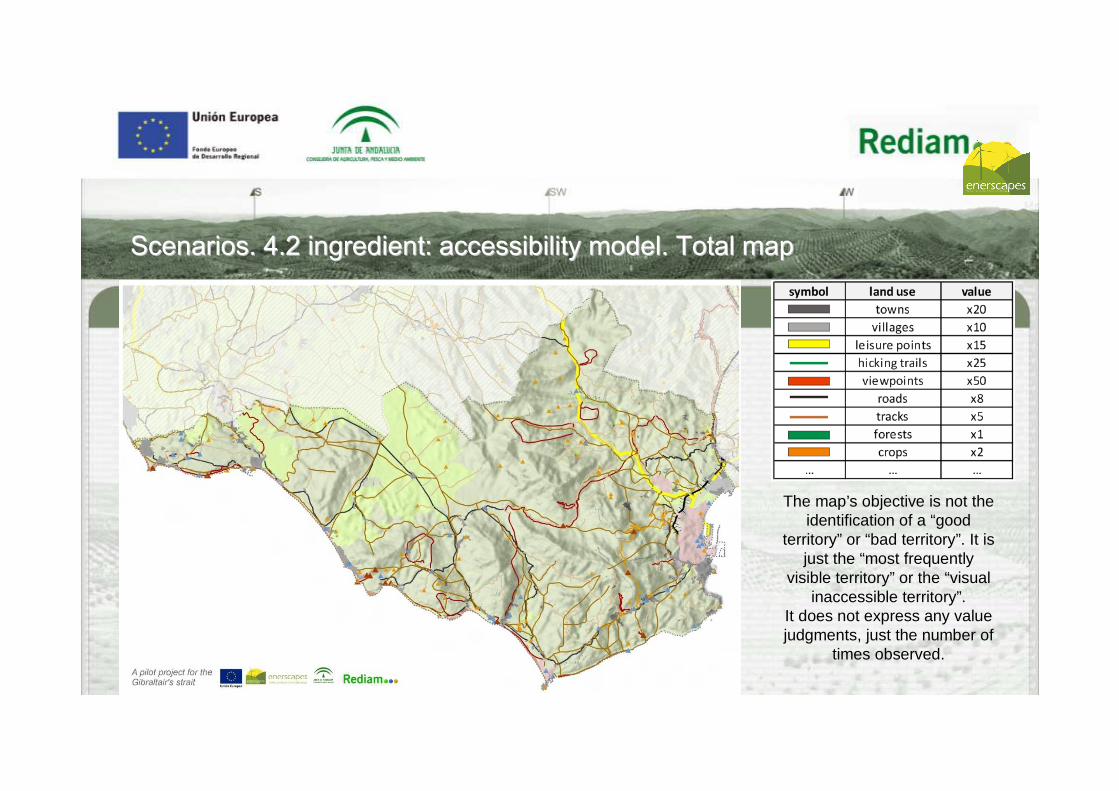
ScenariosScenarios. 4.2. 4.2 ingredientingredient:: accessibility modelaccessibility model. . TotalTotal mapmap
The map’s objective is not the identification of a “good
territory” or “bad territory”. It is just the “most frequently
visible territory” or the “visual inaccessible territory”.
It does not express any value judgments, just the number of
times observed.

ScenariosScenarios’’ goalsgoals
Scenario 0. Evaluation of the impact generated by the construction of 5 new wind farms in locations provided (spontaneous evolution).
Scenario 1: Impact assessment generated if the minimum visual impact is prioritised (Minimum visual accessibility).
Scenario 2: Impact assessment generated if a balance between high visual accessibility and optimal geographical location is seek, focused on the first. (Location optimum landscape II)
Scenario 3: Impact assessment generated if a balance between a high visual accessibility and excellent territorial location is prioritised, focused on the latter. (Location optimum landscape I)
Scenario 4: Impact generated if the conservation of land resources is prioritised (optimal territorial location).
Scenario 0Spontaneous
evolution
Scenario 1Optimal visual location
Visual impactTerritorial
impact
Scenario 2 Optimal landscape location I
Scenario 3Optimal landscape location II
Scenario 4Optimal territorial location

ScenariosScenarios’’ stepssteps
1.- To identify the scenarios’ goals……………………………………………………………………
2.- To georeference wind turbines ……………………………………………………………………
3.- To generate a accessibility model……………………………………………………….……….
4.- To generate a territorial resources’ map…………………………………………………….....
5.- To make the necessary calculations, as seen above: visibility model results………………
6.- Generate scenarios……………………………………………………………………………….
5.- Compare the results with the experts’ approach , and take them to public trial – broadcasting…
STATE OF THE ART

Thanks!