about kern county - california state university, bakersfielddbaron/sci360b/kernwater.pdf · rag...
TRANSCRIPT
1
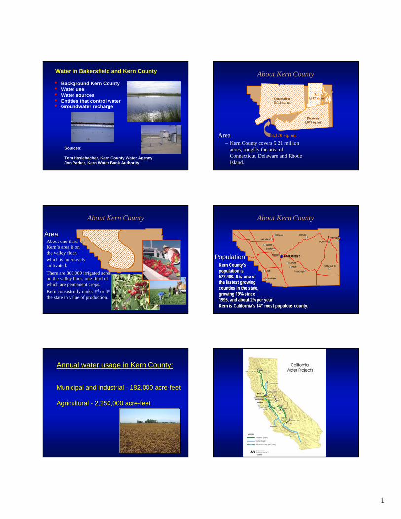
Water in Bakersfield and Kern County
• Background Kern County• Water use• Water sources• Entities that control water• Groundwater recharge
Sources:
Tom Haslebacher, Kern County Water AgencyJon Parker, Kern Water Bank Authority
AreaArea–– Kern County covers 5.21 million Kern County covers 5.21 million
acres, roughly the area of acres, roughly the area of Connecticut, Delaware and Rhode Connecticut, Delaware and Rhode Island.Island.
About Kern County
Connecticut Connecticut 5,018 sq. mi.5,018 sq. mi.
Delaware Delaware 2,045 sq. mi.2,045 sq. mi.
R.I. R.I. 1,212 sq. mi.1,212 sq. mi.
8,170 sq. mi.8,170 sq. mi.
About Kern County
About oneAbout one--third of third of Kern’s area is on Kern’s area is on the valley floor,the valley floor,
There are 860,000 irrigated acres There are 860,000 irrigated acres on the valley floor, oneon the valley floor, one--third of third of which are permanent crops.which are permanent crops.Kern consistently ranks 3rd or 4th in the state in value of production.
which is intensively which is intensively cultivated.cultivated.
AreaArea
About Kern County
McFarlandDelano
WascoShafter
Taft
LamontArvin
Tehachapi
Maricopa
Kernville
Inyokern
Ridgecrest
California City
BAKERSFIELD
per year.per year.
OildalePopulationPopulationKern County’s Kern County’s population is population is 677,400. It is one 677,400. It is one ofofthe fastest growing the fastest growing counties in the state, counties in the state, growing 19% since growing 19% since 1995, and about 2%1995, and about 2%Kern is California’s 14Kern is California’s 14thth most populous county.most populous county.
Annual water usage in Kern County:Annual water usage in Kern County:
Municipal and industrial Municipal and industrial -- 182,000 acre182,000 acre--feetfeet
Agricultural Agricultural -- 2,250,000 acre2,250,000 acre--feetfeet

2
Kern County water sources:Kern County water sources:Kern River Kern River -- 22%22%
State Water Project (California Aqueduct) State Water Project (California Aqueduct) --23%23%
Federal (FriantFederal (Friant--Kern Canal) Kern Canal) -- 11%11%
Groundwater Groundwater -- 43%43%
Gross Water Supplies and Net Water RequirementsSan Joaquin Valley Portion of Kern County
-
500,000
1,000,000
1,500,000
2,000,000
2,500,000
3,000,000
3,500,000
4,000,000
4,500,000
1970
1971
1972
1973
1974
1975
1976
1977
1978
1979
1980
1981
1982
1983
1984
1985
1986
1987
1988
1989
1990
1991
1992
1993
1994
1995
1996
1997
1998
Local CVP SWP Demand(Net WaterRequirements)
July 5, 2001Acre-Feet
Additions toGroundwaterStorage
WithdrawalsfromGroundwaterStorage
Kern County Water Agency•• CreatedCreated in 1961 by act of in 1961 by act of the the LegislatureLegislature
•• AnnualAnnual entitlement of one entitlement of one million acremillion acre--feet of water from feet of water from State Water ProjectState Water Project
•• LargestLargest agricultural participant agricultural participant on SWP on SWP -- second largest urban second largest urban participantparticipant
•• FundedFunded by tax assessmentsby tax assessments
3
Improvement District 4•• Formed by the KCWA to act as a wholesale provider of Formed by the KCWA to act as a wholesale provider of drinking water for most of the Bakersfield metropolitan areadrinking water for most of the Bakersfield metropolitan area
•• Operates Henry C. Garnett Water Purification Plant (Golden Operates Henry C. Garnett Water Purification Plant (Golden State Avenue and Airport Drive)State Avenue and Airport Drive)
•• FundedFunded by tax by tax assessmentsassessments
•• Distributes water to retail water suppliersDistributes water to retail water suppliers
Henry Garnett WaterTreatment Plant
Kern River Water Treatment Plant
Groundwater Recharge aka “Water Banking”
4 0 4 8
Delano-EarlimartID
Rag Gulch WD
Kern-Tulare
WD
Devils Den WD Lake Isabella
5
5
5
5
5
43
5
43
Rosedale-Rio Bravo WSD
KCWA Improvement District No. 4
Wheeler Ridge-
Maricopa WSD
West Kern WD
Semitropic WSD
Belridge WSD
Bakersfield
Southern San
Joaquin MUD
Shafter-Wasco
ID
North Kern WSD Cawelo
WD
Kern Delta WDHenry
Miller WD
Buena Vista WSD
Cross Valley Canal
Lost Hills WD
Berrenda Mesa WD
Arvin-Edison WSD
Infrastructure is Key
Water recharged into Water recharged into the banking projects the banking projects can come from the can come from the Kern River, Friant Kern River, Friant Kern Canal, or Kern Canal, or California Aqueduct.California Aqueduct.
California Aqueduct Kern River
Friant Kern Canal
4 0 4 8
Delano-EarlimartID
Rag Gulch WD
Kern-Tulare
WD
Devils Den WD Lake Isabella
Kern River
California Aqueduct
5
5
5
5
5
5
43
119
5
43
Rosedale-Rio Bravo WSD
KCWA Improvement District No. 4
Wheeler Ridge-
Maricopa WSD
West Kern WD
Semitropic WSD
Belridge WSD
Bakersfield
Southern San
Joaquin MUD
Shafter-Wasco
ID
North Kern WSD Cawelo
WD
Kern Delta WDHenry
Miller WD
Buena Vista WSD
Friant-Kern Canal
Cross Valley Canal
Lost Hills WD
Berrenda Mesa WD
5
Arvin-Edison WSD
Kern County Water Agency
California Aqueduct is Key for Recovery
Water recovered from Water recovered from banking projects banking projects mustmustbe pumped into the be pumped into the California Aqueduct. California Aqueduct. Downstream areas, Downstream areas, primarily MWD, are primarily MWD, are affected by water affected by water quality.quality.
5
5
5
5
5
5
5
5
5
5
5
5
5
5
5
5
43
119
99
166
55
184
43
46
33
58
58
33
46
Delano-Earlimart ID Rag Gulch WD
Kern-Tulare WD
Southern San
Joaquin MUD
North Kern WSD Cawelo
WDShafter-
Wasco ID
Rosedale-Rio Bravo WSD KCWA
Improvement District No.
4 Arvin-Edison WSD
Kern Delta WD
Wheeler Ridge-Maricopa WSD
Henry Miller WDWest Kern
WD
Buena Vista WSD
Semitropic WSD
Lost Hills WD
Berrenda Mesa WD
Devils Den WD
Belridge WSD
Lake Isabella
California Aqueduct
Bakersfield
Semitropic WSD
Semitropic WSD
Arvin-Edison WSD
KCWA Improvement District No. 4
Buena Vista WSD
Rosedale-Rio Bravo WSD
Kern Delta WD
Cawelo WD
Wheeler Ridge-Maricopa WSD
North Kern WSD
Kern County has made Kern County has made major investments since the major investments since the 19871987--92 drought.92 drought.
Kern County Water Agency
Response to Shortages
Wheeler RidgeWheeler Ridge--Maricopa BankingMaricopa Banking
City of Bakersfield 2,800 AcresCity of Bakersfield 2,800 AcresBerrenda Mesa BankingBerrenda Mesa BankingPioneer BankingPioneer BankingKern Water BankKern Water BankSemitropic/MWD/et al BankingSemitropic/MWD/et al BankingArvinArvin--Edison/MWD BankingEdison/MWD Banking
Buena Vista BankingBuena Vista BankingRosedaleRosedale--Rio Bravo BankingRio Bravo BankingKern Delta/MWD BankingKern Delta/MWD BankingCawelo/Dudley Ridge BankingCawelo/Dudley Ridge BankingNorth Kern/MWD BankingNorth Kern/MWD Banking
ID#4/KTRG BankingID#4/KTRG Banking
4
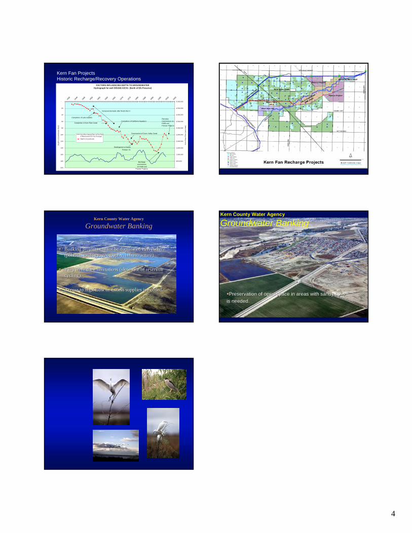
Kern Fan ProjectsHistoric Recharge/Recovery Operations
FACTORS INFLUENCING DEPTH TO GROUNDWATERHydrograph for well 30S/24E-02C01 (North of Elk Preserve)
-
20
40
60
80
100
120
140
160
180
200
19351940
19451950
19551960
19651970
19751980
19851990
19952000
2005
Dep
th to
Gro
undw
ater
(fee
t)
-
500,000
1,000,000
1,500,000
2,000,000
2,500,000
3,000,000
3,500,000
4,000,000
4,500,000
5,000,000
Ker
n R
iver
Flo
w (a
cre
feet
)
Kern River Natural Flow at First Pointof Measurement (5 Year Average)
Depth to Groundw ater
Increased demands after W orld War II
Completion of Lake Isabella
Completion of California Aqueduct
Construction of Cross Valley Canal
Recharge commences
on KWB and Pioneer Projects
Development of James Pioneer I.D.
Completion of Kern River Canal
Recovery Commences on KWB and Pioneer Projects
Kern County Water Agency
Groundwater Banking
Banking projects cannot be duplicated everywhere Banking projects cannot be duplicated everywhere (politics, geology, geography, infrastructure).(politics, geology, geography, infrastructure).
They have their limitations (slow rate of reservoir They have their limitations (slow rate of reservoir cycling).cycling).
Access to highAccess to high--flow or excess supplies is needed.flow or excess supplies is needed.Preservation of open space in areas with sandy soilsPreservation of open space in areas with sandy soils
is needed.is needed.
Kern County Water Agency
Groundwater Banking