a new dam - geographical association - for geography … lesson 1 - new dam.pdf · 15 mins a new...
TRANSCRIPT

A new dam - Teacher notes
British Dams Society Geography Resource
About this lessonThis lesson provides examples of dams in the past and today, and helps to identify some key geographical factors behind the contemporary need for a new dam and reservoir. Students work in small groups to identify and justify the best location for a new dam. The lesson positions dams within larger geographical themes of development and human impacts on the landscape.
Learning objectivesAt the end of the lesson students should be able to:
11-14 14-16 (additional)
• state the main uses of dams in the past and today
•make general geographic distinctions between a town’s past, present and future industrial activities
• explain how large-scale projects can be linked to individual actions and collective needs
• identify future uses of dams in response to climate change and changes in population and economic activity
• use geographical understanding to select the location for a new dam
• consider natural and human factors that affect changes in industry over time
• describe some wider impacts due to town expansion, including infrastructure projects, such as dams, that may alter the landscape and natural patterns and processes
Background informationA dam is a structure built to form a reservoir to collect, retain and store water. Man has used dams since prehistoric times. The earliest known dams were built in the part of the Middle East and beyond known as the ‘fertile crescent’. These early dams managed scarce and unpredictable water supplies during the dawn of agriculture and the earliest civilisations.
There are nearly 500 large or major dams in the UK today. Many were built in the 19th century in response to the needs of growing industrial towns and their populations. As the UK’s population grew, dam construction continued apace but today it is rare due to long and difficultplanningprocesses.
Most UK dams store water to secure its supply and manage variations in availability across the seasons,ortoprovidelargeorsmall-scalefloodmanagement.Whilesomeincludehydroelectricpower, this currently only contributes to around 1% of UK electricity consumption.
Mostnewdamsaresmallandarebuilttomanagewateratalocallevelforfloodalleviation.
A new dam (Lesson 1 of 5)
Page 1

A new dam - Teacher notes
British Dams Society Geography Resource
Lesson plan (1 hr)You will also need blank A4 paper, pens and tape or sticky tack.
Timing Activity Learning objectives(14-16 in italics)
Assessment
5 mins StarterWhat do you know about dams?Show slide 1.1. Students list what they know in pairs. Share as a class.
Discussion, questioning
15 mins MainWhat are dams used for?Explainthatyouarefirstgoingtolookatdamsthrough history. Show slides 1.2 – 1.5. Use the presenter’s notes under each slide to help you and to question students. Explore ideas of scale and use, including multiple uses. Help students to consider how, throughout history, dams have been a response to the growing needs of developing populations to control and manage water. Show slides 1.6 – 1.7. Get students to explain why each is important.
State the main uses of dams in the past and today.
Questioning
20 mins What are the big issues?Show slide 1.8. Establish that climate change isamajorinfluenceonhowdamsmaybecomemore important in the future. Using the exampleofhydropower,brieflyexploretheidea that individual choices and actions (e.g. energy use at home) add up to large scale impacts (e.g. need for a new hydro project).
Split the class into three teams and assign ‘Me’, ‘Us’, and ‘The planet’ to each team.
Workinginpairsorsmallgroups,studentsconsider the factors at their given scale that affect water supply, demand and management. Whatwouldrequiremorewaterandwhatwouldrequire LESS? Students write their ideas on A4 sheets. Stick these on the board or wall and discuss how factors at each scale are linked.
Explain how large-scale projects can be linked to individual actions and collective needs.
Identify future uses of dams in response to climate change and changes in population and economic activity.
Discussion, questioning, written outcomes
15 mins A new damShow slide 1.9. Explore the map as a class. Read the newspaper article and as appropriate, discuss ideas of the town’s location, historic, current and future function and types of industry. Think about the ‘big’ issues that provide the context: planned development and population growth with the background of climate change and uncertain water security. In groups, students read the four options and discuss which option would be the best location for the new dam and reservoir. Groups justify their choice.
(Option 4 is preferred: the reservoir will be filledwhenrequiredbyriverCthatalreadyrunsthrough the valley. It is not taking away high quality farmland. The pylons can be relocated.
Make distinctions between a town’s past, present and future industrial activities.
Consider natural and human factors that affect changes in industry over time.
Oral presentations + discussion
Page 2
A new dam - Teacher notes
British Dams Society Geography Resource
Suggested questions• Whathavedamsbeenusedforinthepast?• Whataretheyusedfortoday,andwhatwilltheybeusedforinthefuture?• Whatweretheymadeofthenandnow?• What’stheimpactonwaterorenergydemandifyouusemoreorless?• Whatifmanypeopleusemoreorless?• Whatchoicesandactionslink‘Us’to‘Theplanet’viaclimatechange?• Whatnetworksandflowsareinvolvedinthislink?(Thecarboncycle.)• Howdoeswaterflowwithintheareacoveredbythemap?• Whatmighttheriverbelikeatlocations1and2?• Whyisanewdamneeded?Willthisneedincreaseordecreaseovertime?• Whatarethegoodreasonsandbadreasonsforeachlocation?• On balance, which location seems best and why?• Whatarethemostimportantchallengesfacingmankindhereandinother
regions of the world? How can dams help?
Differentiation and extensionMake easier: In ‘Big issues’, give students or groups a single theme to consider, such as ‘energy use at home’, ‘industry’, ‘water use at home’ etc. Allow less able students to consider ‘Me’ or ‘The planet’. In ‘A new dam’ explain that there would be time to investigate the archaeological sites, and point out that it’s easier to move things above ground than things that are below ground.
Make harder: Challengestudentstolistsome‘push’and‘pull’factorsthatmayhaveinfluencedmigrationawayfromthetown,andmayinfluencemigrationbacktoit.Getstudentstointerpretthemap and consider the river stages they can see: what clues suggest an upper stage and middle stage?
Extend:• Students write a letter to the town’s local newspaper, or a submission to a council’s
initial public consultation, justifying their choice of location for the new dam.• Use local historic and current mapping to identify old and present dams and their
functions. Your water authority may be able to provide information. • Considerthethemesin‘Bigissues’atyourlocallevel.Whatfactorsaffectwatersupplyanddemandinyourcommunity?Whatrisksarethere,andwhatmightclimatechange mean for you? How could dams contribute to a solution?
Page 3
Timing Activity Learning objectives(14-16 in italics)
Assessment
There are no underground pipes already there and the location does not interfere with transport routes. The archaeological site can be investigated and documented before construction begins. The reservoir will reduce flashfloodrisksfromriverC,whichentersthemain river through the town.)
Describe some wider impacts due to town expansion, including infrastructure projects, such as dams, that may alter the landscape and natural patterns and processes.
5 mins PlenaryReview (5 mins)Get students to use the scenario to review what theyhavelearned.Whatfactorsrequireanewdamintermsof‘Me’,‘Us’or‘Theplanet’?Whatfunctions might the new dam provide for the town?
Use geographical understanding to select the location for a new dam.
Discussion, questioning
British Dams Society Geography Resource
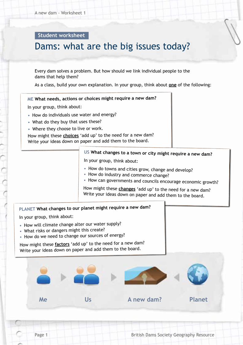
Every dam solves a problem. But how should we link individual people to the dams that help them?
As a class, build your own explanation. In your group, think about one of the following:
ME What needs, actions or choices might require a new dam?
In your group, think about:
• How do individuals use water and energy?
• Whatdotheybuythatusesthese?
• Wheretheychoosetoliveorwork.
How might these choices ‘add up’ to the need for a new dam?
Writeyourideasdownonpaperandaddthemtotheboard.
US What changes to a town or city might require a new dam?In your group, think about:
• How do towns and cities grow, change and develop?• How do industry and commerce change?• How can governments and councils encourage economic growth?How might these changes ‘add up’ to the need for a new dam? Writeyourideasdownonpaperandaddthemtotheboard.
PLANET What changes to our planet might require a new dam?
In your group, think about:
• How will climate change alter our water supply?
• Whatrisksordangersmightthiscreate?
• How do we need to change our sources of energy?
How might these factors ‘add up’ to the need for a new dam?
Writeyourideasdownonpaperandaddthemtotheboard.
Me Us A new dam? Planet
Page 1
Anewdam-Worksheet1
Dams: what are the big issues today? Student worksheet
British Dams Society Geography Resource

British Dams Society Geography Resource
North
River A
River C
River B
Red – roads (proposed new roads are dashed)Green dashes – proposed railway spurOrange dashes – existing underground gas pipeDark grey area – existing town
White – river valleyBrown – higher groundPale green area – site of special scientific interest (SSSI)Blue – rivers (flow is shown by arrows)
Light grey area – proposed new housing, science park and industrial zoneBlack dashes – electricity pylons (national grid)Numbers – potential dam sites
White – river valleyBrown – higher groundPale green area – site of special scientific interest (SSSI)Blue – rivers (flow is shown by arrows)Red – roads (proposed new roads are dashed)Green dashes – proposed railway spurOrange dashes – existing underground gas pipeDark grey area – existing townLight grey area – proposed new housing, science park and industrial zoneBlack dashes – electricity pylons (national grid)Numbers – potential dam sites
Key:
White – river valley
Brown – higher ground
Pale green area – site of special scientific interest (SSSI)
Blue – rivers (flow is shown by arrows)
Red – roads (proposed new roads are dashed)
Green dashes – proposed railway spur
Orange dashes – existing underground gas pipe
Dark grey area – existing town
Light grey area – proposed new housing, science park and industrial zone
Black dashes – electricity pylons (national grid)
Numbers – potential dam sites
Page 2
Anewdam-Worksheet2
Map Student worksheet
British Dams Society Geography Resource
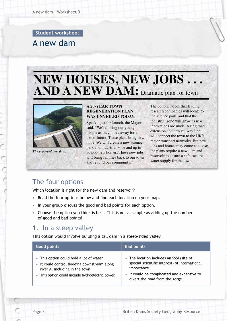
The four optionsWhichlocationisrightforthenewdamandreservoir?
• Readthefouroptionsbelowandfindeachlocationonyourmap.
• In your group discuss the good and bad points for each option.
• Choosetheoptionyouthinkisbest.Thisisnotassimpleasaddingupthenumber of good and bad points!
1. In a steep valleyThis option would involve building a tall dam in a steep-sided valley.
Good points Bad points
• This option could hold a lot of water.
• Itcouldcontrolfloodingdownstreamalongriver A, including in the town.
• This option could include hydroelectric power.
• The location includes an SSSI (site of specialscientificinterest)ofinternationalimportance.
• It would be complicated and expensive to divert the road from the gorge.
Page 3
Anewdam-Worksheet3
A new dam Student worksheet
NEW HOUSES, NEW JOBS . . . AND A NEW DAM: Dramatic plan for town
A 20-YEAR TOWN REGENERATION PLAN WAS UNVEILED TODAY.Speaking at the launch, the Mayor said, “We’re losing our young people as they move away for a better future. These plans bring new hope. We will create a new science park and industrial zone and up to 30,000 new homes. These new jobs will bring families back to our town and rebuild our community.”
The council hopes that leading research companies will locate to the science park, and that the industrial zone will grow as new innovations are made. A ring road extension and new railway line will connect the town to the UK’s major transport networks. But new jobs and homes may come at a cost; the plans require a new dam and reservoir to ensure a safe, secure water supply for the town.
The proposed new dam.

British Dams Society Geography Resource
2. Using earthworksThis option would involve creating earthworks to form three sides of the reservoir, with the hillside forming the fourth side.
Good points Bad points
• This option would be simple to construct. • Three sides have to be constructed.
• This area is high quality farmland on which many crops grow.
• There is one small archaeological site.
• The proposed railway spur would run through this location.
• Thisoptionwouldnotcontrolfloodinginthetown since it gathers water from where river A is downstream of the town.
3. Harness a tributary
This option would harness the small tributary river.
Good points Bad points
• ItmaycontrolfloodingalongriverBtoa small extent.
• This is low quality land used for animal grazing.
• An underground gas pipeline runs through this location.
• National Grid pylons cross the location.
4. A large valley riverThisreservoirwouldinvolvedammingtheendofthevalley.ItwouldbefilledbyriverCrunning through the valley.
Good points Bad points
• ThiswillreduceflashfloodingfromriverC,which enters river A upstream of the town. TheflowinriverCcanrapidlybecomemuchlarger during heavy rain.
• This is low quality land used for animal grazing.
• This option could include hydroelectric power.
• There is one small archaeological site.
• National Grid pylons cross the location.
Page 4
Anewdam-Worksheet4
A new dam Student worksheet

British Dams Society Geography Resource
Use these questions to extend your thinking:
What might the town have used a dam for…
• in the Middle Ages?
• during the Industrial Revolution?
Think about the materials they might have used, and who would have owned the dam.
The town in the case study is typical of many in the UK.• Whymightpeoplehavefirstsettledhere? (Whatresourceswouldhavebeenhere?)• Whymightmanufacturinghavebecomethemainindustry? Whatresourcesmighthavebeennearbyforthistohappen?• Whyhasmanufacturingshiftedtootherpartsoftheworld?
Which option for the dam has the best farmland?
Look at where this location is in relation to the river system.
• Whymightthebestfarminglandbelocatedhere?
The plans will make the town much larger.
• Whatimpactsmightthishaveondemandsforservices
inthetown?Whatelsewillthecouncilneedtoprovide
for new residents?
• Whatotherpressuresmighttheseextrapeopleputon
resources or networks?
Science parks and industrial zones are examples of government planning to change industry.• Whatwouldresearchandmanufacturing companies want to know is there?• Whatincentivesmightneedtobeoffered to encourage them to locate there?
Page 5
Anewdam-Worksheet5
A new dam: 14–16 extensions Student worksheet