830-191 upwell conservation area - king's lynn · upwell conservation area was designated in...
TRANSCRIPT

UpwellConservation AreaCharacter Statement
Character Statement Designated: October 1977 Revised: February 1992, May 2001, June 2010
UPWELL, sometimes called Well, is a long and populous village, adjoining Outwell, 6 miles S.E. of Wisbech, and 9 miles W. by S. of Downham, in the fens, where the old rivers Nene, Welney, and the Well Creek fall into the Wisbech canal.
WilliaM White 1845

Contents
1Introduction
1Setting and Location
3Origins and Historical Development
5Character Overview
6Spaces and Buildings
11Listed Buildings
12Important Unlisted Buildings
13Post War Development
14Traditional Materials
14Archaeological Interest
14Detractors
16Conservation Objectives
Upwell Conservaton Area

www.west-norfolk.gov.uk
Character Statement
Introduction
A Conservation Area – “An area of specialarchitectural or historic interest, thecharacter of appearance of which it isdesirable to preserve or enhance”.
The conservation of the historic environmentis part of our quality of life, helping to fostereconomic prosperity and providing anattractive environment in which to live orwork. The Borough Council is committed tothe protection and enhancement of WestNorfolk’s historic built environment andsignificant parts of it are designated asconservation areas.
Conservation areas were introduced by the1967 Civic Amenities Act. Local Authoritieswere required to identify areas of specialarchitectural or historic interest, whosecharacter or appearance it is desirable topreserve or enhance, and to designate themas conservation areas. This duty is now partof the 1990 Planning (Listed Buildings &Conservation Areas) Act which also requiresthe review of existing conservation areasand, where appropriate, the designation ofnew ones. The quality and interest of aconservation area depends upon acombination of factors including therelationship and architectural quality ofbuildings, materials, spaces, trees and otherlandscape features, together with views intoand out of the area.
Upwell Conservation Area was designatedin October 1977. The boundary was revisedin 1992 and 2010. The current ConservationArea Statement was prepared in May 2001.This document highlights the special qualitieswhich underpin the character of theconservation area, justifying its designation.It also seeks to increase awareness of thosequalities so that where changes to the
environment occur, they do so in asympathetic way without harm to theessential character of the area. This type ofassessment has been encouraged byGovernment Advice and the CharacterStatement has been adopted by the BoroughCouncil.
This character statement does not addressenhancement proposals. Community ledenhancement schemes will be consideredas part of a separate process.
Setting and Location
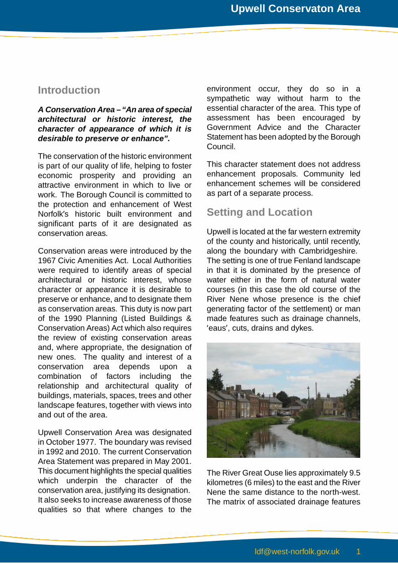
Upwell is located at the far western extremityof the county and historically, until recently,along the boundary with Cambridgeshire.The setting is one of true Fenland landscapein that it is dominated by the presence ofwater either in the form of natural watercourses (in this case the old course of theRiver Nene whose presence is the chiefgenerating factor of the settlement) or manmade features such as drainage channels,‘eaus’, cuts, drains and dykes.
The River Great Ouse lies approximately 9.5kilometres (6 miles) to the east and the RiverNene the same distance to the north-west.The matrix of associated drainage features
Upwell Conservaton Area

is dramatic and so typical of this part ofEngland. To the south is Popham’s Eau, tothe south-east is the Sixteen FootDrain/Middle Level Drain, and 6.5 kilometres(4 miles) or so miles further beyond this isthe Old Bedford River running parallel withthe New Bedford River or Hundred FootDrain. In between are a plethora of dykesand minor drainage channels all of whichhelp to effectively drain this low lying areasouth of the Wash and which are animportant historical feature of the area.
Upwell is surrounded by fen land. StowBardolph Fen to the east, Euximoor Fen tothe south, Laddus Fen to the west andMarshland Fen to the north. It is anagricultural setting but one unique to this partof the country where the typical componentsare an unremitting flat landscape broken bythe odd tree and hedgerow, isolatedfarmsteads and a few larger settlements, allconnected by a system of roads, countrylanes, tracks and droves. The wholeassembly is however dominated by the ‘bigsky’ which gives the area so much of itsevocative character.
The communication system is dictated utterlyby the route of water courses and theirbanks, which generate the complex roadsystem around Upwell and its sister villageOutwell to the north. A glance at theOrdnance Survey Map reveals thisdramatically.
The settlement was based on a crossingover the River Nene which became theA1101, an important connecting routebetween Wisbech, 8 kilometres (5 miles) tothe north, Littleport 21 kilometres (13 miles)and Ely 30 kilometres (18 miles) to the south.
In the wider context, the A1101 is a majorconnecting road linking to the east via theA47, the Midlands and the North via the A17and the A1, and London and the South viathe A10.
The major urban settlement to the east isDownham Market, approximately 13kilometres (8 miles) away. But such is thebarrier formed by the complex watermanagement system to the south-east ofUpwell that there is no direct route betweenthe two - you have to go either via Outwellin the north or Lots Bridge in the South
March lies to the south-west but againanother tortuous route has to be taken, eithervia minor roads to Friday Bridge 5.5kilometres (3.5 miles) north and then south
www.west-norfolk.gov.uk2
Character Statement

on the B1011, or south on the B1098 toBedlam Bridge, and afterwards westwardson the B1109.
Upwell’s location and setting is thereforefascinating. It is a settlement basedinextricably on the presence of water whichalso totally dominates and dictates thesurrounding communication pattern withadjoining settlements.
In terms of solid geology, Upwell lies in the‘Upper Jurassic’ area characterised in recentgeological terms by marine and river alluviumas a result of marine incursion, which floodedthe freshwater marshes with silty marine orestuarine clay. In soil landscape terms,Upwell lies in an area of marshland mostlyreclaimed from the Wash in the 17thCentury. The soils have a large waterstorage capacity and support the mostextensive and intensively farmed arable landin the country.
Its immediate setting is also unique to theFenland area. The major components areroads on either side of a water course withthe built fabric in linear form along the roadsalthough is a few instances land has been‘colonized’ between the river and adjacent
lines of buildings. Generally the surroundinglandscape comes right up to the edge of thisthin band of settlement.
Origins and HistoricalDevelopment
Upwell, translated as a ‘settlement higher upthe stream’ (Old English ‘upp’= up and ‘well’=spring), is a large village of 32 hectares (80acres) and a population of some 2,275. It islinked now, without break in development,with Outwell village lying to the north, thetranslated meaning of which could refer to alater settlement that sprang up outside theold village. The key factors relating to theorigin of the settlement are the presence ofwater and the location of a river crossing.Upwell is a settlement located alongside theold course of the River Nene, in part alsoknown as ‘Well Creek’. The historic core islocated at the Church Bridge river crossingand is almost certainly the site of the originalsettlement, the rivers dividing to the south,between the Old Nene and Old Croft rivers.
The village is also located in the area ofmarshland fen south of the Wash and isdominated by water which in earlier timeswas even more of a physical barrier. It wasnevertheless an extremely fertile area andthere is evidence of extensive Romansettlement in the locality, although signs ofany settlement before this are virtuallynon-existent. The Old Fen Causeway, aRoman Road, lies just to the south of thevillage.
Navigable water meant the ability to tradeand gave associated wealth and prosperity.Control of such trade was, post NormanConquest, firmly held in the hands of themonasteries and in the 14th century therewere no less than 16 religious houses in the
Upwell Conservaton Area

settlement. It was clearly an importantreligious centre, and ecclesiastical lordshipwas accompanied by prolonged measuresto deal with the drainage problems of thisFenland area.
In medieval times, and in the 17th Century,away from the main riverbank, Upwellgradually gained in prosperity as the fenlanddrainage schemes became more effective.Agricultural and commercial activityblossomed and the settlement tookadvantage of its river and road links to largerurban centres. The height of this prosperitywas probably reached in Georgian andVictorian times and reflects similar ‘wealthorientated’ building in King’s Lynn, Wisbechand Downham Market. The historic builtfabric of Upwell generally dates from thesetwo periods as the original settlement burstsouthwards along each side of the river. Afurther vehicular river crossing was formedat Hall Bridge (now known as New Bridge)and, with a matrix of connecting droves andtracks coupled with ever more efficientdrainage, communications and agriculturalefficiency improved dramatically.
Religion always appears to have been animportant part of the area and earlysettlement would have been based around
Church owned farmsteads and hamletsdotted around the Fens, always a sparselypopulated part of the county. After the 1538Dissolution, land ownership graduallychanged and building plots in Upwell wereslowly disposed of as either as ‘tied’cottages, or for commercial and industrialuse by trades and professions attached toagriculture and commerce. These twoingredients, the latter inextricably linked towater borne commercial activity, alsogenerated a wealthy merchant class whichin turn sustained associated professionalclasses and the local population who workedfor them.
The form of the current settlement developedin Georgian and Victorian times, when thelevel of activity both economic and socialgenerated almost a ‘town’ status rather thanjust a ‘village’. The railway came in 1881and although it ceased in 1929, very earlyin railway history, it encouraged yet furthercommerce and communication. As anindication of the prosperity and activity inOutwell and Upwell, the settlement was ableto support its own tram service (a lightrailway for goods and passengers) until the1950s.
The history of Upwell is closely related tothat of Fenland drainage schemes. Thesegained pace in the 17th and 18th Centuriesand enabled the further exploitation of thefarming landscape but at the same timeminimised the risk of devastation by flooding,always a problem in this low lying area.
www.west-norfolk.gov.uk4
Character Statement

This area is not one particularlycharacterised by large estates, althoughUpwell Hall provides the nearest semblanceto one. It is more characterised historicallyby small holdings and farms, a pattern whichhas only recently changed due to thenational trends in agriculture and itsassociated economic activity. Like manysimilar rural communities, Upwell is now hostto a car borne society which generally travelsto other areas for employment and leisure.Despite this loss of commercial activity thecommunity is clearly a vital one, which isjustly proud of its historic heritage.
Nonconformism spread rapidly in theseagricultural areas and Upwell was noexception, with chapels located at either endand in the middle of the settlement.
‘Town’ status was thus justified over ‘village’and, although much of the commercialactivity has now gone, the historic fabric isstill intact and the settlement is still anattractive place to live. The Old River, nowthankfully restored after years of neglect, isonly used by pleasure craft (generally longboats) but still forms a quintessentiallyimportant component of the settlement’scharacter and is a part of the Middle Leveldrainage system in the Fens.
Character Overview
Upwell Conservation Area has a long,(almost 2500m or 2700 yards) and relativelysinuous form (around 200-300metres/yardswide) orientated in a north-east to south-westdirection. It is a linear settlement whichstretches from just north of St Peter’s Churchsouth-westwards along the Well Creek tothe southern end of School Road.
The conservation area contains the buildingline on each side of the river and its uniquecharacter comes from the range of attractive
Upwell Conservaton Area

vistas which are provided as the river, andconsequently the adjacent roads, twist subtlyin a gentle arc. There is also a diversity inbuilding types reflecting the historicaldevelopment described above with several‘listed’ architectural ‘gems’ and manyimportant unlisted historic buildings whichnevertheless contribute to the overall qualityof the conservation area. Node points areprovided by the two bridges althoughhistorically the northern (and oldest) one isthe most important as this area contains thechurch and inn.
Landscape is also a key ingredient of theconservation area’s character. Views out ofthe conservation area are dramatic,particularly to the south, and the regular gapsbetween the ranges of buildings are eitherfilled with mature trees or hedgerows or giveviews out to the wider fen landscape beyond.
The sense of enclosure is at best flimsy inan area dominated by distant landscape and‘big skies’ but there are significant pocketsof mature landscape, particularly aroundUpwell Hall, which do give a sense ofenclosure and intimacy so different from thelandscape beyond.
Being an important trading settlement awider than usual range of traditional buildingmaterials are displayed but it is the overallcharacter provided by a linear river frontagesettlement which is all important. Theseelements are described in more detail below.
Spaces and Buildings
The easiest way to describe the conservationarea in detail is to begin at the northern‘node’ point around Church Bridge, worksouthwards along St. Peters Road andSchool Road (western bank) and then towork northwards back to Church Bridgealong Town Road.
Church Bridge is the probable basis for thesettlement as it is the location for the originalbridge over the river. This area, in a sense,represents the historic core of thesettlement. The architectural ‘jewel in thecrown’, St. Peter’s Church, stands in all itsmagnificence to the north-east of the bridge.It is set back from the river bank behindSmall Lode, a minor road running northwardto join Low Road which then connects theeastern bank of Upwell with Outwell.
www.west-norfolk.gov.uk6
Character Statement

On this side of the river, the northern edgeof the conservation area encompasses theimportant and dominant landscape buffer ofLode House, a modern residence. Thisbuilding is located to the south of an ‘island’site and has attractive mature landscapearound virtually the whole of its perimeter.
There are two attractive ‘lodge’ type buildingslocated in the south-east corner withinterconnecting screen wall. Also, there isa small attractive outbuilding to the north.
The conservation area boundary includesthe important listed Welle Manor Hall, aformer Rectory, (and interesting listed Tudortowers) which lies to the south-east of thechurch.
It is surrounded by a mature treed landscapewith an enclosing screen wall to the east andsouth. An attractive and important screenwall also encloses the churchyard andcontains some lovely iron gates opposite thenorth porch.
The pub, once presumably a coaching inn,is much altered. A very well designed carpark has been formed further to the eastincorporating good screen walls andadjoining outbuildings. This car park is alsoused in association with Village Hall, aninteresting Victorian building lying on thesouth side of the road.
Upwell Conservaton Area
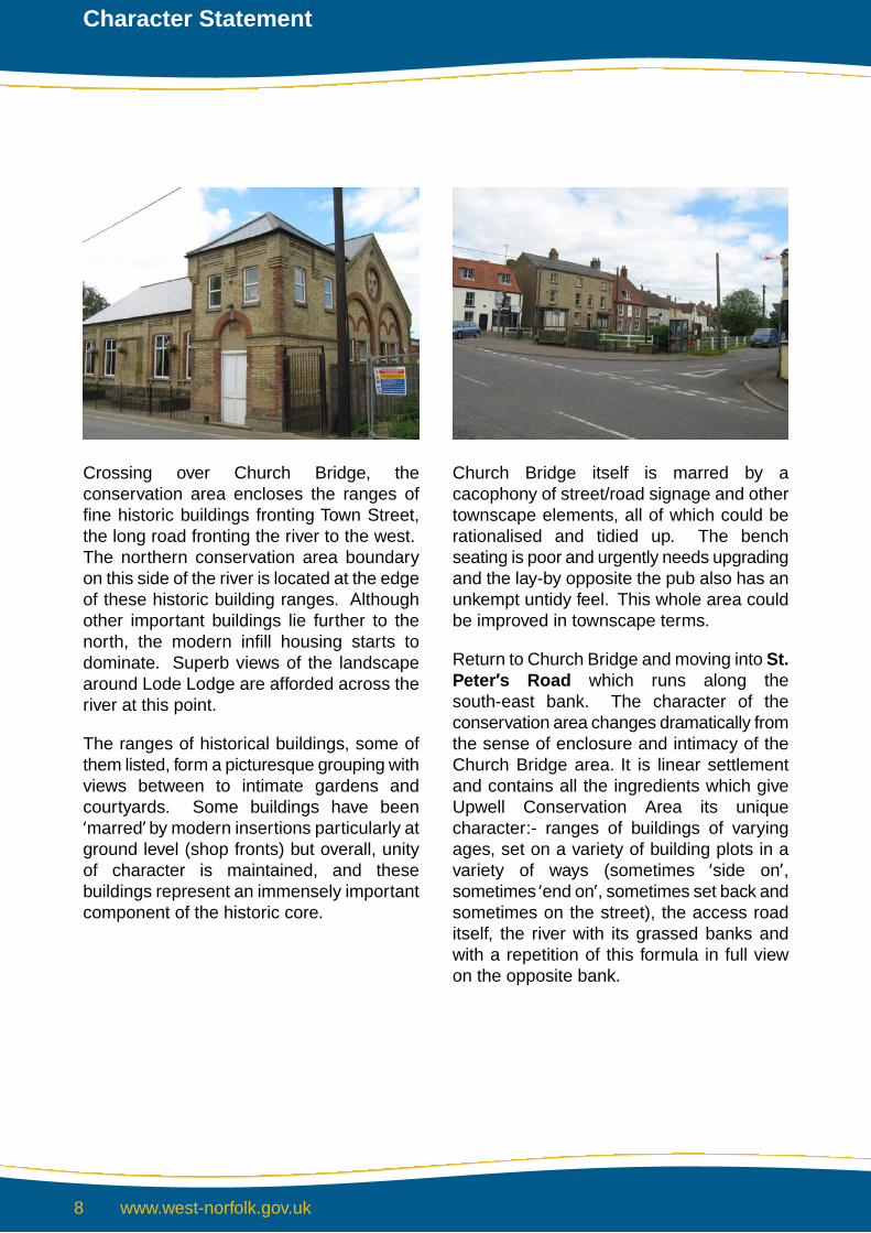
Crossing over Church Bridge, theconservation area encloses the ranges offine historic buildings fronting Town Street,the long road fronting the river to the west.The northern conservation area boundaryon this side of the river is located at the edgeof these historic building ranges. Althoughother important buildings lie further to thenorth, the modern infill housing starts todominate. Superb views of the landscapearound Lode Lodge are afforded across theriver at this point.
The ranges of historical buildings, some ofthem listed, form a picturesque grouping withviews between to intimate gardens andcourtyards. Some buildings have been‘marred’ by modern insertions particularly atground level (shop fronts) but overall, unityof character is maintained, and thesebuildings represent an immensely importantcomponent of the historic core.
Church Bridge itself is marred by acacophony of street/road signage and othertownscape elements, all of which could berationalised and tidied up. The benchseating is poor and urgently needs upgradingand the lay-by opposite the pub also has anunkempt untidy feel. This whole area couldbe improved in townscape terms.
Return to Church Bridge and moving into St.Peter’s Road which runs along thesouth-east bank. The character of theconservation area changes dramatically fromthe sense of enclosure and intimacy of theChurch Bridge area. It is linear settlementand contains all the ingredients which giveUpwell Conservation Area its uniquecharacter:- ranges of buildings of varyingages, set on a variety of building plots in avariety of ways (sometimes ‘side on’,sometimes ‘end on’, sometimes set back andsometimes on the street), the access roaditself, the river with its grassed banks andwith a repetition of this formula in full viewon the opposite bank.
www.west-norfolk.gov.uk8
Character Statement

The spaces between these ranges ofbuildings are just as important. They havea variety of functions: access to a businessyard behind the building line; containinglandscape planting which gently punctuatesthe street line; affording dramatic views ofthe landscape beyond. Some of these siteshave been subject to modern infilldevelopment as the commercial life of thetown declined in the 20th Century.
St. Peters Road contains all these elementsand, although the architecture is not quiteas important as that on the north-west bank,it is the general assembly of components toform a long river frontage with subtle curvesand interesting vistas in both directions whichcreates the special character.
There are no listed buildings here but thereare several which are of ‘townscape’significance. It is also encouraging to seesome commercial use continuing e.g. MartinsProduce Merchant and Harnwell Electricalin the old Salvation Hall. The villagecemetery is also contained in this section ofroad and has an important landscape buffersurrounding it.
A second node is reached at New Bridge(also known as Hall Bridge) where St. Peter’sRoad becomes School Road. There isanother public house on the south-eastcorner and a minor road (New Bridge Road)continues south-east from the bridge toconnect with another track linking the‘backlands’ of the area this side of the river.
The character of School Road contains allthose components listed above andrepresents the line of major expansion of thesettlement in Georgian/Victorian times. Thecharacter is however subtly different in thatthere is now little building on the westernbank across the river and, as aconsequence, even more dramatic views ofthe Fenland landscape stretching into thedistance are afforded. In addition the eastbank begins to widen out sufficiently to allow
Upwell Conservaton Area

the formation of small riverside gardens, orin one or two places actual buildingsthemselves between the river and the road.
The more significant buildings are locatedat the New Bridge end of School Roadalthough virtually every range will have hadsome connections with the town’scommercial past. There is still the oddcommercial business run from thesebuildings although the area is nowpredominantly residential. Moving furthersouthwards, the architectural characterdissipates dramatically and almost everybuilding has been marred by moderninsertions in a most unattractive way.‘Townscape value’ in such circumstancesis marginal in purely visual terms, but thebuilt fabric as a unity represents an importantelement of the town’s historic past. TheCounty Primary School is an important lateVictorian building here. Turning to thewestern bank of the river, the southernsection up to New Bridge contains only twoproperties, Bleak House and TasmanianHouse.
Crossing over the river, Town Streetproceeds in a north-west direction towardsthe Church and Church Bridge. There is anextremely high quality of townscape here.
Whilst all the components described aboveare present, the architectural quality isheightened by the presence of several finelisted buildings ranging from Upwell Hall itselfand Hall Lodge, to The Crescent. The builtfrontage is in a sense akin to the riverfrontage at Wisbech and contains manydelightful pieces of ‘set piece’ architecture.
There are also some extremely importantnon-listed historic buildings which havetownscape value. The variety of views areas dramatic as those on the east bank,culminating in the revealing of the churchfurther to the north.The spaces between thebuildings and the landscape components arealso vital to character, and range from theimportant mature landscape around UpwellHall and the Methodist Church to thebackdrop of mature trees to the rear gardensof the riverside properties, with severalimportant connecting screen walls.
The conservation area boundaryencompasses all these gardens which forma natural ‘edge’ between ‘urbanism’ andagricultural countryside beyond. The latteragain comes right up to the curtilage of theproperties to create a very dramatic transition‘edge’ to the conservation area.
www.west-norfolk.gov.uk10
Character Statement

The arrangement of buildings on their plotsand the size of building plots themselvescontribute greatly to the attractiveness andvariety of the street scene with a series ofdelightful groupings of built form resultingfrom ad hoc development over the decades.This ‘patina’ of age is very special to thecharacter of Upwell Conservation Area.
In summary, Upwell Conservation Area,although essentially a linear settlement, isin fact more than this. It has a variety ofspaces, each with its own special characterrelated to the size and disposition ofbuildings on their plots, the spaces inbetween and the riverside landscape setting,which all contribute to its special and uniquecharacter.
Listed Buildings
There are 34 listed buildings within UpwellConservation Area. The statutory list wasrevised in 1986 and there have been nofurther additions.
Grade l Buildings
Church of St. Peter, Small Lode. 13thCentury with 14th and 15th Centurywork. Restored 1836-38. Barnack stone
and clunch with leaded roofs. Threestage tower.
Grade ll* Buildings
Welle Manor Hall, New Road. Manorhouse; mid 14th Century, altered 1480,17th Century and 20th Century. Brickwith slate or plain tile roofs. North frontthree storeys.Crescent House,Town Street. House1620-1640 with early 18th Centuryfacade. Red brick with paler bricks, thickpointed to 18th Century facade.Parapetted roof of slate. Three storey.2 Cottages, east of Lloyds Bank,Town Street. 14th Century part of amedieval building of U plan and possiblya lodging or guest house. Now 2cottages. Coursed Barnack with brickrepairs. Pantile ridge.
Grade ll Buildings
2 no. towers to Welle Manor Hall Built1480 in brick, octagonal.60 no. headstones and memorials, StPeter’s Churchyard. All in limestoneand dating from the 1720s and 30s.Upwell Hall,Town Street. House, mid19th Century. Gault brick with low pitch,
Upwell Conservaton Area
hipped, slate roof and deep boardedeaves.
Hall Lodge,Town Street. Mid 18thCentury, local red brick with steeplypitched slate roof and end / ridgestacks.Gates and Gate Piers, Upwell Hall.Mid 18th century in wrought iron. Piersare cast iron with cast iron finials.Crescent Cottage,Town Street.Originally a pair of cottages, now onedwelling. Late 18th early 19th Century.Brown gault brick with yellow gault brickto side wall. Parapetted roof of slate,two storey.Gable End and West Wall to WorkShop (rear of Builders Merchants),Town Street. Right hand rear range ofmedieval lodging, probably 14thCentury.Bridge House, Church Bridge. Houselate 18th century. Red brick, renderedwith steeply pitched roof, two storeys.Late 19th Century shop front.
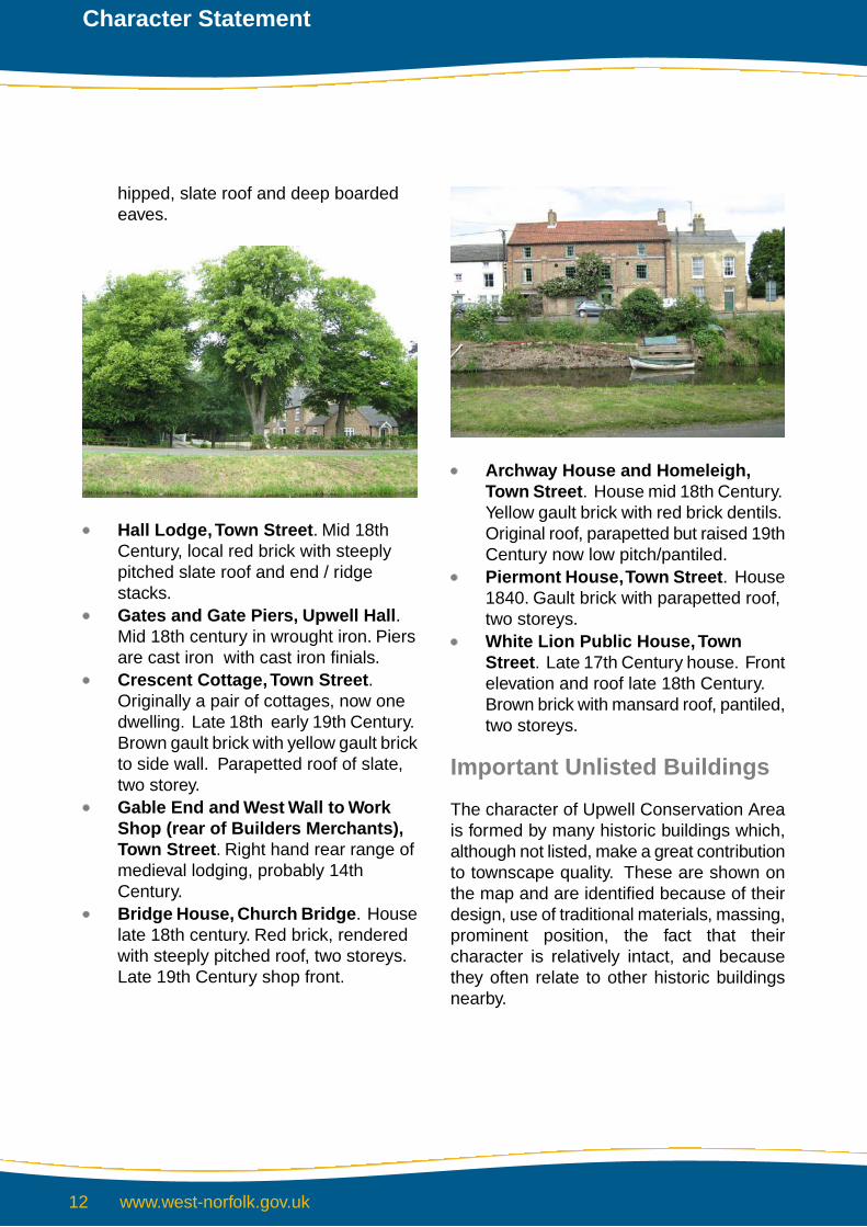
Archway House and Homeleigh,Town Street. House mid 18th Century.Yellow gault brick with red brick dentils.Original roof, parapetted but raised 19thCentury now low pitch/pantiled.Piermont House,Town Street. House1840. Gault brick with parapetted roof,two storeys.White Lion Public House,TownStreet. Late 17th Century house. Frontelevation and roof late 18th Century.Brown brick with mansard roof, pantiled,two storeys.
Important Unlisted Buildings
The character of Upwell Conservation Areais formed by many historic buildings which,although not listed, make a great contributionto townscape quality. These are shown onthe map and are identified because of theirdesign, use of traditional materials, massing,prominent position, the fact that theircharacter is relatively intact, and becausethey often relate to other historic buildingsnearby.
www.west-norfolk.gov.uk12
Character Statement
Wherever possible adjacent outbuildingshave been subject to the same scrutiny asthese structures can also be a vitallyimportant reminder of the town’s historicpast.
Post War Development
Upwell, lying on a major communicationroute in difficult terrain, has been subject tomuch post war development. There havebeen several agents of this trend.
On the one hand there has been, and still is,continual pressure to provide housing, eitheron single plots or in groups such as HallBridge Road and Ransome Close. Similarly,new housing development has clusteredaround New Bridge Road, New Road, (themain A1101 road leading to Three Holes andLittleport) and to the north of Town Roadsuch that Upwell and Outwell are noweffectively one settlement. Individualdwellings have also been constructed onmany infill housing sites between the rangesof historic buildings.
On the other hand the post war period haswitnessed dramatic structural changes in oursociety, which has altered the wholecommercial basis on which Upwell existed.
The changes in agricultural practice and theneed for associated local industry and crafts,together with an immediately availableworkforce, has meant the erosion of the verybasis of settlement.
A place the size of Upwell will always sustaina certain amount of commerce and industry,but it can never compare with, or generatethe richness and vitality of the old agriculturaltrading community. The forces behind thistrend are national and in a sense are a resultof ‘globalisation’.
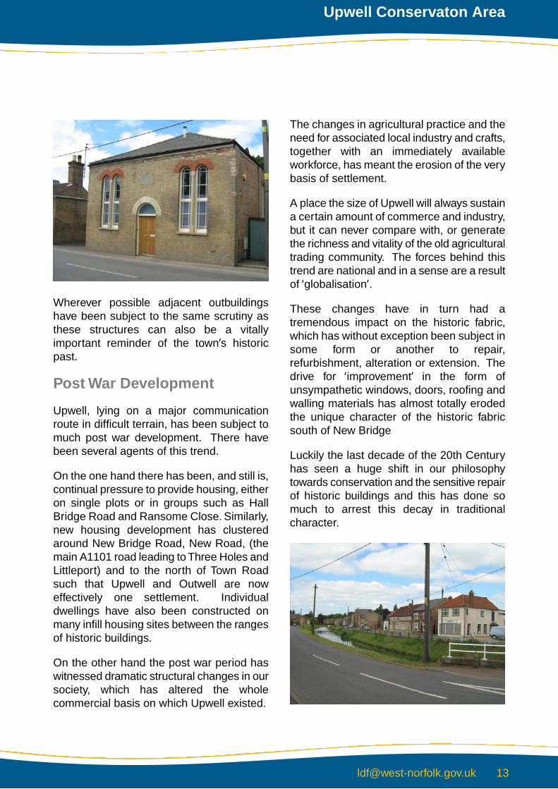
These changes have in turn had atremendous impact on the historic fabric,which has without exception been subject insome form or another to repair,refurbishment, alteration or extension. Thedrive for ‘improvement’ in the form ofunsympathetic windows, doors, roofing andwalling materials has almost totally erodedthe unique character of the historic fabricsouth of New Bridge
Luckily the last decade of the 20th Centuryhas seen a huge shift in our philosophytowards conservation and the sensitive repairof historic buildings and this has done somuch to arrest this decay in traditionalcharacter.
Upwell Conservaton Area

Modern development has also meant theinsertion of a modern services infrastructureand in visual terms this has resulted inobtrusive overhead wirescape, again to thedetriment to the quality of the visual scene,particularly around Church Bridge.
Generally the early modern infill housing hasbeen of undistinguished ‘anywhere’ designwith scant respect for context or the use oflocal building materials. More recentschemes have however been moresuccessful in terms of ‘designing for context’.
It is encouraging to see the continuation ofcommercial activity, as it can only help thegeneral vitality of the settlement. Upwellremains an attractive place to live. It alsobenefits from being near larger urban areasand its population has actually increased inrecent years.
This conservation area is undoubtedlytreasured by the community, as witnessedby the huge local effort injected into savingthe waterway itself, which only a fewdecades ago was in a very sad state. It isnow an important source of tourism in thearea.
Traditional Materials
The character of Upwell Conservation Areaowes a great deal to the use of localtraditional materials in the construction of itshistoric buildings. These materials include:-
Barnack limestone.Clunch (chalk).Pink/buff or cream local gault claybrickwork.Colourwashed masonry.Flint – generally random rubble.Welsh slate.Norfolk red/orange clay pantile.Clay plain (peg) tiles.
Archaeological Interest
There are no Scheduled Ancient Monumentsin Upwell Conservation Area.
Detractors
The special quality of conservation areascan easily be eroded by seemingly minoralterations such as unsuitable replacementwindows and doors, inappropriate materialsor unsympathetic paintwork, removal ofwalls, railings, trees and hedges.
www.west-norfolk.gov.uk14
Character Statement

Upwell Conservation Area has all too manyexamples of the above detractors. Othersignificant items are listed as follows:-
Prominent overhead wires, poles andother equipment.
Poor/untidy townscape components atChurch Bridge.Poor floorscape to layby near Church,Five Bells pub, area south of the VillageHall, and layby west of School Road.Poor landscaping and enclosure withtoo much reliance on evergreen speciesand modern walling / fencing materials.Undistinguished quality of modernhousing lacking reference to context interms of massing, siting and materialspecification.Poor design of shop fronts in anhistorically important context.
Upwell Conservaton Area
Conservation Objectives
Statement 1
The overall conservation objective is to protect and reinforce the establishedspecial character of Conservation Areas and their setting.
This will be achieved by:
Encouraging the retention and maintenance of buildings which contribute to theoverall character of each conservation areaEnsuring that new development is sympathetic to the special qualities and characterof each conservation areaProtecting the setting of the conservation area from development which adverselyaffects views into or out of the areaThe retention, maintenance and locally appropriate new planting of treesMaintaining and enhancing local features and details which contribute towards anarea's local distinctivenessWorking with the community to prepare schemes of enhancementEncouraging the removal of detractors to the special character of each conservationarea
www.west-norfolk.gov.uk16
Character Statement

Contacts and advice
Within conservation areas, a number of special controls apply and it is advisable that anyone proposing to carry out new development, alteration, extensions, installations or demolition should seek advice from Development Services at an early stage. Special controls also apply to the trees sand some may be subject to tree Preservation Orders. anyone wishing to carry out work to trees within a Conservation area should therefore seek advice from Development Services.
King’s CourtChapel StreetKing’s lynnNorfolk Pe30 1eXtel: (01553) 692722Fax: (01553) 691663DX 57825 KiNG’S lYNN
830-191-1

BACK DROVE
THURLAND'S DROVE
MAR
CH R
IVER
SIDE
B 14
12
B 14
12
D O V EC O TE
R O A D
BACK
DRO
VE
BAPT
IST
ROAD
SCHO
OL R
OAD
WORKHOUSE L A N E
BROADDROVE
TOW
NST
REET
ST P
ETER
'S R
OAD
NEWBRIDGE
ROAD
SCHO
OLRO
AD
MAR
CH R
IVER
SIDE
HALLBRIDGEROAD
B 14
12
B 14
12
T H U R L A N D ' S D R O V E
A 11
01
BROAD DROVE
A 1101
NEW ROAD
TOW NS
END
ROAD
A 11
01
GREEN ROAD
T OW N
S TR EE
T
S T P E T E R SR O A D
LOW
SID
E
SMALL LODE
LISTE
R'S
ROAD
TOW
NLEY
CLO
SE
NEWROAD
B 14
12
B 1 4 1 2
A 11
01
A 1101
PINFOLD ROAD
S T O N E H O U S E R O A D
NEW BRIDGE RD
GREENROAD
RANSOME'SCLOSE
BAPT
IST
ROAD
A 11
01
T O W N S T R E E T
MILLFIELD
A 1 1 0 1
L O W S ID E
THE RUSSETS
NEW
ROA
D
A 1 1 0 1
T OW N
S T RE E T
Peartree Farm
Marmont Priory Farm
Dovecot Farm
Stratford House
County Primary School
Upwell
Gara
ge
The PrioryAudley House
The Downs
Glenlea
Pandora
Coronation Cottage
Upwell Baptist Church
66
34
2220
16
1
711
1519
27
35
59
71
159
155153
149133
129127
123
119a119
105101
89
83
73
59
86
94
9810
4
128
134
2628
141
137
145
63
67
97
1
5
9
11
15
19
2527
127a
113
117111
Peachey House
Boat
man
Cot
t
3
20
AquaSilente
110
ShrewnessHouse
Sutheral
Stores
Cannery
The Globe(PH)
Southlands
Birdbeck
Dodds Stile
FairlawnsTabarka
Halliton
Hall Lodge
The Old Duke's Head
HallUpwell
Works
Beechers
Stepends
Newhaven
TasmaniaHouse
Mill Rigg
HouseStrawberry
Villetta
Mill House
1
7
13
19
24
29
34
Bleak House
62
65
73
79
5
1115
23
10
14
8
1
59
15
19
2527
31
33
43
4751
55
26
Cott
7
24
Newbr
idge
Cotta
ge
Keval
6
Highbury
Cartref
6667
70
2
WelleHouse
OrchardRise
Sharma
IvyCottage
The Orchards
The Cottage
4 8
5 2
15
31
3230
20
9
2
Redroofs
Whiteheads Farm
St Helen's
53
1
176
170
112
Sunnyside
18
1
6
1 5
25
35
41
57
1
3
5
1 to
7
911
15
1921
2325
28
18
10
2 to 8
33
37
47
35
25
15
3
86
80
74
72
6856
46
20
8
20
32
44
53
48
43
33
30
2928
2527
29
33
28
1610
9
6
24
6
1
1115
27
10
23
56
36
66
78
88
100
Grenville
River View
RedRoofs
Oakdene
Walnut Lodge
Oakley House
White Lion
(PH)
UpwellMethodist Church
LynwoodHouse
Belladonna
Cottages
Bramley
House Surgery TheLimes
Eastwy-ns
Lee House
Westlyn
Ho Bank
Bank
Five Bells
(PH)
Hall
St Peter'sChurch
HealthCentre
Pavilion
TheHollies
VictoriaHouse
Pavilion
TramwayVilla
BotanyBay
Cranleigh
Margaray
House
17
Acton House
1 2
Bramley
Cottages
Plaw Field
36
Low Side Lodge
42
59
61
BirkbeckGarden Mews
Harlow House
R iv e r V ie w1
4
LittleLynwood
Crescent House
Pretty Brides
Queens Head
The Old Pantry
Bridge House
30
12
100
The Cottage
St Peters Cottage
1
PO
1 7
Riverside Cott
Rans
omes
Cot
t
Laurences Cott
Ni-Jan
The Chilterns
TheHollies
H a ll
Hunstanton
VillaRiverdale
HomelandLeafield
Seaford
Villas
W e s le y
M a n s e
Kim-Bar
Sunningdell
Orchard
Und
B en-El
My
Clovelly
West Villas
F e r n C o ttag e
Tetcott
Falconbury
Hotel
The Bramleys
GympieD alvee
n
O rc ha rd
L od g e
4
1
EllerslieCottage
1
46
3236
10
2
58
70
82
94
106
9
Averydene Creek Lodge
Lode Cottage
Rosemead
Victory House
The OldMushroom Farm
V ic to ry B u n g a lo w s
A p p le b y Ho u s e
4
163
1
6
1
The Washes
St
Old Crof
t
Rive
r Nen
e
(Old
Cou
rse)
Drai
n
Drain
Drain
Drain
Drai
n
Drain
Drain
Drain
Drain
Drain
Drain
Drain
Drain
Drain
Drain
Drain
Drai
n
Drain
Drain
Drain
Drain
Drai
n
Drain
Drain
Drain
Drain
Drai
n
Drain
Rive
r
Drai
n
Drain
Drain
Drain
Drai
n
Drain
Drain
Drain
Drai
n
Drain
Drai
n
Drain
Drain
Drain
Drain
Drain
Drai
n
Drai
n
Drain
DrainDrain
Drain
Drain
Drain
Drain
Drain
Drain
Drain
Drain
Drain
(Old
Cou
rse)
Rive
r Nen
e
Pond
Drai
n
Drain
Drain
Drain
DrainPonds
Drain
Drai
n
Drain
Drain
Drai
n
Drain
Drain
Drai
n
DrainDrain
Drain
Drain
Drain
Drain
Drain
Drain
Drain
Drain
Drain
Drain
Drain
Drain
Drain
Drain
Drain
Drain
Drai
n
Drai
n
Drai
n
Drai
n
Drain
Drain
Drain
Drain
Drain
Drain
Drain
Drain
River Nene (old course)
Drain Drain
Drain
Drai
n
Drain
Drain
Drain
Drain
Drain
Drain
Drain
Drain
Drain Drai
n
Drain
Drain
Drain
Drain
Drain
Drain
Drain
Drain
Drain
Drai
n
Drain
Drain
Drai
n
Drai
n
DrainDrain
DrainDrain
Drain
Drain
Drain
Drain
Drain
Drain
Drain
Drai
n
River N
ene
(old course)
Drai
n
Drai
n
0002
0078
0054
0051
0046
0043
0037
0031
0007
0003
5000
5340
4515
2654
2900
9200
6600
590049003900
3891
2600
0079
4766
0068
8354
7553
8145
6933
5313
3317
2900 5000
5205
7368
8357
9200
8311
0078
0056
0051
0046
0037
0031
0020
0003
1500 2000
3400
3529
3200 4800
4700 5800
5267
5600 6400
6892
6634
6700 77007400
7918
8069
8853
8718
8900
9749
00059000
560048003200
Upwell
Shelter
Plaw Field
Birdbeck Field
Allotment
Sewage Tank
Depot
FB
LB
Track
Upwell
Track
Track
Track
Trac
k
Path (um)
FB
BM 3
.94m
3.5m
3.5m
3.1m
2.8m
3.3m
BM 3.76m
3.5m
BM 2
.37m
3.6m
Track
3.0m
BM 3.72m
3.2m
Sluice
BM 3.77m
Gardens
MP
Shelt
er
Allotment Gardens
Upwell
Plaw
Track
Track
Tank3.3m
3.3m
LB
Hall Bridge
3.7m
3.4m
El Sub Sta
3.5m
Filter Bed
Track
Track
Track
Track
FB
Sluice
BM 2.25m
Cotton's Common
Allotment Gardens
Allotment Gardens
Track
2.4m
BM 2.65m
2.3m
Tank
Trac
k
Track
Field
Tenn
isCo
urt
Birdbeck Field
Track
Trac
k
Foot Bridge
Coal Yard
Track
Trac
k
Track
Track
Track
Plaw Field
Path (um)
2.1m
2.8m
BM 2.79m
FB
2.5m
Track
Birdbeck Field
Track
3.7m
Playing Field
BM 4.50m
GP
3.4m
3.9m
Trac
k
3.8m
WB
BM 4.07m
ChurchBridge
4.1m
TCBBM 4.
97m
Tower
Tower
Movable Greenhouses
Gree
nhou
ses
3.3m
Upwell
3.5m
FootBridge
BM 3.75m
3.4m
ElSubSta
Playing Field
BowlingGreen
WarMeml
El Sub Sta
2.5mCemetery
Track
Movable Greenhouses
BM 2.82m
2.4mPlaw Field
FB
Mov
eabl
e
BM 4.
58m
Mov
able
Gre
enho
use
Track
Track
Track
Track
Track
BM 3.74m
FB
Guide Post
3.7mTank
Upwell
2.6m
LBTCB
GP
Tank
Upw
ell
3.5m
LB
N
This Map is reproduced from Ordnance Survey material with the permission of Ordnance Survey on behalf of the Controllerof Her Majesty’s Stationery Office © Crown Copyright. Unauthorised reproduction infringes Crown Copyright and may leadto prosecution or civil proceedings. Borough Council of King’s Lynn and West Norfolk. Licence No 100024314. 2009.
UPWELLCONSERVATION AREA
DESIGNATED: October 1977REVISED: February 1992
May 2001June 2010
NOTATION
CONSERVATION AREA BOUNDARY
LISTED BUILDINGS
IMPORTANT UNLISTED BUILDINGS