6. integrated transport and land use - city of gold …€¦ · coastal transit precinct the vision...
TRANSCRIPT

29
Part C - Key outcome areas
6. Integrated transport and land use
Objective:
To support well-designed urban development that reduces the need to travel and is easy to access via frequent public transport, walking and cycling.
IntroductionTransport and land use planning are critical factors influencing where and how people travel. Land use policy has significant implications on the demand for transport, while transport policy often determines the location and distribution of different land uses. An integrated approach to transport and land use planning is essential for achieving our transport vision.
By shaping the pattern of development and influencing the location, scale, design and mix of development, integrated transport and land use planning can help deliver social, economic and environmental sustainability by:
enhancing business and retail activity to support the local economy
reducing the need to travel, especially by car
reducing the length of journeys
supporting efficient operation of frequent, reliable public transport
making walking and cycling to local services like shops and schools more enjoyable and safe
making it easier for people to get to work, shops, and entertainment or sporting venues
reducing the effects of transport on communities
providing for the efficient distribution of goods and services to businesses and communities.
Since the 1960s, the approach to transport planning on the Gold Coast has been mainly focused on cars, while sustainable modes such as public transport, cycling and walking were seen as ‘back up’ modes for those who did not drive. This has translated into a preference for suburban developments based on car access.
The Gold Coast City Transport Plan 1998 and subsequent planning scheme put in place themes to reverse this trend and move towards a more compact and diverse urban form that supported transport choice. The Gold Coast City Transport Strategy 2031 complements the planning scheme, confirming policies and actions that will deliver integrated, compact and connected communities on the Gold Coast.
Current situation – a snapshoturban settlement pattern of the Gold Coast today
In coastal centres, the compact and mixed-use urban form provides a concentration of activities that support public transport use and are attractive for walking and cycling. The lower-density canal estates and suburban developments are more car-dependent. The canal and river systems limit east-west connectivity while the network of arterial roads divides many communities.
Priority transport and land use precincts
Based on analysis undertaken for the Gold Coast City Transport Strategy 2031, two areas of the city will be the focus of a broad mix of multi-modal transport initiatives and supporting land use actions. These are:
coastal transit precinct The vision is for the coastal strip between Southport and Coolangatta to be easy to travel around by public transport, walking and cycling, with a strong focus on light rail and bus. Walking will be given the highest priority in activity centres along the coastal transit precinct. Parking policies will be tailored to reflect local conditions and the needs and aspirations of the community in each centre. Waterway barriers will be examined to identify opportunities for green bridges. There will be limited expansion of road capacity along the coastal strip, but support for road upgrades inland, for example along Southport-Burleigh Road, which will provide viable alternative routes for cars. This package of initiatives will reduce the dominance of the car in this precinct and will facilitate the transformation of land use, activity and amenity in this world-famous stretch of coastline.
activity centres Council will develop local area transport plans for the city’s principal, major and specialist activity centres. This will coordinate public and private investments in walking, cycling, public transport, road networks and parking. A package of integrated initiatives will help create high-quality places that support economic development, social interaction and more sustainable travel.
The complex interaction of multi-modal transport initiatives and land development in these areas requires particular attention. The coastal transit precinct and the local area transport plans for activity centres will provide the mechanisms to ensure that transport and land development activities are fully integrated.
30
Gold Coast City Transport Strategy 2031: Technical Report

Figure 21 Aerial view of Las Ramblas
Figure 22 Pedestrianised and landscaped median
OpportunitiesIn contrast to the growth management strategies of the past decades, the Gold Coast is expected to accommodate much of its future population by consolidating urban centres according to transit-oriented development principles. This direction poses a significant opportunity to change the current travel behaviour of Gold Coast residents from principally relying on cars, to utilising a balanced mix of cars, public and active transport options.
Other opportunities include:
improving urban design in major activity centres and along high-frequency public transport corridors to create productive and liveable spaces that are economically vibrant, accessible, comfortable and safe, and connected by frequent and reliable public transport
building on the potential for new economic activity provided by high-frequency public transport corridors, including light rail, bus and heavy rail
enhancing connections to the wider public transport network and improving enjoyment and convenience of walking and cycling for local trips
creating diverse centres offering a range of services and activities
encouraging a greater spread of peak transport demand, as a multi-centred city means not everyone is trying to access the one central business district
increasing development and redevelopment capacity in the coastal areas
improving pathways, kerb ramps and streetscapes to help underpin transit-oriented development principles
promoting the inclusion of more affordable housing outcomes in areas well serviced by high-quality public transport.
Leveragingthebenefitsofourhigh-frequencypublictransport network
The Gold Coast’s future transport network has a strong focus on light rail and rapid bus corridors, with land use modifications recommended to support the system. Changes to land use would include:
supporting a more diverse mix of residential housing near public transport stations
supporting a more intense mix of commercial and residential development near public transport stations
providing planning mechanisms to prioritise development densities closer to transport stations
supporting the intensification of centres on Nerang-Broadbeach Road and Nerang-Southport Road to capture the benefits of bus lanes in these corridors.
CASESTUDY:LASRAMBLAS,BARCELONA
Las Ramblas is the best-known street in the centre of Barcelona, Spain. This 1.2-kilometre long, wide, tree-lined boulevard is a major shopping centre and is known for the quality of its street performers, with large crowds gathering to listen to musicians in the evenings. The atmosphere of the street has been achieved by pedestrianising the median. Traffic is restricted to narrow lanes with parking bays to service the buildings and businesses that line the street.
This is an excellent example of quality planning and urban design bringing about tangible economic and social benefits. By giving priority to pedestrians – but still accommodating limited vehicular access to service businesses – Las Ramblas becomes a people-focused boulevard that attracts people to shop, dine, meet friends and interact with their community. Along Las Ramblas, local businesses benefit because more customers are able to fit into the urban space as cars and traffic are greatly reduced.
Achievements
Land use integration with Gold Coast light rail project
Council has been working closely with the Queensland Government and the private sector to promote transit-oriented development in appropriate locations around the city. One example is the development activity along the 13-kilometre stage one of the Gold Coast light rail route from the new University Hospital at Southport Parklands through to Broadbeach. Activities undertaken to support the light rail include:
the creation of the Surfers Paradise Boulevard, a major traffic scheme that removed a six-lane couplet of two one-way streets, giving rise to significant urban regeneration throughout Surfers Paradise. This work was undertaken by Council over a decade ago in anticipation of a future light rail system
support for the management of the Gold Coast Highway as a boulevard for the entire length of the highway from Smith Street at Southport to Hooker Boulevard at Broadbeach. This section has been ‘de-mained’, or changed from a state-controlled road to a Council road with a lowered traffic speed to 60 kilometres per hour (and lower through Surfers Paradise)
the development of the Gold Coast Health and Knowledge Precinct, including a major university hospital, around an underground light rail station for stage one of the Gold Coast light rail project
the selection of station locations for the first light rail stage based on their existing and future ‘city-building’ potential. This means stations are located right in the heart of centres, rather than on the edge, to contribute to the quality of the local area and the passenger experience.
The Gold Coast Rapid Transit Corridor Study 2011 provided recommendations for future directions for the approximately 2000 hectares of Gold Coast City surrounding the first light rail stage. The study will inform the planning scheme to meet the future needs of the community and provide better buildings, better streets and better places.
What is transit-oriented development?
An approach to transport and land use planning that supports high-quality, high-density and sustainable urban communities focused around public transport stations.
Incorporates a mix of residential, commercial and retail uses, including affordable housing, shops, offices and other facilities, within a comfortable, safe and accessible 10-minute walk of established or planned rail, light rail and bus stations.
Parking policies and prices are set to support the highest and best use of land.
A concept that has significantly informed transport, land use and social planning, local economic development and urban design in many cities in Australia and internationally in the past two decades.
Challenges The lack of a dominant central business district, which means
Gold Coast trips (particularly commuter trips) are spread across multiple locations. While this city structure helps balance transport trips across the entire network, it makes providing high-quality public transport and prioritisation of investment across multiple centres challenging.
Almost two-thirds of all new housing in the city in the next 20 years will need to be infill development. This means that many centres will need to accommodate increased density.
Developing land in the right areas so that high trip-generating activities are located close to high-quality transport stations.
A lineal, multi-centred urban form with limited east-west connectivity.
A need to better tailor car parking solutions to specific areas to minimise negative effects on local traffic, ensuring the highest and best use of valuable land in the centre and achieving better affordability of housing and business premises.
Strong community demand for affordable housing, which has tended to be provided outside of areas well-serviced by public transport, perpetuating the growth of car traffic.
The effectiveness of existing transport infrastructure is adversely impacted by the development of certain land uses (such as retail shops, commercial offices and some community facilities) in locations outside recognised activity centres.
Encroachment of housing on freight routes and industry areas, and pressures to allow non-industrial development that generates high volumes of car traffic in industrial areas.
The lack of pathways, kerb ramps and infrastructure around the catchment areas of public transport stops and stations.
Meeting the needs of an ageing population and high rates of disability.
32 31
Gold Coast City Transport Strategy 2031: Technical Report

Themes and actions – integrated transport and land use
Theme 1 Develop new communities around sustainable transport.
Theme 2 Encourage the development of strong centres.
Theme 3 Prioritise future urban development as ‘transit-oriented development’ in centres and along public transport corridors.
Theme 4 Protect land close to freight routes for use by freight-generating businesses.
Theme 1: Develop new communities around sustainable transport
Limit urban sprawl
Urban sprawl limits opportunities to create productive and economically vibrant communities connected by frequent and reliable public transport services. National and international practices show that containing or limiting urban expansion is the most effective way to achieve an urban form that supports public transport use.
In practical terms for the Gold Coast, this means that broadhectare urban development should be limited to planned areas such as Coomera and should not encroach into other greenfield areas.
Develop new communities around sustainable transport
The Queensland Government’s Next Generation Planning Handbook provides a clear basis for developing new urban communities, such as Coomera, that support the public transport network and are more attractive for active transport users. Key features will include:
design of communities around key transport stations or along public and active transport network corridors
a mix of land development along public transport network corridors
strong town centres focused on the regional heavy rail service and incorporating public transport stations
development that facilitates ‘affordable living’, with access to transport options, employment, services and education
a local arterial network connecting communities to avoid reliance on the Pacific Motorway
a network of inter-connected active transport paths and on-road bikeways.
The achievement of these sustainable transport outcomes is dependent on:
development of road networks that prioritise public and active transport
the timely provision of public transport services from the commencement of development
progressively building the urban form to maximise public transport services.
CASE STuDy: CooMERA
Coomera is one major area on the Gold Coast that has been earmarked for significant broadhectare development. Council’s planning scheme earmarks Coomera as a principal activity centre that maximises diverse employment opportunities in proximity to the Coomera rail station.
Opportunities
As it is largely undeveloped, Coomera provides an opportunity to develop an integrated centre that promotes public and active transport use at all times of the day.
The location of the Coomera rail station at the heart of the future centre will enable people to travel to the centre via public transport.
It also presents an opportunity for integrating existing development within an upgraded bus/rail interchange facility, which is expected in the long-term.
Challenges
The centre will require significant infrastructure due to its current low level of development.
Timing for the development of Coomera remains subject to market readiness.
Willingness of the market to deliver development that is in accordance with the intent of the Coomera Town Centre Structure Plan (that is, a traditional city centre comprising multi-storey mixed-use development) in the short-term. Traditional development patterns suggest that new development areas are more likely to evolve. As such, this could have significant implications for the provision of high-quality public transport services in the northern part of the city in the short-term.
Theme 1 actions:
Action Lead Timeframe
1.1 Continue to apply the principles of compact urban settlement as per the South East Queensland Regional Plan 2009-2031.
Council Ongoing
1.2 Ensure that any new broadhectare communities are fully consistent with the government guidelines aimed at promoting sustainable transport practices and eliminating car-dependent urban sprawl.
Council Ongoing
Theme 2: Encourage the development of strong centres
Council has had an activity centres strategy in place since 1998. Maintaining a centres strategy:
enables better coordination of public transport investment with higher-density development
helps prevent inappropriate development outside of designated activity centres
ensures land use reliant on car-based access is developed outside of activity centres.
Connecting SEQ 2031 identifies the relative level of public transport required for employment and activity centres in the urban areas of South East Queensland. It also defines a connected network of centres that will enable people to access work, education and other everyday destinations by public transport from elsewhere in the region.
These key centres will be linked by high-frequency public transport services, such as bus, light rail or heavy rail, operating at least every 15 minutes (6am to 9pm) every day. The combination of multi-modal transport services will ensure services are available at closer to five minute frequencies, meaning passengers will not need to consult a timetable. New public transport stations should be located to service town centres (rather than at the edges of centres) to improve passenger transport experiences.
The centres network is used to guide:
development where the public transport service will be best, and in the right density. This includes the optimum location of offices, retail, education, medical and high-density residential areas which can generate significant public transport demand
parking policy, including parking management initiatives, such as reducing the growth of permanent off-street parking in areas well serviced by public transport
transport infrastructure investment priorities with transport stations within centres being the first consideration for upgrades, active transport links and end-of-trip facilities
local area transport plans in key centres to coordinate public and private investments in public and active transport, road networks and parking.
Theme 2 actions:
Action Lead Timeframe
2.1 Adopt planning provisions for activity centres that encourage the development of strong centres, with uses that support public transport confined to agreed activity centres.
Council Ongoing
2.2 Develop local area transport plans for the city’s principal, major and specialist activity centres, and the coastal transit precinct, to coordinate public and private investments in walking, cycling, public transport, road networks and parking.
Council 2014-26
Theme 3: Prioritise future urban development as ‘transit-oriented development’ in centres and along public transport corridors
Encouraging transit-oriented development
As the number of people living, working and socialising in one area increases, the need to establish an integrated transport network with more travel choices also increases.
As identified in Connecting SEQ 2031, the priority transport corridor for the Gold Coast is located along stage one of the Gold Coast light rail route from the Health and Knowledge Precinct to Broadbeach. This corridor, together with planned future light rail and rapid bus corridors, should be the focus of urban infill development and redevelopment.
Council will undertake corridor planning studies for the Gold Coast’s identified high-frequency public transport corridors. These studies will produce a proactive framework for guiding and managing growth within these corridors. Similar to the Gold Coast Rapid Transit Corridor Study 2011, these studies should examine the following:
placemaking
economics and land use
streets and public spaces
building form
corridor access and mobility, including public and active transport
implementation recommendations.
Benefits of a more compact and diverse urban form
Mixed-use development has a significant effect on the performance of a city’s transport network as it enables people to reduce the length and number of trips they must take each day.
This type of development also contributes to creating a vibrant economy, fostering social cohesion and reducing the need for large-scale expansion of roads and parking areas.
34 33
Gold Coast City Transport Strategy 2031: Technical Report

Theme 3 actions:
Action Lead Timeframe
3.1 Undertake corridor planning studies for each high-frequency public transport corridor, including:
• GoldCoastHealthandKnowledgePrecinct to Parkwood
• GoldCoastHealthandKnowledgePrecinct to Biggera Waters
• BroadbeachtoCoolangatta • NerangtoSouthport • NerangtoSurfersParadise • NerangtoBroadbeach • NobbyBeachtoRobina • alongrapidbusroutesinUpperCoomera
and Coomera
Council
2014
2014
201420162016201820182020
3.2 Zone land within activity centres and along high-frequency public transport corridors to support transit-oriented development, facilitating more intense and diverse development, where appropriate.
Council Ongoing
Theme 4: Protect land close to freight routes for use by freight-generating businesses
Freight needs to have guaranteed 24-hour movement to meet the needs of a modern economy. Connecting SEQ 2031 provides for land suitable for freight-intensive activities to be protected from encroachment of, or use by, incompatible land uses. Land use planning needs to recognise major freight-generating areas like industries or freight terminals and prohibit conflicting types of development nearby. If land served by these routes is taken up with uses that do not generate freight transport, the opportunity to reduce freight transport through suburban areas and improve freight efficiency is significantly reduced.
Theme 4 actions:
Action Lead Timeframe
4.1 Identify future strategic freight routes in the planning scheme and protect adjoining land use at strategic access points for land zoned for industry.
Council Ongoing
Signature projects – integrated transport and land useSignature Project 1: Protect the coastal strip between Southport and Coolangatta
The protection of the city’s heritage, its sense of place in Australian society and the future success of the city’s economy all depend on maintaining the iconic coastal strip in a way that supports accessibility, safety and amenity.
The Gold Coast City Transport Strategy 2031 will play a major role in the development of accessible, safe and attractive areas by establishing a coastal transit precinct – a people-focused area along the coastal strip predominantly for public and active transport use. The coastal strip between Southport and Broadbeach, and other areas such as Burleigh Heads and Coolangatta, are the subject of town planning provisions which allow intensive residential and tourist development and supporting commercial services. While there is some criticism of this type of development, the relatively small part of the city’s land area that provides access to our prized coastal strip for all Gold Coast residents and tourists must be protected.
Although there will be safety improvements and the elimination of choke points, major roads will generally not be expanded in the coastal transit precinct. Investment priority will be given to public and active transport modes.
The more intense urban development is, the more traffic demand it tends to generate. Some responses to this increased traffic demand have relied on large road and car parking systems, which dominate the urban landscape and reduce amenity. In the 1990s, for example, serious proposals for beachfront freeways emerged to cater for traffic growth. Council effectively ended speculation about more highways when it launched its light rail proposal in 1998.
The light rail vision is now being implemented and the beachside precinct will continue to focus on public transport as the preferred option for managing traffic growth, with strict limits applied to new capacity and off-street parking supply.
A local area transport plan will be developed for the coastal transit precinct to coordinate public and private investments in walking, cycling, public transport, road networks and parking.
Signature Project 2: Prepare local area transport plans for activity centres
Local area transport plans will be developed for the city’s principal, major and specialist activity centres to coordinate public and private investments in walking, cycling, public transport, road networks and parking.
The complex interaction of multi-modal transport initiatives and land development in these areas requires particular attention. The coastal transit precinct and the local area transport plans for activity
centres will provide the mechanisms to ensure transport and land use activities are fully integrated.
Signature Project 3: undertake corridor planning studies along public transport corridors
Council will undertake corridor planning studies for the following high-frequency public transport corridors:
Gold Coast Health and Knowledge Precinct to Parkwood
Gold Coast Health and Knowledge Precinct to Biggera Waters
Broadbeach to Coolangatta
Nerang to Southport
Nerang to Surfers Paradise
Nerang to Broadbeach
Nobby Beach to Robina
along rapid bus routes in Upper Coomera and Coomera.
These studies will give us a proactive framework for guiding and managing growth within these corridors. This will promote transit-oriented development – encouraging large developments to be located where they have easy access to high-frequency public transport, walking and cycling.
Signature Project 4: Protect land near freight routes for freight-generating businesses
Freight and local deliveries need to have guaranteed 24-hour movement to meet the needs of a modern economy. To help achieve this, Council will identify future strategic freight routes in the planning scheme and protect nearby land for freight-generating businesses. This will reduce freight traffic on suburban streets and improve freight efficiency.
Signature Project 5: Develop new communities around sustainable transport
Council will work with developers and the State Government to ensure that new communities (such as parts of Coomera and Upper Coomera) are built around sustainable transport principles. This will give new communities real transport choices, as they will have good bus and train services from the outset, and safe and connected pathways that encourage sustainable travel.
36 35
Gold Coast City Transport Strategy 2031: Technical Report

Gold Coast City Transport Strategy 2031: Technical Report
Everything we need is close by and I can walk or cycle to get to most places. When the light rail starts, moving around will be even easier.
Why do you love living in Southport?
Arnold Wolthers, Southport
Integrated land use and transport actions for Council
No. Action Lead area Timeframe
1.1 Continue to apply the principles of compact urban settlement as per the South East Queensland Regional Plan 2009-2031.
Strategic Environmental Planning and Policy
Ongoing
1.2 Ensure that any new broadhectare communities are fully consistent with the government guidelines aimed at promoting sustainable transport practices and eliminating car-dependent urban sprawl.
Strategic Environmental Planning and Policy/City Transport
Ongoing
2.1 Adopt planning provisions for activity centres that encourage the development of strong centres, with uses that support public transport confined to agreed activity centres.
Strategic Environmental Planning and Policy/City Transport
Ongoing
2.2 Develop local area transport plans for the city’s principal, major and specialist activity centres and the coastal transit precinct to coordinate public and private investments in walking, cycling, public transport, road networks and parking.
City Transport 2014-26
3.1 Undertake corridor planning studies for each high-frequency public transport corridor, including:
• Gold Coast Health and Knowledge Precinct to Parkwood
• Gold Coast Health and Knowledge Precinct to Biggera Waters
• Broadbeach to Coolangatta
• Nerang to Southport
• Nerang to Surfers Paradise
• Nerang to Broadbeach
• Nobby Beach to Robina
• along rapid bus routes in Upper Coomera and Coomera.
Strategic Environmental Planning and Policy/City Transport
2014
2014
2014
2016
2016
2018
2018
2020
3.2 Zone land within activity centres and along high-frequency public transport corridors to support transit-oriented development, facilitating more intense and diverse development, where appropriate.
Strategic Environmental Planning and Policy
Ongoing
4.1 Identify future strategic freight routes in the planning scheme and protect adjoining land use at strategic access points for land zoned for industry.
City Transport/Strategic Environmental Planning and Policy
Ongoing
38 37

Gold Coast City Transport Strategy 2031: Technical Report
40 39
7. Car parking
Objective:
To manage car parking in a way that supports the economic vitality of the city and boosts sustainable transport use.
IntroductionCar parking policies strongly influence the way cities function and evolve. They affect land use structure, amenity of local streets, public and active transport use, levels of traffic congestion and car-dependence.
Council is responsible for regulating parking on the Gold Coast and is currently reviewing its policy with a view to developing a more strategic approach to parking management and pricing. This new approach is likely to include the use of new technology so that car users have choices and these choices are balanced with city-wide transport objectives.
Over the past 50 years, the number of car parks on the Gold Coast has significantly increased. The Gold Coast City Transport Strategy 2031 recognises that this is not a sustainable long-term approach and calls for a new policy framework to deliver a balanced parking strategy that is economically, socially and environmentally sustainable.
The management of parking is a sensitive issue, particularly for businesses that rely on customer access. A new whole-of-city parking strategy will acknowledge the role that car use plays in the economic sustainability of many of the Gold Coast’s small businesses and activity centres. Council will consult with the community and local businesses before considering any significant changes to parking on the Gold Coast.
Our approach to parking is critical to achieving our overall transport vision. A strategic parking policy that works with local improvement
projects is essential for realising the great potential of our centres as attractive and accessible places that invite people to live, work and play.
Current situation – a snapshot
on-street parking
On-street parking is available throughout the city, servicing activity centres, industrial areas and residential areas. Typically, on-street parking is available free-of-cost or at low-cost in centres like Surfers Paradise, Broadbeach, Southport, Burleigh Heads and Bundall. In most cases, it is located near main trip generators, which substantially increases the competition for car parking spaces. The supply of on-street parking in the city generally exceeds demand, except in major centres such as Southport, Surfers Paradise and Broadbeach.
Council has the capability to regulate on-street parking on both state and Council-controlled roads. Regulation can include measures, such as:
no limit except as signed control such as kerb allocation, parking spaces, loading zones, clearways and bus stops
time regulated or limited time parking, for example imposing two-hour limits in major centres to ration use of the spaces and ensure they turn over regularly and are available for shoppers and business access, rather than commuters
paid or metered parking in areas of high demand, which levies a time-based fee to use the parking space and manage its use.

Challenges
Targeting parking policies on a precinct-by-precinct basis
Parking policy decisions must be adapted for the different needs of each centre. Any parking policy changes must ensure that parking supply, type and regulation are appropriate and equitable to that local area.
While the growth of car parks will increasingly be limited in regional and maturing centres, the parking strategies must allow centres to continue to grow, by not making them too difficult or expensive to visit. In addition, accessible car parking spaces and set down areas in on-street and off-street locations need to be maintained for people with various forms of disabilities, injuries, older people and people with prams.
CASE STuDy: PARKiNG BENEFiT DiSTRiCTS
The ideas of Donald Shoup have challenged the way that we think about parking. Professor Shoup’s ideas have been used in many cities in the United States and increasingly in Australia. An example can be found in Old Pasadena, with its ‘parking benefit district’, where business owners agreed to price on-street parking in their downtown area in return for certain benefits.
The primary objective was to make parking more available for customers rather than longer-term users. To achieve this, parking meters were installed and prices calibrated so that more parking was available in the centre and traffic circulating streets in search of parking was minimised. This required changes to parking pricing, from a flat all day hourly rate to a charge that reflected the changing level of demand for parking in different places and at different times of the day.
The ‘parking benefit district’ exists by agreement and partnership between the City and the Old Pasadena Business Improvement District. All parking revenues are reinvested back into the area for street improvements like new street furniture, trees, lighting features and cleaning and maintenance.
The success of this project has led to other city centres initiating similar schemes. The experience is increasingly being reflected in Australian centres (including Brisbane, Melbourne and the Sunshine Coast) to improve parking management and the overall amenity of centres.
Opportunities
improving our centres
A strong parking policy that is part of a wider transport strategy can encourage greater public and active transport use, improve awareness of the true cost of parking, and reflect local needs and aspirations. Parking policy changes can significantly improve the way centres function and increase the use of sustainable transport by:
enhancing local economic development (by increasing parking bay availability where businesses rely on ‘drop-in’ visits)
creating more attractive streets and public spaces
using new parking revenue for local centre improvements
supporting transport choices including walking and cycling for local trips
providing for safer local traffic conditions with less circulating traffic
providing for affordable housing and business choice as the cost of parking is minimised
encouraging long-stay parking to move to off-street areas
supporting the higher-level transport objectives for the city that will improve accessibility and mobility for all.
Themes and actions – car parking
Theme 5 Manage the supply and location of parking within centres
Theme 6 Improve parking efficiency through new technology
Theme 5: Manage the supply and location of parking within centres
Reducing parking in public transport precincts
Investment in public transport infrastructure, such as light rail, can change the way people choose to get around. Centres such as Southport, Surfers Paradise and Broadbeach will be transformed from car-dependent centres to public transport-oriented centres. This will revolutionise how the public perceives public transport and provide a real transport choice. In activity centres, parking policy must be well-managed to embrace the transition and encourage travel behaviour change.
introducing regulated parking in car-based activity centres
Many activity centres on the Gold Coast will continue to be primarily car-based centres, where efficient car parking is essential to the local economy. The gradual implementation of regulated parking (and possible paid parking) in these areas may be adopted to balance visitor parking and long-stay staff parking needs. Areas closest to high-demand activities, including public transport stations and essential services, must be prioritised for conversion to short-stay parking. The remaining long-stay parking needs to be located towards the outer boundary of the activity centre.
Local area parking plans will be developed collaboratively with local centres to provide for specific parking needs. Under this process, communities will be asked to consider how they want their centre to evolve. New policy ideas and technology will be used to provide new opportunities for local centre improvements that give more reasons for people to visit.
In the urbanised areas of the Gold Coast, there is strong competition for road space between all users. The supply of on-street parking on main streets and roads may be expected to progressively reduce as the light rail network, combined with more bus stops, clearways, bike lanes and bus lanes, is developed.
In the past, Council has worked closely with the business community to review on-street parking with a view to achieving better use of the limited space available. In some cases, local businesses have relinquished some on-street parking to provide wider footpaths and to provide places that attract and hold people and generate local business. This has occurred in Southport, Surfers Paradise, Broadbeach, Burleigh and other centres across the city with considerable success.
Council is currently looking at new ways of pricing parking using new technology that sets prices according to demand at times of the day or days of the week. The experiences of other cities have been promising and where prices have increased, the extra revenue has gone back into local services and centre improvements.
off-street parking
Off-street parking includes:
public off-street parking, such as multi-storey car parks, that may either be free or charge a time-based fee
private off-street parking supplied for workers, residents and customers as part of building development.
Public off-street car parks
Council controls a large number of paid and free public off-street parking areas throughout the city. Similar to on-street parking, off-street parking supply generally exceeds demand. However, continued population growth, coupled with high car-dependency, is leading to some of these facilities reaching their capacity during peak periods.
In almost all cases, the cost of parking is unlikely to offset the true cost of supplying it, even where some form of charge is applied. The benefit provided by the car park would usually be expected to accrue to the business patronised, even though that business may not actually have contributed to the cost of the parking space.
Council also indirectly controls the supply of public off-street car parking through its ownership of some public car-parking developments. These car parks might be seen as long-term ‘land banks’ for the city. The supply of these sites is expected to reduce as better uses of these sites becomes necessary.
A key policy challenge is the growth of the commercial off-street parking environment. The extent of the growth will be influenced by the pricing of parking by Council. While car parking is subsidised by Council, it is unlikely that new parking will be provided by the private car parking sector.
Private off-street car parks
There are a number of paid and free privately-owned off-street public car parks on the Gold Coast. These are usually associated with shopping centres and entertainment venues. Some have schemes in place that allow customers to park for a certain time period without charge or at a discounted rate, while commuters are charged a higher rate.
Council regulates the supply of privately-owned off-street car parking through its planning scheme, either:
through how much car parking it specifies as a minimum for new developments, or
by approving the construction of dedicated parking facilities.
The specification of required parking for new developments is the most valuable source of new car parking on the Gold Coast. Consistent with most planning schemes in Australia, the Gold Coast requires a minimum number of car parks to be provided with all new developments. However, larger cities and busy centres with good access by public transport are moving away from setting minimum rates for car parking, and instead setting maximum rates to significantly reduce building costs while improving the viability of public transport. Brisbane City Council introduced a capped parking supply regime in 1986. As a result, an estimated 70 per cent of all peak hour commuter trips to the CBD are being made by public transport.
Off-street parking in residential or commercial buildings forms a significant component of the building cost. However, these costs tend to be hidden in the overall costs of property. The trend in many cities is to unbundle the parking component so that the true parking costs are clear and people are able to make informed decisions about what they are paying for. In fact, demand for units without car spaces is growing in other cities with good public transport access.
Regulating parking
Regulated parking can cover both on-street parking and publicly-owned off-street parking. The need for regulated parking comes from traders wishing to ensure turnover of spaces and local residents who want to protect the amenity of their street. Council is often asked to consider new areas for regulated parking. However, a condition in one area will affect an adjoining area and such judgements must be made carefully and with a view to the wider consequences.
Regulated parking requires enforcement and monitoring and the trend is for more areas in the city to become regulated. For Council, this means that additional resources for enforcement would be needed. New technology is improving the efficiency of monitoring and regulation. This technology can also provide drivers with improved information so that they can be better informed about where and when they can park without penalty.
New parking innovations
Potential policy innovations could include:
setting maximum car-parking rates in new developments, rather than minimum rates. This allows developers to determine how much parking they want to provide and avoids an unnecessary cost burden on new development
providing for flexible car park structures. Design should be able to accommodate other uses over the longer term, such as office space
implementing congestion pricing tools where parking exceeds a certain level and negatively affects local traffic conditions. This could include levies on extra parking spaces in the centre
unbundling parking from development so it can be priced and traded separately. This contributes to price transparency.
42 41
Gold Coast City Transport Strategy 2031: Technical Report
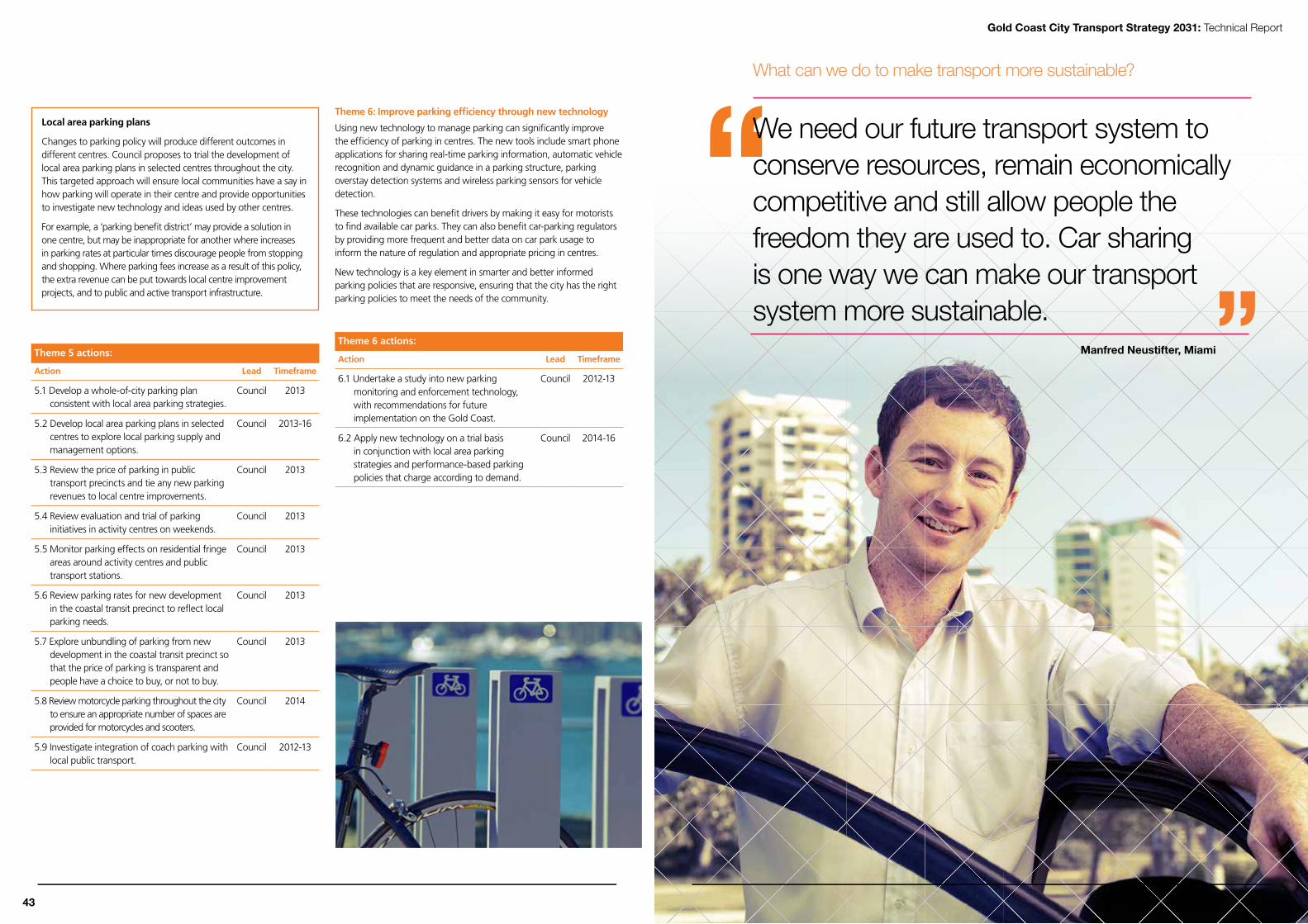
We need our future transport system to conserve resources, remain economically competitive and still allow people the freedom they are used to. Car sharing is one way we can make our transport system more sustainable.
What can we do to make transport more sustainable?
Manfred Neustifter, Miami
Local area parking plans
Changes to parking policy will produce different outcomes in different centres. Council proposes to trial the development of local area parking plans in selected centres throughout the city. This targeted approach will ensure local communities have a say in how parking will operate in their centre and provide opportunities to investigate new technology and ideas used by other centres.
For example, a ‘parking benefit district’ may provide a solution in one centre, but may be inappropriate for another where increases in parking rates at particular times discourage people from stopping and shopping. Where parking fees increase as a result of this policy, the extra revenue can be put towards local centre improvement projects, and to public and active transport infrastructure.
Theme 5 actions:
Action Lead Timeframe
5.1 Develop a whole-of-city parking plan consistent with local area parking strategies.
Council 2013
5.2 Develop local area parking plans in selected centres to explore local parking supply and management options.
Council 2013-16
5.3 Review the price of parking in public transport precincts and tie any new parking revenues to local centre improvements.
Council 2013
5.4 Review evaluation and trial of parking initiatives in activity centres on weekends.
Council 2013
5.5 Monitor parking effects on residential fringe areas around activity centres and public transport stations.
Council 2013
5.6 Review parking rates for new development in the coastal transit precinct to reflect local parking needs.
Council 2013
5.7 Explore unbundling of parking from new development in the coastal transit precinct so that the price of parking is transparent and people have a choice to buy, or not to buy.
Council 2013
5.8 Review motorcycle parking throughout the city to ensure an appropriate number of spaces are provided for motorcycles and scooters.
Council 2014
5.9 Investigate integration of coach parking with local public transport.
Council 2012-13
Theme 6: improve parking efficiency through new technology
Using new technology to manage parking can significantly improve the efficiency of parking in centres. The new tools include smart phone applications for sharing real-time parking information, automatic vehicle recognition and dynamic guidance in a parking structure, parking overstay detection systems and wireless parking sensors for vehicle detection.
These technologies can benefit drivers by making it easy for motorists to find available car parks. They can also benefit car-parking regulators by providing more frequent and better data on car park usage to inform the nature of regulation and appropriate pricing in centres.
New technology is a key element in smarter and better informed parking policies that are responsive, ensuring that the city has the right parking policies to meet the needs of the community.
Theme 6 actions:
Action Lead Timeframe
6.1 Undertake a study into new parking monitoring and enforcement technology, with recommendations for future implementation on the Gold Coast.
Council 2012-13
6.2 Apply new technology on a trial basis in conjunction with local area parking strategies and performance-based parking policies that charge according to demand.
Council 2014-16
44 43
Gold Coast City Transport Strategy 2031: Technical Report

Gold Coast City Transport Strategy 2031: Technical Report
Signature projects – parking Signature Project 1: Develop a city-wide parking plan
Council will develop a city-wide parking plan, addressing park-and-ride, on-street parking, off-street parking, parking supply in developments and pricing. A key principle of the plan will be to return the revenue raised from parking into centre improvement schemes and better public transport services.
Signature Project 2: Develop local parking plans for individual areas
Council recognises that the management of parking is a complex and sensitive issue, particularly for businesses. We will consult extensively with the community and local businesses to tailor parking policies to the needs of local areas. To achieve this, we will develop local area parking plans for individual centres throughout the city.
Signature Project 3: Trial new parking technology
Council will trial new parking technology in conjunction with local parking plans. The new tools include smart phone applications for sharing real-time parking information, automatic vehicle recognition and guidance in car parks, parking overstay detection systems and wireless parking sensors for vehicle detection.
This technology can benefit drivers by making it easier to find available car parks. They can also benefit car parking regulators by providing more frequent and better data on car park usage to inform the nature of regulation and appropriate pricing in centres.
Signature Project 4: Review parking rates along the coastal strip
As light rail is introduced, centres such as Southport, Surfers Paradise and Broadbeach will be transformed from car-dependent centres to public transport-oriented centres. This will revolutionise how the public perceives public transport and provide a real transport choice. In activity centres, parking policy must be well-managed to embrace the transition and encourage travel behaviour change. Council will review parking rates for new development along the coastal strip to reflect local parking needs. Revenue raised from parking meters will be used to improve local centres and public transport services.
Signature Project 5: Build new park-and-rides
Council will work closely with the State Government to encourage new and expanded park-and-ride sites on the Gold Coast. Park-and-rides provide access to the public transport network for people living in low density or hinterland areas not supported by well-connected or frequent public transport services. Council will work with the State Government to ensure any new park-and-rides required for the 2018 Commonwealth Games are located to provide ongoing benefits for the city.
Car parking actions for Council
No. Action Lead area Timeframe
5.1 Develop a whole-of-city parking plan consistent with local area parking strategies. City Transport 2013
5.2 Develop local area parking plans in selected centres to explore local parking supply and management options.
City Transport 2013-16
5.3 Review the price of parking in public transport precincts and tie any new parking revenues to local centre improvements.
City Transport 2013
5.4 Review evaluation and trial of parking initiatives in activity centres on weekends. City Transport 2013
5.5 Monitor parking effects on residential fringe areas around activity centres and public transport stations. City Transport 2013
5.6 Review parking rates for new development in the coastal transit precinct to reflect local parking needs. City Transport 2013
5.7 Explore unbundling of parking from new development in the coastal transit precinct so that the price of parking is transparent and people have a choice to buy, or not to buy.
City Transport 2013
5.8 Review motorcycle parking throughout the city to ensure an appropriate number of spaces is provided for motorcycles and scooters.
City Transport 2014
5.9 Investigate integration of coach parking with local public transport. City Parking 2012-13
6.1 Undertake a study into new parking monitoring and enforcement technologies, with recommendations for future implementation on the Gold Coast.
City Parking 2012-13
6.2 Apply new technology on a trial basis in conjunction with local area parking strategies and performance-based parking policies that charge according to demand.
City Parking 2014-16
46 45

47
8. Public transport network
Objective:
To improve the quality of the public transport system so it provides an attractive alternative to the car.
IntroductionBuilding a strong public transport network is a key part of Council’s plan to manage the city’s continuing population growth. A frequent, reliable and affordable public transport system will serve the city by protecting its air quality, helping maintain the health and quality of life of its residents, and ensuring a competitive advantage for the city as a tourist destination.
Current situation – a snapshot
Rail and bus services
The Gold Coast public transport network forms part of the broader regional public transport network. Currently, the Gold Coast’s public transport network comprises of a rail service connecting the city to the north, a comprehensive bus network serving urban areas, and flexible bus services to areas where scheduled bus services are not economically viable.
In the 2010-11 financial year there were 17.14 million bus trips and in excess of 3.6 million trips by rail.
The Gold Coast is served by six rail stations, which form part of the Beenleigh-Gold Coast line and link the Gold Coast to Brisbane. There are 39 services per day from Brisbane to the Gold Coast (Monday to Friday) and 39 services per day from the Gold Coast, with the majority of services connecting directly to the Brisbane International and Domestic Airport.
Flexible transport and Council Cabs
Gold Coast City Council funds and supports the Community Transport program which includes the Council Cab service, Cancer Patient Transport services and trial services at Pacific Pines and Bonogin. Community Transport initiatives may also offer grants to foster innovation, provision of information and provision of transport services to groups with special needs.
The Council Cab service assists older people and those with a disability to travel to their local shopping centre at a cost of $2 each way. Council Cabs are an initiative of Gold Coast City Council with the support of Gold Coast Cabs and Volunteering Gold Coast.
Taxis
The public transport network is also supported by the 352-strong taxi fleet which provides commercial passenger transport services across the Gold Coast. Taxis are operated privately by Gold Coast Cabs and Yellow Cabs with 29 per cent of the fleet being hybrid vehicles.
Council’s role in delivering public transport
The State Government bears overall responsibility for the development, expansion and upgrade of public transport services and infrastructure throughout the city. Council contributed $6.9 million for bus services in the 2010-11 financial year and $447,500 towards bus stops. The Queensland Government has the major responsibility for public transport planning and provision. Council continues to improve public transport services to better meet community needs and reduce traffic on the city’s road network. In addition to the $70 million provided by the State Government for public transport on the Gold Coast, Council in 2010-11:
subsidised bus services, providing $6.9 million for TMR to operate Surfside buses, with passengers taking over 17 million individual trips during the year
funded Council Cabs, a door-to-door service for 17,775 seniors and people with disabilities to travel to their local shopping centre for $2 each way
operated a park-and-ride service at Bundall, providing easy access to the busy Evandale commercial precinct for more than 24,000 passengers
provided transport services to approximately 6000 oncology patients.
Park-and-ride
Park-and-ride sites provide access to the public transport network for people living in low density or hinterland areas not supported by well-connected or frequent public transport services. By bringing people to consolidated public transport stations, sufficient demand is generated to warrant higher-frequency services.
Park-and-ride facilities are present at all Gold Coast train stations, but there are no formal park-and-ride sites for the local bus system. Some part-time park-and-ride facilities are brought into service for major
48
Gold Coast City Transport Strategy 2031: Technical Report

Figure 23 Light rail in central Portland
Figure 24 Light rail in central Portland
events such as the V8 car racing, Gold Coast Titans rugby league and Gold Coast Suns AFL games. These rely on specially-programmed shuttle bus services.
Achievements Since the release of the Gold Coast City Transport Plan 1998, there have been a number of improvements to the public transport network, some of which include:
commencement of construction of stage one of the Gold Coast light rail from Griffith University, Southport to Broadbeach (scheduled for completion in 2014. Joint Council, Queensland Government and Commonwealth Government project)
establishment of an integrated ticketing system and introduction of the go card smart card across South East Queensland (Queensland Government)
duplication of the rail line between Ormeau and Coomera, and between Helensvale and Robina (Queensland Government)
completion of a planning study examining the extension of the Gold Coast rail line from Robina to Tugun with the extension of the Gold Coast rail line to Varsity Lakes completed in 2009 (Queensland Government)
branding of all public transport stop signs and passenger information across the Gold Coast as part of the TMR network (Queensland Government)
improvement to bus services across the city providing in excess of 12,000 weekday services (joint Queensland Government/Council)
progressive roll-out of bus lanes along priority bus corridors including the Gold Coast Highway (Broadbeach to Miami); Smith Street, Southport; Frank Street, Labrador; and Nerang-Broadbeach Road (Queensland Government)
development of a dial-up bus service between Pacific Pines, Helensvale Town Centre and Helensvale station (Council)
implementation of Gold Coast City Council Cab initiative (Council)
introduction of the NightLink bus services route N21 and N750 and introducing a trial of new NightLink services between Kingscliff and Coolangatta (route N798) (Council)
co-funding the new permanent bus services from the Gold Coast Airport to Southport (route 702) (Council)
co-funding the new permanent bus services from Tweed Heads to Robina (route 761) (Council).
Challenges
Low public transport mode share
Our low public transport mode share is putting increased pressure on the road network, contributing to traffic congestion and threatening the Gold Coast’s environmental, social and economic sustainability.
Inadequatepublictransportnetwork
Low public transport patronage is indicative of a system that is not meeting the needs of Gold Coast residents or visitors. An inadequate public transport network can have negative effects on health and wellbeing, such as:
social isolation – inability to connect with the local community and build social support networks, particularly for new residents from interstate or overseas
limited accessible transport options for older people and people with a disability
limited access to employment.
TheGoldCoastisadispersed,low-densityregion
The diversity of trip origins and destinations, the multi-centred nature of the Gold Coast and the low-density design of many of the Gold Coast’s suburbs make it difficult to provide direct public transport services that are competitive with car travel times.
Higher-frequency public transport services are generally focused on the coastal strip in a north-south direction. Cross-town and NightLink services are limited and infrequent.
The northern Gold Coast has limited public transport access to the coastal strip
The northern Gold Coast, including Coomera, is expected to grow significantly in the years ahead, and currently has limited and infrequent public transport services. A car-dependent northern Gold Coast would lead to more local trips being made on the Pacific Motorway, negatively affecting the regional and economic role of the National Highway.
improving accessibility in the rural hinterland
Large areas to the west of the Pacific Motorway are not viable for urban public transport services. However, residents of these areas sometimes require assistance with travel, which requires innovative service models to provide public transport options that are affordable and consistent with the rural context.
Limited funding for additional infrastructure and fleet expansion
The State Government has limited funding for projects identified over the next four years. Without adequate funding, projects required to meet Council’s public transport objectives cannot be delivered in a timely manner.
Gold Coast 2018 Commonwealth Games
Getting the city ready to host the 2018 Commonwealth Games requires new public transport investment by the State Government and Council, including permanent and temporary park-and-ride sites and transit malls, priority lanes and additional fleet vehicles. Games-specific investments must also contribute to achieving Council’s transport objectives.
Opportunities
Best practice public transport network planning
This strategy aims to achieve an increase in the share of public transport use from 3.1% in 2011 to 12 per cent of all trips by 2031. As the population grows, the actual number of trips taken on public transport each day must increase from 80,000 to almost 450,000 by 2031. If the public transport network is to have the capacity to meet this target, it will require considerable expansion and improvement, and best practice techniques must be adopted to improve passengers’ experiences, with emphasis on:
developing a public transport network of direct, high-frequency services on strategic routes across urban areas
supporting the public transport network with local buses that extend service coverage to areas not serviced by high-frequency transport services
developing a connected network that services the full range of destinations within the urban area, based around key transfer points
including ‘speed protection’ measures such as maximising pre-paid boarding to reduce dwell times, and prioritising buses on roads where there is frequent traffic congestion, to improve reliability and reduce travel times
providing safe and effective infrastructure for walking and cycling to the public transport system, to extend the coverage of the sustainable transport network
providing park-and-ride facilities at the edge of the public transport network to intercept passengers using transport emanating from outside the public transport service area.
Simplifying the system
Currently, there are three different types of bus services on the Gold Coast (high-frequency bus services, local buses and community buses), with no real distinction between the different service types. This lack of distinction has a negative effect on public perceptions of the services. Some passengers find the current bus network complicated and perceive that bus services are slow and circuitous.
TMR and Council can improve the legibility of the system by using the introduction of light rail services in 2014 as an opportunity to distinguish between the different types of bus services. This can be achieved by introducing fleet colour schemes, route numbers, stop infrastructure and signage, transport network maps and overall service branding. This will help deliver a public transport system that is attractive and easy to use.
Stageddevelopmentofthehigh-frequencypublic transport network
The completion of the first stage of the light rail system between the Gold Coast University Hospital and Broadbeach offers an opportunity to combine the light rail with rapid bus routes to extend the coverage of Gold Coast high-frequency public transport services right across the urban area. The branding, signage, stations and fleet livery of the first stage of the light rail network could be applied to rapid bus routes,
connecting the major activity centres from the outset. Rapid bus routes would progressively be replaced by each successive extension of the light rail network.
The existing Gold Coast rail line presents an additional opportunity to expand the rapid public transport network. Introducing more stations and operating an all-stops Gold Coast suburban service would complement the intercity rail service and improve network coverage and connectivity, particularly for the fast-growing northern suburbs of the Gold Coast between Helensvale and Beenleigh.
CASESTUDY:PORTLAND,OREGON
In 1974, the Portland City Council stopped planning for a freeway and used the rediverted funds to build the downtown transit mall and eastside light rail system. Construction of the 24-kilometre light rail route started in 1982, and the system opened in 1986.
Today, the system is 84.3 kilometres in length with 85 stations. The network carried 41.2 million passengers in 2011. This is an excellent example of the successful staged delivery of a light rail network in a growing, metropolitan city, with multiple branch lines and higher frequency on the central main line sectors.
50 49
Gold Coast City Transport Strategy 2031: Technical Report

740
Coomera
Beenleigh
Ormeau
Helensvale
Parklands
Surfers Paradise
The Spit
Broadbeach
Burleigh Heads
Elanora
Airport
Robina Rail
Paradise Point
Varsity Lakes
Main Beach
Southport
Bond University
RobinaTown Centre
BiggeraWaters
Nerang
To Brisbane
Coolangatta
KEYRAIL
Brisbane - Varsity Lakes intercity rail
RAPID BUS
700 Southport - Coolangatta
702 Southport - Gold Coast Airport
703 Biggera Waters - Burleigh Heads
706 Paradise Point - Elanora
707 Parklands - Burleigh Heads
709 Parklands - Broadbeach
715 Helensvale - The Spit
20/20A Broadbeach - Nerang - Southport
740 Nerang - Surfers Paradise
745 Nerang - Broadbeach - Surfers Paradise
747 Robina - Southport
750 Mudgeeraba - The Spit
760 Coolangatta - Broadbeach
761 Coolangatta - Robina
765 Elanora - Robina
Map not to scale
715
715
703
703
706
706
706
706
707 709
709 707
707
750
750
750
750
750
761
761
745 745
747
747
20/20A
20/20A
700 702
702 703 700
700 702 706
700 702 760
760
760
765
765
The high-frequency public transport network is supported by a network of integrated local bus routes.
Figure 25 Current2012high-frequencypublictransportnetwork
Themes and actions - public transport
Theme 7 Work with the Department of Transport and Main Roads to simplify the bus route network.
Theme 8 Work with the Department of Transport and Main Roads to progressively deliver a city-wide, integrated, high-frequency public transport network, consisting of light rail, heavy rail and bus.
Theme 9 Support the development of new park-and-rides for bus and rail passengers.
Theme 10 Extend community transport options in areas of weak demand.
Theme 11 Integrate requirements to support public transport within other vpolicy areas.
Theme 7: Work with the Department of Transport and Main Roads to simplify the bus route network
The Gold Coast’s public transport service structure can be broken down as follows:
Service type Mode Attributes
Frequency (minutes)
Peakoff-peak
High-frequency services
Light rail, heavy rail and bus
• High-frequencyservices
• Connect people to major activity centres
5-15 10-30
Local bus services
Bus • Lower-frequency services with broad coverage across the city
• Connect people to local shops and public transport stations
20-30 40-60
Community transport services
Community bus and Council Cab
• Flexible in route or stopping pattern
• Provide connections to local centres and other public transport services for rural, hinterland and low-mobility communities
• May not run all day
Flexible
NightLink Bus, light rail, rail
• Late night transport options 60
Table 8-1 Gold Coast public transport service structure
By better distinguishing between these bus service types, residents of the Gold Coast will begin to appreciate that:
community transport services are specialist services to improve accessibility
local bus services stop frequently, provide coverage and connectivity in the urban area
high-frequency services provide a viable alternative to driving for commuter trips to major employment and activity centres.
Restructuring local bus routes
Bus service legibility can be improved by grouping services numerically, so the numbering reflects a local service group or ‘basket’ of services.
For example, all services in the 750 to 759 group will serve the one transfer location or station and concentrate on a particular sector of the city. The design of bus stops, fleet branding, route numbering and passenger information can all assist with the presentation of these local bus route groups.
It is proposed that local bus routes be grouped to serve a separate quarter of the Gold Coast as follows:
Assign numbers 710 to 729 to northern quarter local bus routes servicing Yatala, Ormeau, Coomera and Helensvale (currently route numbers 3, 10, 14, 16, 567, 725, 726, 727, 728 and the northern section of route 5).
Assign numbers 730 to 749 to central quarter local bus routes servicing Nerang, Southport and Broadbeach (currently route numbers 15, 18, 18A, 20, 20A, 21, 737, 738, 748 and the southern section of route 5).
Assign numbers 750 to 759 to Robina quarter local bus routes servicing Broadbeach, Robina and Burleigh (currently route numbers 4, 751, 752, 753, 754, 755, 758 and 759).
Assign numbers 760 to 769 to southern quarter local bus routes servicing Burleigh, Elanora and Coolangatta (currently route numbers 762, 763, 764, 766, 767, 768 and 769).
Over time, these local bus routes will be extended and modified to provide coverage of new communities as subdivision occurs, providing new residents with public transport services in the early stages of development and offering an alternative to the need to buy a second car. Assigning both the 710 and 720 route number series to the northern quarter will ensure that enough route numbers are available to add services over time.
As population continues to grow across the border in the Tweed Shire of New South Wales, it will also be important to explore ways to better integrate the Tweed network with the Gold Coast network. This will include focussing the NSW services on a particular station at either Coolangatta or the Gold Coast Airport, with appropriate interstate border fare arrangements that allow for the use of electronic ticketing systems and do not penalise passengers through flagfalls.
Re-numbering of the rapid bus routes is discussed in Policy 8.
Theme 7 actions:
Action Lead Timeframe
7.1 Renumber local bus routes as described in this strategy.
TMR 2013-14
7.2 Better distinguish between bus routes (including via fleet colour schemes, stop infrastructure and signage, public transport information, network maps and overall service branding).
TMR 2013-14
7.3 Integrate Tweed Shire public transport services with the Gold Coast transport network.
Transport for New South Wales/TMR
2013-14
52 51
Gold Coast City Transport Strategy 2031: Technical Report

Table 8-2 Proposed changes to route numbering lists the existing high-frequency bus routes and shows the proposed changes to route numbering and terminus points.
Existing bus route Revised rapid bus route (Changes shown in orange)
700: Southport – Tweed Heads 700: Broadbeach North – Tweed Heads
702: Southport – Gold Coast Airport Broadbeach North – Gold Coast Airport
703: Harbour Town – Burleigh Heads Cancelled
706: Paradise Point – Elanora
747: Southport – Robina
Northern portion of 706 joined to 747 and renumber to 710: Paradise Point – Robina
707: Griffith Uni – Southport – Burleigh Heads Renumber to 701: Broadbeach North – Burleigh Heads
709: Griffith Uni – Broadbeach Pacific FairCancelled. Convert to new 720: Gold Coast University Hospital – Helensvale – Coomera
715: Helensvale – Southport – Sea World 715: Helensvale – Southport – Sea World
20/20A: Broadbeach Pacific Fair – Nerang – SouthportSplit 20/20A: Create 735 from Southport – Nerang sector Re-invest Broadbeach – Nerang sector into revised 745
740: Nerang – Surfers Paradise 740: Nerang – Surfers Paradise
745: Nerang – Broadbeach Pacific Fair – Surfers Paradise745: Nerang – Broadbeach Pacific Fair Cancel Broadbeach North – Surfers Paradise sector
750: Mudgeeraba – Robina – Bond Uni – Broadbeach Pacific Fair – Sea World750: Mudgeeraba – Robina – Bond Uni – Broadbeach Pacific Fair – Sea World
760: Tweed Heads – Broadbeach Pacific Fair 760: Tweed Heads – Broadbeach Pacific Fair
761: Tweed Heads – Elanora – Varsity Lakes rail – Robina 761: Tweed Heads – Elanora – Varsity Lakes rail – Robina
765: Elanora – Burleigh Heads – Robina 765: Elanora – Burleigh Heads – Robina
Table 8-2 Proposed changes to route numbering
Theme 8: Work with the State Government to progressively deliveracity-wide,integrated,high-frequencypublictransportnetwork,consistingoflightrail,heavyrailandrapidbus
The 2031 vision for the Gold Coast is of a public transport network of light rail lines connecting the principal and major activity centres. This network will take time to build over the next two decades, and a strategy to stage the development of the high-frequency public transport network is required.
The current public transport network
There are currently 15 key bus routes on the Gold Coast that provide connections between the major activity centres. These are:
700: Southport – Tweed Heads
702: Southport – Gold Coast Airport
703: Harbour Town – Burleigh Heads
706: Paradise Point – Elanora
707: Griffith Uni – Southport – Burleigh Heads
709: Griffith Uni – Broadbeach
715: Helensvale – Southport – Sea World
20/20A: Broadbeach – Nerang – Southport
740: Nerang – Surfers Paradise
745: Nerang – Broadbeach – Surfers Paradise
747: Robina – Southport
750: Mudgeeraba – Robina – Bond Uni – Broadbeach – Sea World
760: Tweed Heads – Broadbeach
761: Tweed Heads – Elanora – Varsity Lakes rail – Robina
765: Elanora – Burleigh Heads – Robina
The 2018 public transport network
When the first stage of light rail begins operation in 2014 between the Gold Coast University Hospital and Broadbeach, many bus routes must be modified to avoid duplication of bus and light rail services.
Collectively, the light rail and rapid bus routes would become the Gold Coast high-frequency public transport network. High-frequency transport networks are not delivered by light rail alone. Buses can also form part of a network with the right frequency, high-quality stops and stations, comfortable buses, service differentiation, good-quality passenger information, and bus priority to bypass traffic congestion points. The benefits of the Gold Coast high-frequency public transport network could be shared across Gold Coast City rather than being concentrated in the communities that will directly benefit from the new light rail service.
As many of the existing bus routes follow the alignment of proposed future light rail extensions, the new light rail and rapid bus routes could connect major activity centres from the outset, with bus services progressively replaced by successive extensions of the light rail network.
Re-numbering the network will provide a route numbering system that supports the light rail and bus network and is easy to understand and remember.
The proposed numbering of priority bus routes:
the 710 and 720 route number series be applied to the local bus network in the northern quarter - 710 (Paradise Point – Robina), 715 (Helensvale – Sea World) and 720 (Gold Coast University Hospital – Helensvale – Upper Coomera – Coomera)
the 730 and 740 route number series be applied to the local bus network in the central quarter - 735 (Southport – Nerang), 740 (Nerang – Surfers Paradise) and 745 (Nerang – Pacific Fair)
the 750 route number series be applied to the local bus network in the Robina quarter - 750 (Mudgeeraba – Robina – Bond Uni – Broadbeach – Sea World). There is a case for this service to be truncated at Broadbeach, however, the connectivity to Sea World was considered to be important, so it is proposed that this service run along Surf Parade to avoid duplication of the light rail through Broadbeach and provide the tourist accommodation precincts with same-seat connections to Sea World
the 760 route number series already applied to the local bus network in the southern quarter be retained as 760 (Tweed Heads – Broadbeach), 761 (Tweed Heads – Elanora – Varsity Lakes rail – Robina) and 765 (Elanora – Burleigh Heads – Robina)
the priority bus routes south from Broadbeach will be progressively replaced by light rail extensions and should be presented as a package of related Gold Coast Highway routes, converting the rapid bus route numbers to consecutive numbers 700 (Pacific Fair – Tweed Heads), 701 (Pacific Fair – Gold Coast Airport) and 702 (Pacific Fair – Burleigh Heads).
54 53
Gold Coast City Transport Strategy 2031: Technical Report

740
735
KEYRAIL
Brisbane - Varsity Lakes intercity rail
LIGHT RAIL
Line A Parklands - Broadbeach
RAPID BUS
700 Broadbeach North - Coolangatta
701 Broadbeach North - Burleigh Heads
702 Broadbeach North - Gold Coast Airport
710 Paradise Point - Robina
715 Helensvale - The Spit
720 Parklands - Coomera
735 Nerang - Southport
740 Nerang - Surfers Paradise
745 Nerang - Broadbeach North
750 Mudgeeraba - The Spit
760 Elanora - Broadbeach North
761 Coolangatta - Robina
765 Elanora - Robina
Map not to scale
Coomera
Beenleigh
Ormeau
Helensvale
Parklands
Surfers Paradise
The Spit
Broadbeach South
Burleigh Heads
Elanora
Airport
Robina Rail
Paradise Point
Varsity Lakes
Main Beach
Southport
Bond University
RobinaTown Centre
BiggeraWaters
Nerang
To Brisbane
Coolangatta
715
715
750
750
750
750
750
761
761
745 710
710
700
702
700 702
700 702
760
760
765
765
710
720
Broadbeach North
Bundall
720
Line A
Line A
701
The high-frequency public transport network will be supported by a network of integrated local bus routes.
Figure 26 2018high-frequencypublictransportnetwork
Primary transfer points between the local bus and rapid bus network are Coomera, Helensvale, Parklands, Southport, Nerang, Broadbeach South, Broadbeach North, Robina rail, Burleigh Heads, Elanora and Coolangatta. Secondary transfer points are Main Beach, Surfers Paradise, Bundall, Varsity Lakes rail, Robina Town Centre, Bond University and the airport.
The 2031 public transport network
By 2031, this transport strategy proposes that:
a light rail branch line is extended west from Parklands to a new park-and-ride rail station at Parkwood, and a second branch line is extended north from Parklands to Biggera Waters, with provision made for a future extension north of Biggera Waters (a branch line is a secondary line that branches off the main line)
the light rail main line is extended south to the airport
a light rail branch line is extended west from Nobby Beach to Robina
light rail branch lines are introduced between Surfers Paradise and Bundall, as well as between Main Beach and The Spit
the heavy rail line is extended to Elanora
an all-stops suburban rail service is introduced between Beenleigh and Elanora to support the Brisbane to Gold Coast regional rail service.
The objectives of this 2031 public transport network are:
to connect to the rail system at Parkwood and Robina so that the northern and western suburbs of the Gold Coast, and the Brisbane commuter and tourist markets, have a connected public transport system that offers a viable alternative to driving and reduces demand on the Pacific Motorway
to replace multiple rapid bus routes with light rail on the high-demand coastal corridor, connecting to the airport for tourism, economic development, self-containment and coastal development purposes
to connect the Evandale cultural and civic precinct, Bundall employment centre and Southport-Burleigh Road bus corridor into the light rail network
to continue to utilise high-quality bus services on the lower-demand routes.
The extension of passenger rail south of Elanora has not been proposed due to its relatively low patronage potential, the high construction costs, and its duplication of function with the light rail extension to the airport. Modelling shows that demand on regional rail would be low, and that the southern Gold Coast and airport are better serviced by light rail. However, the need for a regional rail extension to the airport will be monitored, and the rail corridor between Elanora and the airport will be protected for possible future extensions.
our 2031 vision – public transport that is ready to go when you are
According to our vision for 2031, 80 per cent of Gold Coast residents will be within a 10-minute walk of frequent all-day services. This transport strategy aims to provide high-frequency services (every 15 minutes or better) to almost all parts of the city where the densities and road network make it viable.
The remaining 20 per cent live in hard-to-reach or low-density areas where it is not cost effective to run frequent services. These areas are proposed to be serviced by flexible community transport options, such as Council’s Pacific Pines service and Council Cabs.
Frequency and reliability are vital for successful public transport. Under this strategy, public transport services will be ready to go when you are. Public transport will be an attractive transport option and people will be able to use it spontaneously to move around the city.
56 55
Gold Coast City Transport Strategy 2031: Technical Report

715
720
735
745
740
700
Line C
Line A
Line A
Line D
765
710
710
Line B
Coomera
HopeIsland
Beenleigh
Yatala
Ormeau North
Ormeau
Pimpama
Helensvale
Parklands
Surfers Paradise
The Spit
Broadbeach
Burleigh Heads
Elanora
Airport
Robina Rail
Nobby Beach
Paradise Point
Varsity Lakes
Main Beach
Southport
Bond University
RobinaTown Centre
Parkwood
BiggeraWaters
Bundall Nerang
To Brisbane
Coolangatta
Merrimac
KEY
RAIL
Brisbane - Elanora intercity rail
Beenleigh - Elanora suburban rail
Protect corridor for future heavy rail extension
Protect corridor for future light rail extension
LIGHT RAIL
Line A Parkwood - Airport
Line B Biggera Waters - Broadbeach
Line C Bundall - Robina
Line D The Spit - Elanora
RAPID BUS
700 Airport - Coolangatta
710 Helensvale - Robina
715 Pimpama - Southport
720 Pimpama - Biggera Waters
735 Nerang - Southport
740 Nerang - Surfers Paradise
745 Nerang - Broadbeach
765 Robina - Burleigh Heads
Note - only major stations and stops shown
Map not to scale
The proposed high-frequency public transport network will be supported by a network of integrated local bus routes.
(Protect corridor for
future rail extension)
Figure 27 Proposed2031high-frequencypublictransportnetwork
Extending our light rail network
Since 1998, several studies have examined whether the Gold Coast light rail network should connect to the regional rail network at Helensvale or Parkwood. Evaluation of the two alternative connections has consistently identified positives and negatives with both options. The Helensvale option has the advantage of servicing the Harbour Town area, but has high costs, environmental considerations and flooding issues associated with crossing the Coombabah wetlands. The Parkwood option is much shorter, less expensive, does not cross the Coombabah wetlands and would provide a significant park-and-ride at Parkwood for the light rail and regional rail networks, but requires a new regional rail station to be built at Parkwood and does not serve the Harbour Town area.
In 2010, the decision was taken to construct the Gold Coast University Hospital station shell in a way that allows for the future light rail extension to connect to Harbour Town. Since then, the Gold Coast has been awarded the 2018 Commonwealth Games, so this transport strategy has reconsidered the light rail connections to regional rail in the context of the Games as well as a comprehensive review of the function of light rail as part of a city-wide, multi-modal transport plan.
Transport modelling shows that light rail patronage demand is not uniform along its length; it is high between the Gold Coast University Hospital and Burleigh Heads, and even higher between Main Beach and Broadbeach. To accommodate these peak loadings, this transport strategy proposes branch lines for the lower-demand sectors, which combine along the central sector to overlap services, creating higher frequencies on the high-demand central sector.
This approach delivers the following branch lines:
Line A is extended west from Parklands to Parkwood. It connects with a new regional rail station and park-and-ride site at Parkwood. It would be desirable to have this connection and park-and-ride in place for the 2018 Commonwealth Games
a new Line B service is introduced on the main line between Broadbeach and Parklands, and is extended north on a branch line to Biggera Waters. This will capture the land use benefits of servicing the activity centre, but instead of crossing the Coombabah wetlands, Line B is set up to allow for a future extension north
Line A is extended in stages to the south between now and 2031. Extension staging options include Broadbeach to Nobby Beach; Nobby Beach to Burleigh Heads; Burleigh Heads to the Gold Coast Airport via Elanora. Demand modelling shows that patronage between the airport and Coolangatta is relatively low in 2031 and therefore no extension south beyond the airport is proposed before 2031. Demand to the south of the airport would be met by rapid bus services that can service the dispersed demand in Coolangatta and north Tweed. A corridor will be protected for a future extension of light rail to Coolangatta
a new Line C is introduced on the main line between Surfers Paradise and Nobby Beach, and operates on a new western branch line between Surfers Paradise and Bundall as well as a southern branch line between Nobby Beach and Robina. The link between Robina, Bond University and the coastal corridor is forecast to attract good patronage, and Robina’s status as a Principal Activity Centre
makes it a high priority for high-quality public transport connections. The 1.5-kilometre western branch line from Surfers Paradise to Bundall connects to the Evandale cultural and civic precinct, Bundall employment centre and Southport-Burleigh Road bus corridor. Line C provides higher-frequency light rail on the Surfers Paradise to Nobby Beach main line sector
a new Line D is introduced on the main line between Palm Beach and Main Beach and operates on a 3-kilometre northern branch line between Main Beach and The Spit. This would provide direct connections between tourist precincts and allow further frequency increases on the busy Burleigh Heads to Main Beach main line sector. A branch line is also proposed between Palm Beach and Elanora.
Beyond 2031, opportunties exist for further extensions to the light rail system, as well as heavy rail extensions on the preserved Elanora to airport corridor.
For each stage of the high-frequency transport network development, the local bus networks in the northern, central, Robina and southern quarters would continue to operate, providing local coverage and connectivity to the high-frequency public transport network. The local bus network would be further supported by community transport, such as Council’s Pacific Pines service and Council Cabs in rural, hinterland and low-mobility communities.
Light rail extensions are subject to further technical investigation and the availability of state and federal funding. Council will play a supporting role to the Department of Transport and Main Roads in the planning and delivery of the future light rail network.
introducing suburban rail services on the Gold Coast line
The Gold Coast line is an intercity railway connecting Brisbane, Logan and the Gold Coast. The stations in the Gold Coast area are generally spaced widely apart to allow for high-speed intercity train operations (Beenleigh – Ormeau 12 kilometres; Ormeau – Coomera 7 kilometres; Coomera – Helensvale 9 kilometres; Helensvale – Nerang 8 kilometres; Nerang – Robina 9 kilometres; Robina – Varsity Lakes 3 kilometres).
High-quality, high-speed intercity rail services between Brisbane, Logan and the Gold Coast must be maintained, but as the population and employment opportunities continue to increase in the northern suburbs of the Gold Coast between Yatala and Helensvale, increased levels of intra-city connectivity will be required.
To service the growing transport demand, two train service types could be introduced on the Gold Coast line. The existing intercity train would continue to operate at high speed with limited stops, and a new all-stops suburban rail service could be operated to connect passengers to nearby train stations and activity centres.
Heavy rail infill stations would be constructed at Yatala, Ormeau North, Pimpama, Hope Island, Parkwood and Merrimac and an all-stops suburban rail service would commence operation stopping at 14 stations (Beenleigh, Yatala, Ormeau North, Ormeau, Pimpama, Coomera, Hope Island, Helensvale, Parkwood, Nerang, Merrimac, Robina, Varsity Lakes and Elanora).
58 57
Gold Coast City Transport Strategy 2031: Technical Report

Theme 8 actions:
Action Lead Timeframe
8.1 Work with TMR to restructure the local bus network, roll-out the rapid bus network, and implement supporting initiatives including stop upgrades, bus priority treatments and passenger information campaigns.
TMR/Council
2013 onwards
8.2 Work in cooperation with TMR, the private sector and the Commonwealth Government to plan and deliver the Gold Coast light rail network in stages, as identified in this strategy.
Council Ongoing
8.3 Provide new rail stations at Yatala, Ormeau North, Pimpama, Hope Island, Parkwood and Merrimac.
TMR Ongoing
8.4 Extend the heavy rail line to Elanora and protect the corridor for future extension to the airport.
TMR Ongoing
8.5 Introduce an all-stops suburban rail service between Beenleigh and Elanora.
TMR Ongoing
8.6 Progressively expand NightLink services. TMR Ongoing
8.7 Support alignment improvements and capacity upgrades in Logan City and Brisbane City to allow for increased speeds and service frequency on the Gold Coast to Brisbane intercity rail service.
TMR Ongoing
8.8 Establish and upgrade public transport interchanges at key transport stations as identified in this strategy to provide convenient transfers between local buses and high-frequency transport services (heavy rail, light rail and bus).
Council Ongoing
8.9 Work with TMR and public transport operators to ensure that the new fleet is fit-for-purpose on the high-frequency public transport network, and is supported by appropriate fleets for local services.
TMR/Council
Ongoing
8.10 Duplicate the Gold Coast rail line between Coomera and Helensvale.
TMR Ongoing
Theme 9: Support the development of new park-and-rides for bus and rail passengers
Park-and-ride: the right amount in the right places
The expansion of the high-frequency public transport network throughout the Gold Coast will generate demand for park-and-ride facilities at strategic locations. Council supports the development of new park-and-ride sites (and expanding the existing rail station park-and-ride facilities) to support high-frequency or priority public transport corridors. As discussed above, a new regional rail and light rail station at Parkwood would provide park-and-ride for both regional rail and light rail. This could also have over-spill parking spaces to provide park-and-ride for the 2018 Commonwealth Games and other major events.
The Department of Transport and Main Roads is primarily responsible for the planning and provision of park-and-ride facilities throughout South East Queensland. Council will work closely with TMR to ensure appropriate provision is made for new and expanded park-and-ride sites on the Gold Coast.
Theme 9 actions:
Action Lead Timeframe
9.1 Undertake a study to identify long-term park-and-ride requirements to support the development of the future Gold Coast public transport network.
TMR 2013
9.2 Work with the Commonwealth Games authorities to ensure a legacy benefit of park-and-ride sites at those facilities created for the Games events, provided they are in the right location outside the coastal transit precinct, meet TMR policy and will not create traffic congestion.
Council 2013-18
9.3 Establish or expand park-and-ride facilities along the Gold Coast railway line to service heavy rail and light rail, as well as shuttle buses for major events such as AFL at Carrara, NRL at Robina and the 2018 Commonwealth Games.
TMR Ongoing
Theme 10: Extend community transport options in areas of weak demand
Many Gold Coast residents live in low-density areas that cannot be easily serviced by public transport. In areas with low population density (fewer than 10 dwellings per hectare), more flexible public transport options must be made available.
Community transport buses
To improve public transport services in urban fringe areas, Council is currently conducting trials of flexible community transport services in Pacific Pines and Bonogin. The services are for residents in areas currently under-serviced by public transport and are fully-funded by Council’s transport levy.
The objective of the trial is to develop a model that will allow the delivery of flexible bus services to appropriate urban fringe and hinterland communities, linking them to the scheduled public transport network. Ideally, these services would coordinate with the enhancement of regular scheduled public transport services from TMR.
Council Cabs
The Gold Coast City ‘Council Cab’ assists older people and those with a disability with travel to their local shopping centre. Services run three times per week, with the Council Cab picking up passengers from their home.
In 2011-2012, Council Cabs made 18,688 trips across the Gold Coast, taking seniors and people with disabilities to their local shopping centre for $2 each way.
Theme 10 actions:
Action Lead Timeframe
10.1 Continue to provide the Council Cab service to assist older people and those with a disability with travel to their local shopping centre.
Council Ongoing
10.2 Continue to provide flexible bus services to low-density areas across the Gold Coast that cannot be easily serviced by scheduled public transport services.
Council Ongoing
10.3 Investigate opportunities for ‘access awareness’ training for public transport and community transport providers as a way of improving customer service to those with mobility challenges.
Council 2013-14
Theme11:Integraterequirementstosupportpublictransportwithin other policy areas
Embedding public transport considerations into other strategy areas will help to increase public transport usage on the Gold Coast. Integration opportunities that will help to make public transport more attractive include:
active transport initiatives around the design and location of paths, the provision of cycle facilities at stations and interchanges, and policies in relation to cycles on public transport
parking initiatives that make park-and-ride an attractive option in appropriate locations
road network initiatives including bus priority at congestion points, high-quality passenger waiting environments in road reserves, and convenient pedestrian crossing points near stops and stations
land use initiatives that locate high-demand activities close to high-quality public transport, and facilitate public transport interchanges that are integrated into the urban landscape
Gold Coast 2018 Commonwealth Games initiatives that ensure that permanent and temporary park-and-ride sites, transit malls, priority lanes, additional fleet, and the overall games transport experience contribute to achieving this transport strategy’s vision
travel behaviour change initiatives that provide people with high-quality public transport information, tourist ticket products and information systems, and create a positive transport experience
infrastructure improvement initiatives such as closed circuit television, lighting, shelter and footpath improvements to create better taxi ranks.
Public transport tickets for tourists and families
Council supports the provision of tourist-friendly public transport ticketing products, such as Surfside Buslines' Freedom Pass and Gold Pass.
Residents and sightseers often comment that there is no incentive for family groups to use public transport when they are charged individual fares (compared to private car use). Council supports the provision of family-friendly and tourist-friendly public transport ticketing products that will boost the attractiveness of public transport for these key markets. This could also be supported by the use of Quick Recognition technology to provide timetable and route information in different languages.
Public transport fare structure
Currently, Gold Coast travellers are generally charged more per distance than travellers in Brisbane. Fare boundaries on the Gold Coast dissect the city in an east-west direction. North-south trips often cross multiple fare boundaries, making trips very expensive, and east-west trips often stay within the one zone, distorting the cost of public transport trips. For example, a cross-town trip in Brisbane from Grange to the University of Queensland (approximately 10 kilometres) costs $5.20. This trip crosses two fare zone boundaries (zones 2/1/2). A trip of similar length on the Gold Coast, from Southport to Bond University, will also cross two zone boundaries (zones 13/14/15) but will cost $6.20. This is
60 59
Gold Coast City Transport Strategy 2031: Technical Report

a 19 per cent fare disadvantage, and the problem is worse for longer trips. The maximum fare paid across Brisbane is five zones at $7.90, yet nine zones are charged across the Gold Coast at $11.20 – a 41 per cent disadvantage.
Council supports a more equitable distance-based pricing system, making the best use of the go card system currently in place.
Assessing a future ferry network
Since the late 1990s, Council has investigated a number of opportunities to introduce commuter ferry services on the Gold Coast’s waterways. However, the circuitous nature of some waterways, the existence of low bridges, and the lack of disability-compliant infrastructure are some of the reasons that limit the ability to operate these services efficiently. In 2011, Council sought market interest to deliver a trial of ferry services on the Broadwater and Nerang River between Surfers Paradise and Bundall. This approach to market showed us that the delivery of a ferry service on the Gold Coast is not viable in the short-term, due to a range of financial and operational constraints.
Council will support the provision of ferry services on our waterways that are cost-effective and deliver maximum public transport and tourism benefits for the people of the Gold Coast. The viability of providing commuter ferry services will be reassessed throughout the life of the strategy.
Taxis
There are difficulties with cross-border taxi travel into Tweed Shire as well as taxi trips to Ormeau, due to regulatory restrictions associated with the Gold Coast Cabs service area. This creates higher costs for users and makes the areas less attractive for taxi drivers to service, decreasing the availability of taxis for the local community. Council will work with the Department of Transport and Main Roads and the New South Wales Department for Transport to examine ways to address these cost and service issues.
Theme 11 actions:
Action Lead Timeframe
11.1 Re assess the viability of providing commuter ferry services for the Broadwater and Nerang River.
TMR/ Council
By 2022
11.2 Support land use initiatives that locate high-demand activities close to high-quality public transport services, and facilitate public transport interchanges that are integrated into the urban landscape (refer to Land Use Chapter).
Council Ongoing
11.3 In new communities, develop road networks that can accommodate bus routes and develop complementary urban design that creates boulevards along rapid bus routes (refer to Land Use Chapter).
Council Ongoing
Theme 11 actions:
Action Lead Timeframe
11.4 Implement road network initiatives including bus priority at congestion points, high-quality passenger waiting environments in road reserves, and convenient pedestrian crossings near stops and stations (refer to Road and Freight Chapter).
Council/TMR
Ongoing
11.5 Develop ‘people-focused’ public transport passenger information using published network maps and timetables, static and real-time signage at stations and stops, and personal information technology devices (refer to Changing Travel Behaviour Chapter).
TMR Ongoing
11.6 Deliver travel behaviour change programs that provide information about available public transport options (refer to Changing Travel Behaviour Chapter).
Council/TMR
Ongoing
11.7 Work with TMR to review fare zone boundaries on the Gold Coast.
Council/TMR
2013-14
11.8 Work with the State Government and Gold Coast 2018 Commonwealth Games Organising Committee to optimise the infrastructure and behaviour change benefits accrued from hosting the Games.
Council/TMR/CGOG
2012-18
11.9 Work with TMR to develop family-friendly and tourist-friendly ticketing products for public transport.
Council/TMR
2014
11.10 Collaborate with other community transport providers to foster innovation, provision of information and provision of transport services to groups with special needs.
Council Ongoing
11.11 Refine the public transport funding agreement with TMR.
Council/TMR
2013-14
11.12 Provide infrastructure improvements such as closed circuit television, lighting, shelter and footpath improvements to create better taxi ranks.
Council/TMR
Ongoing
11.13 Advocate for Ormeau and Tweed to be included in the Gold Coast Cabs service area.
Council/TMR
2013
61

Gold Coast City Transport Strategy 2031: Technical Report
63 64
Frequent and properly integrated public transport will give ultimate economic and social freedom to people on the Gold Coast when they can choose whether they actually need a car for their daily travel.
How important is public transport to our city?
Steven Jamieson, Carrara
Signature projects – public transport networkSignature Project 1: Deliver a rapid bus network
Council supports the introduction of rapid bus services on the following routes by 2018:
Broadbeach – Coolangatta
Broadbeach – Airport
Broadbeach – Burleigh Heads
Broadbeach – Elanora
Paradise Point – Southport – Robina
Helensvale – Sea World
Parklands – Coomera
Nerang – Southport
Nerang – Surfers Paradise
Nerang – Broadbeach
Mudgeeraba – Sea World
Coolangatta – Robina
Elanora – Robina
This will extend the coverage of the high-frequency public transport network right across the urban area. Where appropriate, we support bus priority measures to ensure bus trips are fast, frequent and reliable. The high-frequency network will be supported by local buses that extend service coverage to all urban areas of the Gold Coast.
The branding, signage, stations and fleet livery of the light rail network could be applied to the rapid bus routes, which would largely follow the routes of the long-term light rail network. The rapid bus routes would progressively be replaced by light rail as patronage warrants.
Signature Project 2: Reduce the cost of public transport and develop tourist-friendly ticketing products
Fare zone boundaries on the Gold Coast mean travellers are generally charged more per distance than travellers in Brisbane. Council will work with TMR to investigate a more equitable distance-based pricing system, making the best use of the go card system currently in place.
Council supports the provision of family and tourist-friendly public transport ticketing products. These initiatives will make the public transport system fairer and encourage more people to use it.
Signature Project 3: Extend the light rail network across the city
Council supports significant expansion of light rail, with a network of four lines by 2031:
Line A is extended west from Parklands to Parkwood. It connects with a new regional rail station and park-and-ride site at Parkwood. Line A is also extended in stages to the south by 2031. Extension stages include Broadbeach to Nobby Beach; Nobby Beach to Burleigh Heads; Burleigh Heads to the Gold Coast Airport via Elanora. A corridor will be protected for a future extension of light rail to Coolangatta.
Line B is introduced on the main line between Broadbeach and Parklands, and is extended north on a new branch line to Biggera Waters (a branch line is a secondary line that branches off the main line). This line is set up to allow for a future extension north.
Line C service is introduced on the main line between Surfers Paradise and Nobby Beach, and operates on a new western branch line between Surfers Paradise and Bundall as well as a southern branch line between Nobby Beach and Robina.
Line D service is introduced on the main line between Palm Beach and Main Beach, with new branch lines between Main Beach and The Spit, and Palm Beach and Elanora.
Signature Project 4: Extend the heavy rail line to Elanora and build new stations
Council supports extending the heavy rail line to Elanora and building new rail stations at Yatala, Ormeau North, Pimpama, Hope Island, Parkwood and Merrimac. This would allow for the introduction of an all-stops suburban rail service between Beenleigh and Elanora to support the Brisbane to Gold Coast regional rail service.
Signature Project 5: Deliver flexible public transport services in areas of low demand
Not all areas of the Gold Coast are able to be serviced by regular public transport. To improve connections for more residents, Council is currently trialling flexible bus services in low-density areas including Bonogin and Pacific Pines. These services are funded by Council’s transport levy. The objective of the trial is to develop a model that will allow the delivery of flexible bus services to appropriate urban fringe and hinterland communities, linking them to the scheduled public transport network.
Council also funds the Council Cab service to assist older people and those with a disability with affordable travel to their local shopping centre. This program will continue into the future.

6
1
5
4
3
2
1
5Varsity Lakes station
Coomera station
Helensvale station
Robina station
Nerang station
Ormeau station
Beenleigh station
Varsity Lakes station
Coomera station
Helensvale station
Robina station
Merrimac stationMerrimac station
Nerang station
Ormeau station
Beenleigh station
GriffithUniversity
BondUniversity
GriffithUniversity
BondUniversity
Gold Coast AirportGold Coast Airport
Ormeau North station
Pimpama station
Hope Island station
Yatala station
Ormeau North station
Pimpama station
Hope Island station
Yatala station
Parkwood stationParkwood station
Legend
GCCC boundary
Pacific Motorway
Multi-modal arterial
Train station
Train line
Light rail and station
Staged light rail extensions with interim rapid bus services
1 Parklands - Biggera Waters
2 Parklands - Parkwood
3 Surfers Paradise - Bundall
4 Broadbeach - Miami
5 Miami - Coolangatta
6 Miami - Robina
Implement rapid bus corridors
1 Southport - Nerang
2 Bundall - Nerang
3 Southport - Robina
4 Broadbeach - Nerang
5 Southport - Coomera
6 Biggera Waters - Helensvale
7 Helensvale - Coomera
8 Coomera - Pimpama (West)
9 Coomera - Pimpama (East)
Deliver infill heavy rail stations and implement an all-stops suburban rail
Park-and-ride sites on the heavy rail, light rail and bus network
Map not to scale
Varsity Lakes
Bundall
ElanoraCurrumbin
Hope Island
Maudsland
Reedy Creek
Mermaid Beach
Tugun
Palm Beach
Upper Coomera
Mt Tamborine
South StradbrokeIsland
JacobsWell
Springbrook
CedarCreek
Tweed City Council
Steiglitz
Mudgeeraba
Hinze Dam
Yatala
BiggeraWaters
Pimpama
Ormeau
Coomera
Nerang
Broadbeach
Surfers
Southport
Helensvale
Paradise
Beenleigh
Robina
Burleigh Heads
Coolangatta
Figure 28 overview of public transport actions
Public transport actions for Council
No. Action Lead area Timeframe
8.1 Work with TMR to restructure the local bus network, roll-out the rapid bus network, and implement supporting initiatives including stop upgrades, bus priority treatments and passenger information campaigns.
City Transport † 2013 onwards
8.2 Work in cooperation with TMR, the private sector and the Commonwealth Government to plan and deliver the Gold Coast light rail network in stages, as identified in this strategy.
City Transport † Ongoing
8.8 Establish and upgrade public transport interchanges at key transport stations as identified in this strategy to provide convenient transfers between local buses and high-frequency transport services (heavy rail, light rail and bus).
City Transport † Ongoing
8.9 Work with TMR and public transport operators to ensure that the new fleet is fit-for-purpose on the high-frequency public transport network, and is supported by appropriate fleets for local services.
City Transport † Ongoing
9.2 Work with the Commonwealth Games authorities to ensure a legacy benefit of park-and-ride sites at those facilities created for the Games events, provided they are in the right location outside the coastal transit precinct, meet TMR policy and will not create traffic congestion.
City Transport † 2012-2018
10.1 Continue to provide the Council Cab service to assist older people and those with a disability with travel to their local shopping centre.
City Transport Ongoing
10.2 Continue to provide flexible bus services to low-density areas across the Gold Coast that cannot be easily serviced by scheduled public transport services.
City Transport Ongoing
10.3 Investigate opportunities for ‘access awareness’ training for public transport and community transport providers as a way of improving customer service to those with mobility challenges.
City Transport 2013-14
11.1 Reassess the viability of providing commuter ferry services for the Broadwater and Nerang River. City Transport † By 2022
11.2 Support land use initiatives that locate high-demand activities close to high-quality public transport services, and facilitate public transport interchanges that are integrated into the urban landscape (refer to Land Use Chapter).
Planning Environment &
Transport
Ongoing
11.3 In new communities, develop road networks that can accommodate bus routes and develop complementary urban design that creates boulevards along rapid bus routes (refer to Land Use Chapter).
City Transport Ongoing
11.4 Implement road network initiatives including bus priority at congestion points, high-quality passenger waiting environments in road reserves, and convenient pedestrian crossings near stops and stations (refer to Road and Freight Chapter).
City Transport/Engineering Services †
Ongoing
11.6 Deliver travel behaviour change programs that provide information about available public transport options (refer to Changing Travel Behaviour Chapter).
City Transport † Ongoing
11.7 Work with TMR to review fare zone boundaries on the Gold Coast. City Transport † 2013-14
11.8 Work with the State Government and Gold Coast 2018 Commonwealth Games Organising Committee to optimise the infrastructure and behaviour change benefits accrued from hosting the Games.
City Transport ‡ 2012-2018
11.9 Work with TMR to develop family-friendly and tourist-friendly ticketing products for public transport. City Transport † 2013-2014
11.10 Collaborate with other community transport providers to foster innovation, provision of information and provision of transport services to groups with special needs.
City Transport Ongoing
11.11 Refine the public transport funding agreement with TMR. City Transport † 2013-14
11.12 Provide infrastructure improvements such as closed circuit television, lighting, shelter and footpath improvements to create better taxi ranks.
City Transport † Ongoing
11.13 Advocate for Ormeau and Tweed to be included in the Gold Coast Cabs service area. City Transport † 2013
KEy † Joint with TMR ‡ JointwithTMR,CGOC
66 65
Gold Coast City Transport Strategy 2031: Technical Report
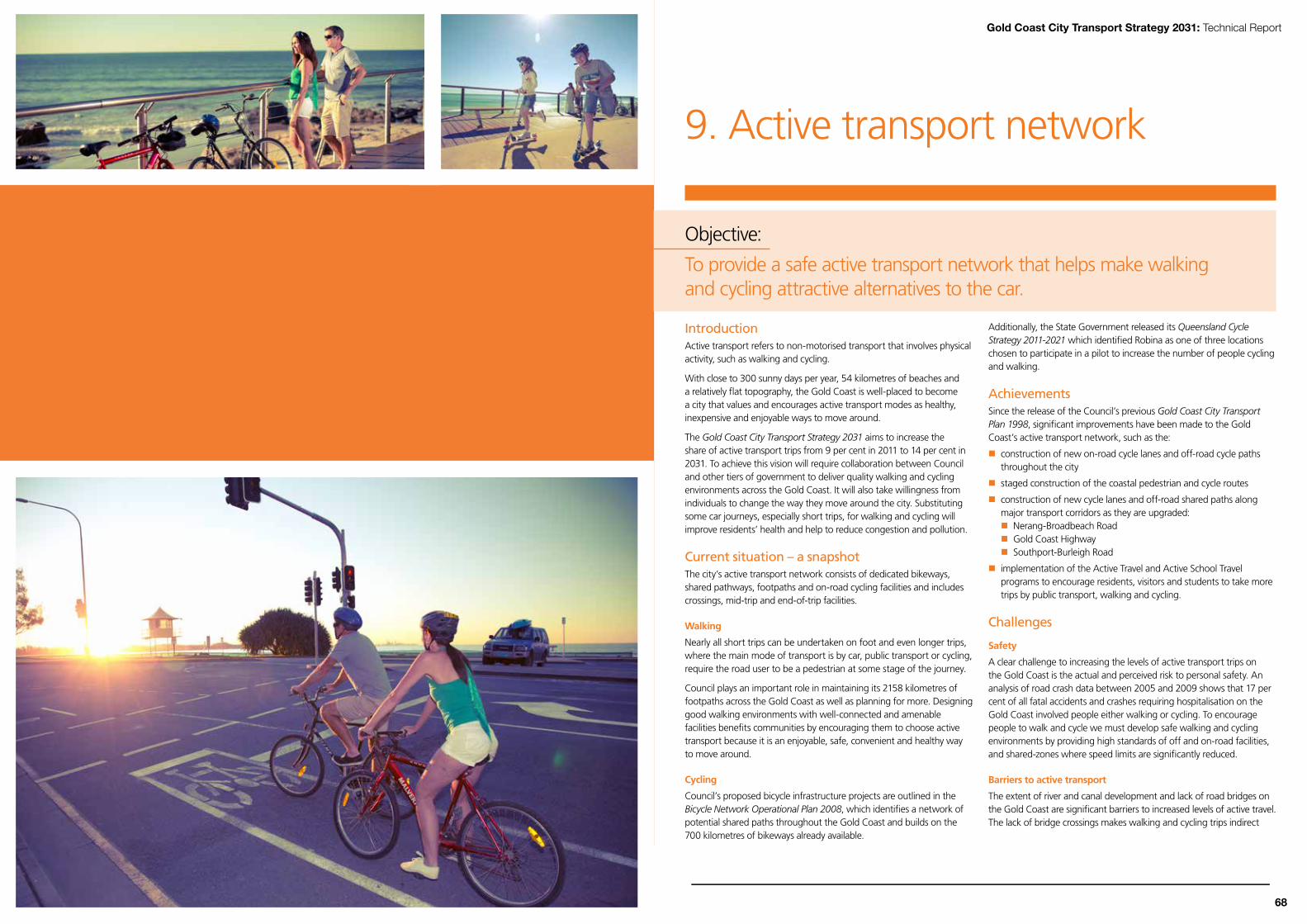
67
9. Active transport network
Objective:
To provide a safe active transport network that helps make walking and cycling attractive alternatives to the car.
IntroductionActive transport refers to non-motorised transport that involves physical activity, such as walking and cycling.
With close to 300 sunny days per year, 54 kilometres of beaches and a relatively flat topography, the Gold Coast is well-placed to become a city that values and encourages active transport modes as healthy, inexpensive and enjoyable ways to move around.
The Gold Coast City Transport Strategy 2031 aims to increase the share of active transport trips from 9 per cent in 2011 to 14 per cent in 2031. To achieve this vision will require collaboration between Council and other tiers of government to deliver quality walking and cycling environments across the Gold Coast. It will also take willingness from individuals to change the way they move around the city. Substituting some car journeys, especially short trips, for walking and cycling will improve residents’ health and help to reduce congestion and pollution.
Current situation – a snapshotThe city’s active transport network consists of dedicated bikeways, shared pathways, footpaths and on-road cycling facilities and includes crossings, mid-trip and end-of-trip facilities.
Walking
Nearly all short trips can be undertaken on foot and even longer trips, where the main mode of transport is by car, public transport or cycling, require the road user to be a pedestrian at some stage of the journey.
Council plays an important role in maintaining its 2158 kilometres of footpaths across the Gold Coast as well as planning for more. Designing good walking environments with well-connected and amenable facilities benefits communities by encouraging them to choose active transport because it is an enjoyable, safe, convenient and healthy way to move around.
Cycling
Council’s proposed bicycle infrastructure projects are outlined in the Bicycle Network Operational Plan 2008, which identifies a network of potential shared paths throughout the Gold Coast and builds on the 700 kilometres of bikeways already available.
Additionally, the State Government released its Queensland Cycle Strategy 2011-2021 which identified Robina as one of three locations chosen to participate in a pilot to increase the number of people cycling and walking.
AchievementsSince the release of the Council’s previous Gold Coast City Transport Plan 1998, significant improvements have been made to the Gold Coast’s active transport network, such as the:
construction of new on-road cycle lanes and off-road cycle paths throughout the city
staged construction of the coastal pedestrian and cycle routes
construction of new cycle lanes and off-road shared paths along major transport corridors as they are upgraded: Nerang-Broadbeach Road Gold Coast Highway Southport-Burleigh Road
implementation of the Active Travel and Active School Travel programs to encourage residents, visitors and students to take more trips by public transport, walking and cycling.
Challenges
Safety
A clear challenge to increasing the levels of active transport trips on the Gold Coast is the actual and perceived risk to personal safety. An analysis of road crash data between 2005 and 2009 shows that 17 per cent of all fatal accidents and crashes requiring hospitalisation on the Gold Coast involved people either walking or cycling. To encourage people to walk and cycle we must develop safe walking and cycling environments by providing high standards of off and on-road facilities, and shared-zones where speed limits are significantly reduced.
Barriers to active transport
The extent of river and canal development and lack of road bridges on the Gold Coast are significant barriers to increased levels of active travel. The lack of bridge crossings makes walking and cycling trips indirect
68
Gold Coast City Transport Strategy 2031: Technical Report

Figure 29 Brisbane's Bicentennial Bikeway
Figure 30 Tank Street bike lanes in Brisbane City
and inconvenient. Where bridge crossings are provided, they have limited or no provision for active transport modes.
Poor connectivity
The planning of bicycle paths and footpaths on the Gold Coast has traditionally focused on centres and coastal strips with limited planning for suburbs west of the Pacific Motorway. The majority of active transport paths are limited to the major road corridors with minimal facilities installed along local suburban roads.
There are a number of missing links for active transport users within and between major centres of activity, which can be resolved by retro-fitting bicycle paths and footpaths onto streets where no provisions currently exist. Where this is not possible due to limited street verge widths, Council must explore other measures such as the development of shared zones.
Lack of mid-trip and end-of-trip facilities
To increase the proportion of active transport users on the Gold Coast, a significant increase in the number and standard of mid-trip and end-of-trip facilities at appropriate locations is required. These could include:
bicycle lockers and cages for the safe storage of bicycles
showers and change rooms
clothing lockers.
The provision of mid-trip and end-of-trip facilities is a joint responsibility between Council, employers and the State Government.
Diverse cycling needs
In creating a safe and supportive environment for bike riders, Council must cater for a wide variety of user groups with different skill levels, including:
recreational bike riders – sport/touring/leisure
experienced and confident bike riders
inexperienced and cautious bike riders
beginners.
Funding and governance for pedestrian network
Currently, the majority of new footpaths are delivered through development assessment requirements placed on developers through the planning scheme. New footpath projects delivered outside the development assessment process are typically delivered under discretional divisional budgets. These divisional budgets are typically less than $1 million per annum and tend to be expended across a range of initiatives such as sporting grants, community buildings, as well as footpaths.
To achieve the active transport vision of providing residents and visitors with a connected network of cycling and walking routes, funding for footpaths must increase and their delivery managed via a coordinated ‘whole of active transport network’ approach.
Opportunities
Environmental benefits
Boosting the number of active transport trips on the Gold Coast will result in substantial environmental benefits, such as:
reduced air pollution and greenhouse gas emissions – active transport uses no fossil fuels
reduced need for road widening, which can have a pronounced effect on natural habitats
reduced road noise levels which can improve neighbourhood amenity.
Public transport benefits
Walking is an element of most public transport trips. By promoting active transport options, Council is simultaneously supporting public transport as an alternative to using cars. Improving accessibility for active transport users (footpaths, bikeways, bike parking and storage) will enable residents to more easily change their travel behaviour. Increased public transport patronage, in turn, will raise standards of public transport over time, with improved coverage, service levels and frequency. It will also help manage growing traffic congestion.
Health benefits
Walking and cycling are practical and inexpensive modes of transport and ideal forms of moderate exercise. One quarter of Gold Coast residents live within 5 kilometres of their place of employment, meaning there is significant potential to increase the number of people cycling to work.
Almost three-quarters of primary school students and half of all secondary school students live within 3 kilometres of their nearest school. Encouraging active travel will help to tackle rising rates of childhood obesity.
Economic benefits
Walking and cycling benefit businesses as an attractive active transport environment and public realm will encourage people to stop, socialise and shop locally.
CASE STuDy: BRiSBANE’S BiKEWAyS
Just 45 minutes up the Pacific Motorway from the Gold Coast is some of the best cycling infrastructure in the world. The Bicentennial Bikeway and the Tank Street bike lanes are examples of world-class off-road and on-road cycle infrastructure.
The Bicentennial Bikeway is Brisbane city’s busiest shared pathway and an important cycle and pedestrian link in the active transport network. It runs along the Brisbane River, connecting the CBD to Toowong, and each day it carries more than 4000 pedestrians and cyclists. The bikeway was built in 1988 and had become so popular, that it needed upgrading. Brisbane City Council has been progressively upgrading the Bicentennial Bikeway since 2008, with expected completion in 2013.
These projects show that more people will use bike lanes if they have some protection from traffic operating at higher speeds.
70 69
Gold Coast City Transport Strategy 2031: Technical Report

Themes and actions – active transport
Theme 12 Develop a connected and accessible active transport network.
Theme 13 Coordinate active transport planning and funding.
Theme 14 Provide for mid-trip and end-of-trip facilities at key locations.
Theme 15 Improve safety, standards and personal security.
Theme 16 Integrate active transport into the broader transport system.
Theme 12: Develop a connected and accessible active transport network
Connectionstoactivitycentres,educationalfacilitiesandpublictransport services
Connected networks of cycling and walking paths must provide safe, comfortable and direct routes from residential areas to major destinations such as schools, universities, public transport stations and activity centres. A significant amount of planning has been done in recent years to identify existing and future cycling routes, including:
Connecting SEQ 2031: An Integrated Regional Transport Plan for South East Queensland (Queensland Government)
Queensland Cycle Strategy (Queensland Government)
South East Queensland Principal Cycle Network Plan (Queensland Government)
Bicycle Network Operational Plan (Gold Coast City Council)
The Gold Coast City Transport Strategy 2031 supports these plans and builds on them. A key action of this strategy is the completion of the strategic cycle network, ‘Complete 5’, ‘Connect To’ and ‘Educated Ways’, as outlined in the Queensland Cycle Strategy and Connecting SEQ 2031.
Complete 5 Focus on completing the active transport network within
five kilometres of activity centres.
• On the Gold Coast, 91 per cent of people live within five kilometres of a centre.
• Many jobs are located in activity centres and most of the Coast’s universities and schools are within five kilometres of centres.
Connect To Focus on developing and upgrading walking and cycling routes
(and supporting facilities such as bike parking) that connect to major public transport stations and stops.
• This will extend the reach of the public transport network, boost public transport patronage and help manage congestion.
• Will alleviate significant pressure on park-and-ride facilities across the public transport network.
Educated Ways Focus on three-kilometre catchments around larger schools and
tertiary education establishments, with priority given where school communities are already running programs to encourage more cycling and walking.
• On the Gold Coast, 74 per cent of primary school students and 48 per cent of secondary school students live within three kilometres of their nearest school.
• Delivery of infrastructure under Educated Ways can include end-of-trip facilities.
Strategic cycle network Focus on cycle networks that link centres and are corridors
where higher numbers of bike riders are expected.
• These routes will form part of the principal cycle network.• Many of these strategic cycle network links will need to be
either off-road or on-road facilities, which separate bike riders from general traffic, to cater for all types of cyclists, pedestrians and other path users such as wheelchairs.
• Most strategic cycle network corridors will share facilities with pedestrians.
A new pedestrian plan for the Gold Coast
A city-wide pedestrian plan will be developed to identify gaps and deficiencies in the footpath network and recommend new links based on particular criteria. This plan will prioritise improvements to the city’s footpath network.
Better coastal pathways
The city's coastal pathways provide healthy and environmentally-friendly ways for pedestrians and bike riders to explore the Gold Coast’s beaches.
Council is investing in the improvement of the quality and capacity of these pathways to encourage healthier and more sustainable travel behaviour from Gold Coast residents and coastal visitors.
overcoming barriers
The Gold Coast has more than 480 kilometres of rivers and streams and 774 hectares of lakes, dams and canals which can represent a significant barrier to travel, particularly for pedestrians and cyclists.
Improving connections across waterways where there are concentrated volumes of pedestrian and cyclist movements is important for safe and efficient walking and cycling. Council, in partnership with the Department of Transport and Main Roads, will investigate improving walking and cycling environments at key locations.
As part of the Gold Coast light rail project, a new green bridge will be built adjacent to the Gold Coast Bridge (Sundale Bridge) connecting Southport and Main Beach. Other potential locations for improved pedestrian and cycling connections could include:
Chevron Island and the Gold Coast Arts Centre
Surfers Paradise and Chevron Island
Benowa and Carrara
Other locations where waterways create barriers to active transport will also be considered.
New bikeways
High-standard, high-speed bikeways (separated from general traffic either on-road or off-road) are proposed along key transport corridors including the Gold Coast heavy railway corridor and the Smith Street Motorway corridor.
Pedestrian priority zones
Council proposes to implement pedestrian priority zones within areas of:
Broadbeach
Burleigh Heads
Coolangatta
Coomera
Gold Coast Health and Knowledge Precinct
Main Beach
Robina
Southport
Surfers Paradise
Within areas of these zones, the road use priority is given to pedestrians. To achieve this aim, a number of measures are proposed to provide a more pedestrian-friendly and safe environment by lowering traffic speed, while balancing the needs of drivers. Car traffic would continue to have access to most parts of these areas.
72 71
Gold Coast City Transport Strategy 2031: Technical Report

Varsity Lakes station
Coomera station
Helensvale station
Robina station
Nerang station
Ormeau station
Beenleigh station
Varsity Lakes station
Coomera station
Helensvale station
Robina station
Nerang station
Ormeau station
Beenleigh station
GriffithUniversity
BondUniversity
GriffithUniversity
BondUniversity
Gold Coast AirportGold Coast Airport
Legend
GCCC boundary
Pacific Motorway
Future motorway/highway
Multi-modal arterial
Future multi-modal arterial
Train station
Train line
Future train line
Bypass road
Future bypass road
Community boulevard
Primary local access
Future primary local access
Secondary local access
Future secondary local access
MODAL LEGEND
Priority bike route
Pedestrian priority zone
Other bike routes exist and will be provided that connect to the priority routes and to local destinations
Note:
Map not to scale
BiggeraWaters
Varsity Lakes
Bundall
ElanoraElanoraCurrumbin
Hope Island
Pimpama
Varsity Lakes
Bundall
Maudsland
Reedy Creek
Mermaid Beach
Tugun
Palm Beach
Upper Coomera
Mt Tamborine
JacobsWell
Springbrook
CedarCreek
Tweed City Council
Steiglitz
Mudgeeraba
South StradbrokeIsland
Hinze Dam
Yatala
BiggeraWaters
Pimpama
Ormeau
Coomera
Nerang
Broadbeach
Surfers
Southport
Helensvale
Paradise
Beenleigh
Robina
Burleigh Heads
Coolangatta
Figure 31 Strategic active transport links and pedestrian priority zones
Figure 32 Lock'n'RidebikeshelteratMaylandsstation,Perth
Local links
To encourage an increase in walking and cycling, direct and accessible infrastructure within centres must be available to provide access to local facilities, public transport services and the strategic cycle network. These local active transport links will be vital in improving the permeability of local areas for pedestrians and cyclists.
Planning for active transport links must include the development of a continuous network that provides links between activity centres, along strategic routes, and directly to facilities within these areas, encouraging walking and cycling as a suitable alternative to the car for short trips.
Theme 12 actions:
Action Lead Timeframe
12.1 Regularly update the delivery program for the strategic cycle network.
Council Ongoing
12.2 Investigate opportunities for the construction of high-standard, high-speed bikeways along key active transport corridors, and develop concept plans.
Council/TMR
2013-14
12.3 Continue to progressively complete the coastal cycle and pedestrian routes.
Council 2013-31
12.4 Determine where green bridges and other active transport links across waterway, motorway and railway barriers are required throughout the city.
Council 2012-31
12.5 Deliver green bridges and other active transport links across waterways, motorways and railways.
Council 2014-31
12.6 Develop and implement a city-wide pedestrian plan to prioritise improvements to the footpath network at key locations.
Council 2013-31
12.7 Implement pedestrian priority zones within areas of Southport, Main Beach, Surfers Paradise, Broadbeach, Burleigh Heads, Coolangatta, Robina, Coomera, and the Gold Coast Health and Knowledge Precinct.
Council 2013-26
12.8 Develop and implement a city-wide cycle plan that focuses on providing ‘local links’ that give direct access from residential areas to major destinations such as schools, universities, public transport nodes and key centres for employment and local services.
Council 2013-31
Theme 13: Coordinate active transport planning and funding
The planning and development of the Gold Coast’s active transport network will require joint efforts by state and local governments. Through a coordinated approach across all levels of government we can adopt a ‘one-network’ approach to active transport planning on the Gold Coast. This means Council and the State Government will work together to plan and deliver projects, regardless of road ownership or jurisdiction.
Theme 13 actions:
Action Lead Timeframe
13.1 Set up an active transport reference group involving representatives from Council, State Government, the private sector and the community.
Council 2013-14
Theme 14: Provide for mid-trip and end-of-trip facilities at key locations
To make cycling and walking more attractive, mid and end-of-trip facilities must be significantly improved, such as seating, water bubblers, bicycle lockers, showers and change rooms. Making these facilities available across the active transport network and at key activity centres, employment sectors and high-frequency public transport stations will help boost levels of walking and cycling.
Providing these facilities is the responsibility of local government, State Government and local businesses. Council can play a role in placing conditions on development to ensure that appropriate facilities are provided in all relevant future developments.
CASE STuDy: LoCK ‘N’ RiDE BiKE SHELTERS iN PERTHTransperth provides bike hubs, free lockers or u-rails for people to conveniently and safely park their bike at all stations. Surveys of Perth train station car parks found that approximately 60 per cent of cars parked had driven less than three kilometres – an easy 10-minute ride for most people. Bike parking at public transport stations:
encourages more people to ride and take public transport gives bike riders peace of mind that their bikes will be kept secure provides passengers with an alternative to driving to a station.Best of all, bike parking in the Lock ‘n’ Ride shelters is free.
74 73
Gold Coast City Transport Strategy 2031: Technical Report

Theme 14 actions:
Action Lead Timeframe
14.1 Develop a facilities hierarchy to outline the type of mid-trip and end-of-trip facilities that should be provided at centres and public transport stations.
Council 2013-14
14.2 Identify opportunities to partner with private enterprise to establish user-pays end-of-trip facilities at key activity centres.
Council Ongoing
14.3 Work with event organisers to include mobile end-of-trip facilities (such as bike parking) as part of major events.
Council 2013-14
14.4 Deliver bike parking throughout the city. Council/TMR
2013-18
Theme15:Improvesafety,standardsandpersonalsecurity
Safety, or the perceived lack of it, is one of the main barriers to walking and cycling. Improved infrastructure standards will promote safe journeys. Gold Coast residents and visitors can also play their part by sharing the road space with bike riders and pedestrians.
Roundabouts and road hazards
Roundabouts can be dangerous for bike riders and pedestrians. In many cases, roundabouts are designed to encourage bike riders to use the outside edge of the traffic lane. This results in cars and bike riders sharing the lane, effectively allowing two traffic streams within the one lane. Further, in many locations, drainage gully pits are located on the outside edge of lanes and bike riders can get their tyres caught in the drains, causing serious injury.
On the Gold Coast, there are a number of roundabouts on key cycling routes that are potentially hazardous for bike riders. Improvements could include:
creating treatments which facilitate bicycles merging to the centre of approach lanes and travelling through roundabouts in the centre of lanes (rather than riding on the outside edge). Suggested strategies to achieve this include the use of bicycle pictograms in the middle of lanes, approach and entry lane narrowing to slow drivers (and to physically eliminate the space for two traffic streams in one lane), and diverging bicycle lanes which force cars to merge with bicycles
changing kerb and pavement marking to reduce vehicle speeds and improve cycle visibility
removing the roundabout and replacing it with other intersection controls (such as traffic signals).
improving road landscaping standards
There is a significant impediment to the creation of attractive active transport environments in road corridors through the road policies requiring crash zone clearance on state-controlled roads. This policy, outlined in the Department of Transport and Main Roads’ Road Landscape Manual, results in vegetation that would provide shade in these environments being removed. This policy should be moderated as it is car-focused to the exclusion of other road users such as pedestrians and bike riders.
Theme 15 actions:
Action Lead Timeframe
15.1 Develop and implement specific design standards that provide safe, accessible, high-quality cycling and walking infrastructure.
Council 2013-14
15.2 Develop and implement an ongoing maintenance program to ensure a high level of amenity and safety for users.
Council/TMR
2013-14
15.3 Undertake a pedestrian and cyclist crash analysis to identify safety issues and use data to develop a program of safety improvements.
Council 2013
15.4 Continue to apply Crime Prevention Through Environmental Design (CPTED) principles to all new active transport projects and identify existing facilities where upgrades are required.
Council/TMR
Ongoing
15.5 Plan and provide path widths based on level of service, taking into consideration pedestrian volumes and different types of path users.
Council Ongoing
15.6 Review the Road Landscape Manual to moderate policies around the management of vegetation on state-controlled roads.
TMR 2013-14
Theme 16: integrate active transport into the broader transport system
The Gold Coast City Council and the Department of Transport and Main Roads will work cooperatively to ensure that all major transport infrastructure projects on the Gold Coast include active transport facilities improvements. In addition, Council will encourage development of activity centres that are conducive to high levels of cycling and walking, and which:
provide a permeable and connected network with dedicated facilities on key routes
provide signage, landmarks and a legible street network
create public domains designed to encourage social activity
create centre designs that help reduce trip lengths to key destinations via short-cuts and removal of barriers.
Making public transport easier to access
Council research has shown that many residents feel that public transport stops and stations are difficult to reach on foot. To help reverse this perception, Council has developed corridor access mobility guidelines to improve walk-up access to public transport services and provide a better ‘whole-of-journey’ experience. The guidelines outline the urban design and planning treatments that Council can implement to make it easier for people to get to public transport stations.
By improving the active transport network around public transport stations, we can increase the mode share for sustainable travel and create vibrant, active spaces in our communities.
Theme 16 actions:
Action Lead Timeframe
16.1 Plan and implement a network of signs across the active transport network to help people find their way around.
Council From 2013
76 75
Gold Coast City Transport Strategy 2031: Technical Report

Signature projects – active transport networkSignature Project 1: Complete coastal cycle and pedestrian routes
We will complete the walking and cycling network along the coastal strip. This will encourage healthier and more sustainable transport choices from coastal residents and visitors.
Signature Project 2: Build green bridges in key locations
Council will plan and deliver green bridges between:
Chevron Island and the Gold Coast Arts Centre
Surfers Paradise and Chevron Island
Benowa and Carrara
Other locations where waterways, motorways and railways create barriers to active transport will also be considered. These green bridges will make it easier and quicker for walkers, bike riders and all other active Gold Coast residents to get where they need to go.
Signature Project 3: implement ‘community boulevards’ and pedestrian priority zones in key locations
Council will develop or reinforce community boulevards at Coolangatta, Coomera, Robina, Southport and Surfers Paradise – and progressively along the coastal strip – to give priority to pedestrians, bike riders and public transport. The boulevards will be designed to cater for only low volumes of cars. Where necessary, bypass roads will be provided to ensure appropriate capacity for cars.
In addition, we will implement zones where pedestrians are given priority within areas of Broadbeach, Burleigh Heads, Coolangatta, Coomera, the Gold Coast Health and Knowledge Precinct, Main Beach, Robina, Southport and Surfers Paradise. Cars would continue to have access within these zones, but priority will be given to pedestrians. Traffic speeds would be lowered to achieve this aim.
Signature Project 4: Develop and implement a cycle plan for the city
There are a number of missing links for bike riders within and between major centres of activity. Council will develop and implement a cycle plan that will make it easier to fill in missing bike path segments to create a safe and connected network. This will focus on providing ‘local links’ that give direct access from residential areas to major destinations such as schools, universities, public transport nodes and key centres for employment and local services.
Signature Project 5: Develop and implement a pedestrian plan for the city
Council will develop and implement a city-wide pedestrian plan which identifies gaps and recommends new pathways for construction. This will provide a more strategic approach to providing footpaths across our city.
Active transport actions for Council
No. Action Lead area Timeframe
12.1 Regularly update the delivery program for the strategic cycle network. City Transport Ongoing
12.2Investigate opportunities for the construction of high-standard, high-speed bikeways along key active transport corridors, and develop concept plans.
City Transport * 2013-14
12.3 Continue to progressively complete the coastal cycle and pedestrian routes. Engineering Services 2012-2031
12.4Determine where green bridges and other active transport links across waterway, motorway and railway barriers are required throughout the city.
City Transport/Engineering Services 2012-2031
12.5Deliver green bridges and other active transport links across waterways, motorways and railways.
Engineering Services/City Transport 2012-2031
12.6Develop and implement a city-wide pedestrian plan to plan and prioritise improvements to the footpath network at key locations.
City Transport 2013-2031
12.7Implement pedestrian priority zones within areas of Southport, Main Beach, Surfers Paradise, Broadbeach, Burleigh Heads, Coolangatta, Robina, Coomera, and the Gold Coast Health and Knowledge Precinct.
City Transport 2013-2026
12.8
Develop and implement a city-wide cycle plan that focusses on providing ‘local links’ that give direct access from residential areas to major destinations such as schools, universities, public transport nodes and key centres for employment and local services.
City Transport 2013-2031
13.1Set up an active transport reference group involving representatives from Council, State Government, the private sector and the community.
City Transport 2013-14
14.1Develop a facilities hierarchy to outline the type of mid-trip and end-of-trip facilities that should be provided at centres and public transport stations.
City Transport 2013-14
14.2Identify opportunities to partner with private enterprise to establish user-pays end-of-trip facilities at key activity centres.
City Transport 2013-14
14.3Work with event organisers to include mobile end-of-trip facilities (such as bike parking) as part of major events.
City Transport Ongoing
14.4 Deliver bike parking throughout the city. Engineering Services * 2013-2018
15.1Develop and implement specific design standards that provide safe, accessible, high-quality cycling and walking infrastructure.
City Transport 2013-14
15.2Develop and implement an ongoing maintenance program to ensure a high level of amenity and safety for users.
Traffic Management & Operations * 2012-13
15.3Undertake a pedestrian and cyclist crash analysis to identify safety issues and use data to develop a program of safety improvements.
City Transport 2013
15.4Continue to apply Crime Prevention Through Environmental Design (CPTED) principles to all new active transport projects and identify existing facilities where upgrades are required.
City Transport * Ongoing
15.5Plan and provide path widths based on level of service, taking into consideration pedestrian volumes and different types of path users.
City Transport Ongoing
16.1Plan and implement a network of signs across the active transport network to help people find their way around.
City TransportFrom 2013
KEy * Joint with TMR
78 77
Gold Coast City Transport Strategy 2031: Technical Report

Gold Coast City Transport Strategy 2031: Technical Report
80
Figure 33 overview of active transport actions
Any time of the day, nothing beats a blast on the bike. I find it an easy way to get from A to B. Plus, you can always find a park wherever you go.
Do you make walking or cycling part of your everyday travel?
Mike Dudley, Mermaid Waters
Varsity Lakes station
Coomera station
Helensvale station
Robina station
Nerang station
Ormeau station
Beenleigh station
Varsity Lakes station
Coomera station
Helensvale station
Robina station
Nerang station
Ormeau station
Beenleigh station
GriffithUniversity
BondUniversity
GriffithUniversity
BondUniversity
Gold Coast AirportGold Coast Airport
BiggeraWaters
Bundall
Elanora
Bundall
ElanoraCurrumbin
Hope Island
Maudsland
Reedy Creek
Mermaid Beach
Tugun
Palm Beach
Upper Coomera
Mt Tamborine
South StradbrokeIsland
JacobsWell
Springbrook
CedarCreek
Tweed City Council
Steiglitz
Mudgeeraba
Hinze Dam
Yatala
BiggeraWaters
Pimpama
Ormeau
Coomera
Nerang
Broadbeach
Surfers
Southport
Helensvale
Paradise
Beenleigh
Robina
Burleigh Heads
Coolangatta
Legend
GCCC boundary
Pacific Motorway
Multi-modal arterial
Train station
Train line
Existing cycle network
Proposed cycle network
Priority cycle route
LINKS
Coastal network
1a Sapphire Street - Marine Parade
1b Nerang River Crossing
1c Cli�ord Street - First Avenue
1d Alexandra Avenue - Chairlift Avenue
1e 23rd Avenue - Laceys Lane
1f Thrower Drive - Woodgee Street
1g Toolona Street - Matters Street
Southport - Burleigh Road
2a Loders Creek - Winchester Street
2b Fremar Street - Villa Court
2c Lake Orr Drive - Rainbird Bridge
2d Tree Tops Plaza - Junction Road
Labrador - Carrara Road
3a Gold Coast Highway - Musgrave Avenue
3b Crestwood Drive - Nerang- Southport Road
3c Cotlew Street - Nerang River
Gold Coast Railway/M1
4 Coomera - Elanora
Hope Island Road
5a M1 - Coombabah Creek
5b Coombabah Creek - Columbus Drive
Smith Street
6 M1 - Edmund Rice Drive
Nerang - Broadbeach Road
7a Birmingham Road - Hoy Street
7b Bermuda Street - Ocean Way
Cheltanham/Cottesloe/Paci�c Avenue
8a Robina Town Centre Drive - Pizzey Drive
8b Gold Coast Highway - Ocean Way
Christine Avenue
9 Stanford Avenue - Ocean Way
Nineteenth Avenue
10 Guineas Creek Road - Ocean Way
Pedestrian priority zones as well as on-road and o�-road cycle improvements
11 Coomera, Parklands, Southport, Main Beach, Surfers Paradise, Broadbeach, Robina, Burleigh Heads, Coolangatta, Coastal/ Beach, Bond University
11
11
5a
5b
1a
3a
2a3b
6
1b
3c
7a1c
2b
7b
1d
8a
2c9
2d
10 1e
1f
1g
4
11
11
11
11
11
11
11
8b
Map not to scale
11
Map not to scale
79