2013 vendor track, taking your data off the grid by austin mulder
TRANSCRIPT

Taking Your Data off the GRID Austin Mulder
www.neotreks.com
GIS in the Rockies 2013

Introductions
www.neotreks.com

NeoTreks GRID is a mobile GIS
mapping platform that allows for the
sharing of geospatial data between
office and field work.
Take your proprietary or commercial
mapping content “off the grid” with
the tap of the finger.
GRID
www.neotreks.com

Public web maps
Private web services
KML
Shapefile
Can all be cached and taken into
the field
GRID
www.neotreks.com

Record field observations, take
photos, make markups then share
them back to the office
GRID

Login credentials determine
available content in the Layers list.
With sophisticated account
management you can determine
what data each of your employees
can access.
GRID

NeoTreks Cloud allows you to
upload and manage geospatial data
from your PC or iPad
GRID

Share your
screen via
Download
map tile
cache
Configure
application
settings
Zoom to
your location
Display
“Layers”
list
Display
“Markups”
list
Display
“Tools”
list
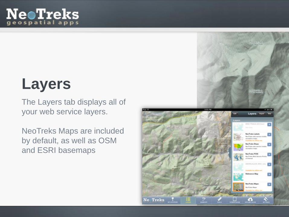
The Layers tab displays all of
your web service layers.
NeoTreks Maps are included
by default, as well as OSM
and ESRI basemaps
Layers

Layers and sub-layers can be
toggled on and off.
Transparencies can be
adjusted
Layers

Add your own web service
layers using the “New” button.
ArcGIS Tiled, ArcGIS
Dynamic, WMS and OSM
services are supported
Layers

To download your maps
simply tap the GRID tiles that
cover your area of interest
and select “Download”.
Once a tile is cached locally,
the grid becomes clear. That
data is now available offline
Caching

Points Adjust, size color, and style
Custom Symbols Choose from our symbol
library, ESRI symbols, or
use your own
Markups

Lines Freehand Drawing
Line segment placement
Markups

Polygons Adjust line color / width /
style, fill color / width / style
Markups

Linear measurements In-line multiple point
measurements can be made
in metric or imperial
Tools

Area measurements define the total square miles
or kilometers, with perimeter
distances noted.
Tools
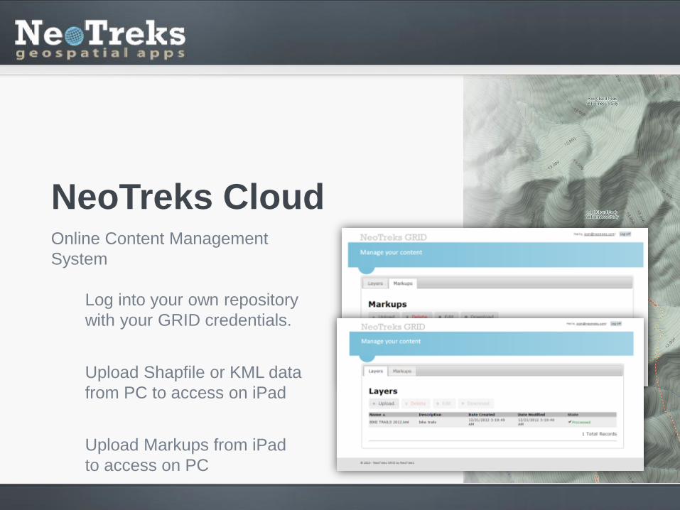
Online Content Management
System
Log into your own repository
with your GRID credentials.
Upload Shapfile or KML data
from PC to access on iPad
Upload Markups from iPad
to access on PC
NeoTreks Cloud

A systematic
sampling of
the Middle
Creek basin
north of Vail,
CO.
Demonstration Forest and Tree Survey Sampling

Free on iTunes Subscription required to
access all features
Includes NeoTreks Maps for
offline use
Corporate Licensing Custom layers, logos, and
features available
Pricing

Taking Your Data off the GRID Austin Mulder
www.neotreks.com
Thank You
GIS in the Rockies 2013