2005 nw esri conference - city of yakima, washington yakima transit & refuse avl client, server...
TRANSCRIPT
2005 NW ESRI Conference - City of Yakima, Washington
Yakima Transit & Refuse AVL
Client, Server and Web Applications
Tom E. Sellsted
Supervising Senior Analyst (GIS geek)
Information Services Division
2005 NW ESRI Conference - City of Yakima, Washington
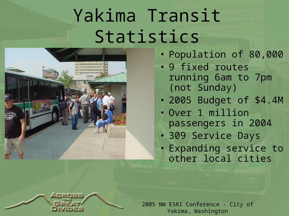
Yakima Transit Statistics
• Population of 80,000• 9 fixed routes running
6am to 7pm (not Sunday)• 2005 Budget of $4.4M• Over 1 million
passengers in 2004• 309 Service Days• Expanding service to
other local cities

2005 NW ESRI Conference - City of Yakima, Washington
Why TransitAVL?
• Dispatching Tool
• Show current bus positions on route
• Calculate estimated arrival times
• Share information with riders
• Measure Yakima Transit performance
• Leverage Yakima’s other AVL/GIS/Web knowledge
2005 NW ESRI Conference - City of Yakima, Washington
TransitAVL Hardware
• Sierra Wireless MP750 Modems
• Cost $950/unit $40/per month (AYCE-$80)
• Integrated Trimble GPS using TAIP
• Consistent position messaging
• Panic Switch
• No session stealing as with CDPD
• Some latency
2005 NW ESRI Conference - City of Yakima, Washington
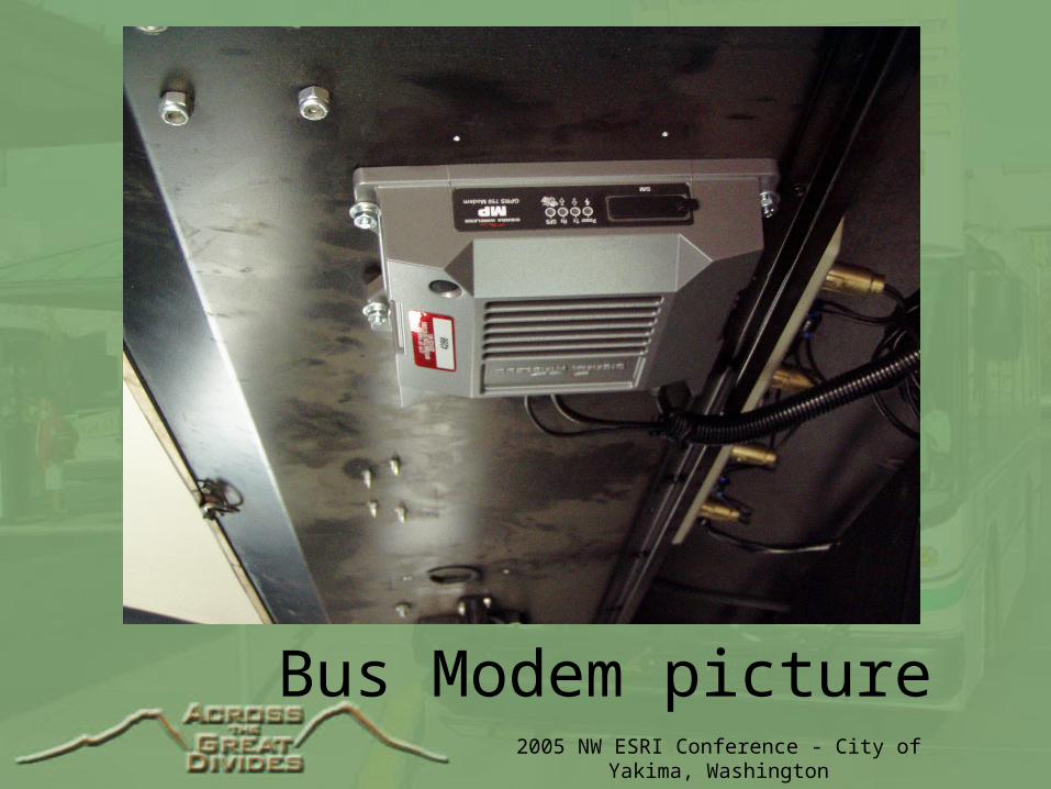
Bus Modem picture
2005 NW ESRI Conference - City of Yakima, Washington
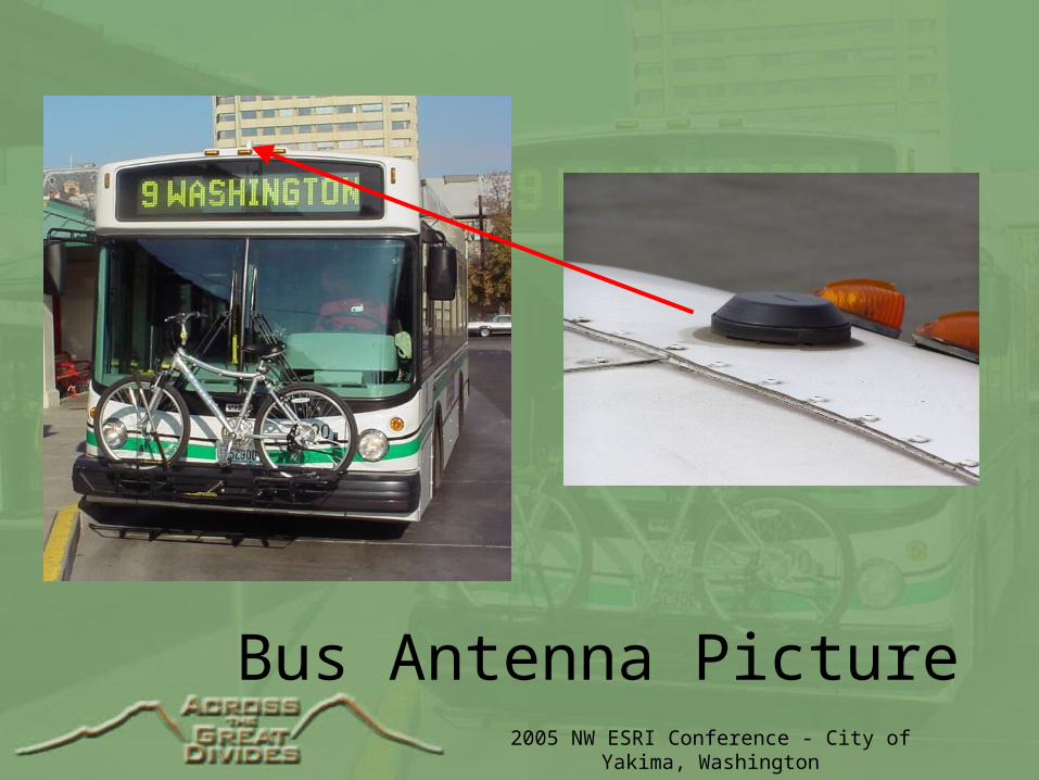
Bus Antenna Picture
2005 NW ESRI Conference - City of Yakima, Washington
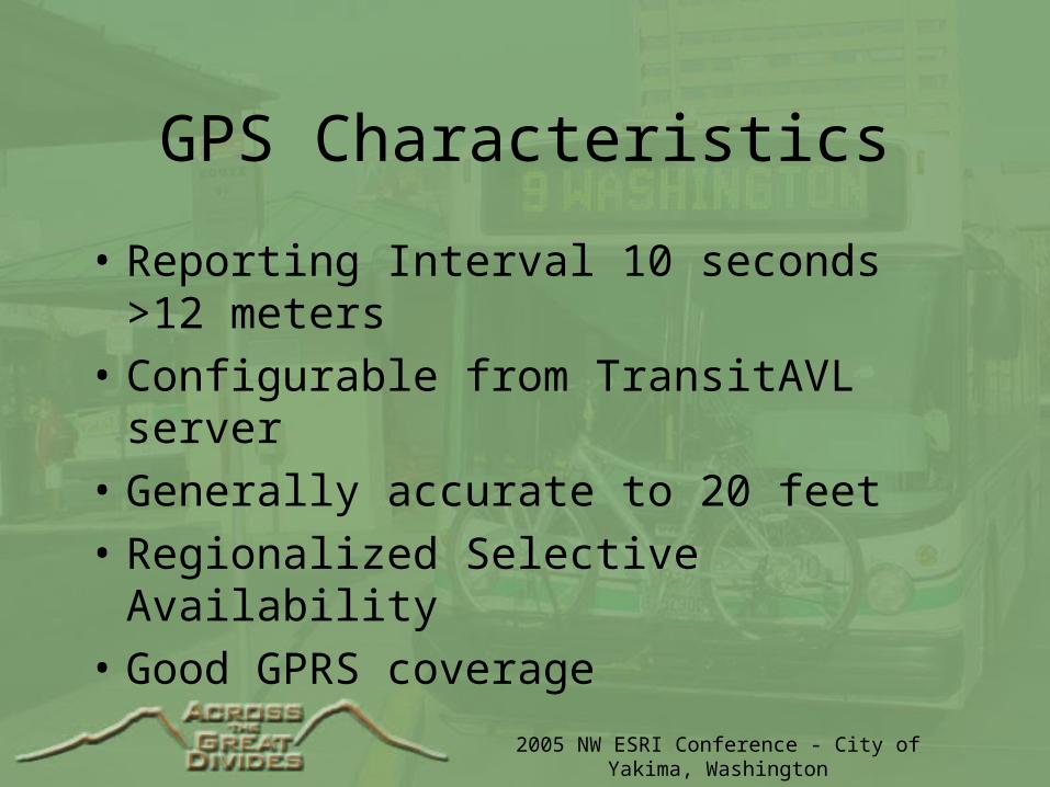
GPS Characteristics
• Reporting Interval 10 seconds >12 meters
• Configurable from TransitAVL server
• Generally accurate to 20 feet
• Regionalized Selective Availability
• Good GPRS coverage
2005 NW ESRI Conference - City of Yakima, Washington
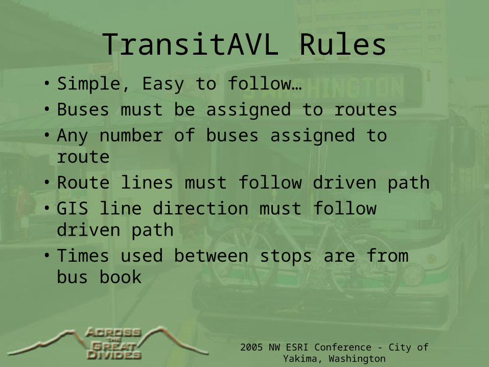
TransitAVL Rules• Simple, Easy to follow…
• Buses must be assigned to routes
• Any number of buses assigned to route
• Route lines must follow driven path
• GIS line direction must follow driven path
• Times used between stops are from bus book
2005 NW ESRI Conference - City of Yakima, Washington
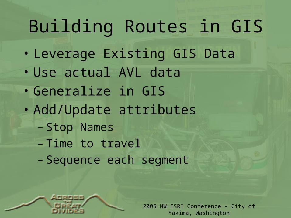
Building Routes in GIS
• Leverage Existing GIS Data
• Use actual AVL data
• Generalize in GIS
• Add/Update attributes– Stop Names– Time to travel– Sequence each segment
2005 NW ESRI Conference - City of Yakima, Washington
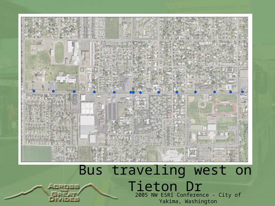
Bus traveling west on Tieton Dr
2005 NW ESRI Conference - City of Yakima, Washington
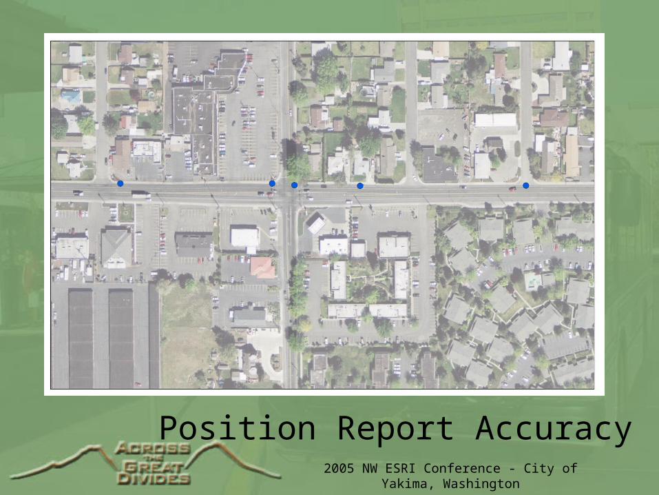
Position Report Accuracy

2005 NW ESRI Conference - City of Yakima, Washington
Time, Speed & Delay
2005 NW ESRI Conference - City of Yakima, Washington
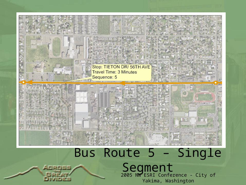
Bus Route 5 – Single Segment
2005 NW ESRI Conference - City of Yakima, Washington
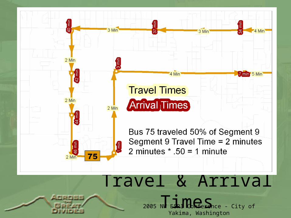
Calculating Arrival Times
• Buses assigned to specific routes
• Recalculated with every new position report
• Times recalculated for major stop points
• Use position to select route segment
• Interpolation/percentage traveled segment
• Add interpolated time to other road segments by sequence number
2005 NW ESRI Conference - City of Yakima, Washington
Travel & Arrival Times

2005 NW ESRI Conference - City of Yakima, Washington
TransitAVL Server• Basic GIS Application• Receives all position reports• Calculates/estimates arrival times• Controls bus assignments• Relays position reports, bus assignments & alerts
to TransitClients and TransitWeb• Saves position data for later examination• Update/Add/Delete Buses, Routes, Users
2005 NW ESRI Conference - City of Yakima, Washington
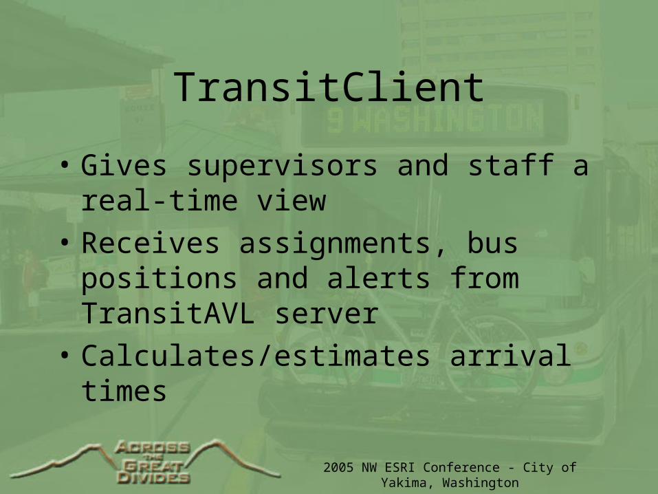
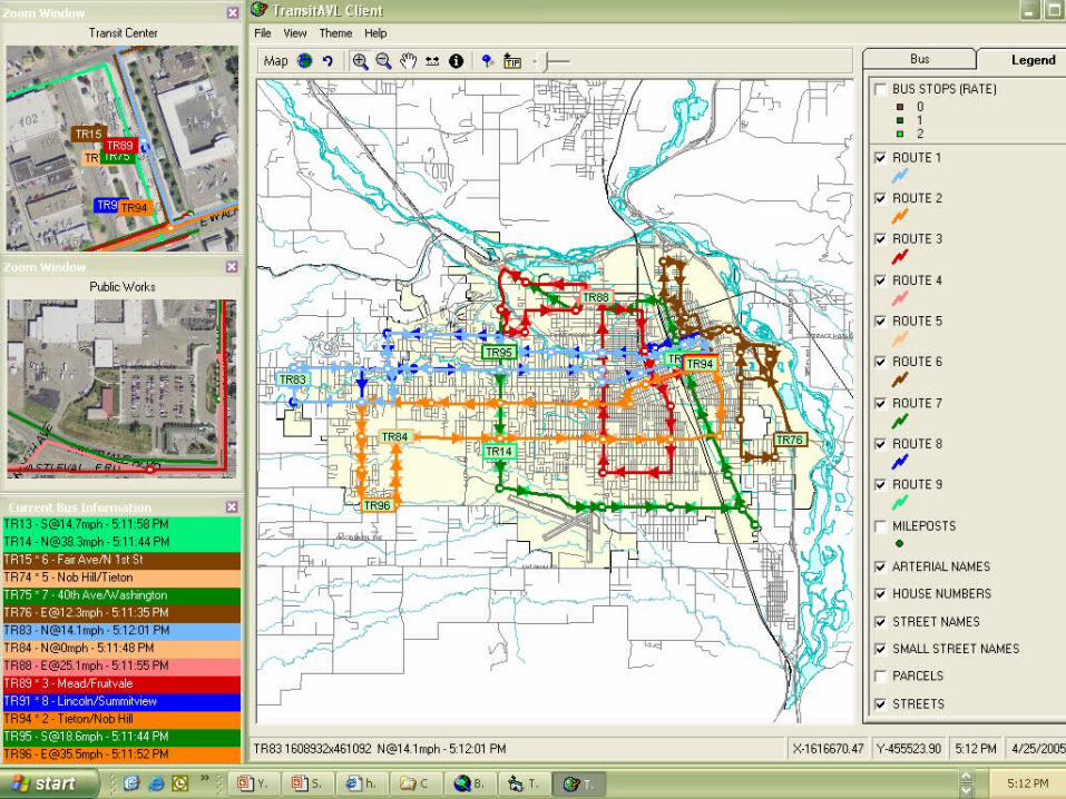
TransitClient
• Gives supervisors and staff a real-time view
• Receives assignments, bus positions and alerts from TransitAVL server
• Calculates/estimates arrival times
2005 NW ESRI Conference - City of Yakima, Washington
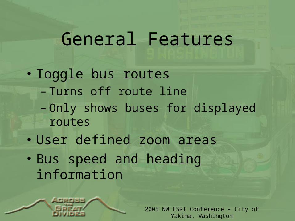
General Features
• Toggle bus routes– Turns off route line– Only shows buses for displayed routes
• User defined zoom areas
• Bus speed and heading information
2005 NW ESRI Conference - City of Yakima, Washington
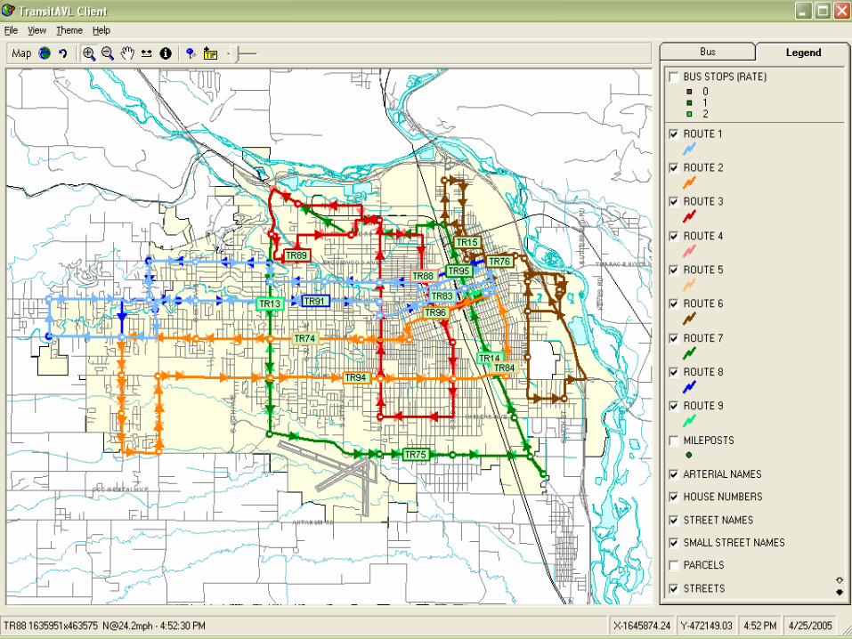
Overview Map
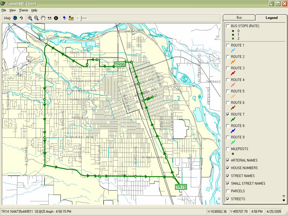
2005 NW ESRI Conference - City of Yakima, Washington
Single Route
2005 NW ESRI Conference - City of Yakima, Washington
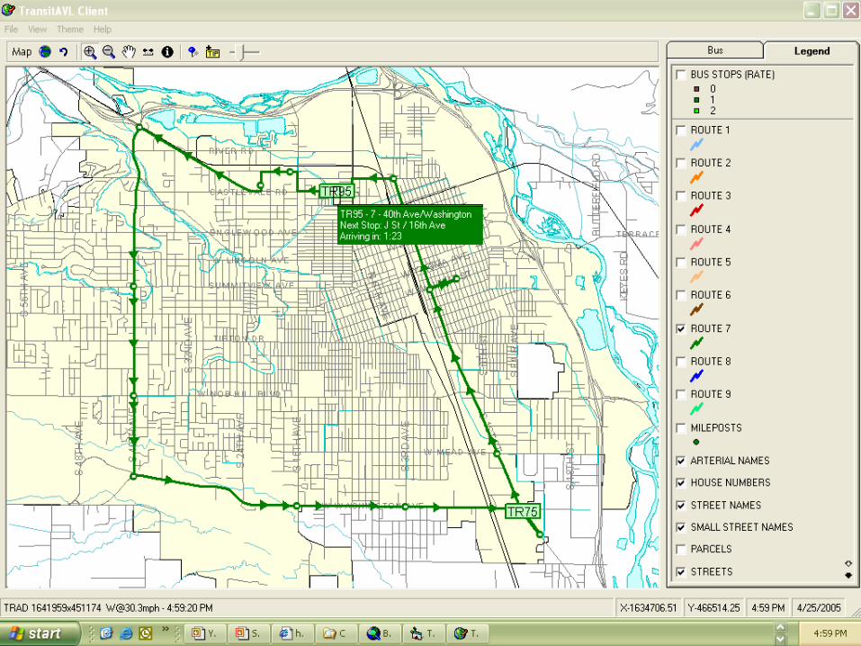
Hover over Bus
2005 NW ESRI Conference - City of Yakima, Washington
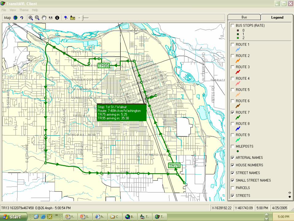
Hover over Stop
2005 NW ESRI Conference - City of Yakima, Washington
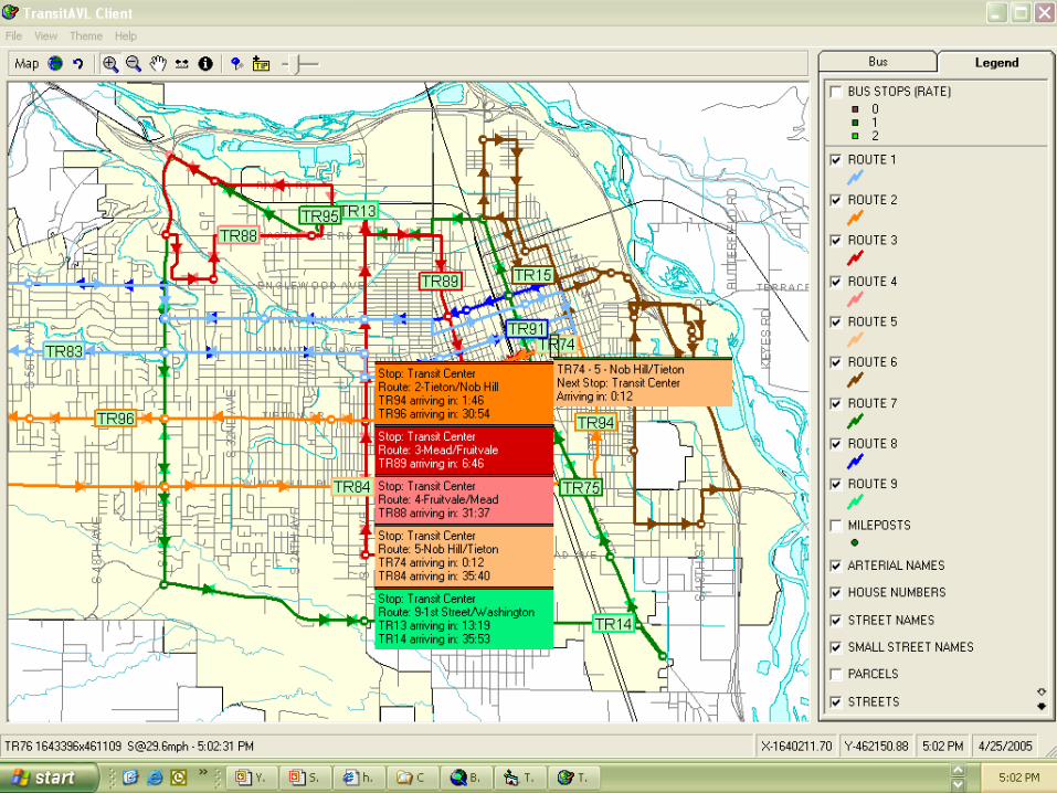
Hover over Multiple
2005 NW ESRI Conference - City of Yakima, Washington
Zoom & Info windows
2005 NW ESRI Conference - City of Yakima, Washington
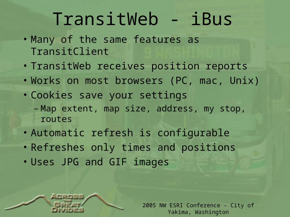
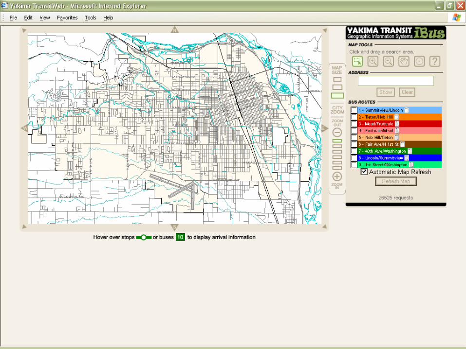
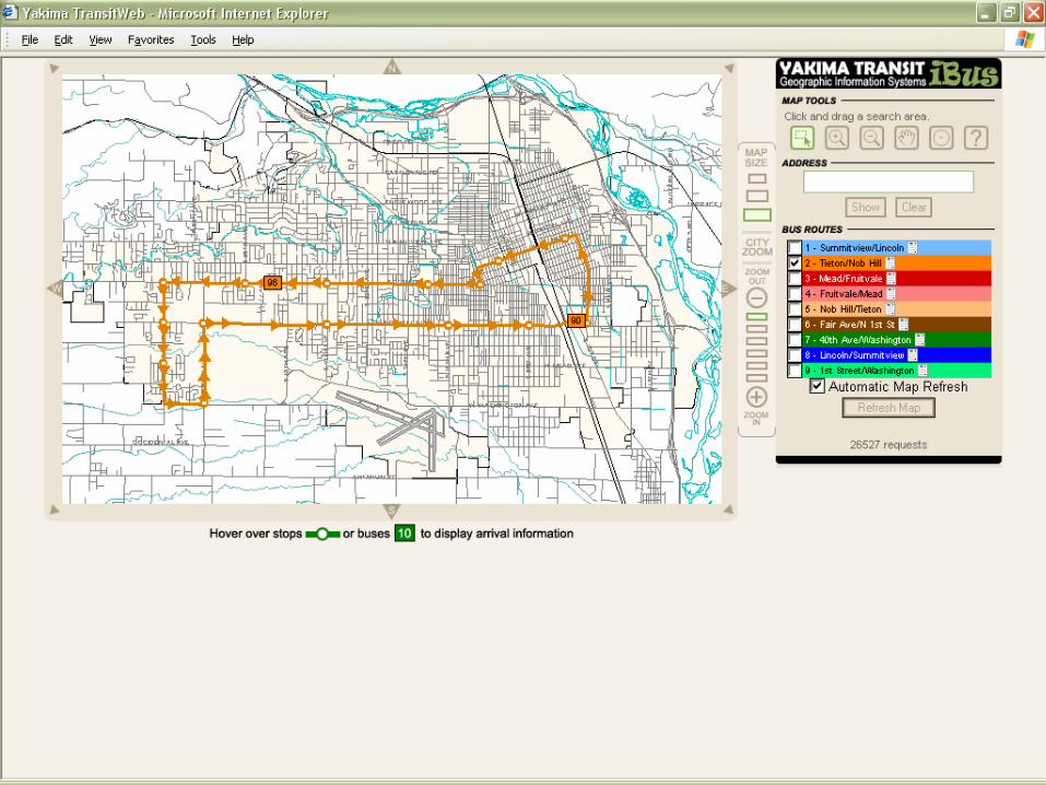
TransitWeb - iBus• Many of the same features as TransitClient
• TransitWeb receives position reports
• Works on most browsers (PC, mac, Unix)
• Cookies save your settings– Map extent, map size, address, my stop, routes
• Automatic refresh is configurable
• Refreshes only times and positions
• Uses JPG and GIF images
2005 NW ESRI Conference - City of Yakima, Washington
Basic Map
2005 NW ESRI Conference - City of Yakima, Washington
One Route
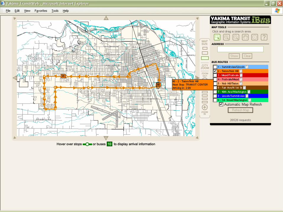
2005 NW ESRI Conference - City of Yakima, Washington
Hover Bus
2005 NW ESRI Conference - City of Yakima, Washington
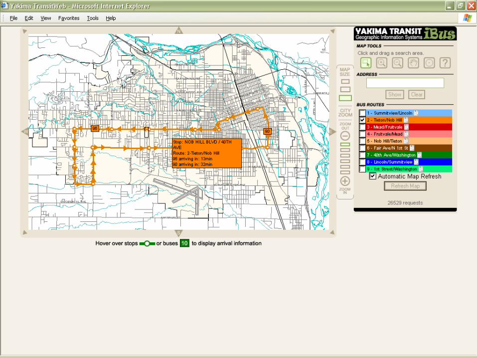
Hover Stop
2005 NW ESRI Conference - City of Yakima, Washington
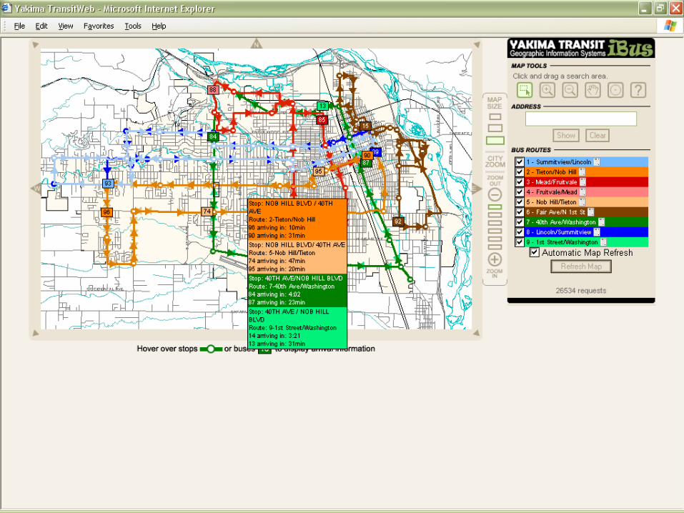
Multiple Routes 1
2005 NW ESRI Conference - City of Yakima, Washington
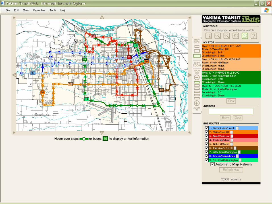
My Stop
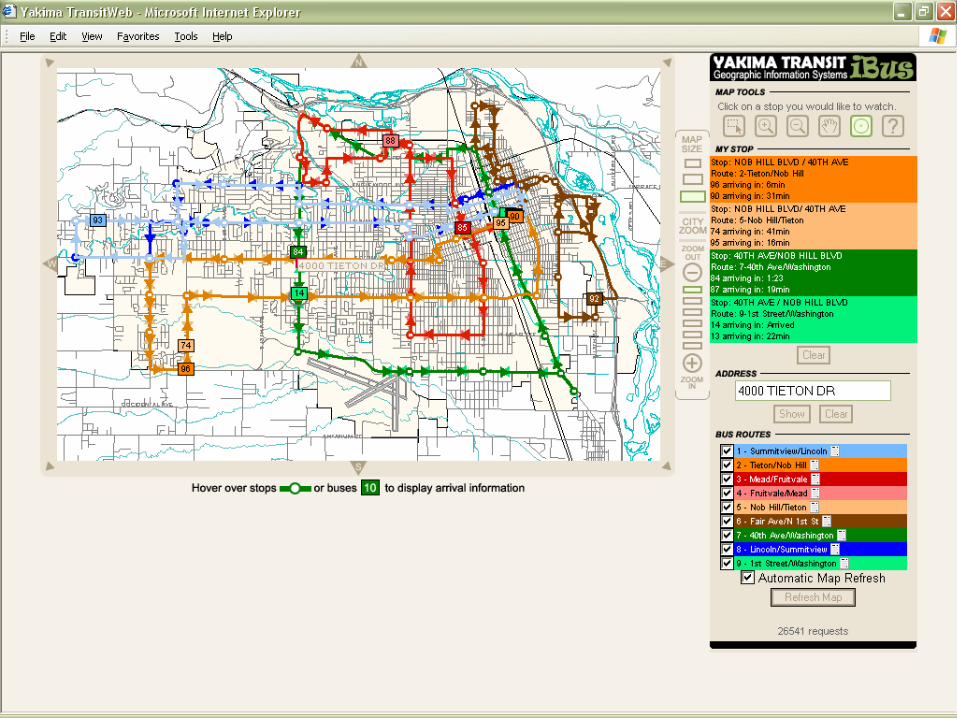
2005 NW ESRI Conference - City of Yakima, Washington
Address
2005 NW ESRI Conference - City of Yakima, Washington
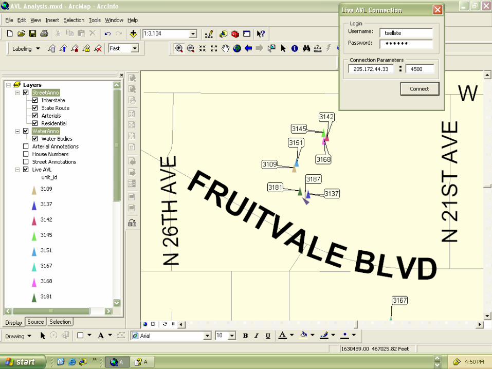
AVL Data• Transit Analysis
– Rider Queries– Route Timing– Performance
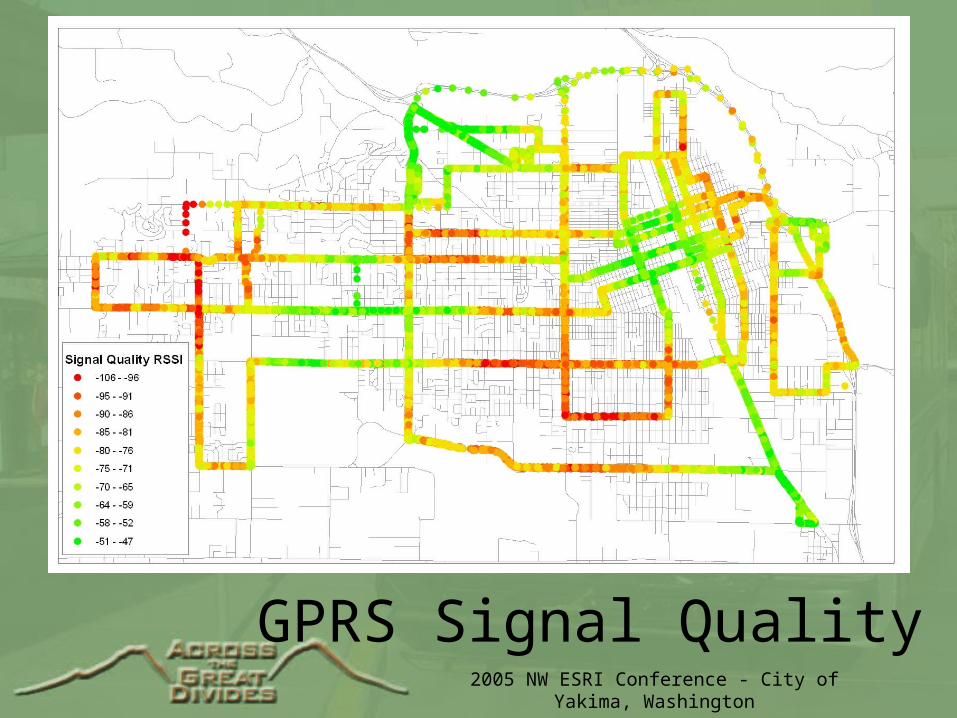
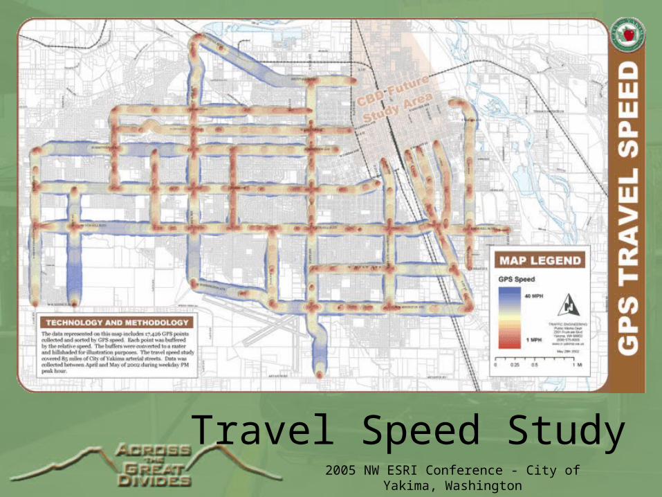
• General Analysis– Travel Speed Study– GPRS Signal Quality
2005 NW ESRI Conference - City of Yakima, Washington
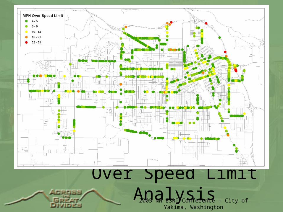
Over Speed Limit Analysis
2005 NW ESRI Conference - City of Yakima, Washington
GPRS Signal Quality
2005 NW ESRI Conference - City of Yakima, Washington
Travel Speed Study
2005 NW ESRI Conference - City of Yakima, Washington
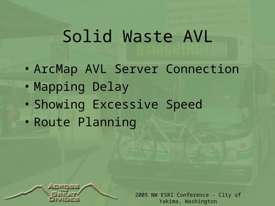
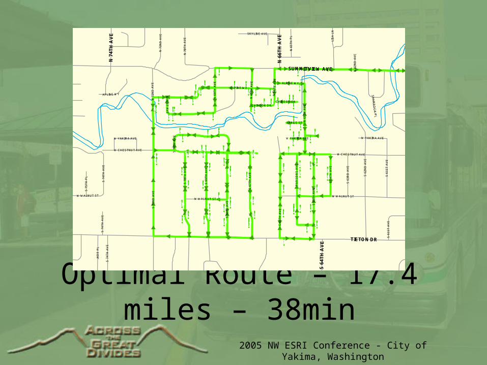
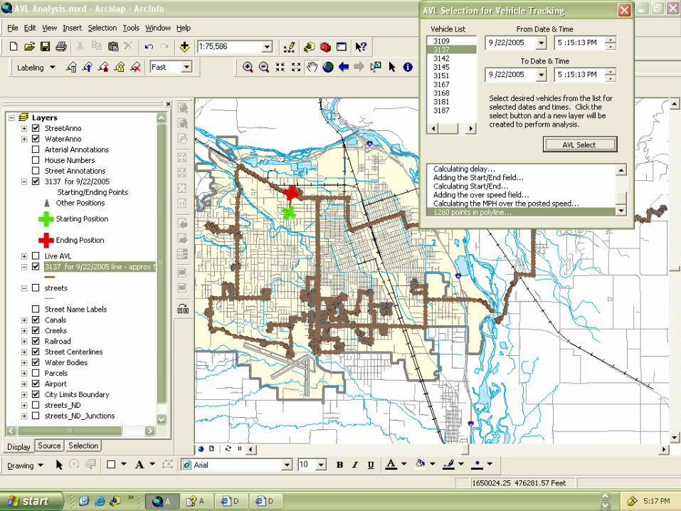
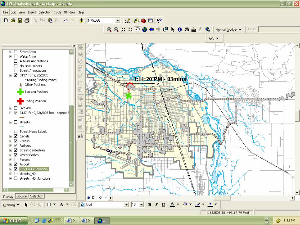
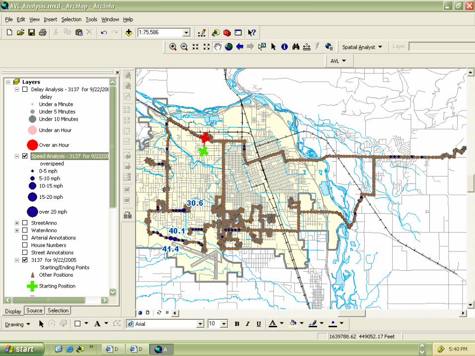
Solid Waste AVL
• ArcMap AVL Server Connection
• Mapping Delay
• Showing Excessive Speed
• Route Planning
2005 NW ESRI Conference - City of Yakima, Washington
2005 NW ESRI Conference - City of Yakima, Washington
!2!3
!4!5
!6
!7
!8
!9
!10
!11
!12
!13
!14
!15
!16
!17
!18!19
!20
!21!22
!23!24
!25
!26
!27
!28
!29
!30
!31 !32
!33
!34
!35
!36
!37
!38
!39
!40!41
!42!43
!44!45!46!47!48!49
!50!51
!52
!53!54!55
!56!57
!58
!59!60!61!62
!63!64!65
!66!67!68
!69!70
!71!72
!73
!74
!75
!76
!77 !78!79
!80
!81!82
!83
!84
!85
!86!87!88
!89
!90!91
!92!93
TIETON DR
SUMMITVIEW AVE
S 7
2N
D A
VE
ALPINE WY
S 6
6T
H A
VE
S 6
8T
H A
VE
S 6
2N
D A
VE
S 7
0T
H A
VE
S 6
9T
H A
VE
W CHESTNUT AVE
S 6
7T
H A
VE
S 6
5T
H A
VE
N 6
5T
H A
VE
PA
RS
ON
S A
VE
CHINOOK DR
N 7
2N
D A
VE
N 6
9T
H A
VE
N 6
7T
H A
VE
S 6
4T
H A
VE
S 6
3R
D A
VE
N 6
6T
H A
VE
W WALNUT ST
N 6
8TH
PL
N 70TH AVE
N 62N
D A
VE
BARGE ST
W YAKIMA AVE
N 7
1S
T A
VE
S 7
4T
H A
VE
S 7
1S
T A
VE
APLIN E WY
N 7
2ND
AV
E
W YAKIMA AVE
ALPINE WY
CHINOOK DR
N 6
2N
D A
VE
S 7
0T
H A
VE
CHINOOK DR
W WALNUT ST
W CHESTNUT AVE
W YAKIMA AVEW YAKIMA AVE
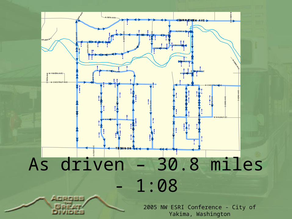
As driven – 30.8 miles - 1:08
2005 NW ESRI Conference - City of Yakima, Washington
Optimal Route – 17.4 miles – 38min
!9!10
!21!15
!20
!11
!19
!34
!14
!13
!12
!89
!46
!55
!66
!65
!56!57
!67
!61!60
!59!58!68
!69
!54
!72
!63
!71
!64!70
!53
!75
!52
!76
!51!77
!80
!79!78
!2!92
!91!90!88!37!38!42
!86!43
!44
!85!84!81
!29!27
!28
!3!62!73!74
!31!32!33
!30!35!36
!41!82
!40!83
!39
!8!7
!6
!16!5!17
!18
!93!87
!4
!50
!26
!25!22!23
!24
!47!48!45!49
TIETON DR
SUMMITVIEW AVE
N 6
6T
H A
VE
N 7
4T
H A
VE
S 6
4T
H A
VE
S 7
2N
D A
VE
ALPINE WY
S 7
0T
H A
VE
S 6
9T
H A
VE
W WALNUT ST
S 6
6T
H A
VE
S 6
8T
H A
VE
S 6
2N
D A
VE
W CHESTNUT AVE
S 6
7T
H A
VE
S 6
5T
H A
VE
N 6
5T
H A
VE
S 6
1S
T A
VE
PA
RS
ON
S A
VE
JAD
E P
L
N 7
0T
H A
VE
CHINOOK DR
N 6
9T
H A
VE
N 6
7T
H A
VE
S 7
4T
H A
VE
S 6
4T
H A
VE
S 6
3R
D A
VE
N 7
2N
D A
VE
N 6
6T
H A
VE
SKYLINE AVE
N 6
5T
H P
L
LIS
A L
N
S 7
5T
H P
L
N 6
2N
D A
VE
BARGE ST
W YAKIMA AVE
N 7
1S
T A
VE
SH
AM
RO
CK
PL
APLINE WY
ALPINE WY
W YAKIMA AVE
S 7
4T
H A
VE
S 7
4T
H A
VE
W CHESTNUT AVE
W YAKIMA AVE
S 7
0T
H A
VE
W WALNUT ST
S 6
1S
T A
VE
CHINOOK DR
W WALNUT ST
N 7
2N
D A
VE
2005 NW ESRI Conference - City of Yakima, Washington
2005 NW ESRI Conference - City of Yakima, Washington
2005 NW ESRI Conference - City of Yakima, Washington
2005 NW ESRI Conference - City of Yakima, Washington
Questions?
Tom E. Sellsted
City of Yakima, Washingtonemail:[email protected]://www.ci.yakima.wa.us/gis