16 bakonyi magyarics - unece.org 2009... · content tisza river basin institutional and legal...
TRANSCRIPT

Péter Bakonyi
András Magyarics

Content� Tisza River Basin
� Institutional and Legal Framework of the Co-operation
� Some Examples of the Co-operation (good & bad)
� Conclusions
22-23 April 2009 Geneva 2
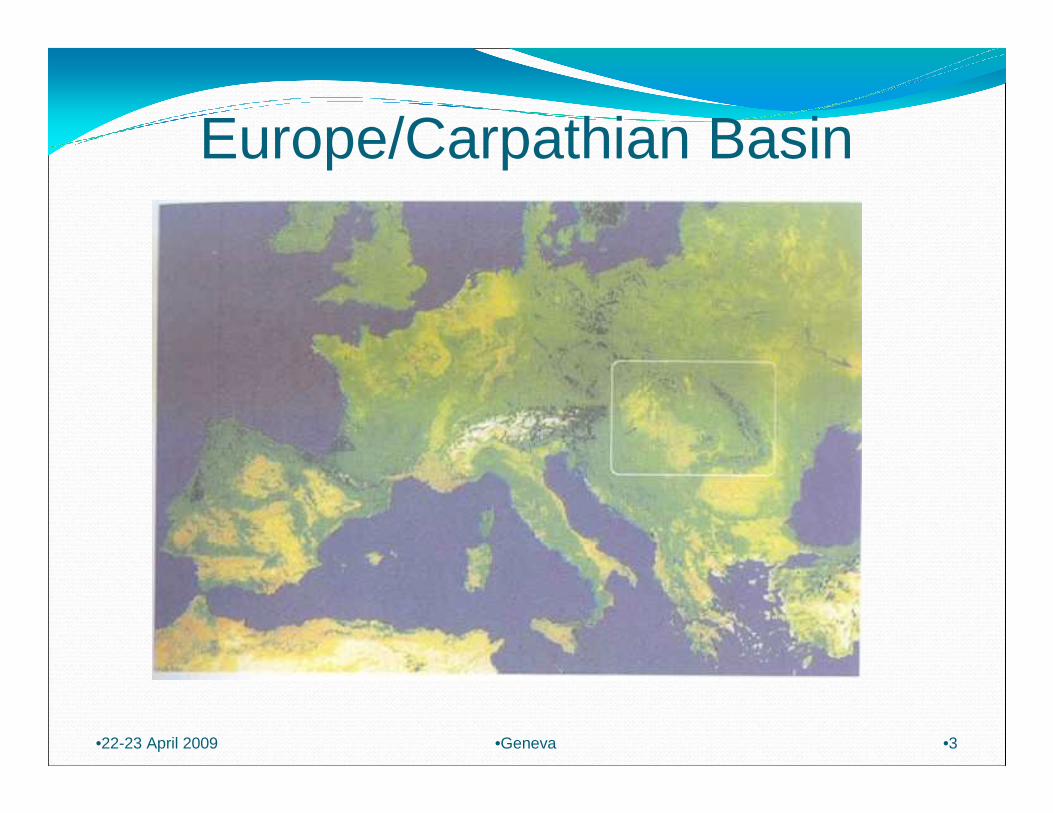
Europe/Carpathian Basin
•22-23 April 2009 •3•Geneva
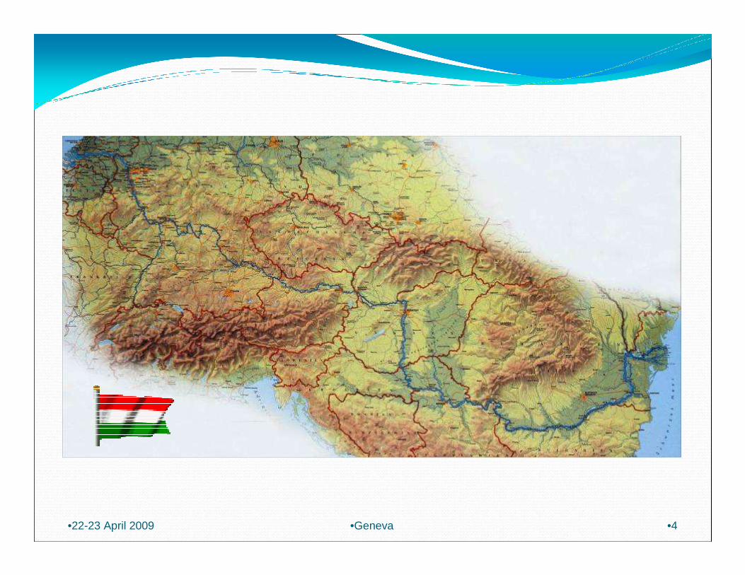
•22-23 April 2009 •4•Geneva
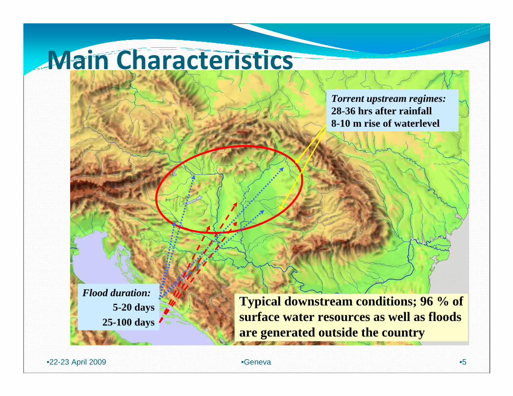
Main Characteristics
Torrent upstream regimes:28-36 hrs after rainfall 8-10 m rise of waterlevel
Flood duration:5-20 days
25-100 days
Typical downstream conditions; 96 % ofsurface water resources as well as floodsare generated outside the country
•22-23 April 2009 •5•Geneva

Water Level Hydrograph at Tivadar
•22-23 April 2009 •6•Geneva

•22-23 April 2009 •Geneva •7
Length of primary defences 4200 km, protected fluvi al floodplain 21200 km 2, 23% of the territory of the country, which is uniqu e in Europe

Frequency of damages caused by
water in Hungary
�Floods: smaller scale in every 2-3 years� significant in every 5-6 years� devastating in every 10-12 years
�Access water: every 2-3 years
�Drought: every 3-5 years
•22-23 April 2009 •8•Geneva

Values at risk of flooding
� Arable land 40 %
� Railways 32 %
� Main roads 15 %
� Communities 646
� Population affected 2,3 millions
� Total value at risk USD 30 billions
•22-23 April 2009 •9•Geneva
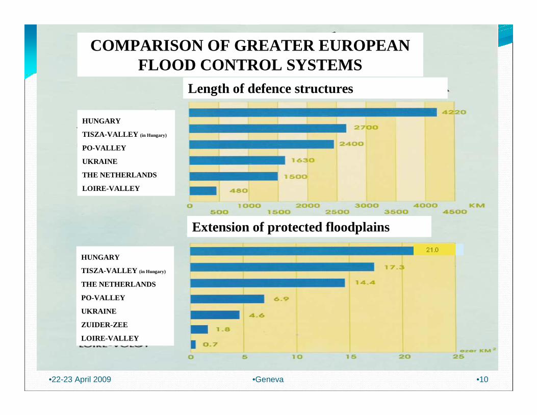
COMPARISON OF GREATER EUROPEAN FLOOD CONTROL SYSTEMS
Length of defence structures
HUNGARY
TISZA-VALLEY (in Hungary)
PO-VALLEY
UKRAINE
THE NETHERLANDS
LOIRE-VALLEY
Extension of protected floodplains
HUNGARY
TISZA-VALLEY (in Hungary)
THE NETHERLANDS
PO-VALLEY
UKRAINE
ZUIDER-ZEE
LOIRE-VALLEY
•22-23 April 2009 •10•Geneva

Water (and Environmental) Institutional Arrangement within the Public Administration in Hungary Including the
Organizations against Flood Events
Ministry of Environment and Water
Central Directoratefor
Water and Environment
National Inspectorate for
Environment and Water
Regional Environmental
and Water Boards (12)
Regional Inspectorates (10)
National Parks (10)
•22-23 April 2009 •11•Geneva

Rivers Entering and Leaving Hungary
•22-23 April 2009 •12•Geneva
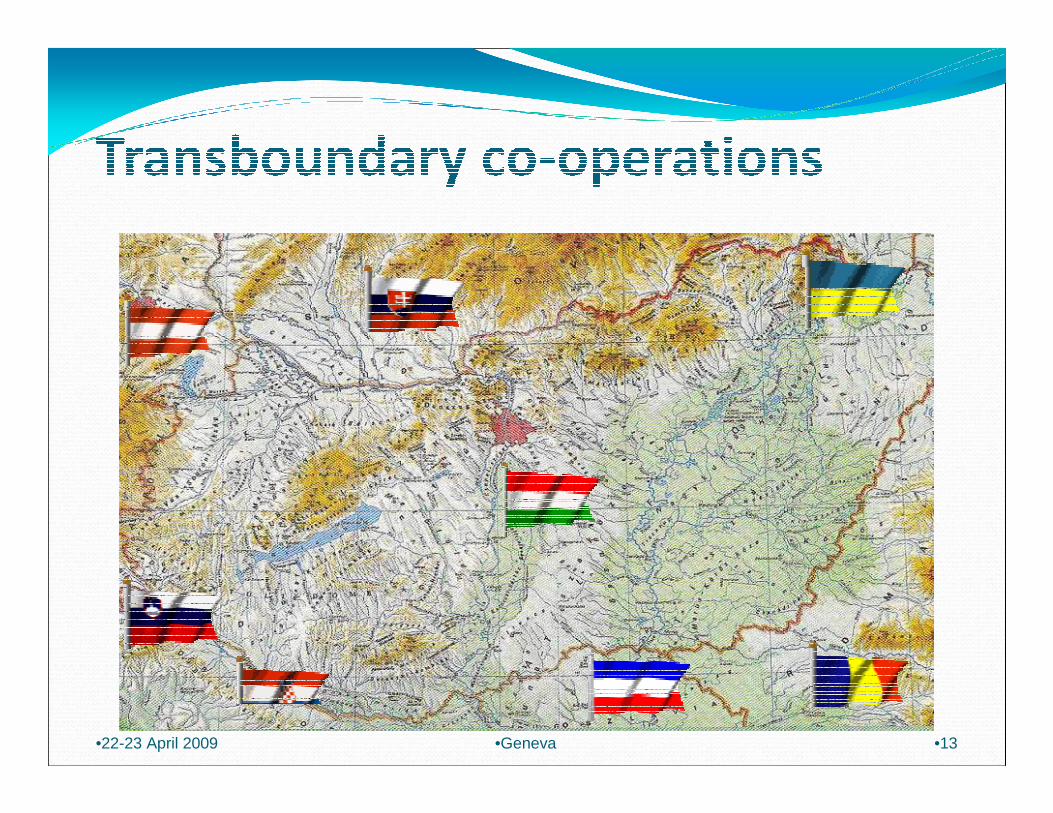
•22-23 April 2009 •13•Geneva
2300 m Asl
100 m Asl
1900 m Asl
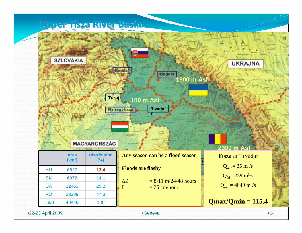
Upper Tisza River BasinUpper Tisza River Basin
•22-23 April 2009 •14•Geneva
Tokaj
Tivadar
Area (km 2)
Distribution (%)
HU 6627 13,413,4
SK 6972 14,1
UA 12461 25,2
RO 23389 47,3
Total 49449 100
Any season can be a flood season
Floods are flashy
∆Z = 8-11 m/24-48 hoursI = 25 cm/hour
Tisza at Tivadar
Qmin= 35 m3/s
Qátl= 239 m3/s
Qmax= 4040 m3/s
Qmax/Qmin = 115.4
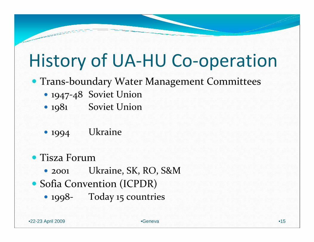
History of UA-HU Co-operation� Trans-boundary Water Management Committees
� 1947-48 Soviet Union
� 1981 Soviet Union
� 1994 Ukraine
� Tisza Forum� 2001 Ukraine, SK, RO, S&M
� Sofia Convention (ICPDR)� 1998- Today 15 countries
•22-23 April 2009 •Geneva •15

Hungarian-Ukrainian co-operation
� Joint projects
� Bereg region localisation (confinement) plan
� Bereg drainage system
� Tisza river training plan
� Research on the effects of deforestation
� Maintenance of the joint monitoring system
� Impact assessment of the development of flood protection systems
� Harmonisation of design flood levels
•22-23 April 2009 •Geneva •16

•22-23 April 2009 •17•Geneva

Development of flood protection systems
•22-23 April 2009 •18•Geneva


Visó
Szamos
Lónyay-fõcs.
Tisza
Túr
Tisza
Feke
te-T
isza
Kasz
ó
Tara
c
Borsa Nagyág
Tisza
Tala
bor
Latorca
Ung
Ljuta
Turja
Tapoly
Ond
ava La
bo
rc
Bodro
g
Tisza
Iza
UNGVÁR központ
NYÍREGYHÁZA KÖZPONT
Ágerdımajor
Nagyecsed
Kocsord
Császárszállás Csenger
V.oroszi
Garbolc
Vásáros-namény
Técsı
Krasznaátjátszó
LáposmezıRahó
Kaszómezı
Nagybocskó
Rahóátjátszó
Körösmezı
Királymezı
Dragobrat
Huszt(Tiszakirva)
Huszt
Husztátjátszó
Ökörmezı
Alsókalocsa (Rókarét)
Alsókalocsa átjátszó
Dolha
Nyéresháza
Szolyva
Vezér-
szállás
Sóhát
Malomrét
Nagyberezna
Turjamezı
Polena
Alsóhideg-
patak
Fülöpfalva
Repenye
Toronya
Zalomiszko
Alsóverecke
Alsóremete
Munkács
Pláj
átjátszó
NAGYBÁNYA
Záhony
Tiszabecs
Sonkád
Dombrád
Szabolcs-veresmart
Tiszabercel
Kótaj
Kántor-jánosi
Tunyog-matolcs
TOKAJ
Jelmagyarázat:Vízgyőjtı határ
Országhatár
Csapadék és léghı- mérséklet
Vízállás
Vízállás USGS
Vízállás TACIS
Csapadék USGS
Csapadék TACIS
Vízminıség
T vm r k zpontá é ı ö
Tivadar
SZLOV KIAÁ
UKRAJNA
ROMNIA
Á
Joint Hungarian-Ukrainian remote sensing system
•22-23 April 2009 •20•Geneva

• In Hungary (31):• 19 hydrological• 2 hydrometeorological• 2 ultrasonic Q meter• 5 automatic GW well• 3 automatic pump st.
• In Ukraine (35):• 25 hydrological
• (10 UHF, 15 satelite)
• 10 hydrometeorological• (5 UHF, 5 satelite)
•22-23 April 2009 •21•Geneva
Joint Hungarian-Ukrainian Remote Sensing System
Remote Sensing Stations

Tisza Técsı vízrajzi-vízminıségi- és Huszt-Tiszakirva vízrajzi távmérı állomás
A Latorca Szolyva USGS vízrajzi távmérı állomás
Hungarian-Ukrainian co-operation
•22-23 April 2009 •22•Geneva
Tisza at Técsı hydrological and WQ and at Huszt-Tiszkirva a hydrological station
Latorca at Szolyva an USGS remote hydrological station

Radar and satelite picture for forecasting
NapkorNapkor BudapestBudapest
National compositNational composit Digital satelite picturesDigital satelite pictures
•22-23 April 2009 •23•Geneva

Humanitarian aid of the Hungarian Governement
Hungarian-Ukrainian co-operation
•22-23 April 2009 •24•Geneva
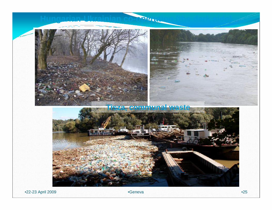
Tisza, communal waste
Hungarian-Ukrainian co-operation (the dark side)
•22-23 April 2009 •25•Geneva
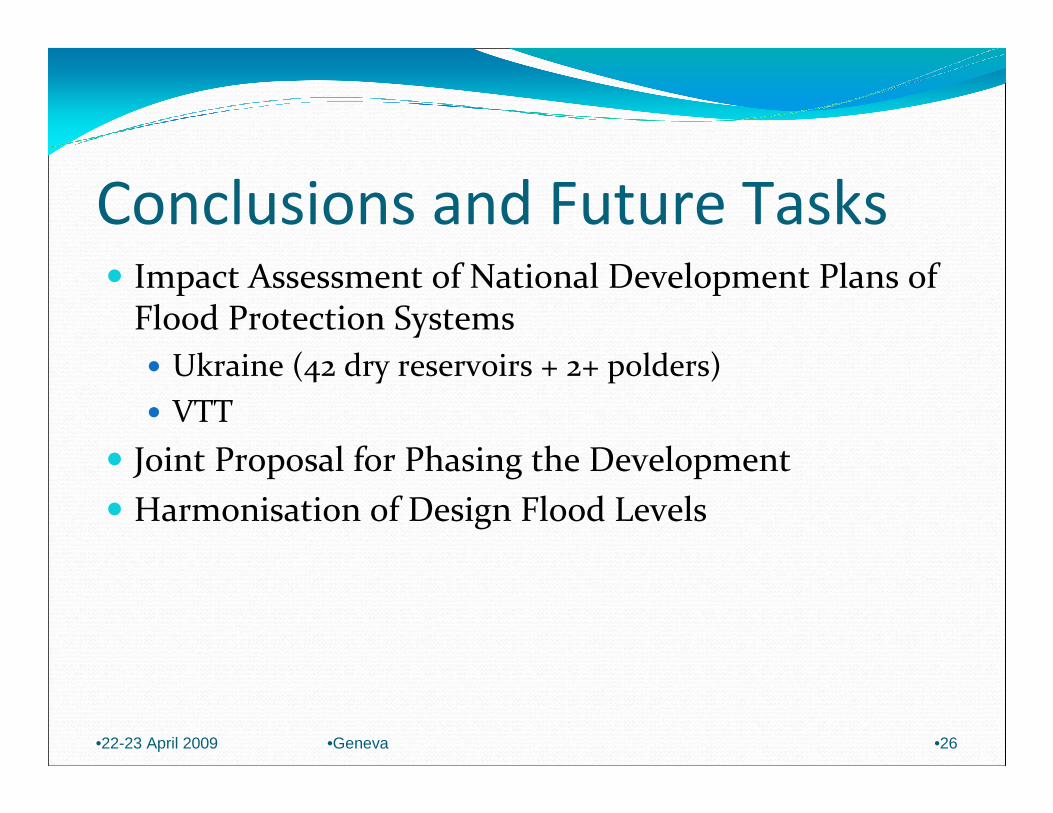
Conclusions and Future Tasks� Impact Assessment of National Development Plans of
Flood Protection Systems
� Ukraine (42 dry reservoirs + 2+ polders)
� VTT
� Joint Proposal for Phasing the Development
� Harmonisation of Design Flood Levels
•22-23 April 2009 •Geneva •26

•22-23 April 2009 •27•Geneva