contents · open geospatial specifications) as synonyms to denote the two ways of describing...
TRANSCRIPT
~ ~ d ~ ~ l u r t & ~ p o w u ~ ( 1 - ~ ~ 1 ~ ~ ~ ~ ~ i ;-i
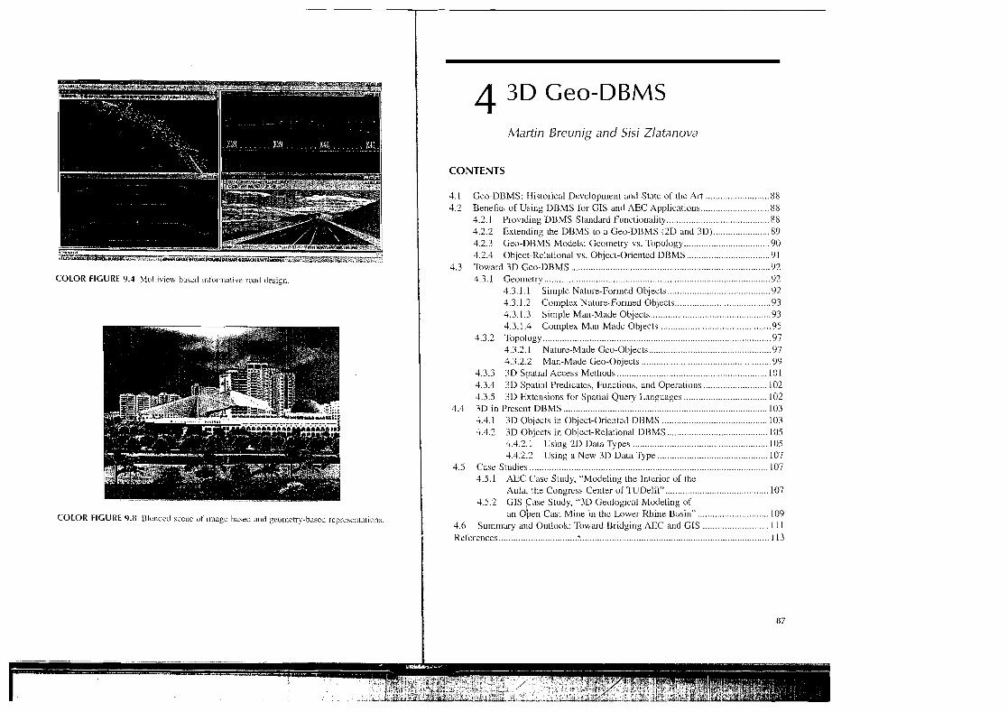
COLOR FIGURE 9.4 hl~~l~ib~ew b~aeil ~nforn~dt~vc ~udd deslgr~
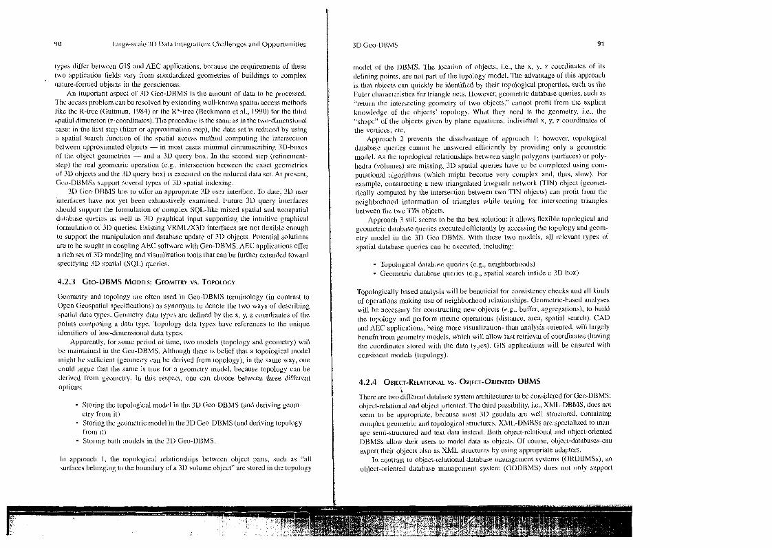
COLOR FIGURE 9.11 Ulur~dcd scerlc of ~mage-based and geometry-based reprrariltntions .
Martin Breunig and Sisi Zlatanova
CONTENTS
.......................... 4.1 Geo-DBMS: Historical Development and State of the Art 88 4.2 Benefits of Using DBMS Lor GIS and AEC Applications ............................ 88
4.2.1 Providing DBMS Standard Functionality .......................................... 88 4.2.2 Extending the DBMS to a Geo-DBMS (2D and 3Dj ....................... 8') 4.2.3 Geo-DBMS Models: Gco~netry vs . Topology ........... ... ................ 90 4.2.4 Object-Relational vs . Object-Oriented DBMS .................................. 91
4.3 'Ibward 3D Gro-DBMS ........................ .. ................................................... 92 4.3.1 Geometry .................. ... . .... ............................................................ 9 2
.......................................... 4.3.1.1 Sinlplc Nature-Formed Objects 92 4.3.1.2 Colnplex Nature-Formed Objects ....................................... 93 4.3.1.3 Sirnple Man-Made Objccts ................................................. 93 4.3.1.4 Complex Man-Madc Objects ........................................... 95
4.3.2 Topology ............................................................................................. 97 4.3.2.1 Nature-Made Geo-Objects .................................................. 97 4.3.2.2 Man-Made Geo-Objects ................................................... 9'9
4.3.3 3D Spatial Access Methods ............................................................. 101 .......................... 4.3.4 3D Spatial Predicates, Functions, and Operatio~la I02
4.3.5 3D Extensions for Spatial Query Languages .................................. 102 4.4 3D in Present DBMS ..................... .. ......................................................... 103
4.4.1 3D Objccts in Object-Oriented DBMS ....................... .. .............. 103 4.4.2 3D Objects in Object-Relational DBMS .................... .. ............... 105
4.4.2.1 Using 2D Data Types ................................................. 105 4.4.2.2 Using a New 3D Data Type ............................................. 107
4.5 Case Studies .............................................................................................. 107 4.5.1 AEC Case Study, "Modeling the Intcrior of the
Aula . the Congrcss Center of TUDeM" .......................................... 107 4.5.2 CIS Case Study, "3D Geological blodeling of
an ~ b e n Cast Mine ill thc Lower Rhirie Basin" ............................. 109 ........................... 4.6 Summary and Outlook: Toward Bridging AEC and GIS I I I
........... ............................................................................. References .. 113

88 Large-scale 3D Data Integration: Challenges and Opportunities
4.1 CEO-DBMS: HISTORICAL DEVELOPMENT AND STATE OF THE ART
Historically, one can distinguish between two ways of incorporating database man- agement system (DBMS) in GIS. The tirst way is that GIS vendors use DBMS mainly to store thematic (i.e., nonspatial) data. The spatial data are managed by single files only, i.e., no DBMS support is provided for spatial data. In this case, the analysis of thc data takes place in the GlS, and only database querics on thematic attributcs are executed by the DBMS. If data analysis concerns spatial and nonspatial data, the gco-objects have to bc composcd explicitly by their spatial and nonspatial parts. Few GIS vendors (e.g., ESRI) pursued storing both nonspatial and spatial data into DBMS. Both solutions are "top-down approaches," because, fro111 an architectural point of vicw, the DBMS lunctionality has been constructed "under" the GIS application and the GIs application accesses "top-down" to the geodata stored in the DBMS.
The second way to integrate DBMS within GIS is DBMS offering support of our spatial data types. This solution is called thc "bottonl-up approach," bccause it extends "low levcl" DBMS data types and indexes to use them in the upper level of CIS applications. Data al~alysis is then pcrfor~ned by DBMS during the execution of davabasc queries. Data analysis on the spatial and nonspatial parts of objects can be executed. Since the 1990s. more and more corrimercial DBMSs provide such spatial cxtensions lo olfcr support o l spatial objects.
In the field of AEC, the use of DBMS functionality is even more restrictive than in thc field of GIS. As the spatial modeling features in DBMS are restricted to single points, cdgcs, and polygons (triangles), thcre are no complcx objects that could be stored consistently in a database. It should be noticed, howcver, that an increasing number of AEC systcms (e.g., GeoCraphics, Microstation) have already dcveloped extensions that make use of spatial models and functionality provided by Geo- DBMS. We bclievc thc significance of Geo-DBMS in both GIs and AEC worlds will continue to increasc.
4.2 BENEFITS OF USING DBMS FOR CIS AND AEC APPLICATIONS
Clearly, there are a lot of reasons to use Gco-DBMSs in both GIS and CADIAEC systems: multiuser control on shared data and crash recovery, automatic locks of singlc objects while using database transactions, advanced database protocol mech- anisms to prevent thc loss of data, data security, data inlegrity and operations that comfortably retrieve, insert, and update data. This section will provide an argumeu- tation for wider utilization of geo-DBMS in GIS and AEC applications.
4.2.1 PROVIDING DBMS STANDARD FUNCTIONALITY
Most CIS and CAD system users would be concerned if there was no multiuser access possible on data during design processes. Thcre is no question that the results oC thcir work being consll-ucted on shared data should be automatically stored within the databasc periodically. Furthermore, unpredictable events, such as power breakdown,
wrong operation by the uscr, hardware error, etc., should not cause the loss of data. Fortunately, multiuser control and crash recovery are two of the standard functious in today's DBMSs. The user does not have to care about obtaining exclusive data access. The DBMS automatically locks single objects or tables using database transactions so that several users can acccss the same objccts, reading or even updating them at the same time. Furthermore, advanced database protocol mecha- nisms prevent thc loss of data by writing the data on disk beforehand.
Other uscful DBMS functions concern data security and thc checking of data integrity. Thus the correctness and the consistency of thematic and spatial data can be automatically checked during thc input of the data and during thc execution of database queries. Typical cxamples are the checking of the data types for input data and the checking of thcir domains. Finally, DBMSs offer opcrations for the com- fortable retrieval, insertion, and update of nonspatial data. Therefore, standard rela- tional or object-relational DBMSs are well suited to store and rctrieve the values of nonspatial attributes of geo-objects.
4.2.2 EXTENDING THE DBMS TO A CEO-DBMS (2D AND 3D)
Many DBMSs have evolved to offer spatial Lunctionality, which brings further benefits for GIS and AEC applications. The spatial functionality concerns thc support of spatial data typcs in the data nod el, the implementation of spatial access methods, and the execution o l spatial database queries (see Guting, 1994). Therefore, a Gco- DBMS managcs both thematic and spatial data. Typical geo-database queries, such as "select the names ol'all buildings which are higher than 20 In and whose distance is smaller than I km from Frankfurt Airport" concern thematic arid spatial attributes and functions of geo-objects.
Geo-DBMSs provide spatial data iypes aud spatial ,functions (and operatiorls) on them that define the spatia1,functiorralitj of a Geo-DBMS. A Geo-DBMS knows primitive (simple) and composed gcometric data types in thc same way as its standard data types such as character, string, integer, real, etc. Currently. many DBMSs offer support of spatial data types, but most of them are only 2D types, i.e., point, line, and poiygon. In contrast to the nonspatial data typcs, spatial data types have to be organized in a model (topological or geometrical), where a number of spatial rules havc to bc fulfilled. For examplc, "lincs should not self-intersect," "two points or1 one line cannot be the same," etc. (see next section).
Following this order of thoughts, a Geo-DBMS is a 3D Geo-DBMS if it:
i Supports 3D data typcs, i.c., point, line, urlace, and volurue in 3D Euclidean space Maintains 3D (topologrcal clndlor geometrical) models Offers 3D spatial functionality, i.e., spatial operations and functions that can operatc with the 3D data types
Having in mind the higher conlplexity of 3D objects, a 3D Geo-DBMS may need to support cven different geo~nctric and topological models necded in different GIS and AEC application classes. The primitive and composed 3D geometric data
YO Large-scale 3D Data Integration: ChaLlenges and Opportunities
types differ betwcen G1S and AEC applications, bccausc the requirements of these two application fields vary from standardized geometries of buildings to complex
'
nature-formed objects in the geosciences. An important aspect of 3D Geo-DBMS is the amount ol'datn to be processed.
'l'hc access problern can be resolved by extending well-known spatial access methods Jikc thc R-trce (Guttman, 1984) or tlie R*-tree (Beckmann et al., 1990) for the third spalial dimension (z-coordinatcs). The procedure is the same as in the two-dimensional case: in the lil-st step (filter or approximation step), the data set is reduced by using a spatial search function of tlic spatial access method computing the intersection between approximated objects - in most cases minimal circurnscribing 3D-boxes of the object geometries - and a 3D query box. In the second step (refinement- step) the real geometric operation (e.g., intersection between the exact geometries of 3D objects llnd tlie 3D query box) is executcd on the reduced data set. At present, Gco-DBMSs supporl scveral types of 3D spatial indexing.
3L) Gee-DBMS has to offer an appropriate 3D user interface. To date, 31) user interfaces have not yet been exhaustively examined. Future 3D query interfaces should support the formulation of complex SQL-like mixcd spatial and nonspatial database cluerics as well as 3D graphical input supporting the intuitive graphical t'orniulation oi' 3D queries. Existing VRMLIX3D interfaces are not flexible enough lo support the n~anipulation and database update of 3D objects. Potential solutions are to be sought in coupling AEC software with Geo-DBMS. AEC applications offer a rich set of 3D modeling and visualization tools that can be further extended toward specifying 3D spatial (SQL) queries.
Geomclry and topology are often used in Geo-DBMS termir~ology (in contrast to Open Geospatial specifications) as synonyms to denote the two ways of describing spatial data types. Geo~r~etry data types are defined by the x, y, z coordinates of the points composing a data type. Topology data types havc references to the unique identifiers of low-dimensio~~al data types.
Apparently, for some pcriod of time. two lnodcls (topology and geometry) will be lnaintai~~ed in the Geo-DBMS. Although there is belief that a topological lnodel night be suflicient (geolnetry call be derived from topology), in the same way, one could argue that the same is true for a geometry model, because topology can be derived from gcomctry. In this respect, onc can choose between three different optior~s:
Storing thc topological model in thc 3D Geo-DBMS (aid deriving geoni- etry from it) Storing thc gconletric model in the 3D Geo-DBMS (and deriving topology from it) Storing 1)otIi rnodcls in the 3D Geo-DBMS.
111 approach I, the topological relationships between object parts, such as "all surfaces belo~~ging to the boundary of a 3D volu~ne object" are stored in the topology
rnodcl of the DBMS. The location of objects, i.e., the x, y, z coordinates of its defining points, are not part of the topology model. The advantage of this approach is that objects can quickly be identified by their topalogid properties, such as the Eulcr characteristics for triangle nets. However, geometric database queries, such as "return the intersecting geometry of two objects," cannot profit from thc explicit knowledge of the objects' topology. What they need is the geometry, i.e., the "shnpc" of the objects given by plane equations, individual x, y, z coordinates of the vertices, etc.
Approach 2 prevents the disadvantage of approach 1; howevel., topological database queries cannot be answered efficiently by providing only a geometric model. As the topological relationships betwcen single polygons (surfaces) or poly- hedra (volumes) are missing, 3D spatial queries have to be completed using com- putational algorithms (which might become very coniplex and, thus, slow). For example, constructing a new triangulated irregualr netwo1.k (TIN) object (geomet- rically computed by the intersection between two TIN objccts) can profit t'ron~ the neighborhood information of triangles while testing for intersecting lriangles between lhe two TIN objects.
Approach 3 still scenls to be the best solution: it allows flexible topological and gcometric database queries executed efficiel~tly by acccssing the topology and gcom- etry model ill the 3D Geo-DBMS. With these two n~odels, all relevant types of spatial database queries can be executed, including:
Topological database queries (e.g., neighborhoods) - Geo~nctric database queries (e.g., spatial search inside a 3D box)
Topologically based analysis will be bencticial for consistency checks and all kir~ds of operations making use of neighborhood relationships. Geometric-based analyses will be necessary for constructing new objects (e.g.. buffer, aggregations), to build the topology and perform metric operations (distancc, area, spatial sexcli). CAD and AEC applications, heing more visualization- thau analysis-oriented, will lal.gely benefit from geometry models, which will allow fast retrieval of coordinates (having the coordinates stored with the data types). GIs applications will be ensured with consistent models (topology).
4.2.4 OBJECT-RELATIONAL VS. OBJECT-ORIENTED DBMS L
There are two different database system architectures to bc considered for Geo-DBMS: object-relational and ~bject~oriented. The third possibility, i.e., XML-DBMS, docs not seslil to be appropriate, because most 3D geodata iu-c well structured, containing co~~lplex geometric and topological structures. XML-DMBSs are speciali~ed to mai- age semi-structured and text data instead. Both object-1.elational and object-oriented DBMSs allow their users to model data as objects. Of course, ol~ject-databases can export their objects also as XML-st~uctures by using appropriate adapters.
In contrast to object-relational database mailagemcnt systems (ORDBMSs), an object-oriented database ~ n a ~ i a g e m e ~ ~ t system (OODUMS) does not only supporl

92 Largr-scale 3D Data Integration. Challenge5 and Opportu~iities
objccts as its data 111ode1, bul it also physically stores the objects on disk. 111 corittast to ORDBMSs, OODBMSs are not based upon existing relational database technol- ogy. OODBMSs are newly dcvcloped DDMSs [or the management of objects.
Most of today's object databases such as Oraclem, Informix@, etc., are solutions on top of relalional DRMS (ORDBMS), but there are also some nativc OODBMS on tlie markct, such as ObjcctStureo, FastObjectsg, etc.
The conceptual data modeling in object-relational and object-oricnted DBMSs is the same: data are modeled as classes, which are the generalization of objects with lhe same or similar properties and operations. ORDBMSs are based on the well-proven technology ol 30 years or rclalional DBMS experience. They are using sophisticated quc~y optimization slrategics based on the well-founded relational algebra. What makes the difference IS the internal physical data model. ORDBMSs store their data in tahles that are couplcd by referential integrity, with relationships between primary and sccondxy keys ufdilferent vablcs. This changc of the data rnodzl from user-defined classes to interual "flat" tables leads to the impedance mismatch, which must be paid hy a pcrformancc loss during thc "object" I-elrieval of vely large data sets.
OODBMSs allow the "nativc" storage of objects in their data model. This is ~nostly dor~e by an overriding of the new operator of object-oriented yrogra~~lrr~ing languages likc C++ or lava. Furthermorc. cluster strategies for the optimized storage of objects in one class are provided. 00DBMSs arc flexible and can be extcndcd by new spatial data typcs and spatial indexes. However, 15 ycars after their birth, OODBMSs still arc a research subject and the idea of having standardized OODBMSs (ODMG, 1993) seems to be far in the future. Unfortunately, they do not provide co~nlortablc data modeling and 110-tools. OODBMSs have not succeeded or1 the lna~kct ycl. in spite of their ~~ndisputed advi~utages coilccrnil~g the manage- lllellt of co~llplex 2D and 3D geo-objects.
G1S and AEC applicatio~is are cu~~en t l y ofrering support to data types provided 11y object-relational DBMS. One of the reasons is, of course, that most of the rnainstrcam Geo-DBMS we object-relational; the other is that the objccts call he defined ill a different way by OODBMS.
4.3 TOWARD 3 D CEO-DBMS
3 0 Gco-DBMS has to be able to provide the necessary data types to maintain as ~ n a ~ i y as possible represent;~lions, to be able to serve both CIS and ACE applications. Several possibilities will be discussed here.
4.3.1.1 Simple Nature-Formed Objects
Uepc~iding on the system orchitcclurc of the DBMS (see Section 4.4), the 3D geo- objects are internally stored as tables or as objects by overriding the new operator of thc obicct-oricntcd application programming interface of the Gco-DBMS.
We pick up olre of the representations to model simple 3D (vector) objects dem- onstrating thcir dcsign and implementalio~~ in Geo-DBMS. The following primitive
3D geometric data types are appropriate to be i~nplemc~ited ill Geo-DBMSs, if rluturr- formed objects shall be modeled:
- twe point3~ = (xi: double, y,: double, z, :double) with (i = 0);
- type Segment3D = (x,:double, y,:double, z,:double) with (0 < i 2 li ;
- type Triangle3D = (xi: double, Y,: double, zi:double)
with (0 5 i <_ 2);
- type Tetrahedron3D = (xi : double, yi: double, z,:double) with(0 5 i 5 3).
We su~nnlarize the special properties of these primitive 3D geometric data types as follows:
Thcy are defined in 3D Euclidean space and are pairwisc i~~dcpendcnt, i.e., the following consistency conditions hold: the lwo points of a segment must not liavc the same coordinates, the thrce points of a triangle must not be on one line, and the four points of a tetrahedron must not lie on one plane.
Each primitive 3 D gcometric data type with dimension i (0 i 3) contains those spatial objects of dimensiou i with tlie most sin~ple geometry in dilnension i. Notice that there is a primitive 3D gcometric data type - Tetrahedron3D - for the explicit modeling of volumetric objects. Thus, thematic information can bc attached to single or groups of tetrahedron objccts.
4.3.1.2 Complex Nature-Formed Objects
Complex nature-formed objects car] be easily consux~ctcd by con~ps ing adjacent prim- itive objects. Thus, the following cor~rposed 3D geometric data typcs u c appropriate:
- type Line3D = (x,:double, y,:double, z,:double) with (0 5 i 5 1);
type Surface3D = (tri, :Triangle3D) with (0 5 i 5 p) ;
- type Volurne3D = (tet1:Tetrahedron3D) with (0 5 i 2 s).
The left side 01 the data typc definition is the abstract interhcc (lil~c, surface, volume). The'irigli~ side, however, gives a possible implc~nenlation thal can bc exchanged by other implementations. In the given example, Surface3D is imple- mented as a list of trianglc~ and Volume3D as a list of tetrahedrons, respectively.
4.3.1.3 Simple Man-Made Objects
In many cases, this approach is not appropriate due to data collection procedures (e.g., many real-world objects are measured only from the outside), modeling consideralions (e.g., unnecessary subdivisions), or volun~e 01 data. Thc problc~ns art: ~rlostly in the 3D primitive. A simple box (e.g., rcprescnting a building) will

require six lclrahedrons Lo model it. Furthermore, CAD software can model a spatial objcct very realislically wilh curved surfaces, but curved surfaces produce a large nun~ber of tetrahedrons. Such arguments give preference Lo the polyhedron option.
The data types in Ceo-DBMS will then become point3D, line3D, polygon3D, and polyhedron3D. However, extending the freedom in the shape requires rules dcfini~~g which shapes arc allowed in the model. Exa~nplcs of widely implemented rules are related to conslraints on self-intersection and planarity of polygons. The polyhedron is restricted to a polyhedron composed of flat faces.
The representations of the data types then will be:
- type ~oint3D = (xi: double, yl: double, z,: double) with (i = 0);
- type ~ i n e 3 ~ = (xi: double, y,: double, 2,: double)
with (0 I i 5 1);
type Polygon3D = (x, : double, y,: double, z, :double) with (0 I i 5 p);
- type Polyhedron3D = (x, :double, y,:double, z,:double) with (0 5 i 5 s ) .
The need of a rule for such data types is apparent. Any polygon with i > 2 is no1 planar by default. A polyhcdroil is delined as "a bounded subset of 3D coordinate space enclosed by a finite set of flat polygons (called faces) such that every edge of a polygon is shared by exactly onc other polygon." The polyhedron should bound a single volu~ne. i.e., l ro~n evcry point (can be on boundary), cvery other point (can bc on boundary) call bc reached via Lhc interior. The characteristics of a polyhedron primilive are given in Arens et al. (2005) as:
Flat~~ess: The polygons that nlakc up thc polyhedron have to be flat. This tileans that all p o i ~ ~ t s that makc up thc polygon rnust be in the same plane (Figure 4.1). 2-Marlifold: The polyliedron should bound only one volun~e. This means thal Lrom every point or1 the boundary, one should be able to reach cvery olher point on the boundary via the inlerior. For the object to be valid. the Caccs where the hole starts and cnds have to be modeled as a Lace with onc or more inncr rings. Simplicity: The polyhedron has to be composed oL simple features, i.e., closed polygons thal are not self-intersecting and have no inncr rings. Thc faces of a polyhedron, however, are allowed to have inner rings, if the polygons together form a closed polyhedron. Tllc innel. rings of polygons are 1101 allowed to interact with thc outcr ring, except [or touching boundaries. The verlices that span a face are not allowed to lie all on a stlight line, i.c., the face has to have an a-ea.A face has exactly onc outcr ring, each edge has exactly two vertices. Only edges with two points arc allowed. Note that two or nlore (but not all) edges arc allowed to lie on a straight line, if this is !nore convcnient for modeling an objcct.
FIGURE 4.1 Two edges in a lirie (Arens et al., 2003).
Orientable: The outside and inside of the polyhedron has Lo be specified. Basic rules in computer graphics related to Lhe normal vector are used for orientation. This means that thc verlices in a face must be specified in counter-clockwise order seen from the outsidc oC the objcct. The ve~iices in inner rings of faces need to be ordered in the opposite dirccliol~ (clockwise).
Implementation of such a data type is given in Sectlon 4.4.2.2
4.3.1.4 Complex Man-Made Objects
Representations with only flat polygons are usually insufficient for Inodeling Inally AEC 3D free-form curves and surfaces. lntroduclion of complex data types based on free-form mathematical curves and surfaces is required.
The representations- of the data types will lhen be:
- type Point3D = (x,:double, y, :double, z,:double) with (i =,0);
- type Curve3D = (x,: double, y,: double, z, :double, rij: double) with '(0 5 i I k) and (0 I j I k);
- type Surf ace3D = (x, : double, yl : double, z, : double, r-,: double) with (0 2 1 5 1) and (0 I j I k);
- type Polyhedron3D = (x, : double, y, : double, z, : double, r,, :double) with (0 l i l m) and (0 5 j 5 k) ;
where r, is a parameter denoting a properly (one or n~arly) of a free-form shape

96 Large-scale 3D Dat,~ Integration: Challenges and Opportunities
NURBS can be an option for representing man-made objects. NURBS are approved as indus~ry standards for t l ~ e representation and design of geometry. Impor- tant characteristics of NURBS are listed below (Rogers and Earnshaw, 1991).
NURBS offer a common mathematical form for both standard analytical shapes (e.g., cones, spheres) and free-form shapes. They provide a flexible way of designing a large variety of shapes. 'The shapes described by NURBS can be evaluated reasonably Cast by numerically stable and accurate algorithms.
l~nportant characteristics lor modeling real-world objccts is that they are invari- ant under affine as well as perspective transformations.
The general drawback oCNURBS is the extra storage necdcd to define traditional shapcs (e.g., circles). Scc also the discussior~ of NURBS in Chapter 3. NURBS shapcs are defined by control points, weights associated with each control point, and knots. A NUKBS curve C(u), is defined as (Piegl, 1991):
where bv,: = weight.\ I', = control points (vector)
N,,, = norr~lalizcd B-spline basis functio~is of degree k.
These B-splines arc dclincd recursively as:
and
N ,,,, (u) = 1 if t ,<= u < t , + ,
and
N,,,(u) = 0 else
whcrc t, are the knot points forming a knot vector U = {t,,t,, ..., t,,,] (see Figure 4.2). Then the data typc will be:
- type NURBS3D = (xi: double, yl: double, z, :double, w,:double, tij:double) with (0 < i l k ) and (0 S j S k ) ;
FIGURE 4.2 B-spline (courtesy o f h t tp : / /1~1alhwor ld .wo1fr~ni .co11~lB-Spl i~ l )
NURBS surface can be defined in a similar way:
where
The definition of NURBS requi1.e~ a number of parameters to be included in the data type. Examples of such parameters are kuots sequence, number of control points, coordinates of control points, ctc. In case of surfaces, the parameter doubles.
Si~nilar to geometry data types, topology data types can be different with respect to the objects to be modeled. Discussing topological data structures, Inany application- rclatcd issues have to be take11 ir~to consideration, e.g., the space partitioning (full, embedding), the object co~nponents (volumes, faces), the construction rules (planar- ity, intersection constraints, etc.). The 3D topologidal data structures reported cur- rently in Ihe literature can be subdivided into two large groups: structures maintaining objects and those maintaining relationships. While in the first group (object-oriented), most of the relationships between the ol?jects have to be derived, in the second group (topology-oriented), the representation of the objects has to be derived. Many struc- turcs that are typical examplss of the explicit storage of objccts also muintain explicit storage of relationships, i.e., singularities.
4.3.2.1 Nature-Made Ceo-Objects
The lund of geomctric or topological data model presented here is known as "ccll decomposilion" (Requicha and Voclcker, 1982). Cell decomposition is taken here as an example to show the design and implementation of topology and geometry

98 Large-scale 3D Data Integration: Challenges and Opportunities
in Geo-DBMS. Bcing a special case ol'a cell decomposition, a TIN is known as "a collection of adjacent triangles with the topological consistency requirement that -two pairwise adjacent lriangles must colnplelely touch in their adjacent edges by their whole length." There are no "dangling" triangles allowcd in the TIN. Thematic attribules can be allached to whole TIN objects as well as to its parts, i.e., to single points, edgcs, and triangles. Analogously, tetrahcdron nets can be joined together by adjacent tetrahedra with the topological consistency requirement that two pairwise telrahedra are touching completely at their adjacent triangle faces. Thematic attributes can be attached to whole tetrahedron net objects or to its parts, i.e., to single points, edgcs. triangles, and tetrahedra.
The theory behind thc implementation of topological or con~posed data typcs like "point scl," "polylincs," "surlaces," and "volumes" are the simplicial colriplexcs that have been introduced into the lield of GIS by Egenhofer (1989) and Egenhofer cl :11. (1990). The advantages of implenlellting simplicial complex data types in Geo- DBMSs arc the following:
Unilicd treatment lor 0-, I-, 2-, and 3-dimensional objects, i.e., all objects are defined in one unified topology and geometry model.
Sirnplicial con~plexes are composed objects so that thematic attributes can also be attached to single points, edges, surfaces, and volumes of simplicial con~plex objects. Silnplicial complexes provide a good approxi~nation for the shape of con]. plex nalurc-Iornied 2D and 3D objects. like the earth's surface or geological strata. Gcometric database queries like thc intersection query between a set of complex 3D objects executcd on simplicia1 complexes illternally profit from using the relatively sinl1,lc inlerscclion algorilllnls I-retwccn puinls. segments, triangles, and tetrahedra, all bcing men~bcrs of [he introduced prilnitive 3D geolrletric data types. . > lo choose a suitablc 3D prinlilive. some criteria have to be evaluated. Thc imple- mentation should lead to valid objccts. And once an object is modeled, there cmlot be any anlbiguities. A represcntalion of an object should makc clear how the object looks in reality. It should be easy to create and enable eilicient algorithms. Furthennore, the size and redundancy of storage (col~ciseness) should be take11 into consideration.
Figure 4.3 shows a conceptual 3D Geo-DBMS topology and geometry model for complex nature-formed objects. The simple topological data types are Poitit, Sexmenl, Triut~gle, and 7klralledron. Notice the following topological extension of the "lraditio~lal" simplicial complex approach: Each segment internally knows its start and end point. each triangle is aware of the list of its maximum three neighboring triangles, and cach tetrahedron knows its maximum four neighboring tetrahedra.
The complex objects Polylhe, TriangleNet, and TeIraNet are composed by a liat of segments, triangles, aud tetrahedra, respectively. However, a segment, a lriangle, and a tetrahedron can belong to one or more polylines, triangle nets, or tetra nets to avoid data redundancy of primitive topological objects.
GroPoint, GeoSt~gn~errt, GeoTriangle, and GeoTetralzedron ;Ire the col~esponding 3D gcome~ric data types that col~tain thc x-. y-, z-coordinate information and addi- tional thc~natlc illformation.
Finally, GuoObject3D is a polyline, triangle net, or te~ru net attached with thematic information for applicadon-spccific thematic information. A Grurip is a colleclion of GcoObjecl3D objects that are allowcd to have diffcrent dimensions. Group objects are
v 4 Point
GeoObjectSD
Startpoinl Endpoint
GeoTetraliedron Tetrahedron TetraNet
FIGURE 4.3 Conceplual 3D Geo-DBMS topology and geometry nlodcl Lor cornplcx tlolure- formed obiects.
generated during the execution of geometric 3D operations, e.g., if the inlersection betweell two intersecting and touching tctra nets is cor~~puted as nixed triangle (two- dimensional) and tetra nets (three-dimensional objects).
111 the future, it must be discussed whether advanced topology models such as Lhe "GMaps" (L'ienhardt, 1994; Lcvy, 1999) being used in the gOcaSm 3D geological lnodeling sol'tware (Mallet, 1992, 2002) should bc implemented in 3D Geo-DBMS. Obviously GMaps serve as an abstract framework as well as a flexible instrument to attach thcmatic and geometric attributes to 3D gco-objects.
4.3.2.2 Man-Made Ceo-Objects
The existence of many topological n~odels for man-made objects clearly indicates the complexity of the issue. A large number of topological slructures have been dcvcloped through the years (Zlatanova et al., 2004). To distinguish between geom- etry and toPolog$, often different names are used for the primitives, (e.g., TEN):
- type N o d e 3 D = point^^,, x j , y j , Z j ) w i t h ( j = 0 ) ;
- type A r c 3 D = ( a r c I D , , p o i n t I D , , , ) w i t h ( 0 2 j I);
- type F a c e 3 D = ( f a c e I D , , a r c I D i , j ) w i t h ( 0 _< j 5 2 ) ;
- type B o d y 3 D = ( b o d y I D , , f a c e I D i , , ) w i t h ( 0 i 1 5 3 ) ;
Futiherrnore, the type of p~imnitivc varies from simplexes as described above (Pilouk, 1996; Coors 2003) to more frce representations (Molenaal., 1992, Zlatanova 2000, de la

100 Largescale 3D Data Integration: Challenges and Opportunilies
Losa and Cervelle 1999). Clearly. advantages of a topological representation in one of the aspects occur as disadvanlages in another aspect. For example, the arbitrary number of nodes per face can be seer1 as advantage and disadvantagefor different '~pplications. It is very convenient for rnodeling complex 3D objects (e.g., buildings), sincc an inappropriate partitioning (into triangles) is not required, but the operators for consistency chccks becomc very con~plex.
The subdivisior~ into triangles furnishes thc data needed to display graphic information in thc most appropriate way. In this respcct, TEN and UDM (Coors, 2003) arc perhaps the opti~nal models for visualization or surfaces. Maintenance of triangles solves other nodel ling problems as holes or explicit storage of relationships (such as arc-011-race and node-on-face). An additional disadvantage for TEN is the much largcr database co~npared to other reprcsenlations and the need for special processing of thc tetrahedrons that are not needed for visualization.
Some of thc primitives (e.g., arcs) are suggested to be left out of the model to accelerate the visualizatio~~ (Zlatanova, Holwcg, and Coors, 2003). Those usually storcd with Arcs BeginNode EndNodc can be derived from ordered nodes in faces. Howevcr, some lopological queries, such as navigating trough surfaces (c.g., "follow shortest palh"), can become timc-consuming.
The relationships stored per object also diNer: a body can be explicitly described by faces, but body can also be implicitly derived from rcferences stored with the faces (i.c., "lcft" and "right" body). "LeA" and "right" body stored per face is a very conveuicnt manner for navigating through 3D objects, but requires refercnce to a body "opcn air." The major problem with TEN (see abovc) refers to the no deli rig stage. Since the space is completely subdivided inlo tetrahedro~~s, the interiors of objects (c.g., buildings), as well as the open space, lire also decomposed inlo tetra- hedrons. Such subdivisior~ is rather inconvenient for 3D man-made objects. Pilouk 1996 suggests a cornbination of TEN and TIN when appropriate.
Pigot (1995) elaborates on a cell tuplc data structure: which provides the largest spectrum of topological relations betwecn cells and complex cells. From a database point of vicw, this model prornises an easy mriintenance, due to the solid mathemat- ical foundation5 and the simple reprcsentation. In the visualizntion respect, thc extraction of faces and points is a si~nplc operation, due to the explicitly stored liuk bctwecn the cells. In addition to thc tuples, some supplementary inl'ormation is needed, such as order (clockwise or counter-clockwise) of cells (note that the cycle is ensured). Assuming a relational implementation. Lhe entire tuple inlormation is available in onc relational table, which has advantages and disadvantages. On the one hand, there is no need to perform JOIN operations Lo select any data. On the other hand, the size of the table grows tremendously, which slows down the speed of SELECT operations. For example, the records for a simple box occupy double space comparcd Lo other rcprescntations.
Prescntl y, no agreement on a 3D topological representation exists. Van Oosterorr~ ct al. (2002) suggcst an altcrnativc approach. Instead of looking for an appropriate 31) Lopological represenlatio~~, it is suggested to extend the DBMS kernel with meta intbr~nation describing dirferent topological structures in (be DBMS.
This topological meta information can then he used both within the DBMS and outside the DBMS. In general, nleta information (or system catalogs) of a DBMS
contains descriptions of the data stored in the database: tables, attributes, and types, and also contains descriptions of the available types and operators. Thc different topological structures can be characterized by the following "parameters":
Di~nension of the embedding space: 2D, 2.5D, 3D, tinie added Topological primitives are used: node, edge, face, volume If the elements considered are directed (oriented) or not Explicit topological relationships (part- of, in, on) are stored Topological "rules" - crossing edges allowed? dangling elements allowed? same topological primitive on both sides of boundary allowed? etc.
In general, such an approach may resolve many 3D n~odeling and visualiza- tion problems but requires robust consistency management. Such an approach is not completely unfamiliar for Geo-DBMS. For cxample, Oracle Spatial also uses a specific rneta data tahlc to describe geometric attributes in more detail: USER-SDO-GEOM-METADATA, which conlains information about thc number of dimensions, the extent of the domain, and the resolution.
Similarly Geo-DBMS supporting topology lnanagcment has to store (and supply to Lhc applications) the topological information: e.g. topological layer name, which table plays the role of the boundary table, which table plays the role of the area table, and how are the relevant attributes, with metrical and topological insormation called, within Lhese tables. A drawback of this solution is that the topology elements (object ids, rcferences and also the metric attributes) have fixed names. A better approach is storing this information in a meta data bable. Again, somewhcrc it must be declarcd which tables and which attributcs carry thc topological information. AII example of the extcnsion or the meta information of the DBMS is given in Vijlbrief and van Oosterom, 1992.
3D spatial access methods irnplcmented ill a Geo-DBMS have thc task to speed up database queries referring to thc spatial position of objects in 3D Euclidean space. They support the 3D region query (3D-box query), LC., all objects co~~taining or intersecting a given 3D query box are selected. The SQL-like formulation of the 31) region query runs as follows:
SELECT k*
FROM GeoObj ect3D
WHERE 3DQUERYBOX intersects Geo0bject.boundingBox;
To support the spatial search query efficiently, spatial index structures such as the R-trcc (Guttman, 1984) or Lhe I<*-tree (Beckrnann et al., 1990) are used. Such index structures are based or1 the hierarchical decompositio~~ or the data space. The objects in the database are divided into subsets (buckets) that corresporld to a partition of the data spacc, respectively. The buckets are accessed by a search t . ~ . Typically all buckets
102 Large-scalc 3D Data Integration: Challenges and Opportunities
belonging to an I<-tree or ]<*-tree node are stored together on one database page. That is why a spatial precluslcring is guwanleed in the database. For each object in the database, a mi~~i~l la l 3D axe-dil-ected bounding box must exist, because the spatial index structure only takes these "approximated objects" to determine a possible inter- section between a given 3D query box and the ~ninirnal bounding boxes of the objects in thc databasc.
An Important question is which spatial functionality should be allocalcd to a Geo- DBMS. Apparenlly, [he functionality will be distributed between DBMS and front cnd, but how? In gcncl.al, G1S l'u~~ctionalitics that are generic for the geodata should be provided by the DBMS. Argu~nenls lor this are ~naintenancc of logical consislency and data in~egrity. Following these arguments, we appreciate the development of generic geo-dalabase kernel systems and front ends. They provide 3D data types, 3D acccss methods, and a 3D query user interface. First prototype systenls have becn developed with Lhc DASDUS-Geoherncl (Schek aud Waterfeld, 1986; Waterfeld and Urcunig, 1992), CEO" (Vijlbrief and van Oostcron~, 1992). Geo, (David et al., 1993), OMS (Brcunig ct al., 1994), GeoToolKit (Balovnev et al. 2004), and others. Front ends can build a further specific functionality. On the other hand, 3D topo- logical analyses arc of higher corrlputatio~ral conlplexity compared to 2D. If per- formed at object-relational DBMS level - e.g., on top of SQL - this might have a negative effect on thc database performance. This would speak for the direct embedding into the programming language of an OODBMS instead.
Moreovcr, tllc clucstion arises whether the Geo-DBMS is an appropriale place lo ouganize level of detail ILOD). OIiDBMSs or OODBMSs could be extended by new spatial access methods supporting LOD.
Obviously, Lherc are mauy specialized 3D geometric functions and operations needed in GlS and AEC applications. Therefore, a Geo-DBMS should provide the possibility to embed user-defined procedures for the computalion of such operators (see Gunther, 1991; Brcunig et al., 1994). Of course, the efficiency of the computing in these operators depends on the geometry and topology model, as well as on the spatial access methods internally used in the geometric operators (Gunther, 1988; Guting, 1994).
To support 3D spatial database queries, query languages like SQL have to be extended by 3D predicates, functions, and operations. We give two examples for 3D database queries in geology using the 3D spatial function and operation ir~troduced in the last section:
SELECT *
FROM drilling
WHERE distance3D(DKILLING, drilling.geometry) i 100rn;
Query 1 uses the distarlce3D function. It selects all drillings in 3D Euclidean space that have a distance of less than 100 m to the specified DRILLING. One could also think of an additional geometric 3D query that projects the drillings sclccted by query 1 on a vertical plane (Breunig et a]., 2004). Such projections are very useful for the construction of geological profile sections.
DEFINE VIEW AS
SELECT intersection3D(fault.geometry)
FROM fault
WHERE STRATUM intersects3D fault.geometry ;
Query 2 uses the spatial predicate intersects3D and thc spatial operution irrtersection3D. It creates new objects being computed by the intersection between the current geometry of STRATUM and thc geometry of all faults in the database. In each step of the query execution the intersection is only cornputed if lhe intersects3D predicate returns the Boolean value TICUE.
4.4 3D IN PRESENT DBMS
The currently offered funclionulity by Geo-DBMS is not 3D with respect to the back- ground providcd in Section 4.3, but 3D objec~s can bc stored and a number of spatial operations can be pcrfornled on 3D objects. The following sections provide examples.
4.4.1 3D OBIECTS I N OBJECT-ORIENTED DBMS
Kay, the inventor of Smalltalh object-oriented programming language, summarized five essential characteristics of pure object-oriented modeling and programming (Eckel, 2002):
Everything is an object. A program is a bunch oT objects telling each other what to do by sending messages. Each object has its own memory made up of other objects. Every object has a type. All objects of a particular type can receive the same messages.
The requests h a t may bc sent to an object are defined by its inte$ace. The data type determines the interlace. The idea that the data type is quasi equivalent to the interface is fundamental to object-oriented modeling. Thus, the implementation, i.e., all internal strucLurcs are hiddcn from the user and arc separated from the interface. In the database context, the interface is called database schema.
We speak of an OODBMS if the DBMS conlpletely "understands" objects as its data model. Thus, the database schema is defined by classes (collections of objects) and the DBMS is in the position to store extensions of a class, i.e., arbitrary objects (instances). The OODBMS can return the illstances by its object query

104 Latge-scale 3D Data Integration: Challenges and Opportunities
language (OQL). This implies facilities for the descriptio~~ of the schema and for the hierarchical navigation between objects in classes. ., The design of the topology and geometry model (see Figure 4.3) can be directly transferred to the pl~ysical database schema OODBMS is used. The structure of the spalid data type hierarcl~y co~~sisting of primitive and composed data types can be dircctly maintained by inheritance relationships between the con-esponding classes. The attributes of the 3D data types are implemented as properties of the classes (class variables), and their geometric and topological operations are realized as class methods. 'l'hcrelore, every 3D object knows to which class it belongs and whlch properties and mclhods it owns. The multiplicities of the relationships between two classes (such as n:m-relalionship) are impleme~lted as properties of classes that again are allowed to be of type "class." Furthcrmorc, every class is responsible for checking the input data if gcncrdting a valid geometry ol'this class (see valid method in the following example).
Example - part of class code demonstrating some methods for class Tetrahedr"n3~: .
-
PUELIC MEMEERS:
static int valid (const pointRep& PI, const pointRep&
p2,
const pointRep& P3, const pointReph P4);
/ / Description: this function checks if the points PI, P2, P3 and P4 form a valid tetrahedron.
/ / Parameter: the points of the tetrahedron.
/ / Return value: 1 if the tetrahedron is valid, else 0
/ / Description: generates a "default-" Tetrahedron3D with the points (0,0,0), (1,0,0), (0,1,0), (0,0,1).
Tetrahedron3D (const pointRep& PI, const pointRep& p 2 ,
const pointRep& P3, const pointReph P4);
/ / Description: generates a Tetrahedron3D with the points PI, P2, P3 and P 4 .
/ / Parameter: the four points of the tetrahedron
/ / Integrity constraint: The four points must define a tetrahedron, i.e. they must not be
/ / equal and they must not be situated on a single plane.
In the above example, we have only shown the methods for the intcgrity check of the geometry and two constructors generating a new Te~rahedron3D object. Beyond thc presented code, the Tctrahedron3D class provides other methods such as cloning and geometric intersection with other Tetrahedron3D objccts.
From an architectural point of view, we can distinguish between Lwo types of OODBMS: page-based OODBMS vs. object-based OODBMS. Page-based OODBMS allows the loading ol' all objccts that are located on onc database pagc in one call. Therelore, they use the advantage of an object cached in main memory instcad of reloading single objccts. Against that, object-based OODMBS allow the loading of single objects tiom a disk. This type of OODBMS is well suiled for the retrieval of individual objects or small sets of objects.
4.4.2 3D Oeltc~s IN OHIECT-RELATIONAL DBMS
Object-rclational approach is based on defining new objects (data types) that can be stored in one record of relational tables. DBMS knows the meaning of the new data types and threads them in the samc way as the simple data types. The spatial data types are complex, easily resulting in the relationship 1:m. This multiplicity can be reprcsented in different ways, e.g., Oracle Spatial ol'l'ers Varrrrys and Nested tables.
Thc data types and the validity rules are only Lhc first step in providing spatial functionality. Geo-DBMS offers a set of spatial functions. For example, Oraclc Spatial, SDO-RELATE operator inlple~ne~~ls h e 9-intersection model Ibr categorizing binary topological relations between points, lines, and polygons. The 9-intersection modcl investigates the intersection between the interiors, boundaries, and exteriors of two objects. The intersections are recorded in a 3 x 3 matrix, which results in 9 intersections. In general, Oracle, IBM DB2, Informix, and PostGIS support georr~etric functions defined by OGC - and often more functions than these.
The major problem of the implementations of spatial featurcs and operators in mainstream DBMSs is that they differ from each other. Thc statement "select attribute-a from table-b where a i 100" is the same in evcry DBMS. However, if geometries have to be found within a certain distance, different types of queries havc to be executed in the different DBMSs. For example, Oracle Spatial has implemented data types that do not have explicit names such as point, line, and polygon. Thcre is one co~nplex data type, sdo_geoinetry, conlposed of several parameters indicati~~g type geometry, dimension, and an array with thc x, y, z coordinates.
3D objects c&n be organized in Gco-DBMS in different ways: using existing 2D data types or defining a new 3D data type.
4.4.2.1 Using 2 D Data Types
Mainstream DBMSs maintain 2D data types (point, line, polygon) but with their 3D coordinates. Using 3D polygons, 3D objects can be represented as polyhedrons in two ways: as a list of data type polygons or as data type nzultipolygordcollecrion.
The fi rst option (defining a 3D objects as a list of 3D polygons) will be corupletcd by creating two tables: a table BODY and a table FACE. 111 the table BODY the 3D

106 Large-scale 3D Data Integration: Challenges and Opportunities
spatial object is dclincd by a sct o l records containing a unique pointcr to the faces closing the volume of a body. The table FACE contains geomelry of faces stored as .3D polygons. This model is partly a topological model; since the body is defined by reierenccs to the faces (faces sharc two bodies).
In the second representation, a body is stored, using the data typc multipolygond ~.olle~.rion, as one record. I11 this case, only one table is necessary, i.e., BODY. Note that the type o l gconletry used is not vlsible in the creak statenlent
An apparent advantage of the 3D multipolygon approach is the one-to-one conespondence between a rccord and an object. Furthermore, 1he 3D multipolygon (compare to a list of polygons) is that it is recognized as one object by front-end applications (GISICAD). For example, a 3D multipolygon is visualized as n "group" of objects in Microstation Geographics. However, in case of editing the objects, it still has to be ungrouped illto composing faces (Figure 4.4).
A disadvantage of botli represcntalions is the redundanl storage of coordinates (also in the case of 3D ~nultipolygons). The coordinates of vertex of the body are stored at least three times either in the 3D multipolygon or in the FACE table.
Moreover, both representations are not recognized by DBMS as a volumetric object, i.c., they are still polygons and, thus, the 3D objects cannot be validated (as apecitied in Section 4.3.1). 'l'he objects can be indexed as 3D polygons hut not as 3D volumetric objects.
FIGURE 4.4 Visuali~aliu~~ ul' 3D ubject stored in the Oracle Spatial
4.4.2.2 Using a New 3D Data Type
The only way Lo resolve these drawbacks is by defining a true 3D data type. Arens at el. (2003) implemented a 3D data type polyhed~on (.as described in Section 4.3.1.3) using the Oracle Spatial object relational model. The new data is given sdo-gtype = 3008. Ins ted of listing all the coordinates composing a face, the structure 01' mdsys.sdo-ordinate array is suggested to have two parts - onc with the coordiuates of all the vertices (listed o~lly once) and, second, a list wilh rcfercnces to the triple coordinates.
The rules for validity of polyhedra are used as basis lor a validation function. This function as well as some other interesting Sunctions such as 3D area, volume, etc., are implemented and tested with different data sets. More details can be Sound in Arens (2003).
4.5 C A S E S T U D I E S
Two case studies from man-made objects arid natul-e-made objects reveal some of the problems with maintaining large-scale 3D objects, which are used to draw conclusions and requirements for 3D developments.
4.5.1 A E C CASE STUDY, "MODELING THE ~NTERIOR OF THE AULA, THE CONGRESS CENTER OF TUDELFT"
3D modeling of man-made objects usually results in large mounts of data and has always required carel'ul consideration of details (with or without texture), thematic and spatial structuring of individual scctions of large public buildings, etc. With the advances of technology (as discussed in Chapter ?), new sensors and 3D reconstruc- tion methods arc becorning available, which allows co~nplex construction to be modeled with centimeter accuracy. This progress brings new opportunities for cre- ating high-resolution models of real-world objects, which look as dctailed as the construction plans at design stage.
For the purpose or experimenting with 3D indoor navigation, a 3D interior model of the congress Centrum (the Aula) at TUDelft has to be created (Figure 4.5). The entire Aula building was scanned from inside. This resulCed in a 25 million poiut cloud obtained from 237 scans (Figure 4.6). Such a data set poses new challenges to the databaae. 11 was decided to organize the point cloud in Oracle Spatial for the purpose of simplifying the !nodcling process and preserving the points for later usc. It ahould be noticed, that for'the purpose of 3D navigation, only walls, floors, ceilings, windows, and doors were modeled. Many other ohlects such as tables, chairs, plants, curtains, etc., were left out. the points lrorr~ these objects still can be appropriately organized in the database for future consideration. Furlhermore, a proper organi~ation of points (segmentation into scans or rooms, floors) would allow many users to have access to only a part o l the point cloud, which will simplily LLhe motleling process. Finally, each modeled object (wall, room, etc.) will know the poinls it wascreated from.
Tests with this point cloud revealed drawbacks of the offered data types. The supported data type for a point is very expensive; one point is stored in one record.

108 Large-scale 3D Data Integrat~on. Challenges and Oppor tun~t~es 109
FIGURE 4.5 'I'UDelN, 11rc Aula: photo (above) and 3D model (below)
Opcrdtions on such a point cloud are ti~nc-consunling (loading, 10 hours; indexing, 13 tlours; etc.). Spatial indexing is not optimal for poinl data types. If multiple point data types are usccl, Ihc idcntily of the points are lost. Appuenlly, point data typc has to be reco~rsidered, or a new point data type has to be created.
FIGURE 4.6 (Sec color insert after pagc 86.) Poinl cloud of the scanned inler~or uE the Aula.
Furthermore, Inany sections of the interiol- can be modeled in CAD software (Cyclone, CloudWorx) with predetined primi~ivcs such a cones, cylinders, spl~cres, etc. Such objects, however, canno1 be organi~ed later in the dalabase. Data storage of each representation can be based on free-form shapes, NUKBS, Berier, or B- splines as suggested in Section 4.3.1.4. Storage of NIJRBS requires space nearly twice as large as Bezicr or B-spline. However, certain costs in data storage should be acceplable in order to get more realislic results.
4.5.2 C I S CASE STUDY, "3D GEOLOGICAL MODELING OF AN
OPEN C A ~ MINE IN TWE LOWER RHINE BASIN"
The iollowing sections sun~ma<izc the description first given by Thornscn and Siehl (2002). Geological objects arc, by nature. threc-dime~~sional. In the case of allnost undisturbed, alld not niuch inclined strata, 2.5-D "llying carpet" models using a stack of stratum boundary surfaces as basic elemenls of a geometry niodel (nay be sufficient. But in the general case of folded and faulted strata, or of intrusionary orebodies, sail domes, etc., only a true 3D ~rlodel is adequate. As all example, thc 3D modeling of the Bergheim open cast mine near Cologne, Germany, is presented (Figure 4.7j. For iuther details of this application, we refer to Thomsen and Sichl(2002).

Large-scale 3D Data Integration: Challenges and Opportunities
Geological profde
FIGURE 4.7 Slructure of the Ucrglleim 3D geoinetry model
This 3D nlotlel has bccn constructed to support a new kind ot geological map. The objective is to gain dceper insight into the structural evolution of the Lower Rhine Basin from thc Tel-tiary period until today, by modeling the kinematics of the Bergheim lignite mine, a small and intensely faulted region with an extension of about 2 km and a maximal depth of 500m.
The Bergheim open cast mine 3D model was designed to accommodate about 400 fault blocks, with about 2000 stratum surfaces, 800 fault surfaces, and 800 artificial boundary surfaces, each surfacc consisting of a small number of triangles.
For futurc spatio-temporal analysis (Breunig, 20OI), an estimated total of 10,000 time-dependent surfaces have to bc managed with an estimated 50,000 small timeslep surfaces. Whercas the Bergheim kinematic model may serve as an exarnplc of a very discontinuous space-time model, experience from other static 3D-models of parts of the Lower Ichine Basin showed that individual stratum surfaces may comprise as many as 100,000 triangles.
Tectonic blocks are separated by layer boundaries, fault surfaces. and artificial bou~ldaries at the location of thc geological sections. Each block cornbincs three typcs of triangulated surfaccs, namely layer boundaries, faults, and artificial bound- arics, following the original geological profile sections.
Starting with 20 parallel geological sections in SW-NE direction at a scale of 1:2000 supplied by Khcinbraun AG, Cologne, the gOcad 3D" modeler (Mallet, 1992) was used to construct the 3D volume model. For the data management, an extension of the 3D Gco-DBMS kernel GeoToolKit (Balovncv et al., 2004) was used, based on OODBMS ObjectStorcfig.
The geoscientific 3D geometry model must obey certain consistertcy construir~ts, whether strict geometrical and topological (e.g., the exclusion of gaps and overlaps between neighboring objects) or weaker and more problem specific (e.g., inverse correspondence of age and vertical positior~ of strata, with certain exceptions). There- fore the Geo-DBMS must enforce georizetric and topological consisrency between strata, faults, and other geological objects. It should also permit formulating integrity checks based on application specific constraints.
The 3D topology and geometry model of the Bergheim ope11 cast mine are implemented in GeoToolKit, using an extension with 3D data types in bouudary representation. Thus, the topology and geometry of the geological profile sections, faults, and tectonic blocks are implemented by GeoToolKit classes, inherited by persistent Objectstore classes.
The 3D geometric operations are realized as methods of GcoToolKit's 3D topological and geometric classes. This means that they are narrowly coupled with the OODBMS, also using Objectstore's clustering and object management facilities. The methods are embedded into calls of 3D database queries realized with the C+t API of ObjcctStorc. lJntil now, no optimization rules determining lire order of their execution have been implemented. This would be a difficult task, because the exe- cution of arbitrary 3D geo~netric operations would lead far beyond the rules known from relational algebra applied in relational or object-relational DBMSs. To support the efficient execution of 3D database queries, the 3D geometric intersection oper- ations, for example, are using an R"-tree index internally. Thus, the scarch 01- the "entry point" in the intersection algorithm, i.e., searching the first two intersecting primitive geometries (triangles or tetrahedra), is executed cfficiently.
As GeoToolKit does not provide a co~nplete spatial query language, the 3D database queries are implemented in C++ code supported by the object browses and the 3D visualization interface. Typical 3D database queries being implemented for this application scenario are:
"Return the spatial part o l the subsurface model specified by the 3D query box." "Cornpute thc distaticc between all faults and the geological profile sec- tion No. IOA." - "Return the fault surfaces intersecting the tectonic block No. 4."
To support a flexible client-server connection between gcoscientific applications and the Geo-DBMS, a client interface was developed in Java, using CORBA tech- nology (OMG, 1998) and an extension to a commercial VKML browser for visual- ization of geometry (Shumilov,et a]., 2002; Thomsen and Siehl, 2002).
4.6 SUMMARY AND OUTLOOK: TOWARD BRIDGING AEC AND CIS
In thc last several years, many changes affected DBMS toward providing spatial functionality. Still, many developments at the DBMS lcvcl have to be compleled, c.g., a 3D geometrical model should be fully supported by DBMS, based on stanclardized

112 Large-scale 3D Data Integration: Challenges and Opportunities
specifications. Thc riativc support of a polyhedron by DBMS will have significant consequences for 3D modcling in the coming years. Many questions related to CAD- .like features have to be ddrcssed: how to maintain curved faces, how to store para- melric shapes (cone, sphere, etc.), how to store texture and other components used to create realistic 3D scenes, mechanisms to maintain levels of detail in DBMS, etc.
Maintenancc of topology (especially 3D topology) at the DBMS level is still in an ir~fant stage. I11 both application fields, GIs and AEC, therc are no agreenlcnts on a standard 3D topological model. The current imple~nentations are mostly 2D with small exceptions (e.g., radius topology, which uses z-tolerance). The problems with the unification of 3D topology nlodels are relatively high compared to the 2D topology. It is likely that several topologies have to be maintained in the database. The description of the models and transition from one to another may be describcd in meta-data tables.
Learning from the case studies, we can summarize the following requirements to 3D Geo-DBMS:
3D object InanagernenL of OD-, ID-, 2D-, arid 3D-objects, such as point clouds of buildings, drillings, profile scctions, faults, and tectonic blocks 3D data visualization for whole scenes and for results of 3D database queries Database support for spatio-temporal planning ;md processes such as city planning and geological analysis of kinenlatic modeling
Obviously, most ofthe ~.equirements canilot be accomplished by today's standard DBMSs.
Clcarly DBMS can bc used as a bridge betwcen AEC and GIS applications. Currcntly, marly AEC veiidors (Bentley, AutoCAD), as well as many CIS vendors (ESRI, Maplnfo, lnlcrgraph), use the spatial models of Geo-DBMSs. Although niany intcroperability issucs (maintenance of color, texturc, attributes) still have to be devclopcd, the experiments show pron~ising results, i.e., modcls stored on Geo- DBMS can be visualized and cditcd from hoth G1S and AEC applications.
To be able to provide a stronger management of objects from AEC and CIS, Geo-DBMSs have to extend their spatial support to accommodate design objects (coming from AEC) and real-world objects (considering new data collection and modeling techniques). Some of thc required developments are listed below:
Real 3D geometry typcs and corresponding 3D validity operations: Many objects coming from AEC applications are well-defined closed spaces and thcir integrity has to be recogni~ed by Geo-DBMSs. Frec-form curves aud surfaces: AEC applications have a large number of free-form curvcs and surfaces, basically not used in GIs. To be ablc to conlbiue 3D design models (modeled in CAD) with existing hituatio~is (modclcd in CIS), specialized data types for free-form sur- faces are needcd. Anlong a large alIlount of mathcrnatical representa- tions of 3D space, NURBS could be one possible solution. NURBS are approvcd as industry standards for the representation and design of geometry.
Point cloud data types: With the progrcss of data collection techniques, existing data types and spatial indexing appcared to be insufficient. Today, laser-scanned technology easily generates millions of points for a singlc building. DBMSs fail to efficiently handle such amounts of data. T1.N data type: Most of the tcrrain representations prcser~tly nlaintained in CIS, as well as many CAD designs (meshes), are TIN representations. TINS can be stored in DBMS using (he polygon data typc. This data type is generally assumed for n~ultiple vcrtices and thus conlains many attributes. Thus, a simpler adapted data type is required. Maintenancc of multiple representations Lo be used as LOD: The man- agement of multiple representations is still far from formalized. Users take care of thcir own implementations, which, however, cannot bcnefit from the indexing mechanisms in the Geo-DBMS. Management of texturc and mechanism for texture mapping and texturc draping: 3D objects usually need more physical attributes cornpared to 2D objects. Oflcn 3D objects are textured with images from thc real world. As AEC and CIS applications come together, the question of linking textures to geornetrics will appear. Textures have to serve as attributes of 3D ob.jects decoded in thc data types.
Questions such as 3D functionality are the ncxt to be consideretl. It should not be forgotten that Geo-DBMS, in the first place, is a DBMS, i.e., the location for storage and management. The 3D fu~~ctionality should not bc completely taken away from CIS and CADIAEC applications. 3D Geo-DBMSs should provide the basic (simple) 3D functions, such as computing volumes and iinding neighbors. Coniplex analysis has to be attributed to the applications.
REFERENCES
Aguilera, A., Orlhugonul pulyhedt-u: sludy utrd upplicariotl, Ph.D. Tticsis, Universitat Politechica de Catalunya, Barcelona, Spain. 2001
Arcns, C.A., Maintaining reality, modelling 3D spatial objects in a Geo-DBMS using a 32) primitive, M.Sc. Thesis, TU Delft, The Netherlands, available a1 t~ttp:/twww.gdmc.nl/, 2003.
Arens, C., Stotcr, J., and van Oosterom, Y, Modelling 3D spatial objects in a Gco-DBMS using a 3D;prilnitivc. Compurers & Geoscietrces, 3 1 (2). 165177. 2005.
Balovnev, O., Bodc, T., Bleunig, M. Cremers, A.B., Miiller, W.. Pogodaev, Ci., Shumilov, S., Siebeck, I., Siehl, A,, and Thomsen, A,, The story of t11c GeoToolKit - an object- orientcd geodatabase kerdel systcm. Geol~forrrutica, 8 (I), 5 2 7 , 2004.
Bcclonann, N., Krjrgel, H.P., Schneidcr, R., and Seeger, B., The R-trce: An eflicient and robust access method for poinls and rectangles, SlCMOD Co~~ferznce, 322--331, 1990.
Breunig, M., On the Wuy to Component-Bused 3L)/4D Geuitfurnlation Systems. Lecture No~es in Earth Sciences, Springer, Hcidelberg, 2001.
Breunig, M., Thomsen, A., and B~I, W, Advancement of Geoservices - Scrvices for Geoscienlilic Applications Based on a 3D-Geodatabase Kernel. Geotechr~ologies Science Rcport No. 4, Information Systems in Eaah Management, Potsd;un, Gernrany, 35-39. 2004.

114 Large-scale 3D Data Integration: Challenges a n d O p p o r t u n i t ~ e s
Breunig, M., Bode, T., and Creniers, A.B., I~llplementation olelenientary geometric database operations for a 3D-CIS, in Procet,dings of the 6th Inter~zarional Syn~posium or1 Spatial Dota Nondlirtg SDH, Edinburgh, Scotland, 604417 , 1994.
Coura, V., 3D CIS in Networking Environments, CEUS, 27 (4), 345-357, 2003. David, B., Kayal, L., Schurter, C . , and Mansart, V., Gc02: why objects in a gcugraphical
DBMS? in Proceedings qf the .7rd lr~fernalional Syn~posicrm or1 Large Slxztial Data- buses, Smgapore, 264-276, 1993.
de la Losa, A. and Cervelle. B., 3D topological modelling and visualisation for 3D GIS, Cony)urer&Grnl>hics. Vol. 23, 1999.
Eckel, B.. Thinkinp in Jrlva, 3rd Edition, Prcntice I-Iall, free elecuunic book. http://www.BruceEcl;el.corn, 2002. EgcnhoSer, M.J., A f o l ~ l ~ a l drlinitiun of binary topological rclationships, in Forrridarions of
Data Organisution ur~d Algorirltms. Proceedirtgs PODO, Paris, Lecture Nules in Culnpuler Science No. 367, Springer, Berlin, 457472, 198').
Egcnholer, M.J., Frank, A.U., and Jackson, J.P., A topological data model for spatial databases. in Proc. Is1 Syrnl~. urr Dc.rigrt und Int~~let?tentufion u f l a rge Spatiul I)afuhases, Vol. 409 of Lecture Notes ill Cunlputer Science, Buchmann. A., Giinther, O., Smith,T.R., and Wang, Y.-F., Eds., Springer, Berlin, 271-286, 1990.
Guntlicr, 0 . Efficient structures ror geonlctric data management. Lecrurc~ Notes ill Conlpufer Science Nu. 337, Springer, Berlin, 1988.
Gunther, 0 . Spatial datahaaes (in Gcl-man), Informutik Spekrrurn. 14 (4), 218-220, 199 1. Giiling, R.H., An inkoduction to spatial dalabase systems, VLDB Jourrtul. :i (4), 357-399,
1994. Guttruan. A.. R-trecs, a dyrlaniic data structure fur spatial searching. in ACAf SIGMOD 13,
47-57, 1984. Levy, B., Modilisufion d base lo~~ologiyue: Combinufoire el Plongernerlf, Ph.D. Theais,
Institut National Polytechniquc dc Lorraine, Nancy, Ral~cz , 1999. L~enhardt, P., N-dinrcnsional generalized co~nbinatorial maps and cellular quasi-manifolds.
Jour-nu1 ort Currt/~ututionol Geonretry and Applications 4 (3), 261-274, 1994. Mallet. J.-L., GOCAD - a colnputcr aided design program for geological applicalions, in
Three-Din~en.!ional Afodeling with Geoscientijic Injornrarion Systems. NATO AS1 1701. .154. Turncr, A.K., Ed., Kluwcr Acndenlic Publishers, Dord~e~l l l , Tllr Netherlands, 123-142. 1992.
Mallet. 1.-L., C;eornodeling, Oxford University Press, Oxford, U.K., 599 S , 2002. Molenaar, M., A torm;~l data structure for 3D vcclor maps, in Proceedirtgs ofEGIS"Y0, Vul. 2,
Amstcrdarn, The Ncthcrlands. 770-781. 1990. ODMC, Cultell It'(;G, fhr Ol?jecr Datubuse Sturrdurd: ODhfB-93. Morgan Kaufnlan Publish-
era, San Mateu, CA. 19'13. OMG. Object Management Group, The Common Object Request Broker: Architecture 2nd
Specification. l i cv~s~on 2.2., 1998. Picgl, L, On NURUS: a survey, IEEE Computer Gruphics and Applications, 1 I ( I ) , 55-7 1,
1991. Pigot, S., A tupolo~itul nrodel for- a 3-liirrren.~ionul, Sputiul Inforrrrutiorr Systmt, P1i.D. Thesis,
University of 'Pasmania, Australia, 1995. Piluuk, M., Irrrejirutcd rirodelling f i r 3 0 <;IS, PI1.D. Tl~csis, ITC, The Netherlands, 1996. liequicha, A.A.G. ant1 Voclcker, H.B., Solid Mudcling: A Historical Summary and Contern-
porary Assess~~~ciit , IEEE Conll~ufer Gruphics ur~d Al~pli ,~~tions. 9-24, 1982. Rogers, D.F and Earnahaw, R.A., Eds., State of the Art in Computer Graphics - Vis~talization
urrd Modeling, Springer-Verlag, New h r k , 1991.
Schek. I-I.-]. and Waterfelti, W., A dalabase kernel systcm Tor peoscicntifc applicatious. in Proceedings of thr 2nd Symposiurn on Spatial Dufa Hundlirlg SDH, Seattle, 1986.
Shumilov, S.. Thon~sen, A,, Cremers, A.B., and Koos. B., Management ar~d visualisation of large, complex and tintc-dcpcnde111 3D objects in distributed GIs, in Proceedings of the IOrlr ACM International Symposiurn on Adbunces in Geogruphi<. 1nforrnurit)n Systems, McLean, VA, 2002.
Stoter, 1. and Zla~anova, S., Visnalisation and editing of 3D objects organised in a DBMS, Proceedings of the EuroSDR Com K Workshop on Visualisation and Kendering. 22-24 January 2003, Enschedc, Thc Ncthcrlands, 2003.
Thunisen, A. and Siehl, A., Towards a balanced 3D kinematic lnodel oC a faulted donlain - the Berghein1 open pit mine, Lower Rhine Basin, Netherlands Journal of Geosciences/ Geol. Mijnhouw, 81 (2), 241-250,2002.
van Oosteron~, P., Stoter, I., Quak, W., and Zlatanuva, S., Thc balance between gcornelry and topology, in Adlances in Sj)afiul Dutu Hundling, 10th Infcrnaliunul Synrpo.riurri on Spatial L)afa Handling, Kicllardson, D. and van Ousterorn, P., Ids . , Springer-Vcrlag. Bcrlin, 2002, 209-224.
Vijlbricf. T. and van Oosteroln, P., The Geo++ System: an extensible GIS, in Procecvfing~ qf the 5th Interrtational Syml~vsium on Spatiol Dafa Horrdlirrg SDH, Charleston, SC, Vol 1, 44-50, 1992.
Waterfeld, JV. and Breunig, M., Experiences wilh the DASDBS Geokerncl: Extensibility and Applications, in Fronr Geoscientifrc A f a ~ Series ro Geo-lnfurn~utio~l Sysfenzs, Geolog. Jahrbuch, A(122). Hannover, Germany, 77-90, 1992.
Zlalanova, S., Holweg, D., and Coors, V., Geon~etrical and topological models for real-timc CIS, lrlterrrationol Wilrkshop on Next Cent,ration Ceosputiul Irlfornli~ti<~n, 19-21 October 2003, Cambridge. MA, 2003.
Zlahilnova, S., Rahman, A.A., a r~d Shi. W., Topological niodels and frarncworlis for 3D spatial objects, Journal of Computers & tieosciences, 30 (4). 419428, 2004.