zalazone r&i activities
TRANSCRIPT

ZalaZONE R&I activities
11.11.2021Dr. Viktor Tihanyi

Research and Education in the DNA of ZalaZONE
ZalaZONE Research & Technology Center University research groups
Dual-education programs
Industrial laboratories
Start-up incubation

ZalaZONE R&I cooperations

ZalaZONE Joint Research Projects – Industrial and Scientific Partners

ZalaZONE Research & Innovation
Cutting-edge Research
Future-proof Education
Wide dissemination of research results
Value-creating knowledge transfer

Fundamental research activities in CAM topic
Environment perception Sensor signal processing
Object level fusion
Object tracking methods
AI based raw data fusion
Testing methods of perception systems
HD map application in autonomous vehicles
HD map generation and formats
Decision control AI based decision methods
Static and dynamic trajectory planning
Trajectory following
Lateral and longitudinal control
Vehicle control in case of instability
Communication technology DSRC technology research
5G technology research
Cybersecurity
Simulation technology Own tools
Commercial SW customization

Applied research activities in CAM topic
Automated vehicles examples Smart fortwo (completely autonomous)
Valet parking
Traffic jam pilot
Platooning
BMW M2
Automated steering and throttle control
Automated drifting
Range Rover Evoque
Robotized with ABD driving robots
Environment perception applications Vehicle with full sensorset
Data collection
Real time operation
Infrastructure sensors
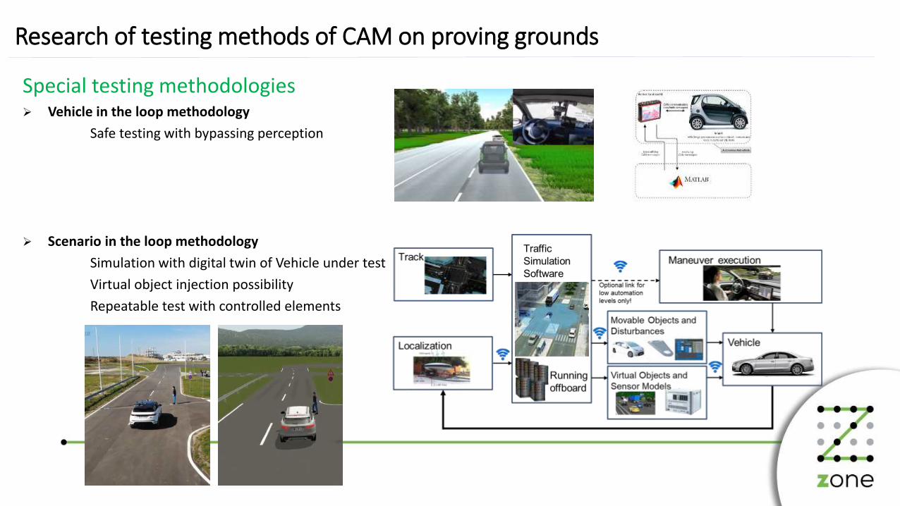
Research of testing methods of CAM on proving grounds
Special testing methodologies Vehicle in the loop methodology
Safe testing with bypassing perception
Scenario in the loop methodology
Simulation with digital twin of Vehicle under test
Virtual object injection possibility
Repeatable test with controlled elements

HD map supportPoint cloud models
3D point cloud, models and HD maps:• Dynamics platform• Handling course• Motorway & ADAS surface – awailable soon
We are continuously updating our database. If the construction of a track element is done, we scan it and create road models with cm accuracy in simulation tools. We also update and correct the blueprints models with the scanned data. All these models and data will be available on https://www.automateddrive.bme.hu/website.
Basic file format is OpenDRIVE, but we can export:• AutoCAD (.dxf)• Unity 3D• Unreal Engine• Carla • GeoJSON• Simulation SW models will be upgraded accordingly• Surface and material description handling is in progress

Airport
DroneMotive plans
Offices
HangarMotivation: drone related services might generate outstanding economical and social benefits
ZalaZONE connection• The development of autonomous ground and air vehicles share
numerous common problems (e.g. in communication, surveillance, navigation, conflict MGT)
• Establish synergies between the 2 transportation systems

Physical and Digital Infrastructure – Central System approachOngoing development
Real time digital world model includingStatic 3D map
Low dynamic information (road works, weather, traffic..)
High dynamic information, vehicles, pedestrians…
Central, real time fusion combining in vehicle and infrastructure
sensor set
Data record bufferSupporting automated vehicle testing
Accident reconstruction support
GDPR compliant solution
Using international standards for overall system (OpenDrive,
ETSI CPM, Sensoris, Adasis..)
Supporting automated vehicles (first testing and later operation)
with real time environment data
Ability to control automated vehicles and infrastructure elements
(e.g. traffic lights)
Supports mixed reality testing
Cloud based scalable, distributed system
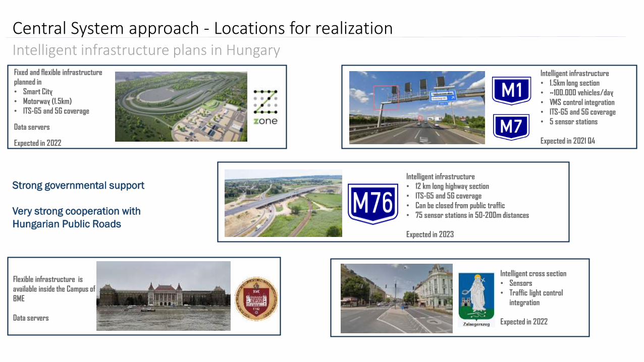
Central System approach - Locations for realizationIntelligent infrastructure plans in HungaryFixed and flexible infrastructure
planned in
• Smart City
• Motorway (1.5km)
• ITS-G5 and 5G coverage
Data servers
Expected in 2022
Intelligent infrastructure
• 1.5km long section
• ~100.000 vehicles/day
• VMS control integration
• ITS-G5 and 5G coverage
• 5 sensor stations
Expected in 2021 Q4
Flexible infrastructure is
available inside the Campus of
BME
Data servers
Intelligent infrastructure
• 12 km long highway section
• ITS-G5 and 5G coverage
• Can be closed from public traffic
• 75 sensor stations in 50-200m distances
Expected in 2023
Strong governmental support
Very strong cooperation with
Hungarian Public Roads
Intelligent cross section
• Sensors
• Traffic light control
integration
Expected in 2022

Central System approach - Dedicated infrastructure and test toolsPlanned elements
• Network/ power supply• Traffic control (traffic lights, VMS)• Sensors (Cameras, Lidars, Radars, Weather sensors…)• ITS-G5, C-V2x, 5G communications• Servers/Cloud/Edges• Test equipment (AB-Dynamics and other devices)• GNSS base station for RTK service• HD maps of the areas with cm accuracy
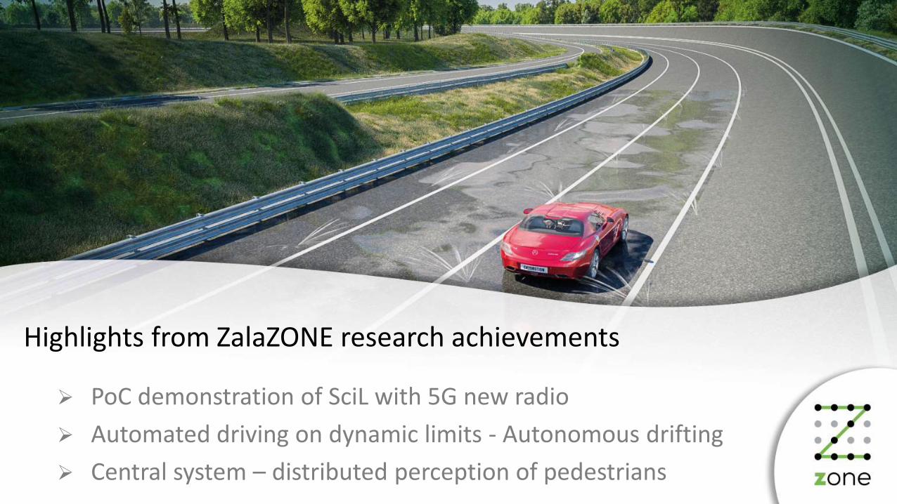
Highlights from ZalaZONE research achievements
PoC demonstration of SciL with 5G new radio
Automated driving on dynamic limits - Autonomous drifting
Central system – distributed perception of pedestrians

Scenario in the loop youtube video link
Scenario in the loop demonstration using 5G networkThe video was captured during the opening ceremony of ZalaZONE proving ground in 2019 May. The fully automated smart vehicle do automated Valet parking and traffic jam pilot while a simulation server communicates with it through 5G network and provides the SCiL simulation with virtual object injection as well as real dummy control
Virtual object
Real object (Dummy)
https://www.youtube.com/watch?v=Ue3W7cjUtf8

Scenario in the loop

BMW M2 automated drift youtube video link
BMW M2 automated driftingWe are presenting our BMW M2 automated drift demonstrator vehicle. During the video, the vehicle fully controls the stabilized drift
https://www.youtube.com/watch?v=saFgazF2bcs
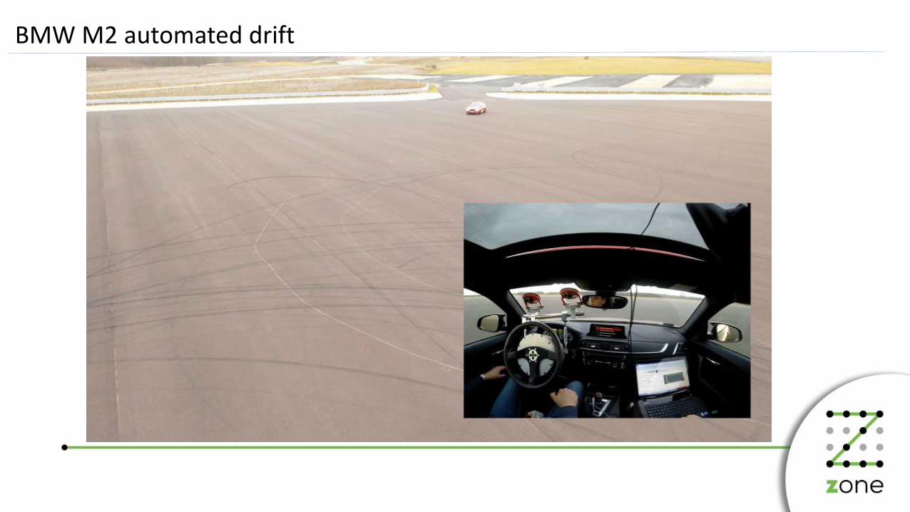
BMW M2 automated drift

Central system – Actualities
