you be the scientist
TRANSCRIPT
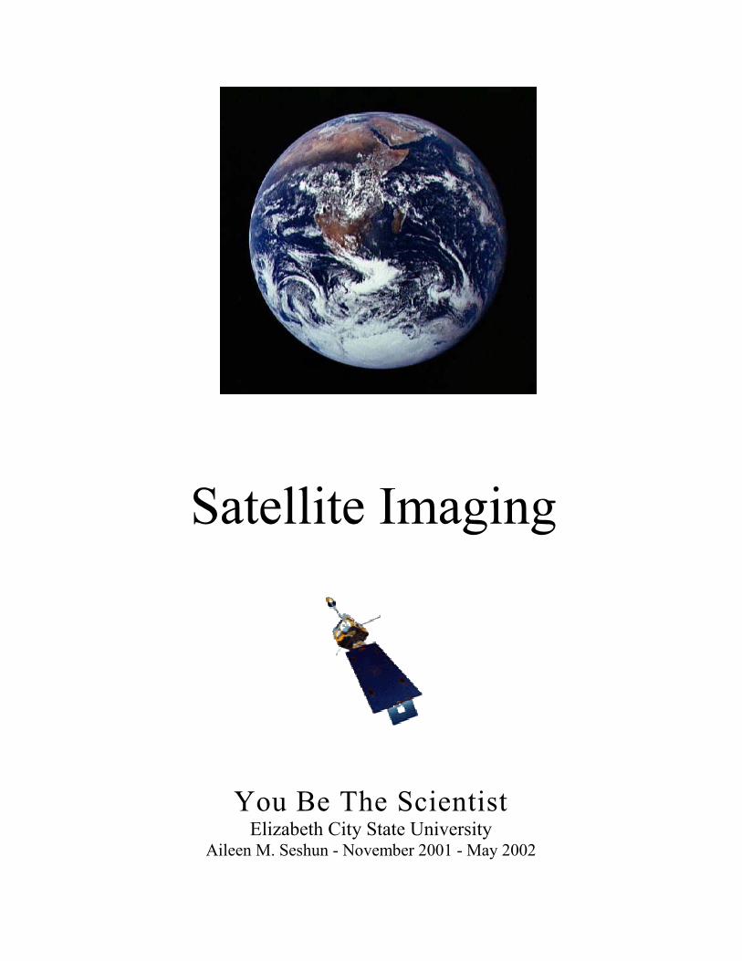
You Be The ScientistElizabeth City State University
Aileen M. Seshun - November 2001 - May 2002

Table of Contents
Topics - Month Chapter
Administration 1
YBTS Missions & Goals - Nov. 2
Intro to Remote Sensing & Satellites - Dec. 3
Visualization of Satellite Imagery - Jan. 4
Meteorology - Weather - Feb. 5
Principles of Aviation & Rockets - Mar. 6
Space Station & Shuttle Missions - Apr. 7
NASA Careers in Math & Science - May 8
Student Notebooks Outline 9
Worksheets & New URLs 10

2New Plans for YBTS.doc 02/08/02 1
Administration
New Plans/Suggestions for YBTS We now have a realistic picture of the challenges of this project, which includes the technology challenges. The YBTS program as we have implemented it through the Network Resources and Training Site is an after school enrichment program targeting grades 6-8. The key to success appears to be the design of a schedule, which promotes the successful understanding of satellite imagery, career information, and NASA's earth science mission. These are the larger program goals. Receiving the real time satellite data is just one of the objectives. With that firmly in mind, the project can proceed. I will continue to work on identifying a source of support for the technology through our own in-house personnel, GSFC personnel, and personnel (still to be identified) in VA/NC. Linda Hayden informed me Tuesday evening (11/1/01) when I was at ECSU that we have to develop a theme for every month, keep records of the meetings, & progress according to a very specific plan. Continuation phases of the project will be as described below. ========================================================================= GOALS: YBTS with Satellite Imagery in EZ/EC Communities ---Understanding of satellite imagery concepts ---Sharing with students information on careers critical to NASA's overall mission ---Sharing with students and educators information related to NASA's earth science enterprise ---Support for and participation in NASA's existing earth science education projects and events. ========================================================================= Here are a few suggestions for the focus for each month, but remember with the various meetings throughout the month, you will embellish with activities & projects appropriate to the theme. Please look over the list & let's try to come up with an agenda for the year, which will please everyone. I NEED your suggestions. I will compile them & return them to you for final selection. �� I will be glad to help with any of the activities, such as creating Q & A cards for the videos. �� I will send the URLs soon to which we can ass as we go along. Please send me any appropriate
URLs you use or new ones you have found or find along the way. ��Administration - Monthly Miscellany
- Update team web pages Continue to add new photos of group activities/events Continue to add interesting links Add descriptions of activities/events/reports/drawings/contests/etc.
- Student Reports for Adjunct Trainer need to be completed & submitted on a monthly basis - Have someone in student group maintain a list of the websites & include short descriptions with
a rating from 1 to 5 / Design as a form to add to your web page - Have students work for funding (community, local businesses, grant $) to have an overnight at
the VASC (include making/testing rockets, time in the AeroZone, etc.) – Fayetteville & Brawley might want to check with museums, which are closer
2New Plans for YBTS.doc 02/08/02 2
Suggested monthly themes: �� November YBTS Missions & Goals
- Echo the Bat: light, electromagnetic spectrum - use worksheets - Infrared video - create a Q & A on cards (have students select before film & tell them it will be
their responsibility to review it with class after video)* - Adventure of Echo the Bat with worksheets
��December Introduction to Remote Sensing & Satellites: - URLs to browse (have simple quizzes): Exploratorium, Observatorium- Learning without
Touching, Third from the Sun, The Space Place, etc. - Research satellites: design or create a copy of one or make-believe - Video: GOES - Visit to VASC on Saturday, Dec. 15 - Let's plan some pre-visit activities to match our theme for
the month & form class teams & assign each group a topic to review & take notes regarding Dec. themes as well as future themes (make the visit a productive as well as one visit)
��January Visualization of Satellite Imagery - Use Scientific Inquiry - Interpret NASA Lithographs in Teams (2 per team): Predict, analyze, verify using data on
reverse sides of lithos, compare with Atlas maps, modify hypotheses, share findings with class C - Students in Teams of 3 to 5 per team complete 12 GVAR imagery projects from the list of
projects at http://coolspace.gsfc.nasa.gov/outreach/background/index.html Activities which work well together:
1 - 5 2 - 11
3 - 4 - 10 6 - 7
8 - 9 (See Activity Descriptions.doc)
These activities will require some modification since we no longer work with the GVAR
software - SuperLooper Activities
��February Meteorology - Study Weather - Weather: clouds, temperatures - graph results for the month (compare with partner YBTS
schools) - URLs: ww2010, Globe for clouds, Cloud Boutiques, etc. - Video: Dance of Sky & Sea - GVAR &/or SuperLooper Activities
��March Study Principles of Aviation & Rockets - Build & fly gliders, helos, and rockets - Record distances, heights, modifications, etc. & graph results - Conduct team competitions for which team design activities on their own / Have every team
member try their own & record / Have every team try every other teams creation ��April Study Space Station & Shuttle Missions
- Try experiments: plants, Glove Box experiments, etc. ��May NASA Careers in Math & Science (mathematics, computer science, geosciences,
engineering, and physics) - Each student selects 3 & research in depth the current preference - Include short description of current preference - What academic subjects would be required to be studied - How many years of school &/or training

2New Plans for YBTS.doc 02/08/02 3
- Colleges & universities offering courses - List possible scholarship & internship opportunities - Internet options: Web Chats, NASA Quest, AstroVenture, NASA career video, Women of
NASA
* Do same for all videos - I can make up Q & A suggestions that you can print out, cut, & distribute to the students before the video.
�� Subscribe or Register to: - NASA Connect - http://connect.larc.nasa.gov (to register) - NASA "why?" Files - http://edu.larc.nasa.gov/dl.html (no subscription) - WON (Women of NASA) - Send a message to: [email protected] / Leave the Subject line blank, & in the Message body, type: subscribe updates-won - NASA Quest / AstroVenture & NASA Ames Education Technology Team Updates - Mark calendar for webcasts - Check with school computer technicians to verify webcasts will be possible
New URLs Check out this site & scroll down to 'Types of Satellites' to see Polar orbiting & Geosynchronous satellites spinning around the earth. http://daac.gsfc.nasa.gov/CAMPAIGN_DOCS/atmospheric_dynamics/ad_education/remote.htm Here's another wonderful RS site: http://www.comet.ucar.edu/nsflab/web/remote/index.htm I love the remote sensing exercise. This would be a great project for the students. Have them collect in-situ sensors graphics & remote sensors graphics from the Internet or magazines at home. Glue/paste them on stiff paper & mount with Velcro so they can be moved into the appropriate boxes that they would first draw on a big poster board. Check it out & see what you think. This way different children could try their hand at making the right choices. It they are pasted onto the poster board it will be a static display & not a continuous learning tool.

2New Plans for YBTS.doc 02/08/02 4
November YBTS Missions & Goals & Introduction Echo the Bat: light, electromagnetic spectrum - use worksheets
Navigating Echo the Bat website Look at Home Page & discuss routing (stay with me / turn over mouse when asked) imagers.gsfc.nasa.gov/ Next, click on Adventures of Echo the Bat (OR read from the Echo Po-Up Book) imagers.gsfc.nasa.gov/intro/story.html Note: The Pop-Up Book has some Activities of it's own. SKIM the story / Do NOT Begin the Adventure / Back out address to return to imagers.gsfc.nasa.gov/ Home Page (delete intro/intro12.html from URL above)
Teacher's Guide or Student's Guide imagers.gsfc.nasa.gov/teachersite/index.html Unit I - Understanding Light (Click on Understanding Light) 1 Lesson - Primary Colors of Light imagers.gsfc.nasa.gov/teachersite/UL1.htm Activity 1 - Have students work on the Birds & Bats Venn Diagram Handouts (Venn Diagram Exercises) Activity 1B - Review 'Interesting Facts about Light' Handout Activity 1C - Have students create hand shadows (see copy) Handout Activity 2 - Primary Colors of Light worksheet & RGB Color Board (a MUST DO) Handouts (Primary Colors worksheet) Click on IMAGERS color mixing page at imagers.gsfc.nasa.gov/color/title.html & practice mixing the colors / Then complete Venn Diagram of Primary Colors Return to Teacher's Site 2 Lesson - What Color Is It? (Show color paddles (or cellophane) with flashlights) Return to Teacher's Site 3 Lesson - Electromagnetic Spectrum (Radio, Microwaves, IR, Visible) imagers.gsfc.nasa.gov/teachersite/UL3.htm Scroll down & click on IMAGERS - Electromagnetic Spectrum Web Site imagers.gsfc.nasa.gov/ems/ems.html Activity 3, 4, 5, & 6 - Slinky, prism, Liquid Crystal IR Detector, & Wavestown worksheet Handouts (Wavestown worksheet) Activity 7 & 8 - IR video - a) Create a Q & A: On 3 X 5 cards (have students select before film & tell them it will be their responsibility to review it with class after video) OR b) Online quiz - do as a Pre-Test & Post-Test (before & after film) * school.discovery.com/quizzes10/ybts/IRQuiz.html Activity 9 - Have students work on the Infrared Light & Visible Light Venn Diagram Handouts (Venn Diagram Exercises) Activity 10 - URLs to cover (See Remote Sensing Interactive URL List): a) The Explorato- www.exploratorium.edu/exhibits/f_exhibits.html rium & b) NASA's Observatorium observe.ivv.nasa.gov/nasa/education/gis/opening.html Note Resources

2New Plans for YBTS.doc 02/08/02 5
Unit II - Remote Sensing (definition) imagers.gsfc.nasa.gov/teachersite/RSi.htm 1 Lesson - What are we looking at? (pennies in grass) imagers.gsfc.nasa.gov/teachersite/RS1.html Activity 11 - Draw keyboard (paper cup, any object) from eye level (kneel down to look at keyboard) & when standing up & draw keyboard while looking down at it / Discuss differences Activity 12 - Look over the Perspective Pictures Click on Back button instead of Return to Teacher's Site 2 Lesson - What are satellites? imagers.gsfc.nasa.gov/teachersite/RS2.html#tips Activity 13 - Look over Pictures of Satellites & point out the six main components (or subsystems) that satellites require (students can build satellites) Click on Back button instead of Return to Teacher's Site 3 Lesson - Adventure of Echo the Bat imagers.gsfc.nasa.gov/teachersite/RS3.htm
Click on Content Map of all the areas that Echo visits (check later) imagers.gsfc.nasa.gov/teachersite/content.html Next click on Student's Site & then click on Echo (check other areas later) NOW change URL imagers.gsfc.nasa.gov/adventure/setup.html
Click on appropriate browser for your computer / Read text / Click on ACCEPT YOUR MISSION Begin the Adventure Activity 14 - Work in pairs: 1 at computer & other marking 10 locations on the map Handouts (map & location worksheet) IF time is short, we may stop after only 2 or 3 sightings & move on to worksheet Activity 15 - Work in pairs: 1 measure distances between points & other fill out worksheet
Specific URLs for this Topic Electromagnetic Spectrum Quiz (only 4 questions) imagine.gsfc.nasa.gov/cgi-bin/print.pl Visible & Infrared Imagery octopus.gma.org/surfing/sensing/imagery.html Remote vs. In-situ Sensing: Sensing Interactive Exercise (click & drag items into correct categories) www.comet.ucar.edu/nsflab/web/remote/114.htm
Nature of an Image - description of multi-spectral images (R, G, B) www.nr.usu.edu/Geography-Department/rsgis/Remsen1/lee3/imgnatr.html General Wave Motion (great info) www.school-for-champions.com/science/waves.htm
A Global View of the Earth : Curriculum Materials for Echo the Bat ltpwww.gsfc.nasa.gov/landsat7/teacherkit/index.html Lesson 2 - Landsat-7 TM Image Interpretation ltpwww.gsfc.nasa.gov/landsat7/teacherkit/html/lesson2.html (wonderful set of 10 mystery images - worksheet can be printed) ltpwww.gsfc.nasa.gov/landsat7/teacherkit/html/lsn2wk2.html
Landsat Program geo.arc.nasa.gov/sge/landsat/landsat.html NASA Observatorium Image Gallery observe.ivv.nasa.gov/nasa/gallery/image_index.shtml.html NASA Explores - HDTV: Coming Soon to a Television Near You www.nasa.explores.com
- K-4: Lesson 1 - Reflect or Absorb & Lesson 2 Coding an Image

2New Plans for YBTS.doc 02/08/02 6
- 5-8: Lesson 1 - Tasty Pixels & Lesson 2 - Imagery Activity - 9-12: Lesson 1 - Binary Code & Lesson 2 - Digital Versus Analog
NASA Explores - Mapping the Earth from Space www.nasa.explores.com - K-4: Lesson 1 - Relief Maps & Lesson 2 - Making a Topographical Map - 5-8: Lesson 1 - Shuttle Orbits & Lesson 2 - Reading Topographical Maps - 9-12: Lesson 1 - Map Makers
Complete YBTS Meeting Report Work on YBTS School Website
* Do same for all videos - I can make up Q & A suggestions that you can print out, cut, & distribute to the students before the video.

2New Plans for YBTS.doc 02/08/02 7
December Introduction to Remote Sensing & Satellites: Echo the Bat - Lesson 2: Remote Sensing �� Activity 1, 2, 3 - Digital Artwork - Pixels
- Forms teams of two - Fold square 16ths & practice sending & receiving (write letters across top & numbers down the Handout paper left side [like Excel]) - Use Echo worksheets to send & receive (write letters across top & numbers down the left side Handout Echo digital art worksheets [like Excel])
�� Activity 4 - Binary Code Exercise URLs to browse (most have simple quizzes): �� Observatorium
- Better Living through Geopyspatial Analysis - An Introduction observe.ivv.nasa.gov/nasa/education/gis/opening.html - Remote Sensing - A Non-Contact Sport: A Tutorial - NASA Observatorium Education - Remote Sensing Basics (PowerPoint Quiz to match) observe.ivv.nasa.gov/nasa/education/reference/main.html RS Asses.ppt - Print out as a handout (or can do on computer if able to print completion Handout or complete of computer AND print out - Learning without Touching observe.ivv.nasa.gov/nasa/exhibits/learning/learning_0.html
�� Exploratorium - Third from the Sun www.exploratorium.edu/learning_studio/landsat/ - Activity 5 - Quiz: three visuals to identify
�� The Space Place - Spacey Things to Do spaceplace.jpl.nasa.gov/eol_1.htm - Activity 6 - Telling a Pine from a Maple Tree ... from Space / Adjust color imaging of trees - Activity 6B - the IR Matching game spaceplace.jpl.nasa.gov/spacepl.htm
�� Activity 7 - What is Remote Sensing? education.ssc.nasa.gov/ltp/LessonPlans/WhatIs.htm �� Possible Activity 7B - Mission to Planet Earth Handout & http://ericir.syr.edu/Projects/NASA/module1_a.html �� Research satellites:
- Activity 8 - design or create a copy of one or an make-believe - Remote Sensing: the online guides / Click on Satellites ww2010.atmos.uiuc.edu/(Gh)/guides/rs/home.rxml
�� GOES & NOAA satellites - Look over GOES & NOAA booklets NOAA & Raytheon Booklets - GOES Bands Handout (GOES Bands.doc) - The GOES System Handout (GOES Instruments.doc) - Satellite Imaging Channel Categories Handout (ChannelTableW.doc)
�� Video: GOES Video - GOES - Activity 9 - Video quiz Computer - Activity 10 - VCP Inventory Handout (VCP SatImagery MS.doc)
�� Interpreting IR Imagery / Read & click on 'Go on to interactive exercise' button cimss.ssec.wisc.edu/wxwise.satir �� Visible Earth visibleearth.gov

2New Plans for YBTS.doc 02/08/02 8
�� Activity 11 - Flashcard Exchange / Click on Middle School 6-8, then Science, then click on Handout from www.flashcardexchange.com/index.jsp Remote Sensing Next click on Card Viewer to see the cards (Q & A) or Card Printer to print them in different formats
�� Remote Sensing Background Q & A for Teachers squall.sfsu.edu/m101/lab9.html Visit to VASC on Saturday, Dec. 15 Let's plan some pre-visit activities to match our theme for the month & form class
teams & assign each group a topic to review & take notes regarding Dec. themes as well as future themes (make the visit a productive as well as one visit)
Send a question on RS weekly to each school or put on school website �� Have someone at each school compile (with answers) & respond to submitted answers from other schools �� Play RS Jeopardy via email �� Supporting interactive websites (see Remote Sensing URLs.doc) - Interpreting IR Imagery cimss.ssec.wisc.edu/wxwise/satir
- Amazing Space amazing-space.stsci.edu - AstroVenture (careers) astroventure.arc.nasa.gov/is/fact_sheets.html - The Observatorium observe.ivv.nasa.gov/nasa/education/gis/opening.html - Earth View www.fourmilab.to/cgi-bin/uncgi/Earth
Specific URLs for this Topic How Satellites See by Christina Wilder (Univ of CA - Berkeley) cse.ssl.berkeley.edu/lessons/indiv/wilder/details.html
NASA Satellites & Electromagnetic Spectrum Lesson Plan & Activities cse.ssl.berkeley.edu/lessons/indiv/wilder/summary.html Guess where this is? Quiz (Click on Quiz) southport.jpl.nasa.gov/education/reference.html What is Imaging Radar? (Read first 3 paragraphs / Click on 'Click Here to See Animation') southport.jpl.nasa.gov/desc/imagingradarv3.html Complete YBTS Meeting Report Work on YBTS School Website

2New Plans for YBTS.doc 02/08/02 9
January Visualization of Satellite Imagery Start Adventure of Echo the Bat �� Activity 1 - Begin the adventure - Click on Echo's picture & ACCEPT YOUR MISSION imagers.gsfc.nasa.gov/student.html �� Activity 2 - Work with the map of Arizona - Record sightings of Echo on map Handout of Arizona map
- Calculate the distance that Echo flies in kilometers & then miles) - see Answer Sheet Handout of 'Distance' sheet Note: Teachers Review the 'Links to Interactive Story Content' in Teacher's Guide imagers.gsfc.nasa.gov/teachersite/content.html �� Different Habitats: How can we find a forest in the satellite image? imagers.gsfc.nasa.gov/adventure/habitats.html �� Activity 2B - Interpreting Satellite Images imagers.gsfc.nasa.gov/teachersite/rs_stdnt.html
Choose 2 pictures & work in teams of 2 / Complete worksheet Interpreting Satellite Images Handout from litho packet Use Scientific Inquiry �� Collect the Data �� Organize the Data �� Analyze the Data �� Display the Data Interpret NASA Lithographs in Teams (2 per team): �� Activity 3 - Where in the US is this? (See handout) - Use as a lead in southport.jpl.nasa.gov/cgi-bin/als/southport/juess.cgi?score �� Review EarthKAM website for activities & info on how to interpret images www.earthkan.ucsd.edu/
Teacher's Guide (lots of great information & activities) www.earthkam.ucsd.edu/public/educators/resources/curriculum/ �� Our Location on Earth - Latitude & Longitude www.relativedata.com/mystars/course/latlng.shtml
- Optional Activity 3B - Compass Lesson - Geography on the Net www.angelfire.com/fl/compless/index.html �� Activity 4 - Predict, analyze, verify using data on reverse sides of lithos, compare with Atlas maps, modify hypotheses, share findings with class �� Activity 5 - Send teams Internet images to explore & describe & compare to what originating team determined (could use a simple email form) / First send image, ask for
description, then send website, so students can see how close they came to correct analysis OR Compare interpretations of lithographs - Exploring Earth from Space (lithographs) NASA lithographs - Echo the Bat (Images of Arizona - Echo Teachers/Students' Sites &/or from the Pop-Up Book Echo printouts & Echo Pop-Up book - Our Mission to Planet Earth (lithographs) NASA lithographs
Following Activities are to be Covered on an 'Either/Or Basis' - Those with GVAR would do the SuperLooper Activities (SL Kickoffs-June.doc) & those without would do the GVAR Activities (Activity Descriptions.doc) with Modifications. GVAR Activities / Projects �� Work on activities in teams / Maybe several teams to accommodate working on the grouped activities in a single class period or two

2New Plans for YBTS.doc 02/08/02 10
�� Share results with partner school via Email &/or Fax (what did each do differently, what learn from each other, share suggestions, OR each school do one activity of a group, & send results to the other school to review, but not to do themselves)
�� Students in Teams of 3 to 5 per team complete 12 GVAR imagery projects from the list of projects. See list included in packet. �� Activities which work well together:
1 - 5 2 - 11
3 - 4 - 10 6 - 7
8 - 9 (See attached groupings & descriptions)
�� Karen Steele has offered to have her group work on a few of the following: 5 3 10 6 8 Note: These activities will require some modification since we no longer work with the GVAR software
SuperLooper Kickoff Plays - For those with access to GVAR software - See notes For Teacher - See ONR Intro Notes �� ONR Intro Notes - Topics for discussion Agenda & URLs.doc (pgs. 1T & 2S) �� Image Interpretation Specific URLs for this Topic �� Satellite Interpretation Tutorials / Image Examples orbit-net.nesdis.noaa.gov/arad/fpdt/tutor.html �� Time Labels on Satellite Images & Weather Maps squall.sfsu.edu/m101/satlab/BQ/UTC_info.html �� Geostationary Satellite Server www.goes.noaa.gov/ �� Earth Images from Space spacelink.nasa.gov/Instructional.Materials/Curriculum.Support/Earth.Science/Earth �� Eyes in the Sky (Short image quiz) observe.ivv.nasa.gov/nasa/exhibits/eyes_sky/remote_main.html �� CCRS Visual Interpretation & Analysis (Short image quiz) www.ccrs.nrcan.gc.ca/ccrs/eduref/tutorial/indexe.html Complete YBTS Meeting Report Work on YBTS School Website

2New Plans for YBTS.doc 02/08/02 11
February Meteorology - Study Weather Weather: clouds, temperatures �� Review Weather Basics (See handout) www.usatoday.com/weather/wcloud0.htm �� Clouds & weather - Go outside:
- Discuss weather & clouds & the browse appropriate websites - Discuss clouds simply (how to describe without proper name) - Estimate cloud cover - Determine temperature outside - Record all information - Return inside
�� Observe Cloud Types archive.globe.gov/sda-bin/wt/ghp/tg+L(en)+P(atmosphere/ObservingCloudType) �� - Activity 1 - Print cloud pictures in color/ cut out & make cards (side one with cloud & side 2 with description)
- Activity 2 - Clouds in a bottle askeric.org/Virtual/Lessons/Science/Meteorology/MET0003.html �� Weather Meteorology Atmosphere/Internet - Atmosphere:
Activity 3 - Interactive Downloads (work in teams & report to others) www.eoascientific.com/prototype/newcampus/atmosphere/atmosint.html Weather logs �� Activity 4 - Keep a weather log between the participating cities & have the students compare records & graph comparisons �� Fayetteville Portsmouth (or Norfolk) Elizabeth City Other
- Graph results for the month (compare with partner YBTS schools) www.wunderground.com/ - Gather info from other YBTS cities & use chart (handout) or one of own design
�� URLs: Review GOES imaging websites (see Remote Sensing URLs.doc) - Introduction to Clouds www.usatoday.com/weather/wcloud0.htm - USA Today www.usatoday.com/weather/wfront.htm - ww2010, Globe (for clouds, Cloud Boutiques, etc.) ww2010.atmos.uiuc.edu/(Gh)/wx/usrgd/home.rxml
�� Video: Dance of Sky & Sea - Activity5 -Have students complete Quiz school.discovery.com/quizzes10/ybts/SeaSky/html
�� Activity 6 - Make weather cards (image on 1 side & description on other See handout of samples �� Activity 7 - Basic Thinking Skills - Analogies Handout �� Activity 8 - Collect newspaper Weather Maps to use for recording & graphing Keep track of storms or weather alerts �� Activity 9 - Track storms or weather alerts & how they are different in each city �� Hurricane Tornado Flood warnings Air pollution Excessive heat �� Measure storm distances traveled & speed Review Interactive Weather URLs See handouts
2New Plans for YBTS.doc 02/08/02 12
Install Weather Bug from Wavy 10 www.weatherbug.com Books & Miscellaneous �� Activity - NASA Connect - Measurement, Ratios, & Graphing: Safety First (GAME) _Use in place of some of the above activities OR �� Activity - NASA Connect - Data Analysis & Measurement: Ahead, Above the Clouds �� Discovery Channel Weather: An Explore your World Handbook ISBN 1-56331-802-4 �� The Weather Book by Jack Williams - USA Today ISBN 0-679-7766506 Other Materials for this Topic
NASA Looking at Earth from Space (thick red book) Complete YBTS Meeting Report Work on YBTS School Website

2New Plans for YBTS.doc 02/08/02 13
March Principles of Aviation & Rockets Basics of Aviation �� Gravity, Lift, Thrust, & Drag Handouts �� Learn to Fly (basics of flight & parts of an airplane & cockpit controls) Handout Famous Scientists Handout �� Newton �� Bernoulli Aviation Websites �� Plane Math www.planemath.com �� K-8 Aeronautics wings.ucdavis.edu Activities �� Build & fly
- Gliders: Kuderia & Kimoto Flyers & Ring Wing Gliders (have students design their own) Handout - Whirlybirds or Helos Handout - Rockets Handout
�� Record distances, heights, modifications, etc. & graph results - Conduct team competitions for which team design activities independently - Have team members try their own aircraft & record - Have every team try every other teams creation
�� Soaring Aloft: Inference & Problem Solving Handout
Specific URLs for this Topic
Curriculum Bridges: Nature (Aviation) wings.ucdavis.edu/Curriculums/Nature/nature_links.html Complete YBTS Meeting Report Work on YBTS School Website

2New Plans for YBTS.doc 02/08/02 14
April Space Station & Shuttle Missions Space Shuttle www.jpl.nasa.gov/srtm/missionoverview.html �� Space Shuttle Flights spaceflight.nasa.gov/
spaceflight.nasa.gov/shuttle/archives.sts-99/index.html �� Review Space shuttle & Rocket picture Handout �� See Living in Space NASA book with many activities - choose any Request from ERC at VASC �� NASA Explores - Mapping the Earth from Space www.nasa.explores.com
- 5-8: Lesson 1 - Shuttle Orbits International Space Station �� Learn what countries are working together Handout �� Learn about different compartments / experiments / astronauts / living conditions �� Review Space Station Environmental Regenerative Flow Diagram Handout �� Activity - Make a Spacelab Model �� Track the Satellite in your night sky Space Colonies �� Activity - make colonies using plastic picnic plates �� Perform experiments: plants, Glove Box experiments, etc.
Specific URLs for this Topic
Complete YBTS Meeting Report Work on YBTS School Website

2New Plans for YBTS.doc 02/08/02 15
May NASA Careers in Math & Science (mathematics, computer science, geosciences, engineering, physics, etc.) Review World-of Work Map Handout
Activity - NASA Explores - My Goals LP Handout
Activity - Spaceworks Handout
Each student Select 3 Careers & Research in Depth the Current Preference �� Include short description of current preference �� What academic subjects would be required to be studied �� How many years of school &/or training �� Colleges & universities offering courses �� List possible scholarship & internship opportunities �� Internet options: Web Chats, NASA Quest, AstroVenture, NASA career video, Women of NASA �� Create a career map for the selected career See NASA Superstars of Science handout for sample
- Use Career Worksheets to record career research (I Want to Be Like Her & I Want to Be Like Him) - Include pictures, articles, & information from research just accomplished - Create Career Trading Cards - Check the NASA Explores Astronaut Trading Cards Handout - Famous Scientist's Laws They Discovered
Specific URLs for this Topic AstroVenture (careers) astroventure.arc.nasa.gov/is/fact_sheets.html Complete YBTS Meeting Report Work on YBTS School Website

2New Plans for YBTS.doc 02/08/02 16
Student Notebooks Outline (suggested inclusions) Students create a personal notebook to include (not every school team may be doing the same thing, but these are recommendations): �� Their application letter & acceptance �� Personal bio (suitable for web - Can use nickname on web) �� Weekly log of YBTS meetings, activities, trips �� Summaries of guests: short bio & activities �� Activities: description. Worksheets, displays, competitions, artwork. �� YBTS photos (scanned or digital) �� Personal contributions to YBTS website �� Careers (at least 3) selected for research: include short description of current preference, what academic subjects would be required to be studied,
how many years of school &/or training, list possible scholarship & internship opportunities

2New Plans for YBTS.doc 02/08/02 17
Worksheets, New URLs & Miscellaneous Activities for any Month
Remote Sensing Interactive URL List
�� Remote Sensing URLs2.doc
�� See list of Imagery Activities which follows
Remote Sensing / Satellite Flashcards
Select one day a month for both schools when they could be in contact with each other at the same time (I would prefer to be there, but it's not necessary)
Create a scavenger hunt See which school can report the most finds at the end of the meeting
Share web pages Ideas Graphics Games Quizzes Experiments
Each school describe an activity or experiment (including materials needed, directions, expected results & reasons for results - like what the summer school program students did - you missed those) for the other to perform & report on the results (light, wavelengths, electromagnetic spectrum, etc.)
From: Van Cleave's science books / Internet / any science book
Create a game or quiz on each school's web page to be played by the other (would have to print out & fax back or email results or comments) - or link to a neat game on the web for each school to try & then comment report back to the other
Amazing Space: amazing-space.stsci.edu record wins of playing cards record time to complete concentration puzzle Exploratorium: www.exploratorium.edu/exhibits/f_exhibits.html which activity liked best - why? which activity liked least - why? Observatorium observe.ivv.nasa.gov/nasa/fun/fun_index.shtml.html observe.ivv.nasa.gov/nasa/fun/concentrate/concentration.html record time to complete concentration puzzle

2New Plans for YBTS.doc 02/08/02 18
Imagery Activities for YBTS October 2001 - May 2002 http://coolspace.gsfc.nasa.gov/outreach/index.html Nature of Student Projects Students will work in teams & will interact during the weekly project meetings. A detailed description of each project follows. The visualization (Satellite Imagery) project has several components each of which will enhance the student's understanding of fundamental remote sensing concepts.
Satellite Imagery Activities: 1. Air Masses of the Earth Abstract: This activity introduces the student to the five basic air masses that affect weather in our hemisphere. Using real-time satellite imagery, the student will then locate the probable location of these air masses and predict current movements. Outcomes: The student will �� Be able to identify the five air masses that typically affect the weather in the Northern
Hemisphere. �� Be able to identify the current location of these air masses using satellite imagery. �� Label a map of the Northern Hemisphere with the correct location of the air masses. �� Predict where these air masses are travelling or if they are stationary. �� Gain an introduction to fronts that relate to the boundary of air masses.
5. Cold Fronts - A Violent Meeting Abstract: This activity will cover the development of cold fronts and link their movement to the overall movement of air masses on the Earth. Outcomes: The student will �� Understand the dynamic forces that create a cold front, and locate a cold front using satellite
imagery. �� Be able to indicate a cold front on a weather map. �� Create a hypothesis and test this hypothesis using satellite interpretation.
2.Atmospheric Absorption Abstract: This activity discusses the atmospheric absorption spectrum. The student will determine the extent to which each channel is affected by atmospheric absorption and form a hypothesis about which channels are most likely to make accurate surface temperature measurements. The student will then test this hypothesis by taking temperature measurements in all the infrared channels and comparing them to ground truth data from ground stations and specialized sea surface temperature satellites.

2New Plans for YBTS.doc 02/08/02 19
He/she will then quantify the deviation of the GOES surface temperature measurements from the ground truth data to confirm or negate the hypothesis. Outcome: The student will �� Learn about the absorption spectrum of various atmospheric constituents �� Use his or her knowledge about atmospheric absorption to form a hypothesis that answers the
question, "Which GOES channels can be used to make surface temperature measurements?" �� Be able to cross reference ground truth data with satellite data to quantify the accuracy achieved
by various satellite channels. 3. Climbing to New Heights Abstract: This activity involves students in the process of identifying cloud types and movement from a satellite image and gathering data through a 48-hour period. Lifting mechanisms that produce clouds will be investigated and the influence of topography on cloud development will be described. This activity should follow successful completion of the basic series of website activities. Outcomes: The student will
�� Distinguish between the various cloud types �� Identify areas of cloud development in a satellite image �� Construct a loop of GOES images showing cloud formation and movement. �� Track cloud movements over the continental United States recording changes in altitude and
temperature as influenced by topography. 4. Graphing Cloud Height vs. Temperature Abstract: The student will create a data table of cloud height and temperature, using derived image channels and latitude/longitude coordinates to locate points, and create a graph of cloud height vs. temperature by plotting these points on an x-y axis. Once the graph has been created, the student must draw conclusions about the mathematical relationship between cloud height and temperature and its effect on the weather. Outcomes: The student will �� Be able to use the GVAR software to locate specific points and create a data table. �� Be able to plot a graph on an x-y axis. �� Determine if a graph represents a direct, inverse, or nonexistent relationship between two
variables. 10. High Level Clouds - What's up? Abstract: This activity will involve identifying clouds in the high level cloud group. It will cover the development of these clouds and the weather associated with the different clouds in this group. Outcomes: Students will
2New Plans for YBTS.doc 02/08/02 20
��Be able to identify clouds in the high cloud grouping by picture identification and satellite imagery identification.
��Classify clouds into separate groups and create a cloud library of these clouds. ��Predict what type of weather an area had, is having and is going to have based on the types of
clouds that are present. ��Use a combination of visible and infrared imagery.
6. The Coriolis Effect Abstract: This activity will explore the causes of the Coriolis Effect and analyze how this effect determines wind movement and weather throughout the globe. Students will learn the science behind the Coriolis Effect by examining various websites and doing some hands-on demonstrations. Satellite images will then be used to analyze the global impact of this. Outcomes: The student will ��Be able to describe the mechanism that causes the Coriolis Effect. ��Be able to demonstrate the Coriolis Effect using at least two methods. ��Be able to predict high and low pressure from the air movement in satellite images.
7. The Diurnal Cycle Abstract: This activity will introduce the diurnal cycle and its effects on the global processes that shape our earth. It begins with an introduction to the mechanisms that drive this heat cycle and continues by having students track this with real-time satellite images. Outcomes: The student will �� develop a comprehensive understanding of the diurnal cycle �� identify the diurnal cycle in film loops of infrared satellite images �� create a surface temperature chart of various regions of the globe at different times of day. �� create a line graph of the temperature data.
8. Fire Detection with GOES Data Abstract: This activity will allow the student to find fires that have been detected on the Internet and then find and track fires with real-time data. This activity also encompasses responses of different IR channels to sub-pixel heat sources, a fire product made by combining information from two channels, and colorizing data through the creation of a color palette. Outcomes: The student will �� understand different applications of IR2 and IR4 channels �� experience the effect of combining data from multiple channels of the electromagnetic spectrum �� use Internet data to verify fires detected with GOES data �� detect fire hot spots using GOES data �� be able to distinguish between different features of an image by creating a color palette �� locate fires by detecting smoke plumes

2New Plans for YBTS.doc 02/08/02 21
9. The Gulf Stream Abstract: This activity allows students to study the Gulf Stream. In doing so, students can isolate the Gulf Stream with a color palette, track its activity over long periods of time, create loops of Gulf Stream movements, and relate to Gulf Stream activity to other environmental factors. Outcomes: The student will �� be able to explain the nature of the Gulf Stream �� explain the factors that cause this phenomenon �� locate the Gulf Stream and isolate it with a color palette �� track the movement of the Gulf Stream by measuring changing distances from points on the
Eastern coast of the U.S �� be able to create a loop to visualize changes in the Gulf Stream over time*
Extended Activities/Outcomes * Review all procedures & activities to see which require a sequential approach to collecting data.
1. Air Masses of the Earth
Contact a YBTS school regarding approaching weather 5. Cold Fronts - A Violent Meeting
Identify a cold front & arrival time at ECSU 2.Atmospheric Absorption
None 3. Climbing to New Heights
Organize data Explain & develop a loop
4. Graphing Cloud Height vs. Temperature
Check cloud heights estimates with actual from web Determine cloud height as a function of temperature Check internet for another algorithm (see web site)
10. High Level Clouds - What's up?
Procedure 7 6. The Coriolis Effect
Label low & high pressure symbols on a full earth image

2New Plans for YBTS.doc 02/08/02 22
7. The Diurnal Cycle None
8. Fire Detection with GOES Data
Determine geographical conditions Relation of fires to El Ni�o Create a false color image Predict movement OR when rain might put fir out - check later*
9. The Gulf Stream
Track movement of Gulf Stream - check later* Monitor shape of GS Research relationship between temperature & phytoplankton