wisdot research & library programsp.research.transportation.org/documents/rac surveys of...
TRANSCRIPT

WisDOT Research & Library Program 4802 Sheboygan Avenue, Room 104 [email protected] PO Box 7915, Madison, WI 53707 www.wisdotresearch.wi.gov
Transportation Synthesis Report & Literature Search Collection and maintenance of utility elevation data to support 3D design
Authors: JonAnne Walters & Daniel Yeh DBM, Research & Communication Services Section
Requester: Travis Feltes DTSD, Statewide Utility Engineer
Date completed: July 12, 2012
Description of topic:
In 2009, the Wisconsin Department of Transportation adopted the use of AutoCAD Civil 3D software for roadway design activities. Although the initiative seeks a seamless data flow from survey and design through construction, the availability of consistent and accurate data remains a challenge. One major data acquisition challenge for 3D roadway design involves underground utilities owned or maintained by external agencies, such as power companies or local municipalities. While WisDOT may have data or access to data concerning the general location of utilities, it often does not have full elevation and characteristic data to support 3D design needs. Since the entire 3D design process is new for WisDOT, the Statewide Utility Engineer asked for research on what advances have been made in the field of the collection and maintenance of utility elevation data to support 3D design, especially in the state DOT context. The research activities for this report include a literature search and a survey of state DOTs.
Survey of current practice among state DOTs In June of 2012, the WisDOT Research Program deployed an on-line, nine-question survey through the AASHTO Research Advisory Committee listserv. The survey was intended for utility engineers and started with the key question of whether the state DOT currently collects and maintains underground utility elevation data suitable for use in 3D design practices. The introduction to the survey specifically asked states to respond even if they did not collect and maintain the data because a follow-up question asked for the reasons or circumstances for why they did not collect the data. The full survey instrument is attached at the end of this document. Results and key findings Sixteen states and one Canadian province responded to the survey. Only one state (Florida DOT) currently collects or maintains underground utility data suitable for use in 3D design practices. Florida collects the information using subsurface sensor devices and stores data in a geographic information system (GIS). Florida does not collect information directly from utilities or municipalities.
1
None of the remaining sixteen respondents actively collect or maintain underground utility data, for a variety of reasons:
• Five respondents do not utilize 3D design.
• Five respondents cited cost or institutional concerns to collecting the data, while another two cited cost or institutional concerns in maintaining the data.
• Six respondents indicated that relevant data was not available from utilities or municipalities.
A few states noted some preliminary steps towards the collection of underground utility data:
• Montana DOT collects data on a project-by-project basis but does not have a central system to maintain the data. Utah DOT had a similar response in that data is collected and maintained only in individual project files and is not readily accessible for future use.
• Maryland State Highway Administration contracts with Subsurface Utility Engineering firms to conduct test pit activities on utilities.
• Like Wisconsin, Alaska DOT is just beginning down the path of 3D design relative to utilities. They have collected minimal existing elevation data on most existing underground utilities but have no format for storing and disseminating 3D data for utilities.
In summary, the results of the survey of practice indicate that there are no responding states that have a significant head-start on Wisconsin in the collection of utility data to support 3D design. There are some state DOTs that are just beginning this work, and there may be benefit for WisDOT to collaborate with these states to share ideas or discuss common standards.
Findings from literature search The literature review identifies completed research and other authoritative information in an area of interest. The citations below are representative, rather than exhaustive, of available English-language studies on the topic. Primary online resources for the literature searches are OCLC’s WorldCat and TLCat, TRB’s TRID Online, the National Transportation Library (NTL), TRB’s Research in Progress (RiP) database, and other academic, engineering and scientific databases as appropriate. The keywords used for this literature review were as follows:
• Subsurface utility engineering • Underground utility lines • Surveying • Public utilities • Three-dimensional imaging • Information retrieval
Results are listed chronologically from new to old. The tables provide links to online copies of cited literature when available. Contact the WisDOT Library to obtain hard copies of any citations.
2
Title: SHRP 2 Tools for underground utility location, data collection, and analysis
Author/Affiliation: Chuck Taylor, SHRP 2 Senior Program Officer/TRB
Source/Publisher: SHRP 2/TRB
Pages/Description: 8 p.
Date: 2012
Format/Filename: http://onlinepubs.trb.org/onlinepubs/shrp2/utilities_2012-03.pdf
Abstract: This project brief provides an overview of the Strategic Highway Research Program 2 (SHRP 2) projects related to underground utilities. It includes a brief description and the status of each project. The projects are as follows: Encouraging Innovation in Locating and Characterizing Underground Utilities; Technologies to Support the Storage, Retrieval, and Utilization of 3-D Utility Location Data; Utility-Locating Technology with Multiple Sensors; Innovations to Expand the Locatable Zone for Underground Utilities; Integrating the Priorities of Transportation Agencies and Utility Companies; and Identification of Utility Conflicts and Solutions.
Title: Utility investigation trends In Texas
Author/Affiliation: Edgar Kraus, Kwaku Obeng-Boampong and Cesar Quiroga/Texas Transportation Institute
Source/Publisher: TRB 91st Annual Meeting Compendium of Papers/TRB
Pages/Description: 18 p.
Date: 2012
Format/Filename: http://docs.trb.org/prp/12-4010.pdf
3

Abstract: Detection of utility conflicts as early as possible during the project development process can help to substantially improve the timely relocation of utilities and/or allow time to develop alternatives to avoid utility relocations. However, collecting accurate underground utility location information from utilities can be challenging. This is one of the reasons Subsurface Utility Engineering (SUE) has become a critical tool to help identify and locate utility installations within the right of way. Although the benefits of SUE have been well documented, researchers hypothesized a disconnect between its full potential and actual use at the Texas Department of Transportation (TxDOT.) The research team conducted a survey of staff at TxDOT in diverse organizational units to learn about current utility investigations practices and gain a better understanding of how TxDOT uses SUE. The researchers found that among other issues, there is unfamiliarity with SUE technology and its best uses, a general need for training and education on the use of SUE, and a recent decline in the use of SUE technology that may be linked to uncertainty about the benefits of SUE.
Title: Subsurface utility engineering
Author/Affiliation: US DOT/FHWA
Source/Publisher: US DOT/FHWA
Pages/Description: Website
Date: Last updated 2011
Format/Filename: http://www.fhwa.dot.gov/programadmin/sueindex.cfm
Abstract: The inability to obtain reliable underground utility information has long been a troublesome problem for highway designers in the United States. Many States utilize consultants to identify the quality of subsurface utility information needed for highway plans, and to acquire and manage that level of information during the development of highway projects. This engineering practice is known as Subsurface Utility Engineering (SUE).
Title: Unweaving tangled webs
Author/Affiliation: Nicholas M. Zembillas/TBE Group Incorporated
Source/Publisher: CE News v.23 no.3/Zweig White Information Services
Pages/Description: pp. 34-38
Date: 2011-4
4
Format/Filename: http://www.cenews.com/magazine-article-cenews.com-4-2011-unweaving_tangled_webs_-8257.html
Abstract: Subsurface utility locations often are not depicted accurately or completely in records, which can lead to conflicts, delays, disruptions, redesigns, and worker injuries during construction activities. This article describes how subsurface utility engineering (SUE) is proving to be an excellent solution to the challenge of providing accurate underground utility information. SUE is an engineering process that combines geophysics, surveying, civil engineering, and nondestructive excavation technologies. Since its original conception in 1989, SUE has become a routine requirement on highway and bridge design projects, and is strongly advocated by the Federal Highway Administration, American Society of Civil Engineers (ASCE), American Association of State Highway and Transportation Officials, and more than 40 state departments of transportation. Using advanced 3D underground imaging, ground penetrating radar, and non-destructive vacuum technology, trained SUE professionals identify and classify to various quality levels existing subsurface utility data and map the utilities’ horizontal and vertical locations. In 2003, the ASCE and its Construction Institute published a standard which formally defined SUE and set guidance for collecting and depicting underground utility information. Technology is available to achieve a complete and precise 3D mapping of subsurface utilities before or during the design phase of a project. The cost of incorporating the SUE process is about 10% of the total preliminary engineering cost, or about 1% of the total project cost. However, a recent study showed that approximately $4.62 was saved on overall project costs for every $1 spent on SUE. In addition to significant cost savings and reduced construction delays, utility owners are more likely to accept the need for relocations when presented with a utility conflict matrix that demonstrates that all other options have been thoroughly investigated. If quality information is collected through the full use of the SUE process, all parties can all proceed with confidence that utilities have been identified and categorized. SUE is gaining strong endorsement by other sectors beyond highways, including aviation, transit and the military. Other countries are using SUE as well.
Title: Marking the Spot
Author/Affiliation: Darlene North/3M
Source/Publisher: CE News v.22 no.11/Zweig White Information Services
Pages/Description: pp. 38-40
Date: 2010-12
Format/Filename: http://www.cenews.com/magazine-article-cenews.com-12-2010-marking_the_spot-8115.html
5
Abstract: This article describes a pilot program established by the Virginia Department of Transportation (VDOT) to identify, relocate, and mark buried utility infrastructure in preparation for highway construction. Since utility relocation requirements for the Route 29/Gallows Road construction project in Northern Virginia were complex, a search was conducted for new utility locating, marking, and record-keeping alternatives. The process that was chosen uses a radio frequency identification (RFID) system incorporated in buried electronic markers that are placed adjacent to underground utilities and deliver location accuracy measured in inches. The markers include information that is important for the current highway project as well as for future projects, such as a unique serial number, utility owner, item description, placement date, depth below grade, orientation, elevation, and information about adjacent items. These waterproof buried devices can be found easily from the surface using a portable locating device. After backfilling, VDOT will take global positioning system readings at each site and will include these marker coordinates and the stored data from the marker in a master geographic information system database. The program is expected to reduce VDOT project risks by reducing the safety hazards, delays, and costs commonly associated with buried utilities and highway construction.
Title: Subsurface utility engineering
Author/Affiliation: C. Paul Scott/Cardno TBE
Source/Publisher: Public Roads v.73 no.6/FHWA
Pages/Description: pp. 2-7
Date: 2010-5
Format/Filename: http://www.fhwa.dot.gov/publications/publicroads/10mayjun/01.cfm
6

Abstract: Problems can occur on highway projects when contractors fail to locate subsurface utilities reliably prior to excavation, drilling, or boring. For almost 20 years, the Federal Highway Administration has promoted an engineering practice called subsurface utility engineering (SUE) to avoid such problems. State departments of transportation (DOTs) today use SUE routinely on major highway construction projects. This article highlights the history and growth of SUE. It also describes the SUE process and the major benefits of using SUE. SUE combines elements of civil engineering, geophysics, and surveying. It essentially involves systematically identifying the quality of utility information needed to design a project, then acquiring and managing that level of information using surface geophysical methods, mapping technologies, and vacuum excavation. As an engineering practice, SUE enables State and local DOTs, design consultants, and utility companies to locate existing subsurface utilities with a high degree of accuracy and comprehensiveness. When used properly, SUE can minimize project-utility conflicts and reduces project delays. In 2003, the ASCE defined SUE as an acceptable engineering practice and provided guidance through standardization for applying it on projects. SUE was first used in 1982 for a project in Virginia. Since then, many state and local DOTS throughout the United States have adopted the practice. It also has spread to other countries. The application of SUE by transportation agencies and qualified providers who understand the practice makes it possible to avoid utility-related problems that have plagued highway engineers for decades and thereby accelerate project delivery. A 2000 study found that for every $1.00 spent on SUE, $4.62 in costs from utility relocation and delays were avoided.
Title: Buried treasure: a transportation department leads utilities in deploying
radio-based marking technology
Author/Affiliation: Darlene North/3M
Source/Publisher: Public Works v. 141 no.1/Hanley Wood
Pages/Description: pp. 59-62
Date: 2010-1
Format/Filename: http://www.pwmag.com/industry-news.asp?sectionID=774&articleID=1177482
7
Abstract: This article describes a system that uses electronic marking for buried utilities mapping. The author explains how a project completed by Virginia Department of Transportation (VDOT) uses a combination of radio-frequency identification (RFID), global positioning satellites (GPS), and geographic information systems (GIS) technologies. The system is being tested at an intersection where two major routes, each with four lanes, are being expanded to six lanes with 28-foot medians. The average distance between pipe crossings along the 60-foot-wide roads is 3 feet, and more crossings will be added during the three-year utility-relocation phase. The relocation includes every utility, including gas, telephone, power, cable television, water authorities, sanitary sewer, and fiber-optics. RFID markers use power provided by the signal from the interrogating device signal and their information is read as a reflective radio frequency response. RFID tags can identify a target within inches. The GPS language of latitude and longitude coordinates made the system easy to synchronic with the coordinates that utilities use. The author describes the 3M Track and Trace Solutions ball marker (the 3M EMS 1400 Series). Approximately 600 marker units are being used at this pilot project, at a cost of $15/marker or about $10,000 total, including installation. Utilities must install markers on relocated assets every 50 feet for metallic pipes and every 25 feet for nonmetallic pipes; at points of horizontal and vertical direction change; at critical utility crossings; appurtenances that are important to the utility; service connections; and abandoned facilities. The article concludes by explaining the computerized recordkeeping that goes along with the use of these electronic markers. One sidebar provides a graphical explanation of how the electronic markers are used.
Title: Utility location and highway design
Author/Affiliation: James H. Anspach/J.H. Anspach Consulting
Source/Publisher: NCHRP Synthesis of Highway Practice 405/TRB
Pages/Description: 52 p.
Date: 2010
Format/Filename: http://onlinepubs.trb.org/onlinepubs/nchrp/nchrp_syn_405.pdf
Abstract: This study explores current practices in use by transportation agencies for consideration of utilities during the project development process, including where in the process the utility impacts are assessed and relocation decisions made; what policies, regulations, manuals, and guidelines are used; and how design decisions are influenced by utilities. The study includes both above-ground and below-ground utilities. Information was gathered through a literature review, surveys of U.S. state DOTs and Canadian provincial transportation agencies, selected interviews, and case studies.
8
Title: 3D As-Built Data for Utilities
Author/Affiliation: James S. Bethel, Boudewijn H.W. van Gelder and Inseong Jeong/Purdue University/Indiana Department of Transportation JHRP
Source/Publisher: FHWA/Purdue University/Indiana Department of Transportation JHRP
Pages/Description: 74 p.
Date: 2010
Format/Filename: PDF available upon request
Abstract: Much time and effort are expended in the search for subsurface utilities in conjunction with transportation related construction activity. There appears to be a consensus about this among all parties involved. This study was proposed to look at the application of recently developed technologies to accurately record, document, and disseminate information about as-built locations of utility features. These new technologies include primarily GPS-RTK (Global Positioning System – Real Time Kinematic) for the field capture function, and a web-based GIS server to disseminate the information to INDOT employees, district offices, contractors, and citizens of the state as appropriate. Since the proposed GPS positioning techniques will only function reliably when there is a substantially unobstructed view of the sky, they are only appropriate for trench installations rather than those done by directional drilling. Furthermore even in cases where the utility feature is exposed in a trench, nearby buildings, structures, vehicles, trees, etc. can restrict the visibility of the satellite constellation and degrade the coordinate accuracy. In that case GPS-RTK may be used to bring high quality control point information into the project site, and the final utility alignment would then be captured by a conventional total station survey, occupying and back-sighting the GPS points. Because there are significant utility installations done by drilling techniques where one never has access for a GPS or optical survey, we also investigated the possibilities of using inertial technology to capture positions while moving along the inside of a pipe. There have been significant developments in recent years in the capability, and availability of web-based GIS server development tools. As part of the study we developed a prototype application to show how such utility position data could be integrated into a database, with display and query of the database from a remote location using the web.
Title: Collecting and converting two-dimensional utility mapping to three-
dimensional
Author/Affiliation: Anspach PG and James Herman/J.H. Anspach Consulting
9

Source/Publisher: TRB 89th Annual Meeting Compendium of Papers
Pages/Description: 8 p.
Date: 2010
Format/Filename: PDF available upon request
Abstract: Assigning depth or elevation values to existing utility mapping is becoming more pervasive as we move from a 2-D CAD design platform to 3-D platforms, whether they are CAD or GIS based. 3D data depiction allows for a robust visualization of mapping elements that can benefit virtually all aspects of a project’s development. Many times we are forced to make judgments or assumptions on the presence or location of a utility, since these utilities are not exposed and therefore able to be directly observed and measured. CI/ASCE 38-02, “Standard Guideline for the Collection and Depiction of Existing Subsurface Utility Data, uses a system of Utility Quality Levels that addresses primarily the horizontal component of a utility’s location. Adding the z component to utility mapping data is not trivial. We use a variety of sources for these judgments. It is important to document the sources for these judgments. This paper discusses source information and documentation issues.
Title: Effective utility accommodation
Author/Affiliation: Dennis R. Semsick and Thomas E. O'Brien/ GAI Consultants, Incorporated and Pennsylvania Department of Transportation
Source/Publisher: FHWA
Pages/Description: 200 p.
Date: 2009
Format/Filename: ftp://ftp.dot.state.pa.us/public/pdf/BPR_PDF_FILES/Documents/Research/Complete%20Projects/Smart%20Transportation%20Solutions/Effective%20Utility%20Accommodation.pdf
Abstract: The report presents research regarding methods to improve project delivery times and minimize construction delays due to utility coordination by conducting a study of the current best practices used by six (6) similar state transportation departments, selected PennDOT District staff, consulting engineers, and utility agencies/owners. Through this research, logical, practical, and implementable solutions to the utility relocation and coordination process problems are recommended.
10
Title: Achieving a more complete view of the subsurface with 3D underground imaging
Author/Affiliation: Christopher R. Proulx/ TBE Group Incorporated and Gary N. Young/ Underground Imaging Technologies, Inc.
Source/Publisher: TRB 87th Annual Meeting Compendium of Papers/TRB
Pages/Description: 9 p.
Date: 2008
Format/Filename: http://docs.trb.org/prp/08-2508.pdf
Abstract: Over the past several years, ground penetrating radar (GPR) systems have been developed and improved upon to enable the accurate mapping of underground utilities and other structures. Many companies now consider the use of GPR a standard process in their Subsurface Utility Engineering (SUE) investigations. Now systems have been introduced that deploy multiple GPR antennas on one platform to allow creation of 3D images of the subsurface for even more complete mapping. In addition, these 3D Radar systems have been augmented by multi-sensor electromagnetic geophysical systems to help image metallic targets. These 3D Underground Imaging systems help engineers do a better job of mapping whatever is in the subsurface by producing high data density images of the target zone. Having such data available benefits State Departments of Transportation, utility owners, and others by aiding in project design and decreasing project delays due to unknown underground structures that may otherwise be discovered only during construction. This paper describes such a 3D Underground Imaging system and then provides relevant case histories.
Title: Subsurface utility engineering manual
Author/Affiliation: Sunil K. Sinha, Thomas H. Randolph et al./ Pennsylvania State University
Source/Publisher: FHWA
Pages/Description: 136 p.
Date: 2007
Format/Filename: ftp://ftp.dot.state.pa.us/public/pdf/BPR_PDF_FILES/Documents/Research/Complete%20Projects/Smart%20Transportation%20Solutions/WO%208%20Final%20Report.pdf
11

Abstract: This report presents the results of a 12-month study that investigated the challenges and opportunities facing subsurface utility engineering (SUE) in Pennsylvania Department of Transportation (PennDOT) projects. The study took an in-depth analysis of ten SUE projects executed by PennDOT districts. Based on this analysis, a decision matrix tool to determine which projects should include SUE and the appropriate level of SUE investigation to be used has been developed. A detailed cost-benefit analysis was also performed on these ten SUE projects. All of the projects showed a strong relationship between SUE benefit-cost ratios and buried utility complexity level at the project site. The analysis clearly showed that there is no relationship between SUE benefit-cost ratio and project cost and also no relationship between buried utility complexity level and project cost. The conclusion of this research is that SUE quality levels A and B should be used based on the complexity of the buried utilities at the construction site to minimize associated risks and obtain maximum benefits.
12

The Wisconsin DOT is conducting a short survey to learn of policies and practices for the collection and management of 3D elevation data for underground utilities. WisDOT recently implemented Civil 3D design practices but does not have much data or a data management system for belowground facilities and infrastructure owned by utilities or municipalities.
1. Does your state DOT currently collect and maintain underground utility elevation data suitable for use in 3D design practices?
*
Yes
nmlkj
No
nmlkj
13
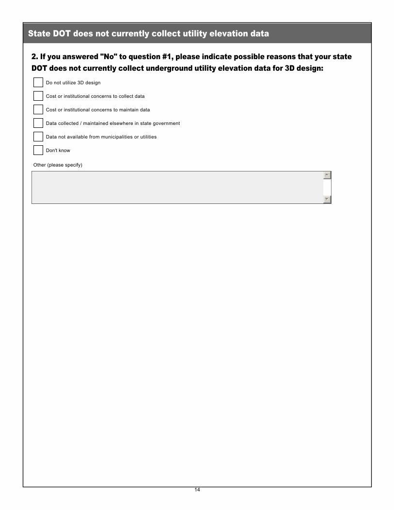
2. If you answered "No" to question #1, please indicate possible reasons that your state DOT does not currently collect underground utility elevation data for 3D design:
State DOT does not currently collect utility elevation data
Do not utilize 3D design
gfedc
Cost or institutional concerns to collect data
gfedc
Cost or institutional concerns to maintain data
gfedc
Data collected / maintained elsewhere in state government
gfedc
Data not available from municipalities or utilities
gfedc
Don't know
gfedc
Other (please specify)
55
66
14
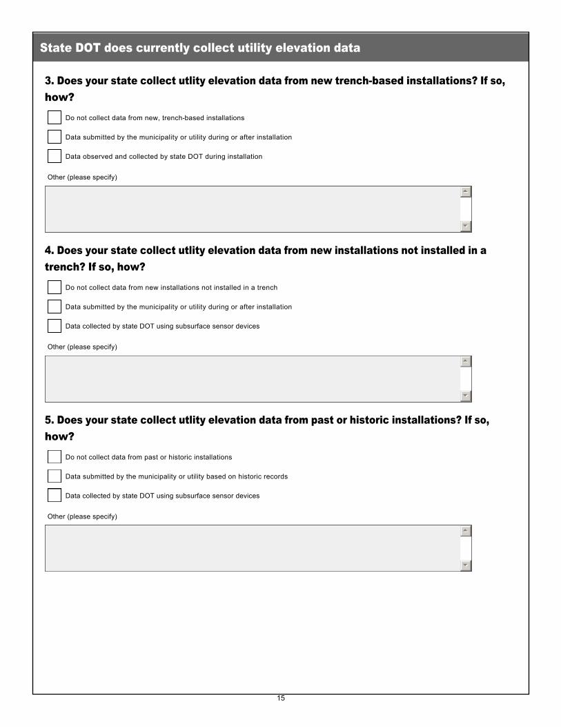
3. Does your state collect utlity elevation data from new trenchbased installations? If so, how?
4. Does your state collect utlity elevation data from new installations not installed in a trench? If so, how?
5. Does your state collect utlity elevation data from past or historic installations? If so, how?
State DOT does currently collect utility elevation data
Do not collect data from new, trenchbased installations
gfedc
Data submitted by the municipality or utility during or after installation
gfedc
Data observed and collected by state DOT during installation
gfedc
Other (please specify)
55
66
Do not collect data from new installations not installed in a trench
gfedc
Data submitted by the municipality or utility during or after installation
gfedc
Data collected by state DOT using subsurface sensor devices
gfedc
Other (please specify)
55
66
Do not collect data from past or historic installations
gfedc
Data submitted by the municipality or utility based on historic records
gfedc
Data collected by state DOT using subsurface sensor devices
gfedc
Other (please specify)
55
66
15
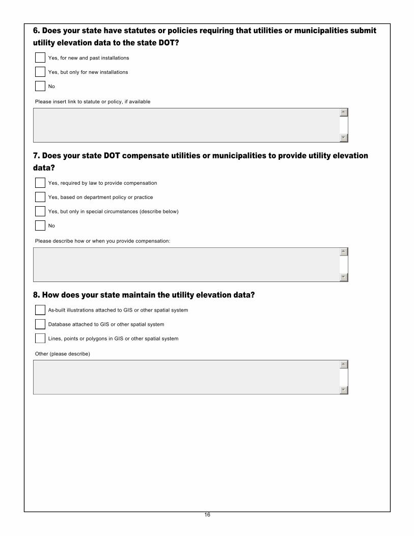
6. Does your state have statutes or policies requiring that utilities or municipalities submit utility elevation data to the state DOT?
7. Does your state DOT compensate utilities or municipalities to provide utility elevation data?
8. How does your state maintain the utility elevation data?
Yes, for new and past installations
gfedc
Yes, but only for new installations
gfedc
No
gfedc
Please insert link to statute or policy, if available
55
66
Yes, required by law to provide compensation
gfedc
Yes, based on department policy or practice
gfedc
Yes, but only in special circumstances (describe below)
gfedc
No
gfedc
Please describe how or when you provide compensation:
55
66
Asbuilt illustrations attached to GIS or other spatial system
gfedc
Database attached to GIS or other spatial system
gfedc
Lines, points or polygons in GIS or other spatial system
gfedc
Other (please describe)
55
66
16

9. Please provide your name, agency, phone and email so that we can contact you for more information about your responses.
Contact information
Name
Agency
Phone
Email
17