welcome to the i –section 6 - in.gov combined... · construction or maintenance of traffic for: +...
TRANSCRIPT
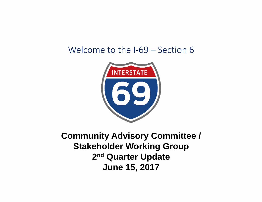
Welcome to the I‐69 – Section 6
Community Advisory Committee /Stakeholder Working Group
2nd Quarter Update June 15, 2017
Introductions
Indiana Department of Transportation
Federal Highway Administration
Study Team and CAC / SWG Member
2
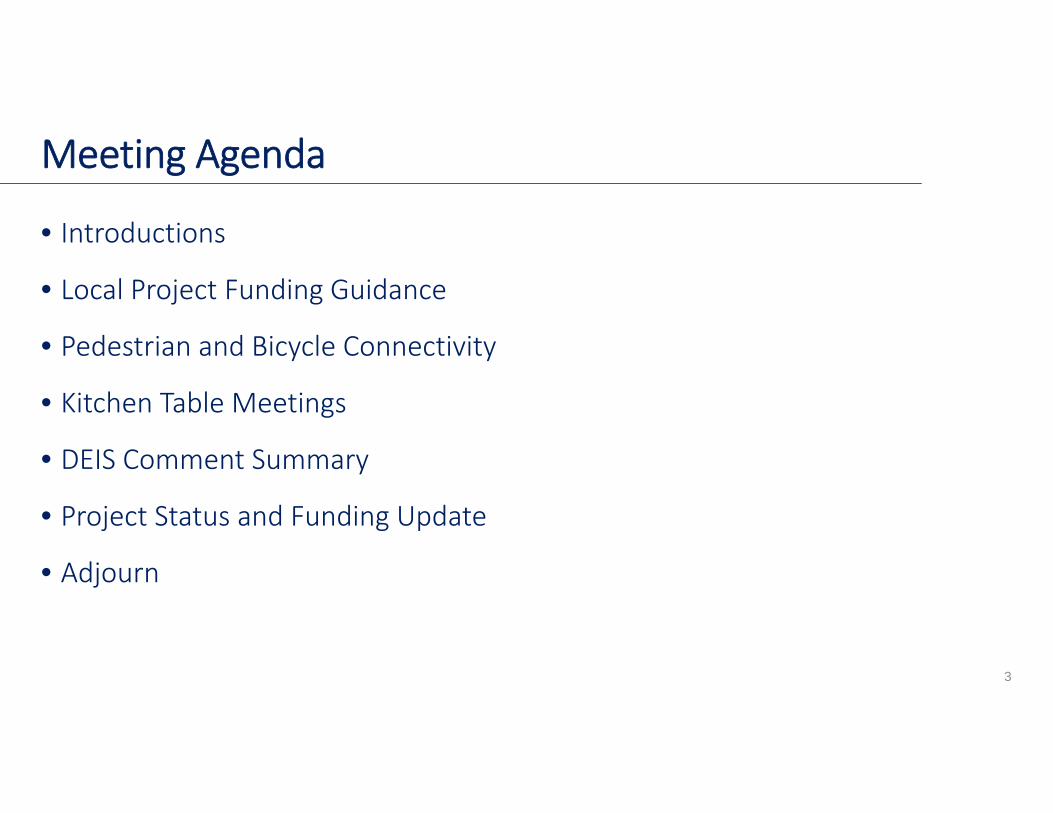
Meeting Agenda
• Introductions
• Local Project Funding Guidance
• Pedestrian and Bicycle Connectivity
• Kitchen Table Meetings
• DEIS Comment Summary
• Project Status and Funding Update
• Adjourn
3

2017 Local Road and BridgeMatching Grant Fund
Kathy Eaton‐McKalipLocal Programs Director
Indiana Department of Transportation
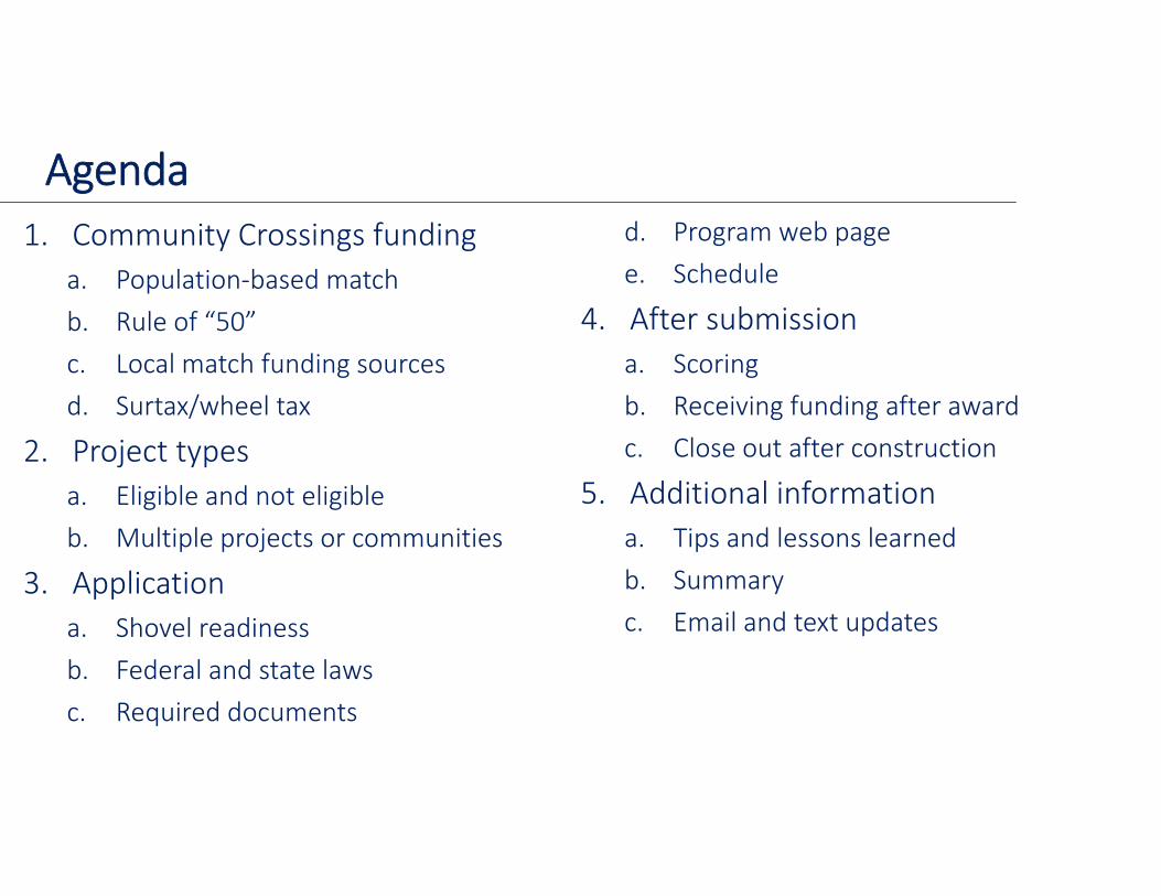
1. Community Crossings fundinga. Population‐based matchb. Rule of “50”c. Local match funding sourcesd. Surtax/wheel tax
2. Project typesa. Eligible and not eligibleb. Multiple projects or communities
3. Applicationa. Shovel readinessb. Federal and state lawsc. Required documents
d. Program web pagee. Schedule
4. After submissiona. Scoringb. Receiving funding after awardc. Close out after construction
5. Additional informationa. Tips and lessons learnedb. Summaryc. Email and text updates
Agenda
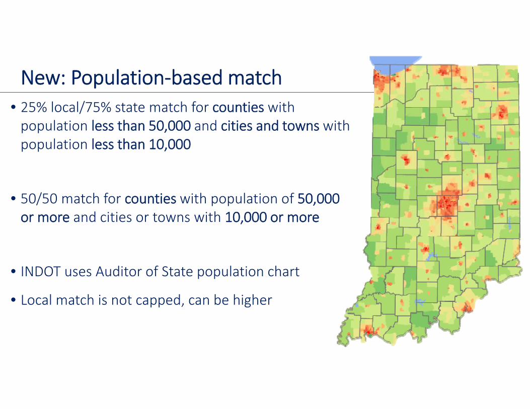
New: Population‐based match• 25% local/75% state match for counties with population less than 50,000 and cities and towns with population less than 10,000
• 50/50 match for counties with population of 50,000 or more and cities or towns with 10,000 or more
• INDOT uses Auditor of State population chart
• Local match is not capped, can be higher
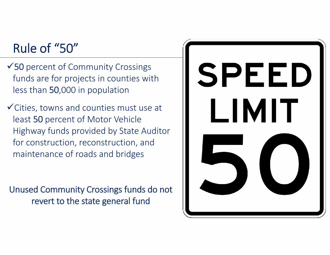
Rule of “50”50 percent of Community Crossings funds are for projects in counties with less than 50,000 in population
Cities, towns and counties must use at least 50 percent of Motor Vehicle Highway funds provided by State Auditor for construction, reconstruction, and maintenance of roads and bridges
Unused Community Crossings funds do not revert to the state general fund
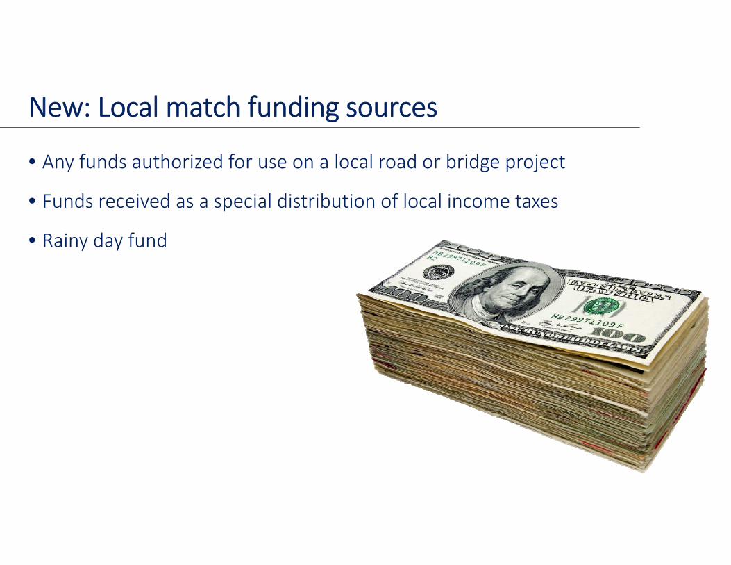
New: Local match funding sources
• Any funds authorized for use on a local road or bridge project
• Funds received as a special distribution of local income taxes
• Rainy day fund
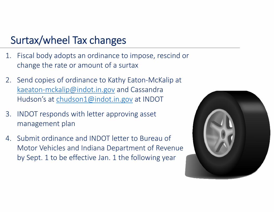
Surtax/wheel Tax changes1. Fiscal body adopts an ordinance to impose, rescind or
change the rate or amount of a surtax
2. Send copies of ordinance to Kathy Eaton‐McKalip at kaeaton‐[email protected] and Cassandra Hudson’s at [email protected] at INDOT
3. INDOT responds with letter approving asset management plan
4. Submit ordinance and INDOT letter to Bureau of Motor Vehicles and Indiana Department of Revenue by Sept. 1 to be effective Jan. 1 the following year
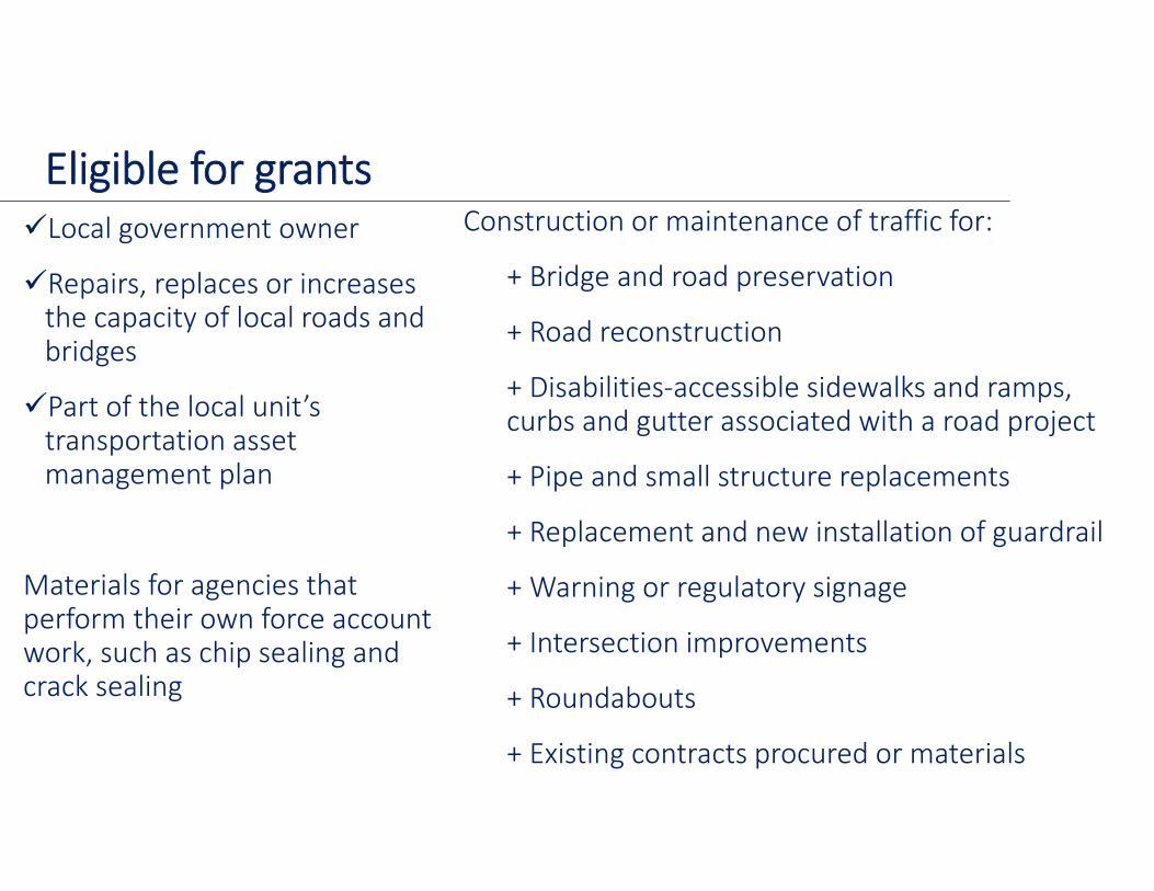
Local government owner
Repairs, replaces or increases the capacity of local roads and bridges
Part of the local unit’s transportation asset management plan
Materials for agencies that perform their own force account work, such as chip sealing and crack sealing
Construction or maintenance of traffic for:
+ Bridge and road preservation
+ Road reconstruction
+ Disabilities‐accessible sidewalks and ramps, curbs and gutter associated with a road project
+ Pipe and small structure replacements
+ Replacement and new installation of guardrail
+ Warning or regulatory signage
+ Intersection improvements
+ Roundabouts
+ Existing contracts procured or materials
Eligible for grants
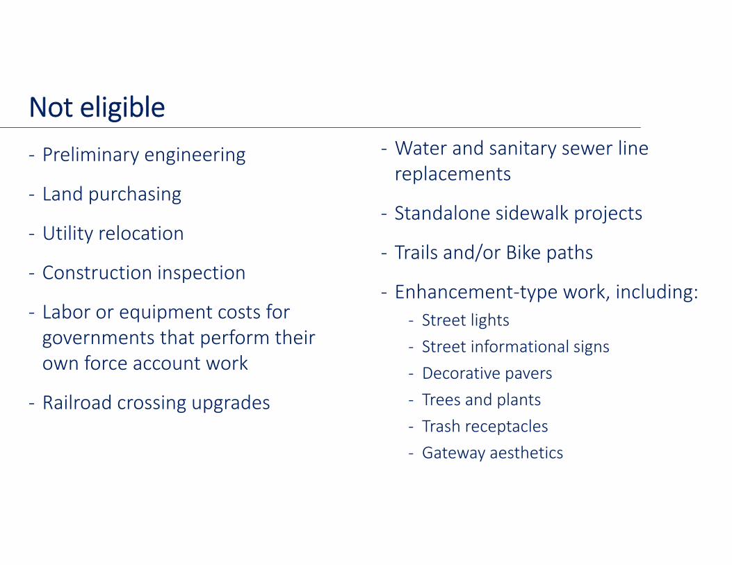
‐ Preliminary engineering
‐ Land purchasing
‐ Utility relocation
‐ Construction inspection
‐ Labor or equipment costs for governments that perform their own force account work
‐ Railroad crossing upgrades
‐ Water and sanitary sewer line replacements
‐ Standalone sidewalk projects
‐ Trails and/or Bike paths
‐ Enhancement‐type work, including:‐ Street lights‐ Street informational signs‐ Decorative pavers‐ Trees and plants‐ Trash receptacles‐ Gateway aesthetics
Not eligible
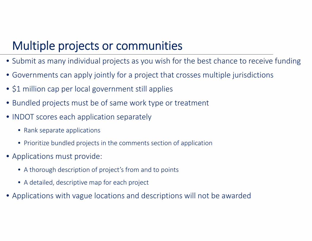
Multiple projects or communities• Submit as many individual projects as you wish for the best chance to receive funding
• Governments can apply jointly for a project that crosses multiple jurisdictions
• $1 million cap per local government still applies
• Bundled projects must be of same work type or treatment
• INDOT scores each application separately • Rank separate applications
• Prioritize bundled projects in the comments section of application
• Applications must provide:
• A thorough description of project’s from and to points
• A detailed, descriptive map for each project
• Applications with vague locations and descriptions will not be awarded
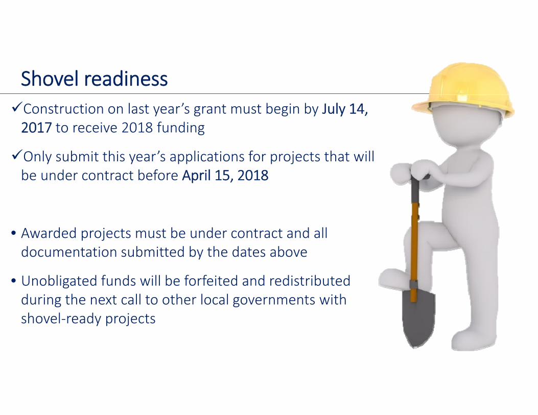
Shovel readinessConstruction on last year’s grant must begin by July 14, 2017 to receive 2018 funding
Only submit this year’s applications for projects that will be under contract before April 15, 2018
• Awarded projects must be under contract and all documentation submitted by the dates above
• Unobligated funds will be forfeited and redistributed during the next call to other local governments with shovel‐ready projects
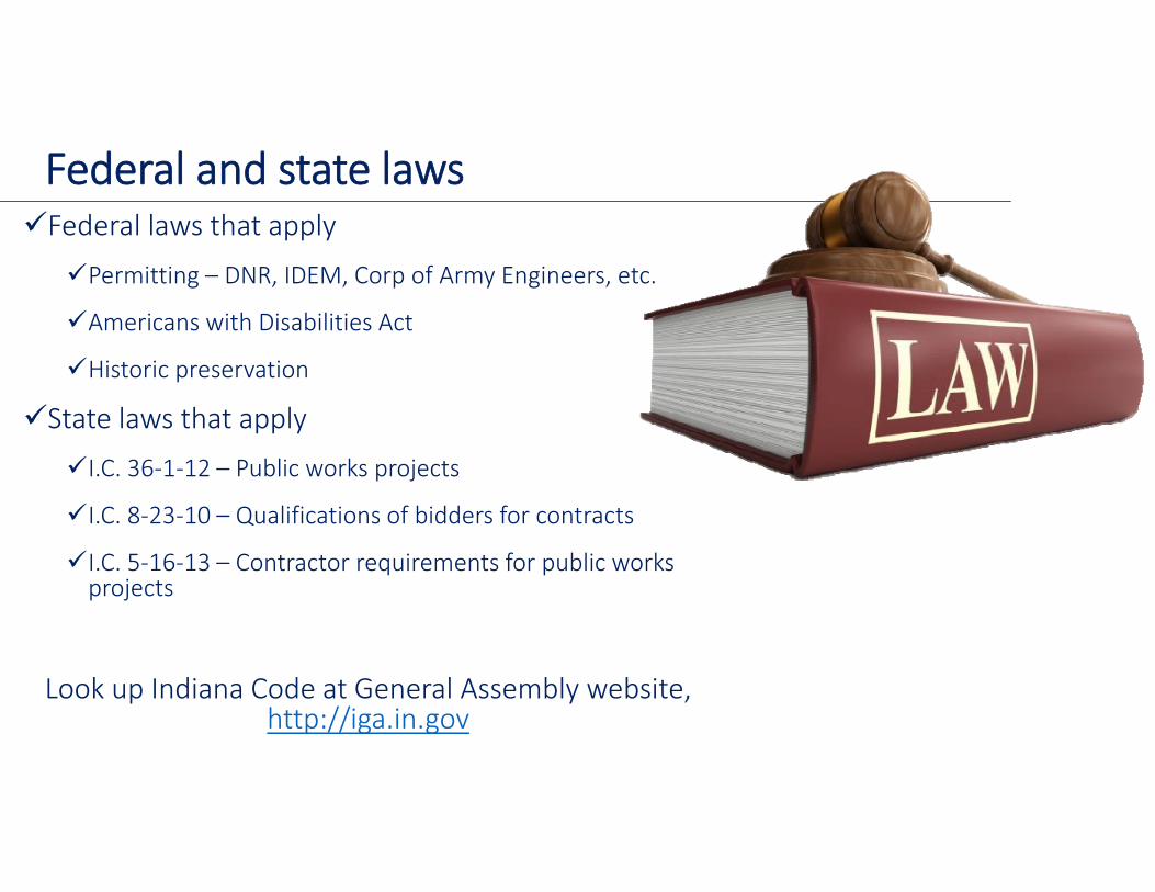
Federal and state lawsFederal laws that apply
Permitting – DNR, IDEM, Corp of Army Engineers, etc.
Americans with Disabilities Act
Historic preservation
State laws that apply
I.C. 36‐1‐12 – Public works projects
I.C. 8‐23‐10 – Qualifications of bidders for contracts
I.C. 5‐16‐13 – Contractor requirements for public works projects
Look up Indiana Code at General Assembly website, http://iga.in.gov
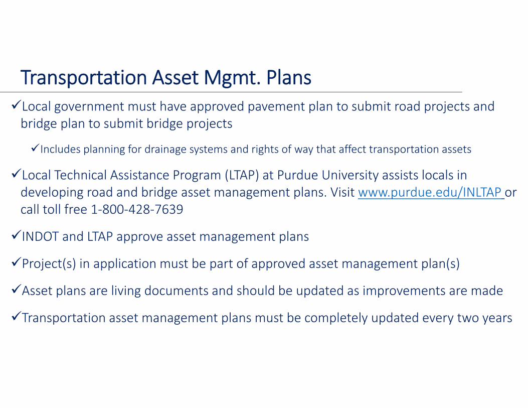
Transportation Asset Mgmt. PlansLocal government must have approved pavement plan to submit road projects and bridge plan to submit bridge projects
Includes planning for drainage systems and rights of way that affect transportation assets
Local Technical Assistance Program (LTAP) at Purdue University assists locals in developing road and bridge asset management plans. Visit www.purdue.edu/INLTAP or call toll free 1‐800‐428‐7639
INDOT and LTAP approve asset management plans
Project(s) in application must be part of approved asset management plan(s)
Asset plans are living documents and should be updated as improvements are made
Transportation asset management plans must be completely updated every two years

Required documents in application
Application
Detailed preliminary estimate
Approved asset management plan
Project location map(s)
Financial commitment letter
Listing of “from and to” points
Structure and inventory reports for bridge projects
Applications missing documentation are not eligible for a matching grant
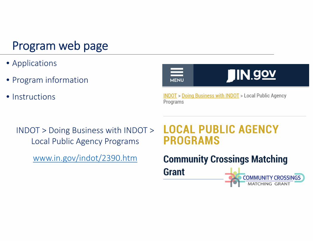
Program web page• Applications
• Program information
• Instructions
INDOT > Doing Business with INDOT > Local Public Agency Programs
www.in.gov/indot/2390.htm
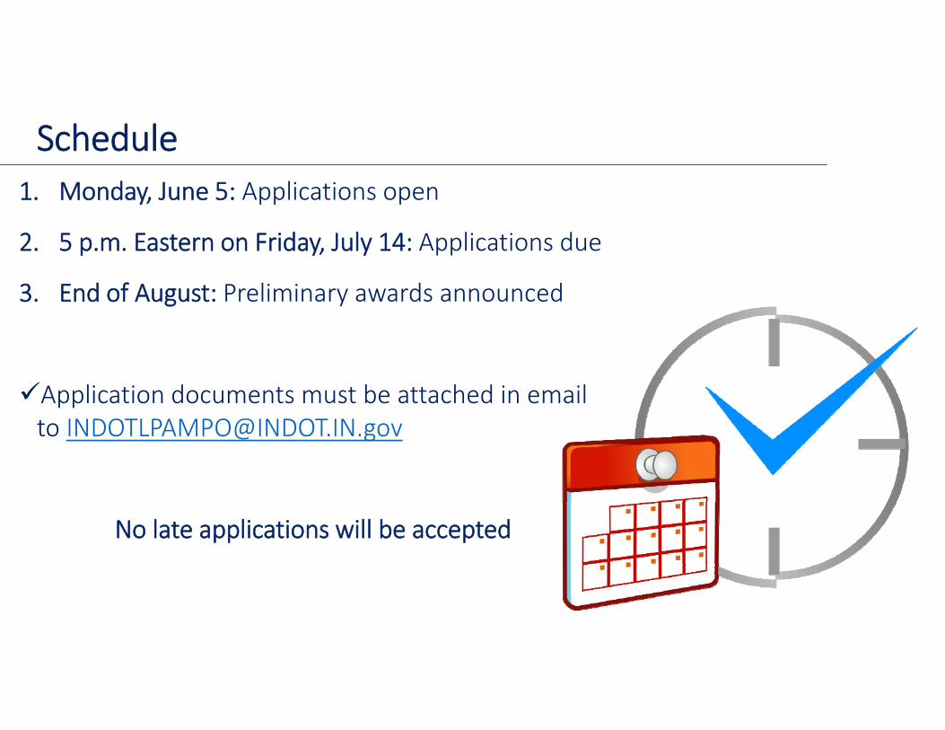
Schedule1. Monday, June 5: Applications open
2. 5 p.m. Eastern on Friday, July 14: Applications due
3. End of August: Preliminary awards announced
Application documents must be attached in email to [email protected]
No late applications will be accepted
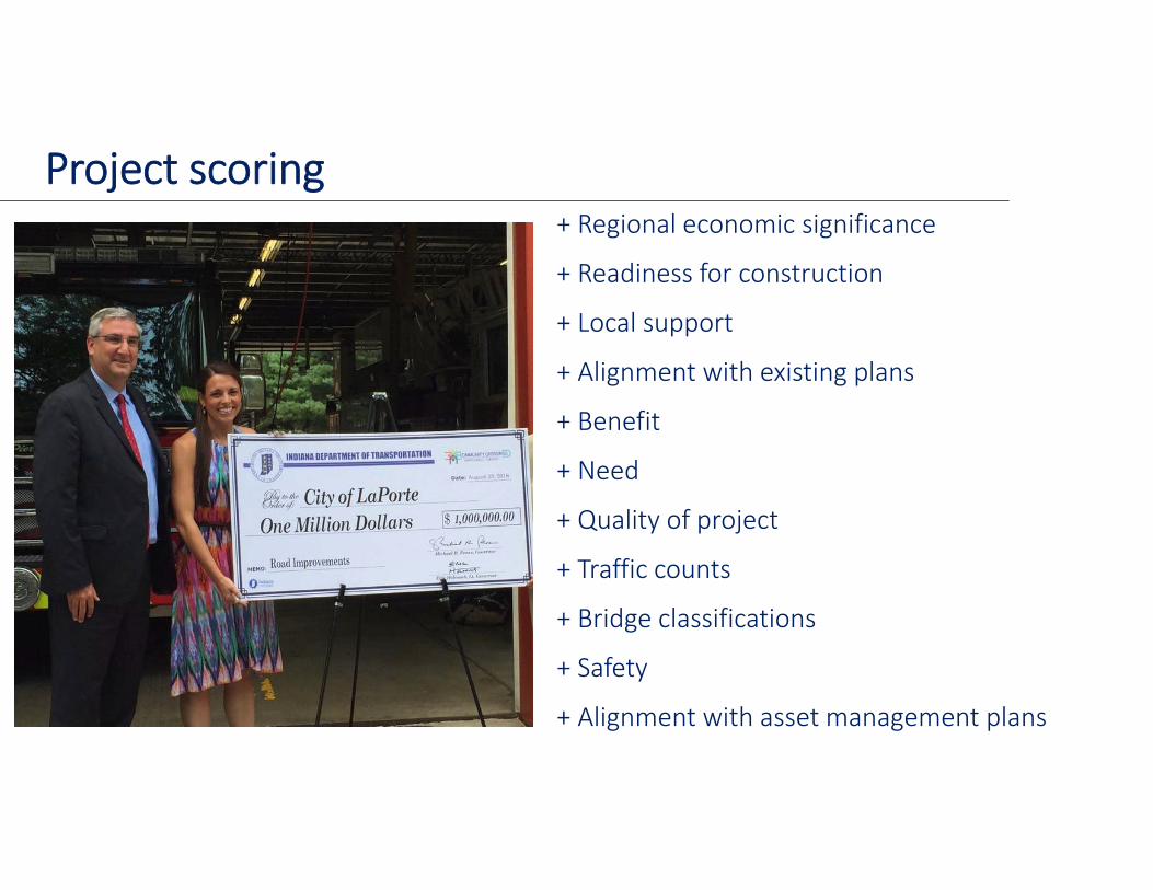
Project scoring+ Regional economic significance
+ Readiness for construction
+ Local support
+ Alignment with existing plans
+ Benefit
+ Need
+ Quality of project
+ Traffic counts
+ Bridge classifications
+ Safety
+ Alignment with asset management plans
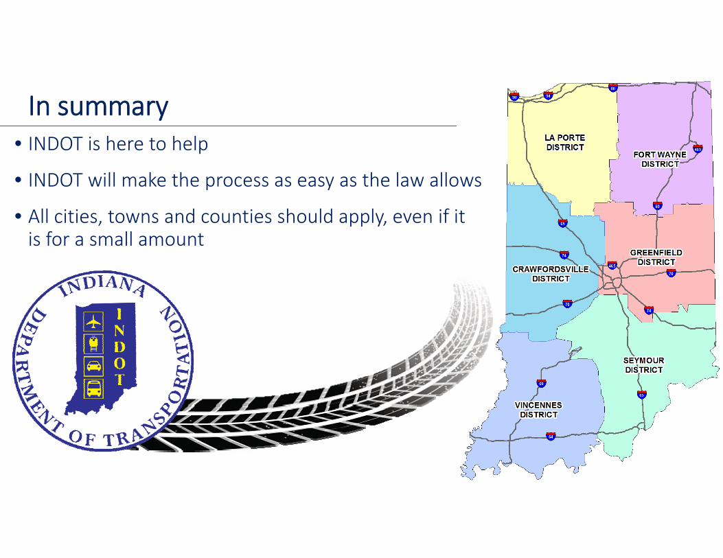
In summary• INDOT is here to help
• INDOT will make the process as easy as the law allows
• All cities, towns and counties should apply, even if it is for a small amount
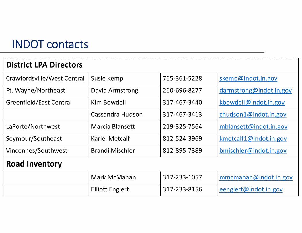
INDOT contacts
District LPA DirectorsCrawfordsville/West Central Susie Kemp 765‐361‐5228 [email protected]
Ft. Wayne/Northeast David Armstrong 260‐696‐8277 [email protected]
Greenfield/East Central Kim Bowdell 317‐467‐3440 [email protected]
Cassandra Hudson 317‐467‐3413 [email protected]
LaPorte/Northwest Marcia Blansett 219‐325‐7564 [email protected]
Seymour/Southeast Karlei Metcalf 812‐524‐3969 [email protected]
Vincennes/Southwest Brandi Mischler 812‐895‐7389 [email protected]
Road InventoryMark McMahan 317‐233‐1057 [email protected]
Elliott Englert 317‐233‐8156 [email protected]
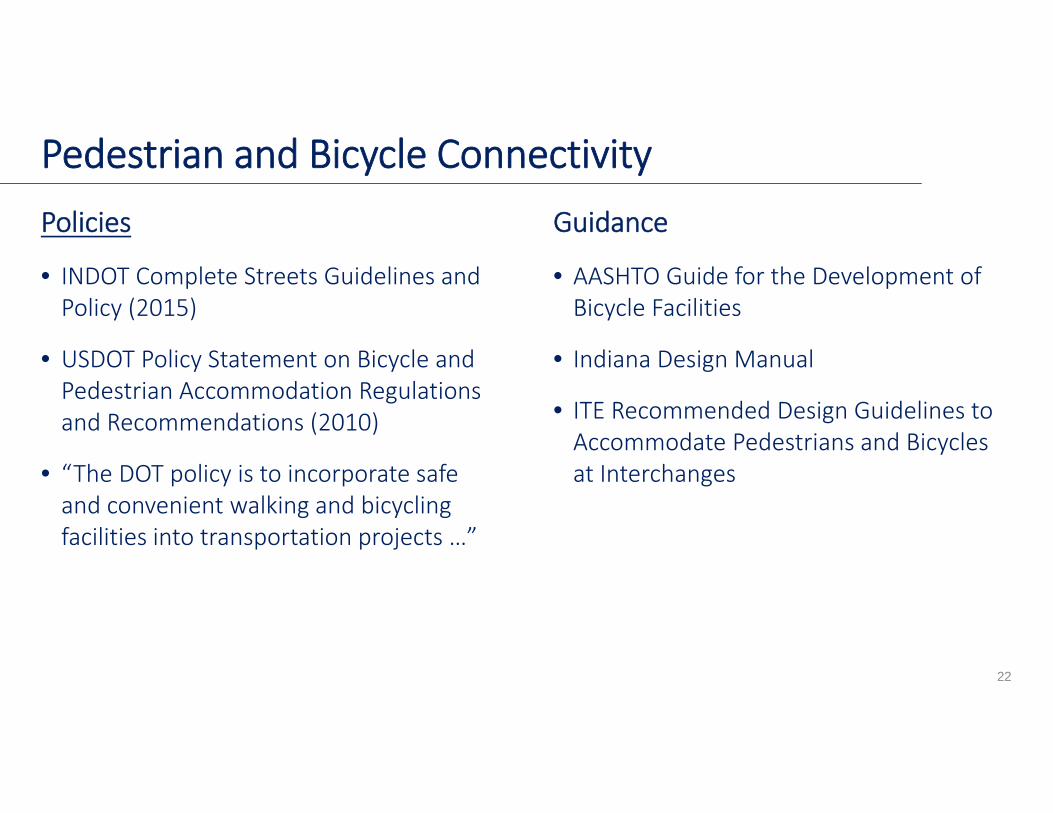
Policies
• INDOT Complete Streets Guidelines and Policy (2015)
• USDOT Policy Statement on Bicycle and Pedestrian Accommodation Regulations and Recommendations (2010)
• “The DOT policy is to incorporate safe and convenient walking and bicycling facilities into transportation projects …”
Guidance
• AASHTO Guide for the Development of Bicycle Facilities
• Indiana Design Manual
• ITE Recommended Design Guidelines to Accommodate Pedestrians and Bicycles at Interchanges
22
Pedestrian and Bicycle Connectivity

• Multiuse pathShare with bikes adjacentto high‐volume roads
• SidewalkMost urban streets
• Paved shoulderRural roads with lower volumes
• Shared streetShort tie‐ins with noadjacent facilities
Pedestrian Connectivity
23
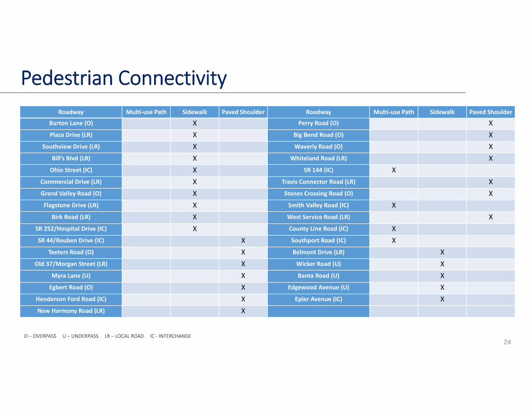
Pedestrian Connectivity
24
Roadway Multi‐use Path Sidewalk Paved Shoulder Roadway Multi‐use Path Sidewalk Paved Shoulder
Burton Lane (O) X Perry Road (O) XPlaza Drive (LR) X Big Bend Road (O) X
Southview Drive (LR) X Waverly Road (O) XBill’s Blvd (LR) X Whiteland Road (LR) XOhio Street (IC) X SR 144 (IC) X
Commercial Drive (LR) X Travis Connector Road (LR) XGrand Valley Road (O) X Stones Crossing Road (O) XFlagstone Drive (LR) X Smith Valley Road (IC) X
Birk Road (LR) X West Service Road (LR) XSR 252/Hospital Drive (IC) X County Line Road (IC) XSR 44/Reuben Drive (IC) X Southport Road (IC) X
Teeters Road (O) X Belmont Drive (LR) XOld 37/Morgan Street (LR) X Wicker Road (U) X
Myra Lane (U) X Banta Road (U) XEgbert Road (O) X Edgewood Avenue (U) X
Henderson Ford Road (IC) X Epler Avenue (IC) XNew Harmony Road (LR) X
O – OVERPASS U – UNDERPASS LR – LOCAL ROAD IC ‐ INTERCHANGE
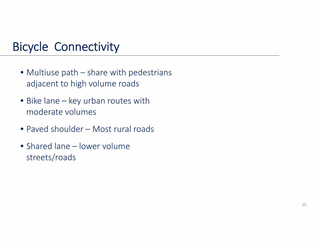
• Multiuse path – share with pedestrians adjacent to high volume roads
• Bike lane – key urban routes with moderate volumes
• Paved shoulder – Most rural roads
• Shared lane – lower volume streets/roads
Bicycle Connectivity
25
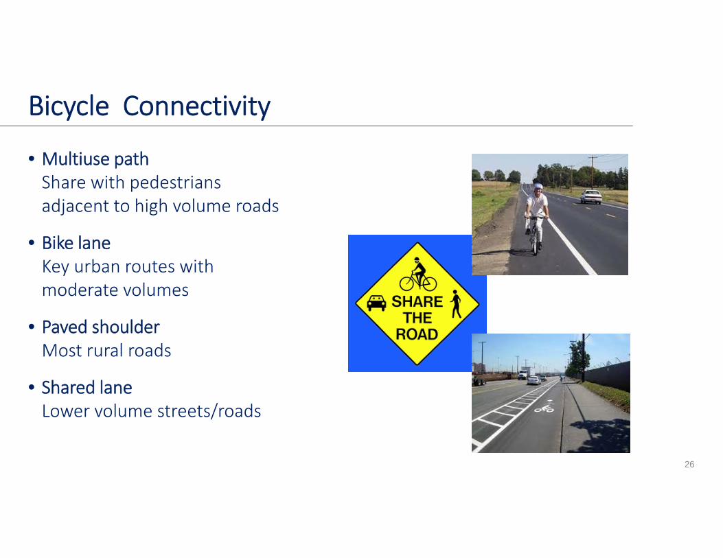
Bicycle Connectivity
• Multiuse pathShare with pedestrians adjacent to high volume roads
• Bike laneKey urban routes with moderate volumes
• Paved shoulderMost rural roads
• Shared laneLower volume streets/roads
26
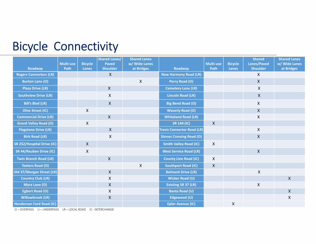
Bicycle Connectivity
27
RoadwayMulti‐use
PathBicycle Lanes
Shared Lanes/Paved
Shoulder
Shared Lanesw/ Wide Lanes
at Bridges RoadwayMulti‐use
PathBicycle Lanes
Shared Lanes/Paved Shoulder
Shared Lanesw/ Wide Lanes
at BridgesRogers Connectors (LR) X New Harmony Road (LR) X
Burton Lane (O) X Perry Road (O) XPlaza Drive (LR) X Cemetery Lane (LR) X
Southview Drive (LR) X Lincoln Road (LR) X
Bill’s Blvd (LR) X Big Bend Road (O) XOhio Street (IC) X Waverly Road (O) X
Commercial Drive (LR) X Whiteland Road (LR) XGrand Valley Road (O) X SR 144 (IC) XFlagstone Drive (LR) X Travis Connector Road (LR) X
Birk Road (LR) X Stones Crossing Road (O) XSR 252/Hospital Drive (IC) X Smith Valley Road (IC) XSR 44/Reuben Drive (IC) X West Service Road (LR) XTwin Branch Road (LR) X County Line Road (IC) X
Teeters Road (O) X Southport Road (IC) XOld 37/Morgan Street (LR) X Belmont Drive (LR) X
Country Club (LR) X Wicker Road (U) XMyra Lane (O) X Existing SR 37 (LR) XEgbert Road (O) X Banta Road (U) XWillowbrook (LR) X Edgewood (U) X
Henderson Ford Road (IC) Epler Avenue (IC) XO – OVERPASS U – UNDERPASS LR – LOCAL ROAD IC ‐ INTERCHANGE
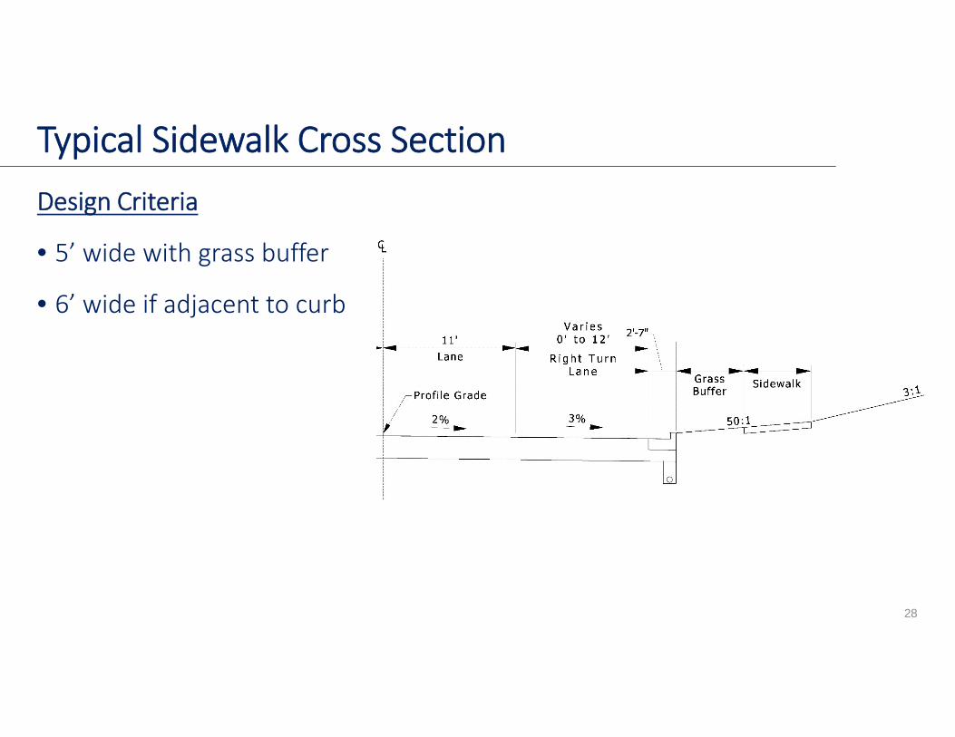
Design Criteria
• 5’ wide with grass buffer
• 6’ wide if adjacent to curb
28
Typical Sidewalk Cross Section
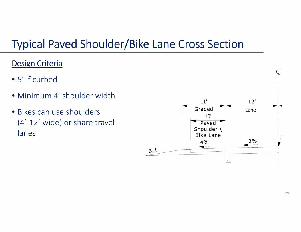
Design Criteria
• 5’ if curbed
• Minimum 4’ shoulder width
• Bikes can use shoulders (4’‐12’ wide) or share travel lanes
29
Typical Paved Shoulder/Bike Lane Cross Section
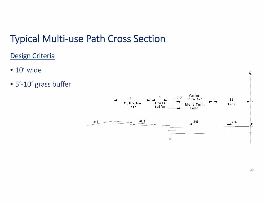
Design Criteria
• 10’ wide
• 5’‐10’ grass buffer
30
Typical Multi‐use Path Cross Section
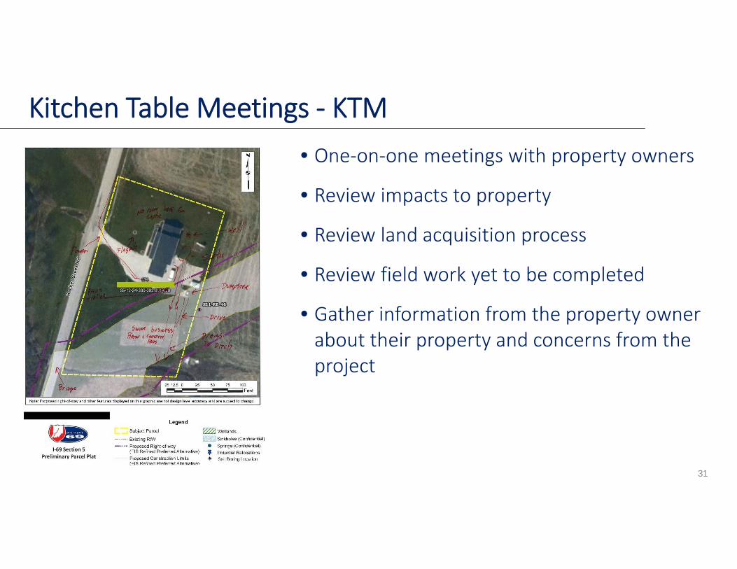
• One‐on‐one meetings with property owners
• Review impacts to property
• Review land acquisition process
• Review field work yet to be completed
• Gather information from the property owner about their property and concerns from the project
31
Kitchen Table Meetings ‐ KTM

• Previous Projects• How KTMs started
• Section 4 – 225
• Section 5 – 325
• Illiana – 100
• I‐69 Section 6 • Expect 800 Meetings
32
Kitchen Table Meetings ‐ KTM
Project Funding Update
• HB1002
• Next Steps for Project Planning/Development
33
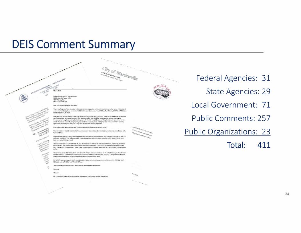
DEIS Comment Summary
Federal Agencies: 31State Agencies: 29
Local Government: 71Public Comments: 257
Public Organizations: 23Total: 411
34
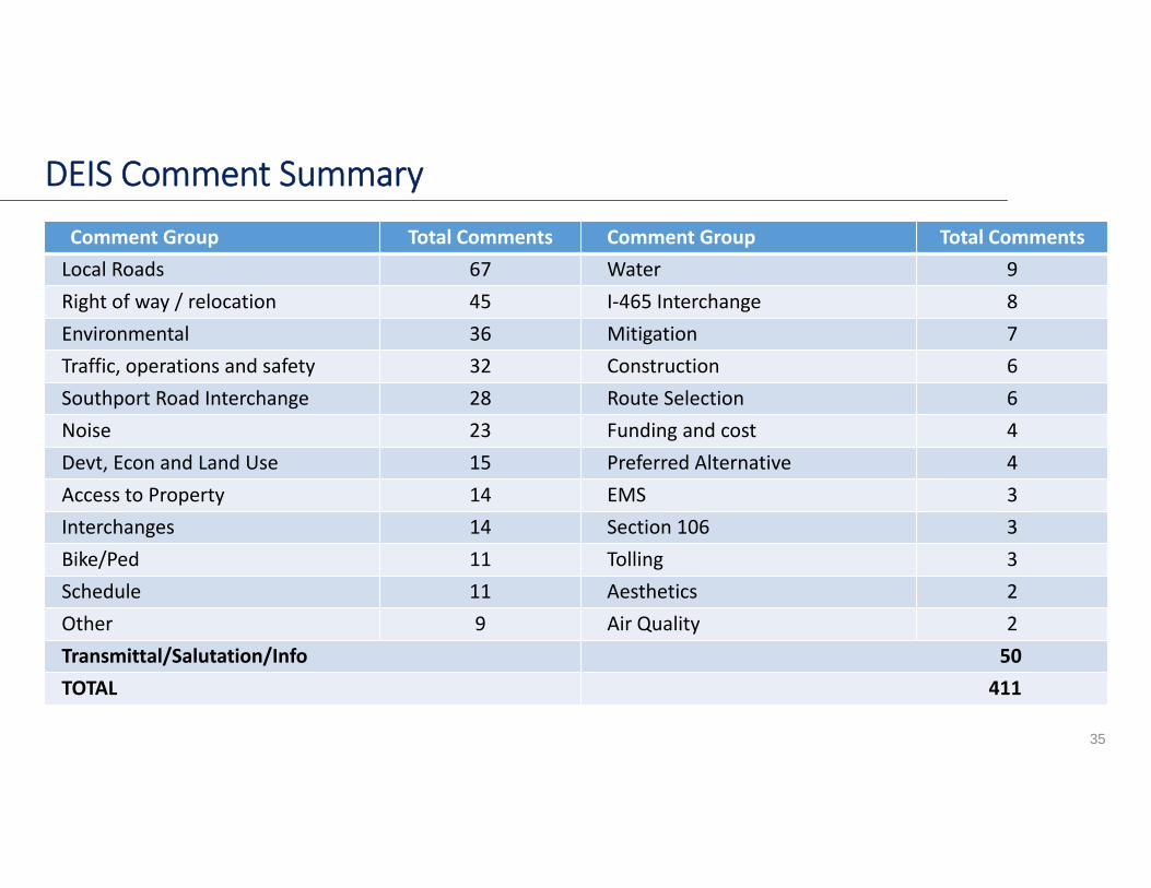
DEIS Comment Summary
35
Comment Group Total Comments Comment Group Total CommentsLocal Roads 67 Water 9Right of way / relocation 45 I‐465 Interchange 8Environmental 36 Mitigation 7Traffic, operations and safety 32 Construction 6Southport Road Interchange 28 Route Selection 6Noise 23 Funding and cost 4Devt, Econ and Land Use 15 Preferred Alternative 4Access to Property 14 EMS 3Interchanges 14 Section 106 3Bike/Ped 11 Tolling 3Schedule 11 Aesthetics 2Other 9 Air Quality 2Transmittal/Salutation/Info 50TOTAL 411
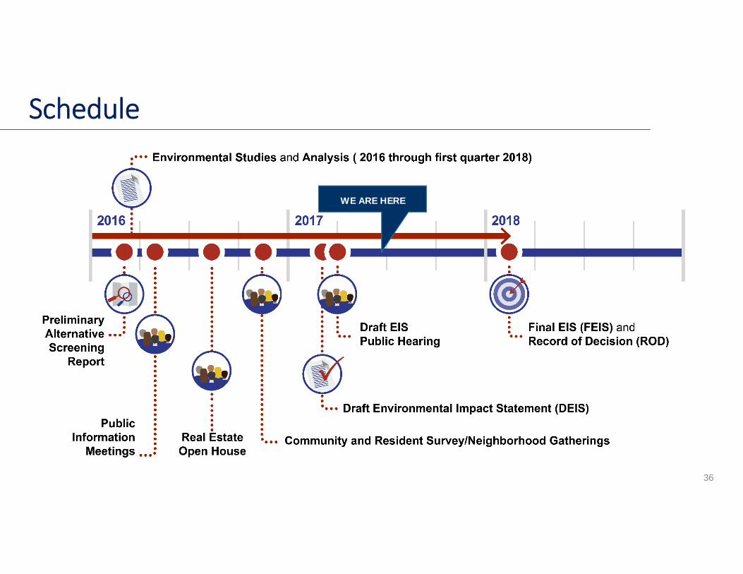
Schedule
WE ARE HERE
36
• Adopted I‐69 Section 6 into the Indy MPO Long Range Transportation Plan
• Begin Re‐establishing centerline of SR 37 and section corners
• Review and consideration of all comments• Design and right of way refinements• Utility Coordination• Begin Preparation of Engineers Report• Verification of traffic / lane determinations • Local coordination • Continue stakeholder meetings
37
What’s Happened Since Hearing?

• Review and prepare responses to comments
• Incorporate revisions• Additional fieldwork on revisions• Publish FEIS/Final Decision/Record of Decision in early 2018
• Design• Real estate acquisition• Construction
38
What’s Next?

Section 6 Project Office7847 Waverly Road | Martinsville, IN 46151
Phone: (317) 881‐6408Email: [email protected]
www.i69indyevn.org