webworldwind, achievements and future of the esa …2016.ogrs-community.org/2016_papers/de-eoapps- -...
TRANSCRIPT

1 / 19
WebWorldWind, achievements and future of the ESA-NASA partnership Yann Voumard, Paulo Sacramento, Pier Giorgio Marchetti, Patrick Hogan OGRS 2016 conference, Perugia, Italy, 13/10/2016

2 / 19
Context Introduction Comparison between WebWorldWind and other 3D
virtual globes Results of the first year Outlook and conclusion
13/10/2016 WebWorldWind, achievements and future of the ESA-NASA partnership
Agenda
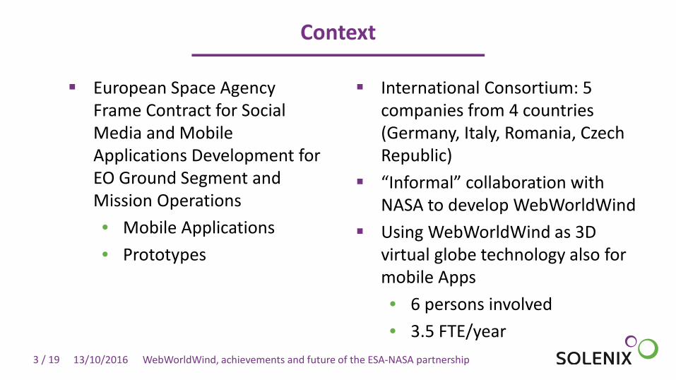
3 / 19
European Space Agency Frame Contract for Social Media and Mobile Applications Development for EO Ground Segment and Mission Operations • Mobile Applications • Prototypes
International Consortium: 5 companies from 4 countries (Germany, Italy, Romania, Czech Republic)
“Informal” collaboration with NASA to develop WebWorldWind
Using WebWorldWind as 3D virtual globe technology also for mobile Apps • 6 persons involved • 3.5 FTE/year
13/10/2016 WebWorldWind, achievements and future of the ESA-NASA partnership
Context

4 / 19 13/10/2016 WebWorldWind, achievements and future of the ESA-NASA partnership
General Process
Develop
New features for the
framework
Promote
In Europe
Demo
Community and Stakeholders
Ideas, needs, etc.
Collect

5 / 19
Introduction
The paper: • presents results of first year of on-going ESA-NASA collaboration on WebWorldWind
development; • highlights concrete examples built with the newly introduced features and puts them in
relation to possible research and education use cases; • Briefly introduces next steps and roadmap.
WebWorldWind is free and open-source 3D virtual globe API for HTML5 and JavaScript developed by NASA with support of the European Space Agency (ESA) and other partners (earlier today: 1 presentation about it and special event to announce NASA WorldWind Europa Challenge winning projects):
• Based on WebGL, available stably as part of HTML5 since 2011 (also on mobile) • Web technology great for distribution, portability, data access, ease of use -> and thus for
research and education • WWW is the web version of WorldWind, started in 2014 • ESA joined the effort in 2015, bringing development capabilities and requirements
13/10/2016 WebWorldWind, achievements and future of the ESA-NASA partnership

6 / 19
Comparison between WebWorldWind and other 3D virtual globes
Primary mission of WebWorldWind is to support the operational needs of the geospatial community:
• Different from other 3D virtual globe platforms such as Google Earth, ESRI and Cesium, which implement business models
An API rather than an application (such as Google Earth) -> N applications vs. 1 WWW now implements KML, so it offers similar visualization capabilities w.r.t. GE ESRI is commercial, relatively expensive, proprietary and not as full-featured as
WWW and GE-> Also an application, not an API Cesium is similar to WWW but harder to use and to extend (WWW strong point).
Aims at computer graphics needs, rather than geospatial community needs. PRO version costs several thousands of EURO (commercialized by AGI)
Key technical differences highlighted in the paper
13/10/2016 WebWorldWind, achievements and future of the ESA-NASA partnership
7 / 19
What about the mobile arena?
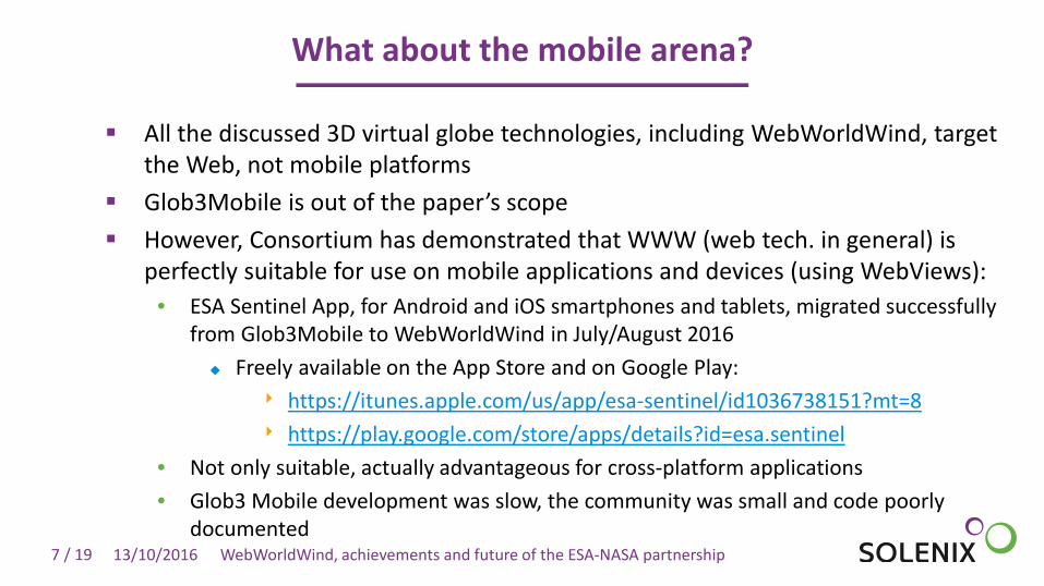
All the discussed 3D virtual globe technologies, including WebWorldWind, target the Web, not mobile platforms
Glob3Mobile is out of the paper’s scope However, Consortium has demonstrated that WWW (web tech. in general) is
perfectly suitable for use on mobile applications and devices (using WebViews): • ESA Sentinel App, for Android and iOS smartphones and tablets, migrated successfully
from Glob3Mobile to WebWorldWind in July/August 2016 Freely available on the App Store and on Google Play:
‣ https://itunes.apple.com/us/app/esa-sentinel/id1036738151?mt=8 ‣ https://play.google.com/store/apps/details?id=esa.sentinel
• Not only suitable, actually advantageous for cross-platform applications • Glob3 Mobile development was slow, the community was small and code poorly
documented 13/10/2016 WebWorldWind, achievements and future of the ESA-NASA partnership

8 / 19 13/10/2016 WebWorldWind, achievements and future of the ESA-NASA partnership
General Objectives
Standard Formats JPEG, PNG, GeoTIFF, Shapefile, GeoJSON, KML, Collada…
OGC Standards WMS, WCS, WMTS, WPS, WFS…
Aesthetic Atmosphere, Day/Night, Skybox, Retina, Antialiasing…
Utilities Layer Management, Controllers, Recognizers…

9 / 19
Results of the first year: framework
In complement to Shapefiles, JPEG and PNG: • GeoJSON for shapes • GeoTIFF for both strip- and tile-based imagery • Collada for 3D models • KML (geometries, placemark, styling, overlays, time primitives,
network link,…) Visual effects:
• Atmosphere • Sun illumination • Day/night layers
13/10/2016 WebWorldWind, achievements and future of the ESA-NASA partnership

10 / 19
GeoJSON
Catalogue results, ground station masks, other shape-based information…
13/10/2016 WebWorldWind, achievements and future of the ESA-NASA partnership

11 / 19
GeoTIFF
Imagery and data, e.g. elevation
13/10/2016 WebWorldWind, achievements and future of the ESA-NASA partnership

12 / 19
Collada
3D models, ground stations, satellites…
13/10/2016 WebWorldWind, achievements and future of the ESA-NASA partnership
13 / 19
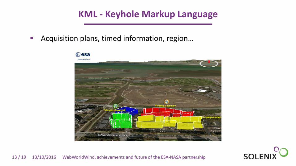
KML - Keyhole Markup Language
Acquisition plans, timed information, region…
13/10/2016 WebWorldWind, achievements and future of the ESA-NASA partnership

14 / 19
Results of the first year: reference applications
Satellite tracker (also in Sentinel App)
13/10/2016 WebWorldWind, achievements and future of the ESA-NASA partnership
EO product visualization (also in Sentinel App)
NDVI Viewer (large amount of data, time-series)

15 / 19
Outlook and Conclusion
13/10/2016 WebWorldWind, achievements and future of the ESA-NASA partnership
1-year extension, started 01/07/2016: • Continue contributing to
framework • Build rich, interesting and
useful applications to promote/help ESA
• Continue working on objectives set at Quarterly intervals
WWW has bright future with ESA and NASA backing
Future ESA use cases? • Thematic Exploitation Platforms • Next Generation Earth Observation
Growing online community and user base
Technical Roadmap: • WMTS, WCS • WPS, WFS, Measurement, Line of Sight,
Analytic Surface, HDF and FBX, among others
• Inputs welcome
For Education: WWW + JSBin

16 / 19
WCS – Web Coverage Service
Layer and elevation model in combination with GeoTIFF
13/10/2016 WebWorldWind, achievements and future of the ESA-NASA partnership
17 / 19
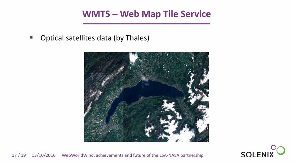
WMTS – Web Map Tile Service
Optical satellites data (by Thales)
13/10/2016 WebWorldWind, achievements and future of the ESA-NASA partnership

18 / 19
Links
Show me the code! • https://github.com/NASAWorldWind/WebWorldWind • https://github.com/ESAFastPrototyping/WebWorldWind/
Examples: • http://worldwindserver.net/webworldwind/examples/GeoJSON.html • http://get.solenix.ch/webworldwind/examples/GeoTiffExample.html • http://get.solenix.ch/webworldwind/examples/Collada.html • http://get.solenix.ch/webworldwind/examples/KmlExample.html • http://wo2.terrasigna.com/wcs-terrain/examples/WcsTerrain.html • http://thales-geo.github.io/webworldwind-demos/WWD/apps/WMTS/WMTS_ESA.html
Contacts: • [email protected] • [email protected]
13/10/2016 WebWorldWind, achievements and future of the ESA-NASA partnership

19 / 19
Solenix Deutschland GmbH Spreestr. 3 64295 Darmstadt Germany
[email protected] www.solenix.de
Thank You