wb-2007_principles and practice of ecologically sensitive urban planning & design
TRANSCRIPT
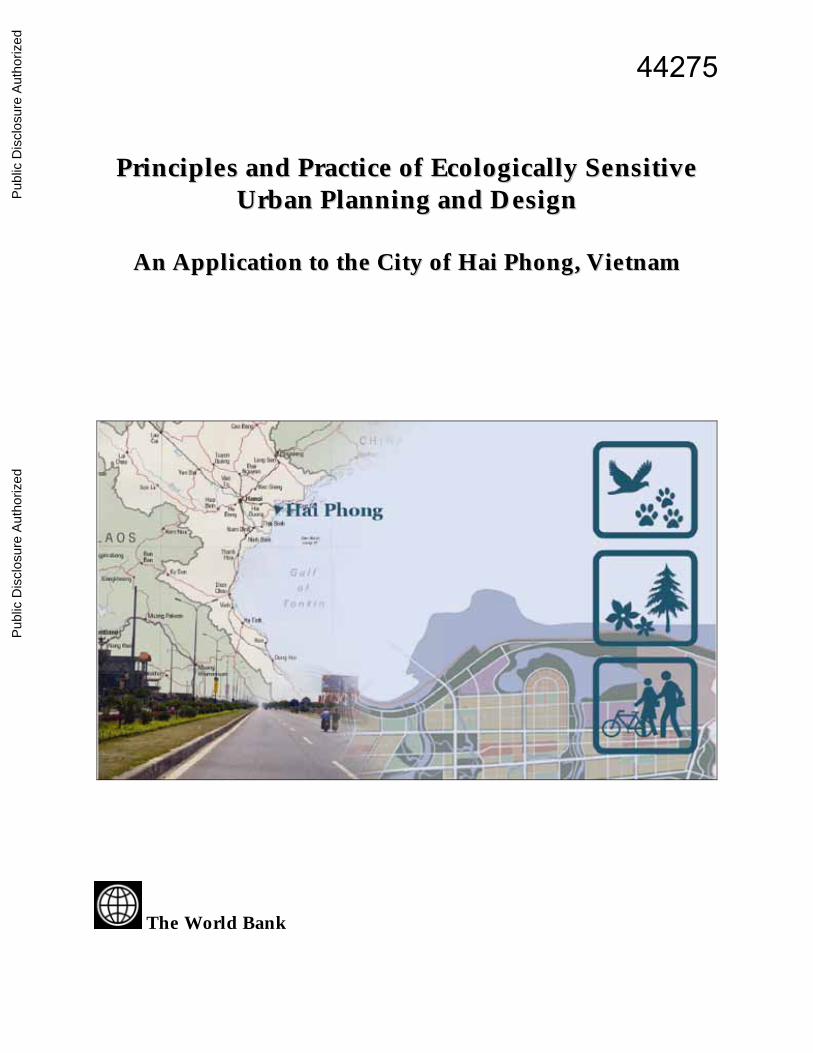
PPrriinncciipplleess aanndd PPrraaccttiiccee ooff EEccoollooggiiccaallllyy SSeennssiittiivvee UUrrbbaann PPllaannnniinngg aanndd DDeessiiggnn
AAnn AApppplliiccaattiioonn ttoo tthhee CCiittyy ooff HHaaii PPhhoonngg,, VViieettnnaamm
The World Bank
44275
Pub
lic D
iscl
osur
e A
utho
rized
Pub
lic D
iscl
osur
e A
utho
rized
Pub
lic D
iscl
osur
e A
utho
rized
Pub
lic D
iscl
osur
e A
utho
rized

2
This paper is the synthesis report of the World Bank’s Technical Assistance Program “Vietnam: Ecologically Friendly Urban Planning and Design”. It was prepared by the Sustainable Development Department of the East Asia and Pacific Region of the World Bank. Environmental and natural resources management issues are an integral part of the development challenge in the East Asia and Pacific (EAP) Region. The Environment Strategy for the World Bank in the East Asia and Pacific Region has provided the conceptual framework for setting priorities, strengthening the policy and institutional frameworks for sustainable development, and addressing key environmental and social development challenges through projects, programs, policy dialogue, nonlending services, and partnerships. This study provides a forum for discussion on good practices and policy issues within the development community and with client countries. Sustainable Development Department East Asia and Pacific Region The World Bank Washington, D.C. June 2007
This volume is a product of the staff of the International Bank for Reconstruction and Development / The World Bank. The findings, interpretations, and conclusions expressed in this paper do not necessarily reflect the views of the Executive Directors of The World Bank or the governments they represent. The World Bank does not guarantee the accuracy of the data included in this work. The boundaries, colors, denominations, and other information shown on any map in this work do not imply any judgment on the part of The World Bank concerning the legal status of any territory or the endorsement or acceptance of such boundaries.
The material in this publication is copyrighted. Copying and/or transmitting portions or all of this work without permission may be a violation of applicable law. The International Bank for Reconstruction and Development / The World Bank encourages dissemination of its work and will normally grant permission to reproduce portions of the work promptly.
For permission to photocopy or reprint any part of this work, please send a request with complete information to the Copyright Clearance Center, Inc., 222 Rosewood Drive, Danvers, MA 01923, USA, telephone 978-750-8400, fax 978-750-4470, www.copyright.com. All other queries on rights and licenses, including subsidiary rights, should be addressed to the Office of the Publisher, The World Bank, 1818 H Street NW, Washington, DC 20433, USA, fax 202-522-2422, e-mail [email protected].

3
TABLE OF CONTENTS Abstract 4 Acknowledgments 5 1. Introduction 6 2. Urbanization and the Urban Planning Framework in Vietnam 7 3. Improving Ecological Sensitivity in the Urban Planning Process 9 4. Planning the Hai Phong – Do Son Corridor on Ecologically Sensitive Principles 17 5. Problems and Potential Solution in Implementation 23 6. Conclusions and Recommendations 28 List of Figures 1. The City of Hai Phong and the Location of the Case Study Area 17 2. Case Study Area Land Cover Analysis 19 3. Alternative One: Land Use Planning Concept for the Case Study Site 20 4. Alternative One: Land Use Plan Axes 20
4
Abstract
Urbanization, which is almost completed now in developed countries and even in Latin America, is now proceeding in much of Asia at an unprecedented rate. Many of the countries in the region have up to half their population now living urban lifestyles and increasingly also living in urban regions. The forms that urbanization is taking in the developing countries, however, are problematic. Towns and cities that were never planned to have large populations are suffering from overloaded infrastructure. Development of the fringes is proceeding with little or no planning, resulting in even worse problems. Scattered developments, gradually increasing in density, are producing intense land-use conflicts and environmental pollution. Once development has occurred, these areas are difficult to service with efficient infrastructure. This paper builds on a study that was carried out with the aim of providing an
ecologically sound planning method to overcome some of these problems and promote the sustainability of urban development, especially in new urban development areas. The method was then applied to an extensive area south of the existing center of Hai Phong City in Vietnam that has been suffering from random development in recent years. The objective was to provide an ecologically sensitive urban planning and design framework for the further development of this area. An outline plan was produced and then a number of planning mechanisms were presented that should help the authorities to implement the plan. This is, furthermore, seen as a model with potential application to fringe areas of other cities in Vietnam and, suitably adapted, to cities in other countries of the East Asia region. Lessons from this exercise as summarized in recommendations at the end of the paper.

5
Acknowledgments
This summary paper—based on a longer study entitled Ecologically Friendly Urban Planning and Design: An Application to Hai Phong City, Vietnam—was prepared by Adrian Atkinson and Jian Xie. The peer reviewers were Tim Campbell, Fernando Loayza, and Henry Sharpe. This paper also benefited from the contributions and comments of Xinhao Wang, Jaeyong Song, and Daniel Sui. The original study was carried out between June 2005 and November 2006 in collaboration with the Vietnam Ministry of Natural Resources and Environment (MONRE) and the Hai Phong People’s Committee. It was commissioned by the World Bank Technical Assistance Program. The program benefited greatly from the leadership and active participation of Dr. Nguyen Van Thanh, vice chairman of Haiphong People’s Committee, and Ms. Tran Thi Minh Ha, director general of the Department of International Cooperation of the Vietnam Ministry of Natural Resources and Environment (MONRE). The final report of the TA program was prepared by a team of experts at the Seoul National University (SNU) with the assistance of the Consultancy Service and Technology Development Company for Natural
Resources and Environment in Vietnam (TECOS). Key members of the team were Dong Keun Lee, Seung Bin Im, Seong Woo Lee, Tong Mahn Ahn, Eui June Kim, and Young Chan Choe of SNU, and Tran Nhu Trung and Nguyen Anh Quan of TECOS. Jian Xie of the World Bank, who managed the TA project, provided detailed guidance to the production of the final report. Special thanks also go to Bui Quang San, Le Son, Vo Quoc Thai, and many others in Hai Phong for their valuable contribution and in-field assistance to the TA program and to those participants who attended consultation meetings and workshops. This paper was prepared under the general guidance of Christian Delvoie, Teresa Serra, Magda Lovei, Rahul Raturi, Hoonae Kim, and Susan Shen at the World Bank. Finally, we greatly appreciate the financial support for the project provided by the government of Korea through the Korea-World Bank Environmental Partnership in East Asia, and from the government of the Netherlands through the Bank-Netherlands Partnership Program.

6
1. Introduction
The longer study— Ecologically Friendly Urban Planning and Design: An Application to Hai Phong City, Vietnam—aimed at illustrating ecological urban planning and design principles in the setting of contemporary Vietnam.1 The intention was to assist in improving the planning of peri-urban areas in Vietnam by creating a model or pilot project on the periphery of the City of Hai Phong. The term “ecological” was used in the report, and is applied here, to indicate a focus on environmental sustainability. The emphasis in the original report, however, was also on urban design (and hence the visual aspects of urban development) rather than a broader urban planning approach.2 This paper does not simply summarize the report. While some of the material from the original report is used by way of illustrating aspects of ecological urban design principles, the intention here is to outline a general approach to ecologically sensitive urban planning and to indicate the value-added of this approach to the urban planning system. It then discusses the problems of implementing such an approach in the Vietnamese setting. Vietnam is by no means unique among developing countries in experiencing runaway urbanization in a context of inadequate planning frameworks and systems, so this paper should have relevance for planners, urban managers, and others responsible for steering urban development in other countries of the region looking for tools and procedures to better guide the urbanization process into a sustainable path.
The structure of this paper is as follows. The urban development and planning context of Vietnam is outlined in Part 2. This is followed in Part 3 by a presentation of some principles and tools of ecological urban planning and design, indicating how these principles can and should be integrated into existing urban planning procedures. Ecological planning is not presented here as a separate or entirely new approach to planning. Our intention is to suggest ways in which urban planning can be more effective in implementing development that enhances environmental sustainability. Part 4 presents the case study from the original report that applies some of the principles of ecologically sensitive planning to the Hai Phong–Do Son corridor. This is a 14-kilometer strip of land on the southern periphery of Vietnam’s third largest city. Like so many urban peripheries in the developing world, it has already been subject to significant unplanned development. This plan aims to provide a coherent, sustainable, and ecologically sensitive structure. Part 5 then focuses on the problems of implementing not only this plan, but more generally urban plans in the Vietnamese context. The proposals made to address these problems can create a framework that enables planners to make—and effectively implement—more coherent decisions about urban development. Part 6 summarizes the recommendations that are contained in various parts of the paper.

7
2. Urbanization and the Urban Planning Framework in Vietnam
The Vietnamese economy has been among the fastest growing economies in the world over the past two decades, but this growth started from a very low base. Even today the country still has a per capita income significantly below that of most other countries in East Asia. Throughout the country, economic growth is being accompanied by urbanization. Just 20 years ago, the Vietnamese population was overwhelmingly living in rural areas. The rate of urbanization, although somewhat slower than in China and other countries of the region, has nevertheless been progressing at a little over 3 percent a year over the past decade. Currently, about 27 percent of the population resides in urban areas.3 It should be noted that urbanization in this context is a complex process. Urban areas are increasingly difficult to define. Urban-type development is occurring in otherwise rural areas on the periphery of urban areas (peri-urban areas), while the inner areas of the larger cities are actually losing population. Significant numbers of the rural population move temporarily to urban areas to work in factories or the informal economy. This might be seasonal or for even shorter periods. Many of these short-term residents eventually become permanent residents, either in or on the edge of urban areas. Urban regions are thus increasing in density, and much of the population is making a transition from the rural economy to the urban economy. To some degree, these trends are contributing to a growing informal economy. The general policy framework for Vietnamese urban development is set by the Orientation Master Plan for Urban Development to 2020, which was adopted in 1998, and the subsequently formulated
Urban Development Direction. Salient policy directions include the following:
• An overall urban system for the national territory.
• Municipal targets for social and economic development and environmental management.
• The development of appropriate urban infrastructure.
• Harmonization of new construction with the existing urban fabric, including conservation of historic heritage.
• Ensuring environmental and habitat conservation and planning to avoid natural disasters.
• The mobilization of local resources for development.
In principle, Vietnam possesses a well-developed urban and regional planning system inherited from communist times. The system was intended to direct and control the processes of the urban transition but has encountered serious problems following the introduction of a market orientation—under the title Doi Moi—in 1987. The overall inherited structure of planning remains in place. • The key national planning document is
the Five-Year Socioeconomic Development Plan (currently 2006–10) produced by the Ministry of Planning and Investment (MPI). Socioeconomic plans are also produced at the provincial level, adding the local details into the overall national plan. In principle, these plans provide the framework for all other plans, including sectoral plans produced by the various ministries.

8
• Land use plans are produced at various scales by the Ministry of Construction (or in a few cases by consultants). Traditionally, provincial plans provided the overall framework. Since the 2005 planning act, regional plans, which include provincial plans, establish the overall framework. In addition, plans may be prepared at a larger scale—for example, for groups of provinces—or at a smaller scale, including areas subject to development pressures such as transport corridors or major industrial estates. These regional plans are currently under development, and the institutional means to implement them remains unclear.
• A greater level of detail is provided in
general construction plans, which cover all urban areas and indicate how these should be extended in future years. There is no development control function attached to these plans. In principle, they prohibit development on areas not yet developed, but in practice they encourage land speculation. There is widespread evidence of unregulated construction in many areas covered by these plans that bears little relation to what is ultimately intended.
• Detailed plans—indicating precise roads,
building plots, and land uses—are the only plans providing a framework for development control. These cover much of the existing and some planned urban areas, but the capacity to produce these plans is limited. In many areas, these plans should exist but do not, and are thus open to unplanned construction.
• The Ministry of Resources and
Environment (MONRE) and Ministry of Agriculture (MOA) also have some
responsibility for ensuring the environmental integrity of development—MONRE produces land use maps independent of the construction plans—and for protecting agricultural land from inappropriate development.
The regional—including provincial, urban, and local—plans are made with the participation of and administered by the provincial and local agencies of the Ministry of Construction; that is, local Planning Institutes and Departments of Construction. It has been recognized for some years that the planning system takes inadequate account of environmental factors. An environmental impact assessment is required on major projects, but this occurs post hoc. By comparison, externally assisted projects have incorporated environmental factors in plans from the outset. Significant among these was the UNDP-supported Capacity 21 Program, which incorporated environmental considerations into the development planning system. This culminated in a joint circular of MPI and MOSTE (the then Environment Ministry) requiring strategic environmental assessments (SEAs) for plans and major investment projects; in practice, however, SEAs are not widely applied. Other externally financed programs have provided detailed advice concerning the inclusion of environmental and sustainability factors into plans. As yet, however, no detailed pilot project has set out a complete process of incorporating these factors into the land use planning process. This study is intended to describe how such a process might work .

9
3. Improving Ecological Sensitivity in the Urban Planning Process
Urban and regional planning developed strongly as a discipline and government function in the developed countries during the two or three decades after the Second World War. The precise procedures and statutory plans that have to be produced and administered differ somewhat among countries, but international exchange has ensured a common set of tools and approaches. There can be little doubt that planning systems have evolved since that time. Since the 1970s, there has been an increased concern that ecological factors have hitherto been systematically undervalued in planning processes, and that these processes need overhauling to ensure that ecological factors—and, strategically considered, the issue of sustainable urban development—are taken sufficiently into account. General Principles of Planning for Sustainable Urban Development There are several areas in which ecological factors should be considered and incorporated into the planning process. Here is a short list: • Biodiversity. Biodiversity is declining
alarmingly in almost all parts of the world. 4 In so far as urban planning traditionally displaces and radically simplifies ecosystems, this should be of concern. Ecologically sensitive planning should start from an awareness of existing ecosystems and wherever possible conserve such systems. In fact it is even possible in some cases to promote urban development and simultaneously enrich local ecosystems, particularly where there are water bodies in the urban context.
• Environmental pollution. Urban development has traditionally been strongly associated with environmental pollution. This can be analyzed in terms of media—water and air pollution, noise etc.—and in terms of sources, including industry, housing, transport systems, and so on. Much has been done in recent years to improve knowledge and analysis of pollution problems. On the whole, however, this has not been effectively incorporated into the planning and decision-making process but rather as a separate set of activities, often after the damage has been done.
• Resource conservation. The use of
resources in the construction and metabolism of urban areas has until recently been seen almost entirely in terms of seeking to satisfy demand— without considering whether resources might be limited in the long run or that their overuse might have serious pollution consequences. Resource conservation thus becomes a significant factor in ecologically sensitive planning in order to address these problems. The concepts that have been developed in recent years to address the problem of balanced resource use are the “carrying capacity” of urban regions and their “ecological footprint,” which registers potential overdemand for resources that implies the need for proactive management.
• Human physical and mental health.
Although not directly an ecological consideration, human physical and mental health is linked to environmental health and hence deserve a greater emphasis in the planning process as part of a more ecologically

10
sensitive approach. For example, the conservation of historic buildings and human interventions in nature become more important as a dimension of the consciousness of continuity that is so important to ecologically sensitive planning. Finally, the overall visual unity and consistency of urban development is an important component of an ecological approach to planning.
Building Ecological Principles into the Planning Process It might be considered self-evident that building ecological principles and factors into planning systems must be a task for relevant experts. Planning processes involve various professionals ranging from architects to economists and sociologists. What is needed is to have stronger representation of ecologists (and environmental planners) among planning teams and advising on planning law. While true, it is first necessary for the general public to recognize and support this increased focus on ecological factors, especially if these conflict with conventional goals and aspirations such as consumption habits. Participation in planning is widely advocated today. In the case of ecologically sensitive planning, participation is important to raise awareness and understanding of the importance of ecological factors. Indeed, while plans and their implementation can improve sensitivity to ecological systems, the behavior of ordinary citizens in using the urban environment is likely to have a greater effect. Thus participation in planning—to improve sensitivity to ecological factors and to change behavior—is an essential dimension of the planning process. It is not simply for planners to listen to what people would like, but a
mutual educational process regarding what, in the long run, is good for people in achieving sustainable development. An ecologically sensitive approach to planning must also start from the existing situation and current development processes, which often involve past development that is ecologically unsound. Ecological principles need to be built into the planning process and system, focusing on ameliorating problems inherited from the past and ensuring that future development takes these principles systematically into account; that is, reducing negative impacts on biodiversity, reducing environmental pollution, increasing the conservation of resources, and improving the conditions that promote human physical and mental health. Technical Procedures for Incorporating Ecological Sensitivity into the Planning Process In the 1960s, with the growth in awareness among planning academics and professionals, steps began to be taken to develop tools to be applied in the framework of urban and regional planning to incorporate ecological factors. For example, the “overlay method”—developed by Ian McHarg and published in Design with Nature—allowed diverse ecological and other factors to be mapped and thence assessed within a single integrated framework. With the advent of GIS systems, this technique has attained a high potential to be able to assess land suitability for development, and especially to insert information about environmental conditions and distribution into such assessments. With the enactment of the National Environmental Policy Act in the United States in 1970, environmental impact assessment (EIA) was launched as a means of focusing more concerted attention on

11
environmental factors in the design of major development projects. By the late 1970s, criticism of EIAs was mounting. Critics said the process was being used as a means to sometimes justify ecologically unsound projects. In addition, the focus on individual development objects generally obscured the broader development process and potentially negative overall ecological effect. For this reason, strategic environmental assessment (SEA) methodologies were developed that were capable of assessing the environmental soundness of policies and plans. Over the past few decades, the growth of increased environmental sensitivity in the developed countries has led to a whole range of mechanisms and approaches being developed and implemented to reduce environmental pollution from all sources. These are most impressive in the case of industry, where even industrial processes are controlled as a measure to reduce pollution. These processes and the regulatory instruments are not generally directly associated with urban planning, but clearly are relevant. Their implications should be understood as background to the plan-making process. More recently, attention has also been focused on the throughput of resources, particularly energy, both in individual development interventions and in cities and even regions. These analyze both resource demand accumulation in producing materials and goods that enter the urban metabolism, as well as the resource demands (such as food and water for the urban population or energy use in buildings) of established urban activities, facilities, and infrastructure. Finally, they analyze the impacts of waste processing in terms of reuse and recycling or final return to nature (disposal). These tools are referred to respectively as lifecycle analysis (LCA) and material flow analysis (MFA).
Considerable effort has gone into developing computer-based systems to carry out analyses of the resource impacts of development. Although little applied, these are available as tools for application within urban and regional planning systems to greatly enhance knowledge and control over resource use. Urban and regional planning generally centers on one or two major documents, including strategic or structural plans, and then master plans with more specific direction in terms of land use. In many countries, planning systems allow for subsidiary plans to be made and sometimes even adopted as statutory instruments. Plans that focus specifically upon ecological factors (the four dimensions described above) should be produced and provided with legal status in any serious move to introduce ecological factors more concertedly into the planning process. A related approach is adopted for the plans made by the authors of the report on Hai Phong described below. Incorporating Ecological Considerations in the Planning Cycle The need for a structured planning cycle is by now well-recognized and practiced in all plan making. Here we indicate the main steps and show how ecological factors should be introduced into this cycle. Preparation. Preparation for the planning process generally involves scooping, which identifies the actors and designs the overall procedure. The dimensions of the plan must be defined, including the physical area that is to be planned and the disciplines or themes that will be incorporated. Economic and social dimensions—and some notion of what can be invested—are accepted as strategic considerations. Infrastructure dimensions generally include the location of industrial and other economic activity,

12
housing (conspicuously absent at the present time from the Vietnamese planning process), transport, water supply, and more generally the management of the water environment (wastewater and drainage) and energy (currently confined to electricity supply in the present Vietnamese planning system). Ecologically sensitive planning adds dimensions and in some cases alters the approach taken to most of the dimensions. This includes (a) studying and planning for ecosystems as a whole; (b) planning the water cycle as a whole with “ecological sanitation” as an overarching concept; and (c) resource management as a whole, encompassing all dimensions of energy use., including energy and transport. During the preparatory phase, the forums and institutional framework through which the various actors—ranging from technical experts and administrators to various social groupings—will be involved in the planning process must be defined and a time-table for the planning process set out. As a first activity, future scenario assessment and visioning exercises should provide the first step of bringing the actors together to agree on the overall parameters and concept of the plan to be produced. Information gathering. Information gathering is the first step in the actual planning process. While this generally involves research on the part of technical experts and specialists, constant communication is important both to ensure the efficiency of this activity, avoid overlaps, and ensure the collection of information that will be useful to the plan. Groups from civil society should also be involved in providing information and understanding its value as part of an awareness-raising and educational process. Information also will be sought for salient ecological factors identified in the course of the planning process.
Plan making. Plan making is generally an iterative process where ideas might come from many sources, be circulated among relevant actors, and be subject to both qualitative and quantitative evaluation. It is at this stage that various planning tools are brought into play, possibly including transport modeling, housing needs assessment, and cost-benefit analysis. Overlay methods should also be applied. Ecological factors are here included both in terms of ecological conditions mapping in the framework of land suitability assessment. The evaluation of plan elements may be the subject of an EIA or LCA, and broader plan options subject to an MFA or SEA. All these activities should involve civil society groups in understanding these processes and the answers they produce and then agreeing with the results in terms of what, finally, is accepted by way of plan elements and overall plans. Plan adoption and implementation. Adoption and implementation involve first the legal process of confirming that the agreed plan will be adhered to by all actors and then that all actors will play their assigned roles—that is, government departments will build the technical and social infrastructure as planned, private investors will invest where and in the form that has been decided upon, and the general public will be mindful of implementation activities that are compatible (or incompatible) with the plan’s environmental objectives. While the plan should have incorporated the results of ecological factors, it is most important to maintain an ongoing educational process in ecological sensitivity involving all actors. Monitoring and Evaluation. Monitoring and evalutation are ongoing activities across the plan implementation period. Are projects being carried out as intended and are the ecological consequences those expected? Are actors playing their role as originally

13
agreed, and is this having the desired effect on the ecological setting? For this, ecological indicators (and also indicators for other aspects of plan implementation) will need to be generated as a basis for making periodic assessments. If the desired results are not forthcoming, then plan modifications will be necessary and the planning cycle initiated and executed anew. A Network approach to ecologically sensitive urban planning The plans made by the Seoul University Institute of Regional Planning and Landscape Architecture and their Vietnamese partners suggested a network approach to coordinating the various aspects of plan making and the incorporation of ecological factors. This approach puts considerable stress on the visual aspect of planning (“urban design”), which satisfies the requirement of the fourth principle of ecologically sensitive planning: the question of human physical and mental health. Five networks are defined and developed as components of the plan, and then integrated into a single planning solution for the plan area. This is presented here as a normative approach to ecologically sensitive planning involving technical measures. Blue Network. This is concerned with planning for the water cycle in the plan area. Water bodies and waterfronts in urban areas need not degrade the environment, and can be visually more pleasant if the environment is conserved and enhanced. Wetlands, while having no direct urban function, should be preserved where possible and appropriate. Waterfronts in urban areas should be allowed to develop their natural ecology. Such developments should allow water runoff to be collected. Planting and encouraging aquatic plants to spread along waterfronts helps protect
biodiversity and also create more pleasant environmental conditions. The water cycle can also be promoted through small rainwater harvesting systems and ponds that enhance local biodiversity, which can also serve as detention ponds to reduce or eliminate the incidence of flooding. Water bodies relating to different urban functions can have waterfronts treated in different ways—hard or soft, managed or left to develop their own ecology. Completely sealed surfaces should be avoided where possible; for instance, car parks should have permeable surfaces allowing rainwater to recharge the groundwater rather than being channeled. Watercourses comprising the Blue Network in urban areas should be consciously interconnected wherever possible. It is imperative that water quality be kept to a high standard (necessitating effective urban sanitation and rainwater runoff treatment). Wherever possible, all water bodies should possess riparian green borders of 10 to 15 meters, which may include footpaths or cycle ways. Other human activities should generally be restricted in these spaces. Where appropriate, they should connect to the Green Network (see below), including perhaps parks and woodland. Designers should be mindful of ways to encourage diverse habitats for both terrestrial and aquatic plant and animal species. Where watercourses have been canalized, these should be restored to a more natural state as far as feasible. Green Network. This will clearly follow and relate to the Blue Network, but will then need further design as an integral part of the allocation of land for urban uses. There should be a hierarchy of park areas supporting various functions, from children’s playgrounds and sports fields to cafes and facilities for concerts and other festivities. Above all, it is desirable to
14
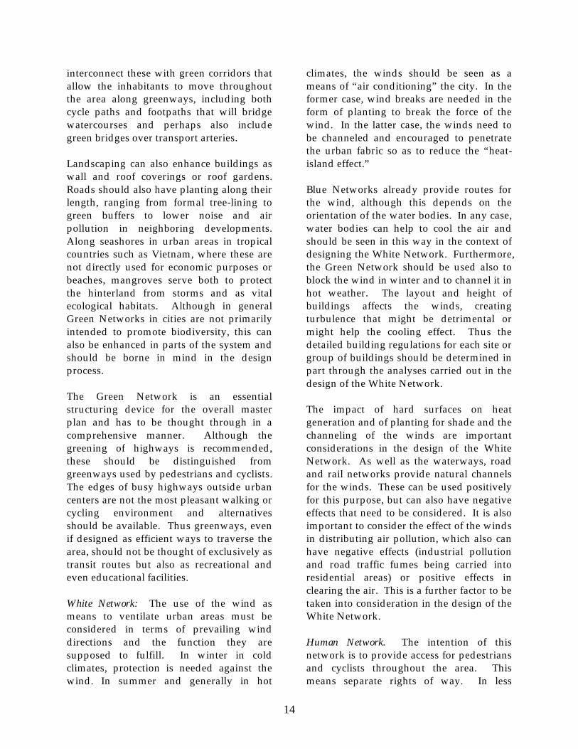
interconnect these with green corridors that allow the inhabitants to move throughout the area along greenways, including both cycle paths and footpaths that will bridge watercourses and perhaps also include green bridges over transport arteries. Landscaping can also enhance buildings as wall and roof coverings or roof gardens. Roads should also have planting along their length, ranging from formal tree-lining to green buffers to lower noise and air pollution in neighboring developments. Along seashores in urban areas in tropical countries such as Vietnam, where these are not directly used for economic purposes or beaches, mangroves serve both to protect the hinterland from storms and as vital ecological habitats. Although in general Green Networks in cities are not primarily intended to promote biodiversity, this can also be enhanced in parts of the system and should be borne in mind in the design process. The Green Network is an essential structuring device for the overall master plan and has to be thought through in a comprehensive manner. Although the greening of highways is recommended, these should be distinguished from greenways used by pedestrians and cyclists. The edges of busy highways outside urban centers are not the most pleasant walking or cycling environment and alternatives should be available. Thus greenways, even if designed as efficient ways to traverse the area, should not be thought of exclusively as transit routes but also as recreational and even educational facilities. White Network: The use of the wind as means to ventilate urban areas must be considered in terms of prevailing wind directions and the function they are supposed to fulfill. In winter in cold climates, protection is needed against the wind. In summer and generally in hot
climates, the winds should be seen as a means of “air conditioning” the city. In the former case, wind breaks are needed in the form of planting to break the force of the wind. In the latter case, the winds need to be channeled and encouraged to penetrate the urban fabric so as to reduce the “heat-island effect.” Blue Networks already provide routes for the wind, although this depends on the orientation of the water bodies. In any case, water bodies can help to cool the air and should be seen in this way in the context of designing the White Network. Furthermore, the Green Network should be used also to block the wind in winter and to channel it in hot weather. The layout and height of buildings affects the winds, creating turbulence that might be detrimental or might help the cooling effect. Thus the detailed building regulations for each site or group of buildings should be determined in part through the analyses carried out in the design of the White Network. The impact of hard surfaces on heat generation and of planting for shade and the channeling of the winds are important considerations in the design of the White Network. As well as the waterways, road and rail networks provide natural channels for the winds. These can be used positively for this purpose, but can also have negative effects that need to be considered. It is also important to consider the effect of the winds in distributing air pollution, which also can have negative effects (industrial pollution and road traffic fumes being carried into residential areas) or positive effects in clearing the air. This is a further factor to be taken into consideration in the design of the White Network. Human Network. The intention of this network is to provide access for pedestrians and cyclists throughout the area. This means separate rights of way. In less

15
densely traversed areas, walkways and cycle paths may be combined. Where there is increased density of use, these should be separated. These should be designed in all cases to have a width adequate to their use. Except in more densely built-up areas, these should be independent of the road network and free of road traffic pollution. Intersections with roads need special treatment in the form of grade-separated crossings or mode-specific traffic signals. For bicycle paths or combined footpaths and cycle paths, markings are necessary to prevent conflicts. Signposts are also useful. Furthermore, facilities for parking bicycles and shelters are needed at appropriate places. Pedestrian ways also need benches in appropriate places. Both cycle paths and footpaths should take people as directly as possible from where they are coming from to where they want to go, linking especially residential areas with public and recreational facilities. However, they should also be pleasant to traverse and coincide as far as possible with the Green and Blue Networks. Cultural Network: In the first instance, heritage sites and monuments need to be inventoried and classified in countries and urban areas where this is not the case. This will determine relative importance and facilitate the identification of the components of the network. Where these are in open countryside, prior to the construction of the surrounding urban fabric, thought should be given to creating a buffer zone around the facility that might be open area or gardens or woodland. Where such monuments are in already built-up areas— such as a component of a hamlet or village—then the wider built-up area should be incorporated into consideration of how the area should be conserved and managed. In the context of a network, monuments should be seen both in terms of clusters and
in how they can be linked to the Green and Human Networks. The intention must be to raise the consciousness of the population to their own history. Access must therefore be easy and the monuments should be visible. There should also be a means of communicating the significance of the monument, both at the site itself and in local educational institutions. The tourist potential should also be considered, and means should be available for accommodating and informing tourists about the monuments. The monuments will need to be well-maintained. In the first instance, this might mean restoration or even relocation. It will mean, as part of the awareness-raising of the population, a commitment to enhancement of the value and of conservation of the monument itself and of the surroundings. Visual Landscape Planning and Management In general, the planning and development of new urban areas needs to take into consideration what is already on the site, and try to accommodate this visually into the new fabric. In some cases, this might be difficult where inappropriate developments have already take place, but the challenge has to be faced. There needs to be a coherent design attitude and approach to advertising, street furniture, and generally the streetscape, including the placing of overhead infrastructure (if it is affordable, electric and telephone cables should be placed below ground). The methods introduced by Kevin Lynch in his book Image of the City are useful also in designing new developments or new towns. Key places need landmarks. This might include monuments at the entrance to areas marking the entry point. Centers and major intersections might also be graced with a distinctive element, which could be a building but might simply be a clock tower

16
or a large sculpture. There need to be different scales: elements that help define the overall structure in people’s minds and
others that define the individuality of neighborhoods, such as fountains or planted areas that are regularly maintained.

17
4. Planning the Hai Phong–Do Son Corridor on Ecologically Sensitive Principles
Hai Phong is the third largest city in Vietnam and the port city for the capital, Hanoi, located 100 kilometers to the west. It has the status of a Class 1 city, equivalent to a province and with a considerable rural perimeter. Like all the larger cities in Vietnam, urban development has been spreading into the surrounding landscape in a very unplanned and scattered manner. Do Son, southwest of the city, is a peninsula
made up of a number of hills that extend into the sea and has historically been the subject of tourist development. The considerable traffic between Hai Phong and Do Son has made the 14-kilometer route the subject of land speculation and considerable development, which led to the city asking consultants to make a plan to direct further development in the area along ecologically sound lines.
Figure 1. The City of Hai Phong and the Location of the Case Study Area
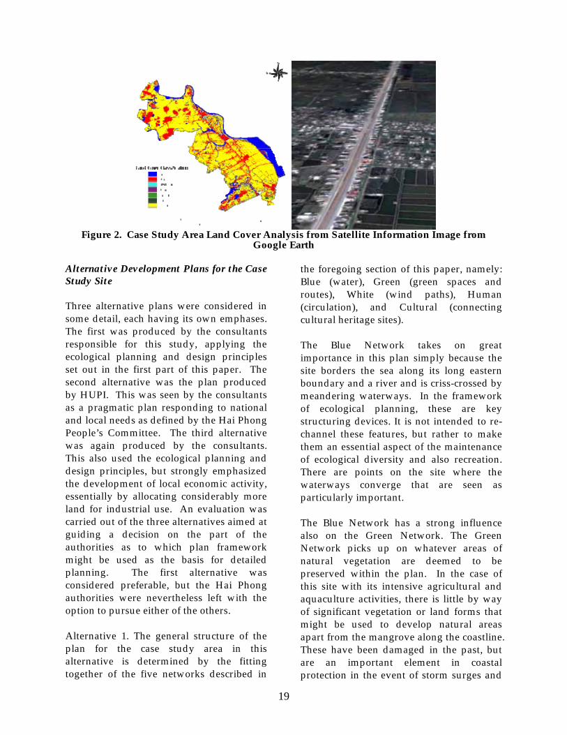
Socioeconomic Analysis The study area takes in parts of eleven communes. Information was gathered and analyzed for a larger area. Then a more confined area comprising 4,577 hectares was adopted by the Hai Phong Urban Planning Institute (HUPI, the urban planning department under the Department of Construction) as the subject of the ecological urban planning project. The study area is almost entirely flat, bordering the sea along its eastern boundary. There are no mineral resources, but a significant area comprises salt recovery basins; much of the rest of the area is used for fish farms or paddy. Surface
water is thus an important component of the environment to be considered in any planning exercise. There is a population of over 30,000 in the area, of which just over half are economically active, some 80 percent in agriculture/aquaculture. Almost 70 percent of the land is in use for agriculture/aquaculture, 15 percent in residential use, and the rest other uses. As yet, there are no public open spaces. There is already a significant network of mainly dirt roads, along which informal development has been taking place. There are a number of hamlets, mainly in the larger study area,.

18
These generally possess temples and pagodas that merit conservation and hence should be incorporated in any plans for the area. Analysis of the Natural Environment The climate is subtropical with a wet, warm season and a dry cooler season. The area is prone to occasional typhoons. Given that it is entirely flat and almost at sea level, the area is prone to flooding, which is thus an important dimension to be considered in any plans for the area. The area is not rich in flora or fauna, but much of the coast is in mangroves, which are not all in good condition but are important as an element of coastal protection. The area has been largely organized into fields and basins, but is still criss-crossed by meandering waterways that drain the area. As part of the planning study, a land cover classification was carried out using satellite information. This largely corroborated the land use information, indicating almost two-thirds of the area in agriculture/aquaculture and almost 20 percent in urban uses, including road cover. A biotope mapping exercise and SWOT analysis were carried out to gain additional insights into the characteristics of the site. Evaluation of the Existing Plan The case study area has been the subject of a planning exercise by HUPI, which is the current basis upon which development of the area is in principle being guided. An appraisal of this plan was carried out in the light of the ecological planning and design principles set out earlier in this paper. This review concluded that the existing plan was formulated using some ecological design principles. This includes sensitivity to the
coastal area and the potential problem of flooding. It stipulated that there should be a building height gradient, starting with low-rise buildings near the coast and higher-rise further inland. The plan is also mindful of encouraging development that will ensure adequate ventilation of the built-up area, regulating the distance between buildings, and channeling the sea breezes. The plan proposed a system of green areas, stipulating minimum standards for green space and the planting of trees. Green spaces will form a hierarchy from local to area-wide. A comprehensive road system is proposed, and also a public transport system. However, no thought was given to providing independent footpaths and cycle-ways. All basic physical infrastructure—including water supply, drainage, and waste disposal—is planned throughout the area. Beside the existing developments on the site, this study was informed of further developments that had been approved for construction and needed to be taken into account. This included a 70-hectare mixed development of residential and related uses in the northeast of the site, and a 150-hectare golf course in the southwest. Finally, a land suitability assessment was carried out to assess the relative sensitivity of all parts of the site to development. This suffered from a lack of good detailed information that could be used in a GIS analysis. Nevertheless, using relatively coarse analytical criteria, a useful mapping exercise was carried out indicating needed directions for the ecological planning and design exercise.
19
Figure 2. Case Study Area Land Cover Analysis from Satellite Information Image from
Google Earth
Alternative Development Plans for the Case Study Site Three alternative plans were considered in some detail, each having its own emphases. The first was produced by the consultants responsible for this study, applying the ecological planning and design principles set out in the first part of this paper. The second alternative was the plan produced by HUPI. This was seen by the consultants as a pragmatic plan responding to national and local needs as defined by the Hai Phong People’s Committee. The third alternative was again produced by the consultants. This also used the ecological planning and design principles, but strongly emphasized the development of local economic activity, essentially by allocating considerably more land for industrial use. An evaluation was carried out of the three alternatives aimed at guiding a decision on the part of the authorities as to which plan framework might be used as the basis for detailed planning. The first alternative was considered preferable, but the Hai Phong authorities were nevertheless left with the option to pursue either of the others. Alternative 1. The general structure of the plan for the case study area in this alternative is determined by the fitting together of the five networks described in
the foregoing section of this paper, namely: Blue (water), Green (green spaces and routes), White (wind paths), Human (circulation), and Cultural (connecting cultural heritage sites). The Blue Network takes on great importance in this plan simply because the site borders the sea along its long eastern boundary and a river and is criss-crossed by meandering waterways. In the framework of ecological planning, these are key structuring devices. It is not intended to re-channel these features, but rather to make them an essential aspect of the maintenance of ecological diversity and also recreation. There are points on the site where the waterways converge that are seen as particularly important. The Blue Network has a strong influence also on the Green Network. The Green Network picks up on whatever areas of natural vegetation are deemed to be preserved within the plan. In the case of this site with its intensive agricultural and aquaculture activities, there is little by way of significant vegetation or land forms that might be used to develop natural areas apart from the mangrove along the coastline. These have been damaged in the past, but are an important element in coastal protection in the event of storm surges and
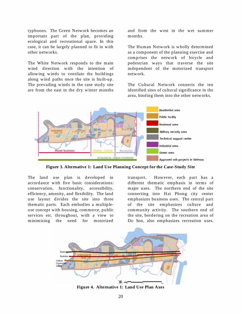
20
typhoons. The Green Network becomes an important part of the plan, providing ecological and recreational space. In this case, it can be largely planned to fit in with other networks. The White Network responds to the main wind direction with the intention of allowing winds to ventilate the buildings along wind paths once the site is built-up. The prevailing winds in the case study site are from the east in the dry winter months
and from the west in the wet summer months. The Human Network is wholly determined as a component of the planning exercise and comprises the network of bicycle and pedestrian ways that traverse the site independent of the motorized transport network. The Cultural Network connects the ten identified sites of cultural significance in the area, binding them into the other networks.
Figure 3. Alternative 1: Land Use Planning Concept for the Case-Study Site
The land use plan is developed in accordance with five basic considerations: conservation, functionality, accessibility, efficiency, amenity, and flexibility. The land use layout divides the site into three thematic parts. Each embodies a multiple-use concept with housing, commerce, public services etc. throughout, with a view to minimizing the need for motorized
transport. However, each part has a different thematic emphasis in terms of major uses. The northern end of the site connecting into Hai Phong city center emphasizes business uses. The central part of the site emphasizes culture and community activity. The southern end of the site, bordering on the recreation area of Do Son, also emphasizes recreation uses.
Figure 4. Alternative 1: Land Use Plan Axes

21
At the same time, three axes are provided that connect uses over the length of the site. The axis on the sea side is a green axis, important for the Blue and Green Networks. The middle axis is the business axis, connecting the subcenters of each of the thematic areas. And to the west is the cultural axis, which connects the existing heritage sites. Within this framework, other dimensions of the plan have been developed. These include the following. The road network builds upon the existing network of roads along which a certain amount of development has already taken place, with new building height regulations to give a harmonious whole once the site is fully built-up. A rail network is also envisaged. Industrial areas are planned mainly along the coast, with buffer zones located in such a way as to minimize impact on other uses. Residential zones are located throughout the area with easy access to the Green Network, with its hierarchy of park areas. Planners will need to consider relocating some existing residences and in general minimizing the possibility of impacts from flooding. Business centers are strung all along the central spine of the case-study area serving all residential areas and linked via the business axis. Public facilities are accessible via the green axis on foot or bicycle. Consideration has also been given to integrating the four planned developments into the plan. Alternative 2. The general planning concept for this alternative is based on four principles: modern and convenient living arrangements, a perfect environment for culture and relaxation, ecological sustainability, and a pollution-free hi-tech industry. As in Alternative 1, the study area is divided into parts along its length—in this case four parts. Also as in Alternative 1,
these are mixed-use zones, but with each zone emphasizing one land use. Area A, adjoining Hai Phong city centre, emphasizes business and industry. Southeast of this, Area B emphasizes local commerce, education, and recreation. Area C then forms the administrative center and includes a residential area destined mainly for foreign residents. Area D, adjoining Do Son, emphasizes recreation extending out from Do Son. It also can accommodate an export processing zone. Again, as with Alternative 1, the transport network is based upon the upgrading of existing roads. Alternative 3. This alternative is based on the same structure as Alternative 1 in terms of the networks and the three thematic sub-areas and three axes. The difference is in the increased land given over to industrial use. The assumption here is that Vietnam is developing industrially and land needs to be made available to locate new industries. The amount that should be allocated to the case-study site was calculated from parameters concerning needs in the region in general. Two variants were calculated. The plan for Alternative 1 makes 2.66 percent of the land available for industry. Alternative 2 provides 6.07 percent. The two calculations made for Alternative 3 allow 6.99 percent and 8.54 percent for industrial land. Conclusion. An evaluation matrix was produced from a number of earlier planning studies and the three plans were subjected to these criteria. Six broad criteria were selected, namely: economy and civil safety, environmental friendliness, civil convenience, environmental welfare, natural amenity, and historic and cultural resources. Given the strong weight given to ecological and environmental criteria, Alternatives 1 and 3 were seen as an improvement on Alternative 2. Alternative 3, however,

22
while addressing national and regional economic needs, was seen as inappropriate for the particular site for two reasons: (1) this site is not well-located with respect to major transport infrastructure necessary to support industry; and (2) and the evaluation criteria were critical of the potential
negative environmental impacts of excessive industry. As already noted, this does not necessarily lead to an absolute rejection of Alternatives 2 and 3, but rather provides a recommendation to the authorities that Alternative 1 is best in meeting the particular evaluation criteria employed.

23
5. Problems and Potential Solutions in Implementation
As this case suggests, implementing ecologically sensitive plans in Vietnam face two sets of problems. First, awareness of the importance of ecological issues—and the need for development to be put on a sustainable basis—remains low, and there is little knowledge among planners regarding how to apply such procedures as land suitability assessment, MFA, SEA, and the kinds of procedures demonstrated in the above pilot study. Furthermore, the participatory initiatives outlined earlier in this paper are as yet far from being practiced. There is clearly considerable work to be done to develop this knowledge and capability and thence to incorporate them into the formal planning process. Second, even conventional planning procedures suffer from serious problems regarding implementation. If these are not improved, then the additional issues involving ecologically sensitive planning also cannot be expected to succeed. Here are the main problems regarding the operation of the planning system in general in Vietnam: • There has been a major shortfall in
achieving the objectives of the Orientation Master Plan for Urban Development to 2020 and Urban Development Direction. Those formulating and executing planning at the regional and local levels possess little awareness of the policies that local planning is supposed to achieve.
• Population movements and industrial
development contributing to urbanization have run far ahead of the financial means of the government to provide adequate infrastructure.
• As noted above, the system of land use plans and development control machinery is inadequate to control the location of development, both through gaps in the planning procedure and lack of adequate trained staff, resulting in nonconforming construction on a large scale.
• Development outside planned areas on
rural land has been encouraged by rampant land speculation, which renders land in urban areas unaffordable and in turns leads to scattering of development in peri-urban areas.
• A significant proportion of the
population migrating into urbanizing regions lacks income to obtain formal housing. As a result, they resort to informal, unregulated housing construction in areas not intended or designated for housing.
• Irregularities in granting both planning
and building permission are widespread, seriously weakening the ability to use plans and building regulations to guide development into more efficient and ecologically sensitive pathways.
These problems are by no means unknown to the government; on the contrary, they have been subject to widespread analysis and debate.5 Regarding irregularities in the regulation of planning, there has also been considerable discussion in the public press. The current National Five-Year Socio-Economic Development Plan 2006–10 states that “(U)nlawful land allocation, land lease, land reclamation, conversion of land use purposes, which conflict with approved

24
planning, still prevail. Inefficient land management and use caused losses for the State budget and affected the integrity of many cadres.” 6 The government is attempting to improve the effectiveness of the planning system (for example, through the 2005 planning law and related legal instruments and moves to eliminate corruption), there is still some way to go before an adequate set of instruments and procedures is in place that can be used to implement plans effectively. Institutional Initiatives to Implement Comprehensive Planned Developments In the report by the Seoul University Institute of Regional Planning and Landscape Architecture upon which this paper is based, a number of more strategic initiatives for the implementation of comprehensively planned development were presented as potential ways to operationalize ecologically sensitive plans, such as those proposed for the Hai Phong– Do Son corridor. Over the past half century, a substantial number of mechanisms have been developed in various countries to facilitate comprehensive forms of urban development such as town extensions and new towns. Drawing on the original report, the following paragraphs describe some of these initiatives that have been adopted and further developed in the Republic of Korea that might be adapted to assist in similar developments in Vietnam and other Asian countries. The Development Planning Processes and Information Management Urban Development Agencies. Urban development agencies have a substantial history behind them, having emerged both from the post-reconstruction of European cities and the construction of new towns in the United States since the 1960s. Such institutions are now well-established in
various European countries. They are effective ways of promoting and coordinating complex urban development processes that have potential application anywhere in the world. The Korean Land Corporation (KLC) is a particularly effective version of the urban development agency model and merits some description. Established in 1975, the KLC is jointly owned by the Korean government and the Korean Development Bank. It is currently responsible for around half of residential development and almost all industrial land development in the country. These developments are predominantly in new towns, major housing developments, and industrial estates. The function of the corporation is to develop and sell land for residential and industrial use; to acquire idle and vacant land for resale; to issue land debentures; to reclaim land; and to develop new towns. It possesses all the expertise necessary to carry out these functions. KLC is in the processes of adopting environmentally friendly approaches to its developments. In Vietnam, such a corporate approach might also be possible. The government already has substantial planning and land development capacity, and this might be extended to the creation of a general Urban Development Agency similar to that in Korea. Another possibility would be to create an agency specifically for the development of the Road 353 New Urban Development Area, or as a provincial agency for the development of this and other projects—a Hai Phong Land Development Agency. This could link up current planning functions with the proactive planning and development of construction projects. It would need to work on the development of a regional economic development plan and formulate business strategies for the

25
development of particular projects. Mechanisms for financing major integrated urban projects, including both internally generated and equity funding, would have to be developed and this would require central government and banking support. It would need to be empowered to operate such schemes as land readjustment (described below). which would facilitate its operation in acquiring and managing the land develop process. It would need in-house expertise on environmental assessment, risk management, and project cycle management. Finally, it would have to be able to act as a regular real estate development company from design through construction and sales. Land readjustment/land pooling. Whether through the operation of a development agency or simply by extension of the functions of the local authority, land readjustment—sometimes referred to as land pooling—is an extremely useful tool to facilitate more complex land developments such as new towns, where land ownership patterns are complex. As with urban development agencies, there is now considerable experience with this mechanism; in Germany, for instance, it is a well-established practice. The basic principle is that land owners pool their land so that it may be planned as a single entity, and so that infrastructure can be installed that raises the value of the land. The authorities are able to finance the infrastructure from the sale of the land they keep. Landowners receive less land back than they put into the pool, but this should have a total value higher than the value of their original holding. The financial calculations have to ensure that the scheme as a whole is profitable for both original landholders and the government. This depends on the proportion of land taken from landowners and the success of the resulting
development. Such schemes have not always found the right balance. In Korea, there was considerable dissatisfaction with such schemes where landowners received less than half their land back. Nevertheless, 35 percent of the land in the city of Seoul has been acquired for roads, parks, etc. via this mechanism. Difficulties that have to be faced include the source of the initial finance for the system (generally the public purse) and how to control possible runaway land speculation before the scheme is fully established. Land management information systems. Computer systems for land management are today well-developed and widely used. Thus far, however, they are usually applied in a piecemeal fashion, with one system used for land registration, another in the context of urban planning, and another for tax purposes. Local systems are not linked to national systems. In Korea, a single linked system has been developed that could be a model for Vietnam and other countries. Four interlinked systems have evolved in Korea: (1) a national government land policy-making support system; (2) special data management systems for land registration (cadastral maps) and taxation; (3) local land use planning support systems; and (4) land management business systems. It should be possible to also include environmental impact management systems. Systems developed to promote land development should have open system architecture to facilitate inter-operation of different computer software. They must include a national network to share land information; an online network to circulate information on land policies, public regulations and incentives; interconnections between national and local systems; and an openness to share land development, zoning information, and land use data held by the local authority with residents and investors. There should also be an educational system

26
to inform and train users, and the system must be able to deal with civil petitions and litigation on land issues. Investment Planning and Development Industry-led new towns. The British new towns initiated a process whereby industrial relocation and development initiatives were planned in conjunction with new town planning and development. This approach has been further developed in Korea with industries taking the lead, facilitated by government. The intention has been to provide incentives for both internal and foreign business investment. The government provides tax incentives to initiate the process. Private companies then undertake the planning and finance the construction. The government collaborates in the provision of infrastructure. The strategy has been to disperse development around the country with particular new towns containing clusters of particular industries. In so far as this strategy can be exported to Vietnam or elsewhere, it will be up to the government to identify the comparative advantage of regions or cities where such developments can take place. The Road 353 New Urban Development Area could be such a development. It would be necessary to identify the comparative advantage of Hai Phong as a port city relating to Hanoi, and for the central government to provide incentives for industries deemed to be compatible and potentially attracted to the area within this framework. The institutional setting for investment programs. A comprehensive project implementation management system is needed for large-scale projects such as new towns. The Korean case can be instructive and could be applied to the development of the Road 353 New Urban Development Area. The Hai Phong local government
would establish a multidisciplinary team to identify and analyze subprojects. These would then undergo a preliminary feasibility study and be ranked and prioritized, with initial projects selected for construction. The approach would include background studies collecting information on proposed project areas and projects and consulting with interested parties. A policy analysis would need to underpin the exercise to ensure that the projects conform to national and local economic and social plans and would promote balanced regional development. Economic and financial studies would follow, and an overall feasibility evaluation would be carried out in accordance with multidimensional decision analysis (AHP) methods. A total project cost management system (TPCM) would be put in place to structure the process of detailed planning and construction management to reduce the likelihood of cost escalation and ensure the long-run financial health of the project. Within this framework, detailed design and construction of selected projects would be undertaken. Public-private partnerships. In the past, large-scale integrated development projects were carried out entirely by governments. Today, costs are being shared by the private sector, which is becoming increasingly involved in both planning and infrastructure provision, as well as their more traditional areas of construction investment. While governments must continue to maintain strategic control through regulation, private corporations are willing to take over some responsibilities—as long as governments are fair in terms of financing operating costs where these are not generated from the operation of the system, and in providing appropriate incentives and compensation for well-defined risks.

27
Governments thus define those functions the private sector might be invited to provide and decide what areas to privatize (construction, ownership, operation, etc.). In the Korean case, a value for money (VFM) test can be applied as background to deciding which activities should be offered
to the private sector. Documentation must then be prepared and tenders invited. Concessionaires that win tenders are then responsible for carrying out the works and/or activities within specified time periods. Operations are then re-tendered at the end of the defined period.

28
6. Conclusions and Recommendations
This paper, while based upon a specific study carried out to demonstrate aspects of ecologically sensitive urban planning and design, goes somewhat beyond the original study. It provides a broader overview of the essential elements of ecologically sensitive urban panning and how this adds to conventional planning concerns and procedures. It takes a close look at the problems of planning and plan implementation in Vietnam today, with a view to indicating where improvements will need to be made before any effective planning can be implemented. Ecologically sensitive planning can only succeed in a situation where urban and regional planning is effective. In summarizing the recommendations, it is thus first necessary to emphasize that it presupposes the existence of basic, effective urban planning systems, practices, and capacities. It builds upon these in two ways: • It deepens the understanding and
practice of ecological conservation and environmental enhancement in the construction of urban extensions and new towns.
• It moves beyond “passive” urban
planning—represented by master planning—to a proactive development-led approach in the framework of effective land-management systems.
Concerning the first of these, the following general principles need to be adopted and disseminated, both among public and private planning and development actors and the general public: • New urbanization should be
undertaken in ways that conserve or
enhance the ecology of the area. Nature should be seen as an equal partner in the planning process and not something to be cleared aside or given a minor role to play.
• Human physical and mental health are
enhanced by the construction of environmentally healthy urban developments, necessitating that environmental planning be given a high priority.
• Cultural heritage in the form of
monuments and buildings from the past are an important contributor to human well-being in a fast-changing world; priority should also be given to heritage conservation in ways that make this accessible to the general public.
• There are by now numbers of specific
planning tools that are available to analyze ecological issues and provide a basis for taking ecologically sound planning decisions.
All planning exercises go through a cycle of activities from conception through planning, implementation, and evaluation. “Ecologically friendly” urban planning points to certain approaches that need to be paid particular attention in the planning cycle: • In defining the concepts and goals of the
planning process, an “ideal image” of ecological planning needs to be generated and disseminated to all actors, both those responsible for planning and development and to the general public. These need to be agreed by all parties

29
before the planning process can effectively start.
• Site surveys are a necessary part of all
planning exercises. While the existing socioeconomic situation must be understood and existing plans taken into account, expert resources are needed to achieve a thorough understanding of the existing geological, climatic, hydrological, and ecological systems of the site and its surroundings
• Plans need to be generated under the
general heading of “preserving and enhancing nature.” New techniques— including material flow analysis (MFA), ecological mapping, and land suitability analysis (LSA)—need to be applied both in analysis and in evaluating the plans as they are generated. While planning is often carried out as a technical activity by professional planners, it is essential to ensure participation of all affected people to ensure their education, contribution, and commitment regarding the planned result. As in any planning system, a strategic plan guides development. Action plans are then produced for different parts of the site and dimensions of the plan. In all cases, these should include ecological and environmental considerations as a priority to minimize pollution and ensure conservation of ecological integrity and efficient resource management.
• Monitoring and evaluation has become
an accepted procedure during and following plan making and implementation. Indicators used for this purpose must include factors concerned with ecology and sustainability.
The methodology developed and explained above for ecologically friendly urban planning focuses on four themes and indicates an approach to planning in the form of networks. This approach facilitates a sharp focus in the planning process on the key dimensions of ecological conservation, healthy living, and heritage conservation as follows: • Not all development sites have
extensive water environments, but whatever water bodies within the site need to be utilized to the full in terms of ecological systems and recreational potential and as far as possible planned in the form of a Blue Network.
• Urban development usually means the
forcing of nature out of the development area or its being confined to marginal, overmanaged areas such as parks and street trees. Urban development should, however, take place within a matrix of green that conserves or enhances ecological diversity and provides for ample recreational potential in the form of Green Networks. Where there are ample surface water resources, the green and blue networks may often coincide.
• Few plans take note of the way in which
air movement in the city can enhance human health and well-being. Planning construction and land form to utilize air movement—again as a network approach referred to as the White Network—should become a significant consideration in the planning of new urban developments.
• Although today it is necessary to
develop new urban areas with full vehicle access, at the same time it should be possible for pedestrians and cyclists to have full access independent of the vehicle road system. This

30
network is referred to as the Human Network.
• Many new urban developments take
place on sites that have previously been occupied and possess monuments of archaeological remains of significance. In order to enhance local consciousness of these as well as ensuring accessibility, a Cultural Network connects the sites to make these into a whole rather then dispersed and fragmented sites. It should also be connected to other networks.
The second theme of this study concerns the question of effective implementation of plans and recommends the following measures: • The basic organizational framework
best fitted for efficient comprehensive development of new urban quarters or new towns is the urban development agency. Such agencies have been established in many countries. The agency operating in Korea is a possible model for other Asian countries. In general terms, this is in the form of corporation that undertakes the whole development process, from planning through land acquisition to construction.
• Land readjustment is a mechanism,
again with widespread experience, that facilitates the consolidation of land holdings in order to plan an area as a whole and distribute the benefits among existing landowners and the government branch (or development agency) responsible for the development.
• Land management information systems
are computer systems that collect and organize information on land relevant to marketing, taxation, planning, and land management. These are widely
used, but usually as individual systems for different functions and at different levels of government. The Korean system interconnects different subsystems and also national and local systems, thus greatly enhancing the efficiency and effectiveness of such systems.
• Industry-led new town development is
a means to maximize the economic potential of new urban developments. Here there is a focus on “industrial clusters” and a proactive attraction of particular industries to particular developments with incentives.
• New developments are dependent on
attracting funding that should then be efficiently managed to ensure cost-effectiveness and in general control over the flow of funding. There are now numbers of methods, including multi-dimensional decision analysis and total project cost management systems that should be consistently applied throughout the development process.
• In the past, new town development and
management was assumed to be an exclusively public-sector responsibility. Today, the private sector is contributing increasingly to the planning and management of urban areas in the form of public-private partnerships. These need to be encouraged to ensure both the adequacy of financial resources and the efficiency with which urban systems are managed.
The value of this study is that it demonstrates how the ideals that are embodied in ecologically sensitive urban planning and design can be converted from aspirations and principles to concrete planning processes, and then put into practice through the application of effective implementation tools that are already

31
available. This requires political will on the part of governments. Once this is in place, it
will greatly enhance urban development.
Notes 1 Seoul National University. 2006. Ecologically Friendly Urban Planning and Design: An Application to Hai Phong City, Vietnam. A consultant report to the World Bank. Seoul, South Korea: Seoul National UNiversity. 2 The original report contained examples of environmental planning initiatives and components from Korea and from a selection of other countries. These are not referred to in this document but may be consulted in the original document. 3 Two recent documents provide a substantial overview of the urbanization process, its problems, and planning initiatives in Vietnam: (1) M. Douglass et al. 2002. The Urban Transition in Vietnam. Honolulu, Hawaii: UNCHS, Fukuoka, and Department of Urban and Regional Planning, University of Hawai’i at Manoa. (2) A. Coulthart, Q. Nguyen, and H. Sharpe. 2006. Urban Development Strategy: Meeting the challenges of rapid urbanization and the transition to a market oriented economy. Washington, DC: World Bank. 4 MEA (Millennium Ecosystem Assessment). 2005. Ecosystems and Human Well-being: Biodiversity Synthesis. Washington, DC: World Resources Institute. 5 Besides the Douglass and Coulthart et al references cited in note 3, see also: (1) JBIC. 1999. Urban Development and Housing Sector in Vietnam. Tokyo: Japan Bank for International Development; and (2) AusAID. 2000. Vietnam: Land Administration. Working Paper No. 4. Canberra: Australian Agency for International Development. 6 MPI. 2006. National Five-Year Socio-Economic Development Plan 2006-2010. Hanoi: Ministry of Planning and Investment.