waste point kosciuszko national park
TRANSCRIPT

Preliminary Master Plan
Waste Point Kosciuszko National Park

CONTENTS01 INTRODUCTION 4
1.1 Overview 4
02 SITE CONTEXT 5
2.1 Locality 52.2 Site
5
03 SITE HISTORY 6
2.3 History 6
04 SITE ANALYSIS 7
4.1 Accessibility 74.2 Topography 84.3 Flora and Fauna 94.4 Views and Vistas 104.5 Built Form 114.6 Infrastructure and Services
12
05 OPPORTUNITIES AND CONSTRAINTS 13
06 DESIGN PRINCIPLES 15
151515151515
6.1 Principles 6.2 Naming Opportunities 6.3 Demand Opportunities 6.4 Ancillary Facilities for Consideration 6.5 Decommission Option 6.6 Master plan A 6.7 Master plan B
15
07 DRAFT MASTER PLAN OPTIONS 16
1819
7.1 Creel Bay upgrade - Master plan B 7.2 Setbacks and Screening for Cottages 7.3 Sculpture Trails 20
08 REFERENCES 21
2
CONTENTSCONTENTS0101 INTRODUCTIONINTRODUCTION 44
1.11.1 Overview Overview 44
0202 SITE CONTEXTSITE CONTEXT 55
2.12.1 LocalityLocality 552.22.2 SiteSite
55
0303 SITE HISTORYSITE HISTORY 66
2.32.3 History History 66
0404 SITE ANALYSISSITE ANALYSIS 77
4.14.1 Accessibility Accessibility 774.24.2 TopographyTopography 884.34.3 Flora and Fauna Flora and Fauna 994.44.4 Views and VistasViews and Vistas 10104.54.5 Built Form Built Form 11114.64.6 Infrastructure and ServicesInfrastructure and Services
1212
0505 OPPORTUNITIES AND CONSTRAINTSOPPORTUNITIES AND CONSTRAINTS 1313
0606 DESIGN PRINCIPLESDESIGN PRINCIPLES 1515
151515151515151515151515
66.1 Principles .1 Principles 66.2 Naming Opportunities .2 Naming Opportunities 66.3 Demand Opportunities .3 Demand Opportunities 66.4 Ancillary Facilities for Consideration .4 Ancillary Facilities for Consideration 66.5 Decommission Option .5 Decommission Option 66.6 Master.6 Master plan A plan A 66.7 Master.7 Master plan B plan B
1515
07 DRAFT MASTER07 DRAFT MASTER PLAN OPTIONS PLAN OPTIONS 1616
18181919
7.1 7.1 Creel Bay upgrade -Creel Bay upgrade - Master Master plan B plan B 7.2 Setbacks and Screening for Cottages 7.2 Setbacks and Screening for Cottages 7.3 Sculpture Trails 7.3 Sculpture Trails 2020
0808 REFERENCESREFERENCES 2121
September 2016
Prepared by:
Tract Consultants Pty Ltd
Level 8/80 Mount Street
North Sydney NSW 2060
T. 02 9954 3733
DISCLAIMER This report was prepared by Tract Consultants Pty Ltd in good faith exercising all due care and attention, but no representation or warranty, express or implied, is made as to the relevance, accuracy, completeness or �tness for purpose of this document in respect of any particular user’s circumstances. Users of this document should satisfy themselves concerning its application to, and where necessary seek expert advice in respect of, their situation.
The views expressed within are not necessarily the views of the O�ce of Environment and Heritage (OEH) and may not represent OEH policy.
© Copyright State of NSW and the O�ce of Environment and Heritage

3
FIGURESFigure 1 – Mountain biking (Tourism Snowy Mountains 2016) 4Figure 2 – Kayaking on Lake Jindabyne (Mountain Adventure Centre 2016) 4Figure 3 – Contemporary accommodation (Inhabit 2013) 4Figure 4 – Context map (Tract 2016) 5Figure 5 – Regional context map (Tract 2016) 5Figure 6 – Jindabyne (Tract 2016) 5Figure 7 – Waste Point topography (Tract 2016) 5Figure 8 – Creel Lodge (Tract 2016) 6Figure 9 – Waste Point 1906 (Jill Sheppard Heritage Consultants 2012) 6Figure 10 – Regional Timeline 6Figure 11 – Boat ramp area (Tract 2016) 7Figure 12 – Access track (Tract 2016) 7Figure 13 – Waste Point entrance (Tract 2016) 7Figure 14 – Informal walking track (Tract 2016) 7Figure 15 – Topography map (Tract 2016) 8Figure 16 – Flat topography in accommodation precinct (Tract 2016) 8Figure 17 – Steep slopes (Tract 2016) 8Figure 18 – Topography towards the lakes edge (Tract 2016) 8Figure 19 – Black Sallee, Snowgum and open woodland (NPWS 2016) 9Figure 20 – Red-necked wallaby (M. rufogriseus) (Tract 2016) 9Figure 21 – Vegetation map (Tract 2016) 9Figure 22 – View, looking east from NPWS compound (Tract 2016) 10Figure 23 – View of pastoral lands, viewed from lakes edge (Tract 2016) 10Figure 24 – Filtered views, looking north west from cottage 15 (Tract 2016) 10Figure 25 – Filtered views (blue) and panoramic views (red) (Tract 2016) 10Figure 26 – Existing cottage 11 (Tract 2016) 11Figure 27 – Existing cottage 10 (Tract 2016) 11Figure 28 – Heritage signi�cance (Jill Sheppard Heritage Consultants 2012) 11Figure 29 – Works Depot (Tract 2016) 11Figure 30 – Cottage 9 (Tract 2016) 11Figure 31 – Cottage 4 (Creel Lodge) (Tract 2016) 11Figure 32 – Infrastructure map (Tract 2016) 12Figure 33 – Existing rainwater tanks (Tract 2016) 12Figure 34 – Existing powerlines (Tract 2016) 12Figure 35 – Works Depot (Tract 2016) 12
Figure 36 – Biking opportunities (Tourism Snowy Mountains 2016) 13Figure 37 – Utilise lakeside (Jindabyne Chamber of Commerce 2016) 13Figure 38 – Lake Jindabyne (Trip Advisor 2013) 13Figure 39 – Contemporary accommodation 14Figure 40 – Potential sculpture trails (Visit NSW 2016) 14Figure 41 – Opportunity for education and learning (ArtsHub 2016) 14Figure 42 – Non-motorised watercraft (By Land Water and Air 2005) 15Figure 43 – Non-motorised watercraft opportunities (Aalen 2016) 15Figure 44 – Boat ramp precinct concept (Tract 2016) 18Figure 45 – Existing boat ramp precinct (Tract 2016) 18Figure 46 – Boat ramp precinct section (Tract 2016) 18Figure 47 – Eco cottage siting and setbacks sketch (Tract 2016) 19Figure 48 – Eco accommodation cross section (Tract 2016) 19Figure 49 – Indicative montage showing Works Depot screen (Tract 2016) 19Figure 50 – Sculpture trail montage (Tract 2016) 20Figure 51 – Existing landforms and geology of site (Tract 2016) 20Figure 52 – Adelaide Hills sculpture trail (Weekend Notes 2016) 20Figure 53 – Broken Hill sculpture trail (Broken Hill Australia 2016) 20
Vision
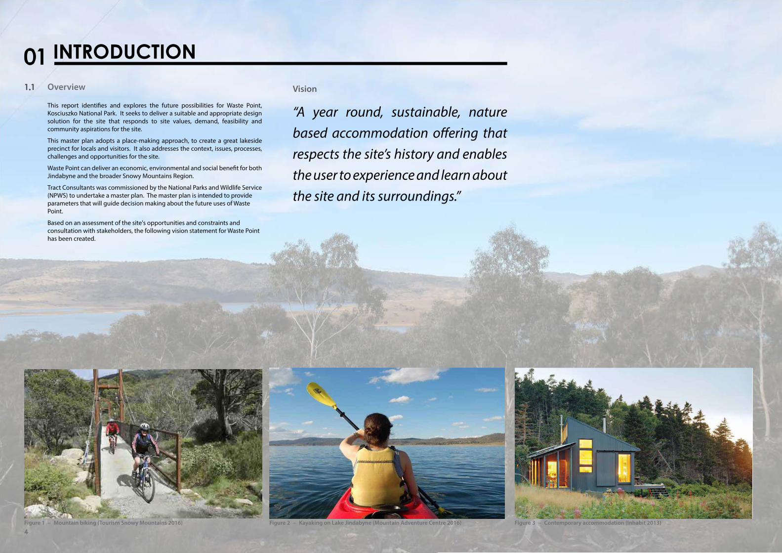
“A year round, sustainable, nature based accommodation o�ering that respects the site’s history and enables the user to experience and learn about the site and its surroundings.”
01 INTRODUCTION1.1 Overview
This report identi�es and explores the future possibilities for Waste Point, Kosciuszko National Park. It seeks to deliver a suitable and appropriate design solution for the site that responds to site values, demand, feasibility and community aspirations for the site.
This master plan adopts a place-making approach, to create a great lakeside precinct for locals and visitors. It also addresses the context, issues, processes, challenges and opportunities for the site.
Waste Point can deliver an economic, environmental and social bene�t for both Jindabyne and the broader Snowy Mountains Region.
Tract Consultants was commissioned by the National Parks and Wildlife Service (NPWS) to undertake a master plan. The master plan is intended to provide parameters that will guide decision making about the future uses of Waste Point.
Based on assessment of the site opportunities and constraints and consultation with stakeholders, the following vision statement for Waste Point has been created.
Figure 1 – Mountain biking (Tourism Snowy Mountains 2016) Figure 2 – Kayaking on Lake Jindabyne (Mountain Adventure Centre 2016) Figure 3 – Contemporary accommodation (Inhabit 2013)
4

5
2.1 Locality Waste Point is located within Snowy Monaro Regional Council and is approximately 13 kilometres north west of Jindabyne and 21 kilometres east of Perisher Valley. The area is characterised by rolling plains to the east and rugged mountain ranges to the south and west.
The site is bound by Lake Jindabyne to the east, north and south. There are a number of small townships around the lake that make up the local population including East Jindabyne and Kalkite.
Jindabyne is the closest major town, providing a number of services and amenities including hotel and motel accommodation, playing �elds, restaurants and shops.
2.2 Site
Waste Point has a site area of approximately 6.059 ha and is situated at the con�uence of the Thredbo and Snowy rivers.
Being on Lake Jindabyne, managed as part of the Snowy Mountains Hydro-Electric Scheme, the shoreline is subject to regular variations in water levels, which creates a �uctuating shoreline.
The site has a range of buildings including the NPWS Waste Point Works Depot (Works Depot), Research Centre and cottages. The Works Depot is located towards the northern tip, while 16 cottages, historically used for sta� accommodation, are scattered across the site. Creel Lodge is identi�ed as having state level signi�cance by Jill Sheppard Heritage Consultants, while the remaining cottages are categorised as either having high, moderate or low local heritage signi�cance.
The main access to the Works Depot is a sealed bitumen road with a network of minor gravel access roads. Located nearby is the Jindabyne Pumping Station and associated surge tower, a prominent landmark on Kosciuszko Road. Waste Point Road provides access to a public boat ramp at the edge of Creel Bay. The boat ramp area provides parking and trailer access.
02 SITE CONTEXT
190 km
283 km
578 km
469 km
Melbourne
Sydney
Canberra
Cooma
Distance to Waste Point
578 km
469 km
283 km
190 kmFigure 4 – Context map (Tract 2016)
Figure 5 – Regional context map (Tract 2016) Figure 6 – Jindabyne (Tract 2016) Figure 7 – Waste Point topography (Tract 2016)
2.3 History
2.3.1 Aboriginal HistoryThe Bidewal, Ngarigo, Wolgal and Ngunawal clans of the Eora Nation have lived in the Snowy Mountains for an estimated 21,000 years. Their traditional life was characterised by seasonal movements across the landscape and occasional gatherings for feasting, inter-clan liaison, marriage and other cultural practices such as initiations.
The varied landscape of the Snowy Region provided the �rst people with a vast array of resources for food, clothing, shelter and tools.
By the mid-19th century traditional foods, accommodation and cultural practices gave way to European customs. As part of this transition Aboriginal people engaged with new settlers making signi�cant contributions to exploration, pastoral enterprises, the timber industries, road and building construction in the Australian Alps.
2.3.2 Regional HistoryThe development of the Snowy Region post contact began with the arrival of the �rst European explorers in the 1820s. For the next century the Snowy Mountains were the preserve of Aboriginal people, graziers, miners and those involved in support industries.
Signi�cant to the region was the development of the Snowy Mountain Hydro-Electric Scheme between 1949 and 1974. It was one of the most complex integrated water and hydro-electric power schemes in the world. Even before the scheme was completed, it was named as one of the civil engineering wonders of the modern world.
03 SITE HISTORY 1820
European exploration of region
1850
James Spencer settles and establishes Homestead at Waste Point
1879
Royal National Park Established
1894
Ku-Ring-Gai Chase National Park Established
1906
Snowy Mountains National Park Established
(Kosciuszko Area)1909
The Creel Lodge built at Waste Point
1943
Announcement by William Kelly of proposal for Kosciuszko State Park
1944
Kosciuszko State Park (KSP) gazetted
Commencement of construction of housing Waste Point
1949
Construction of Snowy Mountains Hydro Electric Scheme
1960
First KSP Visitor Information Centre
1967
Lake Jindabyne Flooded
Kosciuszko National Park established
National Park
Timeline Key
Site
Regional
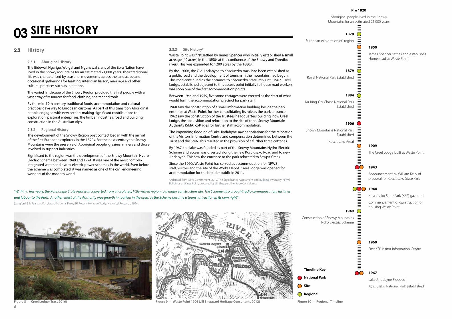
2.3.3 Site History*Waste Point was �rst settled by James Spencer who initially established a small acreage (40 acres) in the 1850s at the con�uence of the Snowy and Thredbo rivers. This was expanded to 1280 acres by the 1880s.
By the 1900s, the Old Jindabyne to Kosciuszko track had been established as a public road and the development of tourism in the mountains had begun. This road continued as the entrance to Kosciuszko State Park until 1967. Creel Lodge, established adjacent to this access point initially to house road workers, was soon one of the �rst accommodation points.
Between 1944 and 1959 �ve stone cottages were erected as the start of what would form the accommodation precinct for park sta�.
1960 saw the construction of a small information building beside the park entrance at Waste Point, further consolidating its role as the park entrance. 1962 saw the construction of the Trustees headquarters building, now Creel Lodge, the acquisition and relocation to the site of three Snowy Mountain Authority (SMA) cottages for further sta� accommodation.
The impending �ooding of Lake Jindabyne saw negotiations for the relocation of the Visitors Information Centre and compensation determined between the Trust and the SMA. This resulted in the provision of a further three cottages.
By 1967, the ake was �ooded as part of the Snowy Mountains Hydro-Electric Scheme and access was diverted along the new Kosciuszko Road and to new Jindabyne. This saw the entrance to the park relocated to Sawpit Creek.
Since the 1960s Waste Point has served as accommodation for NPWS sta�, visitors and the site of the Works Depot. Creel Lodge was opened for accommodation for the broader public in 2011.
Figure 8 – Creel Lodge (Tract 2016) Figure 9 – Waste Point 1906 (Jill Sheppard Heritage Consultants 2012) Figure 10 – Regional Timeline
Pre 1820
Aboriginal people lived in the Snowy Mountains for an estimated 21,000 years
6
“Within a few years, the Kosciuszko State Park was converted from an isolated, little visited region to a major construction site. The Scheme also brought radio communication, facilities
and labour to the Park. Another effect of the Authority was growth in tourism in the area, as the Scheme became a tourist attraction in its own right”.
(Langford, S & Pearson, Kosciuszko National Parks, Ski Resorts Heritage Study: Historical Research, 1994).
*Adapted from NSW Government, 2012, The Significance Assessment and Building Inventory, NPWS Buildings at Waste Point, prepared by Jill Sheppard Heritage Consultants.

7
4.1 Accessibility Waste Point Road provides access to a public boat ramp, which is located at the edge of Creel Bay.
A number of informal and formal roads follow the natural ridge line of the site towards low lying areas at the Works Depot and Creel Bay.
The gravel service roads to the cottages are well maintained.
There are no formalised walking tracks to points of interest such as Creel Bay, vantage points, the lakes edge and recreation areas. Where possible, tracks should be made accessible.
Access from Waste Point Road to the lake foreshore is an accessible grade making it suitable to upgrade parking facilities, including trailer access.
Topography to the west of Creel Bay day-use precinct is relatively steep making it di�cult to form a direct connection with the cottages.
04 SITE ANALYSIS
Figure 11 – Boat ramp area (Tract 2016)
Figure 12 – Access track (Tract 2016) Figure 13 – Waste Point entrance (Tract 2016) Figure 14 – Informal walking track (Tract 2016)

4.2 Topography
Waste Point Road and Kosciuszko Road are at 1040 metres above sea level, with the lakes edge at 900 metres. At this elevation, Waste Point is infrequently covered in snow.
The south east and north west portions of the site are characterised by steep terrain. The general slope within the village precinct is �atter than 1:10, which enables wheelchair assisted access within the area.
The topography to the lakes edge �uctuates based on changing lake levels, presenting either �at plains or steep slopes from the lakes edge. The siting of paths needs to traverse this interface to achieve accessible paths of travel. A direct route would require stairs from the accommodation precinct to the boat ramp area.
Some of the existing cottages were constructed on steeper terrain. This has enabled the establishment of basement car parking or basement levels as is the case with Creel Lodge.
Future upgrades and works on steeper portions of the site will involve additional costs associated with construction.
Creel Bay
Lake Jindabyne
Waste Point
Koscisuzko Road
Waste Point Road
860 904 948 992 1036 1080 1124 1168 1212 1256
Height
m m m m m m m m m m
Figure 15 – Topography map (Tract 2016)
Figure 16 – Flat topography in accommodation precinct (Tract 2016) Figure 17 – Steep slopes (Tract 2016) Figure 18 – Topography towards the lakes edge (Tract 2016)
8

9
4.3 Flora and Fauna
The �ora is an important component of the natural beauty of the site. The vegetation varies from open woodland and grassland to taller closed forest. These combine to create a picturesque quality of contrasting hues and sinuous trunk forms.
While a detailed vegetation survey of the site has not been undertaken, NPWS mapping indicates three key vegetation types.
■ Candle Bark Woodland ■ Snow Gum Mountain Gum Forest ■ Peppermint Forest.
During a site inspection, several native species were observed grazing the area. The species included:
■ Eastern grey kangaroo (Macropus giganteus) ■ Red-necked wallaby (M. rufogriseus) ■ Swamp wallaby (Wallabia bicolor) ■ Common wombat (Vombatis ursinus).
4.3.1 Endangered Ecological Community (EEC)In early 2016, a preliminary vegetation survey was undertaken which identi�ed Tablelands Snow Gum, Black Sallee, Candlebark and Ribbon Gum Grassy Woodland as occurring at Waste Point.
During this survey the community structure and composition were assessed to con�dently identify the community as part of the listed EEC.
Any proposed use of the site that requires disturbance of vegetation will need to be assessed in terms of the signi�cance of its impact on this community. To reduce the signi�cance of the impact, any additional infrastructure on the site should be located in disturbed/weedy parts of the site where possible.
A detailed survey is required to con�rm the location and extent of the EEC.
Peppermint Forest
Snow Mountain Gum Forest
Candlebark Woodland
Vegetation Communities
Waste Point
Lake Jindabyne
Creel Bay
Figure 19 – Black Sallee (Eucalyptus stellulata), Snowgum (Eucalyptus pauci�ora) open woodland east of Cottage 4 (NPWS 2016)
Figure 20 – Red-necked wallaby (M. rufogriseus) (Tract 2016) Figure 21 – Vegetation map (Tract 2016)
4.4 Views and Vistas
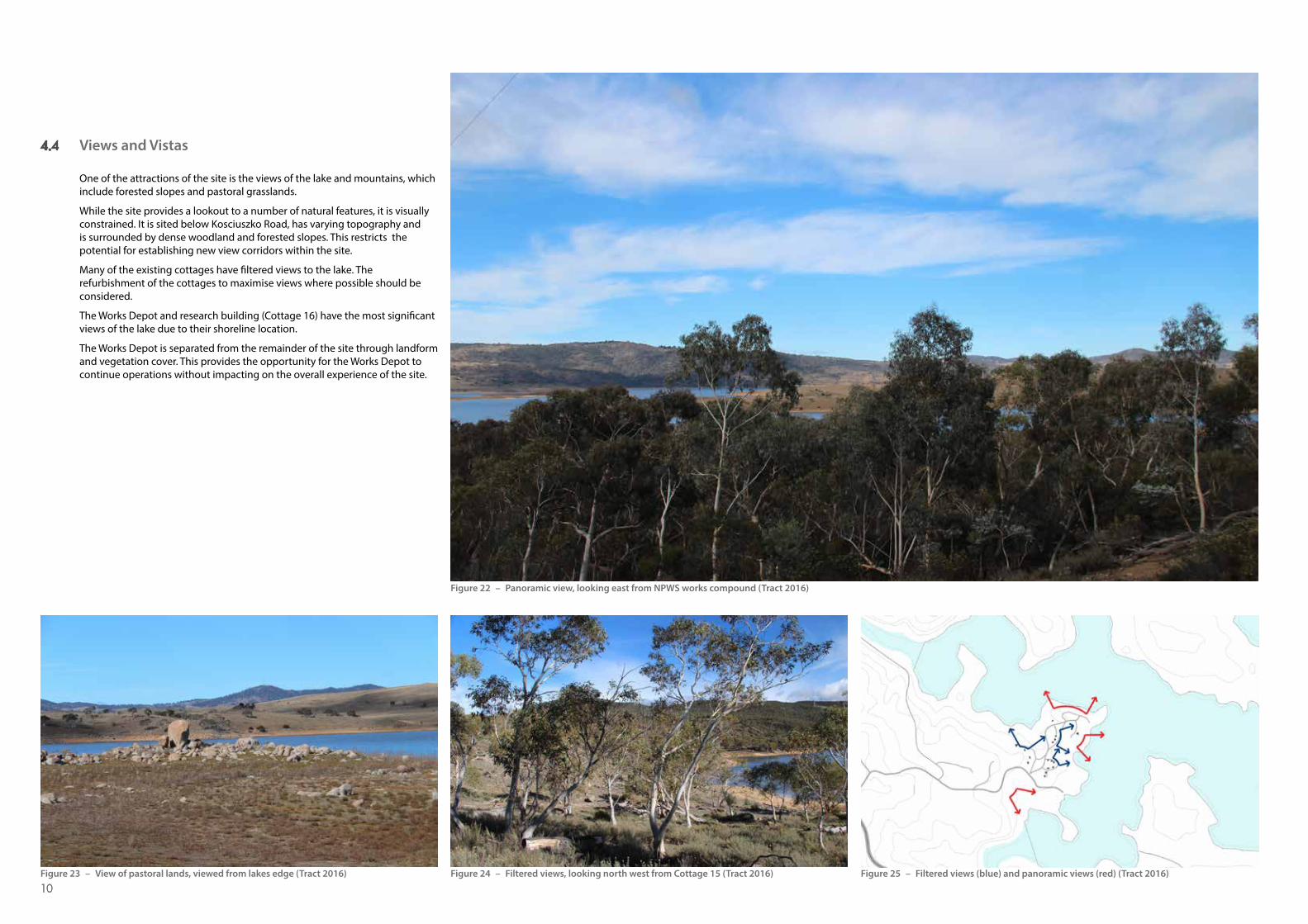
One of the attractions of the site is the views of the lake and mountains, which include forested slopes and pastoral grasslands.
While the site provides a lookout to a number of natural features, it is visually constrained. It is sited below Kosciuszko Road, has varying topography and is surrounded by dense woodland and forested slopes. This restricts the potential for establishing new view corridors within the site.
Many of the existing cottages have �ltered views to the lake. The refurbishment of the cottages to maximise views where possible should be considered.
The Works Depot and research building (Cottage 16) have the most signi�cant views of the lake due to their shoreline location.
The Works Depot is separated from the remainder of the site through landform and vegetation cover. This provides the opportunity for the Works Depot to continue operations without impacting on the overall experience of the site.
Figure 22 – Panoramic view, looking east from NPWS works compound (Tract 2016)
Figure 23 – View of pastoral lands, viewed from lakes edge (Tract 2016) Figure 24 – Filtered views, looking north west from Cottage 15 (Tract 2016) Figure 25 – Filtered views (blue) and panoramic views (red) (Tract 2016)
10

11
4.5 Built Form
Waste Point comprises a number of buildings and facilities that have been developed in line with its historical use. It comprises the following built elements:
■ Village of 16 freestanding dwellings including one used as a Research Centre with accommodation and herbarium
■ Works Depot ■ Creel Bay day-use precinct.
The built elements of the village form a cohesive grouping that makes Waste Point unique. They represent varying forms of architecture and functions from a range of historical periods, which contribute to the overall architectural language and character of the site.
The cottages at Waste Point were constructed over a period of 25 years and re�ect an evolution of a Kosciuszko architectural style. The earliest phase of development had an emphasis on stone, re�ecting the presence of a stone mason Mr Giovanni ‘Jack’ Piazza. The development of this design style culminated in the development of site speci�c building codes in 1963.
The cottages establish an architectural language through form, materiality and scale. The quality of the dwellings and their historical importance ranges from State Level Signi�cance (Creel Lodge) to Local Signi�cance however these are not heritage listed under the Local Environmental Plan or the State Heritage Register.
With the establishment of Kosciuszko State Park, all new buildings adhered to a consistent design style that transitioned with the natural environment, utilised local building fabric and re�ected the values and aspiration of the park and its management.
The Works Depot is located on a levelled site and covers an area of approximately two hectares. The depot adjoins the lakes edge, its presence hinders potential for accommodation adjoining the water with desirable views.
State Level Significance
High Local Heritage Significance
Moderate Local Heritage Significance
Low Local Heritage Significance
Heritage Rating
Figure 26 – Existing Cottage 11 (Tract 2016)
Figure 27 – Existing Cottage 10 (Tract 2016)Figure 28 – Heritage signi�cance (Jil Sheppard Heritage Consultants 2012)
Figure 29 – Works Depot (Tract 2016) Figure 30 – Cottage 9 (Tract 2016)
4
3
2
1
65
78
910
11
1213
1416
15
Figure 31 – Cottage 4 (Creel Lodge) (Tract 2016)

4.6 Infrastructure and Services
The water supply for Waste Point is sourced from Lake Jindabyne as part of the Snowy Hydro Scheme. This supply is presently unmetered and no formal agreement exists between Snowy Hydro and NPWS.
It is recommended that a review and an upgrade of the water supply is undertaken to meet supply reliability and water quality standards.
The site is currently served by a septic system that consists of septic tanks, taking waste water and sewage from all cottages to individually treated sites or to a shared system. The existing septic systems are suitable for buildings used as a single residence.
A shared absorption �eld, which provides on-site sewage treatment, is located in the south west of the site beyond Creel Lodge. The absorption �eld was upgraded in 2004-05 and is within its usable life of 25 years.
The site is currently supplied by an aerial 11kV Essential Energy Cabling system as a spur feed from the area distribution system. The substation servicing the body of the village is insu�cient to meet peak demand of properties �tted with reverse cycle air-conditioning and will need upgrading irrespective of the �nal option adopted.
Site improvements will require upgrades to existing infrastructure, which is in the middle of its life cycle. Infrastructure improvements should aim to have minimal visual impact on the aesthetics of the site and have consideration for the accommodation precinct. Visual screening and planting can assist with this and reinforce the existing separation between infrastructure and the accommodation precinct.
Electrical Overhead Lines
Electrical Substation
Sewer Storage Point
Sewer Treatment Disposal System
Sewer Pipe Run
Services
Creel Bay
Lake Jindabyne
Waste Point
Koscisuzko Road
Figure 32 – Infrastructure map (Tract 2016)
Figure 33 – Existing rainwater tanks (Tract 2016) Figure 34 – Existing powerlines (Tract 2016) Figure 35 – Works Depot (Tract 2016)
12
13
05 OPPORTUNITIES AND CONSTRAINTSOpportunities Constraints
Planning
■ Portion of site zoned Visitor Service, which enables a range of �exible land use options
■ Plan of management enables use of tourism, accommodation and supportive uses on the site.
■ Extisting plan of management restricts Visitor Service Zone and additional accommodation, change may require an amendment
■ Snowy Mountains Hydro Lease is approximately �ve metres above high water mark and �ood level.
Tourism
■ Located 20 minutes from Perisher and 40 minutes from Thredbo ■ Trail networks around Kosciuszko National Park for further
exploration ■ Strong traveller markets and potential for international experience
seekers. These groups are currently not being catered for ■ Potential for accommodation with a strong summer appeal ■ Opportunity to provide experimental eco accommodation ■ Strong park visitation trends.
■ Oversupply of three to four star accommodation in the region ■ Snowy Mountains Region experiencing stagnant visitation over past 10
years ■ Competing against established well branded markets including Perisher
and Thredbo.
History
■ Heritage value instils a unique quality to the site ■ Aboriginal heritage provides interpretation opportunities ■ Cottage history and materiality creates a unique character
statement ■ Site’s history could be a point of di�erence.
■ Heritage classi�cation provides a potential limitation on the extent of future works.
Accessibility
■ Existing roads provide access to important sites including Works Depot and Creel Bay
■ Roads provide access to existing houses ■ Creation of diverse walking tracks for recreation opportunities ■ Access to boat ramp (day visitor opportunity) ■ Existing road network in village can be utilised for additional facilities ■ Creation of interpretative walking tracks and sculpture trails ■ Staging point for major walks.
■ Limited regional access by transport in o� season periods ■ Existing boat ramp facilities are in poor condition ■ Con�icting road use with one main access road for both accommodation
and service vehicles ■ Location of proposed tracks will be restricted by topography.
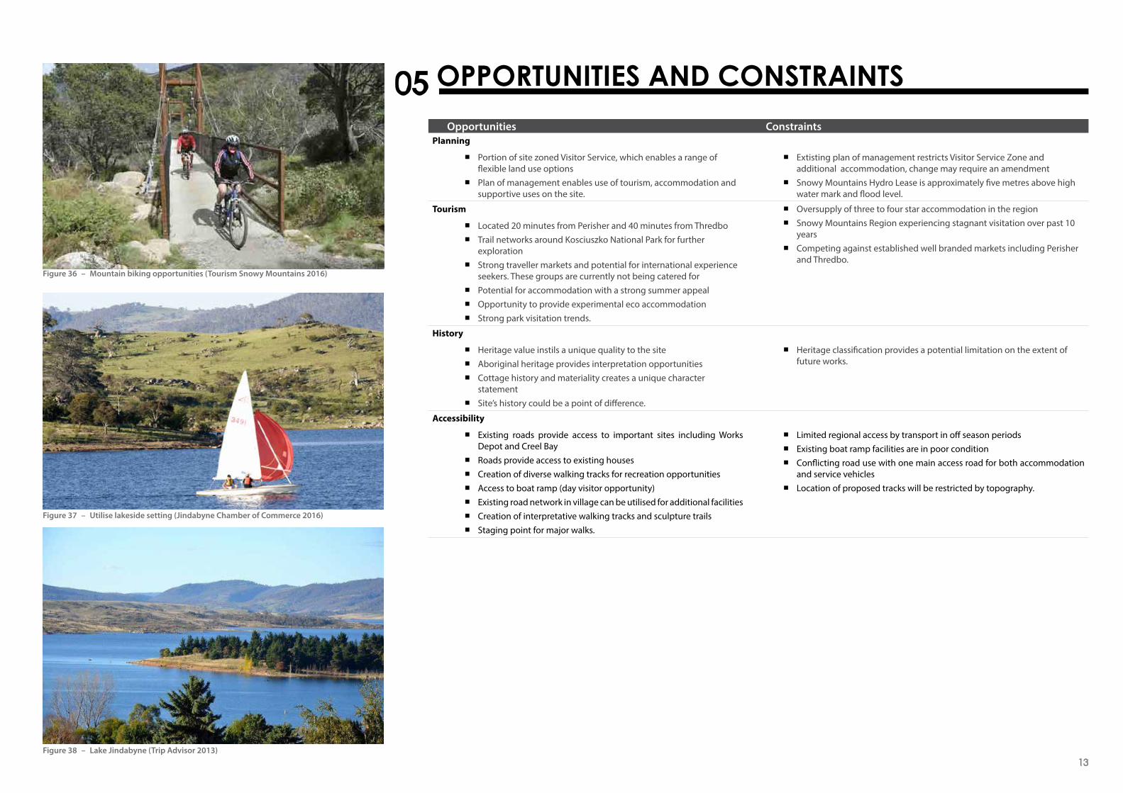
Figure 36 – Mountain biking opportunities (Tourism Snowy Mountains 2016)
Figure 37 – Utilise lakeside setting (Jindabyne Chamber of Commerce 2016)
Figure 38 – Lake Jindabyne (Trip Advisor 2013)

Opportunities ConstraintsLandforms
■ Village area built form responds to topography ■ Relatively gentle slopes around existing built areas ■ Views and vistas of the lake ■ North easterly orientation, which is optimal for building e�ciency ■ Potential for additional facilities within disturbed areas ■ Village area is accessible ■ Unique character of the site.
■ Small localised steeper areas across the site need to be considered in terms of accessibility and walking paths
■ Areas to the north and south present steeper terrain including some areas to the lake
■ Potential erosion problems during rain events ■ Water level in Lake Jindabyne �uctuates, which will in�uence the usability
of sections of the waterfront for recreational use at di�erent times.
Flora and Fauna
■ Home to a range of native animals ■ Endangered ecological community provides visitor attraction or
point of di�erence ■ Tree species and vegetation re�ective of broader Snowy Mountains
ecosystem ■ Distrurbed areas may be utilised and enhanced to reduce impact
on native vegetation.
■ Identi�cation of EEC places stricter controls on development opportunities
■ The area is identi�ed as bush �re prone, which has implications for the ongoing management and protection of the site
■ Candle Bark Woodland could be perceived as unattractive by visitors ■ Slow revegetation due to poor soils, fauna and short growing seasons.
Views and Vistas
■ The Great Dividing Range provides a scenic and attractive outlook ■ Clear connection to the lake ■ Scenic qualities of vegetation provide viewers with a variety of hues
and textures ■ Views and vistas are available on all site boundaries to the lake ■ Existing cottages have �ltered views to the lake and mountains ■ Future cottages and sites can be oriented to maximise views ■ Views and vistas are a strong attribute of the site.
■ Existing vegetation and tree cover can potentially block views and vistas ■ Removal of trees for additional views are not desirable due to
environmental impacts associated with a loss of biodiversity, wildlife and implications in terms of ndangered cological community.
Built Form
■ To leverage heritage character and history provided by the site’s built form and connection to the evolution to the Kosciuszko National Park
■ Boat ramp area provides facilities for day use ■ Screening of Works Depot to create visual separation between
Cottage 16 ■ Beautiful stone cottages are conducive to the surrounding
environment ■ Refurbishing cottages will create accommodation that will meet
market needs.
■ All existing cottages require refurbishment to meet market expectations ■ Heritage value of village restricts the scale of development ■ Works depot built form and scale di�cult to blend in with future use of
the site ■ Additional cottages will require infrastructure upgrades ■ Cost of relocating works depot to another site ■ Potential con�ict between day users and residents.
Infrastructure and Services
■ Existing infrastructure on site to service potable water, wastewater and electricity.
■ No current agreement for potable water connections ■ Any redevelopment scenario will require upgrades to existing infrastructure ■ Visible presence of infrastructure can have a negative impact on the
aesthetics of the site ■ Consideration should be given to the cost of upgrading existing
infrastructure to comply with Australian Standards vs the cost and longevity of new infrastructure.
Figure 39 – Contemporary accommodation
Figure 40 – Potential sculpture trails (Visit NSW 2016)
Figure 41 – Opportunity for education and learning (ArtsHub 2016)14

15
6.1 Principles
Any future master plan needs to ful�l NPWS’ vision for the site, moving Waste Point from an operational based support facility to a recreational park precinct. The following section outlines the key principles and actions to meet this goal.
Principle 1 - Respect and aximise atural and cultural ssets
Principle 2 - Maintain consistency with plan of anagement oals
Principle 3 - Build on the ocal ourism ttributes
Principle 4 - Enhance public ccess to the ite
Principle 5 - Provide robust and lexible ite utcomes
Principle 6 - Provide ear round isitation pportunities
6.2 Naming Opportunities
Consultation undertaken during the preparation of the master plan indicated a strong desire to rename Waste Point. Names could be developed from its indigenous heritage (Bidewal, Ngarigo, Wolgal and Ngunawal clans), European history or relate to the area s heritage and geography, for example:
■ Creel Bay ■ Creel Point ■ James Spencer Point ■ Tarra Point
6.3 Demand Opportunities
A tourism and market assessment undertaken for this project found that while there is an oversupply of standard three to four-star commercial accommodation in the region, there is an identi�ed lack of quality experiential and nature based accommodation. The key opportunity for Waste Point is to provide accommodation with a point of di�erence. This includes the opportunity to deliver accommodation that is both contemporary and iconic in a unique nature based setting.
6.4 Ancillary Facilities for Consideration
There are opportunities to leverage the unique attributes of the site to strengthen its summer appeal. Waste Point will have high occupancy in winter, being only 20 minutes from Perisher. During the o� season (summer), trail links should be developed and boating infrastructure improved, which will strengthen the site’s summer appeal. Ancillary facilities could include:
■ Quality nature trails linking site elements ■ Linkages to key walks and foreshore trails ■ Heritage and ecological interpretation ■ Non-motorised watercraft launch site ■ Creel Bay day-use precinct upgrade including parking upgrade, toilets and
picnic areas ■ Sculpture trail.
6.5 Decommission Option
NPWS has considered alternative options for the site, including decommissioning. Decommissioning would involve removing cottages of low heritage value that are in poor condition and making cottages that are of high heritage value or in good condition safe and water tight. These cottages could be interpreted or used at a later date.
Other options for the site are outlined below.
6.6 Master plan A
Master plan A would involve retention of cottages of high local heritage signi�cance and their refurbishment for eco accommodation purposes. Design guidelines would consider the natural environment setbacks, screening and equitable access.
Cottages 5, 6, 9, 10 and 11 have low/medium local heritage signi�cance and future feas bility assessments may consider their removal or refurbishment.
Cottage 16 could be retained as a research accommodation facility and/or refurbished for general accommodation purposes with potential private vehicle access, away from the works depot.
6.6.1 Recreational UsesRecreational elements in the proposal include:
■ Passive water sports ■ Retention of walking tracks ■ New linkages access to the foreshore
■ Non-motorised watercraft launch site.
6.7 Master plan B
6.7.1 Eco Cottages and Powered Sites
Master plan B includes all options considered in aster plan A and provides areas where new eco cottages could be built and up to 34 powered sites serviced with a new amenities building.
Design guidelines would consider the natural environment, setbacks, screening and equitable access.
6.7.2 Recreational Uses
Recreational elements in the proposal include: ■ Linkages or new linkages to access the foreshore ■ Sculpture trails ■ Passive water sports ■ Tennis court upgrade ■ Non-motorised watercraft launch site ■ Creel Bay Day-use Precinct upgrade.
Infrastructure to support recreational uses would also be upgraded.
Figure 42 – Non-motorised watercraft opportunities (By Land Water and Air 2005) Figure 43 – Non-motorised watercraft opportunities (Aalen 2016)
06 DESIGN PRINCIPLES

07 DRAFT MASTER PLAN OPTIONSA - Utilise existing built form
16

17
B - Utilise existing built form with opportunities for additional amenity and accommodation

7.1 Creel Bay upgrade - Master plan B
7.1.1 Creel BayThe Creel Bay day-use precinct, as depicted in Master plan B, can be upgraded to improve access and circulation and provide visitor facilities such as toilet block amenities and picnic/BBQ areas.
This is a strategic staging point for park visitors and those staying at Waste Point with links to the informal walking tracks along the lake’s edge and good views across the lake.
The redesigned car parking bays will be sealed with trailer parking on grass/unsealed surface. There is the potential to expand the parking facility to the west in the future. The proposed facilities should be designed to minimise the impact on natural and cultural values.
The Creel Bay day-use precinct forms part of council’s 2014-15 priorityregional projects. The project is consistent with the Murray-Riverina Regional Boating Plan and seeks to investigate opportunities to improve boating access in Lake Jindabyne. The plan identifies boating safety, access and infrastructure actions across the region to be implemented over the next five years.
This upgrade could also proceed with Master plan A, subject to funding.
Figure 44 – Boat ramp precinct concept (Tract 2016)
Figure 45 – Existing boat ramp precinct (Tract 2016) Figure 46 – Boat ramp precinct section (Tract 2016)18

19
7.2 Setbacks and Screening for Cottages
Cottages along the main access road will need to retain adequate setback of at least 10 metres to habitable rooms to ensure adequate noise and visual privacy is achieved.
Planting of native vegetation and tree species should be adopted along the existing road where it adjoins a cottage.
7.2.1 Siting and Setbacks
In order to utilise already disturbed areas and minimise vegetation disturbance, cottages can be grouped in clusters and maintain the following setbacks:
■ Front minimum setback of 10 metres from the main access road ■ Front minimum setback of 12 metres from each cottage ■ Side setbacks to be determined based on existing vegetation screening,
topography and other site speci�c conditions.
7.2.2 Screening of Works Depot from Cottage 16
Vegetation should be used where possible to supplement physical screening constructed from sympathetic natural materials that blend into the existing landscape.
This will improve visual privacy and visual outlook from Cottage 16.
Figure 47 – Eco cottage siting and setbacks sketch (Tract 2016)
Figure 48 – Eco accommodation cross section (Tract 2016) Figure 49 – Indicative montage showing Works Depot screen (Tract 2016)

7.3 Sculpture Trails
Sculpture trails can contribute to the area through cultural and interpretative environments. Sculptures create focus points and visual interest along a journey.
Sculpture trails are used by adventure travellers, families and cultural tourists who seek out a walking experience.
A series of sculpture nodes have been identified along existing and proposed walking tracks. These nodes can be part of the cultural heritage interpretation for the site.
Parts of the trail could achieve connectivity through the use of consistent marker or pavement material types for example stepping stones, boulders, mosaics etc. The trails could also re-establish representative habitats and vegetation communities for interpretation.
In the case of long and linear corridors the idea of connectivity and continuity is important. Barriers to continuous movement should be avoided e.g. crossing roads or large obstructions.
Broken Hill, NSW ‘Living Desert and Sculptures’ is a benchmark example of a well designed sculpture trial, which integrates storytelling and interpretative art as a major attraction to the area. At Waste Point there are opportunities to link and create partnerships with a growing local arts community.
Figure 50 – Sculpture trail montage with local boulders to be carved (Tract 2016)
Figure 51 – Existing landforms and geology of site (Tract 2016) Figure 52 – Adelaide Hills sculpture trail (Weekend Notes 2016) Figure 53 – Broken Hill sculpture trail (Broken Hill Australia 2016)
20

21212121
Kosciuszko National Parks, 2006, Plan of Management, Part of the Australian Alps Cooperative Management Program.
Langford, S & Pearson, 1994, Kosciuszko National Parks Ski Resorts Heritage study: Initial Research, Contributed Report prepared August 1994 for NSW NPWS.
NSW Office of Environment and Heritage, 2012, The Significance Assessment and Building Inventory, NPWS Buildings at Waste Point, prepared by Jill Sheppard Heritage Consultants.
Schelmerdines Consulting Engineers, 2016, Waste Point Site Masterplan Electric Site Services Assessment, prepared May 2016.
Tourism Research Australia - International Visitor Survey 2006–2015. Urban Enterprise, 2016, Waste Point Kosciuszko National Park Masterplan, Tourism and Accommodation Market Assessment, prepared June 2016.
Wilde and Woollard, 2016, National Parks & Wildlife Service NSW Kosciuszko National Park Waste Point Masterplan Budget Estimate (Rev 5), prepared June 2016.
Woolacotts Consulting Engineers, 2016, Waste Point Kosciuszko National Park Master Plan Hydraulic Services Report, prepared May 2016.
08 REFERENCES