walking and cycling guide - lancashire...
TRANSCRIPT
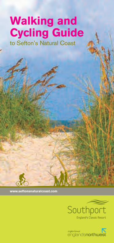
Walking and Cycling Guideto Sefton’s Natural Coast
www.seftonsnaturalcoast.com
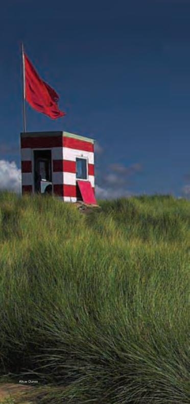
Altcar Dunes
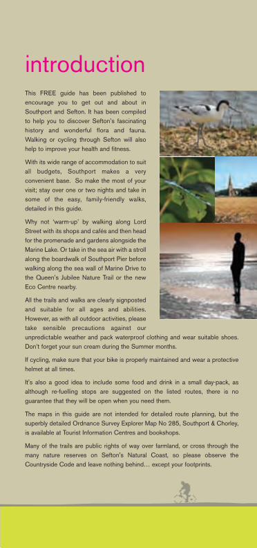
This FREE guide has been published toencourage you to get out and about inSouthport and Sefton. It has been compiledto help you to discover Sefton’s fascinatinghistory and wonderful flora and fauna.Walking or cycling through Sefton will alsohelp to improve your health and fitness.
With its wide range of accommodation to suitall budgets, Southport makes a veryconvenient base. So make the most of yourvisit; stay over one or two nights and take insome of the easy, family-friendly walks,detailed in this guide.
Why not ‘warm-up’ by walking along LordStreet with its shops and cafés and then headfor the promenade and gardens alongside theMarine Lake. Or take in the sea air with a strollalong the boardwalk of Southport Pier beforewalking along the sea wall of Marine Drive tothe Queen’s Jubilee Nature Trail or the newEco Centre nearby.
All the trails and walks are clearly signpostedand suitable for all ages and abilities.However, as with all outdoor activities, pleasetake sensible precautions against ourunpredictable weather and pack waterproof clothing and wear suitable shoes.Don’t forget your sun cream during the Summer months.
If cycling, make sure that your bike is properly maintained and wear a protectivehelmet at all times.
It's also a good idea to include some food and drink in a small day-pack, asalthough re-fuelling stops are suggested on the listed routes, there is noguarantee that they will be open when you need them.
The maps in this guide are not intended for detailed route planning, but thesuperbly detailed Ordnance Survey Explorer Map No 285, Southport & Chorley,is available at Tourist Information Centres and bookshops.
Many of the trails are public rights of way over farmland, or cross through themany nature reserves on Sefton's Natural Coast, so please observe theCountryside Code and leave nothing behind… except your footprints.
introduction
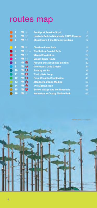
� 1 �� Southport Seaside Stroll 6
� 2 �� Hesketh Park to Marshside RSPB Reserve 10
� 3 �� Churchtown & the Botanic Gardens 12
� 4 �� Cheshire Lines Path 14
� 5 �� The Sefton Coastal Path 18
� 6 �� Maghull to Aintree 22
� 7 �� Crosby Cycle Route 26
� 8 � Around and about Ince Blundell 30
� 9 �� Thornton & Little Crosby 34
� 10 �� Formby Wa ks 38
� 11 �� The Lydiate Loop 42
� 12 �� From Coast to Countryside 46
� 13 � Meanders around Melling 50
� 14 �� The Maghull Trail 54
� 15 �� Sefton Village and the Meadows 58
� 16 �� Netherton to Crosby Marine Park 62
4
routes map
Marine Drive, Southport
part
Formby
Ainsdale-on-Sea
Crosby
Birkdale
Southport
Ainsdale
Hillside
Formby
Freshfield
Blundellsands & Crosby
Waterloo
Maghull
Aintree
Seaforth & Litherland
M57
M58
A565A565
A570
A5147
A565 A5147
A5036
LEEDS LIVERPOOLCANAL
Ince Blundell
Bootle New Strand
Southport
Old Roan
Maghull
Hightown
Hall RoadLittle Crosby
www.seftonsnaturalcoast.com
5
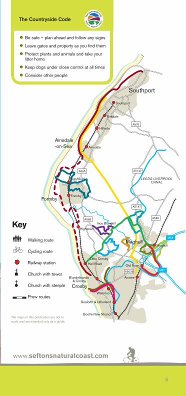
• Be safe – plan ahead and follow any signs
• Leave gates and property as you find them
• Protect plants and animals and take your litter home
• Keep dogs under close control at all times
• Consider other people
The Countryside Code
� Walking route
� Cycling route
Railway station
� Church with tower
� Church with steeple
Prow routes
The maps in this publication are not toscale and are intended only as a guide.
Key
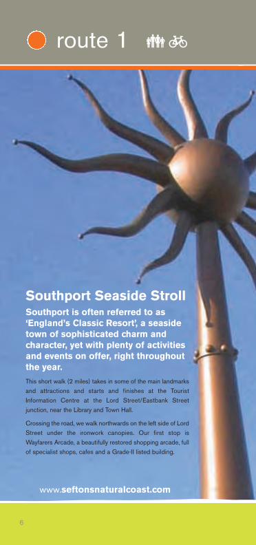
Southport Seaside StrollSouthport is often referred to as‘England’s Classic Resort’, a seasidetown of sophisticated charm andcharacter, yet with plenty of activitiesand events on offer, right throughoutthe year.This short walk (2 miles) takes in some of the main landmarksand attractions and starts and finishes at the TouristInformation Centre at the Lord Street/Eastbank Streetjunction, near the Library and Town Hall.
Crossing the road, we walk northwards on the left side of LordStreet under the ironwork canopies. Our first stop isWayfarers Arcade, a beautifully restored shopping arcade, fullof specialist shops, cafes and a Grade-II listed building.
www.seftonsnaturalcoast.com
6
route 1 ��
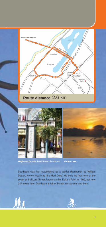
Southport was first established as a tourist destination by WilliamSutton, known locally as ‘the Mad Duke’. He built the first hotel at thesouth end of Lord Street, known as the ‘Duke’s Folly’ in 1792, but now216 years later, Southport is full of hotels, restaurants and bars.
7
Lord S
treet
Eastb
ank S
t
P
rom
enad
e
Marine
Driv
eSouthport Pier & Pavillion
Southport
SouthportStation
King
s Gar
densPr nces Park
Ocean Plaza
Eco Vis torCentre
Marine Way Br dge
Mar ne Lake
START
END
Town Ha l
A565
A570
Route distance 2.6 km
Wayfarers Arcade, Lord Street, Southport Marine Lake
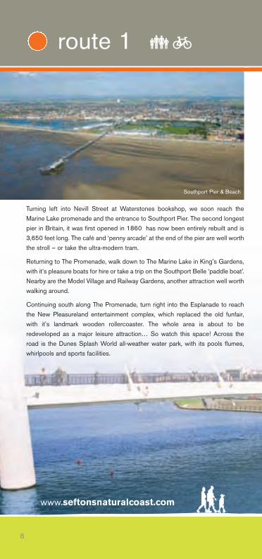
Turning left into Nevill Street at Waterstones bookshop, we soon reach theMarine Lake promenade and the entrance to Southport Pier. The second longestpier in Britain, it was first opened in 1860 has now been entirely rebuilt and is3,650 feet long. The café and ‘penny arcade’ at the end of the pier are well worththe stroll – or take the ultra-modern tram.
Returning to The Promenade, walk down to The Marine Lake in King’s Gardens,with it’s pleasure boats for hire or take a trip on the Southport Belle ‘paddle boat’.Nearby are the Model Village and Railway Gardens, another attraction well worthwalking around.
Continuing south along The Promenade, turn right into the Esplanade to reachthe New Pleasureland entertainment complex, which replaced the old funfair,with it’s landmark wooden rollercoaster. The whole area is about to beredeveloped as a major leisure attraction… So watch this space! Across theroad is the Dunes Splash World all-weather water park, with its pools flumes,whirlpools and sports facilities.
www.seftonsnaturalcoast.com
8
route 1 ��
Southport Pier & Beach

Just across the roundabout on the Esplanade, next to the Park and Ride, is thedistinctive curved wooden and glass-built Eco-Centre, complete with its own 20 KW wind turbine. The centre informs and educates residents and visitorsalike on the sensible policies of sustainability and good environmentalmanagement. Adjacent to the centre is the small Queens Jubilee NatureReserve, which gives a good presentation of the flora and fauna of Sefton’sNatural Coast, which extends southwards all the way to the edge of Liverpool.
Returning to the roundabout, turn left to reach Marine Drive, cross the road andwalk right towards the pier along of the seawall. If the tide is high you will seelots of wading birds and gulls. Under the pier we then turn right onto MarineParade, passing the new Ocean Plaza leisure complex to the right, with its seven-screen cinema, 20-lane ten-pin bowling alley, restaurants and fitness centre.
Opposite the terminus of the Lakeside Miniature Railway, which will take youback to New Pleasureland, we pass the new Ocean Plaza Retail Park and crossthe elegant Marine Way Suspension Bridge. Then cross into Nevill Street andturn right into Lord Street again, to reach the Tourist Information Centre andfinish our short stroll around Southport.
9
Southport Pier & Pavilion
Southport Belle
Southport Eco Visitor Centre

Hesketh Park to MarshsideRSPB ReserveFrom the roundabout at the northern end of Lord Street (by the Fire Station andLaw Courts), continue straight on along Albert Road, to reach the park entrance,at Park Road.
Hesketh Park was created in 1864 and hasrecently, been completely refurbished. A verypleasant walk around ornamental lakes, completewith fountains and flowerbeds, which in summerare a riot of colour. Lots of mature trees attractwoodpeckers and sometimes Red Squirrels,there’s also a café and large play area for children. The park also features a historic observatory; a conservatory; aviary; waterfallsand cascade; American, herbaceous and mixed flower gardens and don’t missthe clock garden, where a carefully restored floral cuckoo clock ‘calls’ the hours.
Leave the park by the north entrance and turn left into Park Crescent with it’slarge Victorian houses, carefully cross the road and turn right into Argyle Roadand walk 300 yards to the next roundabout. Turn left into Hesketh Road, passFleetwood Road on the right to reach a footpath marker on the right after another250 yards.
www.seftonsnaturalcoast.com
10
route 2 ��
Hesketh Park
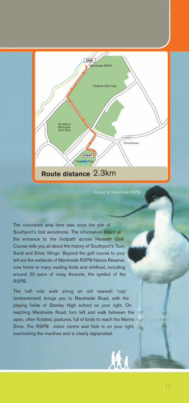
The concreted area here was once the site ofSouthport’s first aerodrome. The information board atthe entrance to the footpath across Hesketh GolfCourse tells you all about the history of Southport’s ‘Sun,Sand and Silver Wings’. Beyond the golf course to yourleft are the wetlands of Marshside RSPB Nature Reserve,now home to many wading birds and wildfowl, includingaround 20 pairs of noisy Avocets, the symbol of theRSPB.
The half mile walk along an old seawall ‘cop’(embankment) brings you to Marshside Road, with theplaying fields of Stanley High school on your right. Onreaching Marshside Road, turn left and walk between theopen, often flooded, pastures, full of birds to reach the MarineDrive. The RSPB visitor centre and hide is on your right,overlooking the marshes and is clearly signposted.
11
SouthportMunicipalGolf Club
Hesketh Park
Churchtown
Hesketh Golf Club
Marshside RSPB
START
END
A565
Route distance 2.3km
Avocet at Marshside RSPB
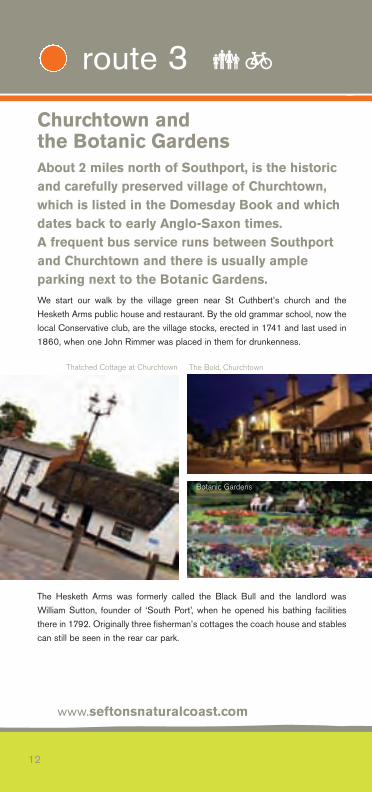
Churchtown and the Botanic GardensAbout 2 miles north of Southport, is the historicand carefully preserved village of Churchtown,which is listed in the Domesday Book and whichdates back to early Anglo-Saxon times. A frequent bus service runs between Southportand Churchtown and there is usually ampleparking next to the Botanic Gardens.We start our walk by the village green near St Cuthbert’s church and theHesketh Arms public house and restaurant. By the old grammar school, now thelocal Conservative club, are the village stocks, erected in 1741 and last used in1860, when one John Rimmer was placed in them for drunkenness.
The Hesketh Arms was formerly called the Black Bull and the landlord wasWilliam Sutton, founder of ‘South Port’, when he opened his bathing facilitiesthere in 1792. Originally three fisherman’s cottages the coach house and stablescan still be seen in the rear car park.
www.seftonsnaturalcoast.com
12
route 3 ��
Thatched Cottage at Churchtown The Bold, Churchtown
Botanic Gardens
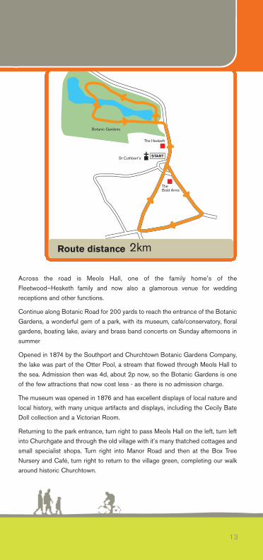
Across the road is Meols Hall, one of the family home’s of theFleetwood–Hesketh family and now also a glamorous venue for weddingreceptions and other functions.
Continue along Botanic Road for 200 yards to reach the entrance of the BotanicGardens, a wonderful gem of a park, with its museum, café/conservatory, floralgardens, boating lake, aviary and brass band concerts on Sunday afternoons insummer
Opened in 1874 by the Southport and Churchtown Botanic Gardens Company,the lake was part of the Otter Pool, a stream that flowed through Meols Hall tothe sea. Admission then was 4d, about 2p now, so the Botanic Gardens is oneof the few attractions that now cost less - as there is no admission charge.
The museum was opened in 1876 and has excellent displays of local nature andlocal history, with many unique artifacts and displays, including the Cecily BateDoll collection and a Victorian Room.
Returning to the park entrance, turn right to pass Meols Hall on the left, turn leftinto Churchgate and through the old village with it’s many thatched cottages andsmall specialist shops. Turn right into Manor Road and then at the Box TreeNursery and Café, turn right to return to the village green, completing our walkaround historic Churchtown.
13
START
The Bold Arms
The Hesketh
Botanic Gardens
St Cuthbert’s
Route distance 2km
Cheshire Lines Walk The Trans Pennine Trail (TPT) is a 346 km (216 mile) multi-user route from Liverpool toHull, with extensions to Southport on the IrishSea coast and to Hornsea on the shores of theNorth Sea. The starting point is adjacent to the TPT Seamark on Southport’s Promenadeand for most of the next 23.2 km (14.5 miles), the route follows the trackbed ofthe former Cheshire Lines Railway. The old station frontage, complete with clocktower, still survives as the front entrance of Morrisons supermarket.
Elegant Lord Street, with its Victorian ironwork, restored parks and gardens andhundreds of shops and restaurants, is signposted from the promenade and canbe accessed via the elegant suspension bridge or Southport’s superbly restoredPier with its new pavilion, café, bar and interesting displays on the pier’s historyand the wildlife of the Ribble Estuary.
Our journey first takes us southwards on the seaward side of the Marine Drive,passing the Queen’s Jubilee Nature Trail on the inland side of the road, just oneof 17 nature reserves that line Sefton’s Natural Coast, all the way from Southportto Liverpool.
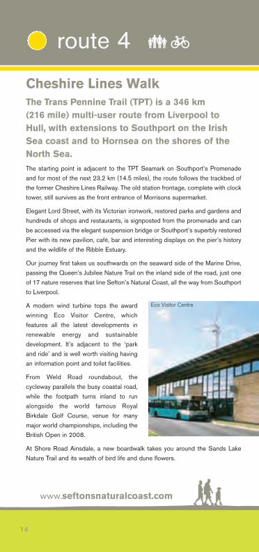
A modern wind turbine tops the awardwinning Eco Visitor Centre, whichfeatures all the latest developments inrenewable energy and sustainabledevelopment. It’s adjacent to the ‘parkand ride’ and is well worth visiting havingan information point and toilet facilities.
From Weld Road roundabout, thecycleway parallels the busy coastal road,while the footpath turns inland to runalongside the world famous RoyalBirkdale Golf Course, venue for manymajor world championships, including theBritish Open in 2008.
At Shore Road Ainsdale, a new boardwalk takes you around the Sands LakeNature Trail and its wealth of bird life and dune flowers.
www.seftonsnaturalcoast.com
14
route 4 ��
Eco Visitor Centre
Southport
RIVER ALT
Maghull
Formby
Ainsdale-on-Sea
SouthportStation
BirkdaleStation
HillsideStation
HightownStation
LEEDS-LIVERPOOL CANAL
Ince Blundell
GreatAltcar
Moss Side
Haskayne
Halsall
MaghullStation
START
Sefton
To Aintree
Old RoanStation
A570
A5147
A565
A565Freshfield
Station
AinsdaleStation
FormbyStation
END
15
Route key points
Route distance
Southport Pier Pavilion (WC Facilities)
Eco Visitor Centre (WC Facilities)
Royal Birkdale Golf Club
Ainsdale Discovery Centre (WC Facilities)
Highest Sand Dunes: Big Balls Hill
Lancashire Mosslands
Aintree Racecourse
Leeds - Liverpool Canal
23.2km
Southport Beach & Dunes
Take time out to visit the nearby Ainsdale Discovery Centre, headquarters of theSefton Coast & Countryside Service, with its excellent displays and a wealth offree literature on the unique natural and local history of the coastal dunes. Food,drink and toilet facilities are all available nearby.
Continuing on the coastal trail, we reach the highest sand dune on the coast atBig Balls Hill. Here the Trans Pennine Trail parts company with the SeftonCoastal Path, continuing along the coastal road to reach Woodvale traffic lightsafter 8 km (5 miles). Carrying straight on down Moor Lane and Plex Moss Lane,with the manicured greens of Formby Hall Golf course on the right, follow theclearly signposted track to rejoin the Cheshire Lines trackbed towards Maghulland Aintree.
The next 10 km (6 miles) to Green Lane, Maghull, takes us over the flat peatlandsof the Lancashire plain, which in winter are visited by thousands of Pink-FootedGeese from Iceland, their ‘gaggling’ calls attracting attention to long skeins offlying birds.
All of the surrounding area was underwater until local landowners drained it inthe 18th and 19th centuries. The monks of Cartmel Priory in Cumbria held theancient fishing rights and many kinds of fish and waterfowl were harvested forfood.
www.seftonsnaturalcoast.com
16
route 4 ��
Royal Birkdale Golf Club Cheshire Lines Cycle Path
At Sefton Lane, 20 km from the start (12.5 miles), we leave the Cheshire LinesPath to follow Old Racecourse Road, which was the site of the Grand Nationalbefore it was transferred to Aintree. Following the TPT signs past the watertreatment works at Meadway, we pass the newly-planted Jubilee Woods, part ofa series of community woodlands on these former landfill sites, to cross the AltRiver at Mill Dam bridge and join Chapel Lane towards Brook House Farm.
Carefully crossing the busy Northern Perimeter Road at Netherton, we carrystraight on down Chapel Lane, which soon becomes Aldrins Lane, to join thetowpath of the Leeds-Liverpool canal at the narrow swing bridge at 22 km(13.75 miles). Heading eastwards along the towpath for the next 1.5 km (0.9miles), we gain access to Ormskirk Road at the overbridge and continuesouthwards to finish our journey at Aintree Station on Park Lane.
Meanwhile the Trans Pennine Trail continues on as the Liverpool Loop Line Pathto reach the shore at Widnes and then heads due east following the MerseyValley to Warrington and eventually the North Sea. Trail guides and detailedmaps are available from www.transpenninetrail.org.uk. At 33.6 km (21 miles), theSefton Coastal Path is the second longest route detailed in this guide.
Sefton’s Natural Coast, as it is now known, is the largest undeveloped dunesystem in England and stretches all the way from Southport and the RibbleEstuary to Seaforth at the mouth of the River Mersey.
17
Swans & Coots Aintree Race Course
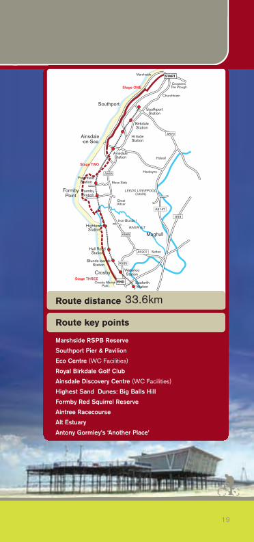
The Sefton Coastal PathA stimulating journey through a wonderfulvariety of landscapes with a rich biodiversity ofwildlife and a fascinating history. Sandy beaches,coastal marshes, pine woodlands, heatheryheathland and tidal estuaries with invigoratingvistas across the Irish Sea to North Wales,Snowdonia and even the Lake District on a clear day. The Sefton Coastal Path can be walked throughout and parts are cycle-friendly.It can easily be completed over a weekend based in Southport, or it can bebroken up into individual short walks as desired. The suggested stages aresummarised below.
Stage One - Crossens to Ainsdale
The route is flanked by the salt marshes of the Ribble which are managed byEnglish Nature and Sefton Council and are suitable for cycling. Attractionsinclude Marshside RSPB Reserve – one of the country’s top reserves forbreeding wading birds; Southport’s wonderful pier, Marine Lake, ThePromenade, Lord Street shopping and dining; the brand new suspension bridge;the Ocean Plaza complex and the Queen’s Jubilee Nature Trail. Southport’sextensive events programme includes the Southport Flower Show and theSouthport Air Show.
www.seftonsnaturalcoast.com
18
route 5 ��part
Marshside RSPB
19
Southport
RIVER ALT
Maghull
Crosby
START
SouthportStation
BirkdaleStation
Blunde lsandsStation
Hall RoadStation
LEEDS LIVERPOOL CANAL
A570
A565
A565
A5207
A5147
A59Ince Blunde l
GreatAltcar
Moss Side
Haskayne
Halsall
Marshside
Churchtown
Sefton
HightownStation
Crosby MarinePark
CrossensThe Plough
WaterlooStation
SeaforthStation
A565
FormbyPoint
Ainsdale-on-Sea
FreshfieldStation
AinsdaleStation
Hi lsideStation
FormbyStation
Stage ONE
Stage TWO
Stage THREEEND
Route key points
Route distance
Marshside RSPB Reserve
Southport Pier & Pavilion
Eco Centre (WC Facilities)
Royal Birkdale Golf Club
Ainsdale Discovery Centre (WC Facilities)
Highest Sand Dunes: Big Balls Hill
Formby Red Squirrel Reserve
Aintree Racecourse
Alt Estuary
Antony Gormley’s ‘Another Place’
33.6km
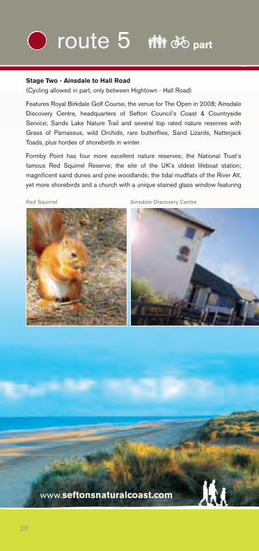
Stage Two - Ainsdale to Hall Road
(Cycling allowed in part, only between Hightown - Hall Road)
Features Royal Birkdale Golf Course, the venue for The Open in 2008; AinsdaleDiscovery Centre, headquarters of Sefton Council’s Coast & CountrysideService; Sands Lake Nature Trail and several top rated nature reserves withGrass of Parnassus, wild Orchids, rare butterflies, Sand Lizards, NatterjackToads, plus hordes of shorebirds in winter.
Formby Point has four more excellent nature reserves; the National Trust’sfamous Red Squirrel Reserve; the site of the UK’s oldest lifeboat station;magnificent sand dunes and pine woodlands; the tidal mudflats of the River Alt,yet more shorebirds and a church with a unique stained glass window featuring
www.seftonsnaturalcoast.com
20
route 5 ��part
Red Squirrel Ainsdale Discovery Centre
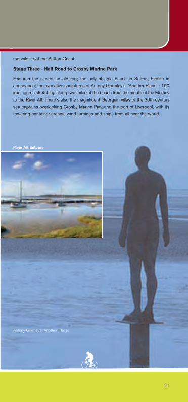
the wildlife of the Sefton Coast
Stage Three - Hall Road to Crosby Marine Park
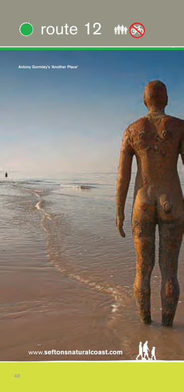
Features the site of an old fort; the only shingle beach in Sefton; birdlife inabundance; the evocative sculptures of Antony Gormley’s ‘Another Place’ - 100iron figures stretching along two miles of the beach from the mouth of the Merseyto the River Alt. There’s also the magnificent Georgian villas of the 20th centurysea captains overlooking Crosby Marine Park and the port of Liverpool, with itstowering container cranes, wind turbines and ships from all over the world.
21
River Alt Estuary
Antony Gormey’s ‘Another Place’
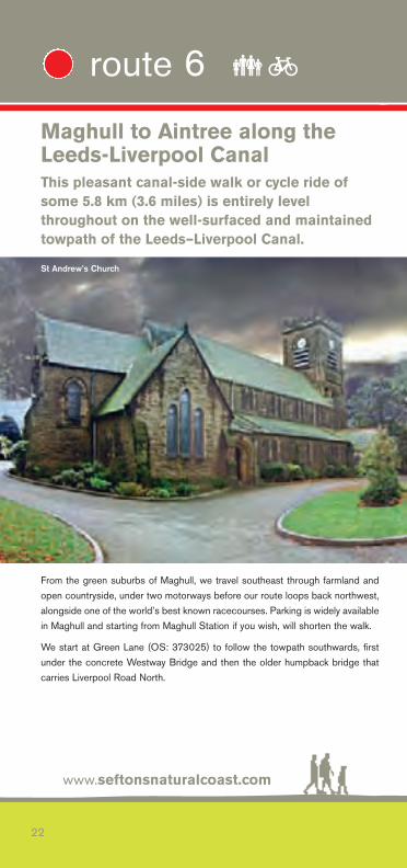
Maghull to Aintree along theLeeds-Liverpool CanalThis pleasant canal-side walk or cycle ride ofsome 5.8 km (3.6 miles) is entirely levelthroughout on the well-surfaced and maintainedtowpath of the Leeds–Liverpool Canal.
From the green suburbs of Maghull, we travel southeast through farmland andopen countryside, under two motorways before our route loops back northwest,alongside one of the world’s best known racecourses. Parking is widely availablein Maghull and starting from Maghull Station if you wish, will shorten the walk.
We start at Green Lane (OS: 373025) to follow the towpath southwards, firstunder the concrete Westway Bridge and then the older humpback bridge thatcarries Liverpool Road North.
www.seftonsnaturalcoast.com
22
route 6 ��
St Andrew’s Church
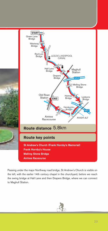
Passing under the major Northway road bridge, St Andrew’s Church is visible onthe left, with the earlier 14th century chapel in the churchyard, before we reachthe swing bridge at Hall Lane and then Drapers Bridge, where we can connectto Maghull Station.
23
LEEDS LIVERPOOLCANAL
RIVER ALT
MaghullStation
Old RoanStation Ledsons
Bridge
HolmesBridge
Melling StoneBridge
DrapersBridge
Red LionBridge
WestwayBridge
Green LaneBridge
Hall LaneBridge
AintreeRacecourse
HandcocksBridge
START
END
M57
M58
LEEDS LIVERPOOLCANAL
RIVER ALT
MaghullStation
Old RoanStation Ledsons
Bridge
HolmesBridge
Melling StoneBridge
DrapersBridge
Red LionBridge
WestwayBridge
Green LaneBridge
Hall LaneBridge
AintreeRacecourse
HandcocksBridge
START
END
M57
M58
Route key points
Route distance
St Andrew’s Church (Frank Hornby’s Memorial)
Frank Hornby’s House
Melling Stone Bridge
Aintree Raceourse
5.8km
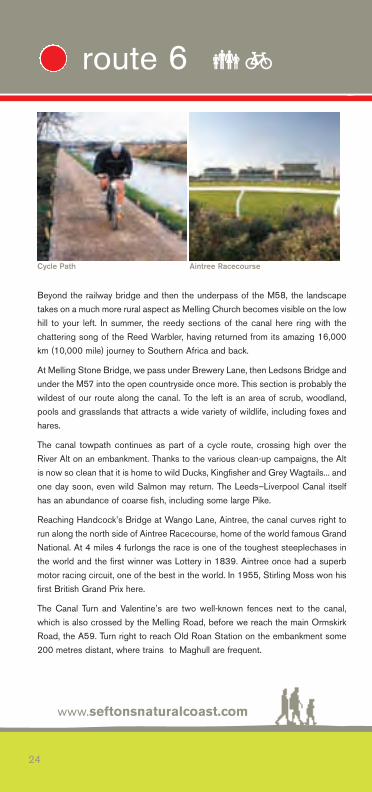
Beyond the railway bridge and then the underpass of the M58, the landscapetakes on a much more rural aspect as Melling Church becomes visible on the lowhill to your left. In summer, the reedy sections of the canal here ring with thechattering song of the Reed Warbler, having returned from its amazing 16,000km (10,000 mile) journey to Southern Africa and back.
At Melling Stone Bridge, we pass under Brewery Lane, then Ledsons Bridge andunder the M57 into the open countryside once more. This section is probably thewildest of our route along the canal. To the left is an area of scrub, woodland,pools and grasslands that attracts a wide variety of wildlife, including foxes andhares.
The canal towpath continues as part of a cycle route, crossing high over theRiver Alt on an embankment. Thanks to the various clean-up campaigns, the Altis now so clean that it is home to wild Ducks, Kingfisher and Grey Wagtails... andone day soon, even wild Salmon may return. The Leeds–Liverpool Canal itselfhas an abundance of coarse fish, including some large Pike.
Reaching Handcock’s Bridge at Wango Lane, Aintree, the canal curves right torun along the north side of Aintree Racecourse, home of the world famous GrandNational. At 4 miles 4 furlongs the race is one of the toughest steeplechases inthe world and the first winner was Lottery in 1839. Aintree once had a superbmotor racing circuit, one of the best in the world. In 1955, Stirling Moss won hisfirst British Grand Prix here.
The Canal Turn and Valentine’s are two well-known fences next to the canal,which is also crossed by the Melling Road, before we reach the main OrmskirkRoad, the A59. Turn right to reach Old Roan Station on the embankment some200 metres distant, where trains to Maghull are frequent.
www.seftonsnaturalcoast.com
24
route 6 ��
Cycle Path Aintree Racecourse
25
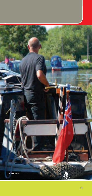
Canal Boat
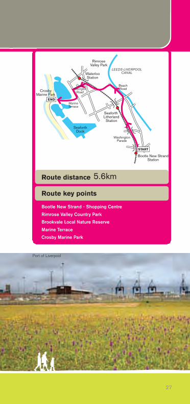
Crosby Cycle RouteThe cycle route is a 5.6 km (3.5 mile) longjourney through industrial and commercial areascoupled with a seaside park, nature reserve andresidential developments, typical of the urbanlandscape of Sefton.We start at the traffic lights junction of Washington Parade and Marsh Lane,Bootle and head away from the newly refurbished Bootle New Strand Stationand the Bootle Strand Shopping Centre, with its shops, food, drink and publictoilets.
The first place of interest along our route is Bootle Leisure Centre, housed in theparkland known as North Park, with children’s play areas and lazy windingpathways through a variety of flowerbeds and shrubbery. Washington Parade isa traffic-calmed road that restricts through traffic with the exception ofpedestrians and cyclists. The route then crosses Knowsley Road and entersLitherland, passing through areas of residential and light industrial business.
The Southport to Liverpool railway line runs parallel to the cycle route, a disusedsection of which passes through Litherland and links with the Kirkby to Liverpooland Ormskirk to Liverpool lines. The link spurs off from the Southport line and thecycle route goes under the line at this point.
Following the bridge, the route becomes a shared cycle/footpath and passesthrough Hapsford Road Recreation Ground, an oasis of green in a typical urbanbackground. On leaving the park the cycle route weaves through the residentialstreets of Litherland and passes through a subway under the A5036, the mainlink road from the Port of Liverpool and the Liverpool Freeport to the M58, M57and beyond.
The route emerges on Beech Road and passes the local allotment gardens andinto the Rimrose Valley Country Park, which is noted for its wild flowers andprolific birdlife. The path leads through the valley’s wetland into Brookvale LocalNature Reserve, which in summer is awash with Yellow Flag Iris, whilst the tallreedbeds are alive with the songs of Reed and Sedge Warblers.
Next to the Brookvale local football pitches, the route enters into Waterloo,passing through the Brookvale housing development (on the carriageway andfootway adjacent to the railway line) to emerge on the A565 opposite the FiveLamps war memorial.
www.seftonsnaturalcoast.com
26
route 7 ��
27
Bootle New StrandStation
Seaforth Litherland
Station
WaterlooStation
MarineTerrace
RimroseValley Park
CrosbyMarine Park
LEEDS-LIVERPOOLCANAL
WashingtonParade
SeaforthDock
START
GreatGeorges
Road
BeachRoad
END
Route key points
Route distance
Bootle New Strand - Shopping Centre
Rimrose Valley Country Park
Brookvale Local Nature Reserve
Marine Terrace
Crosby Marine Park
5.6km
Port of Liverpool
www.seftonsnaturalcoast.com
28
route 7 ��
Azure Damselfly
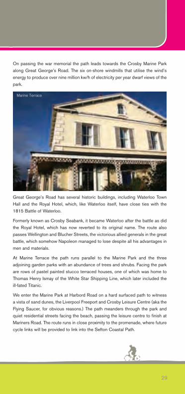
On passing the war memorial the path leads towards the Crosby Marine Parkalong Great George’s Road. The six on-shore windmills that utilise the wind’senergy to produce over nine million kw/h of electricity per year dwarf views of thepark.
Great George’s Road has several historic buildings, including Waterloo TownHall and the Royal Hotel, which, like Waterloo itself, have close ties with the1815 Battle of Waterloo.
Formerly known as Crosby Seabank, it became Waterloo after the battle as didthe Royal Hotel, which has now reverted to its original name. The route alsopasses Wellington and Blucher Streets, the victorious allied generals in the greatbattle, which somehow Napoleon managed to lose despite all his advantages inmen and materials.
At Marine Terrace the path runs parallel to the Marine Park and the threeadjoining garden parks with an abundance of trees and shrubs. Facing the parkare rows of pastel painted stucco terraced houses, one of which was home toThomas Henry Ismay of the White Star Shipping Line, which later included theill-fated Titanic.
We enter the Marine Park at Harbord Road on a hard surfaced path to witnessa vista of sand dunes, the Liverpool Freeport and Crosby Leisure Centre (aka theFlying Saucer, for obvious reasons.) The path meanders through the park andquiet residential streets facing the beach, passing the leisure centre to finish atMariners Road. The route runs in close proximity to the promenade, where futurecycle links will be provided to link into the Sefton Coastal Path.
29
Marine Terrace
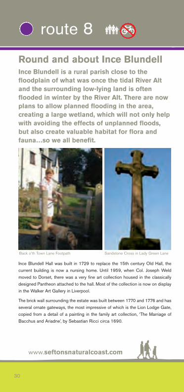
Round and about Ince BlundellInce Blundell is a rural parish close to thefloodplain of what was once the tidal River Altand the surrounding low-lying land is oftenflooded in winter by the River Alt. There are nowplans to allow planned flooding in the area,creating a large wetland, which will not only helpwith avoiding the effects of unplanned floods,but also create valuable habitat for flora andfauna…so we all benefit.
Ince Blundell Hall was built in 1729 to replace the 15th century Old Hall, thecurrent building is now a nursing home. Until 1959, when Col. Joseph Weldmoved to Dorset, there was a very fine art collection housed in the classicallydesigned Pantheon attached to the hall. Most of the collection is now on displayin the Walker Art Gallery in Liverpool.
The brick wall surrounding the estate was built between 1770 and 1776 and hasseveral ornate gateways, the most impressive of which is the Lion Lodge Gate,copied from a detail of a painting in the family art collection, ‘The Marriage ofBacchus and Ariadne’, by Sebastian Ricci circa 1690.
www.seftonsnaturalcoast.com
30
route 8 ��
Back o’th Town Lane Footpath Sandstone Cross in Lady Green Lane
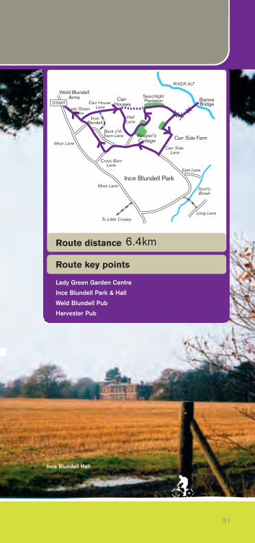
Ince Blundell Park
Weld BlundellArms
Carr House Lane
InceBlundell
Back o'th Town Lane
SearchlightPlantation
Carr Side Lane
BainesBridge
Carr Side FarmMoor Lane
Long Lane
East Lane
Cross BarnLane
HallLane
RIVER ALT
Hunt'sBrook
Moor Lane
To Little Crosby
START
Keeper'sCottage
Carr Houses
Lady GreenLane
31
Ince Blundell Park
Weld BlundellArms
Carr House Lane
InceBlundell
Back o'th Town Lane
SearchlightPlantation
Carr Side Lane
BainesBridge
Carr Side FarmMoor Lane
Long Lane
East Lane
Cross BarnLane
HallLane
RIVER ALT
Hunt'sBrook
Moor Lane
To Little Crosby
START
Keeper'sCottage
Carr Houses
Lady GreenLane
Route key points
Route distance
Lady Green Garden Centre
Ince Blundell Park & Hall
Weld Blundell Pub
Harvester Pub
6.4km
Ince Blundell Hall

Our walk around the Ince Blundell woodland and estate begins at either theWeld Blundell or the Harvester pub directly opposite, on the A565 (OS Ref331403), where patrons may park their cars, and is about 6.4 km (4 miles) inlength.
Turning left out of the car park along Lady Green Lane after 400 metres, we turnleft into Carr House Lane, where Carr Houses is soon reached. This cluster ofdwellings is now a conservation area on the edge of the River Alt’s flood plain.The Norse word ‘kjarr’, from which carr derives, means boggy land covered inwillow scrub, which would have been the case when the cottages were built.
Turning right at Carr Houses takes us down Hall Lane for 500 metres, where weturn left through the grounds of Keeper’s Cottage to enter Keeper’s Wood at agateway. The way marked path first turns right then left to exit the wood as a fieldedge path with a drainage ditch on your right. After 130 metres turn sharply left,still with the ditch on your right, to reach the end of Carr House Lane atSearchlight Plantation.
Turn right here with Searchlight Plantation on your left, so named when asearchlight battery was stationed here in WWII, and then crossing a footbridgewe turn right again back towards Carr Side Farm and its herd of white Charolais
www.seftonsnaturalcoast.com
32
route 8 ��
Park Wall Road
Lady Green Nursrey Cafe
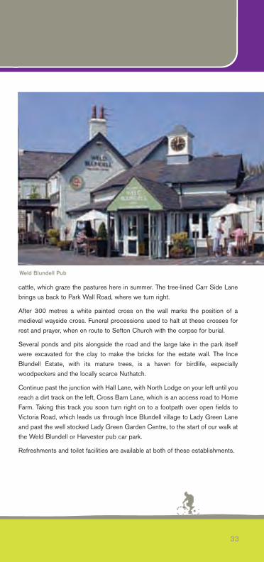
cattle, which graze the pastures here in summer. The tree-lined Carr Side Lanebrings us back to Park Wall Road, where we turn right.
After 300 metres a white painted cross on the wall marks the position of amedieval wayside cross. Funeral processions used to halt at these crosses forrest and prayer, when en route to Sefton Church with the corpse for burial.
Several ponds and pits alongside the road and the large lake in the park itselfwere excavated for the clay to make the bricks for the estate wall. The InceBlundell Estate, with its mature trees, is a haven for birdlife, especiallywoodpeckers and the locally scarce Nuthatch.
Continue past the junction with Hall Lane, with North Lodge on your left until youreach a dirt track on the left, Cross Barn Lane, which is an access road to HomeFarm. Taking this track you soon turn right on to a footpath over open fields toVictoria Road, which leads us through Ince Blundell village to Lady Green Laneand past the well stocked Lady Green Garden Centre, to the start of our walk atthe Weld Blundell or Harvester pub car park.
Refreshments and toilet facilities are available at both of these establishments.
33
Weld Blundell Pub
Thornton & Little CrosbyStarting at the old stocks and sundial inThornton village centre (OS ref: 333696),carefully cross Lydiate Lane towards the NagsHead pub. After 200 metres at the Gamekeeper’sCottage turn right onto a cobbled track betweenhedges, which shortly turns left to cross the edgeof a field leading to Back Lane. Turn left andafter 50 metres the ‘Brooms Cross’ is reached.This is another of the medieval wayside crosses on the ancient ‘corpseway’ fromHightown to Sefton Church, where traditionally bodies washed up on the coastwere given a Christian burial.
Continuing on this pleasant byway, Gates Lane, look out for a footpath on yourleft, taking you alongside drainage ditches to reach Long Lane. In spring thesurrounding fields are full of singing Skylarks and displaying Lapwings tumblearound the sky calling ‘pee-wit’, which is their old country name.
Turn right at Long Lane to reach another footpath sign on the left after 250metres. Follow this peaceful wooded lane, Little Lane, crossing Hunts Brook toreach Park Wall Road, where we turn left. In late summer the wall-side verge canbe full of butterflies, including the less often seen Small Copper and Comma.
Ince Lane (A565) is reached at the splendid Lion Lodge Gates (see InceBlundell Estate), where we very carefully cross this busy trunk road fromLiverpool to Southport and turn right to join a track to the left after 200 metres.This track takes us to the lodge house at Back Lane.
We carry straight on down Back Lane, where the buildings of Crosby Hall areseen on the left. Part of the 15th century Great Barn, former stables and otherbuildings have been converted by the Crosby Hall Educational Trust (CHET), acharitable institution that promotes the personal development of children in need,by providing residential courses in the quiet countryside.
Beyond the Hall, which dates from around 1609, we soon reach West LaneHouse and St. Mary’s Church. West Lane House and Chapel was built in 1719and was a place of worship before St. Mary’s was consecrated in 1847, afterwhich it served as a Presbytery, convent and school. Built in early-decorated
www.seftonsnaturalcoast.com
34
route 9 ��
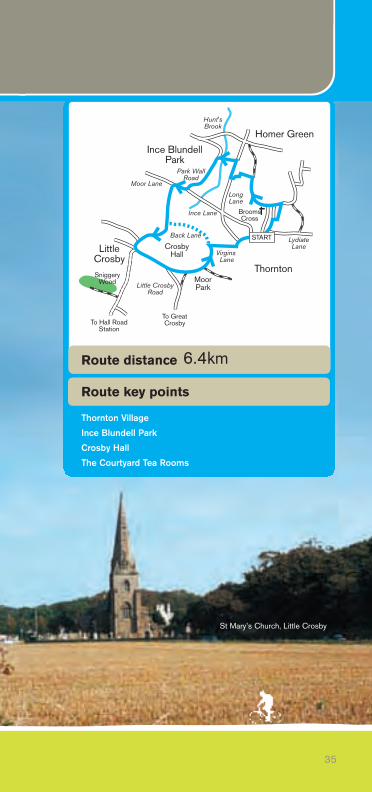
Ince BlundellPark
Homer Green
Moor Lane
Ince Lane
LongLane
Hunt'sBrook
LydiateLaneCrosby
Hall
Thornton
Little CrosbyRoad
LittleCrosbySniggery
Wood
Virgins Lane
MoorPark
START
Park WallRoad
To Hall RoadStation
To GreatCrosby
Back Lane
BroomsCross
35
Ince BlundellPark
Homer Green
Moor Lane
Ince Lane
LongLane
Hunt'sBrook
LydiateLaneCrosby
Hall
Thornton
Little CrosbyRoad
LittleCrosbySniggery
Wood
Virgins Lane
MoorPark
START
Park WallRoad
To Hall RoadStation
To GreatCrosby
Back Lane
BroomsCross
Route key points
Route distance
Thornton Village
Ince Blundell Park
Crosby Hall
The Courtyard Tea Rooms
6.4km
St Mary’s Church, Little Crosby
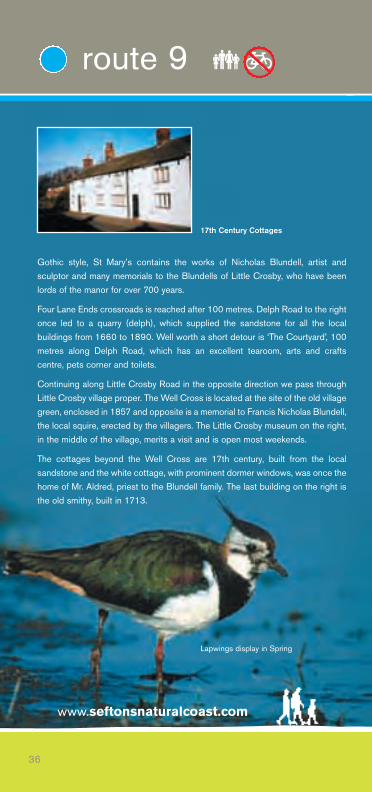
Gothic style, St Mary’s contains the works of Nicholas Blundell, artist andsculptor and many memorials to the Blundells of Little Crosby, who have beenlords of the manor for over 700 years.
Four Lane Ends crossroads is reached after 100 metres. Delph Road to the rightonce led to a quarry (delph), which supplied the sandstone for all the localbuildings from 1660 to 1890. Well worth a short detour is ‘The Courtyard’, 100metres along Delph Road, which has an excellent tearoom, arts and craftscentre, pets corner and toilets.
Continuing along Little Crosby Road in the opposite direction we pass throughLittle Crosby village proper. The Well Cross is located at the site of the old villagegreen, enclosed in 1857 and opposite is a memorial to Francis Nicholas Blundell,the local squire, erected by the villagers. The Little Crosby museum on the right,in the middle of the village, merits a visit and is open most weekends.
The cottages beyond the Well Cross are 17th century, built from the localsandstone and the white cottage, with prominent dormer windows, was once thehome of Mr. Aldred, priest to the Blundell family. The last building on the right isthe old smithy, built in 1713.
www.seftonsnaturalcoast.com
36
route 9 ��
17th Century Cottages
Lapwings display in Spring
We leave the village with the Park Wall on our left and a cross set into the wallindicates the position of the old village cross, which was swallowed up byenclosure into the parkland in the early 19th century.
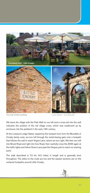
At the Liverpool Lodge Gates, topped by the rampant lions from the Blundells ofCrosby family crest, we turn left through the metal kissing gate onto a footpaththat follows the wall to reach Virgins Lane, where we turn right. We then turn leftinto Brook Road and right into Ince Road, then carefully cross the A565 again atthe traffic lights and follow Green Lane past the Grapes pub to reach our startingpoint.
The walk described is 7.2 km (4.5 miles) in length and is generally levelthroughout. The stiles on the route are low and the easiest sections are on thesurfaced footpaths around Little Crosby.
37
Lions Gates - Ince BlundellThe old smithy building
Courtyard Café - Lttle Crosby
Formby Walks(BOTH ARE WALKING ROUTES ONLY)
ROUTE ONE
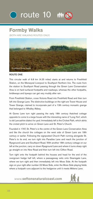
This circular walk of 6.8 km (4.25 miles) starts at and returns to FreshfieldStation, on the Merseyrail Liverpool to Southport Northern line. The route fromthe station to Southport Road passing through the Green Lane ConservationArea is on hard surfaced footpaths and roadways, whereas the other footpaths,bridleways and byways can get very muddy after rain .
From Freshfield Station, cross Victoria Road into Freshfield Road and then turnleft into Grange Lane. The distinctive buildings on the right are Tower House andTower Grange, claimed to incorporate part of a 13th century monastic grangethat belonged to Whalley Abbey.
At Gores Lane turn right passing the early 18th century thatched cottageopposite to come to a large house with the interesting name of ‘Long Yort’, whichis old Lancashire dialect for yard. Immediately left is the Cricket Path, which skirtsthe cricket pitch to arrive on Green Lane and St. Peter’s Church.
Founded in 1747, St. Peter’s is the centre of the Green Lane Conservation Areaand like the church the cottages on the west side of Green Lane are 18thcentury or earlier. Following the signposted Church Path running alongside St.Peter’s to its end, we turn right into Paradise Lane and reach the junction ofRyeground Lane and Southport Road. With another 18th century cottage on ourleft at the junction, carry on down Ryeground Lane and where it turns sharp rightgo straight on into New Road and then turn left into Clifton Road.
Turn right onto the footpath behind the houses and head for the end of theovergrown hedge half left, where a passageway exits onto Deansgate Lane,where we turn right and then immediately left into Moss Side. At the footpathsign on your right after number 22 Moss Side, enter the Moss Side playing fieldswhere a footpath runs adjacent to the hedgerow until it meets Mittens Lane.
www.seftonsnaturalcoast.com
38
route 10 ��
Freshfield Dune Heath
39
FreshfieldStation
Freshfields LWT NR
GoresLane New
Road
WestLane
MontaguRoad
Gores Ave
Victoria Rd
Level Crossing
GreenLane
SouthportRoad
E ght Acre Lane
L ttle HeyLane
ParadiseLane
Southpo tO d Road
A565
STARTGrange
Lane
PastureLane
Route 2
Route 1
Route key points
Route distance
Formby Village
Railway Inn Pub
Freshfields LWT NR
6.8km
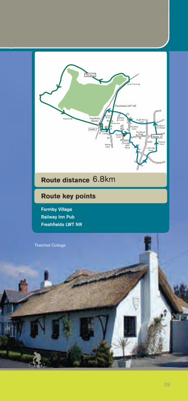
Thatched Cottage
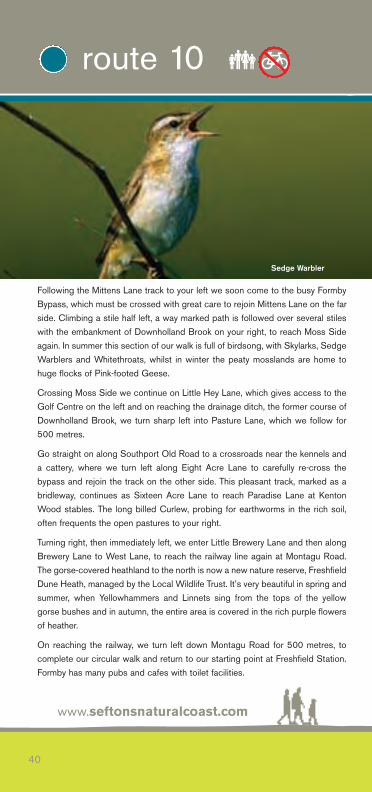
Following the Mittens Lane track to your left we soon come to the busy FormbyBypass, which must be crossed with great care to rejoin Mittens Lane on the farside. Climbing a stile half left, a way marked path is followed over several stileswith the embankment of Downholland Brook on your right, to reach Moss Sideagain. In summer this section of our walk is full of birdsong, with Skylarks, SedgeWarblers and Whitethroats, whilst in winter the peaty mosslands are home tohuge flocks of Pink-footed Geese.
Crossing Moss Side we continue on Little Hey Lane, which gives access to theGolf Centre on the left and on reaching the drainage ditch, the former course ofDownholland Brook, we turn sharp left into Pasture Lane, which we follow for500 metres.
Go straight on along Southport Old Road to a crossroads near the kennels anda cattery, where we turn left along Eight Acre Lane to carefully re-cross thebypass and rejoin the track on the other side. This pleasant track, marked as abridleway, continues as Sixteen Acre Lane to reach Paradise Lane at KentonWood stables. The long billed Curlew, probing for earthworms in the rich soil,often frequents the open pastures to your right.
Turning right, then immediately left, we enter Little Brewery Lane and then alongBrewery Lane to West Lane, to reach the railway line again at Montagu Road.The gorse-covered heathland to the north is now a new nature reserve, FreshfieldDune Heath, managed by the Local Wildlife Trust. It’s very beautiful in spring andsummer, when Yellowhammers and Linnets sing from the tops of the yellowgorse bushes and in autumn, the entire area is covered in the rich purple flowersof heather.
On reaching the railway, we turn left down Montagu Road for 500 metres, tocomplete our circular walk and return to our starting point at Freshfield Station.Formby has many pubs and cafes with toilet facilities.
www.seftonsnaturalcoast.com
40
route 10 ��
Sedge Warbler

ROUTE TWO
Leaving Freshfield Station, turn left into Victoria Road and then left into GoresAvenue, where a bend in the road takes us into Rimmers Avenue and on to theunmade footpath towards Freshfield Dune Heath.
At the crossroads in the paths, we go straight ahead until we reach the levelcrossing, where we cross CAREFULLY into Formby Golf Course and continuealong Fisherman’s Path, until we reach the new Coastal Footpath after a metalgate on the left.
At this point we make a short detour along the original route of the path, followingpurple-topped way-markers, crossing some small dunes until we reach thebeach.
On a clear day, the views across the Irish Sea are outstanding and a stroll alongthe beach can produce many of the shorebirds that make Sefton’s Natural Coastso important for wildlife.
Retracing our steps, we enjoy a nice walk back through the pinewoodsfrequented by Red Squirrels, following the yellow way-markers along the edge ofthe golf course. We soon reach Victoria Road, passing the National TrustReserve Visitor Centre.
On reaching the main road, we turn left to complete our walk back at FreshfieldStation.
41
Formby Beach and Dunes
Formby Village Café
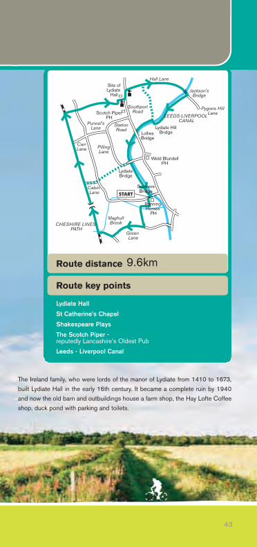
The Lydiate LoopThe walk starts and finishes at the RunningHorses pub (OS Ref: 336403) adjacent to theLeeds–Liverpool Canal at Sumners Turn Bridgeon Bell’s Lane. Patrons may leave their vehicleshere or at the site of the former Lydiate Station(OS Ref: 335404). The Lydiate Loop Walk isapproximately 9.6 km (6 miles) long and isgenerally level throughout.Turn left out of the pub car park and follow the footpath signed Green Lanearound the field edge, crossing Maghull Brook at the footbridge and continuestraight on to Green Lane. Turning right, follow the track signed Cheshire LinesPath/Trans Pennine Trail to reach Maukin Farm after 600 metres, where we turnright on to the farm track to reach the Cheshire Lines Path.
Heading right (north) this path forms part of the 346 km (216 mile) coast-to-coast Trans Pennine Trail and was formerly the trackbed of the former Southportand North Liverpool Extension of the Cheshire Lines Railway, which was openedin 1884 and closed for passenger traffic in 1952.
The flat peaty mosslands are often partially flooded in winter and landmanagement in the Gore House Conservation Area by local farmers and otherlandowners has improved the biodiversity of the area. In Spring the area is alivewith Lapwings and their loud ‘pee-wit’ calls.
The site of the former Lydiate Station is reached after 2 km (1.25 miles), wherethere’s a car park and an information panel on the Trans Pennine Trail. Themosslands here are particularly productive for small mammals, especially fieldand water voles, hunting birds of prey, especially Kestrels and Buzzards can beseen.
At the next path access turn right to cross Acres Lane and follow a footpath sign50 metres to your left to take you right to Southport Road. Following the fieldedge the path continues to a woodland, where the ruins of Lydiate Hall are visiblethrough the trees, before reaching the busy A5147 at OS Ref: 336450.
www.seftonsnaturalcoast.com
42
route 11 ��
CarrLane
MaghullBrook
Jackson'sBridge
Punnel'sLane
StationRoad
SouthportRoad
Weld BlundellPH
Hall Lane
LolliesBridge
Lydiate HillBridge
Green Lane
Cabin Lane
LydiateBridge
PillingLane
CHESHIRE LINES PATH
Pygons HillLane
LEEDS-LIVERPOOL CANAL
Scotch PiperPH
START
Site ofLydiate
Hall
Running Horses
PH
SumnersBridge
The Ireland family, who were lords of the manor of Lydiate from 1410 to 1673,built Lydiate Hall in the early 16th century. It became a complete ruin by 1940and now the old barn and outbuildings house a farm shop, the Hay Lofte Coffeeshop, duck pond with parking and toilets.
43
CarrLane
MaghullBrook
Jackson'sBridge
Punnel'sLane
StationRoad
SouthportRoad
Weld BlundellPH
Hall Lane
LolliesBridge
Lydiate HillBridge
Green Lane
Cabin Lane
LydiateBridge
PillingLane
CHESHIRE LINES PATH
Pygons HillLane
LEEDS-LIVERPOOL CANAL
Scotch PiperPH
START
Site ofLydiate
Hall
Running Horses
PH
SumnersBridge
Route key points
Route distance
Lydiate Hall
St Catherine’s Chapel
Shakespeare Plays
The Scotch Piper - reputedly Lancashire’s Oldest Pub
Leeds - Liverpool Canal
9.6km
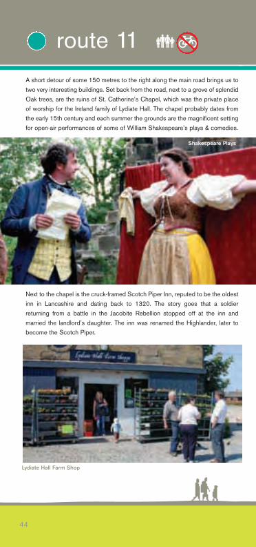
A short detour of some 150 metres to the right along the main road brings us totwo very interesting buildings. Set back from the road, next to a grove of splendidOak trees, are the ruins of St. Catherine’s Chapel, which was the private placeof worship for the Ireland family of Lydiate Hall. The chapel probably dates fromthe early 15th century and each summer the grounds are the magnificent settingfor open-air performances of some of William Shakespeare’s plays & comedies.
Next to the chapel is the cruck-framed Scotch Piper Inn, reputed to be the oldestinn in Lancashire and dating back to 1320. The story goes that a soldierreturning from a battle in the Jacobite Rebellion stopped off at the inn andmarried the landlord’s daughter. The inn was renamed the Highlander, later tobecome the Scotch Piper.
44
route 11 ��
Shakespeare Plays
Lydiate Hall Farm Shop
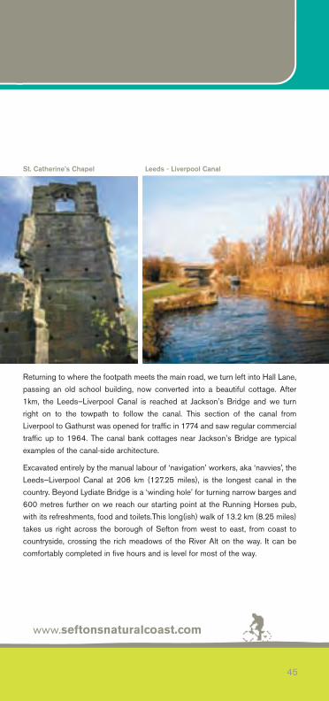
Returning to where the footpath meets the main road, we turn left into Hall Lane,passing an old school building, now converted into a beautiful cottage. After1km, the Leeds–Liverpool Canal is reached at Jackson’s Bridge and we turnright on to the towpath to follow the canal. This section of the canal fromLiverpool to Gathurst was opened for traffic in 1774 and saw regular commercialtraffic up to 1964. The canal bank cottages near Jackson’s Bridge are typicalexamples of the canal-side architecture.
Excavated entirely by the manual labour of ‘navigation’ workers, aka ‘navvies’, theLeeds–Liverpool Canal at 206 km (127.25 miles), is the longest canal in thecountry. Beyond Lydiate Bridge is a ‘winding hole’ for turning narrow barges and600 metres further on we reach our starting point at the Running Horses pub,with its refreshments, food and toilets.This long(ish) walk of 13.2 km (8.25 miles)takes us right across the borough of Sefton from west to east, from coast tocountryside, crossing the rich meadows of the River Alt on the way. It can becomfortably completed in five hours and is level for most of the way.
www.seftonsnaturalcoast.com
45
St. Catherine’s Chapel Leeds - Liverpool Canal
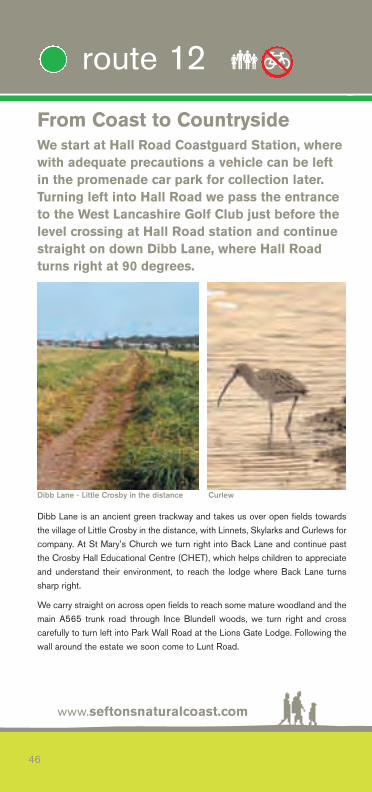
From Coast to CountrysideWe start at Hall Road Coastguard Station, wherewith adequate precautions a vehicle can be leftin the promenade car park for collection later.Turning left into Hall Road we pass the entranceto the West Lancashire Golf Club just before thelevel crossing at Hall Road station and continuestraight on down Dibb Lane, where Hall Roadturns right at 90 degrees.
Dibb Lane is an ancient green trackway and takes us over open fields towardsthe village of Little Crosby in the distance, with Linnets, Skylarks and Curlews forcompany. At St Mary’s Church we turn right into Back Lane and continue pastthe Crosby Hall Educational Centre (CHET), which helps children to appreciateand understand their environment, to reach the lodge where Back Lane turnssharp right.
We carry straight on across open fields to reach some mature woodland and themain A565 trunk road through Ince Blundell woods, we turn right and crosscarefully to turn left into Park Wall Road at the Lions Gate Lodge. Following thewall around the estate we soon come to Lunt Road.
www.seftonsnaturalcoast.com
46
route 12 ��
Dibb Lane - Little Crosby in the distance Curlew
Station Road
MaghullStation
Ince BlundellPark
BlundellsandsMaghull
Little Crosby
LydiateAcresLane
PillingLane
Park WallRoad
Hall RoadStation
InceLane
BainesBridge
RIVER ALT
LEEDS-LIVERPOOL CANAL
START
END
DibbLane
DrapersBridge
CHESHIRE LINES PATH
47
Station Road
MaghullStation
Ince BlundellPark
BlundellsandsMaghull
Little Crosby
LydiateAcresLane
PillingLane
Park WallRoad
Hall RoadStation
InceLane
BainesBridge
RIVER ALT
LEEDS-LIVERPOOL CANAL
START
END
DibbLane
DrapersBridge
CHESHIRE LINES PATH
Route key points
Route distance
Antony Gormley’s ‘Another Place’
Sefton Coastal Path
Little Crosby Village
River Alt
Maghull - Frank Hornby
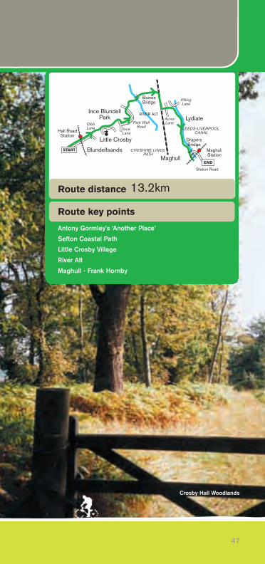
13.2km
Crosby Hall Woodlands
www.seftonsnaturalcoast.com
48
route 12 ��
Antony Gormley’s ‘Another Place’
500 metres further on, turn right into Carr Side Lane, passing Carr Side Farmand its herd of white Charolais cattle, to follow the way marked narrow footpathto Baines Bridge and cross the River Alt. Thanks to the constant efforts of theEnvironment Agency, the river is now as clean as it has ever been in the lasthundred years or so. If you’re very lucky you might even catch a glimpse of thecobalt-blue Kingfisher, which has recently returned to fish along its banks, or aBarn Owl hunting nearby ditches and fields.
Crossing the bridge we head east for two km along a farm track called MaghullHey Cop. Brown Hares are common here and in winter huge noisy flocks ofPink-footed Geese fly over, especially when disturbed by aircraft from the nearbymicrolight landing strip.
Reaching the Cheshire Lines Path, turn right to the car park at Gore House Farm,where we turn left to cross Acres Lane up Punnell’s Lane and right into PillingLane until we reach the bridge over the Leeds–Liverpool Canal.
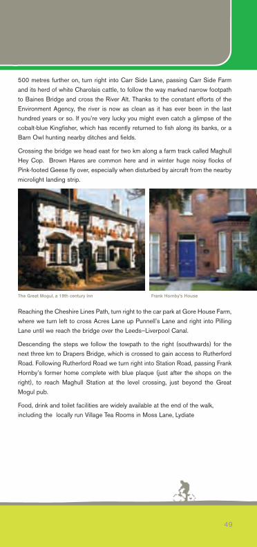
Descending the steps we follow the towpath to the right (southwards) for thenext three km to Drapers Bridge, which is crossed to gain access to RutherfordRoad. Following Rutherford Road we turn right into Station Road, passing FrankHornby’s former home complete with blue plaque (just after the shops on theright), to reach Maghull Station at the level crossing, just beyond the GreatMogul pub.
Food, drink and toilet facilities are widely available at the end of the walk,including the locally run Village Tea Rooms in Moss Lane, Lydiate
49
The Great Mogul, a 19th century inn Frank Hornby’s House
Meanders around MellingMAGHULL STATION CIRCULAR
‘Melinge’, as it is listed in the Domesday Book,once overlooked the marshes, woodlands andreed beds of the River Alt. At the time of theDomesday census, Godiva the widow of Leofric,was the lady of the manor and a forest stretchedfrom Waddicar to Wood End in Maghull. Start by turning left out of the car park at Maghull Station, across the levelcrossing and walk 450 metres along Melling Lane to the M58 overbridge, wherewe turn left on a signposted path through amenity woodland, with the greenfence of the motorway embankment on the right and playing fields to the left.
Reaching the bridge over the motorway carrying Leatherbarrows Lane, we gostraight on a surfaced farm road for 500 metres with rough land to our left. Thelarge dead tree to your left often has a Kestrel sat on it and on summer evenings,even a Little Owl can be seen.
The road crosses the motorway at the telecommunications mast giving accessto Moss Nook farm, where we continue left on a track, once more runningalongside the motorway to Giddygate Lane. We turn right and follow the trackfor 300 metres, looking out for a footpath on the right alongside a drainage ditch,which takes us back to Leatherbarrows Lane once again.
We turn left and then immediately right into School Lane, which becomes SandyLane at the right fork in the road, and after 400 metres to Rock Lane, Melling.Our route carries straight on following a way marked footpath, but first turn rightand after 200 metres you come to the parish church of St. Thomas and the HolyRood (Holy Cross) on your right, with the Bootle Arms pub almost opposite,where food, drink and toilet facilities are available.
Rejoining our footpath at the junction of Sandy Lane and Rock Lane, we continueover open fields and through the farmyard at New House Farm, to reach theLeeds–Liverpool Canal at Holmes Bridge. Crossing the swing bridge we turnright (northwest) to follow the well-surfaced towpath back towards Maghull,passing under Brewery Lane, then the motorway and railway bridges.
After 1.8 km (1.1 miles) we leave the canal towpath at Drapers Bridge, cross thecanal and reach Maghull station car park via Rutherford Road and Station Road.Thus completing our circular walk around the historic village of Melling.
www.seftonsnaturalcoast.com
50
route 13 ��
51
MellingLane
Holmes SwingBridge
MellingVillage
MaghullStation
DrapersBridge
M58
BreweryLane
RockLane
Lea herbarrowsLane
SandyLane
GiddygateLane
LEEDS-LIVERPOOL CANAL
START
SchoolLane
Melling StoneBridge
Bootle ArmsPH
Route key points
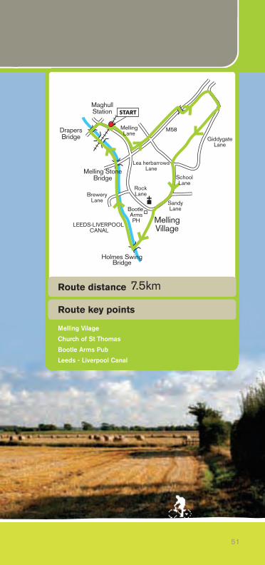
Route distance
Melling Vilage
Church of St Thomas
Bootle Arms Pub
Leeds - Liverpool Canal
7.5km
Red Route
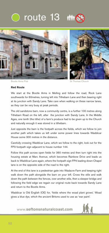
We start at the Bootle Arms in Melling and follow the road, Rock Lanesouthwards for 60metres, turning left into Tithebarn Lane and then bearing rightat its junction with Sandy Lane. Take care when walking on these narrow lanes,as they can be very busy at peak periods.
The old sandstone barn, now a community centre, is a further 100 metres alongTithebarn Road on the left, after the junction with Sandy Lane. In the MiddleAges, one tenth (the tithe) of a farm’s produce had to be given up to the Churchand naturally enough it was stored in a tithebarn.
Just opposite the barn is the footpath across the fields, which we follow to joinanother path which takes us left under some power lines towards WaddicarHouse some 300 metres in the distance.
Carefully crossing Waddicar Lane, which we follow to the right, look out for theFP3 footpath sign adjacent to house number 144.
Follow this path across open fields for 360 metres and then turn right into thehousing estate at Marc Avenue, which becomes Rainbow Drive and leads usback to Waddicar Lane again, where the footpath sign FP4 leading down Chapellane is on the opposite side of the road to the right.
At the end of this lane is a pedestrian gate into Wadacre Farm and keeping rightwalk down the path alongside the barn on your left. Cross the stile and walkdown the path between the fences, over another stile, then a sleeper bridge andfollowing the field edge we regain our original route back towards Sandy Laneand return to the Bootle Arms.
Waddicar is Old English (OE) for, ‘fields where the woad plant grows’. Woadgives a blue dye, which the ancient Britons used to use as ‘war paint’.
www.seftonsnaturalcoast.com
52
route 13 ��
Bootle Arms Pub St Thomas Church
Green Route
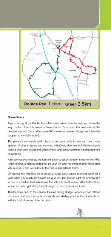
Again starting at the Bootle Arms, this route takes us to the right and down theway marked footpath towards New House Farm and the towpath of theLeeds–Liverpool Canal, after some 465 metres at Holmes Bridge, we follow thetowpath to the right (north).
The pleasant canal-side walk gives us an opportunity to see and hear manyspecies of birds in spring and summer, with Coot, Moorhen and Mallards busilylooking after their young and Whitethroats and Yellowhammers singing from thehedgerows.
After almost 300 metres, we turn left down a set of wooden steps to join FP8,which follows a mature hedgerow on your left until reaching another track after200 metres, which we follow to the yard of Brooklands Farm.
On leaving the yard turn left to follow Brewery Lane, which becomes Spencer’sLane when you reach the houses on your left. 100 metres past the houses turnleft on to a marked footpath across the fields, to reach a ditch after 260 metres,where we bear right along the field edge to reach a surfaced track.
This leads us back to the canal at Holmes Swing Bridge , where we can retraceour steps past new House farm towards our starting point at the Bootle Arms,with its food, drink and toilet facilities.
53
Routes Red 1.5km Green 3.5km
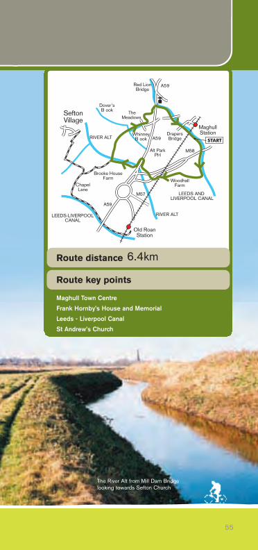
The Maghull TrailMaghull is another local town that dates back tothe Domesday book, where it is listed as‘Magele’. The route is fairly level and at justunder 6.4 km (4 miles) makes a pleasant half-day stroll and passes several sites of localhistory interest, including the churchyard whereMaghull’s most famous former resident, FrankHornby is buried.
From Maghull Station (OS Ref: 33840) turn right along Station Road and thenturn left after 200 metres on to Rutherford Road, to gain access to theLeeds–Liverpool Canal at Drapers Bridge. We then turn left (south) along thetowpath, heading under the railway and then the M58 motorway, towards thevillage of Melling.
At Melling Stone Bridge (OS Ref: 338400) leave the towpath via a track to reachBrewery Lane, passing a small row of terraced houses, where a footpathcontinues straight on through open fields, as the driveway to Wood Hall Farm.
A great forest formerly surrounded Wood Hall, which dates back to at least1300, when the Molyneux family owned it. The current house is late 17th centuryand James II is reputed to have stayed here when the family were persecuted asCatholics in the Elizabethan period. It is a Grade II listed building and now afarmhouse, so please respect the privacy of the current tenants.
www.seftonsnaturalcoast.com
54
route 14 ��
Frank Hornby Memorial
55
START
Alt ParkPH
ChapelLane
Dover'sB ook
RIVER ALT
LEEDS AND LIVERPOOL CANAL
RIVER ALTLEEDS-LIVERPOOLCANAL
TheMeadows
MaghullStation
Old RoanStation
WoodhallFarm
SeftonVillage
Brooke HouseFarm
Red Lion Bridge
A59
A59
M58
A59
WhinneyB ook
M57
Drapers Bridge
Route key points
Route distance
Maghull Town Centre
Frank Hornby’s House and Memorial
Leeds - Liverpool Canal
St Andrew’s Church
6.4km
The River Alt from Mill Dam Bridgelooking towards Sefton Church
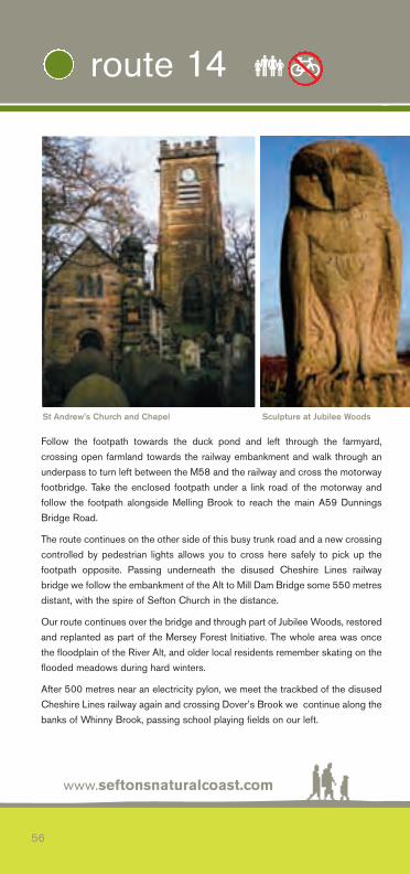
Follow the footpath towards the duck pond and left through the farmyard,crossing open farmland towards the railway embankment and walk through anunderpass to turn left between the M58 and the railway and cross the motorwayfootbridge. Take the enclosed footpath under a link road of the motorway andfollow the footpath alongside Melling Brook to reach the main A59 DunningsBridge Road.
The route continues on the other side of this busy trunk road and a new crossingcontrolled by pedestrian lights allows you to cross here safely to pick up thefootpath opposite. Passing underneath the disused Cheshire Lines railwaybridge we follow the embankment of the Alt to Mill Dam Bridge some 550 metresdistant, with the spire of Sefton Church in the distance.
Our route continues over the bridge and through part of Jubilee Woods, restoredand replanted as part of the Mersey Forest Initiative. The whole area was oncethe floodplain of the River Alt, and older local residents remember skating on theflooded meadows during hard winters.
After 500 metres near an electricity pylon, we meet the trackbed of the disusedCheshire Lines railway again and crossing Dover’s Brook we continue along thebanks of Whinny Brook, passing school playing fields on our left.
www.seftonsnaturalcoast.com
56
route 14 ��
St Andrew’s Church and Chapel Sculpture at Jubilee Woods
At Ormonde Drive turn right, then left into Liverpool Road, passing the Meadowspub. The Meadows, with its food, drink and toilets, is built on the site of the OldRacecourse Farm, which was where the steeplechase – later to become theworld famous Grand National – was run in 1837 and 1838, before its permanenttransfer to Aintree.
From the Meadows, cross the road towards the modern Maghull Town Hall andturn left along Liverpool Road South to the children’s playground. Enter the KingGeorge V playing fields and go through the public gardens and follow the pathalongside the tennis courts. Turn right to reach the A59 Northway via the steps,turn left at the top and after 100 metres a footpath sign marks the steps downto the canal towpath once more.
Turning right (south) beneath the main road we come to St. Andrew’s Churchbuilt in 1878, on the other side of the canal. A marble memorial to Frank HornbyMP, of Hornby Dublo, Dinky Toys and Meccano fame, stands in the graveyardby the chapel, which is much older, built around 1300.
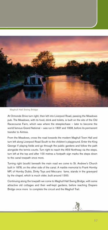
Continuing along the towpath we come to Maghull Hall Swing Bridge, with someattractive old cottages and their well-kept gardens, before reaching DrapersBridge once more to complete the circuit and the Maghull Trail.
57
Maghull Hall Swing Bridge
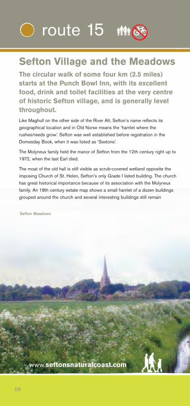
Sefton Village and the MeadowsThe circular walk of some four km (2.5 miles)starts at the Punch Bowl Inn, with its excellentfood, drink and toilet facilities at the very centreof historic Sefton village, and is generally levelthroughout. Like Maghull on the other side of the River Alt, Sefton’s name reflects itsgeographical location and in Old Norse means the ‘hamlet where therushes/reeds grow’. Sefton was well established before registration in theDomesday Book, when it was listed as ‘Sextone’.
The Molyneux family held the manor of Sefton from the 12th century right up to1972, when the last Earl died.
The moat of the old hall is still visible as scrub-covered wetland opposite theimposing Church of St. Helen, Sefton’s only Grade I listed building. The churchhas great historical importance because of its association with the Molyneuxfamily. An 18th century estate map shows a small hamlet of a dozen buildingsgrouped around the church and several interesting buildings still remain
www.seftonsnaturalcoast.com
58
route 15 ��
Sefton Meadows
59
Dover'sBrook
RIVER ALT
PunchBowl
HomerGreen
Lunt
Netherton
SeftonRIVER ALT
HarrisonsBrook
LuntRoad
BackLane
LydiateLane
ells
BrickwallLane
ShowrickBridge
BridgesLane
SeftonMeadows
MERSEYFOREST
START
MoorLane
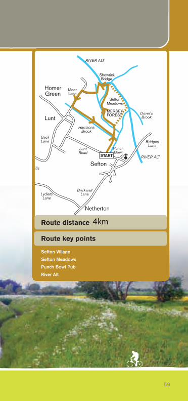
Route key points
Route distance
Sefton Village
Sefton Meadows
Punch Bowl Pub
River Alt
4km
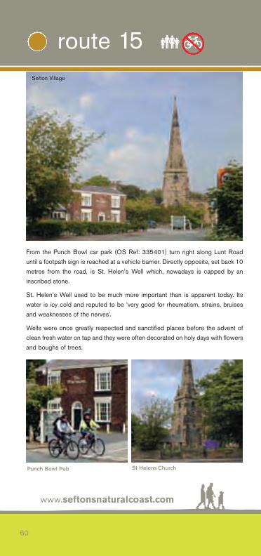
From the Punch Bowl car park (OS Ref: 335401) turn right along Lunt Roaduntil a footpath sign is reached at a vehicle barrier. Directly opposite, set back 10metres from the road, is St. Helen’s Well which, nowadays is capped by aninscribed stone.
St. Helen’s Well used to be much more important than is apparent today. Itswater is icy cold and reputed to be ‘very good for rheumatism, strains, bruisesand weaknesses of the nerves’.
Wells were once greatly respected and sanctified places before the advent ofclean fresh water on tap and they were often decorated on holy days with flowersand boughs of trees.
www.seftonsnaturalcoast.com
60
route 15 ��
Sefton Village
Punch Bowl Pub St Helens Church
Turning right at the footpath sign takes us along a track, which crossesHarrison’s Brook in 300 metres and continues to reach a wooden footbridge andthe site of the former landfill site, now extensively replanted with native trees aspart of the Mersey Forest Initiative. The landscape improvements have alreadymeant that many more bird species now nest in the area, including the secretiveGrasshopper Warbler, whose strange reeling song sounds like a fishing reel ora freewheeling bicycle.
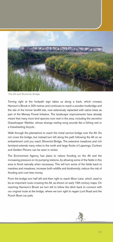
Walk through the plantations to reach the metal service bridge over the Alt. Donot cross the bridge, but instead turn left along the path following the Alt on anembankment until you reach Showrick Bridge. The extensive meadows and richfarmland extends many miles to the north and large flocks of Lapwings, Curlewsand Golden Plovers can be seen in winter.
The Environment Agency has plans to relieve flooding on the Alt and theincreasing pressure on its pumping stations, by allowing some of the fields in thisarea to flood naturally when necessary. This will turn some of the fields back tomarshes and meadows, increase both wildlife and biodiversity, reduce the risk offlooding and cost less money.
From the bridge turn half left and then right to reach Moor Lane, which used tobe an important route crossing the Alt, as shown on early 19th century maps. Onreaching Harrison’s Brook we turn left to follow the ditch back to connect withour original route at the bridge, where we turn right to regain Lunt Road and thePunch Bowl car park.
61
The Alt and Showrick Bridge
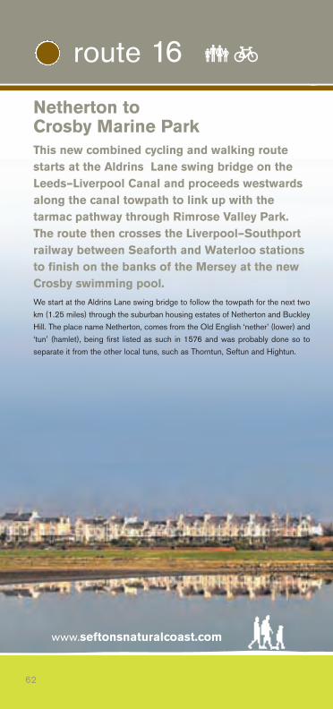
Netherton to Crosby Marine ParkThis new combined cycling and walking routestarts at the Aldrins Lane swing bridge on theLeeds–Liverpool Canal and proceeds westwardsalong the canal towpath to link up with thetarmac pathway through Rimrose Valley Park.The route then crosses the Liverpool–Southportrailway between Seaforth and Waterloo stationsto finish on the banks of the Mersey at the newCrosby swimming pool. We start at the Aldrins Lane swing bridge to follow the towpath for the next twokm (1.25 miles) through the suburban housing estates of Netherton and BuckleyHill. The place name Netherton, comes from the Old English ‘nether’ (lower) and‘tun’ (hamlet), being first listed as such in 1576 and was probably done so toseparate it from the other local tuns, such as Thorntun, Seftun and Hightun.
www.seftonsnaturalcoast.com
62
route 16 ��
LEEDS-LIVERPOOL CANALGorsey
Lane
Litherland
Crosby MarinePark
SeftonRoad
ChurchRoad
To Haw horneRoad
To LinacreRoad
SeaforthRoad
PrincessWayCrosby Road
Sou h
Great GeorgesRoad
Stuart Road
BrookVale
KirkstoneRoad
Crosby GloversLane
AldrinsLane
SandyRoad
EdgeLane
BrownmoorLane
Seaforth & Litherland
Station
START
Cookson'sBridge
Pennington Road
WaterlooStation
WhabbsTip
63
LEEDS-LIVERPOOL CANALGorsey
Lane
Litherland
Crosby MarinePark
SeftonRoad
ChurchRoad
To Haw horneRoad
To LinacreRoad
SeaforthRoad
PrincessWayCrosby Road
Sou h
Great GeorgesRoad
Stuart Road
BrookVale
KirkstoneRoad
Crosby GloversLane
AldrinsLane
SandyRoad
EdgeLane
BrownmoorLane
Seaforth & Litherland
Station
START
Cookson'sBridge
Pennington Road
WaterlooStation
WhabbsTip
Route key points
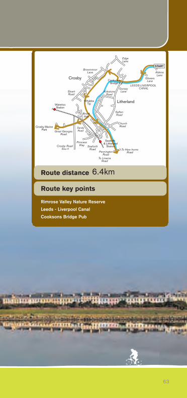
Route distance
Rimrose Valley Nature Reserve
Leeds - Liverpool Canal
Cooksons Bridge Pub
6.4km

On reaching the overbridge at Gorsey Lane with the Cooksons Bridge pub tothe right, we enter into Rimrose Valley, with its more open surroundings andgreenery. The valley was formed 1.6 million years ago and always being liable toflooding was never settled or farmed extensively. During the 20th century muchof the land was used for tipping and some areas were also used for allotmentsand recreation grounds.
It now forms part of the chain of nature reserves and amenity sites administeredby the Sefton Coast & Countryside Service and the Brookvale Local NatureReserve was set up in the wettest and wildest part of the valley to furtherenhance the wildlife value for residents and visitors.
We turn right as the canal bends to the left after 250 metres to join the mainpathway through the Rimrose Valley Park. After 1.5 km (0.95 miles) at the highestpoint, known as Whabbs Tip, most of northern Liverpool and Bootle is laid outbefore you. The panorama includes both cathedrals, St. John’s Beacon and theRoyal Seaforth docks, complete with container cranes and its modern ‘windmills’.
As you drop down towards the entrance to the Park at Beach Road, look out forsome steps to your right just before the notice board. This narrow pathway hasrecently been surfaced and crosses the lowest point of the valley betweenallotments on your left and football pitches to your right, turn to reach the railwayline and emerge onto Cambridge Road.
www.seftonsnaturalcoast.com
64
route 16 ��
Rimrose Valley Park
After 350 metres Cambridge Road crosses the busy A565 at traffic lights beforereaching the large car park at Crosby Marine Park in a further 250 metres, whereyou can connect with the Sefton Coastal Walk. To complete this interestingjourney from Netherton, continue through the car park on to the newlyconstructed cycle track along the southern edge of the marine lake and then turnright onto the promenade. The route then continues to the recently-built Crosbyswimming pool.
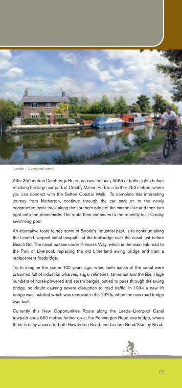
An alternative route to see some of Bootle’s industrial past, is to continue alongthe Leeds-Liverpool canal towpath at the footbridge over the canal just beforeBeach Rd. The canal passes under Princess Way, which is the main link road tothe Port of Liverpool, replacing the old Litherland swing bridge and then areplacement footbridge.
Try to imagine the scene 100 years ago, when both banks of the canal werecrammed full of industrial wharves, sugar refineries, tanneries and the like. Hugenumbers of horse-powered and steam barges jostled to pass through the swingbridge, no doubt causing severe disruption to road traffic. In 1934 a new liftbridge was installed which was removed in the 1970s, when the new road bridgewas built.
Currently this New Opportunities Route along the Leeds–Liverpool Canaltowpath ends 800 metres further on at the Pennington Road overbridge, wherethere is easy access to both Hawthorne Road and Linacre Road/Stanley Road.
65
Leeds - Liverpool canal
Making the most of your walk or cycle ride
Walking and cycling are often quoted as being the most accessible and beneficial activities you can be involved in. You can do them at your ownpace, leisurely or brisk, and you need very little equipment; they can also bedone on your own or with friends. Just 30 minutes of moderate exercise fivetimes per week will half the risk of developing coronary heart disease.
Rights of AccessThe public regularly uses all the footpaths, trails, tracks and dedicated cycleways in this guide, without let or hindrance as public rights of way, or as permissive paths with the consent of the respective landowners. However,please respect the privacy of landowners, tenants and farmers and the possession of this guide is NOT to be taken as a guarantee of any particularright of access.If you encounter any problems in walking or cycling any of the routes listed inthis guide, please contact Sefton Council’s Rights of Way Officer, Tel: 0845140 0845 or write to us at Director of Technical Services, Sefton MBC,Magdalen House, Trinity Road, Bootle L20 3NJ
Maps, Guides and BooksAll of the routes in this guide are clearly marked on the latest 1:25,000Explorer series maps from the Ordnance Survey. You are strongly advised touse Explorer 285 Southport & Chorley and 275 Liverpool, as both also give awealth of other rights of way and tourist information.
Many books and other publications about the area covered in this guide,especially local history titles, are widely available at all good bookshops. Many churches have their own leaflets and booklets.
www.seftonsnaturalcoast.com
66
Information
67
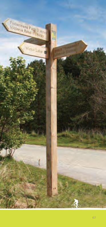
What to wear and bring with you
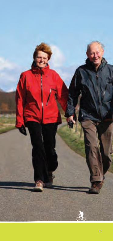
Most of the walks and rides in this guide are fairly level and could in no waybe described as ‘strenuous’. Considerable sections follow well-drained andreasonably surfaced trackbeds of disused railways or canal towpaths and/orspecific way marked footpaths and trails.In winter, many of the open countryside stretches or routes shared as bridleways can be very muddy and suitable footwear should be worn.
There are many places to stop off for a drink or a meal, including some excellent pubs and there are signposted links to all of the Merseyrail stationson both the Northern Line and the Ormskirk Line.
Each walk or ride is designed to be as long or as short as you want it to be,but as a guide, any reasonably fit person should be able to complete all ofthe shorter routes described in a morning or an afternoon walk. The TransPennine Trail/Cheshire Lines Path from Southport to Maghull and back is afavourite afternoon cycle ride for families and groups of all ages and abilities.
If walking any distance, good quality walking shoes or lightweight waterproofboots are advisable, as is a daypack to carry your maps, food and drink andextra clothing or waterproofs. In winter be aware of the wind chill effect inexposed areas, on the Sefton Coastal Path for example.
In summer it would be sensible to pack a hat, sunscreen and plenty of waterand it is always better to be able remove or add layers of clothing dependingon the local weather conditions, than to be unprepared in the first place.
A couple of reference field guides on the flora and fauna will make your journey that much more interesting and a pair of binoculars brings anotherfascinating world into focus and adds considerable detail to your observations. Make notes on what you see and where. A small compact digital camera is also very useful to take along with you.
Please remember the Countryside Code and leave everything as you find it,leaving only footprints or tyre tracks behind. Picking wild flowers or disturbingwild birds is highly illegal and if you do see anything suspicious or believethat wildlife is being disturbed please contact the Merseyside Police WildlifeOfficer on 0151 777 3628 who will be grateful for your information.
www.seftonsnaturalcoast.com
68
Information
69
Getting AboutSefton is well served by an excellent and frequent public transport system, inparticular the electrified rail services operated on behalf of Merseytravel.Information on local bus and rail services is available at all tourist informationcentres, libraries and other local facilities. You can also contact Arriva Bus (0844 8004411) or Merseytravel (0871 200 2233) for their timetables and other information, including an excellent series ofFREE walkabout guides from Merseytravel.
Organised WalksIf you fancy walking regularly, why not take part in one of the ‘Every StepCounts’ organised walks? The walks are lead by a qualified walk leader andare free, fun and friendly. There are walks organised all over the borough onweek days and weekends. For more information, please contact the Sefton Walking Co-ordinator Stephanie Boote on 0151 934 2824
WatersportsWind and watersports are popular with a hub of activity at Ainsdale offeringpower kiting, kite buggying and land boarding ( one of the premier sites in theUK). Southport and Crosby Marine Lake also allow windsurfing and dinghysailing. Ainsdale is also the only Blue Flag designated beach in theNorthwest.
www.seftonsnaturalcoast.com
70
Information
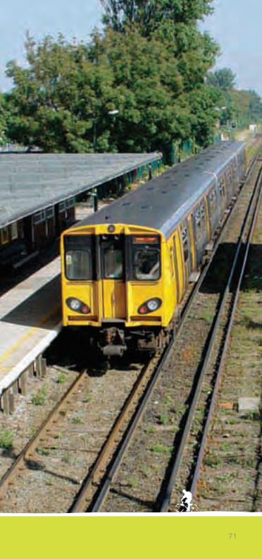
71
Free Cycle LoanIf you would like to cycle the routes in this guide, but don’t have your ownbike, why not join the free cycle loan scheme? There are currently 10‘Freewheeling’ loan centres throughout the borough with a selection of ladiesand gents bikes. The centres are located close to many of the routes for easyaccess. Free cycle loan is subject to proof of identity and you will also needtwo passport-size photographs to register within the scheme.There will also be bikes available for people with special needs and disabilities. These bikes are located at the ‘Wheels for All’ cycle centre inSouthport and at the Litherland sports park. For more information, please contact the Sefton Council CyclingDevelopment Officer on 0845 140 0845.
The National CycleNetwork/SustransThe National Cycle Network is designed and promoted by the charitySustrans to provide an infrastructure of continuous, high quality, safe andattractive routes for cyclists, walkers and people with disabilities, through allareas of the country. So successful has the initiative been that it has acted as a catalyst for manynew local routes and links, and currently 15,800 km (10,000 miles) are completed. Latest information is readily available on the Sustrans website atwww.sustrans.org.uk
Bike for Your LifeThe Cyclist’s Touring Club, Britain’s biggest cycling organisation, is behindthis initiative to get more of us out of our cars and on to our bikes, on thebasis that cycling is healthy for us and also benefits the community we live in.Three quarters of all personal journeys are less than eight km (five miles) –that is no more than 30 minutes on a bike and switching from car to cycle forthese short journeys improves your fitness, reduces noise and air pollution aswell as traffic congestion....so we all gain.For further information, practical advice and details on how to contact yournearest CTC local group, look up their excellent website at www.ctc.org.uk
www.seftonsnaturalcoast.com
72
Information
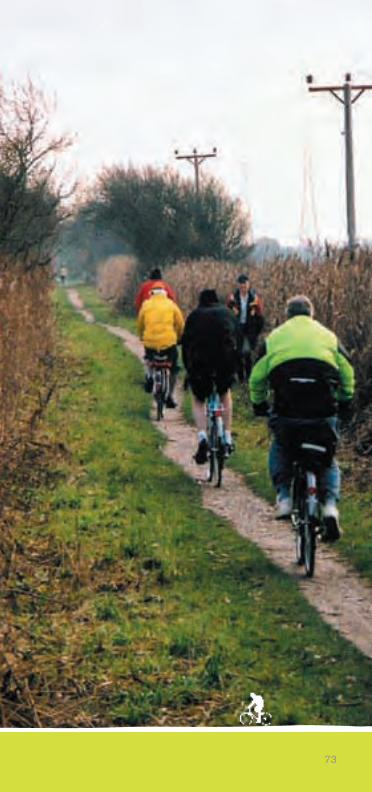
73
www.seftonsnaturalcoast.com
74
The following is a short alphabetical list of the current web sites of organisations that could be helpful to you. Web addresses almost neverchange once established, whereas physical addresses and telephone numbers often do. Those listed as .gov are government agencies or departments.
www.britishwaterways.co.uk (British Waterways)
www.countryside.gov.uk (Countryside Agency)
www.cpre.org.uk (Council for the Preservation of Rural England)
www.ctc.org.uk (Cyclist’s Touring Club)
www.cycleweb.co.uk (for information on cycle clubs and shops in our area)
www.cycling.org.uk (Cycling Project North West inc. cycles for the disabled)
www.defra.gov.uk (Dept. of Environment, Food and Rural Affairs)
www.english-heritage.org.uk (English Heritage)
www.english-nature.org.uk (English Nature)
www.environment-agency.gov.uk (Environment Agency)
www.forestry.gov.uk (Forestry Commission)
www.gotravelwise.com (Merseyside TravelWise)
www.groundwork.org.uk (Groundwork Trust )
www.jncc.gov.uk (Joint Nature Conservation Committee)
www.mammal.org.uk (The Mammal Society)
www.merseybasin.org.uk (Mersey Basin Campaign)
www.merseyforest.org.uk (Mersey Forest)
www.merseywaterfront.com (Mersey Waterfront Regional Park)
www.merseyworld.com/mcc (Merseyside Cycling Campaign)
www.sefton.gov.uk (Sefton Council Coast & Countryside Service)
www.nationaltrust.org.uk (The National Trust)
www.ordnancesurvey.com (The Ordnance Survey)
www.ramblers.org.uk (Ramblers Association)
www.rspb.org.uk (Royal Society for the Protection of Birds)
www.rspca.org.uk (Royal Society for the Prevention of Cruelty to Animals)
www.seftoncoast.org.uk (Sefton Coast Partnership)
www.sustrans.org.uk (Sustrans)
www.ukbap.org.uk (UK Biodiversity)
www.visitsouthport.com (Official Southport Tourism site)
www.wildlifetrust.org.uk/lancashire (Lancs & N Merseyside Wildlife Trust)
www.seftonsnaturalcoast.com (Sefton’s Natural Coast)
useful contacts
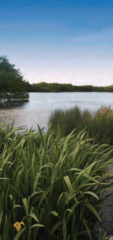
75

Sefton MBC Technical ServicesCycle Project TeamMagdalen House, Trinity Road, Bootle L20 3NJ Tel: 0845 140 0845
Southport Tourist Information Centre112 Lord StreetSouthport PR8 1NYTel: 01704 533333 (24 hrs)www.VisitSouthport.com
Research, words John [email protected]
Photograohy John Bannon, Roy Greeson & Dave McAlevy
Designed and produced by Jennings Campbell BibbyTel: 01704 [email protected]
No part of this publication may be reproduced or transmitted by any means or stored in any informationstorage and retrieval system without the publisher’s permission.
The views expressed in this publication are the personal opinions of the authors and do not necessarilyreflect the views of Sefton MBC’s Members or Officers. Whilst every care has been taken in thecompilation of this publication, the Members and Officers of Sefton MBC cannot be held responsiblefor the accuracy of any statement contained within.
www.seftonsnaturalcoast.com
SNC 2008 Walking & Cycling 2/7/08 17:11 Page 76