walesby parish 5.229 5.230 5 - newark and sherwood
TRANSCRIPT

Walesby Parish
5.229 Within Walesby Parish, 11 sites have been through the full Assessment process. 6 sites are not considered suitable for development and have not progressed through the Achievability or Availability stages.
5.230 5 sites may be considered suitable for development within the next five year period, and could provide for approximately 212 dwelling units. For development of these sites to be considered suitable, changes to Planning Policy would need to be considered and implemented through the Local Development Framework. It should be noted that no decisions on changes to Planning Policy have yet been made and the inclusion of sites within this category should not be taken as an indication that changes will be made.
5.231 The following sites within the parish of Walesby have been submitted to the Local Planning Authority, or have been identified through the Planning Officer led Desktop search exercise, and have been fully assessed:
Sites not Considered Suitable
• 08_0181 • 08_0204 • 08_0205 • 08_0586 • 08_0587 • 08_0686
Sites which May be Considered Suitable
• 08_0106 • 08_0166A • 08_0166B • 08_0206 • 08_0380
5.232 The following site has also been submitted, but is under the size threshold of 0.25 ha (paragraph 12 of the Nottingham Outer Strategic Housing Land Availability Assessment Methodology (July 2008) refers) and a full Assessment has therefore not been undertaken:
• 08_0256- Land at Manor Close, Walesby
5.233 However, the information provided will be used in developing the new detailed planning policies for this area.
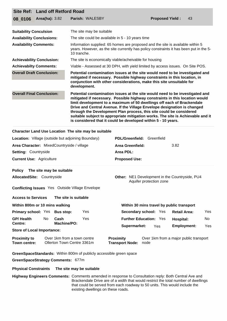
Land off Retford RoadSite Ref:
08_0106 Area(ha): 3.82 Parish: WALESBY Proposed Yield : 43
Location: Village (outside but adjoining Boundary) PDL/Greenfield: Greenfield
Current Use: Agriculture
Area Character: MixedCountryside / village
Suitability Conculsion
Setting: Countryside
Character Land Use Location
Policy
AllocatedSite: Countryside Other: NE1 Development in the Countryside, PU4 Aquifer protection zone
Conflicting Issues Yes Outside Village Envelope
Within 800m or 10 mins walking
Access to Services
Within 30 mins travel by public transport
Primary school: Yes
GP/ Health
Centre:
No Cash
Machine/PO:
Yes
Bus stop: Yes Secondary school: Yes
Further Education: Yes
Supermarket: Yes
Retail Area: Yes
Hospital: No
Employment: Yes
Proximity to
Town centre:
Over 1km from a town centre Ollerton Town Centre 3361m
Proximity
Transport Node:
Over 1km from a major public transport node
Physical Constraints
The site may be suitable
The site is suitable
The site may be suitable
The site could be available in 5 - 10 years time
The site may be suitable
The site may be suitable
Availability Conclusions:
Availability Comments: Information supplied: 65 homes are proposed and the site is available within 5 years. However, as the site currently has policy constraints it has been put in the 5-10 tranche.
Achievability Conclusion:
Overall Draft Conclusion: Potential contamination issues at the site would need to be investigated and
mitigated if necessary. Possible highway constraints in this location, in
conjunction with other considerations, make this site unsuitable for
development.
Area PDL:
Area Greenfield: 3.82
Proposed Use:
GreenSpaceStandards: Within 800m of publicly accessible green space
GreenSpaceStrategy Comments: 677m
Highway Engineers Comments: Comments amended in response to Consultation reply: Both Central Ave and Brackendale Drive are of a width that would restrict the total number of dwellings that could be served from each roadway to 50 units. This would include the existing dwellings on these roads.
Achievabilty Comments: Viable - Assessed at 30 DPH, with yield limited by access issues. On Site POS.
The site is economically viable/acheivable for housing
Store of Local Importance:
Overall Final Conclusion: Potential contamination issues at the site would need to be investigated and
mitigated if necessary. Possible highway constraints in this location would
limit development to a maximum of 50 dwellings off each of Brackendale
Drive and Central Avenue. If the Village Envelope designation is changed
through the Development Plan process, this site could be considered
suitable subject to appropriate mitigation works. The site is Achievable and it
is considered that it could be developed within 5 - 10 years.

Land off Retford RoadSite Ref:
08_0106 Area(ha): 3.82 Parish: WALESBY Proposed Yield : 43
Topography
Constraints:
No Site slopes down to the south
Contaminated Land?: Yes Access to Utilities? Yes
Site within a flood
zone?:
In Floodzone 1
Agricultural Land Quality: Grade 3 (Good-moderate) Site Apparatus: Pylons bisect site from north to south
Neighbour Issues: Poultry use to south
Impact on Landscape Biodiversity
Natural Features: Yes TreesImpact on views: No
Impact on existing
Recreational Use:
No
ProtectedSpecies/
Habitats:
No
Availability and Achievability
Ownership Constraints No ownership constraints 0-5 years
Legal Issues: No
Timescale: No other constraints 0-5 years
Viability Comments: Viable - Assessed at 30 DPH , with yield limited by access issues. On Site POS. Number of dwellings 43.
The site is suitable
Tree Preservation Order: No
Conservation Area: No
Listed Bldg / Local Interest Bldg: No
Availability Other Issues: No other constraints 0-5 years
Suitability Conclusion: The site may be suitable
Contamination Category: A-Potentially contaminative usage has been identified at the site
Availability Conclusions: The site could be available in 5 - 10 years time
Achievability Conclusion:
Legal Comments:
Ownership Comments:
Additional Comments: Proposes residential with element of employment development on this site.Across the track from SHLAA site 08_0204.
Identified in SFRA: No
SFRA Comments:
The site is economically viable/acheivable for housing
Availability Comments: Information supplied: 65 homes are proposed and the site is available within 5 years. However, as the site currently has policy constraints it has been put in the 5-10 tranche.
Achievabilty Comments: Viable - Assessed at 30 DPH, with yield limited by access issues. On Site POS.


Land West of Green LaneSite Ref:
08_0166A Area(ha): 2.40 Parish: WALESBY Proposed Yield : 62
Location: Village (outside but adjoining Boundary) PDL/Greenfield: Greenfield
Current Use: Agriculture
Area Character: MixedCountryside/Village
Suitability Conculsion
Setting: Countryside Village
Character Land Use Location
Policy
AllocatedSite: Countryside Other: NE1- Development in the Countryside, PU4- Aquifer Protection Zone
Conflicting Issues Yes Outside Village Envelope
Within 800m or 10 mins walking
Access to Services
Within 30 mins travel by public transport
Primary school: Yes
GP/ Health
Centre:
No Cash
Machine/PO:
Yes
Bus stop: Yes Secondary school: Yes
Further Education: Yes
Supermarket: Yes
Retail Area: Yes
Hospital: No
Employment: Yes
Proximity to
Town centre:
Over 1km from a town centre Ollerton Town Centre 4271m
Proximity
Transport Node:
Over 1km from a major public transport node
Physical Constraints
The site may be suitable
The site is suitable
The site may be suitable
The site could be available in 5 - 10 years time
The site may be suitable
The site may be suitable
Availability Conclusions:
Availability Comments: Information Supplied: A developer has shown interest in this site. Available within all the timescales specified on the Site Submission Form. However, as the site currently has policy constraints it has been put in the 5-10 tranche.
Achievability Conclusion:
Overall Draft Conclusion: Possible highway constraints in this location. Possible off site highways
mitigation works may be required. If the Village Envelope designation is
changed through the Development Plan process, this site could be
considered suitable subject to appropriate mitigation works. The site is both
Available and Achievable.
Area PDL:
Area Greenfield: 2.4
Proposed Use:
GreenSpaceStandards: Within 400m of publicly accessible green space
GreenSpaceStrategy Comments: 217m
Highway Engineers Comments: Visability and on site highway layout required to standard. Off site highway works and a Traffic Assessment required. The section of Green Lane upon which this site fronts is an adopted highway. However, this highway is not of a standard that could support intensive development of a site of this size without extensive improvements to Green Lane.
Achievabilty Comments: Viable - Assessed at 30dph with 14% on-site POS but no POS commuted sum. No. of dwellings 62.
The site is economically viable/acheivable for housing
Store of Local Importance:
Overall Final Conclusion: Possible highway constraints in this location. Possible off site highways
mitigation works may be required. If the Village Envelope designation is
changed through the Development Plan process, this site could be
considered suitable subject to appropriate mitigation works. The site is
Achievable and it is considered that it could be developed within 5 - 10 years.

Land West of Green LaneSite Ref:
08_0166A Area(ha): 2.40 Parish: WALESBY Proposed Yield : 62
Topography
Constraints:
No Slight slope down to North
Contaminated Land?: No Access to Utilities? Yes
Site within a flood
zone?:
In Floodzone 1
Agricultural Land Quality: Grade 3 (Good-moderate) Site Apparatus: None
Neighbour Issues: Close to HV overhead power line (See notes)
Impact on Landscape Biodiversity
Natural Features: Yes Trees on edges of fieldImpact on views: No
Impact on existing
Recreational Use:
No
ProtectedSpecies/
Habitats:
No
Availability and Achievability
Ownership Constraints No ownership constraints 0-5 years currently held under an agricultural tenancy agreement
Legal Issues: No
Timescale: No other constraints 0-5 years
Viability Comments: Viable - Assessed at 30dph with 14% on-site POS but no POS commuted sum. No. of dwellings 62.
The site is suitable
Tree Preservation Order: No
Conservation Area: Yes
Listed Bldg / Local Interest Bldg: No
Availability Other Issues: No other constraints 0-5 years
Suitability Conclusion: The site may be suitable
Contamination Category: C-Potentially contaminative usage is yet to be identified at the site or surrounding areas
Availability Conclusions: The site could be available in 5 - 10 years time
Achievability Conclusion:
Legal Comments:
Ownership Comments: currently held under an agricultural tenancy agreement
Additional Comments: Residential or Employment uses proposed.Submitted along with Site B (East of Green Lane). Adjacent to SHLAA sites 08_0205 and 08_0586Site abuts 08_0205 to the North.
Identified in SFRA: No
SFRA Comments:
The site is economically viable/acheivable for housing
Availability Comments: Information Supplied: A developer has shown interest in this site. Available within all the timescales specified on the Site Submission Form. However, as the site currently has policy constraints it has been put in the 5-10 tranche.
Achievabilty Comments: Viable - Assessed at 30dph with 14% on-site POS but no POS commuted sum. No. of dwellings 62.

LB
GRE
EN L
AN
E
32.9m
Forge
St Edmund's Close
The
The Vicarage
Cadar
Hou
se
IdrisOld
Chur
ch F
arm
The Heathers
Orchard House
Throleigh House
Gre
enty
les
Hemingfield
Mag
nolia
Cot
tage
New-Haven
Hea
ther
Midway
2.22 Hectares08_0166a
Walesby CP
29.3m
1
Byefields
Corner House
WILLOUGHBY WAY
1:1,250Scale:
Date:
This map is reproduced from the Ordnance Survey material with the permission of Ordnance Survey on behalf of the Controller of Her Majesty's Stationery Office © Crown Copyright.Unauthorised reproduction infringes Crown Copyright and may lead to prosecution or civil proceedings. Newark and Sherwood District Council. Licence 100022288, 2010.
Strategic Housing Land Availability Assessment 2010
08_0166a - Land West of Green Lane,Walesby
10/03/2010

Land East of Green LaneSite Ref:
08_0166B Area(ha): 1.22 Parish: WALESBY Proposed Yield : 29
Location: Village (outside but adjoining Boundary) PDL/Greenfield: Greenfield
Current Use: Agriculture
Area Character: MixedCountryside/ Village
Suitability Conculsion
Setting: Other Countryside/ Village
Character Land Use Location
Policy
AllocatedSite: Countryside Other: Ne1- Development in the Countryside, PU4- Aquifer Protection Zone, C1-5, C12, C15-18 Conservation Areas
Conflicting Issues Yes Outside Village Envelope
Within 800m or 10 mins walking
Access to Services
Within 30 mins travel by public transport
Primary school: Yes
GP/ Health
Centre:
No Cash
Machine/PO:
Yes
Bus stop: Yes Secondary school: Yes
Further Education: Yes
Supermarket: Yes
Retail Area: Yes
Hospital: No
Employment: Yes
Proximity to
Town centre:
Over 1km from a town centre Ollerton Town Centre 4271m
Proximity
Transport Node:
Over 1km from a major public transport node
The site may be suitable
The site is suitable
The site could be available in 5 - 10 years time
The site may be suitable
The site may be suitable
Availability Conclusions:
Availability Comments: Information Supplied: A developer has shown interest in this site. Available within all the timescales specified on the Site Submission Form. However, as the site currently has policy constraints it has been put in the 5-10 tranche.
Achievability Conclusion:
Overall Draft Conclusion: Possible highway constraints in this location. Possible off site highways
mitigation works may be required. Potential flooding issues. Flood Zone 3
covers 20% of the eastern part of the site. Further information would need to
be provided to justify development in this location. Although constraints
could prevent part of the site from being developed, some areas could
accommodate development. If the Village Envelope designation is changed
through the Development Plan process, this site could be considered
suitable subject to appropriate mitigation works. The site is both Available
and Achievable.
Area PDL:
Area Greenfield: 1.22
Proposed Use:
Achievabilty Comments: Viable - Assessed at 30dph site area reduced by 20%, no on-site POS as assumed accomodated in 20% site area reduction, POS commuted sum. No. of dwellings 29.
The site is economically viable/acheivable for housing
Store of Local Importance:
Overall Final Conclusion: Possible highway constraints in this location. Possible off site highways
mitigation works may be required. Potential flooding issues. Flood Zone 3
covers 20% of the eastern part of the site. Further information would need to
be provided to justify development in this location. Any possible
development would need to mitigate against any detrimental impact on the
possible Protected Species Habitat adjacent to the site. Although constraints
could prevent part of the site from being developed, some areas could
accommodate development. If the Village Envelope designation is changed
through the Development Plan process, this site could be considered
suitable subject to appropriate mitigation works. The site is Achievable and
it is considered that it could be developed within 5 - 10 years.

Land East of Green LaneSite Ref:
08_0166B Area(ha): 1.22 Parish: WALESBY Proposed Yield : 29
Physical Constraints
Topography
Constraints:
No Slight rise to centre
Contaminated Land?: No Access to Utilities? Yes
Site within a flood
zone?:
In zone 3 Applies to Eastern margins of site.
Agricultural Land Quality: Grade 3 (Good-moderate) Site Apparatus: None
Neighbour Issues: Close to HV overhead power line (See notes)
Impact on Landscape Biodiversity
Natural Features: No Impact on views: No
Impact on existing
Recreational Use:
No
ProtectedSpecies/
Habitats:
Yes Possible Protected Species Habitat adjacent to the site.
Availability and Achievability
Ownership Constraints No ownership constraints 0-5 years currently held under an agricultural tenancy agreement
Legal Issues: No
Timescale: No other constraints 0-5 years
Viability Comments: Viable - Assessed at 30dph site area reduced by 20%, no on-site POS as assumed accomodated in 20% site area reduction, POS commuted sum. No. of dwellings 29.
The site may be suitable
The site is suitable
Tree Preservation Order: No
Conservation Area: Yes
Listed Bldg / Local Interest Bldg: No
Availability Other Issues: No other constraints 0-5 years
Suitability Conclusion: The site may be suitable
GreenSpaceStandards: Within 400m of publicly accessible green space
GreenSpaceStrategy Comments: 217m
Highway Engineers Comments: Visability and on site highway layout required to standard. Off site highway works and a Traffic Assessment required. The section of Green Lane upon which this site fronts is an adopted highway. However, this highway is not of a standard that could support intensive development of a site of this size without extensive improvements to Green Lane.
Contamination Category: C-Potentially contaminative usage is yet to be identified at the site or surrounding areas
Availability Conclusions: The site could be available in 5 - 10 years time
Achievability Conclusion:
Legal Comments:
Ownership Comments: currently held under an agricultural tenancy agreement
Additional Comments: Residential or Employment uses proposed. Submitted along with Site A (West of Green Lane).Adjacent to SHLAA Site 08_0206
Identified in SFRA: No
SFRA Comments:
The site is economically viable/acheivable for housing
Availability Comments: Information Supplied: A developer has shown interest in this site. Available within all the timescales specified on the Site Submission Form. However, as the site currently has policy constraints it has been put in the 5-10 tranche.
Achievabilty Comments: Viable - Assessed at 30dph site area reduced by 20%, no on-site POS as assumed accomodated in 20% site area reduction, POS commuted sum. No. of dwellings 29.

1.39 Hectares08_0166bWalesby CP
1:2,500Scale:
Date:
This map is reproduced from the Ordnance Survey material with the permission of Ordnance Survey on behalf of the Controller of Her Majesty's Stationery Office © Crown Copyright.Unauthorised reproduction infringes Crown Copyright and may lead to prosecution or civil proceedings. Newark and Sherwood District Council. Licence 100022288, 2010.
Strategic Housing Land Availability Assessment 2010
08_0166b - Land East of Green Lane,Walesby
10/03/2010

Willoughby House and Sawmill, Tuxford RoadSite Ref:
08_0181 Area(ha): 1.79 Parish: WALESBY Proposed Yield :
Location: Seperated from urban/village boundary PDL/Greenfield:
Current Use: Sawmill and residentialLand & Bldgs in Use
Area Character: CountrysideSawmill
Suitability Conculsion
Setting: Countryside Sawmill
Character Land Use Location
Policy
AllocatedSite: Countryside Other: NE1 Development in the Countryside; PU4 Aquifer Protection Zone
Conflicting Issues Yes Development in the Countryside
Within 800m or 10 mins walking
Access to Services
Within 30 mins travel by public transport
Primary school: Yes
GP/ Health
Centre:
No Cash
Machine/PO:
Yes
Bus stop: Yes Secondary school: Yes
Further Education: Yes
Supermarket: Yes
Retail Area: Yes
Hospital: No
Employment: Yes
Proximity to
Town centre:
Over 1km from a town centre Ollerton Town Centre 4430m
Proximity
Transport Node:
Over 1km from a major public transport node
Physical Constraints
Topography
Constraints:
No Slopes down to south
Contaminated Land?: Maybe Access to Utilities? Yes
The site is not suitable
The site is suitable
The site may be suitable
The site is not suitable
The site is not suitable
Availability Conclusions:
Availability Comments: Information Supplied: One developer has made a preliminary enquiry about this site. In answer to the question concerning number / type of dwellings, the respondent states: 'Starter Homes for young villagers plus reasonable sized houses if possible.' Available within 5 years - or sooner if needed.
Achievability Conclusion:
Overall Draft Conclusion: Potential contamination issues in the locality would need to be investigated
and mitigated if necessary. Potential flooding issues. Further information
would need to be provided to justify development in this location. Not
presently suitable due to level of separation from existing settlement.
Area PDL: 0.66Area Greenfield: 1.13
Proposed Use:
GreenSpaceStandards: Within 400m of publicly accessible green space
GreenSpaceStrategy Comments: 156m
Highway Engineers Comments: Visibility and Highway layout required to standard. Traffic Assessment required. Edge of village site that would need to provide for adequate vehicular access and pedestrian links from the site onto the highway network.
Contamination Category: B-Potentially contaminative usage has been identified in close proximity to the site
Achievabilty Comments:
Store of Local Importance:
Overall Final Conclusion: Potential contamination issues in the locality would need to be investigated
and mitigated if necessary. Potential flooding issues. Further information
would need to be provided to justify development in this location. Not
presently suitable due to level of separation from existing settlement.

Willoughby House and Sawmill, Tuxford RoadSite Ref:
08_0181 Area(ha): 1.79 Parish: WALESBY Proposed Yield :
Site within a flood
zone?:
In zone 3 Western edge of site in Zones 2 and 3
Agricultural Land Quality: Grade 3 (Good-moderate) Site Apparatus: Pylons and transformer on site
Neighbour Issues:
Impact on Landscape Biodiversity
Natural Features: No Impact on views: No
Impact on existing
Recreational Use:
No
ProtectedSpecies/
Habitats:
No
Availability and Achievability
Ownership Constraints No ownership constraints 0-5 years
Legal Issues: No
Timescale: No other constraints 0-5 years
Viability Comments:
The site is suitable
Tree Preservation Order: No
Conservation Area: No
Listed Bldg / Local Interest Bldg: No
Availability Other Issues: No other constraints 0-5 years
Suitability Conclusion: The site is not suitable
Availability Conclusions:
Achievability Conclusion:
Legal Comments:
Ownership Comments:
Additional Comments:
Identified in SFRA: No
SFRA Comments:
Availability Comments: Information Supplied: One developer has made a preliminary enquiry about this site. In answer to the question concerning number / type of dwellings, the respondent states: 'Starter Homes for young villagers plus reasonable sized houses if possible.' Available within 5 years - or sooner if needed.
Achievabilty Comments:

1.79 Hectares
08_0181
Walesby CP
1:2,500Scale:
Date:
This map is reproduced from the Ordnance Survey material with the permission of Ordnance Survey on behalf of the Controller of Her Majesty's Stationery Office © Crown Copyright.Unauthorised reproduction infringes Crown Copyright and may lead to prosecution or civil proceedings. Newark and Sherwood District Council. Licence 100022288, 2010.
Strategic Housing Land Availability Assessment 2010
08_0181 - Willoughby House And Sawmill, Tuxford Road,Walesby
10/03/2010

Land off Bog LaneSite Ref:
08_0204 Area(ha): 2.13 Parish: WALESBY Proposed Yield :
Location: Seperated from urban/village boundary PDL/Greenfield: Greenfield
Current Use: Agriculture
Area Character: CountrysideVillage
Suitability Conculsion
Setting: Countryside Village
Character Land Use Location
Policy
AllocatedSite: Countryside Other: NE1- Development in the Countryside, PU4- Aquifer Protection Zone
Conflicting Issues Yes Development in the Countryside
Within 800m or 10 mins walking
Access to Services
Within 30 mins travel by public transport
Primary school: Yes
GP/ Health
Centre:
No Cash
Machine/PO:
Yes
Bus stop: Yes Secondary school: Yes
Further Education: Yes
Supermarket: Yes
Retail Area: Yes
Hospital: No
Employment: Yes
Proximity to
Town centre:
Over 1km from a town centre Ollerton Town Centre 4097m
Proximity
Transport Node:
Over 1km from a major public transport node
Physical Constraints
Topography
Constraints:
No Slopes down to the South East
Contaminated Land?: No Access to Utilities? Yes
Site within a flood
zone?:
Adjacent zone 3 and adjacent to Zone 2
Agricultural Land Quality: Grade 3 (Good-moderate) Site Apparatus: Pylons through and adjacent to site
Neighbour Issues: None
The site is not suitable
The site is suitable
The site is not suitable
The site is not suitable
The site is not suitable
Availability Conclusions:
Availability Comments: Information provided: Site available within 5 years.
Achievability Conclusion:
Overall Draft Conclusion: Not presently suitable due to level of separation from existing settlement.
Possible highway constraints in this location, in conjunction with other
considerations, make this site unsuitable for development.
Area PDL:
Area Greenfield: 2.13
Proposed Use:
GreenSpaceStandards: Within 400m of publicly accessible green space
GreenSpaceStrategy Comments: 354m
Highway Engineers Comments: This site has no connection to the public highway and is therefore unsatisfactory.
Contamination Category: C-Potentially contaminative usage is yet to be identified at the site or surrounding areas
Identified in SFRA: No
SFRA Comments:
Achievabilty Comments:
Store of Local Importance:
Overall Final Conclusion: Not presently suitable due to level of separation from existing settlement.
Possible highway constraints in this location, in conjunction with other
considerations, make this site unsuitable for development.

Land off Bog LaneSite Ref:
08_0204 Area(ha): 2.13 Parish: WALESBY Proposed Yield :
Impact on Landscape Biodiversity
Natural Features: No Impact on views: No
Impact on existing
Recreational Use:
Yes Walesby FP7
ProtectedSpecies/
Habitats:
No
Availability and Achievability
Ownership Constraints No ownership constraints 0-5 years
Legal Issues: No
Timescale: No other constraints 0-5 years
Viability Comments:
The site is suitable
Tree Preservation Order: No
Conservation Area: No
Listed Bldg / Local Interest Bldg: No
Availability Other Issues: No other constraints 0-5 years
Suitability Conclusion: The site is not suitable
Availability Conclusions:
Achievability Conclusion:
Legal Comments:
Ownership Comments:
Additional Comments: Abuts SHLAA site 08_0587 and across the track from 08_0106.
Availability Comments: Information provided: Site available within 5 years.
Achievabilty Comments:

2.13 Hectares08_0204Walesby CP
1:2,500Scale:
Date:
This map is reproduced from the Ordnance Survey material with the permission of Ordnance Survey on behalf of the Controller of Her Majesty's Stationery Office © Crown Copyright.Unauthorised reproduction infringes Crown Copyright and may lead to prosecution or civil proceedings. Newark and Sherwood District Council. Licence 100022288, 2010.
Strategic Housing Land Availability Assessment 2010
08_0204 - Land Off Bog Lane,Walesby
10/03/2010

Land at Retford RoadSite Ref:
08_0205 Area(ha): 17.93 Parish: WALESBY Proposed Yield :
Location: Seperated from urban/village boundary PDL/Greenfield: Greenfield
Current Use: Agriculture
Area Character: Countryside
Suitability Conculsion
Setting: Countryside
Character Land Use Location
Policy
AllocatedSite: Countryside Other: NE1- Development in the Countryside, PU4- Aquifer Protection Zone
Conflicting Issues Yes Development in the Countryside
Within 800m or 10 mins walking
Access to Services
Within 30 mins travel by public transport
Primary school: Yes
GP/ Health
Centre:
No Cash
Machine/PO:
No
Bus stop: Yes Secondary school: Yes
Further Education: Yes
Supermarket: Yes
Retail Area: Yes
Hospital: No
Employment: Yes
Proximity to
Town centre:
Over 1km from a town centre Ollerton Town Centre 4436m
Proximity
Transport Node:
Over 1km from a major public transport node
Physical Constraints
Topography
Constraints:
No Slight slope to East
Contaminated Land?: No Access to Utilities? Yes In adopted road
Site within a flood
zone?:
In Floodzone 1
Agricultural Land Quality: Grade 3 (Good-moderate) Site Apparatus: Pylons running through field,
telephone wires to West of site. HV overhead power line (See notes)
Neighbour Issues: None
The site may be suitable
The site is suitable
The site may be suitable
The site is not suitable
The site is not suitable
Availability Conclusions:
Availability Comments: Information Supplied: Site available within 5 years.
Achievability Conclusion:
Overall Draft Conclusion: Possible off site highways mitigation works may be required. Not presently
suitable due to level of separation from existing settlement.
Area PDL:
Area Greenfield: 17.93
Proposed Use:
GreenSpaceStandards: Within 400m of publicly accessible green space
GreenSpaceStrategy Comments: 250m
Highway Engineers Comments: Visibility and on site highway layout to be provided to standard. Traffic Assessment required. This is a large site onto a straight section of Retford Rd . Visibility may not be an issue but the turning traffic may be an issue.
Contamination Category: C-Potentially contaminative usage is yet to be identified at the site or surrounding areas
Identified in SFRA: No
Achievabilty Comments:
Store of Local Importance:
Overall Final Conclusion: Possible off site highways mitigation works may be required. Not presently
suitable due to level of separation from existing settlement.

Land at Retford RoadSite Ref:
08_0205 Area(ha): 17.93 Parish: WALESBY Proposed Yield :
Impact on Landscape Biodiversity
Natural Features: No Impact on views: Yes
Impact on existing
Recreational Use:
No
ProtectedSpecies/
Habitats:
No
Availability and Achievability
Ownership Constraints No ownership constraints 0-5 years
Legal Issues: No
Timescale: No other constraints 0-5 years
Viability Comments:
The site is suitable
Tree Preservation Order: No
Conservation Area: No
Listed Bldg / Local Interest Bldg: No
Availability Other Issues: No other constraints 0-5 years
Suitability Conclusion: The site is not suitable
Availability Conclusions:
Achievability Conclusion:
Legal Comments:
Ownership Comments:
Additional Comments: Adjacent to SHLAA sites 08_0166, 08_0380 and 08_0586. Residential and employment uses proposed. Abuts an Article 4 direction area to North.Site previously has permission for golf uses. This is a large site in close proximity to a scheduled ancient monument situated to the north (Haughton Decoy and Motte & Bailey Castle). Given the relative open nature of land, there is likely to be a significant impact on the setting of the SAM which may affect how this site is developed. (EH).
SFRA Comments:
Availability Comments: Information Supplied: Site available within 5 years.
Achievabilty Comments:

17.93 Hectares08_0205
Walesby CP
1:5,000Scale:
Date:
This map is reproduced from the Ordnance Survey material with the permission of Ordnance Survey on behalf of the Controller of Her Majesty's Stationery Office © Crown Copyright.Unauthorised reproduction infringes Crown Copyright and may lead to prosecution or civil proceedings. Newark and Sherwood District Council. Licence 100022288, 2010.
Strategic Housing Land Availability Assessment 2010
08_0205 - Land At Retford Road,Walesby
10/03/2010

Tuxford RoadSite Ref:
08_0206 Area(ha): 0.43 Parish: WALESBY Proposed Yield : 13
Location: Village (outside but adjoining Boundary) PDL/Greenfield: Greenfield
Current Use: Agriculture
Area Character: CountrysideVillage
Suitability Conculsion
Setting: Countryside Village
Character Land Use Location
Policy
AllocatedSite: Countryside Other: NE1- Development in the Countryside, PU4- Aquifer Protection Zone
Conflicting Issues Yes Outside Village Envelope
Within 800m or 10 mins walking
Access to Services
Within 30 mins travel by public transport
Primary school: Yes
GP/ Health
Centre:
No Cash
Machine/PO:
Yes
Bus stop: Yes Secondary school: Yes
Further Education: Yes
Supermarket: Yes
Retail Area: Yes
Hospital: No
Employment: Yes
Proximity to
Town centre:
Over 1km from a town centre Ollerton Town Centre 4353m
Proximity
Transport Node:
Over 1km from a major public transport node
Physical Constraints
Topography
Constraints:
No Flat land Contaminated Land?: No Access to Utilities? Yes
The site may be suitable
The site may be suitable
The site is suitable
The site could be available in 5 - 10 years time
The site may be suitable
The site may be suitable
Availability Conclusions:
Availability Comments: Information provided: Site available within 5 years. However, as the site currently has policy constraints it has been put in the 5-10 tranche.
Achievability Conclusion:
Overall Draft Conclusion: If the Village Envelope designation is changed through the Development Plan
process, this site could be considered suitable in all other respects. The site
is both Available and Achievable.
Area PDL:
Area Greenfield: 0.43
Proposed Use:
GreenSpaceStandards: Within 400m of publicly accessible green space
GreenSpaceStrategy Comments: 150m
Highway Engineers Comments: Visibility and on site highway layout to be provided to standard. Likely to be frontage development, adequate visibility should be provided together with on site turning facilities.
Contamination Category: C-Potentially contaminative usage is yet to be identified at the site or surrounding areas
Achievabilty Comments: Viable - Assessed at 30 dph, no on-site POS but POS commuted sum. No. of dwellings 13.
The site is economically viable/acheivable for housing
Store of Local Importance:
Overall Final Conclusion: If the Village Envelope designation is changed through the Development Plan
process, this site could be considered suitable in all other respects. The site
is Achievable and it is considered that it could be developed within 5 - 10
years.

Tuxford RoadSite Ref:
08_0206 Area(ha): 0.43 Parish: WALESBY Proposed Yield : 13
Site within a flood
zone?:
Adjacent zone 3 Also Zone2
Agricultural Land Quality: Grade 3 (Good-moderate) Site Apparatus: None
Neighbour Issues: None
Impact on Landscape Biodiversity
Natural Features: No Impact on views: No
Impact on existing
Recreational Use:
Yes
ProtectedSpecies/
Habitats:
No
Availability and Achievability
Ownership Constraints No ownership constraints 0-5 years
Legal Issues: No
Timescale: No other constraints 0-5 years
Viability Comments: Viable - Assessed at 30 dph, no on-site POS but POS commuted sum. No. of dwellings 13.
The site is suitable
Tree Preservation Order: No
Conservation Area: No
Listed Bldg / Local Interest Bldg: No
Availability Other Issues: No other constraints 0-5 years
Suitability Conclusion: The site may be suitable
Availability Conclusions: The site could be available in 5 - 10 years time
Achievability Conclusion:
Legal Comments:
Ownership Comments:
Additional Comments: Abuts SHLAA site 08_0166 and 08_0686. Small agricultural building on North West corner of site.
Identified in SFRA: No
SFRA Comments:
The site is economically viable/acheivable for housing
Availability Comments: Information provided: Site available within 5 years. However, as the site currently has policy constraints it has been put in the 5-10 tranche.
Achievabilty Comments: Viable - Assessed at 30 dph, no on-site POS but POS commuted sum. No. of dwellings 13.

Playing Field
TUXFORD ROAD
Gardens
Pond
27.7m
29.3m
WILLOUGHBY WAY
Beck Side
Trees
The
Drain
Byefields
Allotment
Corner House
Yew
Cottage
Willoughby Lodge
Tolc
arne
Holdings
Tore
styn
Cherry
Wellow
Church
St Edmund's
1
1519
27
11
Cottage
The
Cottage
0.43 Hectares08_0206Walesby CP
1:1,250Scale:
Date:
This map is reproduced from the Ordnance Survey material with the permission of Ordnance Survey on behalf of the Controller of Her Majesty's Stationery Office © Crown Copyright.Unauthorised reproduction infringes Crown Copyright and may lead to prosecution or civil proceedings. Newark and Sherwood District Council. Licence 100022288, 2010.
Strategic Housing Land Availability Assessment 2010
08_0206 - Tuxford Road,Walesby
10/03/2010

Land at Oakham Farm, Forest LaneSite Ref:
08_0380 Area(ha): 2.50 Parish: WALESBY Proposed Yield : 65
Location: Village (outside but adjoining Boundary) PDL/Greenfield: Greenfield
Current Use: Agriculture
Area Character: ResidentialCountryside
Suitability Conculsion
Setting: Village Countryside
Character Land Use Location
Policy
AllocatedSite: Countryside Other: NE1 Development in the Countryside, PU4 Aquifer Protection Zone
Conflicting Issues Yes Outside Village Envelope
Within 800m or 10 mins walking
Access to Services
Within 30 mins travel by public transport
Primary school: Yes
GP/ Health
Centre:
No Cash
Machine/PO:
Yes
Bus stop: Yes Secondary school: Yes
Further Education: Yes
Supermarket: Yes
Retail Area: Yes
Hospital: No
Employment: Yes
Proximity to
Town centre:
Over 1km from a town centre Ollerton Town Centre 4018m
Proximity
Transport Node:
Over 1km from a major public transport node
Physical Constraints
Topography
Constraints:
No Slight slope down to north
Contaminated Land?: Yes Access to Utilities? Yes
The site may be suitable
The site is suitable
The site may be suitable
The site could be available in 5 - 10 years time
The site may be suitable
The site may be suitable
Availability Conclusions:
Availability Comments: Information Supplied: Available within 5 years. However, as the site currently has policy constraints it has been put in the 5-10 tranche.
Achievability Conclusion:
Overall Draft Conclusion: Potential contamination issues at the site would need to be investigated and
mitigated if necessary. If the Village Envelope designation is changed
through the Development Plan process, this site could be considered
suitable subject to appropriate mitigation works. The site is both Available
and Achievable.
Area PDL:
Area Greenfield: 2.5
Proposed Use:
GreenSpaceStandards: Within 400m of publicly accessible green space
GreenSpaceStrategy Comments: 153m
Highway Engineers Comments: Visibility and on site highway layout to be provided to standard. Traffic Assessment required.
Contamination Category: A-Potentially contaminative usage has been identified at the site
Achievabilty Comments: Viable - Assessed at 30 DPH with on-site POS , no POS commuted sum. No. of dwellings 65.
The site is economically viable/acheivable for housing
Store of Local Importance:
Overall Final Conclusion: Potential contamination issues at the site would need to be investigated and
mitigated if necessary. If the Village Envelope designation is changed
through the Development Plan process, this site could be considered
suitable subject to appropriate mitigation works. The site is Achievable and it
is considered that it could be developed within 5 - 10 years.

Land at Oakham Farm, Forest LaneSite Ref:
08_0380 Area(ha): 2.50 Parish: WALESBY Proposed Yield : 65
Site within a flood
zone?:
In Floodzone 1
Agricultural Land Quality: Grade 3 (Good-moderate) Site Apparatus: None
Neighbour Issues: None
Impact on Landscape Biodiversity
Natural Features: No Impact on views: No
Impact on existing
Recreational Use:
No
ProtectedSpecies/
Habitats:
No
Availability and Achievability
Ownership Constraints No ownership constraints 0-5 years
Legal Issues: No
Timescale: No other constraints 0-5 years
Viability Comments: Viable - Assessed at 30 DPH with on-site POS , no POS commuted sum. No. of dwellings 65.
The site is suitable
Tree Preservation Order: No
Conservation Area: No
Listed Bldg / Local Interest Bldg: No
Availability Other Issues: No other constraints 0-5 years
Suitability Conclusion: The site may be suitable
Availability Conclusions: The site could be available in 5 - 10 years time
Achievability Conclusion:
Legal Comments:
Ownership Comments:
Additional Comments: Adjacent to SHLAA site 08_0205
Identified in SFRA: No
SFRA Comments:
The site is economically viable/acheivable for housing
Availability Comments: Information Supplied: Available within 5 years. However, as the site currently has policy constraints it has been put in the 5-10 tranche.
Achievabilty Comments: Viable - Assessed at 30 DPH with on-site POS , no POS commuted sum. No. of dwellings 65.

2.5 Hectares08_0380
Walesby CP
1:2,500Scale:
Date:
This map is reproduced from the Ordnance Survey material with the permission of Ordnance Survey on behalf of the Controller of Her Majesty's Stationery Office © Crown Copyright.Unauthorised reproduction infringes Crown Copyright and may lead to prosecution or civil proceedings. Newark and Sherwood District Council. Licence 100022288, 2010.
Strategic Housing Land Availability Assessment 2010
08_0380 - Land At Oakland Farm, Forest Lane,Walesby
10/03/2010

North of New HillSite Ref:
08_0586 Area(ha): 1.69 Parish: WALESBY Proposed Yield :
Location: Village (outside but adjoining Boundary) PDL/Greenfield: Combination
Current Use: Paddock/ResidentialOther
Area Character: MixedCountryside/Residential
Suitability Conculsion
Setting: Other Countryside/Residential
Character Land Use Location
Policy
AllocatedSite: Countryside Other: NE1 - Development in the Countryside, PU4 - Aquifer Protection Zone
Conflicting Issues Yes Outside Village Envelope
Within 800m or 10 mins walking
Access to Services
Within 30 mins travel by public transport
Primary school: Yes
GP/ Health
Centre:
No Cash
Machine/PO:
Yes
Bus stop: Yes Secondary school: Yes
Further Education: Yes
Supermarket: Yes
Retail Area: Yes
Hospital: No
Employment: Yes
Proximity to
Town centre:
Over 1km from a town centre Ollerton Town Centre 4214m
Proximity
Transport Node:
Over 1km from a major public transport node
Physical Constraints
Topography
Constraints:
No Contaminated Land?: Yes Access to Utilities? Unknown
The site may be suitable
The site is suitable
The site is not suitable
The site is not suitable
The site may be suitable
Availability Conclusions:
Availability Comments:
Achievability Conclusion:
Overall Draft Conclusion: Potential contamination issues at the site would need to be investigated and
mitigated if necessary. Highway access constraints in this location. This site
is not appropriate for development in isolation. However, the site is adjacent
to other SHLAA sites, which may be considered suitable for development and
provide access. See Site 08_0205.
Area PDL: 0.27Area Greenfield: 1.42
Proposed Use:
GreenSpaceStandards: Within 400m of publicly accessible green space
GreenSpaceStrategy Comments: 92m
Highway Engineers Comments: This site has no connection to the public highway and is therefore unsatisfactory.
Contamination Category: A-Potentially contaminative usage has been identified at the site
Achievabilty Comments:
Store of Local Importance:
Overall Final Conclusion: Potential contamination issues at the site would need to be investigated and
mitigated if necessary. Highway access constraints in this location. This site
is not appropriate for development in isolation. However, the site is adjacent
to other SHLAA sites, which may be considered suitable for development and
provide access. See Site 08_0205.

North of New HillSite Ref:
08_0586 Area(ha): 1.69 Parish: WALESBY Proposed Yield :
Site within a flood
zone?:
In Floodzone 1
Agricultural Land Quality: Grade 3 (Good-moderate) Site Apparatus: None
Neighbour Issues: None
Impact on Landscape Biodiversity
Natural Features: Yes Several hedges and treesImpact on views: No
Impact on existing
Recreational Use:
No
ProtectedSpecies/
Habitats:
No
Availability and Achievability
Ownership Constraints
Legal Issues:
Timescale:
Viability Comments:
The site is suitable
Tree Preservation Order: No
Conservation Area: No
Listed Bldg / Local Interest Bldg: No
Availability Other Issues:
Suitability Conclusion: The site is not suitable
Availability Conclusions:
Achievability Conclusion:
Legal Comments:
Ownership Comments:
Additional Comments: Coal Authority mining area; Smoke Control ZoneAdjoins SHLAA sites 08_0166, 08_0205
Identified in SFRA: No
SFRA Comments:
Availability Comments:
Achievabilty Comments:

Posts
NEW HILL
(Graveyard)
Hou
se
Hol
me
Leig
h
Carriage Way
King
ston
Clov
elly
Wes
t Hol
me
Lingmoor
York
Vill
a
Ingl
ewoo
d
Lind
holm
e
Clou
ghto
n
Clai
rwoo
d
Wyv
ille
Hea
ther
Monza
Posts
1.69 Hectares
08_0586Walesby CP
Gre
enty
les
1:1,250Scale:
Date:
This map is reproduced from the Ordnance Survey material with the permission of Ordnance Survey on behalf of the Controller of Her Majesty's Stationery Office © Crown Copyright.Unauthorised reproduction infringes Crown Copyright and may lead to prosecution or civil proceedings. Newark and Sherwood District Council. Licence 100022288, 2010.
Strategic Housing Land Availability Assessment 2010
08_0586 - North Of New Hill,Walesby
10/03/2010

East of Red Fern FarmSite Ref:
08_0587 Area(ha): 2.33 Parish: WALESBY Proposed Yield :
Location: Village (outside but adjoining Boundary) PDL/Greenfield: Greenfield
Current Use: PaddocksAgriculture
Area Character: MixedCountryside/Residential
Suitability Conculsion
Setting: Other Countryside/Residential
Character Land Use Location
Policy
AllocatedSite: Countryside Other: NE1 - Development in the Countryside, C1-C5,C12,C15-C18 - Conservation Areas, PU4 - Aquifer Protection Zone
Conflicting Issues Yes Outside Village Envelope
Within 800m or 10 mins walking
Access to Services
Within 30 mins travel by public transport
Primary school: Yes
GP/ Health
Centre:
No Cash
Machine/PO:
Yes
Bus stop: Yes Secondary school: Yes
Further Education: Yes
Supermarket: Yes
Retail Area: Yes
Hospital: No
Employment: Yes
Proximity to
Town centre:
Over 1km from a town centre Ollerton Town Centre 4016m
Proximity
Transport Node:
Over 1km from a major public transport node
Physical Constraints
Topography
Constraints:
No Contaminated Land?: Maybe Access to Utilities? Unknown
Site within a flood
zone?:
In Floodzone 1 Adjacent zone 2 and 3 - eastern corner
Agricultural Land Quality: Grade 3 (Good-moderate) Site Apparatus: Pylons on site
Neighbour Issues: None
The site may be suitable
The site is suitable
The site is not suitable
The site is not suitable
The site may be suitable
Availability Conclusions:
Availability Comments:
Achievability Conclusion:
Overall Draft Conclusion: Potential contamination issues in the locality would need to be investigated
and mitigated if necessary. Possible highway constraints in this location, in
conjunction with other considerations, make this site unsuitable for
development.
Area PDL:
Area Greenfield: 2.33
Proposed Use:
GreenSpaceStandards: Within 400m of publicly accessible green space
GreenSpaceStrategy Comments: 198m
Highway Engineers Comments: This site has no connection to the public highway and is therefore unsatisfactory.
Contamination Category: B-Potentially contaminative usage has been identified in close proximity to the site
Identified in SFRA: No
Achievabilty Comments:
Store of Local Importance:
Overall Final Conclusion: Potential contamination issues in the locality would need to be investigated
and mitigated if necessary. Possible highway constraints in this location, in
conjunction with other considerations, make this site unsuitable for
development.

East of Red Fern FarmSite Ref:
08_0587 Area(ha): 2.33 Parish: WALESBY Proposed Yield :
Impact on Landscape Biodiversity
Natural Features: Yes Hedges and trees on site.Impact on views: No
Impact on existing
Recreational Use:
Yes Public Right of Way 214/7/1 Walesby FP7
ProtectedSpecies/
Habitats:
No
Availability and Achievability
Ownership Constraints
Legal Issues:
Timescale:
Viability Comments:
The site is suitable
Tree Preservation Order: No
Conservation Area: Yes
Listed Bldg / Local Interest Bldg: No
Availability Other Issues:
Suitability Conclusion: The site is not suitable
Availability Conclusions:
Achievability Conclusion:
Legal Comments:
Ownership Comments:
Additional Comments: Mining Area; Smoke Control ZoneAdjoins SHLAA site 08_0204Small part of site has expired residential permission
SFRA Comments:
Availability Comments:
Achievabilty Comments:

2.33 Hectares08_0587Walesby CP
1:2,500Scale:
Date:
This map is reproduced from the Ordnance Survey material with the permission of Ordnance Survey on behalf of the Controller of Her Majesty's Stationery Office © Crown Copyright.Unauthorised reproduction infringes Crown Copyright and may lead to prosecution or civil proceedings. Newark and Sherwood District Council. Licence 100022288, 2010.
Strategic Housing Land Availability Assessment 2010
08_0587 - East Of Red Fern Farm,Walesby
10/03/2010

Tuxford RoadSite Ref:
08_0686 Area(ha): 0.52 Parish: WALESBY Proposed Yield :
Location: Seperated from urban/village boundary PDL/Greenfield: Greenfield
Current Use: Agriculture
Area Character: Countryside
Suitability Conculsion
Setting: Countryside
Character Land Use Location
Policy
AllocatedSite: Smoke Control Zone Other: NE1 Development in the Countryside, PU4 Aquifer Protection Zones
Conflicting Issues Yes Development in the Countryside
Within 800m or 10 mins walking
Access to Services
Within 30 mins travel by public transport
Primary school: Yes
GP/ Health
Centre:
No Cash
Machine/PO:
Yes
Bus stop: Yes Secondary school: Yes
Further Education: Yes
Supermarket: Yes
Retail Area: Yes
Hospital: No
Employment: Yes
Proximity to
Town centre:
Over 1km from a town centre Ollerton Town Centre 4416m
Proximity
Transport Node:
Over 1km from a major public transport node
Physical Constraints
Topography
Constraints:
No Contaminated Land?: No Access to Utilities? Unknown
Site within a flood
zone?:
In zone 3 40 % in Flood Zone 3 and 50% in Flood Zone 2
Agricultural Land Quality: Grade 3 (Good-moderate) Site Apparatus: None
Neighbour Issues: None
The site is not suitable
The site is suitable
The site may be suitable
The site is not suitable
The site is not suitable
Availability Conclusions:
Availability Comments:
Achievability Conclusion:
Overall Draft Conclusion: Approximaterly 40% of the site lies within Environment Agency Flood Zone 3
where residential development should be resisted. Not presently suitable due
to level of separation from existing settlement.
Area PDL:
Area Greenfield: 0.52
Proposed Use:
GreenSpaceStandards: Within 400m of publicly accessible green space
GreenSpaceStrategy Comments: 145m
Highway Engineers Comments: Visibility and on site highway layout to be provided to standard. Off site highway work required. Likely to be a site suitable for frontage development . Individual plots would need to provide for adequate access and on site turning facilities.
Contamination Category:
Identified in SFRA: No
Achievabilty Comments:
Store of Local Importance:
Overall Final Conclusion: Approximaterly 40% of the site lies within Environment Agency Flood Zone 3
where residential development should be resisted. Not presently suitable due
to level of separation from existing settlement.

Tuxford RoadSite Ref:
08_0686 Area(ha): 0.52 Parish: WALESBY Proposed Yield :
Impact on Landscape Biodiversity
Natural Features: No Impact on views: No
Impact on existing
Recreational Use:
No
ProtectedSpecies/
Habitats:
No
Availability and Achievability
Ownership Constraints
Legal Issues:
Timescale:
Viability Comments:
The site is suitable
Tree Preservation Order: No
Conservation Area: No
Listed Bldg / Local Interest Bldg: No
Availability Other Issues:
Suitability Conclusion: The site is not suitable
Availability Conclusions:
Achievability Conclusion:
Legal Comments:
Ownership Comments:
Additional Comments: SHLAA sites adjoins 08_0166 and 08_0206
SFRA Comments:
Availability Comments:
Achievabilty Comments:

Playing Field
TUXFORD ROAD
Pond
27.7m
Beck Side
DrainYew
Cottage
Tolc
arne
1519
11
0.52 Hectares08_0686Walesby CP
1:1,250Scale:
Date:
This map is reproduced from the Ordnance Survey material with the permission of Ordnance Survey on behalf of the Controller of Her Majesty's Stationery Office © Crown Copyright.Unauthorised reproduction infringes Crown Copyright and may lead to prosecution or civil proceedings. Newark and Sherwood District Council. Licence 100022288, 2010.
Strategic Housing Land Availability Assessment 2010
08_0686 - Tuxford Road,Walesby
10/03/2010

WALESBY – SITES NOT FULLY ASSESSED/REMOVED FROM THE STUDY
Ref Address Parish Reason Why Not Fully Assessed/Removed from the Study
08_0256
Land at Manor Close
Walesby
Site below 0.25ha. Not included in study.

Walesby
St Edmund's
Red Fern Farm
Firs Farm
Red Lion
Church
New Farm
Inn
COLLINRIDGE VIEW
El Tfmr
MANOR CLOSE
30.8m
30.5m
The
Tree
(PH)
Pear
Hall
House
Ivy Cottages
East View
Elze
vir
Farm
Cottage
Landmere Cottage
Charrington Lodge
Linconia
The Meadows
LynwoodBarn
The Hayloft
Whitehouse
Wellow
Baltika
Issues
ASH VA
LE ROA
D
MAIN STREET
Bramble Cott
18
30
42
35
36
27
50
826
34
15
23
2
40
17
14
38
12
1
7
4
3
2
15
2
17
1
08_0256Walesby CP
29.3m
28a
Allotment
Gardens
Church
1:1,250Scale:
Date:
This map is reproduced from the Ordnance Survey material with the permission of Ordnance Survey on behalf of the Controller of Her Majesty's Stationery Office © Crown Copyright.Unauthorised reproduction infringes Crown Copyright and may lead to prosecution or civil proceedings. Newark and Sherwood District Council. Licence 100022288, 2010.
Strategic Housing Land Availability Assessment 2010
08_0256Walesby
14/05/2010