volume 47 no 3 2015 - gtanswgtansw.org.au/files/geog_bulletin/gtansw_bulletin_3_2015.pdf · volume...
TRANSCRIPT
wine making
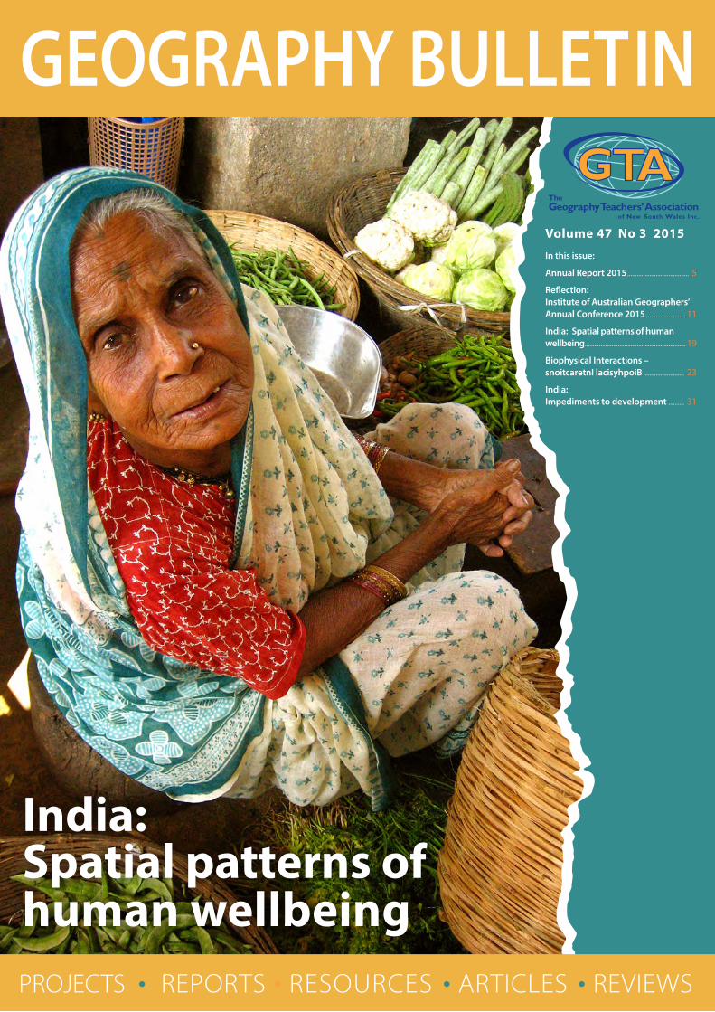
India: Spatial patterns of human wellbeing
Volume 47 No 3 2015
In this issue:
Annual Report 2015 ....................................... 5
Reflection: Institute of Australian Geographers’ Annual Conference 2015 ......................... 11
India: Spatial patterns of human wellbeing ................................................................ 19
Biophysical Interactions – snoitcaretnI lacisyhpoiB .......................... 23
India: Impediments to development .......... 31
PROJECTS • REPORTS • RESOURCES • ARTICLES • REVIEWS
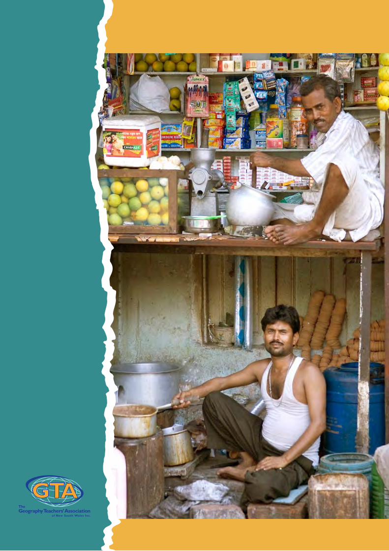
Covers: Street vendor, Mumbai and Two-storey shop, Kolkata Image source: Wikimedia Commons
President Susan Caldis
Vice Presidents Milton Brown
Lorraine Chaffer
Dr Grant Kleeman
Martin Pluss
Honorary Secretary Susan Caldis
Minute Secretary Milton Brown
Honorary Treasurer Dr Grant Kleeman, Macquarie University
Councillors Paul Alger
Paula Cooper
Catherine Donnelly
Keith Hopkins
Gabriella Hunter (ACT)
Grace Larobina
David Latimer
John Lewis
Sharon McLean
Sarah Menassa-Rose
Louise Swanson
Karen Tuhan (ACT)
Steve Weingarth
Public Officer Dr Grant Kleeman
The Geography Bulletin is a quarterly journal of The Geography Teachers’ Association of New South Wales. The ‘Bulletin’ embraces those natural and human phenomena which fashion the character of the Earth’s surface. In addition to this it sees Geography as incorporating ‘issues’ which confront the discipline and its students. The Geography Bulletin is designed to serve teachers and students of Geography. The journal has a particular emphasis on the area of the Pacific basin and its near neighbours and a specific role in providing material to help meet the requirements of the Geography syllabuses. As an evolving journal the Geography Bulletin attempts to satisfy the requirements of a broad readership and in so doing improve its service to teachers. Those individuals wishing to contribute to the publication are directed to the ‘Advice to contributors’ on the preceding page. Articles are submitted to two referees. Any decisions as to the applicability to secondary and/or tertiary education are made by the referees. Authors, it is suggested, should direct articles according to editorial policy.
© Copyright 2015 Geography Teachers’ Association of New South Wales Inc.
Unless otherwise indicated in an article, non-profit organisations such as schools and universities may make up to 30 photocopies of any article in this journal without obtaining further permission.
EXECUTIVE 2015 – 2016
Articles and letters should be sent to the Editors:
Lorraine Chaffer Email: [email protected]
Dr Grant Kleeman Email: [email protected]
Design and layout:Jill Sillar, Professional Teachers’ Council NSW [email protected]
ISSN 0156-9236
GEOGRAPHY BULLETIN
OFFICE OF THE GEOGRAPHY TEACHERS’ ASSOCIATION OF NEW SOUTH WALES
ABN 59246850128 Address: 56 Bland Street, Ashfield NSW 2131 Postal Address: PO Box 577 Leichhardt, NSW, 2040, Australia Telephone: (02) 9716 0378, Fax: (02) 9564 2342 Website: www.gtansw.org.au Email: [email protected]
ANNUAL MEMBERSHIP (Subscriptions include GST)
Personal membership $90.00Corporate membership (school, department or business) $180.00Concessional membership (retiree, part-time teacher or student) $40.00
Editors Lorraine ChafferDr Grant Kleeman
Geography Bulletin Vol 47, No 3 2015 1
EDITOR: Dr Grant Kleeman
Volume 47, No3 2015
Editorial ......................................................................................................................................................2
Annual Report 2015 ...........................................................................................................................5
Reflection: Institute of Australian Geographers’ Annual Conference 2015.......11
Australian Geography Competition ....................................................................................13
India: Spatial patterns of human wellbeing .....................................................................19
Biophysical Interactions – snoitcaretnI lacisyhpoiB ...................................................23
India: Impediments to development ..................................................................................31
Benefits of GTA NSW Membership ........................................................................................38
Advice to Contributors ..................................................................................................................39
2 Geography Bulletin Vol 47, No 3 2015
Dr Grant Kleeman, Editor
Welcome to the Third Edition of the Geography Bulletin for 2015. In this issue we continue our focus on development issues in India. We look at the impediments to development in India and the spatial patterns of human wellbeing. Also included in this edition a reflection on the Australia Geographers’ Annual Conference and an article Biophysical Interactions: Trialling a flipped approach to teaching, learning and assessment in the Geography classroom. Susan Caldis has contributed both of these articles.
AGTA/GTA NSW Geography RoadshowThe first of AGTA’s Geography Roadshows took place in Brisbane in mid-March. The second took place in Western Australia in early November. The one-day professional learning event included both a primary and secondary program. Topics addressed included thinking geographically, inquiry in Geography, fieldwork, ICT in Geography, and developing literacy through Geography.
Multiple Roadshow events are planned for NSW/ACT in late November. These will be held in suburban Sydney, Newcastle and Canberra (see the GTA NSW website for details).
Syllabus release: No longer a truly national curriculumWith the release of the NSW K–10 Geography Syllabus it is worth reflecting on the state-of-play in the implementation of the Australia Curriculum: Geography.
It is now clear that the interventions of governments have compromised the integrity of a truly national Geography curriculum F–12. Revisions have been made to the previously available Australian Curriculum following the Federal Government’s Review of the Australian Curriculum chaired by Professor Ken Wiltshire AO and Dr Kevin Donnelly. The revisions are described as making the curriculum “easier to manage, particularly for primary schools, simplify the curriculum’s presentation and strengthen the focus on literacy” (ACARA). Of particular concern to geographers is the decision to conflate the curriculums for History, Geography, Civics and Citizenship, and Business Studies into a Humanities and Social Sciences curriculum. While retaining the majority of the Geography Content Descriptors it is disappointing that Geography’s identity, as a distinct discipline, is lost at least in F–6.
The implementation of the Curriculum also varies significantly from state-to-state. What follows is a summary of the current state of play:
NSW has rejected ACARA’s Humanities and Social Sciences curriculum and proceeded with mandatory studies in Geography and History K–10 using a syllabus document based on ACARA’s originally endorsed History and Geography curriculums (Version 7.5). The NSW Geography Syllabus is, however, a rather liberal interpretation of the Australian Curriculum: Geography. The content has been pared back and topics have been swapped from year-to-year in Years 7 and 8 and Years 8 and 9. No commitment has been made to implementing the Geography curriculum for the senior years even though the existing document is incompatible with the new K–10 Geography Syllabus. The current senior Geography syllabus is now 15 years old.
Victoria has developed its own state-based curriculum F-10. This is closely aligned with the content descriptors of the Australian Curriculum: Geography but reflects Victorian priorities and standards. In the senior years Units 1 and 3 (Hazards and Disasters and Changing the Land are based on the ACARA endorsed curriculum. However, Units 2 and 4 are substantially different, being focused on studies of tourism and human population respectively.
The ACT will transition to the Humanities and Social Sciences curriculum (i.e.

Geography Bulletin Vol 47, No 3 2015 3
Version 8.0) by December 2016. The curriculum in the senior years is closely aligned with ACARA’s Senior Secondary Australian Curriculum: Geography.
In the absence of a state-based curriculum document, South Australian schools are expected to transition to ACARA’s Humanities and Social Sciences curriculum. At the senior secondary level, the SACE Board is currently developing the new Geography curriculum for Stages 1 and 2 (Years 11 and 12), due to be implemented in 2017 at Stage 1 and 2018 for Stage 2. The curriculum has been developed with reference to the ACARA Senior Geography Curriculum with modifications to suit local requirements.
In Western Australia, an integrated Humanities and Social Sciences curriculum has been developed based on the Australian Curriculum: Geography (Version 7.5) – full implementation by 2017. Some content descriptors have been expanded in the mandated content and some have been placed into the additional content section. In the senior years, Natural Hazards and Global Networks and Interconnections are to be studied in Year 11 while Global Environmental Change and Planning Sustainable Places are studied in Year 12 – a re-sequencing of the ACARA topics.
In the absence of a state-based curriculum document, Tasmanian schools are expected to transition to ACARA’s Humanities and Social Sciences curriculum. HASS is mandatory F–8. Geography in Years 9 and 10 is not mandated. At the senior secondary level, there are two Tasmanian Certificate of Education courses that draw on Senior Secondary Geography – Environmental Science, and Society and Geography. Both courses are pre-tertiary and provide a pathway to University entrance. The Environmental Science & Society course was redeveloped in 2013 and implemented in 2014 while Geography was redeveloped in 2014 and is being implemented in 2015.
Australian Geography Competition GTA NSW is pleased to be associated with this important national initiative offered by AGTA and the Royal Geographical Society of Queensland. In 2015, more than 70,000 students participated in the competition nation wide.
The National Geography Competition is a great opportunity to promote the study of Geography in schools. Winners of the competition can also be invited to join the Geography Olympiad team and attend Geography’s Big Week Out (this year held in New South Wales). The Australian team represented the country at the International Geography Olympiad held in Tver University and Moscow in Russia in August 2015. The Australian team consisted of: Samantha Dixon-South, Ballajura Community College, Perth; Canada Gavin, Kinross Wolaroi School, Orange; Esrom Leaman, Pembroke School, Adelaide; and Giselle Pickering, Wavell State High School, Brisbane.
After many years, responsibility for the National Geography Competition has passed from Kath Berg to Bernard Fitzpatrick, Executive Officer at the Royal Geographical Society of Queensland. Kath’s longstanding involvement in the competition is greatly valued and appreciated.
A detailed Competition report is included in this issue of the Geography Bulletin.
ResourcesNew Geography skills bookWork is progressing on a replacement for Keys to Geography Skills. The text, Geography Skills Unlocked, will provide students with an up-to-date resource aligned to the requirements of the Australian Curriculum: Geography. Publication is scheduled for mid to late 2016.
4 Geography Bulletin Vol 47, No 3 2015
Thinking Geographically DVD
The second edition of this popular resource has an extensive range of geographical thinking examples, exercises and articles and over 50 additional Thinkpieces. It also features new links to Australian Curriculum resources materials, professional learning presentations, and curriculum planning suggestions. See the GTA NSW website details.
Being a Citizen CD
A new innovative product has been released to help teachers provide opportunities for students to explore the Australian Curriculum: Civics and Citizenship. Content of the Being a citizenresource includes: links to civics and citizenship teaching materials; political mapping classroom activities; social issues worksheets and processes; GIS and political mapping activities; links to curriculum documents and teaching materials on civics and citizenship; and professional reading links on civics and citizenship education. See the GTA NSW website details.
Nick Hutchinson honouredNick Hutchinson has been warded AGTA’s Don Biddle Award in recognition of his outstanding contributions to geographical education in Australia.
Nick is one of Australia’s leading geographical educators. He served as an AGTA Board Director between 2000 and 2013 and was AGTA Chair 2006–2008. Nick’s contribution to geographical education extends over for 40 years in both schools and tertiary institutions in New South Wales. He is a long-standing member of the GTANSW Council and served in various leadership roles including a terms as the Association’s President. Nick was a key member of the GeogSpace writing team (2012-2013) and a national conference convenor.
In his time as AGTA Chair, Nick played a leading role in the securing Geography’s place in the Australian Curriculum and, between 2009 and 2013, was influential in shaping the nature of the curriculum developed.
Nick’s commitment to Geography has left an indelible mark on school Geography in Australia and he is nationally recognised as having a deep interest in, and knowledge of, the discipline. He is widely acknowledged as an expert in his field.
Nick’s contribution to AGTA and GTA NSW is ongoing. He is editor of the Association’s journal Geographical Education.
Congratulations Nick!
Grant KleemanEditor

Geography Bulletin Vol 47, No 3 2015 5
Presented at the Annual General Meeting, Thursday 15 October 2015
Introduction2014–2015 has been a busy and productive year for the Association. A range of teacher professional learning events have occurred around NSW, and will continue to occur for the remainder of 2015. We have welcomed the release of the new NSW K-10 Geography syllabus and eagerly anticipate not only its implementation but also being able to continue our close relationship with BOSTES and provide continued support to facilitate effective teaching, learning and assessment of this new syllabus across primary and secondary schools.
Membership to the Association has remained steady throughout the year, hovering around 400 members.
GTA NSW CouncilOur 2014 –2015 GTANSW Council had 20 members from NSW and two members from ACT.
Executive Officers: President: Susan Caldis
Vice Presidents: Milton Brown, Lorraine Chaffer, Grant Kleeman, Martin Pluss
Honorary Treasurer: Grant Kleeman
Honorary Secretary: Martin Pluss/Susan Caldis
Minute Secretary: Paul Alger
Immediate Past President: Nick Hutchinson
Council Members: Paula Cooper, Keith Hopkins, Gabriella Hunter (ACT), Brett Jackson, Grace Larobina, David Latimer, John
Lewis, Sharon McLean, Sarah Menassa-Rose, Martin Pluss, David Proctor, Louise Swanson, Darren Tayler, Karen Tuhan (ACT), Steve Weingarth
It is with great pleasure that I announce our Council for 2015–2016, as voted at our Annual General Meeting on Thursday 15 October 2015:
Executive Officers: President: Susan Caldis
Vice Presidents: Milton Brown, Lorraine Chaffer, Grant Kleeman, Martin Pluss
Honorary Treasurer: Grant Kleeman
Honorary Secretary: Susan Caldis
Minute Secretary: Milton Brown
Immediate Past President: Nick Hutchinson
Council Members: Paul Alger, Paula Cooper, Catherine Donnelly, Keith Hopkins, Gabriella Hunter (ACT), Grace Larobina,
David Latimer, John Lewis, Sharon McLean, Sarah Menassa-Rose, Martin Pluss, Louise Swanson, Karen Tuhan (ACT), Steve Weingarth
ANNUAL REPORT 2015
6 Geography Bulletin Vol 47, No 3 2015
Annual Report 2015
It was with great sadness that GTA NSW learnt about the unexpected and sudden passing of Robyn Greene in mid 2015. Robyn had been an active member of GTA NSW for over a decade and held the role of Treasurer and other leadership positions during her time on Council. Robyn’s dedication to teaching, enthusiasm for making a difference on Council, and her love of all things Geography are fondly remembered by those who knew and worked with her.
The GTA NSW Council would like to extend much thanks and appreciation to Paul Alger for over two decades of service to GTA NSW Council and particularly for his willingness to fulfil the role of Minutes Secretary for almost as many years. It is with reluctance that we accept Paul’s withdrawal from this role as his sense of humour, reliability and incredible attention to detail whilst writing legible minutes will be sorely missed, however, we wholeheartedly welcome his continued contribution as a Councillor and would like to take this opportunity to thank Paul very much for his extensive contribution to the Association as Minute Secretary.
We would also like to acknowledge the contributions Darren Tayler, Brett Jackson and David Proctor have made to Council over the years. Both Darren and Brett have fulfilled the roles of ‘official photographer’ at many GTA NSW events – sometimes unexpectedly – and all three Councillors have only ever been a request away if assistance was required for any item on our teaching and learning agenda each year. We would like to wish each one of you all the best with your current work-related pursuits and thank you very much for the time you have spent in the role of Councillor; and we look forward to welcoming you back in future years.
The support of key staff from the Professional Teacher’s Council NSW office is integral to the smooth operation and distribution of communication and promotional material, general query answering and timely processing and payment of accounts. We would like to thanks and sincerely acknowledge the tireless and patient work of David Browne, Bernadette Motulalo, Paul Taylor, Shreela Pradhan, Mai Mai Lin, and Jill Sillar who provide extensive support to the GTA NSW Council through their work in administrative, financial, publishing and organisational tasks.
Additionally, Rob Berry liaises closely with PTC NSW staff in maintaining and updating the GTA NSW website as required. This is a time consuming and ‘attention to detail’ requiring role and I would like to thank Rob for the hours spent and care taken to ensure our website continues to remain up to date and inviting to peruse.
Professional development and student engagement activitiesThere is no ‘sub-committee’ allocated to organise professional development and student engagement activities, instead, committee members volunteer to coordinate these events. Professional development and student engagement events for 2015 included the Arthur Phillip Awards, the HSC Exam Review series; a Dubbo Mini Conference; a series of Geography Skills workshops; the AGTA Roadshow; the HSC Geography student lecture series; and the Annual Conference
The agreed focus for our professional learning and student engagement program in 2015 was around the Stage 6 Geography course and best practice geographical methodology in the classroom, particularly focusing on skills, integration of ICT, and adopting more inquiry based learning and fieldwork activities. The intention was to provide support particularly for early career teachers and those new to teaching Geography. These focus areas have also been reflected in many of the articles submitted for publication in the Geography Bulletin throughout 2015.
Thank you to Nick Hutchinson who represented GTANSW as Conference Convenor for the 2015 AGTA Conference in Rotorua, NZ. The conference takes approximately 2 years to organise and the tremendous amount of time Nick spent liaising with Group Events to ensure the conference catered for the professional and social needs of teachers is much appreciated and thoroughly acknowledged by Council. The 2015 AGTA conference kicked off a successful year of teacher professional learning for GTA NSW even though it was under the umbrella of AGTA. Thank you to Lorraine Chaffer, Susan Caldis, Grant Kleeman and Louise Swanson who delivered several workshops, chaired discussion panels and assisted Nick with general organisational duties during the conference. Particular congratulations are also extended to Nick whose outstanding contribution to geographical education in NSW and across Australia over many decades resulted in him becoming a recipient of the prestigious Don Biddle Award.

Geography Bulletin Vol 47, No 3 2015 7
Annual Report 2015
Thank you to David Latimer for organising the 2015 HSC Review series. These review sessions were held during Term 1 at Newcastle, Sydney and Wollongong. The focus was to deconstruct the 2014 HSC Geography examination questions and provide insight to the marking guidelines so that teachers could identify potential strengths and areas for improvement in their delivery of the HSC course and related assessment. Feedback received from attendees continues to be positive and reinforces the importance of this event in our professional learning agenda. The Council would like to sincerely thank David for volunteering to organise this program for the first time in 2015.
Thank you to Grace Larobina for continuing to expertly co-ordinate the Arthur Phillip Awards; to the team from Council who assisted Grace with the marking process during the January school holidays (Paul Alger, John Lewis, Lorraine Chaffer, Sharon McLean, David Latimer, Brett Jackson, Susan Caldis); and to everyone from Council who attended and participated in the ceremony. Congratulations to Keith Hopkins and Steve Weingarth who had students with winning entries. The Arthur Phillip Awards recognises outstanding achievement by students - and their teachers - in the HSC Geography exam from the previous year and in school-based fieldwork projects. There is a marking and feedback process for Year 10 and Year 11 students who submit fieldwork projects (often the Senior Geography Project or the Research Action Plan). Awards and prizes are presented at an awards evening with a guest speaker. This year, the event was again held at ACU Strathfield and we were privileged to have Professor Simon Pinnegar (UNSW) as the guest speaker.
Thank you to Sharon McLean for organising the Dubbo Mini Conference and presenting a fieldwork session along the banks of the Macquarie River; and to Lorraine Chaffer, Mick Law and Dr Grant Kleeman for delivering the mapping skills and ICT based presentations. This was held in early Term 1 at Dubbo RSL. This was one of our most popular events in 2015 and the attendees traveled from areas such as Hay, West Wyalong, Newcastle and also from Sydney. The focus of the conference was on mastering Geography skills and incorporating fieldwork activities in to teaching and learning activities. Whilst this was targeted at teachers who were new to teaching Geography, it was also well received by specialist Geography teachers.
Thank you to Lorraine Chaffer for organising the HSC Student Lecture series, and to Dr Grant Kleeman, David Hamper, Susan Caldis, Chris Tanna and Sharon McLean for delivering engaging and rigorous presentations. The lectures were held in Sydney City, Wollongong and Newcastle during Term 2 and based around Skills and each HSC topic: Ecosystems At Risk, Urban Places, and People and Economic Activity. It is pleasing to also see an increasing number of teachers attending these lectures without students as part of their own professional learning.
Thank you to Milton Brown for organising and conducting Geography’s Big Week Out during the October school holidays in 2013 and 2014. This culminated in him taking the top Australian students to Russia to compete in the Olympiad during September-October 2015, where their achievements awarded them silver and bronze medals.
Thank you to Susan Caldis for organising the Annual Conference. Thanks also to John Lewis and Paul Alger for filling over 120 Conference bags with resources prior to the Conference and thank you in advance for agreeing to organise the registration table at the Conference. Thanks in advance is also extended to Dr Grant Kleeman, Lorraine Chaffer, Sharon McLean, David Latimer and Steven Weingarth for offering their time as MC’ers, ‘meet and greeters’ and for being willing to provide general assistance at the Conference. The conference will be held on Thursday 5 November at Novotel Central. The theme is focused around sustainability of our subject, our places and our environments to support the release of the new NSW K–10 Geography Syllabus. There will be a range of keynote sessions delivered by BOSTES representatives, geography academics, geography teachers, and representatives from LendLease and World Vision. An opportunity to complete a site tour of Barangaroo is available for a small group of teachers at the conclusion of the conference.
Thank you to Susan Caldis and Dr Grant Kleeman for organising the GTA NSW component of the AGTA Roadshow initiative. This professional learning opportunity will be held during November in Canberra, Sydney and Newcastle; and is designed to support the Australian Curriculum: Geography.
8 Geography Bulletin Vol 47, No 3 2015
Annual Report 2015
Conceptual understandings, the effective integration of spatial technologies, fieldwork and inquiry methodologies, an understanding of the geographical learning in primary and secondary years, and an exploration of resources are covered in workshops to be run by Susan Caldis, Grant Kleeman, Malcolm McInerney, Mick Law and John Butler.
Planning for professional development and student engagement for 2016 began in September 2015. Thank you to all Council members who have already expressed willingness to coordinate specific programs during 2016.The agreed focus will continue to be in explicitly providing support for early career teachers and those new to teaching Geography; and also to connect more directly with regional NSW teachers. Strategies such as greater provision of accredited workshops; greater incorporation of fieldwork, inquiry and skills based activities in to professional development; and an improved presence in regional NSW will be continued to help raise the profile of Geography in schools.
Publications and projectsThank you to Dr Grant Kleeman and Lorraine Chaffer for their joint role as Editors of the Geography Bulletin. There are 4 issues scheduled for 2015 and the 3rd issue is currently in production. The journal is in electronic form accessed via a membership password. During 2015 the focus reflected our agreed position on continuing to encourage best practice Geography methodology for the classroom, particularly focusing on fieldwork, the use of ICT and updating case studies related to the Stage 6 course.
Thank you to Nick Hutchinson for his role as Editor of Geographical Education – a peer reviewed journal. Geographical Education will be published during the last quarter of 2015 and includes Australian and international contributions. This journal is in electronic form and the suggested theme for Volume 28, 2015 will be ‘Complementary Geographies’. Examples of refereed contributions include:
• What is powerful knowledge and can it be found in the Australian Geography curriculum? Associate Professor Alaric Maude, Flinders University
• Working with students’ ideas in physical geography: a model of knowledge development and application Dr Rod Lane and Associate Professor Pamela Coutts, Macquarie University
Action for the promotion of GeographyThere is no ‘sub-committee’ to specifically organise events to promote Geography to students or teachers, instead Committee members volunteer to coordinate these activities and work closely with PTC NSW staff as appropriate.
Thank you to Susan Caldis and Martin Pluss for actively seeking to develop connections between Geography being taught university and schools. Martin has been the GTA NSW representative for many years with the Geographical Society of NSW, having a regular presence at their meetings and providing the opportunity for continued dialogue and connection between school-based and academic geography. In this representative role, Martin liaises closely with academic geographers and tertiary geographical educators. To support this connection with universities, throughout the year Susan built a strong relationship with Professor Simon Pinnegar (UNSW) and Associate Professor Deirdre Dragovich (University of Sydney). Both of these expert geographers have fulfilled the guest speaker role at the 2014 and 2015 Arthur Phillip Awards and will be presenting at the Annual Conference in November 2015. The connection with the Institute of Australian Geographers (IAG) was re-established by Susan when she became a member early in 2015 and then attended and presented at their annual conference in Canberra during July. Susan will also be the AGTA Representative at IAG meetings for 2015–2016. Relationships between academic and school geography needs to be nurtured for the benefit of our educators and students.
Thank you to Lorraine Chaffer for continuing to share and prepare a collection of resources for Scoop.It. These resources are accessible from the GTA NSW website page under Resources, available via your membership login.
Geography Bulletin Vol 47, No 3 2015 9
Thank you to Sharon McLean for presenting lectures at Western Sydney University HSC Enrichment Day. This year, Sharon’s focus was on guiding students through effective use and application of case studies presented by geography academics to examples of HSC questions. The enrichment day was well attended and held on Friday 21 August at UWS Parramatta Campus.
GTA NSW Council continues to be approached collectively and individually by BOSTES, schools, education offices, publishers, private and public organisations and businesses to assist with teacher professional learning and/or the development of geographical education resources. Thank you to the many Council members who are involved in this work to ensure the delivery of quality, rigorous, user friendly geographical education resources. Of particular note has been the online Barangaroo Learning Portal, developed as a result of collaboration between LendLease and Dr Grant Kleeman. This is user-friendly, free of charge resource, able to be accessed by both students and teachers. The learning focus is directed towards the content of the Australian Curriculum (as contained in the new NSW K–10 Geography syllabus) as well as the current Stage 6 Geography course.
GTA NSW continued to have a representative capacity in the development of revisions of the new NSW K–10 Geography syllabus and associated teacher support materials. Thank you to Lorraine Chaffer for her participation on the BOSTES syllabus writing team and to David Latimer for officially representing GTA NSW as part of the BOSTES reference group. Susan Caldis was approached by BOSTES and the Sydney Morning Herald to write the Geography section for the HSC Study Guide. Milton Brown has also continued his involvement with the DEC NSW HSIE Cross Curriculum committee.
AwardsThere are several Awards that enable recognition of outstanding and distinguished contribution to geographical education in schools and/or universities. It is with great pleasure that GTA NSW are able to nominate the following recipients for 2015:
• Brock Rowe Award 2015 (to be presented at the GTA NSW Annual Conference) The winners of this award will be:
Sally Egan, Geography teacher and BOSTES contact at Dubbo School of Distance Education. Sally will be presented with the award at the 2015 Annual Conference on Thursday 5 November. Catherine Donnelly, Head Teacher HSIE, Irrawang High School. Catherine will be presented with the award at the 2016 Annual Conference, scheduled to be held during Term 1 2016.
• McDonald Holmes Award 2015 (to be presented at the Geographical Society of NSW Awards Night)
This is a biennial award coordinated by the Geographical Society of NSW. Suitable nominees will be put forward to Council during October. The most recent recipient of this award was Martin Pluss in 2013.
• PTC NSW Outstanding Professional Service Award 2015 to Association members and PTC NSW Media Award 2015
GTA NSW representatives will be nominated for these awards in 2015. The recipient of the Outstanding Professional Service Award for 2014 was awarded to Milton Brown.
Issues and ChallengesFortunately, there are only a few challenges affecting the work of GTA NSW Council:
• Lack of formal meeting space equipped with items such as a projector, teleconference and/or videoconference facilities remains a challenge. Towards the end of 2014, there was a discussion about alternative meeting venues; and the decision was to hold our meetings at the PTC NSW Offices in Ashfield during 2015. It is still hoped that our meeting space for 2016 will be adequately equipped to enable us to include colleagues such as ACT Council members or regional NSW teachers in meetings, and also to invite presentations from Council members or special guests as part of the Council meeting.
Annual Report 2015
10 Geography Bulletin Vol 47, No 3 2015
Annual Report 2015
• Obtaining a quorum at meetings (perhaps due in part to the above point and/or a restriction to Wednesday afternoon meeting dates) has become an increasing challenge throughout the year. Hopefully there will be greater flexibility with meeting dates during 2016 which will enable a greater proportion of Councillors to attend and participate in our monthly meetings.
• Whilst the release of the new NSW K–10 Geography syllabus in July 2015 was welcomed, NSW remains significantly behind the majority of other states and territories in terms of implementation, which will commence for NSW in 2017 with Years 7 and 9. One of the main concerns raised by teachers now is the overlap in content between the current Stage 6 syllabus and Stage 5 in the new K-10 Geography syllabus. GTA NSW will continue to initiate conversations with BOSTES about the need for a review and update of the Stage 6 Geography syllabus.
ConclusionPersonally, I would like to extend my appreciation and thanks to all Council members for their support of and participation in GTA NSW activities throughout the year. It has been a pleasure to work with all of you and I look forward to the privilege of being able work closely with you again and lead the Association for a third year during 2016. In particular, I would like to thank the Immediate Past President, Nick Hutchinson; and the Vice Presidents, Dr Grant Kleeman, Lorraine Chaffer, Milton Brown and Martin Pluss for their unwavering support and advice, generosity of time and expertise, and willingness to take on additional and/or multiple roles within the Association, often at short notice. This is something for which I remain very grateful.
Overall, 2014 –2015 became another diverse and successful year for the GTA NSW, achieved through the enthusiasm and commitment from Council members; the interest and support from Association members; and the efficient, ongoing administrative support from the PTC NSW office.
To all our members, thank you for attending our events, reading our journals, making contact with us at a personal level, and for providing us with feedback about professional learning opportunities you are specifically looking for in your teaching of Geography. We look forward to your continued interest in and engagement with GTANSW and our professional learning and student engagement program during 2016.
Susan Caldis, GTA NSW President
Geography Bulletin Vol 47, No 3 2015 11
Institute of Australian Geographers’ Annual Conference 2015
Susan Caldis, GTA NSW President
REFLECTION:
During the first week of July I had the pleasure of attending and presenting at my first academic Geography conference. The conference was held at the Australian National University, Canberra with the theme being ‘Exploring Geographic Connections’. Keynotes, panel discussions and research presentations focused on the diversity of domains to which geographers are connected. Conference delegates were warmly welcomed with a puffer jacket to help combat the sub-zero temperatures and an invitation to join the conversation on Twitter via #iag2015Canberra.
The program was jam-packed and the geographical research being presented was varied https://kaigi.eventsair.com/QuickEventWebsitePortal/iag2015/iag2015/Agenda I would like to take the opportunity to profile a couple of the sessions that resonated with me most as a Geography teacher:
Professor Patrick Dodson provided the opening keynote live from Broome, via Skype. His message was about the importance of cultural connections and links to Indigenous communities, using many specific examples to reference the disruptive effects mining, town planning and community closures are having on the social and cultural practices of Indigenous peoples. As I considered the new K-10 Geography syllabus and the units focused on water, liveability, interconnections and environmental management, together with the Aboriginal and Torres Strait Islander histories and cultures cross-curriculum priority, I saw many entry points where key components of his research and message could be introduced to students.
David Crew, a PhD candidate from Macquarie University, is building on the work of Janice Monk to determine the reasons for and extent of change about social life, access to housing, income and education levels, and dependence on the government amongst the Aboriginal population in rural towns across NSW. His work, as Monk’s did, concentrates on Coffs Harbour, Griffith and Deniliquin – towns that in 1965 had similar demographics. Preliminary research findings indicate the following: since 1965 the reasons for and extent of change for the prior mentioned factors in Aboriginal communities has been positive in the Coffs Harbour region; has remained much the same in the Griffith region; and has declined or been negative in the Deniliquin region. Examples such as the following were cited: in 1965 the Aboriginal
population in Deniliquin was economically viable but in 2011 research and statistics indicate the Aboriginal population is comparatively poorer, less educated and less employable. The next component of this research project is to ask how the Aboriginal population can become ‘better off’ through an exploration of community and stakeholder narratives. The units and cross-curriculum priority mentioned in the previous paragraph for our new Geography syllabus provide an opportunity to explore this research as an interesting and contemporary example.
Rhonda Itaoui, a PhD candidate from the University of Western Sydney, presented her research about Islamaphobia and the mobility of young Muslims in Sydney. Her work investigates the influence of media in creating areas of inclusion and exclusion around Sydney for young Muslim people – a constructed and perceived space of ethnicity which leads to young Muslim people creating internalised mental maps of safe and unsafe spaces. I found this a fascinating study in its own right but also an interesting way to help students interpret the term ‘mental maps’ and further their understanding about the geographical concept of space in the new K–10 Geography syllabus.
Dr Rebecca Cross, an IES PhD graduate from the University of Sydney, presented her research about the relationship between mining and agriculture and its effect on the Great Barrier Reef – enter some fabulous material to explore vulnerability and resilience, nature and rate of change, and contemporary management strategies for Ecosystems At Risk.
Throughout my time as President of GTA NSW I have often reflected on the ways in which our Association and members could increase connections with academic geography. At the conference I discovered the flip side – the academic geographers were
12 Geography Bulletin Vol 47, No 3 2015
wondering about opportunities to build relationships with Geography teachers. As a result, I look forward to continued dialogue and increased levels of participation at ‘each other’s’ events from hereon.
In closing I would like to encourage an aspiration to add depth to understanding Geography as a discipline and invite you to consider joining the Institute of Australian Geographers, particularly if engaged in postgraduate study https://www.iag.org.au/home/ . The access to professional readings centred on various aspects of geography (such cultural, political, environmental etc.) provide rich, alternative perspectives and case studies that with some thought can be cleverly integrated in to teaching and learning programs, particularly for the senior years. For those engaged with Twitter, the following accounts might be of interest to begin investigating the realm of academic Geography: @AUSCCER (Australian Centre for Cultural Environmental Research, Geography and Environment at the University
REFLECTION: Institute of Australian Geographers’ Annual Conference
of Wollongong); and @SCGRG_RGS (Committee of the Social and Cultural Geography Research Group at the Royal Geographical Society).
Obviously I would also like to encourage schools and individuals to continue their membership with GTA NSW – an association set up by teachers, for teachers; and an Association that endeavours to provide a variety of professional learning opportunities and access to networks to support the teaching of Geography for those about to commence their career in teaching through to our most experienced and expert practitioners.
As teacher-accreditation requirements and implementation of the new K–10 Geography syllabus become a reality, it will be important to ensure a range of opportunities to maximise learning are accessed not only for the benefit of our students but also for our own professional learning and growth.
Susan Caldis
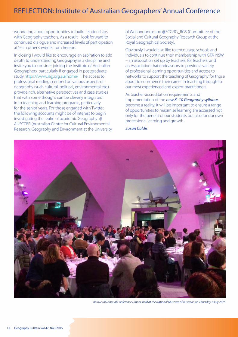
Below: IAG Annual Conference Dinner, held at the National Museum of Australia on Thursday 2 July 2015
Geography Bulletin Vol 47, No 3 2015 13
REFLECTION: Institute of Australian Geographers’ Annual Conference
2015 marked the twenty-first year of the Australian Geography Competition which is a joint initiative of the Australian Geography Teachers’ Association and the Royal Geographical Society of Queensland.
The number of students entering the 2015 Australian Geography Competition in total was 78,473 from 770 schools. This was an increase of over 7500 students and 9 schools compared to 2014, and over 3800 students and 45 schools compared to 2013. New South Wales (NSW) recorded an increase in the number of students entering with 27,841 in 2015 and 25,892 in 2014; however, a decline from the 2013 total of 29,323. There was a similar trend in school numbers: 281 in 2015, 275 in 2014, and 286 in 2013. Between 2014 and 2015, the Australian Capital Territory (ACT) experienced a decline in both student and school numbers between 2014 (2,682 students and 19 schools) and 2015 (2,497 students and 16 schools), yet 2015 student numbers increased compared to 2013 (2,166 students and 16 schools):
Congratulations to the NSW and ACT students who came first in their age divisions or achieved outstanding results, and to the school winners:
NSW Junior Jarvis Pitcher, Normanhurst Boys’ High School
(first in Australia) Emily Zhang, James Ruse Agricultural High School
Oliver Yau, James Ruse Agricultural High School
Edwin Xu, James Ruse Agricultural High School
Tom Liu, Sydney Boys High School
(students who achieved outstanding results)
NSW Intermediate Rowan Lembit, Fort Street High School
Tom Masters, Penrith Academic Selective High School
Thulashigan Sreeharan, Penrith Academic Selective High School (equal first in NSW)
Amelia Rawson, Kinross Wolaroi School
Matthew Blyth, Merewether High School
Aiden Ball, Merewether High School
Sebastian, Hodge, Newington College
Jovi Leung, Baulkham Hills High School
Jenson Xie, James Ruse Agricultural High School
(students who achieved outstanding results)
2015 Australian Geography CompetitionReport to the Geography Teachers’ Association of New South Wales
NSW Senior Andreas Orsmond, Sydney Grammar School (first in
Australia) Robbie Arnold, Sydney Grammar School
James Kalas, Sydney Grammar School
Matthew Brener, Sydney Grammar School
Natalie Maynard, Coffs Harbour Senior College
Nicholas Jarvis, Coffs Harbour Senior College
Jack Day, Albury High School
(students who achieved outstanding results)
NSW School Sydney Grammar School (Australia first)
ACT Junior Tristan Miller, Lyneham High School
Spencer Collaviti, Marist College Canberra
(equal first in ACT and combined Territories)
ACT Intermediate Michael Nguyen-Kim, Canberra Grammar School
(first in ACT and combined Territories)
ACT Senior Deepan Kumar, Canberra Grammar School
(first in ACT and combined Territories)
ACT School Canberra Grammar School
(first in ACT and combined Territories, and second in Australia)
A number of NSW and ACT schools ranked in the top 10 schools in Australia.
Rank School1 Sydney Grammar School, NSW
2 Canberra Grammar School, ACT
= 3 St Joseph’s College, Hunter’s Hill, NSW
= 3 Shore School, NSW
5 Merewether High School, NSW
6 Sydney Boys High School, NSW
7 James Ruse Agricultural High School, NSW
=9 Kinross Wolaroi School, NSW
=9 North Sydney Boys’ High School, NSW
=9 Northern Beaches Secondary College, NSW
14 Geography Bulletin Vol 47, No 3 2015
The Australian Geography Competition Committee worked to ensure that the 2015 Competition questions were guided by the Australian Curriculum: Geography. Attached to this report is the list of question numbers and relevant Curriculum Content Descriptors. This approach of matching questions to the Australian Curriculum: Geography will be used in the coming years while continuing the 2014 move to include more skills questions and fewer based on place-specific knowledge. The introduction of the Australian Curriculum: Geography based questions did impact on the average score with a decline in averages from 2014, yet an increase against 2013 averages (see following table).
Age level 2013 2014 2015Junior (out of 30) 12.5 15.7 13.7
Intermediate (out of 40)
17.6 22.7 19.5
Senior (out of 35) 14.8 18.9 16.6
2015 Australian Geography Competition
Geography’s Big Week Out
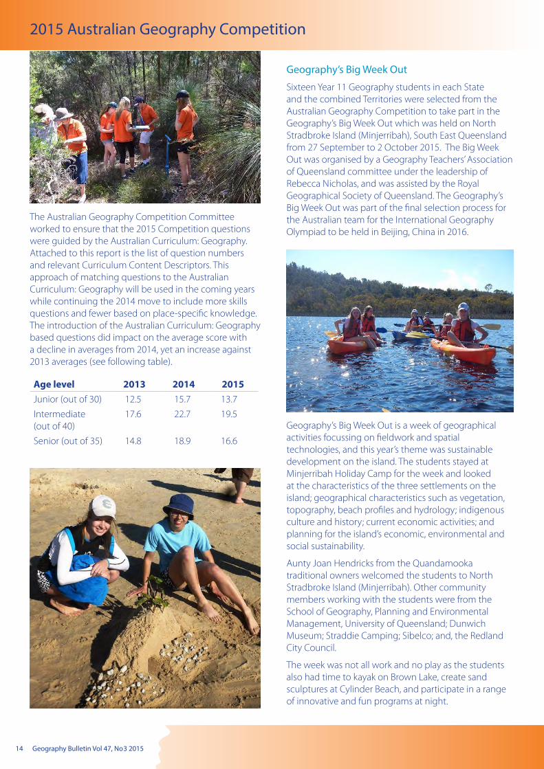
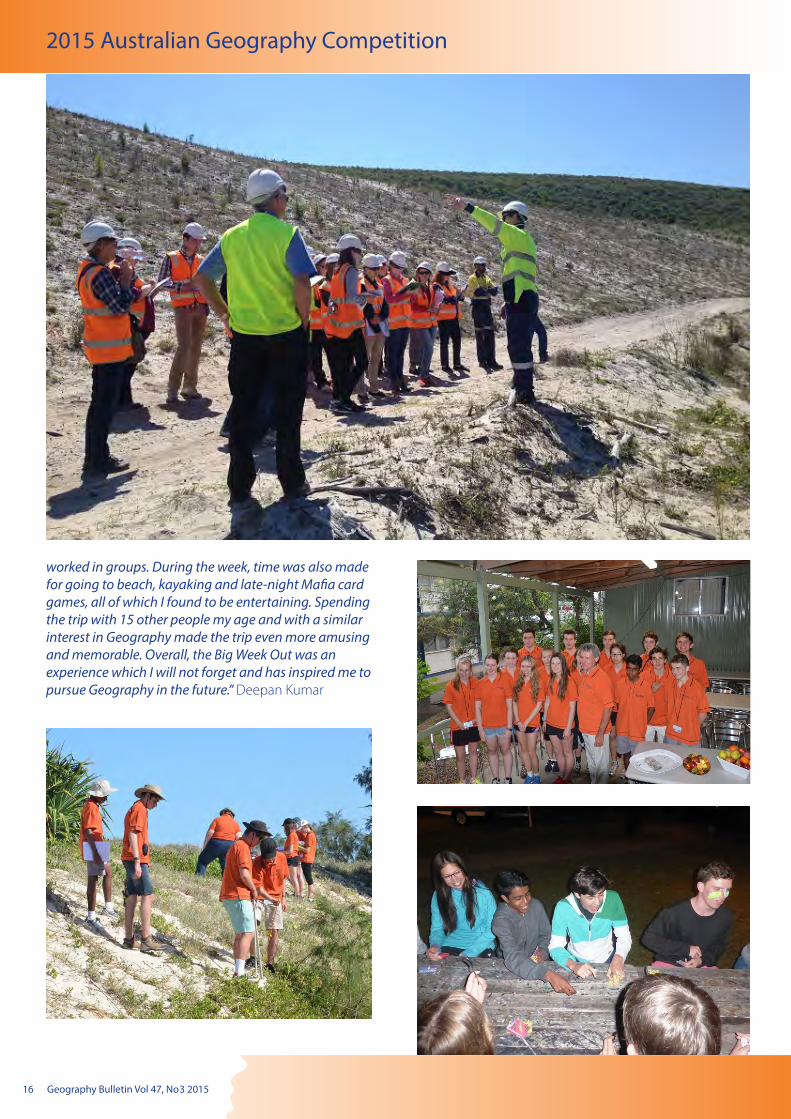
Sixteen Year 11 Geography students in each State and the combined Territories were selected from the Australian Geography Competition to take part in the Geography’s Big Week Out which was held on North Stradbroke Island (Minjerribah), South East Queensland from 27 September to 2 October 2015. The Big Week Out was organised by a Geography Teachers’ Association of Queensland committee under the leadership of Rebecca Nicholas, and was assisted by the Royal Geographical Society of Queensland. The Geography’s Big Week Out was part of the final selection process for the Australian team for the International Geography Olympiad to be held in Beijing, China in 2016.
Geography’s Big Week Out is a week of geographical activities focussing on fieldwork and spatial technologies, and this year’s theme was sustainable development on the island. The students stayed at Minjerribah Holiday Camp for the week and looked at the characteristics of the three settlements on the island; geographical characteristics such as vegetation, topography, beach profiles and hydrology; indigenous culture and history; current economic activities; and planning for the island’s economic, environmental and social sustainability.
Aunty Joan Hendricks from the Quandamooka traditional owners welcomed the students to North Stradbroke Island (Minjerribah). Other community members working with the students were from the School of Geography, Planning and Environmental Management, University of Queensland; Dunwich Museum; Straddie Camping; Sibelco; and, the Redland City Council.
The week was not all work and no play as the students also had time to kayak on Brown Lake, create sand sculptures at Cylinder Beach, and participate in a range of innovative and fun programs at night.

Geography Bulletin Vol 47, No 3 2015 15
2015 Australian Geography Competition
Representing NSW and ACT at the 2015 Big Week Out were:
NSW Andreas Orsmond, Sydney Grammar School
Georgia Worner, Loreto College - Kirribilli
Isabella Croker, Mt St Benedict College
Robert Arnold, Sydney Grammar School
ACT (and combined Territories)
Claire Yung, Lyneham High School
Deepan Kumar, Canberra Grammar School
NSW and ACT student’s comments on Geography’s Big Week Out:
“I knew before I arrived at Geography’s Big Week Out that if you put 16 kids of similar ages and interests in the same place for a week, it is bound to be a success. But I would never have expected how much fun I would have and how much I would learn during this fantastic week. It was a perfect balance of in-the-field investigation, classroom reflection and laidback fun, in which I was not only exposed to a whole new set of complex concepts to grapple with and reflect upon, but I got to meet some of the nicest and funniest kids imaginable. I couldn’t have asked for anything better.” Andreas Orsmond
“Geography’s Big Week Out was a great experience to work with other students from around Australia at North Stradbroke Island in Queensland. The week was filled with a variety of activities including guest speakers, beach profiling, working with spatial technologies as well as having fun swimming and kayaking at Brown Lake. The range of activities made the week very enjoyable and kept us all engaged throughout the trip. I enjoyed hearing the different perspectives on topical issues of North Stradbroke Island and also seeing the range of careers Geography leads to.” Georgie Worner
“I thoroughly enjoyed GBWO. I thought it was very well thought out and took us on a process to the final exam which I enjoyed because it was something different and more creative than the normal exam. The whole experience though was one of the best I possibly could have. A week with fellow geographers staying at one of the best places in Australia, doing work but mainly having a fun and relaxed time. Couldn’t really ask for more.” Robert Arnold
“Overall I thoroughly enjoyed the Geography Big Week Out experience. I found it really interesting to engage with other like-minded students studying the subject of Geography. I also found the activities very engaging and educational, and they helped me to learn a lot more about the subject of Geography.” Isabella Croker
“For me, Geography’s Big Week Out was an exciting opportunity to learn about a subject I enjoy. I learned a lot during the week, not only content on different aspects of geography but also the skills that geographers use in the real world. I felt it was a valuable experience, and I thoroughly enjoyed the activities and the atmosphere of being with students from around Australia.” Claire Yung
“The Big Week Out was an interesting, insightful and enjoyable experience overall. Throughout the week, we observed settlements, completed a transect, listened to guest speakers and took part in other various fieldwork exercises. I found all of these to be quite intriguing and challenging yet enjoyable at the same time as we
16 Geography Bulletin Vol 47, No 3 2015
2015 Australian Geography Competition
worked in groups. During the week, time was also made for going to beach, kayaking and late-night Mafia card games, all of which I found to be entertaining. Spending the trip with 15 other people my age and with a similar interest in Geography made the trip even more amusing and memorable. Overall, the Big Week Out was an experience which I will not forget and has inspired me to pursue Geography in the future.” Deepan Kumar

Geography Bulletin Vol 47, No 3 2015 17
12th International Geography Olympiad (iGeo)The 12th International Geography Olympiad (iGeo), held from 11 to 17 August, was hosted by Russia at the Computeria youth recreation and educational centre in Tver Oblast, 200 km NW from Moscow. The iGeo is an annual competition for the world’s best 16 to 19 year old Geography students selected through a national Geography competition. Based on their performances at the 2014 Geography’s Big Week Out (GBWO), the four students chosen to represent Australia in 2015 were:
Samantha Dixon, South Ballajura Community College, Perth W A
Canada Gavin, Kinross Wolaroi School, Orange NSW
Esrom Leaman, Pembroke School, Adelaide SA
Giselle Pickering, Wavell State High School, Brisbane Qld.
The Team Leaders were Milton Brown (Geography Teachers’ Association of New South Wales, and organiser of the 2013/14 GBWOs) and Marg McIvor (Australian Geography Competition Committee member). Although Kath Berg also accompanied the team, she was mainly involved with her duties as Co-Chair of the Olympiad Task Force.
“After spending more than 24 hours on planes and in transit, we finally arrived in Moscow... We were lucky enough to spend some time exploring Moscow before the Olympiad began, and we managed to navigate our way along the Metro lines to Red Square and the Kremlin, which provided a lot of great photo opportunities. On the next day, we travelled to Tver where we would be staying for the Olympiad and we settled into our accommodation. Meeting everyone as they arrived in groups on buses was very exciting, and talking about
2015 Australian Geography Competition
how differently each country learned Geography was interesting” Esrom
The iGeo programme included three tests: a written response test, a multimedia test and a substantial fieldwork exercise requiring observation, cartographic representation and geographical analysis. Students must be able to answer all test questions in the official language of the Olympiad which is English. This year, a record 41 countries participated and we are proud to announce that Esrom and Sam won silver medals and Giselle a bronze.
The programme also included poster presentations by teams, cultural exchanges, a handicraft fair and a song night. At the latter, the Australian Team decided to perform “Waltzing Matilda” As Canada commented:
“Our performance was an interesting arrangement of the song, leaving many members of the audience singing along with us for the rest of our time in Russia.”
The Competition organisers appreciate the support of New South Wales and Australian Capital Territory teachers in entering their students in the Competition and welcome any feedback teachers may have. Please do not hesitate to contact us if you have any queries.
Bernard FitzpatrickCoordinator, Australian Geography Competition ph 07 3368 2068,[email protected]
18 Geography Bulletin Vol 47, No 3 2015
EVENTS
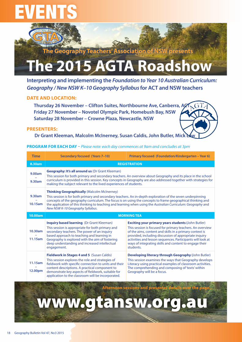
Interpreting and implementing the Foundation to Year 10 Australian Curriculum: Geography / New NSW K–10 Geography Syllabus for ACT and NSW teachers
The 2015 AGTA Roadshow
DATE AND LOCATION: Thursday 26 November – Clifton Suites, Northbourne Ave, Canberra, ACTFriday 27 November – Novotel Olympic Park, Homebush Bay, NSWSaturday 28 November – Crowne Plaza, Newcastle, NSW
PRESENTERS: Dr Grant Kleeman, Malcolm McInerney, Susan Caldis, John Butler, Mick Law
PROGRAM FOR EACH DAY – Please note: each day commences at 9am and concludes at 3pm
Time Secondary focused (Years 7–10) Primary focused (Foundation/Kindergarten – Year 6)
8.30am REGISTRATION
9.00am –
9.30am
Geography: It’s all around us (Dr Grant Kleeman)This session for both primary and secondary teachers. An overview about Geography and its place in the school curriculum is provided in this session. Key concepts in Geography are also addressed together with strategies for making the subject relevant to the lived experiences of students.
9.30am –
10.15am
Thinking Geographically (Malcolm McInerney)This session is for both primary and secondary teachers. An in-depth exploration of the seven underpinning concepts of the geography curriculum. The focus is on using the concepts to frame geographical thinking and the application of this thinking to teaching and learning when using the Australian Curriculum: Geography and New NSW K-10 Geography Syllabus.
10.00am MORNING TEA
10.30am –
11.15am
Inquiry based learning (Dr Grant Kleeman)This session is appropriate for both primary and secondary teachers. The power of an inquiry based approach to teaching and learning in Geography is explored with the aim of fostering deep understanding and increased intellectual engagement.
Exciting your primary years students (John Butler)This session is focused for primary teachers. An overview of the aims, content and skills in a primary context is provided, including discussion of appropriate inquiry activities and lesson sequences. Participants will look at ways of integrating skills and content to engage their students.
11.15am –
12.00pm
Fieldwork in Stages 4 and 5 (Susan Caldis)This session explores the role and strategies of fieldwork with specific connection to units and their content descriptions. A practical component to demonstrate key aspects of fieldwork, suitable for application to the classroom will be incorporated.
Developing literacy through Geography (John Butler)This session examines the ways that Geography develops Literacy using practical examples of classroom activities. The comprehending and composing of ‘texts’ within Geography will be a focus.
Afternoon sessions and presenter details over the page...
Geography Bulletin Vol 47, No 3 2015 19
Street cleaner, Mumbai. Source: Wikimedia Commons
Spatial patterns of human wellbeingDr Grant Kleeman
Macquarie University–Sydney
INDIA:
This article builds on an examination of India: A nation in transition published in the Geography Bulletin Vol. 47, No. 1 2015. In doing so, it examines the spatial and social patterns of wellbeing evident in India today. In a subsequent article we examine the factors that contribute to these spatial patterns.
There are great variations in the wellbeing experienced by people across India. These differences have both a spatial and social dimension. In other words, how Indians live depends, to a large extent, on where they live and their social circumstances.
A tale of ‘two India’s’Economic growth and development has been most rapid in India’s southern, western and northwestern states, while the core-north, central and eastern states have experienced deteriorating socioeconomic standards. This ‘tale of two countries’ is a legacy of India’s socioeconomic, political and cultural complexity.
Historically, some princely states were more prosperous than others, resulting in variations in socioeconomic development across the various regions of India. The south and the west of India have traditionally been much more affluent than the north and the east. Also, the various invasions experienced by the north (including those of the Greeks, Mongols and Muslims) held back the developmental prospects of the region for centuries. The north was also the part of the country that suffered the most exploitative aspects of British colonialism, a legacy that continues to be reflected in terms of regional socioeconomic polarization with the south and western regions achieving advances in human wellbeing while the north and east struggle to deliver improvements in people’s quality of life. The south largely avoided the disruptive impacts of invasion and colonialism has less poverty.
The economic and development policies pursued by the Indian Government post 1991 have tended to reinforce existing patterns of spatial inequality. This is because the economic growth, which resulted from the policy change, has been focused in particular regions. While western states such as Maharashtra and Gujurat and southern states including Andhara Pradesh and Kerala are making progress in reducing poverty and raising living standards, India’s northern states, especially Uttar Pradesh and eastern ones including Bihar and Odisha (formally Orissa), remain among the country’s poorest states.
Andhara Pradesh is an example of a state that has benefited from the shift in economic policy. It is one India’s most developed states, with a booming IT industry based in its capital city, Hyderabad. There has also been an effort to
develop the state’s rural areas. As a result, it has been able to lower its poverty rate to 9 per cent, well below the India-wide average of 22 per cent. By way of contrast, Odisha, a state in which corruption is widespread, the poverty rate is 33 per cent. This can, at least in part, can be explained by the entrenched culture of feudalism found in rural areas.
While India has experienced relatively high rates of economic growth over the past decade or so, many minorities (and regions) appear to have been marginalised by the policies. For example, India’s focus on the promotion of corporate services such as telephony and ICT rather than on developing the country’s manufacturing base has resulted in large segments of the Indian population being excluded from the development process. In opening its markets to global competition, India’s small-scale self-employed population (a large percentage of which are Muslims) has been especially

20 Geography Bulletin Vol 47, No 3 2015
INDIA: Spatial patterns of human wellbeing
disadvantaged. As a result, one-third of the 200 million Muslims living in India continue to live below the poverty line. More generally, the top five percent of Indian households hold 38 per cent of total assets while the bottom 60 per cent own just 13 per cent.
Also, India’s caste system still casts a shadow over the lives of many Indians, especially those of the Dalit caste (the untouchable). Dalits are at the bottom of the Hindu caste system and despite laws to protect them they still face widespread discrimination in India. While India’s constitution bans the practice of untouchability – in which members of India’s higher castes will not touch anything that has come in physical contact with the Dalits, the lowest caste – the practice is still widespread. Examples of discrimination include the local barber refusing to cut the hair of a dalit man, a group of children being forced to eat lunch separately from their classmates, and a women who is required to walk for hours to fetch water because she are not allowed to use the public tap in their village. Very few manage to break out of the cycle of poverty and caste that they are born into. Untouchability helps to lock Dalits, who traditionally do the dirtiest manual jobs, in their occupations.
Caste still shapes the way the India is run. The Indian government and bureaucracy are dominated by the upper castes and it helps to explain why 15 per cent of the population is kept on the very margins of society by the circumstances of their birth.
Spatial patternsThe map below shows the GDP per capita for each of India’s states. Goa, on the west coast, has the highest GDP per capita. Bihar in the northeast has the lowest. Generally, states in the north and northeast are the most disadvantaged on these measures. The next map show that states such as Maharashtra, Utter Pradesh, Andhra Pradesh and Tamil Nadu dominate India’s economy in terms of their share of total GDP. The subsequent map shows the percentage of each state’s population living below the poverty line. Chhattisgarth is
the worst state on this measure with nearly 40 per cent of its population below the poverty line. There are also maps showing the pattern of life expectancy, the pattern of fertility and the pattern of female literacy.
GDP per capita, Indian states, 2011–2012
Source: http://www.geocurrents.info/place/southeast-asia/new-maps-of-india-and-of-the-indian-economy
Roadside repairs, Agra. Source: Wikimedia Commons
Adivasi couple, Chlattisgarth. Source: Wikimedia Commons
Geography Bulletin Vol 47, No 3 2015 21
INDIA: Spatial patterns of human wellbeing
Share of India’s GDP by state, 2009–2010
India: Percentage of the population below the poverty line, 2012.
Head of Shiva, Little Vagator Beach, Goa. Source: Wikimedia Commons
Women and children, Andhra Pradesh. Source: Wikimedia Commons
Husking rice, Tamil Nadu. Source: Wikimedia CommonsSource: Pearson Education Australia
India: Life expectancy at birth, 2012
Source: Pearson Education Australia
Source: Pearson Education Australia
22 Geography Bulletin Vol 47, No 3 2015
INDIA: Spatial patterns of human wellbeing
India: Total fertility rate, 2012
Source: Pearson Education Australia
India: Female literacy rate
Source: Pearson Education Australia
There are, as the maps illustrate, very significant spatial variations in the level human wellbeing experienced by people in India. Some states have been better positioned to enhance the standard of living of their people than others.
Elderly street vendor, Mumbai. Source: Wikimedia Commons
Young girl, Tamil Nadu. Source: Wikimedia Commons
Geography Bulletin Vol 47, No 3 2015 23
Biophysical Interactions snoitcaretnI lacisyhpoiB
Trialling a flipped approach to teaching, learning and assessment in the Geography classroom.
Susan Caldis, GTA NSW President
As educators we frequently encounter requests to design teaching and learning programs that will incorporate an effective use of technology and enable the development of a range of 21st Century skills such as collaboration, communication, critical thinking, creative thinking and citizenship (often referred to as the 5C’s). These requests come from a variety of sources such as policies, research, leaders, students and also as a result of personal reflection.
In recent years, literature emerging from the United States of America, initially from Bergmann and Sams (2012) in particular, has been encouraging teachers, internationally, to move towards a flipped approach in the development of their teaching and learning programs.
The purpose of this article is not to explore the arguments for and against flipped learning but to firstly express a basic outline of what a flipped learning approach is, and secondly to share my interpretation and adaptation of this in to my delivery of Biophysical Interactions.
Flipped Learning is probably best described as class time being utilised as ‘a workshop of learning’ (Boyer, 2013, p28). Typically, videos or information about the key theory, concepts or skills associated with a unit of work are investigated at home so that during class time the teacher is available to work with their students, provide advice, check progress and pick-up errors. The ability to increase time interacting with students was also something that significantly appealed to Gaughan (2014) as she explored arguments for and against moving towards a flipped approach to teaching and learning. Although Ng (2014) profiled flipped teaching and learning specifically in the Science classroom, there were many points raised that would be of equal merit in a Geography classroom such as self-directed learning, self-paced learning, increased contact time between teacher and student and the opportunity to develop better peer relationships through collaborative effort. Both Boyer (2013) and Ng (2014) suggested that ‘flipping’ leads to more effective use of digital
technologies by teachers and students as well as the opportunity to engage with more complex problem-solving activities. According to the literature, authors had used platforms such as BlackBoard, EdModo or Moodle and apps such as Camtasia to create the videos (or used already available clips from YouTube). The main idea put forward about flipped learning is that the learning environment becomes more interactive (student-student and student-teacher) and teachers become a facilitator of learning so students can apply key concepts in a thoughtful and creative way. However, as with any pedagogical approach, the skill of the teacher and their ability to design work that best caters for the needs of their students is crucial (DeSantis, Van Curen & Putsch, 2015).
As an advocate for a constructivist inquiry-based approach to teaching and learning in Geography, I embarked upon changing my teaching, learning and assessment program for Biophysical Interactions using a combination of key messages from the literature together with a new school direction in to the domain of BYOD, support from my colleagues, and clear requests from student surveys. A flipped classroom approach was in the making and even though I didn’t video myself delivering a lecture, I endeavoured to encapsulate the concept of flipped learning. I also worked towards a specific ‘flipped’ stage rather than having all lessons being flipped. As always, there is plenty of room for refinement but everyone has to start somewhere…
Typically this unit of work culminates in the detailed, summative assessment event of the Half-Yearly exam and this year was to be no different. However, to lend purpose to flipping the classroom and facilitate student success in the assessment (whilst I and they grappled with trialling a flipped classroom approach) I framed the tasks around progressing towards an already available extended response question i.e. this question would appear in the Half-Yearly exam and students had to work both collaboratively and individually to construct the response.
24 Geography Bulletin Vol 47, No 3 2015
Biophysical Interactions – snoitcaretnI lacisyhpoiB
Vital Statistics
Online Platform EdModo
Unit Biophysical Interactions
Case studies Iceland (secondary research)
Kurnell Peninsula (primary research via fieldwork)
Overarching questionIs the biophysical environment of Iceland significantly affected by its spatial and ecological dimensions compared to the biophysical environment of Kurnell peninsula?
Duration of unit Term 1
Assessment
Formative: through items such as EdModo comments; questions posed; engagement with task; number and quality of draft responses submitted
Summative: half-yearly extended response question
Motivation/Incentive
A mixed ability class of 24 students ranging from students with additional learning needs requiring in-class support from the Learning Support Team through to gifted and talented.
The school becoming Bring Your Own Device (BYOD) oriented and an opportunity to lead school-based professional learning in the use of technology to support the new BYOD policy.
Results from student surveys expressing the desire to use their device frequently and meaningfully; to have more groupwork opportunities; to learn about somewhere ‘really different’ to Australia.
First stage (approx. 1 week): Getting used to EdModo!After some explicit instruction about spatial and ecological dimensions and the 4 spheres (types, interactions, interdependencies) it was time for students to apply their knowledge and understanding. On EdModo they were invited to:
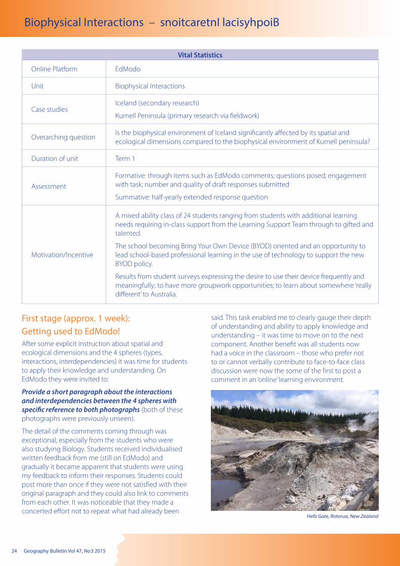
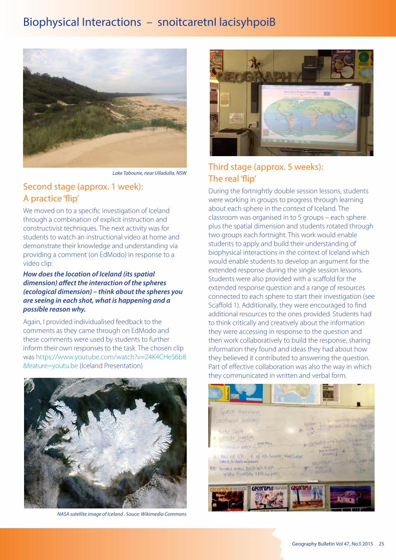
Provide a short paragraph about the interactions and interdependencies between the 4 spheres with specific reference to both photographs (both of these photographs were previously unseen).
The detail of the comments coming through was exceptional, especially from the students who were also studying Biology. Students received individualised written feedback from me (still on EdModo) and gradually it became apparent that students were using my feedback to inform their responses. Students could post more than once if they were not satisfied with their original paragraph and they could also link to comments from each other. It was noticeable that they made a concerted effort not to repeat what had already been
said. This task enabled me to clearly gauge their depth of understanding and ability to apply knowledge and understanding – it was time to move on to the next component. Another benefit was all students now had a voice in the classroom – those who prefer not to or cannot verbally contribute to face-to-face class discussion were now the some of the first to post a comment in an ‘online’ learning environment.
Hells Gate, Rotorua, New Zealand
Geography Bulletin Vol 47, No 3 2015 25
Biophysical Interactions – snoitcaretnI lacisyhpoiB
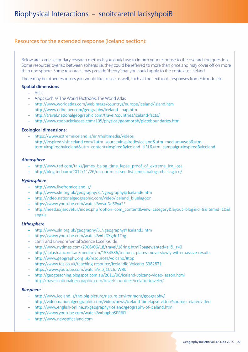
NASA satellite image of Iceland . Souce: Wikimedia Commons
Lake Tabourie, near Ulladulla, NSW
Second stage (approx. 1 week): A practice ‘flip’We moved on to a specific investigation of Iceland through a combination of explicit instruction and constructivist techniques. The next activity was for students to watch an instructional video at home and demonstrate their knowledge and understanding via providing a comment (on EdModo) in response to a video clip:
How does the location of Iceland (its spatial dimension) affect the interaction of the spheres (ecological dimension) – think about the spheres you are seeing in each shot, what is happening and a possible reason why.
Again, I provided individualised feedback to the comments as they came through on EdModo and these comments were used by students to further inform their own responses to the task. The chosen clip was https://www.youtube.com/watch?v=24K4CHeS6b8&feature=youtu.be (Iceland Presentation)
Third stage (approx. 5 weeks): The real ‘flip’During the fortnightly double session lessons, students were working in groups to progress through learning about each sphere in the context of Iceland. The classroom was organised in to 5 groups – each sphere plus the spatial dimension and students rotated through two groups each fortnight. This work would enable students to apply and build their understanding of biophysical interactions in the context of Iceland which would enable students to develop an argument for the extended response during the single session lessons. Students were also provided with a scaffold for the extended response question and a range of resources connected to each sphere to start their investigation (see Scaffold 1). Additionally, they were encouraged to find additional resources to the ones provided. Students had to think critically and creatively about the information they were accessing in response to the question and then work collaboratively to build the response, sharing information they found and ideas they had about how they believed it contributed to answering the question. Part of effective collaboration was also the way in which they communicated in written and verbal form.
26 Geography Bulletin Vol 47, No 3 2015
Biophysical Interactions – snoitcaretnI lacisyhpoiB
Scaffold 1 for the extended response:
Biophysical Interactions: Investigating the 4 spheres in the context of Iceland and Kurnell Peninsula
Overarching question: Is the biophysical environment of Iceland significantly affected by its spatial and ecological dimensions compared to the biophysical environment of the Kurnell peninsula?
Justified hypothesis:
Research methodologies: A combination of primary and secondary research methodologies will be used to investigate the overarching question and gather research findings in order to reach a conclusion.
Kurnell peninsula will be investigated via primary research methodologies (1 April) such as:
Iceland will be investigated via secondary research methodologies such:
In order to respond to the overarching question you will need to investigate spatial dimensions (location) and the ecological dimensions (interactions) occurring within and between the 4 spheres.
Maps, diagrams, images, representation of data and information, excerpts from newspaper articles etc., should be evident in your geographical research.
Presentation of research findings should be developed around the use of sub headings, dot points, paragraphs etc.
Spatial dimensions:
1. Use the Atlas, Google Earth, apps such as The World Factbook, World Atlas etc., to provide an appropriate overview of Iceland’s spatial dimensions (remember location can reveal a lot about interactions likely to occur)
Ecological dimensions:
2. Investigation of each sphere will need to occur in order to explain the biophysical environments (including species) that are occurring in Iceland
– Atmosphere (hint: climate, air quality)
– Hydrosphere (hint: water cycle, role of water)
– Lithosphere (hint: soil and rock type, erosion, weathering, mass movement)
– Biosphere (hint: flora and fauna)
Geography Bulletin Vol 47, No 3 2015 27
Biophysical Interactions – snoitcaretnI lacisyhpoiB
Resources for the extended response (Iceland section):
Below are some secondary research methods you could use to inform your response to the overarching question. Some resources overlap between spheres i.e. they could be referred to more than once and may cover off on more than one sphere. Some resources may provide ‘theory’ that you could apply to the context of Iceland.
There may be other resources you would like to use as well, such as the textbook, responses from Edmodo etc.
Spatial dimensions – Atlas – Apps such as The World Factbook, The World Atlas – http://www.worldatlas.com/webimage/countrys/europe/iceland/island.htm – http://www.edhelper.com/geography/Iceland_map.htm – http://travel.nationalgeographic.com/travel/countries/iceland-facts/ – http://www.roebuckclasses.com/105/physical/geomorph/plateboundaries.htm
Ecological dimensions: – https://www.extremeiceland.is/en/multimedia/videos – http://inspired.visiticeland.com/?utm_source=InspiredbyIceland&utm_medium=web&utm_term=InspiredbyIceland&utm_content=InspiredByIceland_URL&utm_campaign=InspiredByIceland
Atmosphere – http://www.ted.com/talks/james_balog_time_lapse_proof_of_extreme_ice_loss – http://blog.ted.com/2012/11/26/on-our-must-see-list-james-balogs-chasing-ice/
Hydrosphere – http://www.livefromiceland.is/ – http://www.sln.org.uk/geography/[email protected] – http://video.nationalgeographic.com/video/iceland_bluelagoon – https://www.youtube.com/watch?v=sa-DdSPya2E – http://need.is/jardvefur/index.php?option=com_content&view=category&layout=blog&id=8&Itemid=10&lang=is
Lithosphere – http://www.sln.org.uk/geography/[email protected] – https://www.youtube.com/watch?v=blDXgde1Tpg – Earth and Environmental Science Excel Guide – http://www.nytimes.com/2006/06/18/travel/18ring.html?pagewanted=all&_r=0 – http://splash.abc.net.au/media/-/m/1534586/tectonic-plates-move-slowly-with-massive-results – http://www.geography.org.uk/resources/volcano/#top – https://www.tes.co.uk/teaching-resource/Icelandic-Volcano-6382871 – https://www.youtube.com/watch?v=2j1UzJulWBk – http://geogteaching.blogspot.com.au/2011/06/iceland-volcano-video-lesson.html – http://travel.nationalgeographic.com/travel/countries/iceland-traveler/
Biosphere – http://www.iceland.is/the-big-picture/nature-environment/geography/ – http://video.nationalgeographic.com/video/news/iceland-timelapse-video?source=relatedvideo – http://www.english-online.at/geography/iceland/geography-of-iceland.htm – https://www.youtube.com/watch?v=boghpSPR6FI – http://www.newsoficeland.com

28 Geography Bulletin Vol 47, No 3 2015
Biophysical Interactions – snoitcaretnI lacisyhpoiB
Fourth stage: Fieldwork The fieldtrip to Kurnell Peninsula was organised to occur at the end of Term 1. In order to prepare students for their visit to this place and to start thinking about the differences between this environment and what they were learning about in Iceland, students were invited to complete the following task on EdModo:
a) explore Google Earth. Provide a description about its spatial dimension (where is it) and about how at least 2 spheres would be expected to interact (this description is like a prediction of what you would be expecting to see there on the fieldtrip based on what you can see from Google Earth).
b) explore http://hscgeography.hsieteachers.com/towra-point.html and complete the virtual fieldtrip. Provide a comment about the different ecosystems you can see in this area and the spheres to which they are mostly connected.
And then…The fieldtrip!
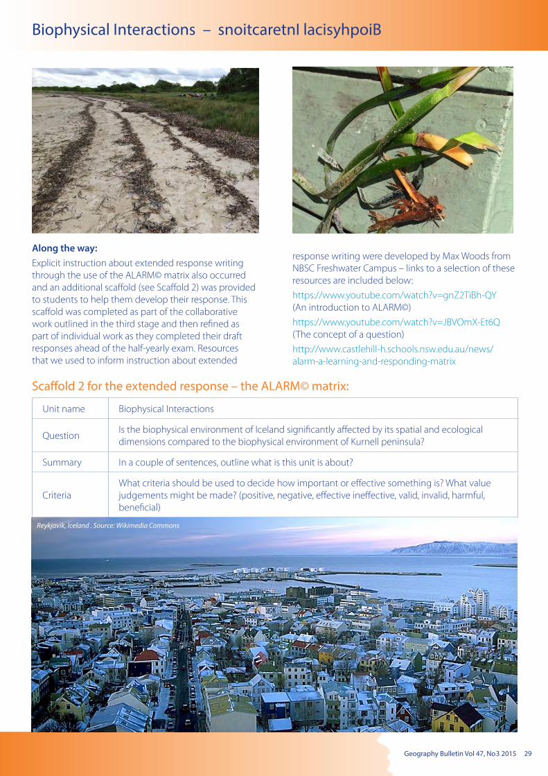
Geography Bulletin Vol 47, No 3 2015 29
Biophysical Interactions – snoitcaretnI lacisyhpoiB
Along the way:Explicit instruction about extended response writing through the use of the ALARM© matrix also occurred and an additional scaffold (see Scaffold 2) was provided to students to help them develop their response. This scaffold was completed as part of the collaborative work outlined in the third stage and then refined as part of individual work as they completed their draft responses ahead of the half-yearly exam. Resources that we used to inform instruction about extended
response writing were developed by Max Woods from NBSC Freshwater Campus – links to a selection of these resources are included below:
https://www.youtube.com/watch?v=gnZ2TiBh-QY (An introduction to ALARM©)
https://www.youtube.com/watch?v=JBVOmX-Et6Q (The concept of a question)
http://www.castlehill-h.schools.nsw.edu.au/news/alarm-a-learning-and-responding-matrix
Scaffold 2 for the extended response – the ALARM© matrix:
Unit name Biophysical Interactions
QuestionIs the biophysical environment of Iceland significantly affected by its spatial and ecological dimensions compared to the biophysical environment of Kurnell peninsula?
Summary In a couple of sentences, outline what is this unit is about?
CriteriaWhat criteria should be used to decide how important or effective something is? What value judgements might be made? (positive, negative, effective ineffective, valid, invalid, harmful, beneficial)
Reykjavik, Iceland . Source: Wikimedia Commons

30 Geography Bulletin Vol 47, No 3 2015
Biophysical Interactions – snoitcaretnI lacisyhpoiB
Name and define Describe Explain Analyse Critically analyse Evaluate
What is it? What are its features/properties?
What is its function/purpose/effect?
How does it work? What are its pro’s and con’s and why
How important is it and why
Provide a name and definition of each factor/criteria/component
What are the features of each factor/criteria/component
What does each factor/criteria/component address or what is their impact or effect?
How and why does each factor/criteria/component work or operate
What are the arguments for and against each factor/criteria/component and why
To what extent is each factor/criteria/component contributing to the overall process? Does it achieve purpose? Why
Panoramic view of Bjarnarflag Geothermal Station, Iceland. Source: Wikimedia Commons
Aerial view of Kurnell. Source: Wikimedia Commons
Key references: Boyer, A. (2013). The flipped classroom. Teacher
Learning Network p28–29
DeSantis, J., Van Curen, R. & Putsch, J. (2015). Do students learn more from a flip? An exploration of the efficacy of flipped and traditional lessons. Journal of Interactive Learning Research, 26(1), 39–63
Gaughan, J.E. (2014). The flipped classroom in World History. The History Teacher, 47(2), 221–246
Ng, W (2014). Flipping the science classroom: exploring the merits, issues and pedagogy. Teaching Science, 60(3), 16–27
Pearson and the Flipped Learning Network (2013) http://flippedlearning.org/cms/lib07/VA01923112/Centricity/Domain/46/FLIP_handout_FNL_Web.pdf
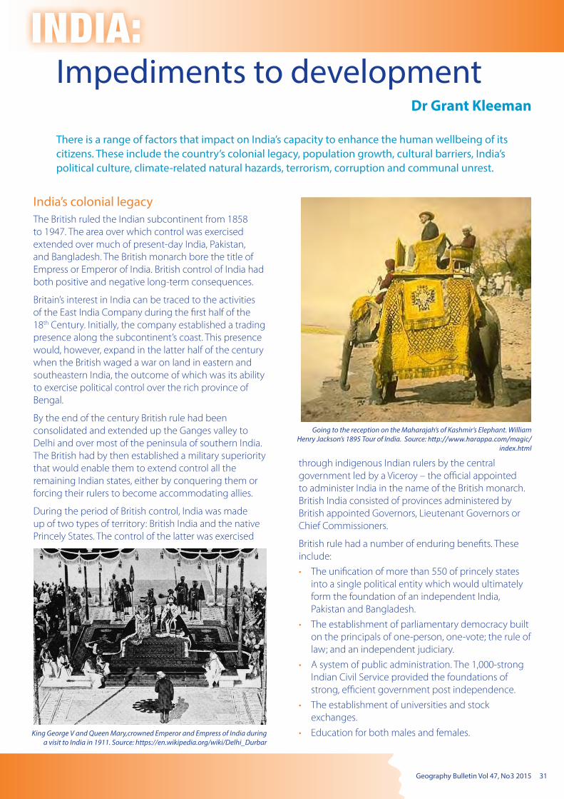
Geography Bulletin Vol 47, No 3 2015 31
Impediments to developmentDr Grant Kleeman
INDIA:
There is a range of factors that impact on India’s capacity to enhance the human wellbeing of its citizens. These include the country’s colonial legacy, population growth, cultural barriers, India’s political culture, climate-related natural hazards, terrorism, corruption and communal unrest.
India’s colonial legacyThe British ruled the Indian subcontinent from 1858 to 1947. The area over which control was exercised extended over much of present-day India, Pakistan, and Bangladesh. The British monarch bore the title of Empress or Emperor of India. British control of India had both positive and negative long-term consequences.
Britain’s interest in India can be traced to the activities of the East India Company during the first half of the 18th Century. Initially, the company established a trading presence along the subcontinent’s coast. This presence would, however, expand in the latter half of the century when the British waged a war on land in eastern and southeastern India, the outcome of which was its ability to exercise political control over the rich province of Bengal.
By the end of the century British rule had been consolidated and extended up the Ganges valley to Delhi and over most of the peninsula of southern India. The British had by then established a military superiority that would enable them to extend control all the remaining Indian states, either by conquering them or forcing their rulers to become accommodating allies.
During the period of British control, India was made up of two types of territory: British India and the native Princely States. The control of the latter was exercised
through indigenous Indian rulers by the central government led by a Viceroy – the official appointed to administer India in the name of the British monarch. British India consisted of provinces administered by British appointed Governors, Lieutenant Governors or Chief Commissioners.
British rule had a number of enduring benefits. These include:
• The unification of more than 550 of princely states into a single political entity which would ultimately form the foundation of an independent India, Pakistan and Bangladesh.
• The establishment of parliamentary democracy built on the principals of one-person, one-vote; the rule of law; and an independent judiciary.
• A system of public administration. The 1,000-strong Indian Civil Service provided the foundations of strong, efficient government post independence.
• The establishment of universities and stock exchanges.
• Education for both males and females.King George V and Queen Mary,crowned Emperor and Empress of India during a visit to India in 1911. Source: https://en.wikipedia.org/wiki/Delhi_Durbar
Going to the reception on the Maharajah’s of Kashmir’s Elephant. William Henry Jackson’s 1895 Tour of India. Source: http://www.harappa.com/magic/
index.html
32 Geography Bulletin Vol 47, No 3 2015
INDIA: Impediments to development
• The building of transport infrastructure, especially ports, dams, irrigation canals, roads, telephone and telegraph, and railways* brought unity to connected regions which would later help India modernise.
• The English language which provided a source of unity for the subcontinent.
• Banned the caste system and attempted to abolish a range of cultural practices including suttee (the custom of widow burning) and infanticide (the intentional killing of infants).
* India has one of the world’s largest railway networks comprising 115,000 km of track and 7,500 stations. In 2012, it transported over 25 million passengers daily (over 9 billion on an annual basis). The network employs 1.4 million people.
The costs of British rule included economic exploitation. Before the British occupied India the country was one of the richest countries in the world. When the British left in 1947, India was poor and industrially backward. The British had restricted the development of any industry that would compete with those back in England. India’s role was to supply the raw materials needed by Britain’s factories (for example cotton) and a market for its manufactured products (cloth). In other words Britain extracted large trade surpluses from India, and forced it to export commodities and become a dumping ground for British manufactured goods.
Many believe India’s bureaucracy – a legacy of British colonialism – has held back the Indian economy for more than four decades by curtailing the entrepreneurial spirit of many Indians through their insistence on time consuming bureaucratic processes (‘red-tape’). They are equally good at discouraging foreign investment from coming into the country.
The manner in which the British withdrew from India created political instability and initiated an arms race in the region. This instability detracts from efforts to enhance human wellbeing.
Partition of British IndiaIn 1947, the British Indian Empire was partitioned (or divided) into two sovereign states – India and Pakistan (which later split into the Islamic Republic of Pakistan and the People’s Republic of Bangladesh). This partition involved more than just the division of territory. It involved the division of the Empire’s assets including the British Indian Army, the Indian Civil Service and other administrative services, the railways and treasury. The haste in which the partition of India occurred resulted in the mass displacement of people and outbreaks of religious-based violence. As many as one million people died.
Once the new borders were established, about 14.5 million people crossed into what they hoped were the relative safety of a religious majority – Islam dominated Pakistan or Hindu dominated India.
The Partition of the British Indian Empire was a highly controversial arrangement, and remains a cause of much tension on the Indian subcontinent. It has certainly hindered efforts to enhance the human wellbeing of people within the region.
Crowded Indian train during the partition of India.
The partition of India led to one of the greatest mass movements of people in history.
Refreshment stall in station - Madras Railway William Henry Jackson’s 1895 Tour of India. Source: http://www.harappa.com/magic/index.html

Geography Bulletin Vol 47, No 3 2015 33
INDIA: Impediments to development
Population growthEnhancing the material wellbeing of a people is difficult when the population is growing rapidly. Unless the rate of economic growth exceeds the rate of population increase, GNI per capita will decline. In other words, while the ‘economic pie’ is getting bigger each person get a smaller slice because it is shared between more people. The key to tackling rapid population growth is to tackle the causes of poverty. As people’s standard of living improves, fertility rates decline.
In 2013, India’s population reached a massive 1.28 billion people. This makes the country the second most populous on earth. Only China, with 1.36 billion, has more people. By 2050 India’s population is projected to overtake that of China. Graphs below shows the decade-by-decade increase in India’s population. The decadal growth rate peaked at 24.80 per cent in 1970s and has since declined to 21.34 per cent. The next two graphs show the spatial variation in population growth in the decade 2001–2011 and the decline in fertility rates since 1960 when the average women gave birth six children. The birth rate is now 2.6. The final graph shows that the rate of decrease in fertility is far from uniform. Rates are still relatively high in India’s Hindi-speaking heartland but below replacement level in the south. The decline in fertility has been attributed to increased female education participation rates, urbanisation, and rising standards of living more generally.
Decadal growth in India’s population, 1901–2001
Spatial variations in population growth, 2001–2011 (Source: India Census 201
India’s fertility rate 1960 –2011
Woman and children fleeing camera, Bombay. William Henry Jackson’s 1895 Tour of India. Source: http://www.harappa.com/magic/index.html

34 Geography Bulletin Vol 47, No 3 2015
INDIA: Impediments to development
Population distribution and densityWhile India occupies just 2.4 percent of the earth’s surface it is home to 17.5 per cent of its people. The most densely settled parts of the country are the Ganges River Valley and the eastern and western coastal margins of the Deccan Plateau. A string of northern states, which lie just to the south of the Himalayas Mountain Range, are dominated by cold, arid deserts and fertile valleys. The physical limitations of the region limit population densities.
Fertility rates by state and territory, 2012
Population density
Green (2012) and Red (2050)India’s population structure, 2012 and 2050 (projected)
Population structure
Thirty-one per cent of India’s population is under the age of 15 years of age and more than 50 per cent is below 25. More than 65 per cent are below the age of 35. This means that India has a relatively young population (median age 26.7 years compared, for example, Australia’s median age of 39.9). This is important because future population growth is unavoidable, as this group will shortly enter the childrearing age group.
The figure below features two population pyramids – one showing India’s age and sex structure in 2012; the other the projected structure in 2050. The narrowing of the base of the pyramid reflects the declines in fertility over the last two decades.
Indian workers building railway. William Henry Jackson’s 1895 Tour of India. Source: http://www.harappa.com/magic/index.html
Geography Bulletin Vol 47, No 3 2015 35
INDIA: Impediments to development
Cultural barriersIndia is a culturally diverse nation. It is also an emerging economic powerhouse. Sadly, however, India still struggles to address the great disparities in human wellbeing found within the country. As in all societies, cultural factors can either enhance or obstruct efforts to improve people’s quality of life.
India’s diverse culture
India is a place where several cultures interact. The most significant of these are the Aryan, in the north, and the Dravidian people in the south. Add to this India’s religious diversity. The country is the birthplace of Hinduism, Buddhism, Jainism and Sikhism. Today, Hinduism and Buddhism are the world’s third and fourth-largest religions respectively, with over 2 billion followers and possibly as many as 2.5 or 2.6 billion followers. From time-to-time, ethnic or communal violence ignites, complicating efforts to promote a more socially just society.
India’s caste system
The caste system is a form of social stratification and control. Traditionally, it divided Indian communities into thousands of hereditary groups called Jāti. Each Jāti was identified with a traditional job function or tribe. The Jati featured four broad caste groupings with hundred of sub-castes. The principal groups were the Brahmin (priests, scholars and teachers), Kshatriyas (warriors, administrators and law enforcers), Vaishyas (farmers, cattle raisers and traders) and Shudras (service providers and servants). A fifth group, the Panchama, are the outcasts or untouchables (Dalits).
The caste system was a form of social control. The untouchables, for example, if they aspired to improve their situation in life, were penalized by again being born an untouchable in the next life. While now illegal elements of this social practice, and the discrimination that goes with it, still holds sway in some parts of India.
India’s untouchables
The Dalits (or untouchables) are the lowest social status group in the Hindu caste system. In fact, the Dalits are actually born below the caste system.
The untouchables were assigned, by birth, to spiritually contaminating work that nobody else wanted to do. They lived on the fringes of Indian society and were historically associated with occupations regarded as ritually impure, such as leather tanning, butchering, or removal of rubbish, animal carcasses and waste. Dalits worked as manual labourers cleaning streets, latrines, and sewers. According to Hindu beliefs, such jobs corrupted the workers’ souls, making them unfit to mingle with other kinds of people.
Humans were born an untouchable as a form of punishment for their conduct in a former life. If a person was born in to the (Dalit) untouchable caste, she or he could not ascend to a higher caste within that lifetime; untouchables had to marry fellow untouchables, and could not eat in the same room or drink from the same well as a caste member.
In the Hindu religion (with its belief in reincarnation) untouchables who followed the restrictions outlined above were rewarded with a promotion to a caste in their next life.
Woman carrying large sheets of corrugated roofing iron. William Henry Jackson’s 1895 Tour of India. Source: http://www.harappa.com/magic/index.html
A British Colonial residence. William Henry Jackson’s 1895 Tour of India. Source: http://www.harappa.com/magic/index.html
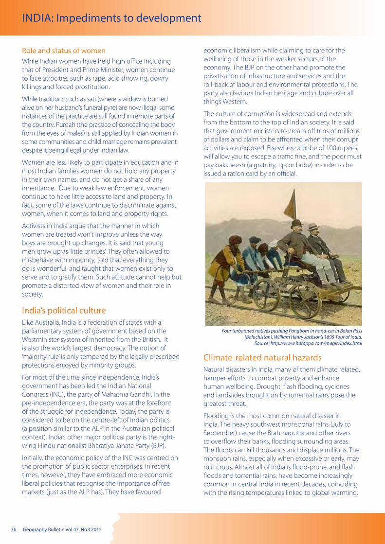
36 Geography Bulletin Vol 47, No 3 2015
INDIA: Impediments to development
Role and status of womenWhile Indian women have held high office including that of President and Prime Minister, women continue to face atrocities such as rape, acid throwing, dowry killings and forced prostitution.
While traditions such as sati (where a widow is burned alive on her husband’s funeral pyre) are now illegal some instances of the practice are still found in remote parts of the country. Purdah (the practice of concealing the body from the eyes of males) is still applied by Indian women in some communities and child marriage remains prevalent despite it being illegal under Indian law.
Women are less likely to participate in education and in most Indian families women do not hold any property in their own names, and do not get a share of any inheritance. Due to weak law enforcement, women continue to have little access to land and property. In fact, some of the laws continue to discriminate against women, when it comes to land and property rights.
Activists in India argue that the manner in which women are treated won’t improve unless the way boys are brought up changes. It is said that young men grow up as ‘little princes’. They often allowed to misbehave with impunity, told that everything they do is wonderful, and taught that women exist only to serve and to gratify them. Such attitude cannot help but promote a distorted view of women and their role in society.
India’s political cultureLike Australia, India is a federation of states with a parliamentary system of government based on the Westminister system of inherited from the British. It is also the world’s largest democracy. The notion of ‘majority rule’ is only tempered by the legally prescribed protections enjoyed by minority groups.
For most of the time since independence, India’s government has been led the Indian National Congress (INC), the party of Mahatma Gandhi. In the pre-independence era, the party was at the forefront of the struggle for independence. Today, the party is considered to be on the centre-left of Indian politics (a position similar to the ALP in the Australian political context). India’s other major political party is the right-wing Hindu nationalist Bharatiya Janata Party (BJP).
Initially, the economic policy of the INC was centred on the promotion of public sector enterprises. In recent times, however, they have embraced more economic liberal policies that recognise the importance of free markets (just as the ALP has). They have favoured
economic liberalism while claiming to care for the wellbeing of those in the weaker sectors of the economy. The BJP on the other hand promote the privatisation of infrastructure and services and the roll-back of labour and environmental protections. The party also favours Indian heritage and culture over all things Western.
The culture of corruption is widespread and extends from the bottom to the top of Indian society. It is said that government ministers to cream off tens of millions of dollars and claim to be affronted when their corrupt activities are exposed. Elsewhere a bribe of 100 rupees will allow you to escape a traffic fine, and the poor must pay baksheesh (a gratuity, tip, or bribe) in order to be issued a ration card by an official.
Climate-related natural hazardsNatural disasters in India, many of them climate related, hamper efforts to combat poverty and enhance human wellbeing. Drought, flash flooding, cyclones and landslides brought on by torrential rains pose the greatest threat.
Flooding is the most common natural disaster in India. The heavy southwest monsoonal rains (July to September) cause the Brahmaputra and other rivers to overflow their banks, flooding surrounding areas. The floods can kill thousands and displace millions. The monsoon rains, especially when excessive or early, may ruin crops. Almost all of India is flood-prone, and flash floods and torrential rains, have become increasingly common in central India in recent decades, coinciding with the rising temperatures linked to global warming.
Four turbanned natives pushing Pangborn in hand-car in Bolan Pass [Baluchistan]. William Henry Jackson’s 1895 Tour of India.
Source: http://www.harappa.com/magic/index.html
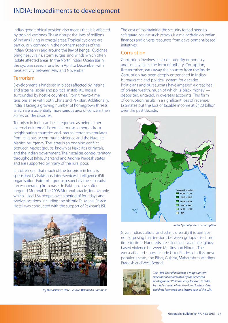
Geography Bulletin Vol 47, No 3 2015 37
INDIA: Impediments to development
India’s geographical position also means that it is affected by tropical cyclones. These disrupt the lives of millions of Indians living in coastal areas. Tropical cyclones are particularly common in the northern reaches of the Indian Ocean in and around the Bay of Bengal. Cyclones bring heavy rains, storm surges, and winds which often isolate affected areas. In the North Indian Ocean Basin, the cyclone season runs from April to December, with peak activity between May and November.
Terrorism Development is hindered in places affected by internal and external social and political instability. India is surrounded by hostile countries. From time-to-time, tensions arise with both China and Pakistan. Additionally, India is facing a growing number of homegrown threats, which are a potentially more serious area of concern then across border disputes.
Terrorism in India can be categorised as being either external or internal. External terrorism emerges from neighbouring countries and internal terrorism emulates from religious or communal violence and the Naxalite-Maoist insurgency. The latter is an ongoing conflict between Maoist groups, known as Naxalites or Naxals, and the Indian government. The Naxalites control territory throughout Bihar, Jharkand and Andhra Pradesh states and are supported by many of the rural poor.
It is often said that much of the terrorism in India is sponsored by Pakistan’s Inter-Services Intelligence (ISI) organisation. Extremist groups, especially the separatist forces operating from bases in Pakistan, have often targeted Mumbai. The 2008 Mumbai attacks, for example, which killed 164 people over a period of four days and twelve locations, including the historic Taj Mahal Palace Hotel, was conducted with the support of Pakistan’s ISI.
The cost of maintaining the security forced need to safeguard against such attacks is a major drain on Indian finances and diverts resources from development-based initiatives.
Corruption Corruption involves a lack of integrity or honesty and usually takes the form of bribery. Corruption, like terrorism, eats away the country from the inside. Corruption has been deeply entrenched in India’s bureaucratic and political system for decades. Politicians and bureaucrats have amassed a great deal of private wealth, much of which is ‘black money’ — deposited, untaxed, in overseas accounts. This form of corruption results in a significant loss of revenue. Estimates put the loss of taxable income at $420 billion over the past decade.
Communal unrest
India: Spatial pattern of corruption
Given India’s cultural and ethnic diversity it is perhaps not surprising that tensions between groups arise from time-to-time. Hundreds are killed each year in religious-based violence between Muslins and Hindus. The worst affected states include Utter Pradesh, India’s most populous state, and Bihar, Gujarat, Maharashtra, Madhya Pradesh and West Bengal.
Taj Mahal Palace Hotel. Source: Wikimedia Commons
The 1895 Tour of India was a magic lantern slide tour of Indiacreated by the American photographer William Henry Jackson. In India, he made a series of hand-colored lantern slides which he later took on a lecture tour of the USA.

38 Geography Bulletin Vol 47, No 3 2015
The Geography Teachers’ Association of New South Wales (GTA) is a not-for-profit, incorporated body that represents the professional interests of Geography teachers in NSW and Geographical Education more generally. The objectives of the Association are to promote the study and teaching of geography in schools by:
• providing professional learning opportunities for teachers of Geography;
• advocating the interests of Geography teachers on matters in the State and National interest;
• providing forums where teachers of Geography and the wider community can exchange views;
• supporting Geographical Education through the development and dissemination of geographical resources; and
• promoting geographical research and fieldwork.
The GTA seeks to address its objectives via a yearly program of activities and events, which include:
• online publication of the quarterly Geography Bulletin a quality, peer-reviewed journal designed to serve the contemporary interests of Geography teachers and students.
• delivering Teacher Professional Learning Workshops and in metropolitan and regional locations, focussing on current issues, including in Global Education, the use of technology in the classroom, research and fieldwork skills.
• conducting an Annual Conference with keynote addresses from leading geographers on contemporary and emerging geographical issues as well as more practical sessions by geographical practitioners.
• hosting School Certificate and Higher School Certificate Reviews for teachers of Geography. These reviews are held in a number of regional areas across the state.
For further information about GTA NSW activities and events go to: www.gtansw.org.au
Please select ONE of the following membership options and complete the details
Personal membership $90.00 Title – please tick: Dr Mr Mrs Ms Miss Other: .............................
Surame: ..................................................................................................... Given Name(s): ..............................................................................................Home address: .............................................................................................................................................................................. Postcode: ...................
Phone: ..................................................... (Mob) ....................................................... (Home) ........................................................ (Work)
Fax: ....................................................... Email: ..........................................................................................................................................................................
Corporate membership $180.00Title – please tick: Head of HSIE Head Teacher of Social Science Head Teacher of Geography
Co-ordinator of Geography Senior Geography Teacher Librarian
School: .............................................................................................................................................................................................................................................
School address: ............................................................................................................................................................................. Postcode: ...................
School phone: .............................................................................................. School fax: .................................................................................
Concessional membership $40.00 Retiree Part-time teacher Student (verification required)
Title – please tick: Dr Mr Mrs Ms Miss Other: .............................
Surame: ..................................................................................................... Given Name(s): ..............................................................................................Home address: .............................................................................................................................................................................. Postcode: ...................
Phone: ..................................................... (Mob) ....................................................... (Home) ......................................................... (Work)
Fax: ....................................................... Email: ..........................................................................................................................................................................School: .............................................................................................................................................................................................................................................
PAYMENT:Membership is for twelve months commencing in January. If payment is made later in the year all back copies of Geography Bulletin will be forwarded. A membership reminder will be sent in December.
Please make cheques payable to: Geography Teachers’ Association of NSW Inc OR
Charge $........................... to my credit card: Mastercard Visa
Card Number: ................... /.................... /.................... /...................... Expiry: ............... /.................
Name on card: ................................................................................................... Signature:...........................................................................................
Post this form and your payment to: GTA NSW, PO Box 577 Leichhardt, NSW 2040
MEMBERSHIP RENEWAL/APPLICATION FORM 2016 ABN 59 246 850 128 – This form will become a tax invoice when completed, GST included.
BENEFITS OF GTA NSW MEMBERSHIP
Geography Bulletin Vol 47, No 3 2015 39
1. Objective: The Geography Bulletin is the quarterly journal of the New South Wales Geography Teachers’ Association, Inc. The role of the Geography Bulletin is to disseminate up-to-date geographical information and to widen access to new geographic teaching ideas and methods. Articles of interest to teachers and students of geography in both secondary and tertiary institutions are invited, and contributions of factually correct, informed analyses, and case studies suitable for use in secondary schools are particularly welcomed.
2. Content: Articles, not normally exceeding 5000 words (no minimum specification), should be submitted to the GTA Office [email protected] or by mail to: . PO Box 577, Leichhardt, NSW, 2040 who will forward to the editor/s:
Submissions can also be sent directly to the editors: Lorraine Chaffer ([email protected]) or Dr Grant Kleeman ([email protected])
Articles are welcomed from tertiary and secondary teachers, students, business and government representatives. Articles may also be solicited from time to time. Articles submitted will be evaluated according to their ability to meet the objectives outlined above.
3. Format: Digital submission in Word format. Tables should be on separate pages, one per page, and figures should be clearly drawn, one per page, in black on opaque paper suitable for reproduction. Photographs should be in high resolution digital format. An indication should be given in the text of approximate location of tables, figures and photographs. Every illustration needs a caption. Photographs, tables and illustrations sourced from the internet must acknowledge the source and have a URL link to the original context.
4. Title: The title should be short, yet clear and descriptive. The author’s name should appear in full, together with a full title of position held and location of employment.
5. Covering Letter: As email with submitted articles. If the manuscript has been submitted to another journal, this should be stated clearly.
6. Photo of Contributor: Contributors may enclose a passport-type photograph and a brief biographical statement as part of their article.
7. References: References should follow the conventional author-date format: Abbott, B. K. (1980) The Historical and Geographical
Development of Muswellbrook Newcastle: Hunter Valley Press.
Harrison, T. L. (1973a) Railway to Jugiong Adelaide: The Rosebud Press. (2nd Ed.)
Harrison, T. L. (1973b) The Spatial Distribution of Macadamia Plantations on the Far North Coast of New South Wales, Journal of Rural and Agricultural Problems, 13, 4, Oct. pp. 347–359.
O’Donovan, M. J., et. al. (1980) “Animal life in the North Star District of New South Wales”. In W.W. Murphy, (Ed.) Readings in Regional Geography (Vol. 2), Sydney: Williams and Sons.
8. Spelling should follow the Macquarie Dictionary, and Australian place names should follow the Geographical Place Names Board for the appropriate state.
Editorial policy attempts to:
• promote material which will assist the study and teaching of geography
• encourage teachers to share their ideas on teaching geography
• provide a means by which teachers can publish articles
• inform readers of developments in geographical education
Articles are sought reflecting research and innovations in teaching practices in schools. From time to time issues of the Bulletin address specific themes.
Refereeing
All suitable manuscripts submitted to the Geography Bulletin are subject to the process of review. The authors and contributors alone are responsible for the opinions expressed in their articles and while reasonable checks are made to ensure the accuracy of all statements, neither the editor nor the Geography Teachers’ Association of New South Wales Inc accepts responsibility for statements or opinions expressed herein.
Books for review should be sent to:The GTA NSW CouncilPO Box 577Leichhardt NSW 2040
Editions
There are four bulletins each year – two published each semester.
Notice to Advertisers
‘Geography Bulletin’ welcomes advertisements concerning publications, resources, workshops, etc. relevant to geography education.
FULL PAGE (26 x 18cm) – $368.50 Special issues $649.00
HALF PAGE (18 x 13cm or 26 x 8.5cm) – $214.50 Special Issues $382.80
QUARTER PAGE (13 x 8.5cm or 18 x 6.5cm) – $132.00 Special issues $242.00
INSERTS (A4 supplied) – $374.00 All prices include GST
Advertising bookings should be directed to: GTA NSW OfficeTelephone: (02) 9716 0378Fax: (02) 9564 2342Email: [email protected]
ADVICE TO CONTRIBUTORS
40 Geography Bulletin Vol 47, No 3 2015
RESOURCE
Thinking Geographically
AGTA’S THINKING GEOGRAPHICALLY
DVD resource Updated 2015 edition
$99.00 site license
A ready-to-go professional development resource to
support teachers to become familiar with geographical thinking in the Australian Curriculum: Geography
Contents of the 2015 edition of the Thinking Geographically resource
Geographical thinking resources, exercises and articles
Over 150 Thinkpieces on geography (articles and resources on geographical education in schools)
Curriculum planning and assessment processes and templates
100’s of direct links to Internet sites to support geographical thinking and the teaching of
geography Links to Australian Curriculum: Geography trial
projects Presentations to support professional learning
on the Australian Curriculum: Geography
ATTENTION: GEOGRAPHY/SOSE COORDINATOR/CURRICULUM LEADERS
For further information on this resource or to opt out of future AGTA fax promotion email: [email protected]
PROFESSIONAL LEARNING FOR GEOGRAPHY
A comprehensive professional learning resource from the Australian Geography Teachers Association (AGTA) for the teaching of geography in your school
Purchase via the AGTA website at: www.agta.asn.au/Products
Confirm your order on-line either by:
Paying using your credit card (Visa or MasterCard) or your PayPal account.
or
by using a school authorised purchase order through the website ordering process.
A copy of the resource will be promptly dispatched to you following confirmation of payment.
The purchase of this resource comes with a full school site license for the product
AGTA ABN: 96 100 676 748