vision zero los angeles collision and...
TRANSCRIPT

1
VISION ZERO LOS ANGELES
COLLISION AND COUNTERMEASURE ANALYSIS: LITERATURE REVIEW
March 2016

2
ACKNOWLEDGEMENTS
Los Angeles Department of TransportationSeleta Reynolds, General ManagerNat GaleTim FremauxValerie WatsonJacqui SwartzTim Black
Fehr & Peers Technical ConsultantsDana WeissmanMeghan MitmanFatemeh RanaiefarChelsea RicherJeremy Klop
Los Angeles County Department of Public HealthJean AmbrusterChandini SinghKim Porter
New York City Department of TransportationJuan MartinezRob Viola
Seattle Department of TransportationJim CurtinAllison Schwartz
Chicago Department of TransportationDavid PulsipherAmanda WoodallEric Hanss
Florida Department of TransportationTrenda McPhersonJoseph Santos

3
04
07
18
22
23
26
09
13
EXECUTIVE SUMMARYCollision Data AnalysisSafety CountermeasuresKey PartnersNext Steps
INTRODUCTION
COLLISION DATA ANALYSISLiterature ReviewPeer Agency Interviews
SAFETY COUNTERMEASURESLiterature ReviewPeer Agency Interviews
KEY PARTNERSLiterature ReviewPeer Agency Interviews
CONCLUSION
REFERENCES
APPENDIX: LIST OF SAFETY COUNTERMEASURES
CONTENTS

4
EXECUTIVE SUMMARYThis report documents findings from a literature review and peer agency interviews conducted to investigate current best practices in data-driven traffic collision analysis and collision reduction efforts for the Vision Zero Los Angeles Safety Study.
With assistance from Fehr & Peers Transportation Consultants, staff at the Los Angeles Department of Transportation (LADOT) reviewed relevant literature to determine the most robust collision analysis methodologies, the most effective engineering countermeasures, and the most productive public outreach strategies. Staff also interviewed four peer agencies in three cities and one state to better understand how collision analysis and reduction efforts are implemented in practice.
This report is organized into three sections: Collision Data Analysis; Safety Countermeasures; and Key Partners. Each section summarizes the relevant literature and expands on the insights from the peer agency interviews. The conclusion at the end of the report describes how the findings will inform the next steps for the Vision Zero Los Angeles Safety Study.
Key findings for each section are summarized in the following pages.
VISION ZERO LOS ANGELES LITERATURE REVIEWEXECUTIVE SUMMARY

5
The second major element of the Vision Zero Los Angeles Safety Study includes “countermeasure pairing,” the process of identifying the physical design and engineering countermeasures that would most effectively address each “collision profile,” a group of collisions with similar contributing factors.
The Federal Highway Administration is the leading source of peer-reviewed, robust research to understand the effects of safety countermeasures on collisions. Countermeasures are typically organized by mode but will often improve the safety for all modes of travel.
Rather than focus on reducing the incidence of all collisions, the City will prioritize its efforts on the types of collisions that are more likely to result in a severe or fatal injury.
Each interviewed agency uses data analyses differently to guide countermeasure pairing and infrastructure investment. Collision analyses, both univariate and multi-variate, are generally used to define programmatic interventions, such as policy changes in speed limits, the use of automated enforcement, roll-out of Leading Pedestrian Intervals (LPIs) or count-down timers, and installation of additional street-lighting.
Although peer cities conduct multi-variate collision analyses, many of their implementation decisions are driven by simpler statistical analyses and in-depth study of specific priority locations. Some of the collision analysis findings are very consistent across agencies and academic studies, and the City of Los Angeles anticipates the same or similar results:
Speed is a very common contributing factor for collisions resulting in severe and fatal injury
Most collisions occur on arterials
Left turns and right turns are extremely common factors across all collisions
Driving under the influence is a common contributing factor for collisions resulting in severe and fatal injury
Agencies take different approaches to designating high-priority locations, with some focusing more on corridors and others prioritizing intersections. To identify high-priority locations, agencies aggregate data in a variety of ways, typically based on some measure of crash rate per distance or user. The collision history at priority locations is then investigated further to help define which countermeasures are selected. The first outcome of the Vision Zero Los Angeles Safety Study will be a prioritized list of locations for safety projects.
Data assembly and analysis is challenging for every agency, but the process is considerably easier when data are collected and maintained in-house. The City of Los Angeles will continue to assemble and refresh data as a goal to make future analysis more efficient.
Collision Data Analysis Safety Countermeasures
VISION ZERO LOS ANGELES LITERATURE REVIEWEXECUTIVE SUMMARY

6
Public OutreachAll agencies conduct public outreach at various stages of the process. New York City, Seattle and Chicago hold public meetings to help shape the development of specific plans or projects.
New York City Department of Transportation (NYCDOT) incorporates some public input in its selection of priority locations. However, when soliciting input online, the highest levels of engagement came from areas that were overall more educated, wealthy, and active in civic processes and therefore not representative of the areas of the city with low levels of engagement but high incidence of serious and fatal collisions. Recognizing this disparity, NYCDOT relies primarily on the results of data analysis to determine high-priority locations. Public comment was found to be most helpful augmenting patterns and trends revealed in the data analysis.
Education & EnforcementAll four agencies conduct education/enforcement efforts in partnership with their police departments, which take the form of high-visibility public education coupled with enforcement.
The New York Police Department (NYPD) has been particularly effective reducing severe and fatal crash injuries by aligning enforcement efforts with the results of their data analysis. Recognizing that speeding and failure to yield were common collision factors among severe and fatal injuries, NYPD has launched a citywide campaign against these dangerous driving behaviors.
The City will continue to develop the database that includes all collisions in the most recently available ten-year period, as well as key environmental variables These data, currently available on the City’s GeoHub (geohub.lacity.org), will be continually updated as new information becomes available.
The purpose of the forthcoming Vision Zero Los Angeles Safety Study is twofold. First, the City will identify a list of prioritized locations along the High Injury Network (HIN) for the development of safety projects.
The second major element of the analysis includes “countermeasure pairing,” the process of identifying the physical design and engineering countermeasures that would most effectively address each “collision profile,” a group of collisions with similar contributing factors.
At the priority locations, the City will work with local communities to scope detailed projects using the identified collision profiles and appropriate countermeasures.
Key Partners Next Steps
VISION ZERO LOS ANGELES LITERATURE REVIEWEXECUTIVE SUMMARY

7
INTRODUCTIONOn August 24, 2015, Mayor Eric Garcetti launched Executive Directive 10, Vision Zero, with the goals of reducing citywide traffic deaths by 20 percent by 2017 and eliminating all traffic deaths by 2025. To meet these ambitious targets, the City has adopted a data-driven approach, focusing efforts where they are likely to have the most effect on reducing severe and fatal crash injuries.
This data-driven approach begins with a review of successful strategies. LADOT staff has reviewed the literature to determine the best collision analysis methodology for Los Angeles and summarized the effectiveness of various safety countermeasures.
In addition to the literature review, LADOT staff interviewed four peer agencies whose publications and plans related to Vision Zero are most relevant for Los Angeles’ approach to reducing severe and fatal injuries. Although Los Angeles is a relatively early adopter of Vision Zero, many other cities have been employing innovative safety strategies and have already seen impressive gains. The following page includes a short description of each agency’s Vision Zero effort.
The rest of this report is organized into three sections: Collision Data Analysis; Safety Countermeasures; and Key Partners. Each section summarizes the relevant literature and expands on the insights from the peer agency interviews. The conclusion at the end of the report describes how the findings will inform the next steps for the Vision Zero Los Angeles Safety Study.
VISION ZERO LOS ANGELES LITERATURE REVIEWINTRODUCTION
8
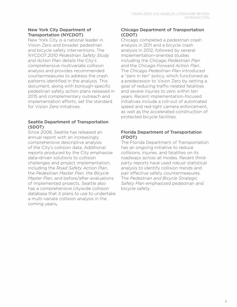
Chicago Department of Transportation (CDOT)Chicago completed a pedestrian crash analysis in 2011 and a bicycle crash analysis in 2012, followed by several implementation-oriented studies including the Chicago Pedestrian Plan and the Chicago Forward Action Plan. The Chicago Pedestrian Plan introduced a “zero in ten” policy, which functioned as a predecessor to Vision Zero by setting a goal of reducing traffic-related fatalities and severe injuries to zero within ten years. Recent implementation-focused initiatives include a roll-out of automated speed and red-light camera enforcement, as well as the accelerated construction of protected bicycle facilities.
Florida Department of Transportation (FDOT)The Florida Department of Transportation has an ongoing initiative to reduce collisions, injuries, and fatalities on its roadways across all modes. Recent third-party reports have used robust statistical analysis to identify collision trends and pair effective safety countermeasures. The Pedestrian and Bicycle Strategic Safety Plan emphasized pedestrian and bicycle safety.
New York City Department of Transportation (NYCDOT)New York City is a national leader in Vision Zero and broader pedestrian and bicycle safety interventions. The NYCDOT 2010 Pedestrian Safety Study and Action Plan details the City’s comprehensive multivariate collision analysis and provides recommended countermeasures to address the crash patterns identified in the analysis. This document, along with borough-specific pedestrian safety action plans released in 2015 and complementary outreach and implementation efforts, set the standard for Vision Zero initiatives.
Seattle Department of Transportation (SDOT)Since 2008, Seattle has released an annual report with an increasingly comprehensive descriptive analysis of the City’s collision data. Additional reports produced by the City emphasize data-driven solutions to collision challenges and project implementation, including the Road Safety Action Plan, the Pedestrian Master Plan, the Bicycle Master Plan, and before/after evaluations of implemented projects. Seattle also has a comprehensive citywide collision database that it plans to use to undertake a multi-variate collision analysis in the coming years.
VISION ZERO LOS ANGELES LITERATURE REVIEWINTRODUCTION

9
COLLISION DATA ANALYSISThe first major step of the Vision Zero Los Angeles Safety Study includes assembling a comprehensive collision database and conducting an analysis to better understand trends and patterns, a process that will culminate with a list of prioritized project locations. The literature review and peer agency interviews helped identify current best practices in collision data assembly and analysis.
The literature differentiates collision analysis into multiple types: collision risk, collision frequency, collision severity, and collision contributing factors. There is extensive research on the wide range of statistical analysis methodologies developed for each of these purposes, summarized in published reviews by Lord and Mannering (2010), Savolainen et al (2011), and Mannering and Bhat (2014). Additional research focuses on identifying the most appropriate statistical model to tackle specific collision questions related to collision risk and frequency, collision severity, contributing collision factors, or contributing roadway design factors for one or more modes (Kim et al., 1995, Poch and Mannering, 1996, Wang and Nihan, 2004, Schneider et al., 2010, Zhang et al., 2012, Aziz et al., 2013, Sasidharan and Menendez, 2014).
Despite this wide breadth of statistical methodologies in the literature, many of the implementation decisions of peer cities are driven by simpler statistical analyses and in-depth study of specific priority locations. The type of priority location is also different for each peer city. Some identify intersections, corridors, and areas, while others primarily look at corridors and include intersection treatments within those corridors. After choosing the type of high-priority location, agencies aggregate data in a variety of ways, typically based on some measure of crash rate or injury rate per distance or user.
The work of the collision analysis begins by collecting and assembling data. Interviews with peer cities revealed that this is challenging for every agency, but the process is considerably easier when data are collected and maintained in-house. In partnership with the Los Angeles County of Public Health, the City is currently developing a database that includes all collisions in the most recently available ten-year period, as well as key environmental variables, many of which are highlighted here in the literature review and summary of peer agency interviews.
VISION ZERO LOS ANGELES LITERATURE REVIEWCOLLISION DATA ANALYSIS

10
Peer Agency InterviewsThis section summarizes the collision data assembly and analysis processes described by the four peer agencies during their interviews. No single agency has established a process that would be entirely transferable to Los Angeles, but elements of their different approaches helped inform the methodology developed for Los Angeles. Conversations with the peer agencies shaped how the collision database variables are constructed, how the collision data are categorized and represented, and what parameters are used to guide the hierarchical clustering analysis.
New York City Department of Transportation (NYCDOT)New York City was one of the first U.S. cities to adopt a Vision Zero policy, and New York City Department of Transportation is at the forefront of collision analysis. In 2010, they released the New York City Pedestrian Safety Study & Action Plan and accompanying Technical Document. The report presents findings from a descriptive collision analysis and multi-variate collision analysis, which was employed to develop crash profiles based on collisions characteristics and features of the built environment where the collisions occurred. In this report, and in reports released thereafter, there is significant focus on the importance of the physical characteristics of the streets, which help guide the project development process for addressing the collisions at a particular intersection, corridor, or area.
In the interviews with NYCDOT, staff also emphasized the citywide socio-demographic factors that were found to be associated with higher pedestrian crash frequencies through the multi-variate analysis. For example, New York City neighborhoods with higher percentages of minority residents also have a higher likelihood of collisions resulting in someone being killed or severely injured while walking, even though minorities themselves are not overrepresented in those collisions citywide. Individuals with less education and those who are foreign born have a higher likelihood of being hit by a car while walking. Asian Americans over 65 years of age have almost twice the pedestrian fatality rate of non-Asian American seniors.
In 2015, NYCDOT released five borough-specific updates to the collision analysis and implementation process. These reports identify priority corridors, intersections, and areas for each borough based on the levels of serious and fatal injury collisions within a given borough (e.g., corridors in Manhattan are not compared to corridors in Staten Island). Priority locations were identified by ranking corridors by pedestrians killed or severely injured from collisions per mile and intersections by total number of pedestrians killed or severely injured from collisions. In the past, NYCDOT has experienced a lag in receiving collision data from the state, limiting the availability of up-to-date collision information. However, in 2016 the New York Police Department (NYPD) is moving to electronic data collection. The creation of data capture fields has been closely coordinated with NYCDOT to ensure that the important data for identifying collision trends is captured and easily transferred in real time for Vision Zero analysis. This will essentially eliminate the data lag, and NYCDOT highly recommends other Vision Zero cities pursue this with their police departments.
VISION ZERO LOS ANGELES LITERATURE REVIEWCOLLISION DATA ANALYSIS

11
Seattle Department of Transportation (SDOT)SDOT completed a pedestrian collision analysis in 2006 which compared 2006 collision data to a five-year average from 2001-2005. The City completed a pedestrian and bicycle collision analysis in 2007 which compared 2007 collision data to a five-year average from 2002-2006. Since these analyses, in compliance with a section of the municipal code requiring annual reporting on traffic collisions, SDOT has released annual Traffic Reports beginning in 2008, which summarize all traffic collision data for the previous year, organized by mode. These reports provide a descriptive analysis of current year trends compared to trends across previous years. The most recent analysis was released in 2014 and looks at 2013 data.
SDOT is also in the process of completing a multi-variate collision analysis using ten years of historic bicycle and pedestrian data. One initial finding from this analysis, which SDOT staff shared during the interview, is an unexpectedly high number of severe bicycle collisions occurring on steeply graded streets. The preceding action of the collision was often a vehicle making a left turn and failing to yield to an oncoming bicyclist. SDOT staff surmised that the drivers might be misjudging the bicyclists’ speed of travel as they ride downhill. Another finding from the SDOT analysis was that although most pedestrian collisions occur at intersections, mid-block pedestrian collisions are more severe.
SDOT currently identifies priority corridors based on a corridor-level crash rate of total crashes per million vehicles entering the corridor, using a screenline count for each corridor. Priority corridors are defined as 1.5 standard deviations above the City’s mean collision rate. Differing lengths of corridors complicates this process, and staff are working to develop an approach that takes corridor length into account.
SDOT differs from the other peer agencies interviewed in that they receive collision data directly from the Seattle Police Department and maintain collision records at the city level. They also maintain and update all built environment data in an in-house database, which significantly reduces the effort of assembling and cleaning data. This allows for regular updates to the analysis and for new analyses to be undertaken rapidly. The biggest challenge is the sheer quantity of data that needs to be sifted through for any given analysis.
Chicago Department of Transportation (CDOT)Two documents establish the foundation of Chicago Department of Transportation’s crash reduction efforts: a pedestrian collision study in 2011 and a bicycle collision study in 2012. The analyses are primarily descriptive and include some spatial components to identify corridor and intersection hotspots.
CDOT undertakes additional data analysis as part of its implementation process for specific programmatic efforts. For example, Chicago has a speed camera and red light camera program, which rely on data analysis to determine where the cameras will be installed.
VISION ZERO LOS ANGELES LITERATURE REVIEWCOLLISION DATA ANALYSIS

12
From the 2011 collision analysis and annual updates, CDOT prioritizes high-crash corridors based on the total number of pedestrian crashes per mile, with fatal and severe injury crashes receiving higher weight than other crash types.
CDOT encounters the same challenges in collision data delay experienced by New York City. Collision data come from the state, and they are made available up to two years after the calendar year concludes. Therefore, CDOT’s collision data analysis has been limited and currently does not include any multi-variate analysis. The department aims to pursue this in the future.
Florida Department of Transportation (FDOT)Florida Department of Transportation is the lead state agency for Pedestrian and Bicycle Safety. FDOT differs from the other three peer agencies in its geographic scale, conducting collision analyses at both the state and city level. Despite the differences of scale, however, we found that many of the lessons from FDOT mirror those from the other peer agencies.
FDOT’s data analysis efforts are driven by the overarching goal of reducing severe and fatal injury crashes for all modes by five percent per year from the preceding five-year average, starting with 2006-2010 as the baseline. FDOT collects, analyzes, and reports on data-driven trends both internally and externally. Data are contained within a web-based geographic information system (GIS) that allows internal users to pull reports for specific geographies based on specific data features, including collision types and environmental factors. FDOT generates regular reports for particular types of crashes, such as nighttime collisions, and for particular corridors where a crash problem has been identified.
In December 2013, FDOT published the Comprehensive Study to Reduce Pedestrian Crashes in Florida. This report examined pedestrian crash data from 2008-2010 (a total of 6,434 crashes) and identified collision patterns using two types of analysis: a mixed logit model and a Kernel density clustering analysis to identify collision hotspots throughout the state. The report also presented countermeasures that most effectively pair with specific types of collisions in certain roadway contexts.
Fifteen variables were included in the mixed logit model, capturing a variety of crash factors and environmental factors. Overall, the analysis found that while the majority of pedestrian crashes occurred in urban areas, fatal crashes were disproportionately high in rural areas, and the proportion of all crashes that were fatal decreased with urbanization.
In addition to the Comprehensive Study to Reduce Pedestrian Crashes in Florida, FDOT has released several other reports related to collision analysis. The 2013 Florida Pedestrian and Bicycle Strategic Safety Plan includes a preliminary crash analysis with descriptive statistics only and sets priority counties based on the highest number of pedestrian fatalities and injuries between 2007 and 2011.
VISION ZERO LOS ANGELES LITERATURE REVIEWCOLLISION DATA ANALYSIS

13
SAFETYCOUNTERMEASURESVision Zero literature stresses changing the overall strategy from reducing crash incidence to reducing injury severity and shifting the burden from the individual road users to the cities and their roadway design (Belin et al 1997, Tingval and Haworth 1999). Rather than focus on reducing the incidence of all collisions, the City will prioritize its efforts on the types of collisions that are more likely to result in a severe or fatal injury. Therefore, an intersection with fewer serious and fatal injuries, even if there are more total crashes, is an acceptable outcome of Vision Zero interventions.
To this end, the second major element of the Vision Zero Los Angeles Safety Study (after the project location prioritization) includes “countermeasure pairing,” the process of identifying the physical design and engineering countermeasures that would most effectively address each “collision profile,” a group of collisions with similar contributing factors. The Vision Zero Los Angeles initiative will use a hierarchical clustering to develop these LA-specific collision profiles, based on variables assembled in the data analysis process. This methodology, assessed in research by Depaire, Wets and Vanhoof (2008) and Anderson (2009), is similar to regression analysis in that it identifies how variables interact, but it is simpler to implement and more efficiently employed with large datasets.
Significant research has been conducted to better understand and quantify the safety effects of specific countermeasures (Schneider et al., 2010, Chen et al., 2011, Chen et al., 2014). Safety researchers consistently identify reducing speed as the primary countermeasure to collisions that result in severe or fatal injury, arguing that the road system was designed for a higher level of force than can be tolerated by human physiology without sustaining injury or death (Belin et al., 1997, Tingval and Haworth., 1999, Johansson, 2009).
Refer to the Appendix for a comprehensive list of safety countermeasures, along with summaries of effectiveness research.
VISION ZERO LOS ANGELES LITERATURE REVIEWSAFETY COUNTERMEASURES

14
Peer Agency InterviewsThis section summarizes the countermeasure pairing and project implementation processes described by the four peer agencies during their interviews. No single agency has established a process that would be entirely transferrable to Los Angeles, but elements of their different approaches will help inform the methodology developed for Los Angeles. Conversations with the peer agencies will shape which countermeasures are selected, how the countermeasures are applied, and what parameters are used to prioritize project locations.
New York Department of Transportation (NYCDOT) NYCDOT released a Vision Zero Action Plan in 2014 and a Vision Zero Year One progress report in 2015. The 2015 report discusses the actions NYCDOT took within the first year of Action Plan implementation. Additionally, NYCDOT recently released the five 2015 Borough Pedestrian Action Plans, which serve as the primary guiding documents for each borough to implement countermeasures. The Borough Plans summarize the pedestrian collision analysis; identify priority corridors, intersections, and areas; highlight the outreach undertaken within the borough (discussed more in the following section); and present engineering, education, and enforcement countermeasures.
The identified countermeasures are largely informed by the overall findings from the 2010 and 2015 collision analyses, which point to systemic safety challenges that must be addressed at the policy level with changes such as speed limits and redirected enforcement priorities. Specific location-countermeasure pairing occurs during the implementation process on a case by case basis, once the priority areas, corridors, and intersections undergo scoping for design change. This allows for engineering judgement, feasibility considerations, and the needs and desires of the community to be considered in project definition.
Overall, NYCDOT has aggressively targeted speeding via the use of automated enforcement, signal timing updates to align with a 25 mph speed limit, aggressive ticketing, and additional speed limit signs. The department has also installed leading pedestrian intervals and pedestrian street lighting on a programmatic scale.
Researchers have investigated the safety benefits of certain adopted countermeasures in New York City using before and after data and treatment/control groups. For example, Chen et al (2011) evaluated the effects of on-street bicycle lanes, finding that the installation of bicycle lanes did not lead to an increase in collisions in New York City. The study compared data from time periods before and after the installation of bicycle lanes on the streets where lanes were constructed and on streets where no new facilities were added. Chen et al (2014) found that intersections with Barnes’ Dance phases (all-way pedestrian crossings or “scrambles”) had fewer pedestrian-involved crashes than those without, but in some cases had more multiple vehicle crashes, controlling for built environment characteristics.
VISION ZERO LOS ANGELES LITERATURE REVIEWSAFETY COUNTERMEASURES

15
Seattle Department of Transportation (SDOT)Once SDOT identifies priority corridors, the agency pairs specific countermeasures during the implementation process on a case by case basis. This allows SDOT to factor in engineering judgement, feasibility considerations, and considerations of the needs and desires of the community. Overall, the department has taken an aggressive approach to reducing speed via road diets and lane narrowing.
Also guiding the implementation of countermeasures are several plans published between 2009 and 2015 that demonstrate additional efforts to reduce collisions in Seattle. In 2007, the city passed an ordinance adopting a Complete Streets policy. The subsequent 2009 Pedestrian Master Plan includes some safety-related goals, but it does not establish explicit targets for crash reduction. Similarly, countermeasures are included in a toolbox of strategies, but they are not specifically tied to locations where they would be most effective.
The 2012 Road Safety Action Plan identifies the goal of zero traffic-related fatalities and injuries by 2030 and organizes strategies to reach this goal into six focus areas. One of these focus areas includes engineering and roadway design; the other five center on behavioral issues such as driving while impaired or distracted. The 2014 Traffic Report includes an update on the Road Safety Action Plan, describing the “Be Super Safe” campaign to target the behaviors identified in the Road Safety Action Plan that contribute to collisions. This section of the 2014 Traffic Report analyzes the collision trends related to these behaviors.
Also in 2012, Seattle released the 2012 Action Agenda, a document that includes policies and actions relating to all modes of transportation, to be completed within a two-year timeframe. It includes performance measures related to five core principles, one of which is safety. Within the safety chapter, an interim goal of less than 10 fatalities by 2014 is established, working towards the previously established goal of zero fatalities by 2030. This Action Agenda was updated in 2013, which provides a check-in on the actions completed in 2012.
In 2014, SDOT released the Seattle Bicycle Master Plan, with an accompanying Bike Master Plan Implementation Plan 2015-2019, released in 2015. The 2014 Master Plan is an update from the previous 2007 Bike Master Plan and focuses on safety as well as providing more comfortable facilities to encourage more Seattle residents to ride a bicycle. The 2014 Master Plan identifies specific corridors that would help complete a network of bicycle facilities for Seattle. The 2015 Implementation Plan focuses on project funding, delivery, evaluation, and public engagement. It lays out a prioritization tool – with safety weighted highest – that each project would be scored against in order to establish which projects are built first. Most recently, SDOT published the Vision Zero Plan, which outlines the coordinated efforts to address the most severe crash corridors first. It describes a set of countermeasures that are included to some extent in the documents above, specifically framed around the way they improve safety for all road users. This document clearly articulates the role of the Seattle Police Department and demonstrates commitment to the Vision Zero goal from both agencies.
VISION ZERO LOS ANGELES LITERATURE REVIEWSAFETY COUNTERMEASURES

16
SDOT makes an effort to demonstrate the effects of countermeasures when they are implemented. The department releases a report after each major corridor project, identifying the crash trends before and after implementation, as well as operational information such as speed and volume. This method of evaluation is similar to the before-and-after method used in NYC.
Chicago Department of Transportation (CDOT)CDOT identifies high-crash corridors through its collision analysis, and it applies countermeasures on a case-by-case basis during specific project design and scoping. The agency considers intersections as part of high-crash corridors, looking to intersection-only countermeasures only when the intersection stands out as an anomaly with a significant number of fatal or severe pedestrian collisions. The department relies largely on countermeasures that change the cross-section of the street, such as road diets, paired with treatments at all the intersections along the corridor, such as signal modifications.
Programmatic countermeasures, such as the implementation of Leading Pedestrian Intervals (LPIs), countdown timers, and other signal modifications have their own prioritization models to direct funding when it becomes available.
Implementation of automated enforcement is also directed by a separate analysis and prioritization process. The Children’s Safety Zones program, established in 2012, was authorized by city ordinance to implement speed cameras specifically within ¼ mile of schools and parks. This program, along with a red-light camera program, relies on specific data analysis to determine where the cameras will be installed, which provides a defensible prioritization model for implementation.
For speed cameras, the analysis uses rolling three-year totals of different crash types, with youth and speed-related crashes weighted twice and locations that occur in Census tracts with high residential youth populations scored higher. These factors are added up to generate a safety zone score, and the highest scores are targeted first.
Several other guiding plans assist CDOT in its countermeasure implementation. CDOT released the Chicago Pedestrian Plan and the Streets for Cycling Plan 2020, which identify strategies for improving infrastructure and general conditions for pedestrians and bicyclists.
Chicago also released the 2012 Chicago Forward Action Agenda and updated this document in 2013. These documents address the goals and activities related to all modes within the department, including a focus on “safety first” and stated performance measures of eliminating all collision fatalities within ten years and reducing pedestrian and bicycle crash injuries by 50 percent each within five years.
The Complete Streets Chicago Design Guidelines, released in 2013, established a toolkit of engineering countermeasures designed to improve safety and convenience for all modes, with a “pedestrian-first modal hierarchy,” followed by transit riders, bicyclists, and automobiles.
VISION ZERO LOS ANGELES LITERATURE REVIEWSAFETY COUNTERMEASURES

17
Florida Department of Transportation (FDOT)FDOT implements engineering countermeasures both programmatically and on a project-by-project basis. FDOT also emphasizes education and enforcement countermeasures, which are discussed in the Public Outreach section of this report.
On a programmatic level, FDOT identified a number of focus treatments that it installs at high crash locations as funding becomes available. These engineering countermeasures include enhanced striping and signing, pedestrian scale lighting at signalized intersections, rumble strips (freeway roads) and rumble strips (non- freeway roads), paved shoulders, new signal heads to provide one signal head per lane, signal head back plates for better visibility, pedestrian countdown timers, Pedestrian Hybrid Beacons and Rapid Rectangular Flashing Beacons at currently-unsignalized locations.
On a project level, FDOT uses its collision data analysis to identify the top 20 collision sites within each of seven state districts. The agency then requests that each district investigate the conditions at these locations and identify the appropriate countermeasures based on local conditions.
FDOT is also focused on developing an estimate of pedestrian volumes on its roadways. This will allow them to prioritize future safety efforts where there is high pedestrian activity and the highest potential for collision prevention.
The Florida Pedestrian and Bicycle Strategic Safety Plan, released in 2013, sets a five year plan to dedicate resources and funding to the areas that have the greatest opportunity to reduce pedestrian and bicycle crashes. This report includes goals, objectives, and performance metrics related to implementation of a comprehensive pedestrian and bicycle collision reduction effort.
As an accompanying report, FDOT published the Pedestrian and Bicycle Safety Coalition Strategic Safety Plan Implementation in July 2015, which provides updates on the implementation of the plan, identifying the progress made and the people responsible for completing each strategy for each objective.
Less used by FDOT, but perhaps more relevant to the LADOT process, the 2013 Comprehensive Study to Reduce Pedestrian Crashes in Florida pairs countermeasures to common crash types. These countermeasures are summarized in the Literature Review section of the report.
VISION ZERO LOS ANGELES LITERATURE REVIEWSAFETY COUNTERMEASURES

18
KEY PARTNERSPublic OutreachAll agencies conduct public outreach at various stages of the process. New York City, Seattle and Chicago hold public meetings to help shape the development of specific plans or projects.
New York City Department of Transportation (NYCDOT) incorporates some public input in its selection of priority locations. However, when soliciting input online, the highest levels of engagement came from areas that were overall more educated, wealthy, and active in civic processes and therefore not representative of the areas of the city with low levels of engagement but high incidence of severe and fatal collisions. Recognizing this disparity, NYCDOT relies primarily on the results of data analysis to determine high-priority locations. Public comment was found to be most helpful augmenting patterns and trends revealed in the data analysis.
Education & EnforcementEducation and enforcement are important complements to the engineering efforts of a Vision Zero campaign. All four agencies conduct education/enforcement efforts in partnership with their police departments, which take the form of high-visibility public education coupled with enforcement. The New York Police Department (NYPD) has been particularly effective reducing severe and fatal crash injuries by aligning enforcement efforts with the results of the data analysis. Recognizing that speeding and failure to yield were common collision factors among severe and fatal injuries, NYPD has launched a citywide campaign against these dangerous driving behaviors.
VISION ZERO LOS ANGELES LITERATURE REVIEWKEY PARTNERS

19
Peer Agency InterviewsThis section summarizes the public outreach, education, and enforcement efforts of the four peer agencies. No single agency has established a process that would be entirely transferrable to Los Angeles, but elements of their different approaches will help shape the City’s strategy.
New York City Department of Transportation (NYCDOT)NYCDOT has solicited public input on its Vision Zero activities through a variety of means. Their interactive web-based Vision Zero Public Input Map allowed residents to identify pedestrian safety issues by location. The website was open for a three month comment period between May and July 2014, with resulting levels of engagement varying across the five boroughs, but generally very high. Similar to other traditional outreach methods, the highest levels of engagement came from areas that were overall more educated, wealthy, and active in civic processes.
Equity concerns about this type of disparate engagement in the public outreach process are, in large part, mediated by the use of a collision analysis to direct implementation. The areas that received fewer comments via the website were often priority areas identified through the data analysis. NYCDOT prioritized its investments based primarily on the collision data analysis rather than public website comments to ensure that countermeasures are implemented where crash problems are highest, regardless of anecdotal data.
In addition to the website, NYCDOT conducted public events such as town hall meetings and pedestrian safety workshops in each borough as part of the process of developing the Borough Pedestrian Action Plans. These conversations helped inform the types of countermeasures that would be appropriate and supported in particular neighborhoods.
NYCDOT also implements education and enforcement activities. In the Bronx Borough Pedestrian Action Plan, for example, education countermeasures include street team outreach along priority corridors, areas, or intersections, targeted child education within these areas, and paid placement messaging targeted towards nighttime drivers. Additionally, NYCDOT has developed a new “Street Ambassadors” unit, composed of 10 staff members who will do street level outreach, data collection, and education to assist in the project development. These activties used to occur on an ad-hoc, project specific basis, but are now institutionalized within the department’s regular project development activities.
Enforcement activities are carried out in partnership with the NYPD, and they are a crucial part of the Vision Zero initiative. NYPD has been particularly effective shifting its focus of enforcement from quality of life issues (i.e. “fix-it” tickets) to instead driving behavior that is directly tied to severe and fatal injuries. Leveraging the results of the data analysis, which concluded that speeding and failure to yield were common collision factors among severe and fatal injuries, NYPD has launched a citywide campaign against these dangerous driving behaviors.
VISION ZERO LOS ANGELES LITERATURE REVIEWKEY PARTNERS

20
Seattle Department of Transportation (SDOT)SDOT engages the public through outreach at various points in its planning efforts, largely during the design process rather than as part of the data analysis process.
For every project, SDOT conducts several rounds of public meetings. SDOT first goes to the community with a description of the safety issues (backed by data) and solicits feedback from the public on their experiences. SDOT then returns to the community with several design alternatives that aim to address the safety issues and the concerns raised in the first round of meetings. Based on feedback from the second round of meetings, SDOT develops final project plans and returns to the community with next steps.
SDOT engages diverse communities across Seattle by contracting with local community development organizations to reduce language and cultural barriers. In some cases, the department uses community liaisons to lead multilingual outreach efforts and holds simultaneous translation at public meetings. SDOT is working to develop relationships with community groups that will help reach a broader diversity of Seattle resident.
SDOT’s enforcement effort is carried out in partnership with SPD, and it is formatted similarly to other cities’ initiatives in that it focuses on public engagement and education first, followed by citation-based enforcement. High-visibility enforcement events are held where collisions occur and target the specific behaviors observed at those locations.
Chicago Department of Transportation (CDOT)CDOT has a robust public education and enforcement strategy. Education efforts include a Safe Routes to School program and a seasonal Bicycling Ambassadors program, which serves as a “street team” at public events and summer camps. CDOT also engages in public outreach around the development of its plans, primarily relying on town hall-style meetings geographically dispersed throughout the city.
CDOT does not incorporate outreach in its data analysis process. The identification of high-crash corridors and priority locations is based on data analysis rather than community input.
CDOT has been partnering with the Chicago Police Department (CPD) Traffic Enforcement unit since 2008 to conduct high-visibility enforcement efforts with a focus on drivers that fail to stop for pedestrians in the crosswalk. These efforts begin as public outreach and education, transitioning into citation-based enforcement in a subsequent phase of activity. CDOT and CPD determine education and enforcement locations based on pedestrian injury data combined with officer knowledege of the local area.
VISION ZERO LOS ANGELES LITERATURE REVIEWKEY PARTNERS

21
Florida Department of Transportation (FDOT)FDOT’s public outreach efforts center on education campaigns and enforcement initiatives. These serve both as countermeasures as well as opportunities to engage the public in a conversation about traffic safety and the state’s ongoing efforts to reduce injuries and fatalities.
Education campaigns initiated by FDOT include high visibility paid media on transit buses, bus shelters, billboards and TV/radio; community engagement teams at local events to distribute flyers about traffic safety and collateral materials like reflective armbands or bicycle spoke lights; and enhanced training with emergency responders to understand how to best handle pedestrian, bicycle, and vehicle collision injuries. Education materials are tailored for language and cultural differences depending on the community context. FDOT’s education efforts have an online presence and a social media presence that is often used to hear feedback from the public and respond.
In addition to data analysis, FDOT uses both observational surveys and public option surveys taken at outreach events to identify high-priority locations.
Enforcement efforts coordinated by FDOT include high visibility enforcement at the top ten corridors and top ten intersections within each county, in partnership with county law enforcement and city police departments. All enforcement events begin with a public outreach campaign coupled with additional officer training specific to pedestrian and bicyclist safety. Once the media campaign ends (campaigns are usually around 10 days), officers begin the education phase, the longest phase of the effort. Following the education phase, officers move to a warning phase, and then, when necessary, a citation phase (warranted where there is a continued pattern of serious offenses). FDOT emphasized the importance of inter-agency partnerships during the interview. In addition to the partnerships with the police departments and emergency responders necessary to execute the education and enforcement initiatives described above, FDOT has established partnerships with the state health department to bring in health and injury data that would otherwise be unavailable through the normal collision reporting process.
VISION ZERO LOS ANGELES LITERATURE REVIEWKEY PARTNERS

22
CONCLUSIONThe next step for the City’s Vision Zero effort is to move forward with the Vision Zero Los Angeles Safety Study, which will identify key trends and statistics related to injury outcomes and contributing factors for collisions Citywide.
The first outcome of this study will be a list of prioritized locations along the High Injury Network (HIN) for the development of safety projects. The second major element of the analysis includes “countermeasure pairing,” the process of identifying the physical design and engineering countermeasures that would most effectively address each “collision profile,” a group of collisions with similar contributing factors. At the priority locations, the City will partner with local communities to scope detailed projects using these identified collision profiles and appropriate countermeasures.
This work is already underway with the development of a database that includes all collisions in the most recently available ten-year period, as well as key environmental variables, many of which were highlighted in the literature review and peer agency interviews. These data, currently available on the City’s GeoHub (geohub.lacity.org), will be continually updated as new information becomes available.
VISION ZERO LOS ANGELES LITERATURE REVIEWCONCLUSION

23
REFERENCESAlluri, P., Haleem, K., Gan, A., Lavasani, M., and Saha, D. 2015. Comprehensive Study to Reduce Pedestrian Crashes in Florida. Florida Department of Transportation: December 2013, revised January 2015.
Anderson, Tessa K. 2008. Kernel density estimation and K-means clustering to profile road accident hotspots. Accident Analysis & Prevention. 41 (3): 359-364.
Aziz, H.M., Ukkusuri, S. and Hasan, S. 2013. Exploring the determinants of pedestrian-vehicle crash severity in New York City. Accident Analysis & Prevention. 50: 1298-1309.
Belin, M., Johansson, R., Lindberg, J., and Tingvall, C. 1997. The Vision Zero and its Consequences. Proceedings from the 4th International Conference on Safety and the Environment in the 21st Century. Tel Aviv, 23-27 November 1997. http://trid.trb.org/view.aspx?id=1164908
Center for Urban Transportation Research, University of South Florida. 2013. Florida Pedestrian and Bicycle Strategic Safety Plan. Florida Department of Transportation: February 2013.
Chen, L., Chen, C., Srinivasan, R., McKnight, C., Ewing, R., and Roe, M. 2012. Evaluating the Safety Effects of Bicycle Lanes in New York City. American Journal of Public Health. 102(6): 1120-1127.
Chen, L., Chen, C., and Ewing, R. 2014. The relative effectiveness of signal related pedestrian countermeasures at urban intersections – Lessons from a New York City case study. Transport Policy. 32: 69-78. http://www.sciencedirect.com/science/article/pii/S0967070X1400002X
Chicago Department of Transportation. 2011. Pedestrian Crash Analysis Technical Report.
Chicago Department of Transportation. 2012. Chicago Pedestrian Plan.
Chicago Department of Transportation. 2012. Chicago Forward Department of Transportation Action Agenda.
Chicago Department of Transportation. 2012. Chicago Bicycle Crash Analysis Summary Report and Recommendations.
Chicago Department of Transportation. 2012. Chicago Streets for Cycling Plan 2020.
Chicago Department of Transportation. 2012. Bicycle Facilities Guide – Streets for Cycling Plan 2020.
Chicago Department of Transportation. 2013. Chicago Forward Action Agenda 2013 Update.
Chicago Department of Transportation. 2013. Complete Streets Chicago – Department of Transportation, 2013 Edition.
Chicago Department of Transportation. 2013. Chicago Children’s Safety Zones Crash Data from 2009-2012.
Depaire, B., Wets., G., and Vanhoof., K. 2009. Traffic accident segmentation by means of latent class clustering. Accident Analysis & Prevention. 40 (4): 1257-1266. http://www.sciencedirect.com/science/article/pii/S0001457508000158
Federal Highway Administration. 2013. Toolbox of Countermeasures and Their Potential Effectiveness for Pedestrian Crashes. http://www.pedbikeinfo.org/collateral/PSAP%20Training/gettraining_references_pedToolboxofCountermeasures2013.pdf
VISION ZERO LOS ANGELES LITERATURE REVIEWREFERENCES

24
Federal Highway Administration. 2015. Separated Bike Lane Planning and Design Guide. https://www.fhwa.dot.gov/environment/bicycle_pedestrian/publications/separated_bikelane_pdg/separatedbikelane_pdg.pdf
Federal Highway Administration. Bicycle Safety Guide and Countermeasure Selection System. http://pedbikesafe.org/BIKESAFE/countermeasures.cfm
Federal Highway Administration. Crash Modification Factors Clearinghouse. http://www.cmfclearinghouse.org/
Florida Department of Transportation. 2015. PBSSP Implementation and Business Plan.
Johansson, R. 2009. Vision Zero – Implementing a policy for traffic safety. Safety Science. 47(6): 826-831. http://www.sciencedirect.com/science/article/pii/S0925753508001859
Kim, K., Nitz, L., Richardson, J., and Li, L. 1995. Personal and behavioral predictors of automobile crash and injury severity. Accident Analysis & Prevention. 27(4): 469-481. http://www.sciencedirect.com/science/article/pii/000145759500001G
Lord, D. and Mannering, F. 2010. The statistical analysis of crash-frequency data: A review and assessment of methodological alternatives. Transportation Research Part A: Policy and Practice. 44(5): 291-305. http://www.sciencedirect.com/science/article/pii/S0965856410000376
Mead, J., McGrane, A., Zegeer, C., and Thomas, L. 2014. Evaluation of Bicycle-Related Roadway Measures: A Summary of Available Research. Pedestrian and Bicycle Information Center. http://www.pedbikeinfo.org/cms/downloads/06%2013%202014%20BIKESAFE%20Lit%20Review_FINAL.pdf
Mead, J., Zegeer, C., and Bushell, M. 2014. Evaluation of Pedestrian-Related Roadway Measures: A Summary of Available Research. Pedestrian and Bicycle Information Center. http://www.pedbikeinfo.org/cms/downloads/PedestrianLitReview_April2014.pdf
Mannering, F. and Bhat, C. 2014. Analytic methods in accident research: Methodological frontier and future directions. Analytic Methods in Accident Research. 1: 1-22.
NACTO. 2015. Policy 2015: Creating Safe, Sustainable, Multi-Modal Urban Transportation. National Association of City Transportation Officials. http://nacto.org/wp-content/uploads/2015/10/NACTO-2015-Policy-Document.pdf
New York City Department of Transportation. 2014. Vision Zero Action Plan.
New York City Department of Transportation. 2015. Vision Zero One Year Report. April, 2015.Poch, M. and Mannering, F. 1996. Negative Binomial Analysis of Intersection-Accident Frequencies. Journal of Transportation Engineering. 122(3): 105-113. http://ascelibrary.org/doi/abs/10.1061/(ASCE)0733-947X(1996)122:2(105)
Riscica, V., Kay, A., and Viola, R. 2015. Getting to Zero: Lessons Learned from Pedestrian Safety Prioritization in NYC. Draft Paper submitted to TRB on 7/31/15.
Roe, M., Shin, H., Ukkusuri, S., Majka, K., et al. 2010. The New York City Pedestrian Safety Study & Action Plan: Technical Supplement. New York City Department of Transportation, August 2010.
Sasidharan, L. and Menendez, M. 2014. Partial proportional odds model – An alternate choice for analyzing pedestrian crash injury severities. Accident Analysis & Prevention. 72: 330-340.
Savolainen, P., Mannering, F., Lord, D., and Quddus, M. 2011. The statistical analysis of highway crash-injury severities: A review and assessment of methodological alternatives. Accident Analysis & Prevention. 43(5): 1666-1676. http://www.sciencedirect.com/science/article/pii/S0001457511000765
Seattle Department of Transportation. 2003-2008. Quarterly Reports.
VISION ZERO LOS ANGELES LITERATURE REVIEWREFERENCES

25
Seattle Department of Transportation. 2003-2011. Annual Reports.
Seattle Department of Transportation. 2006. Pedestrian Collision Report.
Seattle Department of Transportation. 2007. Pedestrian and Bicycle Collision Report.
Seattle Department of Transportation. 2008-2014. Seattle Traffic and Collision Reports.
Seattle Department of Transportation. 2009. Pedestrian Master Plan.
Seattle Department of Transportation. 2012. Road Safety Summit Action Plan.
Seattle Department of Transportation. 2012. Action Agenda: Laying the Groundwork.
Seattle Department of Transportation. 2013. Action Agenda: 2013 Progress Report.
Seattle Department of Transportation. 2014. Seattle Bicycle Master Plan.
Seattle Department of Transportation. 2015. Seattle Bicycle Master Plan: Implementation Plan 2015-2019.
Seattle Department of Transportation. 2015. Vision Zero: Seattle’s Plan to End Traffic Deaths and Serious Injuries by 2030.
Smart Growth America. 2014. Dangerous by Design 2014. Smart Growth America and the National Complete Streets Coalition. http://www.smartgrowthamerica.org/documents/dangerous-by-design-2014/dangerous-by-design-2014.pdf
Tingval, C. and Haworth, N. 1999. Vision Zero – An ethical approach to safety and mobility. ITE International Conference Road Safety & Traffic Enforcement: Beyond 2000. Melbourne, 6-7 September 1999. http://www.monash.edu.au/miri/research/reports/papers/visionzero.html
Viola, R., Roe, M., and Shin, H. 2010. The New York City Pedestrian Safety Study & Action Plan. New York City Department of Transportation, August 2010.
Viola, R, Hostetter, S, Riscica, V, Kay, A, and Peck, H. 2015. Bronx Pedestrian Safety Action Plan. New York City Department of Transportation, January 2015.
Viola, R, Hostetter, S, Riscica, V, Kay, A, and Peck, H. 2015. Brooklyn Pedestrian Safety Action Plan. New York City Department of Transportation, January 2015.
Viola, R, Hostetter, S, Riscica, V, Kay, A, and Peck, H. 2015. Queens Pedestrian Safety Action Plan. New York City Department of Transportation, January 2015.
Viola, R, Hostetter, S, Riscica, V, Kay, A, and Peck, H. 2015. Staten Island Pedestrian Safety Action Plan. New York City Department of Transportation, January 2015.
Viola, R, Hostetter, S, Riscica, V, Kay, A, and Peck, H. 2015. Manhattan Pedestrian Safety Action Plan. New York City Department of Transportation, January 2015.
Wang, Y. and Nihan, N. 2004. Estimating the risk of collisions between bicycles and motor vehicles at signalized intersections. Accident Analysis & Prevention. 36(3): 313-321. http://www.sciencedirect.com/science/article/pii/S0001457503000095
Zhang, G., Zheng, J., and Wang, Y. 2012. Numerical Examinations of Traffic Accident Characteristics Using Analytical Statistical Methods. CICTP 2012: 3546-3557. http://ascelibrary.org/doi/abs/10.1061/9780784412442.35
VISION ZERO LOS ANGELES LITERATURE REVIEWREFERENCES

26
APPENDIX: LIST OF SAFETYCOUNTERMEASURES There are many resources on safety countermeasures, and a wide range of technical approaches to evaluate their effectiveness. The most comprehensive resource is the Federal Highway Administration’s (FHWA) Crash Modification Factors Clearinghouse, a database of studies on most safety countermeasures. Typically effectiveness is measured and reported by a crash reduction factor (CRF), the percentage reduction in collisions that could be expected after implementing a given countermeasure.
The Clearinghouse often contains multiple studies with a range of CRFs. In order to get the best estimate of effectiveness, we consulted two additional resources: The FHWA Toolbox of Countermeasures and Their Potential Effectiveness for Pedestrian Crashes (February 2013) and the Pedestrian and Bicycle Information Center’s Evaluation of Bicycle-Related Roadway Measures: A Summary of Available Research (February 2014). Each of these resources provides a thorough review of the quantitative research to date by selecting only those CRFs that have been derived from studies based on rigorous research methods.
The following sections include a comprehensive list of safety countermeasures, along with summaries of effectiveness research on each countermeasure. The list of safety countermeasures is grouped according to the following categories:
Signalization
Geometric (Road Design)
Signs, markings, operational
Speed control measures, miscellaneous
This list includes all countermeasures discussed in the FHWA Toolbox with the associated CRF, as well as additional countermeasures identified in the sources described above. In some cases, countermeasures lack a quantified CRF but show some safety-related effects; these have also been included in the description below. This review does not reflect details about the feasibility or appropriateness of a proposed countermeasure for a specific location. Location-specific constraints and existing facilities must be considered when determining the most appropriate countermeasure for a given location.
VISION ZERO LOS ANGELES LITERATURE REVIEWLIST OF SAFETY COUNTERMEASURES

27
Pedestrian countdown headsDefinition: Signal head that provides pedestrian countdown, as opposed to traditional WALK/DON’T WALK signal head.
CRF: 25% reduction in pedestrian collisions
Additional research has shown that pedestrian countdown timers have reduced pedestrian collisions by between 52% and 70%.
Flashing beacons (includes RRFB signals)Definition: Flashing beacons highlighting crosswalks and pedestrian crossing signs through the addition of a flashing light. Rectangular Rapid Flash Beacons provide a high-visibility, brighter strobe-like flashing frequency.
Research focused on the rate of drivers yielding to pedestrians has demonstrated an increase in the yield rates in most cases.
While research has focused mainly on the installation of flashing beacons as a pedestrian safety measure, these benefits could be applied to bicyclists as well. Studies have shown that flashing beacons increase the rate of drivers yielding to pedestrians by 50 – 80%.
Signalization
Leading pedestrian phase / Leading pedestrian intervals (LPI)Definition: Traffic signals timed to allow pedestrians a short head start in crossing the intersection to minimize conflicts with turning vehicles.
CRF: 5% reduction in pedestrian collisions
Additional research demonstrated a 59% reduction in the number of pedestrian collisions after implementation of the treatment.
Permissive or permissive/protected left-turn phasing conversionDefinition: Protected left-turn phasing provides an exclusive phase for left-turning vehicles to enter the intersection separate from any conflicting vehicle or pedestrian movements. Permissive/protected left-turn phasing provides the exclusive left-turn phase in addition to a phase permitting left turns simultaneously with conflicting through movements.
CRF: 99% reduction in left-turn collisions (convert permissive or permissive/protected to protected only); 16% reduction in left-turn collisions (convert permissive to permissive/protected)
Additional research has demonstrated that implementing a left turn phase can reduce the pedestrian crash rate by 34% .
Pedestrian hybrid beacon (HAWK signal)Definition: Pedestrian-activated warning light located on a mast arm over a pedestrian crossing. The beacon stays dark until activated. It has one yellow lens and two red lenses to indicate to drivers that a pedestrian is in the crosswalk.
CRF: 29% reduction in all collisions; 69% reduction in vehicle/pedestrian collisions.
As with flashing beacons, research on pedestrian hybrid beacons has focused on benefits to pedestrians, but these benefits could have broader implications for other users, such as bicyclists. Research from 21 crossings in Tucson, AZ demonstrated a statistically significant decrease of 69% in pedestrian collisions after installation of HAWK signals. While not the primary focus of the research, bicycle collisions also decreased after installation.
Signal timing improvements (to match ITE specified intervals) Definition: Shorter signal cycle lengths and longer walk intervals.
CRF: 37% reduction in fatal and injury pedestrian collisions.
In one study in which pedestrian crossing times were increased at over 200 intersections, the pedestrian collision rate decreased by 50%.
VISION ZERO LOS ANGELES LITERATURE REVIEWLIST OF SAFETY COUNTERMEASURES

28
Pedestrian detection to extend crossing time when pedestrian is detected within the intersectionDefinition: Sensors that detect when pedestrians are present in a crossing and automatically increase crossing time when necessary.
Research examining the impact of automated pedestrian detection and crossing time extension on pedestrian collision rates has not yielded statistically significant results.
Pedestrian scrambles / Exclusive pedestrian phasingDefinition: Restricts all vehicular movements to provide an exclusive signal phase allowing pedestrians to cross in all directions, including diagonally.
CRF: 35% reduction in pedestrian collisions
Accessible Pedestrian Signals (APS)Definition: Pedestrian signals that provide audible or tactile cues to aid visually or cognitively impaired pedestrians in safely crossing the street.
Research on accessible pedestrian signals has not focused on the impact of the treatment on pedestrian collisions. However, research has shown that they are effective in decreasing start delay and increasing the number of crossings that stay within the crosswalk.
New traffic signals at unsignalized intersections, when warrantedDefinition: Traffic signal installed at previously unsignalized intersection.
CRF: 25% reduction in all collisions
Research has shown that pedestrian collision rates increased by 12% at treatment sites, compared to an increase of 60% at control sites. However, the findings were not statistically significant.
Removal of unwarranted traffic signals Definition: Traffic signals replaced with all-way stop signs.
CRF: 17% reduction in pedestrian collisions (research is specific to one-way streets).
Optimize signal timing for bicyclists (Green Wave)Definition: Signal timing optimized for bicyclist speeds, reducing number of times bicyclists encounter red signals along a stretch of road.
Signal timing changes have been shown to reduce pedestrian and bicyclist injury collisions by 37%.
Additional countermeasuresThe following countermeasures are currently being used, but research is not yet available to indicate the effectiveness in reducing bicycle collisions.
Bicycle signal detection (pushbutton, loop detector) Bicycle scramble scramble phase (not currently permitted by FHWA)
Bicycle signal heads
Leading bicycle interval
Separate bicycle signal phase
Signalization (continued)
VISION ZERO LOS ANGELES LITERATURE REVIEWLIST OF SAFETY COUNTERMEASURES

29
Temporary painted mediansDefinition: Pavement striping that separates lanes of traffic but does not provide a raised surface.
No research is available that demonstrates the impact of installing a temporary painted median as a countermeasure for pedestrian collisions. However, research has shown that pedestrian collisions rates were 33% lower on streets with 10 foot raised medians than on streets with painted medians.
Raised pedestrian crossing/raised crosswalks/speed tables & raised crosswalksDefinition: Pedestrian crossings that are elevated to the level of the sidewalk, with ramps on each vehicle approach.
CRF: 30% reduction in all collisions, 36% reduction in fatal and injury collisions across all modes intersection to minimize conflicts with turning vehicles.
Corner bulb outs and curb extensionsDefinition: Raised devices, usually constructed from concrete and/or landscaping, that reduce the corner radius or narrow the roadway in order to reduce traffic speeds and shorten crossing distances.
No research is available that demonstrates the impact of installing curb extensions as a countermeasure for pedestrian collisions, though research shows decreases in pedestrian crossing delay and increases in drivers yielding to pedestrians.
Geometric
Intersection conversion to roundaboutDefinition: Roundabout installed at a previously unsignalized intersection or to replace a former traffic signal. Roundabouts are large circular islands, placed in the middle of an intersection, which direct flow in a continuous circular direction around the intersection. Roundabouts can reduce the number of conflict points, compared to an uncontrolled intersection, and decrease vehicle speeds due to intersection geometry.
CRF: 27% reduction in collisions for conversion from unsignalized intersection to roundabout.
Research from the United States and Europe has demonstrated increased safety concerns for bicyclists after the installation of roundabouts, including:
48% increase in risk of injury for bicyclists
700% increase in risk of bicycling injury
Additional research from the Crash Modification Factors Clearinghouse shows a 73% reduction in pedestrian collisions after conversion of intersections to roundabouts, but it does not specify if those intersections were signalized or unsignalized prior to installation of the treatment.
Refuge islands/raised median/pedestrian refuge islandsDefinition: Curbed sections in the center of the roadway that are physically separated from vehicular traffic. Raised medians or refuge islands shorten crossing distances across wider roadways.
CRF: 46% reduction in pedestrian collisions (raised median at marked crosswalk); 39% reduction in pedestrian collisions (raised median at unmarked crosswalk); 56% reduction in pedestrian collisions (refuge island)
Research has shown that pedestrian collisions rates were 33% lower on streets with 10 foot medians than on streets with painted medians.
A study demonstrated that mid-block pedestrian collisions decreased by 73% after the installation of a pedestrian refuge island.
In a study comparing locations with raised medians to those without, the pedestrian collision rate at marked crosswalks was 0.74 in locations with a raised median and 1.37 for sites without a median. At unmarked crossings the pedestrian collision rate was 0.17 at sites with raised medians and 0.28 at sites without a raised median.
VISION ZERO LOS ANGELES LITERATURE REVIEWLIST OF SAFETY COUNTERMEASURES

30
Closed crosswalk removal/new crosswalksDefinition: Removal of existing crosswalks, or installation of new crosswalks.
Research conducted between the 1970s and 2000s produced results stating that pedestrian collision rates were higher in marked crosswalks than in unmarked crosswalks. A 2002 study investigated the importance of various factors such as the presence of a median, ADT, and the number of lanes, demonstrating that the impact of crosswalk installation or removal on pedestrian safety is context-specific. Additional countermeasures explored within this document, including lighting, type of pavement markings, and signs, should also be considered.
On-street parking reconfigurationDefinition: Removing on-street parking near intersections and driveways, or reconfiguring parking to minimize conflict points with bicyclists.
Research has shown that biking on a road without parked cars reduces risk of bicyclist injury by 37%, when compared to roads with on-street parking. An analysis of before and after conditions at a parking reconfiguration treatment site showed that potentially dangerous actions (drivers parking in bike lane, wrong way travel) decreased, but there were no collisions before or after the treatment.
Roadway cross section reduction from 4 to 3 lanes (road diet)Definition: Reduction in number of travel lanes in roadway from 2 lanes in each direction to 1 lane in each direction with a center turning lane.
CRF: 29% reduction in all collisions
Research has shown that for every 10 foot increase in street width, the likelihood that a bicycle collision will occur increases by 38%. In one study of over 300 road diet intersection sites in New York City, researchers found an increase in the number of bicycle collisions, but this did not account for volumes before or after implementation of the treatment.
Additional research on road diets has shown a 41% reduction in pedestrian collisions at treatment sites.
Temporary removable pedestrian refuge island with sign (curb) on two-lane roadDefinition: Small, painted, raised surface in the center of the roadway, with high-visibility pedestrian crossing signs.
No research is available that demonstrates the impact of installing a temporary removable pedestrian island as a countermeasure for pedestrian collisions, though one study demonstrates reduction in speeds after installation of the treatment.
New traffic signals at unsignalized intersections, when warrantedDefinition: Traffic signal installed at previously unsignalized intersection.
On-street parking reconfigurationDefinition: Removing on-street parking near intersections and driveways, or reconfiguring parking to minimize conflict points with bicyclists.
Research has shown that biking on a road without parked cars reduces risk of bicyclist injury by 37%, when compared to roads with on-street parking. An analysis of before and after conditions at a parking reconfiguration treatment site showed that potentially dangerous actions (drivers parking in bike lane, wrong way travel) decreased, but there were no collisions before or after the treatment.
Separated bike lane (cycle track)Definition: Designated bicycle lanes, separated from vehicle traffic by a physical barrier, usually bollards, landscaping, parked cars, or through elevated separation.
Several studies have examined the effectiveness of cycle tracks as a bicycle collision countermeasure. The highlights of this research is outlined below:
Geometric (continued)
VISION ZERO LOS ANGELES LITERATURE REVIEWLIST OF SAFETY COUNTERMEASURES

31
Statistically insignificant decrease in bicyclist injury rates on street segments, but a statistically significant increase of 24% at intersections. 63% decrease in rear-end vehicle-bicycle collisions, 41% decrease between left-turning bicycles and other bicycles, 38% decrease in collisions between bicycles and parked cars. 120% increase in rear-end collisions between two bicycles, 140% increase in collisions between bicycles and right-turning vehicles, 48% increase between bicycles and left-turning vehicles.
Cycle tracks associated with 28% reduction in risk of injury when compared to streets without bicycle facilities.
89% decrease in risk of bicyclist injury, when compared to major streets without bicycle infrastructure and with on-street parking.
95% decrease in risk of bicyclist injury when compared to streets without biking infrastructure.
This research, while supporting the positive impact of cycle tracks as a countermeasure to bicycle collisions, points to the need for additional considerations to increase bicyclist safety at intersections and other bicycle-vehicle conflict points.
Separate shared-use or bicycle pathDefinition: Off-street path, either for exclusive use by bicyclists or by bicyclists and pedestrians, usually with minimal street crossings, and designated by signs and/or pavement markings.
Shared-use paths associated with an 88% decrease in injury risk for children and 86% decrease in injury risk for adults, when compared to bicycling in the street.
Wide curb laneDefinition: Provision of a wider curb lane that accommodates bicyclists and vehicles, where a dedicated bike lane or other bicycle facility is not possible.Research on wide curb lanes has not focused on collision rates, and studies about the lateral passing distance between vehicles and bicycles demonstrates varying results on safety impacts for bicyclists.
Traffic divertersDefinition: Physical barrier placed diagonally across an intersection, which restricts the flow of vehicular traffic, but allows for pedestrians and bicyclists to cross the intersection.
96% decrease in the risk of bicyclist injury on streets with traffic diverters, when compared with other roadway segments.
Additional countermeasuresThe following countermeasures are currently being used, but research is not yet available to indicate the effectiveness in reducing collisions.
Lane narrowing
Curb ramps
Rumble strips
Paved shoulder
Curb radius reduction
Mini-circles Chicanes
Full or partial street closures
Streetcar track/bike lane alignment
Protected intersections
Medians and crossing refuge islands
Driveway reconfigurations (narrowing, restricting turn movements, improving driveway definition)
Geometric (continued)
VISION ZERO LOS ANGELES LITERATURE REVIEWLIST OF SAFETY COUNTERMEASURES

32
Intersection lighting/crosswalk lightingDefinition: Lighting between the crosswalk and oncoming vehicles, usually 10 feet before the crosswalk.
CRF: 27% reduction in injury collisions across all modes; 21% reduction in all collisions
Segment lightingDefinition: Quality and consistent placement of streetlights for drivers, as well as pedestrian-scale lighting for sidewalks.
CRF: 23% reduction in injury collisions across all modes; 20% reduction in all collisions
Right turn on red restrictionDefinition: Right turns prohibited on red to reduce conflicts between pedestrians and right-turning vehicles.
CRF: 3% reduction in all collisions
Additional analysis of collision rates before and after implementation of permitted right turns on red in the eastern United States demonstrates that allowing right turns on red increased pedestrian collision rates between 43% and 107%.
Left turn restrictionDefinition: Left turns prohibited to reduce conflicts between pedestrians and left-turning vehicles.
CRF: 10% reduction in pedestrian collisions
Parking restriction near intersectionsDefinition: Parking spaces removed near crossing locations to allow for improved sightlines for both pedestrians and drivers.
CRF: 30% reduction in pedestrian collisions
Advance stop or yield lines, pedestrian yield signs Definition: Pedestrian yield signs or warning signs for drivers installed either on a post or in the roadway in advance of the crossing. Advance stop or yield lines stop indicate that a driver should stop or yield before approaching the pedestrian crossing. They are usually placed 4 feet away from the crossing.
While studies have not examined the impact of these treatments on the pedestrian collision rate, research indicates that these advanced stop and yield lines are effective in increasing the rate at which drivers yield to pedestrians.
Pavement friction (textured pavement)Definition: Textured pavement or a textured overlay on pavement to provide additional cues to drivers that they are reaching a pedestrian crossing, or other key area such as a tight radius corner.
CRF: 3% reduction in fatal or injury pedestrian collisionsTargeted enforcement efforts
(along corridors for yielding in marked crosswalks)Definition: Police enforcement efforts targeted at drivers at specific pedestrian crossings, or as part of a broader enforcement campaign.
CRF: 23% reduction in pedestrian collisions
High-visibility crosswalk (includes continental crosswalks)Definition: Distinct pavement markings, such as a continental, zebra or ladder pattern, or a reflective inlay or thermoplastic tape.
CRF: 48% reduction in pedestrian collisions; 37% reduction in pedestrian collisions when high-visibility crosswalks are installed in school zones.
Research demonstrated a 37% reduction in pedestrian collisions after the installation of high-visibility crosswalks.
A study of high-visibility crosswalks in New York City shows a 48% reduction in the pedestrian collision rate after installation of the treatment.
Decorative and colored crosswalksDefinition: Crossing pavement markings in colors other than white.
A study of strong yellow/green crosswalks concluded that using the colored crosswalks had no impact on safety.
High-visibility crosswalk in
Signs, Markings, Operational
VISION ZERO LOS ANGELES LITERATURE REVIEWLIST OF SAFETY COUNTERMEASURES

33
conjunction with illuminated overhead crosswalk signDefinition: A high-visibility sign on mast arms over the roadway that calls additional attention to the crossing.
Research on this treatment has not focused on collision rates, but research has found an increased rate of drivers yielding to pedestrians after installation of a high-visibility crosswalk with illuminated overhead sign.
Pedestrian warning signageDefinitions: Signs such as “Yield Here to Pedestrians” or “Stop Here for Pedestrians” that can be placed at the roadway surface level in advance of the crosswalk, on posts, or overhead.
Research on this countermeasure has not specifically examined pedestrian collision rates, but one study has found an 80% decrease in pedestrian-motorist conflicts after installation of a “Stop Here for Pedestrians” sign.
Shared bus-bike laneDefinition: Lanes designated for use only by public transit buses, bicycles and usually right-turning vehicles.
The only study available demonstrated a statistically insignificant decrease in the rate of bicycle crashes.
Signs, Markings, Operational (continued)
Intersection and segment lightingDefinition: Quality and consistent placement of streetlights for drivers and bicyclists.
Research has shown a lack of lighting associated with 111% increase in likelihood of bicyclist fatality, and 100% increase in likelihood of incapacitating injury for bicyclists. In another study, roadway lighting associated with 60% reduction in bicyclist injury collisions.
Shared lane markingsDefinition: Pavement markings on travel lanes, also called Sharrows, which indicate that road space should be shared between bicycles and vehicles.
Studies investigating the impact of sharrows on bicyclist safety show varied results. Research conducted was not focused on the rate of collisions, but several studies did demonstrate that the installation of sharrows increased the lateral distance between bicyclists and drivers, as well as the distance between bicyclists and parked cars. Additionally, sharrows have been associated with a reduction in the number of bicyclists riding on the sidewalk and riding against the flow of traffic. However, additional research showed no change in behavior after the installation of sharrows. Bike lanesDefinition: Five to seven foot wide designated lanes for bicyclists adjacent to vehicle travel lanes, delineated with pavement markings.
Studies dating back to the mid-1970s have produced varying results on the safety impacts of bike lanes, the highlights of which are outlined below:
Overall reduction in bicycle collisions, with an increase in the rate of collisions due to bicyclists making improper left turns
Increase in bicycle collisions associated with turning movements in the first year, with sharp reductions in subsequent years
Reduction in bicycle collisions along roadway segments, with increases at some intersections
Statistically insignificant increases in bicyclist injuries and collisions, and statistically significant 73% increase in collisions involving bicycles and right-turning vehicles
Increase in number of bicycle collisions at treatment sites versus control sites at intersections. Collisions on roadway segments decreased for treatment sites, but decreased much more significantly for control sites. However, this study did not account for bicycle volumes.
This research points the need for special consideration at intersections and other conflict points between bicyclists and vehicles to minimize collisions.
VISION ZERO LOS ANGELES LITERATURE REVIEWLIST OF SAFETY COUNTERMEASURES

34
Warning and regulatory signs for drivers (“Share the Road,” “No Parking in Bike Lane”)Definition: Posted signs that provide warning and regulatory messages alerting drivers to the presence of bicyclists and shared roadway facilities.
Research on the use of these signs has not focused on bicycle collision reduction, but studies have shown they may hold promise in increasing bicycle safety based on the passing distance of vehicles before and after sign installation.
Buffered bike lanesDefinition: Designated lanes for bicyclists, five to seven feet wide, separated from vehicle travel lanes and/or parked cars by pavement markings, usually 3 feet wide and with a double-line, chevron or diagonal line pattern.
In one study of a two-way buffered bike lane in Washington, D.C., the rate of bicycle crashes increased by one crash per year (accounting for the increase in bicycle use) after installation. However, the study also suggested that confusing signage at intersections may have led to the increase in collision rates.
Bike boxDefinition: Designated area for bicycles to wait at red traffic signals in front of queuing vehicles, usually marked with green pavement, with the intent of reducing delay at signals, increasing visibility of bicyclists, and in some cases, facilitating left-turn positioning for bicyclists.
One study of 10 intersections showed that bicyclist-motorist conflicts decreased by 9%. However, that study and others have shown that bike boxes are not effective in encouraging drivers to yield to bicyclists more often, and in many cases drivers encroach on the bike box space.
Green colored pavementDefinition: Green markings, created with paint, epoxy, thermoplastic, or colored asphalt, used to designate bike lanes, cycle tracks, bike boxes, conflict zones or intersection crossings.
One study showed a statistically insignificant reduction in the rate of vehicle-bicyclist conflicts, as well as a significant increase in the rate of drivers yielding to bicyclists, following the installation of a green bike lane.Other studies on the use of green pavement at and across intersections were inconclusive: in some cases drivers yield to bicyclists more often, but in other cases less often.
Additional countermeasures
The following countermeasures are currently being used, but research is not yet available to indicate the effectiveness in reducing bicycle collisions.
Automated speed enforcement (ASE)
Right turn pockets
Smart Lighting Contraflow bike lanes (for one-way streets)
Bicycle route and bicycle boulevard signage Pavement markings (bike symbol, bike detector marking, yield lines)
Two-stage turn queue box
Right turn on red restriction
Targeted enforcement efforts
Parking restrictions near intersections and driveways
Signs, Markings, Operational (continued)
VISION ZERO LOS ANGELES LITERATURE REVIEWLIST OF SAFETY COUNTERMEASURES

35
Speed Control Measures, Miscellaneous
Speed limit reductionsDefinition: Speed limit reductions performed street by street or implemented as part of a speed reduction zone (often found near schools and parks) or bicycle boulevard program.
Research on speed limit reductions has shown a 56% decrease in pedestrian collisions along roadway segments at treatment sites, compared with a 6% increase at control sites. The same study found a 45% decrease in pedestrian collisions from speed limit reductions at intersections, though the findings were not significant in the case of intersections. Research shows that the likelihood of a bicyclist fatality in vehicle-bicycle collisions increases by over 1,000% if the vehicle is traveling over 40 mph, when compared to speeds under 20 mph. If the vehicle is traveling between 20 and 30 mph, risk of bicyclist fatality increases 93% and over 300% for vehicles traveling between 30 and 40 mph. In a study on the implementation of 20 mph speed limit zones, bicyclist injuries decreased by 17% and severe injuries or fatalities decreased by 38%.
In another study of streets with vehicles traveling under 30 mph, there was a 48% reduction in the risk of bicyclist injury when compared with streets with speeds over 30 mph.
Speed tables and humpsDefinition: Asphalt protrusions 3-4 inches high that extend the width of the roadway, varying in length depending on type. Speed humps are rounded, while speed tables have a flat top.
Research compiled in the Evaluation of Pedestrian-Related Roadway Measures report provides mixed results regarding the impact of speed hump installation on pedestrian collisions, with some studies finding increases (though statistically insignificant) and others finding decreases.
Additional research included in the FHWA Crash Modification Factor Clearinghouse demonstrates a decrease of between 40% and 50% in all collision types after speed hump installation.
Portable speed trailer/and radar speed display signsDefinition: Portable speed trailers that display the speed limit as well as the speed of the approaching vehicle in real-time, and in some cases have changeable message display boards.
Research on this countermeasure has not focused specifically on collision rates, but has shown increases in drivers yielding to pedestrians.
Hazard identification and response programDefinition: Publicly-run program that allows for two-way communication between jurisdictions and the public, including temporary signage alerting bicyclists to potential hazards, as well as technology solutions that allows the public to submit real-time information (often via cell phone) on hazards, such as debris in the road.
Construction sites – one particular type of hazard – have been associated with a 167% increase in the risk of bicycling injury.
Additional countermeasuresThe following countermeasures are currently being used, but research is not yet available to indicate the effectiveness in reducing bicycle collisions.
Shared space
Visual narrowing (using street trees, paving treatments, roadway markings) Railings and channelization
Ongoing maintenance (sweep bike and curb lanes, repair potholes)
Visual narrowing (using street trees, paving treatments, roadway markings)
VISION ZERO LOS ANGELES LITERATURE REVIEWLIST OF SAFETY COUNTERMEASURES