virginia coastal management · ernments to help them deal with our increasing coastal population...
TRANSCRIPT

Virginia
Summer/Fall 2005
IN THIS ISSUE
Keeping Our Coastal Communities Strong... 1
Coastal Program Investment in Seaside Restoration 3
Hurricanes Affecting Virginia 8
Virginia’s Maritime Heritage 12
New Feature! Coastal Community in Action 15
Acquiring Sensitive Coastal Lands 16
Feature: Virginia’s Historic Coastal Places 18
COASTAL MANAGEMENTProtecting, Restoring, Strengthening Our Coastal Ecosystems & Economy

ii
Virginia’s coastal zone man-agement program linksstate, local, and federalefforts to create more vitaland sustainable coastalcommunities and ecosys-tems. Virginia’s coastalzone includes the 29 coun-ties and 15 cities of Tide-water Virginia, and all tidalwaters out to the three mileterritorial sea boundary.The program includes stateand local laws and policiesto protect and manage Vir-ginia’s coastal resources,implemented by theDepartments of Environ-mental Quality, Conserva-tion and Recreation, Gameand Inland Fisheries,Health, the MarineResources Commissionand Tidewater local gov-ernments. The Departmentof Environmental Qualityserves as the lead agency forthe program.
Virginia Coastal ManagementSummer/Fall 2005
Virginia Coastal Management is pub-lished twice a year by the VirginiaCoastal Program to highlight coastalresource management issues and activi-ties in the Commonwealth.
Please direct ideas for future issues ofVirginia Coastal Management, or sub-scription requests to Virginia Witmer,Editor, 629 East Main Street, Richmond,VA 23219, (804) 698-4320 or [email protected].
Virginia Coastal Management is alsoavailable on the Virginia Coastal Pro-gram Web site.
Reproduction with credit permitted.
The views in this publication are thoseof the authors and do not necessarilyreflect the views of the Virginia CoastalProgram, NOAA, the U.S. Departmentof Commerce, or any of its subagencies.The Virginia Coastal Program’s outreachactivities are 100% federally fundedthrough the Coastal Zone ManagementAct and are administered by theDepartment of Environmental Qualityand the National Oceanic and Atmos-pheric Administration, Office of Oceanand Coastal Resource Management.
Printed on recycled paper.
Visit us on the Web at: www.deq.virginia.gov/coastal/
Virginia Department of Environmental Quality
Robert Burnley, DirectorVirginia Department of Environmental Quality(804) [email protected]
Michael MurphyDirector, Division of Environmental Enhancement(804) [email protected]
Office of the Virginia Coastal Program
Laura McKayVirginia Coastal Program Manager(804) [email protected]
Shepard MoonCoastal Planner(804) [email protected]
Julie BixbyCoastal Planner(804) [email protected]
Cover Photo: The busy coastal waterways of Hampton Roads. Photo by Kevin Heffernan, DCR-DNH.
Virginia WitmerOutreach Coordinator(804) [email protected]
Rachel BulleneCoastal Grants Coordinator/ Outreach Specialist(804) [email protected]
Scott LerbergCoastal Specialist/GIS Coordinator(804) [email protected]
Front row (left to right) — Laura McKay,Rachel Bullene, Virginia Witmer. Back row(left to right) — Shep Moon, Julie Bixby,Scott Lerberg. Photo by John Tragesser, DEQ.
Message from the DEQ DirectorWhat’s in a name? Quite a lot apparently. Smart communicators are
finding out, for instance, that if we describe natural areas as “open space,”many people think we are talking about “unused or “useless” space. Findingthe right words that resonate in just the right way, that evoke the responsewe seek, is a real science that requires a laboratory, computers and analysts!Most of us don’t have the time nor the resources to communicate with thatdegree of accuracy. So I hope you, our readers, will bear with us as we searchfor the right words to describe how critical it is that we manage growth inways that preserve our ecosystem, our economy and our heritage. The Vir-ginia Coastal Program has been asked by its partner agencies and local gov-ernments to help them deal with our increasing coastal population and thedemands we place on our coastal resources. It is a sensitive issue and a lot isat stake. I hope our opening article will provide you with some basics onwhat various levels of government can do and are doing to manage growth.And I hope you will work with us to find ways to retain and protect whatwe hold so dear – Virginia’s coast.
Robert Burnley, Director of Vir-ginia’s Department of Environ-mental Quality – lead agency forthe Virginia Coastal Program.

1
Keeping Our Coastal Communities Strong: Preserving Tradition and Providing OpportunityBy Laura McKay, Coastal Program Manager
It seems we all want the same thing, but we don’t understandor agree how to get there. We want clean water and air, lotsof crabs and oysters, beautiful views, quaint villages, no traf-
fic jams, job opportunities for ourselves and ourchildren. So who is in charge of this and how dothey make it happen?
At recent open houses held by DEQ acrossthe state, many people said they thought it wasstate government. Many think it’s the federal gov-ernment. The truth is, the power to shape how acommunity looks and grows rests most heavilywith our local governments. Most of us learnedabout federal and state government in school, butdid you ever learn about the powers of local gov-ernment? They are greater than you might think(see box on page 2). Federal and state laws can havean impact, but city, county and town officials makesome of the most important decisions about wheregrowth occurs and what it can look like.
One of the ways that your state coastal zonemanagement program - the Virginia Coastal Pro-gram – is trying to help is by bringing speakers andplanners like Ed McMahon of the Urban LandInstitute and Randall Arendt of Greener Prospects(his conservation planning firm) to Virginia tomeet with local officials and share their ideas forcreating healthy coastal communities. LastNovember we brought Ed McMahon to the Mid-dle Peninsula to share his inspirational stories ofhow local officials used “comprehensive plans” and“zoning ordinances” to maintain the unique char-acter of places like Freeport, Maine. DowntownFreeport was about to witness the conversion of aquaint New England farmhouse to a standardMcDonalds’ chain restaurant. But the town offi-cials said no and upheld their historic preservationordinance. They asked McDonalds to keep theexterior of the house and just convert the interior.McDonalds sued the town, but the little townwon! The best part of the story? This uniqueMcDonalds is now one of the highest grossing inthe country! Ed told similar stories involvingLowe’s, Home Depot and Taco Bell from all overthe country. Sometimes everyone can win…
Another example of building a healthy community occurredright here in our own City of Chesapeake. The Coastal Programthrough a grant to Hampton Roads PDC hired Randall Arendt todesign a residential development that preserves wetlands and wildlifehabitat and provides hiking trails and boardwalks. This 310 acre
development clusters the houses and condos on 21% of the land,leaving the rest of the land in its natural state. The best part of thisstory? Houses are selling for far more than originally anticipated even
before construction is finished! Managing growth is not easy. Many com-
munities across the U.S. are struggling with it.Some call it “smart growth” some call it “livablecommunities” and others call it “intelligent plan-ning.” Whatever we choose to call the concept inVirginia, we need to begin working on it inearnest. According to NOAA’s report, “PopulationTrends Along the Coastal United States: 1980-2008,” Virginia ranks 5th in the U.S. on 3 counts:
1) number of people moving into thecoastal area of a state between 1980 and 2003(1.6 million);
2) % change in population between 1980and 2003 (48%);
3) building permits between 1999 and2003 for single family units (142,000).
Between 2003 and 2008, the greatest %population change for the northeast region(Maine through Virginia) is expected in Virginiawith 8 counties experiencing 10-15% or greaterpopulation increase. By 2008 we can expect tohave 69% of Virginia’s population living withinour coastal area which is only about 23% of theland area of the state. How will we accommodatethis? By working with our local officials and giv-ing them the tools to protect our coastalresources and our coastal heritage.
Last December coastal zone managers fromacross the country met with staff from NOAAand EPA in Washington, D.C. to discuss imple-mentation of growth management strategies inthe coastal zone. We listened to people like Har-riet Tregoning, Director of the Smart GrowthLeadership Institute and Don Chen Director ofSmart Growth America. (See box for contactinformation and website addresses.) Harrietreminded us that the Coastal Zone ManagementAct of 1972 is the closest this country has evercome to federal involvement in land use. TheCZMA was enacted just one year after a federal
land use law failed in Congress by only one vote under PresidentNixon. Ms. Tregoning sees responsibility for improving land usedecisions legitimately placed in coastal management programs. Shealso described “unplanned growth” or “sprawl” as a “default setting.”It’s what happens when no one is looking at the big picture. So we’ll
Continued on page 2
Many coastal states and agencies aredeveloping growth management plans.

2Continued on page 17
have to wok hard with many partners to overcome the inertia of thedefault setting. She recommends that we:
• establish broad coalitions;• communicate the urgency of the situation by using clear
indicators and showing growth patterns on maps;• develop a community vision for an alternative way
of growing;• leverage catalytic projects that show success; and generate
short term “wins” early on in the process.
Don Chen spoke of the importance of “Fix It First.” In otherwords, we should fix our downtowns or village centers before we con-sume more undeveloped land outside these traditional centers ofpopulation. This takes tremendous political will. Don reminded us tocreate a “communication infrastructure” that uses consistent languagethat everyone understands and to which everyone responds positive-ly. Research already shows that most people’s top issues of concern arehigh water quality, easy transportation, affordable housing, and pub-lic health. We should not forget that well-designed, compact com-munities allow for plenty of exercise such as walking to school, workand shops. Obesity is becoming one of our major health problems inthis country. The way many communities have grown forces us torely almost solely on the automobile rather than our own two feet.
One thing federal agencies have done recently to help supportbetter growth patterns is to form their own coalitions. Just last Janu-ary NOAA and EPA signed a Memorandum of Agreement to lever-age the assets of each agency to support state and local developmentinnovations. The NOAA-EPA Partnership promises to provide:
* training for local government staff and officials;* citizen workshops in cooperation with local governments;* a clearinghouse of innovative policies, ordinances and
initiatives;* assessments of local development rules and policies; and,* access to development “swat
teams” to work on locally identified issues.
The Virginia Coastal Programwill keep you updated on theseopportunities through our Web site(www.deq.virginia.gov/coastal).
By late fall of 2005, our Website will offer a mapping system thatwill allow you to zoom into yourlocality and see where the bestremaining natural areas on the land(green infrastructure) and in thewater (blue infrastructure) are locat-ed. Our Blue and Green Infrastruc-ture are those places on which we relyfor critical ecological and community services such as filtering water,absorbing excess nutrients, producing oxygen, protecting us fromfloods and storms, and providing habitat for rare species and evensome commercial species. Once we can all better see where this infra-structure is located, we can help our communities steer developmentaway from those areas that should be protected and toward thoseareas where development is appropriate.
The Code of Virginia Allows Local Government Officials to*…
Adopt Comprehensive Plans for the orderly development of their community
Zone areas within the community for various purposes such as increasingor decreasing housing density or protecting environmentally sensitive areas.Zoning should be consistent with the comprehensive plan.
Adopt Subdivision Regulations to permit the orderly division of land intoparcels or lots for development
Adopt a Capital Improvement Program (CIP) to calculate size, time andlocation of public facilities such as roads, schools, parks, and water andsewer facilities
Incorporate Fiscal Impact Analysis into planning, zoning and land usedecisions
Incorporate Level of Service Standards to determine adequacy of facili-ties for future development
Employ Conditional Use Permits to assess and mitigate potential adverseeffects of a zoned land use
Use Conditional Zoning to mitigate impact of development related torezoning; e.g. allow development but require road improvements, parks,certain architectural styles, landscaping, density limitations, etc.
Accept Cash Proffers to mitigate development impacts if they are highgrowth localities and in the process of rezoning
Designate Targeted Development Areas in the comprehensive plan andzoning ordinance to control use and density
Hold Conservation, Open Space or Scenic Easements on private prop-erty to protect values in perpetuity, but allow private ownership to continue
Purchase Development Rights within specially designated service dis-tricts to preserve habitat, open space or agricultural production
Create a Land Use Assessment and Taxation Program to provide dis-counts in property tax assessments to promote and preserve agricultural
and forestal land uses and open space
Adopt an Agricultural and Forest Conser-vation District Program whereby propertyowners agree to maintain their property inagriculture or forest and thus receive a landuse assessment resulting in lower taxes.
Engage in Revenue Sharing with each otherto offset the consequences of developmentpatterns (e.g. between a city and its neigh-boring county)
Apply to the Virginia Department of Housingand Community Development to create aGovernor-approved Enterprise Zone withinwhich businesses receive tax breaks for theirrevitalization efforts
Promote private investment in blighted areasthrough real estate Tax Increment Financ-
ing. This tool allows the incremental increase in real estate tax revenues fromnew development to be used to pay for public investment in infrastructure inareas needing redevelopment.
Offer developers Density Incentives whereby they can have higher densi-ties of housing if they set aside land for environmental protection.
*Source: Virginia’s Growth Management Tools, prepared by Virginia Chapter of the AmericanPlanning Association, June 1999, updated January 2002
Keeping Our Communities Strong… Continued from page 1

COASTAL NETWORK IN ACTION
3
Coastal Program Investment in Seaside Restoration: $2,000,000Future Value: PricelessBy Scott Lerberg, Coastal Specialist
In September of 2002, the Virginia Seaside Heritage Program(VSHP) was initiated by the Coastal Program to help restore the ecol-ogy and economy of Virginia’s Atlantic barrier island lagoon system.The VSHP has tremendous potential to demonstrate habitat restora-tion techniques and appropriate management of economic develop-ment within a rare and fragile ecosystem.
Initially designed as a three-year $1.5 million project, the VCP’sinteragency Coastal Policy Team agreed to continue funding theVSHP for a fourth year and build upon the successes already achievedby the VSHP partners. These successes were highlighted during arecent “Seaside Day”– a meeting of the Program’s partners at CobbStation in Oyster.
Habitat Restoration...Eelgrass Restoration
Eelgrass recovery rates are very promising given the near totalabsence of eelgrass from the seaside since the 1930’s. Recent aerialphotography shows a wonderfulnatural spread of grasses fromrestoration sites. The currentmethod of large scale-restorationinvolves broadcasting seeds byhand instead of transplantingwhole plants. In the fall of 2003,over 1.7 million seeds were dis-persed in 35 half-acre plots inCobb Bay and Spider Crab Bayby the Virginia Institute of
Marine Science (VIMS). In the spring of 2004, another 6.87 millionseeds were dispersed in 35 acres in plots ranging in size from 1 to 5acres in Spider Crab Bay. VIMS will continue to monitor the rate ofrecovery of these beds and ambient water quality as the beds spread.VIMS, the Army Corps of Engineers, the Virginia Marine ResourcesCommission (VMRC), and the Nature Conservancy (TNC) are alsocurrently negotiating sites for eelgrass restoration in Hog Island Baywhere public grounds are limited.
In a complimentary project, VMRC staff is coordinating withTNC to raise bay scallops in eelgrass restoration areas in South Bay.It is hoped that these scallops will spawn and produce offspring. Thescallops, which come from remnant stocks in Chincoteague Bay, aregenetically distinct from the more northern strains of bay scallopsfound from Massachusetts to New York and from a more southernstrain found in North Carolina. These genetic differences may proveto be very helpful in tracking the progress of scallop restoration onVirginia’s Eastern Shore.
Oyster RestorationOyster reef restoration efforts on the seaside continued, as
VMRC constructed approximately three acres of reef in 2003 and2004. This includes two acres around Gull Marsh and Wreck Islandand one acre in theGargathy Bay/CockleCreek area. Over65,350 bushels ofshell, harvested in2002, spatset (the set-tlement of juvenileoysters) was fairlyhigh in the GullMarsh area (548spat/meter), but poorin Gargathy Bay (12spat/meter). Spatsetwas more promising in 2003, averaging 1000 spat/ meter in WreckIsland and Cockle Creek. Future restoration sites include Cobb Islandand the backside of Parramore Island.
Phragmites Mapping and RemovalOn a national level, invasive species have been identified as the
number two threat to biological diversity, second only to loss ofspecies and habitat from development and urban sprawl. Phragmitesaustralis, an invasive wetland grass also known as common reed, isone of the most serious and problematic invasive plant species in Vir-ginia and other coastal States. This fast-spreading plant grows up to 4meters tall and forms dense monotypic stands, crowding out othernative marsh plants.
Continued on page 4
Laura McKay discusses habitat restoration efforts on the seaside of Vir-ginia’s Eastern Shore with partners in the Virginia Seaside HeritageProgram. Photo by Virginia Witmer, VCP.
Not only are restored beds on theseaside thriving but they are actu-ally spreading as shown in thisrecent aerial photo. Photo courtesy of
VIMS.
Signs posted on the seaside identify restoredoyster reefs as sanctuaries which are closed toharvesting to allow natural regeneration of thepopulation to take place. Photo courtesy of VMRC.

4
Disturbances that expose mineral substrate (e.g., dredging) ornatural disturbances such as wildfires or hurricanes can increase theprobability and rate of Phragmites colonization to a particular loca-tion. Although data is still being collected and analyzed by researchersat VCU, a huge spread of Phragmites on Parramore Island is attrib-uted to a lightning induced wildfire in September 2002. The identifi-cation and treatment of Phragmites within high priority areas on theSeaside is necessary to slow the rate of spread of this species and pro-tect natural biological diversity.
All patches of Phragmites on the mainland interface, lagoon sys-tem, and barrier islands of the Seaside were located, measured for areacoverage and mapped using GPS methods during July to September2004. Results indicate that approximately 2,024 acres of Phragmitescurrently exist on the Seaside in 1,404 patches with the largest patchcovering 186 acres. An atlas of the distribution and abundance ofPhragmites on the Shore was created using GPS field data from theDCR, supplemented by US. Fish & Wildlife data from ChincoteagueIsland. In order to prioritize Phragmites control efforts, these patchesare being compared with known occurrences of sensitive rare specieshabitats and communities.
In the summer of 2005, emphasis shifted to Phragmites control,especially targeting high priority patches (e.g. high marsh communi-ties) using both aerial and ground applications of approved herbicides.In 2004, Phragmites control efforts were hampered by the damagingeffects of high winds and salt spray from Hurricane Isabel. Isabelcaused “top kill” of many Phragmites strands – although the root sys-tem of the plant remained protected underground, the tops of theplants were destroyed, rendering herbicides ineffective. A new wetlandherbicide - “Habitat”, appears promising as it can be used earlier inthe growing season (before hurricane season) and can eliminatePhragmites with one application.
Improving Avian Habitat through Predator RemovalHistorically, the Virginia Barrier islands have been among the
most important nesting areas for shorebirds and colonial waterbirdson the entire Atlantic coast of North America. However decades ofresearch have shown that beach nesting birds are in serious decline.Predation by the raccoon (Procyon lotor) and red fox (Vulpes vulpes)is a major factor in the decline of these birds. The Virginia NaturalHistory Museum has been working with the Coastal Program since1998 to develop and implement a plan to manage these predators andrestore avian nesting habitat on the Virginia Barrier Islands.
To test for the effects of predation management, US Fish andWildlife Service field staff removed red foxes and raccoons from sixVirginia Barrier Islands including Assawoman, Fisherman, Metomp-kin, Myrtle, North Cedar, and Ship Shoal. Avian nesting was thenmonitored from June to August 2004 with very promising earlyresults. Bird numbers and nest productivity increased in most cases.Colonial waterbird abundance in 2004 was greater than the five yearaverage between 1998 and 2003. Piping plover nest productivity wasthe highest, since 1980, on Assawoman, Metompkin, and CedarIsland. Oystercatcher nest productivity was the highest ever reportedon Metompkin Island.
These results indicate that predator removal can be very effectivebut researchers note that it is seldom complete and remains a contro-versial subject. A new method is currently being evaluated. Instead ofphysically removing predators, project staff will attempt to “convince”predators not to eat the eggs through conditioned taste aversion. Oral-estrogen appears to be the most promising, effective, and safe “aver-sive agent” for reducing nest and egg predation. It is biodegradable,stable when injected into quail eggs (which are used to distract predators from shore bird eggs), and shown to induce a conditionedtaste aversion to shorebird, terrapin, and sea turtle eggs. Trials usingoral estrogen were conducted this summer and results should be avail-able soon.
Phragmites has been mapped along the entire seaside of the EasternShore, including all Virginia’s barrier islands. 1400 occurrences weredocumented via helicopter. Patches are as small as 1/4 acre and as largeas 90 acres. Photos by Kevin Heffernan, DCR-NH.
Black Skimmers and Royal Terns on Wreck Island. Photo by Dot Field, DCR-NH.
Seaside Restoration… Continued from page 3

5
Sustainable Ecotourism...
First Ecotour Guide Certifications AwardedThe first Ecotourism Guide Certification Training Course was
held in November 2003 at the VIMS Eastern Shore Lab in Wacha-preague. The day-long course included field and classroom work.Nineteen of the 24 attendees passed the required written final examand received certificates good for three years, as well as official ecotourguide logos denoting their new status as certified operators. A courseto train ecotour guide instructors will be held in late fall of 2005.
Seaside Canoe/Kayak Water TrailA Seaside Water Trail Map and Guide will soon be available.
Developed by Accomack-Northampton Planning District Commis-sion, and Coastal Program staff, with input from many of the VSHPpartners, this guide outlines over 100 miles of paddling routes in thebarrier island system. Thirty-two paddling routes have been mappedbetween the Eastern Shore Wildlife Refuge in Cape Charles to Chin-coteague Island. The water trail guide and a companion Web site willidentify appropriate public access locations and cultural resourcesand amenities near those locations; expected paddling time and levelof difficulty for each of the 32 paddling routes; emergency and safe-ty information; an overview of barrier island visitation rules and reg-ulations; and information on wildlife and conservation practicesalong the trail.
Paddling “Put-Ins”Funding is also in
place to install about 6canoe/kayak floating docks.The first two will be placedon town property in Chin-coteague and Wachapreaguethis fall. Additional docksare slated for Oyster andWillis Wharf.
Management and Education...Aquaculture Best Management Practices
Working closely with the five largest members of the clamaquaculture industry, VIMS has developed a draft set of Environ-mental Codes of Practice and Best Management Practices. The draftECOPs were presented at a 2003 annual meeting of clam growers onthe Eastern Shore and received general endorsement. The ultimategoal is to get industry “buy-in” to this process along with their com-mitment to implement these BMPs. The Virginia Eastern Shorekeeperwill work with the clam farmers to try to implement the best practices.
VIMS is alsoworking with theCenter for Con-servation Biologyto understand howclam aquacultureaffects the feedingactivity of migra-tory shorebirds.Historical shore-bird concentrationdata from 1994through 1996 hasbeen combinedwith clam netlocational data
from the southern portion of the seaside to produce a GIS map show-ing the actual overlap between shorebird foraging areas and clamaquaculture sites. Benthic samples have been taken at sites with andwithout clam aquaculture to determine the type and abundance ofprey species available to shorebirds and the potential impacts of clamaquaculture on prey availability. The VSHP will focus on obtainingmore recent shorebird concentration data as well as current shellfishlease ground data from VMRC. Preliminary data indicates potentialconflicts between shorebird foraging and clam aquaculture may belimited. Shorebirds tend to feed higher in the intertidal zone than theclam aquaculture sites are located. This data will be important to consid-
er when aquaculture best management practice guide-lines are finalized.
Virginia Eastern ShorekeeperThe Virginia Eastern Shorekeeper (Richard
Ayers) logged over 420 hours on water patrol between2003 and 2004. The Shorekeeper encourages com-munity involvement and works with Creek Watchers,a group of volunteers who assist in monitoring, seaside
patrols and beach cleanups. In 2004, the Shorekeeper produced areport documenting current human impacts to the natural resourcesof Barrier Islands. Recommendations include: clearly defining/post-
The Seaside Heritage Program is addressing possi-ble use conflicts on the seaside. One such studyunderway is focused on the interactions amongaquaculture, seagrass and shorebird foraging sites.Photo courtesy of VIMS.
Organized canoe and kayak trips led by certified ecotour guides can helpprotect sensitive coastal resources and stimulate the economies of ruralcoastal communities. Photo courtesy of Southeast Expeditions.
Chincoteague East Side Landing. Newfloating dock will be constructed adja-cent to the boat ramp. Photo courtesy of South-
east Expeditions.
Continued on page 6

ing colonial nesting bird areas; bringing property owners and landresource managers together to protect the resources without compro-mising private property rights; and developing consistent barrierisland land use policy that addresses seasonally closed areas, publicaccess issues, and enforcing “closed” barrier island areas.
An inventory of clam aquaculture netting and an assessment ofits potential cumulative and secondary impacts to this fragile ecosys-tem were the focus of a 2004 report, “Discarded and Abandoned
Aquaculture ClamNetting on theAtlantic BarrierIslands on the East-ern Shore of Vir-ginia.” This reportindicates that thereis positive momen-tum within theclam aquacultureindustry to cleanup these abandoned
clam nets. Clam growers are working with the Shorekeeper to create a“Clam Net Hotline” to report discarded net which will be cleaned upby the growers. Preliminary results indicate that the netting has littleshort term environmental impact and acts in a very similar fashion tobeach wrack. However future study is warranted due to the longevityof the netting and its possible long term cumulative impacts.
Bird Migration StudiesThe Virginia Coastal Program
received a grant from the Virginia Depart-ment of Mines, Minerals and Energy toconduct the first systematic seabird migra-tion watch on Virginia’s seaside. The watchwas conducted in late 2004 through early2005 by William and Mary’s Center forConservation Biology. The SeaWatch pro-ject was conducted from the 191 foot tallCape Charles Lighthouse on Smith Island,using high-powered spotting scopes andbinoculars. Spotters recorded 71,298seabirds of 38 different species in late fall2003 and 42,808 seabirds of 27 species inearly spring 2004. The spotters recordedthe birds’ distance from shore and altitudeabove the water while a wireless weather station recorded meteorolog-ical conditions. This information will help DMME to better assesspotential impacts of wind farms along the seaside of the Shore.
Educating Landowners about PhragmitesIn April and May 2005, DCR offered Phragmites workshops in
Accomack and Northampton Counties which focused on the history,
ecology, abundance, and control methods for Phragmites as well asstrategies private landowners can use to fight Phragmites invasions.Workshop materials are available at www.deq.virginia.gov/coastal/vshp/homepage.html.
Beach Nesting Bird BrochureA new brochure, “Life on the Beach
Isn’t Always Easy,” is now available to helpeducate barrier island visitors about thecritical role island habitats play in the life-cycle of beach nesting birds. Thousands ofbirds nest on the beaches of the barrierislands each year from April to September,which coincides with the height of tourismin the region. The survival of beach nestingbirds on the islands is already difficult dueto predation on eggs and small chicks, andnatural forces such as storm waves and hightides which threaten to wash the nests away.People using these beaches can also affectthe birds’ survival by scaring the birds offthe nest and exposing their eggs to lethallyhot sun, accidentally stepping on nests,bringing dogs to the island, and leaving trash on the islands whichattract predators to these areas. The brochure, developed by CoastalProgram staff and the Seaside Heritage Program partners, is availableat ecotour shops, visitor centers, waterfront information kiosks and onthe Web at www.deq.virginia.gov/coastal/vshp/hompage.html.
Internet Mapping System: Online Tool for Long-Term Management Strategies
The Seaside Internet Mapping System, developed and main-tained by the Virginia Coastal Program Office, serves as the founda-tion for long term restoration and management strategies for theseaside of Virginia’s Eastern Shore. The IMS includes data layers forthe Seaside Water Trail, major seaside public access locations, barrierisland ownership and access, forest change analysis in NorthamptonCounty, shorebird concentration layers (1994-1996), colonial water-bird survey, oyster restoration sites, seagrass restoration sites andPhragmites coverage.
As new geospatial data is collected it will be added to the SeasideIMS (www.deq.virginia.gov/coastal/vshp/homepage.html). In the future,visitors to the site will be able to query a database for specific datasets.
Seaside Management PlanIn the fall of 2005, the Virginia Coastal Program will begin
development of a draft seaside management plan. Drawing on theexperience, research and restoration efforts of the Seaside HeritageProgram partners, the draft plan will begin to formulate recommen-dations for improved policies to protect seaside resources and promotesustainable industries.
6
A common pollutant found on Barrier Islandbeaches is the plastic netting used in clam aqua-culture. Photo by Richard Ayers.
Using a high-poweredspotting scope , a memberof the SeaWatch ProjectTeam records the numbersand flight patterns ofmigrating seabirds aboveSmith Island. Photos courtesy
of William and Mary.
Seaside Restoration… Continued from page 5

7
VIRGINIA COASTAL PUBLIC ACCESS
A new trail, boardwalk and overlook on the seaside of Virginia’sEastern Shore offers a unique inside view of a coastal maritime forestand a spectacular vista of seaside marsh along Brockenberry Bay. TheSeaside Trail, located in Northampton County is ready for birdwatchers, hikers and educational field trips. The maritime forest,about 45 acres, is rare on the East Coast of the US and provides ahaven to migrating songbirds traveling south for the winter. The mar-itime forest is also a natural buffer for the shallow waters of the sea-side, offering protection from runoff to finfish and shellfish.
The 370 foot boardwalk and 12’x16’ overlook were funded bythe Coastal Program and constructed by Eastern Shore Homecrafters,Inc. The grant for this new public access was administered byNorthampton County Parks and Recreation.
The trail and boardwalk are located on Seaside Road off high-way 636 near Eastville and Cheriton adjacent to the current CountyLandfill. The Norfolk-Virginia Beach area is within a 40-minutedrive of the site.
For directions and more information about access to the SeasideTrail contact Barry Randall at (757) 678-0468.
A celebration in fireworkswas held at historic New PointComfort Lighthouse in MathewsCounty on June 4, 2005 to com-memorate the first lighting of thestation two hundred years ago.
The lighthouse was illumi-nated as night fell. One shell wasset off for each decade the light-house has been in existence. Theevent was sponsored by the NewPoint Comfort LighthousePreservation Task Force, theCounty of Mathews, and theMathews Visitor and Informa-tion Center.
New Point Comfort Lighthouse, the third oldest lighthouse inthe Chesapeake Bay, has a long and distinguished history: it was com-missioned by the Second Congress, burned by the British during theWar of 1812, was a key landmark during the Civil War, and had one of
the few officially appointed African-American lightkeepers in the U.S.Two hurricanes in 1933 severed the lighthouse from the main-
land and the 63-foot sandstone tower now stands on a small rip-rapisland in the Chesapeake Bay approximately ? mile from the mainland.
The lighthouse is now the subject of an intense preservationeffort due to severe erosion of the lighthouse island. Mathews Coun-ty, the Commonwealth of Virginia, and the Preservation Task Forceare working with the Army Corps of Engineers on a study of how topreserve, expand, and maintain the island. Congresswoman JoAnnDavis and Senator George Allen have been instrumental in ensuringthat Congress approved federal funds for the project.
To improve safe public access to the lighthouse and facilitatepreservation and maintenance efforts, the Coastal Program gave agrant to the Middle Peninsula Chesapeake Bay Public Access Author-ity to reconstruct a 16-foot pier and T head, destroyed by storms, onthe southwest side of the island as well as a new security door.
For more information about the lighthouse and preservationefforts, please contact Stephen Whiteway, Mathews County Adminis-trator at (804) 725-7172, or Earl Soles, Chairman, New Point Com-fort Lighthouse Preservation Task Force at (804) 776-6194.
From Maritime Forest to Marsh - Take a Walk on Virginia’s Seaside
Fireworks Light Up the New Point Comfort Lighthouse Bicentennial
A new wooded trail on Northampton County land, leads to a boardwalk andoverlook with spectacular views of a seaside marsh. Photos by Virginia Witmer, VCP.
Photo courtesy of Matthews County Visitorand Information Center.

8
from a storm whose eye passes inland will funnel water up into thetributaries and cause extensive tidal flooding. In contrast a storm thatpasses out in the Atlantic will push water to the east in the Bay, not upthe tidal tributaries.
(4) Diameter: The diameter of a storm is one of the factors thatdetermine how long Virginia will feel its affects. For example, thediameter of Hurricane Agnes was approximately 1,000 miles. So whilethe eye of the storm never passed over Virginia, its rainfall and windaffected Virginia for days.
(5) Weather prior to hurricane event: If soils are already saturat-ed prior to a hurricane’s landfall, there is an increased risk for floodingand tree fall. Conversely, in a very dry year, a very large rain event froma hurricane can deliver a real blow to our waters by washing storednutrients and sediment off the land all at once.
What happened during Hurricane Isabel?A Category 1 hurricane, Isabel’s track was such that the eye
passed just to the west of Richmond and its dangerous northwesterlywinds were over our shorelines and rivers throughout its passing.Reported water levels were as high, if not higher, than those of therecord breaking 1933 Storm.
Prior to Isabel’s arrival, Virginia experienced a wet summer andthe ground was already saturated. The additional rainfall and steadywinds from Isabel resulted in dramatic tree damage. Trees, and theirentire roots systems, were up-rooted, bringing down countless powerlines and causing one of the largest power outages in Virginia’s history.
What can we expect in the future?While hurricane impacts are somewhat unpredictable because so
many factors affect the type of storm we experience, there are trendsthat suggest both an increasing number and increasing intensity ofstorms.
Changes in Sea Level – Sea level in the Bay is one foot highertoday than it was in 1933. This explains why water levels were as high(if not higher) during Hurricane Isabel as they were during the 1933Storm, even though the 1933 Storm had a higher storm surge. Of this12 inch increase in sea level, scientists believe that 6 inches are due toland subsidence (sinking of the land in the mid-Atlantic due to shiftsin the earth’s surface) and the other 6 inches can be attributed to anactual rise in sea level. Together these two forces are having a largeimpact on our coastlines. As sea level continues to rise, coastal flood-ing from storms will move further and further inland particularlywhere natural barriers such as oyster reefs, wetlands, dunes and ripar-ian forests are absent.
In the movie The Perfect Storm, three storms combined to formone storm of such magnitude and complexity that it created andalmost apocalyptic situation in the Atlantic Ocean. The series ofevents that came together to produce devastation on the scale of Hur-ricane Isabel are also certainly worth our attention. The 2003 VirginiaCoastal Partners Workshop offered a review of the immediate impactsof Hurricane Isabel and discussion of how this event will shape Vir-ginia’s future coastal hazard management programs and policies. Forsession presentations go to the Coastal Program Web site atwww.deq.state.va.us/coastal/session03. html
Virginians often deal with the affects of hurricanes. Howeverthere are only a handful of storms with which most of us are familiar.What makes a storm notable?
“Category” is not the only thing that mattersStorm surge, rainfall and wind - if in the right combination - can
create a perfect storm, causing tidal and overland flooding, erosion,tree damage and infrastructure loss. Although news coverage on hur-ricanes typically focuses on the “category” of storms as rated by theSaffir-Simpson scale – a scale which is based solely on rotational windspeed – some of the storms that have had the greatest impact on Vir-ginia were only rated Tropical Storms by the time they reached Vir-ginia. (see text box on page 9).
When trying to predict the impact of a hurricane or tropicalstorm, several factors should be considered:
(1) Overland speed: A hurricane traveling quickly through thearea is likely to leave less rainfall. On the other hand, Tropical StormGaston “stalled out” over Virginia and dumped 10-15 inches of rainin 2004 causing catastrophic flooding in Richmond.
(2) Time of year: Pollutants and sediments wash into our coastalwaters during storms, greatly affecting water quality. During springgrowth this can be quite devastating ecologically. Cloudy waters, forexample, inhibit the growth of bay and sea grasses, which in turnreduces the availability of habitat to many other coastal species.
(3) Track of the storm: The most dangerous weather associatedwith a hurricane is in the northeastern quadrant of the storm. Also,because hurricane winds rotate counterclockwise, the driving winds
Hurricanes Affecting Virginia: What Can We Learn From Hurricane Isabel?By Julie Bixby, Coastal Planner
Hurricane Katrina recently devastated the Gulf Coast.
Our hearts go out to the communities affected. We hope that
what we learn from these experiences not only will result in
better emergency planning but also stronger appreciation of
the value of wetlands and dunes in protecting our coastlines.

Global Temperature Change – According to the Intergovern-mental Panel on Climate Change, one likely scenario for the future isthat increases in global temperature will intensify mid-latitude andtropical storms. If this scenario proves to be true, we could see both anincreased number of storms as well as more destructive storms affect-ing Virginia.
Coastal Storms Meet Coastal DevelopmentNot only is there evidence that Virginia may experience more
intense storms in the future, but as development along our coastalshorelines continues to boom, the damage from these storms will befar greater and intensified. Virginia ranks 5th in the nation for thenumber of new single-family units built in coastal counties from1999-2003 and 8th for multi-family units. It is anticipated that300,000 more people will make Virginia’s coastal zone their homebefore 2008.
Planning for the Future: How Can We Be Better Prepared?
What did we learn from Hurricane Isabel and how did our expe-rience with this perfect storm show us where we need to be better pre-pared for the next? We have a glimpse into what the future may holdfor our coast – a future not only of nature’s making but of our own.So, what can we do to change the shape of what is to come?
Enhancements in weather technology and forecasting continueeveryday. NOAA hurricane models gave a pretty accurate prediction
9
Continued on page 10
August Storm of 1933 – Remembered for its tidal flooding andwidespread power outages. Track was similar to Isabel, centeringdestructive winds over Virginia. Impacted Virginia at spring hightide, producing tremendous storm tides.
Hurricane Hazel (1954) – Hazel hit at the highest tide of theyear. A 15 to 18 foot storm surge was reported in North Carolinaat landfall. Hazel’s legacy is the strong winds it carried, with gustsup to 130mph in Virginia. But Hazel moved through very quicklyso rainfall was not an issue. It only took Hazel 12 hours to movefrom landfall in North Carolina to Ontario, Canada.
Hurricane Connie (1955) – This tropical storm tracked up thecenter of the Chesapeake Bay, but was small in diameter andcame through at low tide causing minimal flooding and damage.
Hurricane Camille (1969) – A Category 3 storm when itcrossed into Virginia, Camille was a very strong but fast movingstorm. It tracked across Virginia from west to east but right overthe Blue Ridge picked up extra moisture, dumping nearly 31 inch-es of rain near Charlottesville and causing flash floods and mud-slides leading to a large loss of life and property.
Hurricane Agnes (1972) – Overland flooding is the legacy ofAgnes. This storm, which brought over 15 inches of rain fall, wasover 1,000 miles in diameter, keeping it over Virginia for a verylong time. Hurricane Agnes struck in June. The rainfall amountswere so great in areas of Pennsylvania that the flood gates wereopened on several dams on the Susquehanna River, releasingtons of sediment into the Chesapeake Bay and at a time of yearwhen the grass beds were growing rapidly. The turbidity in thewater resulted in a large scale die-back of grass beds in the Bay.Oyster reefs were also buried and the oysters smothered. Hurri-cane Agnes is a good example of how one storm can have sucha devastating affect on our natural resources. For HurricaneIsabel’s affects on our coastal environment see the text box onpage 10.
Hurricane Fran (1996) – Both tidal and overland flooding wereproblems as a result of Fran. The storm’s inland track pushedwaters up the western tributaries and widespread rainfall of 10-15inches caused significant damage.
For more information on these and other hurricanes:www.vdem.state.va.us/library/vahurr/va-hurr.htm
Hurricane Isabel resulted in over $1.6 billion in damages and power lossfor 1.8 million of Dominion Power’s 2.2 million customers. Photo by Kendell
Jenkins, courtesy of the VCP.
Storm Surge Versus Storm TideStorm Surge is the additional rise in water level caused by
low pressure systems. This rise is measured above the predictednormal tidal level.
Storm Tide is the observed water level during a storm. Forexample, if a 3 foot storm surge hits at a 2 foot high tide, theobserved water level (or storm tide) will be 5 feet. For more infor-mation visit www.vims.edu/physical/research/isabel/
The village ofOyster experi-enced high waterlevels duringHurricane Isabel.Photo courtesy of The
Nature Conservency.
Notable Hurricanes of Virginia’s Past
10
of Isabel – her landfall, storm surge, storm path and rainfall. But howwe interpret these models could make a difference in our futureresponse to storms like Isabel.
Preceding Isabel’s landfall, NOAA web sites and the news mediareported storm surge numbers. While this is very useful information,many coastal homeowners and business owners were most affected byIsabel’s storm tide, or water level. If Virginia had accurate near shoreelevation data, pre-disaster models could show how far inland waterwill travel under different storm surge and storm tide scenarios. Thetechnology needed to gather elevation data, accurate to within sixinches, exists but it is very expensive and not widely available.
State agencies and local governments could benefit from addi-tional pre-disaster planning. Hurricane Isabel caused a massiveamount of infrastructure damage. The coastal management commu-nity needs to be better prepared for a massive rebuilding of houses,docks and piers and accessory structures. In Isabel’s aftermath, the Vir-ginia Marine Resources Commission and former Chesapeake BayLocal Assistance Department did respond to Hurricane Isabel by issu-ing emergency guidance on rebuilding procedures. But there was con-fusion regarding the guidance and many requests for clarification.
In addition, most local government and state agency emergencyguidance and policies allowed land owners only to replicate structures
damaged or destroyed by the storm if they wanted to avoid a moreextensive review. This essentially eliminated the opportunity for prop-erty owners to build more shoreline friendly structures, resulting inthousands of missed opportunities to improve upon the infrastructureof our coastal zone. For example, if a homeowner’s bulkhead wasdestroyed, they could not replace it with a living shoreline of oysterreefs or wetlands, or rip-rap, practices that provide better habitat alongour shorelines.
Much of this pre-disaster planning is taking place right nowthroughout Virginia. All Hazard Mitigation Planning is underwaylocally, regionally and at the state level under the requirements of theDisaster Mitigation Act of 2000. Coincidentally, most governmentsdid not start their plans until after Hurricane Isabel hit so this has pro-vided a tremendous opportunity for us not only to learn from ourexperiences but to apply what we have learned to plans for the future.
Virginia has over 5,000 miles of tidal shoreline. Those who livehere already know or quickly learn that living in such a dynamic areacomes with certain risks. As Hurricane Isabel and so many storms beforeher have attested – nature can be destructive and unforgiving. Wethrive and rejoice in what our coastal environment has to offer, but we cannot harness nature. The best we can do is try to be betterprepared.
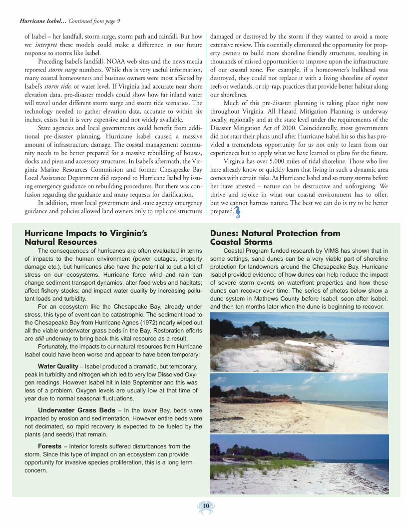
Hurricane Impacts to Virginia’s Natural Resources
The consequences of hurricanes are often evaluated in termsof impacts to the human environment (power outages, propertydamage etc.), but hurricanes also have the potential to put a lot ofstress on our ecosystems. Hurricane force wind and rain canchange sediment transport dynamics; alter food webs and habitats;affect fishery stocks; and impact water quality by increasing pollu-tant loads and turbidity.
For an ecosystem like the Chesapeake Bay, already understress, this type of event can be catastrophic. The sediment load tothe Chesapeake Bay from Hurricane Agnes (1972) nearly wiped outall the viable underwater grass beds in the Bay. Restoration effortsare still underway to bring back this vital resource as a result.
Fortunately, the impacts to our natural resources from HurricaneIsabel could have been worse and appear to have been temporary:
Water Quality – Isabel produced a dramatic, but temporary,peak in turbidity and nitrogen which led to very low Dissolved Oxy-gen readings. However Isabel hit in late September and this wasless of a problem. Oxygen levels are usually low at that time ofyear due to normal seasonal fluctuations.
Underwater Grass Beds – In the lower Bay, beds wereimpacted by erosion and sedimentation. However entire beds werenot decimated, so rapid recovery is expected to be fueled by theplants (and seeds) that remain.
Forests – Interior forests suffered disturbances from thestorm. Since this type of impact on an ecosystem can provideopportunity for invasive species proliferation, this is a long termconcern.
Dunes: Natural Protection from Coastal Storms
Coastal Program funded research by VIMS has shown that insome settings, sand dunes can be a very viable part of shorelineprotection for landowners around the Chesapeake Bay. HurricaneIsabel provided evidence of how dunes can help reduce the impactof severe storm events on waterfront properties and how thesedunes can recover over time. The series of photos below show adune system in Mathews County before Isabel, soon after isabel,and then ten months later when the dune is beginning to recover.
Hurricane Isabel… Continued from page 9

11
Back Bay SymposiumThe Back Bay Restoration Foundation in
conjunction with the Virginia Coastal Programhosted the 2005 Back Bay Forum in March.Presentations by local, state and federal agen-cies covered a wide range of issues and restora-tion and protection efforts, from “WetlandRestoration in the Back Bay Watershed” to“Gypsy Moth Management at False Cape StatePark.” The Foundation hopes the Back BayForum will become an annual event in a con-tinuing effort to understand this waterway sys-tem and how its health can be restored andmaintained.
The Forum was open to anyone interest-ed in management of Back Bay and the day’s117 participants represented many differentfacets of the community and areas of expertise.Participants posed a variety of questions andissues which will need to be addressed. Of
particular concern was a proposal
for a marina at Sandbridge, the effects of saltwater overflow on the turbidity of Back Bay,and restoration of submerged aquatic vegeta-tion to Back Bay. Feedback provided duringthe Forum will assist the Back Bay RestorationFoundation in guiding and supporting futureresearch and restoration efforts. “By listeningto the concerns of those who are interested inthe Bay’s well-being, and identifying the gapsin available data, we hope to have a better ideaof what needs to be done to restore the Bay,”states the Foundation’s President Richard Dyer.
Mainstreaming LID inNorthern Virginia In recent years, Low Impact Development (LID)has been in the stormwater spotlight. LID is acomprehensive, site-based planning and designstrategy to manage both the quantity and qual-ity of stormwater runoff in a manner that mim-ics pre-development hydrologic conditions. LIDoffers improved control over the volume, veloci-ty and quality of surface runoff. The net result isbetter protection of our coastal downstreamwaterways.
The Northern Virginia Regional Com-mission (NVRC), which receives annual supportfrom the Virginia Coastal Program to providecoastal technical assistance to the region’s locali-ties, recently produced several tools focusing onLID. Additional funding to develop the fol-lowing products was provided by the EPA’sChesapeake Bay Program through the VirginiaDepartment of Conservation and Recreation.
Reining in the Storm: One Building at a Time is a 30-minute film of LID around
t h e
the Commonwealth.The film is an intro-duction to LID forelected officials,planning commis-sioners and others.Live musiciansrecorded an originalmusical sound trackto accompany thevisuals. Narrationwas performed by National Public Radioannouncer, Frank Stasio. NVRC also producedan eight-page, full-color, introductory guide toLID to accompany the film. The guide can bedownloaded at www.novaregion.org.
LID Electronic Slide Show: Echoing thethemes of the LID film and basic guide, a 20-slide Power Point presentation was prepared aspart of a LID education package. The presen-tation includes an animated hydrograph to pre-sent the concept of the rising and falling ofstreams during and after rainfall.
On the horizon - A LID DemonstrationSite: Tinner Hill, an African-American heritagesite in Falls Church and Fairfax County willfeature two turn-of-the-century styled build-ings, a small cultural center/museum and a per-formance barn. LID practices on the TinnerHill site are designed to replicate undisturbedforested conditions, achieving stormwaterquantity and quality controls well beyond coderequirements.
Site and soils analyses to determine theoptimal locations for LID practices were per-formed prior to site design and location ofbuildings and driveways. LID practices includegrasspave, pervious pavers, rain gardens, infil-tration trench, partial green roof, and cisterns.The practices are integrated into the structuresand will complement efforts to achieve aLEED design certification by employing arange of sustainable building techniques.
Connecting stories of the past to themodern day, water has been and continues tobe an enduring theme. LID practices will bethe central feature of an interpretive trail, “Fol-low the Drinking Gourd,” and will be accom-panied by interpretive signage.
For more information about any of theproducts above or the Tinner Hill DemonstrationSite, please contact Katherine Mull, NVRC, at(703) 642-4625 or [email protected].
NEWS AROUND THE ZONE
Crater PDC
Rappahannock Area Development Commission
Richmond Regional PDC
Northern Neck PDC
Middle Peninsula PDC
Northern Virginia Regional CommissionHampton Roads PDC
Accomack-Northampton PDC
A Coastal Program exhibitformed a back drop at theSymposium. Photos courtesy of
the BBRF.
Back Bay
•

12
...The Legacy of Virginia’s ShorelinesThe bounty and beauty of Virginia’s coastal waters has long
attracted people to its shores. Native Americans settled along Virginia’sCoastal Plain drawn not only to the abundance of food but to the easeof transportation. Later, European settlers remarked on the incrediblenatural resources and the excellent natural harbors that the coastalplain offered. As the Commonwealth prepares to celebrate the 400thanniversary of the Jamestown settlement, it is important to rememberthe critical role that life along our coastal waters has played and con-tinues to play in our culture.
This issue of Virginia Coastal Management will highlight someof the topics that constitute Virginia’s maritime heritage as well as the“keepers” of this heritage – Virginia’s many fine museums with ties toour maritime culture. Future issues will explore specific maritime her-itage topics, the efforts of museums or other organizations to recover orpreserve artifacts, or simply expose readers to our rich coastal history.
Transportation...For much of the Commonwealth’s history,good transportation alternatives over land were few or nonexistent.Our extensive network of coastal waterways, however, provided rela-tively easy access to large tracts of fertile land and heavily influenceddevelopment patterns during colonial times.
Plantation culture relied on waterborne transportation forexporting raw materials and importing finished goods. Some colonialports of entry, like the Town of Urbanna in Middlesex County, were
designated by the British Crown to control trade. Later, trade centersdeveloped along the limits of tide. Cities like Richmond, Petersburg,Fredericksburg and Alexandria grew and prospered. Well into theTwentieth Century many rural areas, lacking good roads, bridges andrail lines, depended on steamboat transportation. Today, the Port ofHampton Roads, located in the world’s largest natural harbor, is thelargest port complex in the United States.
Virginia’s Maritime HeritageBy Shep Moon, Coastal Planner
Replica 1607 ships at Jamestown Settlement – Susan Constant, Godspeed and Discovery at Jamestown Settlement history museum. Courtesy of the Jamestown-Yorktown Foundation.
“Bird’s Eye View of Alexandria, Va.” Charles Magnus’s lithographic view showing the river port of Alexandria in 1863 contrasts witha present day aerial view of a busy port in Hampton Roads (above.) Lithograph courtesy of the Library of Virginia (Voorhes Collection) and aerial photoby Kevin Heffernan, DCR–NH

Coastal Fisheries...Evidence of fishing and shellfish collectingby Native Americans dates back thousands of years. From the earliestColonial times to the present, watermen have earned their living byharvesting oysters, crabs, fish and other species. Today commerciallandings of menhadden regularly make the small town of Reedvillethe third-largest U.S. port in terms of fish landings.
Watercraft...Regardless of the topic or period, Virginia’s water-craft remain the most recognizable symbol of our maritime heritage.Native American log canoes, colonial era Pilot Boats, Buyboats,Steamboats, and Aircraft Carriers all have strong ties to Virginia.Their use, and their construction, have long been an important partof our economy and our culture and remain so today.
Chesapeake Bay Deck boats and Deadrise Work boats have long beenused for pound net fishing, oystering, crabbing and transporting goods.Photo by Larry Chowning.
Maritime Historic Resources and the Virginia Coastal ProgramThe Coastal Zone Management Act (CZMA) states that “it is the national policy to
provide for...sensitive preservation and restoration of historic, cultural, and esthetic coastalfeatures.”
Preserving our maritime heritage and underwater archeological sites is an importantcomponent of coastal resource management in Virginia. Funding from the CZMA hasenabled Virginia to help carry out this policy. Executive Order 23, signed by GovernorWarner in 2002, directs the Virginia Coastal Program to “protect and restore (the Com-monweath’s) coastal resources” including “underwater or maritime cultural resources”. Overthe years, the Coastal Program has provided CZMA funding for Maritime Heritage projects.For more information on the projects listed below, visit the Program’s Web site atwww.deq.virginia.gov/coastal/projects.html and search by title:
Virginia Department of Historic Resources:Coastal Historic Resources InventoryUnderwater Cultural Resources Assessment“History Under Water” BrochureGIS Database for Underwater Archeological Resources Solving History’s Mysteries exhibit
Middle Peninsula Planning District Commission: New Point Comfort Lighthouse Restoration
A 15-foot, Indian dug-out canoe, found by a citizen in a mud bank onUpper Machodoc Creek on the Northern Neck, is now on display at theVirginia Historical Society. The canoe was first sighted in 1954. In1996, it finally eroded completely from the mud, enabling conservatorsfrom the Department of Historic Resources to preserve it. This processtook 9 months. Photo courtesy of DHR.
As a member agency in the Coastal Program part-nership, the Department of Historic Resources iskey to the Program’s success in achieving its goal topreserve our maritime culture. In the DHR photoabove, a conservator at DHR uses an air-scribe toclean out corrosion from the barrel of a ‘swivel gun’belonging to Yorktown Victory Center.
13
Continued on page 14

14
Maritime Heritage… Continued from page 13
Warfare...Centuries ofnaval warfare, both withinour waters and on foreignshores, has played an impor-tant role in Virginia’s mar-itime heritage. The first battlebetween ironclad warshipstook place in HamptonRoads during the Civil War.This battle between the USS Monitor and the CSS Virginia perma-nently changed naval warfare and is the focus of a new multimillion
dollar exhibit under construction at the Mariners’ Museum in New-port News (photos left and top left). Today, Naval Station Norfolk isthe largest naval base in the world.
The Battleship Wisconsin, now retired, is docked at Nauticus in Nor-folk. Photo courtesy of NOAA
Maritime Heritage Museums – Centers of DiscoveryVirginia has a wealth of museums and centers that capture our maritime heritage, ranging from large, established places like the
Mariner’s Museum – where you can learn about a broad spectrum of maritime issues – to smaller, newer places like the Steamboat Era Muse-um where they focus on a single topic. With so much to see and learn about Virginia’s maritime culture, the Coastal Program encouragesevery Virginian to learn more by visiting some of these “keepers” of maritime history as we count down to 2007.
Barrier Islands Center in Machipongo757-678-5550www.barrierislandscenter.com
Deltaville Maritime Museum804-776-7200www.therivahweb.com/deltavillepark/parkindex.html
Hampton Roads Naval Museum in Norfolk757-322-2987www.hrnm.navy.mil/about.html
Jamestown-Yorktown Visitor’s Center in Williamsburg(757) 253-4838 or toll-free (888)593-4682http://www.historyisfun.org/
Library of Virginia in Richmond804-692-3500http://www.lva.lib.va.us/
Mariners’ Museum in Newport News800-581-7245www.mariner.org
Nauticus: National Maritime Center in Norfolk800-664-1080www.nauticus.org
Naval Shipyard Museum in Portsmouth757-393-8591www.portsnavalmuseums.com
Oyster & Maritime Museum in Chincoteague757-336-6117www.chincoteaguechamber.com/oyster/omm.html
Reedville Fishermen’s Museum804-453-6529www.rfmuseum.org
Steamboat Era Museum in Irvington804-438-6888www.steamboateramuseum.org
Virginia Historical Society in Richmond804-358-4901www.vahistorical.org
Watermen’s Museum in Yorktown757-887-2641www.watermens.org
Photo and drawing courtesy of Monitor Marine Sanctuary Program.

15
Photo courtesy of Kingston Park Elementary.
COASTAL COMMUNITY IN ACTION
Can 600 elementary school students stop Slim Sludge from pol-luting the Lynnhaven River?
Kingston Elementary students showed how they can do just thatin “Lynnhaven Soup” – an original 35-minute drama they presentedalongside faculty and parents at their Virginia Beach school in March.“Omar of the Reef,” mascot of the Virginia Oyster Heritage Program,a Coastal Program private-public partnership initiative to restore Vir-ginia’s oyster population, made a special guest appearance representingthe River’s oyster population.
Lynnhaven Soup is the pinnacle of an innovative program atKingston to teach students about Virginia’s water resources throughstewardship of the Lynnhaven River. Kingston Elementary is locatedat the mouth of the Lynnhaven River.
Spurred by increasing reports on the river’s demise, the KingstonPTA created the Lynnhaven River Keeper Program. The program aimsto enlist the help of all students, faculty and staff in rescuing theLynnhaven River. In just four months, more than 670 Kingston stu-dents and teachers have become official “Lynnhaven River Keepers,”adopting seven acres of forest and wetlands along the waterway in2004. This year the focus is on identifying the sources of pollutionand becoming good stewards of the environment. Agreeing to envi-ronmentally-friendly practices in their homes, Kingston’s River Keep-ers are also participating in neighborhood conservation projectsincluding storm drain marking and trash cleanups.
The evening presentation of Lynnhaven Soup included a “sci-ence smorgasbord” of information gathered by students on pollutionsolutions. Special invitations were extended to federal and state agen-cies and private organizations that play a role in managing and restor-ing the Lynnhaven. An invitation was also sent to President GeorgeBush. According to one young Lynnhaven Soup cast member “Wedon’t know if he’ll come, but at least he’ll hear about what we’re doingto help the Lynnhaven River.”
Increasing awareness is the overall goal of Kingston’s program.“We hope to have a ripple effect—from our students, to their families,and on to the broader community. The education and awareness cre-ated about the Lynnhaven River has the potential to go far beyond thehallways and classrooms at our school,” stated Kathryn O’Hara, Chairof the Kingston PTA committee that developed the program.
Kingston’s “Lynnhaven Soup” was funded in part by a VirginiaBeach Public Schools Education Foundation Building Futures Grantand a Hampton Roads Planning District Commission HR3 Environ-mental Education Mini-Grant.
Special Update: The “Lynnhaven River Keepers” wererecently honored with a 2005 Environmental StewardshipAward!
For more information about the Lynnhaven River Keeper Pro-gram, contact Kathryn O’Hara at (757) 431-1921 or VirginiaO’Malley (757) 431-4015.
“Lynnhaven Soup” – Kingston Elementary School’s Recipe to Rescue Its River

Despite all the other tools at our disposal, the surest way to guar-antee long term protection of natural coastal lands is through owner-ship or perpetual conservation easements. As mentioned in our coverarticle on managing a growing human population, we expect a lot ofneighbors to be joining us in Virginia’s coastal zone over the comingyears. We will have to find room for them. And we can and must workwith our local governments to adopt appropriate ordinances andincentives to accommodate that growth in ways that keep our com-munities livable and pleasant. But will this continued growth ulti-mately mean that few to none of our rural, natural coastal landscapeswill remain?
Although the cost of waterfront and even near-coast property isskyrocketing in Virginia, the Coastal Program continues to do what itcan with its limited funds to help protect some of our most sensitivecoastal areas. Fortunately we have good partners who can help usstretch our dollars. And they are all working with us to come up witha prioritization plan.
In fact, all state coastal management programs across the coun-try are working with NOAA and their state and local partners todevelop prioritization plans for acquiring coastal land. That’s becausea few years ago Congress began “earmarking” funds in the federal bud-get for certain coastal land acquisitions under a program calledCELCP – the Coastal and Estuarine Land Conservation Program.Congress recognizes the fast rate of growth in coastal areas and theneed to preserve the ecological, aesthetic and historic values of coastalareas. NOAA and the coastal states are trying to bring a more orga-nized approach to the “earmarking” process (whereby a single legisla-tor identifies a particular area or parcel for acquisition) by developingacquisition priority plans that incorporate ecological criteria and areapproved by the public. The Virginia Coastal Program is responsiblefor developing the plan in Virginia, which we are doing with the helpof our many conservation partners. Keep an eye on our Website thisfall and winter for updates on our CELCP plan and notice of a pub-lic meeting and public comment period.
In the meantime, the Virginia Coastal Program is receiving ear-marked CELCP funds for acquisitions and conservation easements intwo areas: about $6 million for the Potomac Gorge in Northern Vir-ginia and about $1 million for the Dragon Run in the Middle Penin-
sula. Work is underway to purchase fee simple rights to land and con-servation easements in those areas.
The Virginia Coastal Program also has one other source of fundsfor land acquisition: Section 306A of the Coastal Zone ManagementAct. As part of our annual award of about $3M per year, we set asideabout $200,000 for land acquisition. Of course that buys precious lit-tle these days, but by allocating those funds toward the same projectarea each year, we are starting to make a difference.
This summer we have been working with The Nature Conser-vancy, the Department of Conservation and Recreation, the Depart-
For the Most Sensitive Coastal Lands, Acquisition May Still Be the Best Bet
Aerial showing a portion of the tract being purchased in the Dragon Runwith CELCP funding. Photo by Teta Kain.
The Coastal Program is partially funding acquisition of theseaside tract outlined in blue. Map by Scott Lerberg, VCP.
Virginia’s diverse coast is reflected in this view of Potomac Gorge, a tractbeing purchased and protected as a natural area with CELCP funding.Photo by ©Gary Fleming.
By Laura McKay, Coastal Program Manager
16

17
ment of Game and Inland Fisheries and the US Fish & Wildlife Ser-vice to acquire two major properties on the southern tip of the East-ern Shore. This area has long been a priority for the Coastal Programand our partner conservation agencies. It was with Virginia CoastalProgram funds in 1990-93 that this area was first scientifically docu-mented as a hemispherically important migratory songbird stopoverarea. For years the Coastal Program funded a Special Area Manage-ment Plan in an attempt to develop new local land use policies to pro-tect this habitat, but local political will faltered and ordinances toprotect the habitat and its native vegetation were never adopted. Thenthis spring The Nature Conservancy purchased two key properties on
the tip with the expectation that federal and state agencies would buyit from them as soon as grant funds could be secured. Currently wehave about $856,000 in CZM funds from 4 different grant yearawards dedicated to the seaside property. DCR’s Natural Heritage Pro-gram may match these grants with about $350,000 in state funds.This $1.2 million will be the first “buy back” funding TNC willreceive toward their recent purchases. Without all of us workingtogether on complex projects such as this, we could never accomplishthis scale of land protection. We still have a long way to go on this one,but we’re hoping that additional CELCP and other federal and statefunds will come our way over the next few years!
Keep Our Communities Strong… Continued from page 2
Virginia Coastal Program Land Acquisition History
Year Grantee Parcel Locality Acres CZM$ Match $ Total1991 Isle of Wight Jones Creek Isle of Wight 4.00 $40,000 $40,000 $80,0001992 DCR Kellam/Alton’s Creek (N Landing NAP) VA Beach 45.00 $85,000 $95,787 $180,7871992 TNC New Pt Comfort Mathews 95.00 $85,000 Lily Pt $85,0001993 DCR McAlpine (Northwest River) Chesapeake 926.00 $183,000 $184,769 $367,7691994 DCR Maxey (Northwest River timber rights) Chesapeake 415.00 $178,575 $192,881 $371,4561995 DCR Fitchett (Bethel Beach NAP) Mathews 35.63 $37,161 N Landing $37,1611997 ANPDC/DCR Parsons (Kiptopeke State Park) Northampton $100,000 $100,000 $200,0001998 DCR Parsons (Kiptopeke State Park) Northampton $182,504 $178,114 $360,6181999 DCR Parsons (Kiptopeke State Park) Northampton 161.25 $200,000 $709,382 $909,382
$01999 VIMS/CBNERRS Dragon Run King & Queen 121.12 $90,000 $15,200 $105,2002000 MPPAA/DOF Brown (Dragon Run) Essex 137.00 $200,000 $0 $200,0002001 MPPAA/DOF Brown (Dragon Run) Essex/K&Q 137.00 $192,000 $0 $192,0002002* DCR Southern Tip Northampton 17.82 $225,652 $0 $225,6522003* DCR Southern Tip Northampton 32.65 $263,792 $150,000 $413,7922004* DCR Southern Tip Northampton 28.92 $167,000 $200,000 $367,0002005* DCR Southern Tip Northampton 15.76 $200,000 $0 $200,000
TOTAL 2172.15 $2,429,684 $1,866,133 $4,295,817
*grants currently in negotiation
Also coming up this fall are two major undertakings for the Vir-ginia Coastal Program. The first, which is now underway, is our 5 yearCoastal Needs Assessment and Strategy Development. UVA’s Institutefor Environmental Negotiation is helping us prepare this 2- part docu-ment. One of the 9 areas that will be assessed is our ability to deal withthe cumulative impacts of coastal growth and development. If this areais ranked by our Coastal Policy Team as a “high priority” and a strate-gy for making improvements to our ability to deal with growth issuesis developed, we could receive up to $540,000/year for 5 years fromNOAA for this work. The public will have an opportunity to commenton the needs assessment between October 15 and November 15.
The second undertaking is our October 5-7 Biennial CoastalPartners Workshop. This year will be quite different though – we willsimultaneously be hosting the Northeast Regional CZM meeting. Thiswill be a unique opportunity for those involved in coastal managementin Virginia to share experiences and dialogues with their counterpartsfrom Maryland to Maine. The workshop will focus on 3 major areas:growth management, coastal impacts and planning for energy produc-tion and distribution and social marketing.
So let’s roll up our sleeves, start talking to our neighbors, localofficials and even counterparts from other states to make our commu-nities grow the way we want them to – after all we, the people, are thegovernment!
Smart Growth and Related Web Sites
Smart Growth America: www.smartgrowthamerica.com/
Environmental Protection Agency:www.epa.gov/smartgrowth/
Smart Growth Leadership Institute: www.sgli.org/
University of Maryland National Center for SmartGrowth: www.smartgrowth.umd.edu/
National Geographic: www.nationalgeographic.com/earthpulse/sprawl/
index_flash.html
Randall Arendt: www.greenerprospects.com/
Ed McMahon: www.uli.org

18
VIRGINIA’S HISTORIC COASTAL PLACESThe Small Seaside Village of OysterHas Big Plans
The seaside Village of Oyster is tucked away on the southern tipof Virginia’s Eastern Shore. This tiny community sits on the AtlanticOcean protected by barrier islands and has the southernmost deepwater harbor on the eastern side of the Peninsula.
Oyster began in 1737 as a private port for Littleton Eyres’sBroad Creek Plantation. With the expansion of the seaside oysterindustry and coming of the railroad in 1884, Oyster grew into asmall community of watermen who lived their lives according to thetides. In the late 1890s Hog Island residents relocated their homes toOyster after a series of hurricanes put the community under water.Today, Oyster is a peaceful village with fewer than 100 residents.
The traditional industryof Oyster was seafood andthe fortunes of the Village’sharbor and working water-front have mirrored the for-tunes and cycles of the EastCoast seafood market overthe years. At one time, thewaterfront held severalseafood processing business-es, numerous docks for work-ing watermen and even aVictorian-era hotel overlook-ing the harbor and off shorebarrier islands. Today, tradi-tional water-related indus-tries still maintain a toehold
on the harbor, but due to the collapse of the native oyster industry,the harbor has suffered. There are two wholesale seafood businessesand a few watermen that still operate from Oyster. The harbor isperiodically dredged by the Army Corps of Engineers. Deep waterdockage is available in portions of the harbor, although much of thewaterfront bulk heading is broken up and not dockable.
The residential areas of the Village have an authentic charm,based not on elaborate architecture or public amenities, but on acombination of traditional compact neighborhoods contrastingagainst the wide open farmland and coastal scenery surrounding theVillage. Several houses were floated to Oyster from the former HogIsland community of Broadwater, after a series of hurricanes devas-tated the now uninhabited barrier island. A tiny post office and well-proportioned old church (Travis Chapel) are local landmarks, inaddition to some of the older houses.
Oyster’s location in the heart of an important natural area hasattracted global attention and a number of conservation-based ini-tiatives over the years. The portion of the seaside that includes Oys-
ter is ecologically important partly because it lies within a criticalstopover area for migratory songbirds headed south for the winter.Coastal areas such as this on the southern tip of the Delmarva penin-sula are among the most important migration staging areas on theAtlantic coast. A large number of neotropical migratory songbirdsuse remaining thickets and wooded areas to replenish their fatreserves before crossing the Chesapeake Bay and continuing theirjourney to winter homes in Central and South America. The exten-
Oyster’s New Vision For the FutureOyster has a unique opportunity to plan for a more compat-
ible and sustainable future that respects its natural and culturalheritage and its traditional water-dependent economy. Recogniz-ing this, the Virginia Coastal Program partnered with Citizen’s fora Better Eastern Shore and The Nature Conservancy and providedCoastal Zone Management Act funds to develop the “OysterCommunity Vision”, a blueprint of changes for the village thatcould help it maintain its values, history and character.
The Oyster Community Vision Project is a citizen-basedvisioning effort, completed in October 2004 with the assistance ofa professional facilitator, Paradigm Design. The process involved aseries of public forums which culminated in affirmation of an Oys-ter Community Vision Plan and a citizen committee to implementthe plan. Northampton County, which participated in the publicforums, has expressed support for the plan and pledged to helpprepare an amendment to the Northampton County Comprehen-sive Plan to incorporate the Village’s vision in its policy framework.
Donna Fauber, chair of the citizen working group, expressesthe eagerness and optimism of local resident leaders to get started.“The Vision is a wonderful thing for Oyster. It gives us a commonsense of purpose and a plan to preserve and enhance the place weall love.”

sive salt marshes on the seaside of the Eastern Shore also provideimportant feeding and spawning areas for many finfish and shellfishas well as habitat for shorebirds.
Oyster is a very popular place for sport fishermen to “put-in.”Projects are underway to expand the current harbor parking lot, con-struct a public pier and a public memorial for watermen. The Coastal
Program also plans to install a canoe/kayak floating dock as part of itsSeaside Heritage Program (see page 5.) The University of Virginia isconstructing a Coastal Research Facility on the harbor front. The areaaround Oyster has been the focus of coastal ecology research for over15 years by a UVA Long Term Ecological Research Program. TheNature Conservancy has owned over 1,000 acres of farmland andcoastal marsh in and around the Village for almost 20 years. Thesepurchases were an effort to protect the mainland areas that borderedoff shore barrier islands preserved by TNC.
Oyster has also been targeted by the private sector for significantresidential growth. Human uses of this seaside landscape can havemajor impacts on water quality and the subsequent health of theadjoining estuarine system. Incompatible development in or aroundthe village could have impacts that reach deep into the delicate estu-arine bays and salt marshes that are the lifeblood of these globallyimportant seaside ecosystems.
Beach Pollution: A Top Ten List Not to Brag AboutWhen you hear “Top Ten” and “Beaches” in the same sentence,
it is a sure bet that it is not the list below that springs to mind. How-ever, this is what volunteers in the 2004 International CoastalCleanup (ICC) found last fall strewn on Virginia’s beaches:
1. Beverage Bottles (plastic) 2 liters or less (2,694) 2. Cigarettes/ Cigarette filters (1,984)3. Food wrappers/containers (1,712)4. Caps, Lids (1,587)5. Balloons (1,250)6. Beverage cans (1,143)7. Beverage bottles (glass) (926)8. Bags (847)9. Cups, Plates, Forks, Knives, Spoons (825)10.Rope (588)
“During the cleanups, we found plastic bottles and grocerybags, small buoys, fishing lures, mylar balloons, and nearly 200toys,” states Richard Ayers, the Virginia Eastern Shorekeeper. Ayers,who is funded in part by the Virginia Coastal Program (see page 5),was instrumental in working with the Coastal Program to pulltogether many of the sites involved in the regional cleanup on Virginia’s Eastern Shore.
“Balloons and rope are the biggest story,” according to Katie Register, Executive Director of Clean Virginia Waterways which organizesthe ICC statewide and works with local litter coordinators and programs throughout the year. “Balloons have made the Top Ten list only oncein the last 10 years for the entire state, yet they are commonly in the Top Ten list when we look just at the beaches.”
Released balloons return to the land and sea where they can be mistaken for prey and eaten by animals. Balloons are hazards when theyenter the aquatic environment because they can look a great deal like jellyfish, a major source of food for many animals. Sea turtles, dolphins,whales, fish, and seabirds have been reported with balloons in their stomachs. Mass-releases of balloons are illegal in Virginia and several otherstates due to the potential harm they cause to wildlife when they return to land or sea.
For more on the Eastern Shore Beach cleanup effort this September and October and what you can do to help, visit the Coastal Pro-gram Web! –Virginia Witmer, Outreach Coordinator
There were 7 official ICC cleanup sites on Virginia’s Eastern Shore in Octo-ber 2004. Twelve miles of beach were cleaned - 301 volunteers (includingthose shown at Savage Neck) collected 7,360 pounds of trash–that’s approx-imately 490 bags! Photo by Richard Ayers.
19
COASTAL CLIPS & CONTRIBUTIONSWelcome New Coastal Staff!
Rachel Bullene recently joined the Vir-ginia Coastal Program as the new GrantsCoordinator and Outreach Specialist. Priorto joining the Coastal Program, Rachelserved as the Environmental Educator at Vir-ginia Zoo in Norfolk, VA, and as an educa-tor at the Virginia Aquarium.
Rachel is a graduate of the College ofWilliam and Mary where she completed aBachelor’s degree in Political Economy.
At the Coastal Program, Rachel willoversee all grants management activities ofthe Program. As Outreach Specialist, Rachelwill be working with the Outreach Coordi-nator to produce publications and exhibits,provide workshops and training, andincrease the Program’s visibility.
Thanks to our Summer Intern!
Lauren Harris, oyster gardener extraor-dinaire and recent graduate of MidlothianHigh School, spent her summer beforeattending Virginia Tech helping the CoastalProgram with two projects. Her first assign-ment–conversion of old paper grant files todigital format (ugh!).
But then we livened things up and askedher to tackle updating of the VIMS 1999 oys-ter gardening manual–“Introduction to Oys-ter Culturing in Virginia.” Lauren did a finejob integrating comments from key partnersin the effort – VIMS, the VA Oyster ReefHeritage Foundation and the TidewaterOyster Gardeners Association (TOGA).Look for the new manual coming this fall inprint and on the Web.
Thanks, Lauren!
INSTAR Gives Insight Into Vir-ginia’s Coastal Stream Systems
Virginia Commonwealth University,through support from the Coastal Programand the Department of Conservation andRecreation has created a new stream assess-ment online tool, INSTAR. The INteractiveStream Assessment Resource is an interactivemapping and database application that pro-vides users access to aquatic resources infor-mation from more than 500 sites inVirginia’s Coastal Zone.
This stream data is also one of the“Blue Infrastructure” data layers in theCoastal Program’s Blue-Green InfrastructureInternet Mapping System - see page 2.
Traditionally stream restoration pro-grams have faced two major challenges.First, there are multiple stream assessmentprotocols available and application of theappropriate protocols can be difficult. Sec-ond, it is difficult to define restoration end-points (i.e. when is a stream considered“restored”?). Both of these challenges aredependent on an understanding of, andcomparison to, relevant reference conditionsthat accurately describe the ecological poten-tial of streams in that region. Due to wide-spread development in Virginia, there arevery few, if any, streams that can be used asexamples, or references.
INSTAR addresses these challenges bycompiling a robust database of stream infor-mation for Virginia and analyzing the dataso the user can see a current quality assess-ment of streams and also compare thatstream to modeled “ideal” conditions.
The Coastal Program continues to sup-port data collection and analysis to expandthe geographic scope for INSTAR. INSTARcan be accessed online at: http://gaia.vcu.edu/
For more information, contact Dr. GregGarman at VCU ([email protected])
20
Coastal Project Illustrate GoodCommunity Involvement
Good community involvement hasbeen at the root of the Special Area Manage-ment Plan in the Dragon Watershed. TheSAMP was highlighted as an example of citi-zen initiative and resolve at a “CommunityInvolvement Workshop” sponsored by theDepartment of Environmental Quality dur-ing the 16th Annual Environment VirginiaConference last April.
David Fuss, Coordinator for the Drag-on Run SAMP at the Middle Peninsula Plan-ning District Commission shared howcitizen-based advisory groups have helpedshape a management plan for the DragonRun Watershed. The watershed is recognizedby many as one of the most ecologically sig-nificant areas in Virginia’s coastal zone. Fussalso pointed out the importance of keepingcommunication and opportunities for citizeninvolvement going as the plan is implemented.
The workshop was held as part ofDEQ’s community involvement initiative -an ongoing effort to improve Virginians’ abili-ty to participate in significant environmentalactions that affect individuals, businesses,governing bodies and organizations acrossthe state.
The highlight of community involve-ment activities in 2005 has been communitymeetings held in each DEQ region of Vir-ginia during the summer and fall. Severaldozen participants attended the first meet-ings held in the Lynchburg and Roanokeregional offices, and similar attendance wasexpected in Abingdon, Chesapeake, Wood-bridge, Glen Allen and Harrisonburg.
The DEQ regional offices also havedeveloped community involvement plans,specific to each region of the state. Theseplans detail actions that will help DEQ meetits goal of stronger community involvement
The meetings are part of DEQ’s initia-tive to increase understanding of how DEQoperates, identify issues that are a priority ineach region and enhance opportunities forcommunity involvement in environmentalactivities in Virginia. They were open to thepublic, and DEQ encouraged business own-ers, educators, local governments, communi-ty leaders and others who are interested inenvironmental protection to attend.

21
Coastal Program SponsorsTwo National Conferences The Virginia Coastal Program is support-
ing two major conferences coming to Virginiathis fall: the Watchable Wildlife Conference onOctober 10–14 in Virginia Beach and theNational Estuarine Research Federation Con-ference on October 17–21 in Norfolk.
Coastal Program funding is enabling theNational Estuarine Research Federation toproduce conference proceedings. This scientif-ic program will include a two-day ChesapeakeBay Colloquium (organized in conjunctionwith the Chesapeake Research Consortium).For more information and to register, visitwww.erf.org.
The VirginiaCoastal ProgramManager, LauraMcKay, serves onthe InternationalWildlife ConferencePlanning Commit-tee, whose goal is toprovide conferenceattendees with the most comprehensive anduseful program related to responsible wildlifeviewing while helping to sustain communitycharacter. For more on what this conferencewill offer, visit www.watchablewildlife.org/.
Media Award Presented to Eastern Shore Environmental
Education CouncilThe Virginia Coastal Program congratu-
lates the Eastern Shore Environmental Educa-tion Council on their receipt of the 2004 JuneSekoll Media Award!
The award was presented to the Councilfor their work on Shore Outdoors, a specialquarterly insert in the Eastern Shore Newswhich focuses on the value and protection ofthe Shore’s coastal resources.
Since July 2003, the Council has pub-lished a quarterly edition of Shore Outdoorsto increase environmental literacy and encour-age good stewardship on the Eastern Shore.The insert reaches a wide audience of over65% of Eastern Shore households (a distribu-tion of 12,000).
The Virginia Coastal Program providedfunding support for two issues of Shore Out-doors which featured articles on the efforts ofthe Virginia Seaside Heritage Program (see anupdate on this initiative on page 2).
The award was announced at the Soil &Water Conservation Society’s October 2004awards luncheon in Blacksburg, Virginia, andis given in memory of June Sekoll, former edi-tor of the Farm Chronicle.
Virginia CBNERRS Dedicates New Building;
Director Named NOAA HeroOn September 12, Chesapeake Bay
National Estuarine Research Reserve in Vir-ginia dedicated a new building, the Catlett-Burruss Research and Education Laboratory,to the Catlett and Burruss families for theirgenerous support to CBNERR and to VIMSover the years. The new facility supports waterquality monitoring in Chesapeake Bay coastalwaters, watershed and shallow water habitatstudies, and education of students, teachers,and coastal decision-makers.
At this event, Willy Reay, Director of theCBNERRVA was formally presented with a2005 NOAA Environmental Hero Award.NOAA Deputy Assistant Secretary of OceansTim Keeney made the presentation. Given inconjunction with Earth Day celebrations, theaward honors NOAA volunteers for their“tireless efforts to preserve and protect ournation’s environment.” Dr. Reay was recog-nized as a local and national leader in theeffort to improve water quality, weather andhabitat monitoring in estuarine environments.The NOAA award notes: “In the ChesapeakeBay, his work has contributed to establishingbetter shallow water quality criteria for theChesapeake Bay Program and the state of Vir-
ginia, and documenting the impacts of Hurri-cane Isabel on estuarine water quality. As aleader within the NOAA National EstuarineResearch Reserve System, Reay has continual-ly encouraged and exemplified excellence inthe System Wide Monitoring Program; ensur-ing that reserves around the country producehigh quality data and exploring technology toexpand the scope and parameters of monitor-ing data.”
Established in 1996, the EnvironmentalHero award is presented to individuals andorganizations that volunteer their time andenergy to help NOAA carry out its mission.This year, the award was given to 34 individ-uals and three organizations from across theUnited States and around the world.
NOAA’s Science on a SphereUnveiled at Nauticus
Virginia Coastal Program staff were pre-sent as NOAA and Nauticus officials unveiledNOAA’s Science on a Sphere at the NationalMaritime Center in Norfolk, Virginia, on June2, 2005. Imagine gazing upon Earth as you aresuspended in orbit 22,000miles above its surface.
NOAA chief of staffScott Rayder and NorfolkMayor Paul Fraim gavekeynote remarks during the unveiling of theSphere. Dr. Alexander MacDonald, director ofNOAA’s Forecast Systems Laboratory andinventor of the Sphere, demonstrated a varietyof datasets - for example, he projected the dra-matic satellite imagery of the hurricanes thatlanded along the US Atlantic coastline during2004. According to Scott Raydor, “the NOAAand Nauticus partnership has created theopportunity for NOAA to integrate its sciencewith education and outreach efforts. The newexhibit and NOAA teacher resource center willprovide the Norfolk community and its visitorsvaluable information about our environment.”
NOAA SOS “is an exciting and informa-tive way for people to see NOAA’s climate,weather and ocean science,” states retired NavyVice Admiral Conrad C. Lautenbacher, Ph.D.,Undersecretary of Commerce for Oceans andAtmosphere and NOAA Administrator. “Forexample, viewers can watch how the warmwater of the Pacific that signals an El Ninotravels across the ocean, or watch a hurricaneform, as a small storm slowly gathers strength,traveling westward from Africa, across theAtlantic Ocean, toward the Gulf of Mexico.”
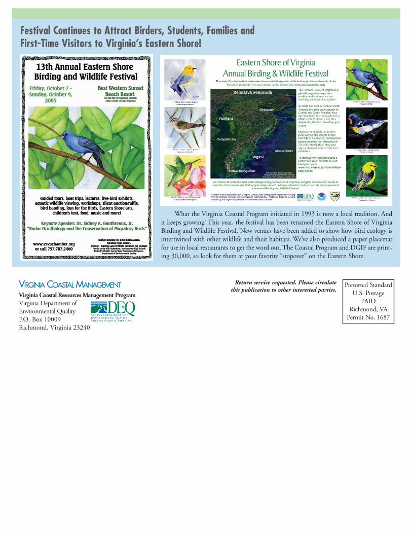
VIRGINIA COASTAL MANAGEMENTVirginia Coastal Resources Management ProgramVirginia Department of Environmental QualityP.O. Box 10009Richmond, Virginia 23240
Presorted StandardU.S. Postage
PAIDRichmond, VA
Permit No. 1687
Return service requested. Please circulatethis publication to other interested parties.
What the Virginia Coastal Program initiated in 1993 is now a local tradition. Andit keeps growing! This year, the festival has been renamed the Eastern Shore of VirginiaBirding and Wildlife Festival. New venues have been added to show how bird ecology isintertwined with other wildlife and their habitats. We’ve also produced a paper placematfor use in local restaurants to get the word out. The Coastal Program and DGIF are print-ing 30,000, so look for them at your favorite “stopover” on the Eastern Shore.
Festival Continues to Attract Birders, Students, Families and First-Time Visitors to Virginia’s Eastern Shore!