web viewoffline ris word form. ... however, it is not accepted by the ramsar secretariat for...
TRANSCRIPT

Site name - Country
CountrySite name
Offline RIS Word formThe purpose of this form is to help in collecting data on a Ramsar Site for the completion of an online Ramsar Information Sheet (RIS) at https://rsis.ramsar.org. It can be circulated between the National
Focal Point, RIS compilers and other national data collectors. However, it is not accepted by the Ramsar Secretariat for submission of a Site update or new Site designation. The data collected
through this form must be transferred to the online form by the National Focal Point or an authorized online RIS compiler.
All fields marked with an asterisk (*) are required.
For more information on how to use this form, please refer to the document How to use the offline RIS Word form.
Page 1 / 30

Summary
1.1 Summary description
Please provide a short descriptive text summarising the key characteristics and internationally important aspects of the site. You may prefer to complete the four following sections before returning to draft this summary.Summary (This field is limited to 2500 characters)
Page 2 / 30

Data & location
2.1 Formal data
2.1.1 Name and address of the compiler of this RIS
Compiler 1Name
Institution/agency
Postal address (This field is limited to 254 characters)
E-mail (The online RIS only accepts valid e-mail addresses, e.g. [email protected] )
Phone (The online RIS only accepts valid phone numbers, e.g. +1 41 123 45 67 )
Fax (The online RIS only accepts valid phone numbers, e.g. +1 41 123 45 67 )
Compiler 2Name
Institution/agency
Postal address (This field is limited to 254 characters)
E-mail (The online RIS only accepts valid e-mail addresses, e.g. [email protected] )
Phone (The online RIS only accepts valid phone numbers, e.g. +1 41 123 45 67 )
Fax (The online RIS only accepts valid phone numbers, e.g. +1 41 123 45 67 )
2.1.2 Period of collection of data and information used to compile the RISFrom year (The online RIS only accepts numeric values)
To year (The online RIS only accepts numeric values)
2.1.3 Name of the Ramsar SiteOfficial name (in English, French or Spanish)* (This field is mandatory)
Unofficial name (optional)
Page 3 / 30

2.2 Site location
2.2.1 Defining the Site boundariesThe site boundaries must be clearly delineated on both: a) a GIS shapefile and b) a digital map/image:
-> To define the site boundaries please complete field 2.2.1 a1), 2.2.1 a2) and 2.2.1 b) via the online form.-UPLOAD via online form-
Boundaries description (This field is limited to 2500 characters)
2.2.2 General locationa) In which large administrative region does the site lie?
b) What is the nearest town or population centre?
2.2.3 For wetlands on national boundaries onlya) Does the wetland extend onto the territory of one or more other countries?
[ ] Yes / [x] No .
b) Is the site adjacent to another designated Ramsar Site on the territory of another Contracting Party? [ ] Yes / [x] No
.
c) Is the site part of a formal transboundary designation with another Contracting Party? [ ] Yes / [x] No
.
d) Transboundary Ramsar Site name:
2.2.4 Area of the SiteIf you have not established an official area by other means, you can copy the area calculated from the GIS boundaries into the 'official area' box.Official area, in hectares (ha): (The online RIS only accepts numeric values)
Area, in hectares (ha) as calculated from GIS boundaries
2.2.5 BiogeographyPlease provide the biogeographic region(s) encompassing the site and the biogeographic regionalization scheme applied:Biogeographic regionsRegionalisation
scheme(s)1Biogeographic
region
Other biogeographic regionalisation scheme (This field is limited to 2500 characters)
1 Marine Ecoregions of the World (MEOW) | Udvardy's Biogeographical Provinces | Bailey's Ecoregions | WWF Terrestrial Ecoregions | EU biogeographic regionalization | Freshwater Ecoregions of the World (FEOW) | Other scheme (provide name below)
Page 4 / 30

Page 5 / 30

Why is the Site important?
3.1 Ramsar Criteria and their justificationTick the box against each criterion applied to the designation of the Ramsar Site. All criteria which apply should be ticked. Please explain why you selected a criterion by filling in the relevant fields on this page, on the three other pages of this section 'Criteria & justification' and on the 'Wetland types' page of the section 'What is the site like?'.
[ ] Criterion 1: Representative, rare or unique natural or near-natural wetland types To justify this Criterion, please select at least one wetland type as representative, rare or unique in the section What is the site like? > Wetland types and provide further details in at least one of the three boxes below.
Hydrological services provided (This field is limited to 3000 characters)
Other ecosystem services provided (This field is limited to 3000 characters)
Other reasons (This field is limited to 3000 characters)
[ ] Criterion 2 : Rare species and threatened ecological communities To justify this Criterion, please give details below on: - relevant plant species in the section Criteria & justification> Plant species (3.2) - relevant animal species in the section Criteria & justification> Animal species (3.3) - relevant ecological communities in the section Criteria & justification> Ecological communities (3.4)
Optional text box to provide further information (This field is limited to 3000 characters)
[ ] Criterion 3 : Biological diversity To justify this Criterion, please give details in the box below. If you want to name any specific species, please give details on: - relevant plant species in the section Criteria & justification> Plant species (3.2) - relevant animal species in the section Criteria & justification> Animal species (3.3)
Justification (This field is limited to 3000 characters)
[ ] Criterion 4 : Support during critical life cycle stage or in adverse conditions To justify this Criterion, please give details below on: - relevant plant species in the section Criteria & justification> Plant species (3.2) - relevant animal species in the section Criteria & justification> Animal species (3.3) and explain the life cycle stage or nature of adverse conditions in the accompanying 'justification' box.
Optional text box to provide further information (This field is limited to 3000 characters)
[ ] Criterion 5 : >20,000 waterbirds To justify this Criterion, please give details below on:- the total number of waterbirds and the period of data collection - relevant waterbird species, and if possible their population size, in the section Criteria & justification> Animal species (3.3)
Overall waterbird numbers* (This field is mandatory)
Page 6 / 30

Start year* (This field is mandatory)
End year* (This field is mandatory)
Source of data:
Optional text box to provide further information (This field is limited to 3000 characters)
[ ] Criterion 6 : >1% waterbird population To justify this Criterion, please give details on relevant waterbird species and their population size in the section Criteria & justification> Animal species (3.3)
Optional text box to provide further information (This field is limited to 3000 characters)
[ ] Criterion 7 : Significant and representative fish To justify this Criterion, please give information in the box below and details of relevant fish species in the section Criteria & justification> Animal species (3.3)
Justification (This field is limited to 3000 characters)
[ ] Criterion 8 : Fish spawning grounds, etc. To justify this Criterion, please give information in the box below. Completion of details on relevant fish species in the section Criteria & justification> Animal species (3.3) is optional.
Justification (This field is limited to 3000 characters)
[ ] Criterion 9 : >1% non-avian animal population To justify this Criterion, please give details on relevant non-avian species and their population size in the section Criteria & justification> Animal species (3.3)
Optional text box to provide further information (This field is limited to 3000 characters)
Page 7 / 30

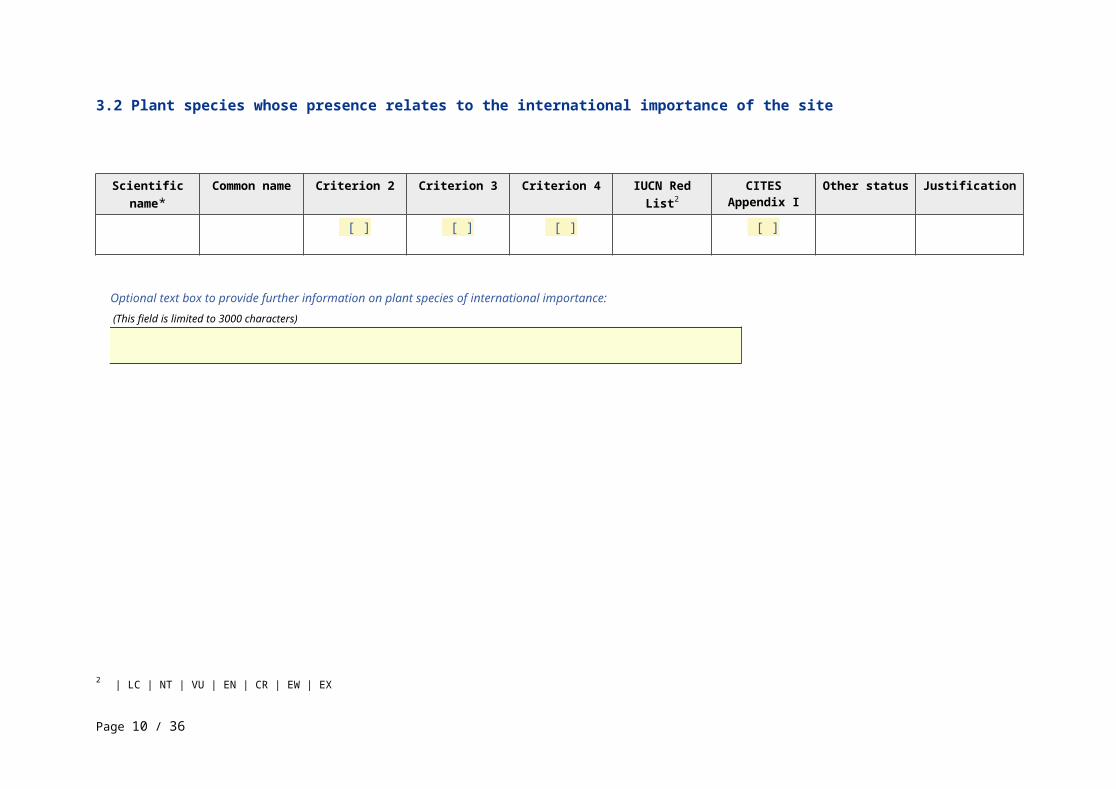
3.2 Plant species whose presence relates to the international importance of the site
Scientific name* Common name Criterion 2 Criterion 3 Criterion 4 IUCN Red List2 CITES Appendix I
Other status Justification
[ ] [ ] [ ] [ ]
Optional text box to provide further information on plant species of international importance: (This field is limited to 3000 characters)
2 | LC | NT | VU | EN | CR | EW | EX
Page 8 / 30

3.3 Animal species whose presence relates to the international importance of the site
PhylumScientific
name*Common
name
Species qualifies under criterion
Species contributes under criterion Pop.
Size3Period of pop. Est.3 % occurrence3 IUCN
Red List4CITES
Appendix ICMS
Appendix IOther Status Justification2 4 6 9 3 5 7 8
[ ] [ ] [ ] [ ] [ ] [ ] [ ] [ ] [ ] [ ]
3 Percentage of the total biogeographic population at the site. These fields are only compulsory to justify criteria 6 & 9
4 | LC | NT | VU | EN | CR | EW | EX
Page 9 / 30
Optional text box to provide further information on animal species of international importance: (This field is limited to 3000 characters)
Page 10 / 30

3.4 Ecological communities whose presence relates to the international importance of the site
Name of ecological community
Community qualifies under
Criterion 2?
Description Justification
[ ]
Optional text box to provide further information (This field is limited to 3000 characters)
Page 11 / 30

What is the Site like?
4.1 Ecological character
Please summarize the ecological components, processes and services which are critical to determining the ecological character of the site. Please also summarize any natural variability in the ecological character of the site, and any known past or current change (This field is limited to 4000 characters)
Page 12 / 30

4.2 What wetland type(s) are in the site?
Please list all wetland types which occur on the site, and for each of them: - rank the four most abundant types by area from 1 (greatest extent) to 4 (least extent) in the third column, - if the information exists, provide the area (in ha) in the fourth column - if this wetland type is used for justifying the application of Criterion 1, indicate if it is representative, rare or unique in the last column - you can give the local name of the wetland type if different from the Ramsar classification system in the second columnMarine or coastal wetlandsWetland types
(code and name)5Local name Ranking of extent
(1: greatest - 4: least)
Area (ha) of wetland type
Justification of Criterion 16
Inland wetlandsWetland types
(code and name)7Local name Ranking of extent
(1: greatest - 4: least)
Area (ha) of wetland type
Justification of Criterion 16
Human-made wetlandsWetland types
(code and name)8Local name Ranking of extent
(1: greatest - 4: least)
Area (ha) of wetland type
Justification of Criterion 16
What non-wetland habitats are within the site?Other non-wetland habitat
Other non-wetland habitats within the
site
Area (ha) if known
Habitat connectivity (ECD)
5 A: Permanent shallow marine waters | B: Marine subtidal aquatic beds (Underwater vegetation) | C: Coral reefs | D: Rocky marine shores | E: Sand, shingle or pebble shores | G: Intertidal mud, sand or salt flats | Ga: Bivalve (shell-fish) reefs | H: Intertidal marshes | I: Intertidal forested wetlands | J: Coastal brackish / saline lagoons | F: Estuarine waters | Zk(a): Karst and other subterranean hydrological systems | K: Coastal freshwater lagoons6 | Representative | Rare | Unique7 M: Permanent rivers/ streams/ creeks | L: Permanent inland deltas | Y: Permanent Freshwater springs; oases | N: Seasonal/ intermittent/ irregular rivers/ streams/ creeks | O: Permanent freshwater lakes | Tp: Permanent freshwater marshes/ pools | P: Seasonal/ intermittent freshwater lakes | Ts: Seasonal/ intermittent freshwater marshes/ pools on inorganic soils | Tp: Permanent freshwater marshes/ pools | W: Shrub-dominated wetlands | Xf: Freshwater, tree-dominated wetlands | Ts: Seasonal/ intermittent freshwater marshes/ pools on inorganic soils | U: Permanent Non-forested peatlands | Xp: Permanent Forested peatlands | Va: Montane wetlands | Vt: Tundra wetlands | Q: Permanent saline/ brackish/ alkaline lakes | R: Seasonal/ intermittent saline/ brackish/ alkaline lakes and flats | Sp: Permanent saline/ brackish/ alkaline marshes/ pools | Ss: Seasonal/ intermittent saline/ brackish/ alkaline marshes/ pools | Zg: Geothermal wetlands | Zk(b): Karst and other subterranean hydrological systems8 1: Aquaculture ponds | 2: Ponds | 3: Irrigated land | 4: Seasonally flooded agricultural land | 5: Salt exploitation sites | 6: Water storage areas/Reservoirs | 7: Excavations | 8: Wastewater treatment areas | 9: Canals and drainage channels or ditches | Zk(c): Man-made subterranean hydrological systems
Page 13 / 30
Page 14 / 30

4.3 Biological components
4.3.1 Plant speciesOther noteworthy plant speciesScientific name Common name
(optional) Position in range / endemism / other
(optional)
Invasive alien plant speciesScientific name Common name Impacts9
Optional text box to provide further information (This field is limited to 2500 characters)
4.3.2 Animal speciesOther noteworthy animal speciesPhylum Scientific
nameCommon
namePop. size
(optional)Period of pop. est.
(optional)
% occurrence (optional)
Position in range
/endemism/other (optional)
Invasive alien animal speciesPhylum Scientific name Common name Impacts9
Optional text box to provide further information (This field is limited to 2500 characters)
9 No impacts | Potentially | Actually (minor impacts) | Actually (major impacts)
Page 15 / 30
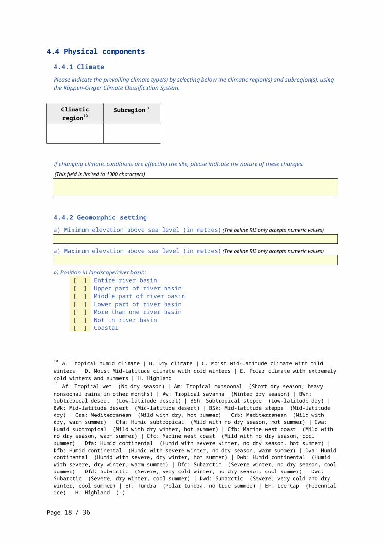
4.4 Physical components
4.4.1 ClimatePlease indicate the prevailing climate type(s) by selecting below the climatic region(s) and subregion(s), using the Köppen-Gieger Climate Classification System.
Climatic region10 Subregion11
If changing climatic conditions are affecting the site, please indicate the nature of these changes: (This field is limited to 1000 characters)
4.4.2 Geomorphic settinga) Minimum elevation above sea level (in metres) (The online RIS only accepts numeric values)
a) Maximum elevation above sea level (in metres) (The online RIS only accepts numeric values)
b) Position in landscape/river basin: [ ] Entire river basin [ ] Upper part of river basin [ ] Middle part of river basin [ ] Lower part of river basin [ ] More than one river basin [ ] Not in river basin [ ] Coastal
Please name the river basin or basins. If the site lies in a sub-basin, please also name the larger river basin. For a coastal/marine site, please name the sea or ocean. (This field is limited to 1000 characters)
4.4.3 Soil [ ] Mineral [ ] Organic [ ] No available information
Are soil types subject to change as a result of changing hydrological conditions (e.g., increased salinity or acidification)?
[ ] Yes / [x] No .
Please provide further information on the soil (optional) (This field is limited to 1000 characters)
10 A. Tropical humid climate | B. Dry climate | C. Moist Mid-Latitude climate with mild winters | D. Moist Mid-Latitude climate with cold winters | E. Polar climate with extremely cold winters and summers | H. Highland11 Af: Tropical wet (No dry season) | Am: Tropical monsoonal (Short dry season; heavy monsoonal rains in other months) | Aw: Tropical savanna (Winter dry season) | BWh: Subtropical desert (Low-latitude desert) | BSh: Subtropical steppe (Low-latitude dry) | BWk: Mid-latitude desert (Mid-latitude desert) | BSk: Mid-latitude steppe (Mid-latitude dry) | Csa: Mediterranean (Mild with dry, hot summer) | Csb: Mediterranean (Mild with dry, warm summer) | Cfa: Humid subtropical (Mild with no dry season, hot summer) | Cwa: Humid subtropical (Mild with dry winter, hot summer) | Cfb: Marine west coast (Mild with no dry season, warm summer) | Cfc: Marine west coast (Mild with no dry season, cool summer) | Dfa: Humid continental (Humid with severe winter, no dry season, hot summer) | Dfb: Humid continental (Humid with severe winter, no dry season, warm summer) | Dwa: Humid continental (Humid with severe, dry winter, hot summer) | Dwb: Humid continental (Humid with severe, dry winter, warm summer) | Dfc: Subarctic (Severe winter, no dry season, cool summer) | Dfd: Subarctic (Severe, very cold winter, no dry season, cool summer) | Dwc: Subarctic (Severe, dry winter, cool summer) | Dwd: Subarctic (Severe, very cold and dry winter, cool summer) | ET: Tundra (Polar tundra, no true summer) | EF: Ice Cap (Perennial ice) | H: Highland (-)
Page 16 / 30

4.4.4 Water regimeWater permanence
Presence?12
Source of water that maintains character of the site
Presence?13 Predominant water source
[ ]
Water destination
Presence?14
Stability of water regime
Presence?15
Please add any comments on the water regime and its determinants (if relevant). Use this box to explain sites with complex hydrology: (This field is limited to 2000 characters)
Connectivity of surface waters and of groundwater (ECD)
Stratification and mixing regime (ECD)
4.4.5 Sediment regime [ ] Significant erosion of sediments occurs on the site [ ] Significant accretion or deposition of sediments occurs on the site [ ] Significant transportation of sediments occurs on or through the site [ ] Sediment regime is highly variable, either seasonally or inter-annually [ ] Sediment regime unknown
Please provide further information on sediment (optional): (This field is limited to 1000 characters)
Water turbidity and colour (ECD)
12 Usually permanent water present | Usually seasonal, ephemeral or intermittent water present | Unknown13 Water inputs from rainfall | Water inputs from surface water | Water inputs from groundwater | Marine water | Unknown14 Feeds groundwater | To downstream catchment | Marine | Unknown15 Water levels largely stable | Water levels fluctuating (including tidal) | Unknown
Page 17 / 30
Light - reaching wetland (ECD)
Water temperature (ECD)
4.4.6 Water pH [ ] Acid (pH<5.5) [ ] Circumneutral (pH: 5.5-7.4 ) [ ] Alkaline (pH>7.4) [ ] Unknown
Please provide further information on pH (optional): (This field is limited to 1000 characters)
4.4.7 Water salinity [ ] Fresh (<0.5 g/l) [ ] Mixohaline (brackish)/Mixosaline (0.5-30 g/l) [ ] Euhaline/Eusaline (30-40 g/l) [ ] Hyperhaline/Hypersaline (>40 g/l) [ ] Unknown
Please provide further information on salinity (optional): (This field is limited to 1000 characters)
Dissolved gases in water (ECD)
4.4.8 Dissolved or suspended nutrients in water [ ] Eutrophic [ ] Mesotrophic [ ] Oligotrophic [ ] Dystrophic [ ] Unknown
Please provide further information on dissolved or suspended nutrients (optional): (This field is limited to 1000 characters)
Dissolved organic carbon (ECD)
Redox potential of water and sediments (ECD)
Water conductivity (ECD)
4.4.9 Features of the surrounding area which may affect the SitePlease describe whether, and if so how, the landscape and ecological characteristics in the area surrounding the Ramsar Site differ from the site itself:
[ ] i) broadly similar / [x] ii) significantly different .
If the surrounding area differs from the Ramsar Site, please indicate how: (Please tick all categories that apply)
[ ] Surrounding area has greater urbanisation or development
Page 18 / 30
[ ] Surrounding area has higher human population density [ ] Surrounding area has more intensive agricultural use [ ] Surrounding area has significantly different land cover or habitat types
Please describe other ways in which the surrounding area is different: (This field is limited to 2000 characters)
Page 19 / 30

4.5 Ecosystem services
4.5.1 Ecosystem services/benefitsPlease select below all relevant ecosystem services/benefits currently provided by the site and indicate their relative importance in the right-hand column.Provisioning Services
Ecosystem service16
Examples17 Importance/Extent/Significance18
Regulating ServicesEcosystem
service19Examples20 Importance/Extent/Significance18
Cultural ServicesEcosystem
service21Examples22 Importance/Extent/Significance18
Supporting ServicesEcosystem
service23Examples24 Importance/Extent/Significance18
Other ecosystem service(s) not included above: (This field is limited to 2000 characters)
16 Food for humans | Fresh water | Wetland non-food products | Biochemical products | Genetic materials17 Sustenance for humans (e.g., fish, molluscs, grains) | Drinking water for humans and/or livestock | Water for irrigated agriculture | Water for industry | Water for energy production (hydro-electricity) | Timber | Fuel wood/fibre | Peat | Livestock fodder | Reeds and fibre | Other | Extraction of material from biota | Medicinal products | Genes for tolerance to certain conditions (e.g., salinity) | Genes for resistance to plant pathogens | Ornamental species (live and dead)18 not relevant for site | Low | Medium | High19 Maintenance of hydrological regimes | Erosion protection | Pollution control and detoxification | Climate regulation | Biological control of pests and disease | Hazard reduction20 Groundwater recharge and discharge | Storage and delivery of water as part of water supply systems for agriculture and industry | Soil, sediment and nutrient retention | Water purification/waste treatment or dilution | Local climate regulation/buffering of change | Regulation of greenhouse gases, temperature, precipitation and other climactic processes | Support of predators of agricultural pests (e.g., birds feeding on locusts) | Flood control, flood storage | Coastal shoreline and river bank stabilization and storm protection21 Recreation and tourism | Spiritual and inspirational | Scientific and educational22 Recreational hunting and fishing | Water sports and activities | Picnics, outings, touring | Nature observation and nature-based tourism | Inspiration | Cultural heritage (historical and archaeological) | Contemporary cultural significance, including for arts and creative inspiration, and including existence values | Spiritual and religious values | Aesthetic and sense of place values | Educational activities and opportunities | Important knowledge systems, importance for research (scientific reference area or site) | Long-term monitoring site | Major scientific study site | Type location for a taxon23 Biodiversity | Soil formation | Nutrient cycling | Pollination24 Supports a variety of all life forms including plants, animals and microorganizms, the genes they contain, and the ecosystems of which they form a part | Sediment retention | Accumulation of organic matter | Storage, recycling, processing and acquisition of nutrients | Carbon storage/sequestration | Support for pollinators
Page 20 / 30
Please make a rough estimate of the approximate number of people who directly benefit from the ecological services provided by this site (estimate at least in orders of magnitude: 10s, 100s, 1000s, 10 000s etc.):Within the site:
Outside the site:
Have studies or assessments been made of the economic valuation of ecosystem services provided by this Ramsar Site?
[ ] Yes / [ ] No / [x] Unknown ..
Where economic studies or assessments of economic valuation have been undertaken at the site, it would be helpful to provide information on where the results of such studies may be located (e.g. website links, citation of published literature): (This field is limited to 2500 characters)
4.5.2 Social and cultural valuesIs the site considered internationally important for holding, in addition to relevant ecological values, examples of significant cultural values, whether material or non-material, linked to its origin, conservation and/or ecological functioning? If so, please describe this importance under one or more of the four following categories. You should not list here any values derived from non-sustainable exploitation or which result in detrimental ecological changes.
[ ] i) the site provides a model of wetland wise use, demonstrating the application of traditional knowledge and methods of management and use that maintain the ecological character of the wetlandDescription if applicable (This field is limited to 2500 characters)
[ ] ii) the site has exceptional cultural traditions or records of former civilizations that have influenced the ecological character of the wetlandDescription if applicable (This field is limited to 2500 characters)
[ ] iii) the ecological character of the wetland depends on its interaction with local communities or indigenous peoplesDescription if applicable (This field is limited to 2500 characters)
[ ] iv) relevant non-material values such as sacred sites are present and their existence is strongly linked with the maintenance of the ecological character of the wetlandDescription if applicable (This field is limited to 2500 characters)
Page 21 / 30

4.6 Ecological processes
This section is not intended for completion as part of a standard RIS, but is included for completeness as part of the agreed format of a ‘full’ Ecological Character Description (ECD) outlined by Resolution X.15Primary production (ECD)
Nutrient cycling (ECD)
Carbon cycling (ECD)
Animal reproductive productivity (ECD)
Vegetational productivity, pollination, regeneration processes, succession, role of fire, etc. (ECD)
Notable species interactions, including grazing, predation, competition, diseases and pathogens (ECD)
Notable aspects concerning animal and plant dispersal (ECD)
Notable aspects concerning migration (ECD)
Pressures and trends concerning any of the above, and/or concerning ecosystem integrity (ECD)
Page 22 / 30
How is the Site managed?
5.1 Land tenure and responsibilities (Managers)
5.1.1 Land tenure/ownershipPlease specify if this category applies to the Ramsar Site, to the surrounding area or to both, by ticking the relevant option(s).Public ownership
Category25 Within the Ramsar Site
In the surrounding area
[ ] [ ]
Private ownership
Category26 Within the Ramsar Site
In the surrounding area
[ ] [ ]
Other
Category27 Within the Ramsar Site
In the surrounding area
[ ] [ ]
Provide further information on the land tenure / ownership regime (optional): (This field is limited to 1000 characters)
5.1.2 Management authorityPlease list the local office / offices of any agency or organization responsible for managing the site: (This field is limited to 1000 characters)
Provide the name and title of the person or people with responsibility for the wetland:
Postal address: (This field is limited to 1000 characters)
E-mail address: (The online RIS only accepts valid e-mail addresses, e.g. [email protected] )
25 Public land (unspecified) | National/Federal government | Provincial/region/state government | Local authority, municipality, (sub)district, etc. | Other public ownership26 Cooperative/collective (e.g., farmers cooperative) | Commercial (company) | Foundation/non-governmental organization/trust | Religious body/organization | Other types of private/individual owner(s)27 Unspecified mixed ownership | No information available | Commoners/customary rights
Page 23 / 30
5.2 Ecological character threats and responses (Management)
5.2.1 Factors (actual or likely) adversely affecting the Site’s ecological characterPlease specify if this category applies to the Ramsar Site, to the surrounding area or to both, by ticking the relevant option(s).Human settlements (non agricultural)
Factors adversely affecting site28
Actual threat29 Potential threat29 Within the site In the surrounding area
[ ] [ ]
Water regulationFactors adversely
affecting site30Actual threat29 Potential threat29 Within the site In the surrounding
area
[ ] [ ]
Agriculture and aquacultureFactors adversely
affecting site31Actual threat29 Potential threat29 Within the site In the surrounding
area
[ ] [ ]
Energy production and miningFactors adversely
affecting site32Actual threat29 Potential threat29 Within the site In the surrounding
area
[ ] [ ]
Transportation and service corridorsFactors adversely
affecting site33Actual threat29 Potential threat29 Within the site In the surrounding
area
[ ] [ ]
Biological resource useFactors adversely
affecting site34Actual threat29 Potential threat29 Within the site In the surrounding
area
[ ] [ ]
28 Housing and urban areas | Commercial and industrial areas | Tourism and recreation areas | Unspecified development29 Low impact | Medium impact | High impact | unknown impact |30 Drainage | Water abstraction | Dredging | Salinisation | Water releases | Canalisation and river regulation31 Annual and perennial non-timber crops | Wood and pulp plantations | Livestock farming and ranching | Marine and freshwater aquaculture | Non specified32 Oil and gas drilling | Mining and quarrying | Renewable energy | Unspecified33 Roads and railroads | Utility and service lines (e.g., pipelines) | Shipping lanes | Aircraft flight paths | Unspecified34 Hunting and collecting terrestrial animals | Gathering terrestrial plants | Logging and wood harvesting | Fishing and harvesting aquatic resources | Unspecified
Page 24 / 30

Human intrusions and disturbanceFactors adversely
affecting site35Actual threat29 Potential threat29 Within the site In the surrounding
area
[ ] [ ]
Natural system modificationsFactors adversely
affecting site36Actual threat29 Potential threat29 Within the site In the surrounding
area
[ ] [ ]
Invasive and other problematic species and genesFactors adversely
affecting site37Actual threat29 Potential threat29 Within the site In the surrounding
area
[ ] [ ]
PollutionFactors adversely
affecting site38Actual threat29 Potential threat29 Within the site In the surrounding
area
[ ] [ ]
Geological eventsFactors adversely
affecting site39Actual threat29 Potential threat29 Within the site In the surrounding
area
[ ] [ ]
Climate change and severe weatherFactors adversely
affecting site40Actual threat29 Potential threat29 Within the site In the surrounding
area
[ ] [ ]
Please describe any other threats (optional): (This field is limited to 3000 characters)
35 Recreational and tourism activities | (Para)military activities | Unspecified/others36 Fire and fire suppression | Dams and water management/use | Vegetation clearance/ land conversion | Unspecified/others37 Invasive non-native/ alien species | Problematic native species | Introduced genetic material | Unspecified38 Household sewage, urban waste water | Industrial and military effluents | Agricultural and forestry effluents | Garbage and solid waste | Air-borne pollutants | Excess heat, sound, light | Unspecified39 Volcanoes | Earthquakes/tsunamis | Avalanches/landslides | Unspecified40 Habitat shifting and alteration | Droughts | Temperature extremes | Storms and flooding | Unspecified
Page 25 / 30
5.2.2 Legal conservation statusPlease list any other relevant conservation status, at global, regional or national level and specify the boundary relationships with the Ramsar Site:Global legal designations
Designation type41 Name of area Online information url
Overlap with Ramsar Site42
Regional (international) legal designations
Designation type43 Name of area Online information url
Overlap with Ramsar Site42
National legal designationsDesignation type Name of area Online information
urlOverlap with Ramsar Site42
Non-statutory designations
Designation type44 Name of area Online information url
Overlap with Ramsar Site42
5.2.3 IUCN protected areas categories (2008) [ ] Ia Strict Nature Reserve [ ] Ib Wilderness Area: protected area managed mainly for wilderness protection [ ] II National Park: protected area managed mainly for ecosystem protection and recreation [ ] III Natural Monument: protected area managed mainly for conservation of specific natural features [ ] IV Habitat/Species Management Area: protected area managed mainly for conservation through
management intervention [ ] V Protected Landscape/Seascape: protected area managed mainly for landscape/seascape
conservation and recreation [ ] VI Managed Resource Protected Area: protected area managed mainly for the sustainable use of
natural ecosystems
5.2.4 Key conservation measuresLegal protection
41 World Heritage site | UNESCO Biosphere Reserve | Other global designation42 whole | partly43 EU Natura 2000 | Other international designation44 Important Bird Area | Important Plant Area | Other non-statutory designation
Page 26 / 30

Measures45 Status46
Habitat
Measures47 Status46
Species
Measures48 Status46
Human Activities
Measures49 Status46
Other: (This field is limited to 3000 characters)
5.2.5 Management planningIs there a site-specific management plan for the site?
50
Is the management plan/planning implemented? [ ] Yes / [x] No
.
The management plan covers51
Is the management plan currently subject to review and update? [ ] Yes / [x] No
.
Has a management effectiveness assessment been undertaken for the site? [ ] Yes / [x] No
.
Please give link to site-specific plan or other relevant management plan if this is available via the Internet or upload it in section 'Additional material': (This field is limited to 500 characters)
45 Legal protection46 Proposed | Partially implemented | Implemented47 Catchment management initiatives/controls | Improvement of water quality | Habitat manipulation/enhancement | Hydrology management/restoration | Re-vegetation | Soil management | Land conversion controls | Faunal corridors/passage48 Threatened/rare species management programmes | Reintroductions | Control of invasive alien plants | Control of invasive alien animals49 Management of water abstraction/takes | Regulation/management of wastes | Livestock management/exclusion (excluding fisheries) | Fisheries management/regulation | Harvest controls/poaching enforcement | Regulation/management of recreational activities | Communication, education, and participation and awareness activities | Research50 No | Yes | In preparation51 All of Ramsar Site | Part of Ramsar Site
Page 27 / 30

If the site is a formal transboundary site as indicated in section Data and location > Site location, are there shared management planning processes with another Contracting Party?
[ ] Yes / [x] No .
Please indicate if a Ramsar centre, other educational or visitor facility, or an educational or visitor programme is associated with the site: (This field is limited to 1000 characters)
URL of site-related webpage (if relevant):
5.2.6 Planning for restorationIs there a site-specific restoration plan?
52
Has the plan been implemented? [ ] Yes / [x] No
.
The restoration plan covers:53
Is the plan currently being reviewed and updated? [ ] Yes / [x] No
.
Where the restoration is being undertaken to mitigate or respond to a threat or threats identified in this RIS, please indicate it / them: (This field is limited to 1000 characters)
Further information (This field is limited to 2500 characters)
5.2.7 Monitoring implemented or proposed
Monitoring54 Status55
Please indicate other monitoring activities: (This field is limited to 3000 characters)
52 Please select a value | No need identified | No; the site has already been restored | No; but restoration is needed | No; but a plan is being prepared | Yes; there is a plan53 All of Ramsar Site | Part of Ramsar Site54 Water regime monitoring | Water quality | Soil quality | Plant community | Plant species | Animal community | Animal species (please specify) | Birds55 | Implemented | Proposed
Page 28 / 30

Additional material
6.1 Additional reports and documents
6.1.1 Bibliographical references (This field is limited to 3000 characters)
6.1.2 Additional reports and documentsi. taxonomic lists of plant and animal species occurring in the site (see section 4.3)
-UPLOAD via online form-
ii. a detailed Ecological Character Description (ECD) (in a national format)-UPLOAD via online form-
iii. a description of the site in a national or regional wetland inventory-UPLOAD via online form-
iv. relevant Article 3.2 reports-UPLOAD via online form-
v. site management plan-UPLOAD via online form-
vi. other published literature-UPLOAD via online form-
Please note that any documents uploaded here will be made publicly available.
6.1.3 Photograph(s) of the SitePlease provide at least one photograph of the site:
File Copyright holder Date on which the picture was taken
Caption
[ ] I certify that I am the photographer, the valid holder of rights over the photograph(s), or an authorized representative of the organization which is the valid holder of rights over the photograph(s), and I hereby assign an irrevocable, perpetual and royalty-free right to use, reproduce, edit, display, transmit, prepare derivative works of, modify, publish, affix logos to, and otherwise make use of the submitted photograph(s) in any way, to the Ramsar Convention Secretariat, its affiliates and partners, for non-commercial purposes in conjunction with the mission of the Ramsar Convention. This use includes, but is not limited to, internal and external publication and materials, presentation on the websites of the Ramsar Convention or any affiliated body, and any and all other communication channels with copyright attributed to the holder in all published forms. The full accuracy of all data submitted rests with the submitter, or organization submitting the photograph(s). In submitting, I hereby agree to the aforementioned terms, personally or on behalf of the organization of which I am an authorized official, certifying that the Ramsar Convention Secretariat, its affiliates and partners are explicitly held harmless for any and all costs, expenses, or damages arising from use of the submitted photograph(s) and any additional information provided.
6.1.4 Designation letter and related dataDesignation letter*
-UPLOAD via online form-
Transboundary Designation letter-UPLOAD via online form-
Page 29 / 30

Date of Designation
Number of certificates wished (The online RIS only accepts numeric values)
Page 30 / 30