victorian flood data and mapping guidelines · available on the internet at ... general guidelines...
TRANSCRIPT

Victorian Flood Data and Mapping Guidelines

© The State of Victoria Department of Environment, Land, Water and Planning 2016
This work is licensed under a Creative Commons Attribution 4.0 International licence. You are free to re-use the work under that licence, on the condition that you credit the State of Victoria as author. The licence does not apply to any images, photographs or branding, including the Victorian Coat of Arms, the Victorian Government logo and the Department of Environment, Land, Water and Planning logo. To view a copy of this licence, visit http://creativecommons.org/licenses/by/4.0/au/deed.en
Printed by Impact Digital – Brunswick
ISBN 978-1-76047-367-9 (Print)
ISBN 978-1-76047-368-6 (Online)
Acknowledgement of Victoria’s Aboriginal communitiesThe Victorian Government proudly acknowledges Victoria’s Aboriginal communities and their rich culture; and pays its respects to their Elders past and present. The government also recognises the intrinsic connection of Traditional Owners to Country and acknowledges their contribution in the management of land, water and resources.
We acknowledge Aboriginal people as Australia’s first peoples and as the Traditional Owners and custodians of the land and water on which we rely. We recognise and value the ongoing contribution of Aboriginal people and communities to Victorian life and how this enriches us. We embrace the spirit of reconciliation, working towards the equality of outcomes and ensuring an equal voice.
Accessibility
If you would like to receive this publication in an alternative format, please telephone the DELWP Customer Service Centre on 136186, email [email protected], or via the National Relay Service on 133 677, www.relayservice.com.au. This document is also available on the internet at www.delwp.vic.gov.au
Disclaimer
This publication may be of assistance to you but the State of Victoria and its employees do not guarantee that the publication is without flaw of any kind or is wholly appropriate for your particular purposes and therefore disclaims all liability for any error, loss or other consequence which may arise from you relying on any information in this publication.
These guidelines were developed by the Department of Environment Land Water and Planning (DELWP) with Jacobs Group Australia and a project steering committee representing agencies with floodplain management functions.
• Ruwan Jayasinghe, Melbourne Water• Paul Fennell, Wimmera Catchment Management Authority• Nick Handbury, Victoria State Emergency Service• Simone Wilkinson, Department of Land, Water and Planning (DELWP)• Gareth Hately, Municipal Association of Victoria• Martijn Gough, Municipal Association of Victoria• Michael Nunn, Department of Transport Planning and Local Infrastructure• Penelope Worthington, Department of Transport Planning and Local Infrastructure.• Simon Cover, Department of Transport Planning and Local Infrastructure.
Cover photograph: Hopkins River at Wickliffe. Source Simone Wilkinson DELWP

Victorian Flood Data and Mapping Guidelines 3
Introduction 5
Part 1: Standardisation of flood mapping 71. Introduction 8
2. Background and context 92.1 The Victorian Floods Review and response 92.2 Standards for flood mapping 92.3 Flood studies 102.4 Approaches to flood mapping 102.5 Review of national guidelines 11
3. Requirements for flood mapping 123.1 What flood mapping is used for 123.2 Data outputs and formatting guidelines 133.3 Flood intelligence products and outputs 143.4 Land use planning and building outputs 15
4. General guidelines on map presentation 164.1 Map scale 164.2 Base layers 164.3 Colour palette 174.4 Labelling maps 17
5. Discussion 185.1 Non-structural flood mitigation 185.2 Guidelines for review of flood mapping 185.3 Recognition of best practice 195.4 Incorporating local knowledge 19
Appendix A. Examples of flood mapping standards/guidelines available in other locations 20
Part 2: Standardisation of flood data collection 231. Introduction 24
2. Background and context 252.1 Overview of the Victorian Floods Review and Government response 252.2 Approaches to flood data collection 25
3. Business requirements for flood data collection 273.1 Business needs and key stakeholders 27
4. Planning for flood data collection 32Step 1 – What is the value of data collection? Determining priority areas and trigger points for data collection 33Step 2 – What could data be used for? 33Step 3 – What data do you need for this purpose? 34Step 4 – What is the most appropriate way to source the data? 38Step 5 – Who is best to collect the data? 38Step 6 – How will the data be documented and stored? 39
Contents

Victorian Flood Data and Mapping Guidelines 4
Part 3: Consultation report 411. Introduction and summary 42
2. Survey overview 44
3. Survey respondents 45
4. Survey responses 46Question 2. What are your most important business needs that should be considered in the finalising of the guidelines? 46Question 3: What parts of the guidelines are of most relevance to your organisation? 48Question 4: What makes these parts more relevant than others? 49Question 5: Do you have any general comments or feedback on the guidelines? 50Question 6: Do you have comments about specific sections of the report? 52Question 7: Is there anything else that should be included in the guidelines? 53Question 8: Please indicate which of the following statements best reflects current practices within your jurisdiction 54
Flood terminology 55
Acronyms 59

Victorian Flood Data and Mapping Guidelines 5
IntroductionThe Victorian Floodplain Management Strategy (VFMS), launched on 20 April 2016 by the Minister for Water Lisa Neville acknowledges that flooding is an inevitable natural hazard in Victoria. Whether the source of flooding is heavy rainfall, coastal storms or overflowing rivers, floods will continue to occur.
Fortunately, well-designed, contemporary flood studies and regular flood data collection can be used to predict the likelihood and impact of floods with reasonable accuracy.
DELWP has prepared the Victorian Flood Data and Mapping Guidelines to guide delivery of flood maps and flood data collection activities that align with the accountabilities, policies and actions set out in the VFMS.
Part 1 promotes a consistent approach to preparing flood studies that help communities consider their options for flood management. The guidelines recognise that the nature, cause and scale of flood risk varies between locations and communities, so they do not attempt to prescribe a single approach. Instead, project managers are encouraged to draw on advice and guidance on current best practice and previous experiences.
Following widespread floods in Victoria during 2010 and 2011 the Victorian Government commissioned a review (led by Neil Comrie) of arrangements for flood response, flood recovery, emergency warnings and evacuations. The Comrie Review noted the importance of regularly collecting data after a flood to improve understanding of flood behaviour for a range of purposes including updating flood plans, identifying gaps in flood warning systems, and enhanced land use planning.
Part 2 of the guidelines reviews historic arrangements for coordination of flood data collection, and provides a guide for developing locally agreed, documented and understood processes for future data collection efforts. Information provided includes a generic list of data types to be collected, agency roles, and triggers for decisions about whether or not a significant investment in post flood data effort is warranted.
During the guidelines’ development, a range of local government sources – including planning, infrastructure management, engineering and emergency management – contributed valuable advice about preparing flood maps. While some of the responses related to matters outside the intended scope of the guidelines, the project steering group considered that it was important that these ideas where not lost.
Part 3 provides a summary of issues raised by local government, and the steering group’s response to those issues. A key message from Part 3 is that the guidelines are a supporting resource for local governments undertaking flood studies, and will not impose additional costs in the majority of cases.
The Victorian Flood Data and Mapping Guidelines provide a reference for flood risk mapping and flood data collection activities that align with Victorian Government policy set out in the VFMS. They set a standard for flood mapping in Victoria to meet the needs of a range of users, including land use planning, assessing risks to Aboriginal cultural heritage, insurance and emergency response. The guidelines should be used as the basis for an agreed and consistent approach to flood mapping and flood data collection between study investors, project managers and local communities.

FloodZoom image showing 1% AEP flood extent around Nathalia. Source: DELWP

Victorian Flood Data and Mapping Guidelines 7
Part 1: Standardisation of flood mapping
1. Introduction 8
2. Background and context 92.1 The Victorian Floods Review and response 92.2 Standards for flood mapping 92.3 Flood studies 102.4 Approaches to flood mapping 102.5 Review of national guidelines 11
3. Requirements for flood mapping 123.1 What flood mapping is used for 123.2 Data outputs and formatting guidelines 133.3 Flood intelligence products and outputs 143.4 Land use planning and building outputs 15
4. General guidelines on map presentation 164.1 Map scale 164.2 Base layers 164.3 Colour palette 174.4 Labelling maps 17
5. Discussion 185.1 Non-structural flood mitigation 185.2 Guidelines for review of flood mapping 185.3 Recognition of best practice 195.4 Incorporating local knowledge 19
Appendix A. Examples of flood mapping standards/guidelines available in other locations 20
Victorian Flood Data and Mapping Guidelines 8
Part 1
Widespread floods in Victoria during 2010 and 2011 led to the Victorian Government commissioning a review (led by Neil Comrie) of arrangements for flood response, flood recovery, emergency warnings and evacuations.
One component of the government’s response to the Review’s recommendations was a commitment to develop guidelines for standardisation of flood mapping. This document forms these guidelines.
The guidelines promote a standardised approach to flood mapping in Victoria, whether the source of flooding is riverine, stormwater or coastal. They set a standard for flood mapping to meet the needs of a range of users, including land use planning, assessing risks to Aboriginal cultural heritage, insurance and emergency response.
1. Introduction
The guidelines also provide some general guidance on preparation of electronic and hard copy flood mapping products, and considerations for revising flood mapping in response to new or changed information.
This document should be used as the basis for an agreed and consistent approach to flood mapping between flood study investors, project managers and steering committees. The guidelines do not specify techniques to be used to prepare flood mapping products and should be read in conjunction with other relevant reference documents, particularly Australian Rainfall and Runoff (currently under revision) and Australian Emergency Management Handbook 7, Managing the Floodplain: A guide to best practice in flood risk management in Australia.
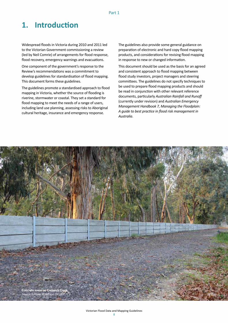
Concrete levee on Creswick Creek. Source: Simone Wilkinson, DELWP

Victorian Flood Data and Mapping Guidelines 9
Part 1
2.1 The Victorian Floods Review and response
Flood maps that were used for emergency response during the 2010-11 floods were variable in both quality and quantity. Some did not contain critical details, such as information on which roads would be cut off and which would be passable at different flood levels. Many maps used for the emergency response had been created primarily with land use and building planning in mind, with less thought given to their use during an emergency.
Flood studies that produced many of these maps were funded without clear agreement between investors and proponents on the data and mapping outputs that would be produced. In addition, maps were frequently not updated to reflect significant changes to the floodplain, such as construction of roads and changes to levees.
The Victorian Floods Review (the Comrie Review) identified inconsistences in standard practices for flood mapping across Victoria:
> Recommendation 21: The state establish standards for flood mapping to ensure they are kept contemporary and meet the purposes of land use risk planning and emergency response. In doing so, maps should extend where appropriate to include Probable Maximum Flood, over a range of Annual Exceedance Probability (AEP) levels and be explicitly linked to a stream gauge.
The Comrie Review was focused on riverine flooding. However, the principles of flood mapping taking account of local knowledge, meeting the needs of a range of users, and extending across both moderate and extreme floods are also relevant for coastal and stormwater flooding.
2. Background and context
2.2 Standards for flood mapping
These guidelines promote a consistent standard for flood mapping in Victoria. Consistency will improve the ways flood information is shared and used by individuals, government agencies and other organisations involved in floodplain management. Flood studies that are prepared with government financial assistance will need to meet this standard by:
• developing flood maps in consultation with local communities to make use of local knowledge
• covering a range of flood extents, from moderate to extreme, as well as historic floods
• referring to the most recent edition of Australian Rainfall and Runoff – A Guide to Flood Estimation and Australian Emergency Management Handbook 7, Managing the Floodplain: A guide to best practice in flood risk management in Australia
• taking into account the State Planning Policy Framework (SPPF) strategies where relevant, including to plan for and manage the potential coastal impacts of climate change
• ensuring maps are vetted by the relevant CMA or Melbourne Water
• consulting with Aboriginal communities to ensure cultural values are considered in assessing and mapping flood risks
• providing maps in the correct format for storage in the Victoria Flood Database (VFD)
• providing flood information at a property scale that can be used, understood and disseminated by flood emergency services agencies.

Victorian Flood Data and Mapping Guidelines 10
Part 1
2.3 Flood studies
Flood studies aim to provide data that can be used to develop products for flood response and help manage risks to the community. They involve the use of hydrologic and hydraulic models to determine flood flows, levels and velocities for a range of design flood Annual Exceedance Probabilities (AEPs). The models are usually calibrated to one or more historic flood events, where applicable data or other information is available on peak flow rates and water levels. The modelling results are used to determine flood hazard (often expressed as a velocity – depth- product), flood damages and ultimately flood risk (expressed as the product of probability and consequence of occurrence).
Until around 2000, flood studies were primarily undertaken to meet the planning and flood mitigation needs of Catchment Management Authorities, Melbourne Water and local government. They typically involved an assessment of the 1% AEP flood event in relation to its extent and depth.
Since 2000, and particularly since the floods of 2010-11, flood studies have had an increased focus on the modelling and mapping of a range of flood events. There is also an increased focus on mapping flood class levels (i.e. minor, moderate and major) where they exist, and also linking flood maps to local gauge levels.
2.4 Approaches to flood mapping
Approaches to flood mapping vary, depending on the location and available resources. This section documents some of these approaches. References to guideline documents are provided in more detail in Appendix A.
2.4.1 VictoriaWithin Victoria, there is no generally adopted, consistent technical approach to flood mapping. Melbourne Water has guidelines and technical specifications that are used for its flood studies. These guidelines have been adopted and used by some local governments.
The data and mapping outputs produced by flood studies depend on available resources and the needs of project investors and the steering committee. The standard of flood mapping has progressed over recent decades in response to advances in modelling techniques and software capability. In the past there has been no consistent standard for flood studies and the focus has tended to be on information needed for planning and building controls. Since the 1998 Victoria Flood Management Strategy was released there has been a growing trend to map a range of floods and to consider not just planning and building control requirements, but also emergency management needs.
Recommendation 21 of the Comrie review notes that, at the time of the review, general guidance was available for producing flood maps, but no formal standards or processes. Since the review, flood mapping projects prepared with financial assistance from the Victorian Government have been required to meet a range of purposes, including land use planning and emergency response, and address the other key Comrie review recommendations to:
• consult with the community to capture local knowledge and verify maps
• map multiple AEPs, including moderate through to extreme floods
• link flood maps to stream gauges where possible• identify the impacts of flooding on key infrastructure.

Victorian Flood Data and Mapping Guidelines 11
Part 1
Flood data in Victoria can be accessed from the Victoria Flood Database (VFD), including historic and modelled flood levels and extents. The VDF is continually improved and added to, and consultants producing flood studies in Victoria are required to deliver data to the VFD as GIS layers at the completion of the study.
Flood studies in Victoria use the technical guidance provided in Australian Rainfall and Runoff and Australian Emergency Management Handbook 7, Managing the Floodplain: A guide to best practice in flood risk management in Australia.
2.4.2 InterstateElsewhere within Australia, flood mapping guidelines are not usually available. NSW floodplain management is driven by the Floodplain Development Manual (2005); other relevant documents include the SES requirements from the FRM (Flood Risk Management) Process (2007). The Queensland Floods Commission of Inquiry has recommended that flood mapping guidelines be created for Queensland.
Copies of many Australian flood studies are available for download from Geoscience Australia’s flood studies database.
2.4.3 InternationalThe European Exchange Circle on Flood Mapping has guidelines for flood mapping from an emergency management and planning perspective. The US Federal Emergency Management Agency also has guidelines that specify the information required in each type of flood map.
2.5 Review of national guidelines
In 2012, the Commonwealth Attorney-General’s Department released the National Guidelines for the National Flood Risk Information Program (NFRIP, 2012). These guidelines were developed to “provide a framework to guide organisations in providing information to the National Flood Risk Information Portal”. Of the six guiding principles, one is of particular relevance:
Standardised – Information will use nationally consistent terminology, will cover a range of flood likelihood and sources, will be presented in standard formats and will be consistent across all jurisdictions. Relevant agencies will be encouraged to adopt best practice and incorporate the guidelines and lessons learnt into future contributions to the Portal. (NFRIP, 2012)
The other guiding principles are: shared, open, accessible, risk-based and innovative.
The Victorian Guidelines for Standardisation of Flood Mapping have been developed in recognition of the national guidelines and to ensure that Victoria’s approach does not contradict the national guidelines.
The 2012 national guidelines do not provide any specific guidance on desirable content of flood maps and are not prescriptive.
Since then, the National Flood Risk Advisory Group (NFRAG), a reference group of the Australian and New Zealand Emergency Management Committee (ANZEMC), has led the development of a generic project brief and technical specifications for flood investigations. NFRAG has also produced a guideline for using the generic project brief, and Victorian project managers are encouraged to use these documents when planning their own flood studies.

Victorian Flood Data and Mapping Guidelines 12
Part 1
The outputs from flood studies are used to create products to meet a range of needs. The National Flood Risk Advisory Group (NFRAG) has developed a National Generic Brief for Flood Investigations (July 2014), and a Guideline for using the National Generic Brief for Flood Investigations to Develop Project Specific Specifications (June 2014). These documents include guidance on desirable flood study outputs. Priorities for new and revised flood mapping will be identified through regional floodplain management strategies
Outputs from a flood study are used to:
• define flood-related controls in municipal planning schemes
• develop flood intelligence products and inform emergency response planning
• design flood mitigation works and activities• assist in the preparation of community flood
awareness and education products • assess flood risks to Aboriginal cultural heritage,
significant places and landscapes• support the assessment of flood risk for insurance
purposes.This section reviews the main uses for flood mapping and other flood study outputs and makes recommendations to help project managers meet these requirements.
Uniformity across multiple projects enables rapid familiarisation of project mapping during times of emergency – a critically important product use. Project managers should consider this when developing project specifications.
3. Requirements for flood mapping
3.1 What flood mapping is used for
3.1.1 Land use and development planning Local government authorities are responsible for land use planning and assessment of development applications on areas of flood prone land. An assessment of a proposed new development or change of land use in these areas needs to consider:
• the suitability of a proposed land use or development with respect to the applicable flood risk, and what level of flood protection needs to be applied
• whether the proposed development is likely to increase the flood risk to surrounding land users.
Local government authorities consider advice from catchment management authorities and Melbourne Water in assessing planning permit applications in areas within the 1% AEP flood extent. CMAs and Melbourne Water require access to flood extent, depth and velocity information to provide this advice.
3.1.2 Planning schemesThe delineation of planning scheme controls and building regulations is informed by mapped flood extents and flood hazard outputs. Local government authorities are responsible for ensuring that areas at risk of flooding in a 1% AEP flood are identified in their planning schemes. Planning scheme maps need access to 1% AEP flood extent and flood hazard data.
3.1.3 Flood mitigation and emergency planningFlood mitigation and emergency planning activities typically have similar requirements and use similar data sets. The key stakeholders in development of these products include VICSES, local government authorities and affected communities.
Flood mitigation and emergency planning activities need access to flood risk and flood consequence data. This will include flood extents, depths, and velocities along with associated impacts and consequences for a range of flood magnitudes (AEPs) including moderate flooding through to extreme floods, as well as historic events. Studies need to consider travel times for emergency planning, recessions and post drainage to assist with recovery.
Flood mitigation also needs to integrate protection of high-value waterways and wetlands, benefits of flooding on agricultural land and the natural environment, and Aboriginal cultural heritage and significant places.

Victorian Flood Data and Mapping Guidelines 13
Part 1
3.1.4 Emergency response and community education
Emergency response needs information that is clear, easy to understand, and easily accessed and shared during an emergency. VICSES and affected communities need to be able to link predicted or forecast flood timing and levels to local flood warning stream gauges to understand how they may be affected. DELWP has developed a web-based flood intelligence platform, FloodZoom, to be used by flood response agencies to access this information during floods. VICSES also produces printed and on-line flood awareness material tailored to the needs of each affected community.
3.1.5 Other usesInsurance premiums may be informed by information on property flood risk assessed against data for a range of flood magnitudes. A range of other stakeholders use flood mapping information for various purposes. For example, VicRoads may access this data to determine roads and other assets that are vulnerable to flooding or to determine whether roads projects are likely to affect existing flood levels. Other users may include environmental flow managers, who may use flood mapping information as part of the decision-making process for timing and magnitude of environmental flow releases.
3.2 Data outputs and formatting guidelines
Given the wide range of uses and users, requirements for data formatting will vary from flood study to flood study and need to be set out in project specifications. Ideally, all project partners, including local community members, should have the chance to have input to the specification. This document provides some guidance on what has been found to work well in previous experience, but these decisions are generally left up to flood project partners.
All flood studies should include a plan for community engagement and consultation to incorporate local knowledge and verification in the flood maps. Melbourne Water or the relevant CMA must also vet flood maps and other flood study outputs before they are published for use.
3.2.1 Digital information – Geographic Information Systems
Digital outputs may include both model outputs and post-modelling derived outputs. The required format, including software requirements, will depend on project partners’ requirements.
All GIS outputs for riverine flood mapping prepared with government financial assistance must be submitted for inclusion in the Victoria Flood Database (VFD). Information about submitting data for inclusion in the VFD and the FloodZoom platform are available from the DELWP website.
Flow depth gauge board at Benjaroop. Photo. Rohan Oliver, Ventia

Victorian Flood Data and Mapping Guidelines 14
Part 1
3.2.2 Static information – hard copy and electronic maps and other products
The need for printed hard copy maps is best determined by VICSES. VICSES may require hard copy maps at A1 or larger sizes to provide redundancy for electronic systems in case communication or electricity services are lost during an emergency. If hard copy maps are to be requested, the flood study specification needs to detail these requirements, and whether the maps need to be submitted in both electronic and printed format.
VICSES has developed a specification for preparation of maps used for emergency planning and response. It has also developed a specification that guides the population of municipal flood emergency plan mapping products. VICSES project group representatives can provide the project managers with the latest version of the specification to include in the flood mapping project specification.
Maps and documentation produced to update a planning scheme need to be in the format required by DELWP. Guides to the production of planning scheme amendment maps and documentation are available from the DELWP website.
3.3 Flood intelligence products and outputs
Flood intelligence products provide explanatory detail on how the mapping outputs were derived; flood behaviour mapping projects should address what they mean and how to interpret them. These products include a study report and flood intelligence outputs. Following are examples of flood intelligence outputs.
3.3.1 Municipal Flood Emergency PlanThe appendices of the Municipal Flood Emergency Plan (MFEP) template set out the type of data used by emergency services agencies in planning for, and responding to, flood events. The MFEP provides location-specific information on flood history, the local flood regime and critical areas of high flood risk and is an invaluable resource for flood analysts during a flood emergency. All flood intelligence outputs from flood studies can be presented in the MFEP, ensuring that this critical information is not buried in a highly technical flood study report.
MFEPs and associated mapping are developed using the VICSES template and specifications, available from the VICSES website.
3.3.2 Community educationA range of community education products can be prepared to supplement flood mapping projects. These may take the form of local guides that provide key information on local flood history, the flood mapping process, anecdotal information from residents and an overview of flood mitigation measures.
The need for, and format of, such guides is best determined by VICSES and community representatives.
Victorian Flood Data and Mapping Guidelines 15
Part 1
3.3.3 Flood damages and mitigation assessment
A flood damage assessment should be undertaken as part of a flood study. Flood damage assessments determine the costs associated with flooding and are completed for a range of AEPs so as to determine a locality’s actual flood risk.
This information is valuable from a floodplain management and emergency planning perspective as it identifies any areas where flood risk is intolerable and may require additional mitigation measures. It is also important to local government, as it provides an understanding of the potential financial burden on communities from various AEP events.
Providing this information will allow local government to assess the impact and costs to their communities associated with flooding, compared to the costs of constructing flood mitigation works. These assessments can in turn be used to support submissions for funding support from state and Australian governments.
Flood studies should also include an assessment of the effectiveness of any existing flood mitigation infrastructure. If possible, this should include an assessment of the impact of removal or failure of these works.
3.3.4 Flood warningEffective flood warnings provide information about when and where flooding is expected to occur and what community members can do to reduce damages. An assessment of flood warning service needs should be undertaken, including consideration of existing arrangements and the potential benefits of new or revised arrangements. This assessment can be later used to inform the design and implementation of a locally specific Total Flood Warning System.
3.4 Land use planning and building outputs
The results of flood studies are an important input in the development of flood-related planning scheme zones and overlays, and building controls.
Development and maintenance of these zones and overlays requires access to high-quality, contemporary flood information, principally flood extents for the 1% AEP event. Building regulations also require flood extent, velocity and hazard data.
Flood studies should consider the need to update the local planning scheme to reflect new flood risk mapping, and where an amendment is needed prepare documentation for the amendment.
DELWP provides a range of Planning Practice notes to assist with application of the Victoria Planning Provisions (VPP) and planning schemes as well as a range of planning processes and topics. Practice Note 12 (PPN12: Applying the Flood Provisions in Planning Schemes) provides guidance about applying the flood provisions in planning schemes. DELWP Practice Notes can be accessed from the DELWP website.

Victorian Flood Data and Mapping Guidelines 16
Part 1
This section discusses some of the many elements that ensure that flood maps achieve their stated purpose, convey the right information to the target audience, and are visually clear and appealing.
An effort has been made not be overly prescriptive around the detail of visual information and presentation style. The intention is to enable enough flexibility to allow for the preferences of particular flood study steering committees.
Some flood study stakeholders (including DELWP, VICSES, Catchment Management Authorities and Melbourne Water) have specific GIS workspaces for flood study data and mapping. These workspaces typically mandate some of the items discussed below and should be used where available.
4.1 Map scale
Nominally, towns or locations of higher population and infrastructure density should have a larger scale to allow for easy reference of flood impacts.
Different scales may also be appropriate for land use planning and emergency response maps. Readability is clearly of paramount importance for hard copy maps.
Project partners may have particular requirements for map scales. Typical map scales in urban areas may be around 1 in 5,000 whereas lower-resolution scales of up to 1 in 10,000 or even 1 in 20,000 may be appropriate for rural areas. Where higher-resolution maps are required it may be necessary to provide maps as a set or collection to cover the entire area of interest. When doing this, include a key map showing the layout of the individual high-resolution maps, and some overlapping area on each high-resolution map is preferred.
The scale at which flood modelling results are presented can depend on the scale at which the modelling itself was undertaken and the quality of the digital terrain data on which it was based. It would not be credible to attempt to present results from a flood model based on a low resolution topographic grid cell size on a very high-resolution, detailed flood map. Advice on selection of the appropriate flood model topographic grid cell size is available from the outcomes of the Australian Rainfall and Runoff Revision Project 15.
All maps should include a bar scale. It may also be desirable to include graticules depending on the scale and content of the map.
4. General guidelines on map presentation
4.2 Base layers
Base layers are the geographic information underlying the flood extents or other flood information shown on maps. They generally consist of data sets such as:
• road alignments (centre lines or greater detail on high-resolution maps)
• alignments or locations of infrastructure such as railways, levee banks, etc
• waterway alignments• locations of lakes, wetlands and other water bodies• land use, including state land, urban land, etc• localities, town and place names for low-resolution
maps• topography, i.e. contours• aerial photography• cadastre, i.e. register of property titles• water storages• gauge locations• features of interest.Use of base layers is primarily designed to enable map users to locate themselves and relate flood information shown on the maps to actual locations. Where possible, detailed and legible labelling of base layers should be included on all maps, but this labelling should not clash with, or detract from, the primary purpose of the maps. Selection of appropriate base layers to be included on any flood map will depend on the scale of the map, the purpose, audience and quality of the available data sets.
Where practicable, labelling of as many base layer features as possible should be included. This is most easily done before the flood data itself is added, as it allows for consistent labels across all maps in the same set. Linear features such as roads and waterways should be labelled with text parallel to the feature.
Formatting of the labels should be consistent and the text colours can be adjusted to match the feature being labelled.
Contours (if used as base map layers) should be labelled so that both the scale and absolute value of any contour on the map can be readily determined. Use of cadastre layers on some maps may be inappropriate if the scale resolution is too low.

Victorian Flood Data and Mapping Guidelines 17
Part 1
4.3 Colour palette
Selection of an appropriate colour palette should consider the following:
• Optimisation of the palette to ensure legibility of the various data sets that are plotted on the map. Reference should be made to the Victorian Department of Planning and Community Development’s Communicating Data with Colour guideline, which has been produced to assist legibility for people with colour blindness.
• Consistency of the palette between various maps in the same set.
• When graded shading is used to define magnitude in a data set, whether critical thresholds and values can be easily interpreted from the shading.
• It can be difficult to distinguish between two shades of the same colour; distinguishing between two different colours is frequently easier. Guidance on appropriate contrasts is available from Vision Australia.
• Typical convention uses blue/green to indicate low magnitude or flood hazard, amber to indicate moderate magnitude or flood hazard and red to indicate high magnitude or flood hazard.
• If legibility of the map requires the user to distinguish between two close shades or colours, there is probably too much data on the map.
• A clear legend explaining the significance of each colour. If a degree of transparency is used in colourisation, ensure this is reflected in the legend.
4.4 Labelling maps
All maps should include basic items such as legend, scale, north arrow and title. Map titles should include a clear description of the data plotted on the map, and a sub-heading that summarises the intention of the map.
Other basic information such as the date the map was created, the organisations responsible for the map (typically local government agency, CMA / Melbourne Water and consultant) and the map revision number.
Where possible, flood study practitioners should include textual information on maps. This is best done in a clearly separated box and may include information such as:
• further information about the purpose or uses of the map
• identification of any limitations or uncertainties in the plotted data
• a statement of reliance for the map and plotted data• data source (e.g. study, year, consultant)• useful local or anecdotal information that supplements
the map data.Where this information is included, it should be carefully edited to ensure that it states the key points without dominating the plotted data.
The following gives sample text for identification of limitations in the plotted data:
“No two floods behave in exactly the same manner even though they may rise to the same maximum height at a given location. The information given shall be regarded as only representing typical conditions. (North Central CMA, Castlemaine, Campbells Creek and Chewton Flood Management Plan: RFT Part B – Specification, November 2012)”
Take care with terminology on maps to minimise confusion. This includes correct and consistent use of flood probability terminology (e.g. ‘1% AEP’ is the preferred approach) as well as clear labelling of items like velocity (cross-sectional average or vectors) and depth of inundation versus flood depth or peak depth.

Victorian Flood Data and Mapping Guidelines 18
This section discusses some other aspects that should be considered when planning and reviewing the lifecycle of a flood map and its uses.
5.1 Non-structural flood mitigation
While the preparation of flood maps is an integral component in assessing structural flood mitigation options, making the information contained in the maps available to the community is also important. For example, a map showing flood extents and consequences can be used to identify those areas subject to the highest flood risk. Such maps are powerful tools for interpreting flood forecasts, planning flood responses and identifying safe access and egress routes during a flood.
Flood maps are used in community flood awareness activities and printed material promoting greater understanding of the likelihood and consequences of flooding for individuals, and how they can act to reduce damages. Total flood warning system design also incorporate flood maps, including making assessments of suitable locations for new flood warning gauges.
Flood maps are also used to determine the numbers, types, and locations of buildings that are affected at different forecast or predicted flood levels.
5.2 Guidelines for review of flood mapping
Flood maps are a snapshot at the point in time when they were created. There will be developments and changes that mean that the maps become less accurate over time. These changes include:
• additional flooding resulting in better understanding of flood behaviour
• changes in land use and population spread or density• changes in flood modelling, mapping or analysis
techniques• changes in key input data such as design rainfall
intensity-frequency-duration data (either as a result of an update or via an external forcing factor such as climate change)
• implementation of structural flood mitigation measures
• availability of improved data sets, including topographic data
• land form change including scour, erosion or sedimentation of waterways, culverts and bridges
• infrastructure development, such as freeways, railways and major buildings.
The decision to renew flood mapping depends on the needs of stakeholders, and any agency with an interest in flood mapping can raise the need for a review. CMAs and Melbourne Water will lead development of regional floodplain management strategies in collaboration with local communities and partner agencies. These strategies will continually review and align the various agencies’ priorities for new and revised flood mapping over a three year rolling implementation plan.
Updating flood maps can involve a substantial update of the existing modelling and analysis, so the costs need to be considered. To minimise the cost of such updates, it is recommended that local government capture and retain electronic copies of the input data sets, models, maps and calculation records that the flood study practitioner used to create the maps. This will ensure that future practitioners can more easily update these data sets.
5. Discussion
Part 1

Victorian Flood Data and Mapping Guidelines 19
5.3 Recognition of best practice
These guidelines seek to provide some advice on good practice for flood mapping in Victoria and should be read in conjunction with other reference documents. Flood study methodologies should be consistent with the advice provided in Australian Rainfall and Runoff. There are a range of other technical guidelines that may be relevant for flood study development.
For flood study steering committees, independent expert review of technical methodology and outputs studies is valuable. While this may add a small sum to the cost of a flood study, such reviews can help ensure that best practice in modelling, analysis and mapping has been used.
Part 1
5.4 Incorporating local knowledge
Recommendation 22 of the Victorian Floods Review highlighted the importance of local information and knowledge:
The state take the necessary measures to require that local knowledge is considered in flood risk planning, including verification of flood maps and flood response plans.
Steering committees for flood studies are made up of locally based stakeholders to ensure local knowledge is incorporated in the flood study, and flood maps are vetted by people who understand local flooding behaviour. Such committees will include CMA / Melbourne Water representatives, local government representatives, emergency services representatives, critical infrastructure managers, residents and business owners.
CMA and Melbourne Water representatives will support the local steering committee’s role in vetting maps and other flood study outputs by reviewing and approving all maps and outputs before they are published.
Flood marker at Breakwater Road, Geelong. Source: Simone Wilkinson, DELWP

Victorian Flood Data and Mapping Guidelines 20
Queensland Floods Commission of InquiryThe Commission of Inquiry identified that “emergency management decision-making would benefit from access to detailed flood maps which show floods over a range of likelihoods – up to and including the probable maximum flood” (QFCI, 2012). The inquiry recommended that mapping be undertaken in areas with no mapping, and that the Queensland Government determine the appropriateness of existing guidelines for flood studies and mapping, and create guidelines where needed (recommendation 2.22).
The report documenting the Commission of Inquiry is available at: http://www.floodcommission.qld.gov.au/publications/final-report
NSW Floodplain Development ManualFloodplain management in NSW is guided by the NSW Floodplain Development Manual (2005). The manual does not provide any guidance on flood mapping. As a result, flood mapping undertaken currently differs between projects. Some broad guidance on flood mapping for emergency management purposes is included in SES requirements from the FRM (Flood Risk Management) Process (2007).
Queensland Reconstruction Authority As part of its briefing documents, the Queensland Reconstruction Authority (QRA) specifies mapping requirements for flood mapping and layers required.
US Federal Emergency Management AgencyOver the past two decades, the US Federal Emergency Management Agency (FEMA) has undertaken identification and assessment of flood hazards along with community based mapping of flood hazard information (FEMA, 2003a). The guidelines outline the information required to be presented on each type of map along with additional optional information if available (Section 1.4.2.3; FEMA, 2003b).
They are highly prescriptive, and specifically geared to US system requirements.
These guidelines are available from: http://www.fema.gov/library/viewRecord.do?id=2206
Appendix A. Examples of flood mapping standards/guidelines available in other locations
European Exchange Circle on Flood MappingThe European Exchange Circle on Flood Mapping (EXCIMAP) Handbook on good practices for flood mapping in Europe (EXCIMAP, 2007) outlines map requirements for planning and emergency management maps, and outlines the type of map, map content, map use, scale considerations and colour scheme for a variety of map types.
The Handbook discusses different approaches used a range of European countries, and provides guidance on the types of information that should or could be used on a range of different maps types for different purposes. It refers essentially to four types of maps, with associated broad purposes:
1. Flood hazard maps• Landuse planning and land management• Watershed management• Water management planning• Flood hazard assessment on local level• Emergency planning and management• Planning of technical measures• Overall awareness building
2. Flood risk maps• Basis for policy dialogue• Priority setting for measures• Flood Risk Management Strategy (prevention,
mitigation)• Emergency management (e.g. the determination of
main assets)• Overall awareness building
3. Emergency maps• Emergency management
4. Insurance maps• InsuranceThe Handbook is available at: http://ec.europa.eu/environment/water/flood_risk/flood_atlas/pdf/handbook_goodpractice.pdf
Part 1

Flood warnings for Geelong are linked to river heights at Macintyre Bridge on the Barwon River. Source: Simone Wilkinson, DELWP

Tide marker at Barwon Heads. Source: Simone Wilkinson, DELWP

Victorian Flood Data and Mapping Guidelines 23
Part 2: Standardisation of flood data collection
1. Introduction 24
2. Background and context 242.1 Overview of the Victorian Floods Review and Government response 252.2 Approaches to flood data collection 25
3. Business requirements for flood data collection 273.1 Business needs and key stakeholders 27
4. Planning for flood data collection 32Step 1 – What is the value of data collection? Determining priority areas and trigger points for data collection 33Step 2 – What could data be used for? 33Step 3 – What data do you need for this purpose? 34Step 4 – What is the most appropriate way to source the data? 38Step 5 – Who is best to collect the data? 38Step 6 – How will the data be documented and stored? 38

Victorian Flood Data and Mapping Guidelines 24
Part 2
One component of the Victorian Government’s response to the 2011 Victorian Floods Review (the Comrie Review) was a commitment to review processes and arrangements for collection of data during and after a flood.
The floods review found that roles and responsibilities for flood data collection were unclear on the extent and type of information that should be collected.
These guidelines promote a consistent approach to the process of flood data collection in Victoria. They encourage development of locally agreed processes for collection of flood data sets that can be used for a range of purposes.
1. Introduction
Development of the guidelines involved several discrete tasks, including:
• stakeholder engagement via a facilitated workshop to determine what was needed in the guidelines, and who uses flood data and why
• review of existing generic guidelines• further engagement to obtain feedback on the revised
guidelines.
Flood depth marker at Russells Bridge. Source: Simone Wilkinson, DELWP

Victorian Flood Data and Mapping Guidelines 25
Part 2
2. Background and context
2.1 Overview of the Victorian Floods Review and Government response
The Comrie Review highlighted the need for consistent, reliable data about floods:
Recommendation 29: “the state clarify which agency is responsible for collecting post-flood extent and related data. This should include:
• The development of guidelines to ensure consistent standards are applied to post-flood data collection; and
• An appropriate process to ensure funding availability for such activities.”
The Review noted the importance of regularly collecting data after a flood to improve understanding of flood behaviour for a range of purposes, including updating flood plans, identifying gaps in flood warning systems, and enhanced land use planning. The Review also noted that data collection should include recording not just flood extents and depths, but the time and corresponding flood gauge height when infrastructure such as roads, medical facilities and other essential services are first flooded.
2.2 Approaches to flood data collection
The Review noted that there was a significant data collection effort, primarily by CMAs, following the 2010-11 floods. This included:
• community meetings, particularly in areas where little information was previously available
• floor level surveys• pegging of flood extents, both during and after the
events• aerial photography, particularly to capture flood
extents.However, during consultation for the Review, some Local Government Authorities (LGAs) said they “were unsure whether or not the CMAs would be collecting data in urban centres”.
These guidelines update arrangements for coordination and consistency of flood data collection to reflect the expectations of the Victorian Floods Review. This includes expanding the generic list of data types to be collected and associated responsibilities for collection.
The roles of each agency in collection of data need to be agreed, documented and understood to avoid confusion and wasted time and resources when a flood occurs.
2.2.1 Victoria Flood Management Strategy 1998The Victoria Flood Management Strategy (1998) stated that Department of Natural Resources and Environment (DNRE), CMAs and Councils would undertake “monitoring of flood events”. Comrie noted that while CMAs typically “coordinate the monitoring of significant flood events”, there was still considerable uncertainty about responsibility for collection of data post the 2010-11 floods. He stated that “it is not unreasonable to expect that Councils would collect data specific to urban systems and CMAs and DSE rural areas.”

Victorian Flood Data and Mapping Guidelines 26
Part 2
2.2.2 Catchment Management Authority Water Act 1989 Statement of Obligations
The Catchment Management Authority Water Act Statement of Obligations clause 28 subclause 5 says: “The Authority shall coordinate the collection of appropriate flood data following a significant flood event and make it available to the public”. The Victorian Government’s response to the Victorian Floods Review Recommendation 29 said the statement of obligations would “be reviewed to recognise the importance of collecting flood data”.
2.2.3 Department of Sustainability and Environment flood response guidelines – July 2008
The DSE 2008 flood response guidelines summarised roles and responsibilities for collection of flood data, as well as describing the main types of data to be collected. The guidelines set out CMA and DSE responsibilities, including cost sharing and triggers for data collection.
The Victorian government’s response to the floods review Recommendation 29 says that these procedures will be reviewed to ensure they include “clearer protocols and standards.”
2.2.4 CMA flood response action planThe generic CMA flood response action plan includes appended flood data collection guidelines that generally reflect the 2008 DSE guidelines.
2.2.5 Victorian Floodplain Management Strategy
The 2016 Victorian Floodplain Management Strategy notes that CMAs and Melbourne Water will continue to be accountable for identifying and prioritising post-flood data needs, in collaboration with DELWP. These guidelines have been developed to encourage consistent standards for post-flood data collection.
Recreational open spaces on the Murray River floodplain at Mildura. Source: Simone Wilkinson, DELWP

Victorian Flood Data and Mapping Guidelines 27
Part 2
3. Business requirements for flood data collection
3.1 Business needs and key stakeholders
Flood data collected during and after a flood from a variety of sources provides valuable information on flood behaviour. Records of flood flow, flood depth, flood extent and flood behaviour are important for calibrating and validating computer models. The types of desirable flood data sets are provided in Chapter 4 to guide development of CMA flood data collection arrangements.
The business needs associated with flood behaviour mapping projects are included in Part 1 of this document, Victorian Guidelines for Standardisation of Flood Mapping.
Crops planted on the Moorabool River floodplain. Source: Simone Wilkinson, DELWP
Some of the more significant data types collected, and their uses, include:
• Peak flood levels; peak flood flows; peak flood extents: This will provide calibration data for hydrologic and hydraulic models, leading to improved estimates of flood levels and extents for a range of AEP floods. This will, in turn, improve planning schemes, improve land use and development planning, and improve assessment of flood risk in determining insurance premiums.
• Inundated properties; roads and rail lines closed or damaged: This will provide input to assessments of flood consequences for a range of AEPs, and improve planning for those events.
• Performance of levees and other flood mitigation works: This will provide data for design of upgrades to mitigation works that did not perform as expected.
Table 1 provides a more complete tabulation of flood data that could be collected, uses of the data and the benefits associated with its collection.

Victorian Flood Data and Mapping Guidelines 28
Part 2
2. What could data be used for?
3. What data do you need for this purpose?
4. What is the most
appropriate way to source data?
5. Who is best to collect
the data?1. What is the value of data collection?
Land use planning, development assessment Emergency planning and response Flood mitigation Property flood risk
Data type Sub-type Description detailsImproved
land use planning
Improved development
application assessment
Improved emergency
planning
Improved emergency
response
Improved flood
mitigation design
Flood mitigation
work upgrades
Improved access
to flood mitigation
funding
Improved waterway
asset protection
Improved Civil
Infrast’ure Protection
Improved Flood Risk
Assessment (Insurance)
Recalibration of models – revised flood levels
RainfallDistribution, totals over period, temporal distribution
Rainfall networks BoM, Rural Water Authorities x x x x x x x
Recalibration of hydrologic models – revised flood levels
Peak flood flows, shapes of hydrographs, travel times
Stream gauging records
Records from permanent stream gauging stations and field measurements of flow / height relationships
Stream gauge sites and Thiess Hydrographic Services Pty Ltd
DEWLP, Rural Water Authorities, BoM
x x x x x x x
Reservoir performance
Reservoir inflows and outflows Reservoir operators DEWLP, MDBA, Rural
Water Authorities
Recalibration of models – revised flood levels
Peak flood levels River gauge levels and flood marks (waterline or debris)
Stream gauge sites (including via Portable Automated Logger Systems (PALS)) and field survey contractors
Municipalities, CMAs x x x x x x x
Recalibration of models – revised flood extents
Peak flood extents
Aerial flood photography
Vertical and oblique flood photography, as close to peak as possible, natural or infra-red
Contractors
Municipalities, Government Agencies (e.g. VicRoads), media.
x x x x x x xSatellite imagery Remote sensing specialist retailers
Municipalities, Rural Water Authorities
Ground-based flood photography
Photographs of flood extent and impacts, taken at ground level
Field staff, local residents
Municipalities, Rural Water Authorities
Assessment of performance of works and infrastructure relative to performance standards
Evaluation of asset performance
Performance of levees, seawalls, retarding basins, bridges, culverts, drainage infrastructure, etc
Photographs, description of performance, description of damage, percentage of flow capacity blocked
Asset owners and managers CMAs, municipalities x x x x x x x
Table 1: Data types, sources, uses and benefits

Victorian Flood Data and Mapping Guidelines 29
Part 2
2. What could data be used for?
3. What data do you need for this purpose?
4. What is the most
appropriate way to source data?
5. Who is best to collect
the data?1. What is the value of data collection?
Land use planning, development assessment Emergency planning and response Flood mitigation Property flood risk
Data type Sub-type Description detailsImproved
land use planning
Improved development
application assessment
Improved emergency
planning
Improved emergency
response
Improved flood
mitigation design
Flood mitigation
work upgrades
Improved access
to flood mitigation
funding
Improved waterway
asset protection
Improved Civil
Infrast’ure Protection
Improved Flood Risk
Assessment (Insurance)
Recalibration of models – revised flood levels
RainfallDistribution, totals over period, temporal distribution
Rainfall networks BoM, Rural Water Authorities x x x x x x x
Recalibration of hydrologic models – revised flood levels
Peak flood flows, shapes of hydrographs, travel times
Stream gauging records
Records from permanent stream gauging stations and field measurements of flow / height relationships
Stream gauge sites and Thiess Hydrographic Services Pty Ltd
DEWLP, Rural Water Authorities, BoM
x x x x x x x
Reservoir performance
Reservoir inflows and outflows Reservoir operators DEWLP, MDBA, Rural
Water Authorities
Recalibration of models – revised flood levels
Peak flood levels River gauge levels and flood marks (waterline or debris)
Stream gauge sites (including via Portable Automated Logger Systems (PALS)) and field survey contractors
Municipalities, CMAs x x x x x x x
Recalibration of models – revised flood extents
Peak flood extents
Aerial flood photography
Vertical and oblique flood photography, as close to peak as possible, natural or infra-red
Contractors
Municipalities, Government Agencies (e.g. VicRoads), media.
x x x x x x xSatellite imagery Remote sensing specialist retailers
Municipalities, Rural Water Authorities
Ground-based flood photography
Photographs of flood extent and impacts, taken at ground level
Field staff, local residents
Municipalities, Rural Water Authorities
Assessment of performance of works and infrastructure relative to performance standards
Evaluation of asset performance
Performance of levees, seawalls, retarding basins, bridges, culverts, drainage infrastructure, etc
Photographs, description of performance, description of damage, percentage of flow capacity blocked
Asset owners and managers CMAs, municipalities x x x x x x x

Victorian Flood Data and Mapping Guidelines 30
2. What could data be used for?
3. What data do you need for this purpose?
4. What is the most
appropriate way to source data?
5. Who is best to collect
the data?1. What is the value of data collection?
Land use planning, development assessment Emergency planning and response Flood mitigation Property flood risk
Data type Sub-type Description detailsImproved
land use planning
Improved development
application assessment
Improved emergency
planning
Improved emergency
response
Improved flood
mitigation design
Flood mitigation
work upgrades
Improved access
to flood mitigation
funding
Improved waterway
asset protection
Improved Civil
Infrast’ure Protection
Improved Flood Risk
Assessment (Insurance)
Assessment of total flood damage costsAssessment of consistency with emergency management planningAssessment of adequacy of land use planning
Flood damages
Deaths/injuries Victoria Police VICSES
x x x x x x x x x x
Erosion/debris damage (waterways, bridges, levees, etc)
Photos of flood extent and impacts, taken at ground level
Field staff CMAs, municipalities
Which buildings and properties were inundated and to what depth
Field staff, local residents
Municipalities, insurance companies
Which roads/rail lines/infrastructure closed/damaged
Asset owners, managers Municipalities
Direct and indirect overall damage costs
Those involved in flood response and recovery, flood situation reports. Flood questionnaires
Dept. Treasury and Finance, Municipalities, DEWLP, BoM, VFF, community, Dept. Human Services, insurance companies
Flood relief payments
Grants and disaster relief payments, insurance payments, Red Cross, Salvation Army
Beneficiaries and those providing funding
Dept. Treasury and Finance, Dept. Human Services, other agencies
Assessment of consistency with and adequacy of emergency management planningAssessment of adequacy of evacuation centres, evacuation routes
Flood warning and emergency management activities
Sequence of flood inundation
Field staff, local residents CMAs, municipalities
x x x x x
Numbers of people evacuated; from/to where. Issues?
Victoria Police, municipalities VICSES
Warning times Local residents VICSES, CMAs, BoM
Performance of emergency services Vic SES Municipalities,
Victoria Police
Table 1: Data Types, Sources, Uses and Benefits (continued)
Part 2

Victorian Flood Data and Mapping Guidelines 31
2. What could data be used for?
3. What data do you need for this purpose?
4. What is the most
appropriate way to source data?
5. Who is best to collect
the data?1. What is the value of data collection?
Land use planning, development assessment Emergency planning and response Flood mitigation Property flood risk
Data type Sub-type Description detailsImproved
land use planning
Improved development
application assessment
Improved emergency
planning
Improved emergency
response
Improved flood
mitigation design
Flood mitigation
work upgrades
Improved access
to flood mitigation
funding
Improved waterway
asset protection
Improved Civil
Infrast’ure Protection
Improved Flood Risk
Assessment (Insurance)
Assessment of total flood damage costsAssessment of consistency with emergency management planningAssessment of adequacy of land use planning
Flood damages
Deaths/injuries Victoria Police VICSES
x x x x x x x x x x
Erosion/debris damage (waterways, bridges, levees, etc)
Photos of flood extent and impacts, taken at ground level
Field staff CMAs, municipalities
Which buildings and properties were inundated and to what depth
Field staff, local residents
Municipalities, insurance companies
Which roads/rail lines/infrastructure closed/damaged
Asset owners, managers Municipalities
Direct and indirect overall damage costs
Those involved in flood response and recovery, flood situation reports. Flood questionnaires
Dept. Treasury and Finance, Municipalities, DEWLP, BoM, VFF, community, Dept. Human Services, insurance companies
Flood relief payments
Grants and disaster relief payments, insurance payments, Red Cross, Salvation Army
Beneficiaries and those providing funding
Dept. Treasury and Finance, Dept. Human Services, other agencies
Assessment of consistency with and adequacy of emergency management planningAssessment of adequacy of evacuation centres, evacuation routes
Flood warning and emergency management activities
Sequence of flood inundation
Field staff, local residents CMAs, municipalities
x x x x x
Numbers of people evacuated; from/to where. Issues?
Victoria Police, municipalities VICSES
Warning times Local residents VICSES, CMAs, BoM
Performance of emergency services Vic SES Municipalities,
Victoria Police
Part 2

Victorian Flood Data and Mapping Guidelines 32
Part 2
4. Planning for flood data collection
To minimise the uncertainties in flood data collection identified in the Comrie review, floodplain managers need to plan and document activities well in advance of a flood.
There are context-specific considerations that need to be taken into account in planning these activities, so these guidelines do not give a prescriptive process for planning flood data collection. Instead, the following provides a series of key questions to be considered and a generic process for determining what activities should be planned. These include:
• Why should we collect the data?• How will it be used?• What data needs to be collected?• What methods should be used for collecting data?• Who should collect the data?
8
1. What is the value of data collection?•e.g. understand flood behaviour in poorly understood areas, or new development areas
2. What could data be used for?•e.g. recalibration of flood models to revise flood levels in key areas of catchment
3. What data do you need for this purpose?• e.g. peak flood extents
4. What is the most appropriate way to source the data?•e.g. aerial photography•e.g. survey of debris level
5. Who is best to collect the data?• e.g. aerial photography contractors
•e.g. local stakeholder/ agencies
6. How will the data be documented and stored?•e.g. Victoria Flood Database
The following sections provide further information about these key elements, including a summary table to inform flood data collection planning and conversations with other agencies and partner organisations.
The scope and nature of flood data collection should be considered for different flood scenarios by following the six step process:

Victorian Flood Data and Mapping Guidelines 33
Part 2
Step 1 – What is the value of data collection? Determining priority areas and trigger points for data collection
Flood data collection can be a costly exercise so it is important that resources be appropriately prioritised and targeted. To maximise the effectiveness of data collection, all CMAs, Melbourne Water, councils and other relevant agencies should have clear plans in place, with accompanying maps documenting target areas, trigger points and relative priorities. Trigger points should, where possible, be linked to flood warnings and associated flood gauge levels.
To determine target areas and priorities, take into account:
• The magnitude of the flood event. Additional effort will particularly be warranted if the event is the largest on record.
• Information gaps, particularly if these are in areas of significant development or known flood risk.
• Types of data gaps. Some types of data are most effectively collected during or as soon as possible after a flood. Gauging of peak flood flows and aerial photography of peak flood extents, for example, must be undertaken as close to the time of the flood peak as possible. The clarity of debris marks and other similar evidence of peak flood levels diminish rapidly after a flood and should be recorded as soon as possible after the flood recedes.
Step 2 – What could data be used for?
Table 1 provides a summary of the types of data that could be collected, uses for the collected data, collection methods and key resources.
The key uses for data summarised in the table include:
• recalibration and validation of hydraulic models – revised flood levels and extents
• recalibration of hydrologic models – revised flows• assessment of performance of levees and other flood
mitigation works relative to performance standards• assessment of total flood damage costs• assessment of consistency with and adequacy of
emergency management planning• assessment of adequacy of land use planning• assessment of adequacy of evacuation centres and
evacuation routes.

Victorian Flood Data and Mapping Guidelines 34
Part 2
Step 3 – What data do you need for this purpose?
Types of data collectionTable 1 documents the various types of data that could be collected, based on a range of business needs. It is important that agencies agree on these needs well in advance of a flood.
RainfallRainfall records help monitor and assess floods, and are useful for future flood studies. Rainfall distribution patterns, intensities and totals falling over the catchment are inputs for hydrological modelling. This information is available from BoM, Regional Water Monitoring Partnerships and Melbourne Water.
Peak flood flowsPeak flood flows and hydrographs are available from stream gauging stations (if they have a rating table). Alternatively, hydrographers can undertake measurements during floods. The information is useful to determine flow magnitude and flood frequency.
Floods provide an opportunity to undertake additional gaugings to improve the gauge height versus flow correlations that form the basis of flow rating tables.
Planning is essential for field measurement during a flood and this can be arranged through the relevant Regional Water Monitoring Partnership. CMAs should check with the partnership coordinator to understand arrangements in their area. Alternatively, each CMA may establish a standing contract with hydrographers that includes provisions for call-out at short notice.
Concentrate on areas where there is a shortage of flow information and also where there is a need to improve rating tables at river gauges. In some instances, CMAs may also want to arrange peak flow measurements at specific ungauged sites, e.g. if there is a need to clarify flow distributions across a floodplain.
Peak flood level surveysFlood level surveys are best undertaken soon after a flood, when multiple recent flood marks are available, pegs haven’t been disturbed and people’s memories are fresh. Apart from the basic requirements of a licensed surveyor (preferably with experience in surveying flood marks) the following is required:
Interviews
• Procedures to ensure a reasonable effort is expended in contacting landholders.
• Interviews with landholders about the current and previous flood heights.
• Contact landholders prior to levelling. Flood marking
• Flood marks should be captured on both sides of the floodplain and, if possible, spread out across the floodplain.
• Levels should be obtained at the locations of previous recorded flood levels if possible.
• Flood levels should be distributed at reasonable intervals along the floodplain (this can be every hundred metres to every 2,000 metres, depending on the hydraulic slope).
• Levelling to AHD +/-5 cm (if GPS is used, need accuracy checks).
• Return runs as a cross check for accuracy. Documentation
• A robust method of documentation (consider use of laptops, spreadsheets, scanned imagery for locating and recording flood mark locations and GIS capability).
• A standard form of documentation so that all flood level surveys are consistent.
• Placing survey marks at a permanent fixture. • Field sketches and photographs. • Distance of flood marks to fences, roads or other
features (for later plotting and establishment of coordinates or if Global Positioning System [GPS] is used, as a sanity check).
• Use of suitable reference maps (hard copies and/or digital).
• Locations of flood marks in AMG coordinates. • GIS capability – peak flood levels should be collected
in a format that enables them to be uploaded to the Victoria Flood Database (VFD).

Victorian Flood Data and Mapping Guidelines 35
Part 2
Project controls
• For large jobs, divide into areas under different survey teams, coordinated by a central project manager who must ensure that there is a reasonable coverage of levels.
• If GPS is used for establishing flood levels, document corrections made and provide cross checks with bench marks.
• Record methodology. • Provide consistent documentation and presentation.• Flood level surveys are usually undertaken by licensed
surveyors.Portable data loggers (Portable Automated Loggers [PALS]) are available for deployment to collect and transmit flood level data during a flood event.
Flood pegging Flood pegging involves placing stakes in the ground, preferably close to the peak and within the area predicted to be affected by flooding. When the flood recedes watermarks are left on the pegs (particularly if they are coated with water-soluble paint).
Flood pegging is commonly employed for slow-moving floods, where there is little turbulence, a reasonable amount of flood warning time and site conditions are not likely to be hazardous. Stakes should be located where they are unlikely to be affected by debris, typically at the edge of the flood, and where they are unlikely to be disturbed.
As a supplement or alternative to recording a level on a stake, a record of peak flood levels can be taken by observing the results of flood debris. Fine debris, in the form of grass seed, saw dust, discolouration (resulting from turbid floodwaters) or small leaves, provides the best record and is often found above coarser flood debris (grass, paper, plastic, rubbish, tree trunks, etc). It is usually deposited from receding floodwaters and is strained out when passing through fence posts, bushes, trees, etc. Flood marks in vegetation may overestimate the flood levels if the vegetation resumes its upright position after a flood or if wave action occurs.
Each stake (or mark) needs to be identified (given a number). Usually, the level of the water on the stake is marked by chalk, crayon, paint or waterproof ink close to the flood peak. The date and time of the observation should be recorded.
Equipment needs are basic and include:
• survey stakes – purchased in advance, preferably painted so they can be seen and stored
• CMA identification • mobile phone • camera • locality map • waterproof clothing, umbrella • writing materials (paper and clipboard or writing pad,
pens, pencils) • tape measure • stakes, hammer and nails • marker tape or fluorescent spray can • adequate refreshments.As many levels as possible should be marked during a flood at chosen locations along the entire length of a waterway. If possible, an adjacent flood mark should be obtained as confirmation of the level and as a safeguard if a stake is washed away. Flood level marking should also be supported by landowner observations, where possible.
Aerial flood photographyAerial photography provides a historic record of the extent of flooding at a given date and time. It provides useful data to confirm areas flooded and to verify flood behaviour.
The quality and the usefulness of the information will depend on the available budget, the coverage and the prevailing weather conditions. If flying conditions are restricted because of bad weather or there are cost issues, a hand-held camera (or video recorder) out of a plane or helicopter might be the only realistic option.
CMAs should consider purchasing a digital camera, with GPS receiver and GPS photo link software to make the process of linking the photo with the location easier.
If weather conditions and budget permit, fully ortho-rectified photography (i.e. photos corrected for camera tilts and terrain distortions) is recommended.
For slow-moving floods across large floodplains, it may be necessary to arrange flood photography over a number of days, to ensure flood extents close to the flood peak are captured.

Victorian Flood Data and Mapping Guidelines 36
Part 2
General requirements are:
• Large format, metric colour photography is preferred. • Civil Aviation Safety Authority (CASA) certified operator
with a specially mounted camera system. • Vertical photography, supplemented by obliques if
cloud cover is a problem. • Digital flight plan showing run and photo centres
provided in ESRI shape format. • Description of flood (e.g. October 1993 floods – Broken
River), time of photography, altitude, date and photo number to be clearly recorded on each photograph.
• Entire flood plain to be captured. • Full stereo coverage (60% forward and 30% side
overlap). • Indication of location and travel time of flood peak. • Follow the flood peak (there’s no point in
photographing dry areas). Flood photography needs to be arranged as quickly as possible, in advance of the flood peak. The time taken from the earliest reliable indication of major flooding to the commencement of photography is typically around 24 hours (less if a locally based contractor is available).
If the flood peak is missed, infra-red photography may provide a reasonable indication of wet and dry areas.
The scale of photography will vary and is generally determined by the cloud cover. For 1:25,000 scale photography, the flying height is about 4,000 m. For 1:5,000 scale, the flying height is about 770 m.
DELWP should be consulted regarding state-based purchasing arrangements prior to seeking quotes.
Satellite photographySatellite imagery can be a useful way to record the extent of flooding for widespread regional floods, particularly if there is plenty of warning time. However, in most instances, aerial photography will provide better resolution and greater flexibility.
Potential applications for satellite photography include:
• use as a supplement to flood photography to provide an overview of flood behaviour at a coarser scale
• in lieu of flood photography where a high resolution is not required (e.g. large-scale rural flooding with slow-moving floodwaters in sparsely inhabited areas
• as a planning tool for flood response operations.Earth observation and satellite imagery is available through Geoscience Australia (GA), Australia’s major
public satellite remote sensing organisation. A link for GA products is http://www.ga.gov.au/earth-observation.html. Prices and outputs vary according to the spatial resolution required, the amount of data processing required, the output format and whether there are any special requirements.
It is worth noting that:
• archived material can be purchased after a flood has passed and is less expensive than specifically booked imagery
• while there are a number of satellites to choose from, they each serve different needs
• special requirements (e.g. high-resolution imagery or cloud penetrating radar) will cost more, and it will typically be necessary to give five days’ notice, assuming the satellite of choice is in the right place at the right time.
Evaluation of asset performanceData collected during and after a flood can be used to assess the effectiveness of levee banks, retarding basins and other flood mitigation works in performing their intended functions. This could include, for example:
• recording the locations of overtopping or failure of levee banks, and flood levels at which failure occurred
• analysing the degree of retardation provided by a retarding basin relative to design intent.
Flood damage assessmentsReliable flood damage figures are necessary for evaluating the economic and social impact of the flood, the effectiveness (or otherwise) of flood response measures, and to provide a framework for economic and social assessment of flood prevention activities.
Data is generally collected during or soon after the flood; and while it should ideally be verified, this is not always feasible. It is recommended that when a formal flood report is produced to document and review the flood, a reasonable attempt is made to collect flood damage data and to assess flood damages, including damage to waterways. Relevant information will include which properties and buildings were inundated and to what depth, and which roads, railway lines and other infrastructure were damaged or suffered reduced services. Relevant agencies should be approached and any shortcomings in the available data followed up, if possible.

Victorian Flood Data and Mapping Guidelines 37
Part 2
Floor levels of buildings in flood-prone areas are useful background data for flood damage assessments. A floor level survey is often undertaken as part of a flood study, and this data can be stored in the Victoria Flood Database (VFD). CMAs and Local Government should keep the VFD floor level database up to date.
Waterway damage assessmentDuring a major flood, waterways and associated assets are often damaged. An assessment of river damage should be carried out and all damage documented:
• Piles of debris accumulate along river banks and the floodplain. During floods, these accumulations can divert stream flows, erode river banks and scour the river bed. If they are not removed, the river environment and infrastructure can be further damaged when the river floods again.
• Debris accumulation at in-stream structures such as weirs and bridges with potential to cause structural damage or even complete failure.
• Swiftly flowing water can erode river banks, especially where native vegetation has been removed or stock access has not been restricted. Erosion damage can be magnified when accumulated debris diverts water flows.
• Soil particles dislodged by swiftly flowing streams and carried in suspension are deposited downstream in the river bed or the adjacent floodplain. Sedimentation within the river corridor can be a problem when it diverts water flows, eroding banks and even diverting the river itself.
• Fences are often damaged or destroyed as a result of scouring, the sheer volume of the water and the movement of flood debris. Many fences protect native re-vegetation plantations and their repair is often a high priority to contain and manage stock movements and to ensure bankside vegetation does not get unnecessarily damaged.
• Damage to works previously undertaken to manage the river environment. Plantations that were designed to restore river vegetation may be destroyed along with their protective fencing, and structures designed to divert or (re)align river flows may be affected.
• Avulsions/river breakaways with potential change in river courses, affecting stream morphology, built infrastructure and private land.
All documentation and records, including damage assessments and photographs, should be stored for future reference.
Flood warning and emergency management activitiesThe effectiveness of emergency management activity should be assessed following a flood. This assessment should include:
• The effectiveness of flood warning and emergency management planning. Key questions will include whether or not warnings provided were consistent with peak flood levels, peak inundation extents, sequences of inundation, flood travel times, road closures, and property inundation. Reasons for any inconsistencies should be investigated, and plans amended if required.
• Consistency of emergency planning and implementation. Typical questions will include whether roads were closed, properties evacuated, and levees sandbagged as planned. Again, reasons for any inconsistencies should be investigated, and plans amended if required.
Campaspe River flood warning gauge at Rochester. Source: John McCartney, Shire of Campaspe

Victorian Flood Data and Mapping Guidelines 38
Part 2
Step 4 – What is the most appropriate way to source the data?
Step 3 includes significant discussion of the technical issues to be considered in collection of peak flood flow data, aerial and satellite photography, and peak flood levels.
Collection of much of the data listed in Table 1 will require consultation with agencies and landholders. Comrie (2011) stressed the importance of capturing and capitalising on local knowledge of flooding, and this particularly applies to flood data collection. The Comrie Report notes that, “Public meetings were held in regional locations with the specific goal to obtain as much information as possible relating to the January 2011 food event, specifically in areas where little information was previously available.”
Consultation to collect flood data should include:
• interviews with relevant agencies and other bodies including municipalities, VicRoads, rail authorities, rural water authorities and other utility agencies, VICSES, Victoria Police and insurance companies
• public meetings• personal discussion with affected landholders.
Step 5 – Who is best to collect the data?
While CMAs typically coordinate the monitoring of significant flood events, there was considerable uncertainty about responsibility for collection of data after the 2010-11 floods.
The Comrie Report noted: “It is not unreasonable to expect that Councils would collect data specific to urban systems and CMAs and DSE in rural areas.”
While such a subdivision of responsibility should be broadly adopted, it is important that CMAs coordinate discussion between the relevant agencies to ensure clear agreement on local arrangements well in advance of a flood. This should be based on availability of resources in the locations where they are likely to be required and should include consideration of the locations of agency offices. Clarity of arrangements is particularly important for any data that must be collected during or as soon as possible after a flood, such as gauging of peak flows, aerial photography of peak flood extents, and recording of peak flood levels.
Agreements on local data collection arrangements should be documented.
CMAs should assume an overarching responsibility for coordination of the collation of data listed in, with the exception of data related to emergency management, which should be overseen by VICSES. DELWP will monitor and review how total flood warning services perform.
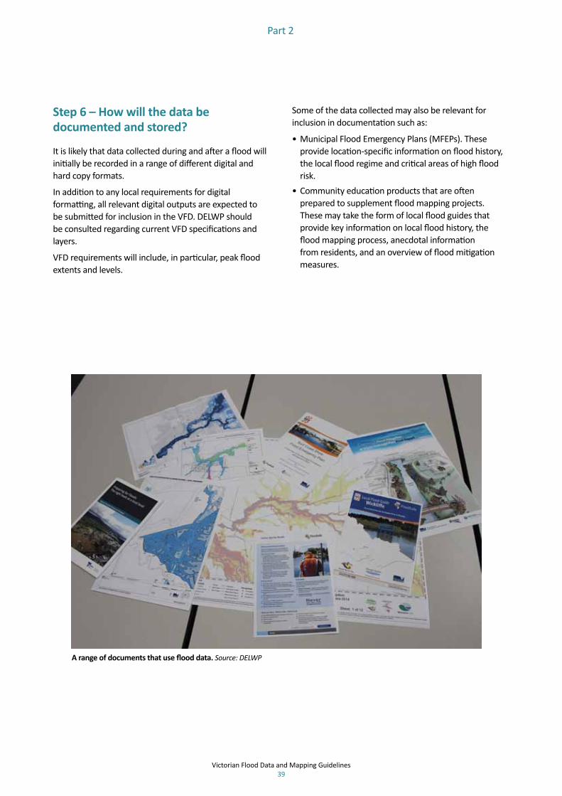
Victorian Flood Data and Mapping Guidelines 39
Part 2
Step 6 – How will the data be documented and stored?
It is likely that data collected during and after a flood will initially be recorded in a range of different digital and hard copy formats.
In addition to any local requirements for digital formatting, all relevant digital outputs are expected to be submitted for inclusion in the VFD. DELWP should be consulted regarding current VFD specifications and layers.
VFD requirements will include, in particular, peak flood extents and levels.
Some of the data collected may also be relevant for inclusion in documentation such as:
• Municipal Flood Emergency Plans (MFEPs). These provide location-specific information on flood history, the local flood regime and critical areas of high flood risk.
• Community education products that are often prepared to supplement flood mapping projects. These may take the form of local flood guides that provide key information on local flood history, the flood mapping process, anecdotal information from residents, and an overview of flood mitigation measures.
A range of documents that use flood data. Source: DELWP

Agriculture on the Moorabool River near Bateford. Source: Simone Wilkinson, DELWP

Victorian Flood Data and Mapping Guidelines 41
Part 3: Consultation report
1. Introduction and summary 42
2. Survey overview 44
3. Survey respondents 45
4. Survey responses 46

Victorian Flood Data and Mapping Guidelines 42
Part 3
During the development of the draft guidelines for standardisation of flood mapping, the project team consulted with the local government sector through the Municipal Association of Victoria (MAV).
A survey was developed and forwarded through MAV to council representatives from planning, engineering and emergency management departments to encourage them to review the guidelines and complete the survey. The survey link was distributed through MAV on 21 November 2013 and was open until 19 December 2013. There were 86 responses from across rural areas (41%), metropolitan Melbourne (34%) and regional cities (25%). Responses were received from a range of roles including (but not limited to) strategic land use planners and planning officers, infrastructure managers, engineers, emergency management coordinators and GIS officers.
This report provides a summary of the feedback obtained from the survey, and the response from the project team responsible for development of the guidelines and a steering group of key stakeholders.
1. Introduction and summary
The key issues raised by the survey, and the project team and steering group’s responses to those issues are summarised in the table opposite.
One of the key messages is that the guidelines do not impose additional requirements for local government in the majority of instances. If local government does undertake flood studies, the guidelines will provide a key supporting resource. The steering group encourages strong collaboration between local government, CMAs/Melbourne Water and DELWP.
The consultation undertaken with a range of agencies, including local government, during preparation of the guidelines provided valuable feedback and input on a diverse range of issues.
Floor levels constructed higher than the 1% AEP flood level. Source: Simone Wilkinson, DELWP

Victorian Flood Data and Mapping Guidelines 43
Part 3
Key issue Project responseThe importance of the guidelines in promoting consistency in the range of outputs needed from flood studies to meet the maximum range of uses, or business needs.
The guidelines aim to promote consistency in the scope of flood studies. They also promote a best practice approach to mapping. They link with appropriate publications (e.g. Australian Rainfall and Runoff [ARR] that provide contemporary technical inputs and link to latest thinking on technical issues.
The importance of the guidelines for land use planning and in linking flood studies to planning schemes.
Several survey responses referred to the need to provide more specific guidance regarding development of planning controls and overlays. While providing advice about developing planning scheme controls is beyond the scope of the guidelines, a discussion has been inserted, with a link to the key relevant DELWP planning practice note.
The potential cost and resourcing implications of the guidelines for local government.
The guidelines do not impose additional requirements for local government. Flood studies and mapping should provide enhanced understanding, better decision making and improved risk managementBased on the steering group’s understanding of contemporary practice, it is not anticipated that the guidelines will significantly affect the current cost and resourcing related to flood studies and mapping. The guidelines also aim to provide additional practical support to those with less experience of flood studies. Many local government areas lack resources and expertise with respect to flood mapping, and the steering group encourages collaboration with CMAs/Melbourne Water and DELWP. The accompanying post-flood data collection guidelines are intended to promote greater collaboration and planning between flooding partners prior to the occurrence of a flood.
The guidelines highlight the need for communication with the community.
A key requirement of the Comrie review was to enhance the provision of information to the community, and this requirement was also identified during interactions with stakeholders in the development of the guidelines. Sharing of information with the community is a key component of the Victorian Floodplain Management Strategy.
The extent of consultation undertaken during preparation of the guidelines.
Substantial input from stakeholders with various experience in flood studies and mapping assisted the development of the guidelines. This included DELWP, CMAs, Melbourne Water and VICSES, so they encompass consistent collection of information, and enhance usefulness of mapping products for emergency planning and management.
The need for the guidelines to consider other types of flooding, e.g. storm surge, and climate change.
The guidelines promote a standardised approach to flood mapping in Victoria that is relevant whether the source of flooding is riverine, stormwater or coastal.The primary mechanism for linking to climate change is through the referenced link to Australian Rainfall and Runoff, which is currently under revision. It is understood that this will include guidance on approaches to climate change.
The importance of guidance on map presentation.
Detailed specification of map presentation and format was considered beyond the scope of the project. However, guidance on map presentation is provided through links with DTPLI’s Communicating Data with Colour guideline. Additionally, it is anticipated that the Flood Intelligence Platform will further assist with standardising protocols and presentation of planning information.

Victorian Flood Data and Mapping Guidelines 44
Part 3
The purpose of the survey was to encourage local government representatives to review the guidelines, complete the survey and provide feedback on the project team and steering group prior to finalisation of the guidelines. The questions were targeted to understand areas of key concern and to identify potential gaps and opportunity for enhancement of the guidelines. The questions asked were:
1. Which of these options best describes where your council is located?
– Rural Area – Regional City – Metropolitan Melbourne
2. What are your most important business needs that should be considered in the finalising of the guidelines?
3. What parts of the guidelines are of most relevance to your organisation?
4. What makes these parts more relevant than others?
5. Do you have any general comments or feedback on the guidelines? If so, please specify.
6. Do you have comments about specific sections of the report? If so, please specify and note the section each comment relates to (e.g. section 3.3 para 2).
7. Is there anything else that should be included in guidelines?
2. Survey overview
8. Please indicate which of the following statements best reflects current practices within your jurisdiction.
– Current practices will be sufficient to meet the requirements of the guidelines
– Current practices will meet most of the requirements of the guidelines.
– Current practices will meet some of the requirements of the guidelines.
– Current practices will not meet any of the requirements of the guidelines.
– I don’t when whether current practices will meet the requirements of the guidelines.
9. What is the name of your organisation? (Optional)
10. What is your position? (Optional)
11. In case we need to follow up any of your responses, please provide your name. (Optional)

Victorian Flood Data and Mapping Guidelines 45
Part 3
Planning Engineering services Emergency management Mapping/GIS
Coordinator Strategic Land Use PlanningPlanning & Environment OfficerPlanning ManagerPlanning OfficersPlanning Scheme Implementation Team,Senior Strategic Land Use PlannerStatutory Planning DepartmentStrategic PlannerStrategic Planning Co-ordinatorStrategic Planning OfficerStrategic Projects Planner
Director Engineering & InfrastructureDirector InfrastructureDirector Infrastructure ServicesDrainage EngineerHead of Stormwater EngineersInfrastructure Planning EngineerManager Infrastructure AssetsProject EngineerManager Infrastructure ServicesManager, Assets and Properties
Emergency CoordinatorEmergency Management Coordinator”Emergency Management OfficersMunicipal Emergency Resource Officers (MERO)
3. Survey respondents
Locations and roles (Question 1)
Respondents were asked to indicate whether they are working for a rural, regional or metropolitan council. The 85 responses to this question show that all three categories were represented.
41%
34%
25%
0%
5%
10%
15%
20%
25%
30%
35%
40%
45%
Rural Metropolitan Melbourne Regional City
Respondents were also given the option to note their work role or role title. The following table shows the various roles of survey respondents:

Victorian Flood Data and Mapping Guidelines 46
Part 3
Question 2. What are your most important business needs that should be considered in the finalising of the guidelines?
Respondents listed 78 ‘important needs’ in response to question 2, and this feedback was grouped into six key themes. The most commonly cited ‘most important needs’ were:
• design of flood mapping projects including minimum requirements for outputs
• converting mapping outputs into planning instruments
• flood impact mitigation including emergency planning and response.
4. Survey responses
Study scope and outputs 28Land use planning 18Flood mitigation 13Community education 8Resourcing 7 Data maintenance 4
28
18
13
8 74
Study
scop
e an
d ou
tputs
Land
use plann
ing
Floo
d m
itigatio
n
Commun
ity edu
catio
n
Resourcing
Data mainten
ance

Victorian Flood Data and Mapping Guidelines 47
Project responses to feedback on Question 2:
Feedback Project response Consistent study scope and outputs
The guidelines aim to promote consistency in the scope of flood studies, i.e. to always map multiple exceedance probability events (including the Probable Maximum Flood [PMF] if appropriate), link flood extents to gauges where possible, identify consequences of flooding and consult with the community to verify mapped extents. The guidelines also promote a best practice approach to mapping. Where practical, they include core key features, but could not include all background features that stakeholders wanted, as users need different information to meet their business needs.The guidelines link with appropriate publications (e.g. Australian Rainfall and Runoff) that provide contemporary technical inputs and link to latest thinking on technical issues, including climate change provisions.
Land use planning and planning scheme
Several comments pertained to the need to provide more specific guidance on development of planning controls and overlays. While providing details about developing planning scheme controls is beyond the scope of the guidelines, some discussion has been inserted. A link to DELWP planning Practice Note 12 (Applying the Flood Provisions in Planning Schemes) has also been included.
Flood impact mitigation, emergency planning and response
This theme includes comments about information to support flood mitigation and emergency planning and planning for infrastructure improvements, including drainage and flood mitigation works.VICSES (a Steering Group member) was consulted for advice to make sure the guidelines encompass consistent collection of information and useful mapping products for emergency planning and management.
Community engagement and education
A discussion is included about the need for maps to be easily interpreted and translated into community information.
Resourcing required to implement the guidelines
Feedback from stakeholders indicated that the guidelines represent an appropriate standard and the approach is already being implemented by flood study proponents. The communication and documentation of these guidelines will promote improving consistency in mapping. The guidelines are not expected to represent a significant change in terms of resources required for undertaking flood studies. One-third of survey respondents believed current practice was sufficient to meet most or all of the guidelines’ requirements.
Data review, update and maintenance
This group of comments contained responses about timing for updates of flood mapping and accountability for keeping mapping current. The guidelines discuss potential triggers for revision of flood mapping, and the Victorian Floodplain Management Strategy provides additional guidance on roles and responsibilities with regard to flood mapping.

Victorian Flood Data and Mapping Guidelines 48
Part 3
Business requirements 17Specifications for flood study briefs 7Guidelines on map presentation 5The entire document 5Not relevant 1Guidelines for review 1
17
75 5
1 1
Busin
ess req
uiremen
ts
Specificatio
ns fo
r flood
stud
y briefs
Guide
lines on map
presen
tatio
n
The en
tire do
cumen
t
Not re
levant
Guide
lines fo
r review
Question 3: What parts of the guidelines are of most relevance to your organisation?
This question received 37 responses. The parts of the guidelines considered of most relevance were grouped into six themes. Typical business requirements and the elements of a project specification were areas highlighted as being of most relevance to local government.
Project responses to feedback on Question 3:
Feedback Project responseBusiness requirements These responses indicated that the business requirements of flood mapping studies were of high
relevance to survey respondents. The practical application of flood studies and maps to meet business needs is covered in the guidelines.
Example specification for flood study briefs.
Guidance for scoping a flood study is understood to be of relevance and importance. The guidelines link to the National Generic Brief for Flood Investigations developed by the National Flood Risk Advisory Group. The National Flood Risk Advisory Group (NFRAG) has developed a National Generic Brief for Flood Investigations (July 2014), and a Guideline for using the National Generic Brief for Flood Investigations to Develop Project Specific Specifications (June 2014). These documents include guidance on desirable flood study outputs. Victorian project managers are encouraged to use these documents when planning their own flood studies
The entire document A number of people identified the document as being relevant and useful for their business needs.Guidelines on map presentation
Presentation of flood information has been an important theme through the consultation on the guidelines. Additional guidance on presentation of maps is provide through the DTPLI document, Communicating with Colour: http://www.dpcd.vic.gov.au/planning/publicationsandresearch/codes-and-guidelines/communicating-data-with-colourFurther standardisation of presentation is expected through the development of the flood information platform: http://www.delwp.vic.gov.au/water/flood-warning-improvements
Guidelines for review of flood mapping
The guidelines discuss potential triggers for revision of flood mapping, and the Victorian Floodplain Management Strategy provides additional guidance on roles and responsibilities with regard to flood mapping
Not Relevant Some respondents indicated that the guidelines were not relevant to councils, that flood mapping is all complete in their municipality and that the guidelines are generic and set broad goals. The steering group indicated that the guidelines are useful to many users, and that it would be difficult to pitch them according to the wants and needs of all users. Changes to the document have made the guidelines more relevant and useful for ongoing use for council staff involved in flood studies.

Victorian Flood Data and Mapping Guidelines 49
Part 3
Decision making and managing risk 16 48.48%Project outputs and design 9 27.27%Cost implications for local government 4 12.12%Communication and the local community 4 12.12%
33 100.00%
16
9
4 4
Decision
making an
dman
aging risk
Project o
utpu
ts and
design
Cost im
plications fo
r local
governmen
t
Commun
ication an
d the
local com
mun
ity
Question 4: What makes these parts more relevant than others?
Participants listed 32 responses to this question. The reasons given for describing particular areas as most relevant to local government fell into four categories:
• providing guidance on project design, and mapping and other outputs from a flood study• improving decision making and managing risk • implications of cost of implementation• communication with the local community.
Project responses to feedback on Question 4:
Feedback Project responseThey are about improved decision making and managing risk
The guidelines show how to enhance the value of a flood study for a range of users and decision makers including councils, CMAs, emergency services and the community.
They guide project design and outputs
This is an important business need identified in Question 2.
They have cost implications for local government
One of the aims of the guidelines was to provide additional value for flood studies undertaken and improve the derived products (including maps). Based on the steering group’s understanding of contemporary practice, it is not anticipated that this will significantly affect cost and resourcing.
They highlight communication with the community.
A key requirement of the Comrie review was to enhance the provision of information to the community, and this requirement was also identified during interactions with stakeholders in the development of the guidelines. Sharing of information with the community is a key component of the Victorian Floodplain Management Strategy.

Victorian Flood Data and Mapping Guidelines 50
Part 3
Question 5: Do you have any general comments or feedback on the guidelines?
Respondents listed 41 general comments in response to this question. Areas covered included suggestions for improved or expanded sections, comments about practical guidance for developing flood mapping practices, and where the guidelines are already in line with current practice.
16
13
64
2
Suggestio
ns fo
rim
provem
ent
The gu
idelines provide
practic
al guida
nce for
flood
stud
ies
Other fo
rms o
f flood
ing
and clim
ate chan
ge
Resourcing
and
costs fo
rlocal governm
ent
The gu
idelines m
ay not
be useful

Victorian Flood Data and Mapping Guidelines 51
Part 3
Project responses to feedback on Question 5:
Feedback Project responseThe guidelines provide practical guidance or are in line with current best practiceThe guidelines could be expanded to deal with other flooding and climate change
The guidelines promote a standardised approach to flood mapping in Victoria that is relevant whether the source of flooding is riverine, stormwater or coastal the guidelines are relevant to other types of flooding. The primary mechanism for linking to climate change is through Australian Rainfall and Runoff. The next ARR edition is expected to include guidance on approaches to climate change.
Resourcing and cost implications for local government needs to be acknowledged
The guidelines are not expected to significantly affect the current cost and resourcing related to flood studies and mapping. The guidelines aim to provide additional practical support for those with less knowledge or experience of flood studies. Where local government lacks expertise and resources with respect to flood mapping the steering group encourages collaboration with CMAs/Melbourne Water and DELWP. The separate post-flood data collection guidelines are also intended to facilitate greater collaboration and planning between flooding partners prior to the occurrence of a flood.
The guidelines may not be useful – mapping is complete or it is not local government’s role
The guidelines are for any agencies that undertake flood studies, including local government, Melbourne Water and Catchment Management Authorities.
Suggestions for improvement including inclusion of additional material, data management and presentationStandardisation of presentation / format
Detailed specification of presentation and format was considered beyond the scope of the project. However, guidance on map presentation is provided through links with DTPLI’s ‘Communicating Data with Colour’ guideline. The flood intelligence platform is also expected to assist with standardising protocols and presentation of planning information.
Guidance on including consequences of flooding
Recommended project outputs include a flood damage assessment and input to Municipal Flood Emergency Plans, which would include consequences to infrastructure and people movement.
Implementation of the guidelines
The Victorian Floodplain Management Strategy provides guidance regarding roles and responsibilities for flood studies and managing flood information. The steering group encourages local government to draw on the skills and resources of floodplain management partners including CMAs/ Melbourne Water and VICSES, and encourages participation in collaboration processes such as the development of Flood Emergency Plans and Flood Management Plans (in the Metropolitan area).
Linking flood studies to planning controls
DELWP provides a range of Planning Practice notes to assist with operation of the Victoria Planning Provisions (VPP) and planning schemes as well as a range of planning processes and topics. Reference to Planning Practice Note 12 (PPN12: Applying the Flood Provisions in Planning Schemes) has been included in the guidelines to provide guidance about applying the flood provisions in planning schemes.
Data collection / use • Agencies carrying out self-funded flood mapping exercises will be encouraged to follow the DELWP guidelines.
• Agencies receiving government funding to support flood mapping will advise DELWP when the mapping is complete and provide a copy for inclusion in the Victorian Flood Database.

Victorian Flood Data and Mapping Guidelines 52
Part 3
65
2 21 1
Project
specificatio
ns and
outputs.
Cost, resou
rces
and legal liability
Data m
anagem
ent
and form
ats
Suggested ed
its
The guidelines do
not p
rovide
useful
guidance
Availability of data
Question 6: Do you have comments about specific sections of the report?
Question 6 provided respondents with the chance to provide more targeted comments on parts of the guidelines that interest them. Seventeen comments, covering six main themes were received, however two important areas dominated:
• comments about providing examples of project outputs or a generic project specification
• comments about the practical implications for local government relating to cost, resources and legal liability.
Areas of specific interest highlighted in feedback on Question 6:

Victorian Flood Data and Mapping Guidelines 53
Part 3
11
4 43
21
0
2
4
6
8
10
12
Project o
utpu
ts design
Usin
g the guidelines in
diffe
rent con
texts
Administrative
arrangem
ents
Transla
ting flo
od m
aps
into plann
ing sche
mes
Staying curren
t and
sharing expe
riences
Data m
anagem
ent a
ndform
ats
Question 7: Is there anything else that should be included in the guidelines?
The dominant theme emerging from the 25 responses received to this question related to requests for guidance on designing a flood mapping project, and examples of the standard that outputs should meet.
Project response to feedback on Question 7
Feedback Project responseProvide examples of preferred outputs and how a project should be designed
Victorian project managers are encouraged to use National Generic Brief for Flood Investigations developed by the National Flood Risk Advisory Group when planning their own flood studies. Examples of what flood study outputs are needed and what they are used for have been added.
Administrative arrangements for the guidelines
The guidelines are linked to the Victorian Floodplain Management Strategy.
Guidance on translating flood maps into planning instruments
DELWP provides a range of Planning Practice notes to assist with operation of the Victoria Planning Provisions (VPP) and planning schemes as well as a range of planning processes and topics. In particular, reference to Planning Practice Note 12 (PPN12: Applying the Flood Provisions in Planning Schemes) has been included in the guidelines to provide guidance regarding applying the flood provisions in planning schemes.
Keeping the guidelines current and sharing experiences
The steering group endorses the sharing of information, practices and examples through the floodplain managers’ forum and collaboration between local government and floodplain managers. Preparation of regional floodplain management strategies will help form contacts and partnerships.
Data management and data formats.
As outlined in the Victorian Floodplain Management Strategy, all agencies carrying out self-generated flood mapping exercises will be encouraged to follow the DELWP guidelines. On completion of such maps, councils will advise DELWP and provide a copy of the mapping for inclusion in the Victorian Flood Database. Agencies carrying out flood mapping projects with government funding will be required to follow these guidelines.

Victorian Flood Data and Mapping Guidelines 54
Part 3
11
4 43
21
Project o
utpu
tsde
sign
Usin
g the guidelines
in differen
t con
texts
Administrative
arrangem
ents
Transla
ting flo
odmaps into plan
ning
sche
mes
Staying curren
t and
sharing expe
riences
Data m
anagem
ent
and form
ats
Question 8: Please indicate which of the following statements best reflects current practices within your jurisdiction
In order to understand how the guidelines relate to scope of current practice, survey participants were asked to indicate which statement reflected current practice. Thirty-three respondents answered Question 8.
Comparison of the guidelines to current practiceTwenty-four respondents believed their current practices meet at least some of the requirements of the guidelines, with three says their current practices will meet all the requirements. No respondents thought their current practices would not meet any of the guideline’s requirements; seven were not sure or did not know.
The guidelines were developed in response to Comrie recommendation 21 to improve consistencies in flood mapping across Victoria. Feedback from the steering group on the guidelines indicated that although the guidelines would help to deliver consistency through documenting and sharing current practice, it was not expected to require significant additional resources over that required for current flood mapping activities.

Victorian Flood Data and Mapping Guidelines 55
Flood terminology
AdaptationAdjustment in response to actual or expected climate change or its effects, which moderates harm or exploits beneficial opportunities.
Annual Exceedance Probability (AEP)The likelihood of the occurrence of a flood of a given or larger size occurring in any one year, usually expressed as a percentage. For example, if a peak flood flow of 500 m3/s has an AEP of 5%, it means that there is a 5% (one-in-20) chance of a flow of 500 m3/s or larger occurring in any one year (see also average recurrence interval, flood risk, likelihood of occurrence, probability).
Average annual damage (AAD)Depending on its size (or severity), each flood will cause a different amount of flood damage to a flood-prone area. AAD is the average damage per year that would occur in a nominated development situation from flooding over a very long period of time. If the damage associated with various annual events is plotted against their probability of occurrence, the AAD is equal to the area under the consequence–probability curve. AAD provides a basis for comparing the economic effectiveness of different management measures (i.e. their ability to reduce the AAD).
Average Recurrence Interval (ARI)A statistical estimate of the average number of years between floods of a given size or larger than a selected event. For example, floods with a flow as great as or greater than the 20-year ARI (5% AEP) flood event will occur, on average, once every 20 years. ARI is another way of expressing the likelihood of occurrence of a flood event (see also Annual Exceedance Probability).
Australian Rainfall and Runoff (ARR)ARR is a national guideline for the estimation of design flood characteristics in Australia published by Engineers Australia. ARR aims to provide reliable (robust) estimates of flood risk to ensure that development does not occur in high-risk areas and that infrastructure is appropriately designed. The edition is currently being revised. The revision process includes 21 research projects, which have been designed to fill knowledge gaps that have arisen since the 1987 edition was published.
AvulsionThe rapid abandonment of a river channel and the formation of a new river channel. Avulsions occur as a result of channel slopes that are much lower than the slope that the river could travel if it took a new course. Avulsions typically occur during large floods that carry the power necessary to rapidly change the landscape.
CatchmentThe area of land draining to a particular site. It is related to a specific location and includes the catchment of the main waterway as well as any tributary streams.
Coastal erosionShort-term retreat of sandy shorelines as a result of storm effects and climatic variations.
Coastal flooding (inundation)Flooding of low-lying areas by ocean waters, caused by higher than normal sea level, due to tidal or storm-driven coastal events, including storm surges in lower coastal waterways.
Coastal hazard assessmentsCoastal hazard assessments commonly define the extent of land expected to be threatened by coastal hazards (inundation, coastal erosion, coastal recession) over specific planning periods. They are typically used for development assessment purposes and to inform land-use planning considerations. In particular such assessments include consideration of future sea level rise scenarios, typically to the year 2100.
ConsequenceThe outcome of an event or situation affecting objectives, expressed qualitatively or quantitatively. Consequences can be adverse (e.g. death or injury to people, damage to property and disruption of the community) or beneficial.
CurtilageThe land occupied by a dwelling and its yard, outbuildings, etc, actually enclosed or considered as enclosed.
Design flood event (DFE)In order to identify the areas that the planning and building systems should protect new development from the risk of flood, it is necessary to decide which level of flood risk should be used. This risk is known as the design flood event.
DevelopmentDevelopment may be defined in jurisdictional legislation or regulation. It may include erecting a building or carrying out work, including the placement of fill; the use of land, or a building or work; or the subdivision of land.
New development is intensification of use with development of a completely different nature to that associated with the former land use or zoning (e.g. the urban subdivision of an area previously used for rural purposes). New developments generally involve rezoning, and associated consents and approvals. Major extensions of existing urban services, such as roads, water supply, sewerage and electric power may also be required.
Infill development refers to the development of vacant blocks of land within an existing subdivision that are generally surrounded by developed properties and is permissible under the current zoning of the land.
Redevelopment refers to rebuilding in an existing developed area. For example, as urban areas age, it may become necessary to demolish and reconstruct buildings on a relatively large scale. Redevelopment generally does not require either rezoning or major extensions to urban services.

Victorian Flood Data and Mapping Guidelines 56
Flood terminology
Greenfield development refers to building in a currently undeveloped area or development that is unrestrained by prior work.
Flash floodingFlooding that is sudden and unexpected, often caused by sudden local or nearby heavy rainfall. It is generally not possible to issue detailed flood warnings for flash flooding. However, generalised warnings may be possible. It is often defined as flooding that peaks within six hours of the causative rain.
FloodA natural phenomenon that occurs when water covers land that is normally dry. It may result from coastal or catchment flooding, or a combination of both (see also catchment flooding and coastal flooding).
Flood awarenessAn appreciation of the likely effects of flooding, and a knowledge of the relevant flood warning, response and evacuation procedures. In communities with a high degree of flood awareness, the response to flood warnings is prompt and effective. In communities with a low degree of flood awareness, flood warnings are liable to be ignored or misunderstood, and residents are often confused about what they should do, when to evacuate, what to take with them and where it should be taken.
Flood class levelsThe terms minor, moderate and major flooding are used in flood warnings to give a general indication of the types of problems expected with a flood
Minor flooding: Causes inconvenience. Low-lying areas next to watercourses are inundated. Minor roads may be closed and low-level bridges submerged. In urban areas inundation may affect some backyards and buildings below the floor level as well as bicycle and pedestrian paths. In rural areas removal of stock and equipment may be required.
Moderate flooding: In addition to the above, the area of inundation is more substantial. Main traffic routes may be affected. Some buildings may be affected above the floor level. Evacuation of flood-affected areas may be required. In rural areas removal of stock is required.
Major flooding: In addition to the above, extensive rural areas and/or urban areas are inundated. Many buildings may be affected above the floor level. Properties and towns are likely to be isolated and major rail and traffic routes closed. Evacuation of flood-affected areas may be required. Utility services may be impacted.
Flood damageThe tangible (direct and indirect) and intangible costs (financial, opportunity costs, clean-up) of flooding. Tangible costs are quantified in monetary terms (e.g. damage to goods and possessions, loss of income or services in the flood aftermath). Intangible damages are difficult to quantify in monetary terms and include the increased levels of physical, emotional and psychological
health problems suffered by flood-affected people that are attributed to a flooding episode.
Flood educationEducation that raises awareness of the flood problem to help individuals understand how to manage themselves and their property in response to flood warnings and in a flood event. It invokes a state of flood readiness.
Flood emergency managementEmergency management is a range of measures to manage risks to communities and the environment. In the flood context, it may include measures to prevent, prepare for, respond to and recover from flooding.
Flood hazardPotential loss of life, injury and economic loss caused by future flood events. The degree of hazard varies with the severity of flooding and is affected by flood behaviour (extent, depth, velocity, isolation, rate of rise of floodwaters, duration), topography and emergency management.
Flood peaksThe maximum flow occurring during a flood event past a given point in the river system (see also flow and hydrograph). The term may also refer to storm-induced flood peaks and peak ocean or peak estuarine conditions.
Flood-prone landLand susceptible to flooding by the largest probable flood event. Flood-prone land is synonymous with the floodplain. Floodplain management plans should encompass all flood-prone land rather than being restricted to areas affected by defined flood events.
Flood proofing of buildingsA combination of measures incorporated in the design, construction and alteration of individual buildings or structures that are subject to flooding, to reduce structural damage and potentially, in some cases, reduce contents damage.
Flood readinessAn ability to react within the effective warning time (see also flood awareness and flood education).
Flood riskThe potential risk of flooding to people, their social setting, and their built and natural environment. The degree of risk varies with circumstances across the full range of floods. Flood risk is divided into three types – existing, future and residual. Existing flood risk refers to the risk a community is exposed to as a result of its location on the floodplain. Future flood risk refers to the risk that new development within a community is exposed to as a result of developing on the floodplain. Residual flood risk refers to the risk a community is exposed to after treatment measures have been implemented. For example: a town protected by a levee, the residual flood risk is the consequences of the levee being overtopped

Victorian Flood Data and Mapping Guidelines 57
Flood terminology
by floods larger than the design flood; for an area where flood risk is managed by land-use planning controls, the residual flood risk is the risk associated with the consequences of floods larger than the DFE on the community.
Flood severityA qualitative indication of the ‘size’ of a flood and its hazard potential. Severity varies inversely with likelihood of occurrence (i.e. the greater the likelihood of occurrence, the more frequently an event will occur, but the less severe it will be). Reference is often made to major, moderate and minor flooding (see also flood class levels).
Flood studyA comprehensive technical assessment of flood behaviour. It defines the nature of flood hazard across the floodplain by providing information on the extent, depth and velocity of floodwaters, and on the distribution of flood flows. The flood study forms the basis for subsequent management studies and needs to take into account a full range of flood events up to and including the largest probable flood. Flood studies should provide new flood mapping for Planning Scheme inclusion, data and mapping for MEMPs, and a preliminary assessment into possible structural and non-structural flood mitigation measures.
Flood warningA Total Flood Warning System (TFWS) encompasses all the elements necessary to maximise the effectiveness of the response to floods. These are data collection and prediction, interpretation, message construction, communication and response. Effective warning time refers to the time available to a flood-prone community between the communication of an official warning to prepare for imminent flooding and the loss of evacuation routes due to flooding. The effective warning time is typically used for people to move farm equipment, move stock, raise furniture, transport their possessions and self-evacuate.
FloodplainAn area of land that is subject to inundation by floods up to, and including, the largest probable flood event.
Floodplain managementThe prevention activities of flood management together with related environmental activities (see also floodplain).
FlowThe rate of flow of water measured in volume per unit time, for example, megalitres per day (ML/day) or cubic metres per second (m3/sec). Flow is different from the speed or velocity of flow, which is a measure of how fast the water is moving, for example, metres per second (m/s).
FreeboardThe height above the DFE or design flood used, in consideration of local and design factors, to provide reasonable certainty that the risk exposure selected in
deciding on a particular DFE or design flood is actually provided. It is a factor of safety typically used in relation to the setting of floor levels, levee crest heights and so on. Freeboard compensates for a range of factors, including wave action, localised hydraulic behaviour and levee settlement, all of which increase water levels or reduce the level of protection provided by levees. Freeboard should not be relied upon to provide protection for flood events larger than the relevant design flood event. Freeboard is included in the flood planning controls applied to developments by LGAs.
FrequencyThe measure of likelihood expressed as the number of occurrences of a specified event in a given time. For example, the frequency of occurrence of a 20% Annual Exceedance Probability or five-year average recurrence interval flood event is once every five years on average (see also Annual Exceedance Probability, Average Recurrence Interval, likelihood and probability).
HazardA source of potential harm or a situation with a potential to cause loss.
HydraulicsThe study of water flow in waterways; in particular, the evaluation of flow parameters such as water level, extent and velocity.
HydrologyThe study of the rainfall and runoff process, including the evaluation of peak flows, flow volumes and the derivation of hydrographs for a range of floods.
Intolerable riskA risk that, following understanding of the likelihood and consequences of flooding, is so high that it requires consideration of implementation of treatments or actions to improve understanding of, avoid, transfer or reduce the risk.
LikelihoodA qualitative description of probability and frequency (see also frequency and probability).
Likelihood of occurrenceThe likelihood that a specified event will occur (see also Annual Exceedance Probability and average recurrence interval).
Local overland floodingInundation by local runoff on its way to a waterway, rather than overbank flow from a stream, river, estuary, lake or dam. Can be considered synonymous with stormwater flooding.
MitigationPermanent or temporary measures (structural and non-structural) taken in advance of a flood aimed at reducing its impacts.

Victorian Flood Data and Mapping Guidelines 58
Flood terminology
Municipal Flood Emergency PlanA sub-plan of a flood-prone municipality’s Municipal Emergency Management Plan. It is a step-by-step sequence of previously agreed roles, responsibilities, functions, actions and management arrangements for the conduct of a single or series of connected emergency operations. The objective is to ensure a coordinated response by all agencies having responsibilities and functions in emergencies
Planning Scheme zones and overlaysPlanning Schemes set out the planning rules – the state and local policies, zones, overlays and provisions about specific land uses that inform planning decisions. Land use zones specify what type of development is allowed in an area (e.g. urban [residential, commercial, industrial], rural, environmental protection). Overlays specify extra conditions for developments that are allowed in a zone. For example, flooding overlays specify that developments must not affect flood flow and storage capacity of a site, must adhere to freeboard requirements, and not compromise site safety and access.
ProbabilityA statistical measure of the expected chance of flooding. It is the likelihood of a specific outcome, as measured by the ratio of specific outcomes to the total number of possible outcomes. Probability is expressed as a number between zero and unity, zero indicating an impossible outcome and unity an outcome that is certain. Probabilities are commonly expressed in terms of percentage. For example, the probability of ‘throwing a six on a single roll of a dice is one in six, or 0.167 or 16.7% (see also Annual Exceedance Probability).
Rainfall intensityThe rate at which rain falls, typically measured in millimetres per hour (mm/h). Rainfall intensity varies throughout a storm in accordance with the temporal pattern of the storm (see also temporal pattern).
Regional Coastal BoardsMembers of Victoria’s three coastal boards have been appointed by the Minister for Environment and Climate Change because of their experience and expertise in areas such as local government, coastal planning and management, tourism and recreational use of the coast. The functions of the Western, Central and Gippsland Coastal Boards, set out under the Coastal Management Act 1995, include developing regional coastal plans and providing advice to the Minister on regional coastal development issues.
Risk analysisRisk is usually expressed in terms of a combination of the consequences of an event and the associated likelihood of its occurrence. Flood risk is based upon the consideration of the consequences of the full range of flood events on communities and their social settings, and the natural and
built environment. Risk analysis in term of flooding is a combination of defining what threat exists (see flood risk) and what steps are taken (see risk management) (see also likelihood and consequence).
Risk managementThe systematic application of management policies, procedures and practices to the tasks of identifying, analysing, assessing, treating and monitoring flood risk.
Riverine floodingInundation of normally dry land when water overflows the natural or artificial banks of a stream, river, estuary, lake or dam. Riverine flooding generally excludes watercourses constructed with pipes or artificial channels considered as stormwater channels.
RunoffThe amount of rainfall that drains into the surface drainage network to become stream flow; also known as rainfall excess.
Storm surgeThe increases in coastal water levels above the predicted tide level resulting from a range of location dependent factors such as wind and waves, together with any other factors that increase tidal water level.
Stormwater floodingThe inundation by local runoff caused by heavier than usual rainfall. It can be caused by local runoff exceeding the capacity of an urban stormwater drainage systems, flow overland on the way to waterways or by the backwater effects of mainstream flooding causing urban stormwater drainage systems to overflow (see also local overland flooding).
VulnerabilityThe degree of susceptibility and resilience of a community, its social setting, and the natural and built environments to flood hazards. Vulnerability is assessed in terms of ability of the community and environment to anticipate, cope and recover from flood events. Flood awareness is an important indicator of vulnerability (see also flood awareness).
Water Management SchemeThe formal process set out in the Water Act 1989 that can be applied to a flood mitigation infrastructure development and its ongoing management. It can be based on and carried out in parallel with a floodplain management study.

Victorian Flood Data and Mapping Guidelines 59
Acronyms
AAD Average Annual DamageAEP Annual Exceedance ProbabilityARI Average Recurrence IntervalARR Australian Rainfall and RunoffBCA Building Code of AustraliaBoM Bureau of MeteorologyCMA Catchment Management AuthorityDELWP Department of Environment, Land, Water and PlanningDFE Design flood eventLGA Local Government AuthorityLPPF Local Planning Policy FrameworkMFEP Municipal Flood Emergency PlanSPPF State Planning Policy FrameworkTFWS Total Flood Warning SystemVCS Victorian Coastal StrategyVFD Victorian Flood DatabaseVFMS Victorian Floodplain Management StrategyVICSES Victoria State Emergency ServiceVPP Victoria Planning ProvisionsWMS Water Management Scheme

www.delwp.vic.gov.au