versatility high precision - evologics gmbh
TRANSCRIPT

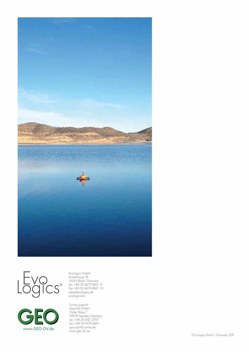
SONOBOTAUTONOMOUSHYDROGRAPHIC SURVEY VEHICLE
EvoLogics GmbHAckerstrasse 7613355 Berlin, Germanytel.: +49 30 4679 862 - 0fax: +49 30 4679 862 - [email protected] evologics.de
Survey support:Geo-DV GmbH Hoher Weg 7 39576 Stendal, Germany tel.: +49 39 3121 2797 fax: +49 39 3179 [email protected]
PRODUCT INFORMATION GUIDE
High Precision
· Differential GPS for high-accuracy cartography(GPS, GLONASS and Galileo) · S2C ultra-broadband echosounder (depth measurement accuracy 6 mm, min. depth 0.5 m, max depth 60 m) · Side-scan sonar option
Flexibility
· Front-view camera for operations in remote locations and surveillance · Fast access to points of interest, accurate maneuvers and efficient area scanning with precisely controllable hydro jet thrusters · Batteries for up to 10 hours of operation (at optimum operation speed) · Software for field operation and data processing with visual georeferenced representation
Versatility
· Autonomous and radio controlled operation modes · Wi-Fi communication (GPRS/UMTS) · On-board data logging, wireless transmission on demand
Robustness
· Carbon fiber floaters, corrosion-free materials, resistant to seawater and industrial waste water
Easy Handling
· Fast assembly without special tools · Can be handled by a single person · Fits into a car trunk compartment for transport
EvoLogics Sonobot – an autonomous unmanned surface vehicle for hydrographic surveysTHE SONOBOT SYSTEM
EvoLogics SONOBOT: Autonomous Surface Vehicle for Hydrographic Surveys
© EvoLogics GmbH - November 2019

BASIC UPGRADES
MO
DU
LES
AN
D O
PTIO
NS
VEHICLE 2 carbon fiber floaters with jet thrusters, body with payload PC
ECHOSOUNDER Basic third-party echosounder. 0.1 m accuracy, depth measurement results only
· EvoLogics broadband single-beam echosounder · Multibeam echosounder
SIDE-SCAN SONAR Not included · 340 kHz side-scan sonar (6 cm resolution, 150 m range) · 670 kHz side-scan sonar (2 cm resolution, 50 m range) · 1200 kHz side-scan sonar (1 cm resolution, 40 m range)
GNSS DGPS receiver with EGNOS · DGPS receiver with RTK (SIM not included) · Integration of own receiver (after assessment) · RTK Base/Rover for Sonobot
ON-BOARD DATA STORAGE 32 GB 128 GB SSD drive
AUTOPILOT Only map-based navigation and real-time measurement results
Software-based mission planning, integrated with the mea-surement system. Real-time measurement results
RECHARGEABLE BATTERY Up to10 hours at optimal operating speed
FRONT-VIEW CAMERA Not included Front HD-camera with software integration
REMOTE CONTROL UNIT IP68 waterproof, omnidirectional antenna Directional antenna with tripod
COMPASS Standard compass High-precision compass with AHRS
WLAN STATION WLAN shore station with separate power supply, tripod, omnidirectional 15 dBi antenna
22 dBi directional antenna.
FIELD PC Rugged handheld PC with touchscreen, long battery life, software package.
TRANSPORT CASES 2 cases for the equipment. Transport cart.
OPE
RATI
ON
WLAN RANGE Up to 1.5 km with omnidirectional antenna, up to 2 km with directional antenna
OPERATING RANGE Up to 40 km
OPERATING SPEED Optimal 3.6 km/h, maximum 12 km/h
OPERATING TIME Up to 10 hours at optimal speed
WIND/ WAVE Wind up to 5 Bft (10 m/s) / non-breaking waves
DIM
ENSI
ON
S HEIGHT 450 mm
WIDTH 920 mm
LENGTH 1320 mm
WEIGHT Mission--ready Sonobot - appr. 30 kg, total weight of the system incl. transport cases - appr. 90 kg
For pricing and configuration information contact us at [email protected] or call +49 30 4679 862 - 0
Specifications subject to change without notice. © EvoLogics GmbH - November 2019
Hydrographic survey
· Bathymetry and seafloor imaging in ports, harbors and inland waters
Search and recovery
· Locating objects, such as archeological artifacts, wrecks etc.
Survey missions
· Exploring shallow waters, natural re-serves, restricted and hard-to-reach areas
Monitoring
· Regular examinations of underwater in-frastructure
The autonomous SONOBOT was developed to provide surveyors, service providers and researchers with a smart lightweight solution for hydrographic surveys and other applications in harbors and inland waters.
Specifically for the SONOBOT, EvoLogics utilized the patented S2C broadband com-munication technology to build an advanced single-beam echo sounder, capable of delivering precise and accurate depth measurements even in very shallow waters. The side-scan sonar, GNSS system and other equipment options were pre-selected among commercial off-the-shelf products to best fit the SONOBOT platform and offer the user the optimal configuration for his particular requirements.
SPECIFICATIONS AND CONFIGURATION OPTIONS
MISSION RESULTSSide-Scan Sonar image
MISSION RESULTSBathymetry in 3D
DURING THE MISSIONSide-Scan Sonar live view
MISSION RESULTSBathymetry in 2D
MISSION PLANNINGThe measurement grid
DURING THE MISSIONBathymetric survey, Side-Scan Sonar mapping
DURING THE MISSIONThe depth profile
DURING THE MISSIONThe camera view
EvoLogics SONOBOT Platform
The SONOBOT unmanned surface vehicle offers a usable platform for planning and executing a hydrographic survey, delivering ac-curate geo-referenced bathymetric measurements and high-quality imagery with minimum transport, launch and recovery efforts. The concept of SONOBOT is to offer the end user a modular system with several configuration options and deliver a ready-to-use USV with all the on-board equipment installed and ready for immediate action.
ECHOSOUNDERSIDE-SCAN SONAR
GNSS
WLAN
WLAN
WLAN
SURVEY GRID
REMOTE CONTROL FIELD PC
WLAN STATION
SONOBOTAUTONOMOUSHYDROGRAPHIC SURVEY VEHICLE
EvoLogics GmbHAckerstrasse 7613355 Berlin, Germanytel.: +49 30 4679 862 - 0fax: +49 30 4679 862 - [email protected] evologics.de
Survey support:Geo-DV GmbH Hoher Weg 7 39576 Stendal, Germany tel.: +49 39 3121 2797 fax: +49 39 3179 [email protected]
PRODUCT INFORMATION GUIDE
High Precision
· Differential GPS for high-accuracy cartography(GPS, GLONASS and Galileo) · S2C ultra-broadband echosounder (depth measurement accuracy 6 mm, min. depth 0.5 m, max depth 60 m) · Side-scan sonar option
Flexibility
· Front-view camera for operations in remote locations and surveillance · Fast access to points of interest, accurate maneuvers and efficient area scanning with precisely controllable hydro jet thrusters · Batteries for up to 10 hours of operation (at optimum operation speed) · Software for field operation and data processing with visual georeferenced representation
Versatility
· Autonomous and radio controlled operation modes · Wi-Fi communication (GPRS/UMTS) · On-board data logging, wireless transmission on demand
Robustness
· Carbon fiber floaters, corrosion-free materials, resistant to seawater and industrial waste water
Easy Handling
· Fast assembly without special tools · Can be handled by a single person · Fits into a car trunk compartment for transport
EvoLogics Sonobot – an autonomous unmanned surface vehicle for hydrographic surveysTHE SONOBOT SYSTEM
EvoLogics SONOBOT: Autonomous Surface Vehicle for Hydrographic Surveys
© EvoLogics GmbH - November 2019