vasey’s paradise groundwater discharges from the wall of marble canyon to form a series of natural...
Post on 21-Dec-2015
221 views
TRANSCRIPT

Vasey’s Paradise
Groundwater discharges from the
wall of Marble Canyon to form a series of natural
springs.
(Grand Canyon)


Major Groundwater Regions of the USAMajor Groundwater Regions of the USA
Columbia Plateau (fractured lava flows)
Puget Sound & Willamette Valley (alluvial basin)
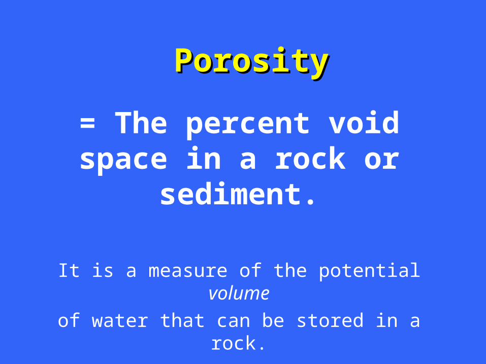
PorosityPorosity
= The percent void space in a rock or sediment.
It is a measure of the potential volume
of water that can be stored in a rock.

PermeabilityPermeability
= The ability of a material to transmit a fluid.
It is a measure of how fast the fluid can
travel through the rock or sediment.

AquiferAquifer
= A geologic unit capable of storing and transmitting water in sufficient
quantities to supply wells.

PorosityPorosity varies withvaries with % Cement% Cement
Size-SortingSize-Sorting
FracturingFracturing

UnUncemented Sandcemented Sand
Cemented SandCemented Sand

Types of AquifersTypes of Aquifers
• UnUnconfinedconfined Aquifer Aquifer - The permeable layer extends to the surface. It consists of an unsaturated zone separated from the saturated zone by the groundwater table.
• ConfinedConfined Aquifer Aquifer - The permeable layer is sandwiched between less-permeable layers (aquitards or aquicludes).

Unsaturated Zone:Unsaturated Zone:Pores include both air and water
Saturated Zone:Saturated Zone:Pores filled with water
Groundwater Table
Unconfined AquiferUnconfined Aquifer

Water TableWater Table
• The top of saturated zone of groundwater
• The level to which water will rise in a hole
• The level to which water will rise in an
unconfined aquifer

Dynamics of an Unconfined AquiferDynamics of an Unconfined Aquiferin a Temperate Climatein a Temperate Climate

During the Wet Season…During the Wet Season…

During the Dry Season…During the Dry Season…

Darcy’s LawDarcy’s Law
An equation by which the An equation by which the dischargedischarge (rate of flow) of groundwater can be (rate of flow) of groundwater can be
calculated.calculated.

Darcy’s LawDarcy’s Law
Q = A ( K Q = A ( K xx S ) S )

Darcy’s LawDarcy’s Law
Q = A Q = A xx ( ( K K xx S S ) = A ) = A xx ( ( K K xx H H // LL ))
QQ = Discharge
AA = Cross-sectional area of flow
KK = Permeability (hydraulic conductivity)
SS = Slope of water table = ( H L )
HH = vertical drop
LL = flow distance

V = ( K x ( h1 - h2 ) / ( d x n )
Permeability = 60 m/dayPorosity = 30% (=0.3)Hydraulic gradient = 1 m / 1000 m
V = (60 m/day x 1 m) / (1000 m x 0.3)
1 m

Darcy’s LawDarcy’s Law

The The recharge arearecharge area of a of a confinedconfined aquifer is the area where rainfall aquifer is the area where rainfall enters (recharges) the aquifer.enters (recharges) the aquifer.
The The pressure surfacepressure surface is the level to is the level to which water will rise in wells in which water will rise in wells in confinedconfined aquifers. aquifers.

Note the Difference Note the Difference Between:Between:
• Groundwater TableGroundwater Table:: The level to which water will rise in an ununconfinedconfined aquifer
• Pressure SurfacePressure Surface:: The level to which water will rise in a confinedconfined aquifer *
* If the pressure surface is above the ground surface, the water will flow freely out of the ground. Such wells are called flowing flowing artesian wellsartesian wells.

Confined AquiferConfined Aquifer
Pressure Surface:Pressure Surface: Height to which water will rise
in the confined aquifer
Recharge Area:Recharge Area: where the confined aquifer is recharged by infiltration
Flowing Flowing Artesian WellArtesian Well


Pressure SurfacePressure Surface
Ground SurfaceGround Surface
Flowing artesian wellFlowing artesian well

Artesian Well in Glacial Sands & Gravels (MA)

Perched Water TablePerched Water Table

Formation of a Cone of DepressionFormation of a Cone of Depression

The OgallalaThe OgallalaAquifer:Aquifer:
““Mining Mining Groundwater”Groundwater”

U.S. Groundwater Withdrawals: 1950-1995U.S. Groundwater Withdrawals: 1950-1995

Fissures and depressionsFissures and depressionscaused by caused by
ground subsidence ground subsidence due to overpumpingdue to overpumping
of groundwaterof groundwater
(Antelope Valley, CA.(Antelope Valley, CA. January 1991.January 1991.
625 meters long!)625 meters long!)

The Winter Park Sinkhole, FloridaThe Winter Park Sinkhole, Florida
(Photo by Leif Skoogfors)(Photo by Leif Skoogfors)

Dynamics of the Dynamics of the Saltwater - Freshwater InterfaceSaltwater - Freshwater Interface

The thickness of the fresh The thickness of the fresh groundwater floating on top groundwater floating on top of the salty groundwater is of the salty groundwater is affected by the balance affected by the balance between between groundwater groundwater recharge and recharge and dischargedischarge

If the rate of discharge If the rate of discharge increases too much (by increases too much (by overpumping), the saltwater overpumping), the saltwater will rise, causing will rise, causing saltwater saltwater intrusionintrusion in the well. in the well.
InvertedCone of depression

Carlsbad Caverns, NM)
Stalagmite
Stalactite
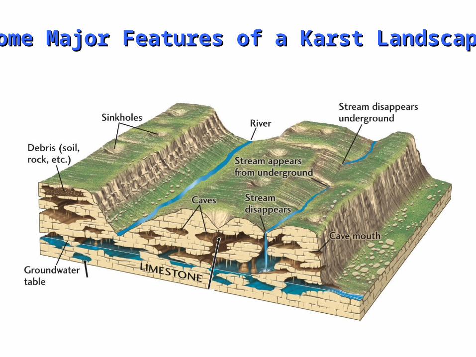
Some Major Features of a Karst LandscapeSome Major Features of a Karst Landscape

Subsurface Features of a Karst LandscapeSubsurface Features of a Karst Landscape

Some Human Activities that Can Some Human Activities that Can Contaminate GroundwaterContaminate Groundwater


Cape Cod Sewage Plume (MA)

Detergent in groundwater (Cape Cod, MA).From abandoned military base (wastewater & sewage disposal).

(Maryland)


Hand-dug well in Sinai.Ancient river sediment.


Lancaster County, PA


