vam information management - ifad
TRANSCRIPT
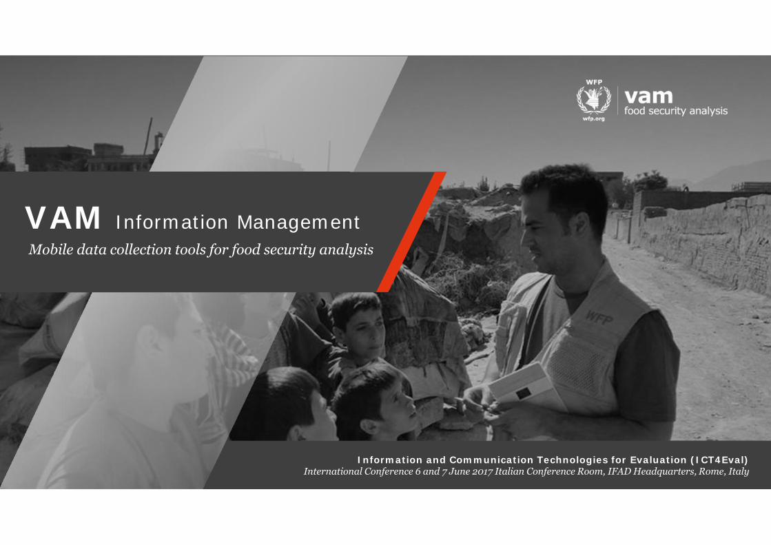
VAM Information ManagementMobile data collection tools for food security analysis
Information and Communication Technologies for Evaluation (ICT4Eval)International Conference 6 and 7 June 2017 Italian Conference Room, IFAD Headquarters, Rome, Italy
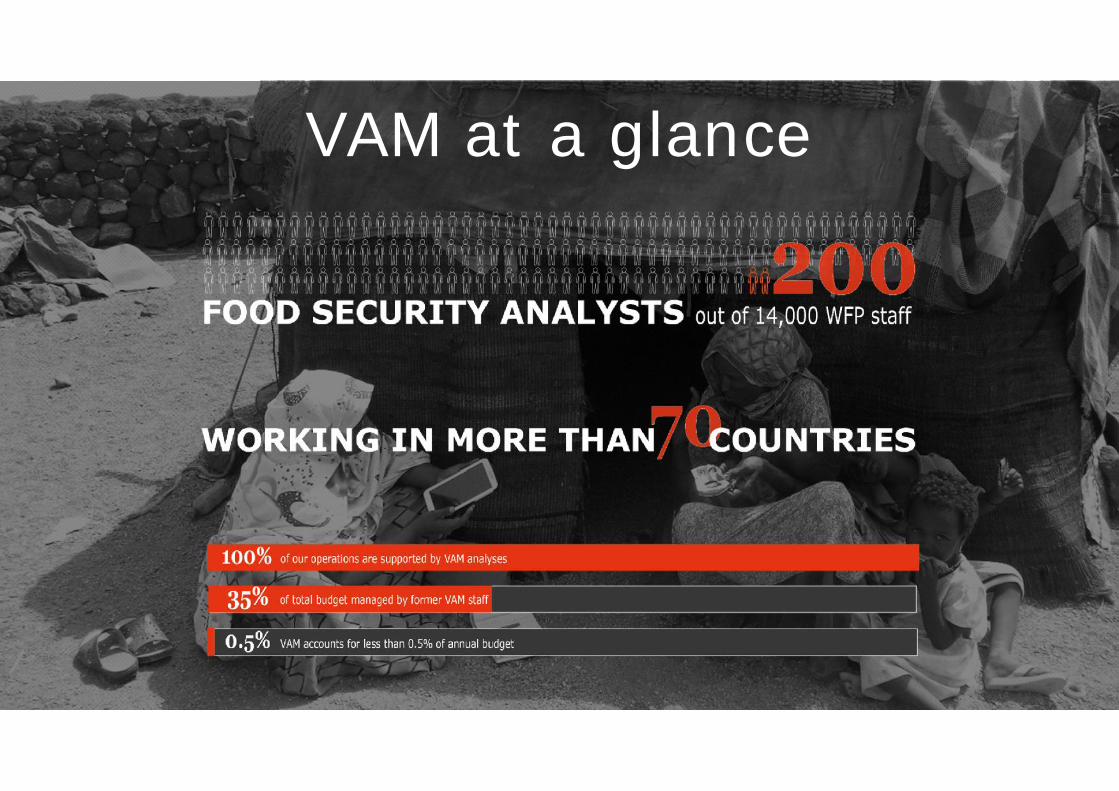
VAM at a glance

Our vision
Provide the best possible analyses to effectively reachthe people in need of assistance
Timeliness Cost efficiencyCredibilityUnderstandingvulnerabilities

We do

We ask

Our tools and innovationsWhy mobile data collection?
Improvement in timeliness
Improvement in data quality
Real time analysis
1
2
3

Improvement in timeliness
Improvement in data quality
Real time analysis
GRASP-ODK-ONA-KOBO
Mobile data collection tools that allow questionnaire design, data collection, transmission and analysis inreal-time through the use of mobile devices such as smartphones and tablets for face-to-face surveys.

Improvement in timeliness
Improvement in data quality
GRASP-ODK-ONA-KOBOMobile data collection tools in use in WFP

Improvement in timeliness
Improvement in data quality
MDCA - WFP Corporate Mobile data collectionand analytics tool
Formbuilder
Mobiledevice Server
CommonAPI Tableau
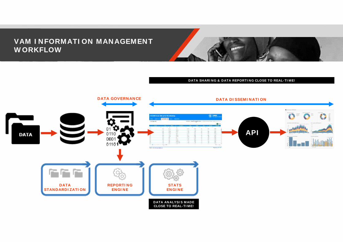
VAM INFORMATION MANAGEMENTWORKFLOW
API
DATASTANDARDIZATION
REPORTINGENGINE
STATSENGINE
DATA ANALYSIS MADECLOSE TO REAL-TIME!DATA ANALYSIS MADECLOSE TO REAL-TIME!
DATA SHARING & DATA REPORTING CLOSE TO REAL-TIME!DATA SHARING & DATA REPORTING CLOSE TO REAL-TIME!
DATA DISSEMINATIONDATA GOVERNANCE

DATABASES ARCHITECTURE
StatsEngine
DataViz

USE OF DATA FOR PROGRAM COURSE CORRECTIONS,- Ntchisi, Travel time to the nearest health facility
1st PDM May 2014 7th PDM May 2016
The map shows the traveltime to the nearest healthfacility in the Ntchisidistrict in Malawi. Shortesttravel times arerepresented in yellow,longest in purple andblue. The locations of thebeneficiaries of the WFPPrevention of Stuntingproject are overlaid as reddots. Green linesrepresent the catchmentareas of the healthcentres, which the modelalso derives.
The analysisempowered theestablishment ofadditional ExtendedDelivery Points (EDPs)to improve beneficiaryaccess to program.

GAZA COMPLEX EMERGENCY AUGUST 2014GRASP/geoSDI for damage assessment census
Some areas were totally destroyed, while others were subject tosystematic horizontal fire, damage not visible by satellite imagery.
UNOSAT Pleiades imagery and Interpretation ofDamage Assessment.
In August 2014 the WFP Palestine Country Office, with the assistance of UNOPS, provided support to UNDPand UNRWA to kick start the Gaza Post Disaster Needs Assessment.
• More than 120000 homes have been assessed.• Support was provided by geoSDI to enhance GRASP with an
advanced online mapping platform
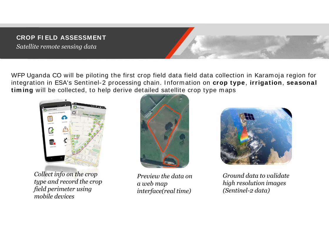
CROP FIELD ASSESSMENTSatellite remote sensing data
WFP Uganda CO will be piloting the first crop field data field data collection in Karamoja region forintegration in ESA's Sentinel-2 processing chain. Information on crop type, irrigation, seasonaltiming will be collected, to help derive detailed satellite crop type maps
Collect info on the croptype and record the cropfield perimeter usingmobile devices
Preview the data ona web mapinterface(real time)
Ground data to validatehigh resolution images(Sentinel-2 data)
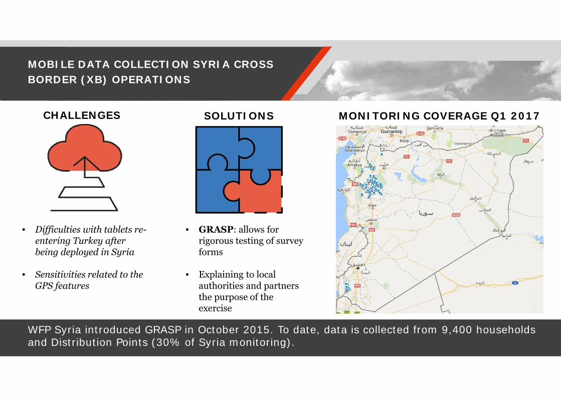
MOBILE DATA COLLECTION SYRIA CROSSBORDER (XB) OPERATIONS
WFP Syria introduced GRASP in October 2015. To date, data is collected from 9,400 householdsand Distribution Points (30% of Syria monitoring).
• Difficulties with tablets re-entering Turkey afterbeing deployed in Syria
• Sensitivities related to theGPS features
• GRASP: allows forrigorous testing of surveyforms
• Explaining to localauthorities and partnersthe purpose of theexercise
CHALLENGES SOLUTIONS MONITORING COVERAGE Q1 2017
Thank you