usgs headquarters update - landsat · usgs headquarters update tim newman program coordinator ......
TRANSCRIPT

USGS Headquarters Update
Tim Newman
Program Coordinator
Land Remote Sensing Program
U.S. Geological Survey
January 10, 2017
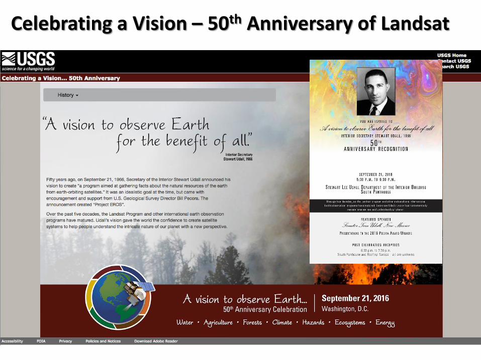
Celebrating a Vision – 50th Anniversary of Landsat
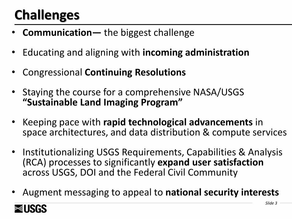
Slide 3
• Communication― the biggest challenge
• Educating and aligning with incoming administration
• Congressional Continuing Resolutions
• Staying the course for a comprehensive NASA/USGS “Sustainable Land Imaging Program”
• Keeping pace with rapid technological advancements in space architectures, and data distribution & compute services
• Institutionalizing USGS Requirements, Capabilities & Analysis (RCA) processes to significantly expand user satisfaction across USGS, DOI and the Federal Civil Community
• Augment messaging to appeal to national security interests
Challenges
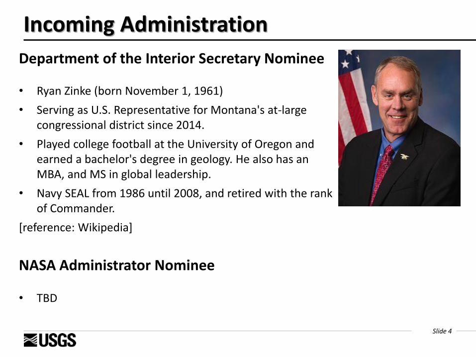
Slide 4
Department of the Interior Secretary Nominee
• Ryan Zinke (born November 1, 1961)
• Serving as U.S. Representative for Montana's at-large congressional district since 2014.
• Played college football at the University of Oregon and earned a bachelor's degree in geology. He also has an MBA, and MS in global leadership.
• Navy SEAL from 1986 until 2008, and retired with the rank of Commander.
[reference: Wikipedia]
Incoming Administration
NASA Administrator Nominee
• TBD
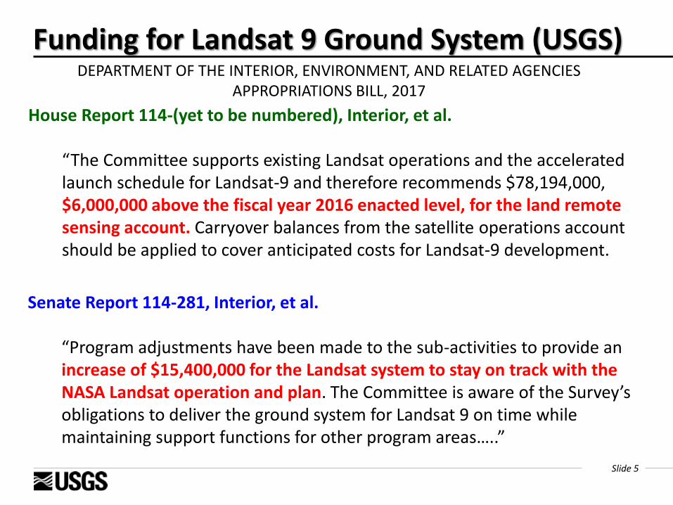
Slide 5
Funding for Landsat 9 Ground System (USGS)
DEPARTMENT OF THE INTERIOR, ENVIRONMENT, AND RELATED AGENCIES APPROPRIATIONS BILL, 2017
Senate Report 114-281, Interior, et al.
“Program adjustments have been made to the sub-activities to provide an increase of $15,400,000 for the Landsat system to stay on track with the NASA Landsat operation and plan. The Committee is aware of the Survey’s obligations to deliver the ground system for Landsat 9 on time while maintaining support functions for other program areas…..”
House Report 114-(yet to be numbered), Interior, et al.
“The Committee supports existing Landsat operations and the accelerated launch schedule for Landsat-9 and therefore recommends $78,194,000, $6,000,000 above the fiscal year 2016 enacted level, for the land remote sensing account. Carryover balances from the satellite operations account should be applied to cover anticipated costs for Landsat-9 development.

Slide 6
If the House and Senate do not pass a budget this year…
Then a Full-year Continuing Resolution (CR) is likely… The USGS requires full funding of the 2017 President’s Budget—a
$15.4M increase over the 2016 budget—to maintain pace with NASA working to a 2020 Landsat 9 launch.
A full-year CR in Fiscal Year 2017 without new funding identified for the USGS Landsat 9 ground system will result in significant budget challenges to USGS Climate and Land Use Change science activities.
USGS is pulling out all the stops for this contingency for 2017,
but without new funding this pushes the challenges to 2018 and beyond.
Slide 7
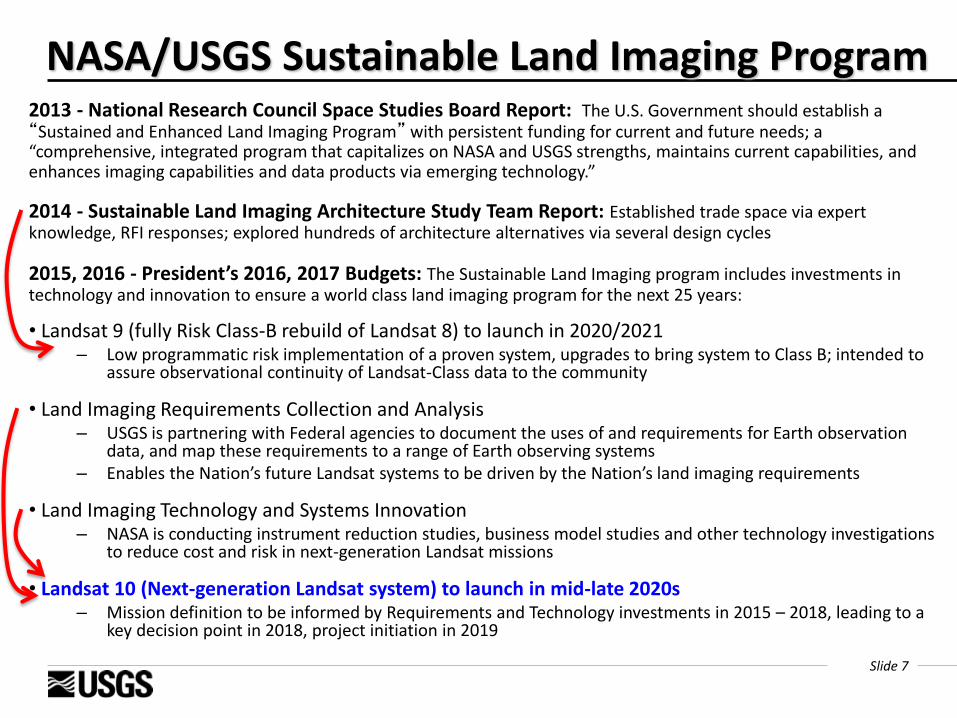
NASA/USGS Sustainable Land Imaging Program 2013 - National Research Council Space Studies Board Report: The U.S. Government should establish a “Sustained and Enhanced Land Imaging Program” with persistent funding for current and future needs; a “comprehensive, integrated program that capitalizes on NASA and USGS strengths, maintains current capabilities, and enhances imaging capabilities and data products via emerging technology.”
2014 - Sustainable Land Imaging Architecture Study Team Report: Established trade space via expert knowledge, RFI responses; explored hundreds of architecture alternatives via several design cycles
2015, 2016 - President’s 2016, 2017 Budgets: The Sustainable Land Imaging program includes investments in technology and innovation to ensure a world class land imaging program for the next 25 years:
• Landsat 9 (fully Risk Class-B rebuild of Landsat 8) to launch in 2020/2021 – Low programmatic risk implementation of a proven system, upgrades to bring system to Class B; intended to
assure observational continuity of Landsat-Class data to the community
• Land Imaging Requirements Collection and Analysis – USGS is partnering with Federal agencies to document the uses of and requirements for Earth observation
data, and map these requirements to a range of Earth observing systems – Enables the Nation’s future Landsat systems to be driven by the Nation’s land imaging requirements
• Land Imaging Technology and Systems Innovation – NASA is conducting instrument reduction studies, business model studies and other technology investigations
to reduce cost and risk in next-generation Landsat missions
• Landsat 10 (Next-generation Landsat system) to launch in mid-late 2020s – Mission definition to be informed by Requirements and Technology investments in 2015 – 2018, leading to a
key decision point in 2018, project initiation in 2019
Slide 8
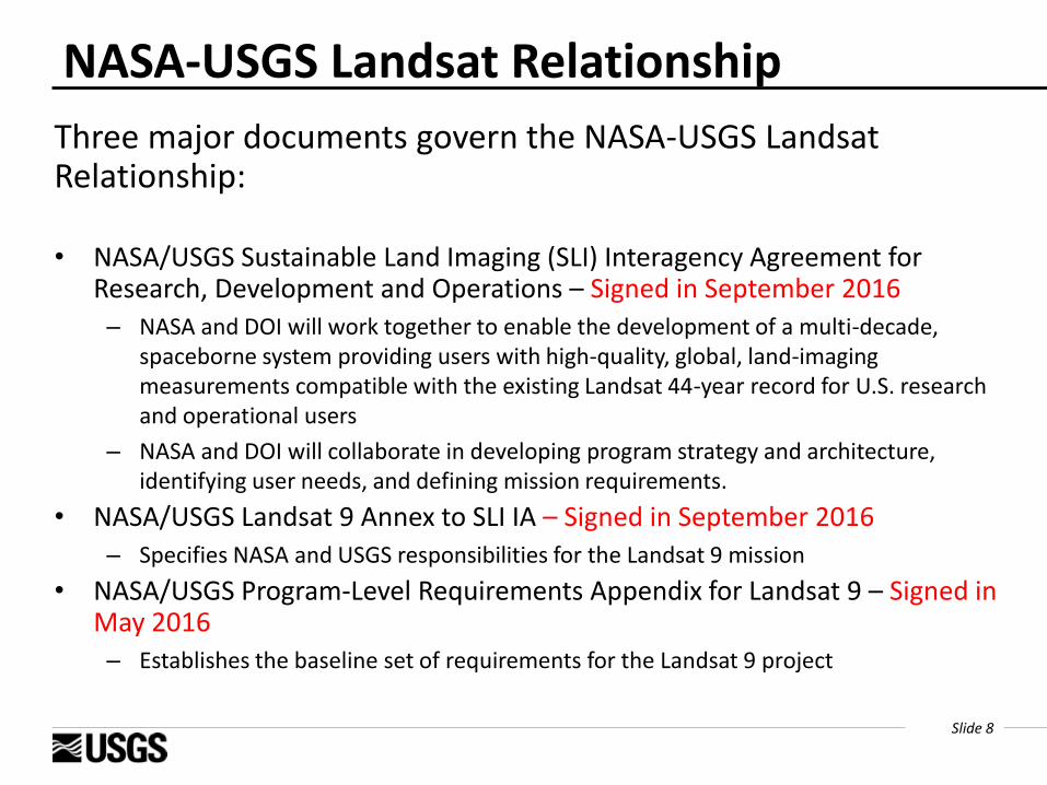
NASA-USGS Landsat Relationship
Three major documents govern the NASA-USGS Landsat Relationship:
• NASA/USGS Sustainable Land Imaging (SLI) Interagency Agreement for Research, Development and Operations – Signed in September 2016
– NASA and DOI will work together to enable the development of a multi-decade, spaceborne system providing users with high-quality, global, land-imaging measurements compatible with the existing Landsat 44-year record for U.S. research and operational users
– NASA and DOI will collaborate in developing program strategy and architecture, identifying user needs, and defining mission requirements.
• NASA/USGS Landsat 9 Annex to SLI IA – Signed in September 2016
– Specifies NASA and USGS responsibilities for the Landsat 9 mission
• NASA/USGS Program-Level Requirements Appendix for Landsat 9 – Signed in May 2016
– Establishes the baseline set of requirements for the Landsat 9 project
Slide 9
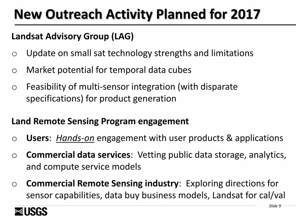
New Outreach Activity Planned for 2017
Landsat Advisory Group (LAG)
o Update on small sat technology strengths and limitations
o Market potential for temporal data cubes
o Feasibility of multi-sensor integration (with disparate specifications) for product generation
Land Remote Sensing Program engagement
o Users: Hands-on engagement with user products & applications
o Commercial data services: Vetting public data storage, analytics, and compute service models
o Commercial Remote Sensing industry: Exploring directions for sensor capabilities, data buy business models, Landsat for cal/val
Slide 10
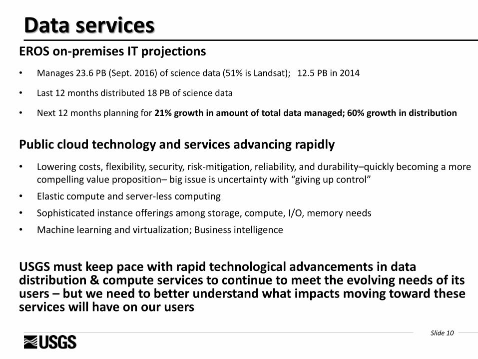
EROS on-premises IT projections
• Manages 23.6 PB (Sept. 2016) of science data (51% is Landsat); 12.5 PB in 2014
• Last 12 months distributed 18 PB of science data
• Next 12 months planning for 21% growth in amount of total data managed; 60% growth in distribution
Public cloud technology and services advancing rapidly
• Lowering costs, flexibility, security, risk-mitigation, reliability, and durability–quickly becoming a more compelling value proposition– big issue is uncertainty with “giving up control”
• Elastic compute and server-less computing
• Sophisticated instance offerings among storage, compute, I/O, memory needs
• Machine learning and virtualization; Business intelligence
USGS must keep pace with rapid technological advancements in data distribution & compute services to continue to meet the evolving needs of its users – but we need to better understand what impacts moving toward these services will have on our users
Data services
Slide 11
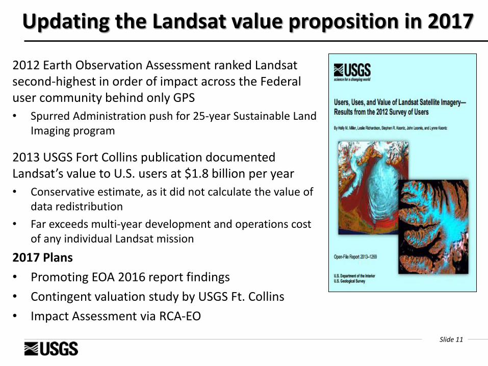
Updating the Landsat value proposition in 2017
2012 Earth Observation Assessment ranked Landsat second-highest in order of impact across the Federal user community behind only GPS
• Spurred Administration push for 25-year Sustainable Land Imaging program
2013 USGS Fort Collins publication documented Landsat’s value to U.S. users at $1.8 billion per year
• Conservative estimate, as it did not calculate the value of data redistribution
• Far exceeds multi-year development and operations cost of any individual Landsat mission
2017 Plans
• Promoting EOA 2016 report findings
• Contingent valuation study by USGS Ft. Collins
• Impact Assessment via RCA-EO

Slide 12
Impact assessment & insights: Landsat use in USGS Landsat Impact on USGS:
• All 7 mission areas use Landsat
• 21 out of 24 programs use Landsat
• 173 USGS products/services directly or indirectly use Landsat (out of 399 total USGS products)
• Major applications include land cover / land use change, species and habitat modeling, ecosystem and natural hazards
• Over 170 USGS SMEs provided information on Landsat data/products usage
• Landsat ranks 1st among all land remote sensing data sources supporting USGS programs
Slide 13
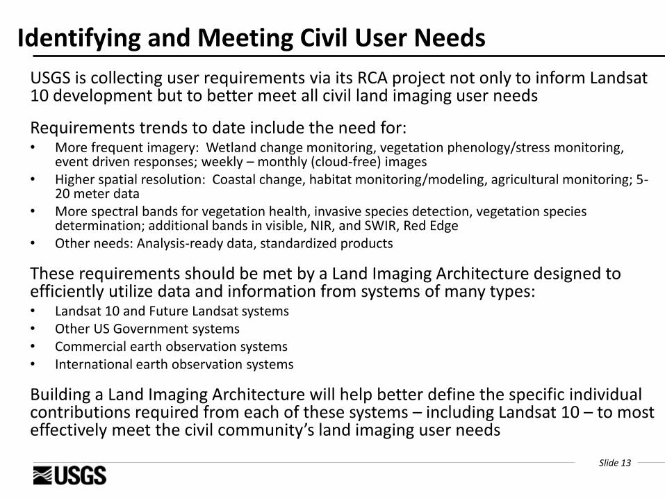
Identifying and Meeting Civil User Needs
USGS is collecting user requirements via its RCA project not only to inform Landsat 10 development but to better meet all civil land imaging user needs
Requirements trends to date include the need for: • More frequent imagery: Wetland change monitoring, vegetation phenology/stress monitoring,
event driven responses; weekly – monthly (cloud-free) images • Higher spatial resolution: Coastal change, habitat monitoring/modeling, agricultural monitoring; 5-
20 meter data • More spectral bands for vegetation health, invasive species detection, vegetation species
determination; additional bands in visible, NIR, and SWIR, Red Edge • Other needs: Analysis-ready data, standardized products
These requirements should be met by a Land Imaging Architecture designed to efficiently utilize data and information from systems of many types: • Landsat 10 and Future Landsat systems • Other US Government systems • Commercial earth observation systems • International earth observation systems
Building a Land Imaging Architecture will help better define the specific individual contributions required from each of these systems – including Landsat 10 – to most effectively meet the civil community’s land imaging user needs

Slide 14
Presidential Memorandum on “Climate change and national security”
Issued: September 21, 2016
Purpose: Establishes a framework and directs Federal departments (20 identified) to perform certain functions to ensure that climate change-related impacts are fully considered in the development of national security doctrine, policies, and plans.
Building on existing policy:
E.g., the 2015 National Security Strategy, which identified climate change as an urgent and growing threat to our national security, contributing to increased natural disasters, refugee flows, and conflicts over basic resources like food and water. It added that increased sea levels and storm surges threaten coastal regions, infrastructure, and property, which in turn threatens the global economy, and compounds the growing costs of preparing and restoring infrastructure.
Slide 15
Climate change and national security– an “opportunity” for Landsat science
• Augment the Landsat application message with appeal to global national security issues
• The science of Land Change doesn’t change…
- Improving global land change monitoring through remote sensing research.
- Understanding the temporal and geographic dimensions of land change.
- Improving the understanding of the connections between climate and land change and their combined impacts on human and natural systems.

Slide 16
Articulating Landsat’s Relevance to National Security Issues
• Water dynamics– drought, flood, desertification
• Disaster early warning (e.g., FEWSNET)
• Arctic– sea ice and permafrost melt
• Food security from agricultural dynamics monitoring
• Carbon assessments and monitoring (COP21 Paris Agreement)
• Energy/Water/Climate nexus
• Factors driving human migration
• …

Slide 17
DOI Role in CRS Satellite Licensing
Per the Land Remote Sensing Policy Act of 1992, DOI is one of a few Federal Agencies that consult with the Secretary of Commerce on licensing of Commercial Remote Sensing (CRS) Satellites
• The Department of the Interior must define, store, and maintain the “basic data set” in the Public Interest of the United States (including data sourced from commercial satellites) for “historical, scientific, and technical purposes, including long-term global environmental monitoring”
• New classes of CRS capabilities require DOI to modify the basic data set in order to ensure that the Public Interest continues to be served in the future
In its focus on threats and risks to US interests in the CRS licensing process, the National Security community does not address the benefits of space to civil society and the environment
DOI is the voice for the public interest of American society in discussions about the benefits that future U.S. land remote sensing capabilities must serve—a necessary element in the licensing process—and a potentially influential role in understanding and shaping the direction of future systems
Slide 18
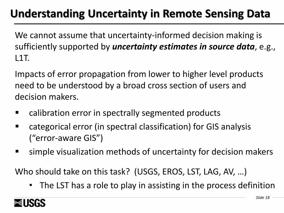
Understanding Uncertainty in Remote Sensing Data
We cannot assume that uncertainty-informed decision making is sufficiently supported by uncertainty estimates in source data, e.g., L1T.
Impacts of error propagation from lower to higher level products need to be understood by a broad cross section of users and decision makers.
calibration error in spectrally segmented products
categorical error (in spectral classification) for GIS analysis (“error-aware GIS”)
simple visualization methods of uncertainty for decision makers
Who should take on this task? (USGS, EROS, LST, LAG, AV, …)
• The LST has a role to play in assisting in the process definition

Slide 19
Summary of Challenges
• Communication
• Continuing Resolutions
• Sustainable Land Imaging Program
• Rapid technological advancements
• Expand user satisfaction across the Federal Civil Community
• Environmental change science relevance to national security
• Understanding uncertainty for decision makers