upper tijeras creek watershed restoration action …...and flow west into the albuquerque basin. the...
TRANSCRIPT

WATERSHED RESTORATION ACTION STRATEGY (WRAS) for the
UPPER TIJERAS CREEK WATERSHED
Prepared by the Ciudad Soil and Water Conservation District
Albuquerque, New Mexico
June 2004

2
TABLE OF CONTENTS
Introduction …………………………………………………………………………………………………………………… p.3 Watershed Setting ………………………………………………………………………………………………..………….. p. 4 Section I: Public Outreach ……………….……………………………………………………………………………….… p. 9 Section 2: Monitoring and Evaluation ………………………………………………………………………………………. p. 13 Section 3: Defining Specific Water Quality Problems …........................................................................................... p.15 Section 4: Actions to be Taken and Desired Water Quality Goals and Outcomes .………………………………… p.15 Section 5: Implementation Schedule…………………………………………………………………………….………… p. 21 Section 6: Funding Needs …………………………………………………………………..………………………………. p.24 References ………………………………………………………………………………………………………………… p. 26 Attachment 1: Map of Upper Tijeras Creek Watershed…………………………….…………………………………… p. 28 Attachment 2: Map of Cibola National Forest Land in the Watershed…………..……………………………………. p. 29 Attachment 3: Public Comments……..………………………………………………………………………………... p.30

3
INTRODUCTION
The Federal Clean Water Action Plan (CWAP) of 1998 was developed to help meet the goals of the Clean Water Act through state-led cooperative efforts. These efforts attempt to identify and prioritize watersheds with water quality concerns. The New Mexico Unified Watershed Assessment (1998) was conducted by a statewide task force in response to the actions mandated in the CWAP. New Mexico’s Unified Watershed Assessment identified 21 out of New Mexico’s 83 watersheds as “in need of restoration” (Category I). The Albuquerque reach of the middle Rio Grande is included as a New Mexico Category I watershed. Tijeras Creek is a tributary to the Rio Grande, originating in the East Mountain Area of eastern Bernalillo County. This Watershed Restoration Action Strategy (WRAS) for the Upper Tijeras Creek Watershed is a comprehensive planning document with a focus on restoring and protecting the health of waters in this subwatershed and positively impacting water quality within the Albuquerque reach of the middle Rio Grande. The WRAS is required as guidance for restoration and nonpoint source pollution control projects in this watershed that are funded through the Clean Water Act Section 319 (h) program. This WRAS contains the following components:
• A description of the Upper Tijeras Creek Watershed.
• The public outreach structure and methods that will be used to engage and maintain public involvement including local, state, and federal governments and NGOs.
• Monitoring and evaluation activities based on water quality and other goals and
outcomes needed to refine the problems or assess progress towards achieving these goals.
• The specific water quality problems to be addressed, the sources of pollution, and the
relative contribution of sources.
• A blueprint of the actions to be taken and desired water quality, natural resources, socioeconomic and other goals and outcomes, i.e., implementation of pollution control and natural resource restoration measures.
• A schedule for implementation of restoration measures and identification of
appropriate lead agencies or cooperators to oversee implementation, maintenance, monitoring and evaluation.
• Funding needs to support the implementation and maintenance of restoration
measures.

4
Watershed Setting Upper Tijeras Creek, in eastern Bernalillo County, New Mexico, is a tributary to the middle Rio Grande. The waters of the creek originate from springs and seeps in the Sandia and Manzanita Mountains and Tijeras Canyon (which separates the Sandias and Manzanitas), and flow west into the Albuquerque basin. The watershed includes Cedro Creek, which flows from the south to join Tijeras Creek near the intersection of State Highways 333 and 337, and several small streams from the east flank of the Sandias located to the north. Tijeras Creek is an interrupted stream; that is, it contains perennial reaches with intervening intermittent reaches through the length of Tijeras Canyon. At the mouth of the canyon, the geology changes drastically from uplifted granite to a 25,000-foot deep graben filled with unconsolidated sediments of the Santa Fe formation. Surface flows disappear into the arroyo bed, presumably to become mountain front recharge to the Albuquerque aquifer, within a short distance, except during large storm events. Water resurfaces in the arroyo within the inner valley, close to its junction with the main stem Rio Grande. The watershed encompasses approximately 76 square miles (48,654 acres) (see Map Attachment 1). The Sandias are composed of intrusive igneous rocks, exposed on the west face of the mountains, in Tijeras Canyon and in some parts of the eastern slope, overlain unconformably by mixed sedimentary beds. Some scattered metamorphic sections exist, particularly in Tijeras Canyon. In the Manzanitas, Madera limestone dominates the surface geology. The watershed includes large tracts (approximately 25,649) of U.S. Forest Service land within the Sandia Ranger District of the Cibola National Forest. Another 23,005 acres are outside of the forest service administrative boundaries (see Map Attachment 2). Military withdrawal lands comprise several thousand acres along the southwest boundary of the watershed administered by the Department of Defense. Other public lands include small areas of state trust lands administered by the State Land Office, City of Albuquerque and Bernalillo County Open Space, and properties owned by Albuquerque Public Schools. The remaining acreage is primarily private lands, much of it subdivided into relatively small lots purchased by individual landowners. Some larger tracts of ranch land and communally owned land grants remain intact. Ciudad SWCD has developed a stewardship plan for the part of the East Mountain Area that includes the Tijeras Creek Watershed. The plan addresses the soil and water resources, fish and wildlife resources, habitat types, threatened or endangered species, recreation and aesthetic resources, timber resources, forest health, noxious weeds, and cultural resources in the watershed. Following are brief descriptions of those resources. Watershed Assessment / Inventory Forest Resources. The watershed’s three principal forest resources are Ponderosa Pine, Piňon/Juniper, and Juniper Open Canopy. It also includes relatively small areas of grassland meadows and rocky outcrops.

5
The Ponderosa Pine type is found at higher elevations (7,000’ +) and/or on north slopes and in drainage basins. The ponderosa is predominately a second growth forest of pole and small log sizes. Many stands reflect years of little or no management, and pure stand basal areas of 180-250 ft2/acre and greater are common. In much of its area ponderosa pine is mixed with piňon pine, alligator juniper and other junipers, Gambel Oak and shrubs such as mountain mahogany and cliff rose. Willows, alders and other shrubs and grasses occur along stream drainages. Pure stands are characterized by pine needle buildup but little to no herbaceous cover. Such cover is similarly absent in mixed stands where shading inhibits its growth. Piňon pine is the predominant forest type found in the project area. A totally closed canopy characterizes the entire area, with openings occurring only where terrain, insect damage, or man has forced the opening. The predominant overstory tree is piňon, with understory of alligator juniper, Rocky Mountain Juniper and one seed juniper, with an occasional oak or ponderosa pine. Common shrubs found are mountain mahogany and three leaf sumac. Overly dense stands have resulted in very little herbaceous ground cover in much of the area, and consequent high rates of erosion. Such high densities weaken the trees and make them more susceptible to insects and disease, particularly during drought conditions. The inclusion of large numbers of juniper and shrubs forms a nearly impenetrable barrier and a perfect fire fuel mass 10-20 feet tall and continuous for entire drainages. Few openings are available for “edge effect” wildlife habitat, and many of those that do exist are being developed as housing sites. The juniper type of forest resource occurs principally on drier slopes, old fields and at the interface with grasslands. The open woodland is composed principally of scattered and bushy growths of one seed juniper with grasses, low shrubs and forbs in the open areas between trees. Fields once cleared of dense stands of juniper are reverting to Open Conifer Woodlands, while areas naturally interfacing with grasslands exhibit the usual receding numbers of trees as they extend into the grasslands. Wildlife Resources. Area wildlife figures prominently in the health of the forest. Common wildlife are mule deer, black bear, and numerous small mammals and birds. Antelope occur at the grasslands interface, while mountain lions can be found at higher elevations. The extreme density of the ponderosa and piňon forest types limits food habitat, especially for large game animals, and “edge effect” food sources are inadequate. Typical small wildlife in the piňon/juniper woodland includes piňon jays, hummingbirds and rock squirrels, lizards and the western rattlesnake. Ponderosa pine areas support hairy woodpeckers, flickers, owls, squirrels, woodrats and other rodents, toads and gopher snakes. Several flocks of wild turkeys have become established in the Manzanos and Manzanitas; another was transplanted into the Sandias in early 2004. None of the seven listed threatened or endangered species in Bernalillo or Torrance Counties is likely to occur in the project area due to a lack of proper habitat and/or conditions. The U.S. Forest Service is actively managing for sensitive species such as Northern goshawk.

6
Soils Resources. Soils on much of the more steeply sloping land in the canyons and on the east face of the Sandias and Manzanitas tend to be stony, cobbly, or gravelly, often having shallow depth to bedrock and areas of rock outcrops. Soils in the portions of the watershed having milder topography fall into the general classification of Mollisols, and tend to be relatively deep, fertile and fragile if misused. Within the Mollisols classification, the area’s three principal series of soils are the Silver Series, the Seis Series and the Kolob Series. Each soil series has a corresponding elevation range, and can be categorized according to permeability, the kind of vegetation it supports and other characteristics. It is important that any specific project identify the soil types involved, and proceed according to the characteristics and limitations of each type. Water Resources. The watershed contains both surface and subsurface water resources. Average total precipitation ranges from 14-16 inches per year, and up to 18 inches in higher elevations. Of this total precipitation, average snow accumulations range from 36 inches to as much as 60 inches near Sandia Peak. The project area contains many drainages but no permanent streams except for the perennial reaches of Tijeras Creek. Certain springs and reaches of Tijeras Creek are known to run year-round except during times of severe drought. Stream flows in Cedro Canyon and San Antonio may be considered intermittent with low flows, while the rest are ephemeral only. Free water surface evaporation is estimated at 50 inches per year, which illustrates the need for management actions to store water “in-situ,” i.e., on site in the soil. In-situ storage would make it available for use by plants, as springs for wildlife, and for aquifer recharge. Much of the area’s subsurface water occurs less than 200 feet below ground, and/or in areas of fractured bedrock, making it moderately vulnerable to pollution. Groundwater is less vulnerable to contamination from the surface toward the eastern end of the watershed, where the water table ranges from 200 to 500 feet deep. Several cases of groundwater pollution have been documented in the watershed, with known sources being either leaking underground storage tanks or septic tanks and drain fields. Recreation and Aesthetic Resources. Cibola National Forest lands in the Sandia Ranger District contain picnic areas, campgrounds and hiking trails in this and adjacent watersheds. There are also a few private campgrounds and day camps within the upper Tijeras Creek watershed. Several tracts of public open space owned by Bernalillo County and/or the City of Albuquerque are regularly used by hikers, rock climbers, mountain bikers, and birdwatchers. A coalition of government agencies has established an Open Space Stewards program for volunteers. A number of citizens' committees and technical teams are developing master plans for managing trails and publicly-owned open space parcels throughout the East Mountain Area. Ground Cover Grasses and Forbs. Grasslands are located principally in the east central

7
extreme of the watershed, and in previously farmed or cleared small bottomland areas. In these areas woodlands give way to Short Grass Steppe. Grasses typical of the Short Grass Steppe include blue grama and hairy grama, purple threeawn, western wheatgrass and buffalograss. Residential development and juniper encroachment are rapidly diminishing what acreage remains in grassland. Ecosystem Threats. Invasive, non-native plant species threaten indigenous plants as well as watershed health and production if left uncontrolled. Six class “A” species, which are those accorded the highest priority for control, may occur in the project area. They are: Camelthorn, Hoary Cress, Purple loosestrife, Perennial Pepperweed, Canada Thistle and Dalmatian Toadflax. Known infestations of perennial pepperweed occur at the top of the watershed on Sedillo Hill, and of dalmation toadflax in several locations, including the Carlito Springs Open Space and alongside Tijeras Creek in Tijeras. Class “B” species which may be of concern are Russian Knapweed and Musk Thistle. Class “C” species which may be of concern are Field Bindweed and Jointed Goatgrass. Unlisted tree species of concern include salt cedar and Russian olive which tend to displace native trees in the riparian zone. Indigenous insects of concern are the twig beetle, which attacks damaged and shaded branches, and the Ips, or bark beetle, which normally attacks damaged or otherwise stressed pine trees. When stressed by drought and overcrowding, even healthy trees can succumb to these insects, as evidenced by epidemic levels of infestation in 2002 and 2003, and which can be expected to continue through 2004. Disease pathogens, also indigenous, usually are not a serious problem in the habitat of the project area. One exception is Dwarf Mistletoe on ponderosas and piňons, which weakens the host trees and makes them susceptible to insect attacks, and may kill them over time. Fire management is a primary concern because of continuous fuels, difficult access, proximity of housing in the fuels, lack of fuel breaks and high potential for fire starts. Government agencies and volunteer organizations are conducting a variety of educational and on-the-ground programs geared towards reducing the forest fire risk in the wildland-urban interface. Some of these have the potential to benefit the watershed through improved land stewardship by private landowners, increased infiltration and decreased runoff in areas where conservation practices are properly applied, and reduced potential for erosion and sedimentation resulting from fire-damaged lands.
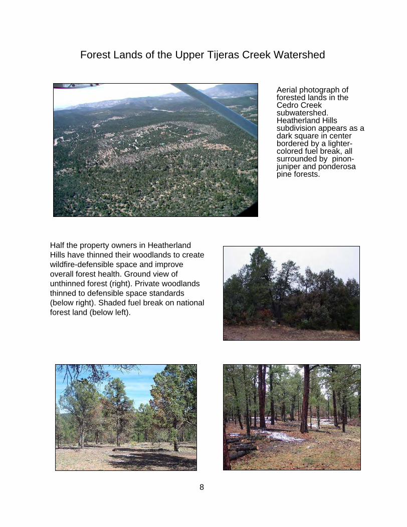
Forest Lands of the Upper Tijeras Creek Watershed
Aerial photograph of forested lands in the Cedro Creek subwatershed. Heatherland Hills subdivision appears as a dark square in center bordered by a lighter-colored fuel break, all surrounded by pinon-juniper and ponderosa pine forests.
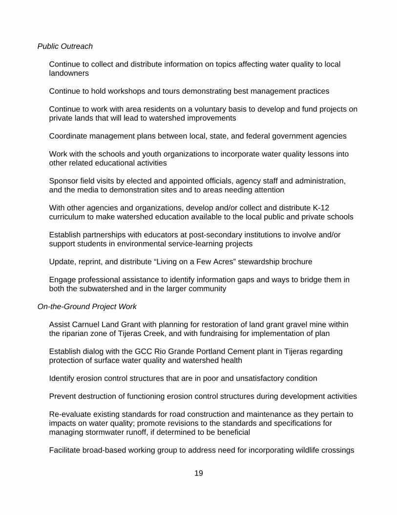
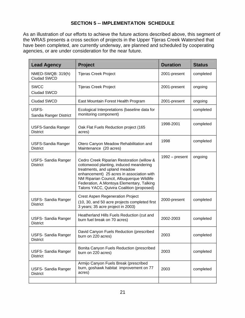
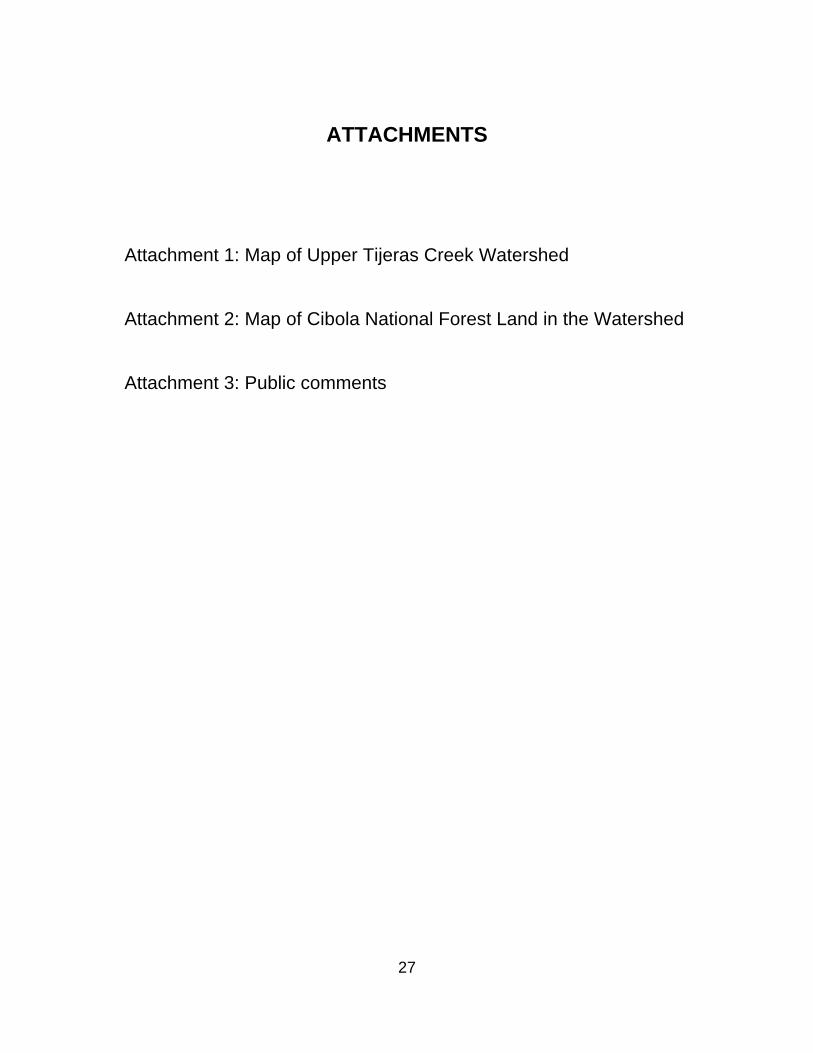
Half the property owners in HeatherlandHills have thinned their woodlands to create wildfire-defensible space and improve overall forest health. Ground view of unthinned forest (right). Private woodlands thinned to defensible space standards (below right). Shaded fuel break on national forest land (below left).
8

9
Cultural and Historic Resources. The project area contains one officially designated historic site, the Holy Child Church in Tijeras, and several sites of historical interest, including Tijeras Canyon pueblo. All these sites are part of established communities. In addition, small archaic Indian sites are scattered throughout the area.
SECTION I -- PUBLIC OUTREACH
This section identifies agencies and organizations that participated in the development of the WRAS and implementation of the public outreach components. Ciudad SWCD has been the primary party in writing this WRAS. Representatives from community organizations and local, state, and federal agencies have contributed to the present document. Individuals with expertise in specific areas of knowledge reviewed pertinent sections of the draft. Ciudad invited the following parties to participate in development of the WRAS submitted to NMED and EPA Region 6:
• USDA Forest Service, Sandia Ranger District • Village of Tijeras • Bernalillo County Parks and Recreation • Bernalillo County Environment Department • Bernalillo County Open Space • New Mexico State Land Office • New Mexico State Highway Department • Acequia Madre de Carnuel Community Ditch Association • Acequia Madre de San Antonio de Padua • Canon de Carnuel Land Grant • East Mountain Forest Health Committee (State Senator Sue Wilson's committee) • East Mountain Chamber of Commerce • East Mountain Area Association • Intermountain Conservation Trust • Talking Talons • BackYard Tree Farm • Forest Trust/Forest Guild • East Mountain Open Space Steering Committee
Public Outreach Efforts To Date Information and education actions taken in the subwatershed to date include:
Annual Back Yard Tree Farm workshops (in Tijeras), plus tours and hands-on training sessions held throughout the area
A variety of workshops on erosion control, water harvesting, and related topics by local SWCDs and their conservation partners

10
Annual Limbwood Festival at the Sandia Ranger District
Open House and associated training sessions sponsored by the East Mountain Interagency Fire Protection Association
Publication of "Living on a Few Acres in the East Mountains and Estancia Valley" stewardship booklet Annual East Mountain/Estancia Valley Water Fairs Public input sessions and public information meetings regarding the revised Bernalillo County Wastewater Ordinance Public input sessions and public information meetings regarding changes to the Bernalillo County solid waste regulations Public input sessions and public information meetings regarding changes to the Bernalillo County stormwater management regulations
Public meetings, newspaper articles, and television news coverage of the District's Tijeras Creek Project and East Mountain Forest Health Program Visits to schools in the middle Rio Grande region to teach about watersheds, river systems, and water quality using the Rolling River Posting signs delineating the wellhead protection zone by the Village of Tijeras
Forest Trust Watershed Study commissioned by Sierra Land Grant Coalition
Acequia Madre de Carnuel's summer 2002 water fair and regular member meetings
Carnuel Mutual Domestic Water and Waste water Association monthly meetings
Acequia Congreso listening conference, summer 2002; hosted by the Acequia Madre de Carnuel
Mentoring in local schools by Intermountain Conservation Trust
Volunteer monitoring of surface waterways through the East Mountain High School Advanced Environmental Sciences program Cedro Creek Riparian Interpretive Trail and brochure Workshops on woodland and backyard health with lectures, slide presentations, and information booths, held periodically and sponsored by the Soil and Water Conservation Districts, New Mexico State Forestry, and the U.S. Forest Service

11
In addition to those activities listed above, many area residents are involved in local planning efforts such as the East Mountain Area Plan update, Bernalillo County Open Space Advisory Committee, and the Bernalillo County Trails and Bikeways Master Plan Committee. Other organizations like the Open Space Stewards Program and Back Yard Tree Farm focus on teaching individuals and groups how to care for and improve natural environment within the watershed through hands-on work days and training workshops. These activities, as well as those being undertaken by other governmental and private organizations (described in Section 4), provide avenues for participation and input by residents on the water issues that directly affect their communities and livelihoods. However, many more residents and visitors are unaware of the issues. Education and outreach need to be expanded in more creative ways to successfully reach them. A concerted effort on a broader, perhaps even county-wide scale, will be required to inform newcomers and recreationists about watershed issues and their role in addressing them. Such an effort should employ professional assistance to identify the information gaps, most effective means of bridging them, and funding needs.

Public Outreach and Education
Effective methods of public outreach include watershed tours, targeted workshops, volunteer work days, and classroom visits to local schools, as well as print and broadcast media. NRCS employees tour watershed conservation projects (right); youth volunteers plant native shrubs (below).
Back Yard Tree Farm sponsors annual workshops on various land stewardship topics (below left); Ciudad SWCD brings the Rolling River to schools to teach students what a watershed is and their role in taking care of it (below right).
12

13
SECTION 2 -- MONITORING AND EVALUATION Many of the programs mentioned under WRAS implementation in Section 4 include a monitoring component. However, there is no central repository for collecting or evaluating the information with regard to watershed health or water quality improvements. Examples of current, past, and planned monitoring or data collection efforts are listed below.
• Monitoring and evaluation is built into all activities, including watershed improvement projects, taken on by the Sandia Ranger District.
• The Albuquerque/Bernalillo County Groundwater Protection Board is charged with
evaluating the work done to date and reviewing recommendations for changes to the action plan on a regular basis.
• The East Mountain Forest Health Program contract calls for regular reporting by the
program administrator and review for compliance and effectiveness by the sponsoring agency. On-site inspections and interviews with landowners, when present, are conducted for each individual project.
• The work plan for the Tijeras Creek project includes a plan for measuring success of
the on-the-ground and the educational components of the project.
• Revegetation test plots established by GCC Rio Grande Portland Cement will be monitored for the next 5-7 years by the company's environmental scientist.
• The Carnuel Mutual Domestic Association has done limited groundwater testing on
existing wells along the creek. They would like to extend the monitoring program to testing surface water quality in Tijeras Creek, per recommendations from the Forest Trust watershed study.
• Water quality testing of domestic wells in the watershed is offered during Ciudad's
annual Water Fair. Although the data is obtained from water samples brought in on a voluntary basis by interested well owners throughout the area, the service has continued long enough to provide an indication of both temporal and spatial variations in water quality. The data is collected and archived by the New Mexico Environment Department.
• Roosevelt Middle School is seeking funds to set up a Tijeras Creek Ecological
Monitoring Station fashioned after bosque monitoring sites installed and managed by the BEMP program in the middle Rio Grande.
There is high potential for meaningful monitoring of the impacts of development, outreach, conservation and restoration efforts on water quality and watershed health, but resources to conduct such activities are often hard to come by. The value of monitoring and evaluation, while generally accepted by the scientific community, may not be obvious to local officials or other funders. Future efforts to protect water quality in the subwatershed under this WRAS should incorporate monitoring and evaluation procedures into the initial project plans.

conduct such activities are often hard to come by. The value of monitoring and evaluation, while generally accepted by the scientific community, may not be obvious to local officials or other funders. Future efforts to protect water quality in the subwatershed under this WRAS should incorporate monitoring and evaluation procedures into the initial project plans.
Monitoring can be built into watershed restoration and water quality projects. Students from Roosevelt Middle School participated in monitoring the Tijeras Creek Project.
Members of a seventh-grade science class gathered baseline data such as counting Siberian elm stems in sample plots prior to removal. Here they measure gully dimensions (upper right) and set photopoints (lower right).
14

15
SECTION 3 -- DEFINING SPECIFIC WATER QUALITY PROBLEMS The Albuquerque reach of the middle Rio Grande is listed in Water Quality and Water Pollution Control in New Mexico, Appendix B - the State’s 305(b) Report (2000), and in the 2002-2004 State of New Mexico CWA Section 303-D List for Assessed Stream and River Reaches. Current designated uses for irrigation and secondary contact are listed under the category of “partially supporting”. The water quality criterion exceeded is fecal coliform. The probable sources of impairment are urban runoff/storm sewers and municipal non-point sources. These effects may be attributed to a combination of urbanization and resulting changes in stormwater hydrology; increased wastewater inputs; changes in riparian, upland, and forestland vegetation; agriculture (including urban agriculture); changes to stream bank morphology and flow regimes in both the main stem and tributaries, including the diversion channels; and road maintenance activities (or lack thereof). The listed causes are reflected in the watershed restoration priorities. They define the general targets for improvement that this WRAS is pursuing. General objectives and specific projects for implementation of this WRAS are identified in Section 4. Project efforts will focus upon improvement of water quality through changes in land and stormwater management practices, changes in vegetative density and diversity, removal of invasive/noxious plant species, riparian restoration, and ensuing reductions in soil erosion and sedimentation. Although new regulations will provide impetus for some improvements, many changes can only be brought about by education and incentives in this largely urban region. Therefore, a combination of on-the-ground activities and public awareness programs will be vital to protecting water quality in the Tijeras Creek subwatershed and the middle Rio Grande. Water quality protection has become even more crucial now that the City of Albuquerque has applied for a permit from the Office of the State Engineer to divert water directly from the Rio Grande for its municipal water supply.
SECTION 4 -- ACTIONS TO BE TAKEN AND DESIRED WATER QUALITY GOALS AND OUTCOMES
WRAS Implementation The upper Tijeras Creek drainage is at the top of the watershed feeding into the Albuquerque reach of the middle Rio Grande from the east. The highest elevations are under the jurisdiction of the USDA Forest Service in the Cibola National Forest. Abutting the Forest Service line are military withdrawal land, some larger tracts of non-federal public and private range and forest land, and smaller tracts of private land that can be characterized as wildland /urban interface. The landowners, land management agencies, and local government regulators all need to work toward the same goals to effectively improve the watershed. This will require overcoming a lack of interjurisdictional communication in some instances as well as competition between agencies for scarce financial resources.

16
Current Activities Many local, state, and federal agencies and non-government groups are already involved in water quality protection efforts in the Tijeras Creek watershed. Some are focused specifically on water quality, while others have a broader or different natural resource objective that either directly or indirectly impacts water quality. Current efforts are described below.
The Phase II rule of the National Pollutant Discharge Elimination System (NPDES) Stormwater Program is meant to limit impacts to surface water quality from small construction activity disturbing between one and five acres of land. Bernalillo County began implementing the Phase II construction rule in 2003 by requiring a stormwater management plan and NPDES permit for any soil disturbance of one acre or more land.
Bernalillo County adopted a groundwater protection policy in 1993, and has been
actively implementing many items in the associated action plan. Although the plan is geared toward groundwater, some of these actions also directly impact surface water quality. They include monitoring of stormwater and agricultural runoff and the use of detention basins to improve water quality.
A resolution under consideration would establish a joint city/county Water Resources
Advisory Committee to make recommendations to the Albuquerque Bernalillo County Water Utility Authority on how to maximize water conservation to balance water use with renewable supply.
An update of Bernalillo County's East Mountain Area Plan is currently underway. The
revised document will provide development guidelines, and may lead to adoption of revised performance criteria or other mechanisms for implementing such guidelines. The plan includes sections that address the natural environment, water and wastewater, drainage, and soil suitability and limitations.
Likewise, establishment of a wellhead protection zone by the Village of Tijeras
discourages activities that could impair surface water as well as groundwater quality within its jurisdiction. The key tools in the Village’s wellhead protection program are inclusion of compliance requirements in its zoning ordinance and a broadbased public information strategy. The Village’s two community wells are surrounded by a 1,000-foot radius of protected area. The New Mexico Rural Water Association helps maintain an inventory of potential sources of pollution within the protected areas, such as underground storage tanks, septic systems, landfills and stormwater runoff.
The U.S. Forest Service's Sandia Ranger District is engaged in several activities that
will positively impact the Tijeras Creek watershed. The District is constructing miles of shaded fuel breaks in the Sandias and Manzanitas. Over time, the ratio of grassed-to-bare ground increases in the fuel breaks and other wooded areas thinned to reduce tree density. Infiltration increases and soil erosion decreases. The chance for damage to soils and streams from catastrophic wildfire is greatly reduced. Sandia has initiated the first stages of a subwatershed restoration project on portions of Cedro

17
Creek that flow through federal lands. A streamside area has been returned to meadow through a controlled burn, and a volunteer Weed Warriors group has begun removing invasive Siberian elms from ephemeral parts of the drainageway. Long-term plans include replanting with native riparian and upland species appropriate to the ecological site conditions.
Forest Service plans for stream improvements include a project sponsored by the
Quivira Coalition, in cooperation with the New Mexico Museum of Natural History and local schools and youth organizations. Students from the Roosevelt Middle School Environmental Club (“E Club”), initially formed by Ciudad SWCD as part of the Tijeras Creek Project's outreach component, will also be involved in the project.
The Middle Rio Grande Water Assembly, comprising stakeholders from throughout the
region, was established to develop a regional water plan. Recognizing the interconnectedness of water quality and quantity, the assembly and its planning partner, the Water Resources Board of the Mid-Region Council of Governments, developed goals and objectives to address water quality concerns. These are listed under Goal H, “Provide appropriate water quality for each use”:
• Ensure compliance with water quality standards. • Establish criteria and a management plan(s) to control water quality degradation
from upstream activities. • Ensure proper well construction and plugging of abandoned wells • Limit use of private wells and septic systems where the health of the aquifer is a
concern.
Surface water quality is also a major concern of the two acequia associations within the subwatershed. The Acequia Madre de Carnuel Community Ditch Association has worked with the City of Albuquerque to avoid a repetition of a sewer line break in the early 1990s that caused untreated effluent to run into Tijeras Creek. The Acequia Madre de San Antonio de Padua battled inappropriate development and herbicide applications along their water source for years. The contested land eventually was purchased and designated as public open space, which will presumably protect the quality of the water in the acequia. The Sierra Land Grant Coalition, which includes the Chilili and Carnuel land grants and the Acequia Madre de Carnuel, recently received a grant from the U.S. Forest Service that funded a study addressing, in part, forest and watershed health. The Coalition is applying for another grant and federal cost-share programs to do on-the-ground work within the watershed.
The local soil and water conservation districts and private organizations such as Back
Yard Tree Farm and Talking Talons have been teaching residents about various aspects of land and water stewardship for many years through workshops, hands-on training sessions, and written information. The Intermountain Conservation Trust recently formed as a 501(c)3 land trust with a focus on watersheds and habitat protection in the East Mountain Area. As mentioned above, the Quivira Coalition is preparing to embark on a stream restoration project along Cedro Creek, a tributary to Tijeras Creek. Examples of the range of programs offered by these nonprofit organizations include riparian restoration training, annual water fairs, demonstration

18
projects, annual forest health workshops, grant writing, environmental education in the schools and youth conservation efforts.
Ciudad SWCD is currently engaged in a forest fuels reduction program, which will
improve watershed health in some forested parts of the watershed. The District is working with private landowners and local public land managers on a voluntary basis to help them conduct selective thinning and other conservation practices in a manner that decreases erosion, increases ground cover, and improves soil moisture retention. At the same time, the U.S. Forest Service is working to improve forest health on the federal side of the fence near some of the same neighborhoods.
The Tijeras Creek Project demonstrates best management practices for treating urban
stormwater runoff prior to it reaching a river system (including the diversion channels), and is disseminating that information within the middle Rio Grande watershed through a variety of outreach methods and to a variety of target audiences:
The project has been featured in photos and newspaper articles in the Albuquerque Journal, the Mountainview Telegraph, and The Independent, and in the Roosevelt and A. Montoya school newsletters. A large poster is displayed with Ciudad's information booth. Brochures are distributed at special events and at the schools and community center adjacent to the site. Information is also available on the district’s web site. A large, NPS-style permanent sign has been ordered and will be installed at the project site once delivered. The District's staff, supervisors, and contractor led numerous tours of the site for conservation and stormwater management professionals, educators, and for the general public. Two successful workshops, each tailored to specific audiences, were held to encourage duplication of the practices on a small scale on private lands and incorporation into larger scale government projects. Students, teachers, and parents from both A. Montoya Elementary and Roosevelt Middle School participated in classroom activities and field days, learned from guest educators, and contributed to monitoring and hands-on improvements at the site. The project was incorporated into one gifted class’s curriculum, and became the catalyst for establishing an Environmental Club at the middle school. The District is working with other organizations to continue the E Club's involvement in local projects at the students' and teachers' request.
Having these entities already in place and focused on watershed and water related issues will make it easier to expand water quality protection efforts, and can provide a variety of platforms on which to base public awareness campaigns. Future Actions Implementation efforts will focus on the following categories of actions that will be necessary to restore water quality and healthy watershed function in the Upper Tijeras Creek Subwatershed.
19
Public Outreach
Continue to collect and distribute information on topics affecting water quality to local landowners Continue to hold workshops and tours demonstrating best management practices Continue to work with area residents on a voluntary basis to develop and fund projects on private lands that will lead to watershed improvements Coordinate management plans between local, state, and federal government agencies Work with the schools and youth organizations to incorporate water quality lessons into other related educational activities Sponsor field visits by elected and appointed officials, agency staff and administration, and the media to demonstration sites and to areas needing attention With other agencies and organizations, develop and/or collect and distribute K-12 curriculum to make watershed education available to the local public and private schools Establish partnerships with educators at post-secondary institutions to involve and/or support students in environmental service-learning projects Update, reprint, and distribute “Living on a Few Acres” stewardship brochure Engage professional assistance to identify information gaps and ways to bridge them in both the subwatershed and in the larger community
On-the-Ground Project Work
Assist Carnuel Land Grant with planning for restoration of land grant gravel mine within the riparian zone of Tijeras Creek, and with fundraising for implementation of plan Establish dialog with the GCC Rio Grande Portland Cement plant in Tijeras regarding protection of surface water quality and watershed health Identify erosion control structures that are in poor and unsatisfactory condition Prevent destruction of functioning erosion control structures during development activities Re-evaluate existing standards for road construction and maintenance as they pertain to impacts on water quality; promote revisions to the standards and specifications for managing stormwater runoff, if determined to be beneficial Facilitate broad-based working group to address need for incorporating wildlife crossings

20
and water quality BMPs into future and existing highway projects near surface water sources Promote improvements in management and/or facilities where domestic animals are confined in proximity to waterways Restore riparian habitats through implementation of appropriate BMPs, removal of non-native, invasive plant species and plantings of native vegetation Inventory and control noxious weed infestations; adopt preventative measures in fields, along roadsides and trails, and in areas impacted by heavy equipment Manage woodland density and composition to restore forest health and increase diversity of wildlife habitat within the watershed Provide workshops on simple BMPs that individual landowners and businesses can easily implement Coordinate efforts with local, state, and federal agencies charged with regulating activities that impact surface water quality within the subwatershed and in the larger middle Rio Grande watershed
Data Gathering and Monitoring
Utilize existing sources of baseline data Support continuous data gathering in new projects Promote the concept of adaptive management of natural resources whenever opportunities arise Where appropriate, conduct surface water quality monitoring in cooperation with local schools and/or organizations Establish riparian zone monitoring station(s) based on the BEMP model in cooperation with local schools and/or organizations Gather vegetation, wildlife, threatened and endangered species data for Tijeras Creek system as research is conducted by cooperating entities Conduct need and feasibility assessment for establishing central repository to collect and evaluate monitoring data Employ surveys of the public and of organizations working with the public to determine new information and program needs as they arise
21
SECTION 5 -- IMPLEMENTATION SCHEDULE As an illustration of our efforts to achieve the future actions described above, this segment of the WRAS presents a cross section of projects in the Upper Tijeras Creek Watershed that have been completed, are currently underway, are planned and scheduled by cooperating agencies, or are under consideration for the near future.
Lead Agency
Project
Duration
Status
NMED-SWQB: 319(h) Ciudad SWCD
Tijeras Creek Project
2001-present
completed
SWCC Ciudad SWCD
Tijeras Creek Project
2001-present
ongoing
Ciudad SWCD
East Mountain Forest Health Program
2001-present
ongoing
USFS- Sandia Ranger District
Ecological Interpretations (baseline data for monitoring component)
completed
USFS-Sandia Ranger District
Oak Flat Fuels Reduction project (165 acres)
1998-2001
completed
USFS-Sandia Ranger District
Otero Canyon Meadow Rehabilitation and Maintenance (20 acres)
1998 completed
USFS- Sandia Ranger District
Cedro Creek Riparian Restoration (willow & cottonwood planting, induced meandering treatments, and upland meadow enhancement) 25 acres in association with NM Riparian Council, Albuquerque Wildlife Federation, A.Montoya Elementary, Talking Talons YACC, Quivira Coalition (proposed)
1992 – present
ongoing
USFS- Sandia Ranger District
Crest Aspen Regeneration Project (10, 30, and 50 acre projects completed first 3 years; 35 acre project in 2003)
2000-present
completed
USFS- Sandia Ranger District
Heatherland Hills Fuels Reduction (cut and burn fuel break on 70 acres)
2002-2003
completed
USFS- Sandia Ranger District
David Canyon Fuels Reduction (prescribed burn on 220 acres)
2003
completed
USFS- Sandia Ranger District
Bonita Canyon Fuels Reduction (prescribed burn on 220 acres)
2003
completed
USFS- Sandia Ranger District
Armijo Canyon Fuels Break (prescribed burn, goshawk habitat improvement on 77 acres)
2003
completed

22
Lead Agency
Project
Duration
Status
USFS- Sandia Ranger District
Heatherland Hills II (habitat enhancement, cut and chip fuels reduction on 74 acres)
2003
completed
USFS- Sandia Ranger District
Tablazon Fuels reduction (200 acres: 30 acre fuel break, 155 acres meadow regeneration, 15 acres Ponderosa pine forest restoration)
planning completed
scheduled 2004-05
USFS- Sandia Ranger District
Seasonal road closures to protect watershed resources and reduce erosion
present
ongoing
East Mountain Open Space Coalition
Interagency effort to establish open space stewards program for volunteer caretakers of locally-owned public open space lands
present
ongoing
Bernalillo County Open Space
Carlito Springs rehabilitation project
plan developed & work begun
ongoing
Bernalillo County Open Space
Las Manzanares/San Antonio rehabilitation
in the planning stages
ongoing
City of Albuquerque Open Space
San Antonito Open Space forest thinning demonstration project
pilot project Dec. 2003
pilot completed
NM State Land Office
Forest fuels reduction/fuelwood gathering
initiated 2003 (Apple Valley )
ongoing
East Mountain Interagency Fire Protection Association
Neighborhood fuels cleanup days - (slash chipping projects)
work days begun in summer 2003
ongoing
East Mountain Area Chamber of Commerce
Neighborhood fuels cleanup days - (slash chipping projects)
in the planning stages
proposed
Talking Talons
Participation by youth in YCC and conservation education efforts within upper Tijeras Creek and adjacent watersheds.
some projects underway; others planned
ongoing
Sierra Land Grant Coalition
Sierra Land Grant Community Coalition Fire Plan, prepared by The Forest Trust
2001-2002
completed July 2002
Sierra Land Grant Coalition
forest health plan mapping project
2003-2004
proposed
Sierra Land Grant
thinning for forest health within land grant
2004
proposed

23
Lead Agency
Project
Duration
Status
Coalition
Intermountain Conservation Trust
Watershed Stewardship and Education programs
1999-
ongoing
ED-SWQB: 319(h) Intermountain Conservation Trust
Components of the Coordinated San Pedro Watershed Outreach and Action Project
2003 -
proposed
Carnuel Land Grant
Rehabilitation of historic ditches interrupted or destroyed by highway construction
2004-
proposed
Carnuel Land Grant
Development of plan for environmental restoration of gravel mine
2004-
under con-sideration
Acequia Madre de San Antonio de Padua
Maintenance of two active acequia ditches within the Village of San Antonio
historic
ongoing
Acequia Madre de San Antonio de Padua
Cooperation with Bernalillo County Open Space on management of public lands bordering springs and active acequias
2002-
ongoing
Village of Tijeras
Annual cleanup day along Tijeras Creek
2002-
ongoing
Village of Tijeras Consideration of water quality impacts of proposals reviewed by Planning and Zoning
2000-
ongoing
Village of Tijeras Removal of invasive tree species in Tijeras Creek riparian zone - pilot project
initiated 2003
ongoing
GCC Rio Grande Portland Cement
Development of mine reclamation plan
1997
completed
GCC Rio Grande Portland Cement
Establish 23 acres of revegetation test plots
2003-2008
ongoing
GCC Rio Grande Portland Cement
Final stage mine reclamation
2040
planned
Roosevelt Middle School science dept.
Install and manage Tijeras Creek Ecological Monitoring Station
2004-
proposed
Note: 1Acronyms are as follows: EPA–Environmental Protection Agency, NMED–New Mexico Environment Department, NMSH&TD–New Mexico State Highway and Transportation Department, SWCC – New Mexico Soil and Water Conservation Commission, SWCD–Soil and Water Conservation District, SWQB–Surface Water Quality Bureau, USFS–United States Forest Service; IMCT- Intermountain Conservation Trust

24
SECTION 6 -- FUNDING NEEDS
Table of Funding Requirements
Task
Funding
Status
Federal
State
Other
Total
East Mountain Forest Health Program 300,000 150,000 450,000 funded for
2002-03 East Mountain
Forest Health Program 364,000 30,600 125,400 520,000 funded for 2003-04
Tijeras Creek Project 72,000 --- 30,000 102,000 funded for 2002-04
Cedro Creek Riparian Restoration
108500 120510 229010 proposed
Sandia Crest Aspen Regeneration
Phase 4
financial info unavailable at this time
Heatherland Hills II financial info
unavailable at this time
Tablazon Meadow Regeneration PPO restoration, & Fuels
Reduction
financial info unavailable at this time
Open Space Coalition Stewardship
ongoing
Carlito Springs rehabilitation project
financial info unavailable at this time
La Manzanares/San Antonio rehabilitation
financial info unavailable at this time
State lands Office fuels reduction financial info
unavailable at this time
Sierra Land Grant Coalition (SLGC) Community Fire Plan
funded 2002
SLGC forest health plan mapping project
financial info unavailable at this time
SLGC thinning for forest health within land grant
undetermined
Rehabilitation of Carnuel ditches project under
consideration; cost undetermined
Carnuel-Tijeras wildlife corridor/crossings
project under consideration;

25
Task
Funding
Status
Federal
State
Other
Total
cost undetermined
RMS Ecological Monitoring Proj.
8000
2700
3500
proposed
Plan development for Carnuel sand and gravel mine rehabilitation
project under consideration;
cost undetermined Restoration of lands impacted by Carnuel sand and gravel operation
project under consideration;
cost undetermined
Tijeras annual cleanup days financial info
unavailable at this time
Tijeras invasive tree project financial info
unavailable at this time
IMCT Coordinated San Pedro Watershed Outreach and Action Project
20,000 26,248 funded
Neighborhood work days
250/day
200/day
450/day
partially funded Note: 1Acronyms are as follows: EMIFPA-East Mountina Interagency Fire Protection Association, EPA–Environmental Protection Agency, IMTC-Intermountain Conservation Trust, NMED–New Mexico Environment Department, NMSH&TD–New Mexico State Highway and Transportation Department, SLGC-Sierra Land Grant Coalition, SWCD–Soil and Water Conservation District, SWQB–Surface Water Quality Bureau, USFS–United States Forest Service; IMCT- Intermountain Conservation Trust

26
REFERENCES
Bernalillo County, 1992. East Mountain Area Plan. Bernalillo County and City of Albuquerque, 1994. Albuquerque Groundwater Protection Policy and Action Plan. Ciudad Soil and Water Conservation District, 2000. Soils of the Greater Albuquerque Metropolitan Area: Bernalillo County and Parts of Sandoval and Valencia Counties, New Mexico. Fletcher, Reggie. 1998. Cibola National Forest Range of Natural Variability. Prepared for USDA Forest Service, Southwestern Region. Forest Trust. 2002. Sierra Land Grant Community Coalition Fire Plan (draft). Prepared for the Sierra Land Grant Community Coalition, July 2002 G&G Resource Consultants. 2001. Ciudad Soil & Water Conservation District South 14 Forest Stewardship Plan. G&G Resource Consultants. 2001. Ciudad Soil & Water Conservation District North 14 Forest Stewardship Plan Kelly, Vincent, and Stuart A. Northrup. 1975. Geology of the Sandia Mountains and Vicinity. New Mexico Bureau of Mines and Mineral Resources Memoir 29. New Mexico Rural Water Association. 1998. Wellhead Protection Plan, Village of Tijeras, 9/8/98 State of New Mexico. 2000. 2000-2002 State of New Mexico CWA Section 303-D List for Assessed Stream and River Reaches. Santa Fe, NM. ________________. NM Environment Department and NM Health Department. 2001. Quality Assurance Project Plan for Water Quality Management Programs 2001. Santa Fe, NM: Surface Water Quality Bureau, Scientific Laboratory Division. Document No. (2001)01-122. ________________. New Mexico Water Quality Control Commission. 2000. State of New Mexico Standards for Interstate and Intrastate Streams. New Mexico Administrative Code 20.6.4. ________________. NMWQCC. 2000. Water Quality and Water Pollution Control in New Mexico, Appendix B - the State’s 305(b) Report. Santa Fe, NM. Document No. NMED/SWQ-00/1.
27
ATTACHMENTS
Attachment 1: Map of Upper Tijeras Creek Watershed
Attachment 2: Map of Cibola National Forest Land in the Watershed Attachment 3: Public comments

28
Insert watershed map here

29
Insert National Forest map here

30
PUBLIC COMMENTS
“For me, when I read the document, the major omission was a sense of urgency.” “Right now, spotty water along the creek limits the draw of large animals to a few places, but when water and riparian vegetation are present along much of the creek, it will act as a ‘sink’, attracting a greater number of animals to their demise…(I-40).” “The strategy looks heavy on public involvement and cooperation, but I think that is key and probably impossible to overdo.” “Overall, the draft looks good. Tijeras Creek should be classified as an interrupted, rather than perennial, stream.” “…it sounds like the Upper Tijeras Creek is a first order stream. It could be useful to list some characteristics and unique importance as such.” “Your detailed description of the geology of the area is good. Are there any rock properties that are of specific importance to the watershed, such as the sedimentary eroding more quickly than the igneous?” “In terms of the setting, I think it would be useful to give similar attention to the other ecosystem components that the plan will address as you do the geology. Specifically, the soils, fish and wildlife, TES, invasives, forest systems. If little is known at this time, referencing this fact only strengthens the rationale for the project.” “Under the ‘WRAS Implementation” section, you list several organizations active in the area. Will you be making efforts to bring the groups together? If so, how? “You cite that thinning improves soil moisture retention. I know we cite this in the Sierra LGC work and many others adhere to this idea, but some assert that any freed water will simply be taken up by the remaining trees. It’s probably not a big deal, but just so you know that there are differing opinions out there on this subject. “Your monitoring and future work sections are general in terms of what is to be done. It could be useful to be more concrete in your descriptions of these. For instance, under ‘manage woodland density’ you could cite Firewise requirements for WUI areas, and then perhaps reference site-dependent canopy cover and/or BA and density targets.” “Overall, I believe this will be a strong project. If you are looking for help to do some of the work post-grant award, I’m sure we would be interested. Good luck with it all, and I hope you find these comments useful.”