update on the nfie presentation to the subcommittee on spatial water data by david r. maidment...
TRANSCRIPT

Update on the NFIE
Presentation to the Subcommittee on Spatial Water Data
By David R. MaidmentCenter for Research in Water Resources
University of Texas at Austin
23 January 2015

A summary of recent progress….• Established a web site http://www.cuahsi.org/NFIE • Conducted three national webinars to provide information (Dec 10,
Jan 7, Jan 21) – recorded on web site. About 60-80 participants in each webinar.
• Established a NFIE conceptual framework with five components: NFIE-Geo, Hydro, River, Response, Services
• Published a first version of NFIE-Geo through AGOL web map and CUAHSI HydroShare data repository
• Succeeded in computing NFIE-Hydro flows for 2.67 million NHDPlus reaches over CONUS for a 14-day historical period
• Produced at BYU an ECMWF-RAPID operating prototype with 15-day ahead ensemble forecasts in Texas Gulf Region.
• Learned from experience in North Carolina about how to represent river channels for real-time flood mapping
• Will request one more data layer from SSWD (24K NHD Flowlines) to support NFIE-River

CUAHSI Web Site for the NFIE
http://www.cuahsi.org/NFIE
Description of the project
Past Webinars
Map access to NFIE-Geo data through HydroShare
Call for applicationscoming soon!
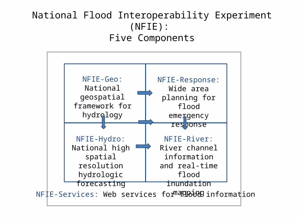
National Flood Interoperability Experiment (NFIE): Five Components
NFIE-Services: Web services for flood information
NFIE-Geo: National geospatial
framework for hydrology
NFIE-Hydro: National high spatial
resolution hydrologic forecasting
NFIE-River: River channel information and real-time flood inundation mapping
NFIE-Response: Wide area planning for flood emergency
response

Draft NFIE-Geo in HydroSharehttps://www.arcgis.com/home/webmap/viewer.html?webmap=2c30160429984a59873f26b9d118dbfe
Accessible through http://www.cuahsi.org/NFIE
David Tarboton, Utah State Univ. and Ray Idaszak, RENCI

NFIE-Hydro: flow computation over CONUS
NWS River ForecastsWRF-Hydro Model
NHDPlus to RAPID Conversion
Grid to Catchment Linking Forecast services
CompletedPending
NFIE-Hydro
Deltares and University of Alabama
14-day historical period, 2.67 million reaches

European Center for Medium Range Weather Forecasting and European Joint Research Commission
15 Day ahead forecast ensemble (50 hydrographs) at each location
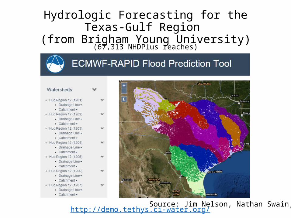
Hydrologic Forecasting for the Texas-Gulf Region
(from Brigham Young University)
http://demo.tethys.ci-water.org/
(67,313 NHDPlus reaches)
Source: Jim Nelson, Nathan Swain, BYU

Ensemble Flow Forecast for Reach Catchment 5592208 made on Jan 13, 2015 (15 day horizon)Weather information source: European Center for Medium Range Weather Forecasting (ECMWF). Summary statistics compiled from 50 forecast hydrographs
Source: Jim Nelson, Alan Snow BYU
1033562.
1033070.
1032564.
1032069.
1031925.
1031244.
Tar_River Plan: Tar_River 1/14/2015
Legend
Ground
Bank Sta
Ineff
0 10000 20000 30000 40000 50000 60000 70000 800000
10
20
30
40
50
60
Tar River - FINAL Plan: T ar River 1/14/2015 Cross Section Tar River 10.0
Q Total (cfs)
W.S
. Ele
v (
ft)Legend
W.S. Elev
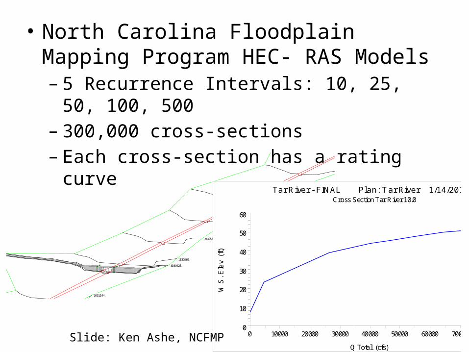
• North Carolina Floodplain Mapping Program HEC- RAS Models– 5 Recurrence Intervals: 10, 25, 50, 100, 500– 300,000 cross-sections– Each cross-section has a rating curve
Slide: Ken Ashe, NCFMP

Our cross-sections give the ability to interpolate between gages expanding the real time information from ~200
locations to 10s of thousands to 100s of thousand of locations
Slide: Ken Ashe, NCFMP

HEC-RAS CrossSections (from 31 separate models on parts of Onion Creek, Austin, Texas)
Onion Creek watershed
Travis County
Hays County
100K NHD (Med res)
24K NHD (High res) Conclusion: We need 24K NHD flow lines to link cross-sectionsSome cross-sections are on tributaries not in 100K NHD
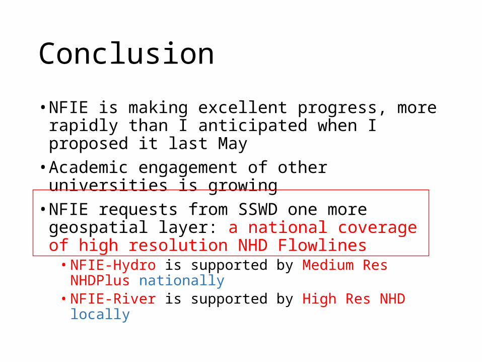
Conclusion
• NFIE is making excellent progress, more rapidly than I anticipated when I proposed it last May
• Academic engagement of other universities is growing
• NFIE requests from SSWD one more geospatial layer: a national coverage of high resolution NHD Flowlines
• NFIE-Hydro is supported by Medium Res NHDPlus nationally
• NFIE-River is supported by High Res NHD locally